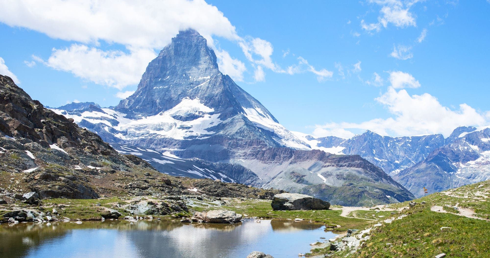
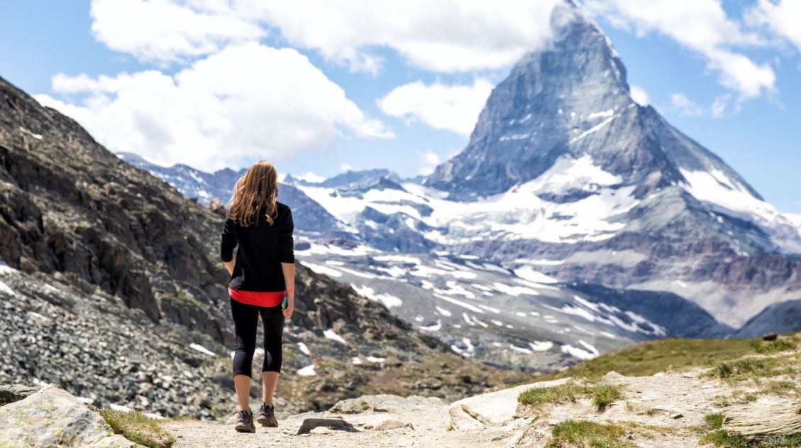
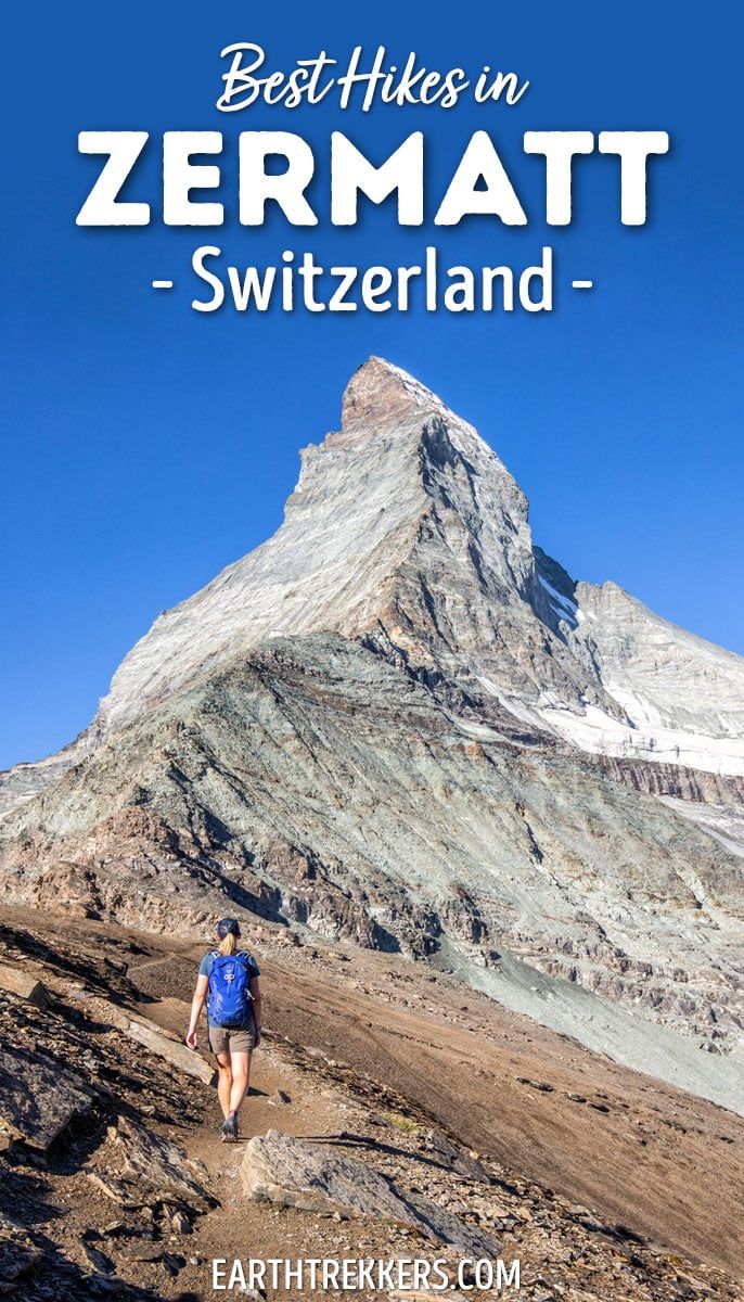
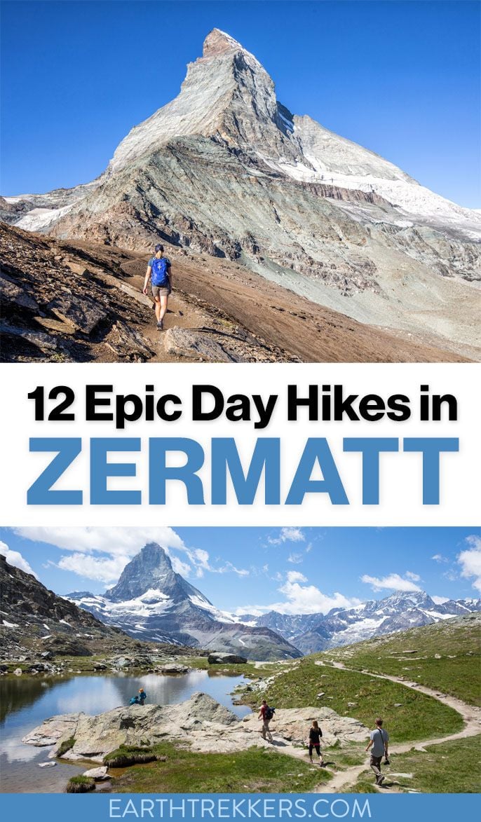
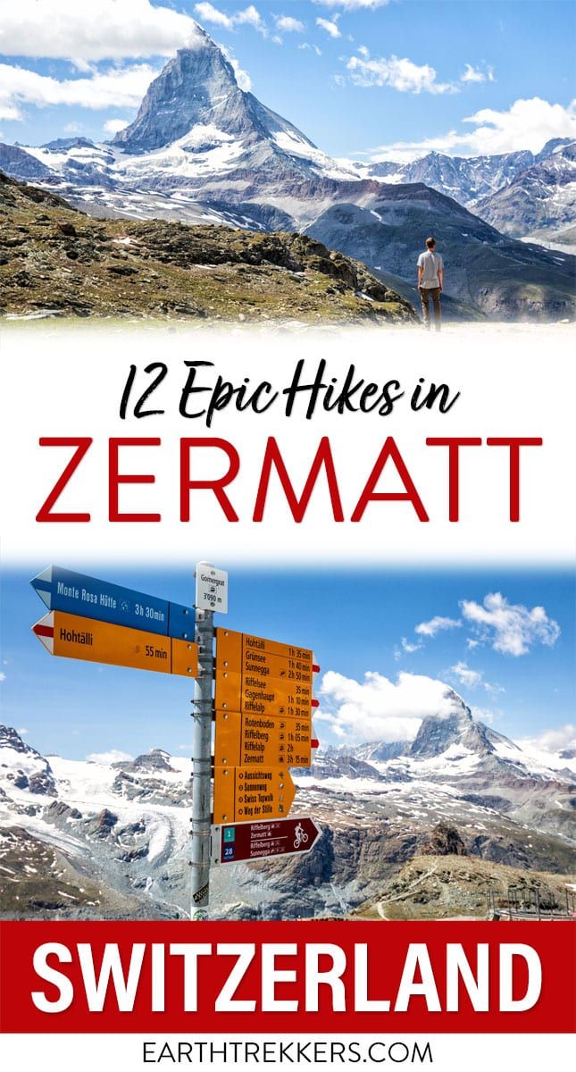
One of the best ways to explore Zermatt is on foot. Hiking trails climb high into the mountains above Zermatt, past Swiss hamlets, through scenic valleys and rocky gorges, and to some of the best viewpoints of the Matterhorn. The network of cable cars and trains takes you up into the mountains, so for the most part, you don’t have to hike long to have an incredible experience. In this guide, we cover the best hikes in Zermatt.
About this List
So far, we have visited Zermatt twice. The first time was in 2019. We only had two days here, so we barely scratched the surface of what there is to do in Zermatt.
In 2022, we returned to Zermatt for a second visit. This time, we hiked the Walker’s Haute Route, walking from Chamonix, France to Zermatt, Switzerland. It was a 13-day trek across 10 mountain passes in the French and Swiss Alps. This challenging but memorable journey is one of the best hiking experiences we have had and it’s something to consider if you are an avid hiker. It’s similar to the Tour du Mont Blanc, but it’s less popular (so the trails are less crowded) and tougher, and a truly unforgettable experience.
On our second visit to Zermatt, we spent four days here and hiked quite a few more trails.
From these two visits, we came up with this list of hikes in Zermatt.
Twelve hikes are a lot to choose from, so at the end of this guide, we give recommendations for the best hikes in Zermatt, whether you are looking for something quick and easy, something more challenging, or if you want to learn what our favorite hikes are.
WHEN TO GO HIKING IN ZERMATT: The hiking season runs from June through September. During this time, the trails are clear of snow. If you have plans to visit Zermatt outside of this time frame, it may not be possible to go hiking, depending on conditions.
Best Hikes in Zermatt
This list starts with the shortest, easiest trails and ends with the longer, more challenging hikes.
Each of these hikes is a day hike, so they all can be completed in one day.
All hiking distances are round trip, unless noted otherwise.
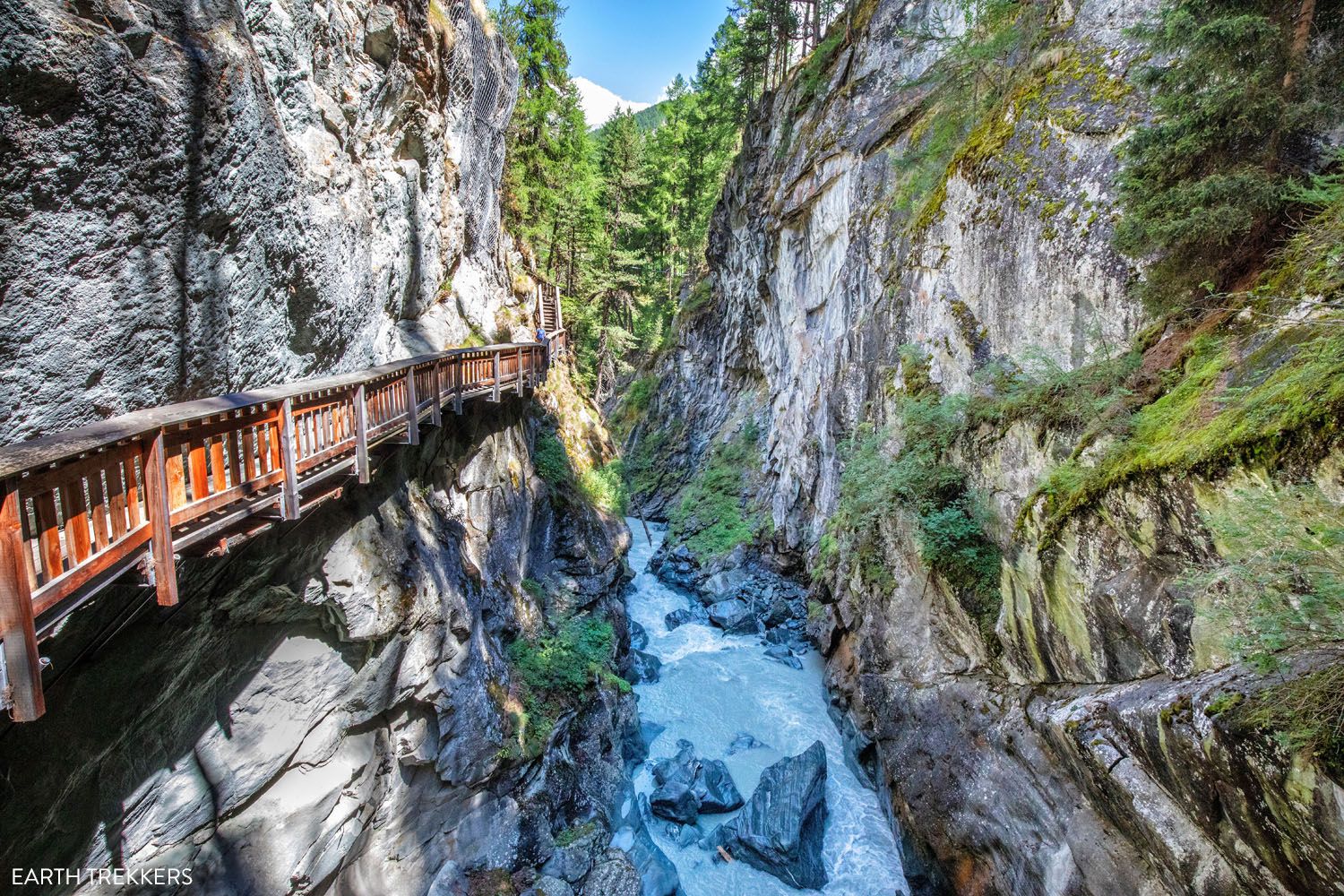
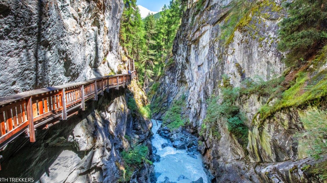
1. Gorner Gorge
Distance: 0.4 km (0.25 miles) one-way | Difficulty: Easy | Total Ascent: Minimal | Time: 15 to 30 minutes
The Gorner Gorge is a deep passage carved out from the rushing waters of the Gornervispa.
Boardwalks and staircases run through a small section of the gorge for visitors to walk along. Below is water flowing through the gorge with incredible force. It takes about 15 minutes to walk through the gorge.
Gorner Gorge
How to Get to the Gorner Gorge: The entrance into the Gorner Gorge is just past the Forest Fun Park and soccer field. Look for a concrete bridge. On the lefthand side just past the bridge there will be a sign for Gornerschlucht. Follow the sign onto a dirt trail.
After a short walk along a trail in the forest you will reach a small building signed Gornerschlucht. This is the official entrance into the gorge. Here you will pay a small fee to enter.
You can also visit the Gorner Gorge while hiking from Furi to Zermatt, which is covered later in this guide.
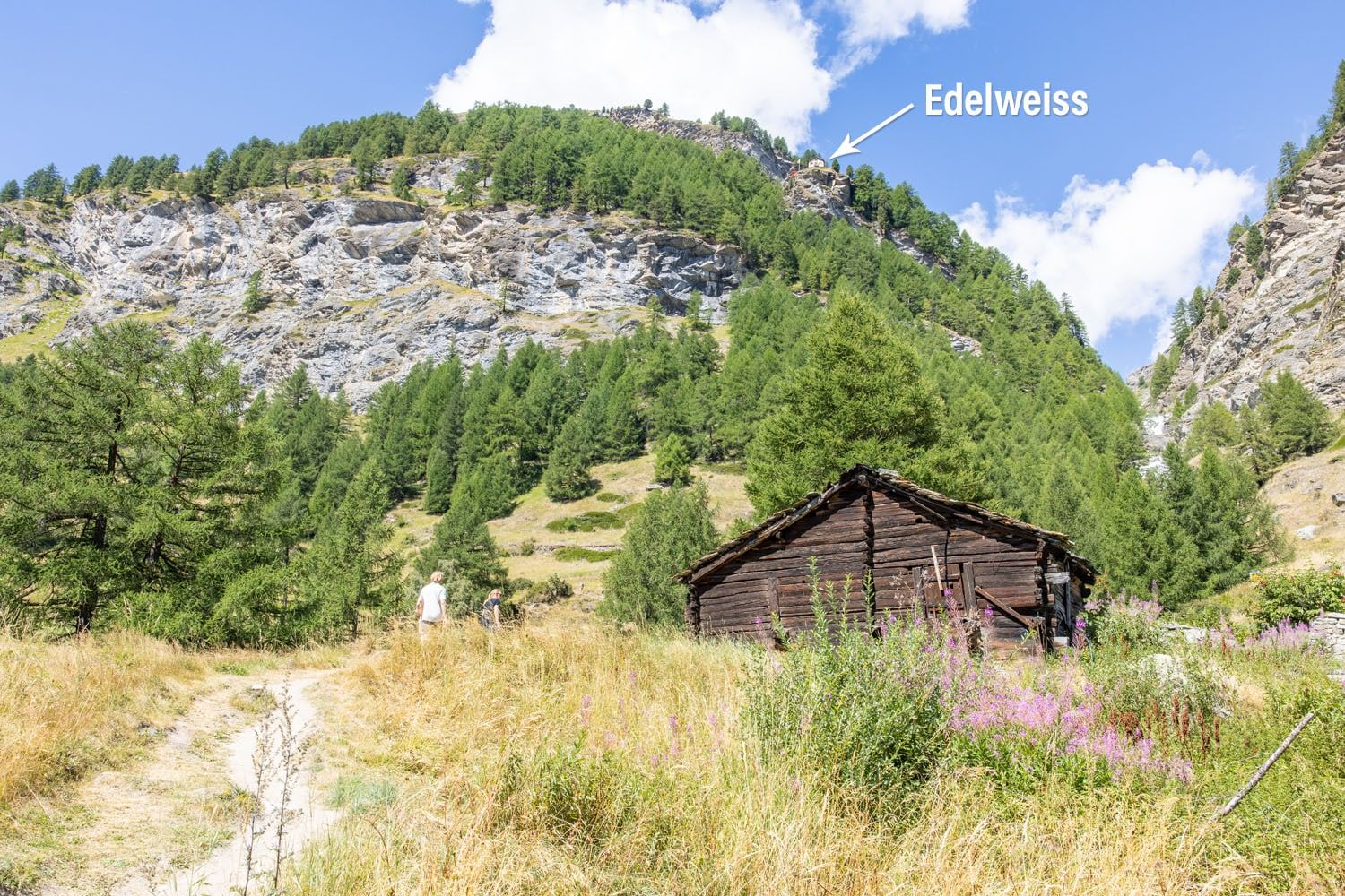
2. Edelweiss
Distance: 2.65 km (1.65 miles) | Difficulty: Moderate to strenuous | Total Ascent: 330 meters (1,080 feet) | Time: 2 to 3 hours (this includes time for lunch)
Edelweiss is a small mountain hut that sits on a cliff overlooking Zermatt. For lunch with a view, you can hike this short but very steep trail to the restaurant. Along the way, you will hike past a waterfall and have very nice views of Zermatt.
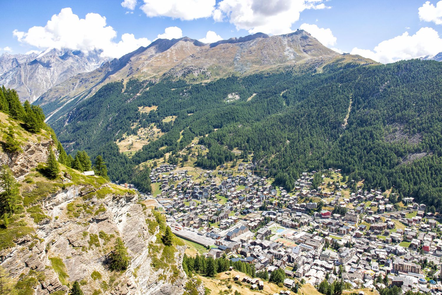
The view from Edelweiss
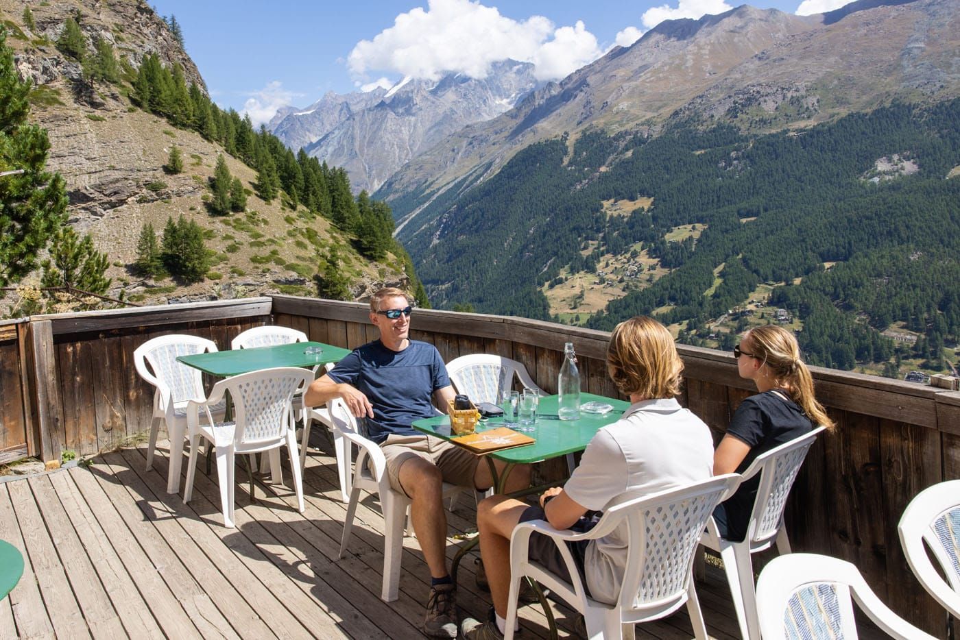
Having lunch at Edelweiss
It’s important to know that you will not have a view of the Matterhorn from this trail or Edelweiss. This hike is also steep, so it’s not the easiest of walks to get to the hut. But if you have lots of time in Zermatt and are looking for a unique dining experience, the hike to Edelweiss is one to consider.
Trail Directions to Edelweiss: Along the main shopping street in downtown Zermatt, take the alleyway (labeled Chrum on Google Maps) next to The Shoe Shop and follow this until you reach the Hotel Romantica. Walk past Hotel Romantica, keeping it on your right. Soon after, turn left onto a paved track labeled Triftweg on Google Maps. This will take you in front of The Omnia (a 5-star hotel) and then in-between a group of chalets. Once you pass those chalets, the paved track will become a dirt track, which is also labeled as Triftweg on Google Maps. Keep following this dirt track until you can turn left onto Edelweissweg (as labeled on Google Maps), which crosses a bridge and takes you to the Edelweisshütte.
3. The Hängebrücke (Furi Suspension Bridge Trail)
Distance: 3 km (2 miles) | Difficulty: Easy | Total Ascent: 175 meters (575 feet) | Time: 1 hour
The Hängebrücke is a suspension bridge that spans the Gornerschlucht (the Gorner Gorge). From this bridge, you get a very nice view of Zermatt.
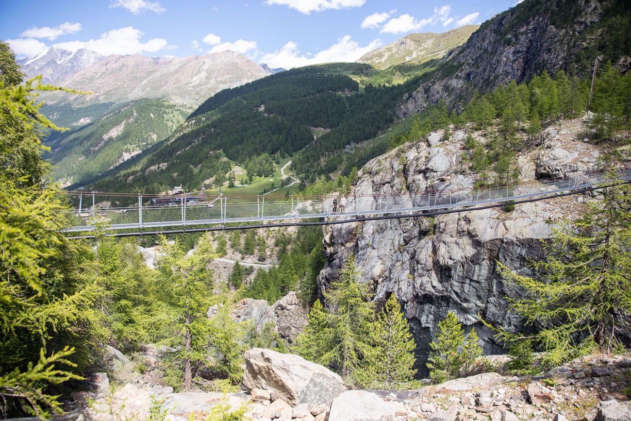
The Hängebrücke
View from the Hängebrücke
This hike starts at the Furi cable car station. It heads gradually uphill through a small hamlet and then briefly through a forest before arriving at the bridge.
To finish your hike, retrace your steps to Furi. You also have the option to add on the walk from Furi to Zermatt, mentioned later in this guide.

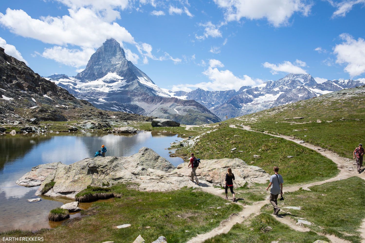
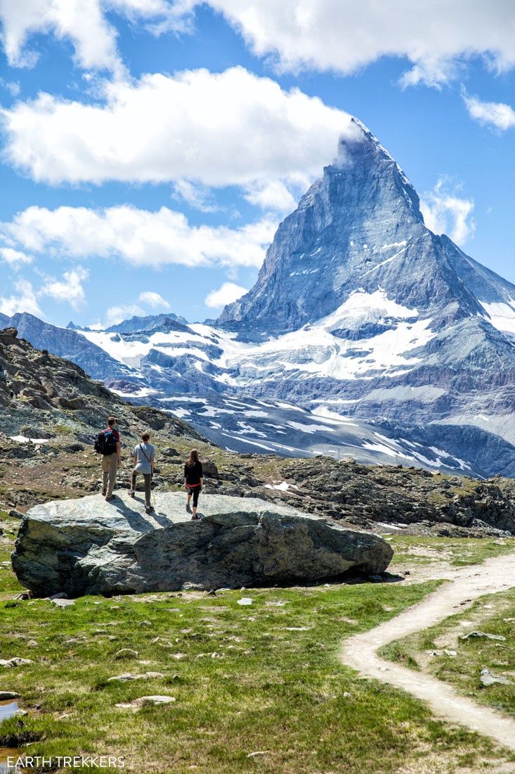
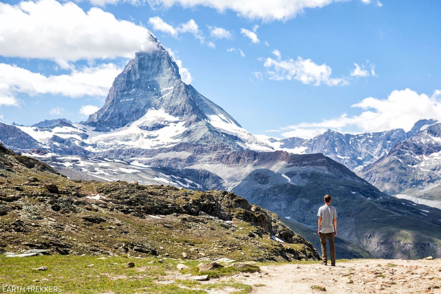
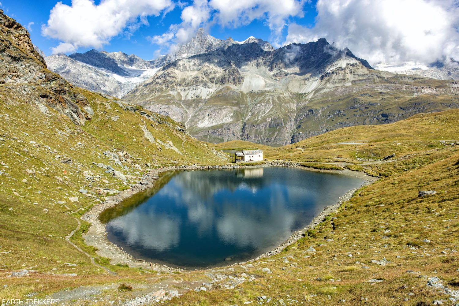
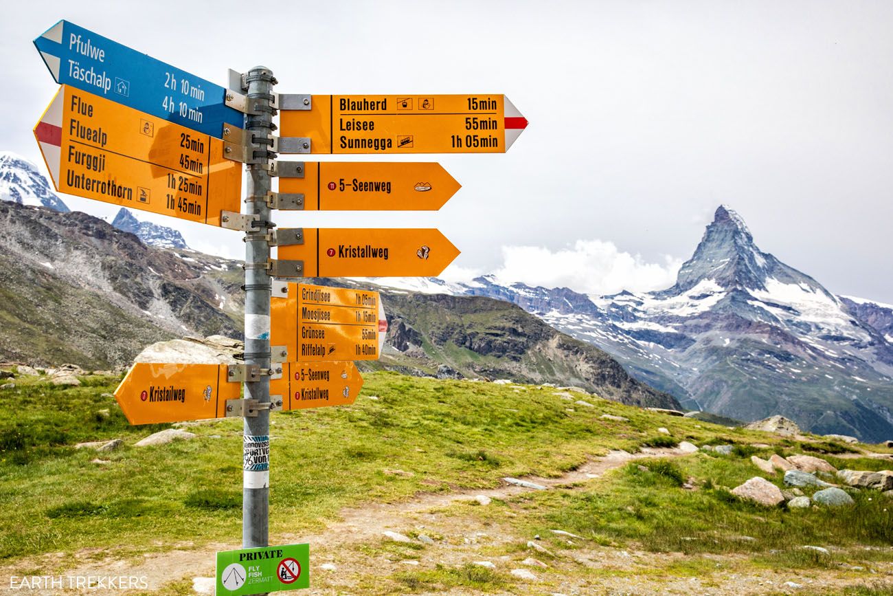
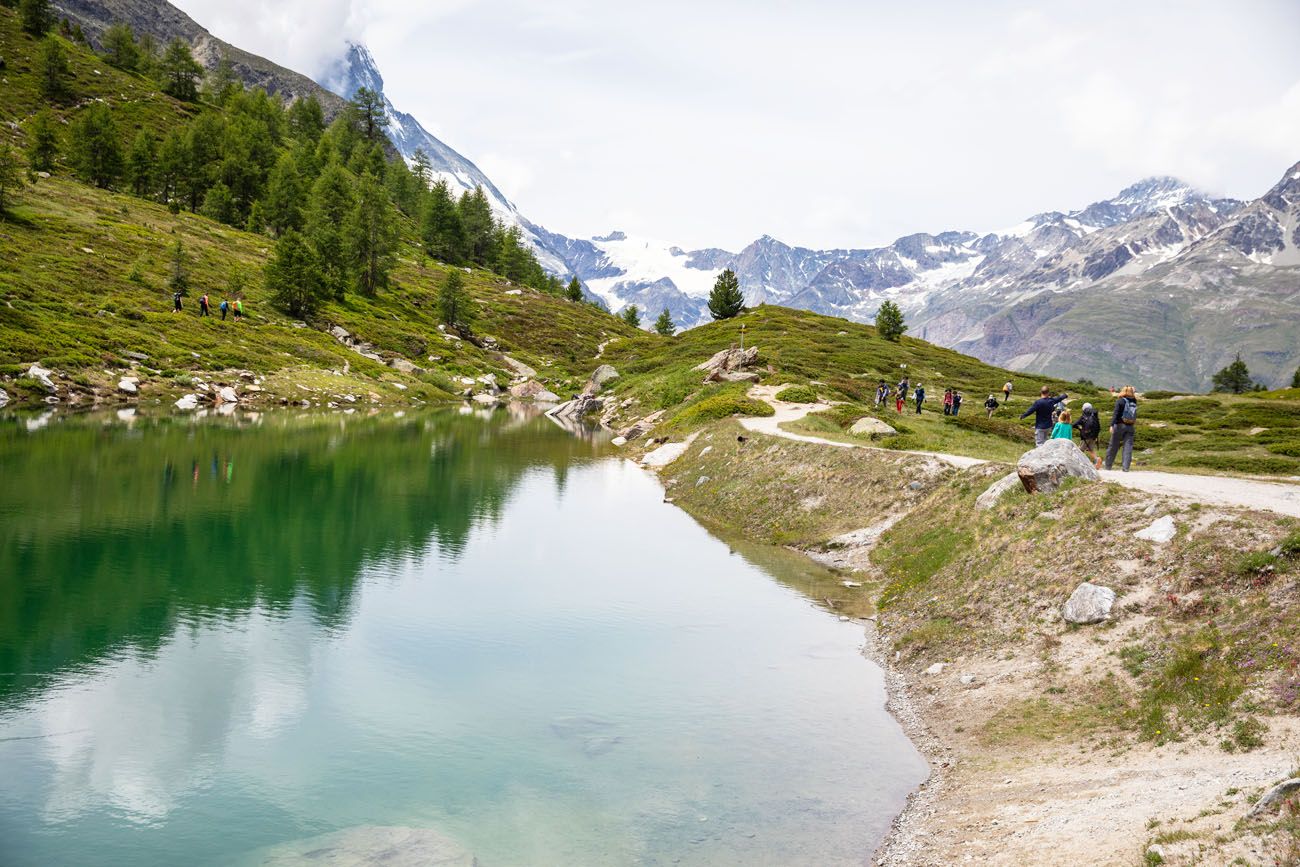
4. Stellisee
Distance: 3 km (2 miles) | Difficulty: Easy | Total Ascent: Minimal | Time: 1 hour
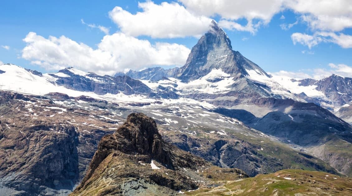
Stellisee is one of the prettiest lakes in Zermatt. Capturing the reflection of the Matterhorn on the lake is one of the best photo spots in the area.
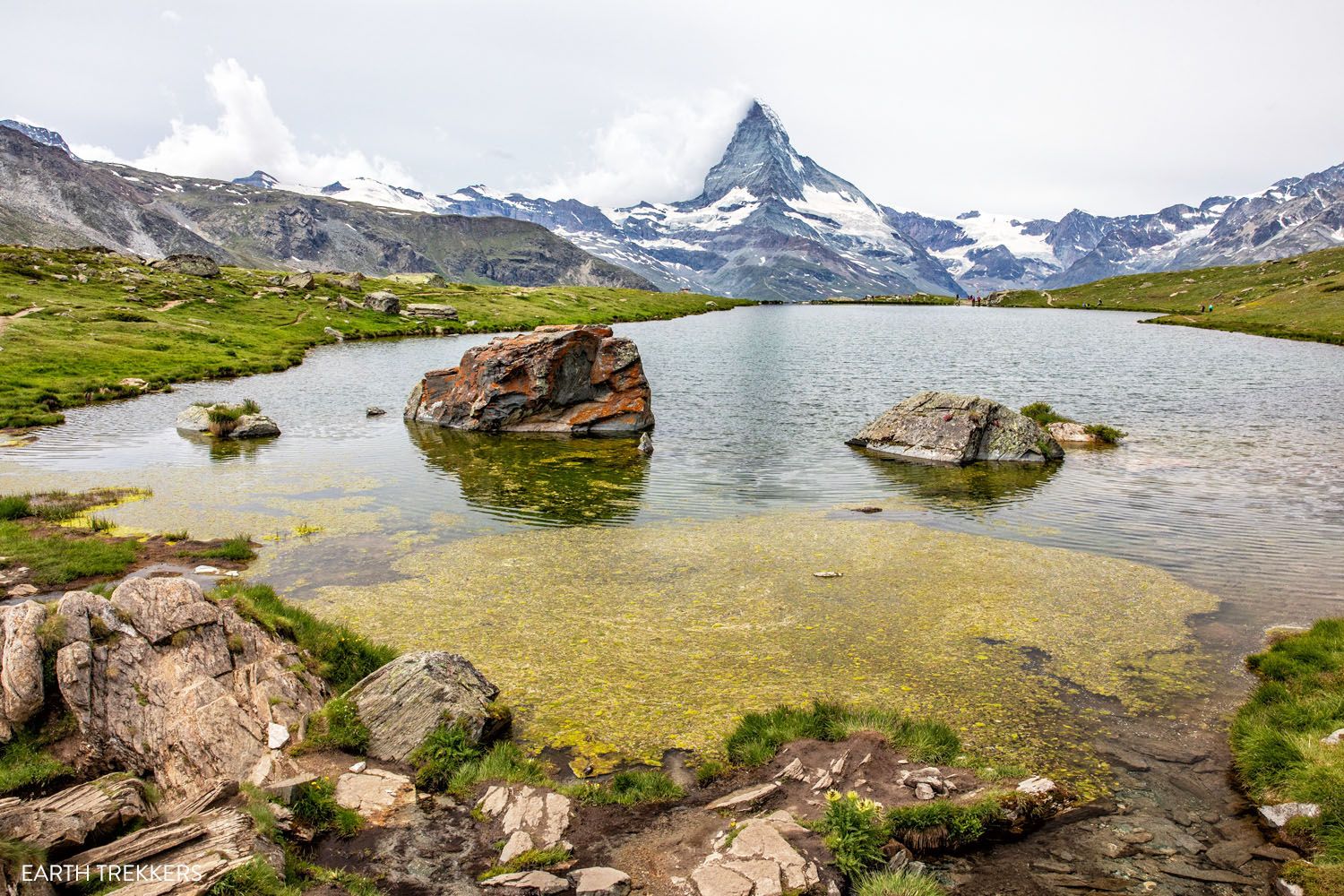
Stellisee | Best Hikes in Zermatt
To get here, it is an easy walk from the Blauherd station. Blauherd is a mountain station that sits on the series of cable cars that runs from Zermatt to Rothorn.
To hike to Stellisee, it is a 20 to 30-minute walk from Blauherd to Stellisee. Once at the lake, you get an iconic view of the Matterhorn shimmering on the lake’s surface.
Stellisee is one of five lakes on the Five Lakes Trail (5-Seenweg). This is an extremely popular hike in Zermatt, but we think it’s a bit overrated. We cover it later in this guide.
For the full details on how to hike to Stellisee, and how to get to Blauherd and Rothorn, read our Guide to Rothorn, Blauherd, and Sunnegga ↓
How to Visit Sunnegga, Blauherd, and Rothorn (Best One Day Itinerary)
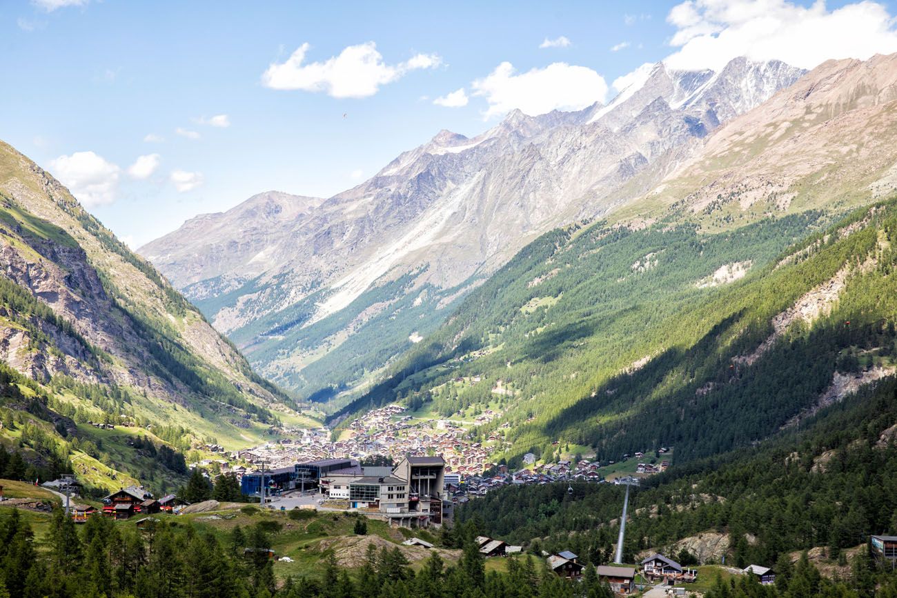
Exactly how to hike to Stellisee and ride the cable car to Sunnegga, Blauherd, and Rothorn.5. Furi to the Gorner Gorge to Zermatt
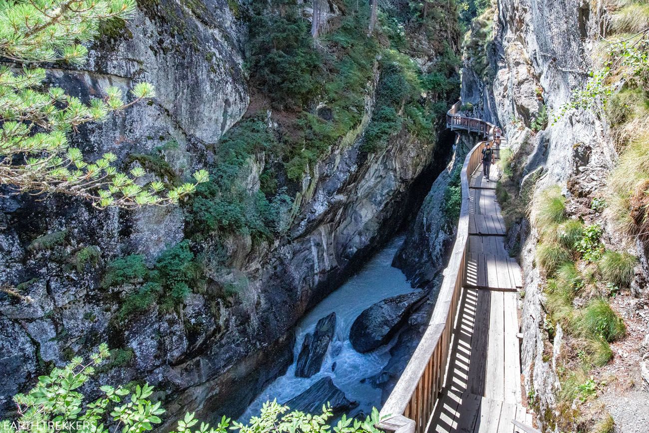
Distance: 3.6 km (2.2 miles) one-way | Difficulty: Easy | Total Descent: 300 meters (985 feet) | Time: 2 hours
This wonderfully easy, downhill walk takes you from Furi to Zermatt. Along the way, have lunch in a Swiss hamlet, walk through the Gorner Gorge (mentioned earlier in this guide), and take a selfie from the Kirchbrücke in Zermatt.
Starting at the Furi cable car station, follow trail signs for Zum See. As you walk through this small Swiss hamlet, you can have lunch at Zum See Restaurant. Or, continue a little farther to Blatten. We had lunch at Restaurant Blatten (Bergrestaurant Blatten) and the food is very good.
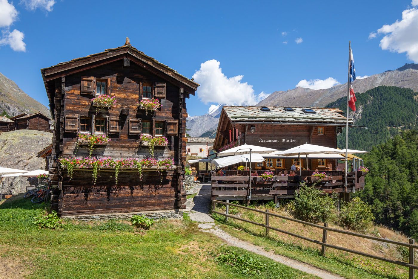
Restaurant Blatten
Gorner Gorge
As you continue downhill, it’s a 15-minute walk to the northern entrance of the Gorner Gorge. Have fun walking the boardwalk trails and photographing the scenic gorge.
Once you exit the southern end of the Gorner Gorge, it is a short walk to Zermatt. If you continue the walk towards the city center, you can end your hike with a selfie on the Kirchbrücke, which is a bridge that spans the Mattervispa and offers a beautiful view of the Matterhorn.
How to Hike from Furi to the Gorner Gorge to Zermatt
Get full details on how to do this hike, plus where to eat along the way.6. Gornergrat to Riffelsee and Riffelberg
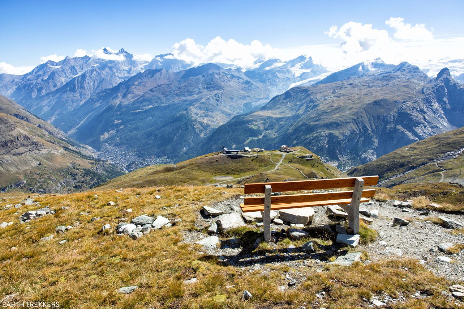
Distance: 4 km (2.5 miles) point-to-point | Difficulty: Easy | Total Descent: 500 meters (1,640 feet) | Time: 1.5 to 2 hours
Not only is this one of the best hikes in Zermatt, it’s also one of our favorite hikes in Europe.
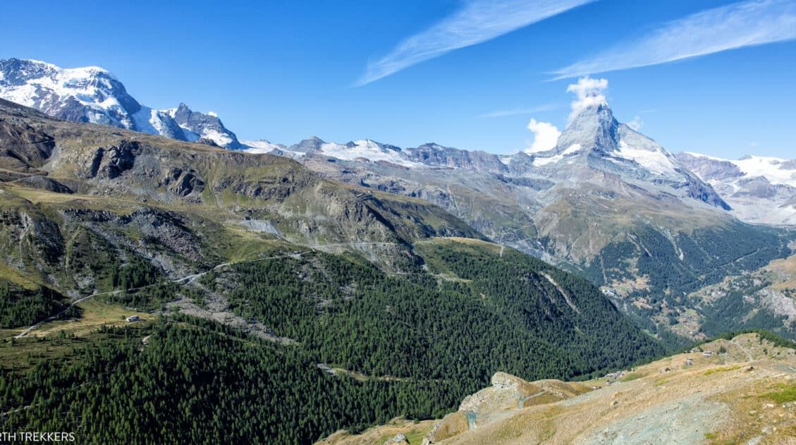
A scenic, cogwheel train takes you from Zermatt to the alpine paradise of Gornergrat. From this mountain station, the views of the Matterhorn are breathtaking.
From Gornergrat, it is an easy, downhill walk to another gorgeous alpine lake, Riffelsee, where you can photograph the Matterhorn’s reflection.
The trail continues to Riffelberg and every step of the way, the Matterhorn is right in front of you.
Hiking from Gornergrat to Riffelberg | Best Hikes in Zermatt
On this hike, you get some of the best views of the Matterhorn.
Because it is short and easy, this is a great hike for all ages and ability levels. For the best experience, do this hike in the morning so you can see the Matterhorn before clouds form around its peak, which typically happens midday and the afternoon.
Get the full details on how to do this in our guide to Visiting Gornergrat and Hiking to Riffelberg ↓
How to Visit Gornergrat and Hike to Riffelsee & Riffelberg
How to get to Gornergrat and what to expect on the hike to Riffelsee and Riffelberg.7. The Gourmet Trail (Gourmetweg)
Distance: 2 to 6 km (1 to 3.75 miles) | Difficulty: Easy to moderate | Total Ascent: 0 to 100 meters (0 to 330 feet) | Total Descent: Up to 700 meters (2,300 feet) | Time: 2 to 5 hours (depending on how many restaurants you visit)
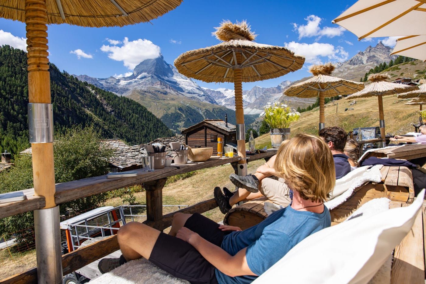
Have a leisurely lunch or spend the afternoon hiking from restaurant to restaurant along the Gourmet Trail.
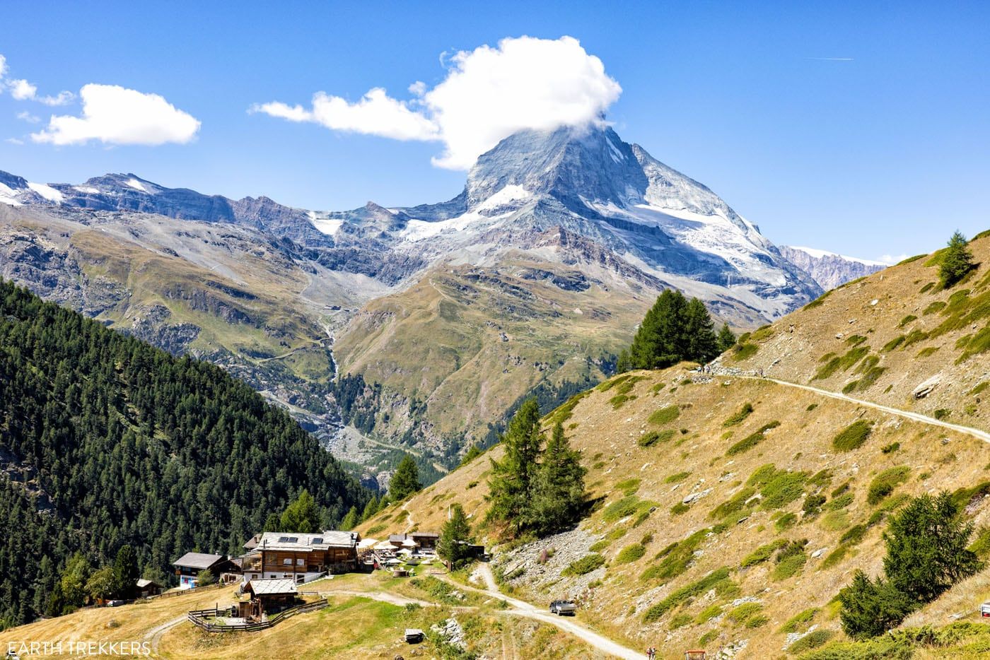
Findeln is a hamlet that is located just down the hill from Sunnegga. Several of the best restaurants in Zermatt are located here, including Adler Hitta, Findlerhof, Enzian, and Chez Vrony, a Michelin-starred restaurant.
You can choose one and have lunch or spend the afternoon hopping from one restaurant to the next.
Views along the Gourmet Trail
Chez Vrony
There are a lot of different ways to do this, which is why the stats above have a wide range of numbers.
If you simply walk out and back from the Sunnegga station to Adler Hitta (the closest restaurant), it is a 2 km (1.2 mile) walk round trip. It’s downhill to get to Adler Hitta and then an uphill walk to return to Sunnegga.
Chez Vrony, Findlerhof, and Enzian are clustered together but located a little farther away from Sunnegga (about 1.3 km/0.8 miles one-way). Once here, you can pick one restaurant and have lunch or visit all three, trying a little bit of food at each. To get back to Zermatt, walk uphill to Sunnegga (1.3km/0.8 miles) or downhill to Zermatt (5 km/3.1 miles with 430 meters/1,410 feet of descent).
This was one of our favorite unexpected experiences in Zermatt. All of the restaurants mentioned have a beautiful view of the Matterhorn and the food is some of the best in Zermatt.
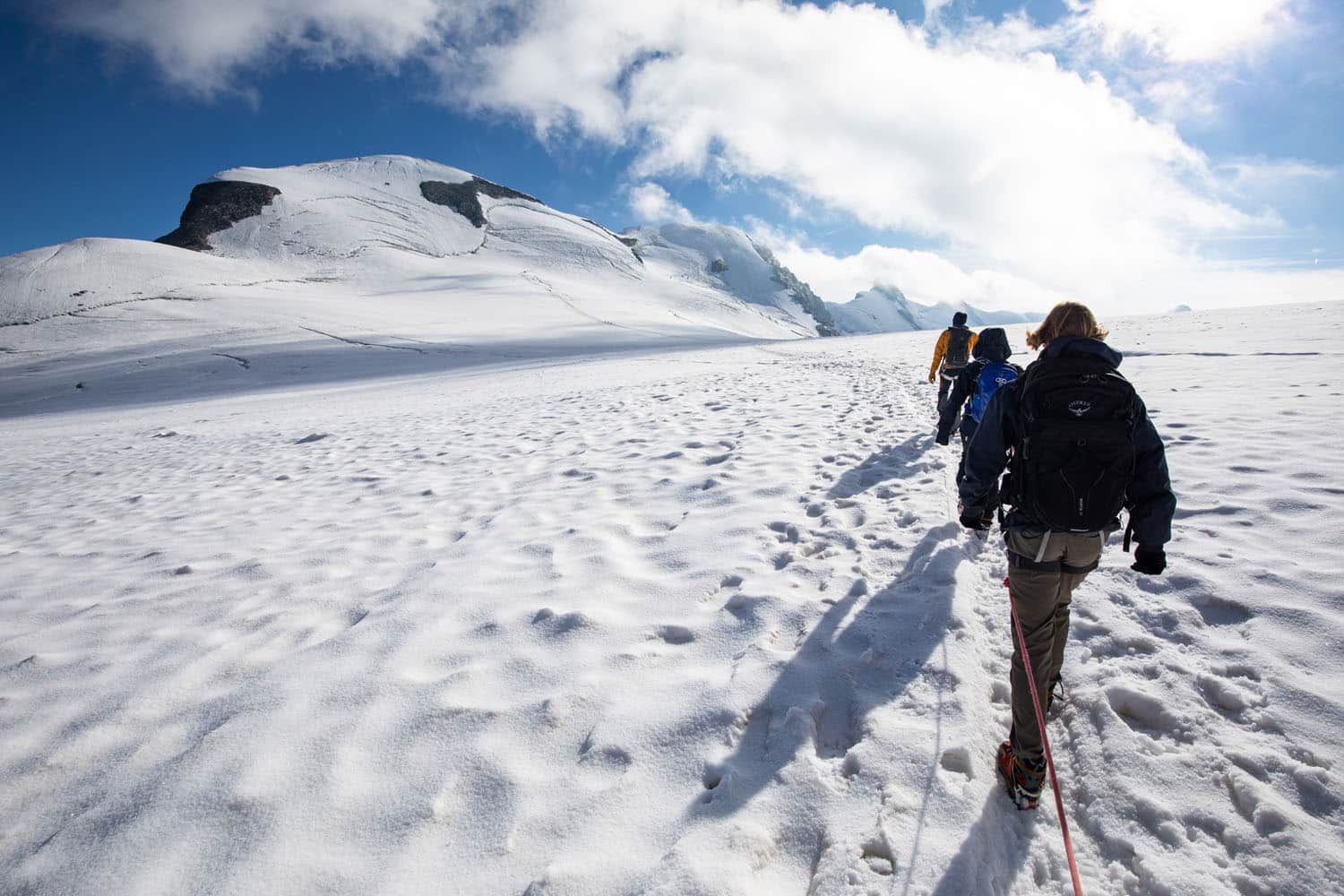
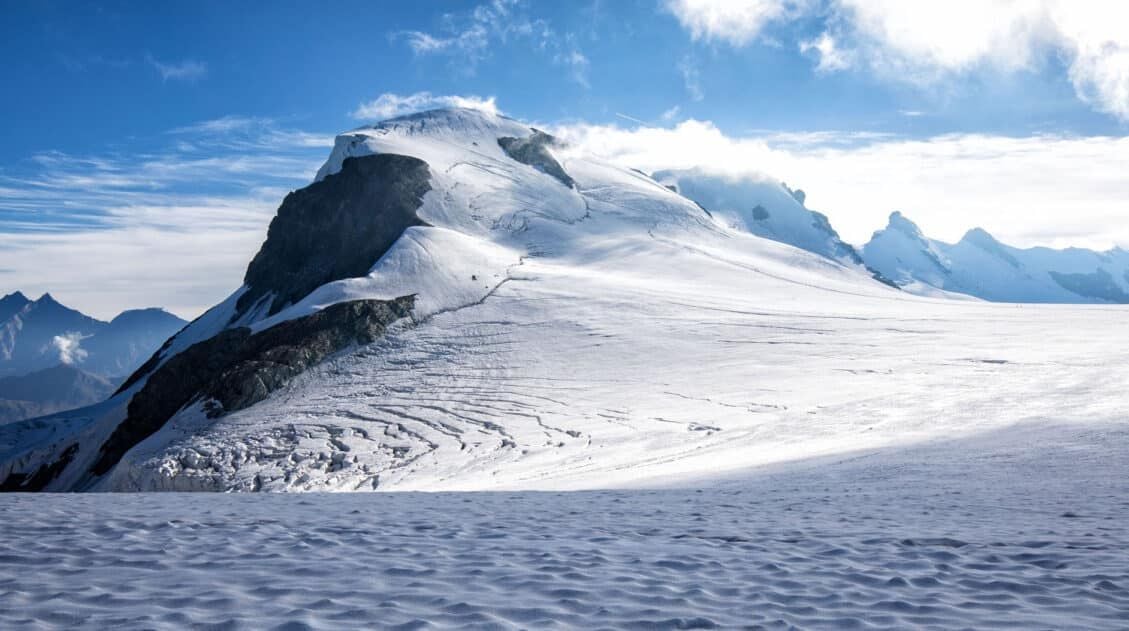
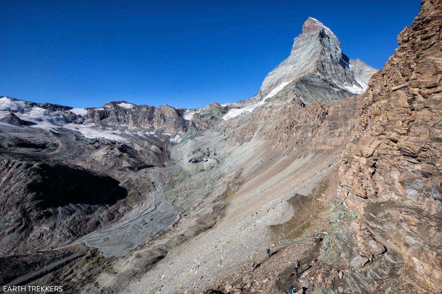
8. Breithorn
Distance: 5.7 km (3.5 miles) | Difficulty: Moderate | Total Ascent: 407 meters (1,335 feet) | Time: 3 to 3.5 hours
Climbing to the summit of Breithorn is one of Zermatt’s most adventurous experiences. Standing at a height of 4,164 meters (13,660 feet), Breithorn is one of the highest peaks in the area and it is one of the easiest 4,000+ meter peaks to summit in the Alps.
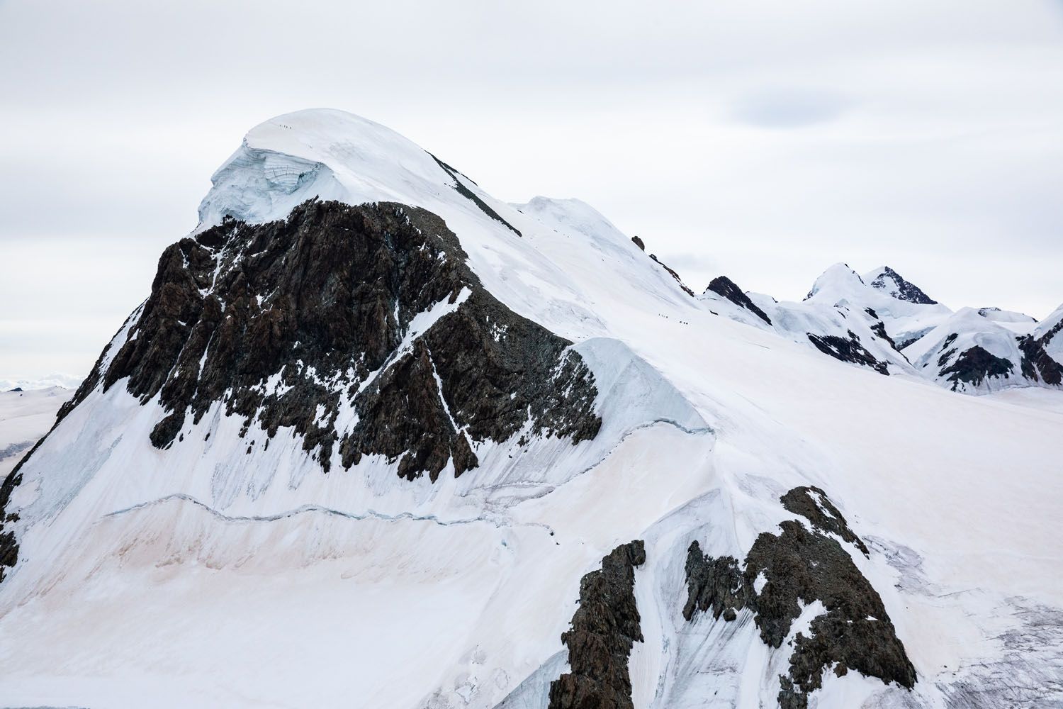
Breithorn (seen from Matterhorn Glacier Paradise)
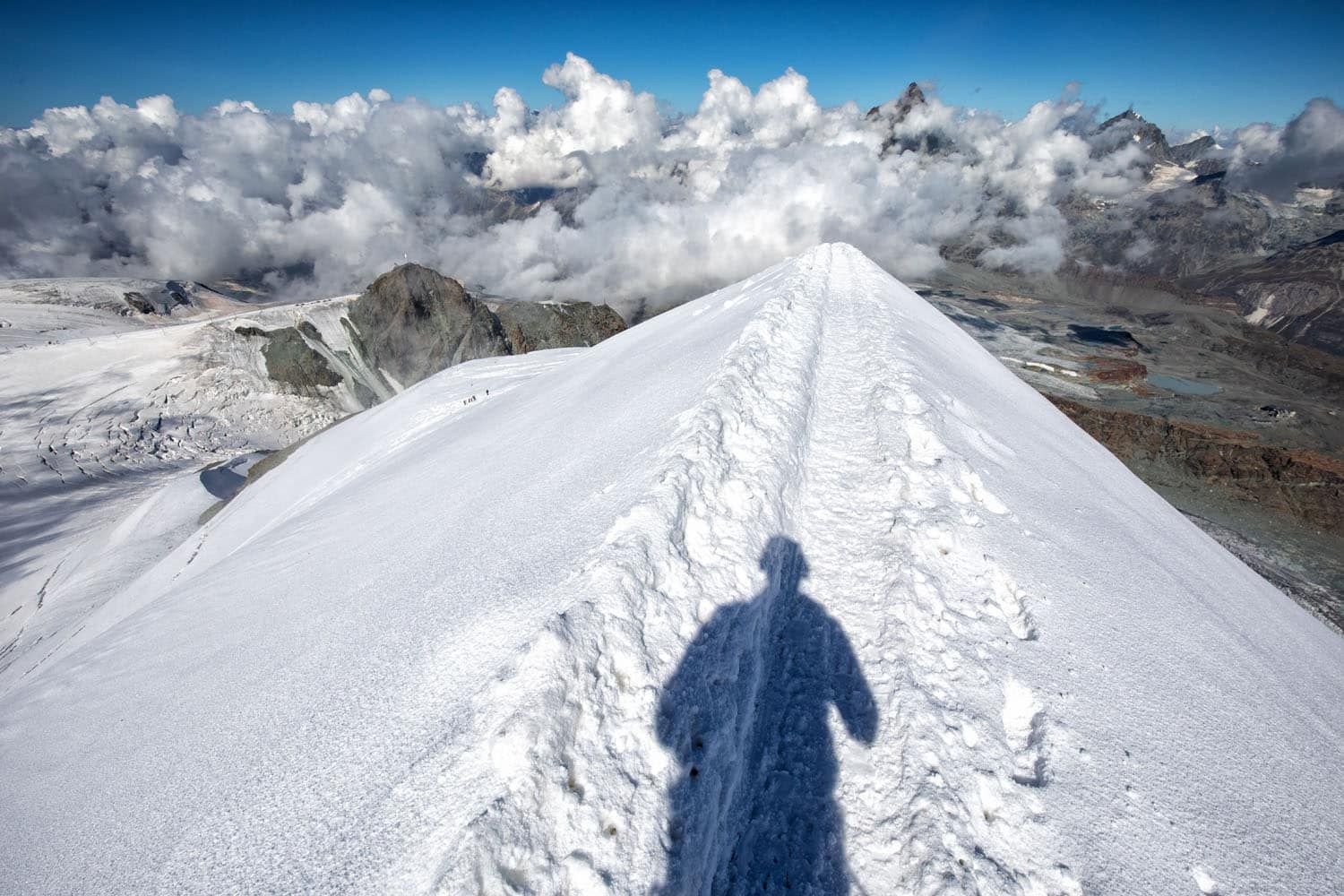
On the summit of Breithorn
Hiking across snowfields and up icy slopes, Breithorn offers a unique hiking experience for those looking to add some adventure to their trip to Zermatt. And the best part is, you don’t need extensive mountaineering training to reach the top (if accompanied by a guide).
To do this, you will need to hire a guide and you will need special equipment (we wore crampons and a harness, and we were roped together with our guide; our guide carried an ice axe).
This mountain climb starts at Matterhorn Glacier Paradise and can be done all year.
For more information, read our article How to Climb Breithorn ↓
How to Climb the Breithorn: Photos, Trail Stats & What to Expect
Everything you need to know to climb the Breithorn.9. Oberrothorn
Distance: 5.8 km (3.6 miles) | Difficulty: Strenuous | Total Ascent: 445 meters (1,500 feet) | Time: 3 to 4 hours
The trail to Oberrothorn is the highest hiking trail in Zermatt. Once at the top of the mountain peak, you will have a view of 38 mountains that stand higher than 4,000 meters.
The view of Oberrothorn from Rothorn
This tough hike starts at Rothorn, which is accessible by cable car. From Rothorn, you have a spectacular view of Zermatt and the Matterhorn, but the views will only get better as you hike the Path to Freedom to Oberrothorn.
This is the only hike on this list that we did not do, simply because we ran out of time. But with it being the highest trail in Zermatt, and the view it offers, we couldn’t leave it off of our hiking list.
Learn more on the official Zermatt website.
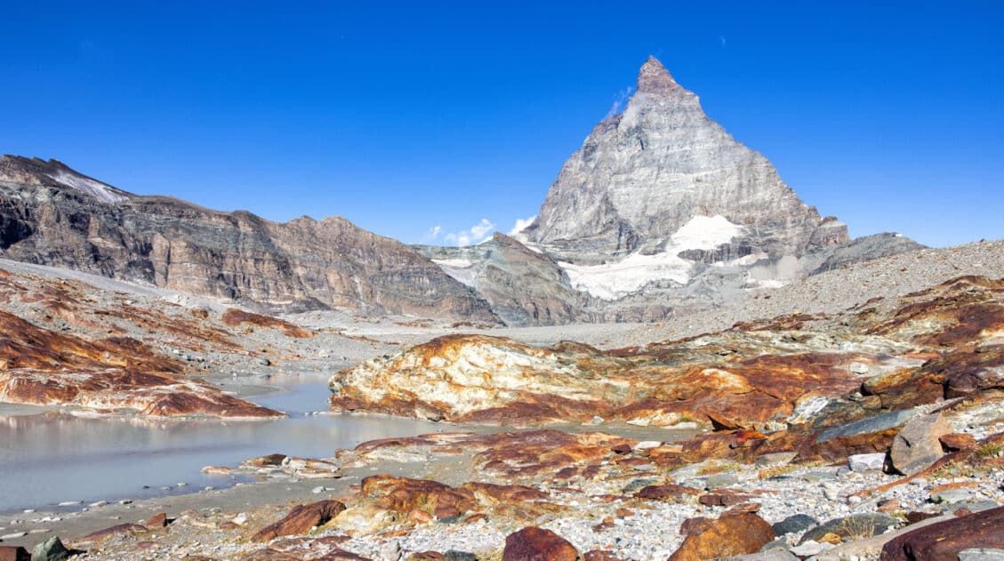
10. Matterhorn Glacier Trail
Distance: 6.8 km (4.25 miles) | Difficulty: Easy | Total Descent: 580 meters (1,900 feet) | Time: 2 to 3 hours
The Matterhorn Glacier Trail is one of the easiest and most scenic hikes to do in Zermatt.
This point-to-point trail weaves its way between alpine lakes and along the way you get up close views of the Matterhorn. Since it is done one-way and is a mostly downhill hike, this is a great trail for all ages and ability levels.
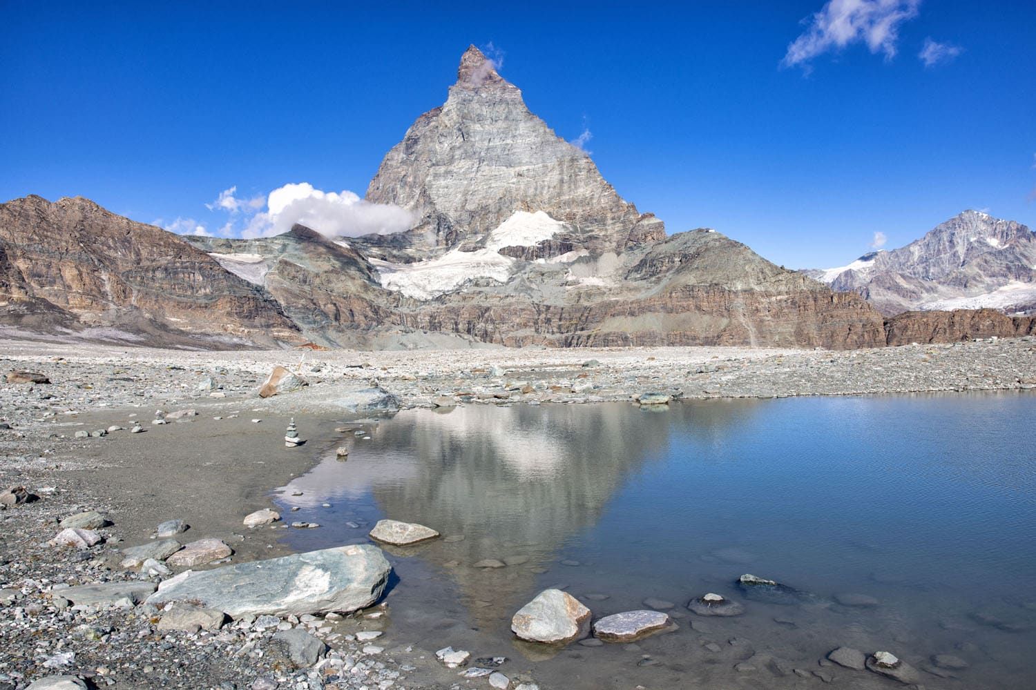
Matterhorn Glacier Trail | Best Hikes in Zermatt
The view of Schwarzsee and Zermatt from the Matterhorn Glacier Trail
Schwarzsee
This is the perfect hike to add on a visit to Matterhorn Glacier Paradise. Start your day with a visit to the Matterhorn Glacier Paradise. On the journey back to Zermatt, take the cable car as far as Trockener Steg.
From Trockener Steg, walk the Matterhorn Glacier Trail to Schwarzsee. If you still have lots of energy and time, you can even add on the hike to Hörnlihütte, but it will be a big day.
How to Hike the Matterhorn Glacier Trail
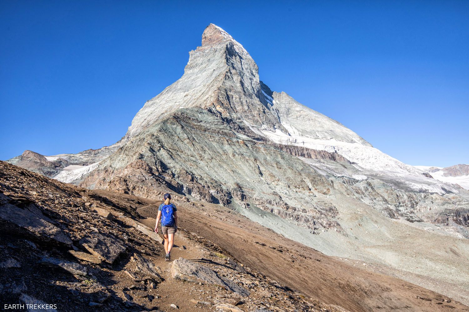
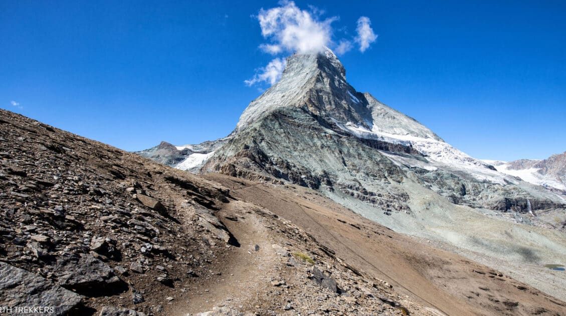
Get full details on how to do this hike and arrange your transportation.11. The Hörnlihütte (Hörnli Hut)
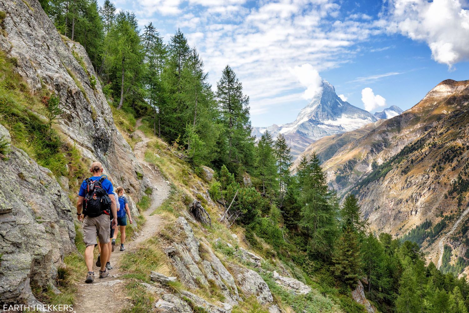
Distance: 8.5 km (5.25 miles) | Difficulty: Strenuous | Total Ascent: 725 meters (2,380 feet) | Time: 4 hours
If you love hiking, the hike to Hörnlihütte is a must-have experience in Zermatt.
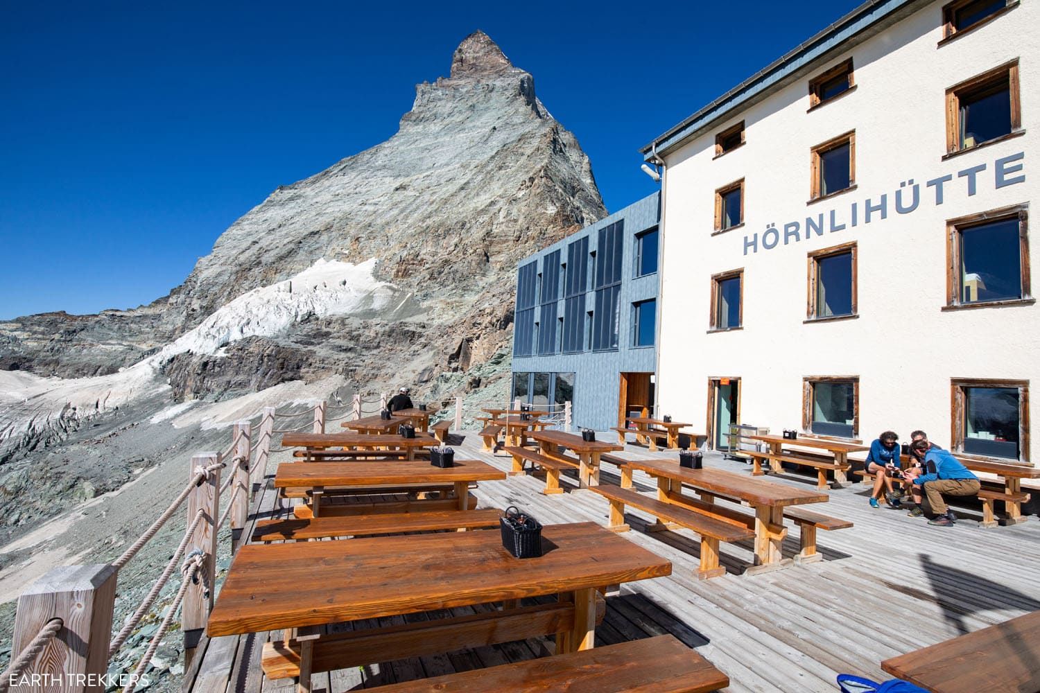
Hörnlihütte
Hiking to Hörnlihütte
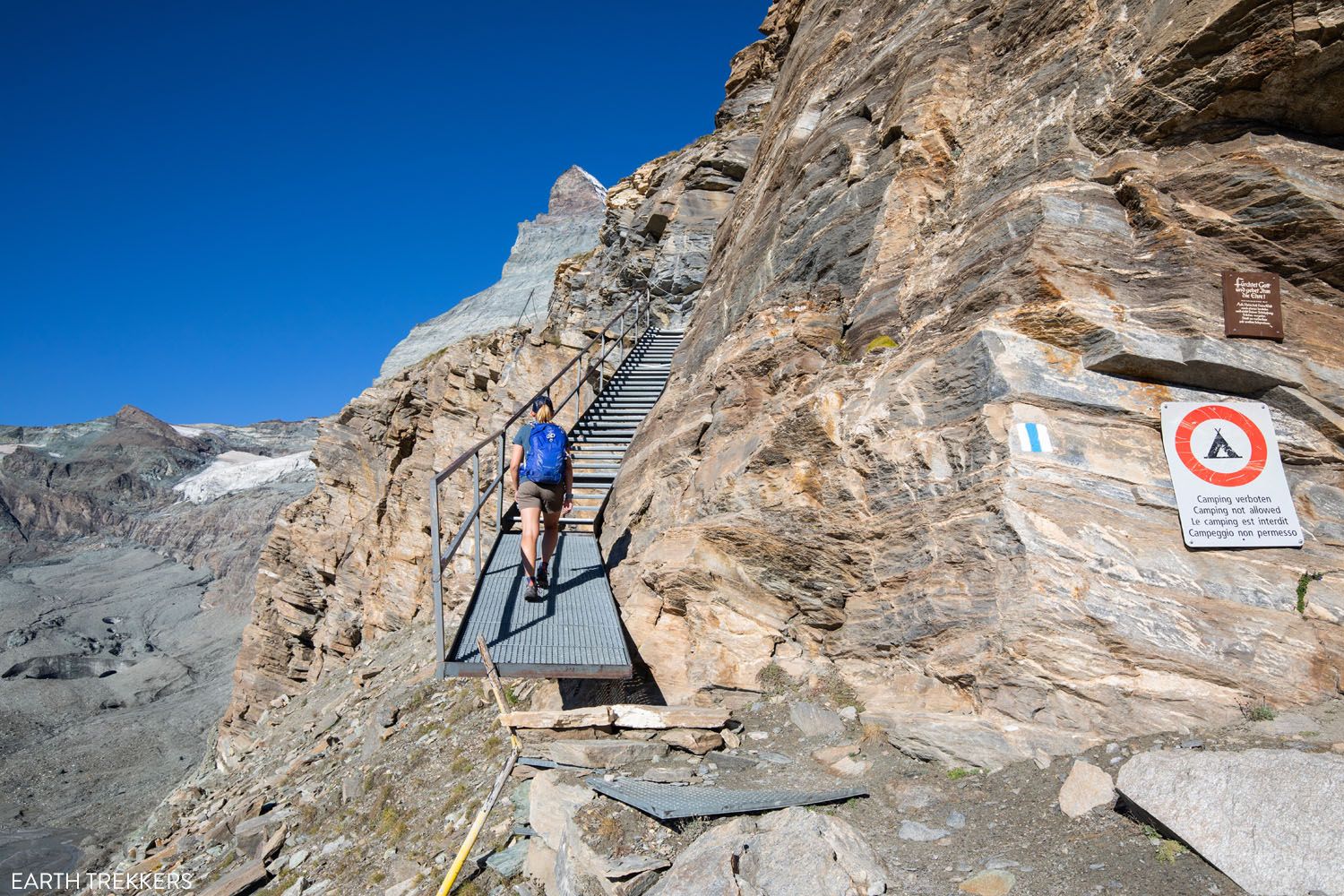
Platforms and stairs on the trail to Hörnlihütte
This short but challenging trail takes you to the Hörnlihütte (Hörnli Hut), a lodge built at the base of the Matterhorn. This is base camp for mountaineers who climb to the peak of the Matterhorn.
As you hike from Schwarzsee to Hörnlihütte, you get some of the best views of the Matterhorn.
Not only are the views some of the best in Zermatt but the trail is also tons of fun. On the hike to Hörnlihütte, you will walk across platforms bolted to the cliffs, walk on narrow trails along the cliff edges and climb several series of staircases. To do this hike, you need to be fit and have a good head for heights.
Get the full details on how to do this in our Hörnlihütte Hiking Guide ↓
Complete Guide to the Hörnlihütte Hike (Map, Trail Stats & Photos)
Everything you need to know to hike Hörnlihütte, an amazing hike in Zermatt.12. Five Lakes Trail (5-Seenweg)
Distance: 10 km (6 miles) point-to-point | Difficulty: Easy to moderate | Total Ascent: 165 meters | Time: 3 hours
The Five Lakes Trail is one of the most popular hikes in Zermatt. Amazing Matterhorn views, five gorgeous lakes, a mostly downhill walk…it sounds perfect, right?!
Not really. For most of this hike, you are wide, gravel roads and walking through the woods, not the most exciting experience. You see Stellisee first, which is beautiful (and mentioned earlier in this guide). And the other four lakes…after Stellisee, they are a let-down.
Five Lakes Trail
View from the Five Lakes Trail
Grünsee
If you are looking for an easy hike in Zermatt with BIG views of the Matterhorn, you have better options, in my opinion. Take a look at the hike from Gornergrat to Riffelberg and Riffelsee, the Matterhorn Glacier Trail, and the hike to Hörnlihütte.
To see more photos of the Five Lakes Trail, and learn more about what to expect, read our Five Lakes Trail Hiking Guide.
Two More Hikes to Mention
The list above covers the best hikes to do in Zermatt. But there are two notable hikes just outside of Zermatt we want to let you know about.
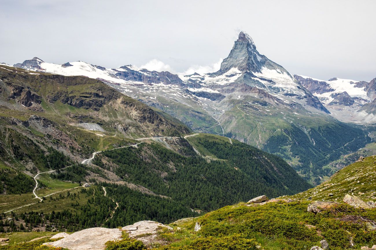
The Europaweg
The Europaweg is called the most beautiful 2-day walk in the Alps. It runs from Grachen to Zermatt and it is part of the Walker’s Haute Route.
Several years ago, a massive rockslide covered a large portion of the trail between Grat and Galenburg. After this occurred, this section of the Europaweg was permanently closed and then rerouted to a lower route through the forest.
Now, the best section of the Europaweg is the walk from the Europahütte to Zermatt. This is also the final stage of the Walker’s Haute Route.
The Europaweg
It is a beautiful walk, with views of the Matterhorn and a walk across the Charles Kuonen Suspension Bridge.
This hike is 20.7 km (12.8 miles) one-way. It has 915 meters of total ascent and 1,525 meters of total descent, so overall it’s a downhill walk, but there are just enough uphill climbs to keep it moderately challenging.
If this sounds like something you want to do, you can either hike to and spend the night in the Europahütte and then hike to Zermatt the following day, or hike from Randa to the Charles Kuonen Suspension Bridge and hike the Europaweg from here to Zermatt (but that will be a massive day of hiking).
Learn more about the Europaweg on our Walker’s Haute Route Stage 14 Guide.
The Charles Kuonen Suspension Bridge
The Charles Kuonen Suspension Bridge is 494 meters long and it is the longest suspension bridge in the Alps.
It is located near Randa, a town north of Zermatt. To get here, you will have to take a train or if you have a car, you can drive here.
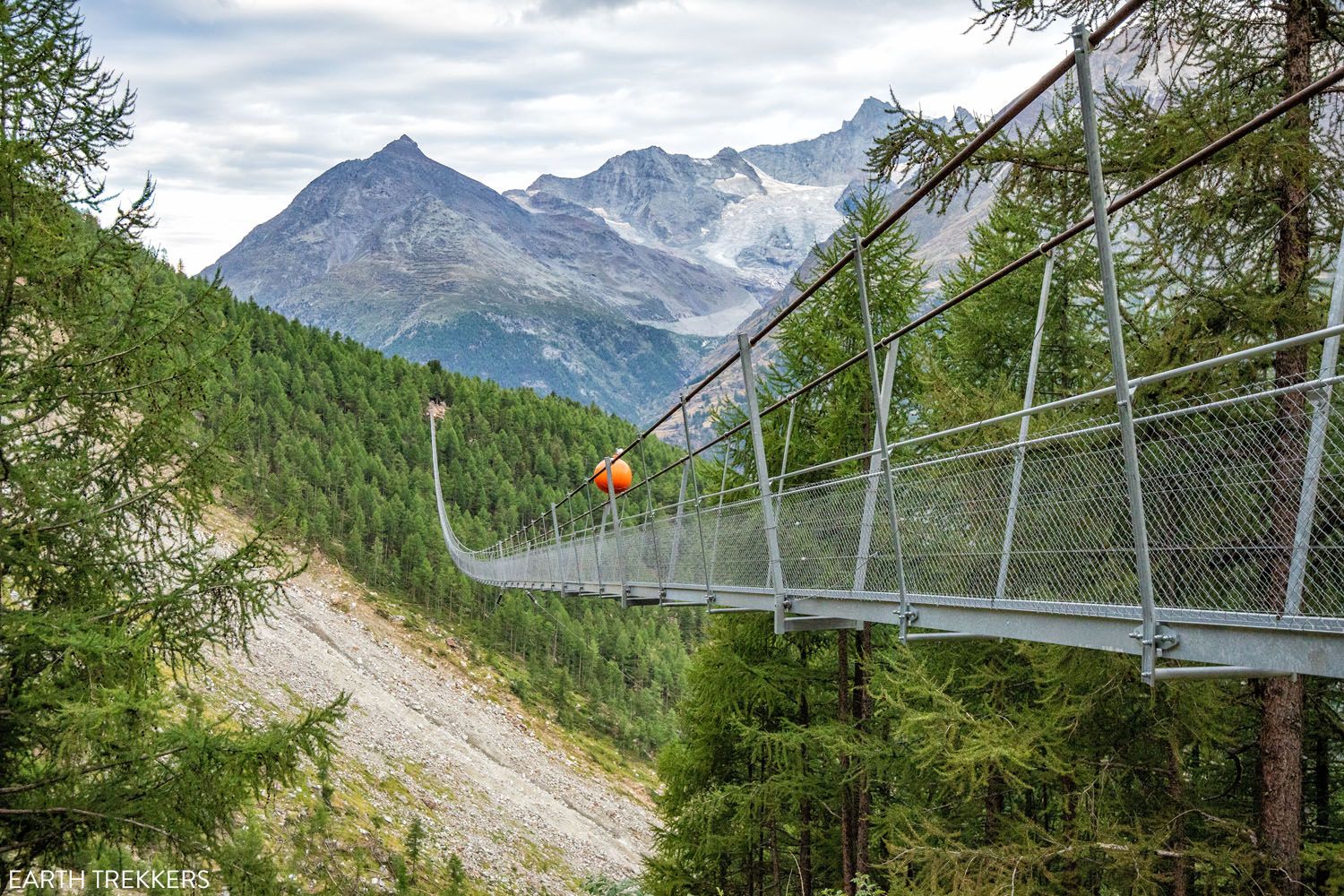
Charles Kuonen Suspension Bridge
We walked across the Charles Kuonen Suspension Bridge while hiking the Walker’s Haute Route. It is very cool to see but I don’t think it’s worth taking the time to get to Randa and hike this trail, not with so many other awesome hikes to choose from in Zermatt. But I’m mentioning it, just so you are aware of it while picking out your hikes to do in Zermatt.
If you are interested in hiking to the suspension bridge, hike trail #69 from Randa. This hike is 8.6 km (5.3 miles) with 990 meters (3,300 feet) of ascent, so it’s a short, tough hike. It’s also mostly in the woods so you won’t have much of a view and you won’t see the Mattherhorn, not even from the bridge. The distances listed includes continuing on to the Europahütte.
Best Hikes in Zermatt: On a Map
How to Use This Map: Click the icons on the map to get more information about each point of interest. To take this map with you, click the star next to the title of the map which adds it to your Google account. Next, within your Google Maps app, select ‘Saved’ and then select ‘Maps’. This map title will now appear in your list.
Our Recommendations
Our Favorite Hikes in Zermatt
Here is a list of our favorite hikes in Zermatt, starting with our favorite.
- Gornergrat to Riffelsee and Riffelberg
- Breithorn
- Hörnlihütte
- Matterhorn Glacier Trail
- Stellisee
- Gourmet Trail (Gourmetweg)
Best Hikes with a View of the Matterhorn
- Gornergrat to Riffelsee and Riffelberg
- Hörnlihütte
- Matterhorn Glacier Trail
- Stellisee
- Breithorn
- Gourmet Trail
- Five Lakes Trail
Best Hikes for Kids
- Gornergrat to Riffelsee and Riffelberg
- Stellisee
- Gorner Gorge
- Matterhorn Glacier Trail
Please practice the seven principles of Leave No Trace: plan ahead, stay on the trail, pack out what you bring to the hiking trail, leave areas as you found them, minimize campfire impacts, be considerate of other hikers, and do not approach or feed wildlife.
On the trail to Hörnlihütte
Frequently Asked Questions
When is the best time to go hiking in Zermatt?
The hiking season runs from June through September. During this time, the trails are clear of snow. If you have plans to visit Zermatt outside of this time frame, it may not be possible to go hiking, depending on conditions.
How many days do I need in Zermatt?
Ideally, plan on spending at least two days in Zermatt. There are three high alpine destinations in Zermatt (Gornergrat, Matterhorn Glacier Paradise, and Rothorn) and with two very busy days, you can visit all of them. Gornergrat and Matterhorn Glacier Paradise can be combined on one day (this also saves some money) and on day two, visit Rothorn, hike to Lake Stellisee, and spend some time in town. Additional time in Zermatt gives you contingency time in case of bad weather and gives you more time to visit some off the beaten path places. Plan your visit with our Zermatt Itinerary, that has suggestions on how to spend your time if you have 1, 2, 3 or more days in Zermatt.
How do I get around Zermatt?
Zermatt is a car free town. The best way to get around Zermatt is on foot but there are also taxis that you can take to get from place to place. From Zermatt, trains and cable cars travel up into the mountains to mountain lodges, hiking trailheads, restaurants, and ski slopes. While in Zermatt, you will ride several of these cable cars, if you plan to visit places like Gornergrat and Matterhorn Glacier Paradise.
What do you do think are the best hikes in Zermatt? Let us know in the comment section below, and feel free to write in if you have any questions about which ones you should do.
More Information for Your Trip to Switzerland
We have TONS more information about Switzerland in our Switzerland Travel Guide, including Zürich, Lucerne, the Bernese Oberland, Zermatt, Lugano, and Lausanne.
Switzerland Travel Guide: How to Plan a Trip to Switzerland
Pinterest Facebook Flipboard Switzerland Travel Guide Looking to hike some of the world’s most beautiful mountain landscapes, stroll through colorful old towns, and dine on some fondue? Then Switzerland is the perfect place for you! Visit the Bernese Oberland, a hikers paradise filled with towering mountains, alpine meadows, historic cogwheel trains, and quaint villages. Or, […]
20 Amazing Things to Do in Zermatt, Switzerland
Zermatt is an idyllic mountain village tucked away in the Swiss Alps. The mighty Matterhorn dominates the skyline, creating one of the most unique alpine landscapes in Europe. Explore the hiking trails, journey up higher into the mountains by cable car and train, stroll the scenic streets of Zermatt, and go skiing all year long. […]
The Ultimate Zermatt Itinerary for 1 to 4 Days
How many days do you need in Zermatt? How do you plan the perfect Zermatt itinerary? The answer to these questions depends on several factors. How much time do you have? Do you want to get out and hike the trails or simply ride the cable cars to viewpoints of the Matterhorn? What time of […]
Matterhorn Glacier Trail: Ultimate Trail Guide (+ Map, Photos & HELPFUL Tips)
The Matterhorn Glacier Trail is one of the easiest and most scenic hikes to do in Zermatt. This point-to-point trail weaves its way between alpine lakes and along the way you get up close views of the Matterhorn. Since it is done one-way and is a mostly downhill hike, this is a great trail for […]
How to Visit Gornergrat and Hike to Riffelsee & Riffelberg
For one of the best views of Matterhorn, it’s hard to beat Gornergrat. A scenic, cogwheel train takes you from Zermatt to this alpine paradise. Once at the top station, you can simply enjoy the sweeping views of the Matterhorn and the Swiss Alps from the restaurant and terraces. Or, you can add on the […]
How to Visit Sunnegga, Blauherd, and Rothorn (Best One Day Itinerary)
Riding the series of lifts to Rothorn is one of the best things to do in Zermatt. Rothorn is one of the highest viewpoints in Zermatt, and from here you get a spectacular view of the Matterhorn and the surrounding mountains. On the journey to Rothorn, you will pass through two stations, Sunnegga and Blauherd, […]
How to Visit Matterhorn Glacier Paradise …and is It Worth It?
Does a trip to the highest cable car station in Europe sound thrilling to you? How about having 360° views across the Alps? If so, then put Matterhorn Glacier Paradise on your Swiss to-do list. Matterhorn Glacier Paradise is an alpine wonderland of ski slopes, panoramic vistas, ice carvings, and a unique view of the […]
How to Climb the Breithorn: Photos, Trail Stats & What to Expect
Climbing to the summit of Breithorn is one of Zermatt’s most adventurous experiences. Standing at a height of 4,164 meters (13,660 feet), Breithorn is one of the highest peaks in the area and it is one of the easiest 4,000+ meter peaks to summit in the Alps. Thousands of hikers come to Zermatt to summit […]
Walker’s Haute Route Stages: An Overview of All 14 Stages
The Walker’s Haute Route is a multi-day trek from Chamonix, France to Zermatt, Switzerland. On this walk, hikers will cross 10 mountain passes, walk through small towns and through rugged, remote landscapes, and get to experience a less touristy side of the Swiss Alps. There are several routes that take hikers from Chamonix to Zermatt. […]
15 Great Hikes to Do in the Bernese Oberland, Switzerland
The Bernese Oberland is a hiker’s paradise. Alpine trails crisscross their way through the towns, valleys, and the mountain peaks of this gorgeous place. Take your pick from short, easy, family-friendly trails to cliff walks to thrilling trails. Here are 15 of the best hikes to do in the Bernese Oberland. All of the hikes […]
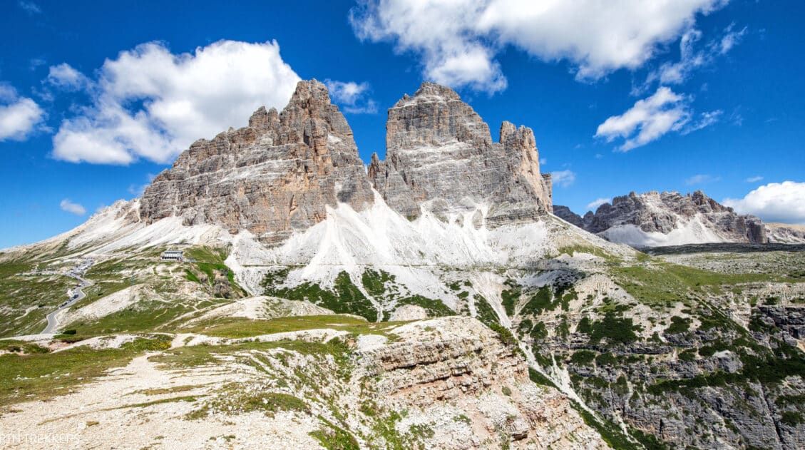
15 Best Hikes in the Dolomites (Easy to Challenging)
The Dolomites are one of the best hiking destinations in Europe. In this guide, we rank the 15 best hikes in the Dolomites, from easy scenic trails to challenging alpine adventures, based on views, difficulty, and our firsthand experience hiking the region. Jagged limestone peaks, knife-edge ridgelines, and turquoise alpine lakes make the Dolomites one […]
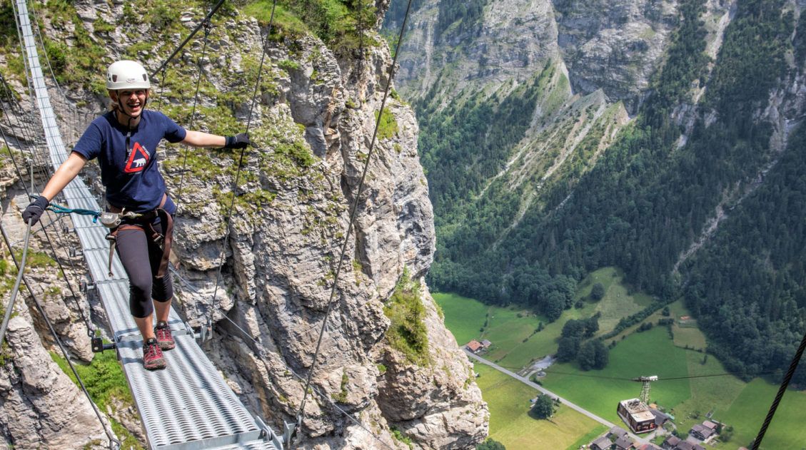
The Mürren Via Ferrata: One of Switzerland’s Most Thrilling Experiences
Does the idea of dangling 600 meters (2000 feet) above the Lauterbrunnen Valley floor interest you? How about walking across a tightrope, with nothing below you except a rushing river? Or how about walking across a wobbly, narrow, suspension bridge? If you said yes to all of these questions, then put the Mürren via ferrata […]
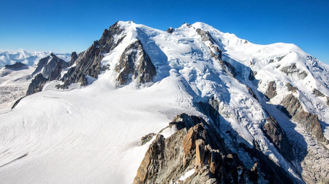
Chamonix Itinerary: How to Spend 1 to 5 Days in Chamonix
Chamonix is one of the best places in the French Alps for a summer itinerary packed with cable car rides, glacier views, high alpine hikes, and jaw-dropping views of Mont Blanc. With 1 day, you can ride to Aiguille du Midi and see one of the most famous views in Europe; with 3 days, you […]
Comments 1