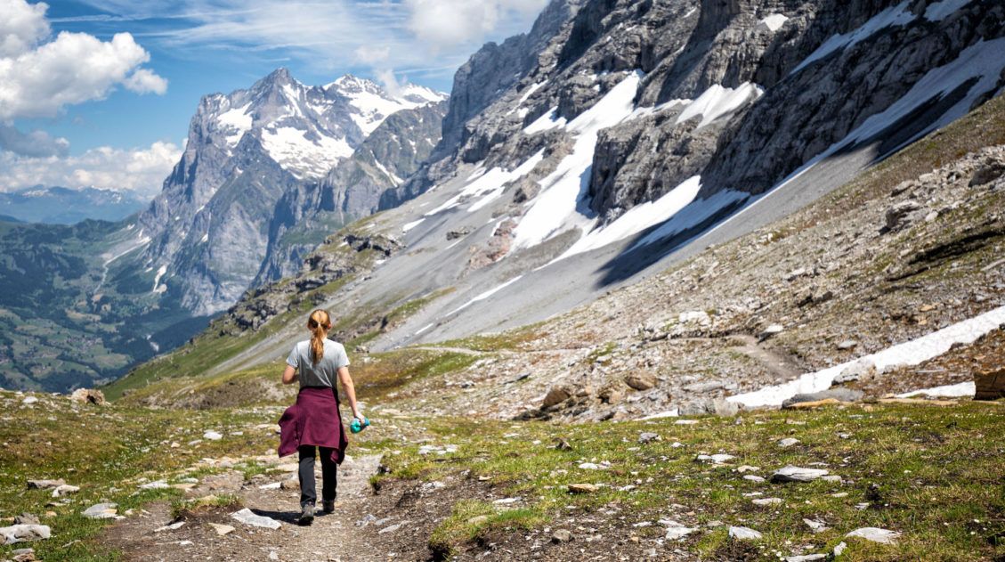
The hike from Schynige Platte to Faulhorn to First is a big day hike in the Jungfrau region of Switzerland, but what a spectacular day. A scenic ride on a cogwheel train, alpine lakes, rustic mountain huts, snow-covered trails, cows and their musical bells, and some of the best views of Swiss Alps…these are just a few highlights of this thrilling hike.
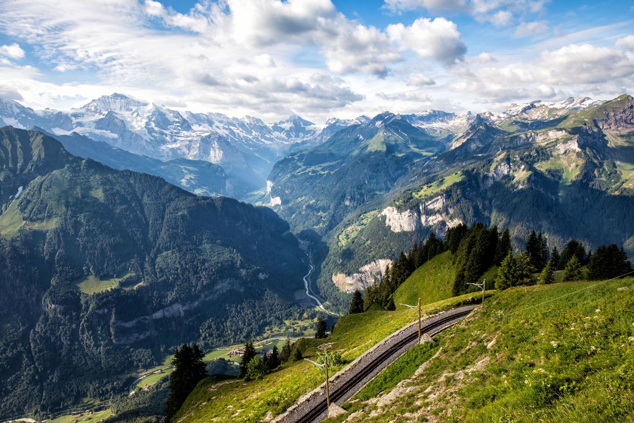
With views of the Jungfrau massif, Lake Brienz, and numerous alpine lakes, this is often labeled as one of the best day hikes to do in the Jungfrau region.
April 2026 Update: Added updated pricing and dates of operation.
Schynige Platte to Faulhorn to First Hiking Stats
Distance: 16 km (10 miles) point-to-point
Total Elevation Gain: 860 meters (2820 feet)
Total Elevation Loss: 690 meters (2260 feet)
Difficulty: Strenuous
Length of Time: 6 hours
When to Go: mid-June through mid-October
This is a point-to-point hike that can be done in either direction. If you start at Schynige Platte and end at First, it is slightly more difficult, since First sits at a higher elevation than Schynige Platte. By starting in Schynige Platte, you have better views of the Jungfrau mountain range.
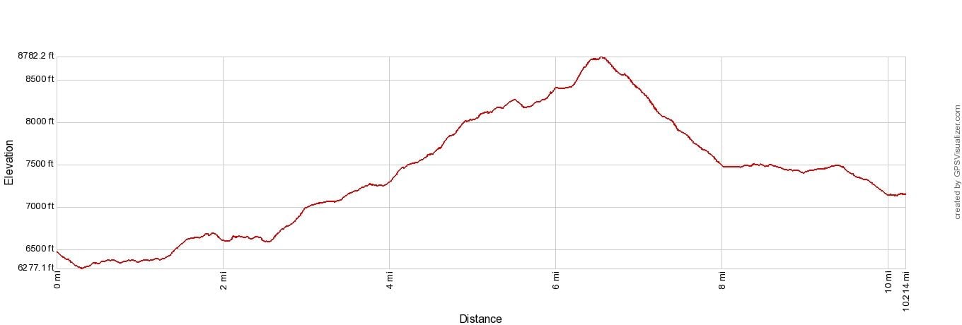
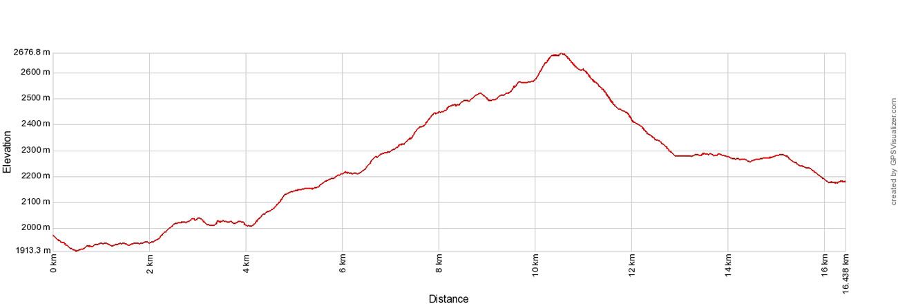
Elevation profile starting at Schynige Platte and ending in First
To do this hike, you will ride the Schynige Platte railway from Wilderswil to Schynige Platte and then the gondola from First to Grindelwald (or vice versa, if you do this hike in the opposite direction).
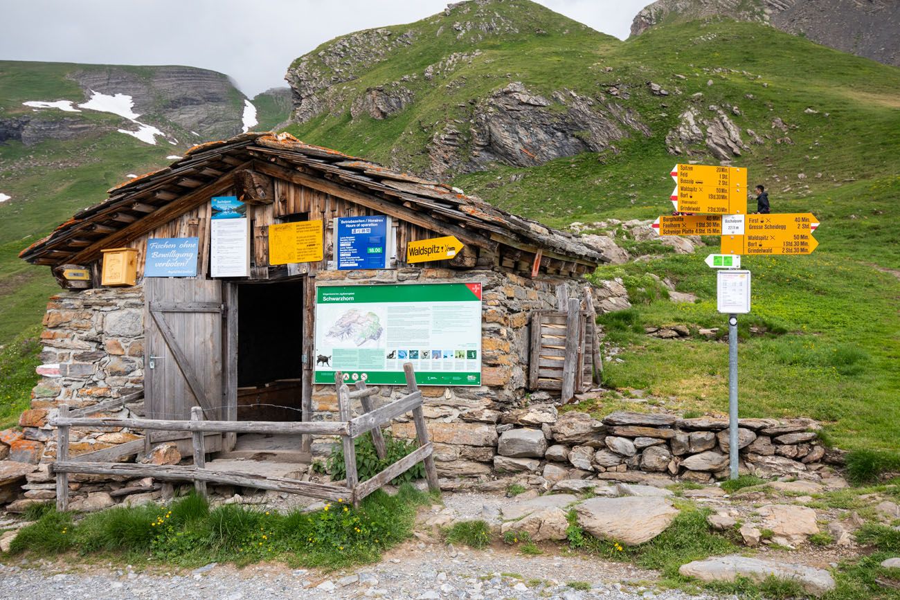
Mountain huts are located at the start, finish, and along the trail, and provide opportunities to stop, take a break, and refuel your batteries.
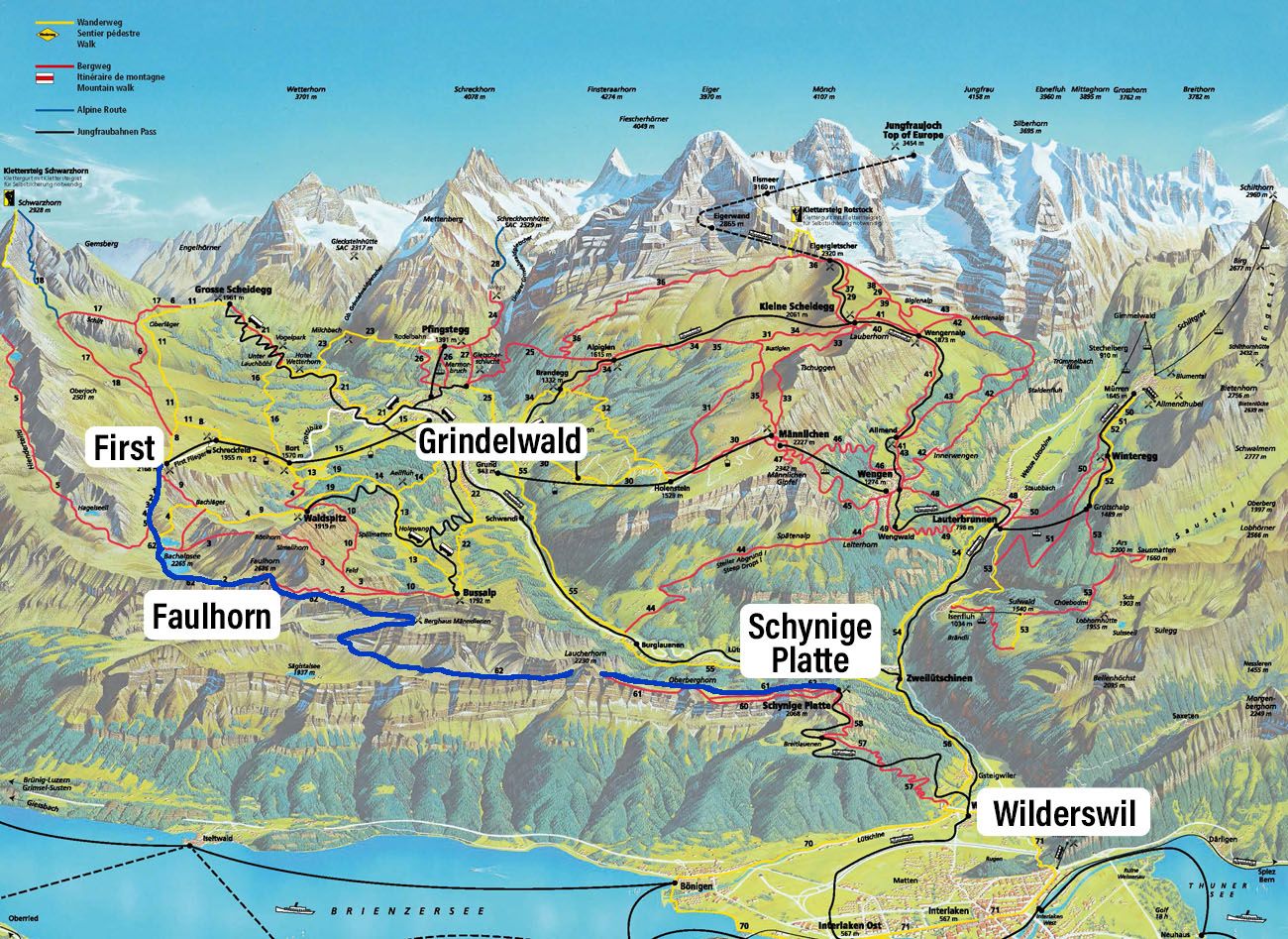
Map of Jungfrau region of Switzerland. The hiking trail is the blue line.
We did this hike from Schynige Platte to First (pronounced Fierst). We liked being able to catch the first train of the day and then ending in First. Once in First, there are restaurants, a cliff walk, and other activities that you can add on to your day.
Please practice the seven principles of Leave No Trace: plan ahead, stay on the trail, pack out what you bring to the hiking trail, leave areas as you found them, minimize campfire impacts, be considerate of other hikers, and do not approach or feed wildlife.
Schynige Platte to Faulhorn to First Hike
Step-By-Step Trail Guide
Riding the Schynige Platte Railway
To get to Schynige Platte, you will ride the cogwheel train from Wilderswil to Schynige Platte.
Not only is this a scenic ride, it’s also historic. This railway was constructed in 1893. Originally, steam locomotives were used, but these were replaced by electric trains in 1914, which were high-tech at the time. These same trains are still in operation.
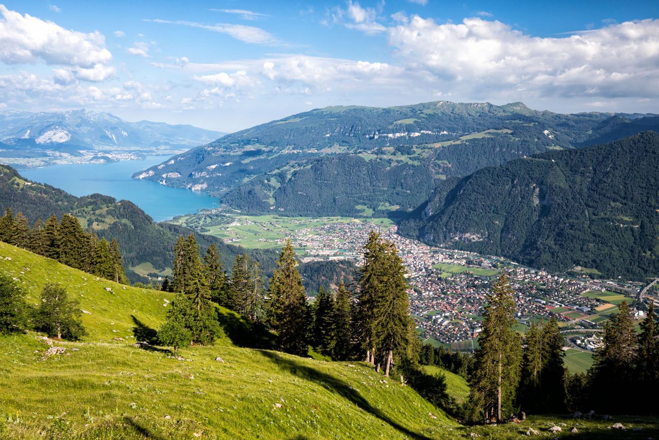
It is a 7.25 km journey to get to Schynige Platte. At times, the train chugs up a 25% gradient. It’s a slow journey, but the higher you go, the better the view. Along the way, you will be able to look out over Lake Brienz and Interlaken as well as along the Lauterbrunnen Valley.
Facts about the Schynige Platte Railway:
- Length of Time: 52 minutes to get from Wilderswil to Schynige Platte
- Hours of Operation: The train leaves every 40 minutes, from 7:25 am to 4:45 pm. If you are hiking to Schynige Platte from First, the last train of the day is between 5 pm and 6 pm (confirm this before you start your hike).
- The train is in operation from June 13 to October 25 (2026)
- Website: Get updated pricing and see the train schedule on the official website.
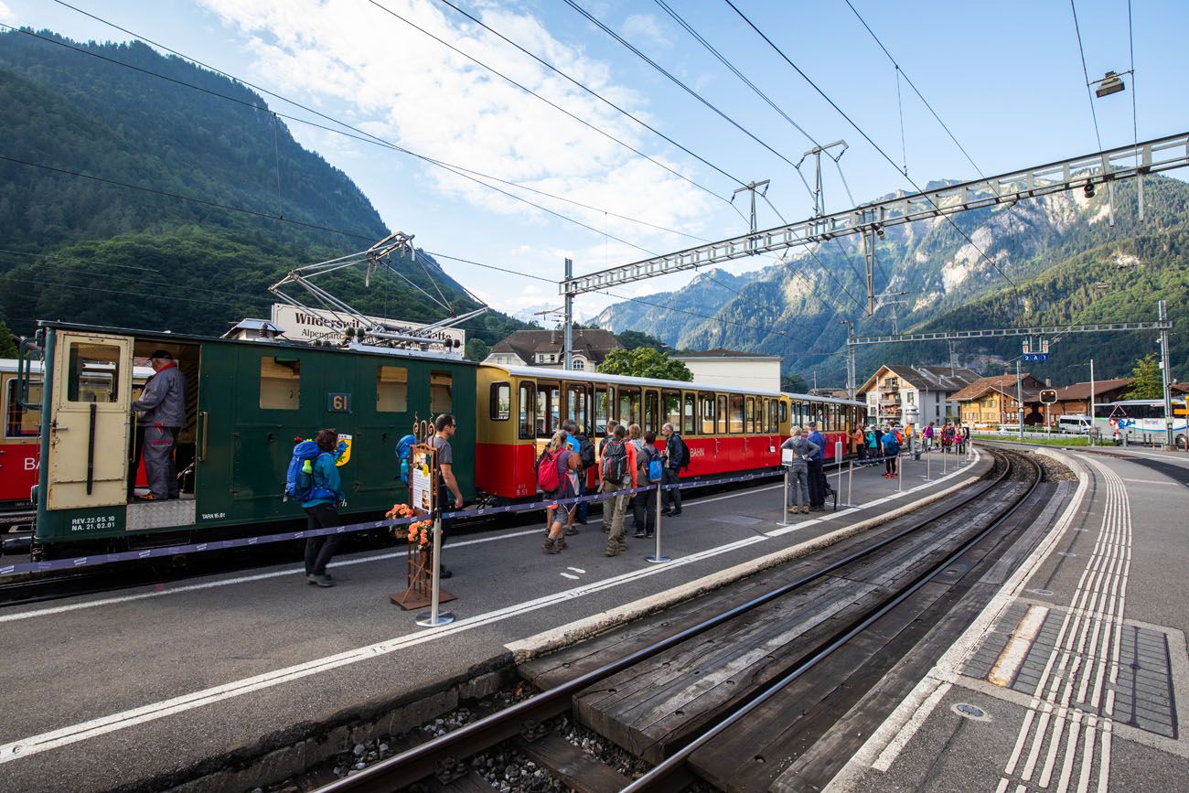
Wilderswil and the train to Schynige Platte
I recommend being on the first or second train of the day. Not only will this give you plenty of time to complete the hike, but this train ride is a very popular thing to do in the Jungfrau region, so trains will fill up early in the day.
We rode the first train of the day and purchased our tickets from the office in Wilderswil. You can also purchase your tickets online in advance or at one of the ticket offices in the area.
Here are the views from the train ride.
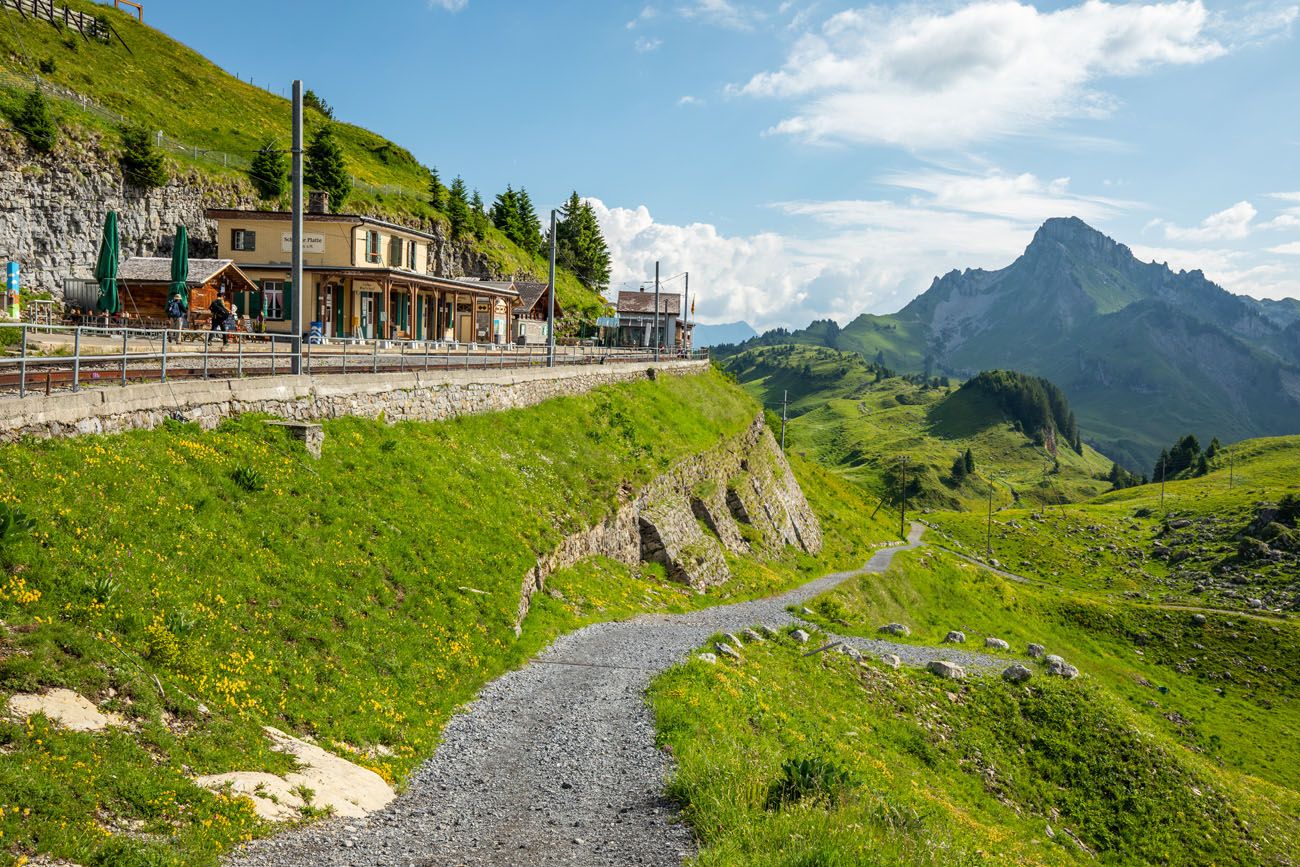
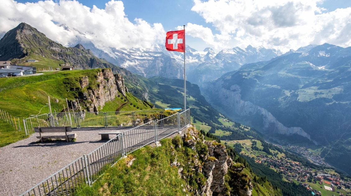
Schynige Platte
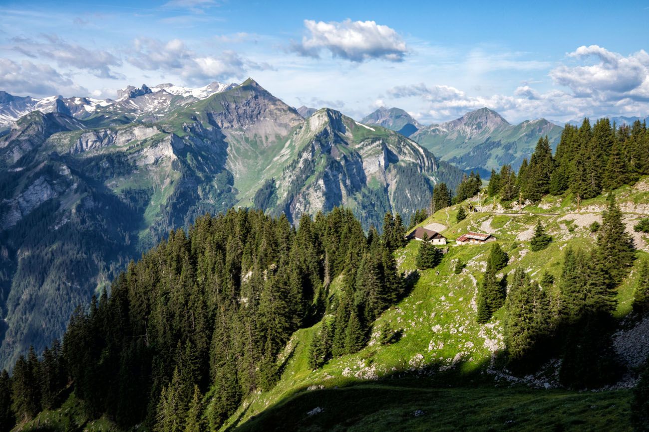
Once at Schynige Platte, you can hop right on the trail and start your day or do a little exploring.
It’s worth the quick walk up to the hotel for a great view across the Lauterbrunnen Valley. The self-service part of the restaurant was open during our visit, so we ate a quick snack here before starting the hike. There is also a playground for kids and a botanical garden.
View from Schynige Platte
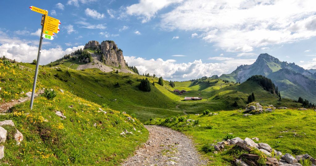
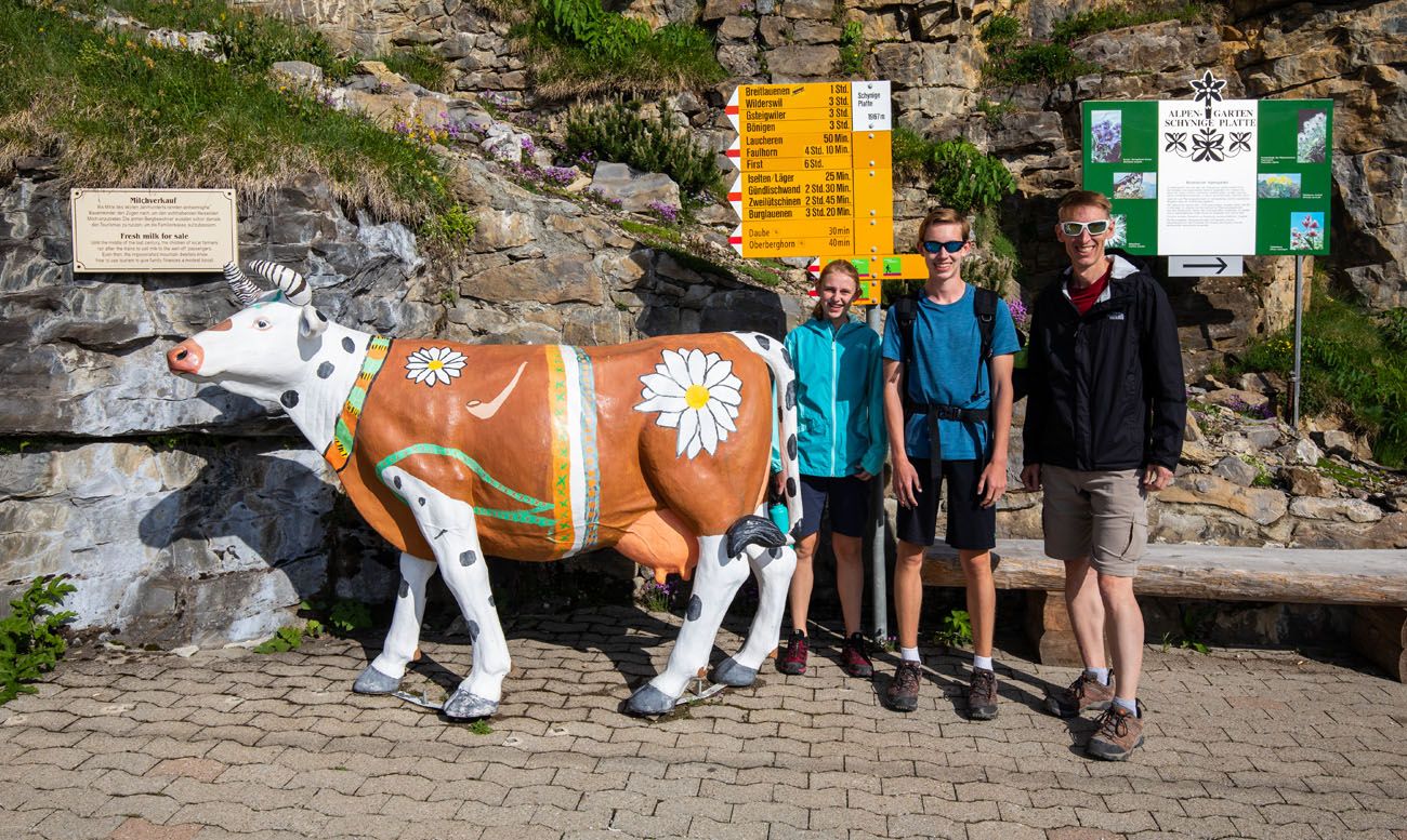
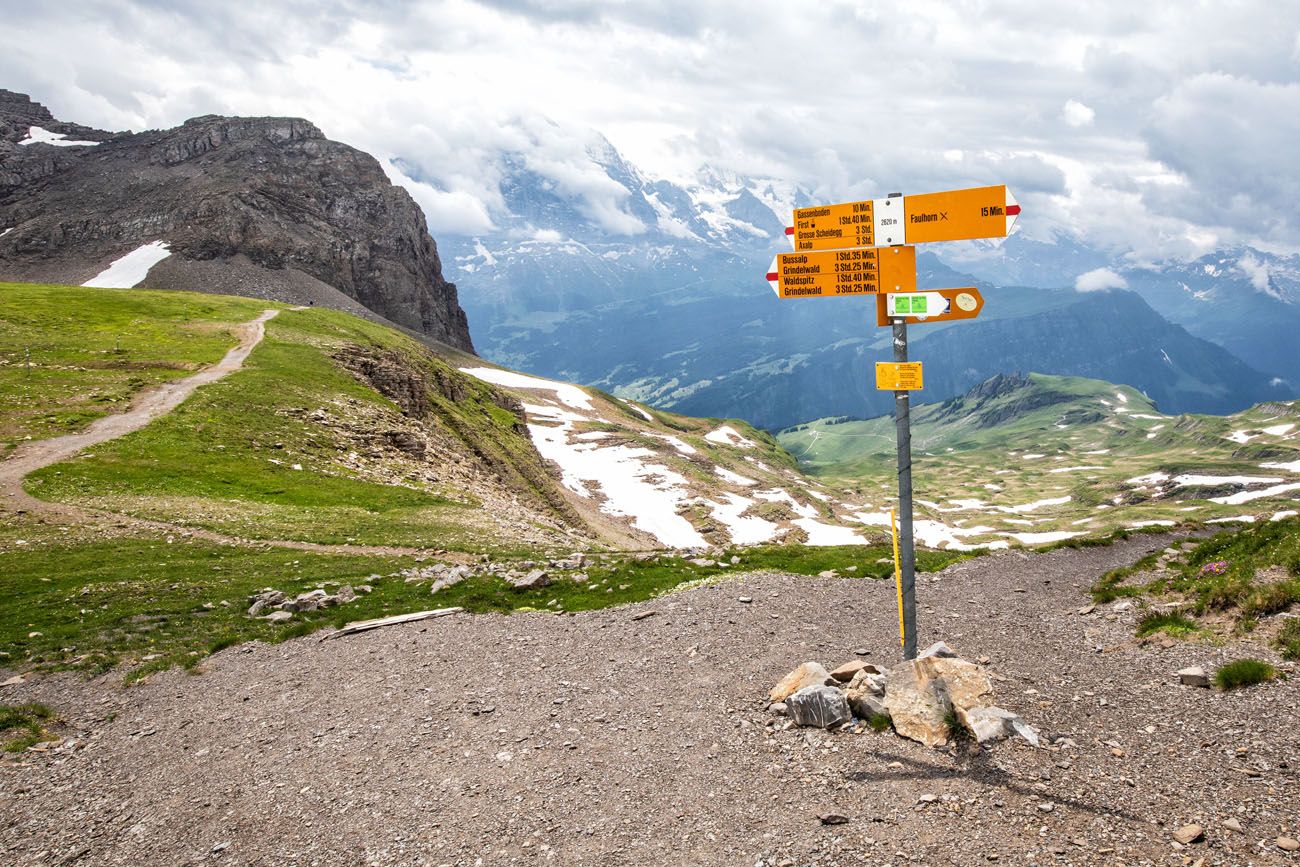
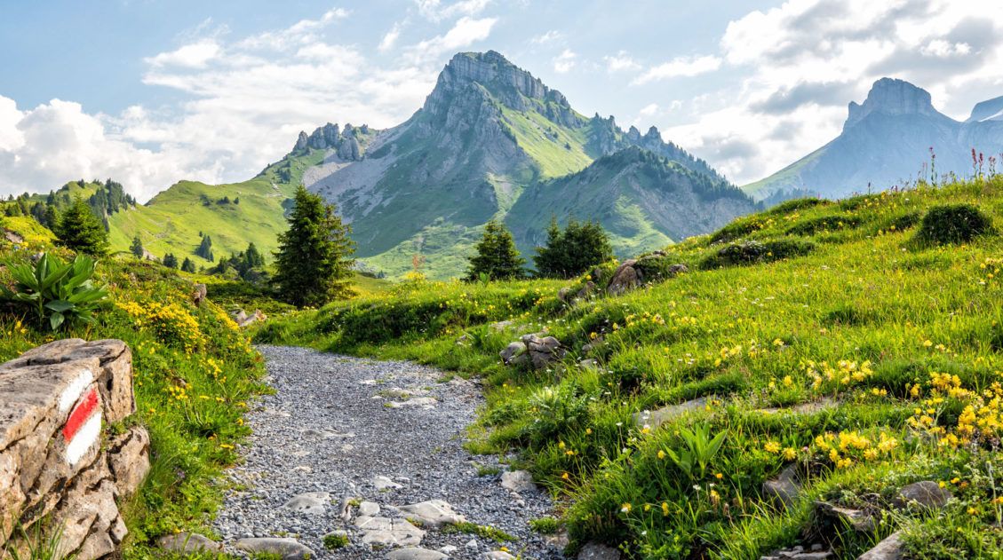
The trail starts next to the train station. Cross the train tracks and look for the yellow trail sign pointing towards First. The cow that is in the photo below is gone (bummer, right?).
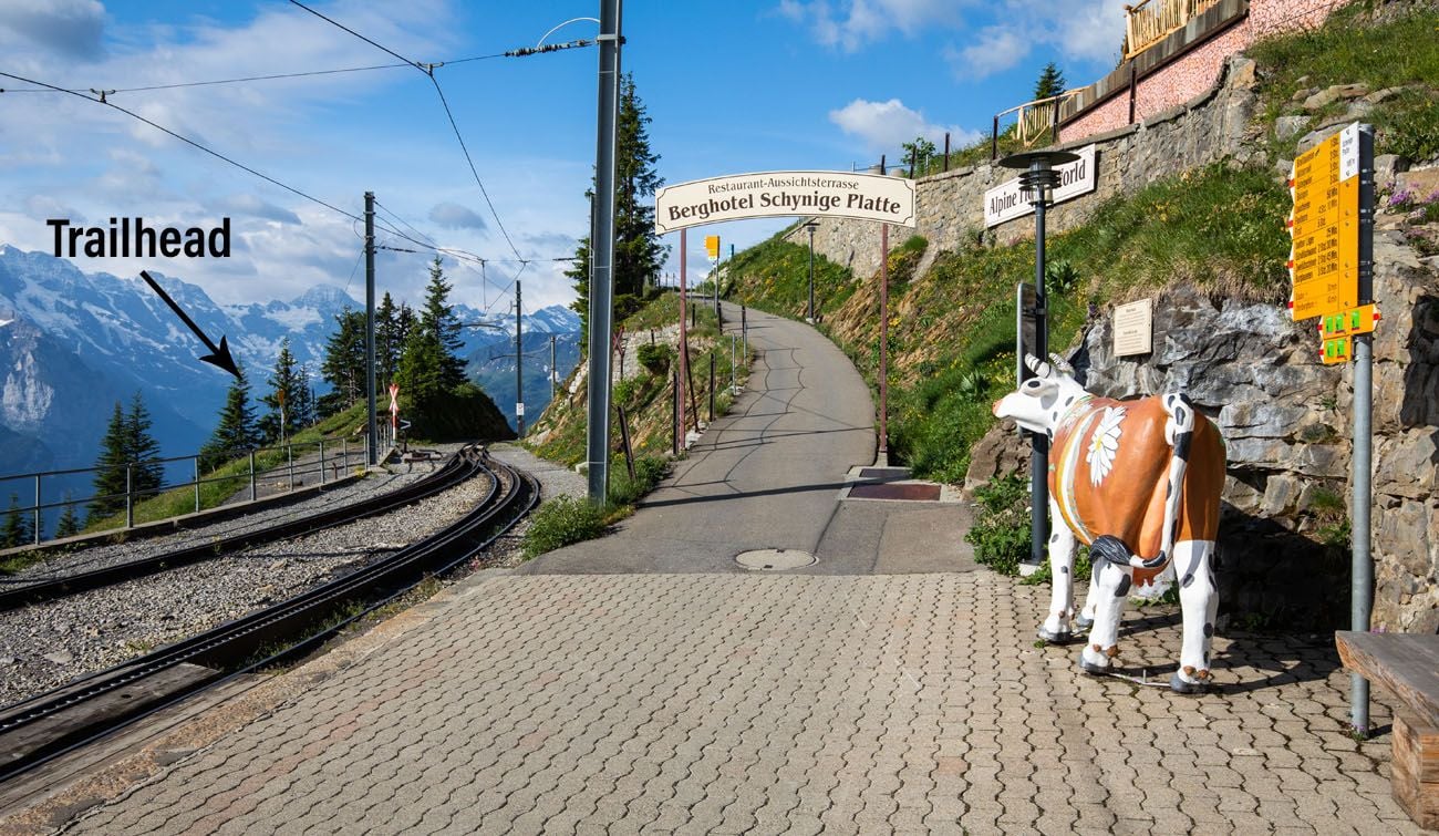
Schynige Platte
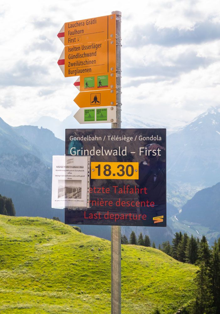
At the trailhead, there should be a sign letting you know the time of the last gondola from First to Grindelwald. This is your deadline. If you get to First too late, you’ll be adding on a long hike down to Grindelwald.
OPTIONAL DETOUR: If you have plenty of time and want to add on a scenic detour, you can hike the Schynige Platte Panorama Trail. This trail adds on several viewpoints over Lake Brienz that you won’t see by hiking the direct trail to First. Adding on this detour adds roughly 30 minutes to this hike. Hike the Panoramaweg Loucherhorn trail and it will meet up with the trail to First near Loucherhorn (don’t return to Schynige Platte).
We did not add on the Panorama Trail to our hike but I wish we had. We didn’t know about it when we did this hike, but from what I have now seen online, the views from the trail are amazing and it’s worth adding it if you don’t mind a 6+ hour hike.
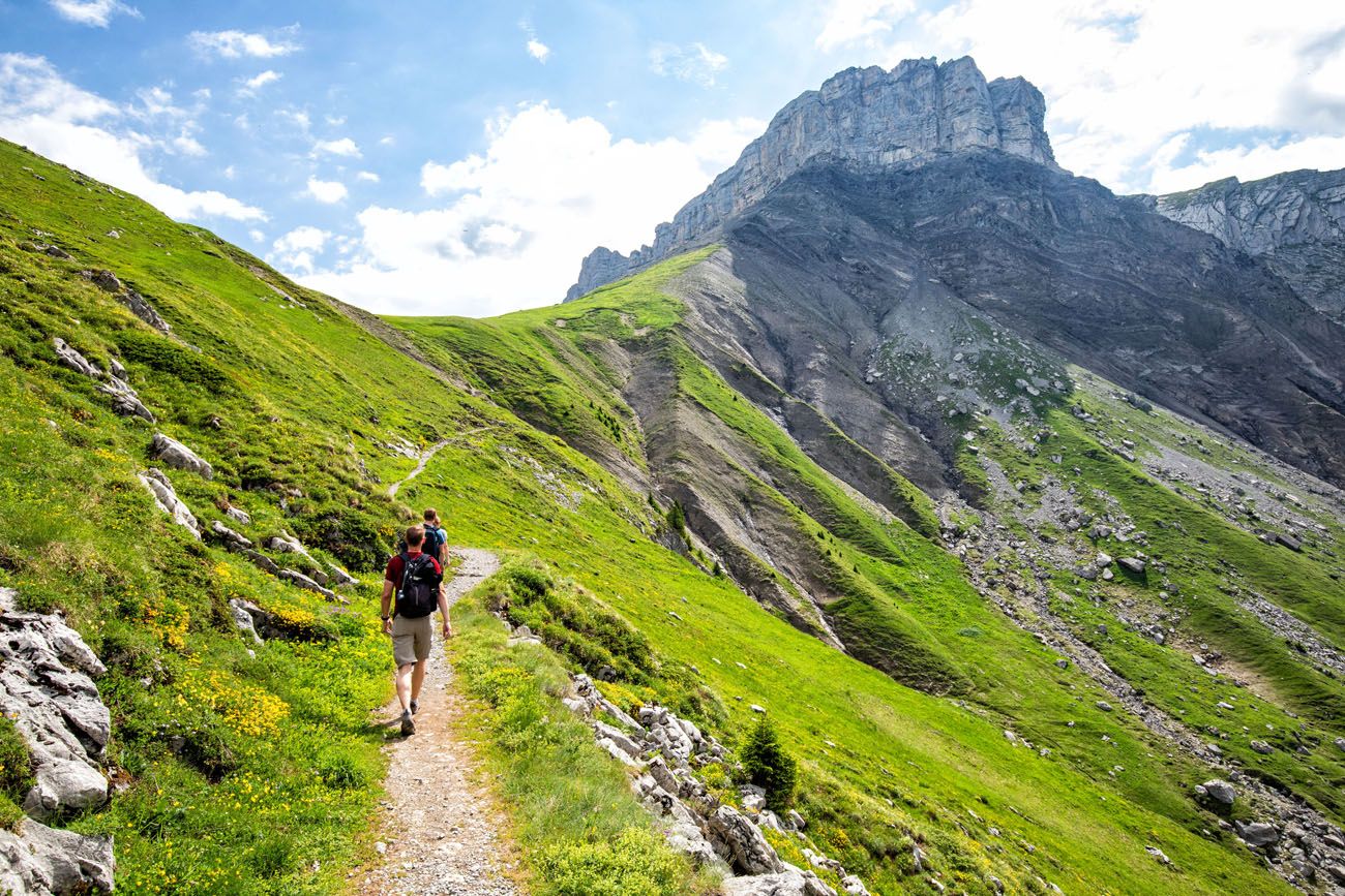
Schynige Platte to the Männdlenen Hut
From Schynige Platte to Faulhorn, it is a steady, uphill walk that is roughly 10 km long. There are just a few, brief sections where it is steep, so overall, it’s not too challenging. However, the steady elevation gain can wear you down, and as you get closer to Faulhorn, you might start to feel fatigued.
If you choose not to take the detour on the Panorama Trail, you will first walk through a green valley with rocky mountains towering over you. It is a very pretty walk and this first part of the trail is relatively easy.
Trailhead at Schynige Platte
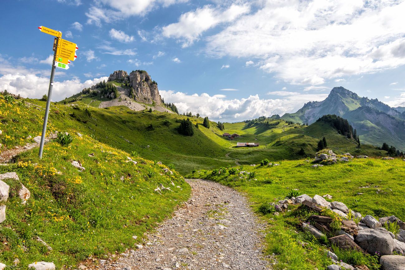
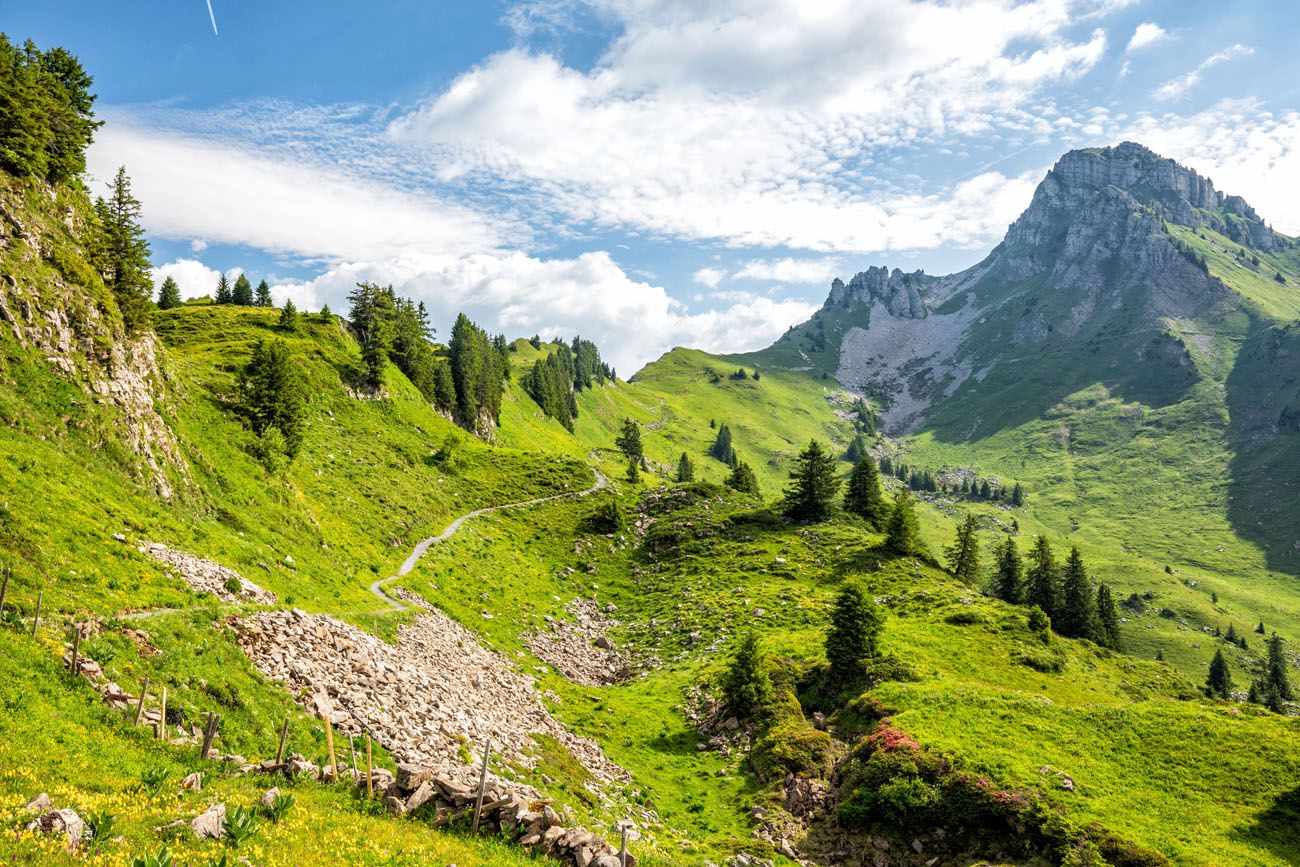
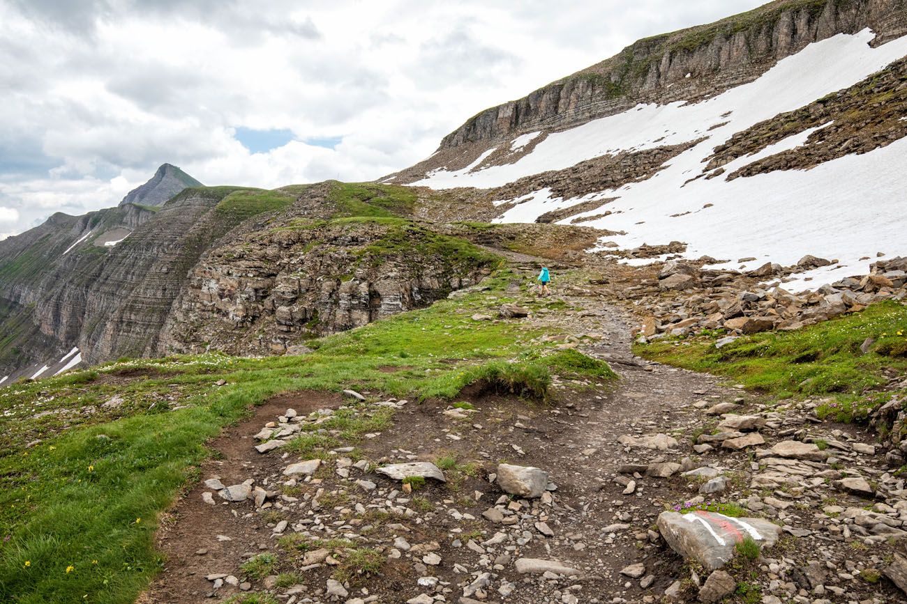
As you approach Loucherhorn, the climbing begins. Right before Loucherhorn, the trail to First joins up with the Panorama Trail.
Looking back at the trail from Loucherhorn. The direct trail from Schynige Platte is the lower trail. The Panorama Trail goes from peak to peak and you can see a staircase on the trail in the small grove of trees.
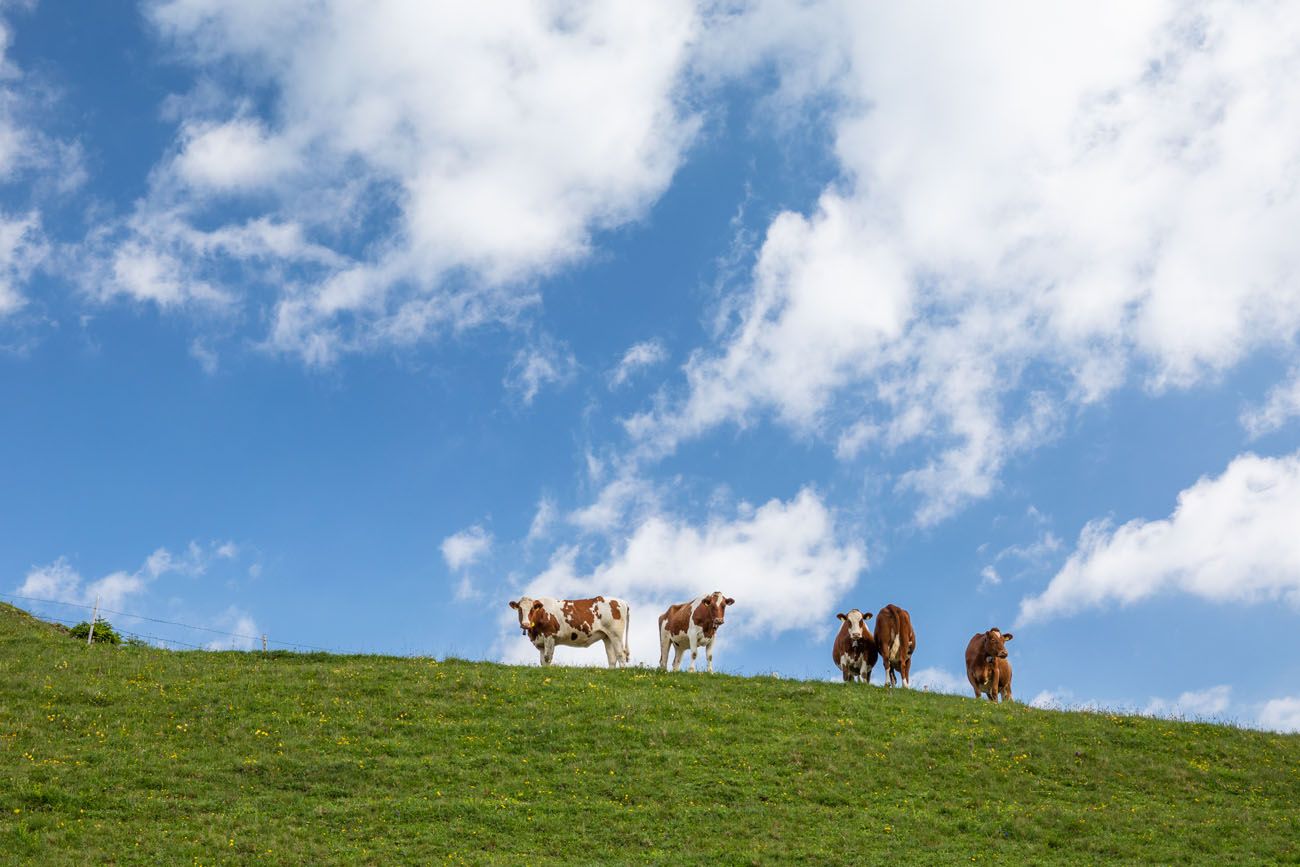
Cows along the trail
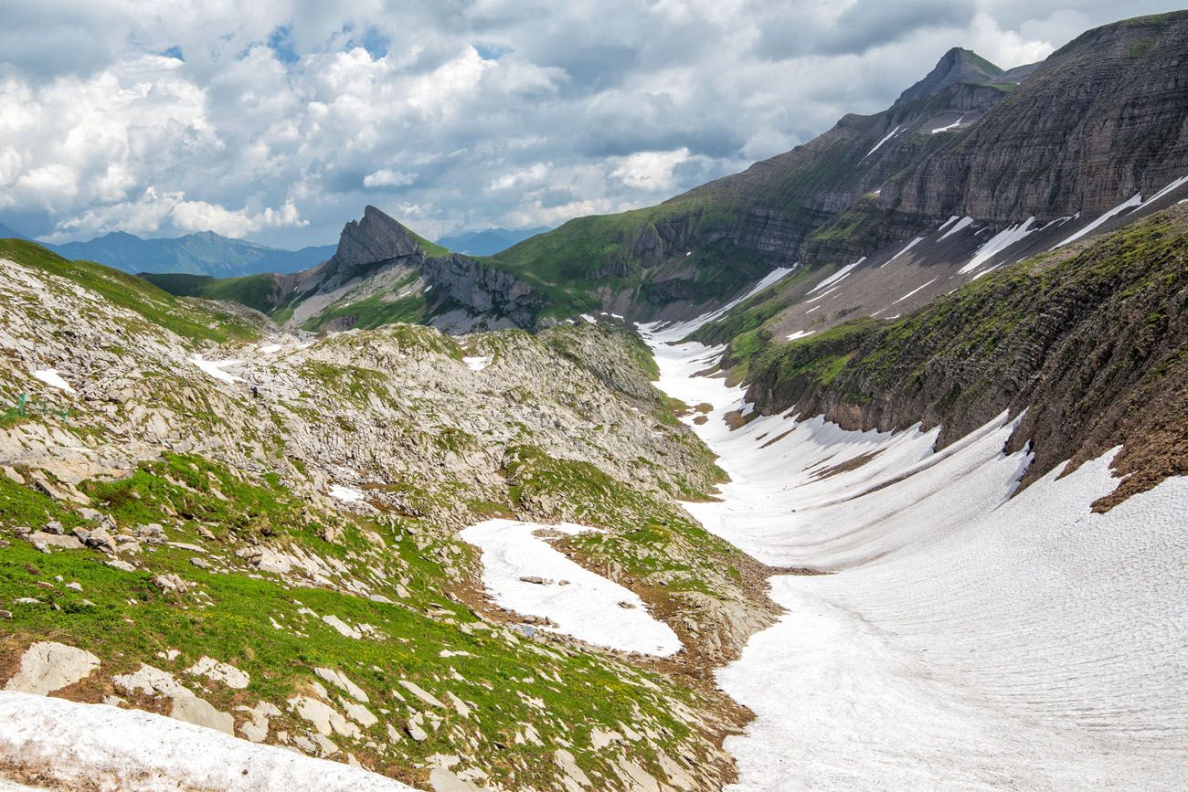
Past Loucherhorn, the trail, and terrain, gets a lot rockier.
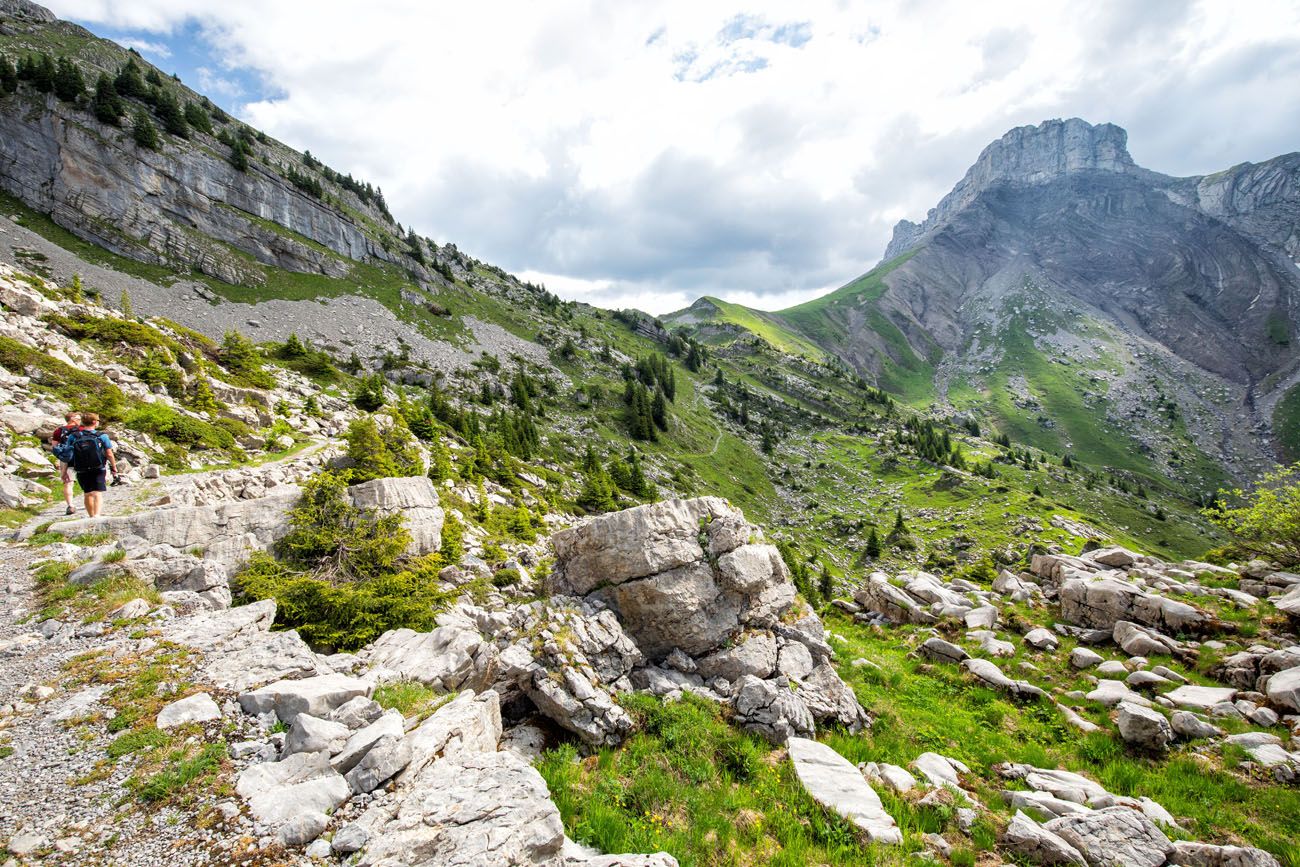
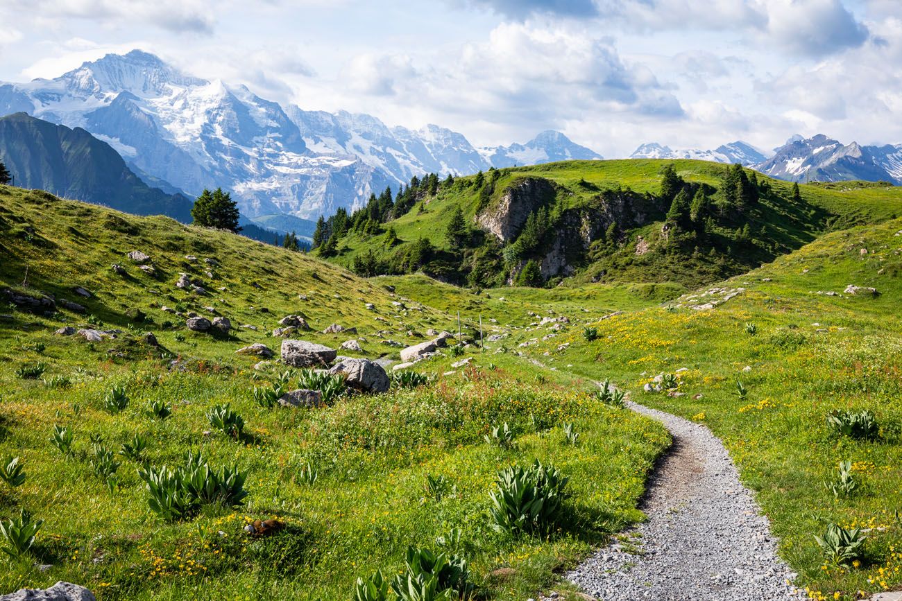
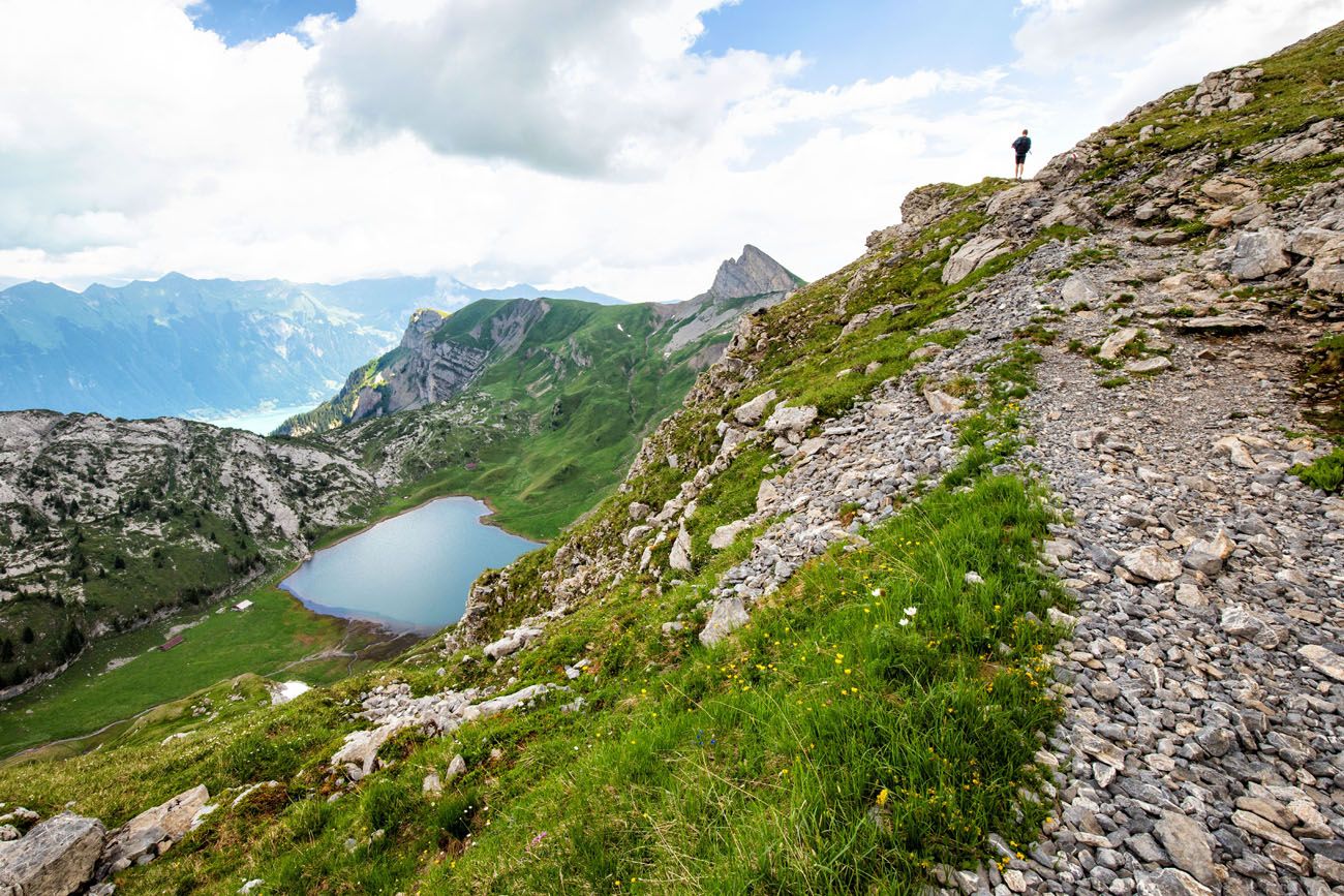
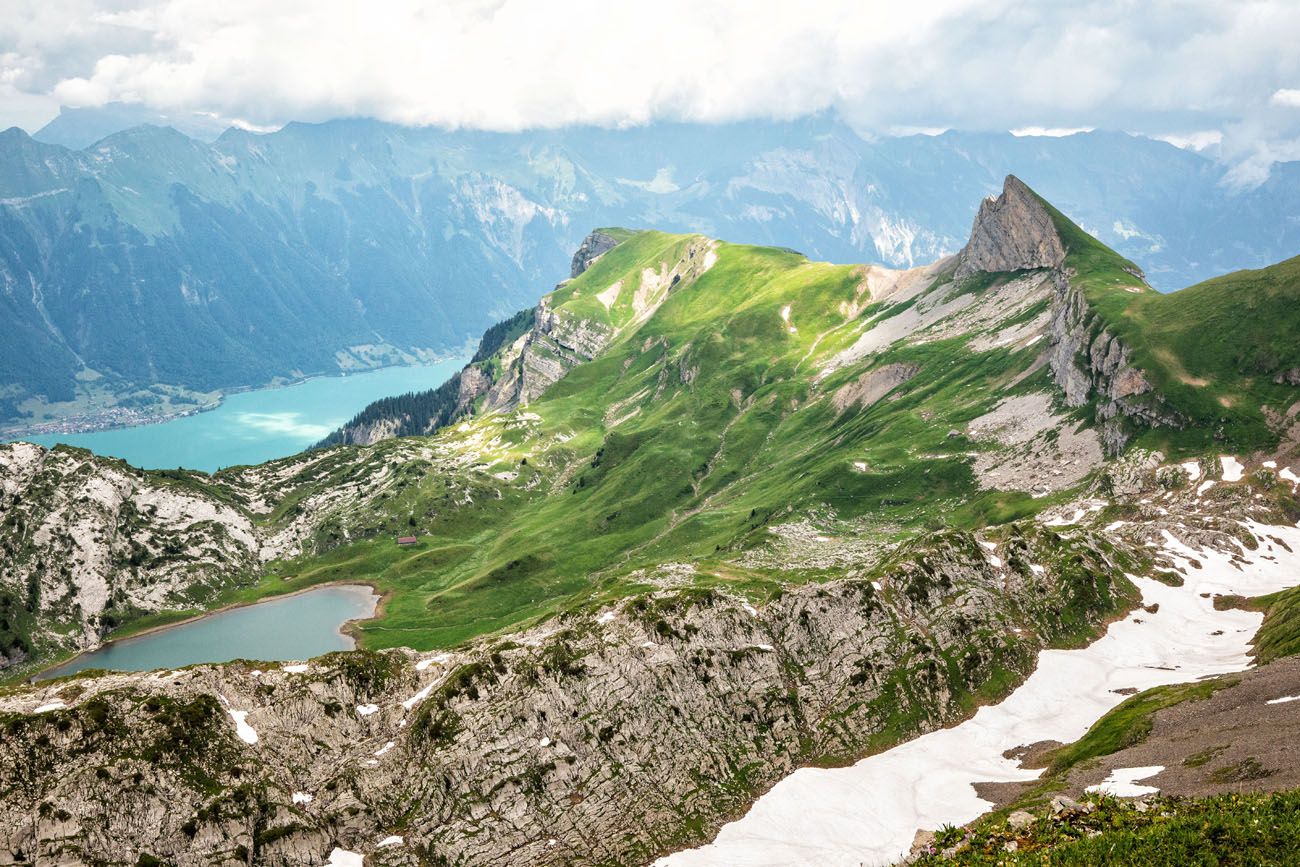
Then the trail almost flattens out as you approach Sägistalsee. We loved this part of the hike and thought it is one of the prettiest sections of the hike.
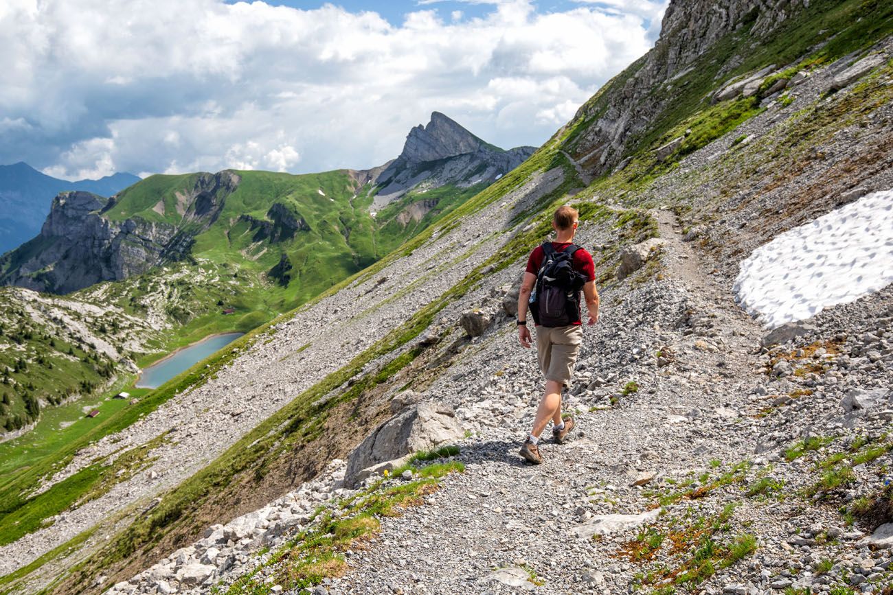
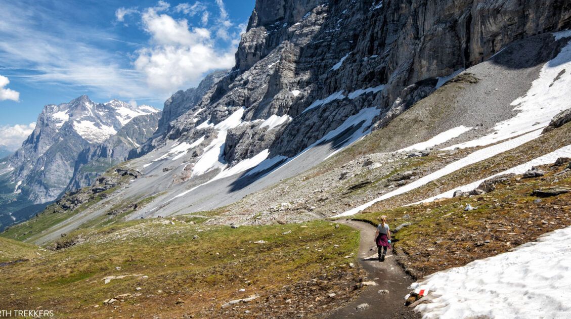
The trail makes a turn and gets more challenging. We did this in mid-July and lots of snow still covered the ground. For us, it was an uphill walk in the snow to the Männdlenen hut. It looks easy in the photos but it is deceptively challenging.
Looking back at the valley from the Männdlenen Hut
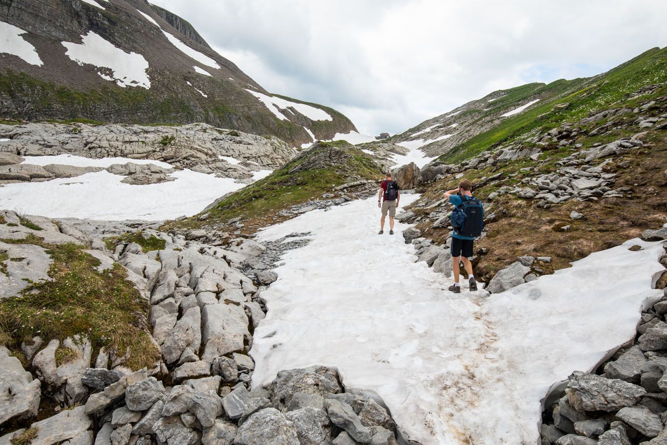
Männdlenen Hut to Faulhorn
The Männdlenen hut is about the halfway point of this hike and it is a great place to stop and take a break. Have lunch, use the restroom, and recharge your batteries. It is chilly here, now that you are a higher elevation.
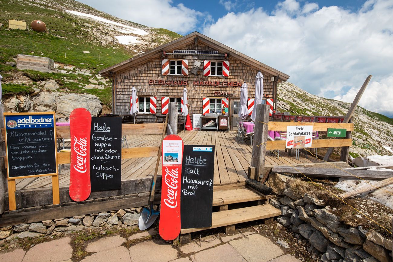
Männdlenen Hut
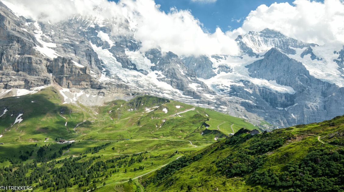
From the Männdlenen hut, it is a tiring, uphill walk to get to Faulhorn. There’s a good chance that you will cross several more fields of snow. During our hike, clouds moved in at this point, so we didn’t have the best views of the Swiss Alps, but on a clear day, the views would be spectacular!
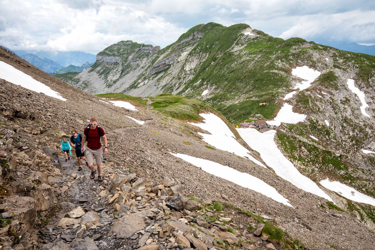
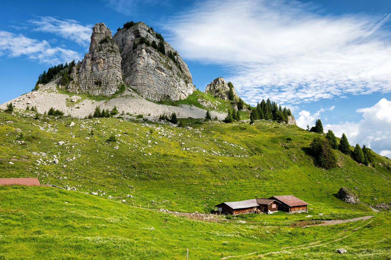
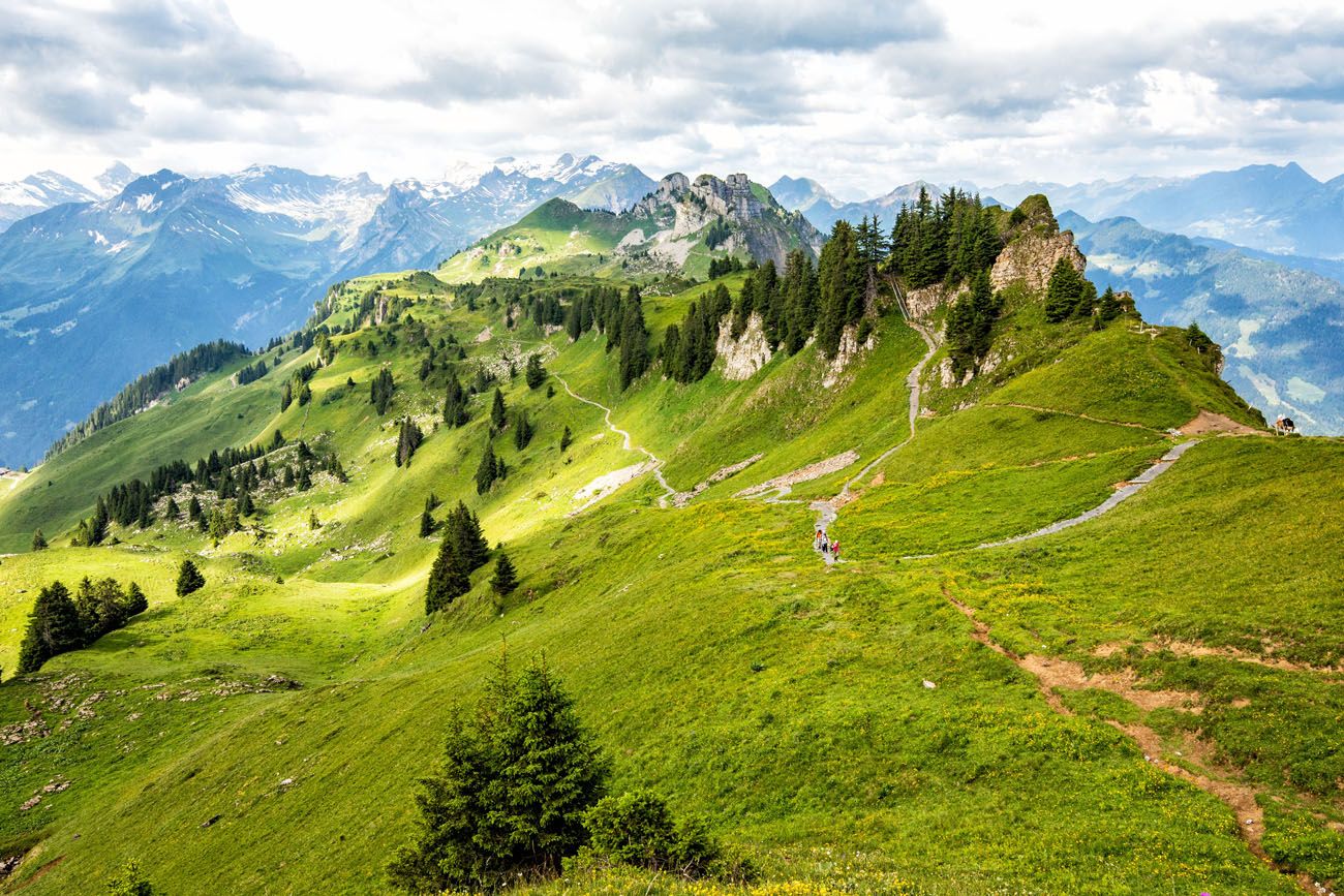
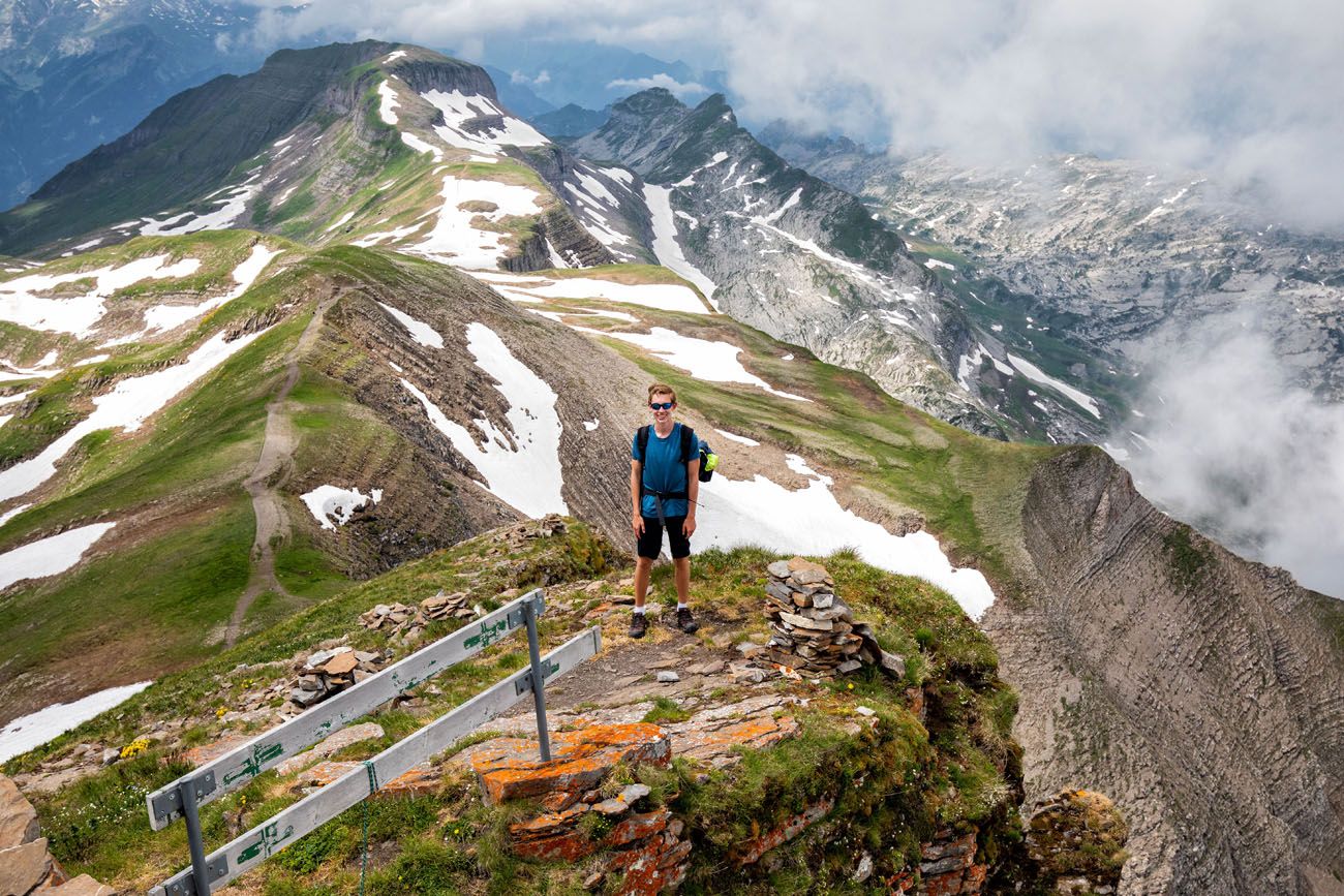
The peak in this photo is Faulhorn
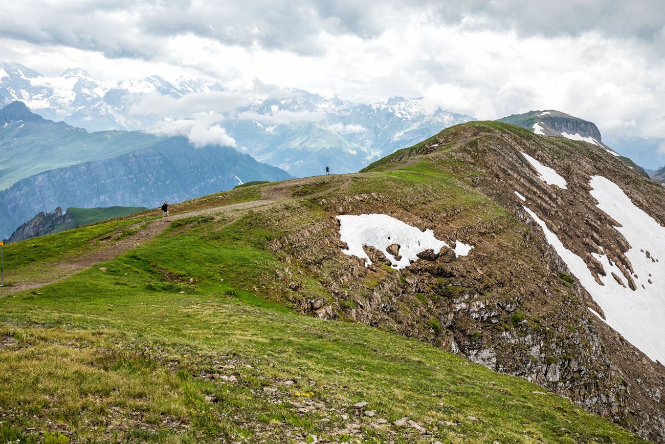
Looking back along the ridge
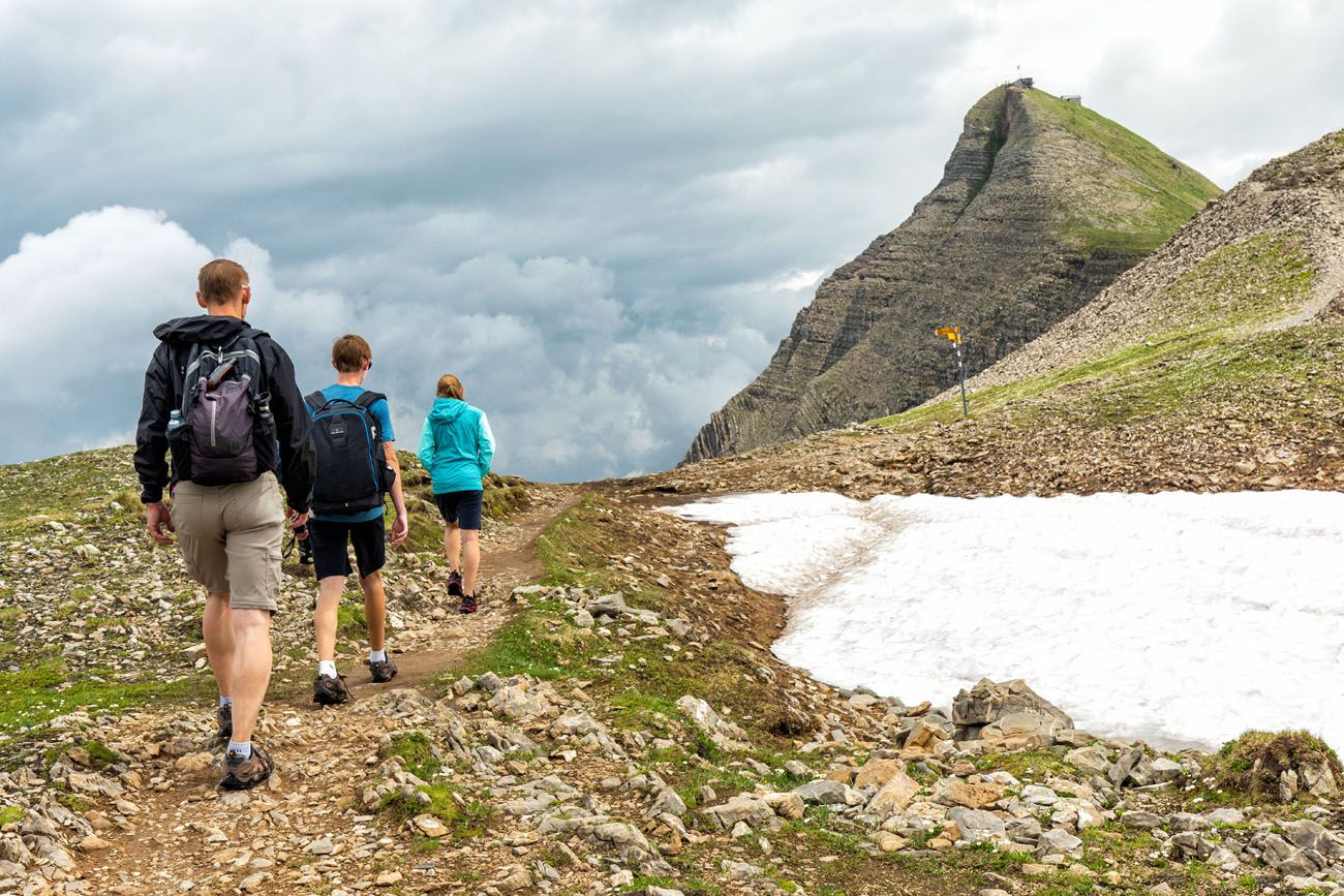
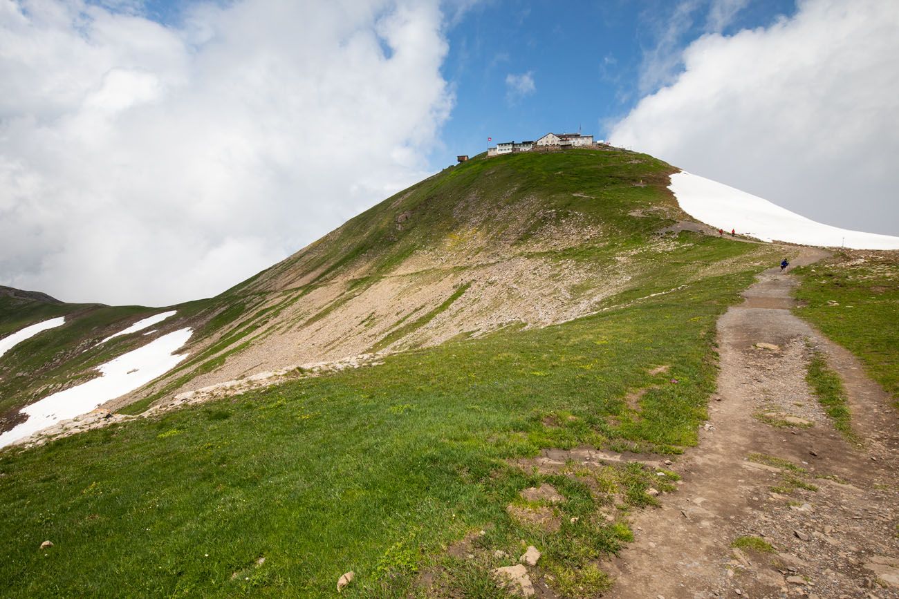
The final climb up to Faulhorn is the most challenging part of the day. It’s not a long climb but it is steep, and by now, most likely you will be feeling a bit worn out. To get to the summit, you’ll hike up narrow trail with a bunch of switchbacks.
Once at the summit, enjoy the panoramic views. This is a mountain hut so you can grab a bite to eat or use the restrooms.
OPTIONAL DETOUR: You have the option to bypass the hike up to Faulhorn. There is a trail that skirts along the base of Faulhorn, joining up the with trail on the other side of the mountain. So, if you don’t think you can handle one more big climb, you can skip Faulhorn.

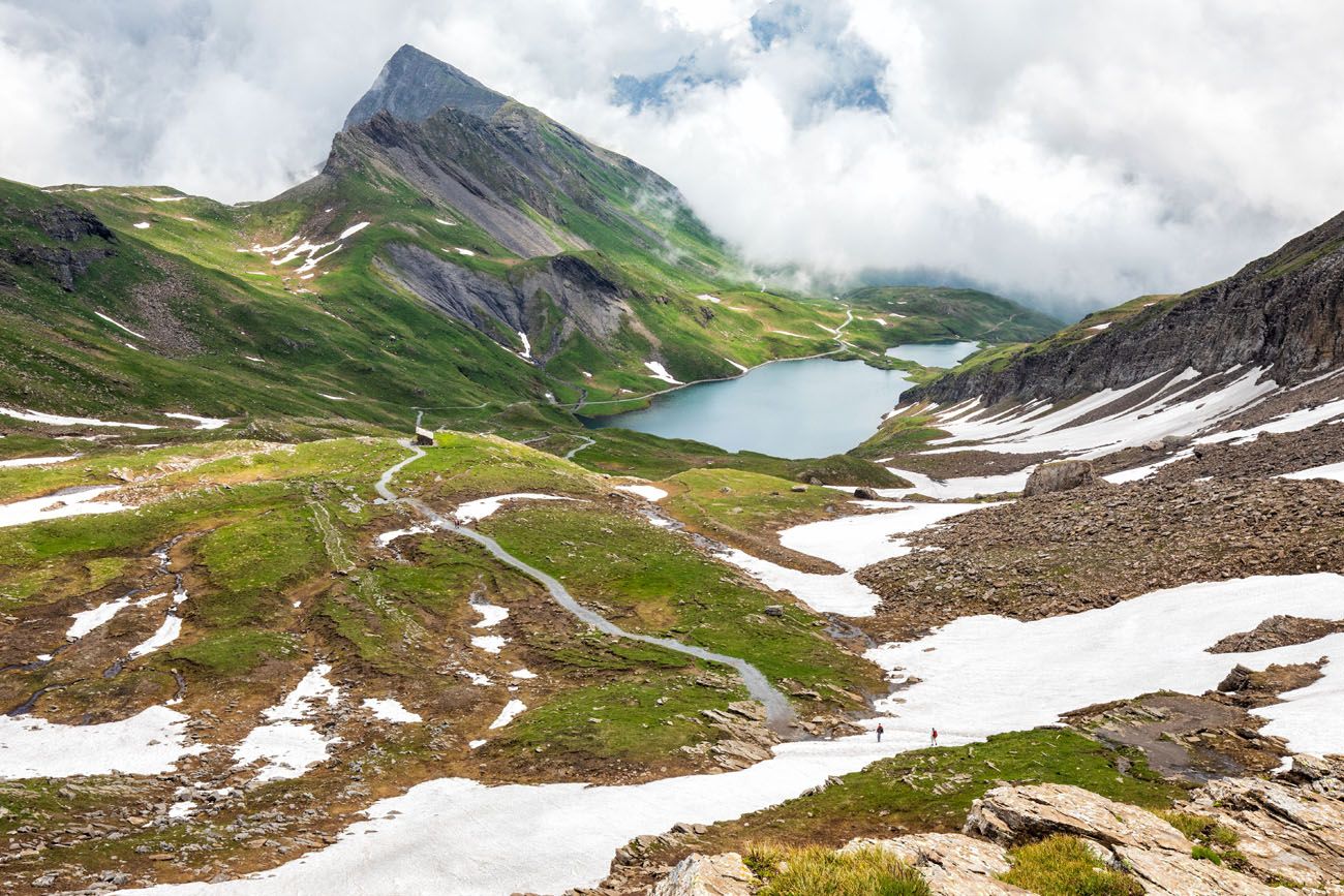
Faulhorn to First
From Faulhorn, it’s a 6 km downhill walk to First. The first part of the descent is the hardest, since it’s steep, but it does level out later once you get to Bachalpsee.
Looking up at Faulhorn
Once you get to Bachalpsee, most likely you will start to see a lot more people on the trail. The hike to Bachalpsee is a popular day hike from First.
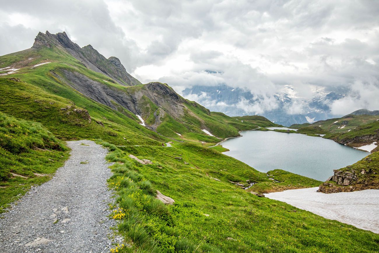
Bachalpsee
From Bachalpsee, it’s an easy walk to First.
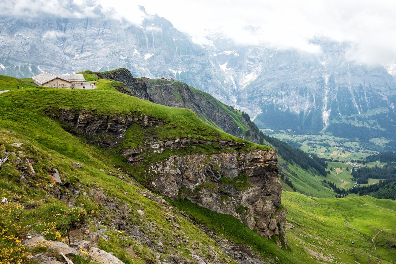
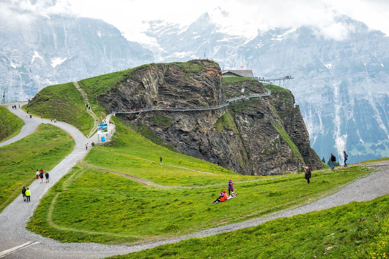
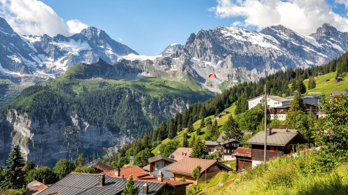
First
This hike ends in First. But before you ride the gondola to Grindelwald, there are a few action-packed activities you can add on to your day.
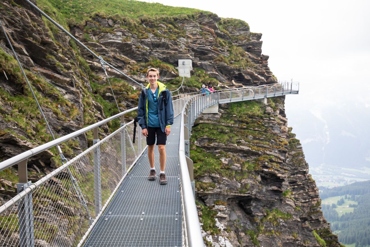
First Cliff Walk. Cling to the edge of the cliffs on metal walkways attached to the rocky mountain face. From here, you have a nice view over Grindelwald. On this hike, you will walk right past the Cliff Walk as you enter First, so it’s quick and easy to add on this on. Plus, it’s free!
First Cliff Walk
First Flyer and First Glider. Fly like a bird or zip-line for 800 meters for a quick thrill.
First Mountain Carts. Ride go-karts downhill on a wide, gravel path from Schreckfeld to Bort.
First to Grindelwald
To get to Grindelwald you will take the gondola from First. This journey takes 30 minutes and costs CHF 34 (50% discount with the Swiss Travel Pass).
In Summary
From Wilderswil, ride the cogwheel train to Schynige Platte (52 minutes, CHF 34). Hike to First (6 hours). Walk the Cliff Walk (15 minutes) and add on other activities that sound interesting. Ride the gondola to Grindelwald (30 minutes, CHF 38).
Transportation Cost: CHF 72 per person
Total Time: 8+ hours
Video of the Schynige Platte to Faulhorn to First Hike
Check out this very cool video that Tyler put together, a combination of drone footage and footage from the hiking trail.
What to Bring on the Hike
Waterproof hiking shoes. These will give you good traction and keep your feet dry if there is still snow on the ground when you do this hike.
Hiking Poles. These are nice to have, especially for the downhill section from Faulhorn to First.
Food and water. You can buy food and water at the huts along the trail, but prices can be expensive. To save money, bring your own food and water.
Sunscreen. There is very little shade on the trail.
Extra Layers. Since you are hiking at a high elevation, it can be chilly, even mid-summer. Bring a rain jacket and extra layers to stay warm and dry.

Essential Hiking Gear: What Should You Bring on a Day Hike?
If you are new to hiking or are curious about what you should bring on a hike, check out our Hiking Gear Guide. Find out what we carry in our day packs and what we wear on the trails.Important Links
- Sbb.ch: check train timetables and fares
- Schynige Platte webcam
- Weather forecast
If you are planning to do this hike and have any questions, comment below!
More Places to Go in Switzerland
We have TONS more information about Switzerland in our Switzerland Travel Guide, including Zürich, Lucerne, the Bernese Oberland, Zermatt, Lugano, and Lausanne.
15 Great Hikes to Do in the Bernese Oberland, Switzerland
Pinterest Facebook Flipboard The Bernese Oberland is a hiker’s paradise. Alpine trails crisscross their way through the towns, valleys, and the mountain peaks of this gorgeous place. Take your pick from short, easy, family-friendly trails to cliff walks to thrilling trails. Here are 15 of the best hikes to do in the Bernese Oberland. All […]
Switzerland Itinerary Ideas: 7 to 21 Days of Alpine Adventures
If you are planning a trip to Switzerland, this is a great place to start. There are many different ways to plan your “perfect Switzerland itinerary,” depending on your interests and how much time you have. In this article, we list five sample itineraries for Switzerland. These range from 7 to 21 days, with suggestions […]
One Day in the Jungfrau Region: Jungfraujoch & the Eiger Trail
Combining Jungfraujoch and the Eiger Trail is one of the best ways to spend one day in the Jungfrau region of Switzerland. If you move fast, you can also add on the Panorama Trail, which runs between Kleine Scheidegg and Männlichen. We did this same itinerary and it was our favorite day of our 3 […]
Complete Guide to the Hörnlihütte Hike (Map, Trail Stats & Photos)
The Hörnlihütte (Hörnli Hut) is a lodge built at the base of the Matterhorn. For thrill seeking rock-climbers, the Hörnlihütte marks the start of the ascent up to the peak of the Matterhorn. Even if you do not wish to stand on top of the Matterhorn, simply hiking to and from the Hörnlihütte makes for […]
20 Amazing Things to Do in the Jungfrau Region of the Bernese Oberland
Towering mountains, alpine meadows, soaring cable cars, historic cogwheel trains, scenic walking trails, quaint villages and hamlets…this is the Jungfrau region of the Bernese Oberland. In this guide, we cover the very best things to do in the Jungfrau region, ranging from scenic cable car rides to hiking some of the most beautiful trails in […]
Best Hikes in Europe: 25 Incredible Hikes for Every Level
From the dramatic cliffs of Norway to the jagged peaks of the Dolomites and the volcanic landscapes of Iceland, Europe is packed with some of the most unforgettable hikes in the world. In this guide, we share our favorite hikes in Europe, trails that stand out for their scenery, uniqueness, and overall experience from start […]
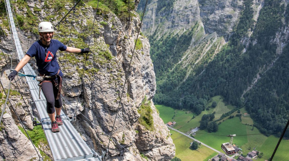
The Mürren Via Ferrata: One of Switzerland’s Most Thrilling Experiences
Does the idea of dangling 600 meters (2000 feet) above the Lauterbrunnen Valley floor interest you? How about walking across a tightrope, with nothing below you except a rushing river? Or how about walking across a wobbly, narrow, suspension bridge? If you said yes to all of these questions, then put the Mürren via ferrata […]
Is Jungfraujoch Worth the Price and Time? An Honest Review
A trip up to Jungfraujoch is one of the most popular things to do in the Bernese Oberland. Stand on one of the highest points in the Swiss Alps, walk through an ice cave, play in the snow, get panoramic views over the Alps, and hike out to Mönchsjochhütte. In this guide, we cover what […]
How to Hike the Eiger Trail: A Step-By-Step Trail Guide
If you are looking for a short but sweet hike in the Jungfrau region of the Bernese Oberland, the Eiger Trail is a great one to consider. This point-to-point hike follows the north face of the Eiger mountain. Along the way, you get jaw-dropping views across the Lauterbrunnen Valley to Mürren and also down to […]
How to Visit Lucerne and Mt. Pilatus in One Perfect Day
Lucerne (also spelled Luzern) is a gorgeous Swiss city that sits at the foot of the Alps. This is the perfect kind of town to explore in one day. The city center is compact with just a few key places to visit. The best things to do are to wander the old town, eat, drink, […]
Walking the Northface Trail in Mürren, Switzerland
The Northface Trail in Mürren has a little bit of everything…stunning mountain views, small hamlets and chalets tucked away amidst the mountains, flower-filled alpine meadows, and pastures filled with cows and their musical bells. This is an easy walking trail that is done as a loop from Mürren. Along the way, you are treated to […]
Hiking the Gastlosen Tour, Switzerland: Stats, Map, & Photos
The Gastlosen is a chain of limestone mountains that look very similar to the Dolomites of Italy. For 11 km, the trail loops around these magnificent, jagged mountains and you are treated to sweeping views of Switzerland. This is a gorgeous hike. A chair lift lops off the first big climb (and the final descent), […]
20 Amazing Things to Do in Zermatt, Switzerland
Zermatt is an idyllic mountain village tucked away in the Swiss Alps. The mighty Matterhorn dominates the skyline, creating one of the most unique alpine landscapes in Europe. Explore the hiking trails, journey up higher into the mountains by cable car and train, stroll the scenic streets of Zermatt, and go skiing all year long. […]
Where to Stay in Jungfrau, Switzerland: Best Towns & Hotels
If you are making a decision about where to stay in the Jungfrau region of Switzerland, you have a lot of options. On a map, the Jungfrau region can look very confusing. With its mountains and valleys, cliffside villages and bustling towns, not to mention its complex transportation network, it can feel overwhelming trying to […]

Comments 47