
The Summerland Trail to Panhandle Gap is a strenuous 12-mile adventure into the quieter side of Mount Rainier National Park. With panoramic views of Mount Rainier and fewer hikers than Paradise or Sunrise, it’s ideal for those craving a bigger, more rugged day on the trail.
Hiking the Summerland Trail to Panhandle Gap is one of the Mount Rainier National Park’s most scenic and rewarding full-day hikes. This trail packs in old-growth forest, wildflower-filled meadows, close-up views of Mount Rainier, high-alpine terrain, and panoramic vistas stretching all the way to Mount Adams.
We hiked the entire out-and-back trail to Panhandle Gap in July, during peak wildflower season, and encountered lingering snowfields near the saddle. Conditions on this trail can vary dramatically from year to year, even in mid-summer, so in this guide we share what to expect, where the toughest sections are, how to handle snow crossings, and whether hiking all the way to Panhandle Gap is truly worth it.
While this isn’t an off-the-beaten-path hike, it sees far fewer crowds than the popular trails starting at Paradise or Sunrise. If you’re looking for a longer, more challenging hike with big rewards and fewer people, this is one of the best hikes in Mount Rainier.
Summerland Trail to Panhandle Gap Hiking Stats
Distance: 12 miles out-and-back
Difficulty: Strenuous
Total Elevation Gain: 3,150 feet
Starting Elevation (Trailhead at Fryingpan Creek): 4,000 feet
Elevation at Panhandle Gap: 6,800 feet
Length of Time: 5 to 7 hours
When to go: The best time to do this hike is from mid-July through mid-September, when most of the trail is free of snow.
This hike includes part of the Wonderland Trail, a 93 mile trail that circles Mount Rainier. Typically, it takes 9 to 13 days to hike the full distance of the Wonderland Trail. The short hike through Summerland to Panhandle Gap is a great way to experience a short section of the Wonderland Trail.

Elevation profile
Please practice the seven principles of Leave No Trace: plan ahead, stay on the trail, pack out what you bring to the hiking trail, leave areas as you found them, minimize campfire impacts, be considerate of other hikers, and do not approach or feed wildlife.
Map of the Summerland Trail
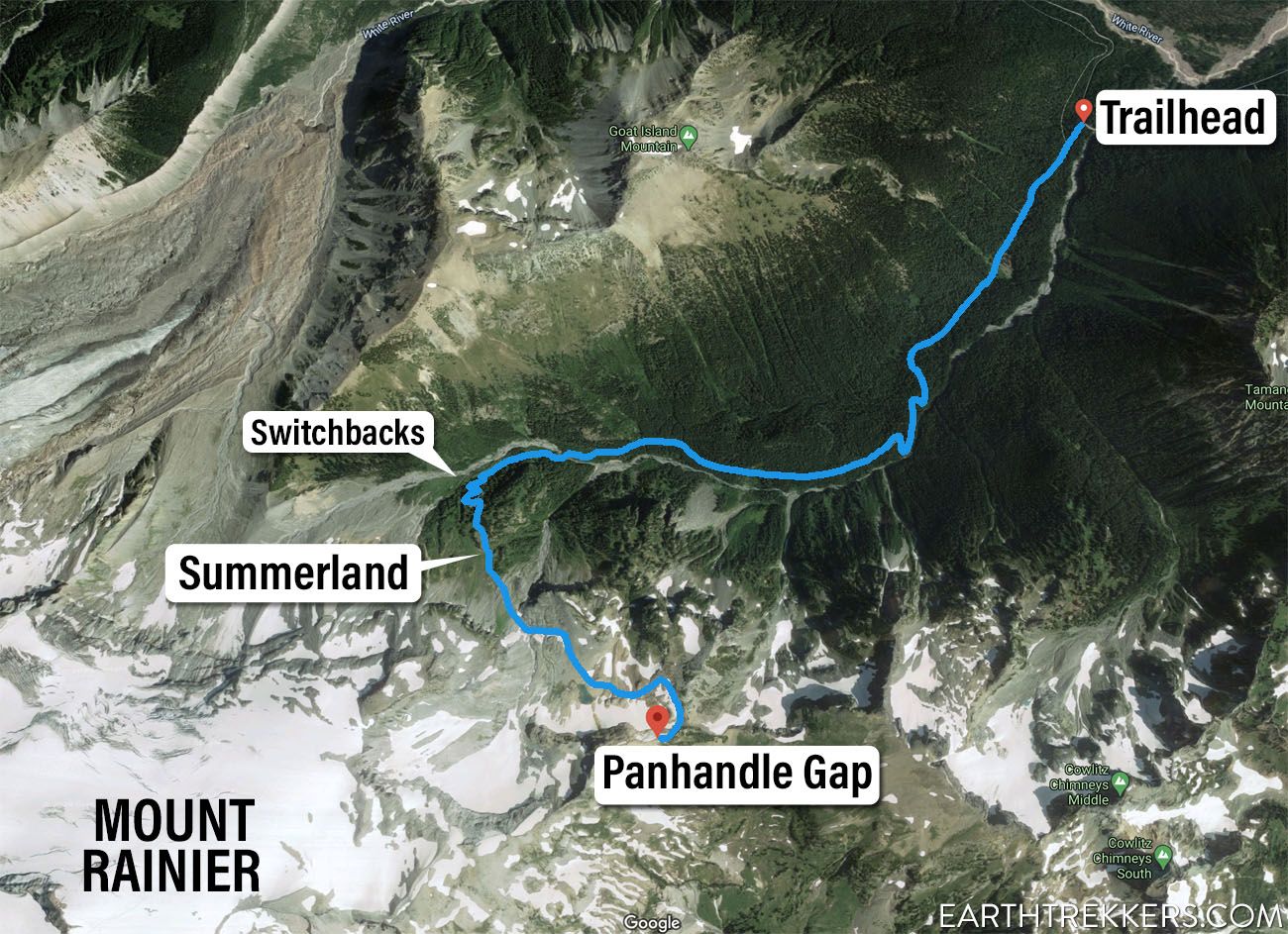
Map of the Summerland Trail
Is the Summerland Trail to Panhandle Gap Worth It?
Yes, for the right hiker.
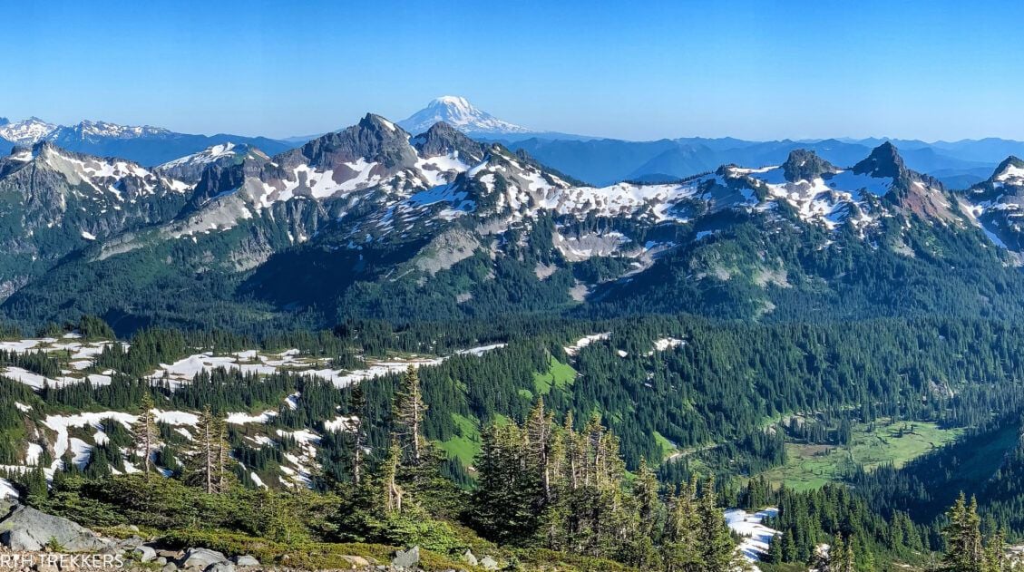
The variety of landscapes on this trail is one of its biggest strengths. You begin in old-growth forest, hike through colorful meadows at Summerland, and finish in rugged alpine terrain with sweeping views of Mount Rainier and Mount Adams. Few hikes in Mount Rainier pack this much diversity into one trail.
That said, the final mile to Panhandle Gap is steep, exposed, and often snow-covered well into July. If snow conditions are poor or you’re low on energy, stopping just below the gap still delivers incredible views and is a perfectly satisfying turnaround point.
If you’re looking for a quieter alternative to the Skyline Trail with equally impressive scenery, and you’re up for the challenge, this hike is absolutely worth it.
Who is the Summerland Trail For?
This hike is best suited for experienced hikers who are comfortable with long distances, steady elevation gain, and potentially crossing snowfields, even in mid-summer. At 12 miles round trip with over 3,000 feet of elevation gain, this is a full-day commitment.
You’ll love this hike if:
- You want big views of Mount Rainier without the Paradise crowds
- You enjoy hiking through a variety of terrain (forest, wildflower meadows, rocky alpine slopes)
- You’re comfortable hiking 5 to 7 hours
- You don’t mind a strenuous climb at the end
- You’re prepared for variable conditions, including lingering snow
This is not the best choice for beginners, families with young kids, or anyone uncomfortable hiking across snow or navigating rocky, exposed terrain near the saddle.
How Hard is the Summerland Trail?
The Summerland Trail to Panhandle Gap is a strenuous 12-mile hike with about 3,150 feet of elevation gain. The first few miles are steady but manageable, then the climb steepens, especially in the final 1.5 miles to Panhandle Gap, where you gain roughly 1,000 feet.
Snowfields often linger into mid-summer, adding difficulty to the final stretch. This hike is best for experienced hikers comfortable with long distances, sustained uphill climbing, and potentially crossing snow.
Trailhead & Parking
The trailhead is located on Sunrise Park Road (also called White River Road), 4.3 miles from Mather Memorial Parkway and 11.2 miles from the Sunrise Visitor Center.
There is a small parking lot at the trailhead, with spots located on either side of the road. There are approximately 25 spaces here. Additional parking can be found on the turnouts along Sunrise Park Road. From these turnouts, you could end up walking a very short distance or a half mile or more to get to the trailhead.
We arrived at 7:30 am on a Saturday in July and were lucky enough to get the last space in the parking lot. The number of visitors on the weekend was enormous. We found that Mount Rainier National Park gets extremely busy on Saturdays and Sundays with much lighter traffic on weekdays. So, on weekdays, you might not have to get here so early to get a space.
Summerland Trail: Step-By-Step Trail Guide
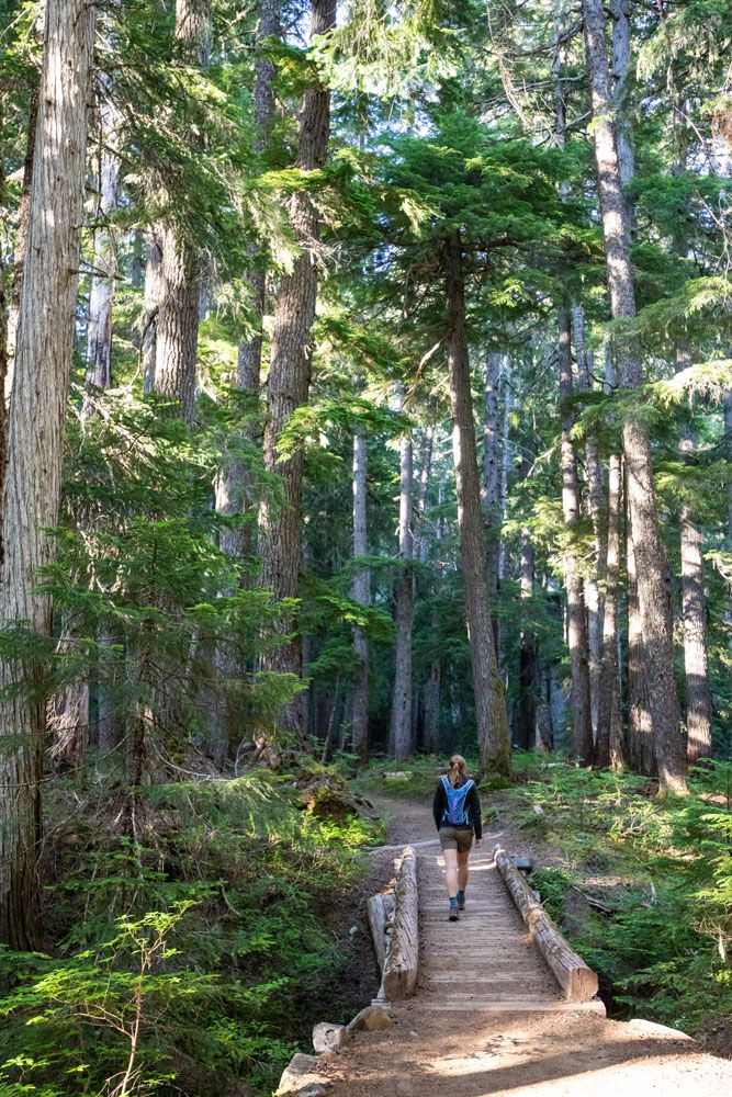
Through the Forest (0 to 2.5 Miles | 1 to 1.5 Hours)
Difficulty: Moderate
Elevation Gain: Gradual but steady
The first half of the hike is relatively easy. It is a beautiful, peaceful walk through old growth forests of evergreen trees. A few times, there will be a break in the trees and you will have views of wildflowers, but these views don’t last long.
For the most part, this walk in the woods is a steady uphill walk. It’s nothing too challenging, just a steady gain in elevation.
We moved quickly through this section, then slowed down later as the trail became more challenging and the views improved.
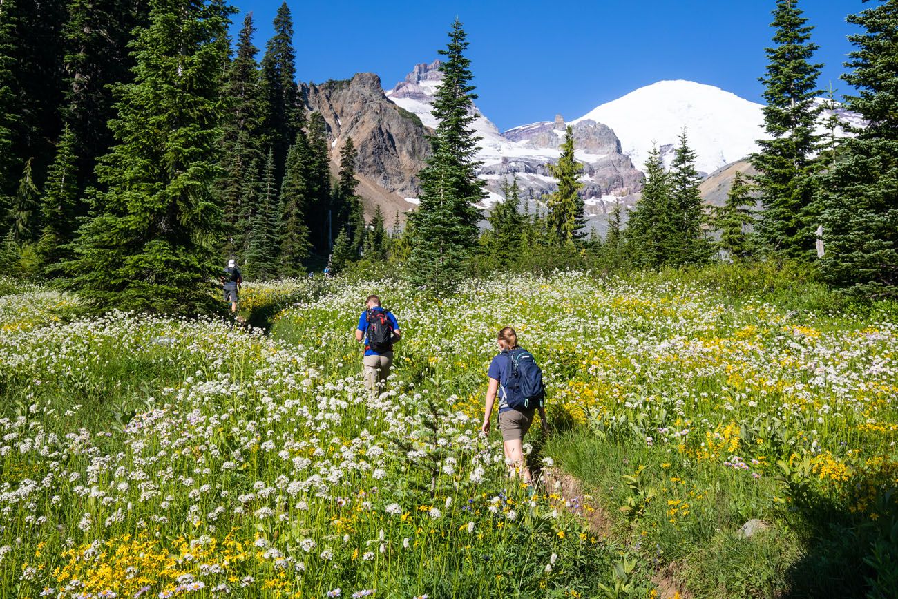
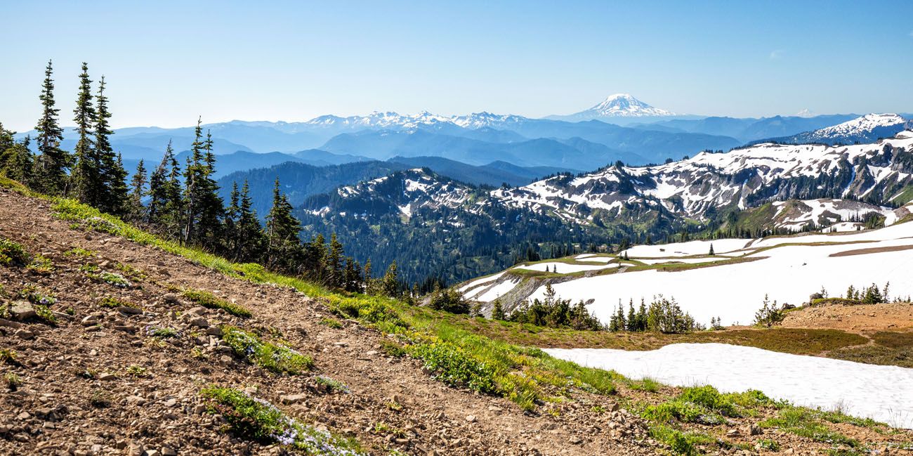
Summerland Meadows (2.5 to 3.8 Miles | 30 to 60 Minutes)
Difficulty: Moderate
Best for: Wildflowers, marmots, photos
Once you emerge from the trees, you are almost halfway through the hike, at least in terms of mileage. But there is still a lot of uphill elevation gain in your future.
This next part of the trail is beautiful. It’s an uphill walk (but nothing too strenuous) through fields of wildflowers. You will be hiking directly towards Mount Rainier and the warm sun can feel great, even in the summer months, if you got an early start (it can be chilly in the forest!!).
Switchbacks to Summerland Camp (3.8 to 4.5 Miles | 30 to 60 Minutes)
Difficulty: Moderately strenuous
Tip: Pace yourself here.
Then you reenter the forest and seriously gain some elevation as you hike up a series of switchbacks. This is one of the most tiring parts of the hike, but it doesn’t last too long.
At the top of the switchbacks, about 4.5 miles into the hike, you reach Summerland. Just off the trail are campgrounds and a bathroom, if you need one. This is the only toilet on the trail.
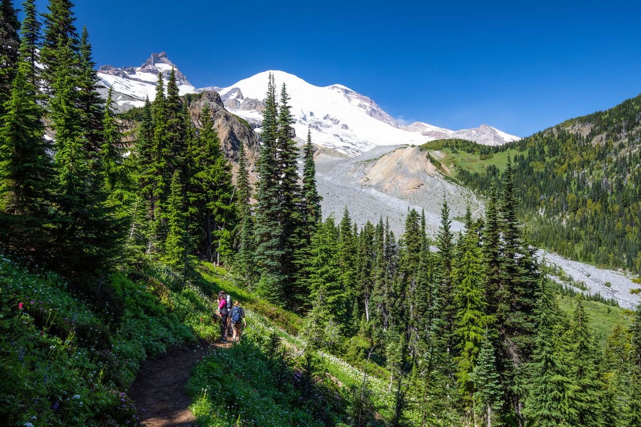
Alpine Climb to Panhandle Gap (4.5 to 5.75 Miles | 30 to 60 Minutes)
Difficulty: Strenuous
Most challenging section of the hike
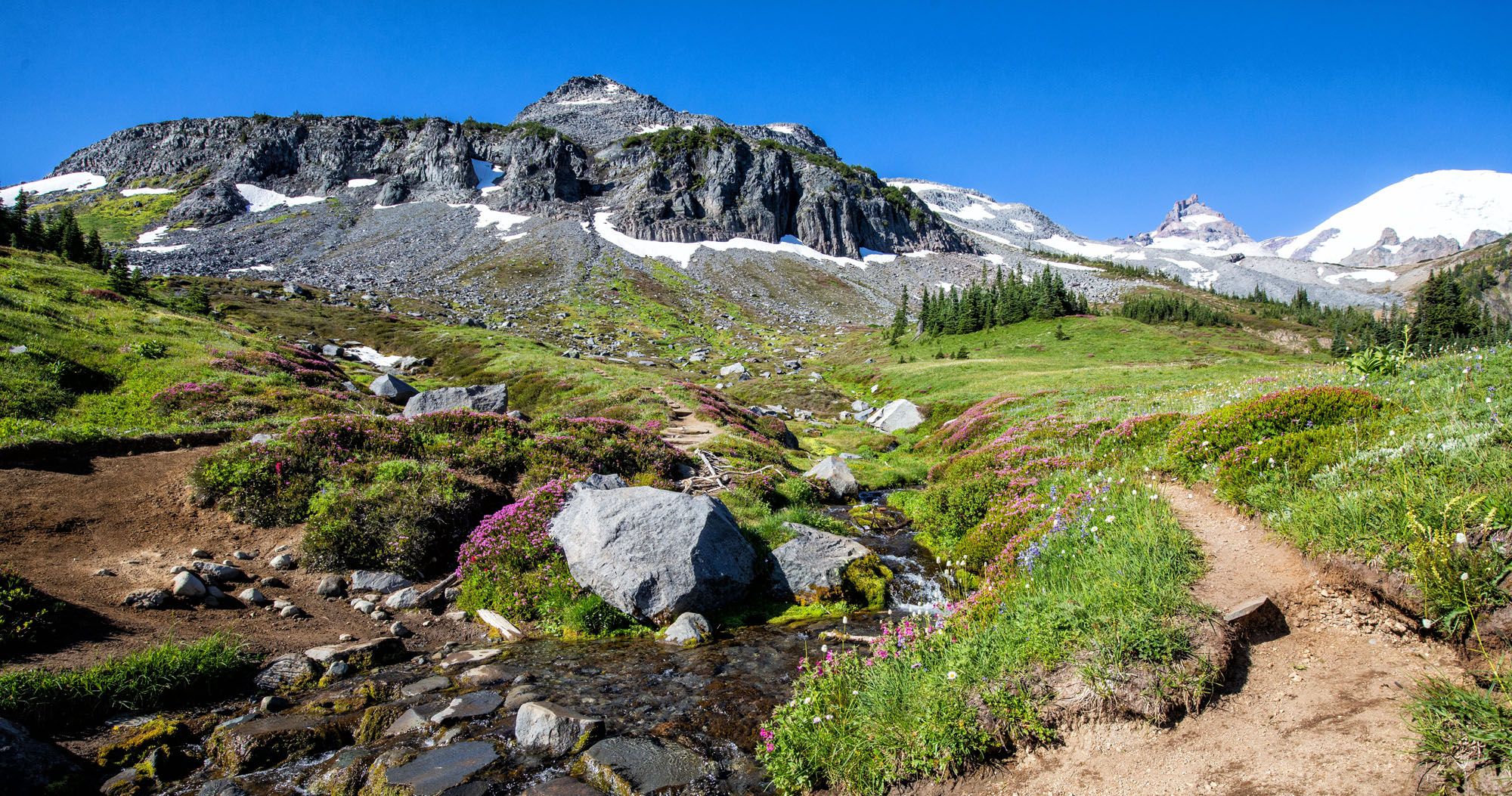
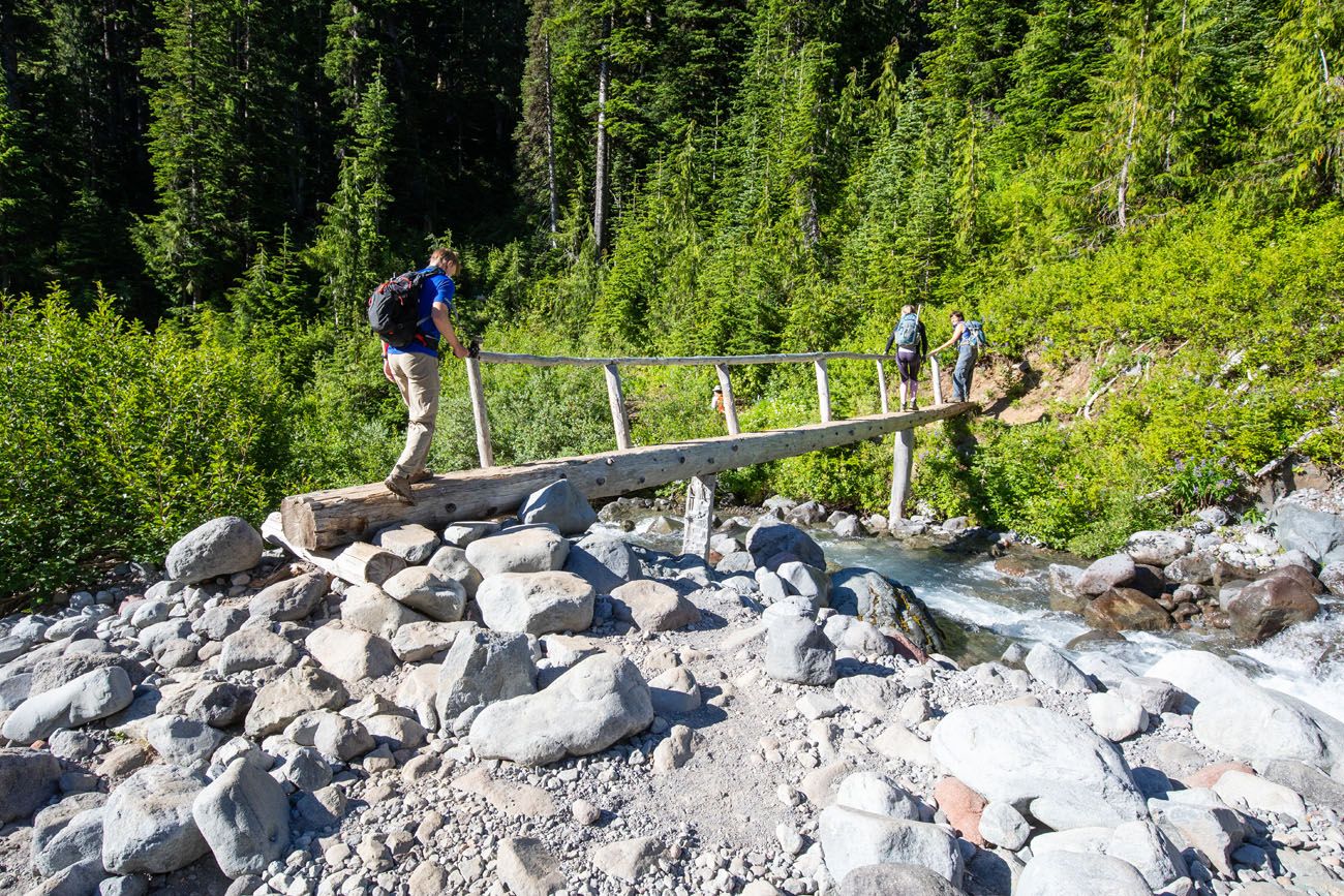
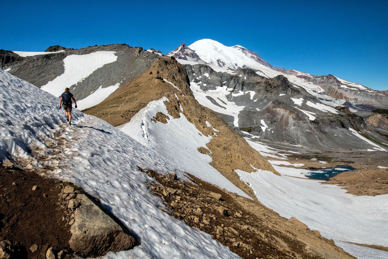
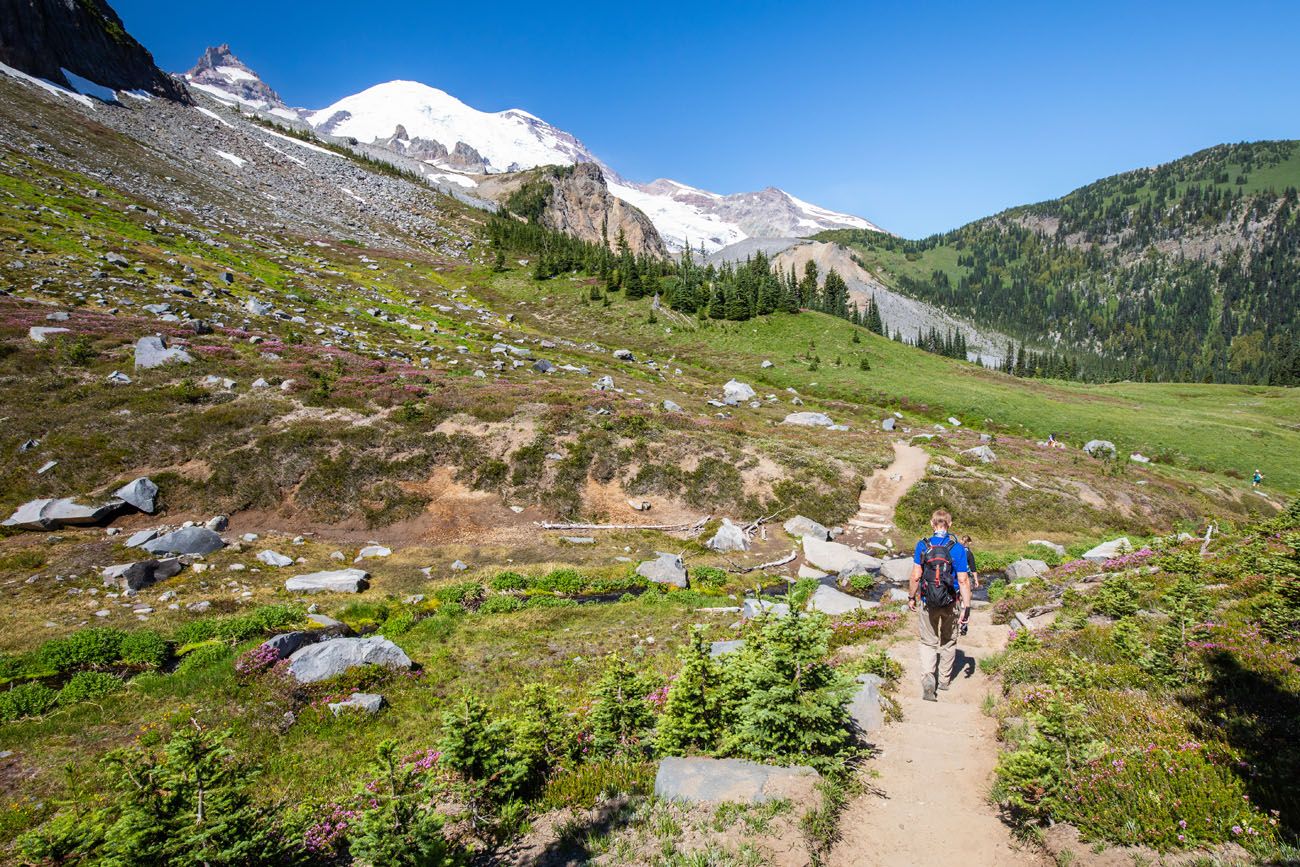
Briefly, the trail levels out. The trail meanders through more fields of wildflowers and you will cross a small creek. We saw marmots here and it is also possible to see black bear.
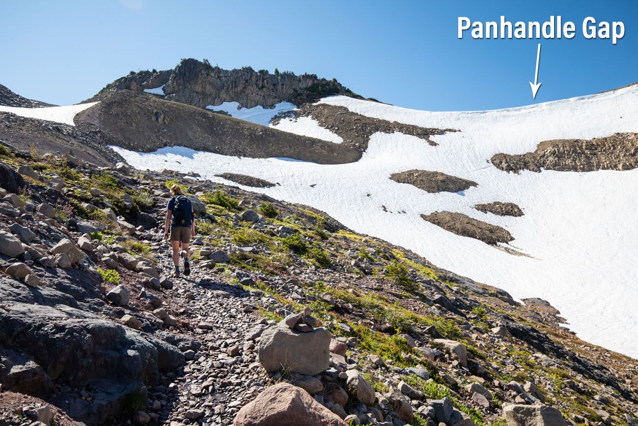
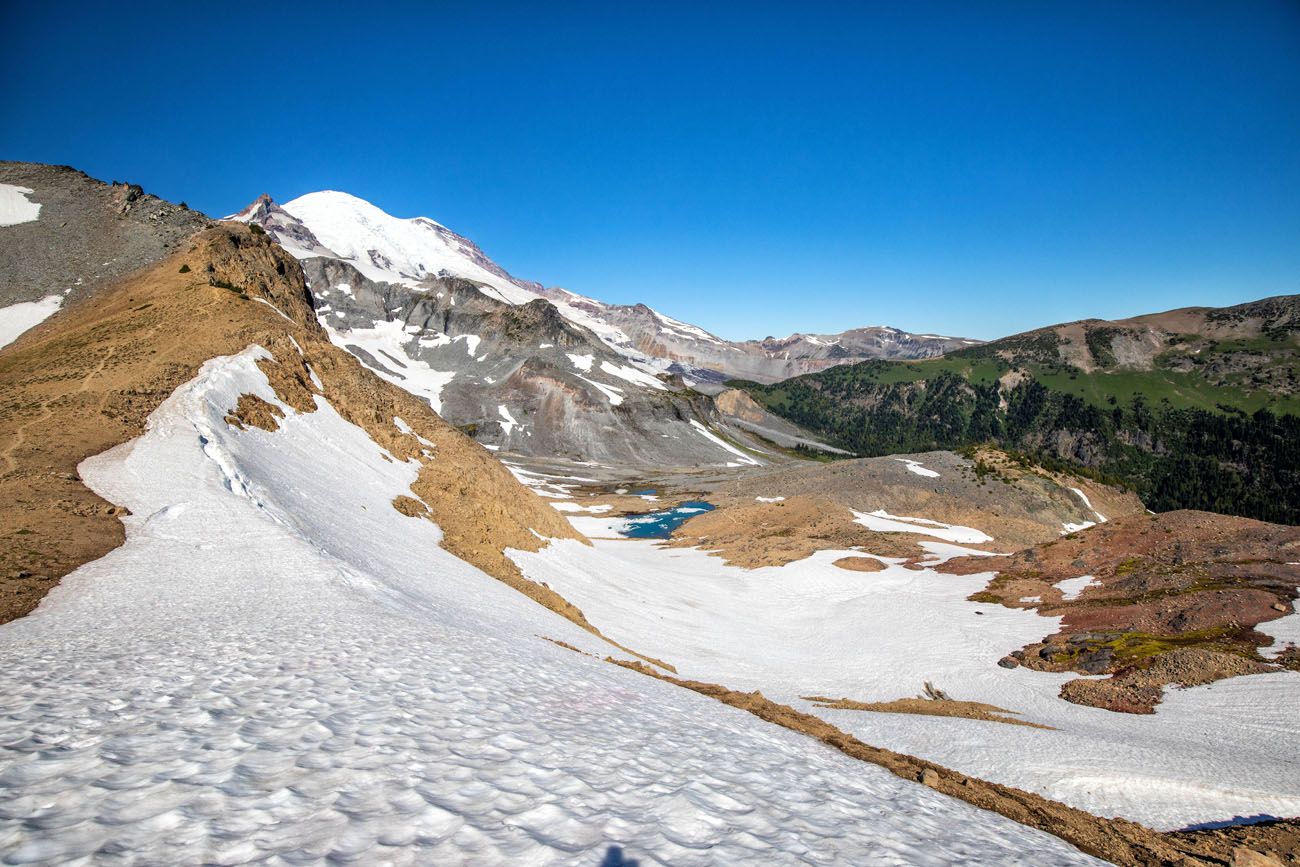
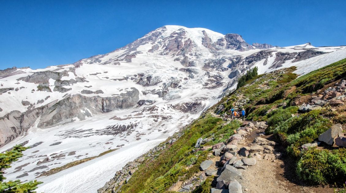
Once you cross the creek, the trail begins to climb again. It’s 1.5 miles to Panhandle Gap and during that time you will rapidly gain another 1000 feet of elevation. This last section of trail is the toughest of the day but it truly does reward you for your efforts.
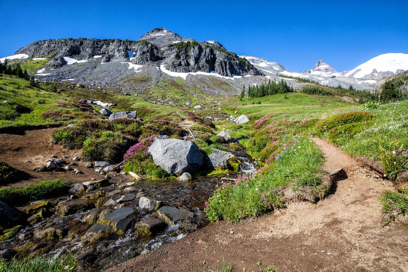
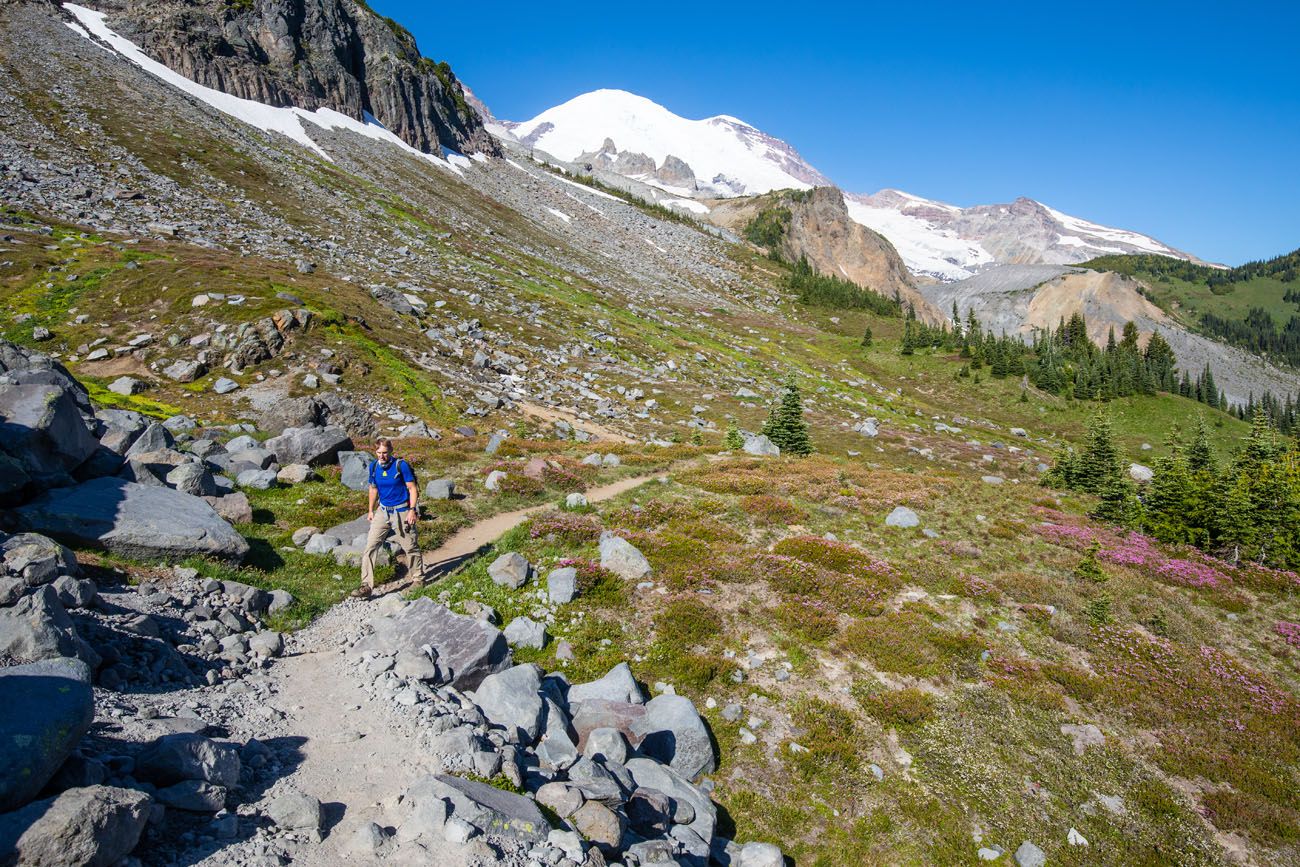
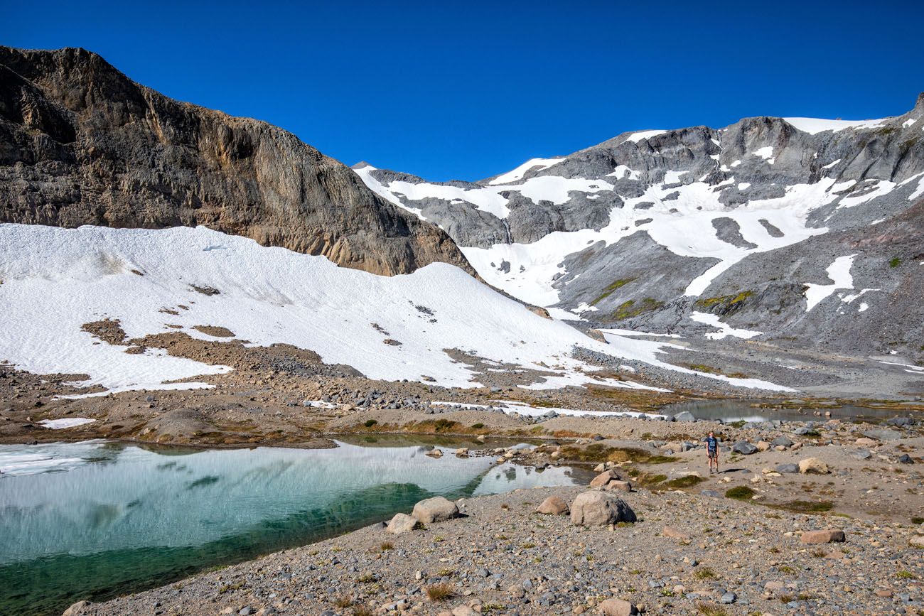
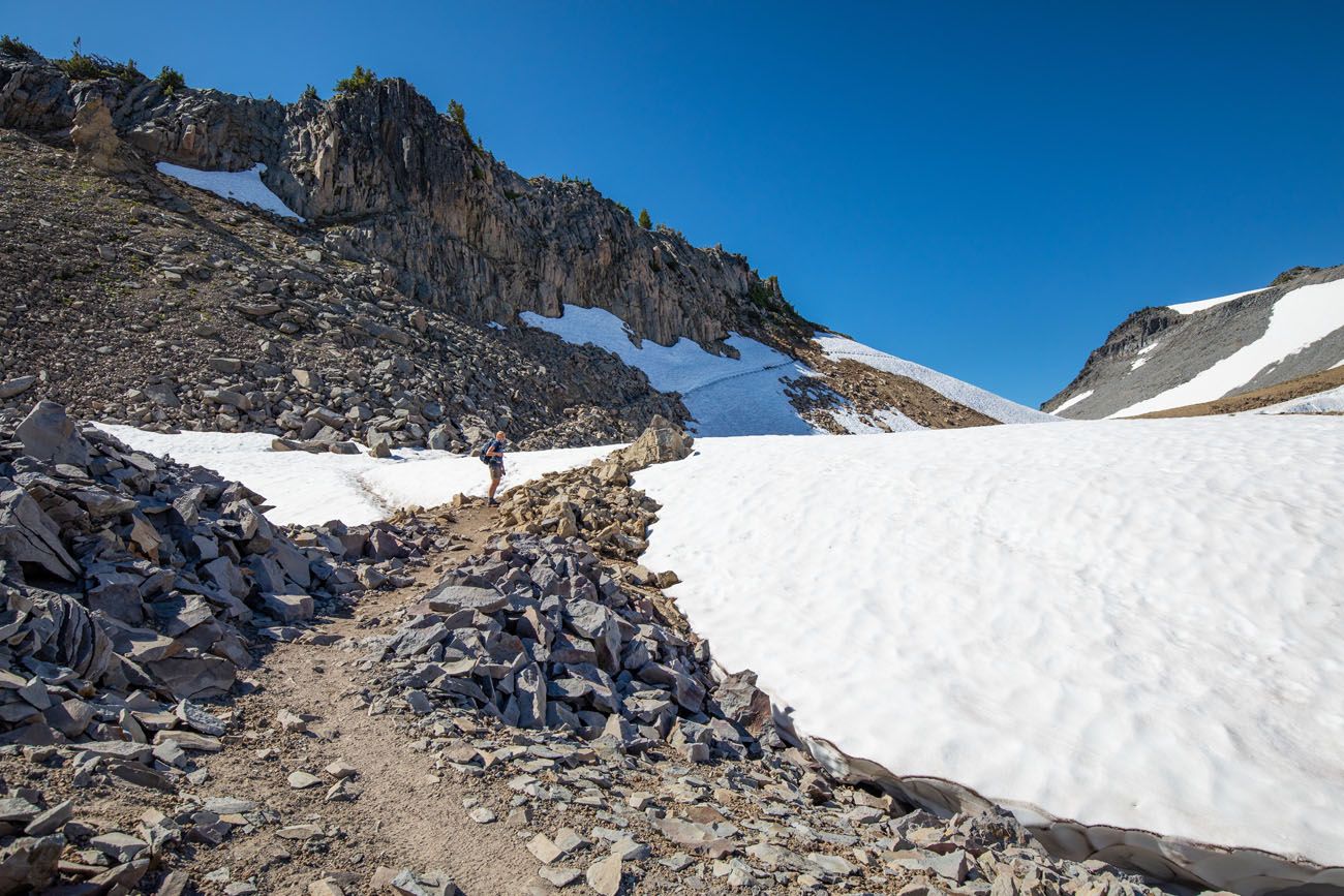
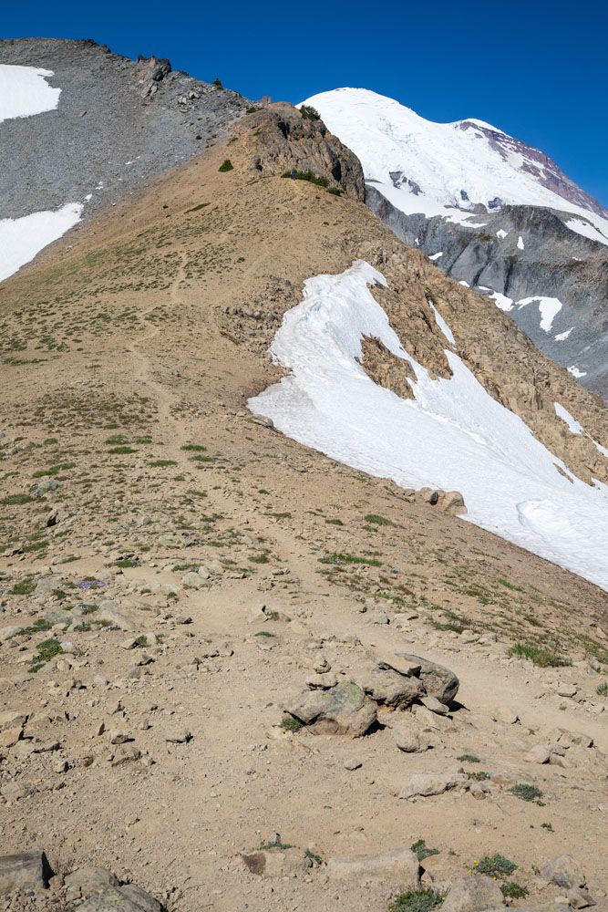
As you climb out of the meadows, the terrain becomes rocky and most, but not all, of the flowers and vegetation disappear. From July into August, you may still have to hike across fields of snow.
The trail gets trickier to follow, now that most of the vegetation is gone. The trail is lined with small boulders, so pay attention to where you are walking, because it can be easy to wander off of the trail in spots.
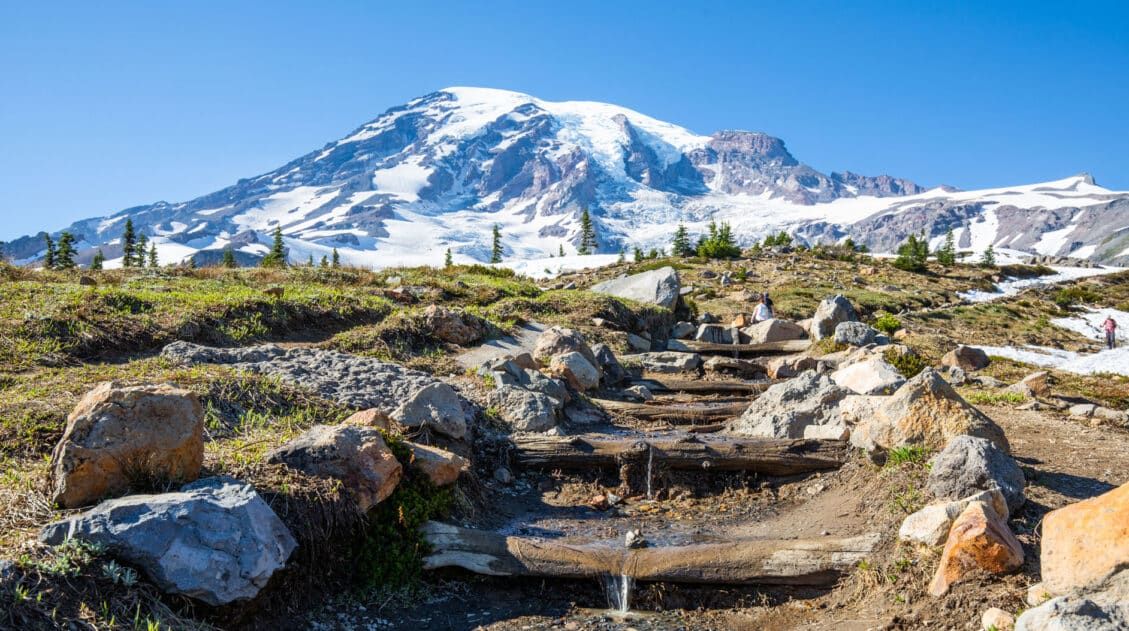
There will be several creek crossings and some will have a log bridge in place.
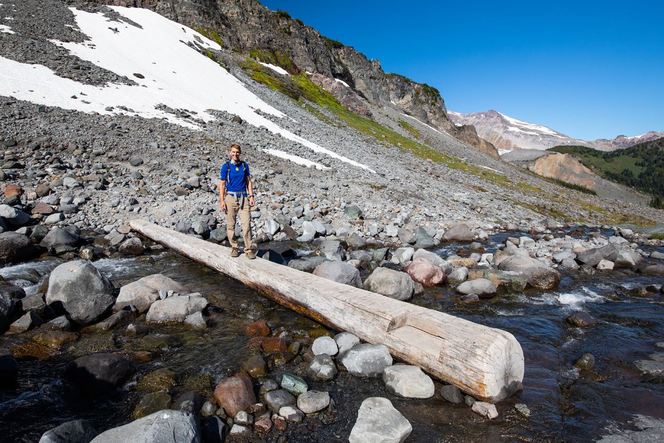
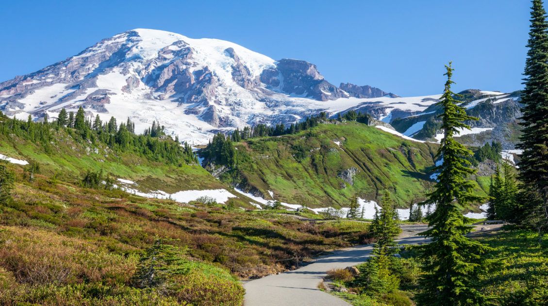
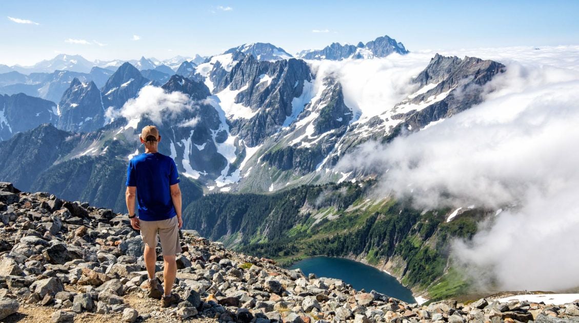
The higher you go, the better the view. It gets easier to see Mount Rainier as you gain elevation on the trail. In fact, the entire region opens up and you are treated to wonderful views of Mount Rainier and Summerland.
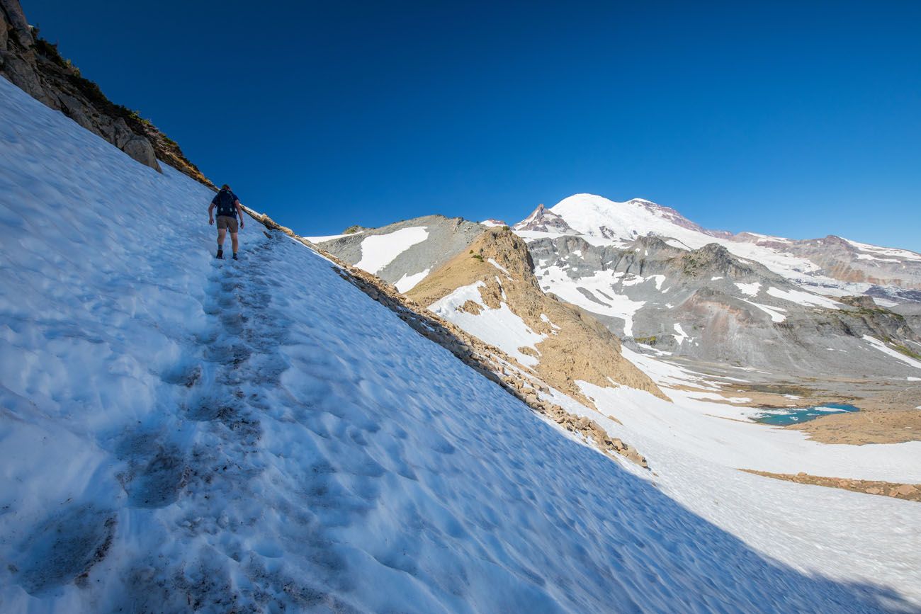
The Final Push to the Saddle (Last 0.25 Mile)
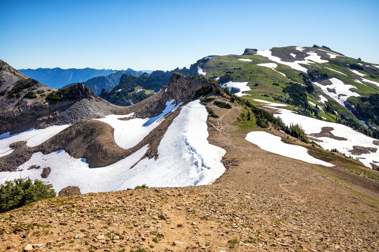
The final section of trail is the most challenging. It’s steep and tiring and when we did this, the sections of snow made hiking somewhat treacherous. If you don’t feel comfortable hiking across these sections of snow, or if you just don’t have the energy to go farther, I don’t think you miss out on much by not going all the way to Panhandle Gap. The views from just below Panhandle Gap are incredible and we actually liked this lower spot more than on the saddle. But keep reading and you can see our photos and determine for yourself if you think it is worth it.
The final quarter mile of the hike is a tiring climb up over dirt and rocky trails.
When we did this, there were two snowfields to cross. A narrow trail was stomped out by the feet of hikers who did this before us, but it is narrow and slippery, and there is the chance of sliding off the trail and down the snowy slope. Judging by the marks in the snow next to the trail, it looked like a few people did slide down the snow, but I can’t be sure if it was by accident or on purpose.
View of Mount Rainier from the trail.
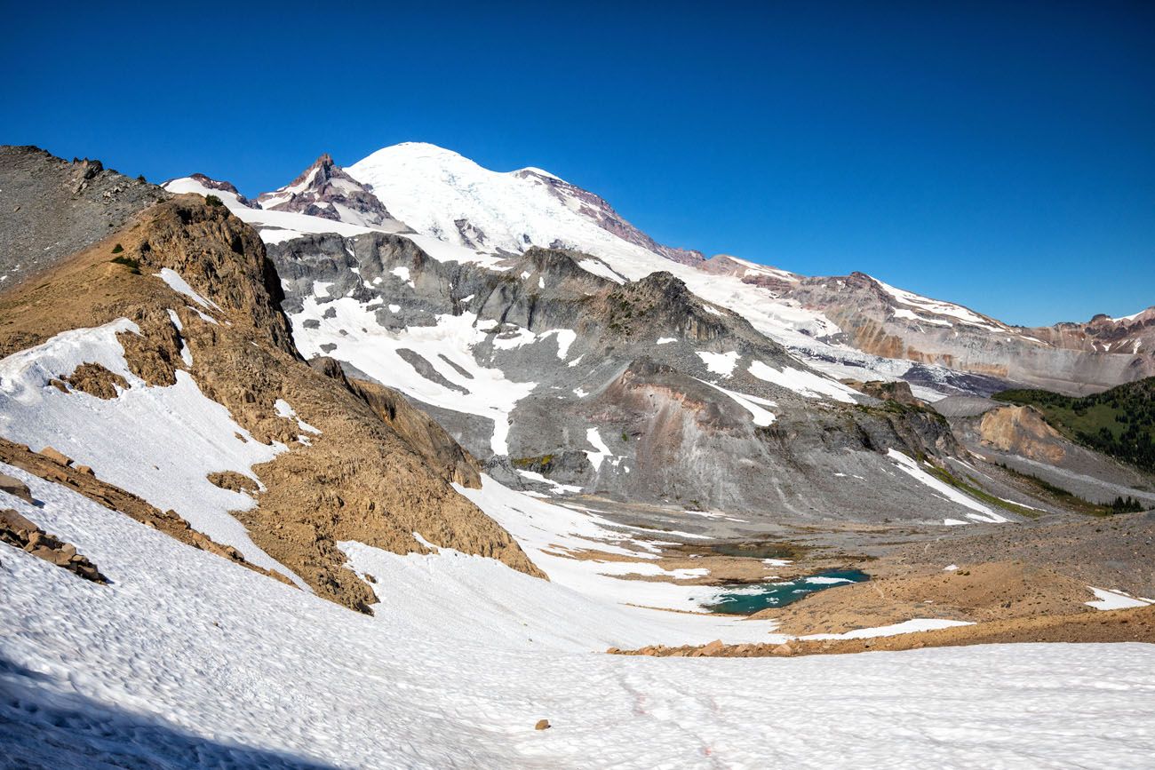
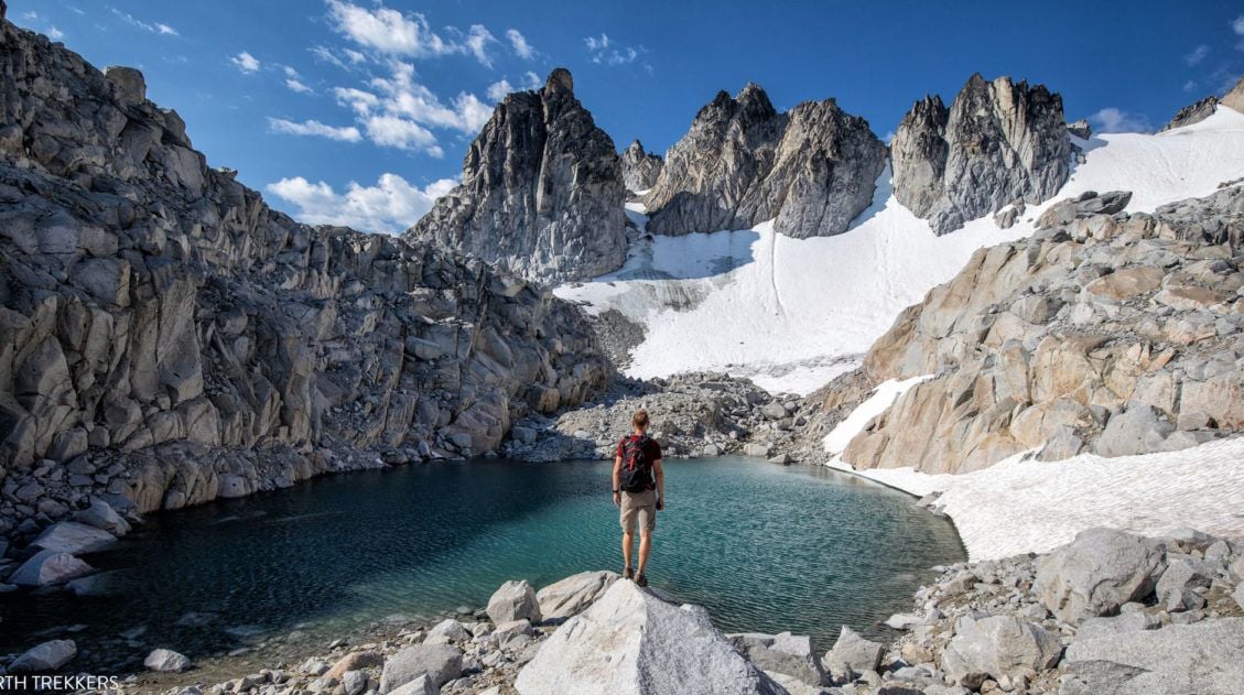
The Views from Panhandle Gap
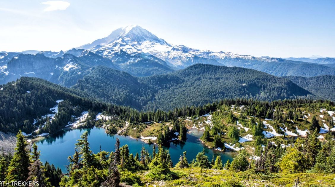
Once on the saddle, you can stop here and take in the view. To the south, you can look out to Mount Adams. To the west is Mount Rainier. And to the north you can look back to Summerland and over the trail that you just hiked.
From the saddle, you have the option to hike farther uphill, towards Mount Rainier. We did this but the view doesn’t change much, so if you are exhausted, you can skip this final climb. Kara climbed up on the rocks next to the trail and had great views of Mount Adams off in the distance.
The Return Hike (6 Miles | 2 to 3 Hours)
To get back to your car, retrace your steps along the same trail. Have care on the snow fields. Now that you are hiking downhill, it’s easier to slip and fall. If you have them, crampons, yak trax, or an ice axe would be helpful on these sections.
It is an overall downhill walk so the return hike is much faster.
Snow Conditions & Safety Tips
Snowfields often linger near Panhandle Gap into late July and sometimes August. The final stretch can be steep, narrow, and slippery, especially in the morning when the snow is firm.
Before you go, check recent trail reports on the National Park Service website. Traction devices such as microspikes or traction cleats can be helpful depending on conditions, and hiking poles improve stability. If the snow feels unsafe or you’re uncomfortable crossing it, turning around just below the gap still offers incredible views and is a perfectly reasonable decision.
Tips to Have the Best Experience
As you plan your trip and just before your visit, get updates on road closures and trail conditions on the National Park Service website.
To get a parking space, plan on arriving by 7 am, especially if you plan to hike to Panhandle Gap in the summer.
We spent six days in Mt. Rainier National Park in July. On most mornings, clouds lingered over the mountains and didn’t disappear until mid to late morning. However, on the day we did this hike, we got very lucky, and the clouds lifted by 7:30 am. Check the weather forecast before you do this hike and know that there is a chance that you might not have much visibility until mid-morning.
Leave No Trace. When you are in the park, practice the seven principles of Leave No Trace. This includes packing out what you bring into the park, be considerate of other hikers, stay on the trail, and do not remove anything from the park.
Do not expect your cell phone to work. For most of this hike we had zero cellular service. There were a few spots in clearings or at higher elevations where we got a few bars of LTE or 3G, just enough to send a text message. But don’t depend on your phone to call for help, talk to friends, or send photos to friends and family.
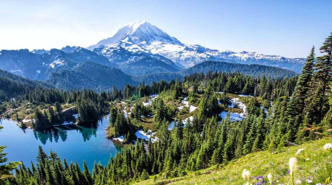
Hiking back through Summerland
What to Bring on the Hike
Hiking shoes. Don’t do this hike in anything other than hiking shoes or hiking boots. There’s a good chance you will hike through snow, even in the summer.
Hiking poles. Hiking poles take the stress off of your legs and help to ease leg pain and fatigue. They also help you keep your balance on the snow crossings.
Crampons, yak trax, or an ice axe can be helpful for the snow crossings.
Water and snacks. At least 3 liters of water in the summer.
Sunscreen, hat, and sunglasses. For more than half of this hike you will be exposed to the sun, with very little shade.
Camera. Even a smartphone will do.
Rain jacket or fleece. It’s chilly at Panhandle Gap. Be prepared for all weather conditions, even snow in the summer months. Pack a rain jacket and/or fleece and even another layer of clothing.

Essential Hiking Gear: What Should You Bring on a Day Hike?
If you are new to hiking or are curious about what you should bring on a hike, check out our Hiking Gear Guide. Find out what we carry in our day packs and what we wear on the trails.Plan Your Mount Rainier Trip
The Summerland Trail to Panhandle Gap is just one of many incredible hikes in Mount Rainier National Park. For a full overview of the park, including where to stay, when to visit, and how to plan your time, read our Mount Rainier Travel Guide.
Looking for more great hikes? Don’t miss our guide to the Best Hikes in Mount Rainier National Park, plus detailed trail guides for the Skyline Trail Loop and the Mount Fremont Lookout Trail.
If you are building a longer itinerary, see our Mount Rainier Itinerary for suggestions on how to organize your days and combine the best hikes and viewpoints.
If you have any questions about hiking the Summerland Trail to Panhandle Gap, let us know in the comment section below. Happy hiking!!
Explore More of Washington
If this is part of a bigger road trip through the USA, visit our United States Travel Guide and our Washington Travel Guide for more inspiration and travel planning tips.
15 Best Hikes in Mount Rainier (Ranked by Difficulty & Area)
Pinterest Facebook Flipboard Mount Rainier is one of the most spectacular hiking destinations in the United States. From wildflower-covered alpine meadows to glacier viewpoints and fire lookout summits, the variety here is incredible. We’ve hiked in more than 50 U.S. national parks and on trails around the world, from Everest Base Camp in Nepal to […]
Skyline Trail Loop: A Step-by-Step Guide to Rainier’s Most Iconic Views
The Skyline Trail Loop is the most iconic hike in Mount Rainier National Park, and we’ve hiked it twice in both directions to figure out exactly which way is better. Here’s everything you need to know, from snow crossings and trail conditions to the best direction for views of Mount Rainier. For jaw-dropping alpine scenery, […]
Tolmie Peak Lookout Hike & Its Jaw-Dropping View of Mount Rainier
One of the best views of Mount Rainier isn’t from Paradise or Sunrise, it’s from a small historic fire lookout high above Eunice Lake. The Tolmie Peak Lookout hike delivers one of the most spectacular perspectives of the mountain, from one of the quietest corners of the park. Tolmie Peak Lookout is one of our […]
20 Epic Hikes in the US National Parks
With 63 national parks and thousands of miles of hiking trails, your options are endless for exploring the American national parks. We narrowed down the list for you to 20 of the best hikes in the US national parks, 20 amazing ways to explore this beautiful country. Hike to the tallest peaks, through massive canyons, […]
Hiking the Enchantments in One Day: A Step-By-Step Trail Guide
Over 19.25 miles, climb Aasgard Pass, wander through a surreal landscape of turquoise alpine lakes and jagged peaks, then descend nearly 7,000 feet to the Snow Lakes trailhead. Hiking the Enchantments in one day is a long, hard challenge, but one you’ll never forget. If you are a hiker, the Enchantments are a destination that […]
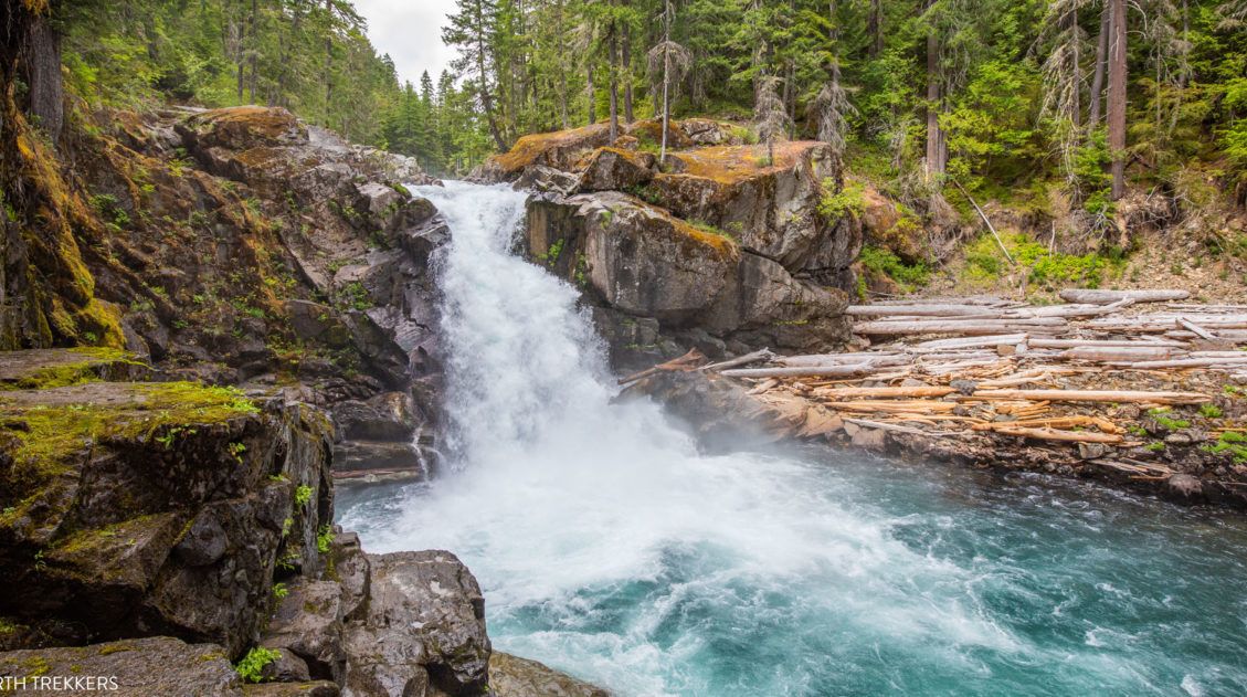
Silver Falls Loop Trail: An Underrated Hike in Mount Rainier
If you’re looking for a hike that quietly exceeds expectations, the Silver Falls Loop Trail is it. We hiked the Silver Falls Loop on our first trip to Mount Rainier at the end of July. The trail was wonderfully quiet even during peak summer; the old-growth forest along the Ohanapecosh River was stunning, and Silver […]
Washington Road Trip Itinerary: Olympic, Rainier & North Cascades (7–14 Days)
Washington state is one of the great road trip destinations in the United States, and this itinerary is the one we wish we’d had before our own trip. We spent several weeks exploring Washington’s three national parks—Olympic, Mount Rainier, and North Cascades—as well as Leavenworth, Lake Chelan, and the Enchantments. We then combined our top […]
Cascade Pass and Sahale Arm: The Best Day Hike in North Cascades
We’ve hiked in more than 50 national parks across the United States, and the Cascade Pass and Sahale Arm hike is one that still stands out. We did this hike as part of a six-week road trip through the national parks of Colorado and Washington, and it was the perfect way to end the trip. […]
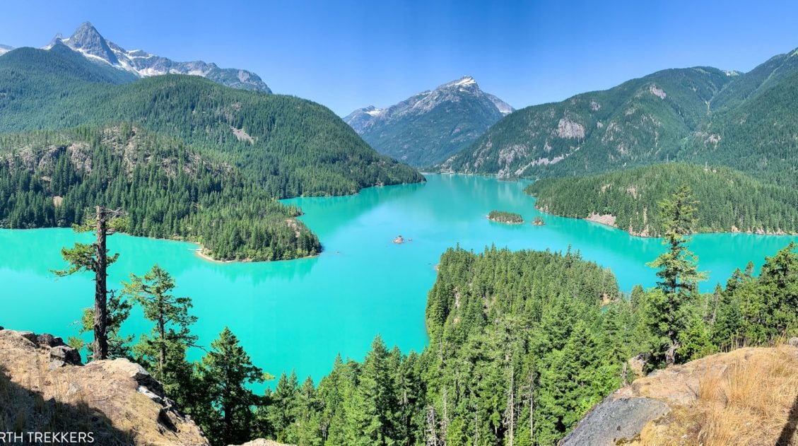
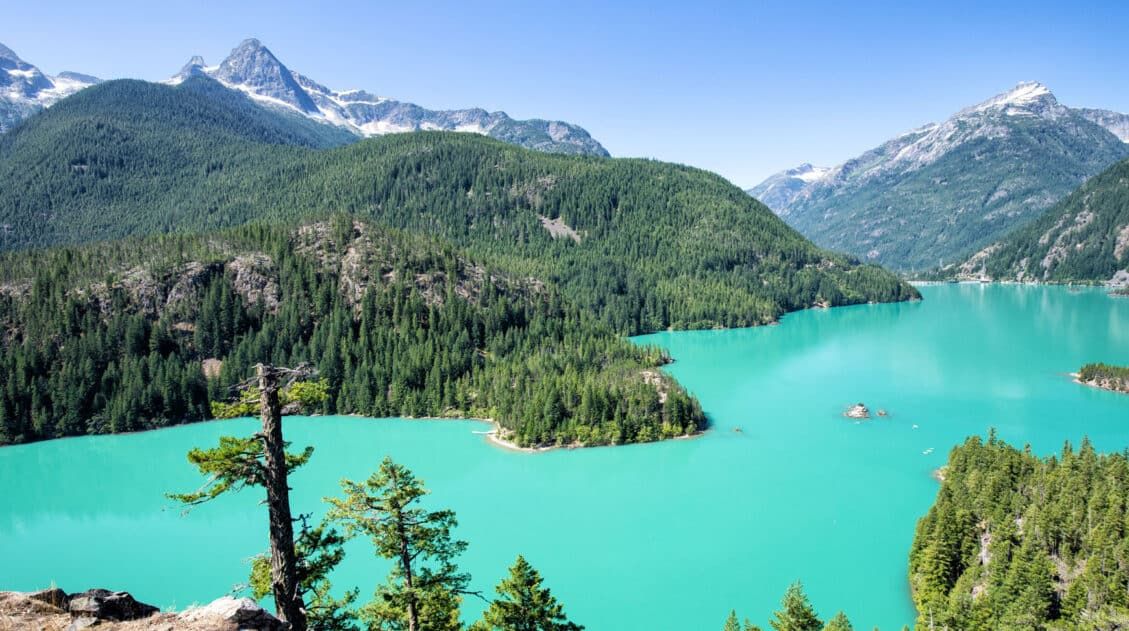
9 Amazing Things to Do in North Cascades National Park
Discover the best things to do in North Cascades National Park, from the stunning drive along Highway 20 to Diablo Lake, Washington Pass Overlook, and world-class hiking trails. North Cascades National Park gets a fraction of the visitors that flock to Olympic and Mount Rainier, and that’s exactly what makes it so good. We visited […]
Best Hikes in Olympic National Park: Ranked by Area and Difficulty
Olympic National Park offers some of the most diverse hiking in the United States. Where else can you hike through a moss-covered temperate rainforest in the morning, walk along a wild Pacific coastline in the afternoon, and look out over glacier-capped mountain peaks from an alpine ridge? We spent four days in Olympic National Park, […]
Klahhane Ridge Trail to Mount Angeles: A Complete Hiking Guide
Not every hike makes you work for the view, but the ones that do are always the most memorable. The Klahhane Ridge Trail to Mount Angeles is that kind of hike. The Klahhane Ridge Trail to Mount Angeles was the very first hike we did in Olympic National Park, and it ended up being our […]

The Ultimate Guide to the 63 US National Parks
Stretching from the South Pacific, across the United States to the Caribbean, are 63 national parks. These national treasures preserve iconic landscapes, majestic mountains, primordial forests, arid deserts, misty coastlines, immense canyons, wildlife, and historic landmarks. We have visited 56 of the 63 US national parks, from the towering granite walls of Yosemite and the […]
North Cascades National Park: How to Plan Your Visit
Plan your visit to North Cascades National Park. Learn about the best things to do, the best hikes and viewpoints, and get sample itineraries and travel tips.
Comments 2