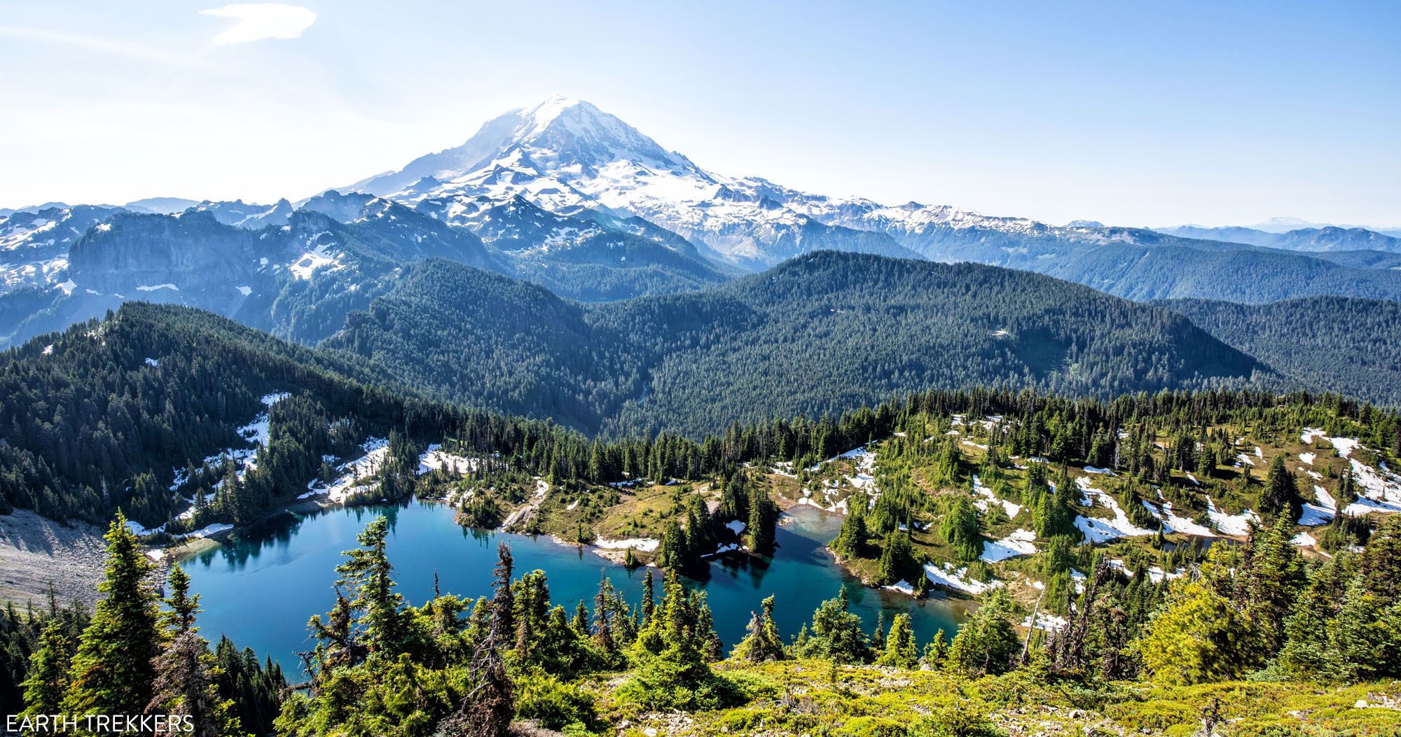
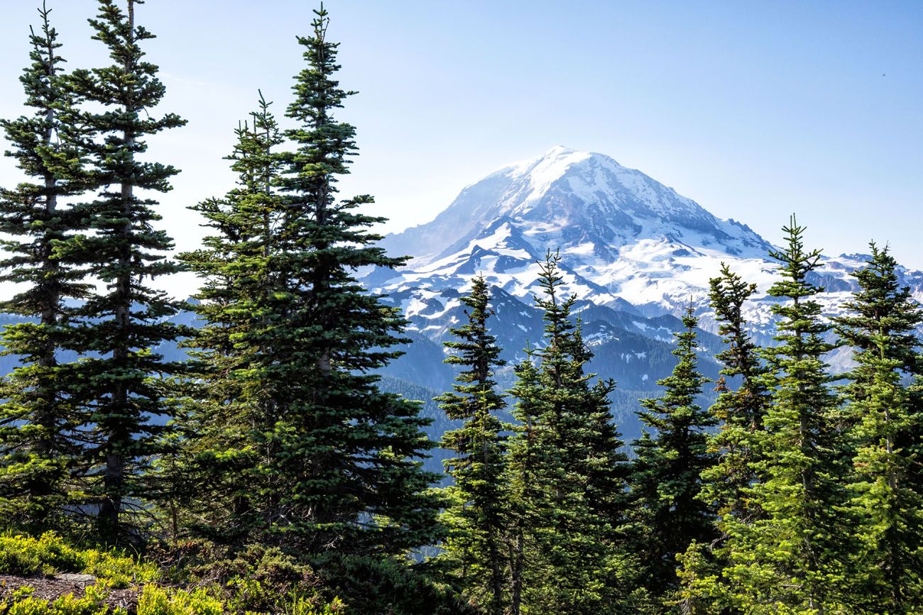
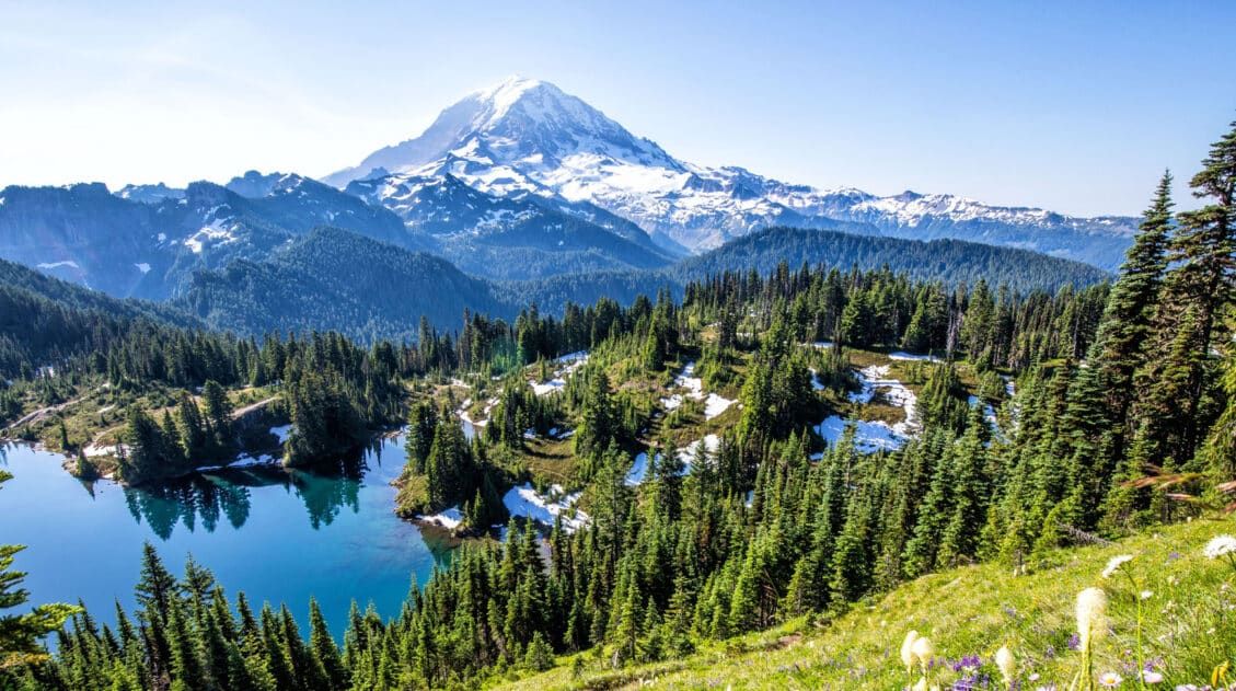
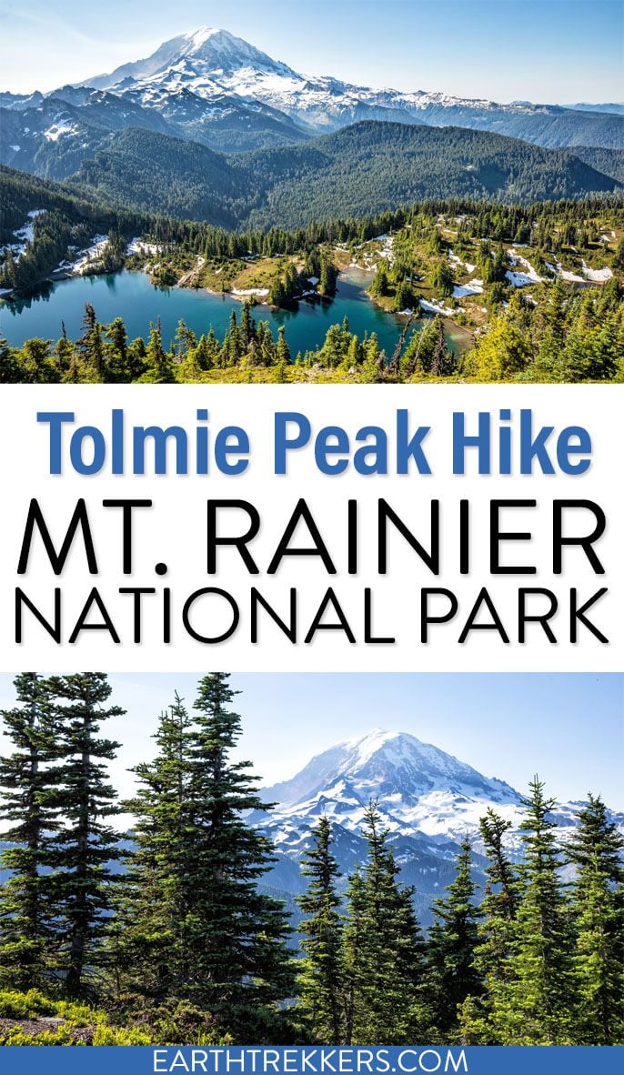
One of the best views of Mount Rainier isn’t from Paradise or Sunrise, it’s from a small historic fire lookout high above Eunice Lake. The Tolmie Peak Lookout hike delivers one of the most spectacular perspectives of the mountain, from one of the quietest corners of the park.
Tolmie Peak Lookout is one of our favorite hikes in Mount Rainier National Park. The trail climbs through quiet forests and past alpine lakes before reaching the historic Tolmie Peak fire lookout, where you get one of the best views of Mount Rainier in the entire park.
Important 2026 update: Access to this hike is currently limited because Mowich Lake Road is closed, which means most visitors cannot drive to the Tolmie Peak trailhead right now. Until the road reopens, the hike is mainly accessible to backpackers traveling through this area of the park, such as those hiking sections of the Wonderland Trail.
In this guide, we cover trail stats, what to expect on the hike, and tips to help you plan your visit when access fully reopens.
If you are planning a visit to the park, see our Mount Rainier Travel Guide to see all of our articles about the park and our guide to the Best Hikes in Mount Rainier National Park for more ideas.
Tolmie Peak Trail Access Update
Currently, Mowich Lake Road is closed to all vehicle, bicycle, and pedestrian traffic until further notice due to closure of the SR165/Fairfax Bridge. This prevents visitors from reaching the Tolmie Peak trailhead by car. There is no indication about when the bridge will be repaired, and most likely it will be many years.
Because of this closure, the Tolmie Peak Lookout hike is currently much harder to access than usual.
It is possible to get to the Tolmie Peak Lookout by backpacking the Wonderland Trail. Experienced hikers can also reach the trail by other backcountry routes.
Before planning this hike, check the official National Park Service website for the latest road status updates. You can also read about proposals to repair or replace the bridge on the WSDOTblog website.
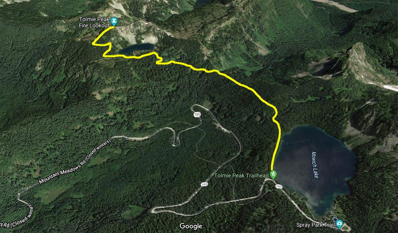
Tolmie Peak Hiking Stats & Map
Distance: 5.6 miles (9 km) round trip (out-and-back)
Total Elevation Gain: 1,633 feet (500 m); roughly 75% of this is on the way to Tolmie Peak lookout
Starting Elevation: 5,100 feet (1,550 m)
Highest Elevation (Tolmie Peak Fire Lookout): 5,900 feet (1,800 m)
Difficulty: Moderate
Length of Time: 2.5 to 4 hours
The hiking stats listed are for the round-trip hike to the Tolmie Peak lookout. You can extend this hike, continuing on to Tolmie Peak. This extra little bit adds about 0.8 miles (1.3 km) out-and-back with minimal elevation gain.
When to Go: This hike can be done from June through October, when the access road to the trailhead is open.


Tolmie Peak Elevation profile
Please practice the seven principles of Leave No Trace: plan ahead, stay on the trail, pack out what you bring to the hiking trail, leave areas as you found them, minimize campfire impacts, be considerate of other hikers, and do not approach or feed wildlife.
Tolmie Peak Lookout Hike: Step-By-Step Trail Guide
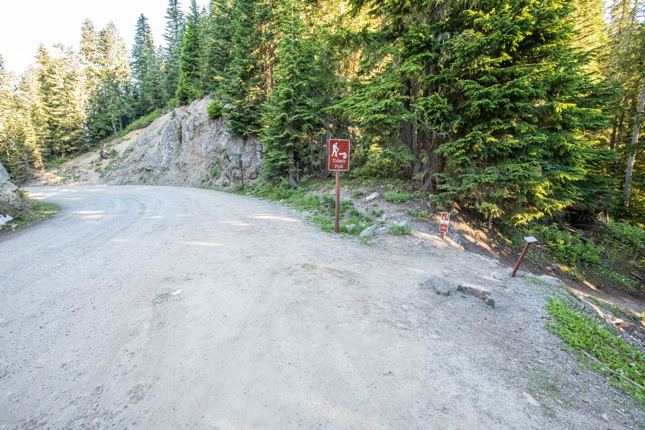
Getting to the Trailhead
The trailhead is located on Mowich Lake Road (aka Mountain Meadows Road). This is a 17-mile gravel road that is rough in some spots. However, you do not need a 4×4 for this road. It is suitable for standard cars.
This road opens in June or July, depending on snowfall, and then closes in October or November. Check the road status on the National Park Service website before you go.
Remember, Mowich Lake Road is currently closed. Get updates about its reopening on the National Park Service website.
There is no park entrance booth for this hike. A few miles before you reach the Tolmie Peak Trailhead, there is a self-pay station, if you do not already have a Mt. Rainier National Park entrance pass or an America the Beautiful Pass.
The trailhead is marked on Google Maps (Tolmie Peak Trailhead). At the trailhead, the road is wide enough for cars to park single file along the side of Mowich Lake Road.
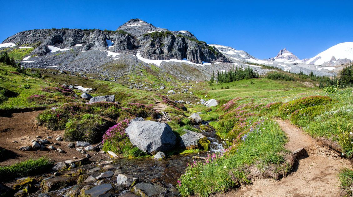
Mowich Lake to Eunice Lake
The trail starts beside Mowich Lake. At first, it’s an easy, flat stroll next to the lake. Enjoy this flat section. It lasts approximately one mile and once you get past this section of trail, you will either be hiking up or down hills, inclines that are rather steep in spots.
At the one-mile point, the trail switchbacks down through the forest. It doesn’t last long, and before you know it, you’ll start the steady climb up to Tolmie Peak.
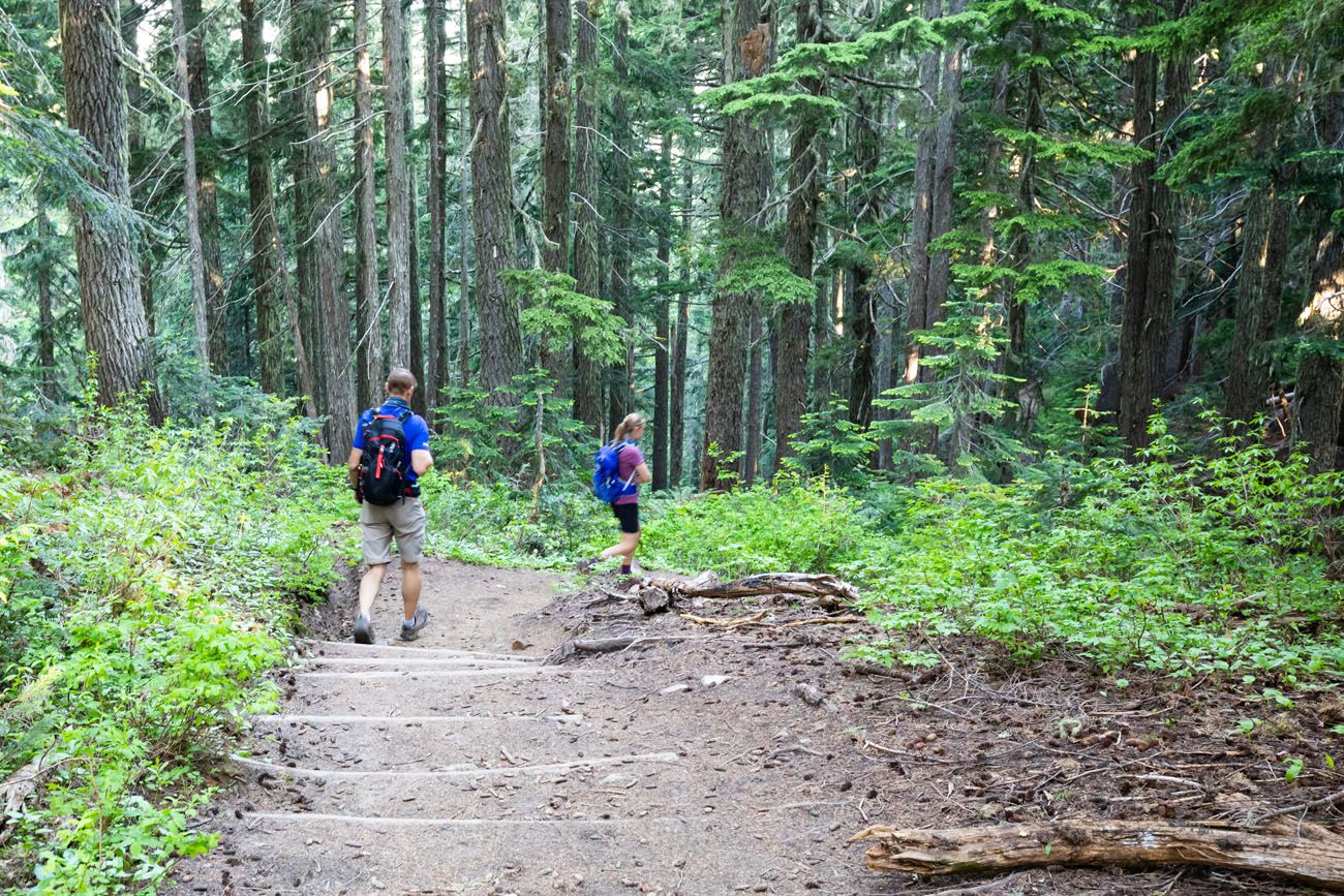
At the bottom of the short descent, you will now regain the elevation you just lost, as you hike up the switchbacks through the forest. This hike up the switchbacks through the forest lasts roughly one mile.
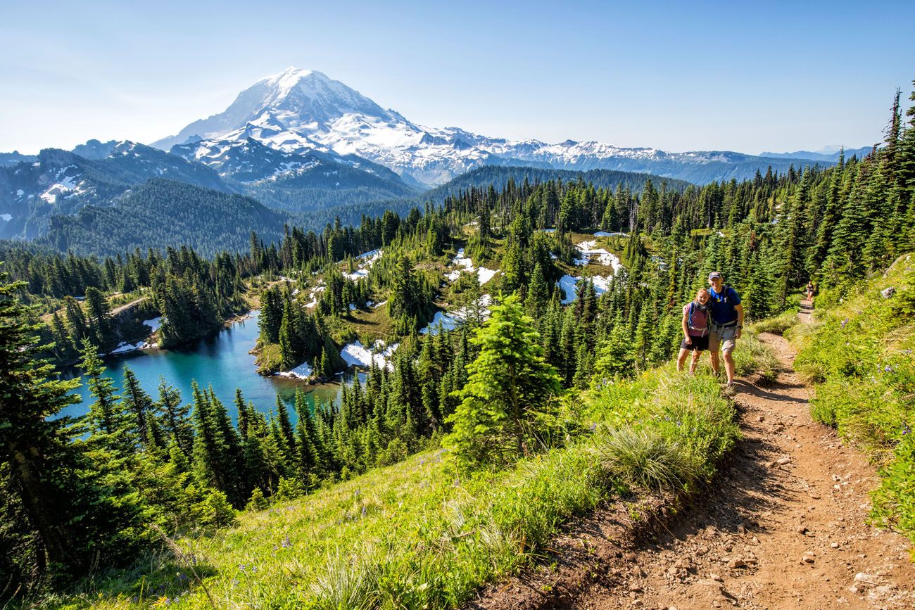
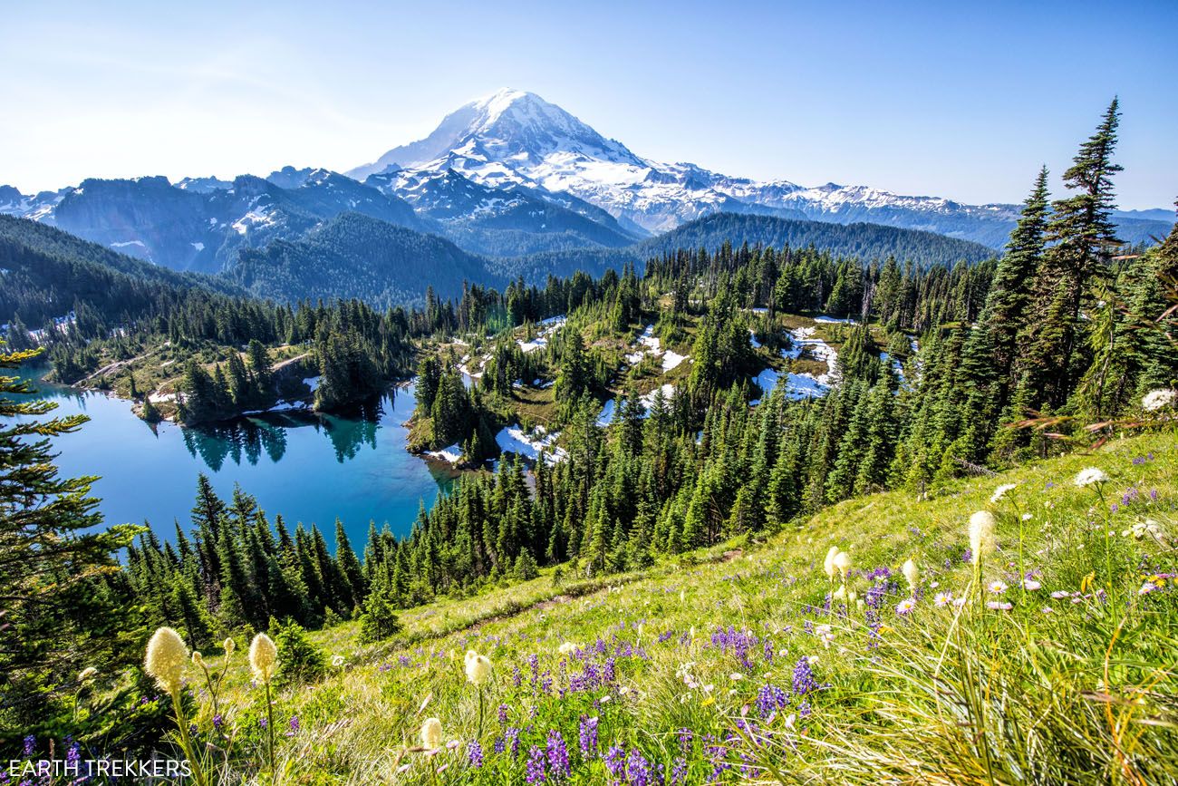
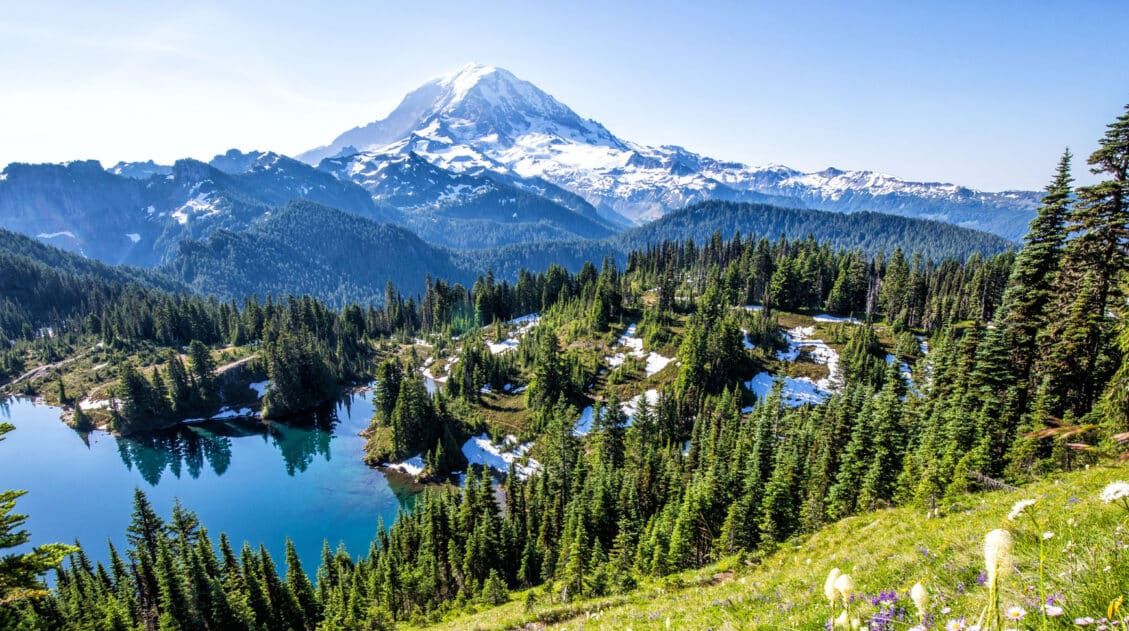
The trail briefly levels out at Eunice Lake. Lakeside, if you look up at the rocky peak in front of you, you can see the fire lookout. Eunice Lake is a nice place to stop and catch your breath before the final climb to Tolmie Peak.
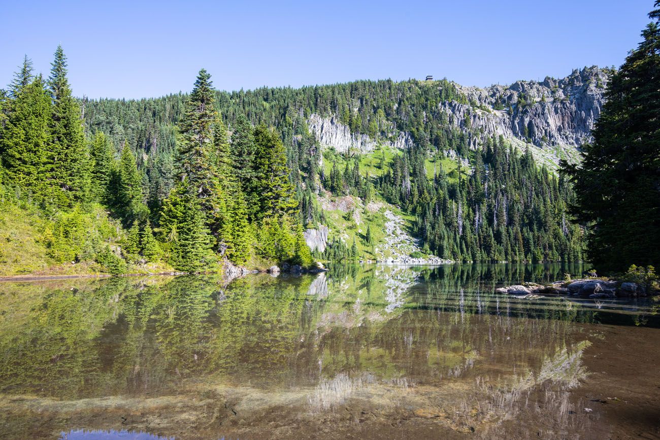
Eunice Lake with the fire lookout at the top of the rocky cliff
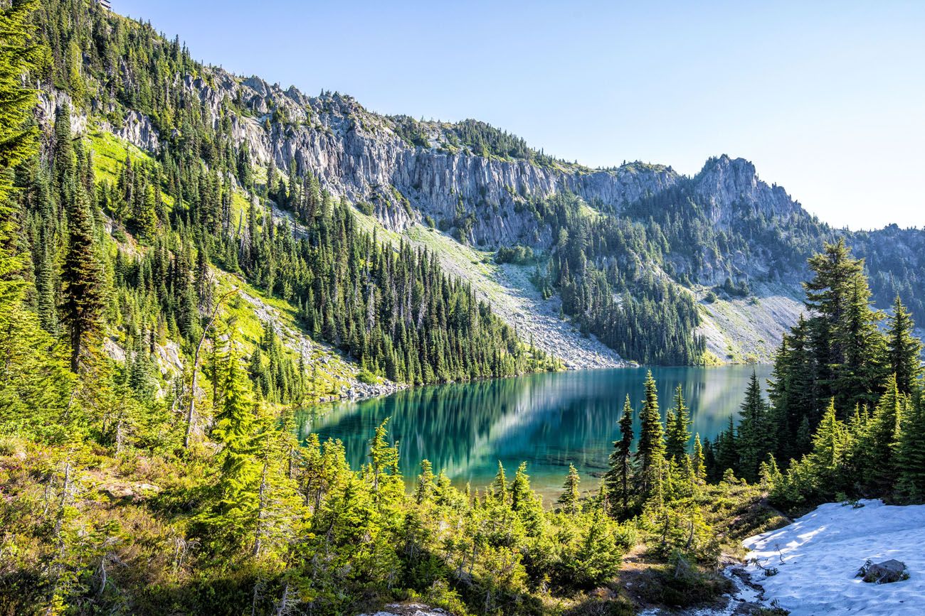
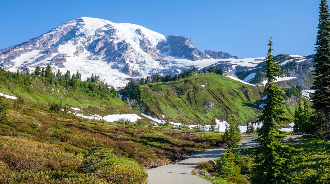
Eunice Lake to Tolmie Peak Lookout
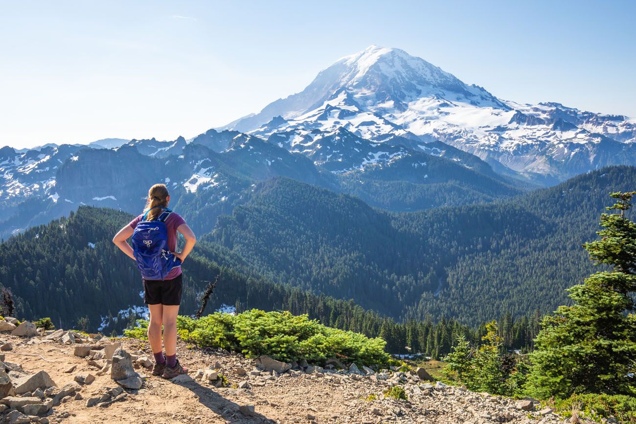
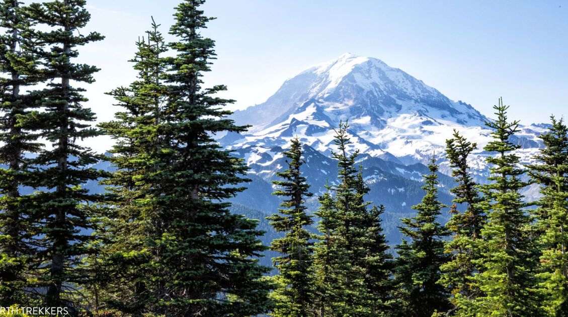
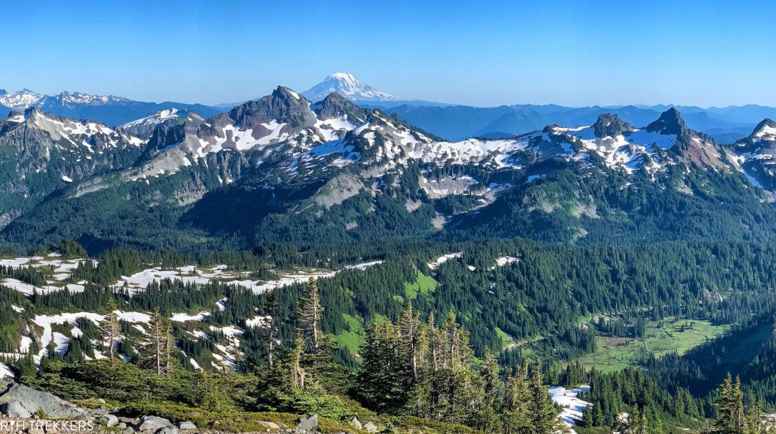
The final climb is the hardest of the hike but it’s worth it. Through the clearings in the trees, make sure you look out to Mt. Rainier. It is an awesome view.
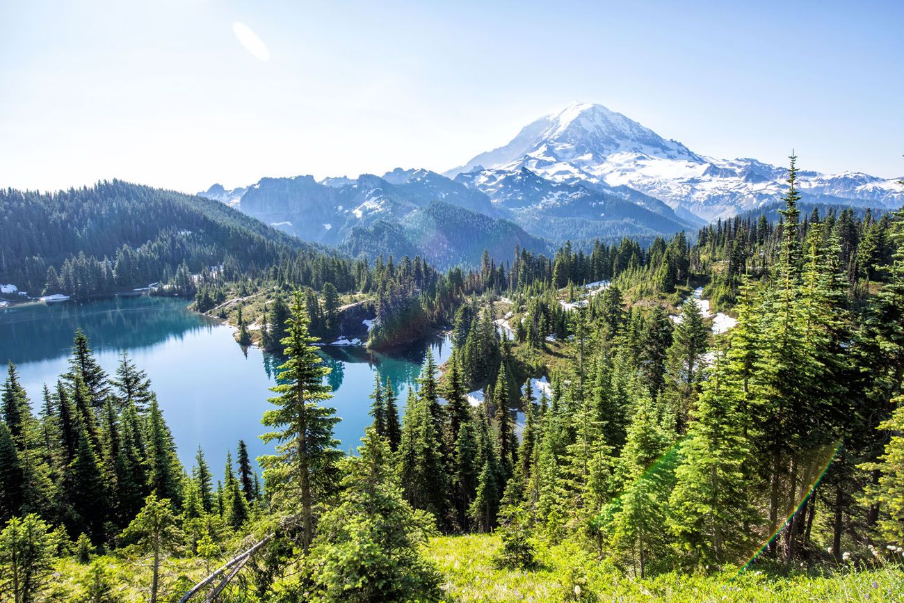
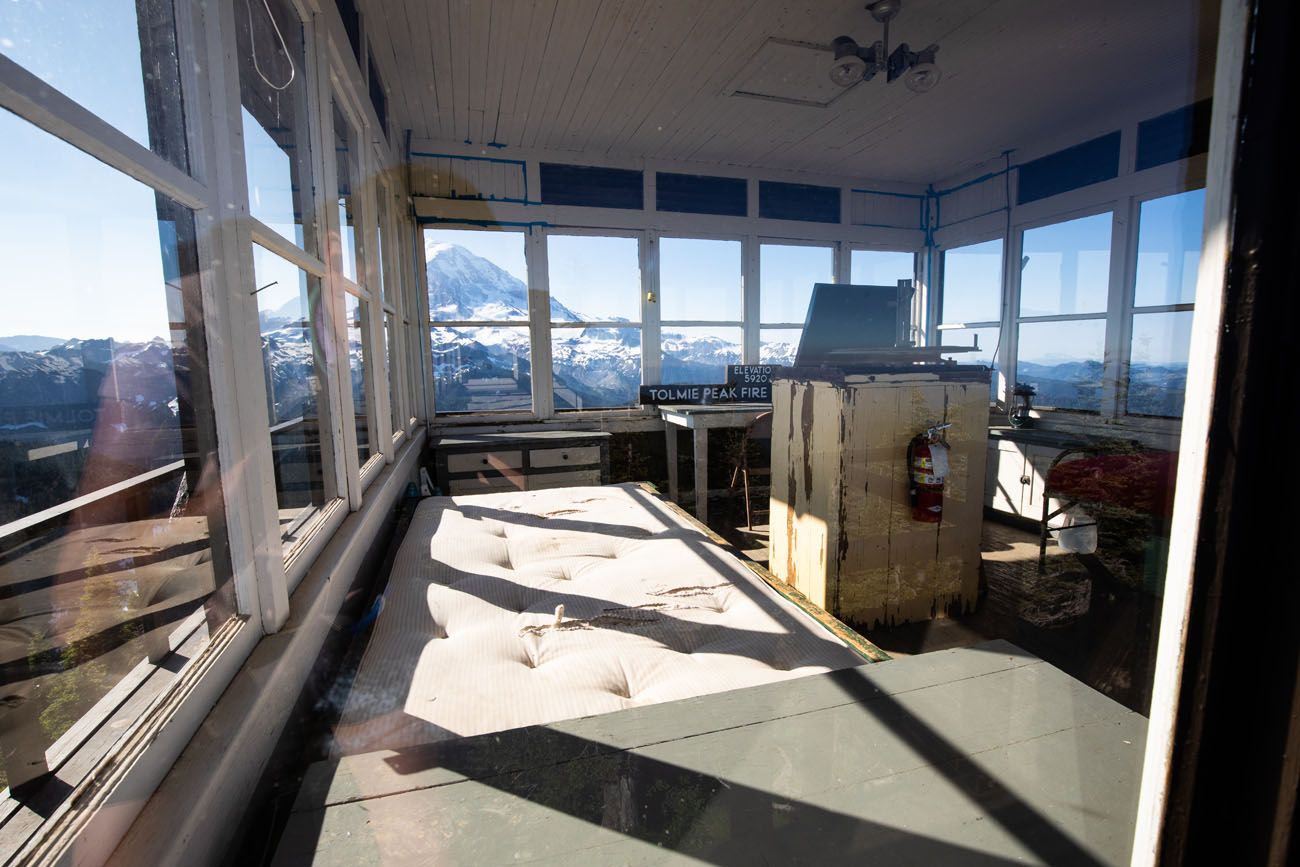
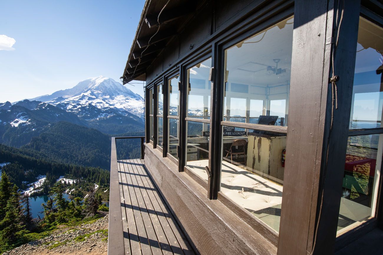
After almost 3 miles of hiking and a long, steady uphill climb, you arrive at Tolmie Peak fire lookout tower and its spectacular view of Mt. Rainier. You can climb the lookout, peer inside of the building (it is now a historical landmark), and enjoy those amazing views you worked so hard for.
If you want to keep going, you can follow the trail to the northeast, for about a half mile, to reach Tolmie Peak.

Tips to Have the Best Experience
Get updates on the road status and trail closures on the official National Park Service website before you go.
Leave no trace. When you are in the park, practice the seven principles of Leave No Trace. This includes packing out what you bring into the park, be considerate of other hikers, stay on the trail, and do not remove anything from the park.
The meadows around Eunice Lake are fragile and easily damaged. Stay on the trails to avoid further damage to the fragile plant life.
Do not expect your cell phone to work. We had zero cellular service on this hike, with the exception of a weak signal on Tolmie Peak. There is also no cellular service once you get past Carbondale, which means you won’t get reception for most of the drive to the Tolmie Peak trailhead. Don’t depend on your phone to call for help, talk to friends, or to send photos to friends and family.
What to Bring on the Hike
Hiking shoes. We recommend hiking shoes. When we did this hike in July, we hiked through patches of snow and large sections of muddy trail. You can get by with a sturdy pair of walking shoes, but I would leave the Converse sneakers and flip flops at home.
Water and snacks. At least 1.5 liters of water in the summer.
Sunscreen, hat, and sunglasses. Once you reach Eunice Lake there is very little shade on the trail.
Camera. Even a smartphone will do.
Essential Hiking Gear: What Should You Bring on a Day Hike?
If you are new to hiking or are curious about what you should bring on a hike, check out our Hiking Gear Guide. Find out what we carry in our day packs and what we wear on the trails.If you have any questions about hiking to Tolmie Peak, let us know in the comment section below.
Explore More of Washington
If this is part of a bigger road trip through the USA, visit our United States Travel Guide and our Washington Travel Guide for more inspiration and travel planning tips.
15 Best Hikes in Mount Rainier (Ranked by Difficulty & Area)
Mount Rainier is one of the most spectacular hiking destinations in the United States. From wildflower-covered alpine meadows to glacier viewpoints and fire lookout summits, the variety here is incredible. We’ve hiked in more than 50 U.S. national parks and on trails around the world, from Everest Base Camp in Nepal to the Dolomites, and […]
Summerland Trail to Panhandle Gap Hike | Mount Rainier National Park
The Summerland Trail to Panhandle Gap is a strenuous 12-mile adventure into the quieter side of Mount Rainier National Park. With panoramic views of Mount Rainier and fewer hikers than Paradise or Sunrise, it’s ideal for those craving a bigger, more rugged day on the trail. Hiking the Summerland Trail to Panhandle Gap is one […]
Skyline Trail Loop: A Step-by-Step Guide to Rainier’s Most Iconic Views
The Skyline Trail Loop is the most iconic hike in Mount Rainier National Park, and we’ve hiked it twice in both directions to figure out exactly which way is better. Here’s everything you need to know, from snow crossings and trail conditions to the best direction for views of Mount Rainier. For jaw-dropping alpine scenery, […]
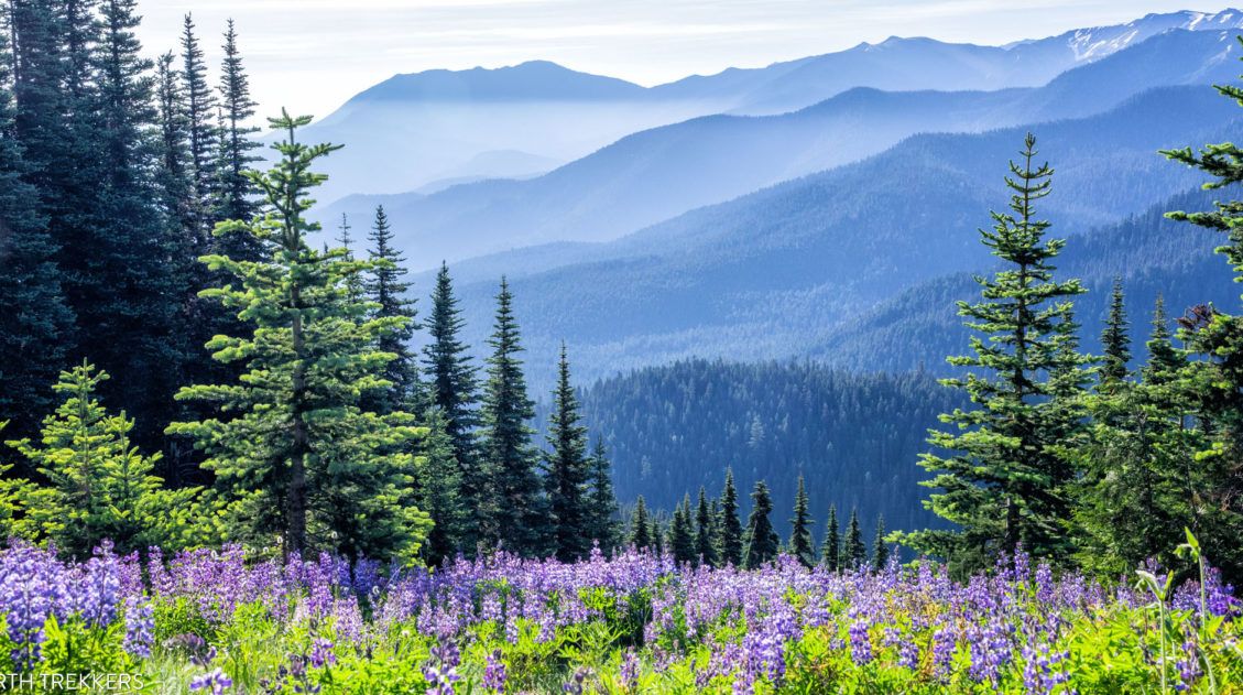
The Perfect Mount Rainier National Park Itinerary (2 to 6 Days)
Planning a trip to Mount Rainier National Park and not sure how to structure your time? We’ve got you covered, and we’re speaking from experience. We’ve visited Mount Rainier twice: once on a six-day trip where we hiked extensively through every corner of the park, from Paradise and Sunrise to the quieter trails of the […]
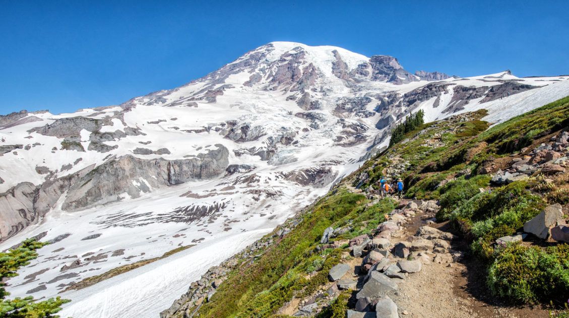
Mount Rainier National Park Travel Guide: How to Plan Your Visit
Mount Rainier National Park Mount Rainier National Park is an outstanding park to visit, whether you are an avid hiker, a family on a road trip through the USA, or someone who simply enjoys exploring the natural wonders of this beautiful country. Mount Rainier is a glacier-capped, active volcano that can be seen for hundreds […]
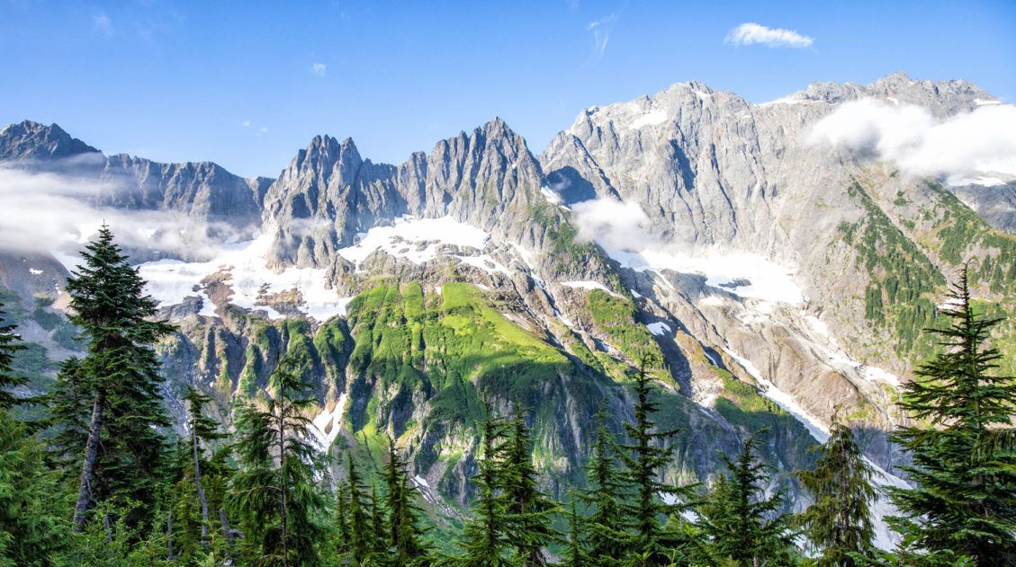
12 Great Hikes in North Cascades National Park
North Cascades National Park is not a place that easily reveals itself. Sure, the drive along Highway 20 is lovely. And the viewpoints over the lakes and mountain passes are gorgeous. But, to really see this park, you are going to have to invest some time on the hiking trails. If you only saw the […]
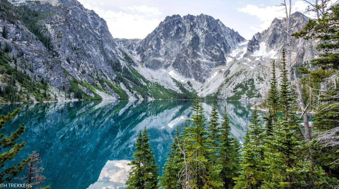
The Enchantments Thru Hike: Complete Planning Guide
The Enchantments are a slice of hiking paradise. Located in the Alpine Lakes Wilderness of Washington state, this is a wonderland of alpine lakes, jagged mountains, and waterfalls. If you’ve done any research on the Enchantments, you already know it’s one of the best day hikes in the United States. What you might not know yet is […]
20 Epic Hikes in the US National Parks
With 63 national parks and thousands of miles of hiking trails, your options are endless for exploring the American national parks. We narrowed down the list for you to 20 of the best hikes in the US national parks, 20 amazing ways to explore this beautiful country. Hike to the tallest peaks, through massive canyons, […]
Best Things to Do in Olympic National Park
Olympic National Park, with its mountain ranges, temperate rainforests, and rugged coastline, is one of the most diverse national parks in the United States. In this post, we share with you interesting facts, important planning tips, and the best things to do in Olympic National Park. Interesting Facts about Olympic National Park Olympic National Park […]
The Ultimate Guide to the 63 US National Parks
Stretching from the South Pacific, across the United States to the Caribbean, are 63 national parks. These national treasures preserve iconic landscapes, majestic mountains, primordial forests, arid deserts, misty coastlines, immense canyons, wildlife, and historic landmarks. The opportunities for adventure are endless. Hiking, rock climbing, rafting, mountain biking, sand boarding, horseback riding, mountaineering, canyoneering, and […]
Washington Road Trip Itinerary: Olympic, Rainier & North Cascades (7–14 Days)
Washington state is one of the great road trip destinations in the United States, and this itinerary is the one we wish we’d had before our own trip. We spent several weeks exploring Washington’s three national parks—Olympic, Mount Rainier, and North Cascades—as well as Leavenworth, Lake Chelan, and the Enchantments. We then combined our top […]
Silver Falls Loop Trail: An Underrated Hike in Mount Rainier
If you’re looking for a hike that quietly exceeds expectations, the Silver Falls Loop Trail is it. We hiked the Silver Falls Loop on our first trip to Mount Rainier at the end of July. The trail was wonderfully quiet even during peak summer; the old-growth forest along the Ohanapecosh River was stunning, and Silver […]
Best US National Parks to Visit Month-By-Month
Best National Parks to Visit Month-By-Month When planning a trip to the national parks, one of the most important things to consider is the time of year that you are planning your visit. With a few exceptions, most national parks have an optimal time to visit, based on factors such as weather, crowd levels, and […]

Comments 8