
Tucked away from the park’s busier viewpoints, the Fairyland Loop offers jaw-dropping vistas, towering hoodoos, and a sense of solitude that’s hard to find on more popular routes. It’s a tough hike, but the reward is a scenic walk through one of the most beautiful landscapes in the American Southwest.
The Fairyland Loop is often overlooked by many visitors to Bryce Canyon, and we are no different. On our first visit to Bryce Canyon, we did the uber popular Queen’s Garden and Navajo Loop Trail and visited the many stunning viewpoints along the rim. It was an awesome day and one of our favorites on all of our trips to Utah. But it wasn’t until our second visit that we hiked both the Fairyland Loop and the Peekaboo Loop, and wow, both are amazing!!
The Fairyland Loop is an underrated gem in Bryce Canyon. Many people skip it, as it is a long hike with some challenging climbs, but that does help keep crowds low. When we did this, we saw just a few other hikers on the trail. And the views…incredible!
In this guide, I’ll fill you in on the details of the hike: stats, which direction to go, and what to expect along the way. We’ll also provide our opinion of which one is better, Fairyland Loop or Peekaboo Loop, should you only have time for one of them.
Fairyland Loop Trail Stats
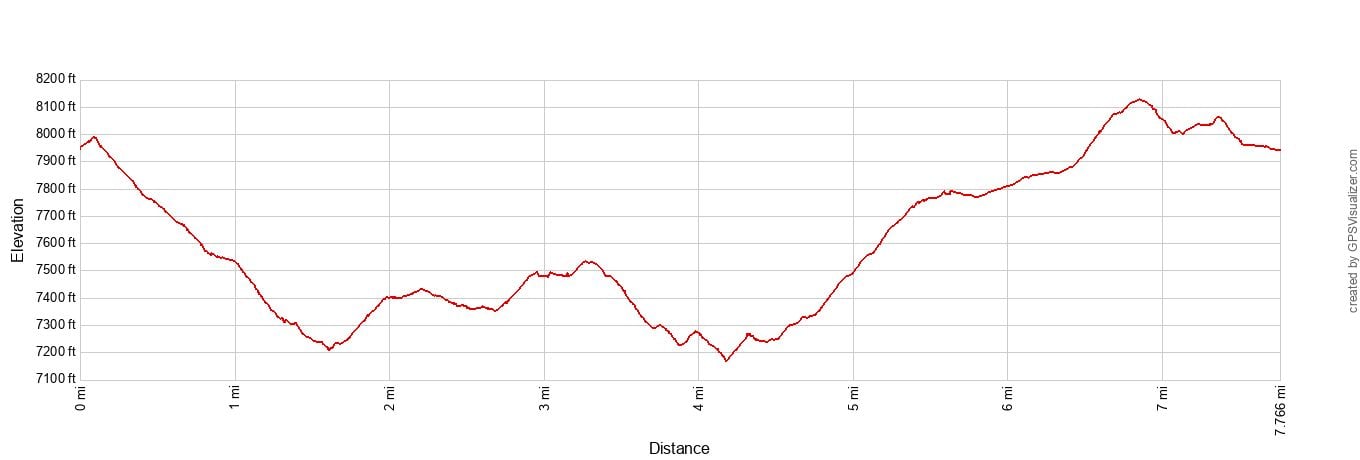
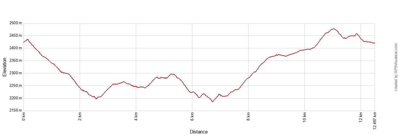
These stats and the elevation profile below are for the hike starting near Sunrise Point and the North Campground General Store and going in a counterclockwise direction.
These stats also include the short detour to the Tower Bridge viewpoint.
Distance: 7.8 miles (12.5 km)
Difficulty: Moderate to Strenuous
Total Ascent: 1,650 feet (503 meters)
Highest Elevation: 8,127 feet (2,477 meters)
Lowest Elevation: 7,168 feet (2,185 meters)
Time: 3 to 5 hours (our time was 3 hours)
How to Use This Map: Click the icons on the map to get more information about each point of interest. To take this map with you, click the star next to the title of the map which adds it to your Google account. Next, within your Google Maps app, select ‘Saved’ and then select ‘Maps’. This map title will now appear in your list.
Which Direction Should You Go?
Since this hike makes a loop, you can do it in either direction. Where you park can also have an impact on the overall experience.
There are two parking lots and starting points for the Fairyland Loop:
- The North Campground General Store
- Fairyland Point
We parked at the North Campground General Store, picking this location since it is a relatively large parking lot (we started this hike at 2 pm). Plus, you can buy snacks, water, and sandwiches to bring with you or to fuel up before or after the hike.
By starting near Sunrise Point and going counterclockwise, the hike starts with steep descent, has a few ups and downs in the middle, and towards the end comes a long uphill walk. The final 2 miles is along the Rim Trail, which at times isn’t all that interesting, especially after the views you had earlier on the hike.
If you choose to go clockwise and start and end at Sunrise Point, you’ll hike the somewhat unexciting rim trail first and have awesome views of the hoodoos for the remaining 6 miles of the hike, but end with a massive, steep hike up out of the amphitheater.
Fairyland Point is a much smaller parking lot, so if you arrive late, you risk not getting a parking space. However, I think the ideal route would be to park here and hike the Fairyland Loop in a counterclockwise direction. You will do the Rim Trail first, then get the best views for the rest of the hike. There will still be a climb up out of the amphitheater, just not quite as steep and strenuous as the clockwise direction.
Step-By-Step Trail Guide
This route is for hiking the Fairyland Loop in a counterclockwise direction, starting and ending near Sunrise Point.
We started this hike at 2 pm in mid-May, which was a gorgeous time to take photos of this trail (the high temperature when we did this was 72°F). In the summer months, when temperatures are warmer, it is better to start this hike earlier in the day, to avoid the hottest temperatures. It’s also good to know that there is very little shade on this trail.
First Descent to Tower Bridge
Distance: 1.7 miles, 40 to 50 minutes
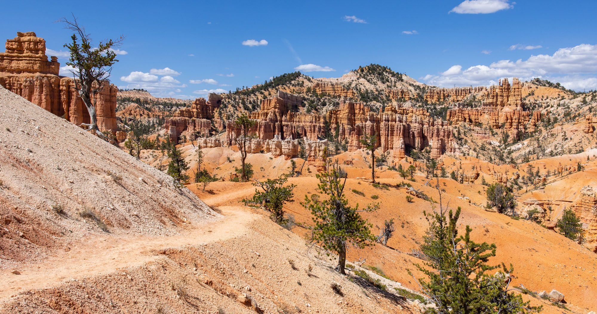
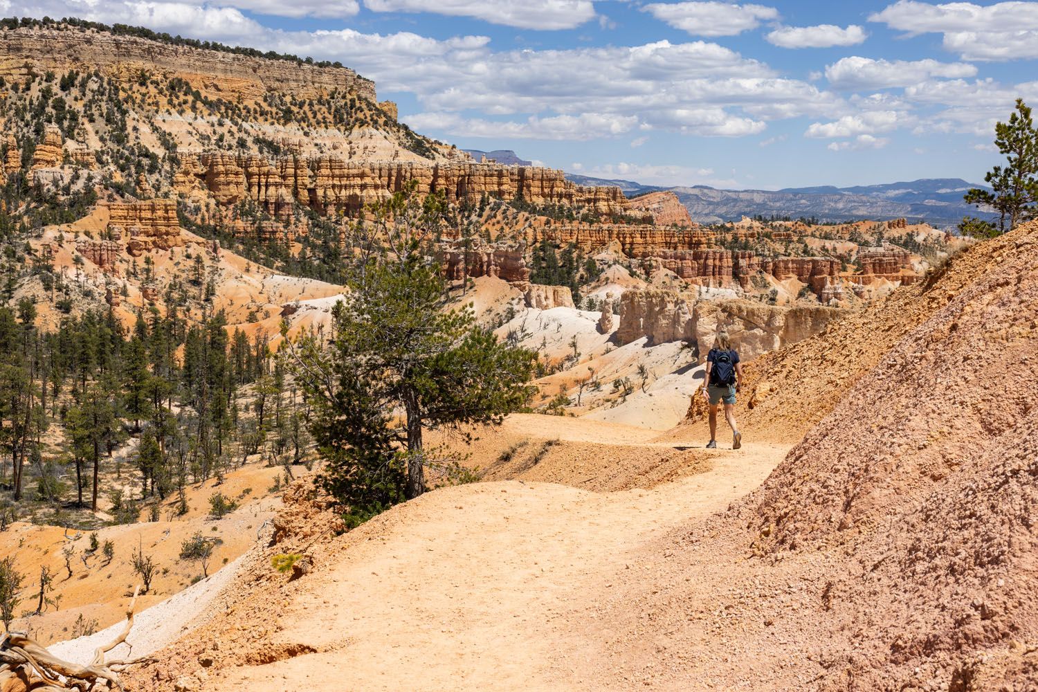
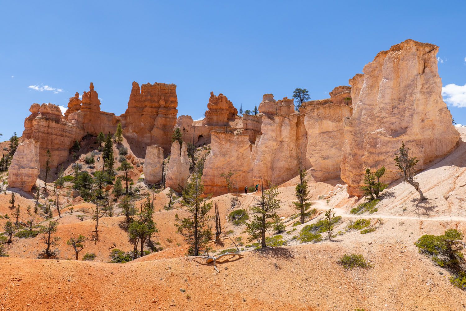
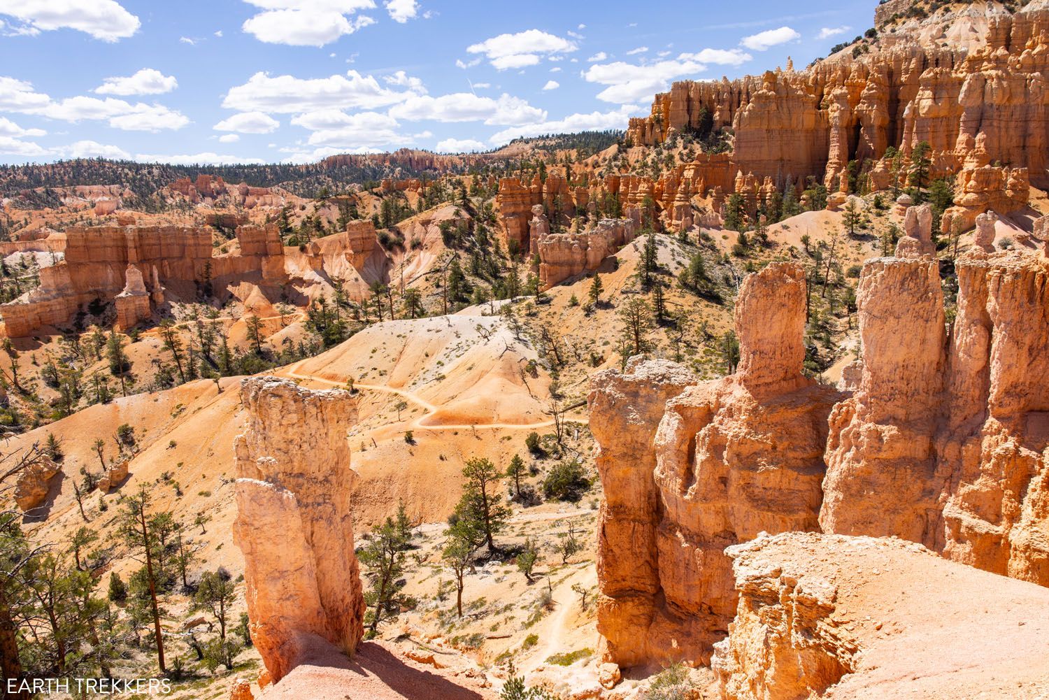
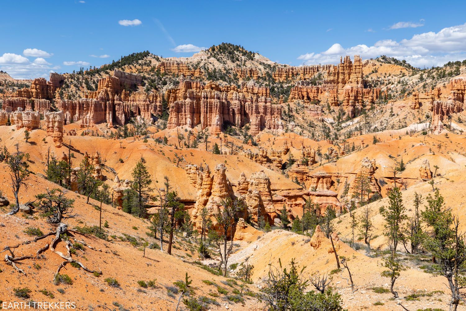
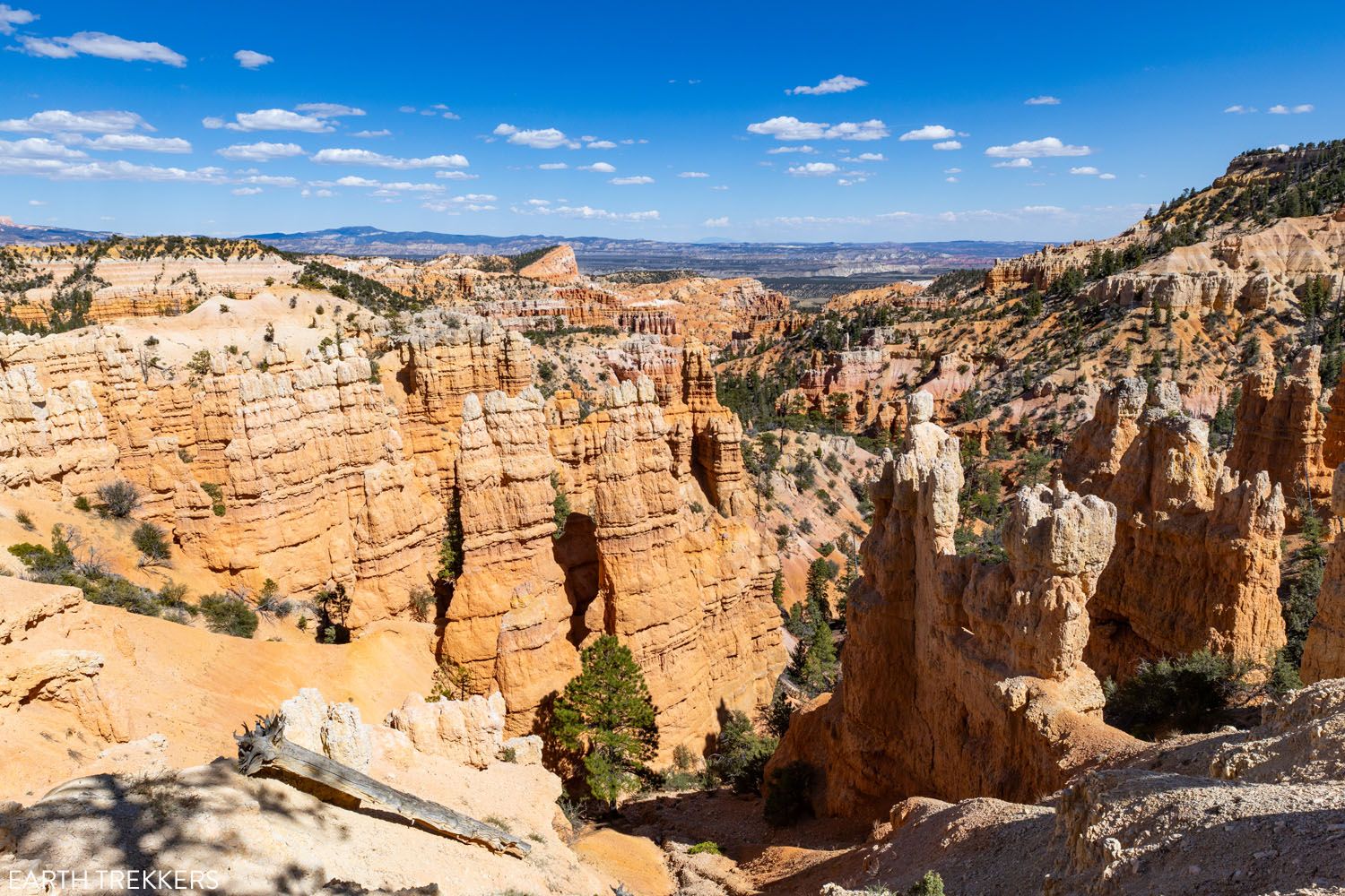
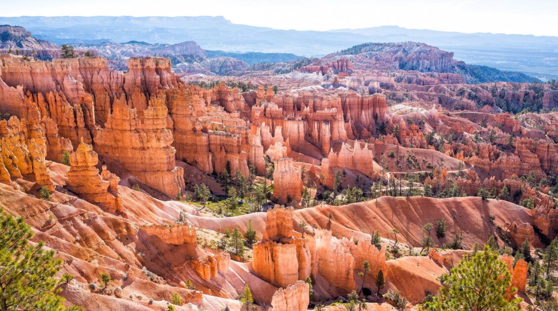
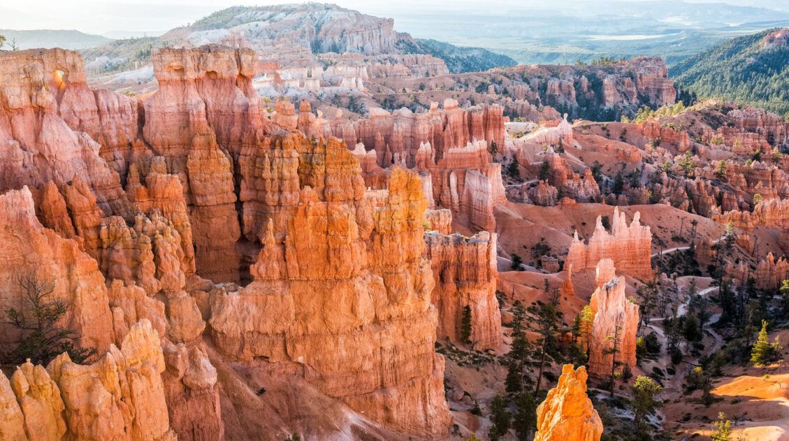
The trail starts off with a long, steep descent down into the amphitheater. The views of the thousands of orange- and coral-colored hoodoos are incredible along every step of this trail. The farther you descend into the amphitheater, the better the views.
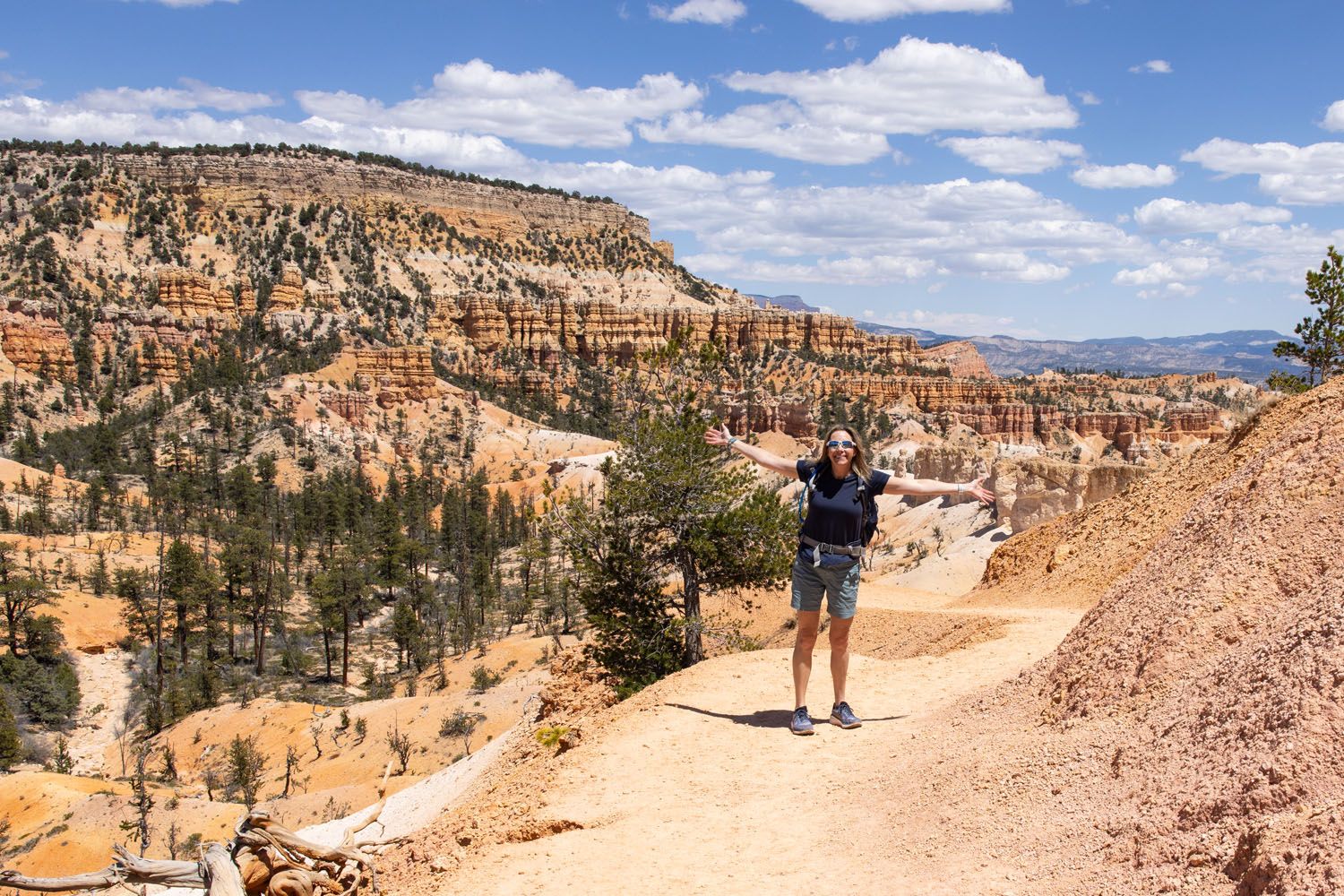
We saw a fair number of hikers on this part of the trail. Hiking out to Tower Bridge is a popular thing to do in Bryce Canyon, so this is the most heavily trafficked section of the Fairyland Loop. Judging by the body language and slow, shuffling steps of some hikers, the hike up this trail to the rim looks to be very strenuous.
PRO TRAVEL TIP: The Fairyland Loop ranges in elevation from about 7,200 to 8,100 feet, and at that height, the air gets noticeably thinner, making it harder to breathe. While the trail’s elevation gain isn’t extreme, the higher elevation will make this hike feel more challenging, especially for those coming from a lower elevation.
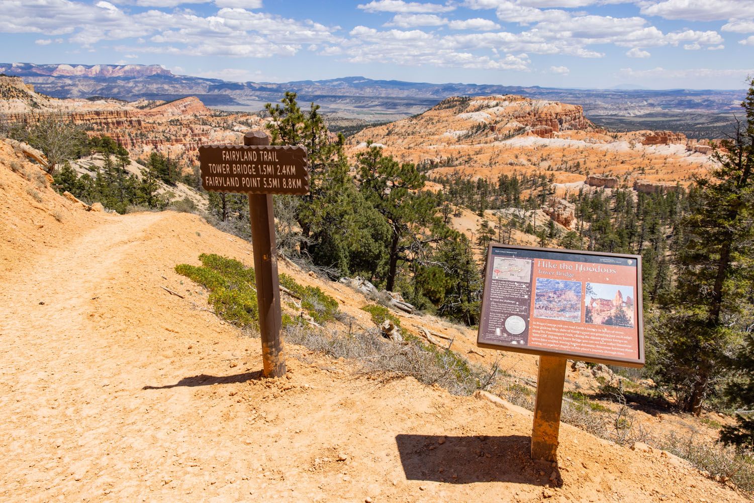
At the bottom of the first big descent, about 1.5 miles into the hike, comes the detour to Tower Bridge. This short spur trail leads to a view of Tower Bridge, a rock formation that resembles Tower Bridge in London, with a little imagination.
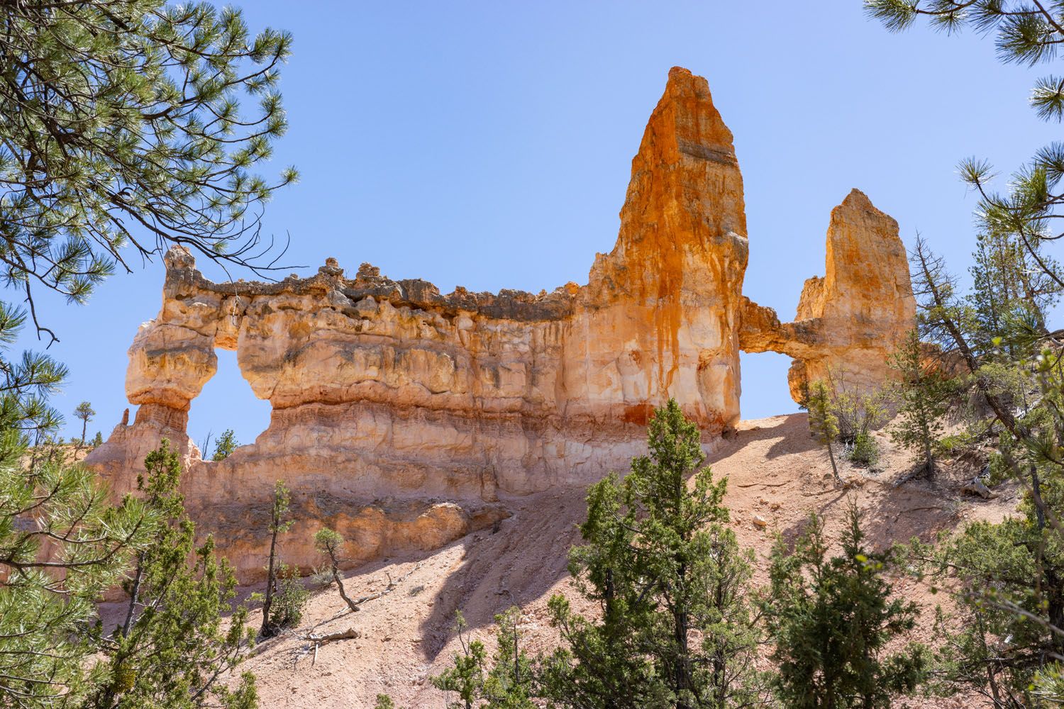
We didn’t think this was worth the detour, as you can still see Tower Bridge from the Fairyland Loop Trail, without adding on a little extra mileage. However, this is one of the few shady spots along the trail, and this could be a nice place to take a break before the final big climb, should you be doing this hike in a clockwise direction.
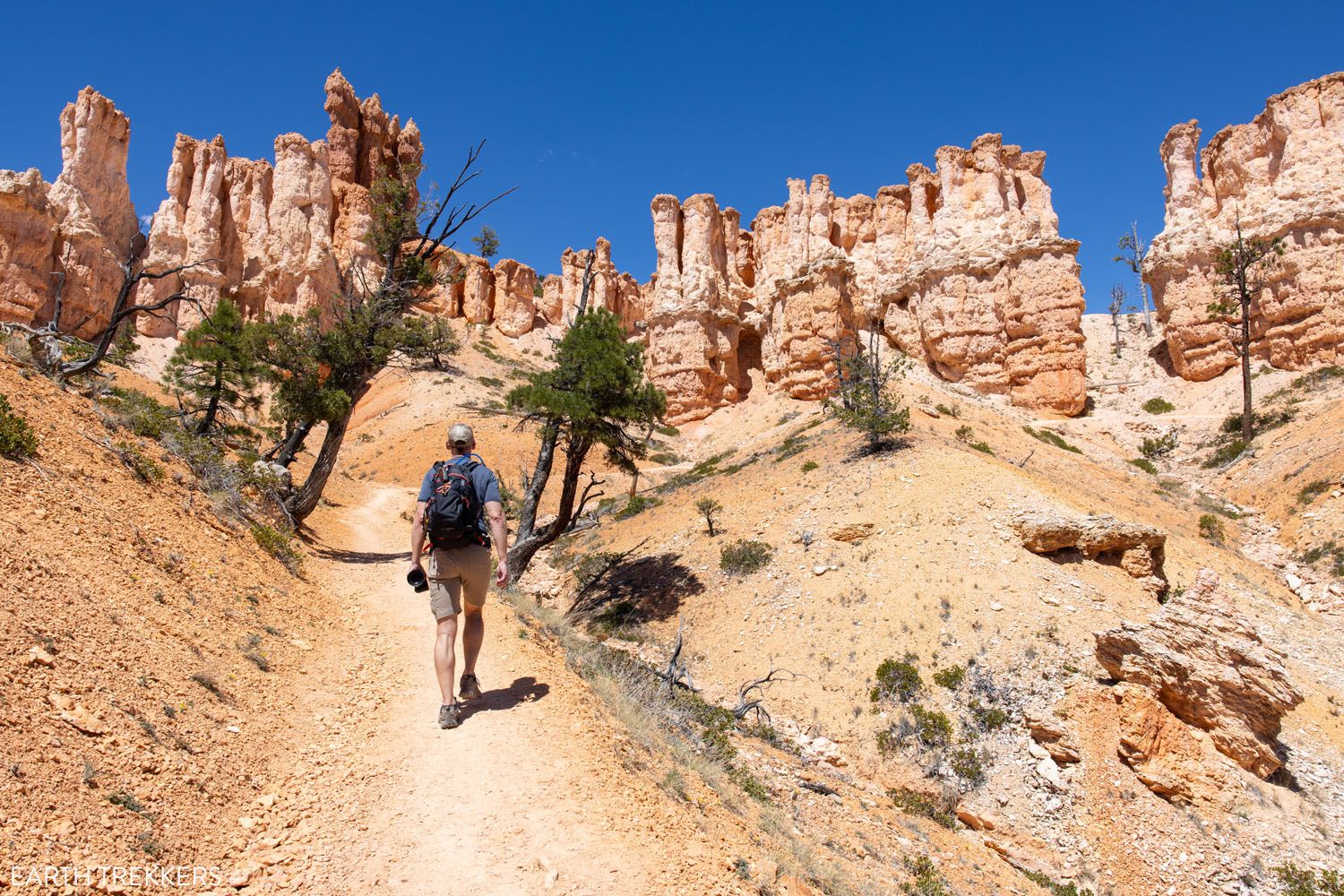
Mid-Section of Fairyland Loop: The Best Part of the Hike
Distance: 3.3 miles (5 miles total), 1 to 2 hours
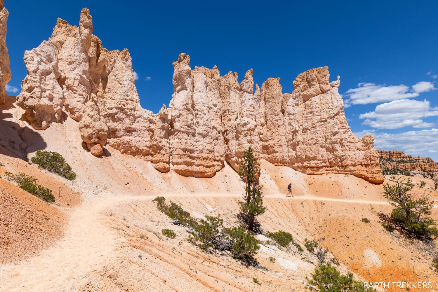
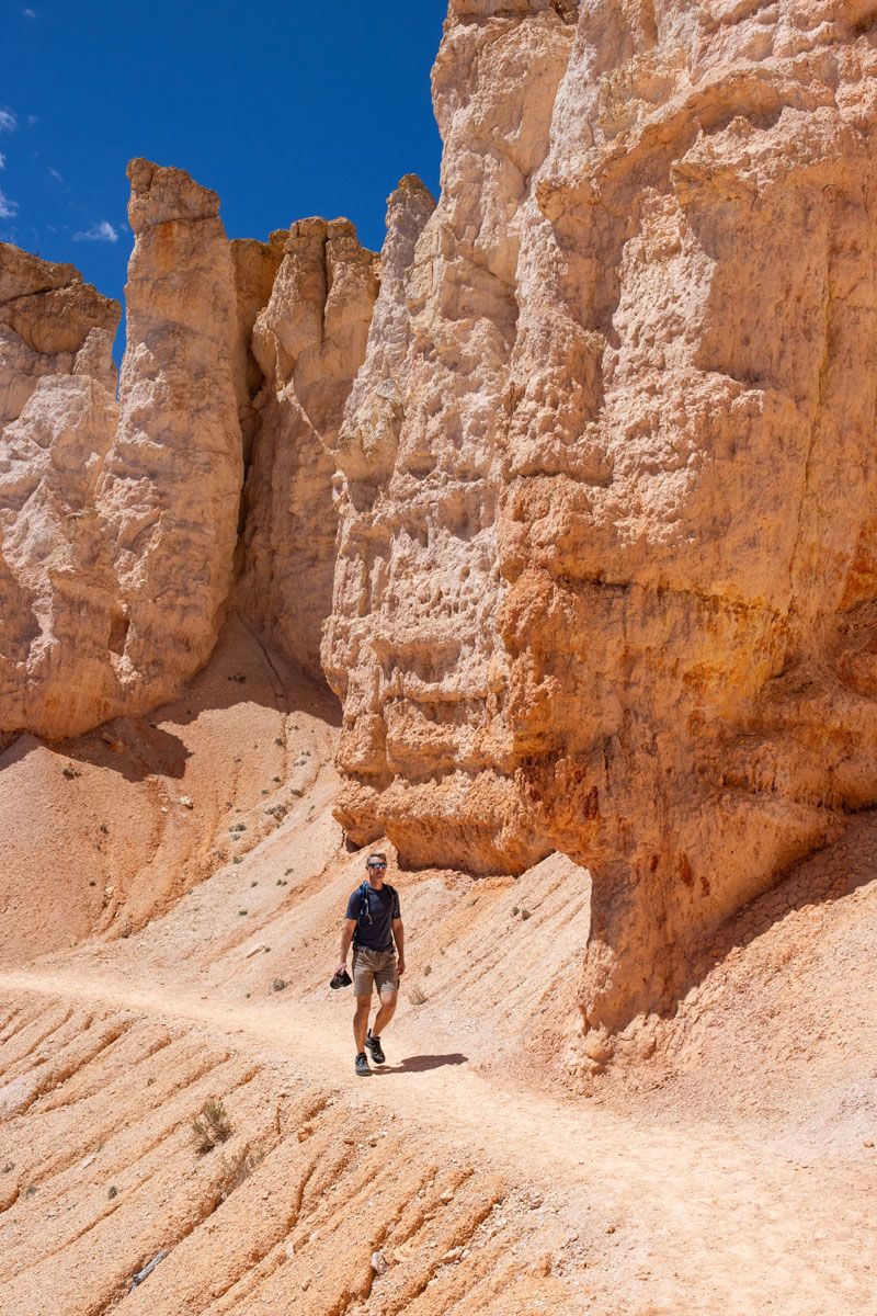
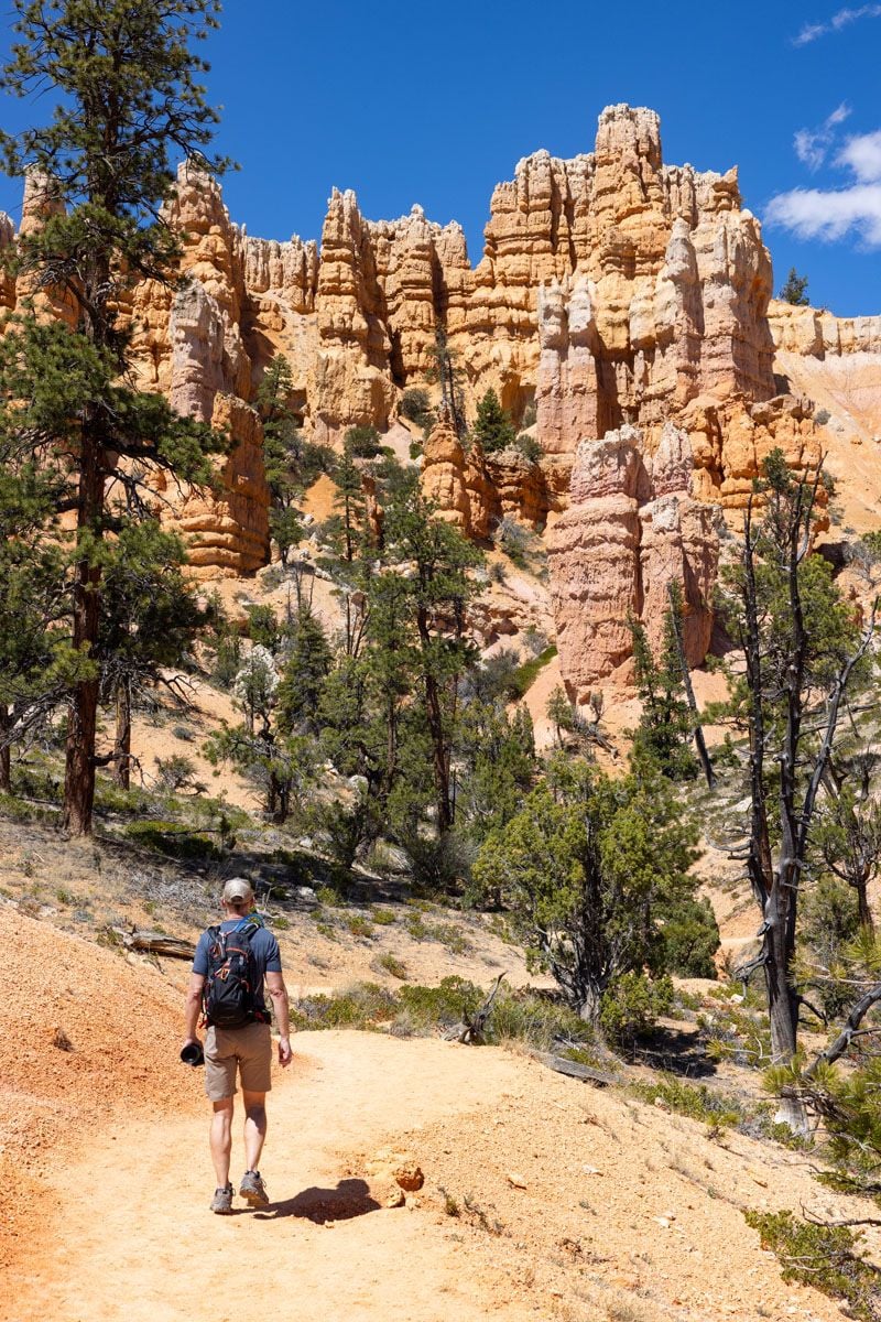
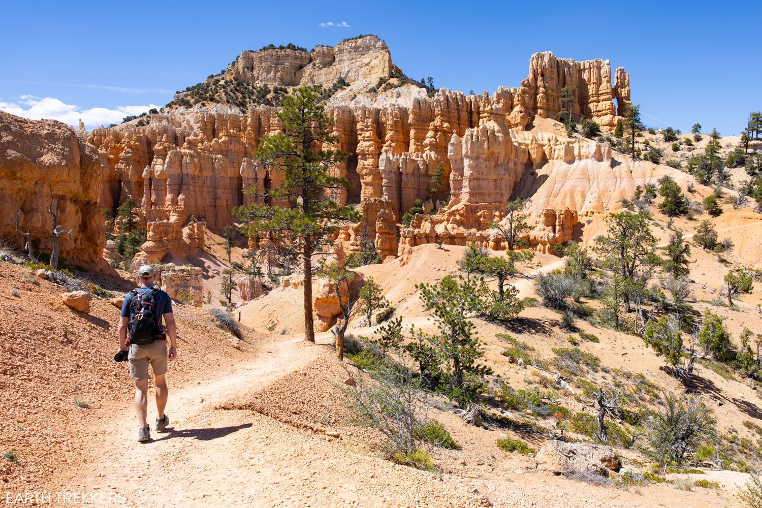
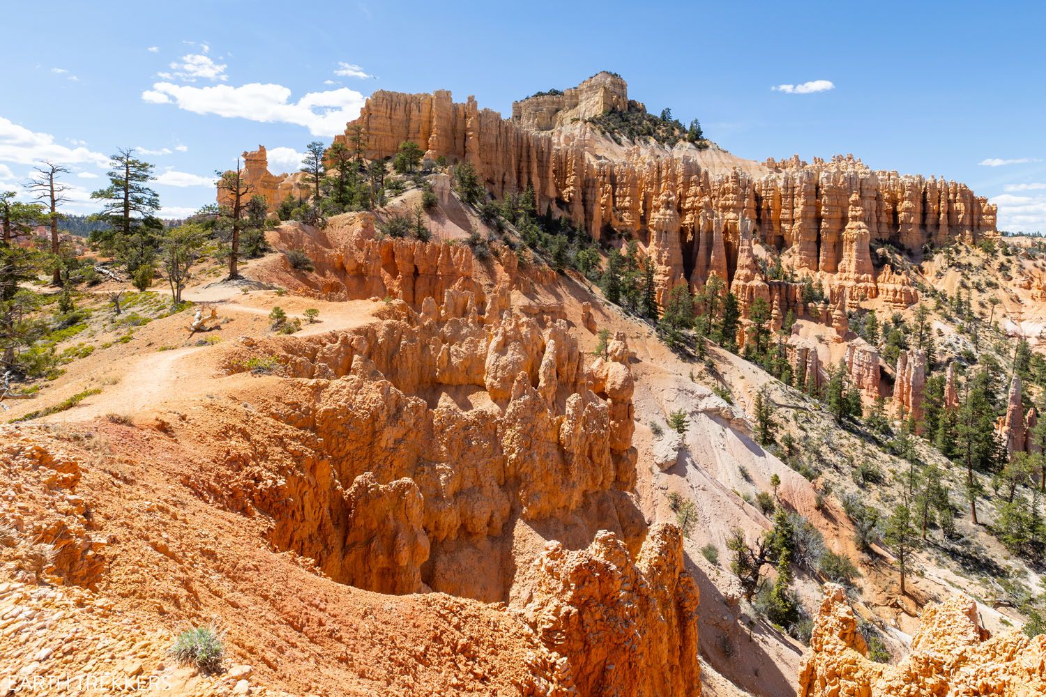
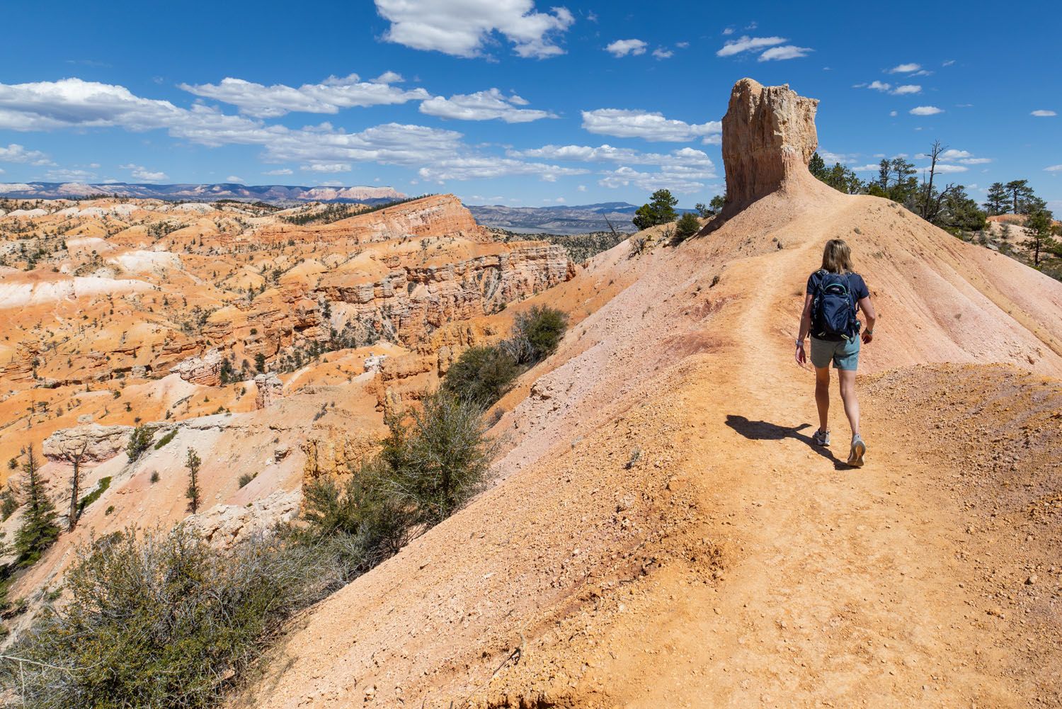
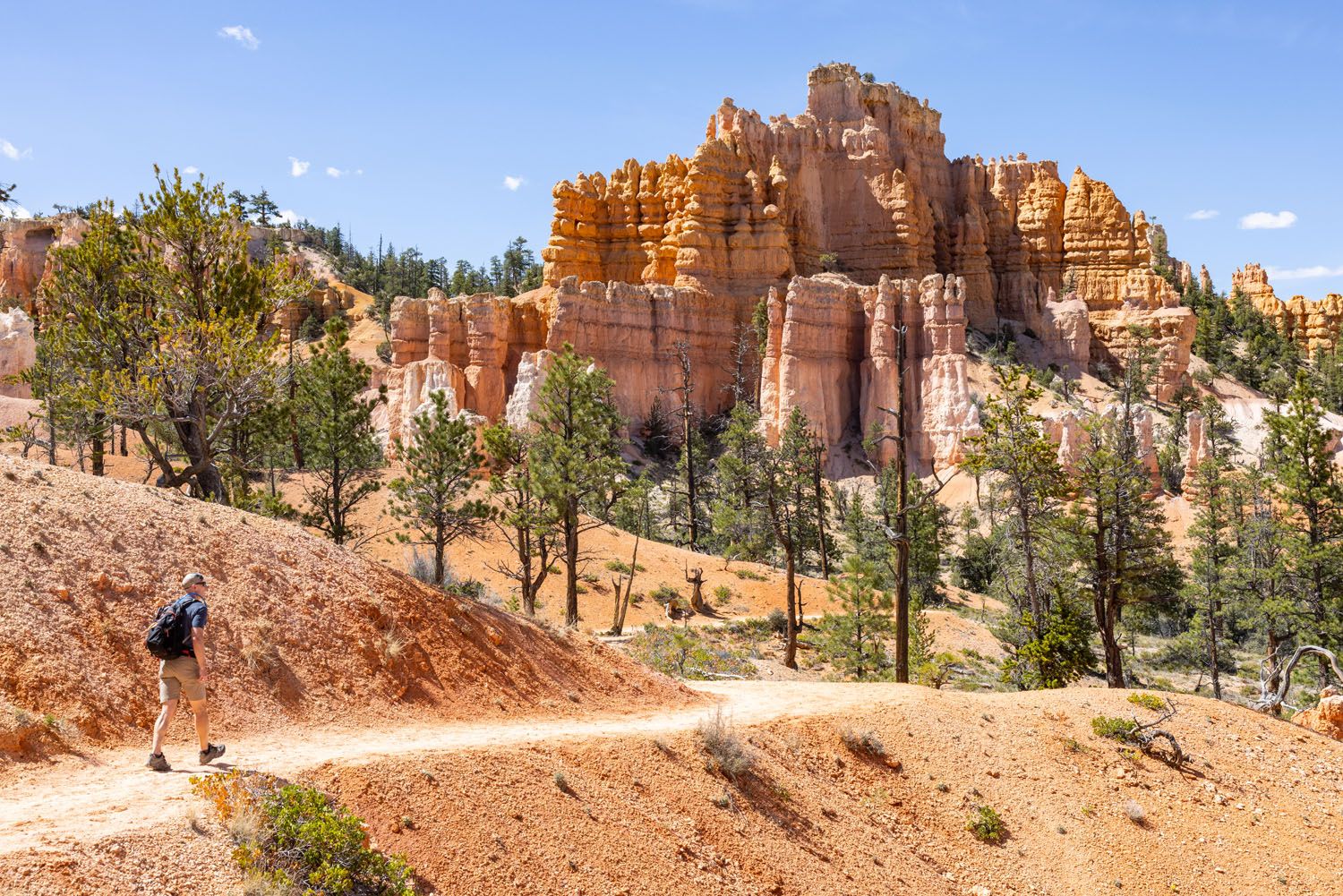
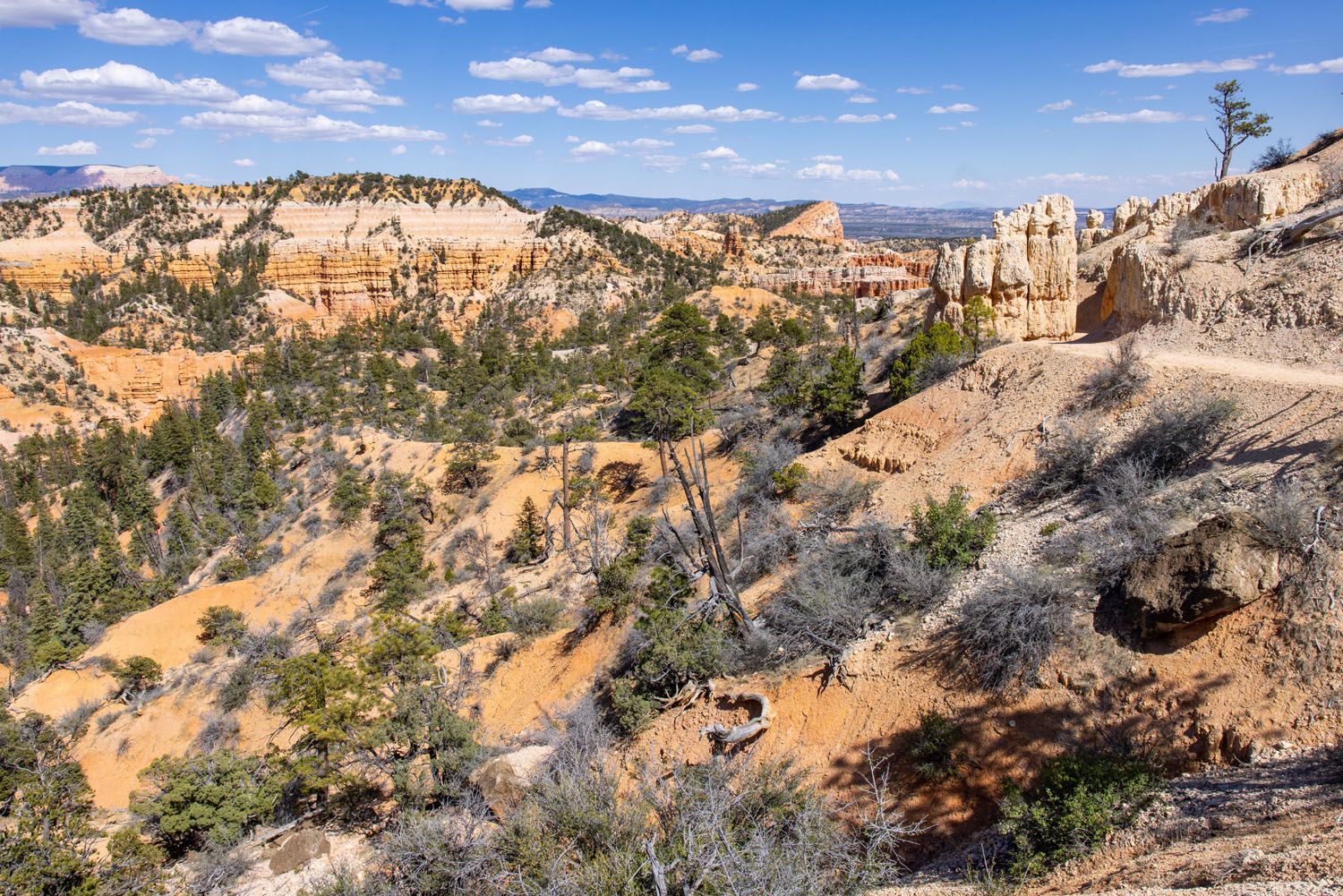
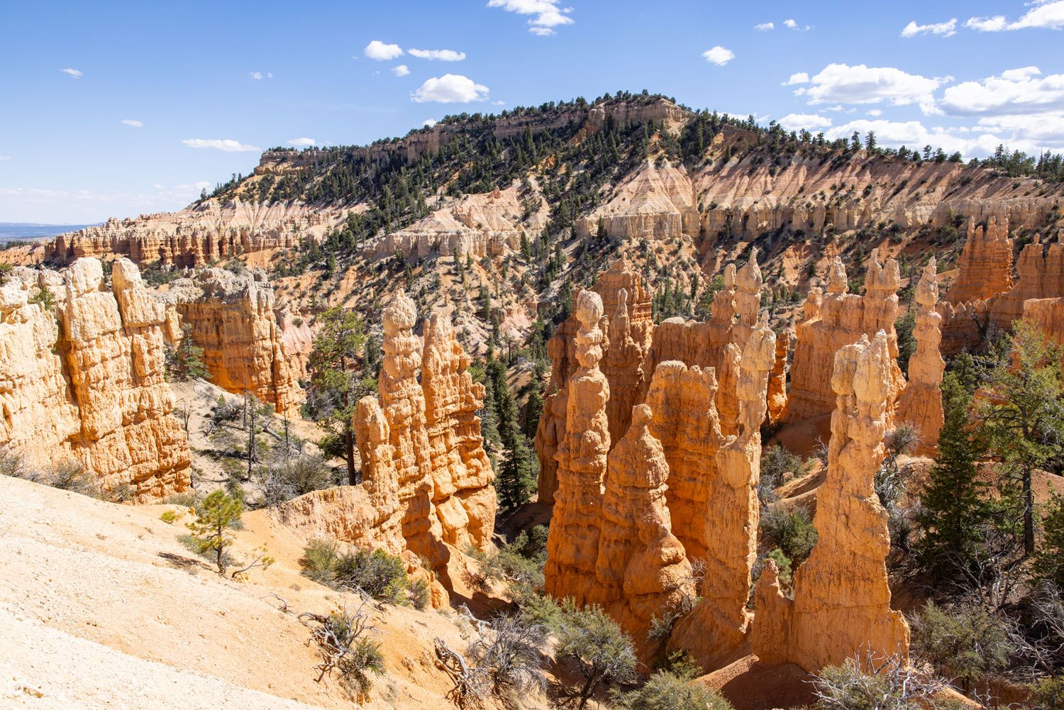
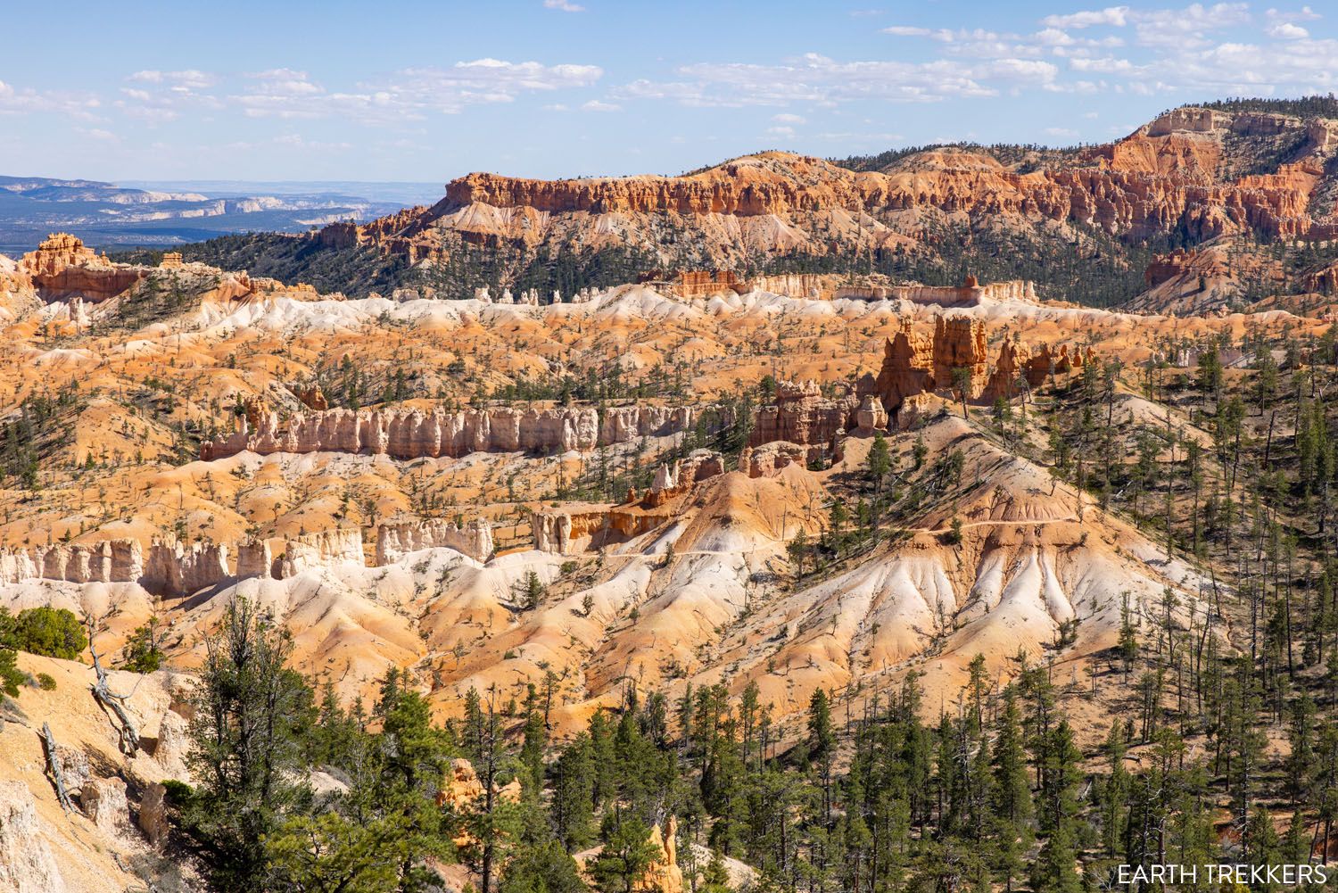
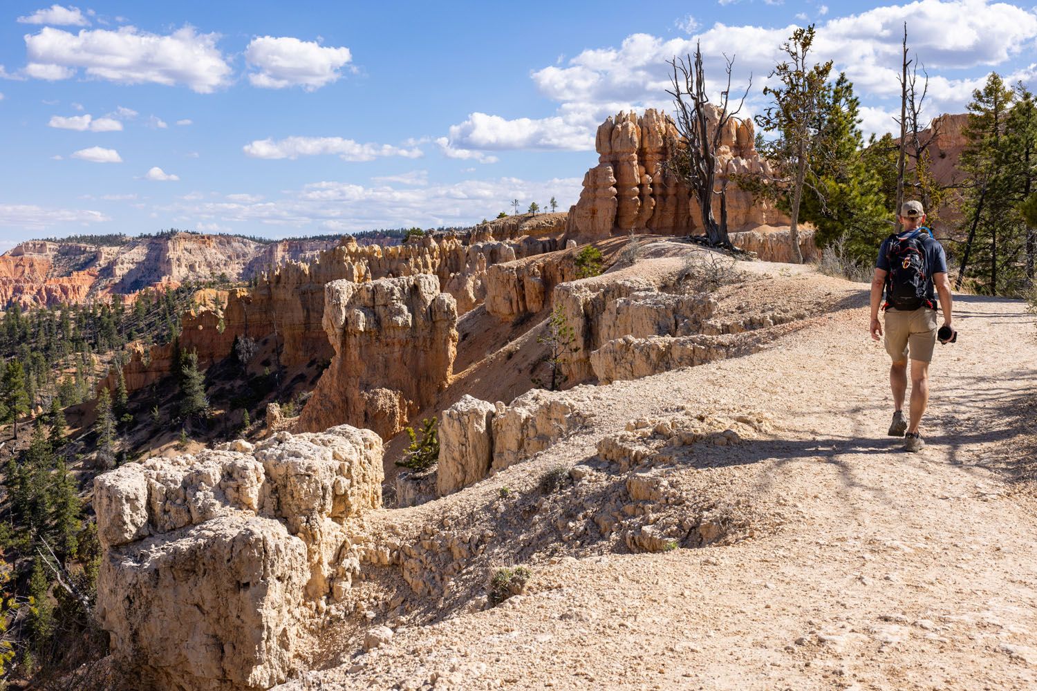
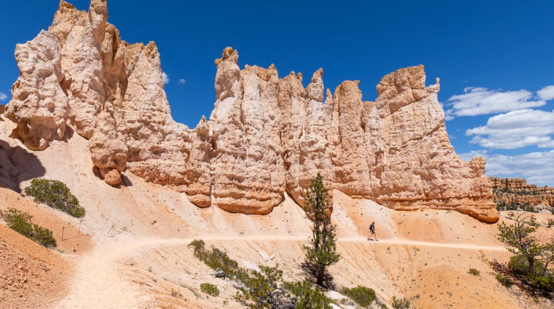
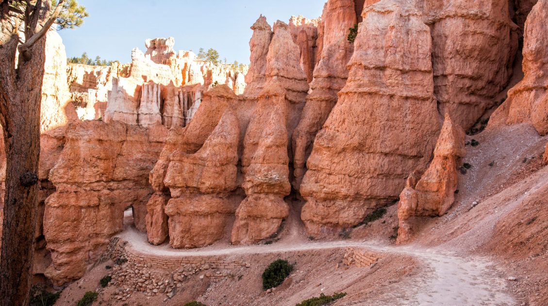
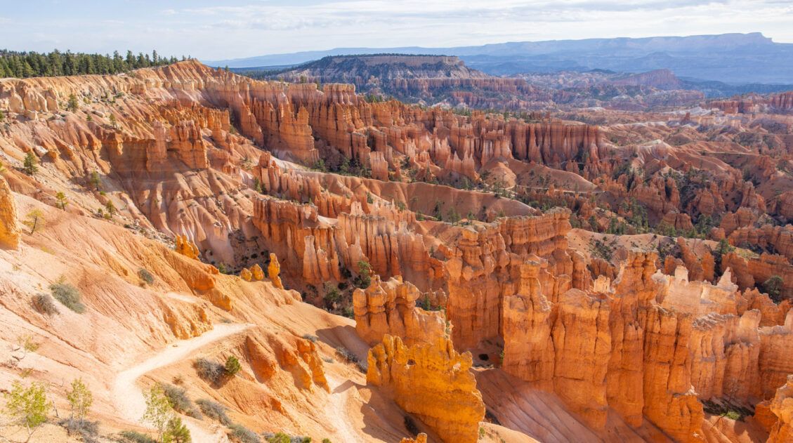
From the Tower Bridge viewpoint to mile 5 of the hike, the trail wanders past clumps of brilliantly colored hoodoos, to overlooks of the amphitheater, and through short, sheltered canyons with a tiny bit of shade.
This is the most beautiful part of the hike, and most likely this is where you will leave the crowds behind. We saw just one other person on this part of the trail, which was amazing, given it was midday in May, one of the busiest months to visit Bryce Canyon.
There are a few ups and downs here, but nothing overly strenuous, which also makes this part of the hike so enjoyable.
Here it is in photos.
The Hike to Fairyland Point
Distance: 0.8 miles (5.8 miles total), 30 minutes
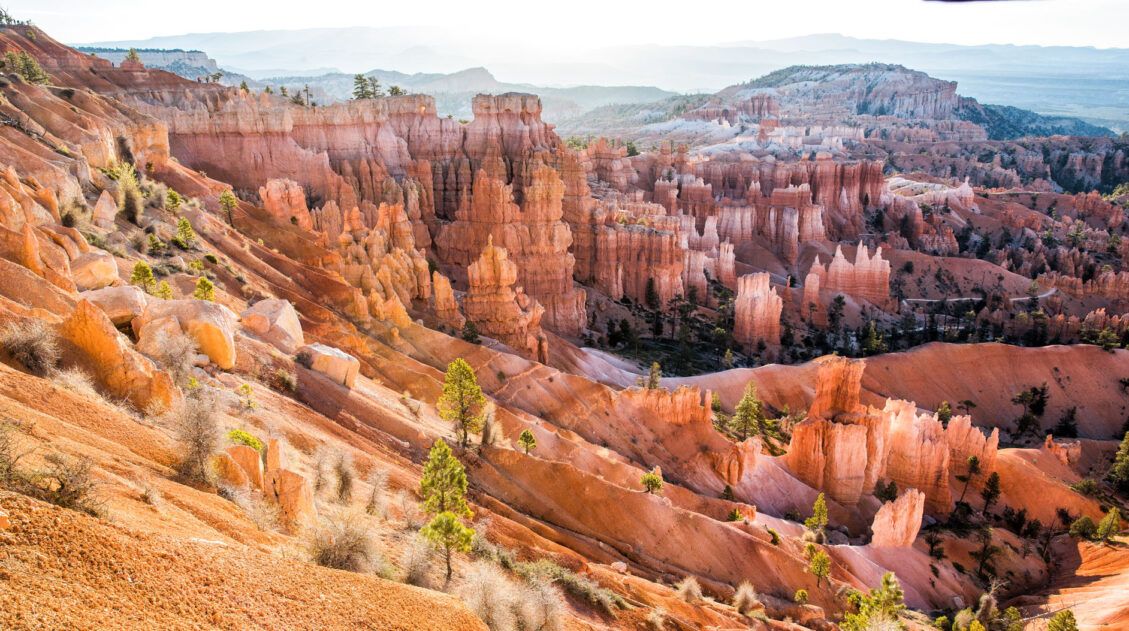
At mile 5, the ascent out of the amphitheater begins. Be mentally prepared for a 0.8 mile hike up to Fairyland Point. This part of the hike can feel tough because of the altitude, but once at Fairyland Point, your reward is another stunning view of Bryce Canyon National Park.
Fairyland Point
Fairyland Point to Sunrise Point
Distance: 2 miles, 45 minutes to 1 hour 15 minutes
The Fairyland Loop ends with a 2-mile hike along the Rim Trail back to Sunrise Point. However, there is still some uphill work to do.
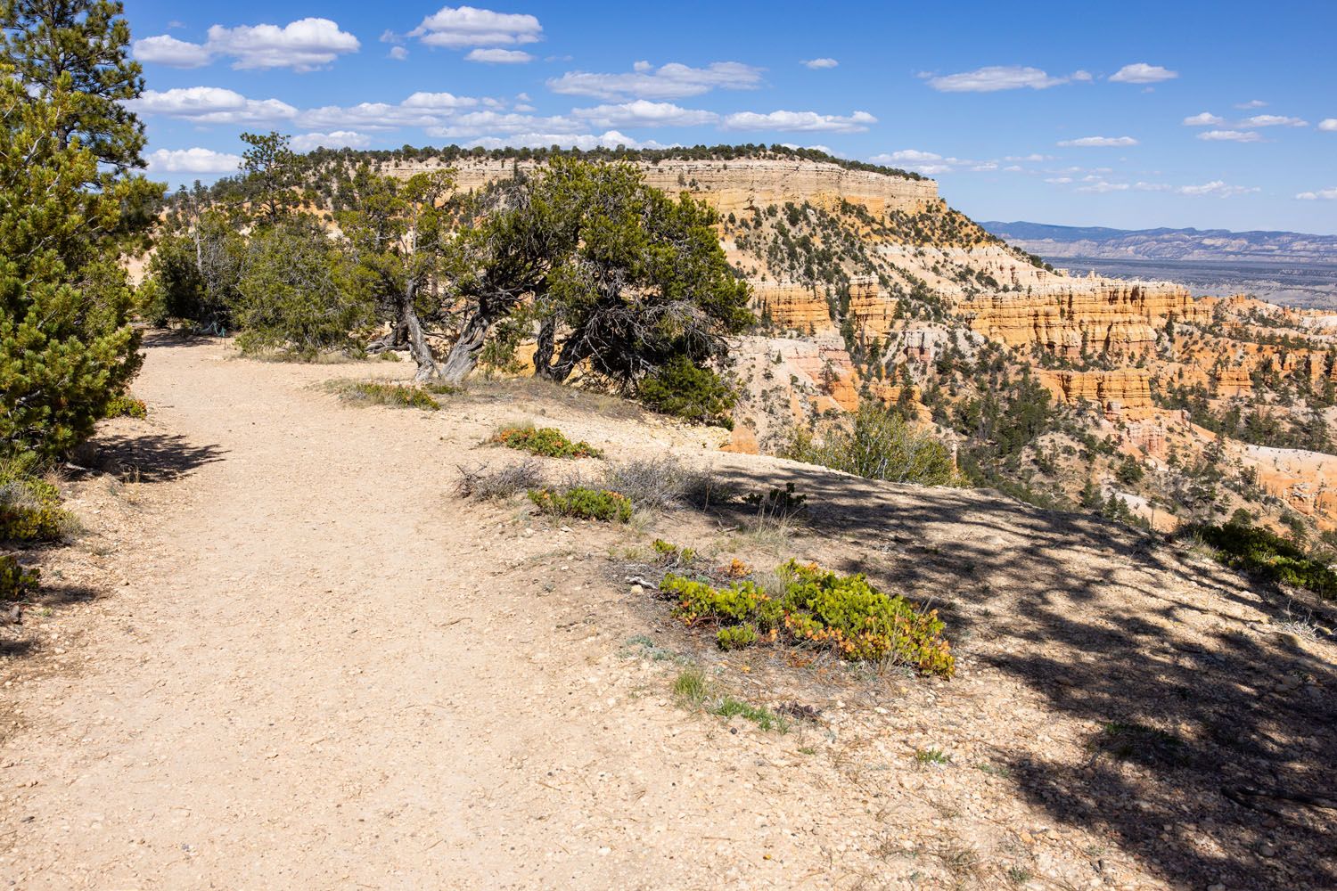
The Rim Trail flattens out for just a little bit, running through a short stretch of Ponderosa forest, before starting another climb. This climb doesn’t last too long, but coming towards the end of the hike, feels worse than it really is. There also isn’t much of a view along this part of the trail.
But once through the final climb, the Rim Trail makes a turn and runs along the top of the amphitheater, providing the classic views of the thousands of hoodoos that Bryce Canyon is famous for.
What to Bring on the Hike
Hiking Shoes. Hiking shoes are ideal, but when the trail is dry, you can do this hike in a sturdy pair of walking or running shoes. I did this hike in running shoes (I was recovering from plantar fasciitis and hiking shoes still bothered my foot). The trail, when it is dry, is compacted dirt. If it’s wet or muddy, wear hiking shoes.
Water and snacks. At least 2 liters of water in the summer.
Sunscreen, hat, and sunglasses. There is very little shade on this trail.
Camera. Even a smartphone will do.
Jacket and Extra Layers of Clothing. Bryce Canyon, since it sits at a high elevation, is cooler than the other national parks in Utah. In the mornings, it can be downright cold. On the day we did this, it was 40°F at sunrise and 72°F midday (mid-May). If you start the hike in the morning, dress warm, but wear layers, so you can shed some clothing as temperatures warm up.

Essential Hiking Gear: What Should You Bring on a Day Hike?
If you are new to hiking or are curious about what you should bring on a hike, check out our Hiking Gear Guide. Find out what we carry in our day packs and what we wear on the trails.Which is Better: Fairyland Loop or Peekaboo Loop?
We did both the Fairyland Loop and the Peekaboo Loop trails, one day apart.
If you only have one day in Bryce Canyon, want to hike down into the amphitheater, and include the famous Queen’s Garden Trail and Wall Street, do the Peekaboo Loop on the Figure 8 Trail. This 6.1-mile trail includes several of the park’s top sights, and it is a gorgeous hike every step of the way. But be prepared for big crowds, as these trails are extremely popular.
The Fairyland Loop has the advantage of much lower crowds. The Peekaboo Trail is a little more scenic, but the Fairyland Loop is still amazing. It is one of our favorite hikes in the National Park system, which is saying a lot, because we have done a ton of hikes in the US National Parks.
So, the Fairyland Loop is perfect for those with a second day in Bryce Canyon, or for those who prefer a quieter, less trafficked hiking trail.
Please practice the seven principles of Leave No Trace: plan ahead, stay on the trail, pack out what you bring to the hiking trail, leave areas as you found them, minimize campfire impacts, be considerate of other hikers, and do not approach or feed wildlife.
If you have any questions about how to hike the Fairyland Loop Trail in Bryce Canyon National Park, let us know in the comment section below.
Plan Your Trip to Bryce Canyon
We have TONS more information about Utah and the Mighty 5 in our Utah Travel Guide.
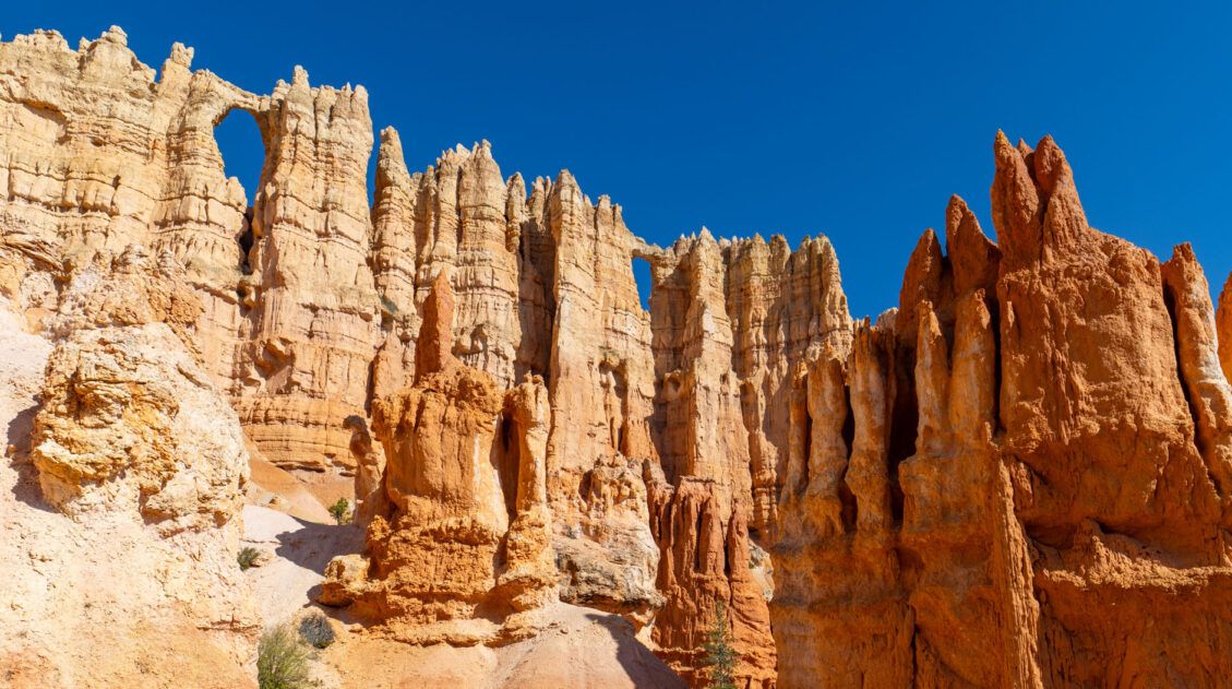
Figure 8 Trail in Bryce Canyon: The Ultimate Trail Guide
Pinterest Facebook Flipboard The Figure 8 Trail combines three popular trails together into a single hike. This includes the Queen’s Garden Trail, the Peekaboo Loop Trail, and the Navajo Loop Trail. All of these trails take you through the amphitheater at Bryce Canyon National Park, where you will be surrounded by hoodoos and sandstone rock […]
12 Epic Hikes in Bryce Canyon Rated from Easy to Hard
If you ask us, putting one foot in front of the other on a hiking trail is the best way to experience Bryce Canyon National Park. These hiking trails take visitors to jaw-dropping viewpoints and hidden canyons. Hike the short but sweet Rim Trail, descend down into the amphitheater on the Queen’s Garden Trail, or […]
One Perfect Day in Bryce Canyon National Park
Bryce Canyon National Park…a fantasyland of hoodoos, bizarre rock formations, and sandstone pillars. This is a crazy beautiful place, and its unique landscape sets it apart from other national parks. Although Bryce may not have the same sweeping, expansive vistas as the Grand Canyon, it’s still a breathtaking experience the first time you see this […]
Hiking Bryce Canyon: Queen’s Garden and Navajo Loop Trails
Bryce Canyon National Park may be small in size but it has an enormous wow factor. With its orange and pink hoodoos and sandstone rock formations, Bryce Canyon is one of the most unique national parks in the United States. By hiking Bryce Canyon and visiting its numerous viewpoints, you can have the best experience […]
Best of Bryce: 8 Amazing Things to Do in Bryce Canyon
Bryce Canyon is the smallest national park in Utah. Despite its small size, there is still a lot to do here. Walk the Rim Trail, gaze across the amphitheater from numerous overlooks, go on a scenic drive, and journey below the rim to venture into a sea of hoodoos…these all top the list of things […]
Bryce Canyon National Park Travel Guide
Bryce Canyon National Park Bryce Canyon is a small national park with a huge wow factor. The moment you step up to the rim and gaze across the hundreds of hoodoos, spires, and rock formations, it will take your breath away. Bryce Canyon National Park is a fantasyland of hoodoos, sandstone pillars, and bizarre looking […]
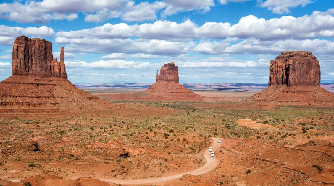
Two Week American Southwest Road Trip: Grand Canyon & Utah’s Mighty 5
This is one of the best road trips in the USA. On this American Southwest road trip, you will visit Utah’s Mighty 5, the Grand Canyon, and a handful of wonderful state parks and national monuments. This is the itinerary I wish we had when we planned our first road trip to the American Southwest. […]
Utah’s Mighty 5: How to Plan the Perfect Road Trip Itinerary
Stretching across southern and central Utah are five stunning national parks. Called the Mighty 5, these parks contain some of the most thrilling hiking trails and iconic landscapes in the United States. Stand atop Angels Landing in Zion. Gaze across a wonderland of hoodoos at Bryce Canyon. Explore the Water Pocket Fold at Capitol Reef. […]
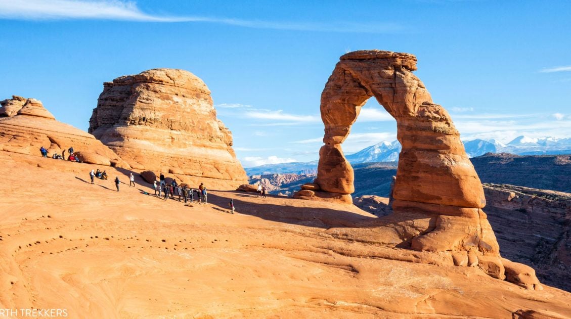
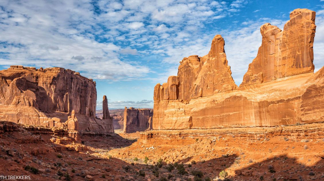
16 Amazing Things to Do in Arches National Park (+ HELPFUL Tips)
Arches National Park is a wonderland of desert vistas, short hiking trails, strange rock formations, and you guessed it, arches. Not only will you find over 2,000 arches here, but you will also see hoodoos, fins of sandstone rocks, massive mesas, and balanced rocks. Here are the best things to do in Arches National Park. […]
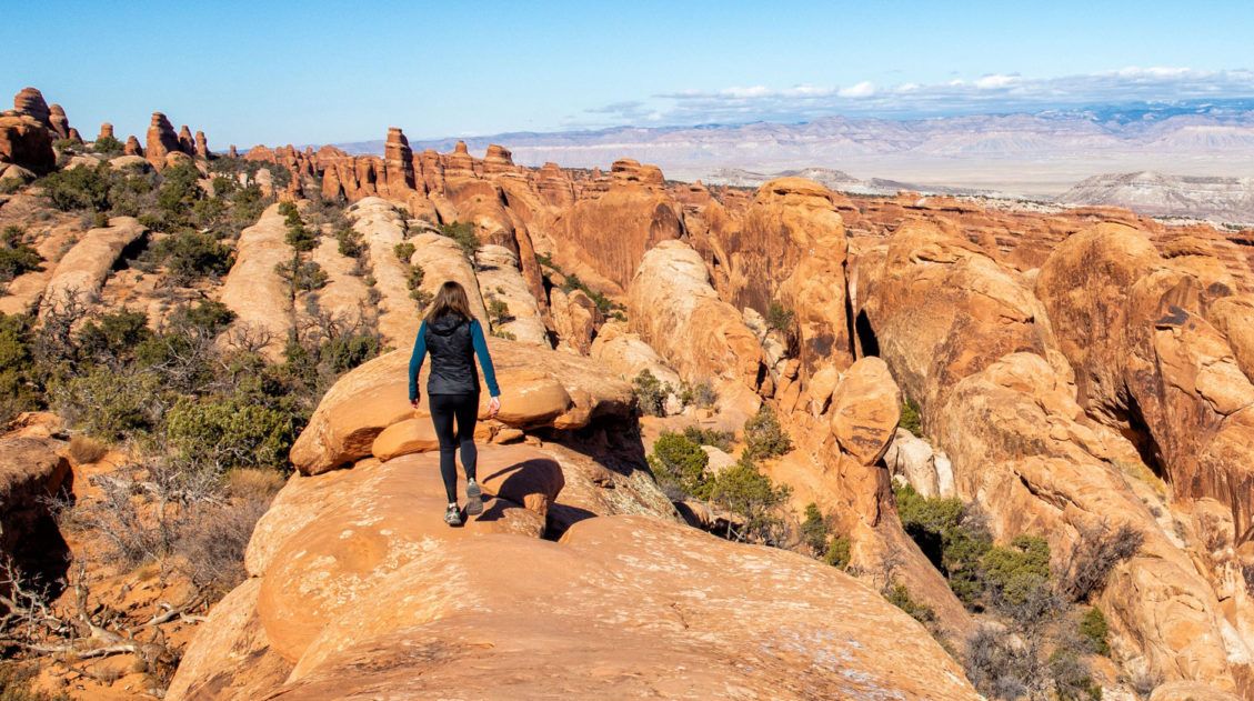
Devils Garden Trail: The Best Hike in Arches National Park
The Devils Garden Trail has all of the ingredients for a perfect hike in Arches National Park. If you hike the entire 7.8-mile loop, you get to see eight arches! Along the way, go rock scrambling, hike along fins of sandstone rock, and enjoy some of the best views of the park. What makes the […]
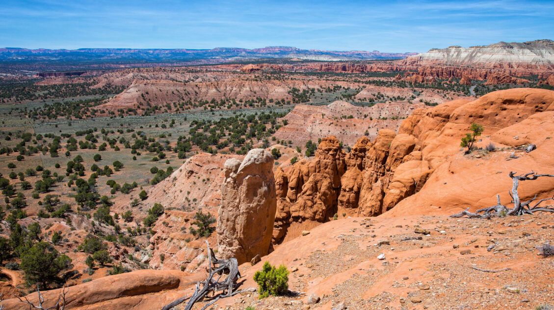
A Quick Visit to Kodachrome Basin State Park
With colorful sandstone spires, red rock mountains, and bright blue skies, Kodachrome Basin is a gorgeous little spot to explore. Its name, Kodachrome, fits it perfectly, describing the multitude of vivid colors that are found here. Laced with hiking and horseback riding trails, you could spend a few days here. In fact, Kodachrome Basin makes […]
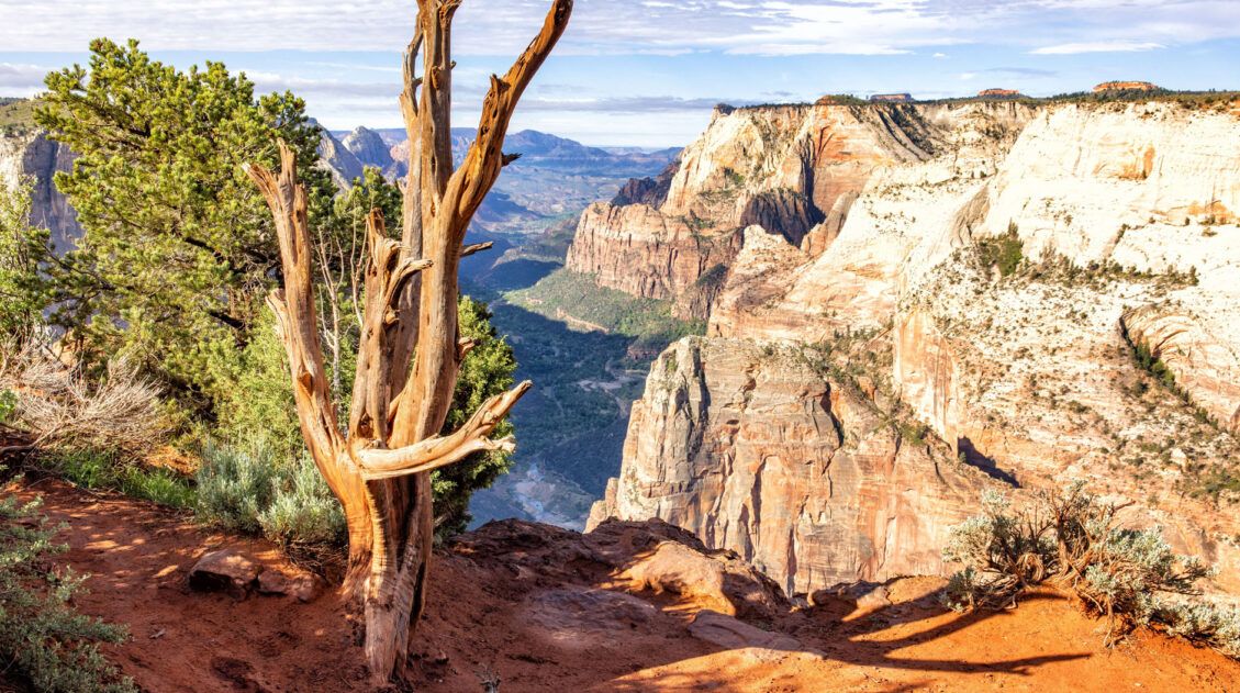
Best Hikes in Zion: 15 Trails from Beginner to Advanced
Zion National Park is one of the best places in the United States to go hiking. From the awe-inspiring hike up Angels Landing to the family-friendly Riverside Walk to multi-day backpacking adventures, there is something here for everyone. In this guide, we cover the best hikes in Zion National Park, from popular trails to hidden gems. […]
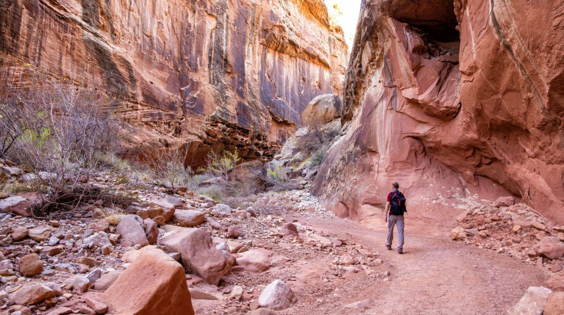
One Perfect Day in Capitol Reef (3 Different Ways)
If you only have one day in Capitol Reef National Park, what should you do? There are several different ways that you can spend one day in Capitol Reef. For some people, “one day” might mean a very quick visit, as you tour Capitol Reef while driving between two different locations in Utah. Or, you […]
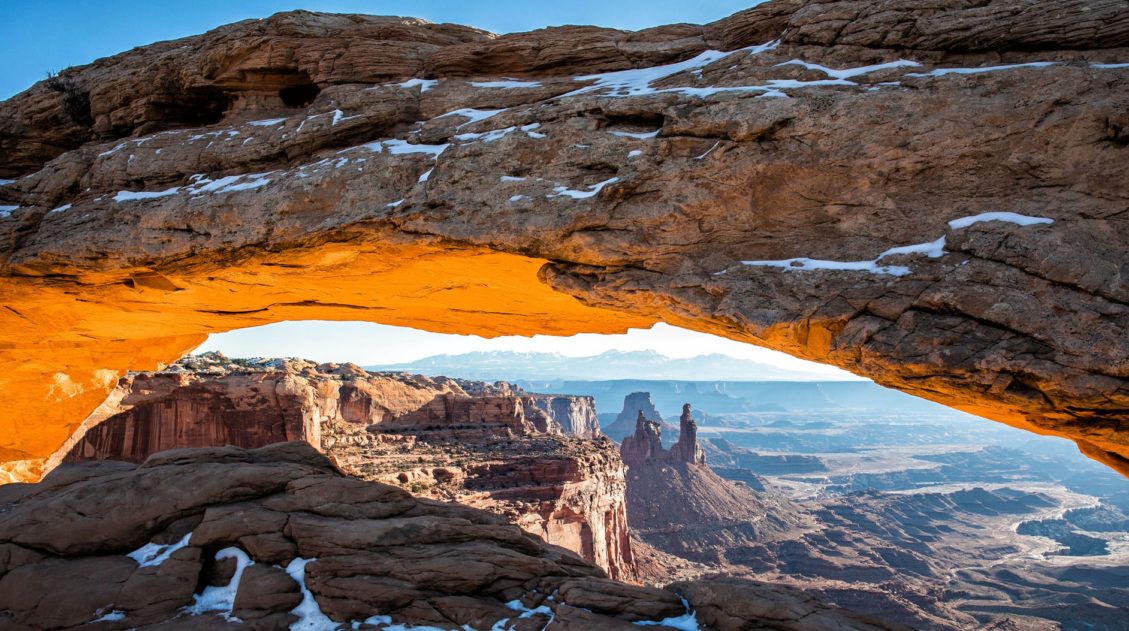
Best Things to Do in Island in the Sky: Canyonlands National Park
Canyonlands National Park is an underrated park located near Moab, Utah. Compared to its smaller and more popular neighbor Arches National Park, Canyonlands feels more rugged, more remote, and a whole lot larger. Island in the Sky, the most popular section of Canyonlands, is filled with jaw-dropping vistas and short but sweet hiking trails. Here […]
6 Epic Utah Road Trip Routes for Your Next Adventure
Utah is home to five of the most stunning national parks in the United States. Throw in some national monuments and a few spectacular state parks and you have a extraordinary road trip destination. If you are planning a Utah road trip itinerary, we have tons of information to share with you. About Our Experiences […]

The Ultimate Guide to the 63 US National Parks
Stretching from the South Pacific, across the United States to the Caribbean, are 63 national parks. These national treasures preserve iconic landscapes, majestic mountains, primordial forests, arid deserts, misty coastlines, immense canyons, wildlife, and historic landmarks. We have visited 56 of the 63 US national parks, from the towering granite walls of Yosemite and the […]
United States Travel Guide: Places to Visit in the USA
Plan your visit to the United States. Learn about the best things to do, how to plan your time, road trip ideas, and sample itineraries.


Comments 2