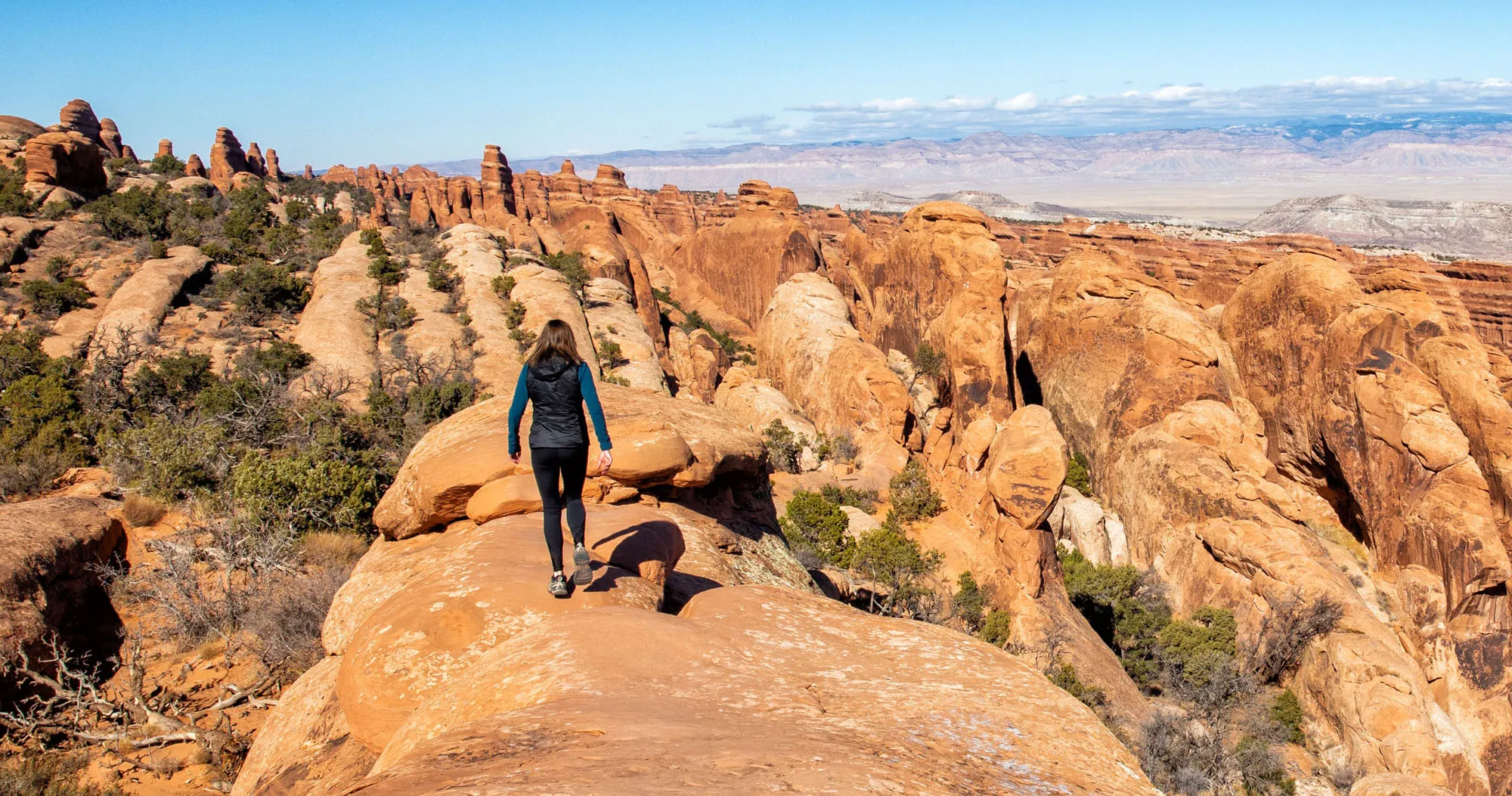

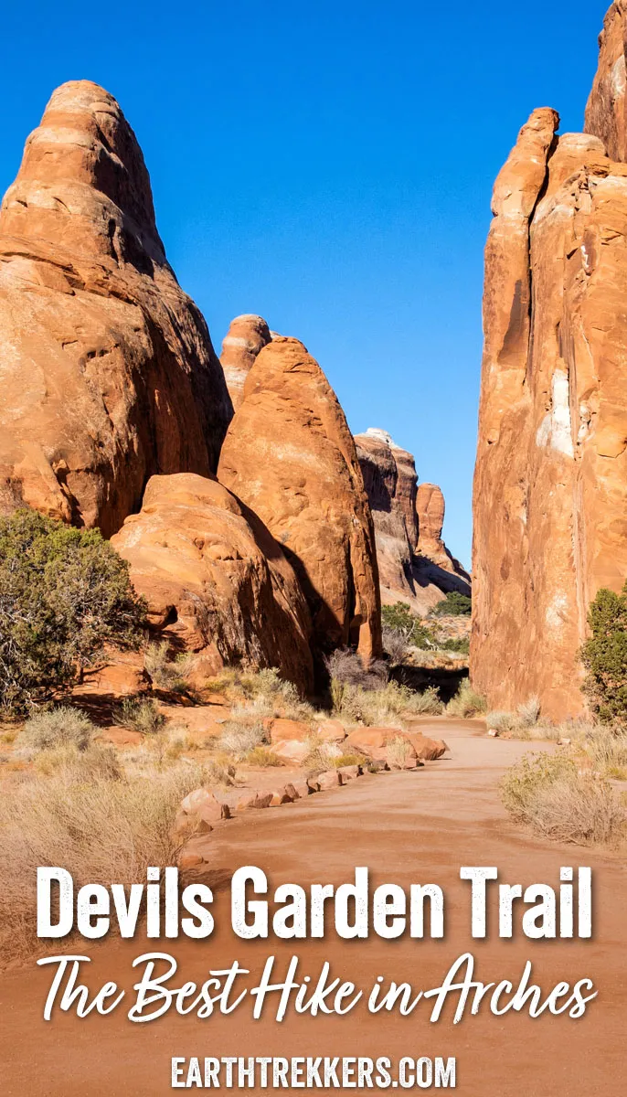
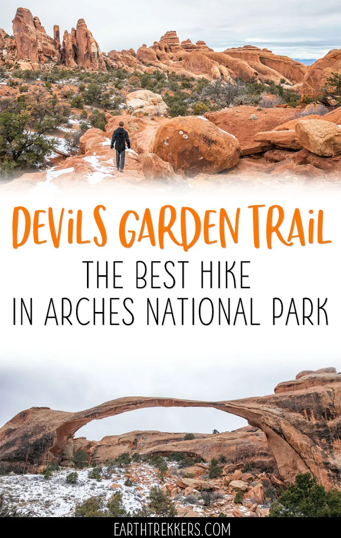
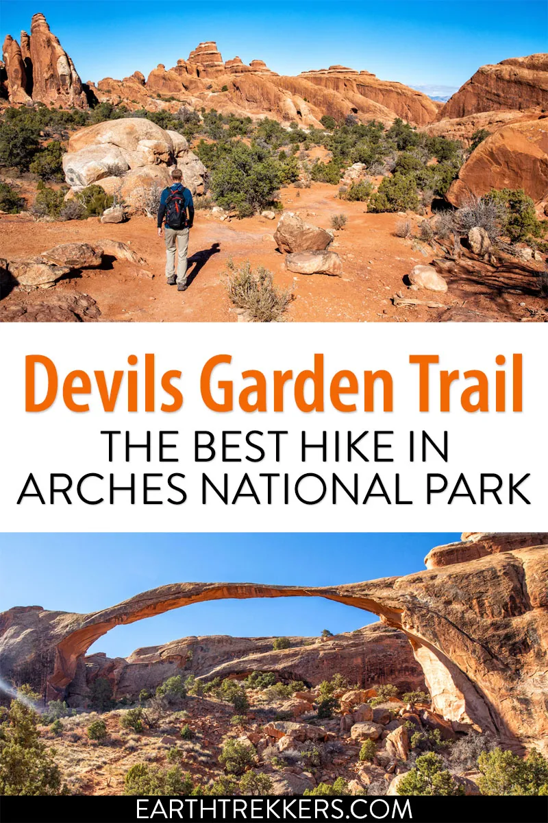
The Devils Garden Trail has all of the ingredients for a perfect hike in Arches National Park. If you hike the entire 7.8-mile loop, you get to see eight arches! Along the way, go rock scrambling, hike along fins of sandstone rock, and enjoy some of the best views of the park.
What makes the Devils Garden Trail so great is that you can pick and choose what you want to do. You can simply hike round trip to Landscape Arch (it’s only 1.6 miles round trip). From the main trail there are two spur trails that detour to more arches. Once you get to the end of the main trail, you can hike back the way you came or try out your route finding skills on the Primitive Trail.
If you are visiting Arches as a family or in a group, some people may choose to explore the easier trails at the front of the hike. Those feeling more adventurous can keep going. As you approach Double O Arch, the trail gets more difficult (and more fun) now that you have short sections of rock scrambling. The views from the sandstone fins are unbeatable. And hiking back on the Primitive Trail is a great way to add a little adventure to your day.
We have hiked the Devils Garden Trail multiple times. Here’s how to do it.
Overview of the Devils Garden Trail
Round Trip to Landscape Arch (no spur trails): 1.6 miles (2.5 km), 1 hour
Round Trip to Double O Arch (no spur trails): 4.2 miles (6.7 km), 2 – 2.5 hours
Round Trip to Dark Angel (no spur trails): 5 miles (8 km), 2 – 3 hours
To Dark Angel and return on Primitive Trail (no spur trails): 5.9 miles (9.5 km), 2.5 – 3.5 hours
Spur Trail to Pinetree and Tunnel Arches adds: 0.5 miles (0.8 km), 20 minutes
Spur Trail to Navajo and Partition Arches adds: 0.8 miles (1.3 km), 30 minutes
Spur Trail to Private Arch adds: 0.6 miles (1 km), 25 minutes
Total Distance (Dark Angel, Primitive Trail, all arches): 7.8 miles (12.6 km), 3 – 4 hours
Difficulty: It is an easy hike to Landscape Arch, with a few ups and downs along the trail. Beyond Landscape Arch, the hike is moderately difficult, with several short, steep climbs and some rock scrambling.
Total Ascent: 1,350 feet (410 m) for the full loop
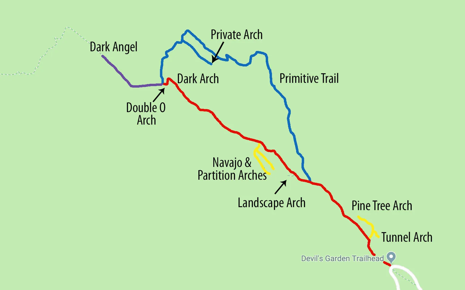
Map of the trail. The main trail is red. The Primitive Trail is blue. The yellow trails are spur trails and the purple trail goes to Dark Angel.
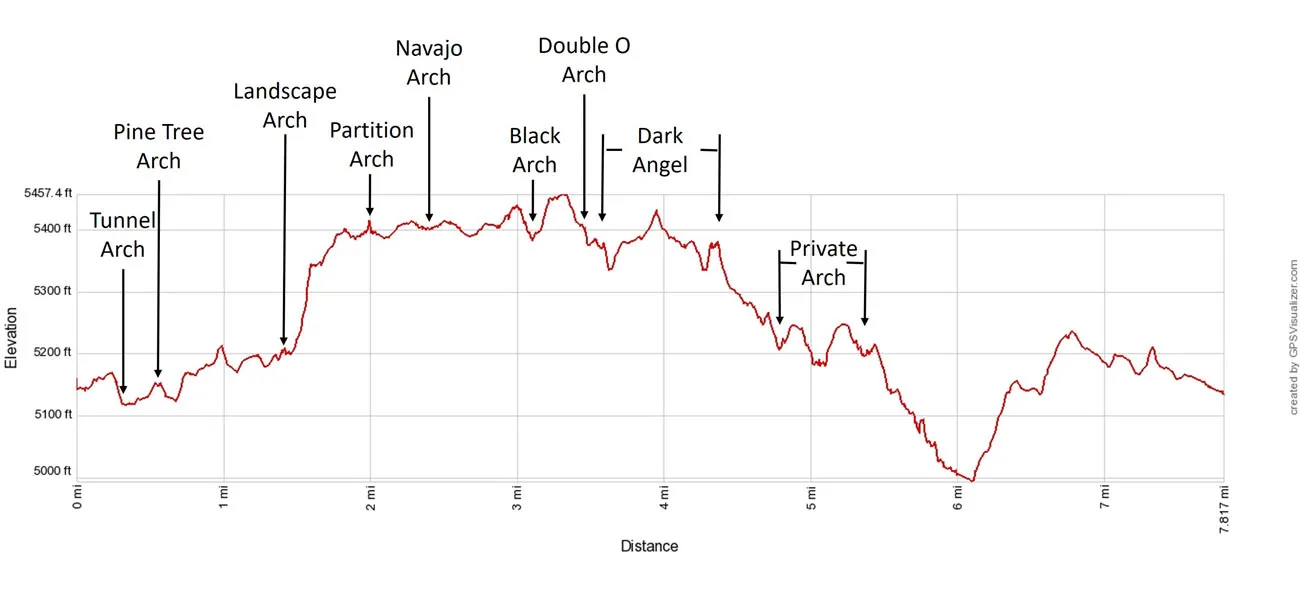
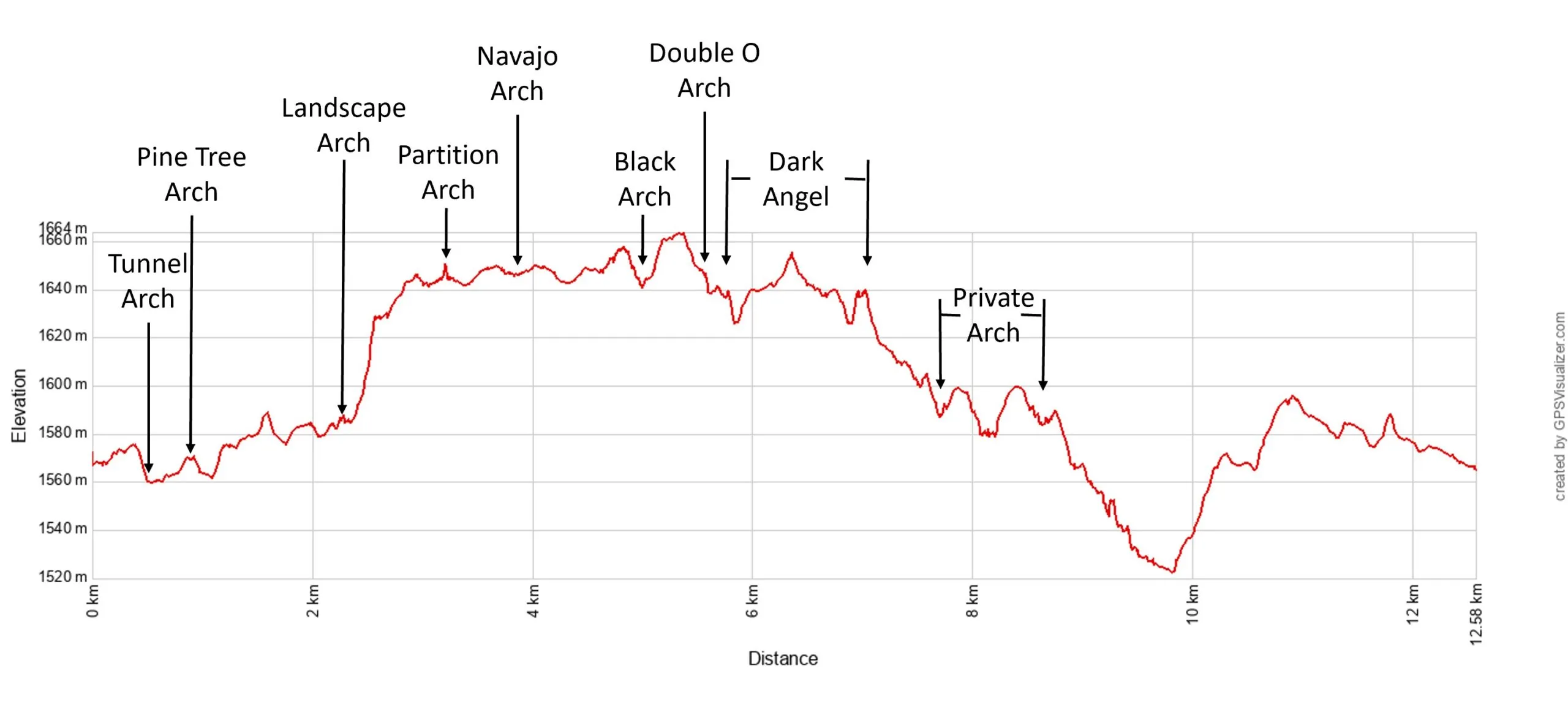
Devils Garden Trail Elevation Profile
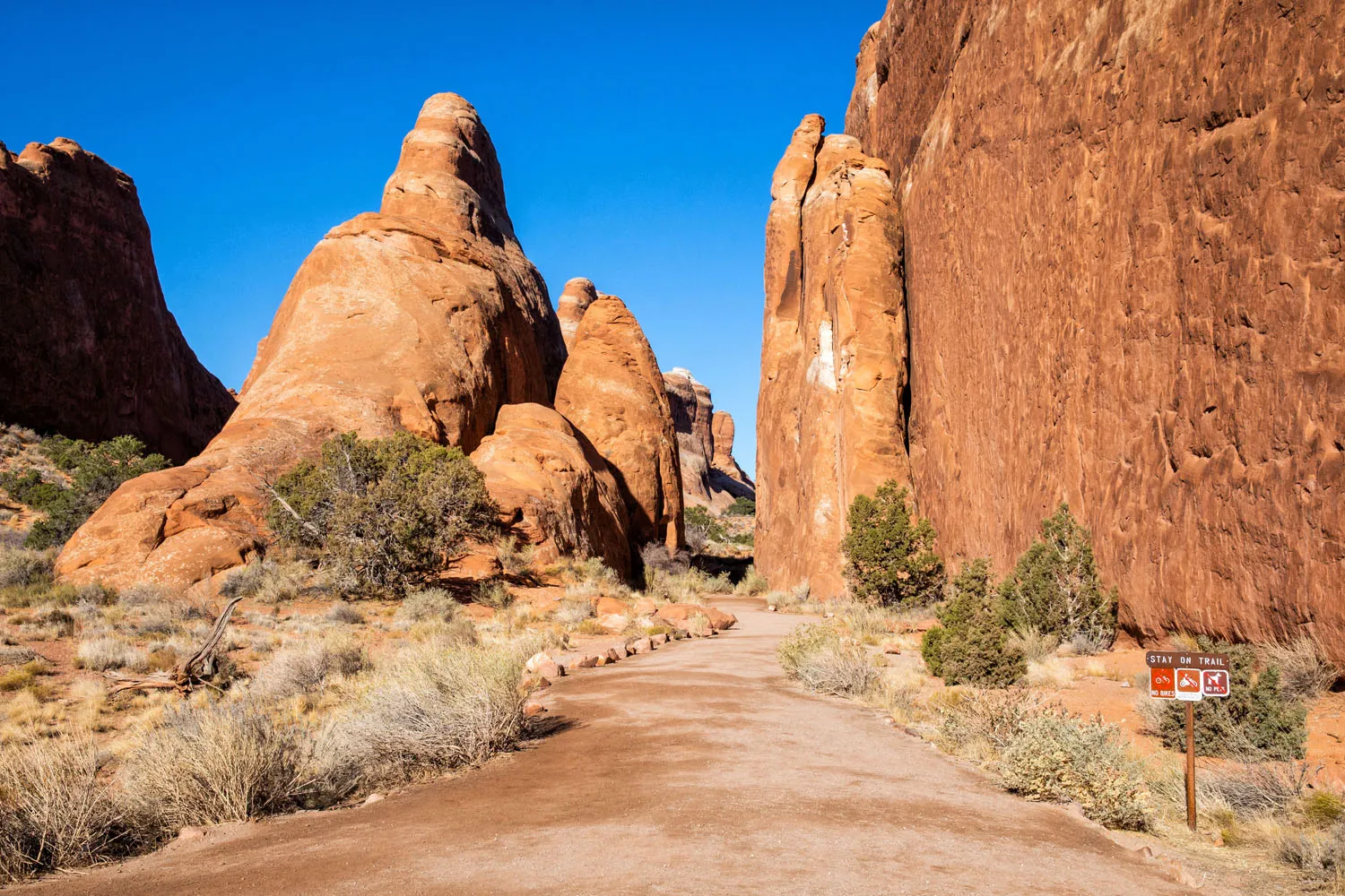
Please practice the seven principles of Leave No Trace: plan ahead, stay on the trail, pack out what you bring to the hiking trail, leave areas as you found them, minimize campfire impacts, be considerate of other hikers, and do not approach or feed wildlife.
How to Hike the Devils Garden Trail
Step-By-Step Trail Guide
Park in the enormous parking lot at the end of Devils Garden Road. The trailhead is well marked and there are restrooms here if you need them.
Trail to Pinetree and Tunnel Arches
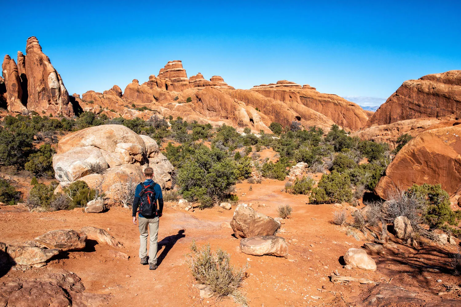
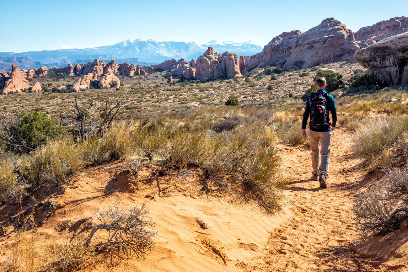
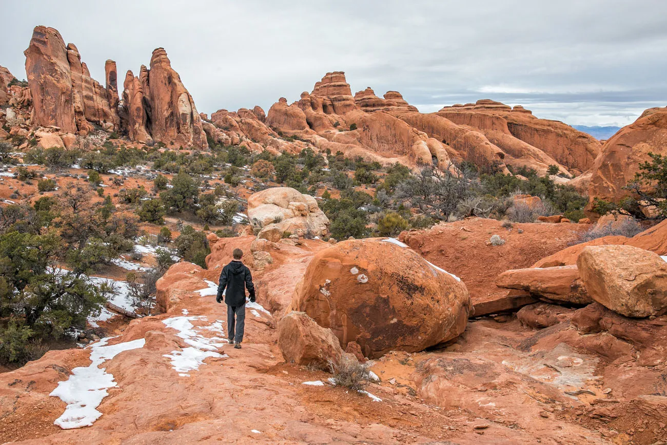
The main trail is well graded and relatively flat until you get to Landscape Arch. Along the way, you will walk through sandstone fins, just like these at the very start of the hike.
About 10 minutes into the hike you have the option to take the spur trail to the right. This takes you to two arches. This short trail is 0.5 miles round trip and adds 15 to 20 minutes to your hike.
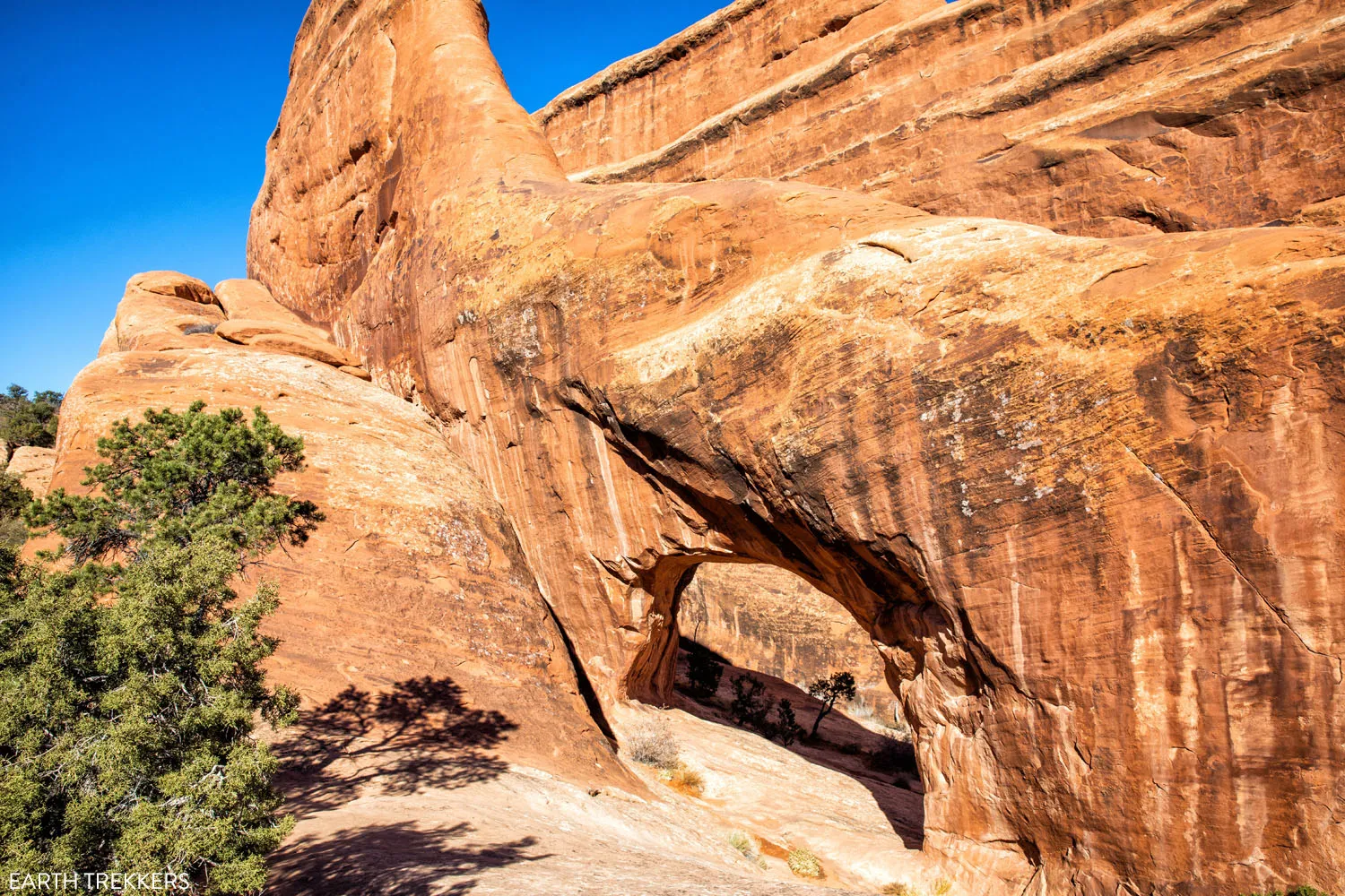
Tunnel Arch
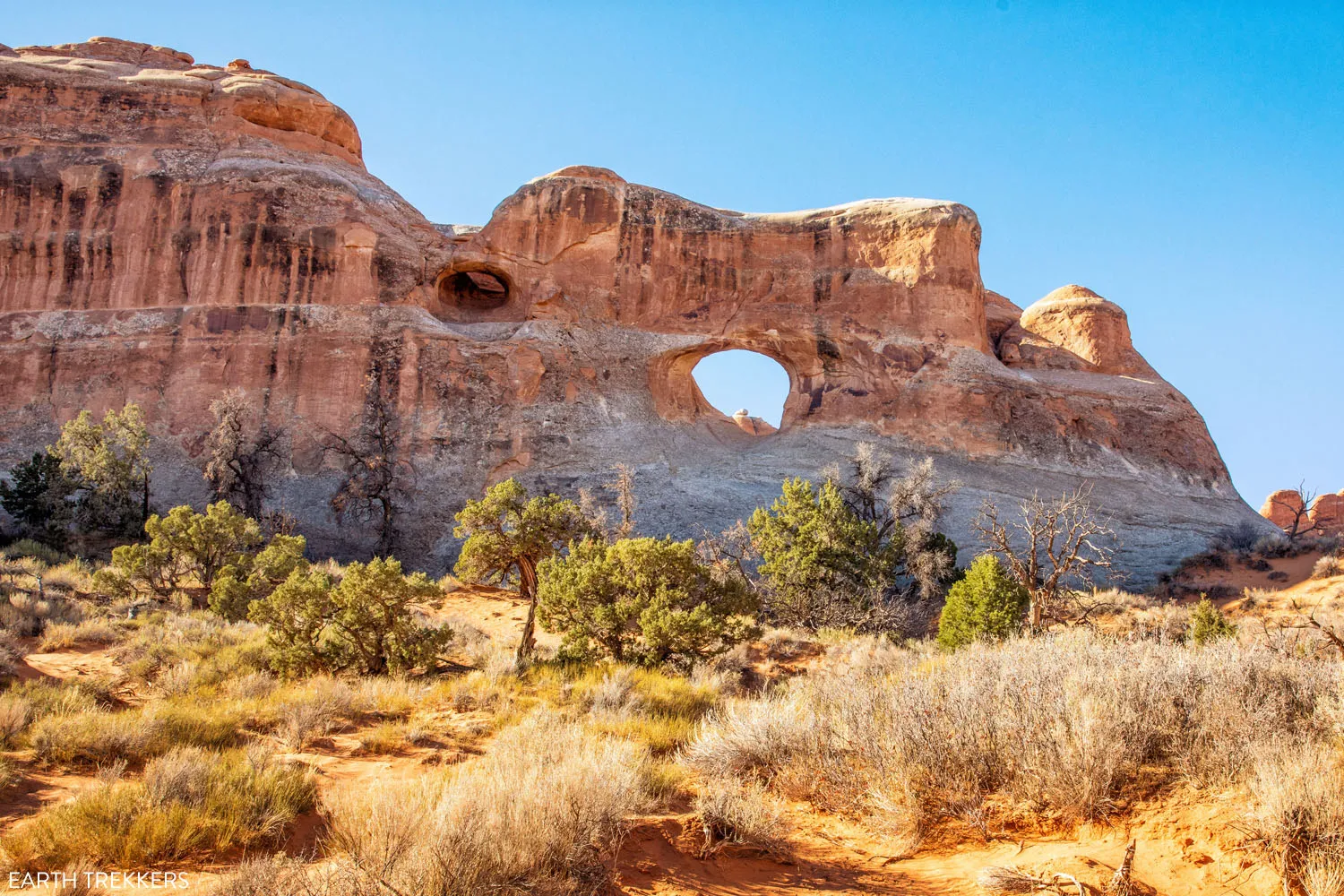
The first arch is Tunnel Arch. You can only view it from a distance but it’s worth a quick look.
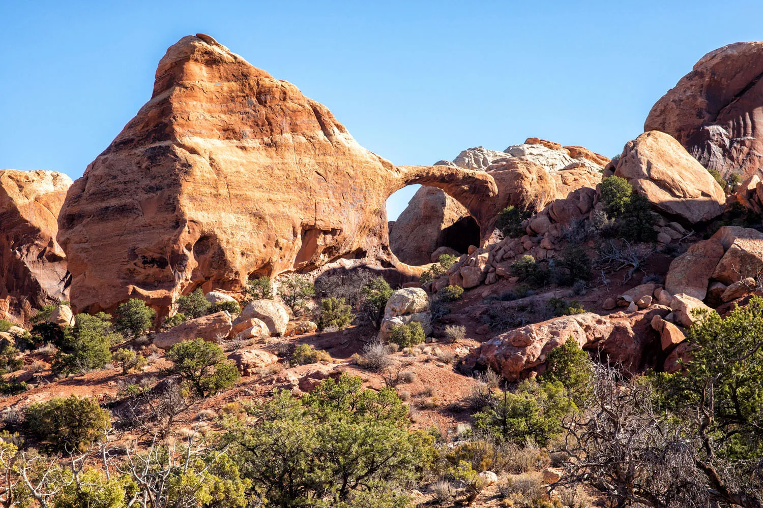
Pinetree Arch
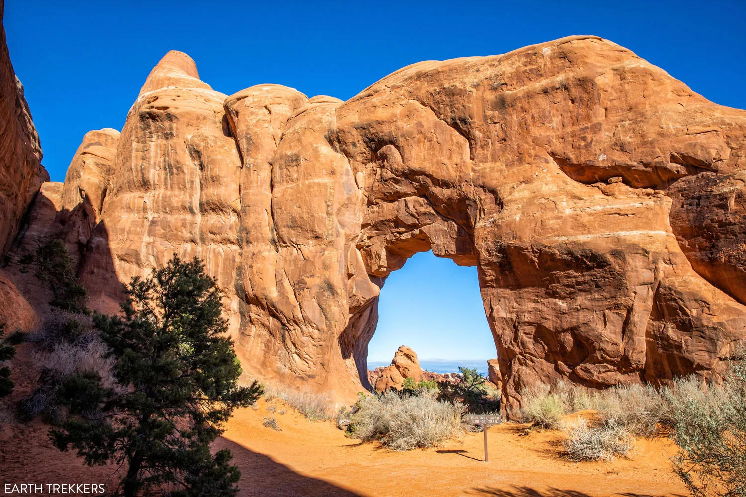
Pinetree Arch is better, in my opinion. You get to see it up close and if there aren’t too many people here, you can take photos in the arch.
Take the spur trail back to the main trail and continue the walk to Landscape Arch. Here is the view along the way.
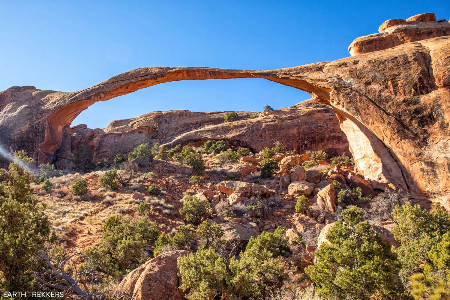
Landscape Arch
Follow the main trail until you get to Landscape Arch. This arch has one of the world’s longest spans. It stretches 306 feet but it is only 11 feet wide in its narrowest section. In 1991, a portion of the arch fell and this is all that remains. At some point, hopefully not too soon, the rest of the arch will fall.
There are several different viewpoints here so have fun photographing the arch.
You can turn around here or keep hiking to Double O Arch. This is when the hike really starts to get fun.
Trail to Navajo and Partition Arches
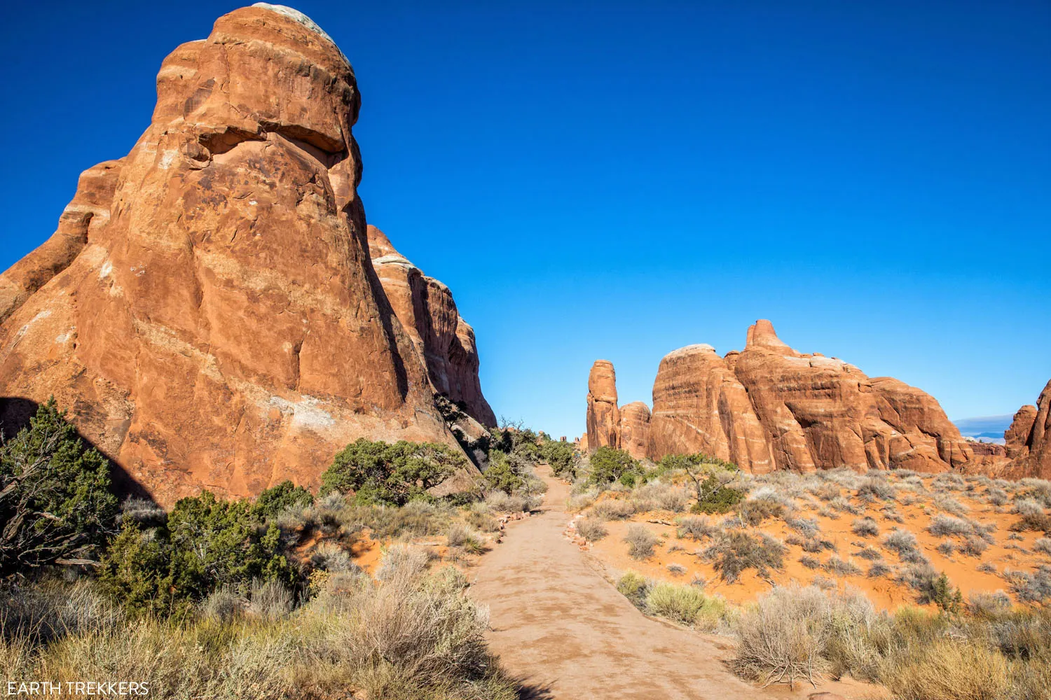
From Landscape Arch, hike up the sandstone fins. Enjoy the spectacular view back over the main trail.
It does not take long to reach the spur trail to Navajo and Partition Arches. If you choose to take this trail, it adds 0.8 miles round trip and it takes about 30 minutes to visit both arches.
The spur trail splits and you can visit these arches in either order.
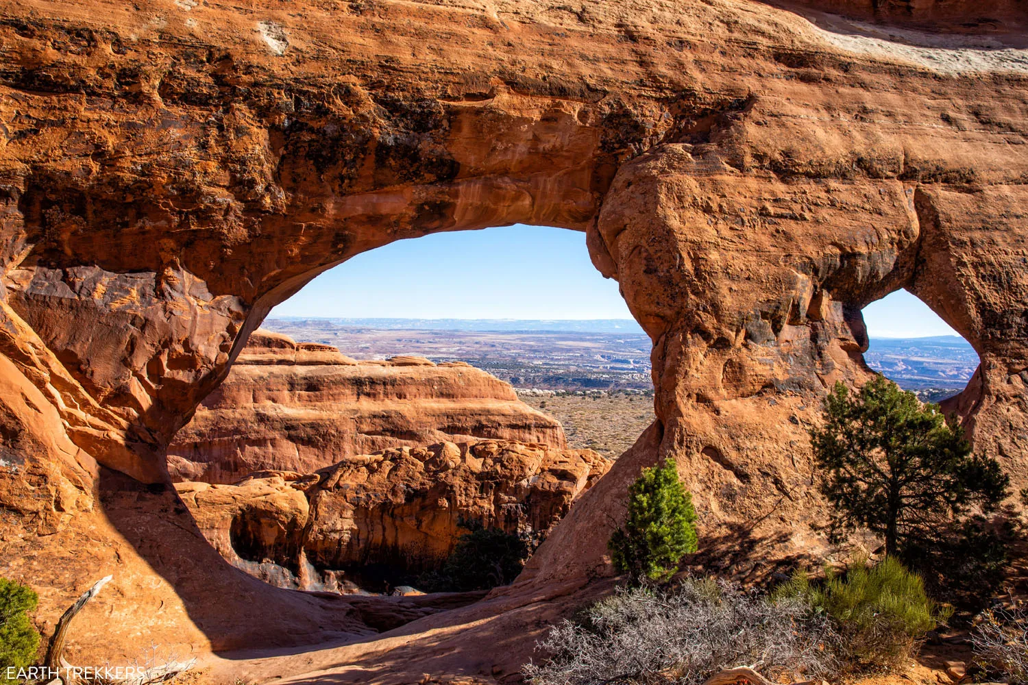
Partition Arch
From Partition Arch, enjoy the view of Arches National Park and the landscape of Devils Garden through “the window.”
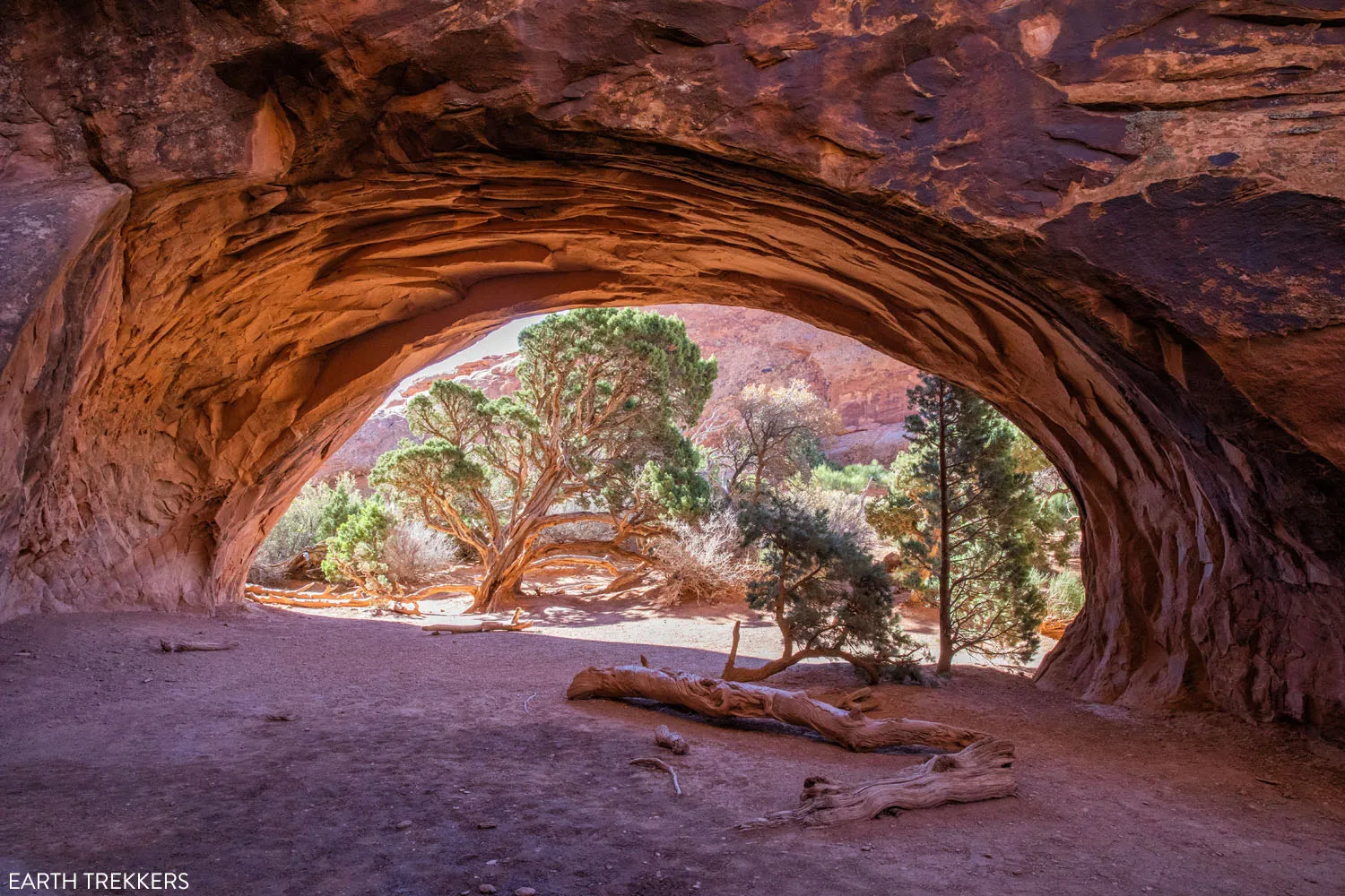
Navajo Arch
This wide, low arch looks and feels more like a cave than an arch.
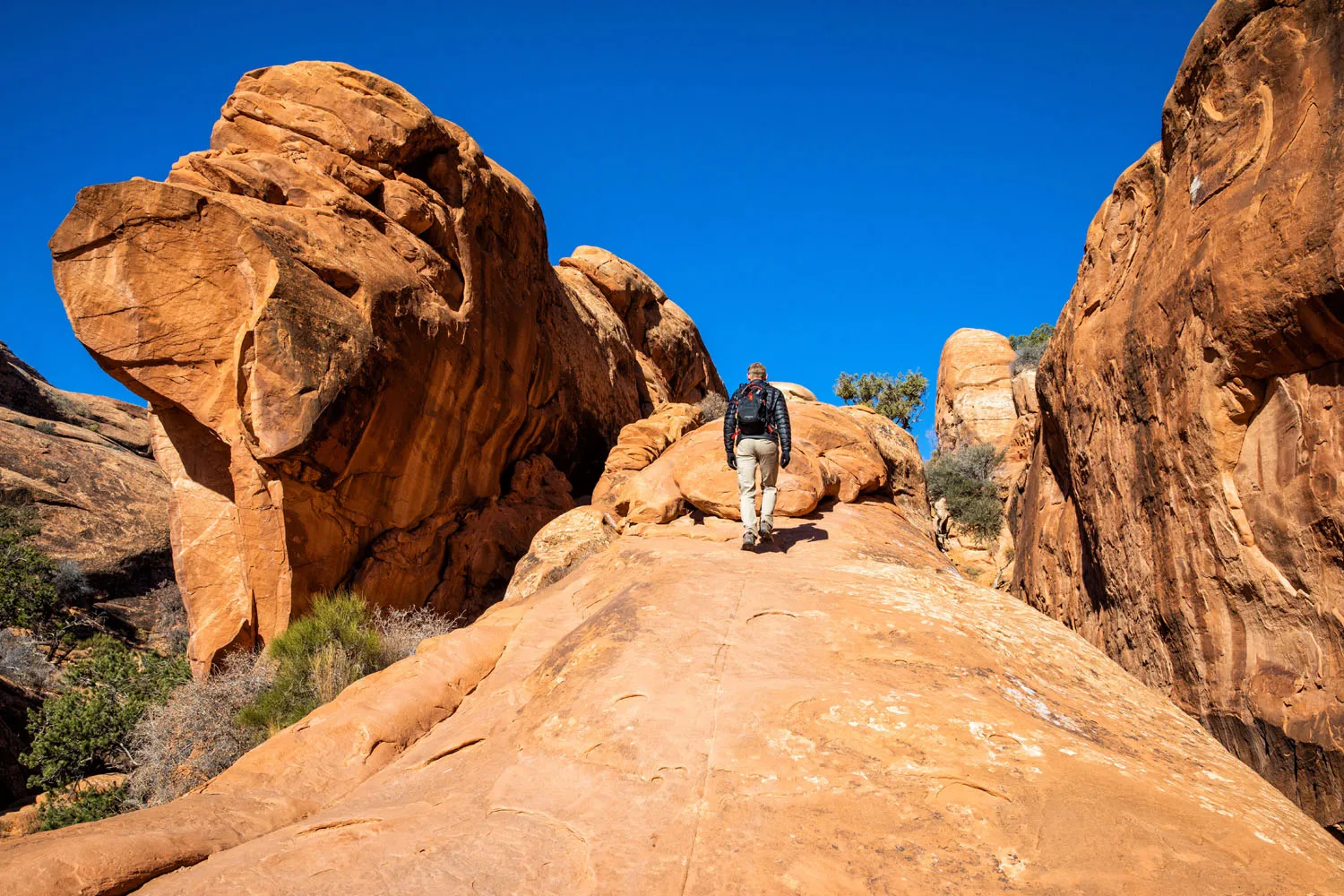
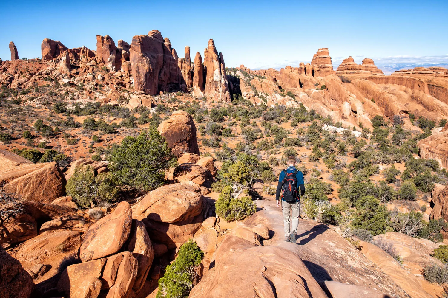
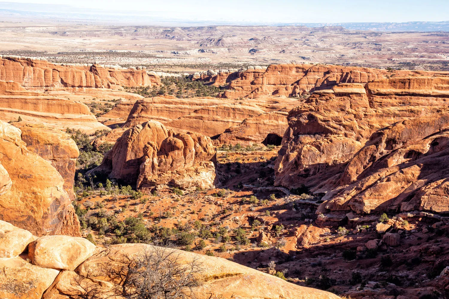
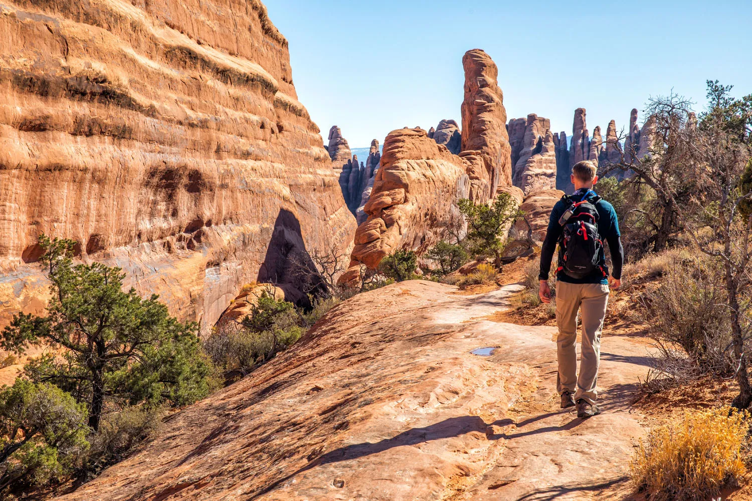
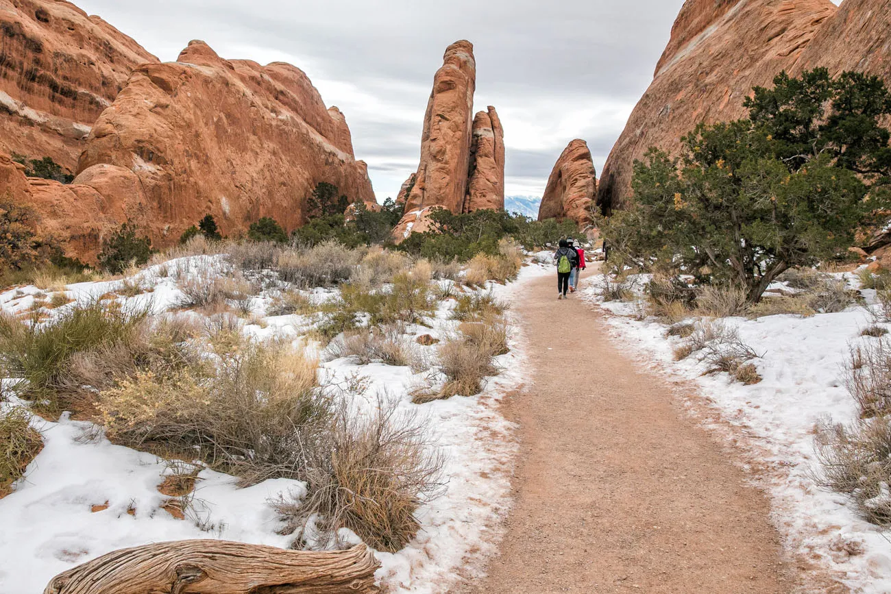
On the Trail to Double O Arch
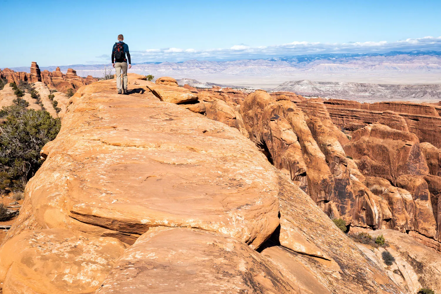
As you hike towards Double O Arch, the scenery keeps getting better and the trail gets less crowded.
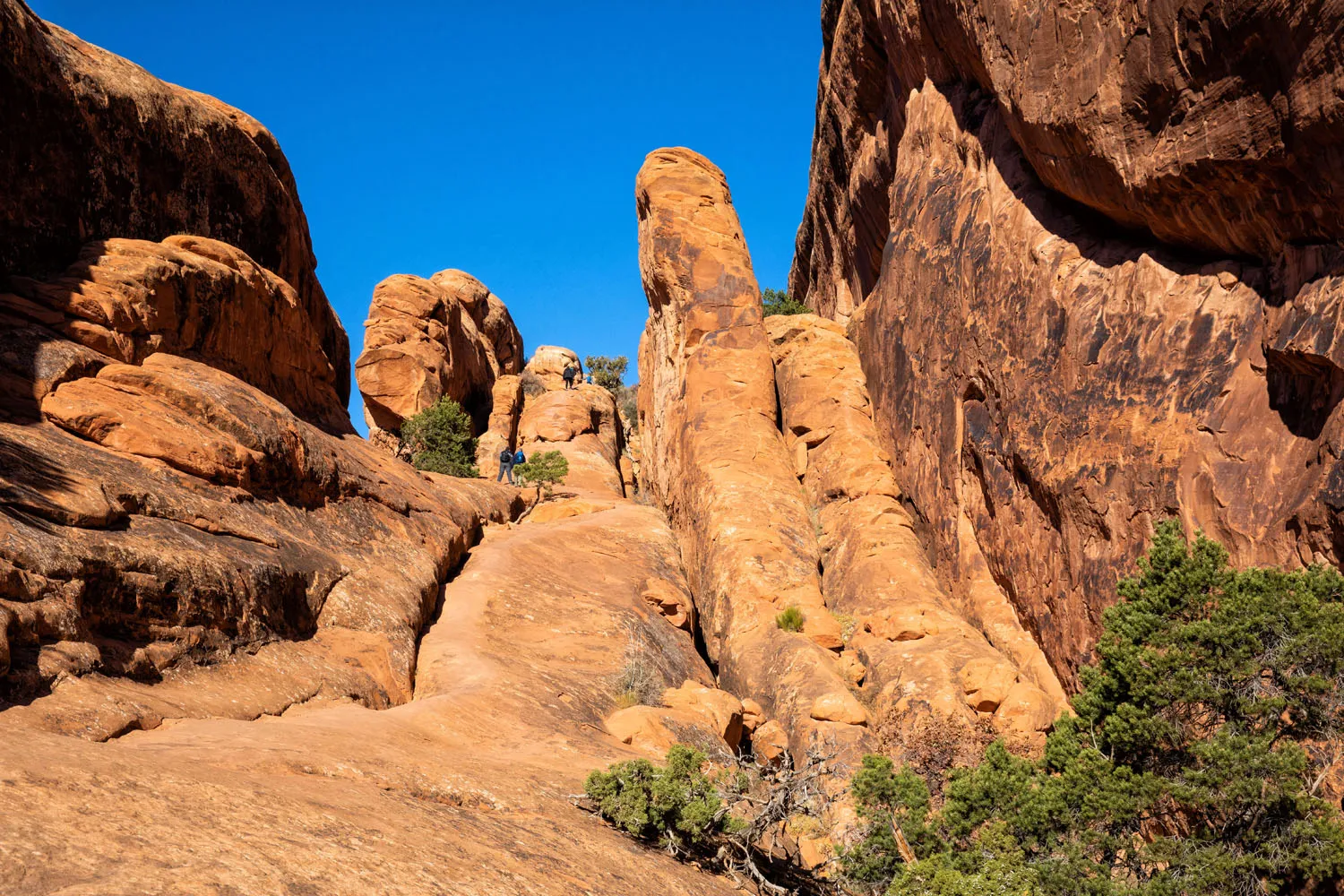
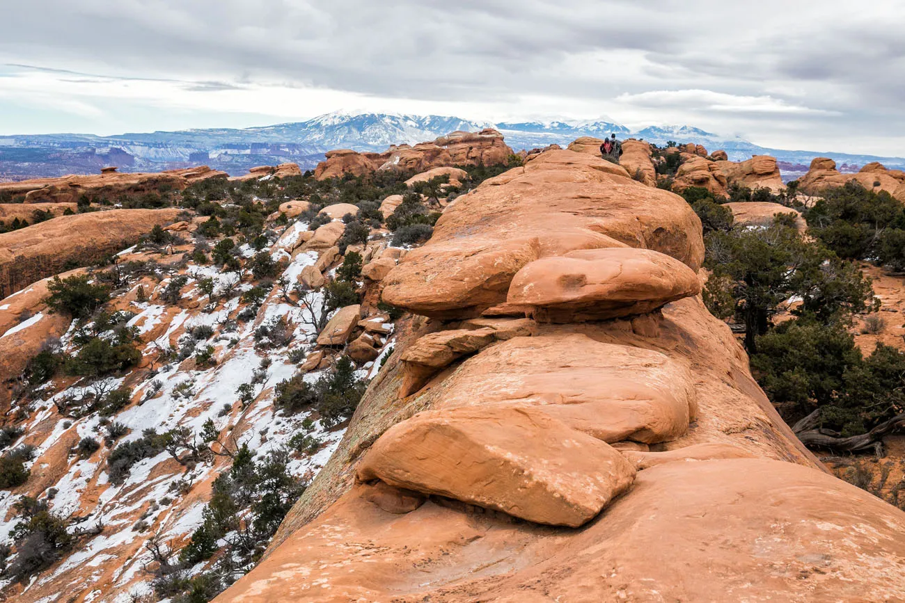
Follow the signs for Double O Arch. The trail is well marked until you get to one large, sandstone fin. Shown in the photo below, you climb up onto the fin and then turn right to walk on top of it. The views from here are incredible on one of my favorites in Arches National Park.
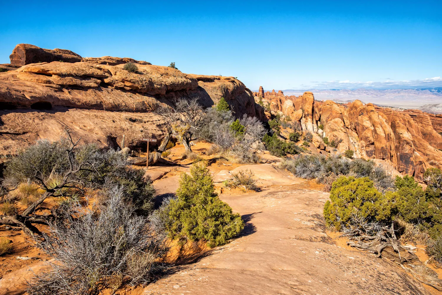
Quick, Optional Detour: Black Arch Overlook
Before you get to Double O Arch, you will see a sign for Black Arch Overlook. This 2-minute detour is well worth it. Not only can you see the Black Arch, way off in the distance, but the landscape is amazing here.
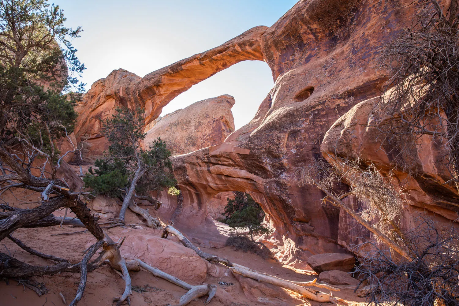
Double O Arch
Back on the main trail, it’s a short walk with a little bit of rock scrambling over the sandstone fins to get to Double O Arch. This looks like a smaller version of Double Arch at the front of the park.
From here, you can walk back to your car or continue the adventure.
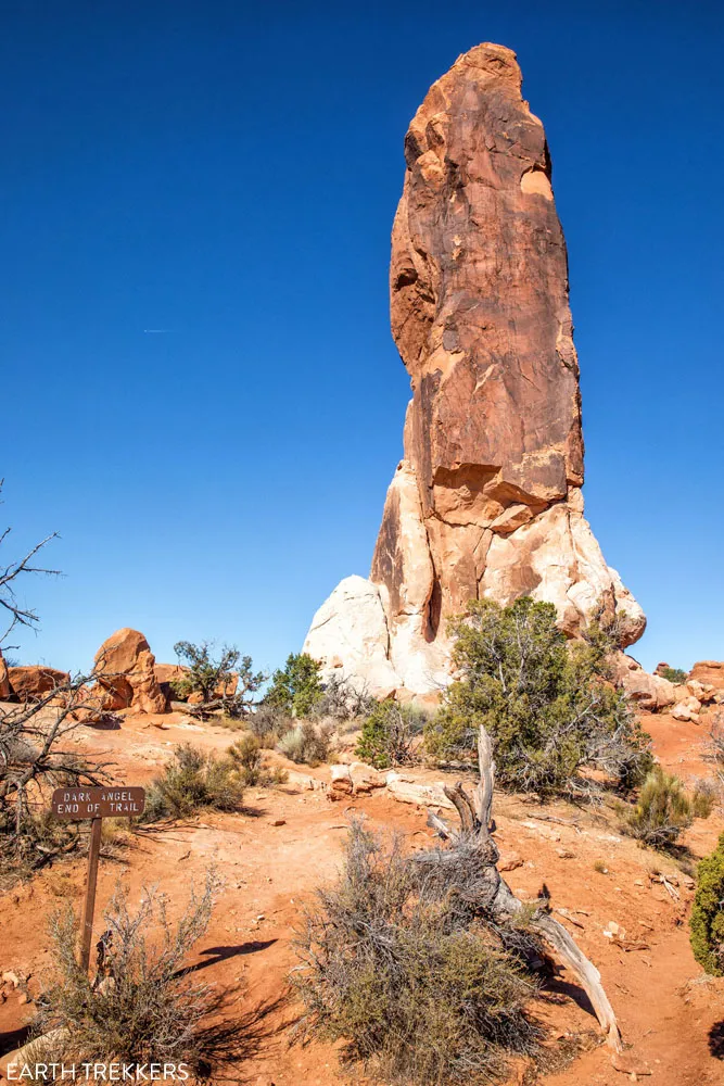
Dark Angel
Dark Angel is a giant pillar of sandstone rock. To get here, take the trail from Double O Arch. This detour adds 0.8 miles to the hike.
If you skip one arch/landmark on this hike, Dark Angel would be the one. We don’t think it’s nearly as interesting as the other arches and rock formations on the Devils Garden Trail, and you can see it off in the distance as you hike to Double O Arch, so there’s no need to hike right up to it.
The view of Double O Arch on the hike back from Dark Angel.
Once you visit Dark Angel, you can return to your car on the main trail or take the Primitive Trail.
The Primitive Trail
The Primitive Trail is a poorly marked trail but it takes you through some of the best scenery in Arches National Park. Expect sections of rock scrambling and a few short, strenuous climbs. For part of the hike, you are walking in a wash (a dry riverbed), so there may be small pools of water that you have to jump over.
You will need to do a bit of route finding to stay on the trail. For most of the way, the trail is marked with cairns, stacked stones that serve as trail markers. However, these cairns are few and far between in some spots, so they can be difficult to spot.
It is very easy to lose the trail. The first time we hiked Devils Garden, we lost the trail and wandered around for a little bit. We saw several other groups of people wandering around, lost as well. There are numerous “false trails.” These are trails that were formed by other hikers who stumbled off the main trail, creating short, dead-end trails. They can be very misleading.
The second time around, we did a lot better. We never lost the trail, taking the time to spot the rock cairns, and cheating a little bit, by following the map on our Garmin Fenix watches.
If you don’t have a GPS device, my advice is to hike to one cairn and then look for the next one. You can also cache the trail map on your phone and use this to double check your location. On our most recent visit, we had a weak cellular signal, but I wouldn’t depend on this as a navigation tool.
While on the Primitive Trail, you can add on the short detour to Private Arch. It’s a small, low arch and you may it all to yourself.
On the Primitive Trail
On the spur trail to Private Arch
Private Arch
Beyond the spur trail for Private Arch, the trail gets a little harder to follow. It is very important that you keep spotting those rock cairns. The trail will make a sharp turn to the left, climb up and over a fin of sandstone, and then turn right again. This is the section where most people lose the trail.
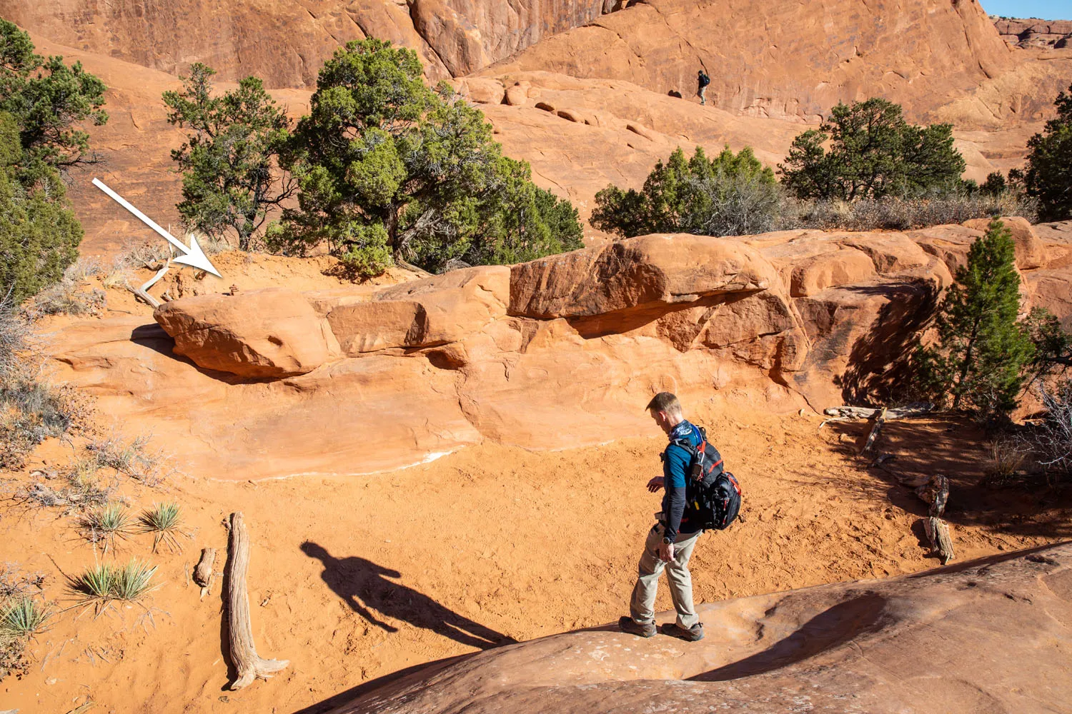
This is the trickiest section. The arrow is pointing to one of the few rock cairns. They can be hard to spot since they really blend in with the landscape.
After climbing up and over numerous fins of rock, it is a long, somewhat boring hike on a sandy trail until you get back to the main trail. The Primitive Trail meets up with the main trail near Landscape Arch. From here, it is about a 30-minute walk to the parking lot.
Shorter Variation of the Devils Garden Trail
So, what if you want to hike the best sections of the Devils Garden Trail without going all 7.8 miles? There is a way you can do it.
Hike to Landscape Arch and continue to Double O Arch. In my opinion, the section of trail between Landscape Arch and Double O Arch is the best of the hike. Skip Navajo and Partition Arches. They are nice but they add almost 1 mile and 30 minutes of hiking. Don’t bother going out to Dark Angel. It’s not all that exciting and you can actually see it in the distance as you hike to Double O Arch. The quickest way back to your car is to retrace your steps (4.5 miles round-trip), but if you like the idea of route-finding and a little more adventure, return on the Primitive Trail (5 miles round-trip).
Finally, you have the option to add in Tunnel Arch and Pinetree Arch (0.5 miles extra) before you get back to the parking lot.
Tips to Have the Best Experience
Cache maps before you go. You might have a weak cellular signal on the Devils Garden Trail but I wouldn’t depend on it. However, you can still use the GPS on your phone to get your location on the hike.
Bring sunscreen. There is very little shade on the trail.
Bring plenty of water. In the warmer months, plan on bringing at least 2 to 3 liters of water per person, especially if you plan to hike the entire loop.
Hiking with Kids. This is a great trail for kids. Younger kids should be able to handle the trail to Landscape Arch. Older, more adventurous kids will love the hike between Landscape Arch and Double O Arch. There are drop-offs while walking on the fins, so keep an eye on young kids here. If you feel confident in your route finding skills, consider taking older kids on the Primitive Trail.
Essential Hiking Gear: What Should You Bring on a Day Hike?
If you are new to hiking or are curious about what you should bring on a hike, check out our Hiking Gear Guide. Find out what we carry in our day packs and what we wear on the trails.About Our Experiences
We have hiked this trail twice.
The first time was on December 27, 2018. During the Christmas holiday season, the parking lots were usually full but the park didn’t feel too crowded. The clouds in the sky were from a storm that was dropping snow in nearby Canyonlands National Park. Too bad it didn’t snow during our visit to Arches. That would have been a treat!
Here are a few photos from our first hike, and a little bit of snow on the ground.
More recently, we visited Arches National Park in November 2020. We had crystal clear skies and low crowds, lower than you would see during the winter holiday season. November is a great time to visit Arches National Park, since crowd levels tend to be low. Just be prepared for chilly temperatures and a small chance of snow.
Places to Visit in Arches National Park
We have more guides to help you plan your visit to Arches National Park.
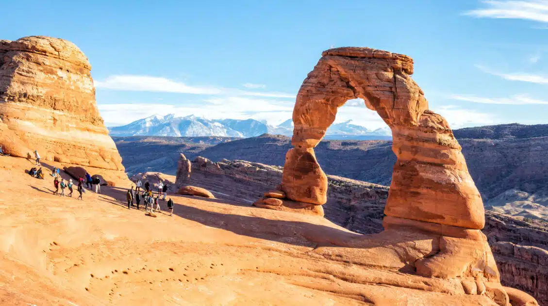
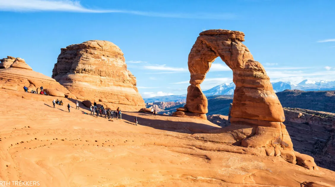
In our guide to Delicate Arch, we cover the hike to get here, unique photo spots, and lots of helpful tips.
We also have guides covering the Best Things to Do in Arches plus how to spend One Day in Arches National Park. If your time is very limited, it’s possible to visit Arches and Canyonlands in One Day.
If your visit here is part of a bigger road trip, here are a few itineraries that include Arches National Park ↓

Are you planning a trip to Arches National Park? If you have any questions about this hike or the park, comment below!
More Information about Utah
Arches National Park Travel Guide
Arches National Park Imagine a place where more than 2,000 arches dot the landscape. Add in fins of sandstone rock, hidden canyons, sweeping vistas of the La Sal Mountains, and a few hoodoos, and you have Arches National Park. This small, easy to visit national park is a joy to explore. You can see several […]
One Perfect Day in Arches National Park (+ Avoid the Crowds)
If you only have one day in Arches National Park, what should you do? Arches National Park is a relatively small national park with a handful of must-see sights. With one day in Arches, you can visit these top sights and a few off-the-beaten-path places. After multiple visits to Arches National Park, we have learned […]
Two Week American Southwest Road Trip: Grand Canyon & Utah’s Mighty 5
This is one of the best road trips in the USA. On this American Southwest road trip, you will visit Utah’s Mighty 5, the Grand Canyon, and a handful of wonderful state parks and national monuments. This is the itinerary I wish we had when we planned our first road trip to the American Southwest. […]
20 Epic Hikes in the US National Parks
With 63 national parks and thousands of miles of hiking trails, your options are endless for exploring the American national parks. We narrowed down the list for you to 20 of the best hikes in the US national parks, 20 amazing ways to explore this beautiful country. Hike to the tallest peaks, through massive canyons, […]
16 Amazing Things to Do in Arches National Park (+ HELPFUL Tips)
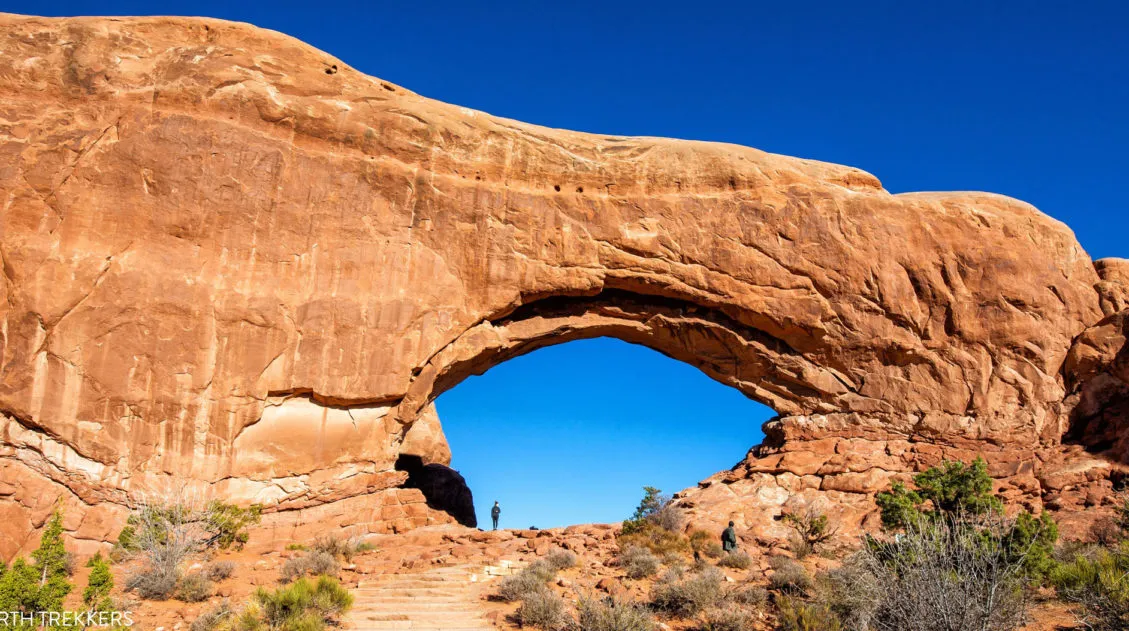
Arches National Park is a wonderland of desert vistas, short hiking trails, strange rock formations, and you guessed it, arches. Not only will you find over 2,000 arches here, but you will also see hoodoos, fins of sandstone rocks, massive mesas, and balanced rocks. Here are the best things to do in Arches National Park. […]
Utah Travel Guide: Places to Visit in Utah
Utah Travel Guide If you like rugged, desert landscapes, it is hard to beat the beauty of Utah. Visit the state’s five stunning National Parks, stand among iconic US monuments, kayak on the Great Salt Lake, and climb through photogenic slot canyons. This state is a great one for road trippers as there are many […]
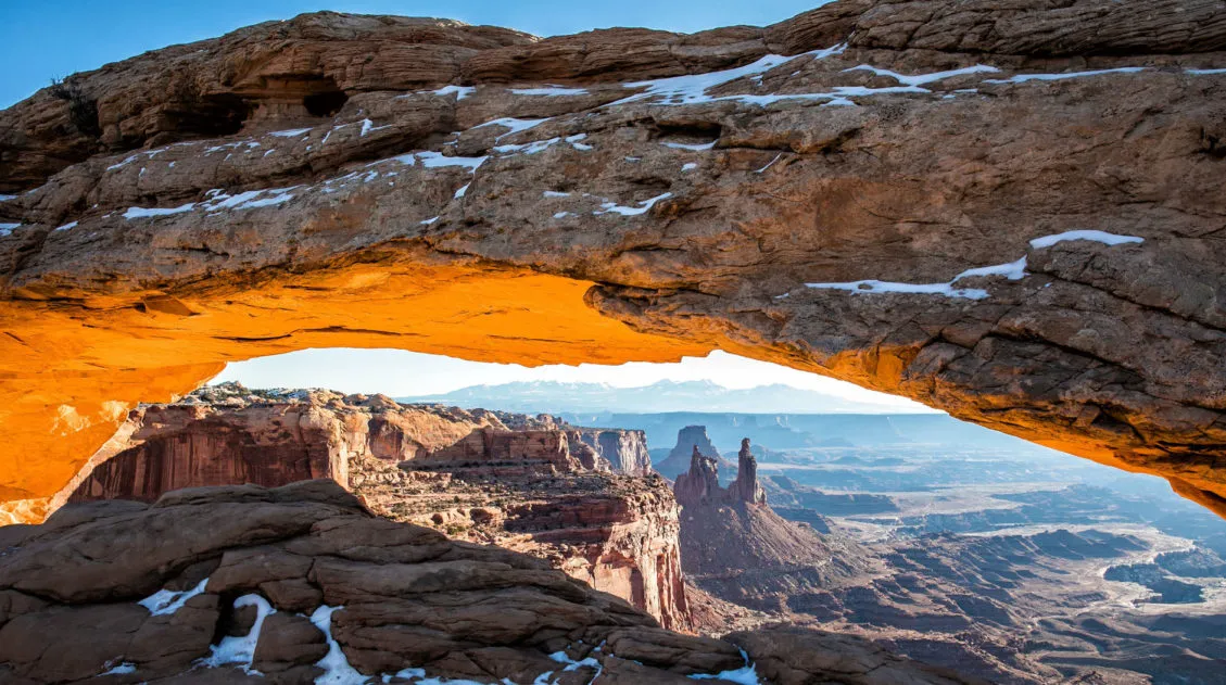
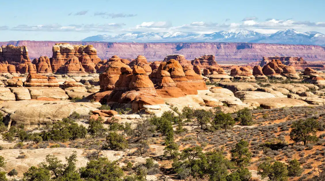
Best Things to Do in Island in the Sky: Canyonlands National Park
Canyonlands National Park is an underrated park located near Moab, Utah. Compared to its smaller and more popular neighbor Arches National Park, Canyonlands feels more rugged, more remote, and a whole lot larger. Island in the Sky, the most popular section of Canyonlands, is filled with jaw-dropping vistas and short but sweet hiking trails. Here […]
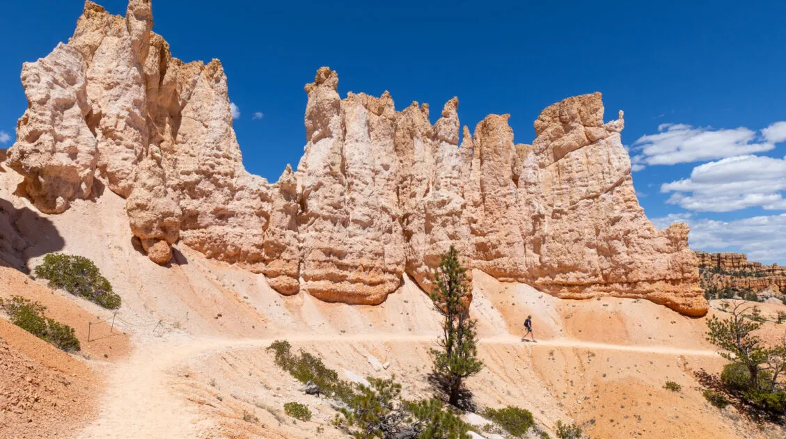
12 Epic Hikes in Bryce Canyon Rated from Easy to Hard
If you ask us, putting one foot in front of the other on a hiking trail is the best way to experience Bryce Canyon National Park. These hiking trails take visitors to jaw-dropping viewpoints and hidden canyons. Hike the short but sweet Rim Trail, descend down into the amphitheater on the Queen’s Garden Trail, or […]
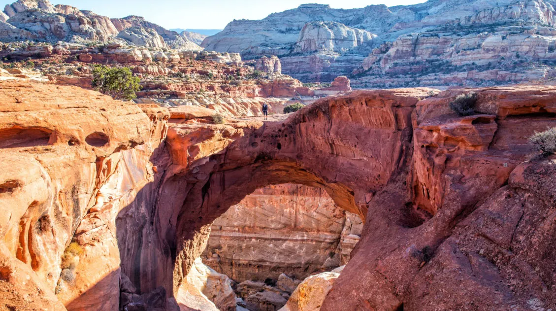
Cassidy Arch, An Essential Hike in Capitol Reef National Park
The hike to Cassidy Arch is one of the most thrilling trails in Capitol Reef National Park. Easily accessible from Scenic Drive, this short 3.4-mile hike features stunning scenery, views over the Grand Wash, and the chance to stand on Cassidy Arch. On this hike, you can view the arch from afar or walk across […]
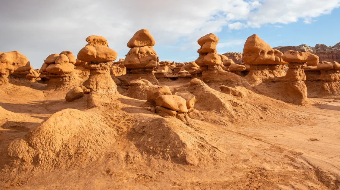
Goblin Valley State Park: Things to Do with Limited Time
Goblin Valley is an easy to visit state park that is located in southeastern Utah. With its hoodoos, toadstools, “goblins,” and short but sweet hiking trails, this park is pure fun to visit. Kids, and kids at heart, will LOVE this park!! The main section of hoodoos and goblins is free to explore…there is no […]
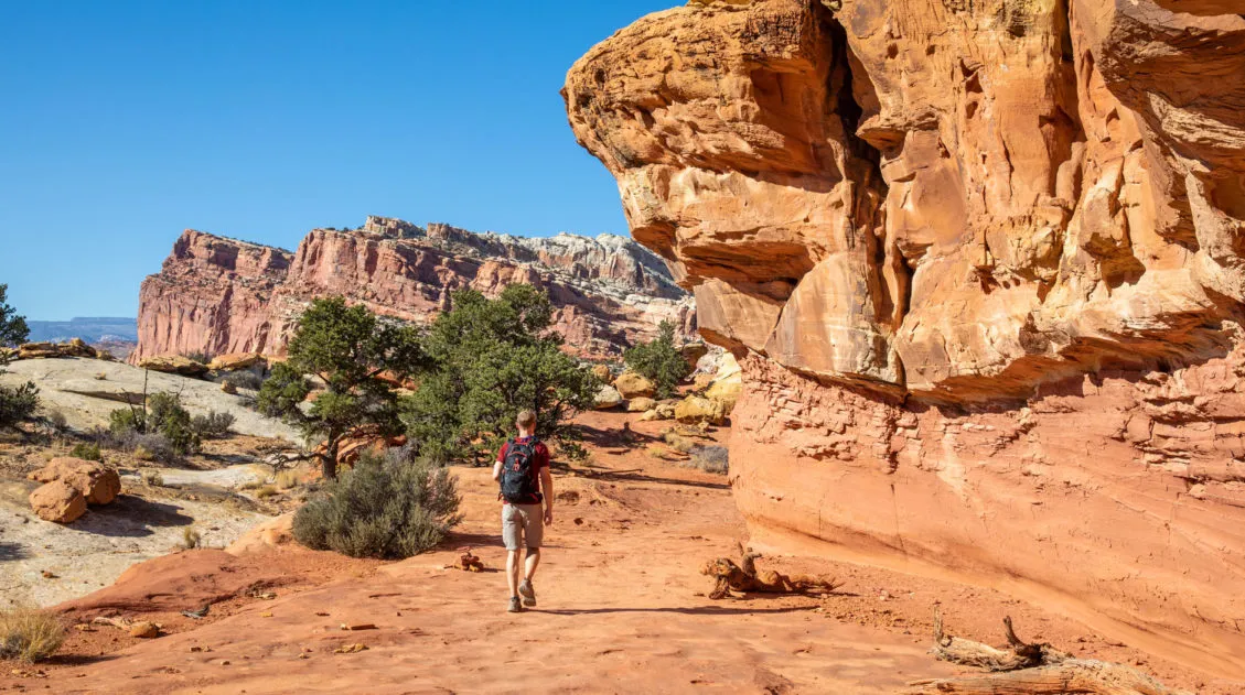
15 Best Hikes in Capitol Reef National Park
The hikes in Capitol Reef National Park are some of the most underrated in Utah. From short, easy trails along Highway 24 to scenic routes like Cassidy Arch and Grand Wash, this park is packed with adventure, without the crowds you’ll find in Zion or Arches. Drive deeper into the park and you’ll discover the […]
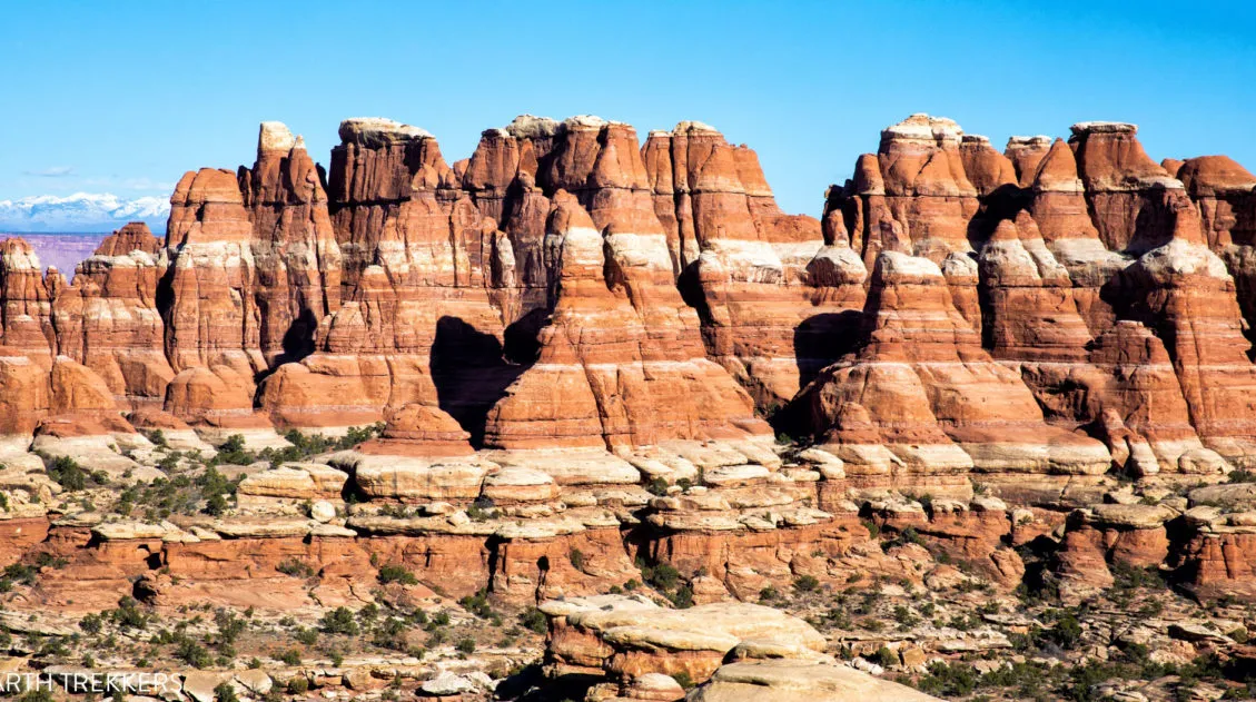
Ultimate Guide to the Chesler Park Loop in the Needles
If you want to get an up-close look at the “Needles,” the sandstone spires that make the Needles district of Canyonlands National Park so uniquely beautiful, put Chesler Park on your list. It is possible to hike out and back to Chesler Park on a short day hike. But if you don’t mind going farther, […]
12 Amazing National Parks for Your Next Family Adventure
We’ve visited 56 of the 63 U.S. national parks and almost every single one would make a fantastic family destination. With 63 parks to choose from, the options can feel overwhelming. After years of exploring the national parks, we’ve narrowed it down to 12 that hit the sweet spot for families. These parks are easy […]
US National Parks List: All 63 Parks, Map & Free Printable Checklist
There are 63 national parks in the United States, and we’ve visited 56 of them, from the remote wilderness of Denali to the coral reefs of the Virgin Islands. We’re a family of avid hikers who have spent over a decade exploring these parks, from multi-day backcountry trips to scenic drives with kids in tow. […]
United States Travel Guide: Places to Visit in the USA
Plan your visit to the United States. Learn about the best things to do, how to plan your time, road trip ideas, and sample itineraries.

Comments 20