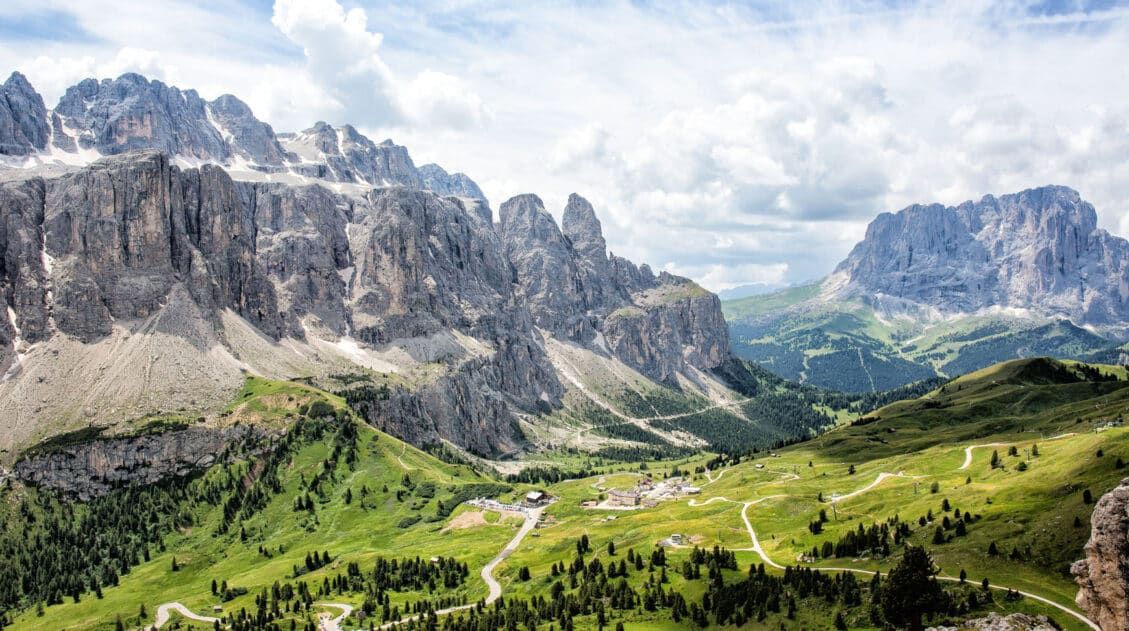
The Adolf Munkel Weg is a point-to-point hiking trail that runs along the Odle/Geisler mountain group in Val di Funes. This hike is on the longer side (13 km) and since it is point-to-point, you will have to use public transportation or do some extra hiking to get back to the starting point.
We didn’t want to do all of that. We shortened the hike, turning it into a loop. The starting and ending points were from the same parking lot, we had awesome views of the Odle/Geisler mountains from Geisler Alm, and we got to visit a few rifugios along the way.
Since we shortened the hike, we did not go to Brogles Alm, another mountain hut located farther up in the mountains. I bet the views are great from there. If you don’t mind a longer hike, later in this guide, I’ll let you know how to add on Brogles Alm.
If you like the idea of an easy-to-moderate loop hike that is much more logistically straightforward to plan, we recommend following in our footsteps.
In this guide, we provide maps, an elevation profile, and lots of photos, so you know exactly what to expect. And if you’re deciding how this hike compares to other classics in the area, you’ll also find it featured in our guide to the best hikes in the Dolomites, alongside other iconic trails.
The Essentials
WHERE | Val di Funes
THE “SWEET SPOT” ROUTE | Hike the easy to moderate 9.2 km (5.7 mile) loop from the Zanser Alm parking lot to see the highlights
TIME | 2 to 3 hours hiking; 1 to 2 hours at the mountain huts
HIGHLIGHTS | Views of the Odlo/Geisler Group from the trail; dine with a view at Gschnagenhardt Alm and Geisler Alm
NEARBY | Make a quick stop at the Church of St. John and/
The Adolf Munkel Weg
The Adolf Munkel Weg starts at the Zans parking lot in Val di Funes. Take trail #6 until you reach the bridge and then take the Adolf Munkel Trail, trail #35. Once you reach Brogles Alm, take trail #28 to Ranui and then complete the loop back to your car. This source lists the distance as 13 km and it will take four and a half hours.
The loop that we did is shorter, since it does not go all of the way to Brogles Alm. This loop is a good option for those who want to explore this area without doing a long hike. It’s a good idea to save some energy, because there is a nearby hike/walk through Val di Funes that is worth adding on after hiking the Adolf Munkel Trail.
Adolf Munkel Weg + Geisler Alm Hiking Stats
Distance: 9.2 km (5.7 miles) loop
Difficulty: Easy to moderate
Total Ascent: 440 m (1,445 feet)
Lowest Elevation: 1,670 m (5,480 feet)
Highest Elevation: 2,055 m (6,740 feet)
Time: 2 to 3 hours + additional time at the rifugios
Our Time: 2 hours of hiking + 2 hours at the rifugios for a total of 4 hours
Starting Point: Zanser Alm in Val di Funes
Ending Point: Zanser Alm in Val di Funes
Toilets: At the trailhead and at the rifugios along the trail.
Best time of day: Morning or evening for lower crowds. Afternoon for better lighting to photograph the Odle/Geisler mountains.
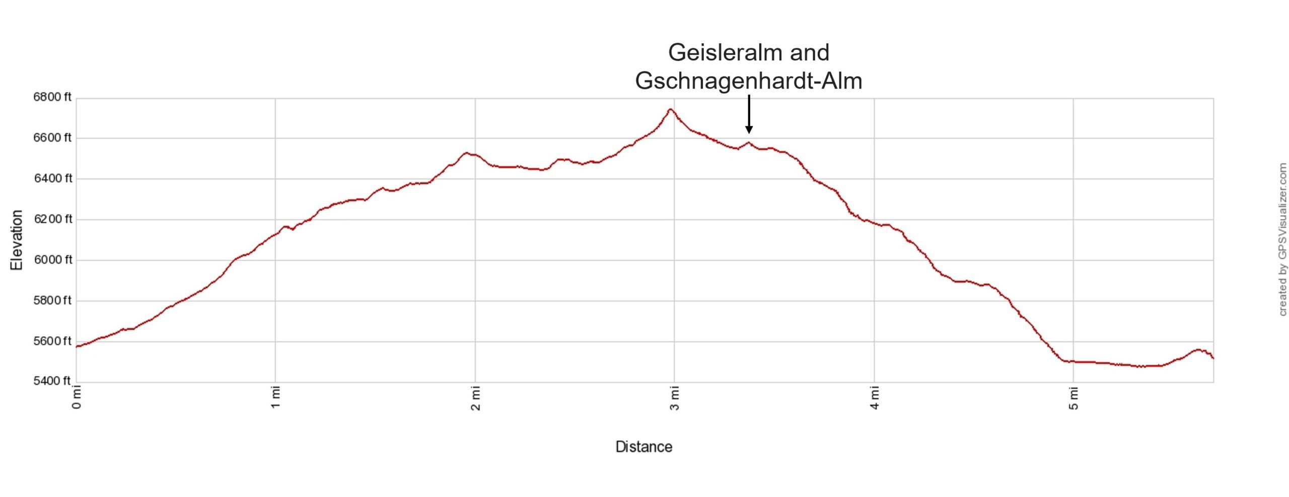
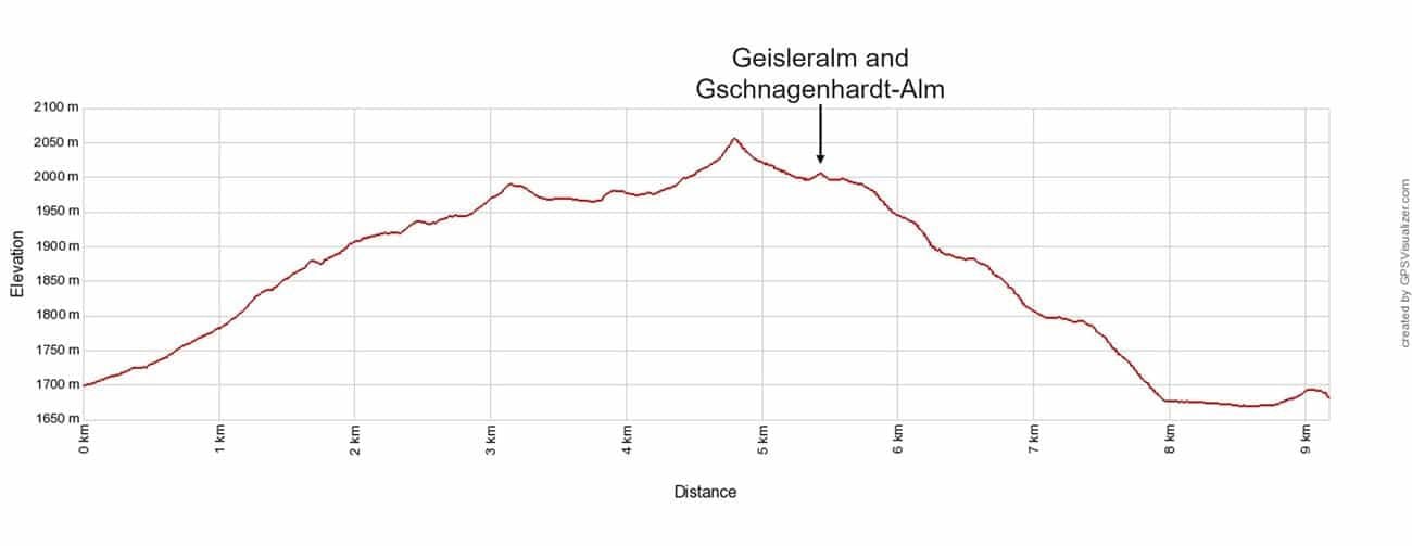
Adolf Munkel Weg to Geisler Alm elevation profile
Maps of the Adolf Munkel Weg
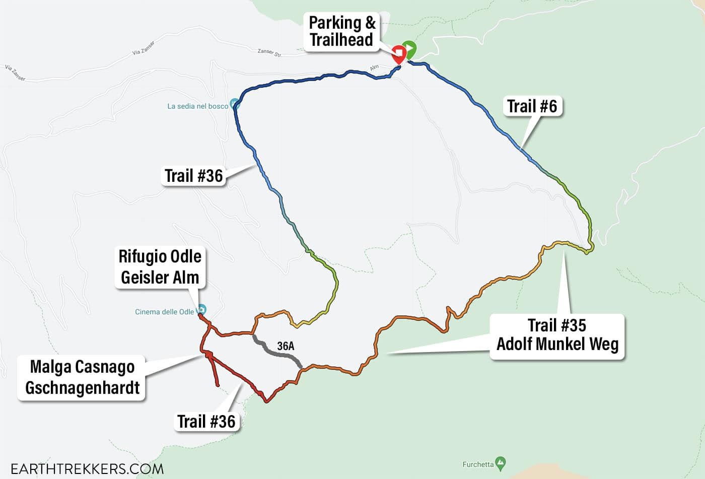
This trail map was generated from my Garmin Fenix watch. The red color is the highest elevation and the blue color is the lowest elevation. I labeled the different number trails. The gray line is an optional shortcut but taking trail #36 is the more scenic way to do this loop.

This Google Earth map shows the location of the trail with respect to the Odle/Geisler group. You can also see how much of the trail is in the woods.
Please practice the seven principles of Leave No Trace: plan ahead, stay on the trail, pack out what you bring to the hiking trail, leave areas as you found them, minimize campfire impacts, be considerate of other hikers, and do not approach or feed wildlife.
Parking for the Adolf Munkel Weg & Geisler Alm
The parking lot is located in Zanser Alm in Val di Funes/Villnoss Valley. On Google Maps, this parking lot has several names: Parkplatz Zanser Alm and Parcheggio Malga Zannes. There is a small fee to park here. It’s a large lot and there were still available spaces when we finished up the hike midday.
Here are driving times from nearby destinations:
- Selva di Val Gardena: 48 km, 1 hour
- Ortisei: 40 km, 55 minutes
- Cortina d’Ampezzo: 85 km, 2 hours
How to Hike the Adolf Munkel Weg to Geisler Alm
Step-By-Step Trail Guide
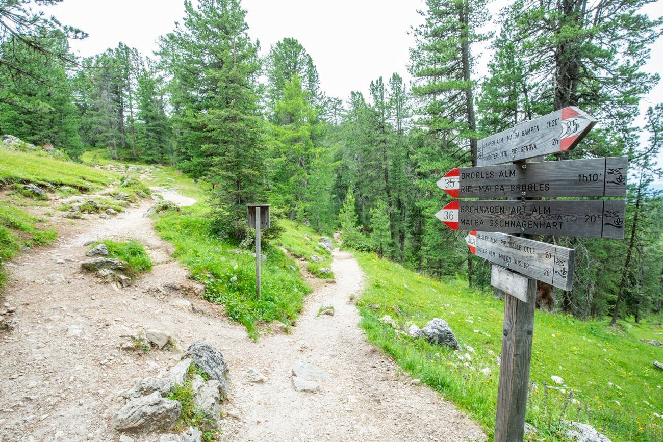
On this loop, there are a LOT of trail junctions. We let you know where these are and which numbered trails to follow along the loop. The entire hike is well marked so as long as you know the numbered trails you need, you shouldn’t have any problems following this loop.
To hike the Adolf Munkel Weg + Geisler Alm loop, here are the trail numbers: Zanser Alm parking/trailhead → trail #6 → trail #35 → trail #36 → Malga Casnago/Gschnagenhardt → Geisler Alm/Rifugio delle Odle → trail #36 → Zanser Alm parking lot.
Trailhead to Adolf Munkel Weg
The trail starts at the Zanser Alm parking lot. Walk towards the restaurant near the parking lot entrance. The trailhead is located to the right of the restaurant.
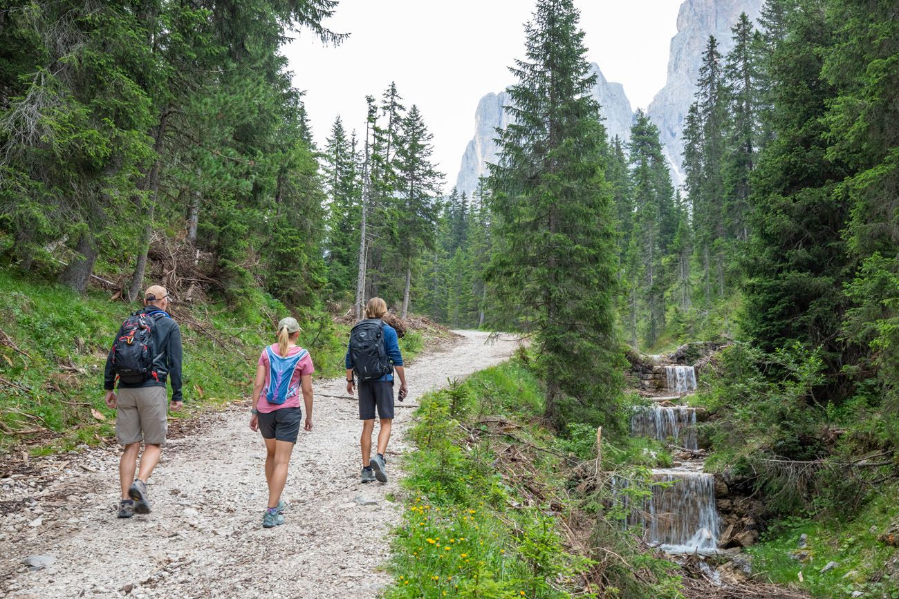
From here, you will take trail #6 to Geisler Alm/Rifugio delle Odle. The trail starts off as a paved road and then changes to a gravel road.
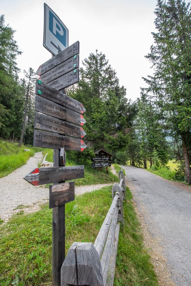
The trailhead
Almost right away you get your first good view of the mountains as you hike past the Zanser Alm hut.
Zanser Alm
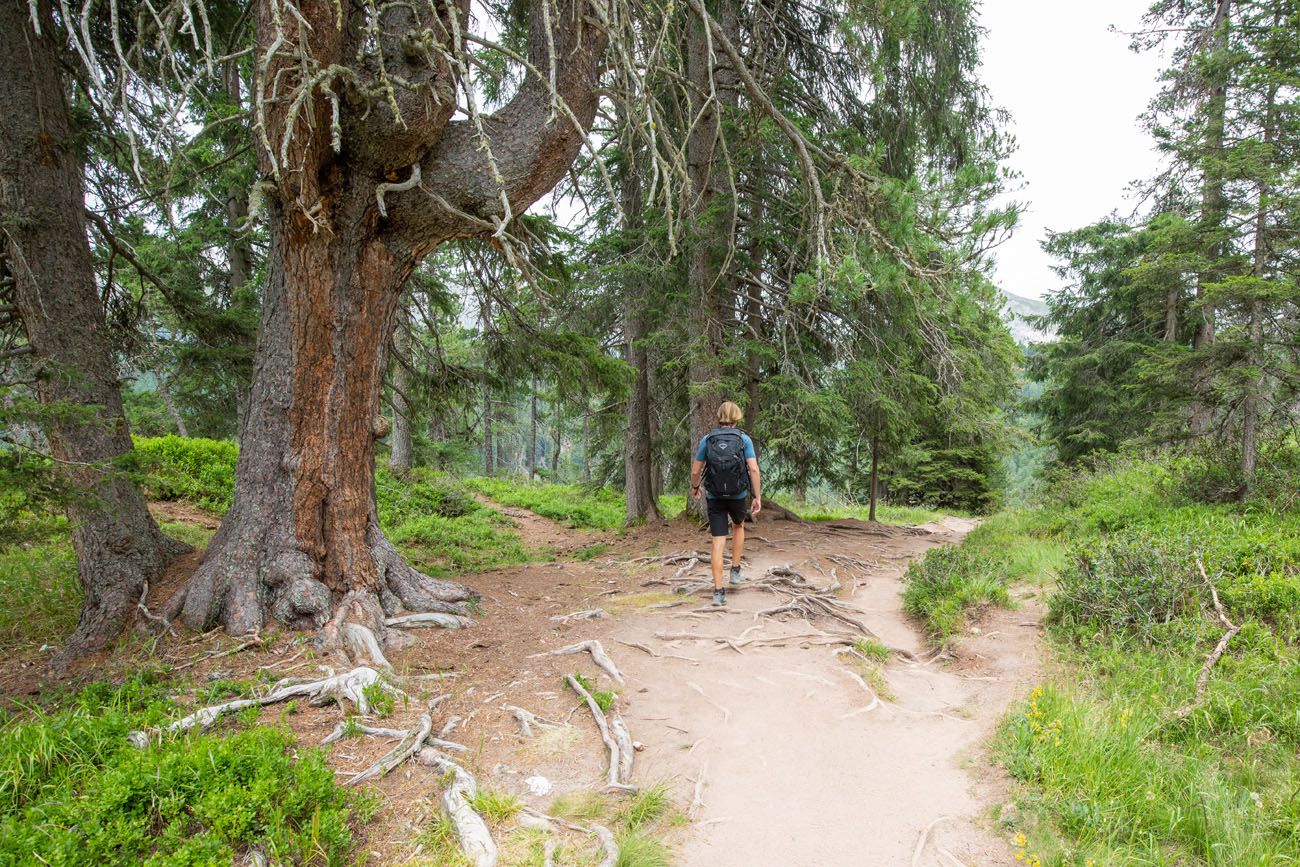
For most of the hike along trail #6, you will be hiking uphill on the gravel road in the woods. There is not much of a view and this is the most uninteresting part of the hike.
Hiking the Adolf Munkel Weg
Trail #6 ends once it reaches the trail junction with the Adolf Munkel Weg, about 1.8 km (1.1 miles) into the hike. At this point, you will now follow trail #35, which is the Adolf Munkel Weg trail. From this point, it will take you one hour to hike to Geisler Alm and 2 hours to hike to Brogles Alm.
Cross the stone bridge and turn left to continue on trail #35, the Adolf Munkel Weg.
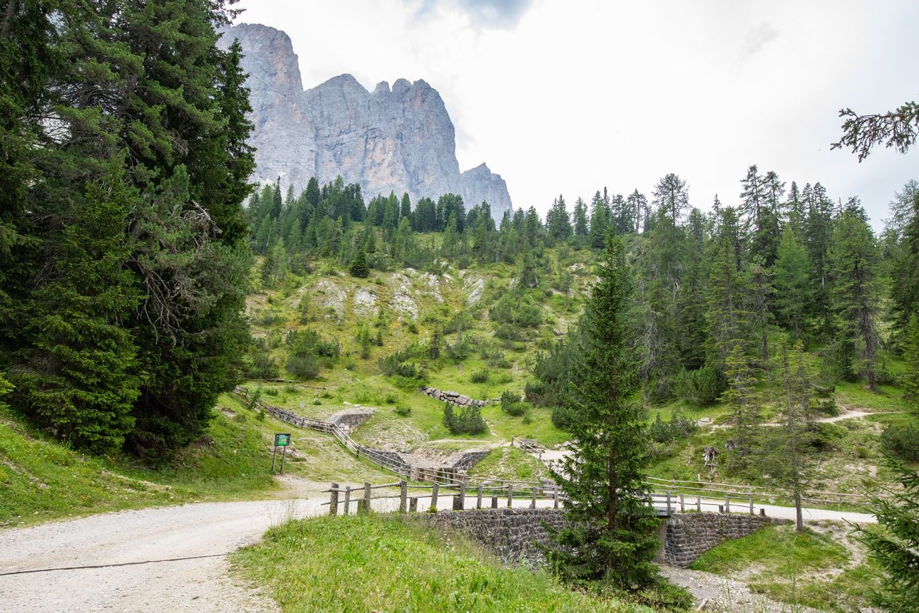
Cross this stone bridge and then take the trail to the left.
The start of the Adolf Munkel Weg. Walk through the turnstile and take the trail to the right.
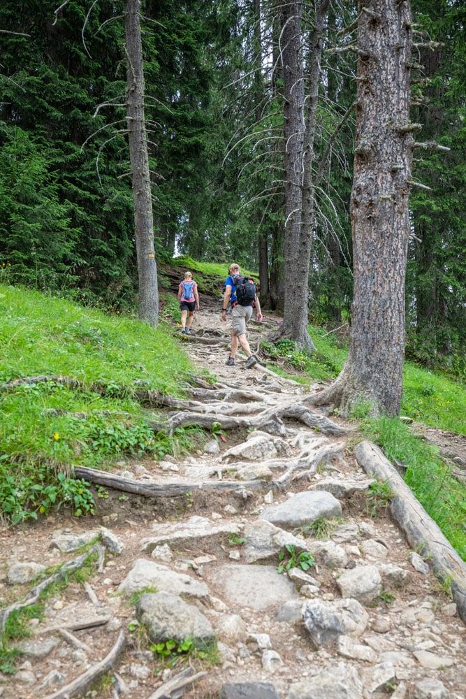
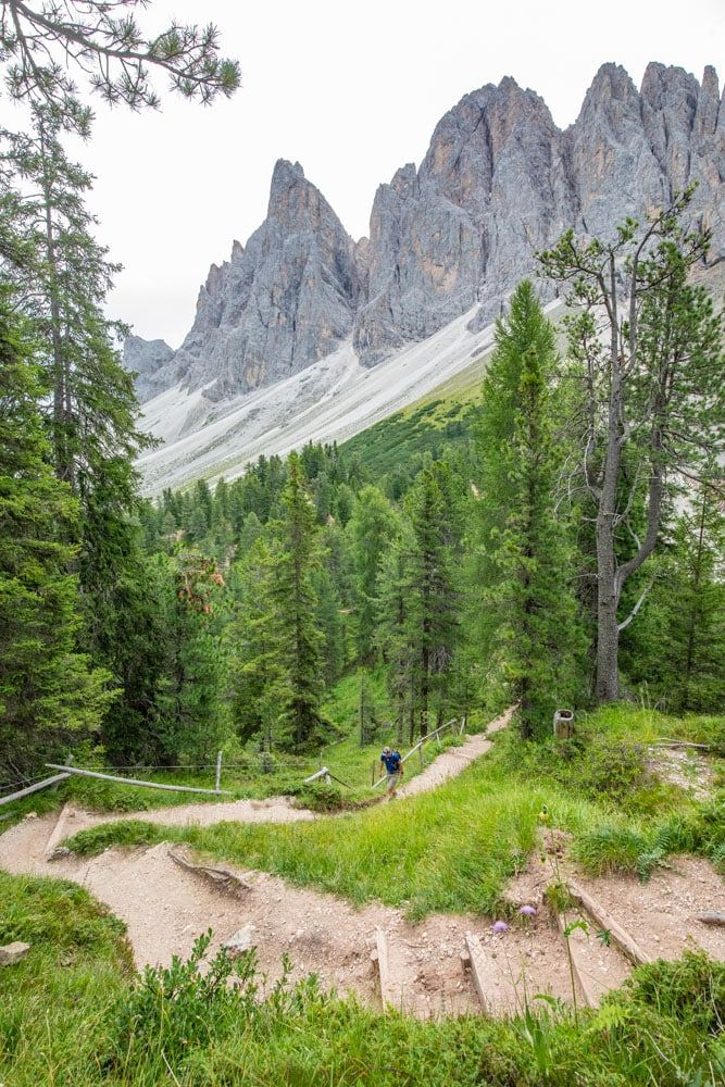
Now the hike gets a little more interesting. You are still in the trees, but you hike over twisted, gnarly tree routes, through dense clumps of evergreens, and occasionally have a view of the mountains.
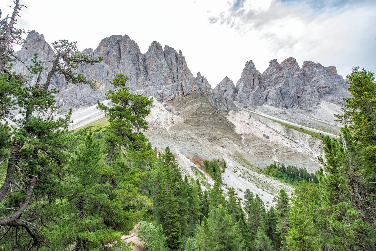
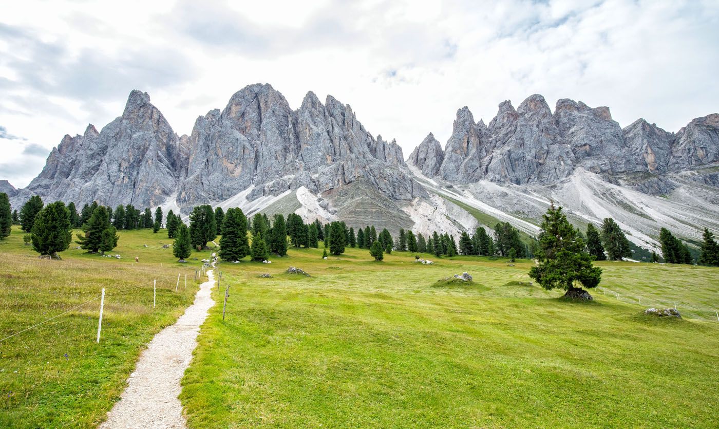
The Adolf Munkel Weg follows along the Odle/Geisler mountain group. There are some ups and downs here, but the occasional views of the mountains and out over Val di Funes makes it worth the effort here.
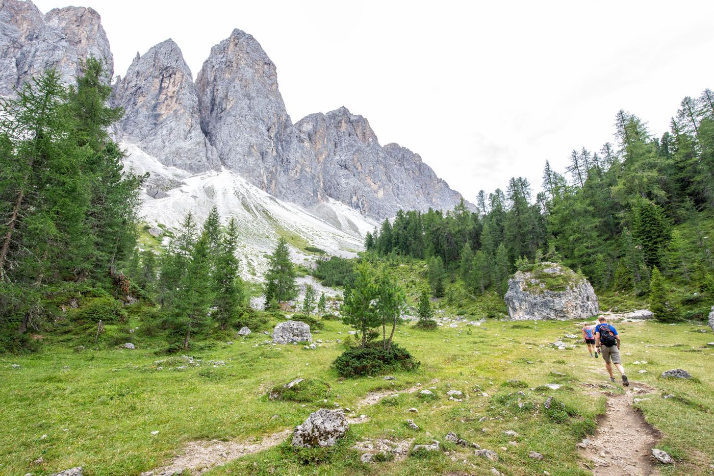
A view of the Odle/Geisler group from the trail.
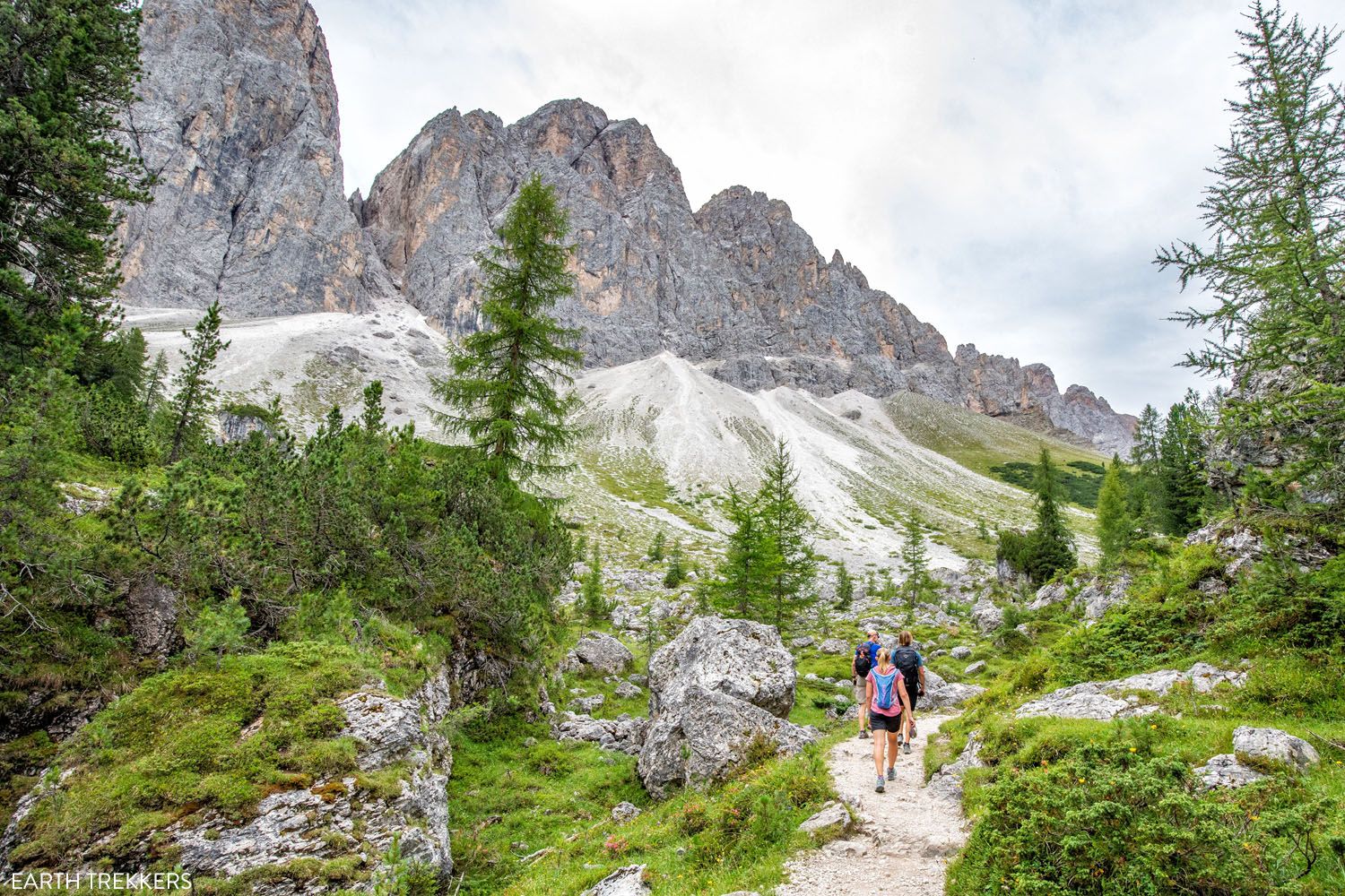
Adolf Munkel Weg
Trail #36 to Gschnagenhardt Alm (Malga Casnago)
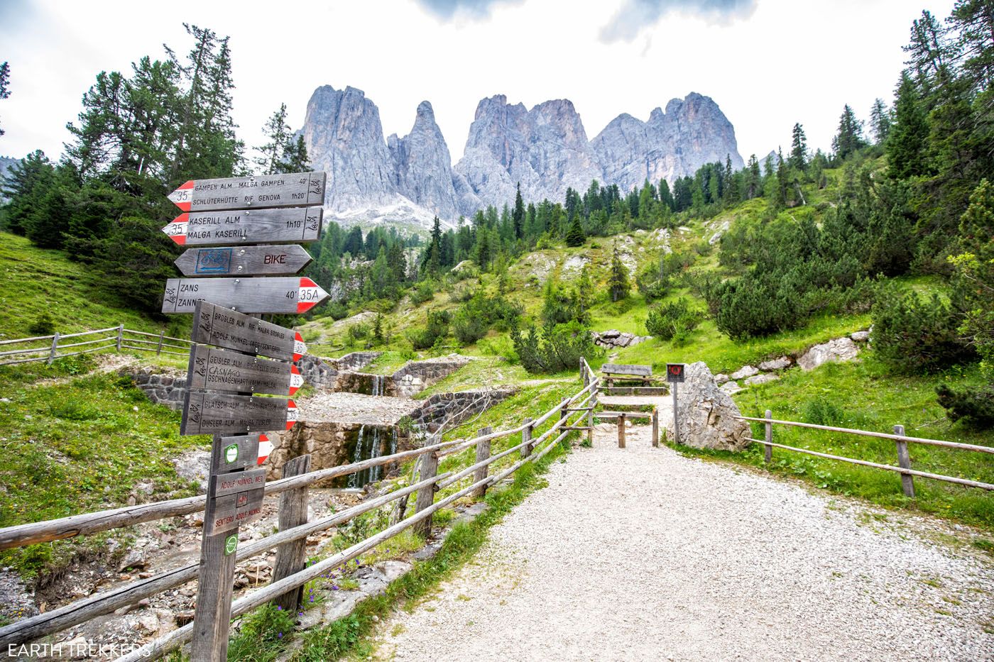
At about 4 km (2.6 miles) you reach a fork in the trail. At this point, you have a choice to make. If you go left, you will take trails #35 and #36 to Gschnagenhardt Alm (Malga Casnago) and have the option to continue to Brogles Alm. If you go right, you will hike trail #36A which is a more direct route to Geisler Alm (but it only saves about 0.1 to 0.2 km).
We spoke to another hiker at this point and he recommended that we go left, on trail #36, since it is more scenic. So, we took his advice and I’m glad we did.
At this trail junction, stay to the left to take the more scenic route to Gschnagenhardt/Malga Casnago.
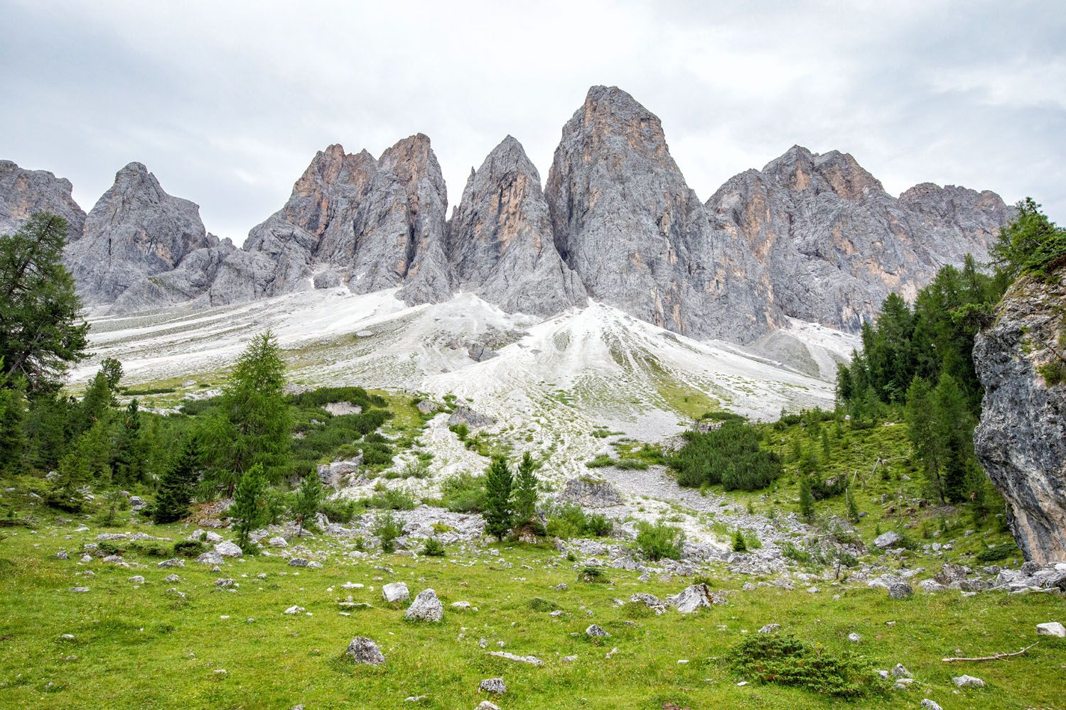
Trail #36 heads uphill and leads to nice viewpoint of the Odle/Geisler mountains.
A view of the Odle/Geisler group.
And then just 0.4 km later (0.25 miles) you will reach yet another trail junction. To do the loop as we did it, turn right to take trail #36 to Geisler Alm and Gschnagenhardt Alm. If you take the trail to the left, it is a one hour hike on trail #35 to get to Brogles Alm.
Tim is hiking up the final climb of the day.
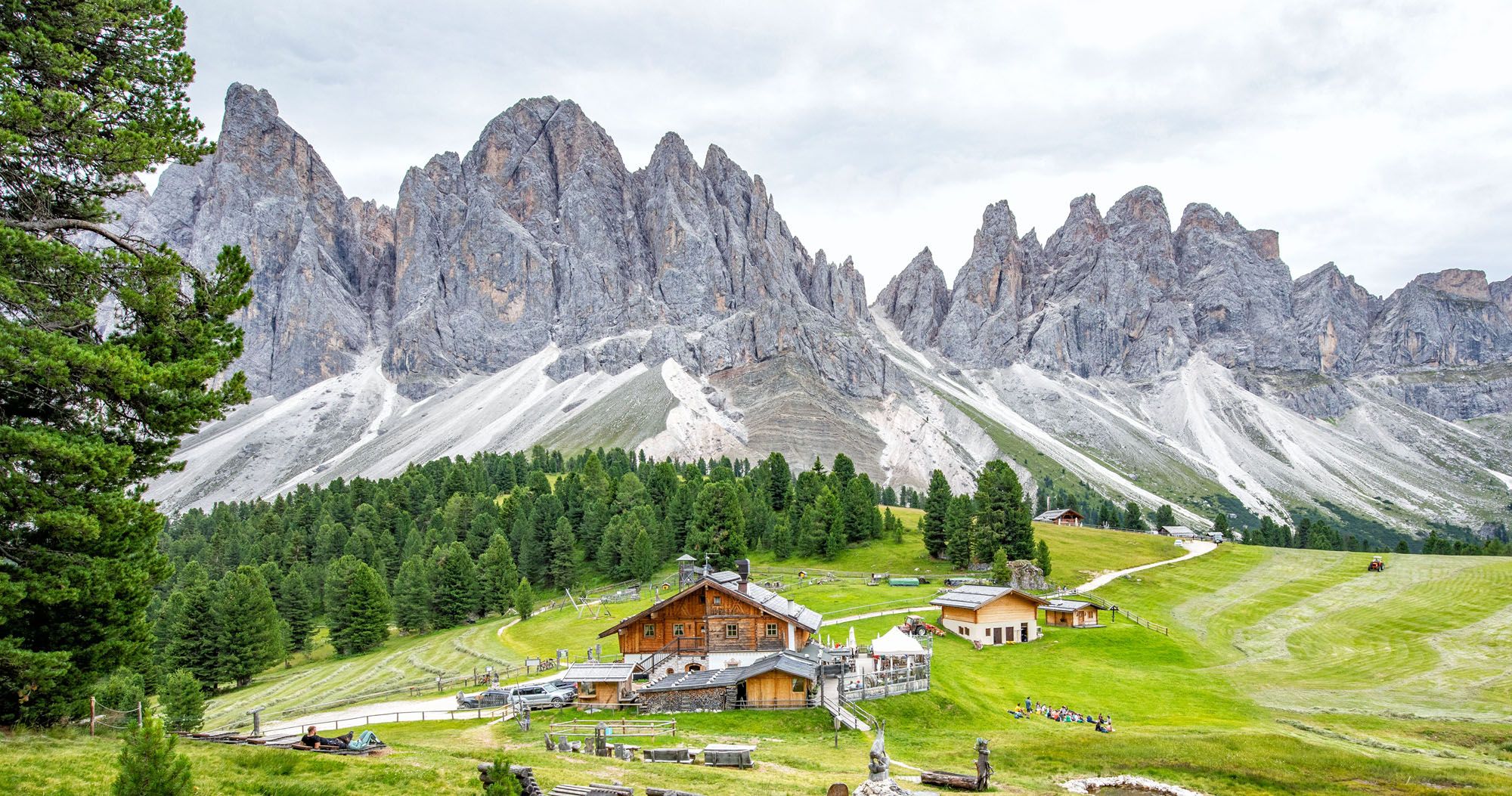
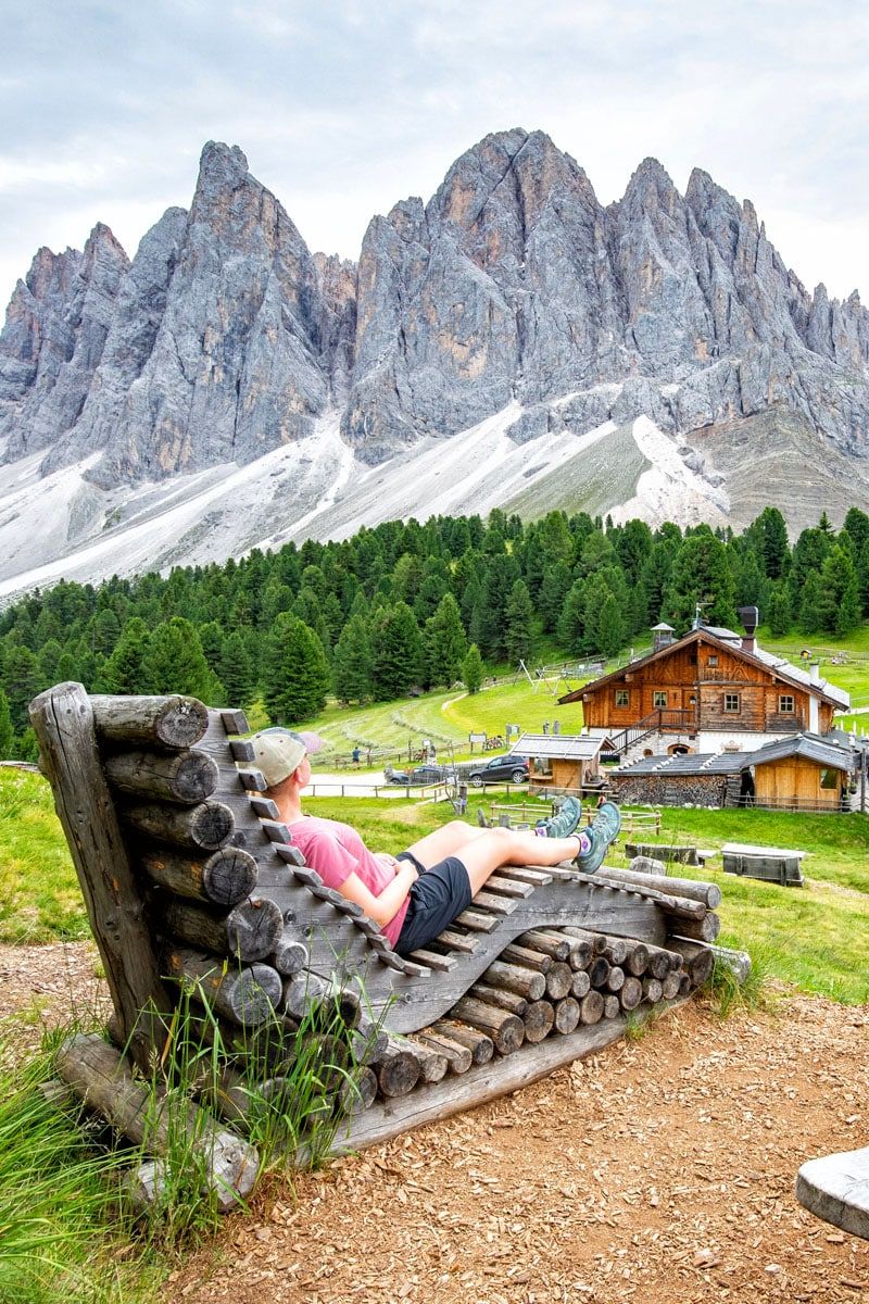
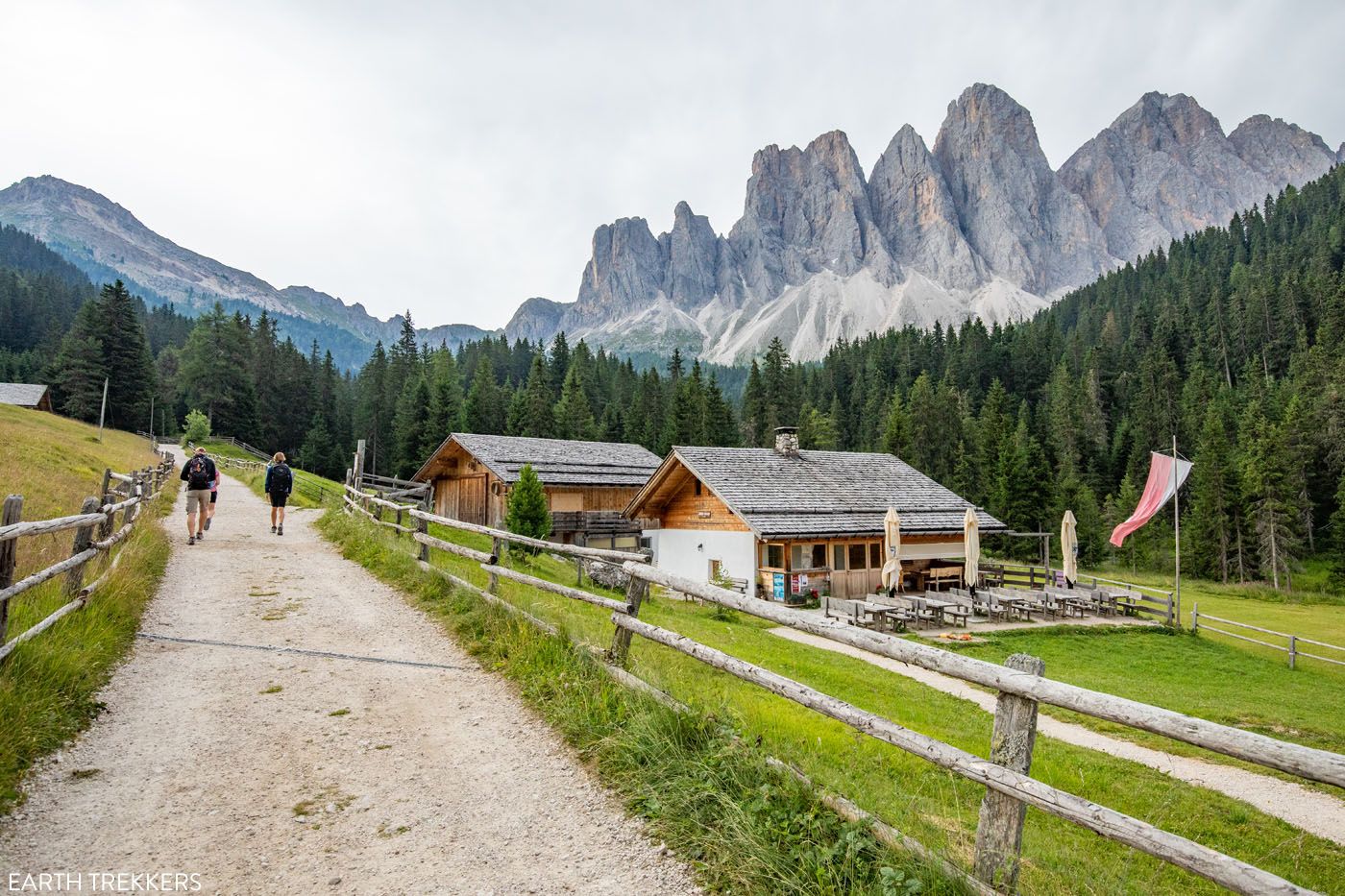
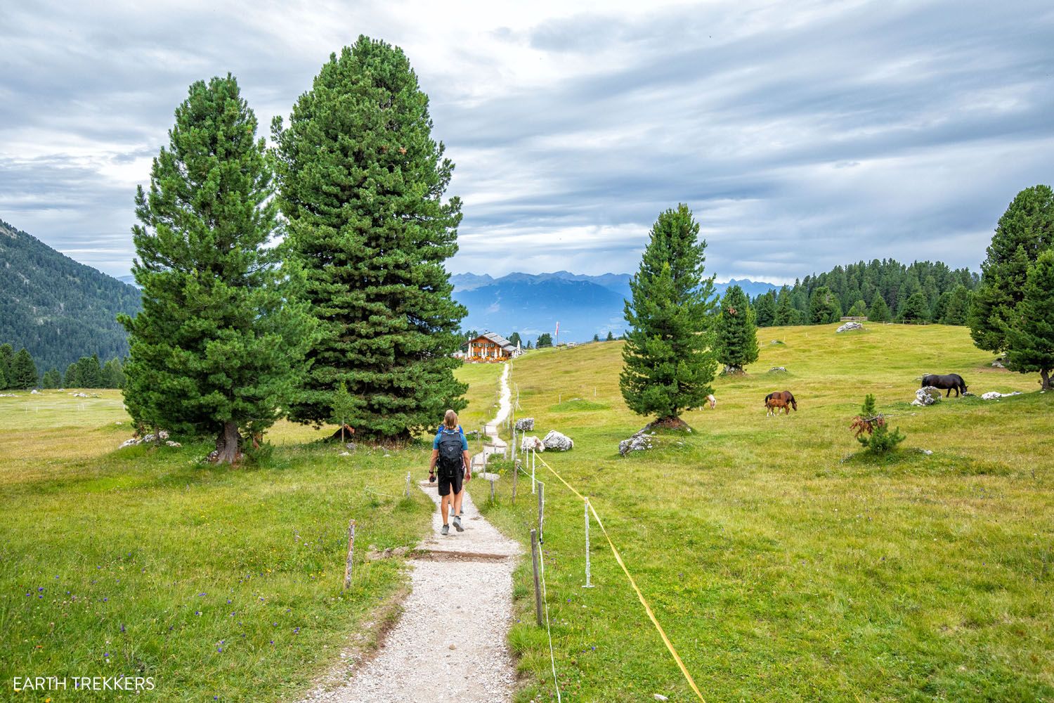
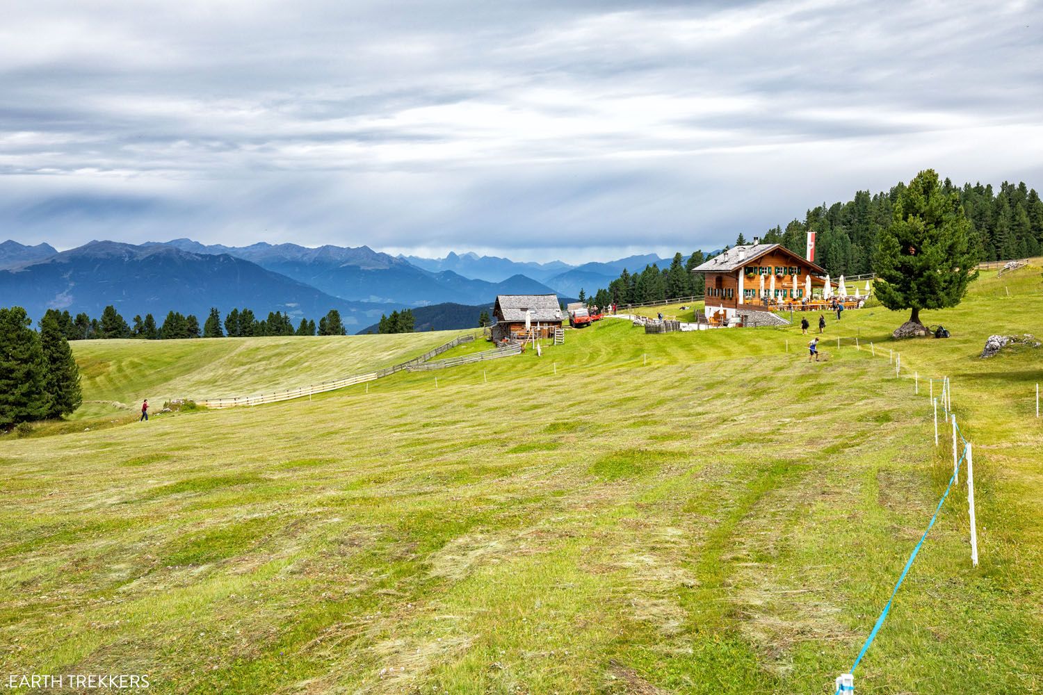
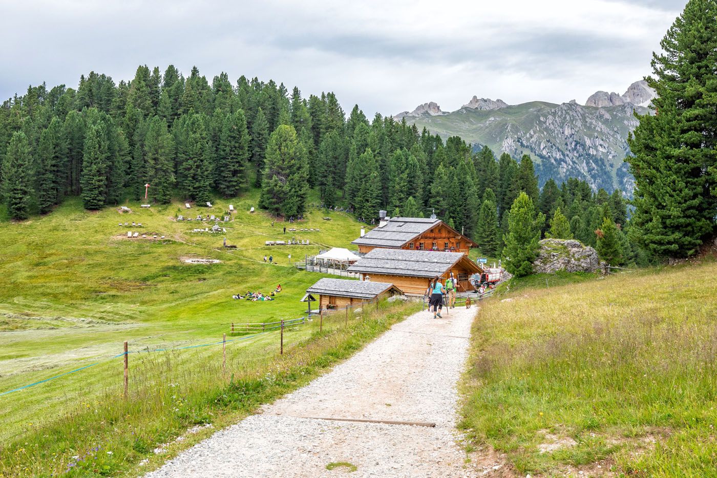
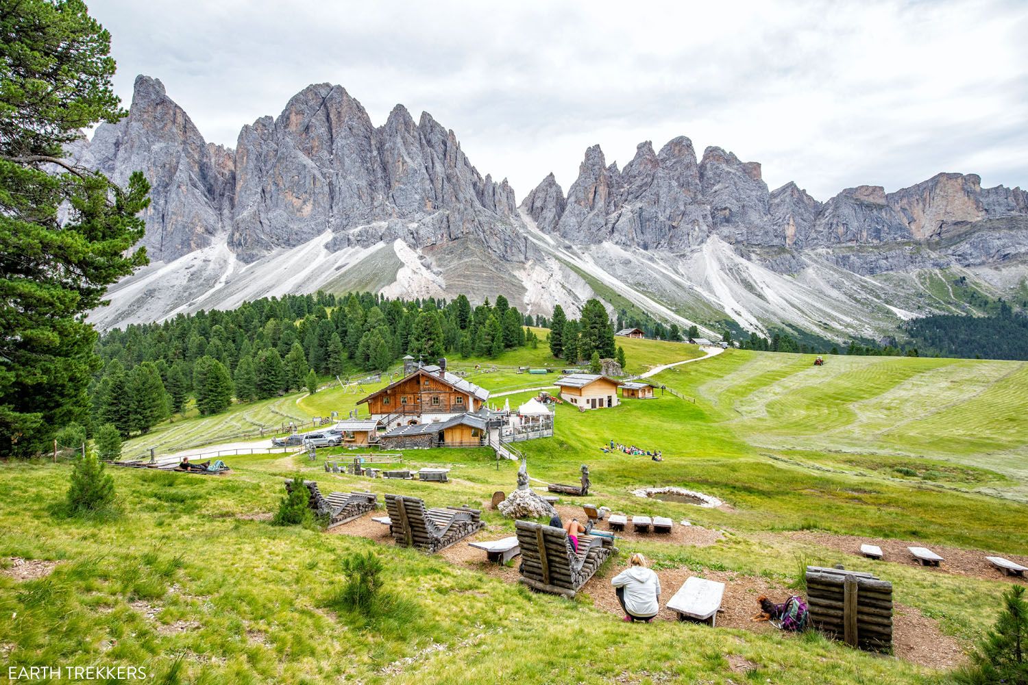
Once you climb the long series of staircases, most of your ascent is done for the hike. And the views are about to get very good. You enter a wide meadow. In front of you is the charming Gschnagenhardt Alm hut (also called Malga Casnago) and behind you are photogenic, jagged peaks of the Odle/Geisler mountain group.
The view from Malga Casnago of the Odle/Geisler group and trail #36.
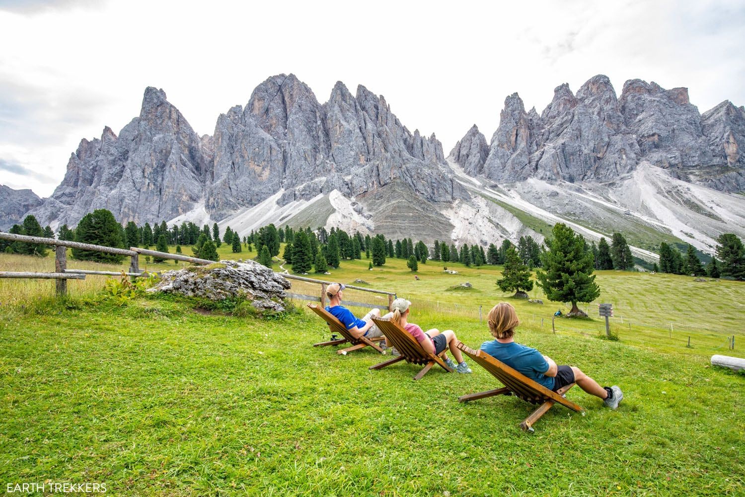
Gschnagenhardt Alm/Malga Casnago
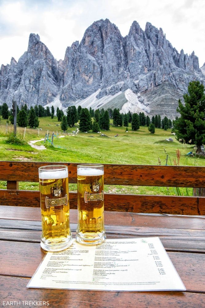
The four of us loved it here. We got here at 10:30 am and hung out here for about an hour and a half. The kitchen opens at 11:30 am, so to pass the time, we took photos in the lounge chairs, enjoyed the view, and shared a few beers.
The food here is very good. Tim had fried eggs with bacon and sausage and Tyler, Kara, and I had gulasch with potatoes. Sitting at their outdoor terrace with the mountain views was the highlight of this hike for us.
If you still like the idea of adding on Brogles Alm, you can do that from here. Take trail #34 and it is a one-hour hike to Brogles Alm.

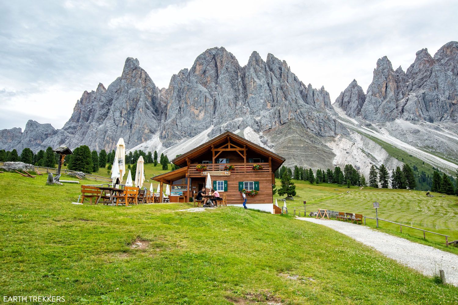
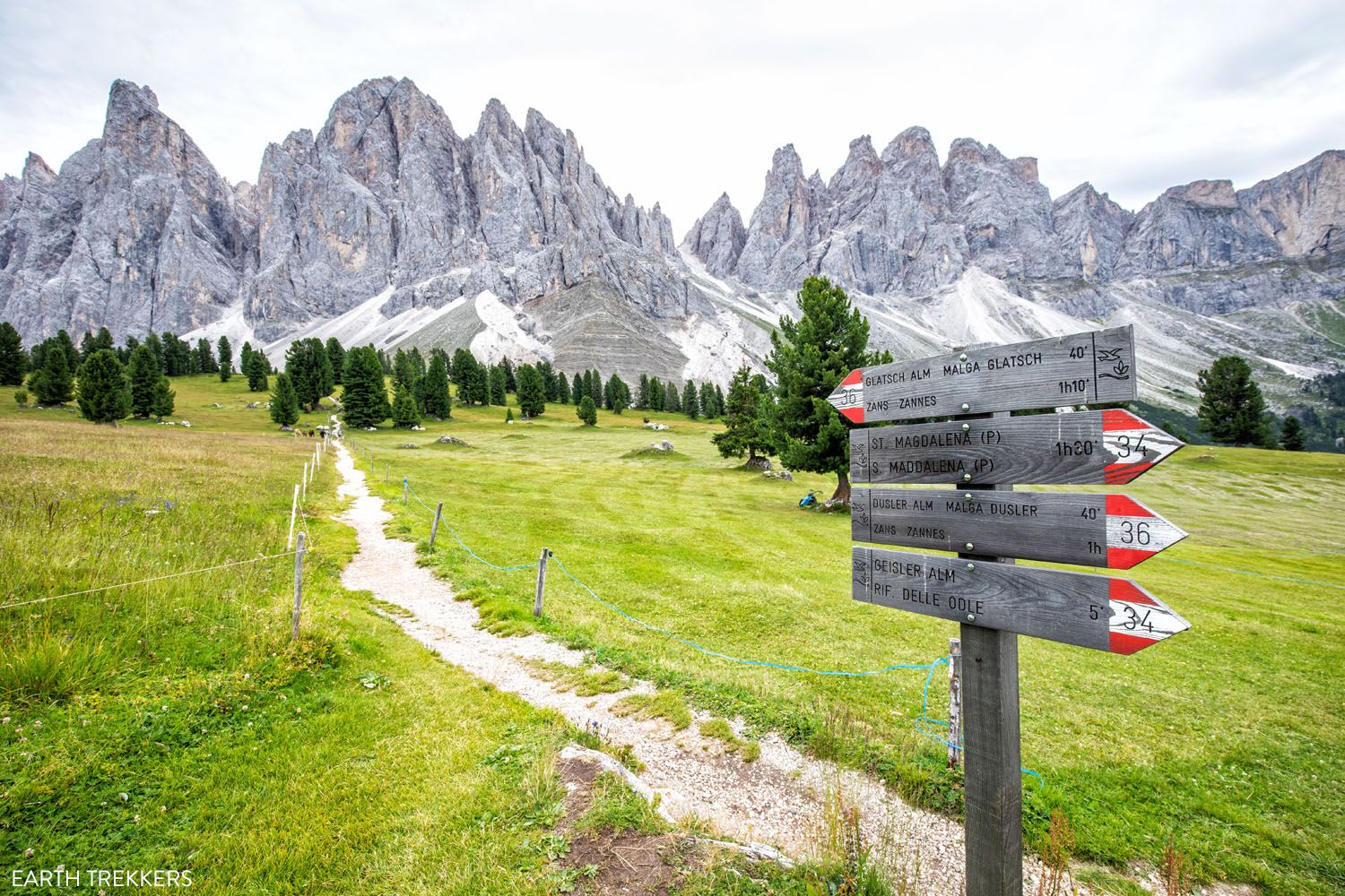
Rifugio delle Odle – Geisler Alm
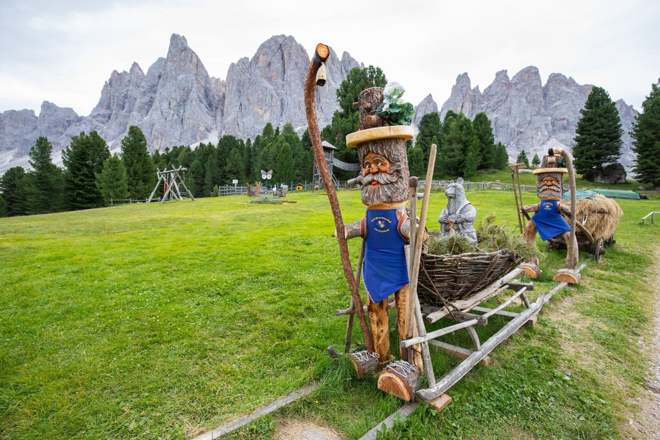
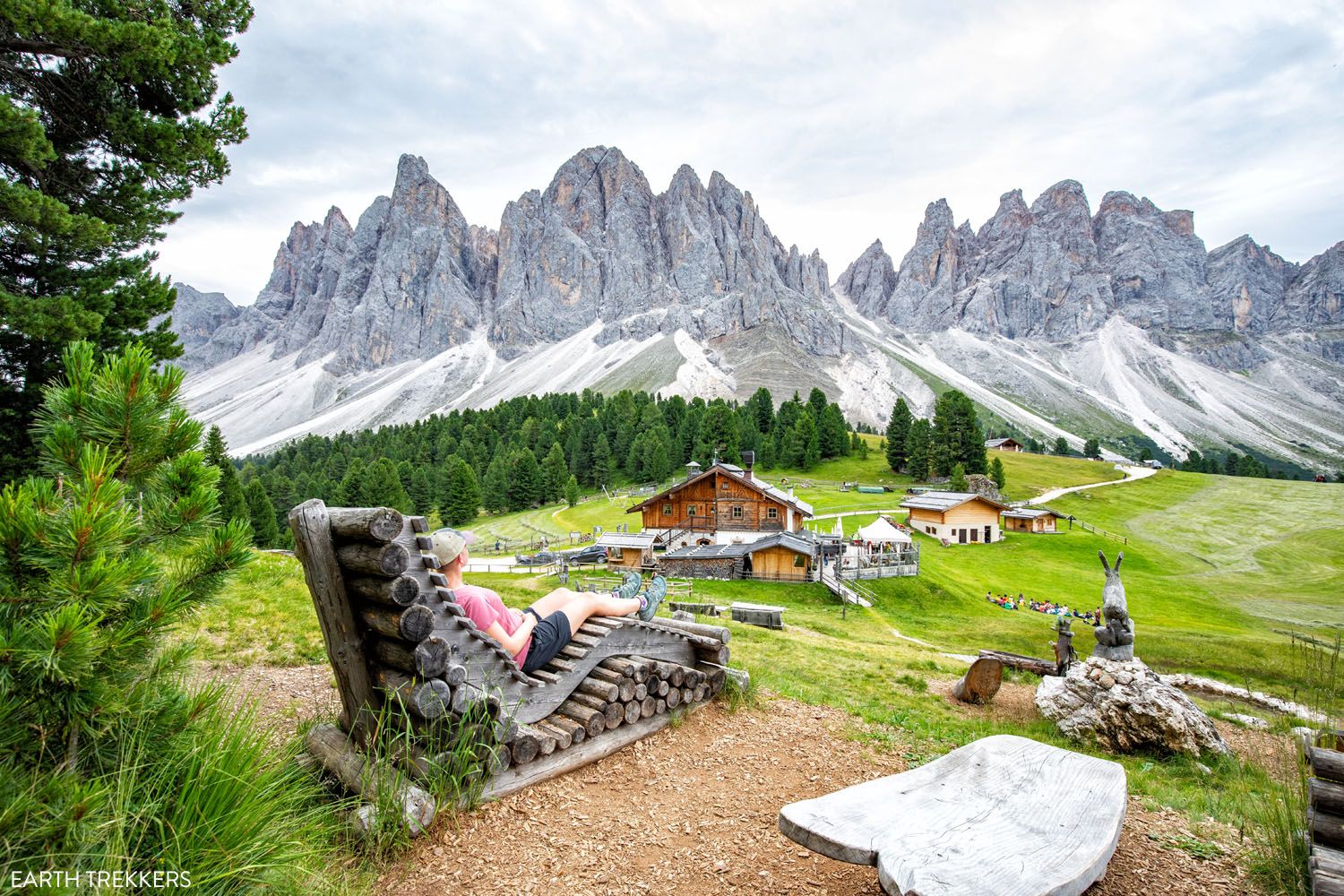
Geisler Alm is a downhill, 5-minute walk (0.2 km/0.1 mile) from the Gschnagenhardt hut. This mountain hut also has a restaurant, as well as a playground. On the hillside are various chairs and lounge chairs, which make interesting photo spots and a great place to sit back and enjoy the view.
The trail between Malga Casnago and Geisler Alm
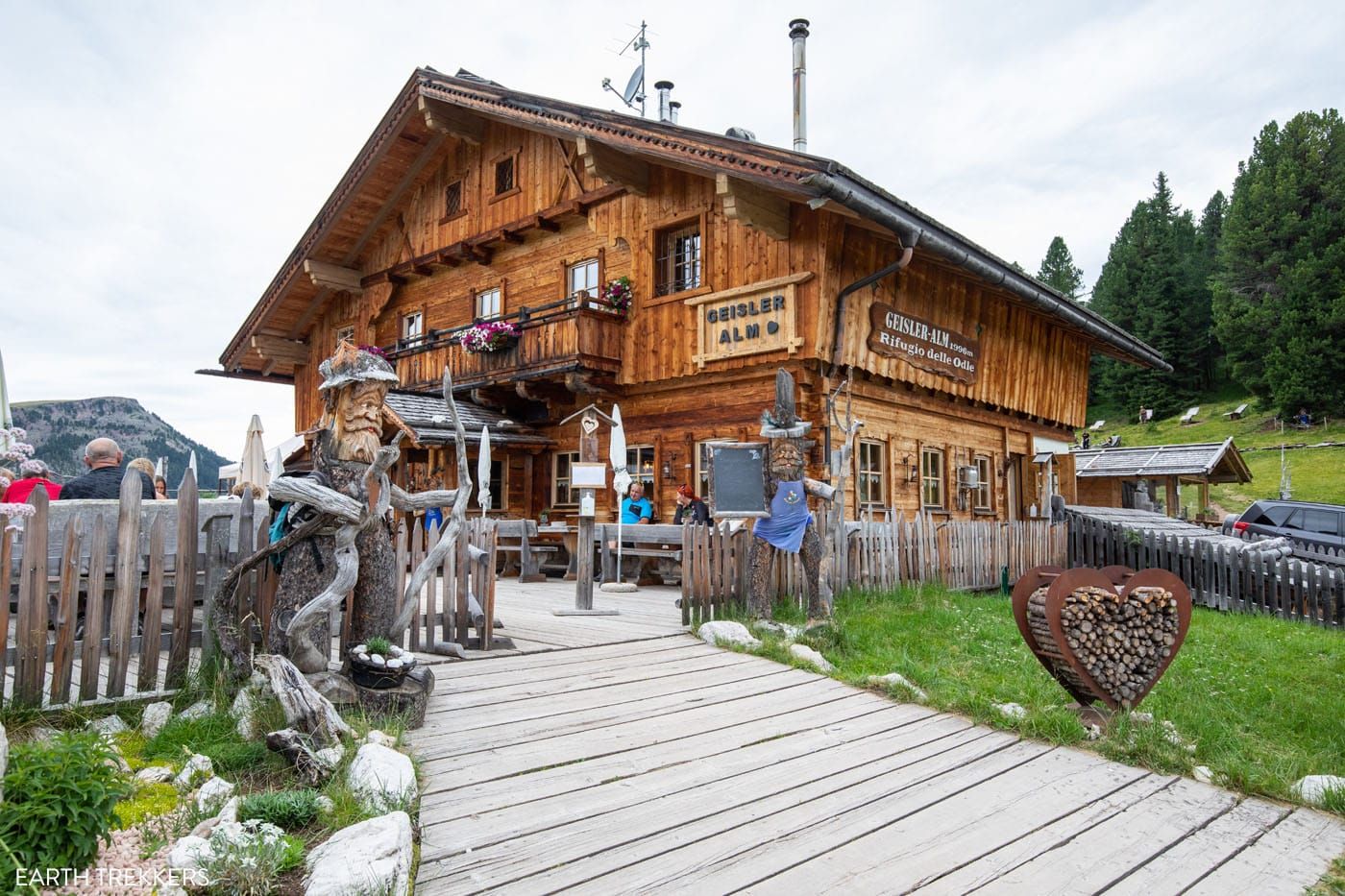
Geisler Alm/Rifugio delle Odle
We liked Gschnagenhardt Alm (Malga Casnago) more than Geisler Alm, since Gschnagenhardt Alm was less crowded and it had unobstructed views of the mountains. However, we did not eat at Geisler Alm, so I cannot comment on the food.
Geisler Alm to Zanser Alm
To complete the loop, take trail #36 towards Zans/Zannes. It is just over an hour of walking from this point.
From Geisler Alm, it’s a downhill walk that can be steep at times. Once again, you are in the trees, so you don’t get much of a view. About halfway back to the parking lot you will pass the hut at Dusler Alm, so you could stop for food or drink here if you need it.
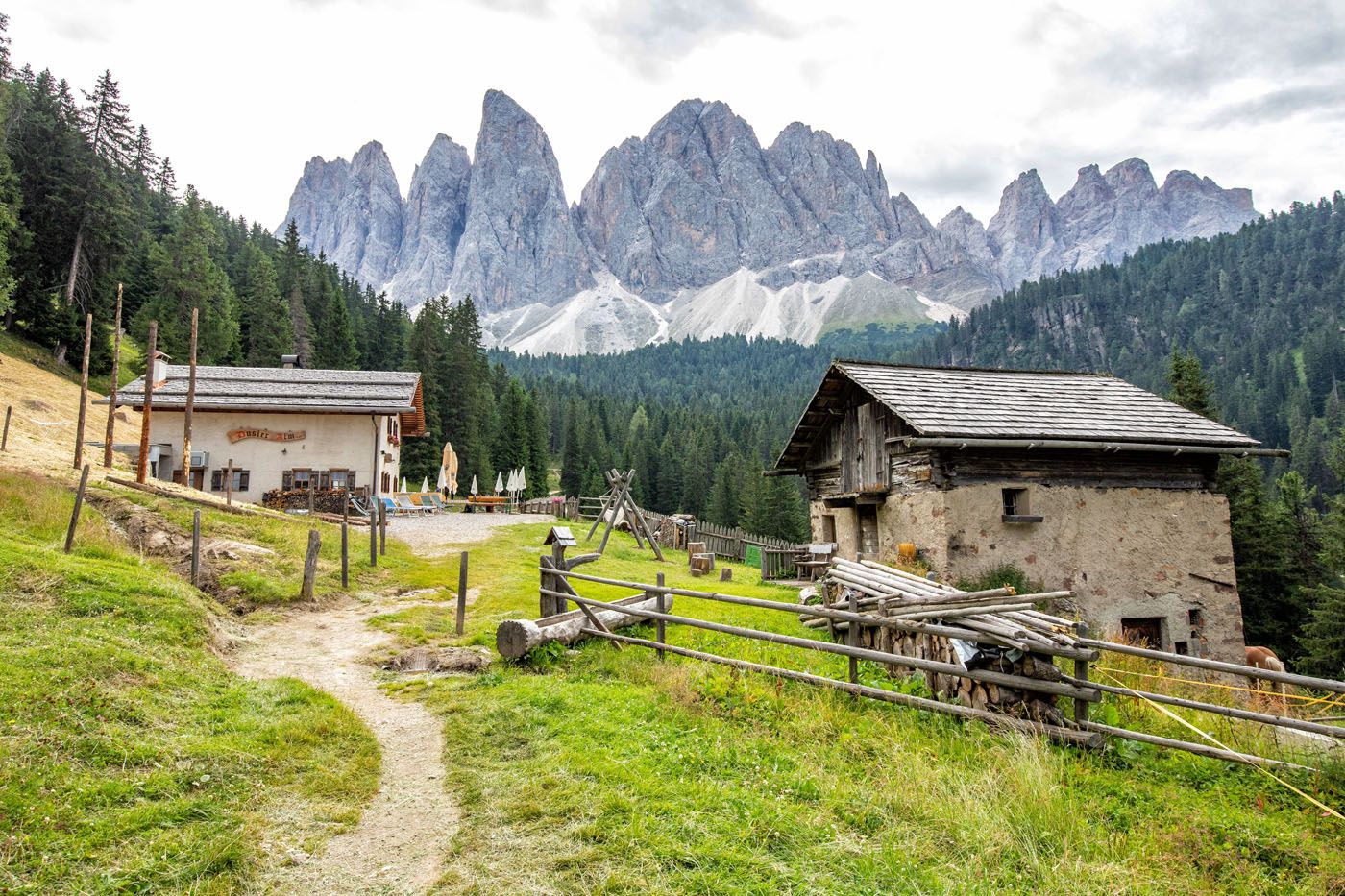
Dusler Alm
Once back in the parking lot, you have completed the loop.
Variations of This Hike
Hiking Directly to Geisler Alm
If you hike directly from the parking lot to Geisler Alm and back, the hiking distance is 7.5 km (4.7miles) that will take approximately two and a half hours. Take trail #36 from the far end of the parking lot (the western end) to Geisler Alm. This skips the walk on the Adolf Munkel Weg.
Distance: 7.5 km (4.7 miles) out-and-back
Difficulty: Easy to moderate
Total Ascent: 400 m (1,310 feet)
Lowest Elevation: 1,670 m (5,480 feet)
Highest Elevation: 2,000 m (6,560 feet)
Time: 2.5 hours plus time at both rifugios
Adding on Brogles Alm
Brogles Alm can be added on after visiting Gschnagenhardt Alm (Casnago Alm) and Geisler Alm. It will be an hour walk to get to Brogles Alm from here. If you walk back to the parking lot via Geisler Alm (hiking out and back to Brogles hut), it will take about 2.5 hours to hike from Brogles hut to the Zanser Alm parking lot.
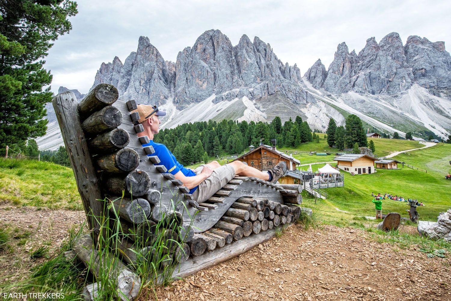
The view from Geisler Alm
Our Thoughts on this Hike
Even though this is a very good hike, it was one of our least favorite hikes in the Dolomites. There are so many outstanding hikes in the Dolomites that this one falls near the bottom of our best hikes in the Dolomites list.
Yes, the views of the mountains from Geisler Alm are spectacular. But you will spend a lot of time in the woods to get here.
Most of the hike is on trails through a forest. It’s a lovely walk through the woods, but most likely you came to the Dolomites to see the mountains, and you only get that briefly on this trail. This hike lacks those big views for most of its distance.
It’s not until you reach Gschnagenhardt (Malga Casnago) and Geisler Alm that you get to see the panoramic views of the Geisler/Odle mountain group. And on the return hike, it is more hiking through the woods.
With that being said, we loved visiting both Gschnagenhardt and the Geisler Alm/Rifugio delle Odle huts. The food and the views from Gschnagenhardt were amazing and in the morning, this area was still relatively quiet.
And Geisler Alm, with its lounge chairs, playground, and restaurant, is a great place to spend an hour or two.
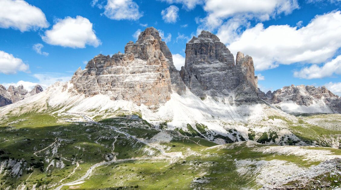
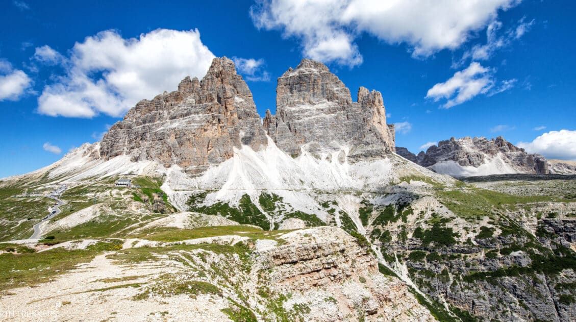
I’m glad we did this hike, but we had a total of 12 days in the Dolomites, spaced out over two separate trips. For those with limited time in the Dolomites, I think there are better hikes to do, such as Tre Cime di Lavaredo (one of the most popular hikes in the Dolomites), the Cinque Torri + Rifugio Nuvolau combo (relatively short and easy and there is never a boring moment on this hike), or the Puez-Odle Altopiano (a longer, more challenging hike with some incredible views of the Dolomites). For a longer list of hikes, read our article Best Hikes in the Dolomites.
If I did it again, I would either hike directly to Geisler Alm and Gschnagenhardt, to have lunch with a view. Or I would go farther, adding on Brogles Alm, for a different viewpoint of the Geisler mountain group.
What to Bring on the Hike
Hiking shoes. I recommend wearing hiking shoes for this hike. The trail is rough and uneven in a lot of places and hiking shoes will give you added traction which will be very helpful on this hike.
Water. Bring at least 1.5 liters of water per person. You can refill you water bottle or hydration pack at the rifugios along the trail.
Sunscreen, hat, and sunglasses. Most of the trail is shaded, but you will be exposed to the sun for an hour or two (or longer, depending on how much time you spend at the rifugios).
Cash or a credit card to purchase food at the rifugios.

Essential Hiking Gear: What Should You Bring on a Day Hike?
If you are new to hiking or are curious about what you should bring on a hike, check out our Hiking Gear Guide. Find out what we carry in our day packs and what we wear on the trails.Add on the Santa Maddalena Viewpoints
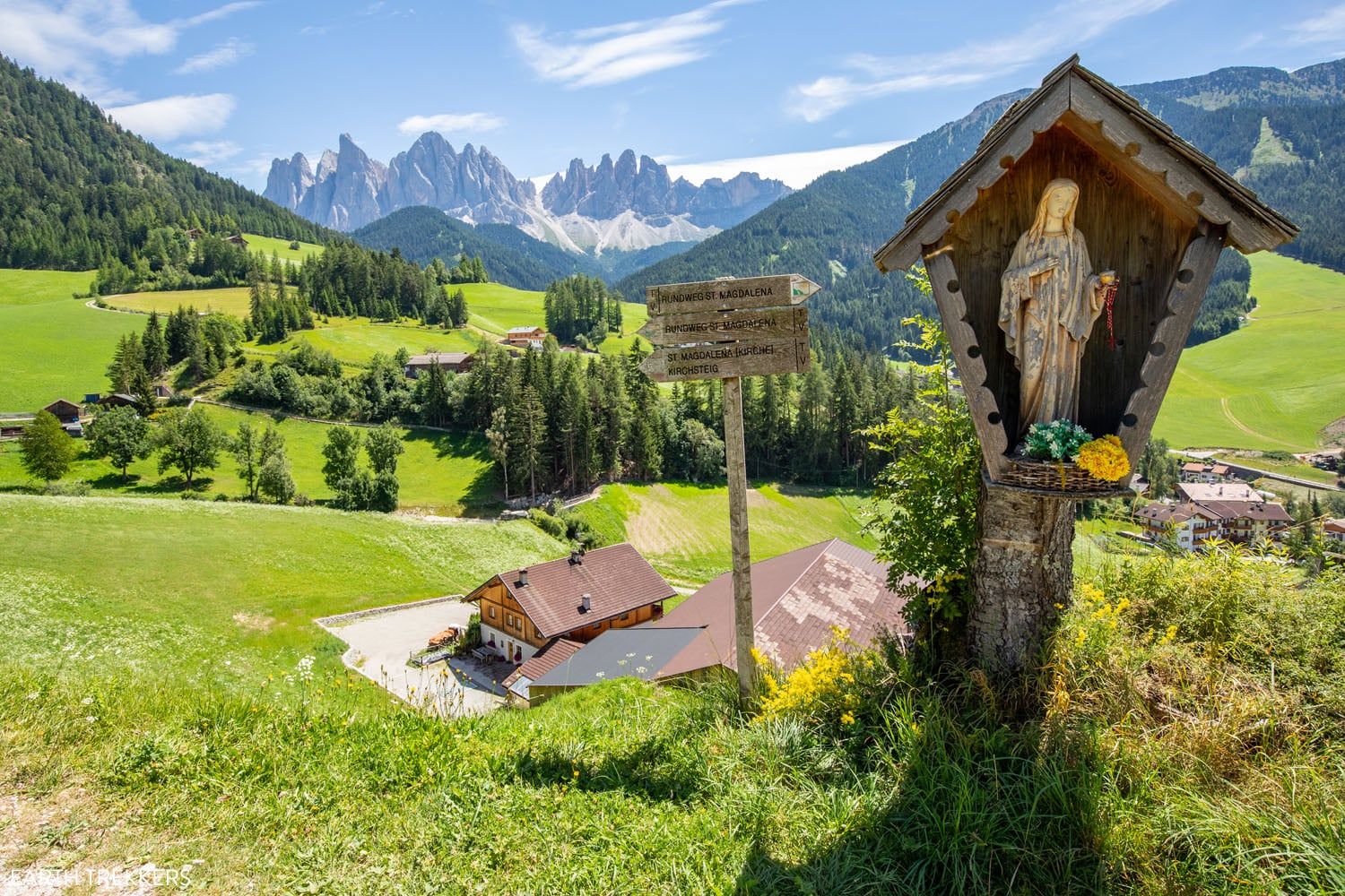
Before leaving Val di Funes, you have the option to add on the viewpoints of Santa Maddalena.
Church of St. John
There is a viewpoint of the Church of St. John that you can get to with a very short walk. In the town of Santa Magdalena (St. Maddalena), park in the small parking lot on Via Zanser (Via Geisler), GPS coordinates: 46°38’12.3″N 11°43’19.6″E. From here, walk 1 minute on San Giovanni (St. Johann) to the viewpoint. It is a small, elevated platform with a fence around it. Here’s the view.
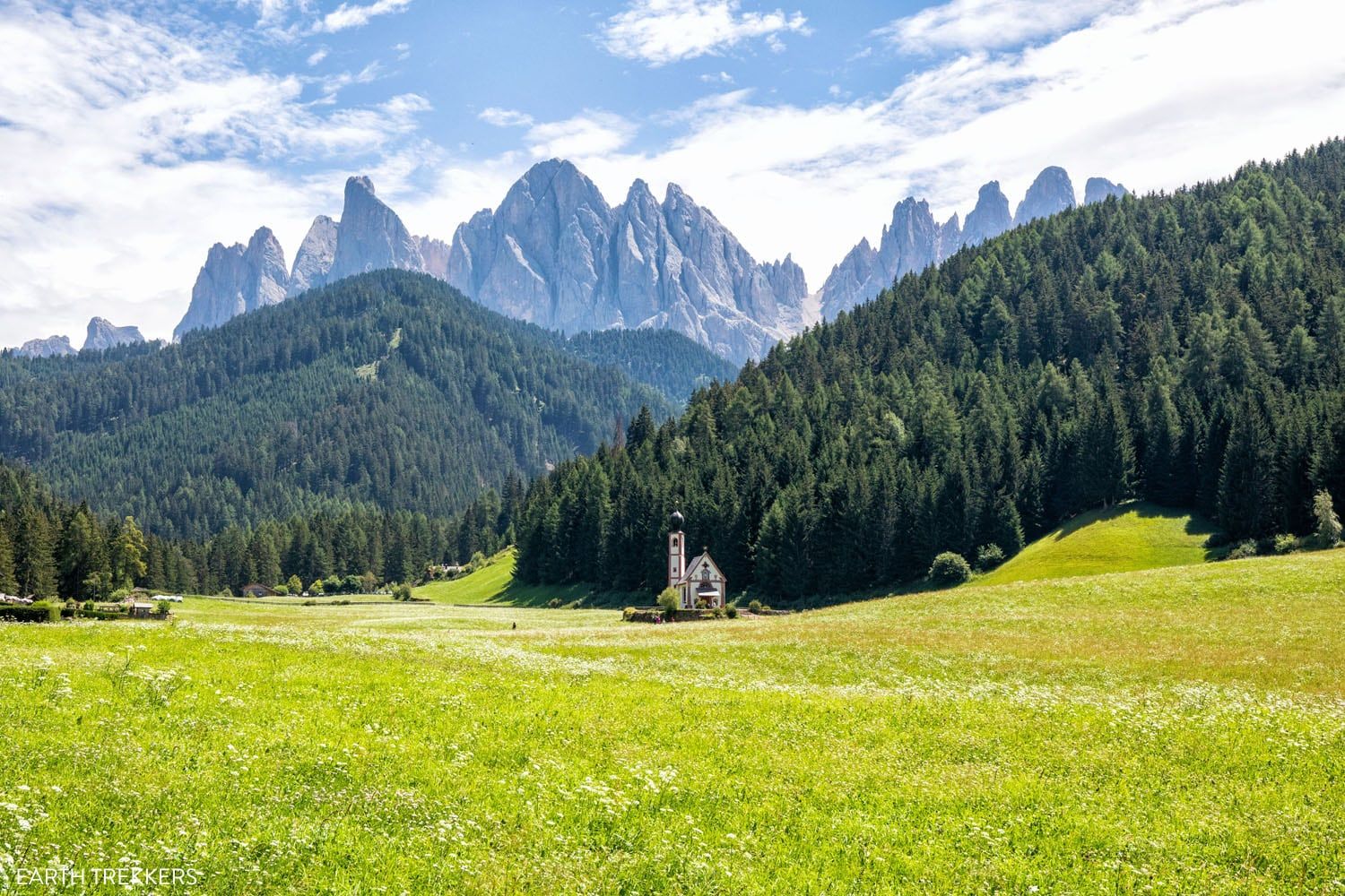
Church of St. John
The Santa Maddalena Panorama Trail
For those who want to explore farther, you can walk the Santa Maddalena Panorama Trail, a 10 km/6 mile loop that has several stunning viewpoints of the area.
A lot of the walk is along paved roads. As a visitor, you are not permitted to drive the roads since they are only open to residents of the area.
You just spent a few hours hiking, so another long walk is probably not something you’re goint to be too excited about doing right now.
The good thing is that you can shorten the hike and walk directly to the viewpoint.
If you just want to get to the viewpoint in the photo below, it is a 1.5 km/0.9 mile walk one-way to the Santa Maddalena viewpoint. Park at the Parkplatz Naturparkhaus lot in town. There were plenty of parking spaces here midday in July when we were here. The entire walk will take about an hour. You also have the option to add on a visit to the Santa Maddalena church during the walk.
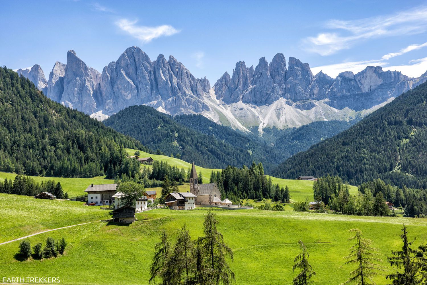
Santa Maddalena viewpoint
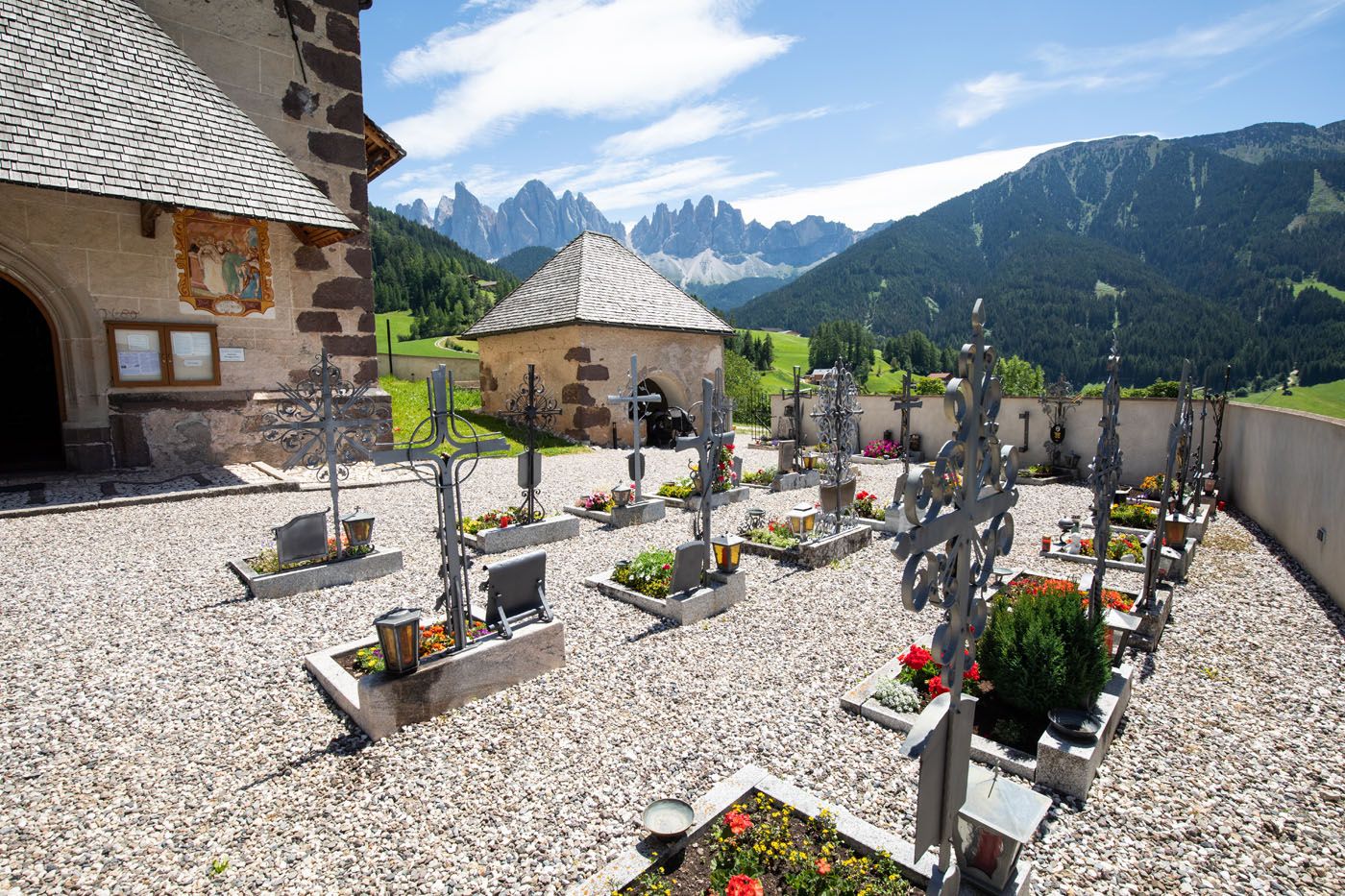
Cemetery at Santa Maddalena church
What We Did
In the morning, we hiked the Adolf Munkel Weg to Geisler Alm as outlined above.
Before leaving Val di Funes, we visited the viewpoints of Santa Maddalena and the Church of St. John.
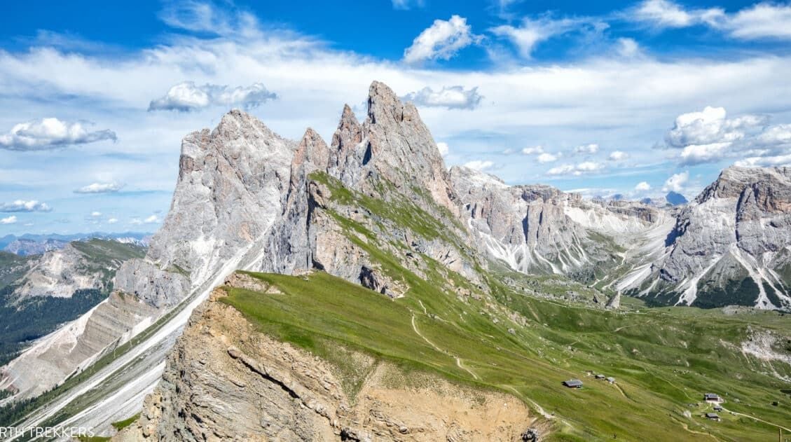
In the afternoon, we spent about an hour in Seceda to see the famous Seceda viewpoint. We didn’t have much time or energy to do a big hike, which is fine, because you can get some great views from Seceda without doing much walking.
The combination of the Adolf Munkel Weg, the Val di Funes viewpoints, and the visit to Seceda makes for a beautiful (but busy) day in the Dolomites.
If you have any questions about hiking the Adolf Munkel Weg or hiking to Geisler Alm, or if you would like to share your experience, let us know in the comment section below.
Plan Your Trip to Italy
We have TONS more information about Italy in our Italy Travel Guide, including Rome, Florence, Venice, Tuscany, the Dolomites, the Amalfi Coast, the Cinque Terre, Sicily, and Puglia.
15 Best Hikes in the Dolomites (Easy to Challenging)
Pinterest Facebook Flipboard The Dolomites are one of the best hiking destinations in Europe. In this guide, we rank the 15 best hikes in the Dolomites, from easy scenic trails to challenging alpine adventures, based on views, difficulty, and our firsthand experience hiking the region. Jagged limestone peaks, knife-edge ridgelines, and turquoise alpine lakes make […]
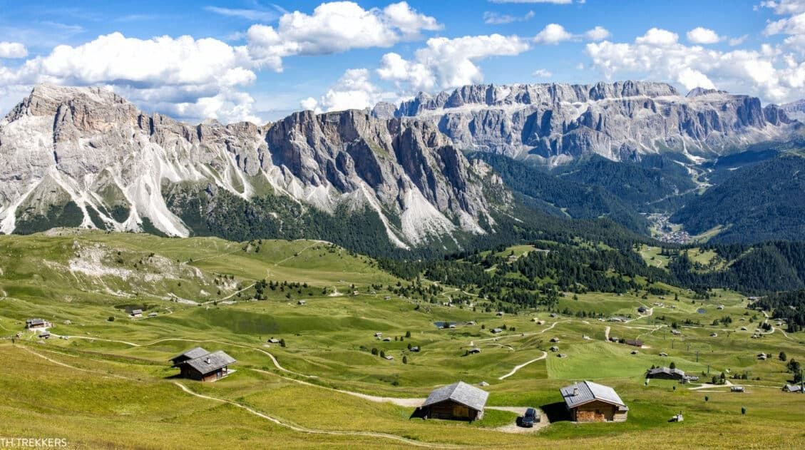
Alpe di Siusi (Seiser Alm) in Summer: Things to Do, Photos & Tips
Alpe di Siusi (Seiser Alm in German) is the highest alpine meadow in Europe. This lush, green meadow is located in the Dolomites of Italy. Cabins, rifugios, and hotels dot the landscape. Hiking trails and biking trails run along the hillsides, connecting the small villages. And Sassolungo, with its jagged, rocky peaks, looms over the […]
Best Way to Visit Seceda (with Little to No Hiking)
The ridgeline of Seceda looks almost unreal — a dramatic wall of jagged peaks rising above the green pastures of Val Gardena. It’s one of those views that stops you in your tracks, the kind you’ve seen in photos of the Dolomites and wondered, Is it really that beautiful in person? (Yes. It is.) And […]
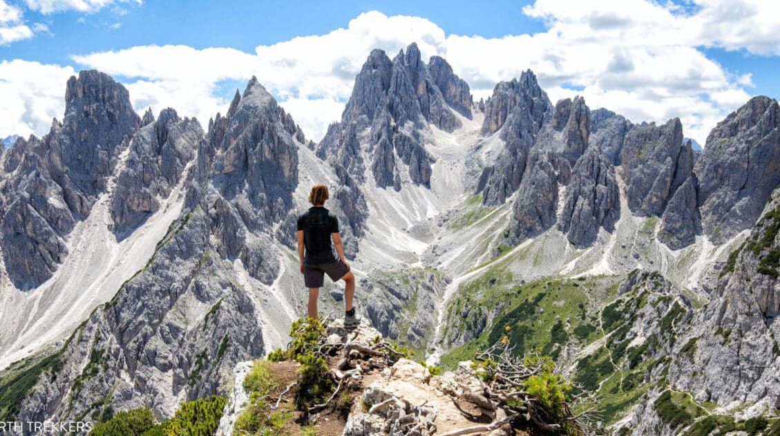
Exactly How to Hike to the Cadini di Misurina Viewpoint
The hike to the Cadini di Misurina viewpoint is one of our favorite short hikes in the Dolomites. This is a gorgeous hike every step of the way, with panoramic views of the surrounding mountains, a unique view of the “backside” of Tre Cime di Lavaredo, and of course, an awesome view of the Cadini […]
15 Surprising Things to Do in the Dolomites That Aren’t Hiking
We have traveled to the Dolomites twice, spending 12 days exploring alpine lakes, mountain passes, and hiking trails. This guide features the very best things to do in the Dolomites that require minimal or no hiking, based on our personal experiences. It’s no secret that the Dolomites are a great place to go hiking. But […]
Tofana di Mezzo & Cima Tofana: The Freccia nel Cielo Cable Car
There are many fantastic cable car rides in the Dolomites. Most visitors head straight to Seceda or Marmolada and miss this. Cima Tofana delivers jaw-dropping views with a fraction of the crowds, plus you have the option to add on a very short but thrilling hike. We rode the Freccia nel Cielo cable car to […]
Hiking the WWI Frontline Trail From Lagazuoi to Passo Falzarego
The Lagazuoi to Passo Falzarego Trail is an easy, downhill hike in the Dolomites that combines stunning alpine views with World War I history. It’s a great hike for families and those looking for a short, sweet hike combined with a thrilling cable car ride. This was the very first hike that we did in […]
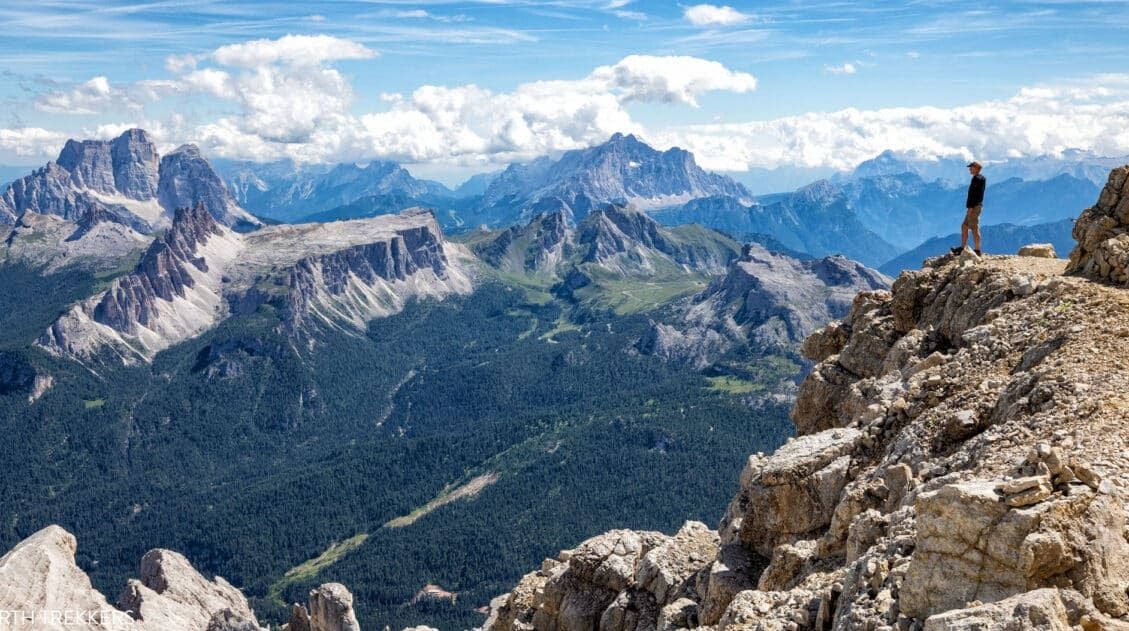
Piz Boè Hiking Guide: Map, Hiking Stats, Trail Guide & Photos
Piz Boè is considered to be one of the easiest summits over 3,000 meters (10,000 feet) in the Dolomites. This is largely because you have the option to take a cable car to skip the majority of the exhausting climb. We hiked Piz Boè on our second trip to the Dolomites. Our day started in […]
Where to Stay in the Dolomites (2026 Guide to the Best Towns & Hotels)
Wondering where to stay in the Dolomites? It’s one of the most important decisions you’ll make when planning your trip. This region may look small on a map, but winding alpine roads and high mountain passes mean travel times are longer than expected. Stay in the wrong town and you could spend hours driving instead […]
Is Marmolada Worth It? Visiting the Highest Peak in the Dolomites
We visited Marmolada while road tripping through the Dolomites, driving from Cortina d’Ampezzo to Val Gardena. Since it is the highest peak in the Dolomites, it had long been on our list of places to visit, and adding it as a stop along this scenic drive made perfect sense. After hiking many of the region’s […]
Dolomites Travel Guide: How to Plan a Trip to the Dolomites
Dolomites Travel Guide The Dolomites are one of the most breathtaking mountain destinations in Europe. Jagged pinnacles of rock soar into the sky, mountain huts and cabins dot the green, rolling hills, cable cars whisk hikers and skiers to the highest mountain peaks, and hiking trails connect small hamlets and towns. We’ve spent 12 days […]
10 Days in Italy: 5 Itineraries for Every Type of Traveler
With 10 days in Italy, you have enough time for an incredible trip, but not enough time to see everything. That’s the good news and the hard news at once. Italy is enormous, wildly varied, and deeply worth savoring. The biggest mistake most people make when planning a 10-day Italy itinerary is trying to fit […]
Italy Travel Guide: How to Plan a Trip to Italy
Italy Travel Guide From the ruins of ancient Rome to the hiking trails of the Dolomites, the trulli of Puglia to the hilltop villages of Tuscany, Italy is a country that rewards every kind of traveler, and keeps pulling you back. We’ve traveled to Italy six times, exploring the country from the lakes and mountains […]

Comments 36