Olympic National Park offers some of the most diverse hiking in the United States. Where else can you hike through a moss-covered temperate rainforest in the morning, walk along a wild Pacific coastline in the afternoon, and look out over glacier-capped mountain peaks from an alpine ridge?
We spent four days in Olympic National Park, as part of a larger Washington road trip, and quickly realized that the best way to experience the park is on its trails. Some of our favorite moments included climbing the ropes on Mount Storm King for incredible views over Lake Crescent, wandering through the surreal moss-covered forest on the Hall of Mosses trail, and hiking along wild stretches of Olympic’s dramatic Pacific coastline.
Those four days shaped this guide. We came away with five hikes we’d recommend to anyone visiting the park for the first time, plus a longer list of trails worth knowing about depending on your interests and fitness level.
This guide is designed to help you:
- Choose the right hikes for your fitness level and available time
- Understand which trails are worth the effort and which you can skip
- Experience all three of Olympic’s distinct ecosystems on foot
- Avoid spending more time driving than hiking
If you are in the early planning stages, start with our Olympic National Park Travel Guide and our Olympic National Park Itinerary for recommendations on how to plan your time.
2026 Update: The Staircase area of Olympic National Park is currently closed due to post-fire hazards from the Bear Gulch Fire, which burned over 20,000 acres in this area in summer 2025. The closure is in effect through at least October 1, 2026. Check current conditions at the NPS website before your visit.
Our Top Picks: Best Hikes in Olympic National Park
These are the five hikes we’d recommend to any first-time visitor. Together, they cover all three ecosystems and all four main regions of the park.
Best alpine hike: Klahhane Ridge Trail to Mount Angeles — the best views in the park, with a fun scramble to the summit. Not ready for the full climb? The Hurricane Hill Trail is the easier alternative from the same area.
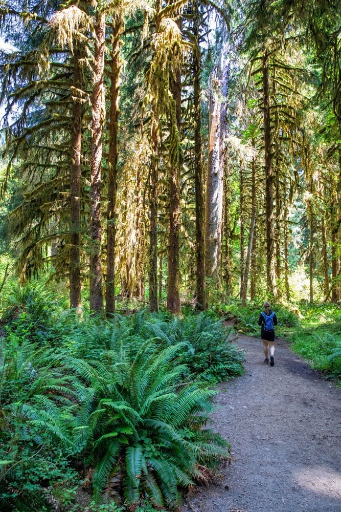
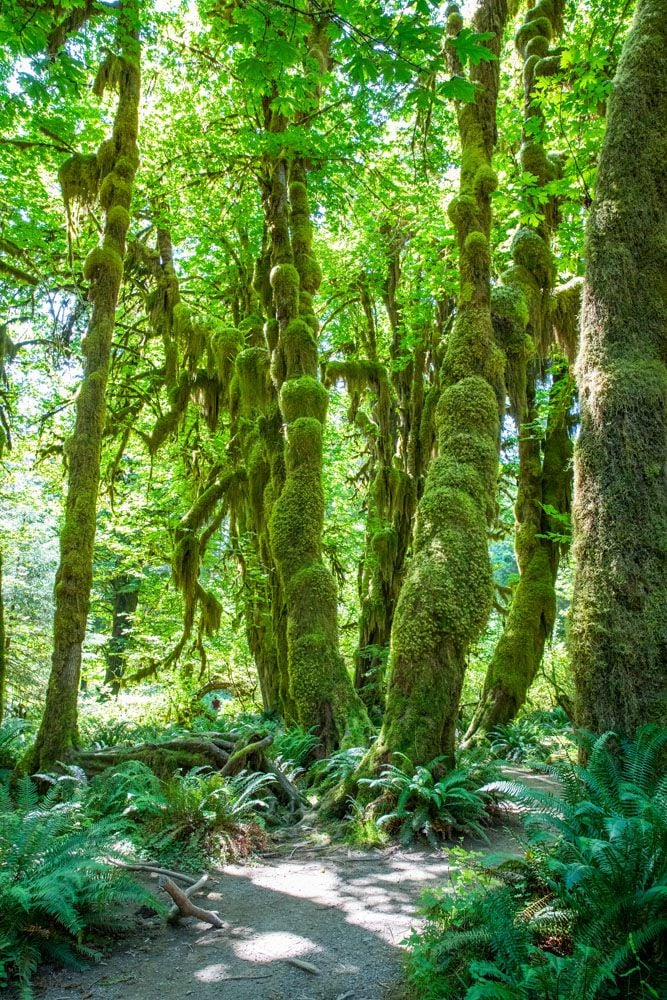
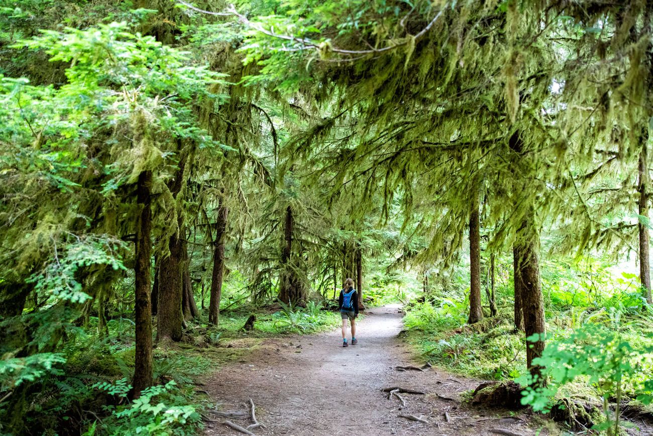
Best rainforest hike: Hall of Mosses — short, easy, and absolutely unforgettable. One of the most unique landscapes in the United States.
Best coastal hike: Rialto Beach to Hole-in-the-Wall — an easy beach walk to a dramatic rock arch, with sea stacks, tide pools, and driftwood as far as you can see.
Best strenuous hike: Mount Storm King — a brutal, relentless climb that ends with one of the most spectacular views in the park, looking straight down over the vibrantly blue waters of Lake Crescent.
Best underrated hike: Staircase Rapids Loop — old-growth forest, a rushing river, a suspension bridge, and almost no one else on the trail. One of our favorites in the entire park.
Olympic National Park Regions: What Hikers Need to Know
Olympic National Park is divided into several distinct regions spread across the Olympic Peninsula. Unlike most national parks, these areas are not connected by a single road and getting between them requires driving around the peninsula.
This matters for planning your hikes: you can’t easily combine a morning at Hurricane Ridge with an afternoon in the Hoh Rainforest. Plan to focus on one region per day.
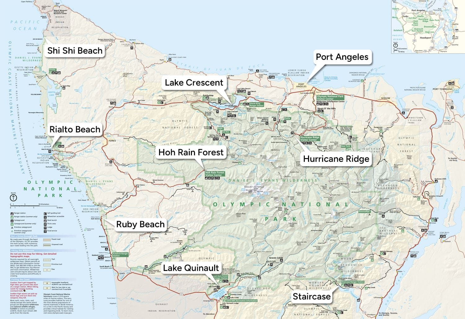
Map of Olympic National Park, showing the main regions
Hurricane Ridge is the alpine region of the park, with the best mountain views and the most exposed ridge hiking. Trails here range from easy walks to strenuous summit climbs. This is the region for hikers who want big panoramic views.
Lake Crescent sits along Highway 101 in the north and is home to two of the park’s most popular trails — the brutal climb up Mount Storm King and the easy walk to Marymere Falls. Both start from the same trailhead.
Sol Duc Valley is old-growth forest country, with easy access to Sol Duc Falls and longer trails into the Seven Lakes Basin for those looking for a bigger day or a backpacking trip.
Hoh Rainforest is unlike anywhere else in the park, or the country. Trails here are short and easy, but the landscape is extraordinary. Plan at least a couple of hours here even if you’re not a big hiker.
Pacific Coast stretches for over 70 miles with several separate access points off Highway 101. Rialto Beach, Ruby Beach, and Shi Shi Beach each require their own dedicated stop.
Staircase sits in the quiet southeastern corner of the park, with old-growth forest trails along the North Fork Skokomish River and access to more challenging peaks like Mount Ellinor. It’s the least visited region and one of the most rewarding.
Please practice the seven principles of Leave No Trace: plan ahead, stay on the trail, pack out what you bring to the hiking trail, leave areas as you found them, minimize campfire impacts, be considerate of other hikers, and do not approach or feed wildlife.
Best Hikes in Olympic National Park
The hikes on this list are organized by geographical location. There are six main regions in Olympic National Park: the northern part of the park (which includes Hurricane Ridge, Sol Duc Valley, and Lake Crescent), the Pacific Coastline, the temperate rainforest, and Staircase.
All of the distances are round trip unless noted otherwise.
Here is a map of the best hikes in Olympic National Park.
How to Use This Map: Click the icons on the map to get more information about each point of interest. To take this map with you, click the star next to the title of the map which adds it to your Google account. Next, within your Google Maps app, select ‘Saved’ and then select ‘Maps’. This map title will now appear in your list.
Hikes in Hurricane Ridge
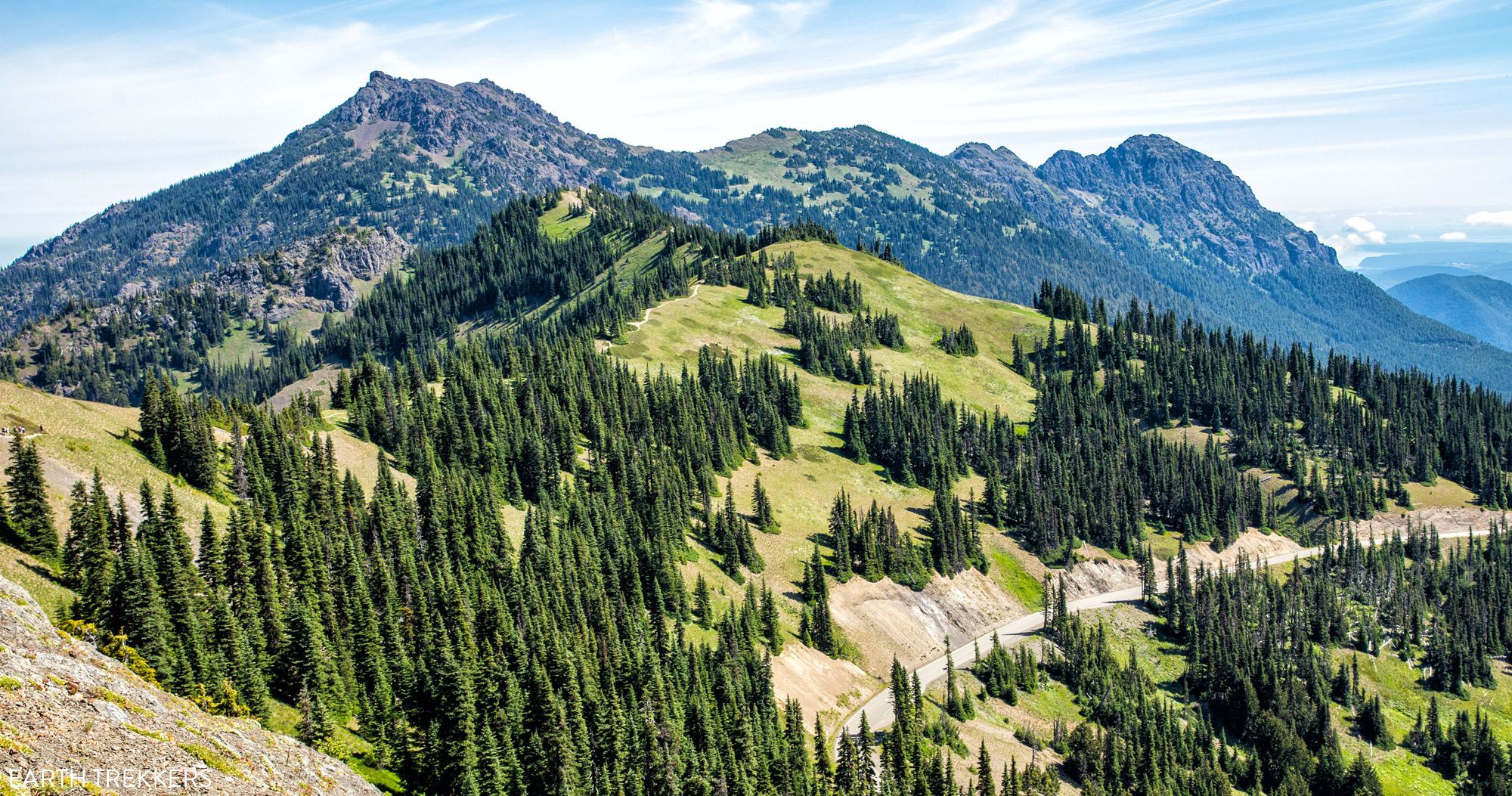
Hurricane Ridge Trail to Hurricane Hill
Distance: 3.2 miles | Difficulty: Easy to moderate | Total Ascent: 700 feet | Time: 2 hours
Best for: Families, first-timers, those who want big views without a strenuous climb
This hike is our top choice on Hurricane Ridge if you are visiting Olympic National Park with kids.
As this wide trail heads along the ridge, it slowly gains elevation, but it is nothing too strenuous. There are a few switchbacks at the end of the hill as you climb up to the final peak, but your reward is a spectacular view of Olympic National Park. On a clear day, you can see the Strait of Juan de Fuca and Vancouver Island to the north.
View of Hurricane Ridge from Mount Angeles
Getting to the Trailhead: Park in the lot at the end of Hurricane Ridge Road. DO NOT park near the Hurricane Ridge Visitor Center. This will add 2.4 miles to your hike. The trailhead is marked on the map above.
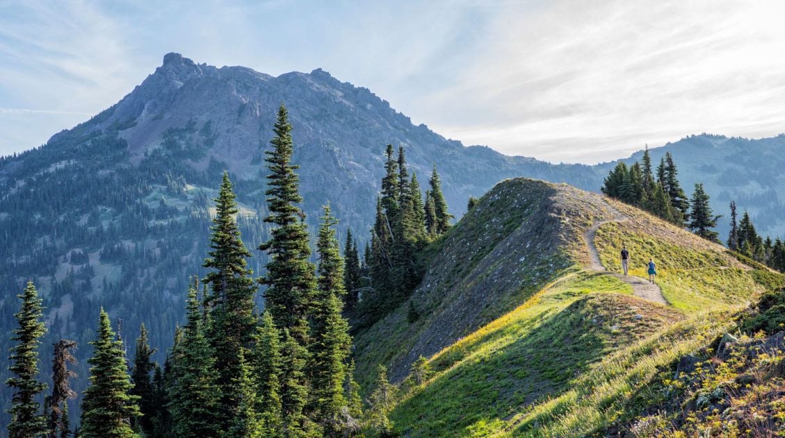
Sunrise Ridge via the Sunrise Point Trail
Distance: 3 miles | Difficulty: Easy to moderate | Total Ascent: 800 feet | Time: 2 hours
Best for: Those who want ridge hiking with mountain views
For more stunning views over Hurricane Ridge, this is another relatively easy hike to consider.
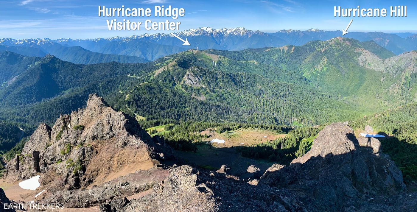
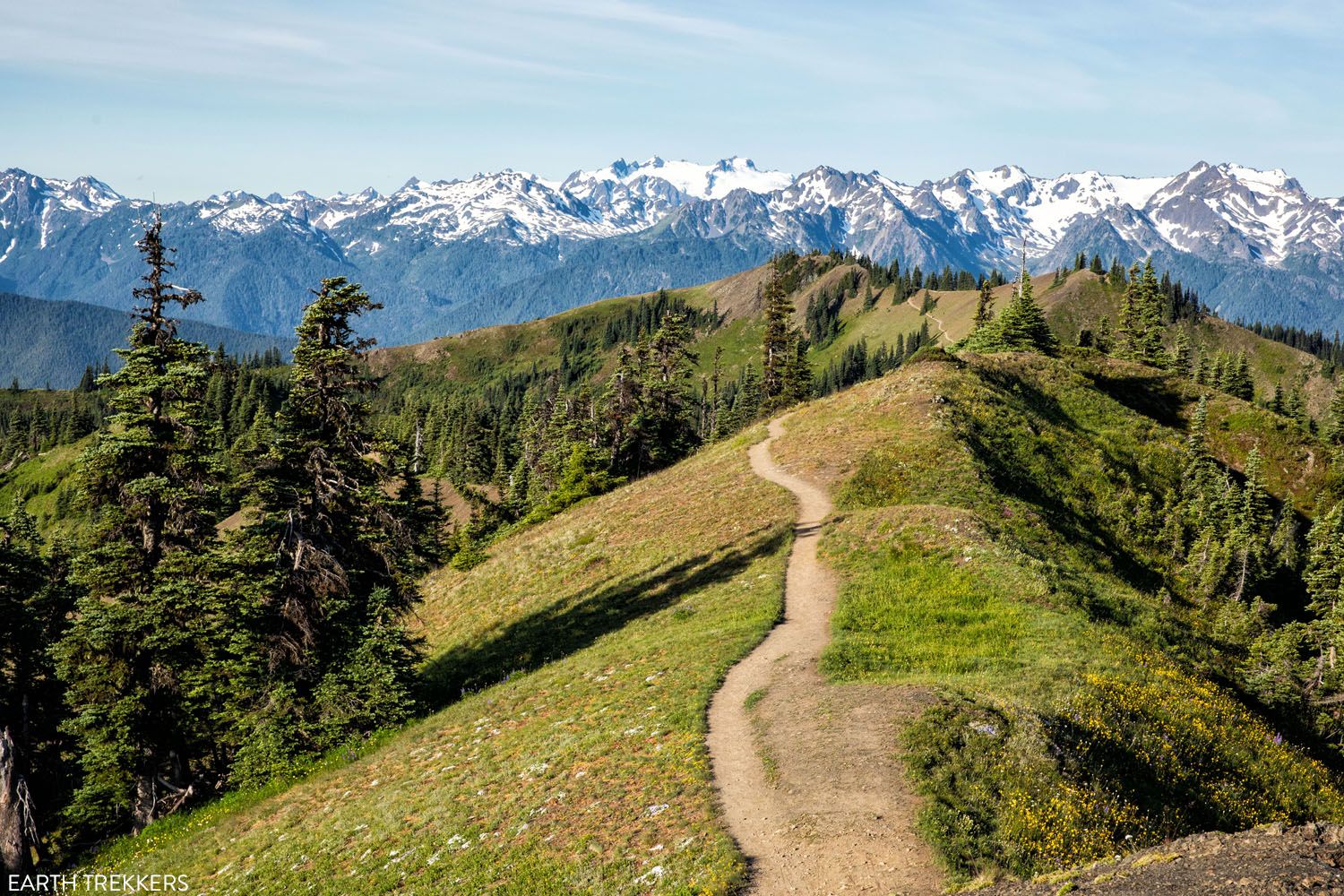
This hike begins at the main Hurricane Ridge parking lot on the High Ridge Trail and heads east along the ridge toward Mount Angeles. The entire hike is stunning. You walk along an exposed ridge with panoramic views the whole way. It ends at an overlook with a fantastic view of Mount Angeles.
This trail is also the starting point for the Klahhane Ridge Trail to Mount Angeles, so if you start this hike and find yourself wanting more, you can keep going.
Sunrise Point Trail
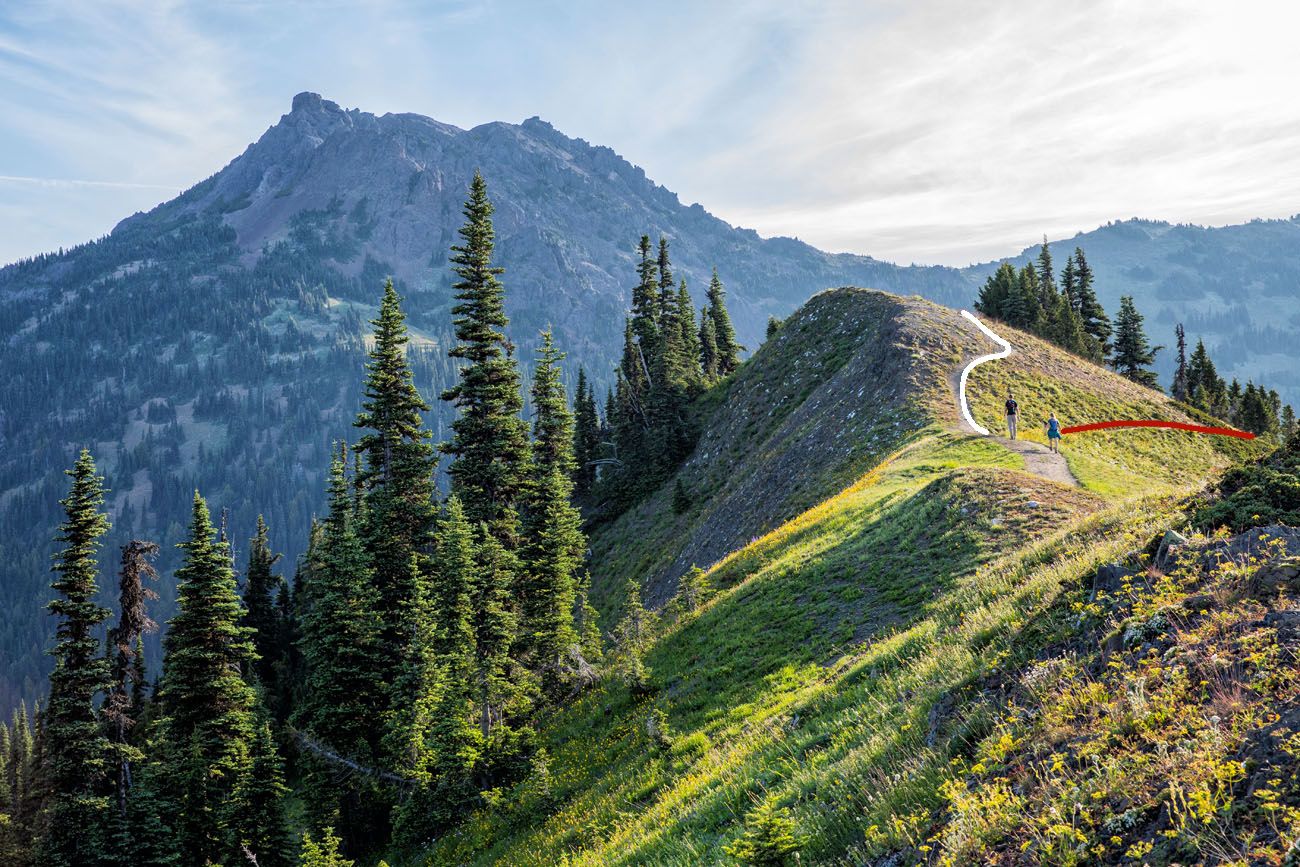
View of Mount Angeles from the trail. The white line marks the short, easy trail to the overlook on the Sunrise Point Trail. The trail to Mount Angeles is the red line (the next hike on this list).
Klahhane Ridge Trail to Mount Angeles
Distance: 6.5 miles | Difficulty: Strenuous | Total Ascent: 2,551 feet | Time: 4 to 6 hours
Best for: Avid hikers, peak baggers
This is our top recommended hike in Olympic National Park and one of the best hikes we’ve done in any national park.
This hike is an extension of the Sunrise Ridge Trail mentioned previously. If you like the idea of climbing to the highest peak in the Hurricane Ridge area and the chance to have one of the best panoramic views in Olympic National Park, put this hike on your list.
Starting at the Hurricane Ridge parking lot, you will head east on the Klahhane Ridge Trail (aka the Sunrise Point Trail) to Sunrise Ridge. Keep going beyond Sunrise Ridge. After a moderate descent, the real fun begins. To get up on top of Mount Angeles, it is an extremely steep hike with some tricky rock scrambling thrown in, just to really keep things interesting.
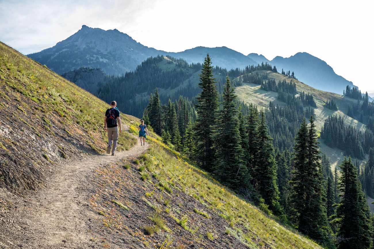
On the Klahhane Ridge Trail with Mount Angeles in the distance.
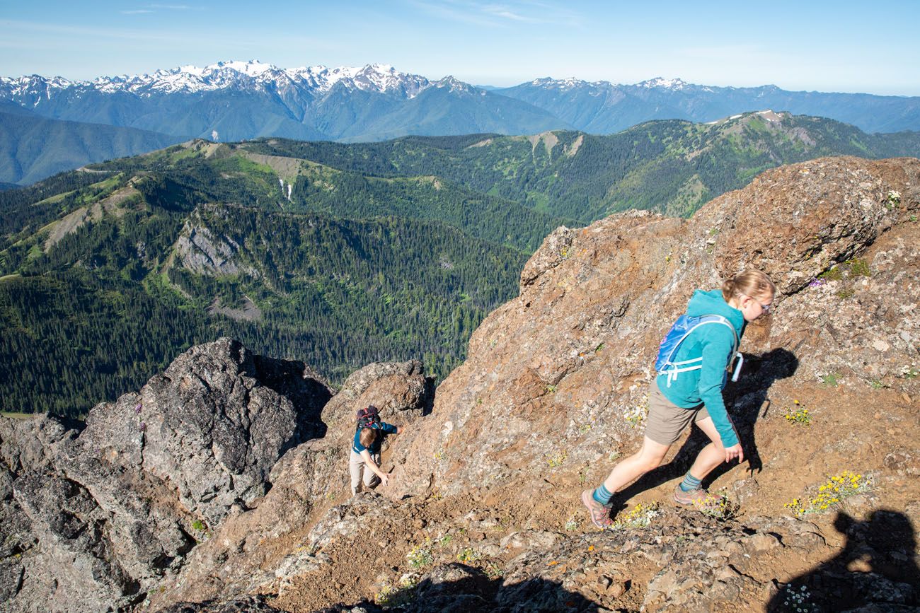
Final climb up Mount Angeles
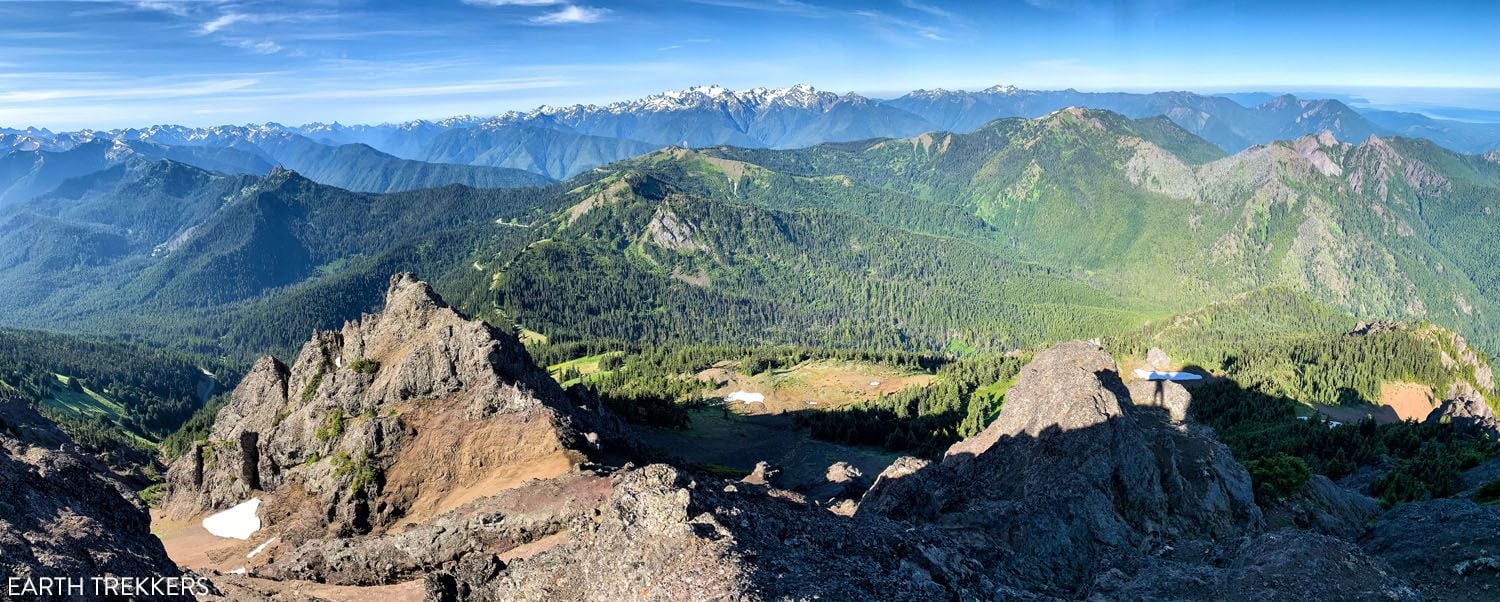
View from Mount Angeles
From the top of Mount Angeles, the views are unbeatable. On a clear day, you can see Puget Sound, Vancouver Island, the mountains of Olympic National Park, and Mount Rainier.
Here’s how to do the hike ↓
Hiking the Klahhane Ridge Trail to Mount Angeles
Step-by-step trail guide for the Klahhane Ridge Trail to Mount Angeles.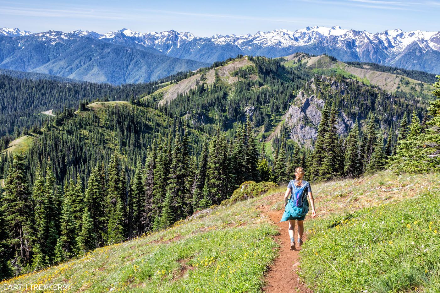
On the hike back to Hurricane Ridge
Hikes in Sol Duc Valley
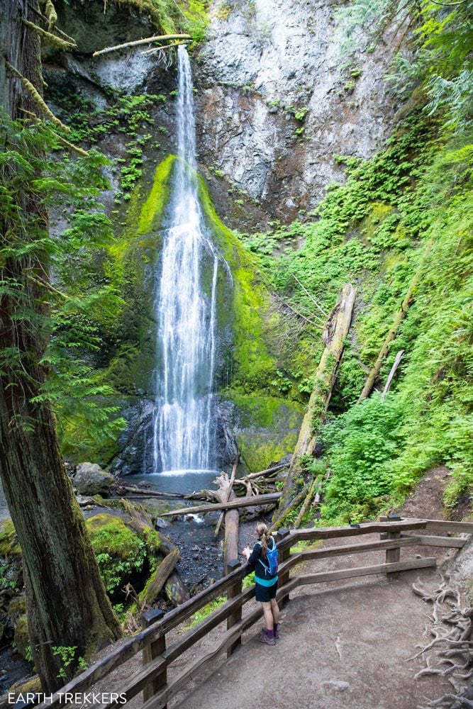
Sol Duc Falls
Distance: 1.6 miles | Difficulty: Easy | Elevation Gain: 200 feet | Time: 45 minutes to 1 hour
Best for: Everyone, families, non-hikers
Sol Duc Falls is one of the most beautiful and accessible waterfalls in Olympic National Park. From the trailhead at the end of Sol Duc Road, an easy flat walk through gorgeous old-growth forest leads to the falls, where the Sol Duc River splits dramatically into several channels before plunging into a narrow rocky canyon. It’s a short hike but a genuinely stunning one.
Worth knowing: The Sol Duc Hot Springs Resort is located just before the trailhead. Day use passes are available if you want to soak in the natural mineral pools — a great way to end the day after hiking.
Hikes in Lake Crescent
Marymere Falls
Distance: 1.8 miles | Difficulty: Easy | Total Ascent: 200 feet | Time: 1 hour
Best for: Families, all fitness levels
This is a short, sweet hike to waterfall that is tucked away in an old growth forest. For most of the walk, the trail is flat, fast, and beautiful. Ancient moss-covered trees loom overhead and you will cross several bridges that span creeks and streams.
To get to Marymere Falls, the walk ends with a short but strenuous uphill climb to a viewpoint of the waterfall.
This is a great hike for families and those who want to walk through an ancient forest. The hike to Marymere Falls also makes a nice add-on to Mount Storm King, since they share the same trailhead.
Getting to the Trailhead: This hike starts at Lake Crescent next to the Storm King Ranger Station.
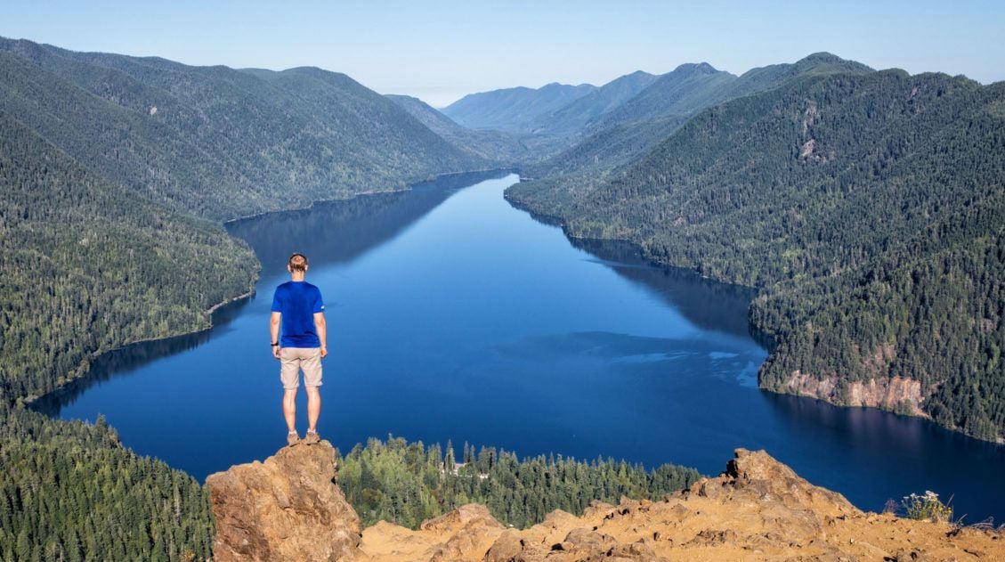
Mount Storm King
Distance: 4.65 miles | Difficulty: Strenuous | Total Ascent: 2,130 feet | Time: 3 to 5 hours
Best for: Avid hikers, those who love a challenge
The hike to Mt. Storm King is one of the best hikes in Olympic National Park, and it is also one of the most popular. This is a short but grueling hike that ends with a spectacular view of Lake Crescent.
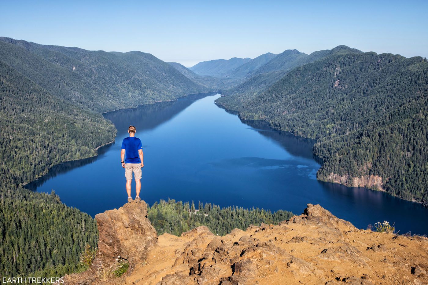
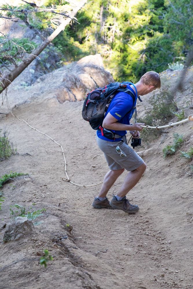
On this hike, it is a steep, relentless climb up to Mount Storm King. Just before reaching the summit, where the trail somehow gets even steeper, you’ll pull yourself up using a series of ropes. Then it’s one final, short scramble to the peak of Mount Storm King.
You can add Marymere Falls onto the beginning or end of this hike.
For full details, check out our hiking guide, which has lots of photos of the trail, so you know exactly what to expect.
Mount Storm King Hike: Is It Worth the Brutal Climb?
Exactly how to hike Mount Storm King from start to finish.Best Hikes on the Pacific Coastline
Rialto Beach to Hole-in-the-Wall
Distance: 3.5 miles | Difficulty: Easy | Total Ascent: Minimal | Time: 1.5 to 2.5 hours
for: Everyone, families, beach lovers
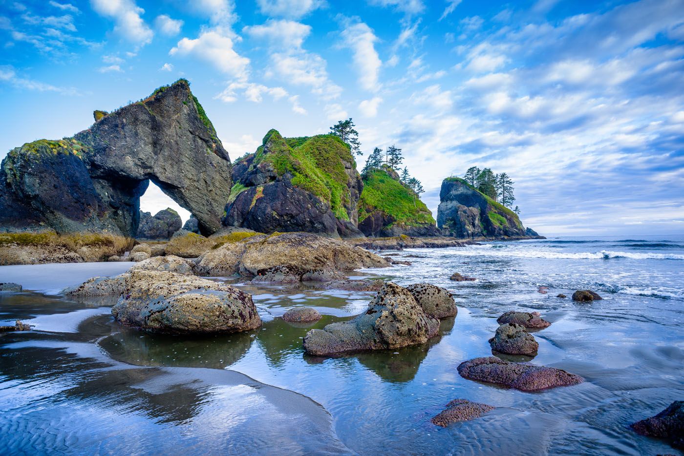
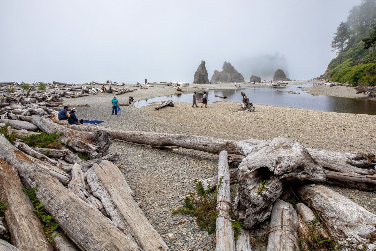
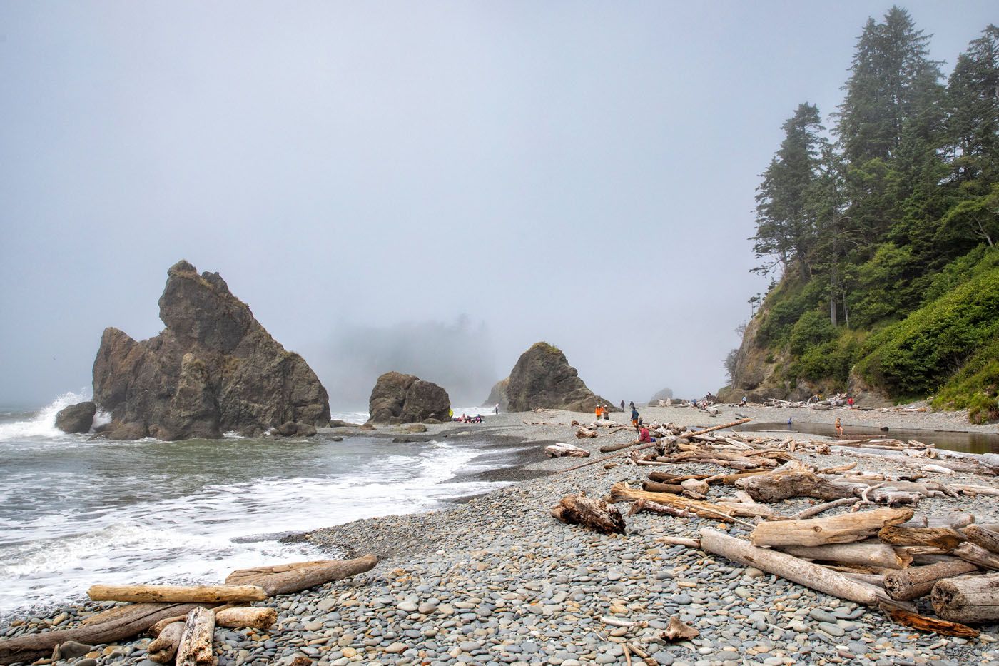
Hiking to Hole-in-the-Wall is one of the best hikes in Olympic National Park. It is short and easy to hike (the beach is the hiking trail), plus the views are amazing.
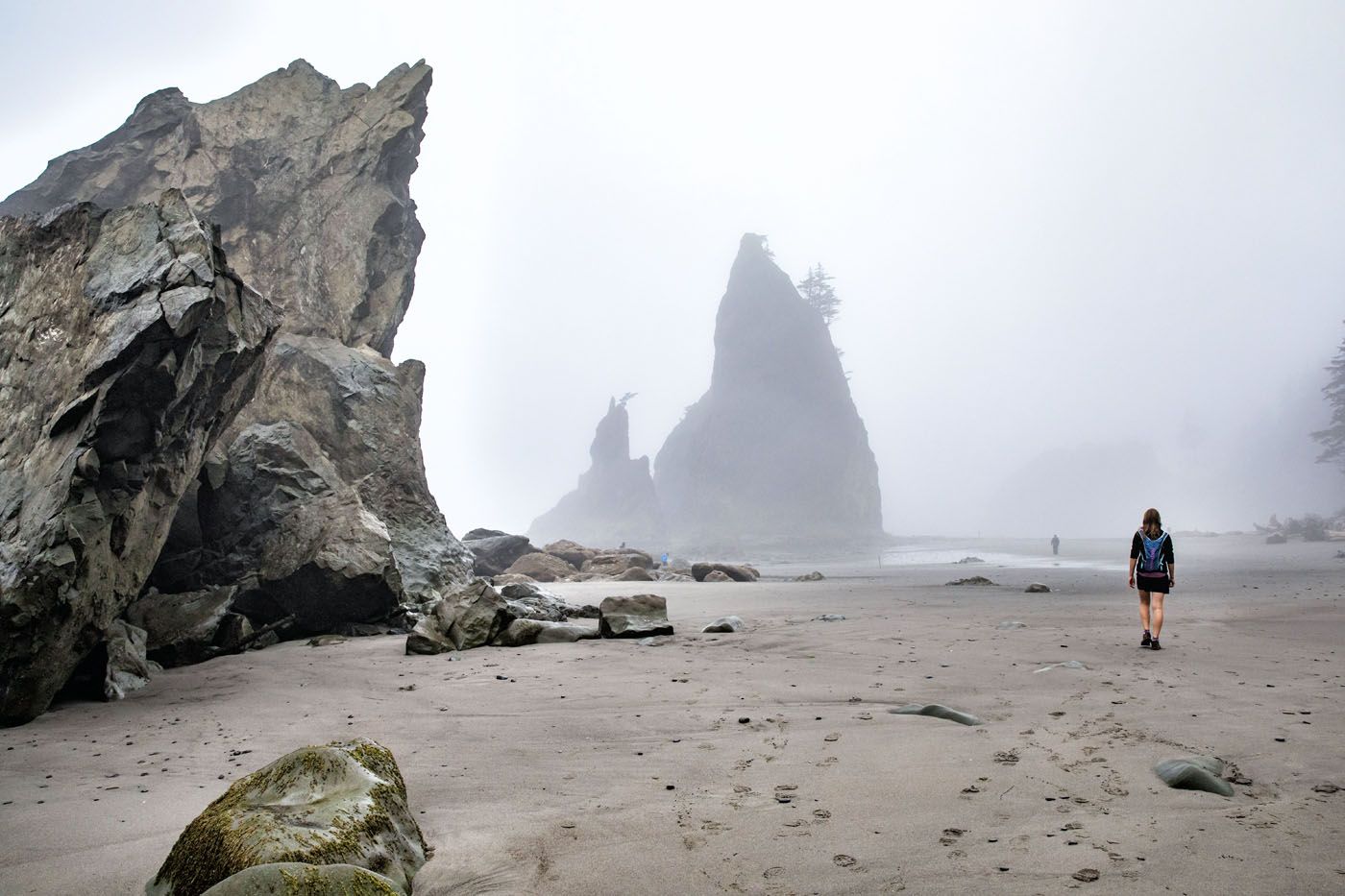
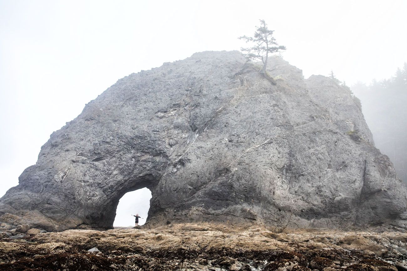
To visit Rialto Beach, park at the Rialto Beach parking area, which is located next to the beach, and then walk right out to the beach. Head north to go to Hole-in-the-Wall, where you get to see the sea stacks sitting along the coastline.
Enormous driftwood logs line the upper beach, sea stacks rise out of the surf, and bald eagles perch in the snags above the treeline. At 1.5 miles, you reach Hole-in-the-Wall, a natural rock arch that you can scramble through at low tide to explore the tide pools on the other side.
PRO TRAVEL TIP: Check tide tables before you go. Hole-in-the-Wall is only accessible at low tide, and the tide pooling is far richer when the tide is out. High tide doesn’t ruin the walk — Rialto is beautiful in any conditions — but low tide makes it significantly better.
Shi Shi Beach
Distance: 6 to 10 miles | Difficulty: Easy | Total Ascent: Minimal | Time: 4 to 6 hours
Best for: Those looking for a wilder, more remote coastal experience
Shi Shi Beach (pronounced “shy-shy”) is widely considered the most spectacular beach in Olympic National Park, with enormous sea stacks, dramatic tide pools, and the iconic Point of Arches rock formations at the southern end. It’s more effort than Rialto or Ruby Beach, but the payoff is proportional.
The trail passes through coastal forest on Makah tribal land before descending steeply to the beach. Fair warning: the middle section of the trail is famously muddy year-round. Waterproof boots are not optional.
william p teed/shutterstock.com
To get here, you will need to do some hiking…6 to 10 miles round trip, depending on how far down the beach you will go.
The beach is located in Olympic National Park, but access to the beach is on the Makah Reservation. To visit Shi Shi Beach, not only do you need to pay the Olympic National Park fee but you will also need a Makah Recreation Pass.
Permits required: Before heading to Shi Shi, you must purchase a Makah Recreation Pass ($20 per vehicle, valid for the calendar year) in the town of Neah Bay. It can be purchased in person at the Makah Mini Mart, Marina, or the Makah Cultural and Research Center Museum. It cannot be bought online, so plan accordingly. If you’re camping overnight, you’ll also need an Olympic National Park wilderness permit.
Ruby Beach
Distance: 6 miles | Difficulty: Easy | Total Ascent: Minimal | Time: 3 hours
Best for: Everyone, families, those short on time
Ruby Beach sits right on Highway 101 and is one of the most accessible and beautiful beaches in the park.
A short quarter-mile path from the parking lot drops you onto a wide expanse of sand scattered with driftwood, dramatic sea stacks, and tide pools. It gets its name from the garnet crystals found in the sand.
You can spend 30 minutes here or turn it into a longer walk. Head north along the beach toward the Hoh River for up to 6 miles round trip if you want to stretch your legs.
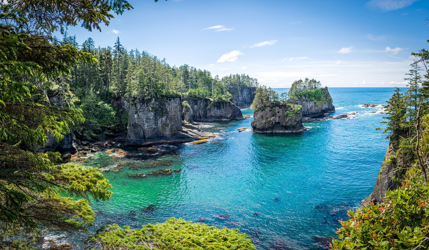
Cape Flattery
Distance: 1.5 miles | Difficulty: Easy | Total Ascent: 200 feet | Time: 1 hour
Best for: Everyone, families
Cape Flattery is the northernmost point of the continental United States. It is located at the point where the Pacific Ocean meets the Strait of Juan de Fuca.
The trail alternates between a gravel trail, dirt trail, and boardwalks. It ends with three viewpoints overlooking the dramatic sea cliffs, sea caves, and crashing surf below. On clear days you can see Tatoosh Island and its historic lighthouse just offshore.
mabahamo/shutterstock.com
Note: Cape Flattery is located on the Makah Indian Reservation, not inside Olympic National Park. You will need a Makah Recreation Pass ($20 per vehicle, valid for the calendar year) to visit. Passes can be purchased in person in the town of Neah Bay at the Makah Mini Mart, Marina, or the Makah Cultural and Research Center Museum.
Third Beach
Distance: 3 miles | Difficulty: Easy | Total Ascent: 400 feet | Time: 1 to 2 hours
Best for: Those who want a quieter beach experience
The La Push Beaches are a group of three beaches that are located near the community of La Push. These beaches are named First, Second, and Third Beaches, with First Beach being the northernmost beach.
Third Beach is the most remote of the La Push beaches. The beach itself is lovely, with sea stacks and a waterfall that drops directly onto the sand. That said, we’ll be honest — the trail through the forest is fairly monotonous, and if you’re short on time, Rialto Beach and Ruby Beach are better uses of your day.
Third Beach is worth it if you want a quieter, less visited stretch of coastline or are making a dedicated La Push day.
Third Beach
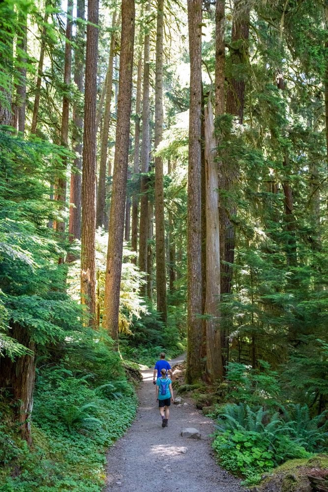
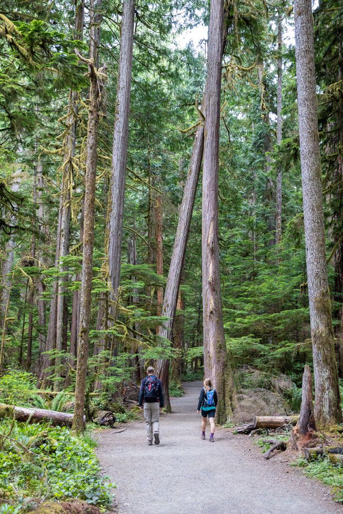
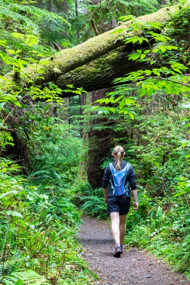
Hikes in the Hoh Rainforest
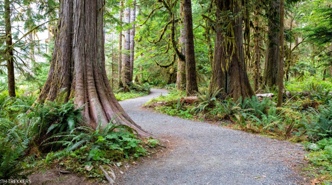
Hall of Mosses
Distance: 0.8 miles | Difficulty: Easy | Total Ascent: Minimal | Time: 30 minutes
Best for: Everyone, non-hikers, families
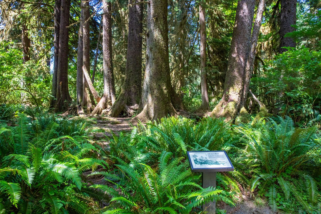
The Hall of Mosses is one of the most extraordinary short walks in the United States. This 0.8-mile loop winds through a grove of ancient big-leaf maple trees draped in thick curtains of moss, with ferns carpeting the forest floor and enormous Sitka spruce towering overhead. Even on a busy summer day it feels hushed and otherworldly, like walking into a fairy tale.
Don’t rush it. This is a trail worth slowing down for, stopping often, and looking up.
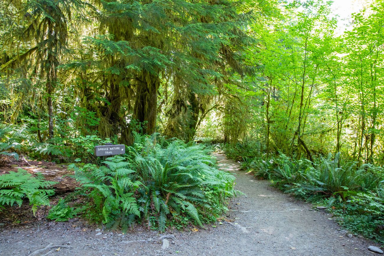
From the same parking lot, the Spruce Nature Trail (1.2 miles, easy) makes a great add-on if you want more time in the forest.
It follows the Hoh River through equally beautiful old-growth forest and tends to be quieter than the Hall of Mosses. We spotted a black bear on this trail during our visit. Keep your eyes open and make noise as you walk.
Best Hikes in Staircase
IMPORTANT: The Staircase section of the park is currently closed due to a wildfire in summer 2025. The area will be closed through October 2026 and may remain closed longer.
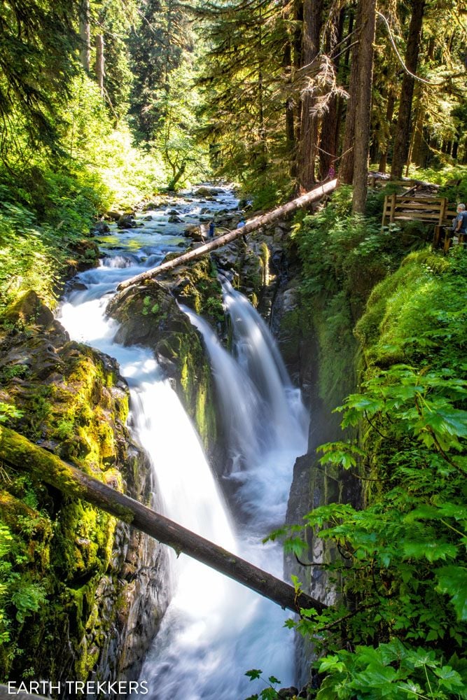
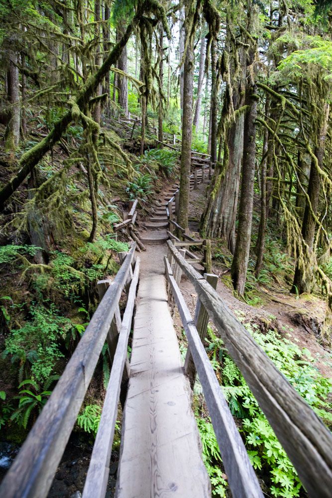
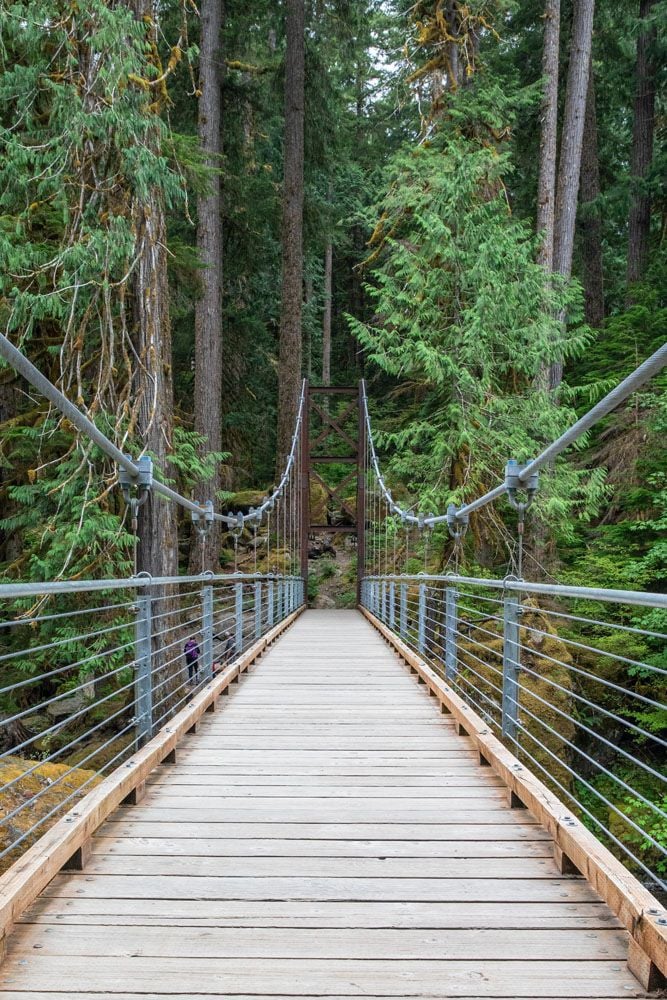
Staircase Rapids Loop
Distance: 2.8 miles | Difficulty: Easy | Total Ascent: 285 feet | Time: 1.5 to 2 hours
Best for: Everyone, families, those looking to escape the crowds
The Staircase Rapids Loop is the most underrated hike in Olympic National Park.
This easy loop follows the crystal-clear North Fork Skokomish River through dense old-growth forest, crossing a suspension bridge with views of the rushing rapids below. The forest here is every bit as impressive as the Hoh Rainforest, with enormous moss-covered trees, lush ferns, fallen giants, but with a fraction of the crowds. When we hiked it, we saw a total of three other people on the trail.
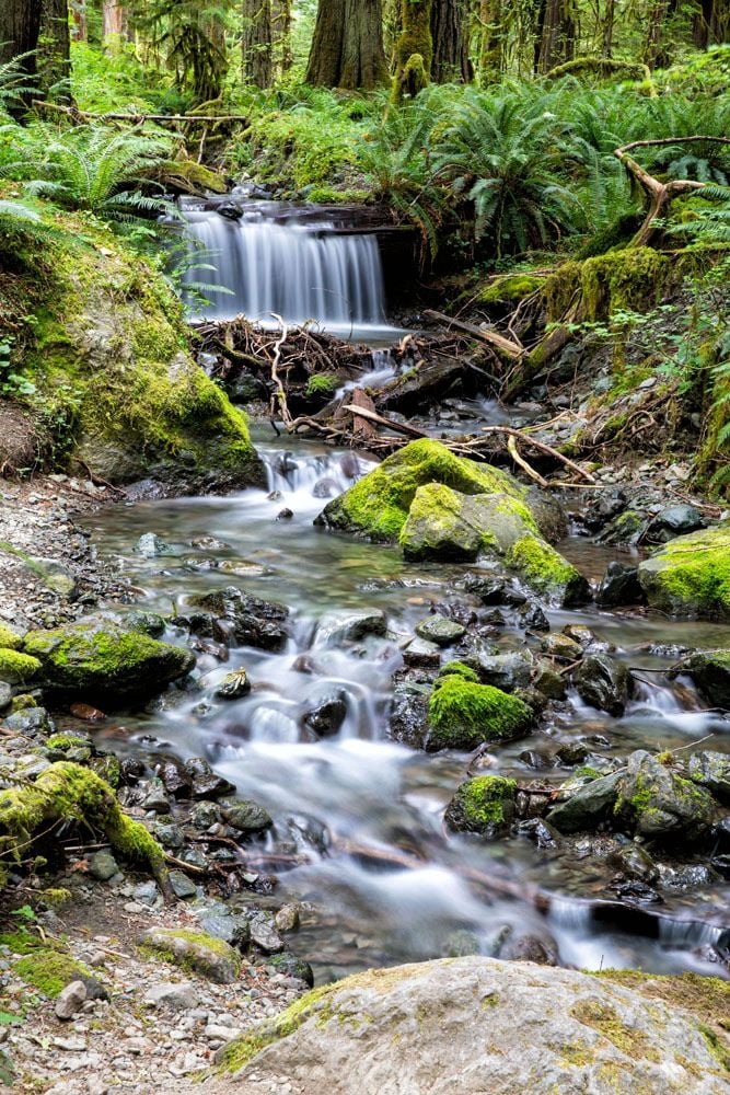
The views are similar to what you get at the Hoh Rainforest, with enormous trees covered in moss and lichen, but with far fewer people, this was a much more enjoyable experience for us.
Here’s how to do it ↓
Staircase Rapids Loop: A Hidden Gem Hike in Olympic National Park
Step-by-step trail guide for the Staircase Rapids Loop.Mount Ellinor
Distance: 3.2 or 6.2 miles | Difficulty: Strenuous | Total Ascent: 2,400 or 3,300 feet | Time: 3 to 5 hours
Best for: Avid hikers, peak baggers
Mount Ellinor is one of the tallest mountains on the eastern side of Olympic National Park. Your reward is panoramic views over the Olympic Peninsula and out to Mount Rainier and Mount Baker.
There are two trailhead options: the upper trailhead makes for a shorter, steeper climb (3.2 miles), while the lower trailhead adds distance but a more gradual ascent (6.2 miles).
This was a hike that was high on our to-do list, but drizzly weather and low-lying clouds created unfavorable conditions. We are hoping to do this hike on our next visit to Olympic National Park. Check conditions before committing because this hike is most rewarding on a clear day.
Backpacking in Olympic National Park
Olympic National Park has some outstanding multi-day backpacking routes for those who want to venture deeper into the wilderness. Here are two of the best.
High Divide Trail & Seven Lakes Basin Loop
Distance: 19 miles | Difficulty: Strenuous | Elevation Gain: 5,000 feet | Time: 2 to 3 days
Best for: Backpackers, experienced hikers
This is one of the most spectacular backpacking routes in Olympic National Park. Starting at Sol Duc Falls, the trail climbs into the subalpine zone past Deer Lake and into the Seven Lakes Basin, a stunning collection of alpine lakes ringed by peaks.
The High Divide section offers panoramic views of Mount Olympus and the surrounding wilderness. Wildlife sightings — including black bear and deer — are common along this route. A wilderness permit is required for overnight camping.
East Fork Quinault River Trail to Enchanted Valley
Distance: 26 miles | Difficulty: Strenuous | Time: 2 to 4 days
Best for: Backpackers looking for a remote wilderness experience
Hike to the historic Enchanted Valley Chalet on an overnight backpacking trip.
This trek starts near Lake Quinault. For 13 miles, you will hike the East Fork Quinault River Trail through old growth forests until you reach the chalet. Bear, elk, coyote, mountain lion, and deer can sometimes be spotted along the trail.
This is typically done as an overnight backpacking trip. With a permit, you can camp at Enchanted Valley, Pyrites Creek, O’Neil Creek, or Pony Bridge.
Note: The national park service is considering dismantling and removing the chalet. Learn more here.
When Can You Go Hiking in Olympic National Park?
One of the advantages of Olympic National Park is that hiking is possible year-round — but the season varies significantly depending on which region you’re visiting.
The coast and rainforest are accessible in every season. Rialto Beach, Ruby Beach, the Hall of Mosses, and Sol Duc Falls can all be hiked in January just as easily as July. In fact, the rainforest is arguably most atmospheric in the wet season, when the moss is at its most vivid and the waterfalls are running full. Just come prepared for rain.
The alpine region has a shorter window. Hurricane Ridge Road is typically open year-round but can close temporarily due to snow and ice. The higher trails — including the Klahhane Ridge Trail to Mount Angeles and Sunrise Ridge — are generally snow-free from late June through October. Always check current conditions on the NPS website before heading up.
Summer is the best all-around season for hiking across all regions. July through September gives you the longest days, the driest weather, and the best chance of clear skies at Hurricane Ridge. This is also peak season, so expect crowds at the most popular trailheads.
Staircase is accessible most of the year but the access road can close in winter due to snow and hazardous conditions. Check the NPS website before making the drive out.
The bottom line: If you’re visiting in summer, everything on this list is accessible. If you’re visiting outside of summer, the coast and rainforest are your most reliable options, and Hurricane Ridge is worth checking on before you commit.
Our Recommendations
We spent four days hiking in Olympic National Park in the summer, covering all four regions of the park. Here’s how we’d guide different types of visitors based on what we experienced:
Our personal favorites: Klahhane Ridge Trail to Mount Angeles, Staircase Rapids Loop, and the Mount Storm King and Marymere Falls combination. These three represent the best of what Olympic has to offer — big alpine views, wild old-growth forest, and a genuinely challenging climb with a spectacular payoff.
For first-time visitors: Start with Hurricane Hill or Mount Angeles at Hurricane Ridge, walk the Hall of Mosses in the Hoh Rainforest, and spend time at Rialto Beach. Those three experiences alone will show you why Olympic is one of the most unique national parks in the country.
For families and non-hikers: Hall of Mosses, Sol Duc Falls, Marymere Falls, and Rialto Beach are all easy, accessible, and genuinely spectacular. None of them require significant fitness or hiking experience.
For avid hikers: Mount Angeles, Mount Storm King, and Mount Ellinor on a clear day. If you have extra time, the High Divide and Seven Lakes Basin backpacking route is one of the best multi-day trips in the Pacific Northwest.
For those who want to escape the crowds: Staircase Rapids Loop instead of the Hoh Rainforest, Mount Angeles instead of Hurricane Hill, and Shi Shi Beach instead of Rialto. You’ll see equally impressive scenery with far fewer people on the trail.
Check conditions before you go on the NPS Olympic National Park website. Road closures and trail conditions can change quickly, especially in spring and fall.
Plan Your Olympic National Park Trip
If hiking is just one part of your visit to Olympic National Park, these guides will help you plan the rest of your trip.
- How to Plan a Trip to Olympic National Park – When to visit, where to stay, road openings, and seasonal tips
- Best Things to Do in Olympic National Park – Scenic drives, viewpoints, and non-hiking highlights
- Olympic National Park Itinerary – Best way to spend 3 days and visit all sections of the park
Mount Rainier is one of our favorite parks for hiking, but it’s not the only one. See how these trails compare in our guide to the Best Hikes in the US National Parks, featuring standout hikes from 55+ parks across the country.
If you are planning a bigger trip across Washington, we have lots of helpful information our Mount Rainier National Park Travel Guide and North Cascades National Park Travel Guide.
If you have any questions about the best hikes in Olympic National Park, let us know in the comment section below.
Explore More of Washington
If this is part of a bigger road trip through the USA, visit our United States Travel Guide and our Washington Travel Guide for more inspiration and travel planning tips.

Essential Hiking Gear: What Should You Bring on a Day Hike?
In this post, find out what we carry with us on day hikes. Whether you are a new hiker, shopping for a friend or family member, or just curious about what hiking gear you should bring on a day hike, we have a lot of great information to share with you. We have hiked thousands […]
15 Best Hikes in Mount Rainier (Ranked by Difficulty & Area)
Mount Rainier is one of the most spectacular hiking destinations in the United States. From wildflower-covered alpine meadows to glacier viewpoints and fire lookout summits, the variety here is incredible. We’ve hiked in more than 50 U.S. national parks and on trails around the world, from Everest Base Camp in Nepal to the Dolomites, and […]
The Enchantments Thru Hike: Complete Planning Guide
The Enchantments are a slice of hiking paradise. Located in the Alpine Lakes Wilderness of Washington state, this is a wonderland of alpine lakes, jagged mountains, and waterfalls. If you’ve done any research on the Enchantments, you already know it’s one of the best day hikes in the United States. What you might not know yet is […]
20 Epic Hikes in the US National Parks
With 63 national parks and thousands of miles of hiking trails, your options are endless for exploring the American national parks. We narrowed down the list for you to 20 of the best hikes in the US national parks, 20 amazing ways to explore this beautiful country. Hike to the tallest peaks, through massive canyons, […]
Maple Pass Loop Hiking Guide 2026 | North Cascades, WA
The Maple Pass Loop, also known as the Heather-Maple Pass Loop, is one of the best day hikes in the North Cascades, and one that’s surprisingly accessible for the views it delivers. In early August, Tim, Kara, and I completed this hike and came away genuinely impressed. It’s not our favorite hike in the area […]
Summerland Trail to Panhandle Gap Hike | Mount Rainier National Park
The Summerland Trail to Panhandle Gap is a strenuous 12-mile adventure into the quieter side of Mount Rainier National Park. With panoramic views of Mount Rainier and fewer hikers than Paradise or Sunrise, it’s ideal for those craving a bigger, more rugged day on the trail. Hiking the Summerland Trail to Panhandle Gap is one […]
20 Fun, Short Hikes in the US National Parks
One of the best ways to experience the national parks is from a hiking trail. Hike to amazing viewpoints, deep into the forests, through scenic canyons, and to hidden lakes and waterfalls. Along the way, you have a better chance of spotting wildlife and potentially leaving the crowds behind. Here are 20 fun, short hikes […]
Ultimate Hiking Guide: Europe, Asia, Africa, Americas & Oceania
Are you looking for the perfect hike? With hikes on six continents ranging from a few miles to multi-day adventures, explore some of the best hikes from around the world.
15 Best US National Parks to Visit in August 2026
Planning a trip to the US national parks in August and don’t know which ones to visit? August is a busy time to visit the national parks, but crowd levels aren’t quite at their peak (that typically happens in July for many parks). In this guide, we list some popular summertime parks to visit plus […]
12 Great Hikes in North Cascades National Park
North Cascades National Park is not a place that easily reveals itself. Sure, the drive along Highway 20 is lovely. And the viewpoints over the lakes and mountain passes are gorgeous. But, to really see this park, you are going to have to invest some time on the hiking trails. If you only saw the […]
Washington National Parks: Travel Guide & Itinerary
There are three Washington national parks: Olympic, Mount Rainier, and the North Cascades. In Olympic National Park, explore the temperate rainforest, hike high into the mountains, and stroll along the rocky, misty coastline. Mount Rainier is an outdoor paradise, with its old growth forests, carpets of wildflowers in the summer months, and network of hiking […]
Mount Fremont Lookout Trail Guide | Mount Rainier National Park
Few hikes in Mount Rainier National Park deliver so much scenery for so little effort. The Mount Fremont Fire Lookout Trail offers nearly nonstop views of Mount Rainier, sweeping alpine landscapes, and the chance to stand on one of the park’s historic fire lookout towers. This was the very first hike we did in Mount […]

The Ultimate Guide to the 63 US National Parks
Stretching from the South Pacific, across the United States to the Caribbean, are 63 national parks. These national treasures preserve iconic landscapes, majestic mountains, primordial forests, arid deserts, misty coastlines, immense canyons, wildlife, and historic landmarks. The opportunities for adventure are endless. Hiking, rock climbing, rafting, mountain biking, sand boarding, horseback riding, mountaineering, canyoneering, and […]

Comments 17