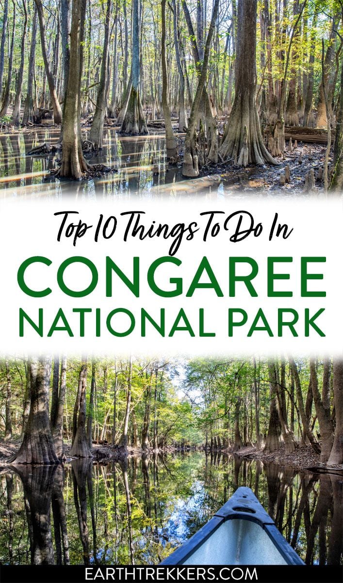
Congaree National Park protects the oldest old-growth bottomland hardwood forest in the southeastern United States. This small park is quick and easy to visit. Walk the boardwalk trail through the forest, go kayaking or canoeing on Cedar Creek, go birdwatching and fishing, and, if you like, venture farther into the park on a number of other woodland trails. In this guide, we cover the best things to do in Congaree National Park.
We spent several days exploring Congaree National Park. For most visitors, a half to a full day is all the time you need to see the main highlights.
In this guide, we cover:
- The top things to do in Congaree
- How to plan your time
- Logistics of planning a visit here: how to get here, where to stay, and where to eat
What Makes Congaree National Park Special?
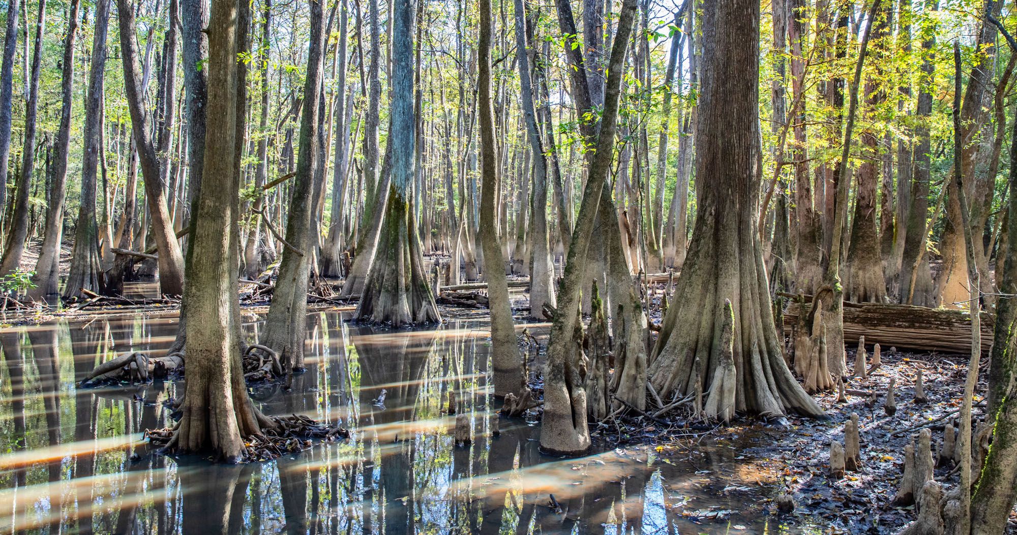
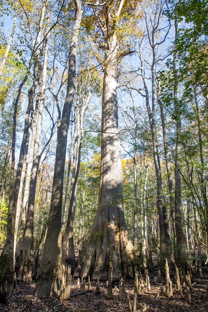
This national park protects the oldest old-growth bottomland hardwood forest in the southeastern United States. The trees that grow here are some of the tallest in the eastern US and this is one of the highest temperate deciduous forest canopies in the world.
This park sits inside the Congaree River floodplain. It is mistakenly referred to as a swamp. Instead, the flooding of the Congaree and Wateree Rivers bring essential water and nutrients to this bottomland region, creating one of the most diverse ecosystems in the USA.
What is a bottomland forest? According to the EPA, a bottomland hardwood forest is a river swamp. These forests are found along the floodplains of rivers in the southeast United States. The trees that live here (usually bald cypress, oaks, gums, and tupelos), are able to survive these seasonal (and sometimes year-round) floods. Of the estimated 30 million acres of bottomland forests that once covered the USA, only 40% remains.
In Congaree, you can see some of the tallest Loblolly pines still alive today as well as bald cypress trees that are over 500 years old. Tupelo trees sit alongside slow moving creeks and oxbow lakes. Fish, amphibians, deer, raccoon, feral pigs, bobcats, and numerous species of snakes and birds all find refuge inside this park.
Congaree officially became a national park on November 10, 2003. It is also a UNESCO Biosphere Reserve. In 2024, 240,000 people visited this park, making it the 13th least visited national park in the United States.
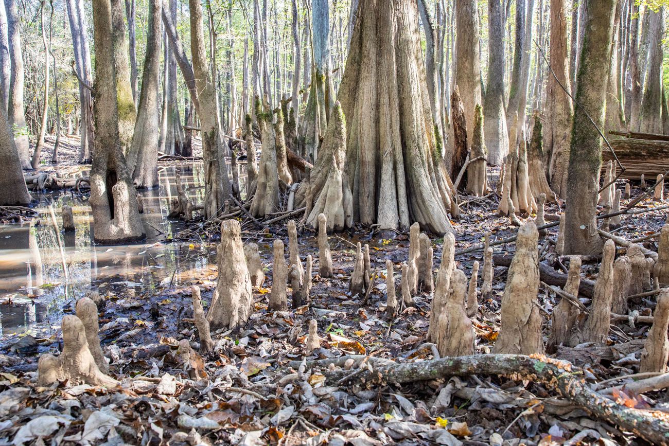
Bald cypress trees produce “knees” like the ones in the photo above. Their function is not totally understood but these knees are thought to give the trees extra support.
Geography and Maps of Congaree National Park
Congaree is one of the smallest US national parks. At 26,000 acres, it is the 7th smallest park.
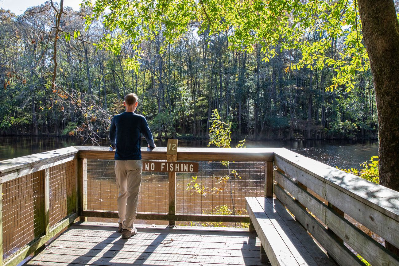
The Harry Hampton Visitor Center is the main hub for the park. This is where the majority of the hiking trails start, including the wonderful Boardwalk Loop Trail. Cedar Creek flows west to east through the center of the park. The Congaree River forms the southern border and out to the east there are a few short trails to hike.
Below is a map from the National Park Service.
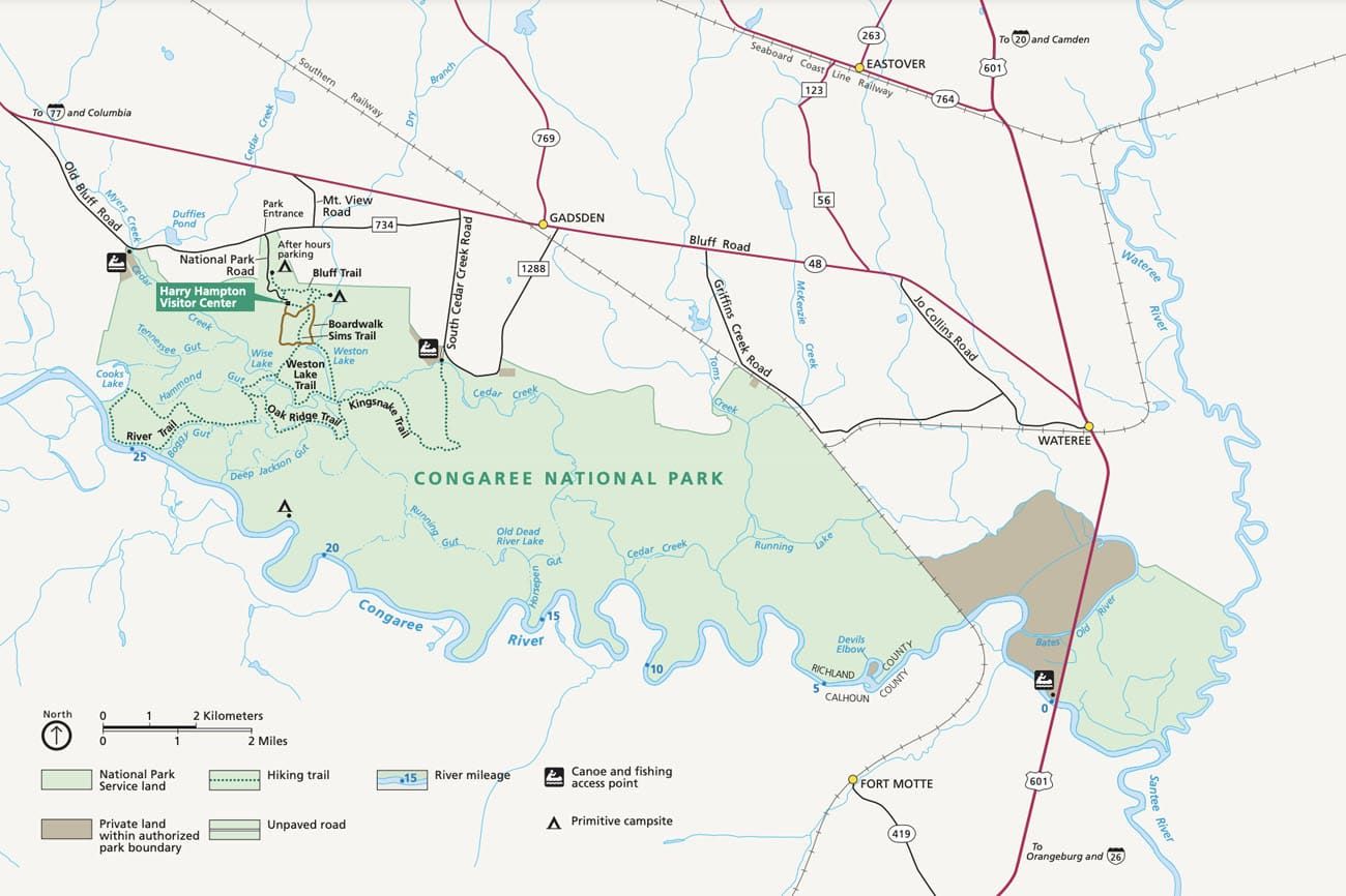
Map of Congaree National Park
Here is an interactive map where we have labeled things to do in Congaree National Park.
How to Use This Map: Click the tab in the top left corner of the map to see a list of the points of interest and to turn layers on/off. Click the icons on the map to get more information about each point of interest.
To take this map with you, click the star next to the title of the map which adds it to your Google account. Next, within your Google Maps app, select ‘Saved’ and then select ‘Maps’. This map title will now appear in your list.
Best Things to Do in Congaree National Park
This list contains 10 things to see and do in Congaree National Park. There are quite a few hikes to do, but they are all rather similar, so there’s no need to do all of them. If you are here on a quick visit and just want to see “the best of the park,” here is a list of what we think are the must-have experiences:
- Walk the Boardwalk Loop Trail
- Go canoeing or kayaking on Cedar Creek
- See Wise Lake
With more time, you can also go fishing or go deeper into the park, on one of many hiking trails. And if you are here between mid-May and mid-June, you can see the synchronous fireflies, just know that you need a lottery ticket, which takes some advance planning.
Here is a list of things to do in Congaree, starting with our favorite experiences and ending with our least favorite.
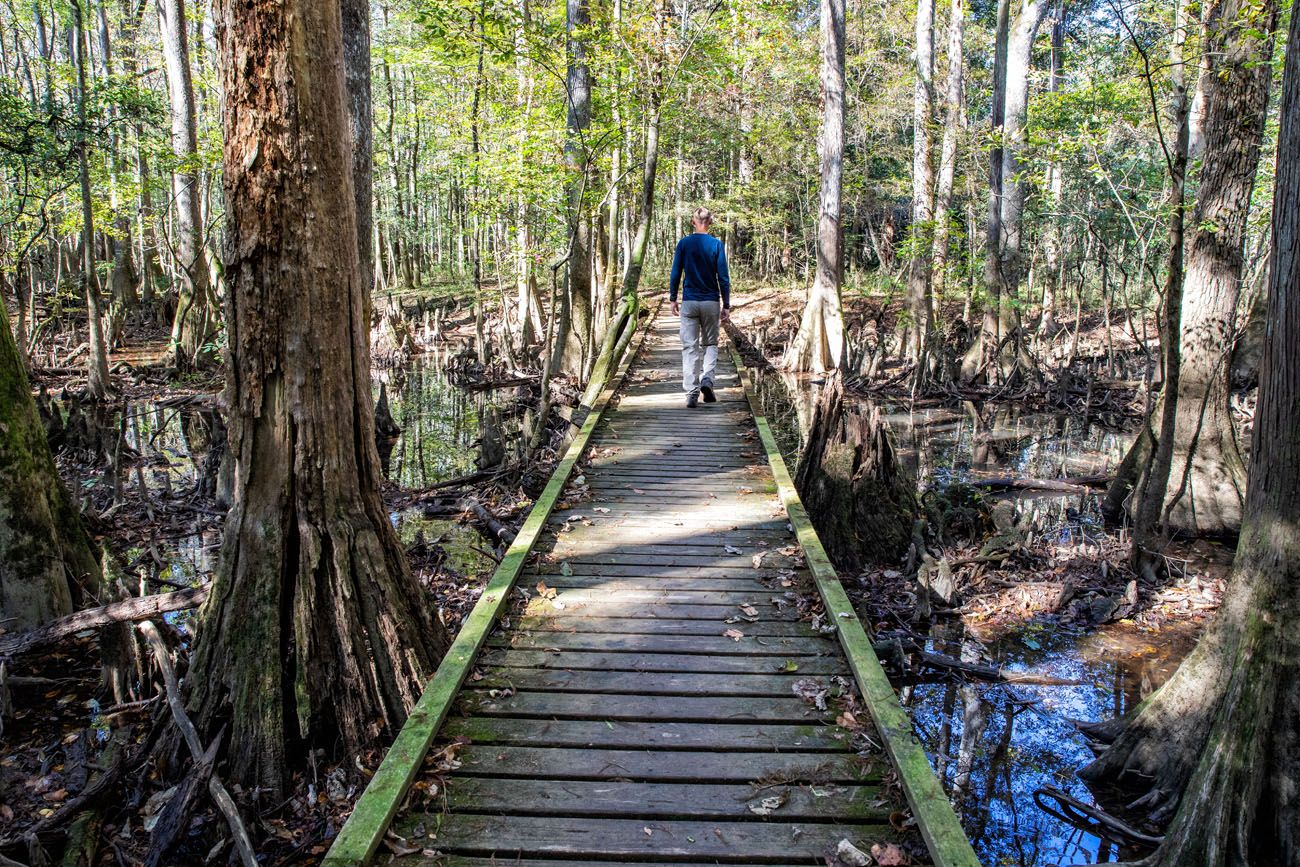
#1 Walk the Boardwalk Loop Trail
Distance: 2.6 mile loop | Difficulty: Easy | Time: 1 to 2 hours
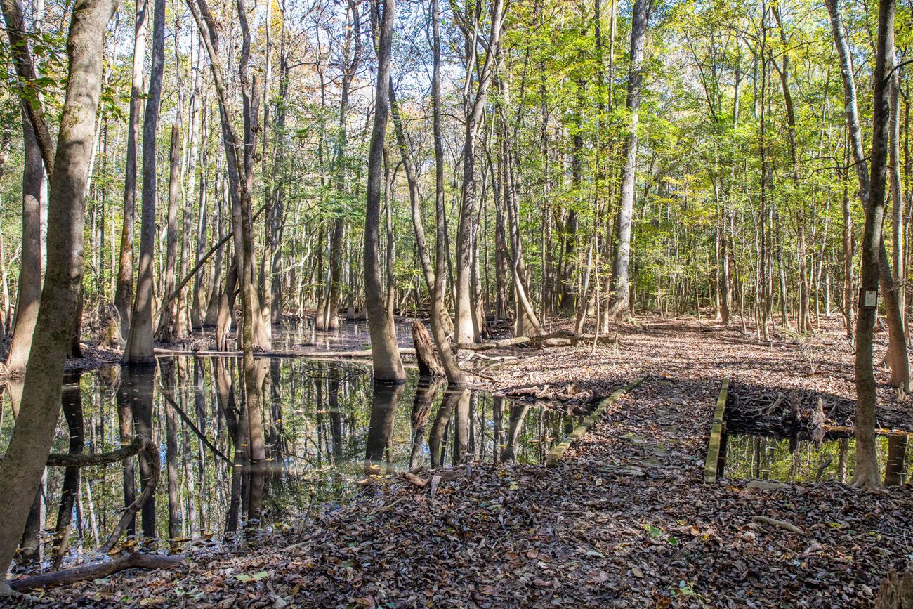
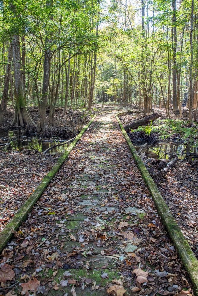
This is the best walk in the park. Starting at the Harry Hampton Visitor Center, this all-boardwalk trail makes a loop through some of the best scenery in Congaree National Park.
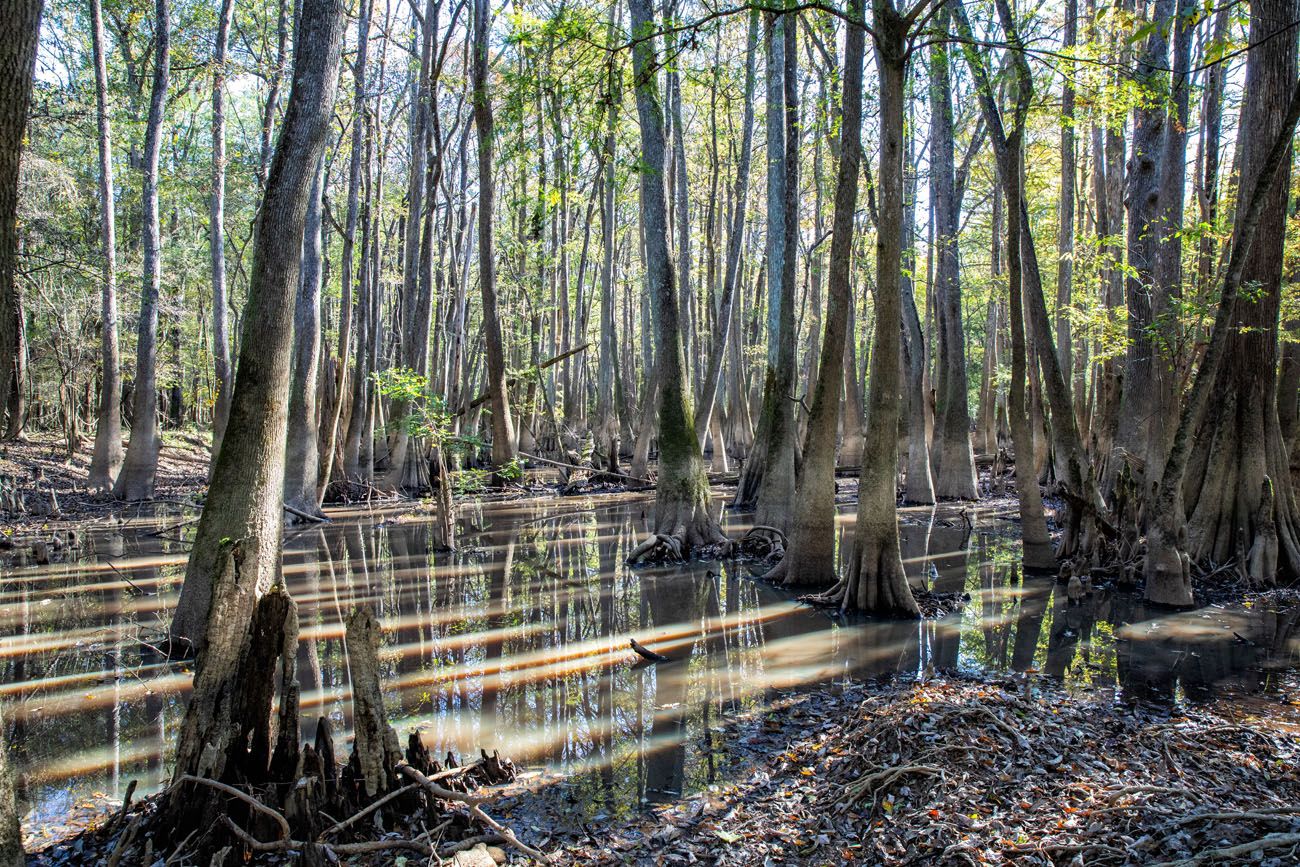
The boardwalk trail is an elevated path through the bottomland, where you can see giant tupelos and bald cypress trees standing in the water. The entire boardwalk trail is wheelchair and stroller accessible.
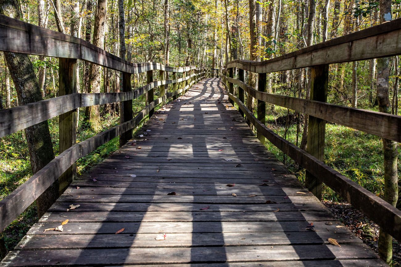
The Boardwalk | Best Things to do in Congaree National Park
Along the trail are numbers that correspond to the Self-Guided Boardwalk Trail brochure that you can pick up at the Visitor Center before you start this walk. It’s well worth it, as it points out both natural and historical sights along the trail.
PRO TRAVEL TIP: This park floods on a regular basis. After a heavy flooding, the Boardwalk Loop Trail, and other trails on this list, can temporarily close. Before planning your trip, and just before your visit, visit the National Park Service website for updates on park conditions to avoid any unfortunate surprises. We had to postpone our trip several times since many of the trails flooded and closed right before our visit.
#2 Go Kayaking or Canoeing on Cedar Creek
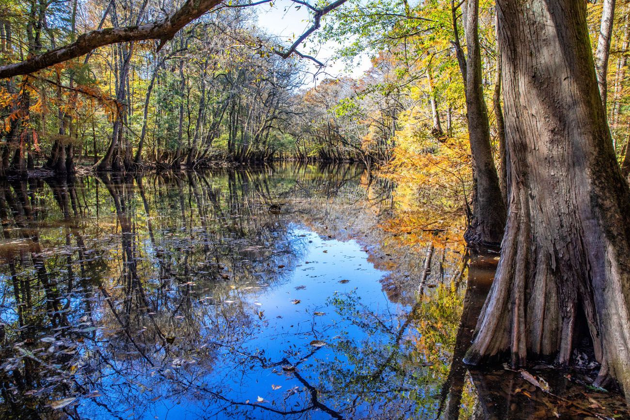
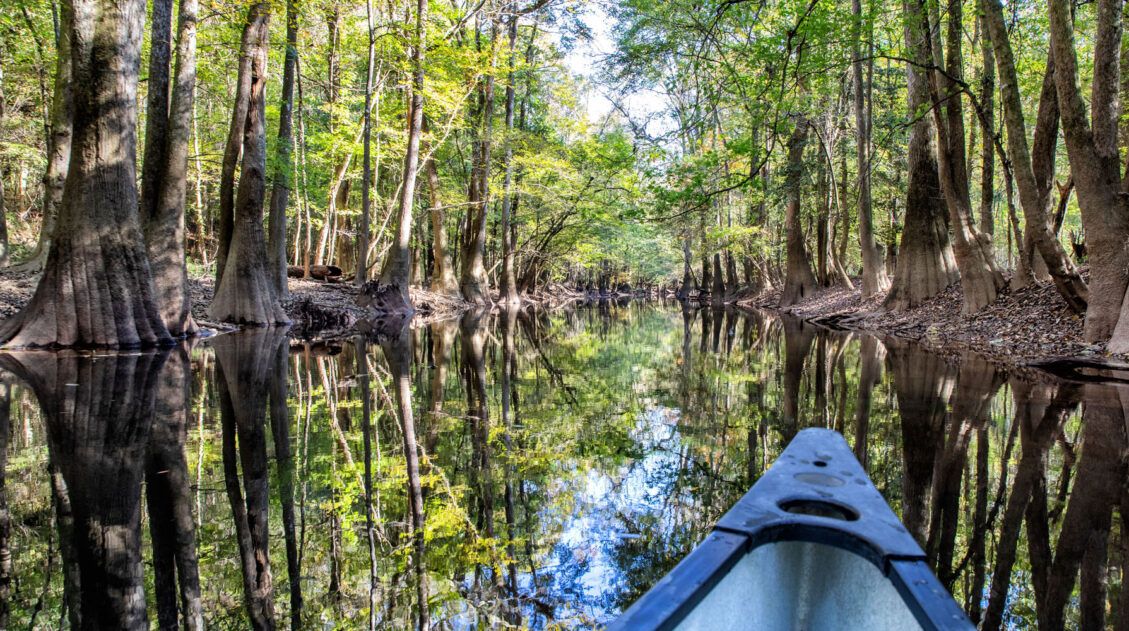
Drifting along Cedar Creek in a kayak or canoe is the one of the best things to do in Congaree National Park. In fact, it was our favorite experience here.
There are several ways to do this, depending on how much time you have and how much you like canoeing or kayaking.
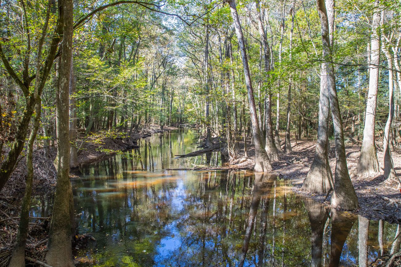
We spent two hours canoeing on Cedar Creek, starting and ending at the Cedar Creek Canoe Launch. Tim and I canoed downstream on the creek, silently drifting past tupelos and bald cypress trees.
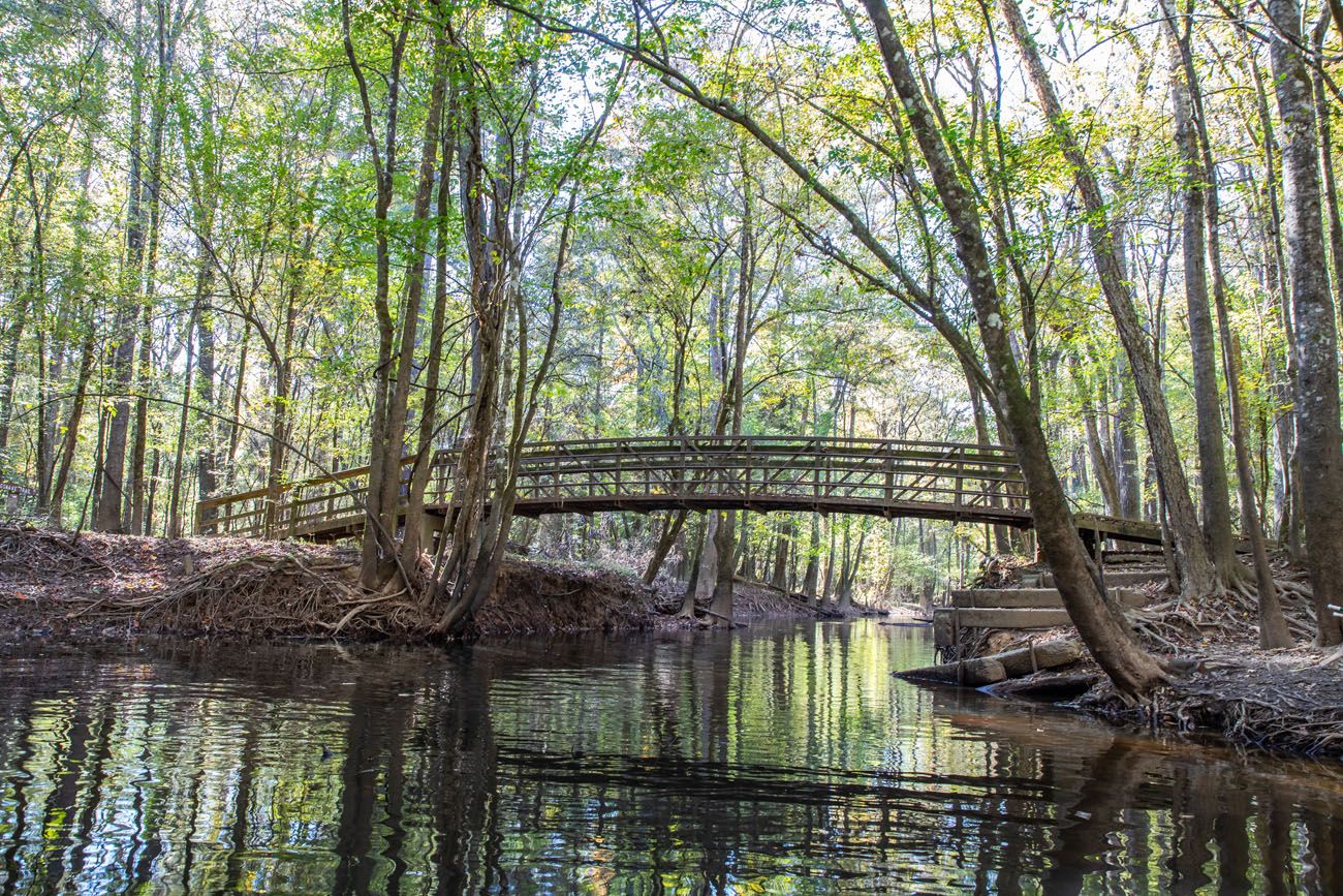
Cedar Creek Bridge
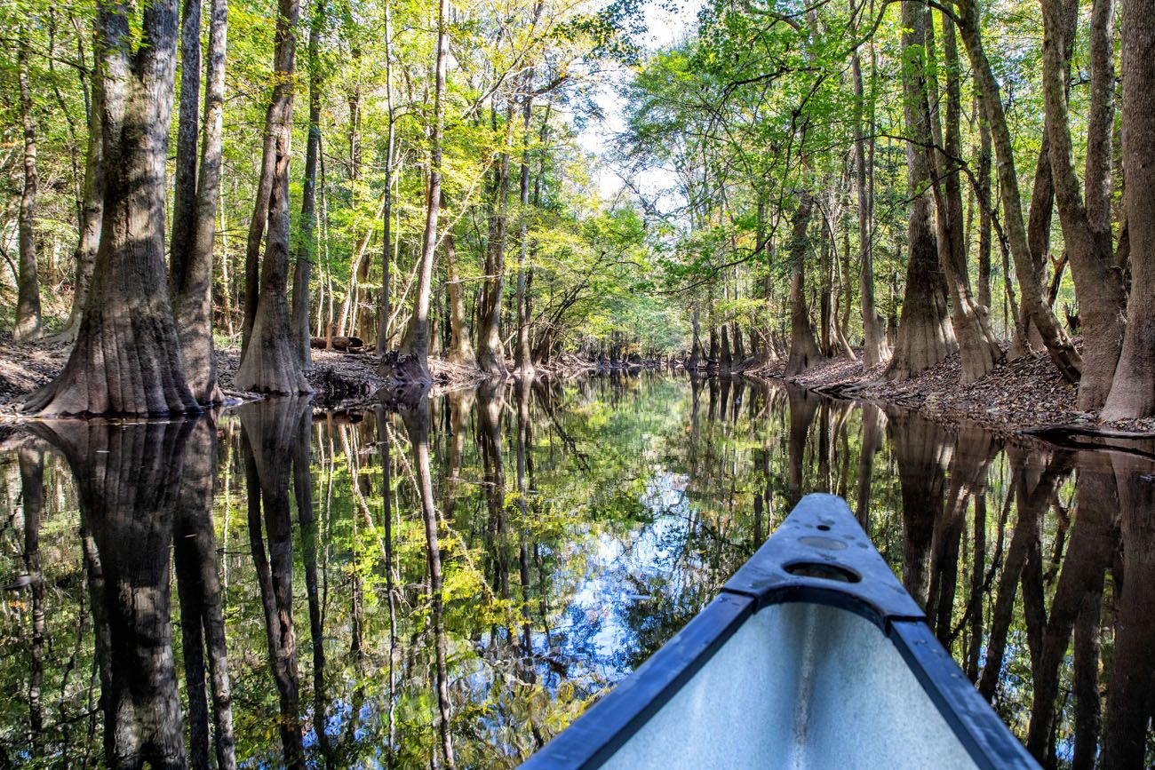
Cedar Creek | Best Things to do in Congaree National Park
Cedar Creek
It is the best way to experience this park. We didn’t see much in the way of wildlife, but Cedar Creek is beautiful, and to drift along the water, listening to the birds and the crickets, and to see these majestic old trees, was a very memorable experience.
Cedar Creek is a very slow moving creek. Paddling upstream is not problem at all and really not any harder than going downstream, at least when we did this.
As water levels change, you could have obstacles along the creek that impede your progress. Water levels were low when we did this, which allowed us to duck under some fallen trees. There is a chance that downed trees can block the creek, forcing you to turn around or pull your kayak/canoe up onto land to carry it around the downed tree.
Renting a Canoe or Kayak
We rented a canoe from River Runner Outdoor Center. You can either pick up the canoe from their office in Columbia, or for an additional fee, have them deliver it right to the canoe launch. We chose to have it delivered.
At 2 pm, our canoe was delivered by Gus from River Runner Outdoor Center. Gus gave us a great overview of Cedar Creek and told us what to keep an eye out for as we paddled on the creek. For two hours, Tim and I paddled on Cedar Creek and once we were finished, Gus picked up the canoe and we were on our way. Having the canoe delivered to Cedar Creek made the logistics super easy.
You can also spend a half day to a full day on Cedar Creek. There is a 15 mile “trail” called the Cedar Creek Canoe Trail, that starts at Bannister’s Bridge and ends at the Congaree River. You can canoe part or all of this trail. If you use an outfitter like River Runner, they can drop your canoe or kayak at the starting point and pick you up at the endpoint.
The Congaree River Blue Trail is a 50-mile paddling trail on the Congaree River that starts in Columbia and ends in Congaree National Park. Learn more here.
For more ideas on canoe trips, visit the National Park Service website.

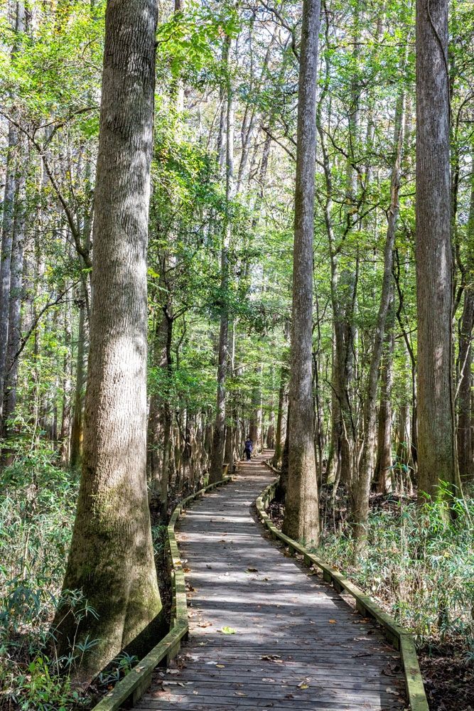
#3 Hike the Weston Lake Loop Trail
Distance: 4.5 miles | Difficulty: Easy | Time: 2 to 3 hours
The Weston Lake Loop Trail loops through old growth forest, where you can see more tupelo and bald cypress trees. Like all of the hiking trails in Congaree, it is completely flat.
This was our second favorite hike in Congaree, with #1 being the Boardwalk Loop Trail.
The best way to do this hike is to start on the Boardwalk Loop Trail, hiking this in a counter-clockwise direction. At the trail junction, follow signs for Weston Lake and you will now be on trail #3 (there will be small, white signs on the trees with the number 3 on them).
The Weston Lake Loop Trail will follow alongside Cedar Creek for almost one mile. At the next trail junction, go left to continue on the Weston Lake Loop Trail and head back towards the Visitor Center. When the trail rejoins with the boardwalk, walk out to the viewpoint of Weston Lake. Then take the boardwalk back to the visitor center.
Weston Lake Loop Trail
Weston Lake Loop Trail
Weston Lake Overlook | Best Things to do in Congaree National Park
#4 See Wise Lake
Wise Lake is one of the prettiest spots that we saw in Congaree National Park. This lake is surrounded by old growth trees.
Wise Lake
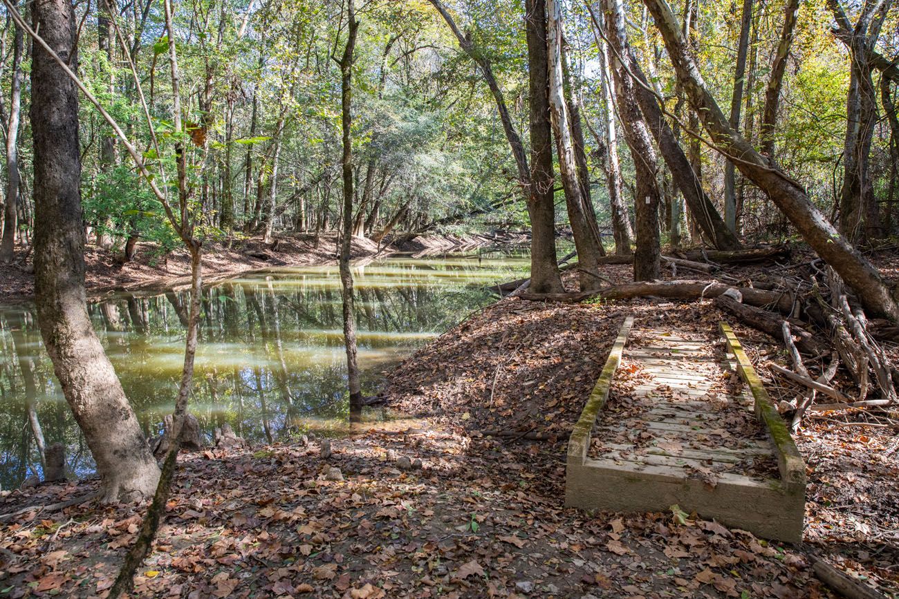
Wise Lake is located near the trail junction for the Weston Lake Loop Trail and River Trail. From the Boardwalk Loop Trail, walk 0.6 miles on the Weston Lake Loop Trail until you get to the trail junction with the River Trail. There are signs here that direct you to Wise Lake. From this junction, you will walk about 100 meters to get to Wise Lake.
#5 See the Synchronous Fireflies
For 2 weeks from mid-May to mid-June, fireflies light up the skies in Congaree National Park. During this time, the fireflies synchronously flash as they search for a mate.
The best time to see the fireflies is between 9 pm and 10 pm. The best viewing spots are near the Harry Hampton Visitor Center.
This has become such a popular event that in 2021 the National Park Service began a lottery system. Learn more on the NPS website.
#6 Go Fishing
Fishing is allowed in all areas of Congaree National Park. We saw a few fishermen along Cedar Creek while we were canoeing.
In order to go fishing in the park, you must have a valid South Carolina fishing license. Catch and release fishing is encouraged. For more restrictions and information, visit the NPS website.
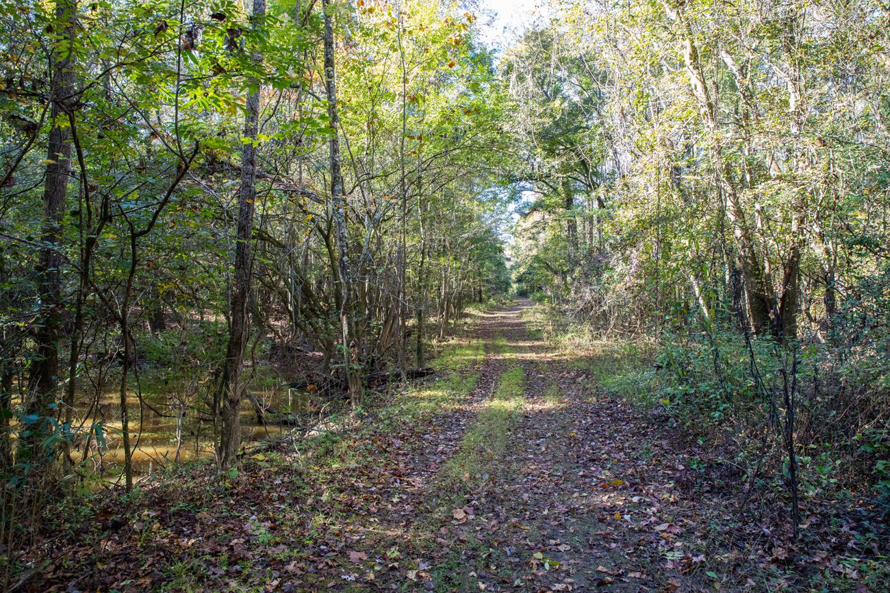
#7 Bates Ferry Trail and the General Greene Tree
This off-the-beaten-path hike is worth it if you want to hike a quieter trail, see the Congaree River, and search for one of the oldest, grandest trees in the park.
The Bates Ferry Trail is really not all that exciting. It is the remains of an old ferry road that ended at the Congaree River. For the entire 1.1 mile walk (one-way), you are on a wide grassy trail that leads to a view of the Congaree River.
Bates Ferry Trail
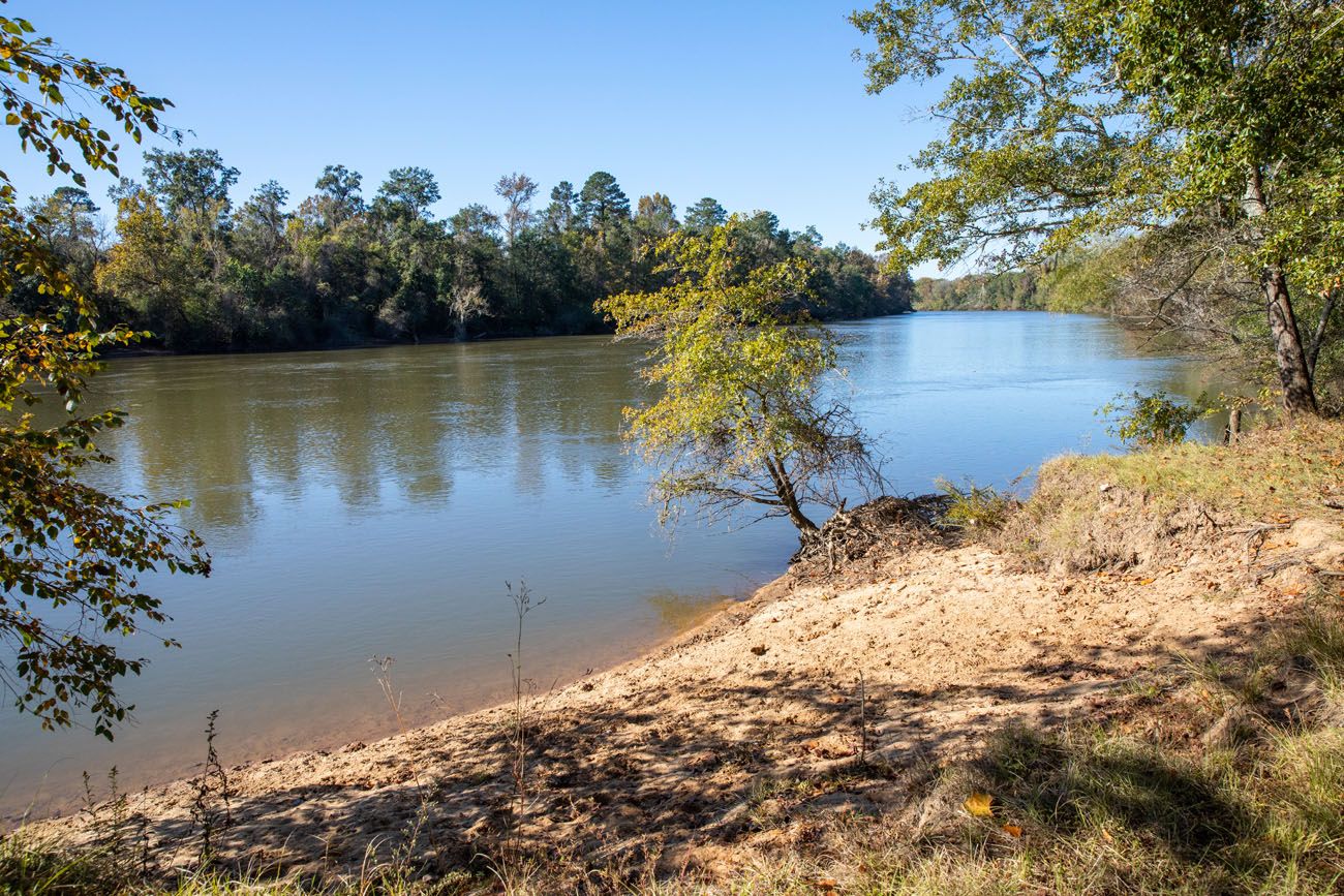
Congaree River
If you just hike the Bates Ferry Trail, it is a 2.2 mile out-and-back hike that is completely flat and takes about an hour.
But I recommend adding on a detour.
Getting to the General Greene Tree
The General Greene Tree was recognized as a South Carolina Heritage Tree on December 7, 2018. It is the largest bald cypress in Congaree National Park with a circumference of 30 feet. The tree is named for Revolutionary War general Nathanael Greene.
Getting to the tree is a bit tricky. We were given hiking directions at the Harry Hampton Visitor Center and have modified them:
From the Bates Ferry trailhead, walk 0.4 miles. On the left will be an unmaintained road. To the right is a metal trail marker with a #7 on it. Walk about 20 feet farther and to your right will be a trail leading into the woods.
On this trail, you will cross a metal bridge over a creek. The trail narrows beyond this bridge. Once the trail turns to the left, look for cypress trees standing in water off on the right side of the trail. The General Greene tree is located here.
General Greene Tree | Best Things to do in Congaree National Park
The total distance from the Bates Ferry Trail to the General Greene Tree is 0.2 miles.
If you continue past the General Greene Tree, in about 0.1 miles you reach another unmaintained road to the right. Follow this for another tenth of a mile and you come to this low area, filled with tupelos and bald cypress trees. It’s a beautiful part of Congaree National Park.
GETTING TO THE BATES FERRY TRAILHEAD: This trail is located in the far eastern section of Congaree National Park on Highway 601. As you drive south on Highway 601, the turn off for the trailhead is located just past the bridge that crosses Bates Old River. This trailhead is labeled on our interactive map.
#8 Hike the Fork Swamp Trail
Distance: 0.6 miles | Difficulty: Easy to moderate | Time: 30 minutes
This hike is quick and easy, as long as it is not flooded or muddy. When we did this, the trail was dry.
The Fork Swamp Trail is located near the Bates Ferry Trail, so this hike is worth doing if you will be out this way. This trail leads out to the southern channel of Bates Old River, an oxbow lake created by a hurricane in 1852.
Fork Swamp Trail
GETTING HERE: On Google Maps, the trailhead is labeled “Fork Swamp Trailhead.” It is located on an access road on Highway 601. There were no signs labeling this access road but the GPS coordinates for the turn off are 33°45’44.7″N 80°38’33.7″W. At the end of this short road is a small parking area and a National Park sign indicating the trailhead. The trailhead is also marked on our interactive map.
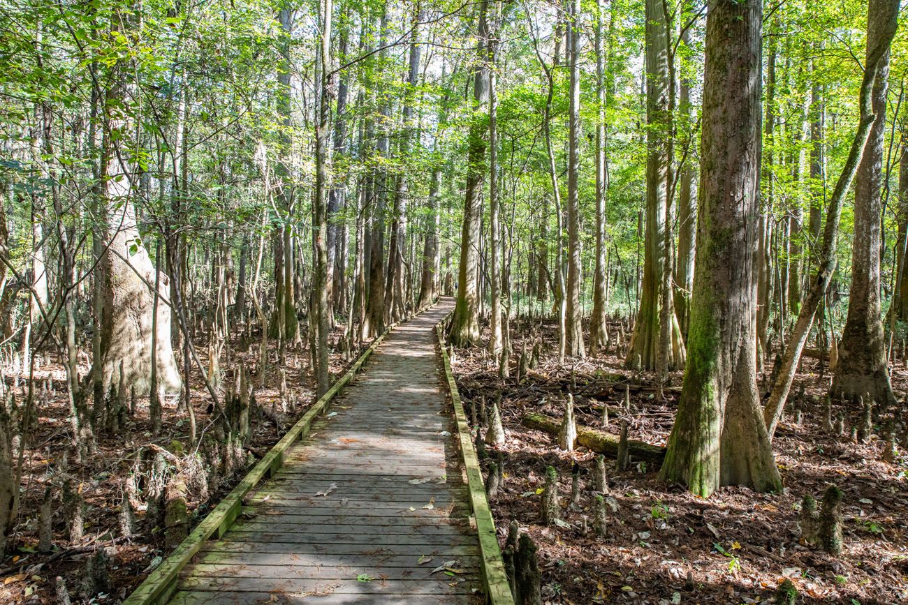
#9 The Kingsnake Trail
Distance: 12 miles out-and-back | Difficulty: Easy to difficult | Time: 5 to 7 hours
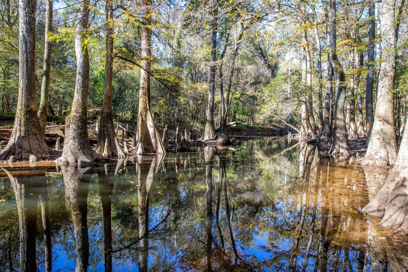
If you are a birdwatcher, this is the best trail in the park. The Kingsnake Trail passes through sloughs of tupelo and cypress trees and runs along part of Cedar Creek. Crossing over the old, rickety bridges with views of the forest is beautiful.
Cedar Creek
Kingsnake Trail
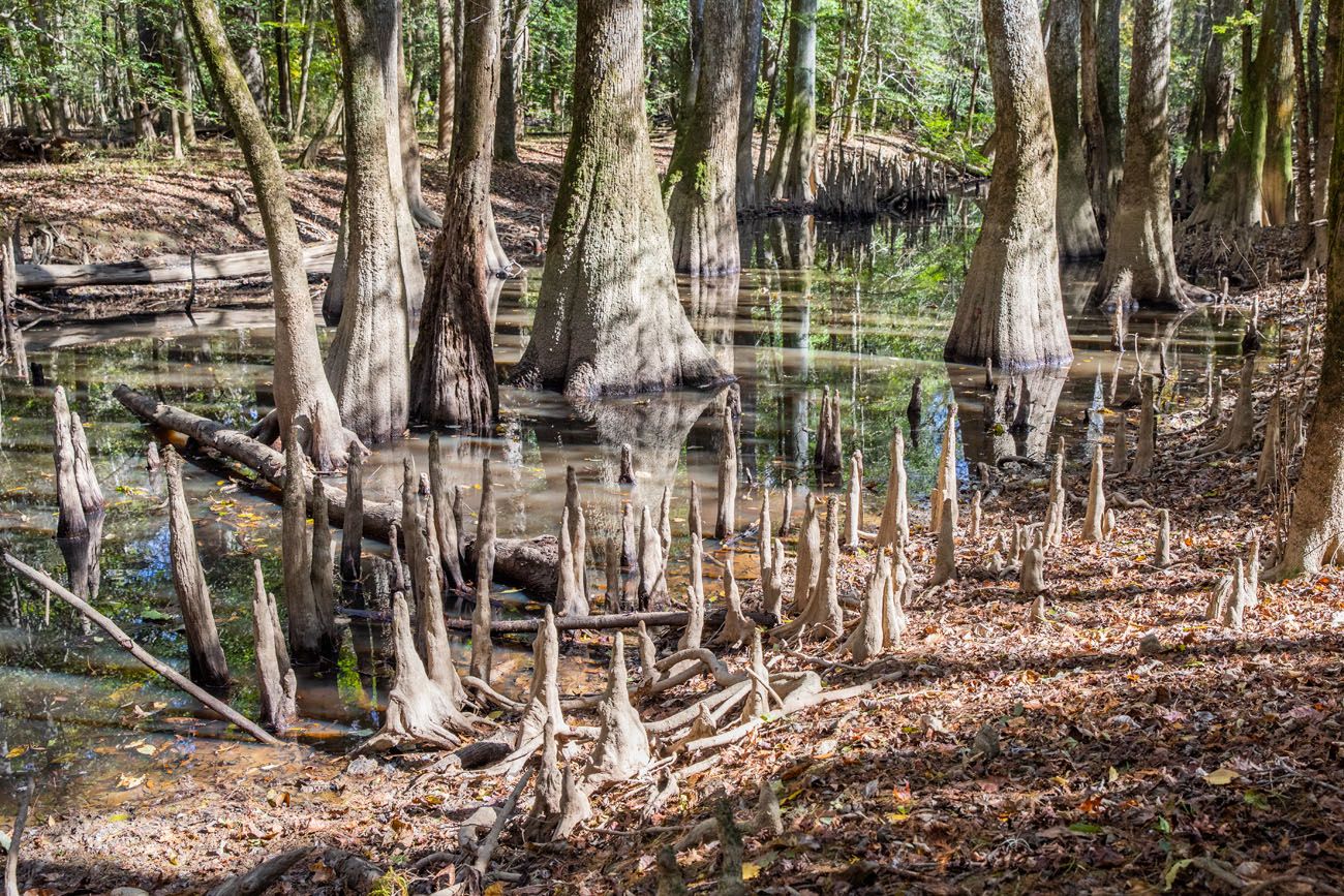
Bald Cypress knees
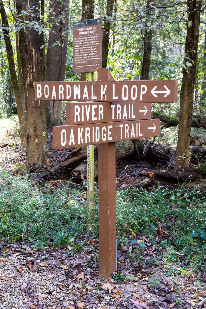
This trail starts at the Cedar Creek Canoe Launch and ends at the junction with the Weston Lake Trail and Oakridge Trail. At this junction, you can retrace your steps back to your starting point or add the Weston Lake Trail or the Oakridge Trail.
The difficulty can vary based on conditions in the park. When we did this hike, it was dry and the trail was very easy to hike (it is completely flat). But downed trees and flooding can create difficult conditions.
#10 Hike the River Trail to the Congaree River
Distance: 11.1 miles | Difficulty: Easy to difficult | Time: 4 to 6 hours
Tim and I were not fans of this hike, but I’m listing it as a thing to do in Congaree National Park in order to provide some information about it.
This is a long hike. And for the most part, the views don’t change all that much over its 11 miles.
The short walk on the boardwalk at the start of the hike is the best part. Seeing Wise Lake is also very nice.
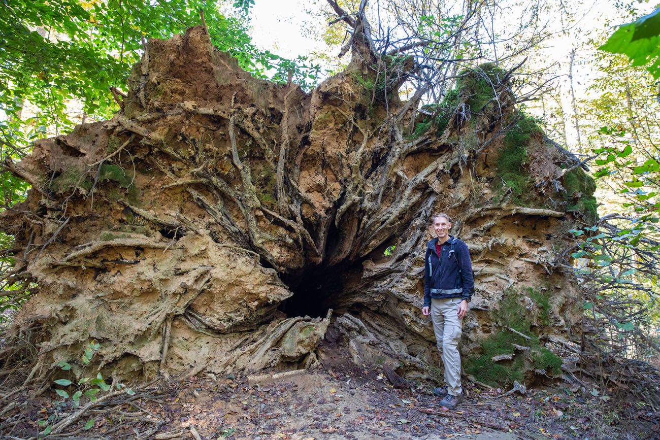
Seeing this fallen tree was one of the most memorable parts of this hike.
But once on the River Trail, it is a completely flat, monotonous walk through the forest. Most of the time, you are walking through oaks and other hardwoods, not through sloughs of tupelos and cypress trees that make Congaree National Park so beautiful and so unique.
And I have never cleared as many cobwebs off my face and clothes as I did on this hike.
At the midpoint of the hike, you get a view of the Congaree River, but it’s not worth it, not for an 11 mile round trip hike (if you want a view of the Congaree River from a hiking trail, do the 2.2 mile Bates Ferry Trail instead).
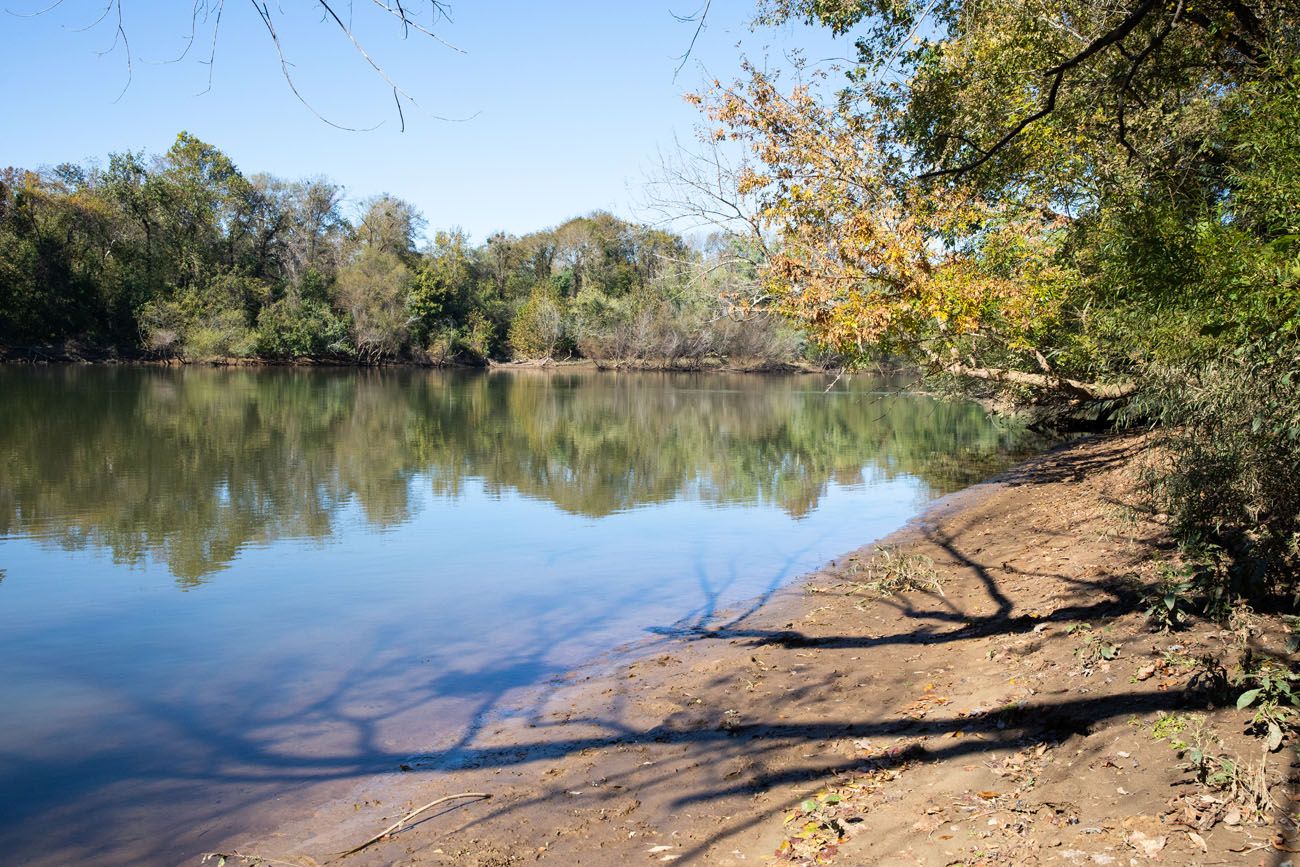
Congaree River
We thought that this hike is easy. It’s completely flat and very well marked with trail signs along its entire distance. The total ascent for this hike is a mere 60 feet. The NPS website warns that it this hike is difficult, since flooding and downed trees can make hiking challenging.
I only recommend this hike for those who are looking for a long hike away from the crowds.
Other Trails in the Park
There are other short trails in the park. Some of these are connector trails.
The Sims Trail is an old gravel road. Part of Sims Trail bisects the Boardwalk Loop Trail and this part of Sims trail is not worth it, since you miss seeing the bottomland forests. The southern part of the Sims trail connects the Boardwalk Trail with the Weston Lake Trail, River Trail, and Oak Ridge Trail.
The Firefly Trail is a flat trail that runs through the woods just to the south of the visitor center. It’s nice but we liked the Boardwalk Trail more. It gets its name since this is a good place to see the synchronous fireflies in May and June.
The Bluff Trail is located north of the Harry Hampton Visitor Center and passes through loblolly and longleaf pines.
The Oakridge Trail is a longer trail (7.1 miles) that passes through hardwood forests with oaks, gums, and poplars. We did not hike this trail, choosing the River Trail instead. Maybe we would have liked this one more?
Congaree Trail Sign
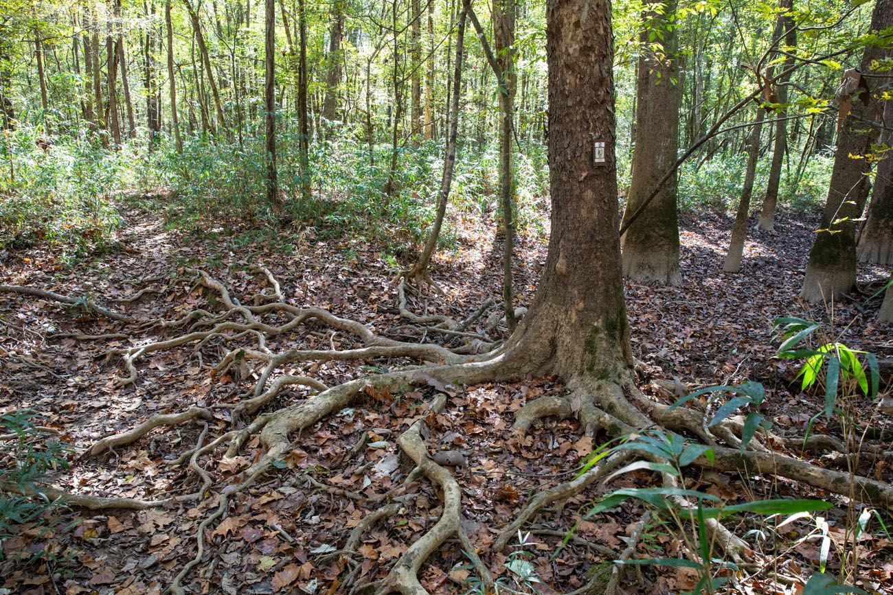
Hiking trails are marked with small white signs like the one on this tree. Each trail has a different number. At the visitor center, pick up a hiking trail guide and this lists each trail with its corresponding number.

How Many Days Do You Need in Congaree National Park?
Since this park is so small, you only need a half to a full day to see the highlights.
We listed 10 things to do in Congaree National Park. The highlights, in our opinion, are walking the Boardwalk Loop Trail and kayaking or canoeing on Cedar Creek. Adding on the Weston Lake Trail and Wise Lake is great for those who want to go a little deeper into the park.
If you have a half day in Congaree National Park, walk the Boardwalk Loop Trail and consider adding on the Weston Lake Trail with the detour to Wise Lake.
If you have one day in Congaree National Park, spend half a day hiking the Boardwalk Loop Trail and Weston Lake Trail and spend half of a day canoeing or kayaking on Cedar Creek. For more information, read our detailed one day itinerary for Congaree National Park.
One Perfect Day in Congaree National Park
Best way to spend one day in Congaree National Park.If you have two days in Congaree National Park, spend one day canoeing or kayaking on Cedar Creek and one day hiking the trails (we recommend the Boardwalk Loop Trail, Weston Lake Trail, and the Bates Ferry/General Greene Tree hike).
Best Time to Visit Congaree National Park
The best time to visit Congaree National Park is in the spring and the fall.
In the spring and fall, temperatures are warm (daytime highs can get up into the 70’s) and mosquitoes are low. In both the spring and fall, Congaree gets about 3 inches of rain per month.
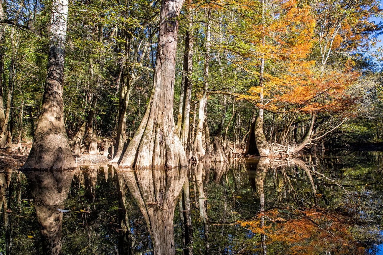
Peak fall colors occur at the beginning of November. We visited Congaree from November 8 through November 10. Daytime highs were in the high 60’s to mid-70’s and at night it got down into the 40’s. We had bright sunny skies each of the three days that we were here.
Fall is the best time to go paddling on Cedar Creek since water levels are ideal.
If you want to see the synchronous fireflies, plan your visit for the end of May to early June.
During the summer months, Congaree is hot and humid. Temperatures frequently get up into the high-90’s and even up over 100°F. The humidity makes it feel worse and mosquitoes are at their highest levels at this time.
Flooding tends to occur during the winter months. Temperatures can be chilly but snow is unusual.
Congaree National Park appears in our Best US National Parks in March, Best US National Parks in May, and Best National Parks in November articles. For more information about the best times to visit the national parks, check out our Best National Parks Month-by-Month Guide.
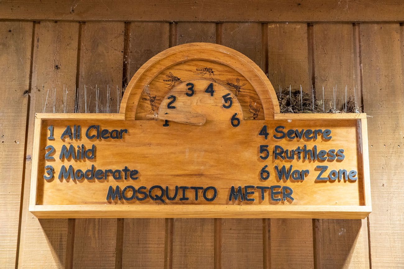
Congaree Mosquito Meter in November
How to Get to Congaree National Park
Congaree National Park is located in South Carolina.
The closest major airport is located in Columbia, South Carolina, which is about a 30 minute drive from Congaree National Park. Charlotte Douglass International Airport, which is located in Charlotte, North Carolina, is a larger airport with more flight options. It takes 2 hours to drive to Congaree National Park from here.
If your visit is part of a bigger road trip, here are the driving distances and times to nearby destinations:
- Columbia, South Carolina: 18 miles, 30 minutes
- Charleston, South Carolina: 105 miles, 2 hours
- Myrtle Beach, South Carolina: 130 miles, 2.5 hours
- Charlotte, North Carolina: 112 miles, 2 hours
- Asheville, North Carolina: 180 miles, 3 hours
- Savannah, Georgia: 150 miles, 2.5 hours
- Augusta, Georgia: 90 miles, 1.5 hours
Where to Stay
Inside of Congaree National Park, your only option is tent camping. There are two campgrounds, the Longleaf Campground and Bluff Campground, and you must make your reservation in advance.
Outside of the park, Columbia is the best place to stay (and eat). It is just a 30-minute drive to get between Columbia and Congaree National Park.
There are numerous hotels in Columbia to choose from. We stayed at the Hilton Columbia Center and had a great experience but the Graduate Columbia, Staybridge Suites Columbia, Aloft Columbia Downtown, and the Courtyard Columbia Downtown all are highly rated and have a great location in downtown Columbia. From these hotels, you can easily walk or Uber to some great restaurants.
On the outskirts of Columbia, the Courtyard by Marriott Columbia Cayce gets wonderful reviews. It has an onsite restaurant and it is 10 minutes closer to Congaree than the hotels in downtown Columbia.
Where to Eat
There are no restaurants in Congaree National Park. If you plan to visit the park for the day, pack a picnic lunch. There are limited food options in Gadsden and the best place to grab a bite to eat is in Columbia, South Carolina.
One of our favorite things to do on this visit was go out to dinner. There are a lot of great restaurants in Columbia. We had three nights here, so we tried three different restaurants as well as one spot for lunch.
Bourbon was our favorite restaurant. The food is very good (Cajun and Creole) but the main reason to put this restaurant on your list is for the bourbon. The bourbon list is extensive. You can sample a wide range of bourbon or have one (or more) of their crafted cocktails. We love bourbon and this is our favorite restaurant in Columbia.
Motor Supply Company Bistro offers farm-to-table fare for lunch and dinner and the menu changes daily. Make your reservation in advance!
We also had a very nice dinner at Saluda’s. Located in the Five Points neighborhood, this restaurant serves southern fare with a twist. It’s the most upscale restaurant listed here and a nice option if you are looking for a fine dining experience.
Menkoi Ramen House. We had a late lunch here and it was excellent. The ramen noodle soups and dumplings are delicious.
Cola’s Restaurant, Mr. Friendly’s New Southern, and Midwood Smokehouse also get very good reviews.
Plan Your Visit
Entrance Fee: There is no fee to enter Congaree National Park.
Hours of Operation: The park is open 24 hours a day, 365 days per year.
Get updates on road conditions and trail closures, as you plan your trip and just before your visit, on the National Park Service website.
If you have any questions about things to do in Congaree National Park, or if you want to share your experience, let us know in the comment section below.
More USA Travel Guides
One Perfect Day in Congaree National Park
With its compact size and short list of things to do, one day is all you really need to visit Congaree National Park. With one day in Congaree National Park, walk the boardwalk trail, go canoeing or kayaking on Cedar Creek, and venture farther into the wilderness on one of several other hiking trails in […]

20 Amazing Things to Do in Charleston, SC
Charleston is a small coastal city in South Carolina. Touring its historic homes, shopping along King Street and in the Charleston City Market, and getting a history lesson at its museums top the list of things to do in Charleston. But you can also dine at a wonderfully long list of restaurants and venture beyond […]
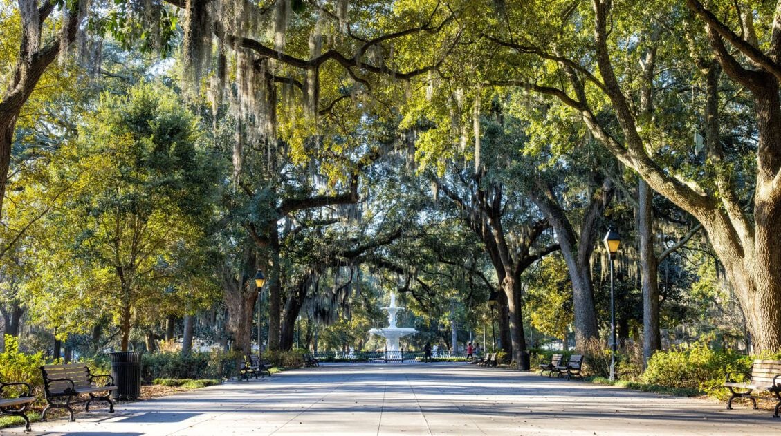
30 Fun Things to Do in Savannah, Georgia (+ Our Favorites)
Savannah, Georgia…this is where elegant mansions sit across from shady squares, art galleries and boutique shops dot the city streets, and restaurants and rooftop bars make great hang out spots for both locals and visitors. In this post, we cover the 30 best things to do in Savannah. Kara has called Savannah home for the […]

A Food Lover’s Guide to the Best Restaurants in Charleston
With its highly rated restaurants and rooftop bars, one of the best things to do in Charleston is to eat. We only had a few days in Charleston and a lot of this time was dedicated to exploring this city’s fabulous restaurant and bar scene. This guide lists many of the top restaurants in Charleston, […]
US National Park Itineraries & Road Trip Ideas
National Park Itineraries The national parks are best experienced as a road trip and with 56 parks visited between us, we’ve done a lot of them. Whether you’re dreaming of a two-week American Southwest loop, a classic Yellowstone and Grand Teton combo, or a deep dive into Utah’s Mighty 5, we’ve put together detailed itineraries […]
South Carolina Travel Guide: Places to Visit in South Carolina
Plan your visit to South Carolina. Learn about the best things to do, how to plan your time, where to stay, and more.
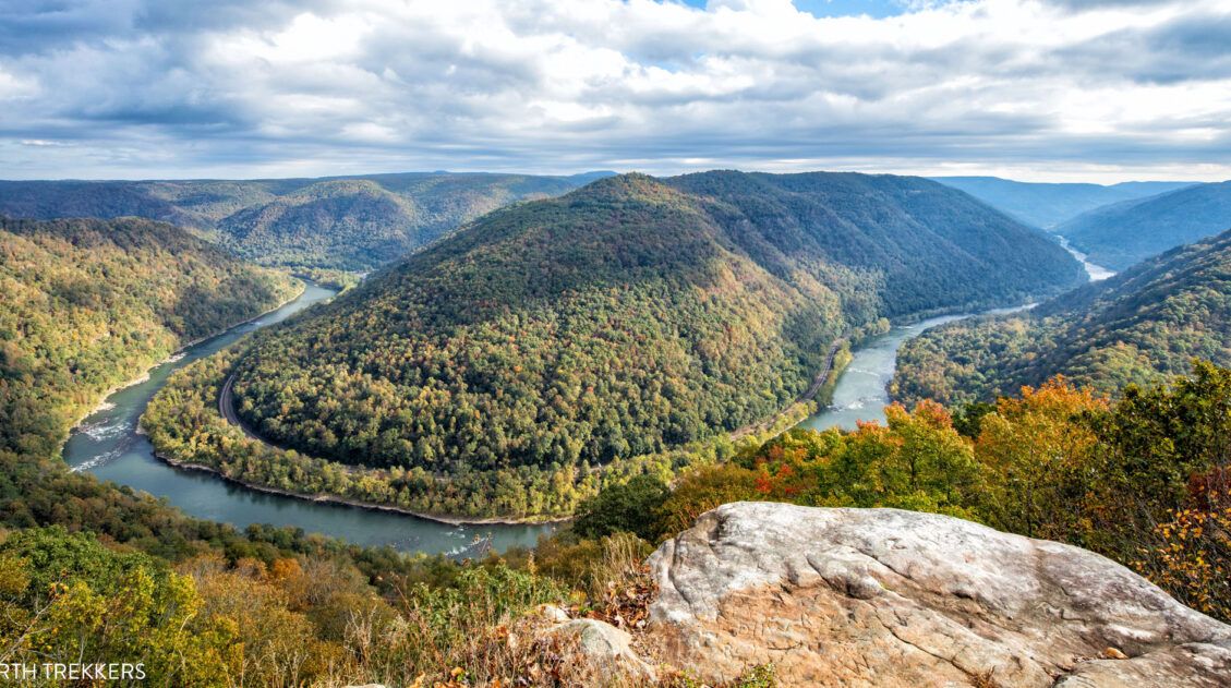
New River Gorge National Park Itinerary for 1 to 3 Days
If you are planning your New River Gorge National Park itinerary, this is a great place to start. There are many different ways to plan the “perfect New River Gorge itinerary,” depending on your interests and how much time you have. The things to do in New River Gorge National Park are scattered along the […]
Our 15 Favorite US National Parks: A Few May Surprise You
Stretching from the South Pacific, across the United States and into the Caribbean, are 63 national parks. These national treasures are filled with scenic drives, hundreds of miles of hiking trails, wildlife, historic sites, and endless opportunities for adventure. In this guide, we cover 15 of the best national parks in the USA and what […]
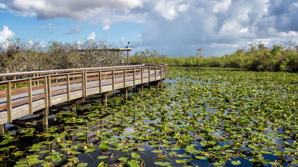
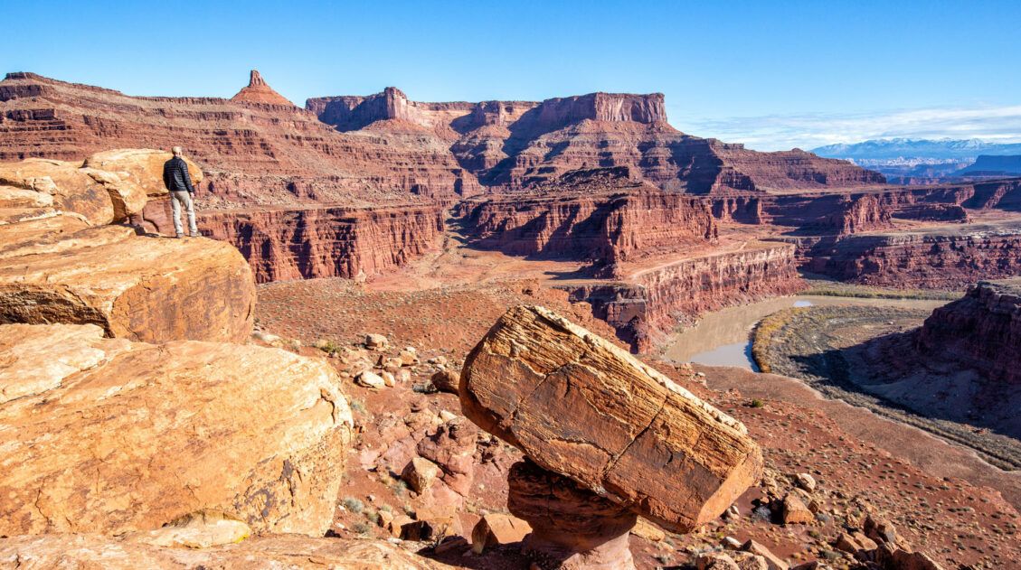
One Perfect Day in Everglades National Park
When you think of the Everglades, what is the first thing that comes to mind? Mosquitos, alligators, and hot, humid weather? Yes, you can find those things here (and in great abundance depending on the time of year you visit), but there is so much more to the Everglades than hot, sticky weather and dangerous […]
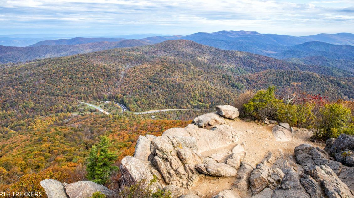
10 Best Hikes in Shenandoah (+One to Skip)
Discover the 10 best hikes in Shenandoah, with tips for families, photographers, and new hikers. 500 miles of hiking trails travel through Shenandoah National Park. These trails range from short, easy summit hikes, gorgeous walks to waterfalls, to challenging climbs up the tallest mountains. You also have the option to walk a few miles of […]
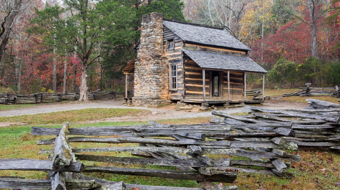
A Weekend in Gatlinburg and Great Smoky Mountains National Park
In an attempt to catch the last of the autumn colors, Tim and I went a road trip to the Great Smoky Mountains in early November. We spent a weekend exploring Great Smoky Mountains National Park, using Gatlinburg, Tennessee as our home base. Great Smoky Mountains National Park is the United States’ most visited national […]
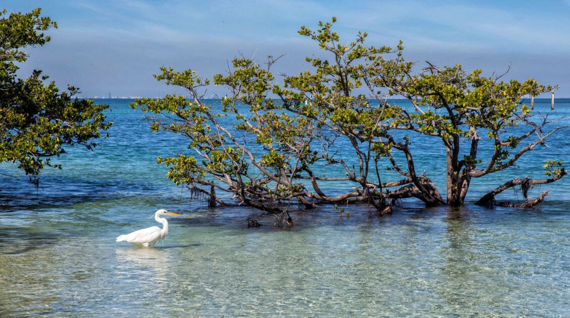
10 Best Things to Do in Biscayne National Park
Biscayne National Park protects one of the largest reef systems in the world. This park is 95% water, so the best way to explore it is by boat, making it very unique from many of the US national parks. If you love snorkeling, scuba diving, swimming, or simply cruising around by boat, you will love […]
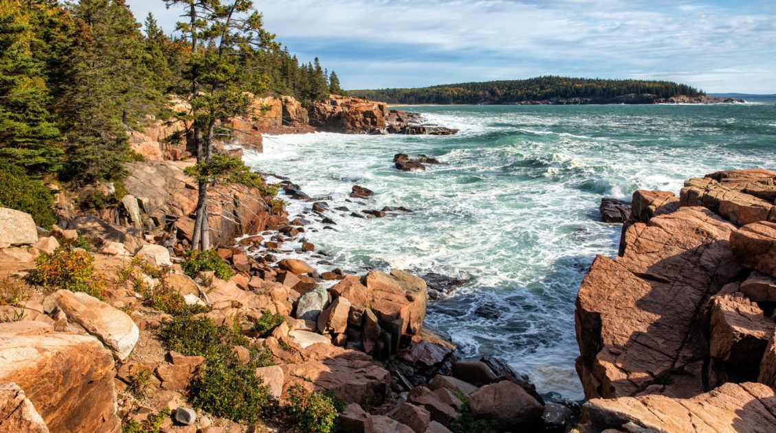
14 Epic Things to Do in Acadia National Park
Called the “Crown Jewel of the North Atlantic Coast,” Acadia National Park protects a portion of the rocky coastline of Maine. Hiking its thrilling trails, going for scenic drives, visiting its remote islands, and watching the sunset from the tallest mountain on the Atlantic Coast all make the best things to do in Acadia National […]

15 Great Places to Work Remotely in the USA
The COVID-19 pandemic brought huge changes to how we live and work. With lockdowns and social distancing, employees of many businesses began to work remotely. Home offices, kitchens, and spare bedrooms became the new office space for many people. What we thought would be a temporary adjustment has now become a more permanent aspect of […]

Comments 12