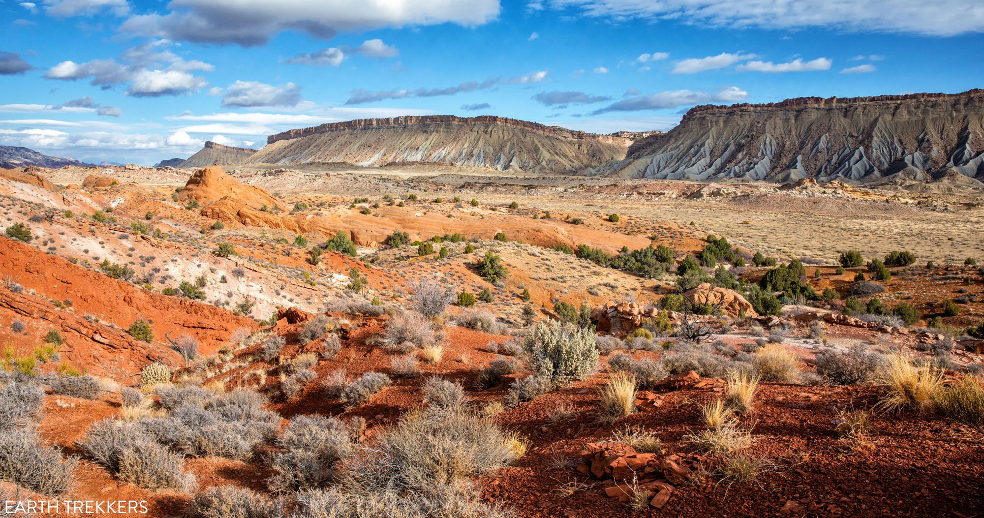
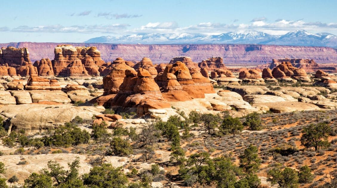
Desert vistas, slot canyons, colorful hills made of bentonite and sandstone, marine fossils…these are just a few of the things that you will see when you Loop the Fold in Capitol Reef National Park.
This incredibly scenic drive takes you through the remote, southern section of Capitol Reef. On this drive, you will circle around part the Waterpocket Fold, a wrinkle in the Earth’s crust that stretches for almost 100 miles.
Often overlooked by most visitors to Capitol Reef, this road, and the hiking trails that lead away from it, get very few visitors. When we did this (November 2020) we saw just two people on the entire drive.
If you like scenic drives, short hikes through slot canyons, and leaving the crowds behind, keep reading! This is an underrated experience in Capitol Reef National Park.
Overview of the Drive
Distance: 125 miles round-trip
Length of Time: It takes roughly 4 hours to drive this loop, but with detours, overlooks, and short hikes, looping the fold takes one full day.
Direction: The best way to Loop the Fold is in the clockwise direction. In this direction, the timing is best for photography and you get to hike the slot canyons in the morning, before it heats up (if you are in Utah in the summer).
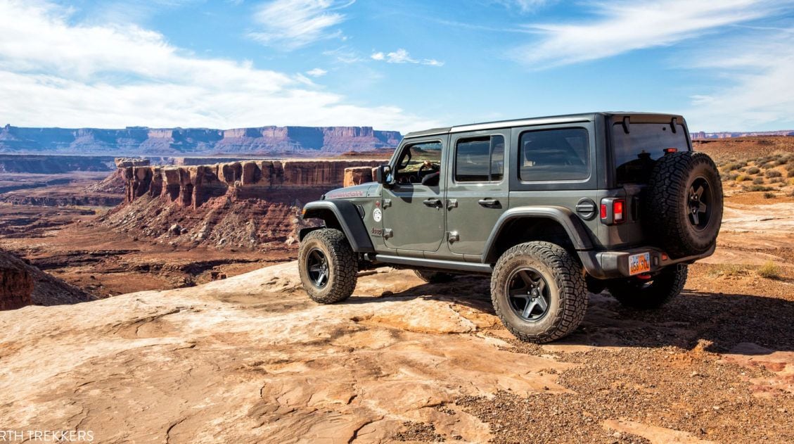
Type of Vehicle: Part of this drive is on a gravel road. When conditions are good (it hasn’t rained or snowed recently), this road is suitable for standard cars. There is one detour where a 4WD is necessary (Strike Valley Overlook). However, if you don’t have a 4WD, you can skip this detour or hike down the road on foot (more on this later). Before doing this drive, get updates on road conditions at the Capitol Reef Visitor Center.
When to Go: You can Loop the Fold all year. Spring and summer storms can temporarily make the roads impassable, even for a 4×4. Notom-Bullfrog road is not plowed in the winter.
Our Experience
We did this drive in early November.
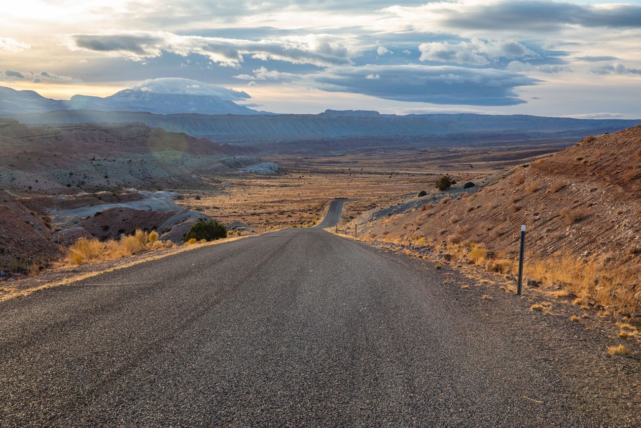
Our day started off great, with bright sunny skies. As you will see in our photos, midday clouds moved in, and by the time we reached Boulder, the first snowflakes were falling. On the drive from Boulder to Torrey it snowed, so unfortunately, we don’t have photos of the overlooks from this part of the drive. But it just goes to show how you need to be prepared for snow, even in the middle of autumn.
Best Things to See & Do
These sights are discussed more below, but here is a list of the best things to see and do when you Loop the Fold.
- Burr Trail Switchbacks
- Surprise Canyon
- Headquarters Canyon
- Strike Valley Overlook
- Long Canyon
How to Loop the Fold
In this post, we provide two route descriptions.
The first route is the complete route Loop the Fold route, which is done round trip from the Capitol Reef Visitor Center.
The second route we describe is a one-way route, which can be done in either direction. This route goes point-to-point on Notom-Bullfrog Road and Burr Trail Road, the two roads that are the best part of Looping the Fold. This is a great option if you want to drive these scenic roads when traveling between Capitol Reef National Park and Escalante or Bryce Canyon National Park.
Route #1: Loop the Fold
This loop is described in the clockwise direction, since that is the recommended way to do this drive.
How to Use This Map: Click the tab in the top left corner of the map to see a list of the points of interest and to turn layers on/off. Click the icons on the map to get more information about each point of interest.
To take this map with you, click the star next to the title of the map which adds it to your Google account. Next, within your Google Maps app, select ‘Saved’ and then select ‘Maps’. This map title will now appear in your list.
The number for each overlook/detour/hike is the mile marker, starting at the Capitol Reef Visitor Center. The distances of the detours we mention are not included in the calculation of the mile markers.
Note: These mileage numbers are from the odometer of the Jeep Wrangler we rented. Odometer readings can vary slightly between vehicles.
0.0 Start: Capitol Reef National Park Visitor Center
Reset your odometer. From the visitor center, head east on Utah State Route 24.
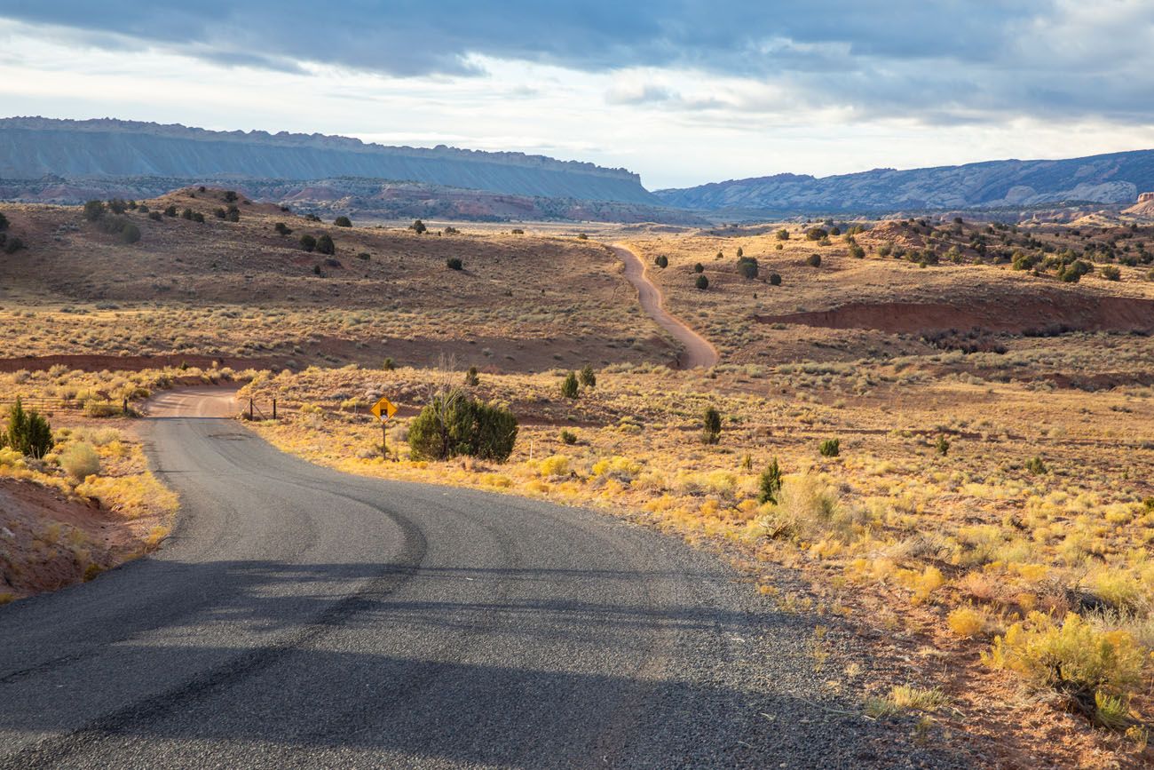
9.0 miles: Notom-Bullfrog Road
Turn right onto Notom-Bullfrog Basin Road. This road starts off as a paved road.
16.7 miles: Burro Wash
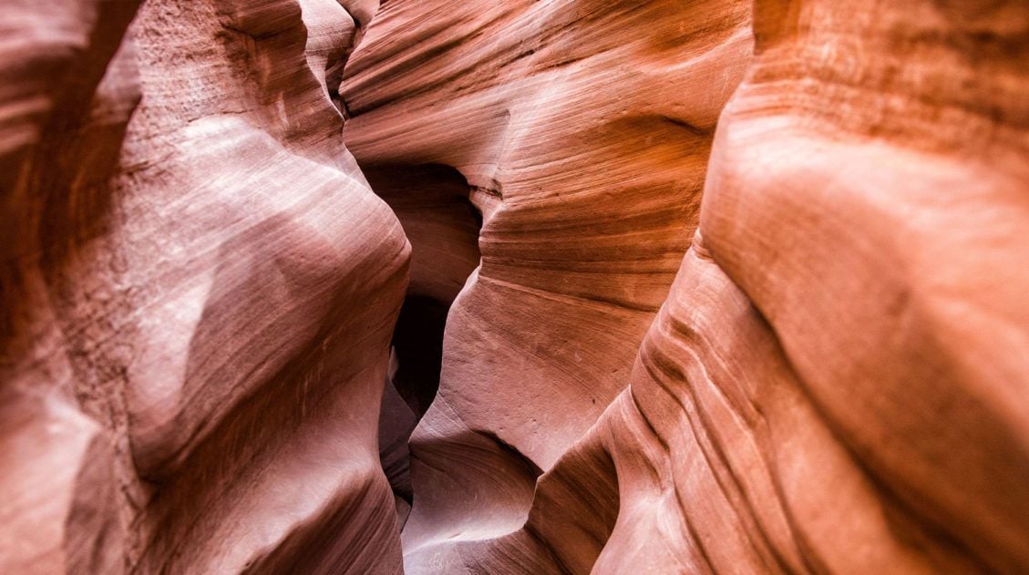
Look for the signed parking area on the right side of the road. This slot canyon hike is 7.5 miles long and strenuous. There may be pools of water in the canyon.
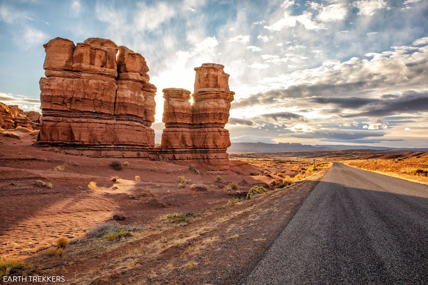
17.4 miles: Notom Road Twin Rocks
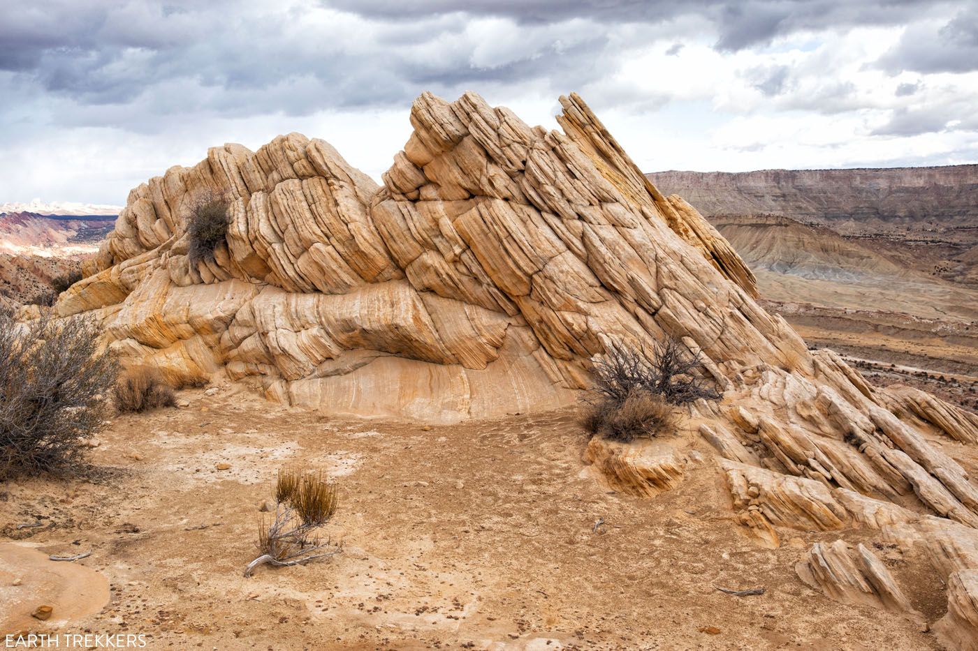
Look for a pull-off area on the right side of the road directly opposite of the hoodoos. This is a great place to view these Entrada sandstone formations.
18.0 miles: Cottonwood Wash
Similar to Burro Wash, Cottonwood Wash is a strenuous slot canyon hike. It is 6 miles long, out-and-back, and there may be pools of water in the canyon.
21.6 miles: Sheets Gulch Trailhead
This is the third and final hiking trail in this area. Sheets Gulch is the longest and most challenging slot canyon. It is just under 14 miles long.
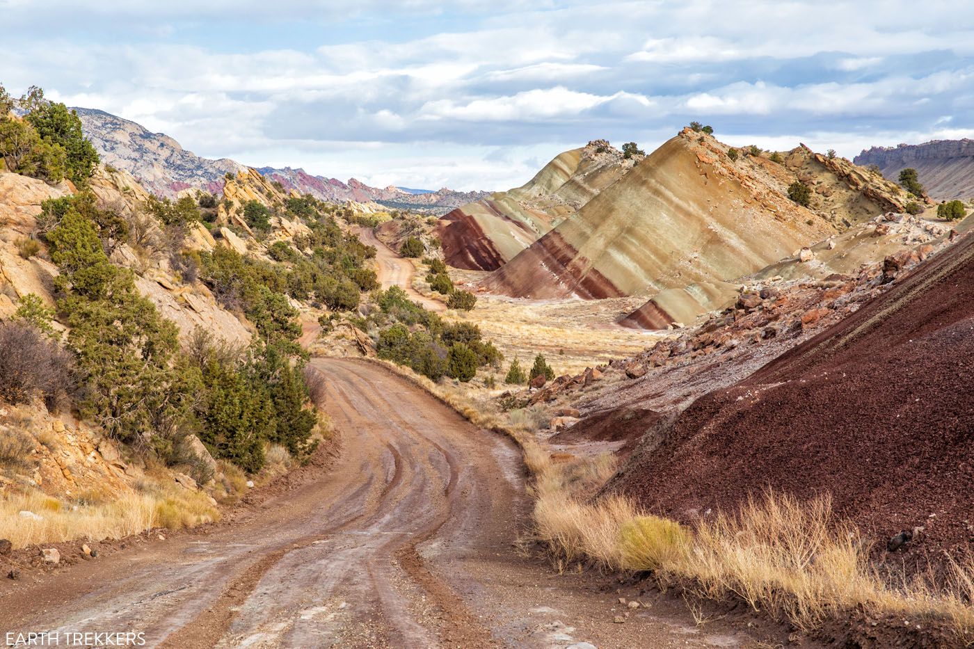
25.3 miles: Dirt Road
At this point, Notom-Bullfrog Basin Road turns into a dirt road.
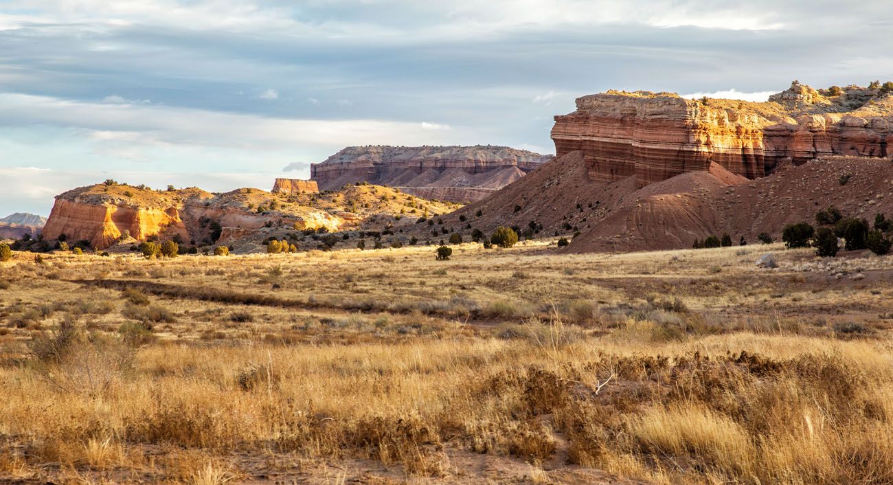
27.7 miles: Entrada sandstone
To your left you can see Entrada Sandstone, which formed over 140 million years ago when this area was covered with water.
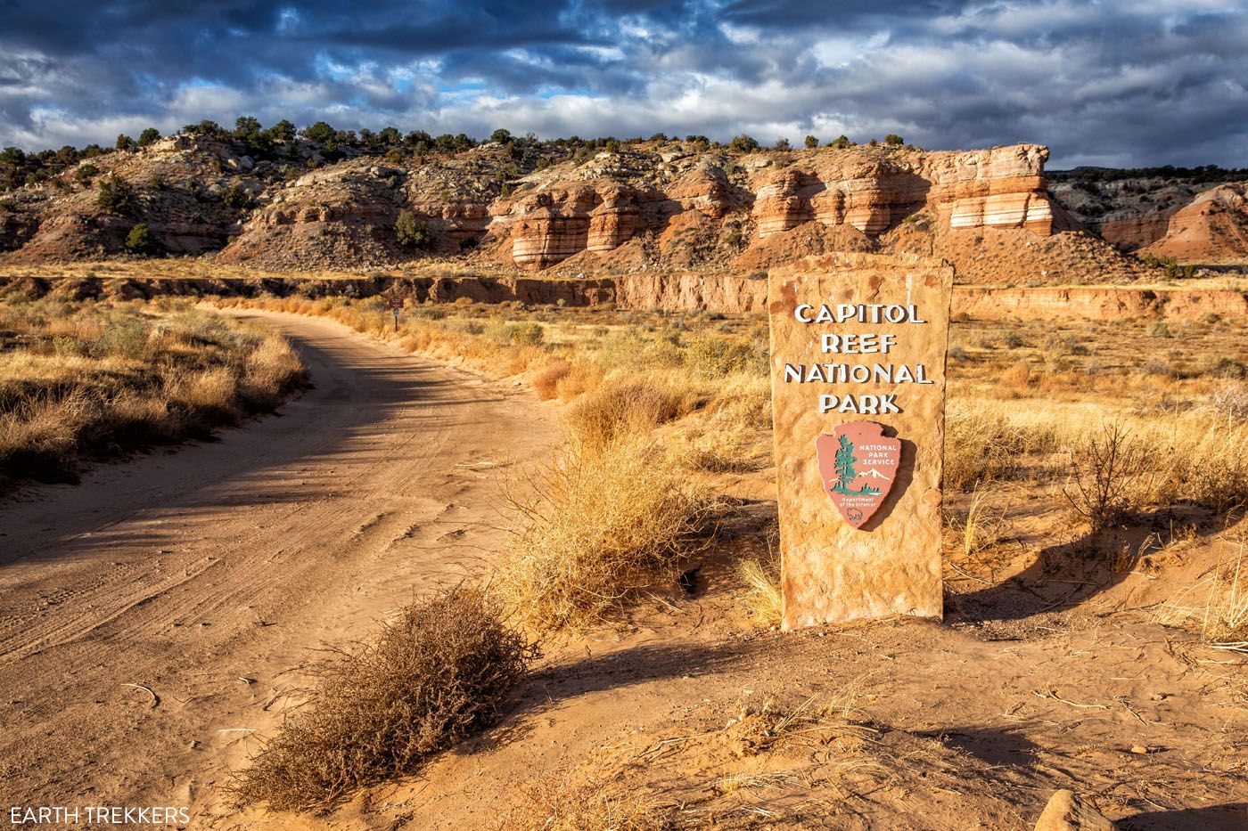
28.0 miles: Enter Capitol Reef National Park
At this point you enter Capitol Reef National Park.
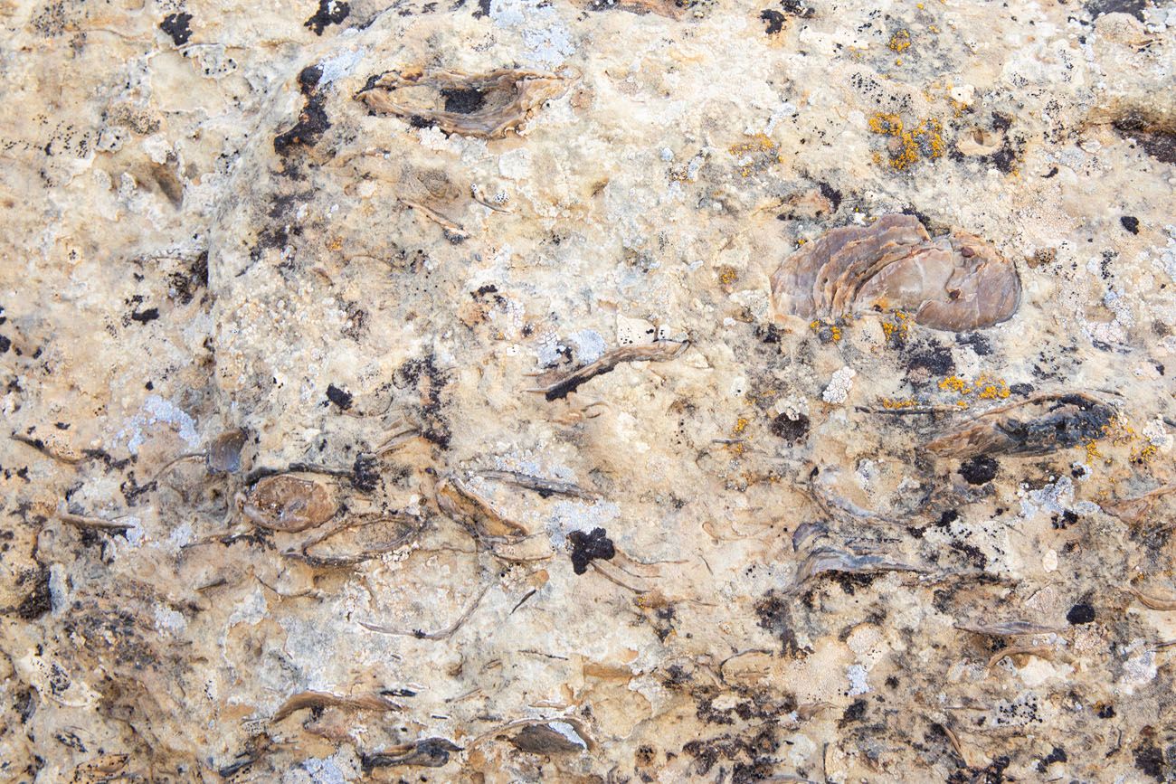
31.9 miles: Oyster Shell Reef
Oyster fossils can be seen in the rocks on the left hand side of the road. There is no pull-off area here so you have to park along the side of the road.
In this ridge of sandstone, you can see tiny oyster fossils that date back 95 million years, when this area was once under water. Please do not disturb or take the fossils.
38.7 to 39.3 miles: Viewpoints of Notom-Bullfrog Road
This is a slightly hilly section of Notom-Bullfrog Road with awesome views all around you. This portion of the road can be impassable when wet due to the clay consistency of the soil.
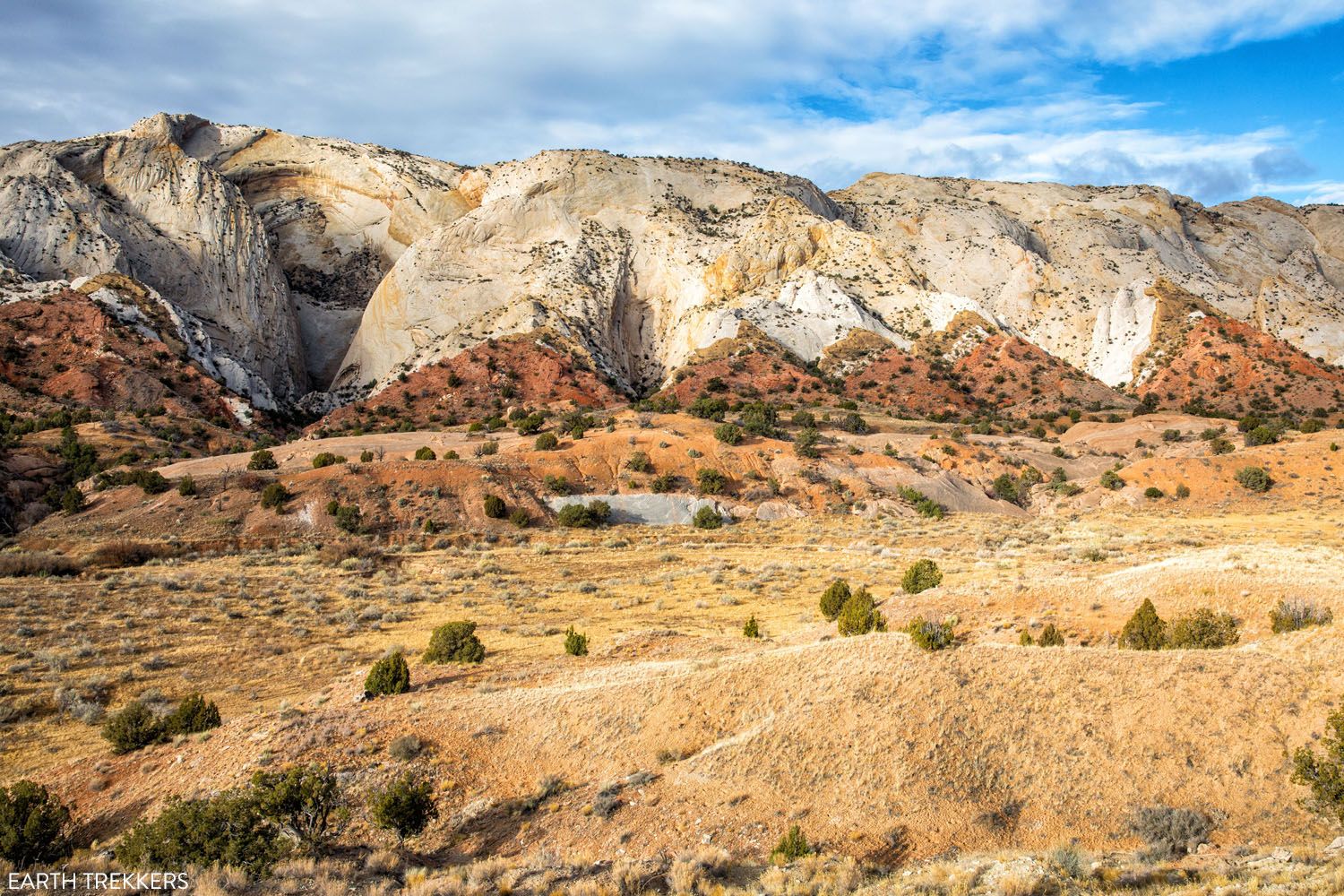
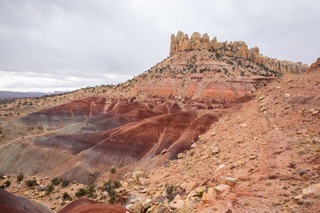
39.3 to 39.4 miles: View of the Waterpocket Fold
Just past the S-turn, look for a small turn out. Park here and walk to the viewpoint of the Waterpocket Fold. The white rock is Navajo Sandstone and the red, jagged layer underneath is the Carmel layer.
41.6 miles: Road Junction
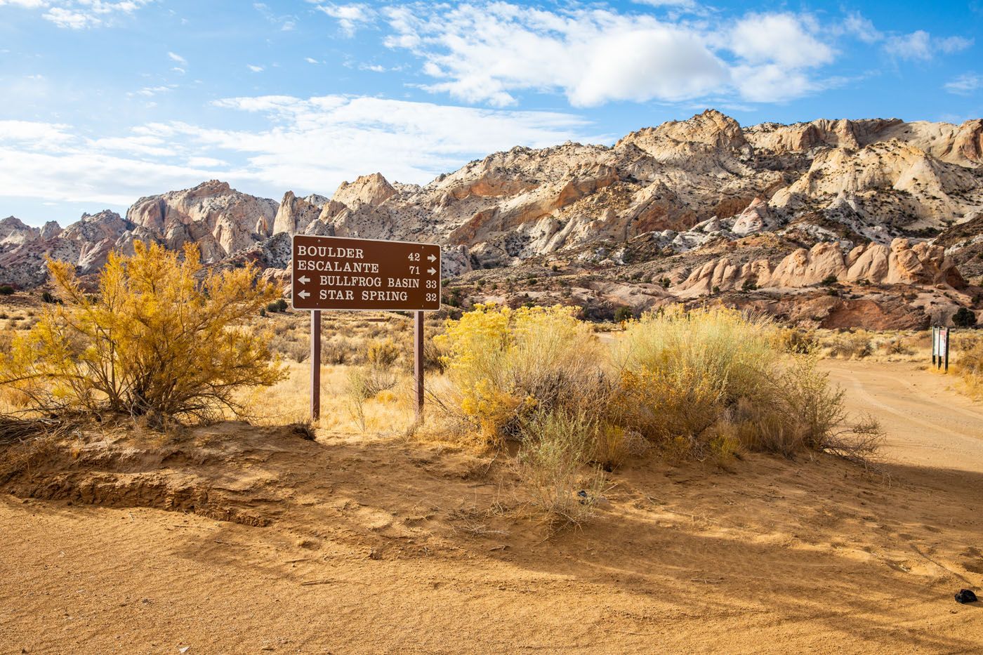
If you continue straight on Notom-Bullfrog Road, you head to Bullfrog and Glen Canyon National Recreation Area. If you turn right, you head towards Boulder on Burr Trail Road. To Loop the Fold, you will turn right here. However, we recommend continuing south on Notom-Bullfrog Road for the best detour of the day.
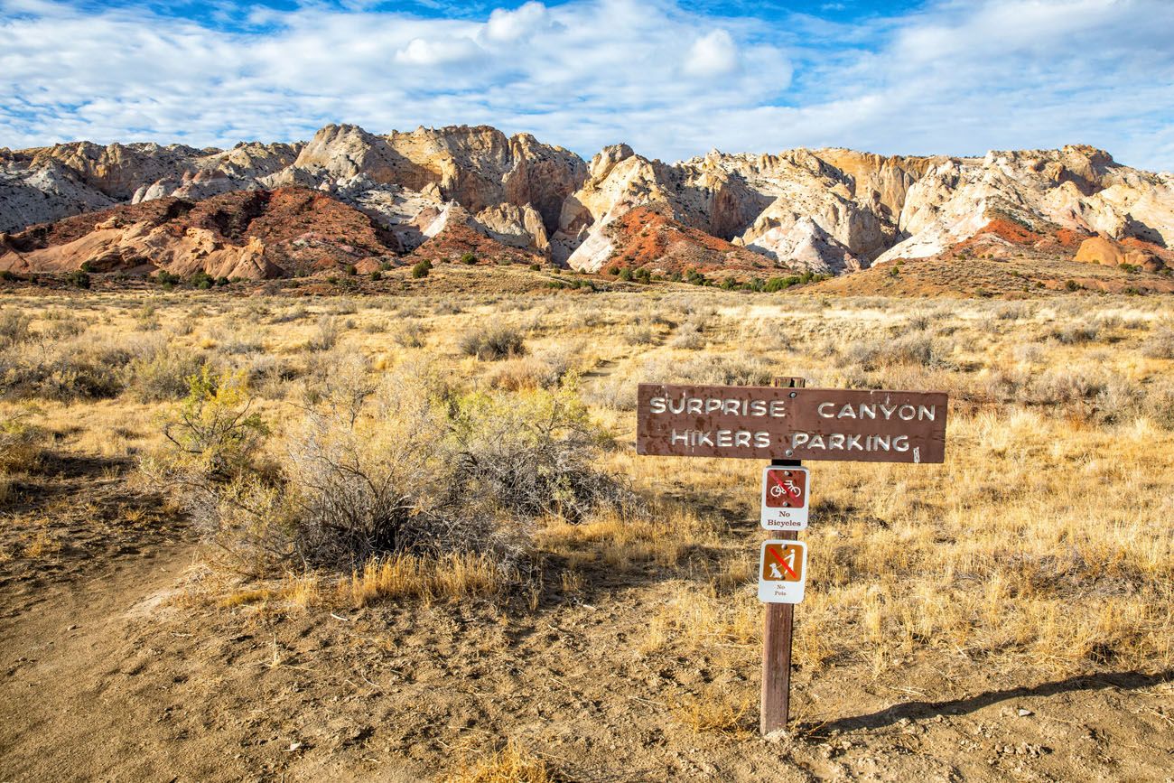
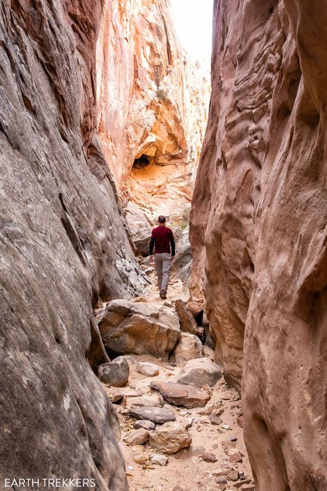
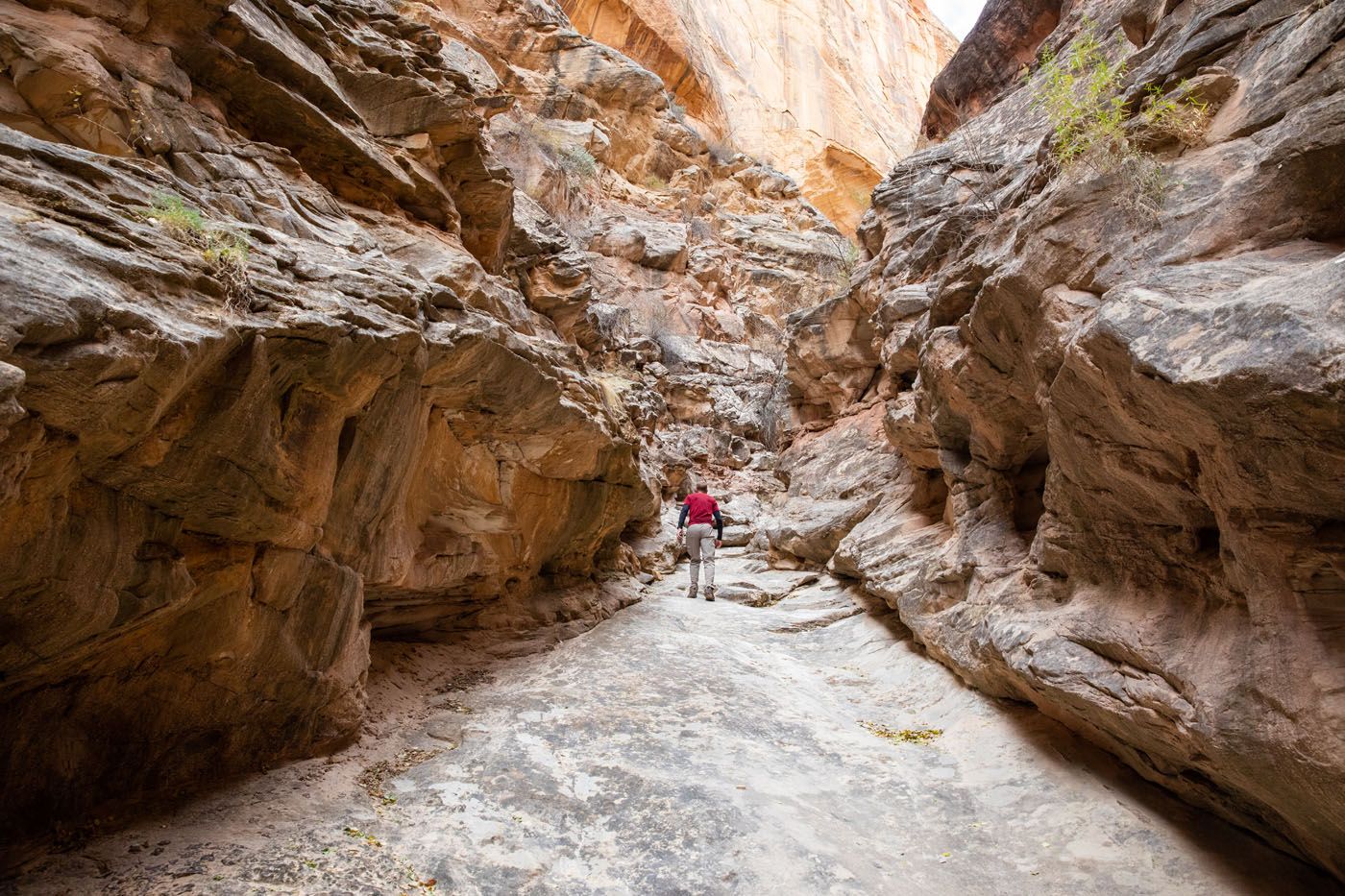
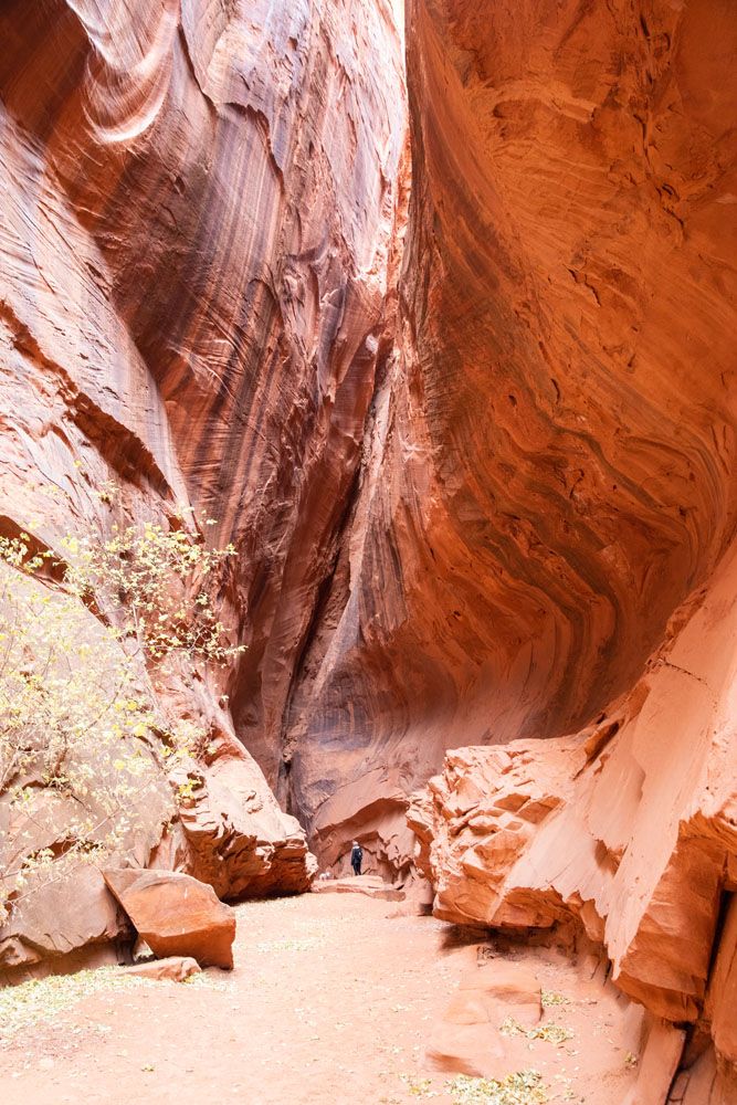
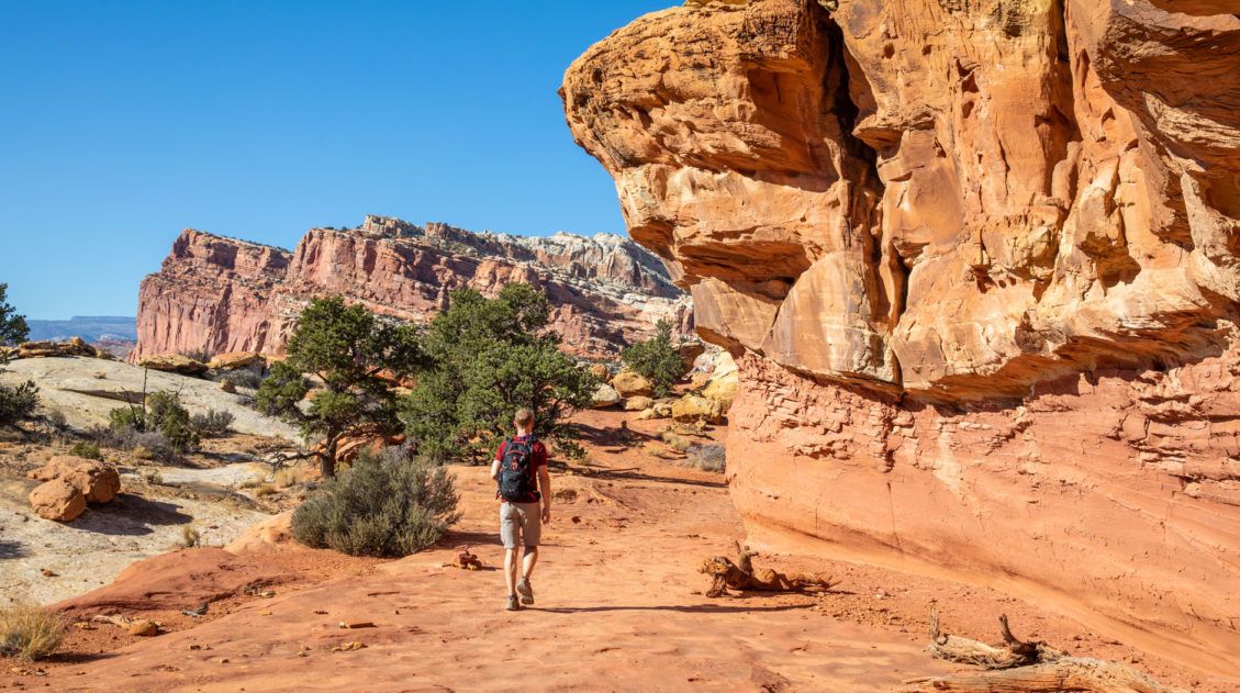
Detour #1: Surprise & Headquarters Canyons
This detour to two slot canyons is well worth the short drive and the extra time. This was our favorite thing to do when Looping the Fold. Because of the remote location, there is a chance that you could have these two slot canyons all to yourself (we did and it was a blast!).
This detour adds 5 miles onto the loop and a total of 2 to 2.5 hours, if you hike both canyons.
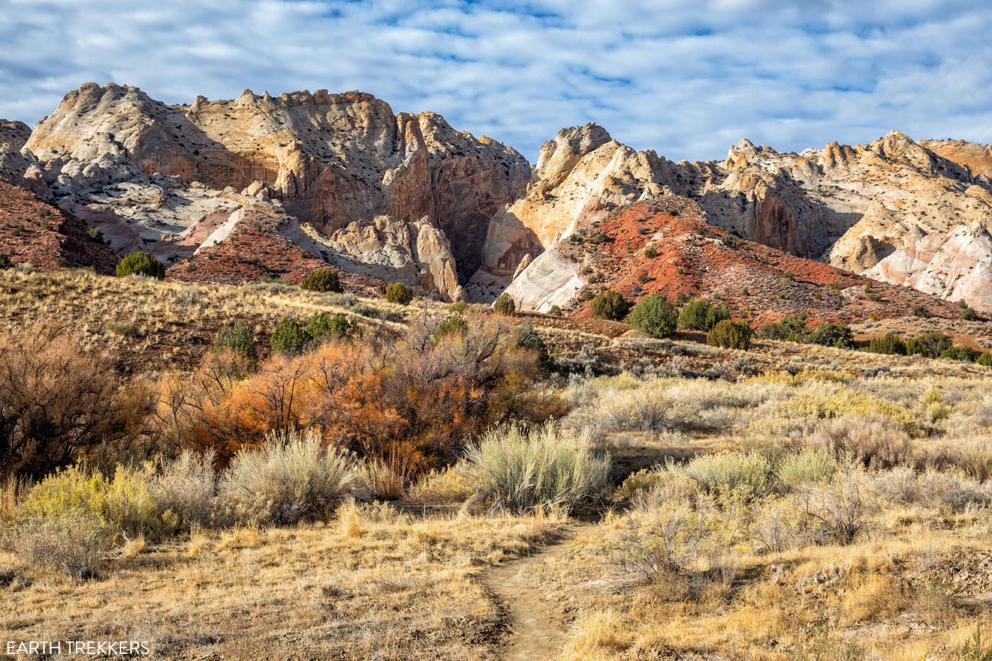
Surprise Canyon (0.9 miles from the Road Junction)
Distance: 2.2 miles out-and-back | Difficulty: Easy | Time: 1 hour
Look for a small parking area on right that can support 3 vehicles. The trail starts here and heads directly towards the colorful hills of the Waterpocket Fold. This slot canyon is somewhat wide and the trail dead ends at a rockfall.
End of Surprise Canyon
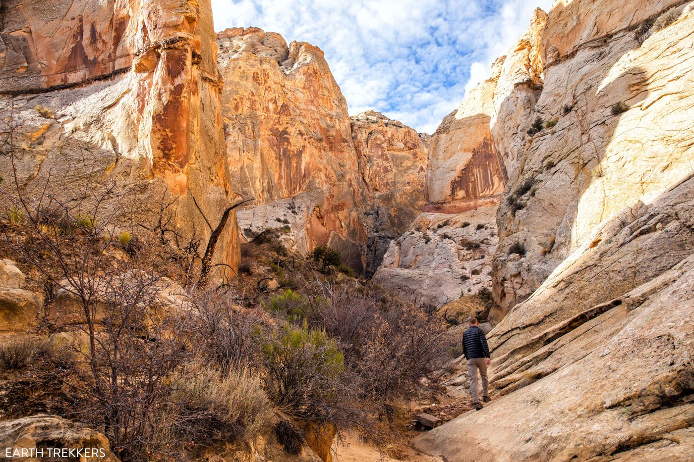
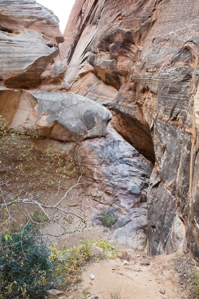
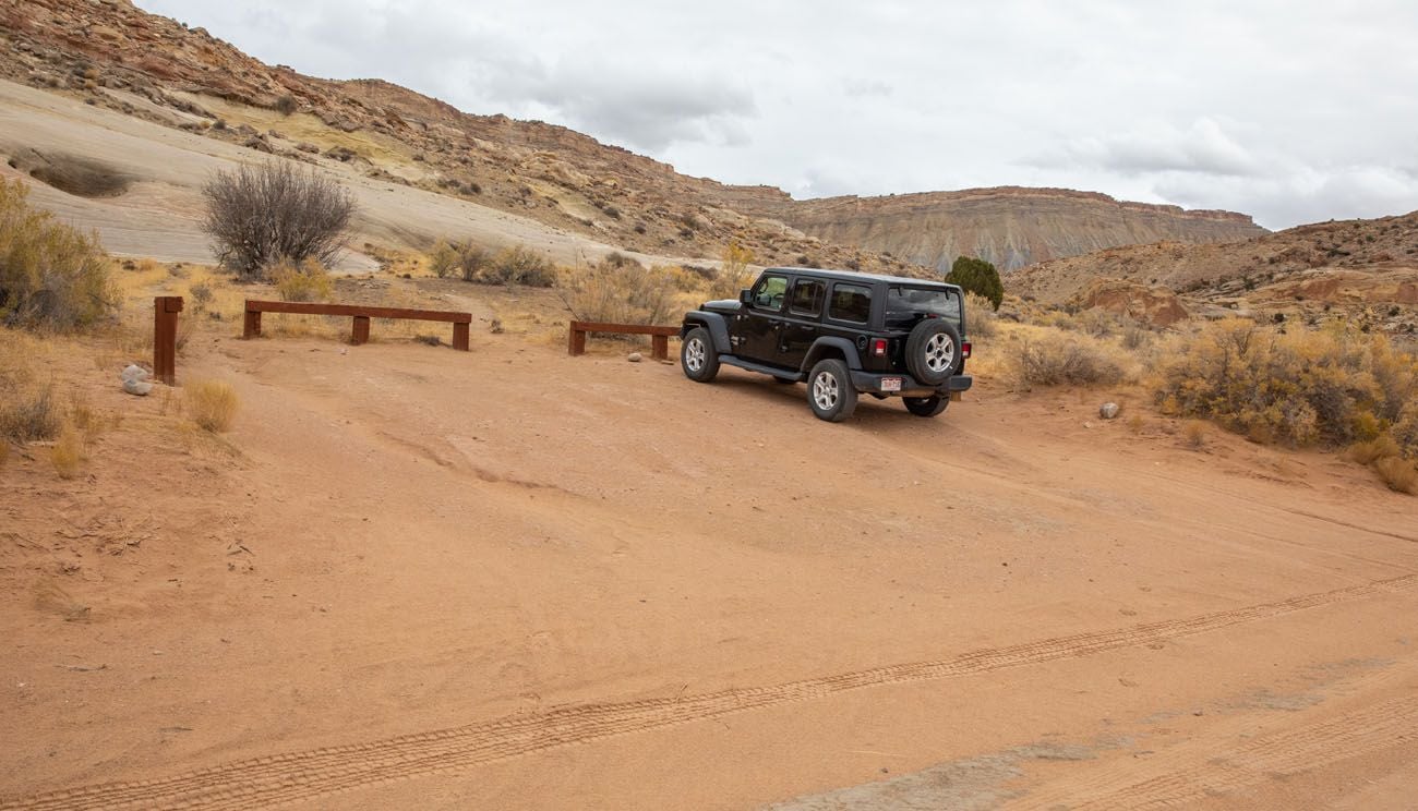
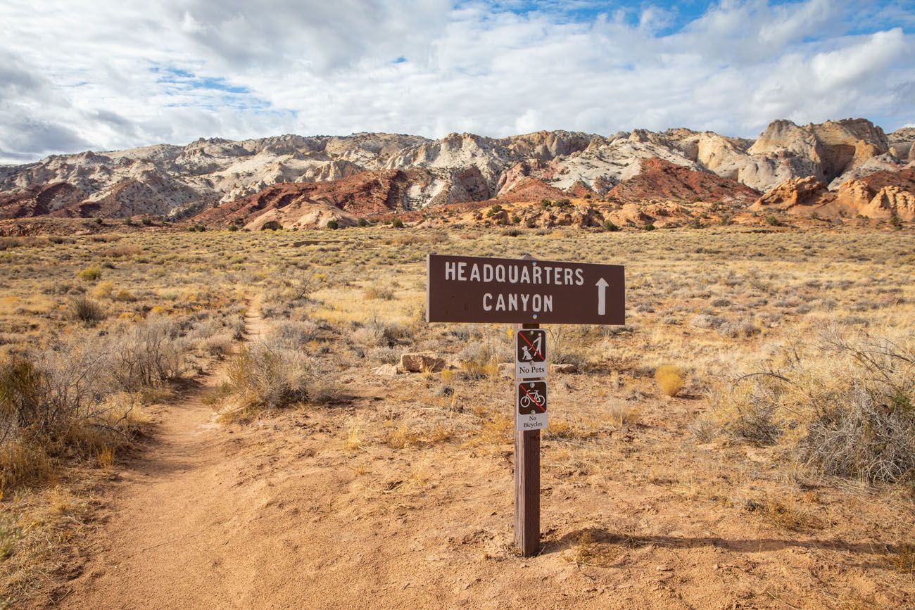
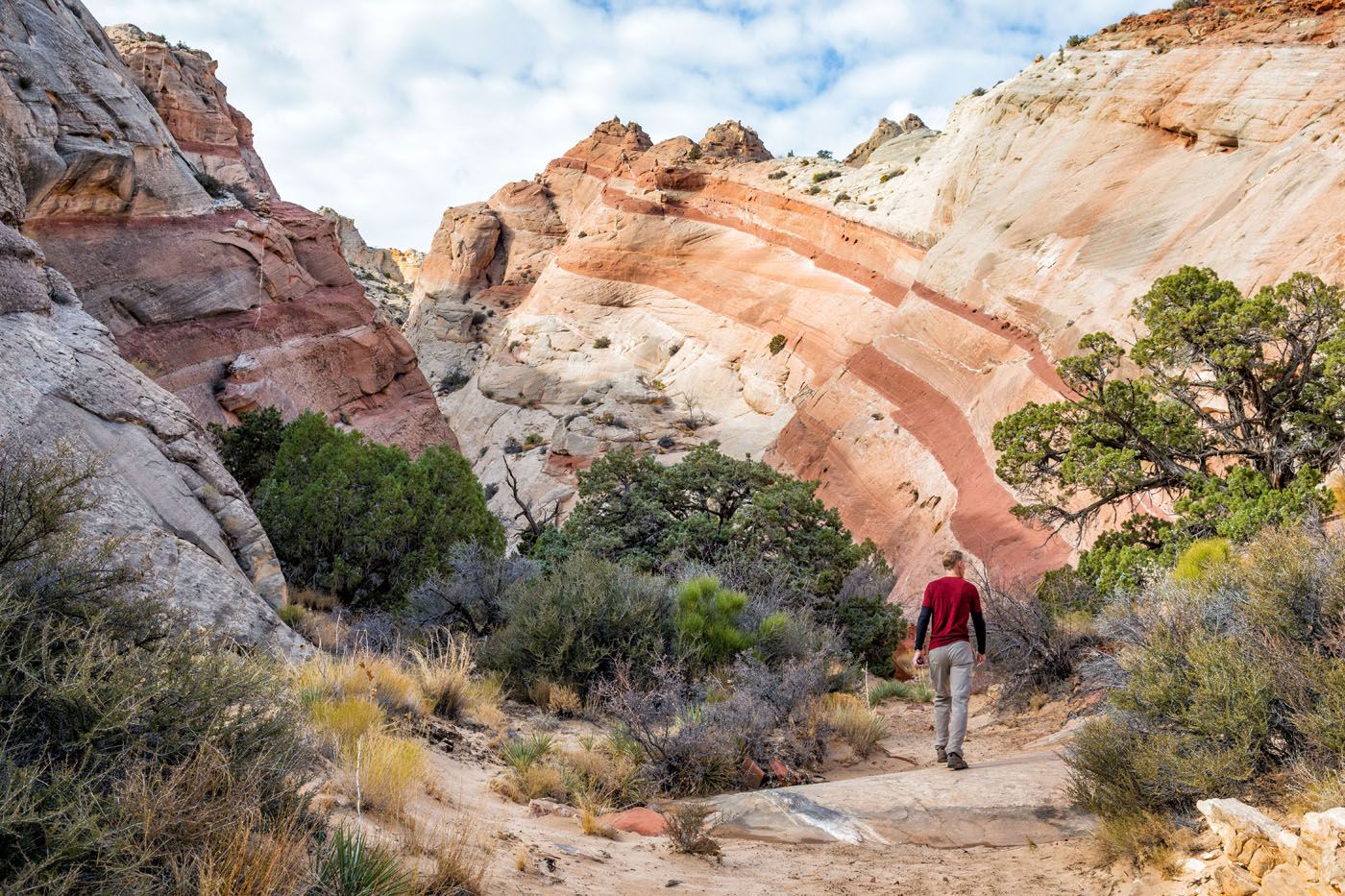
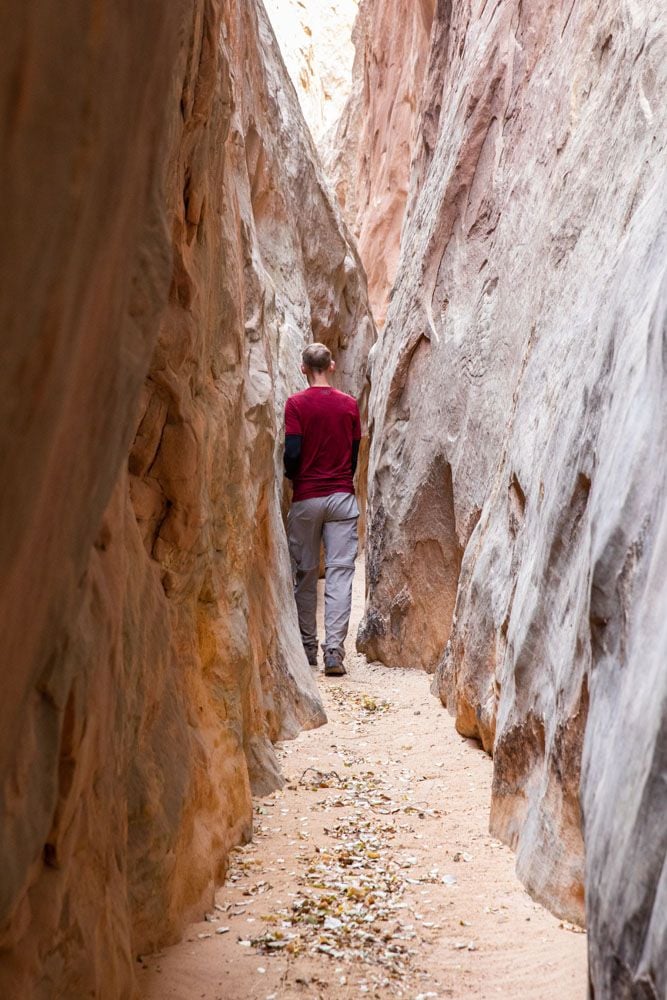
Headquarters Canyon (2.4 miles from the Road Junction)
Distance: 2.6 miles out-and-back | Difficulty: Easy | Time: 1 to 1.5 hours
Look for the trailhead sign on the right and a parking area just past the trailhead sign on the left. The parking area can support 3 vehicles.
Like Surprise Canyon, this trail heads directly into the Waterpocket Fold. Headquarters Canyon is also very easy to hike. But with its narrower sections this is the more thrilling of the two slot canyons here.
PRO TRAVEL TIP: If you only have the time and energy for one hike, I recommend Headquarters Canyon over Surprise Canyon.
Once you finish these hikes, backtrack to the Road Junction.
41.6 miles: Road Junction & the Burr Trail Switchbacks
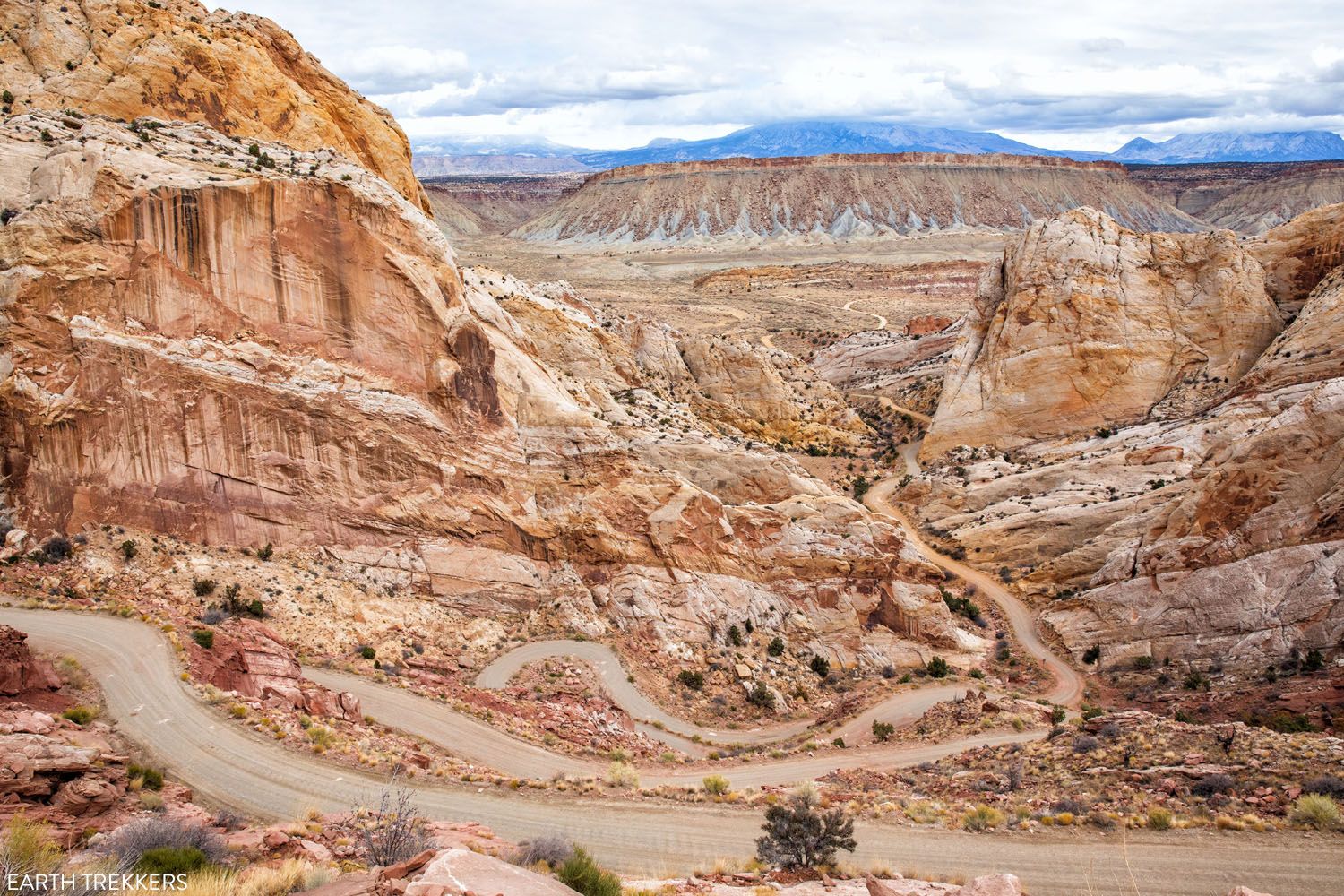
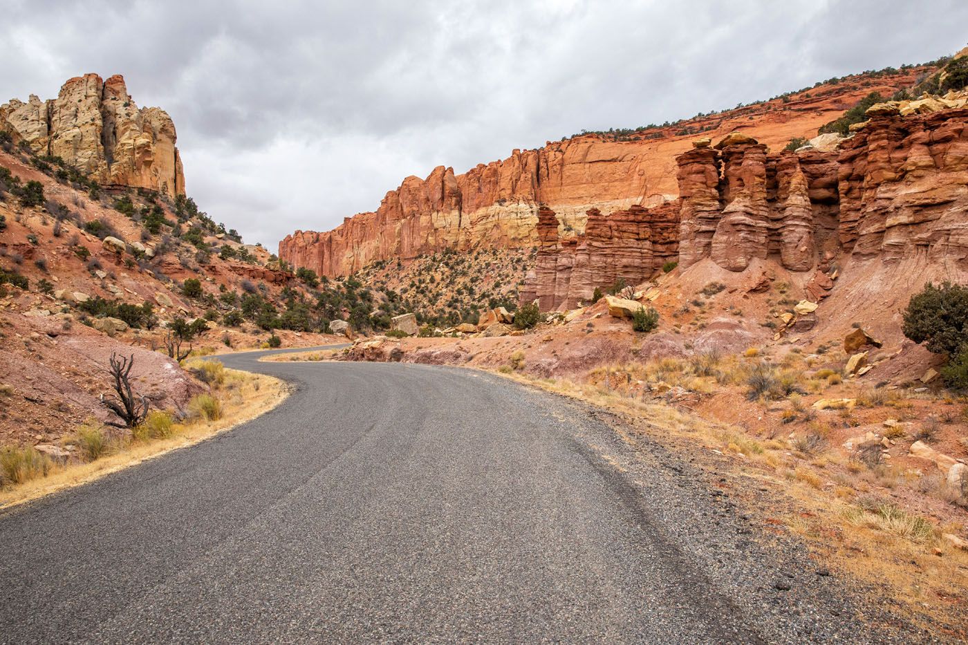
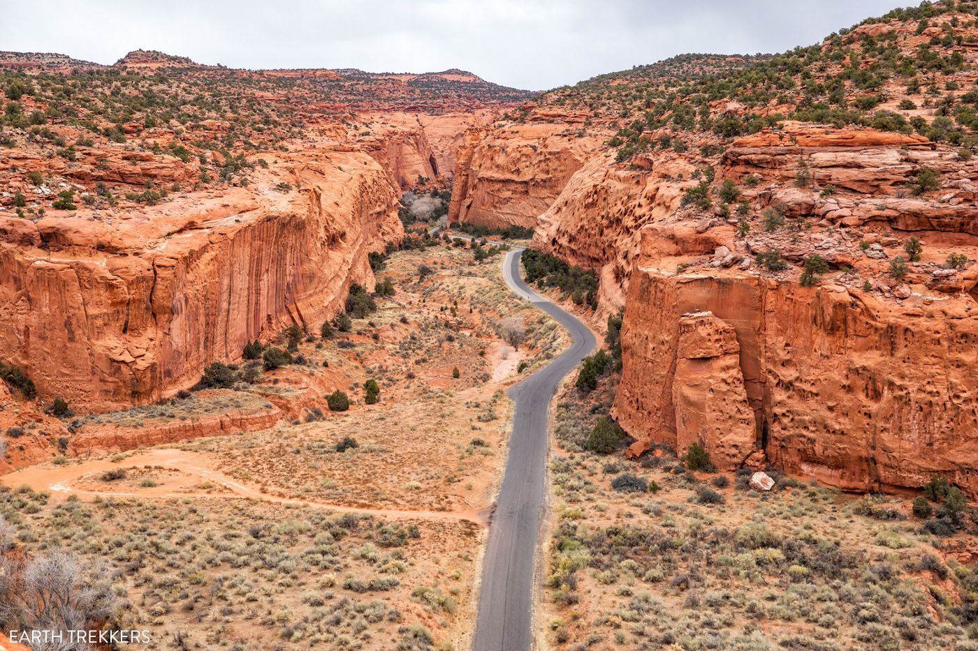
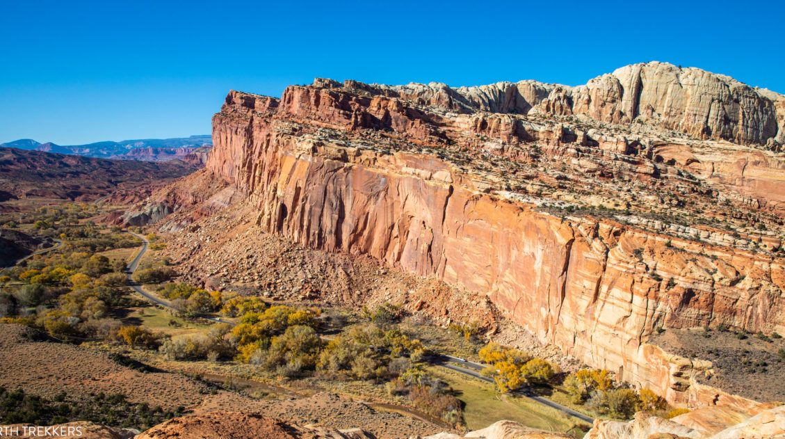
Back at the road junction, turn left to take Burr Trail Road to Boulder. This is the start of the Burr Trail Switchbacks, another highlight when you Loop the Fold.
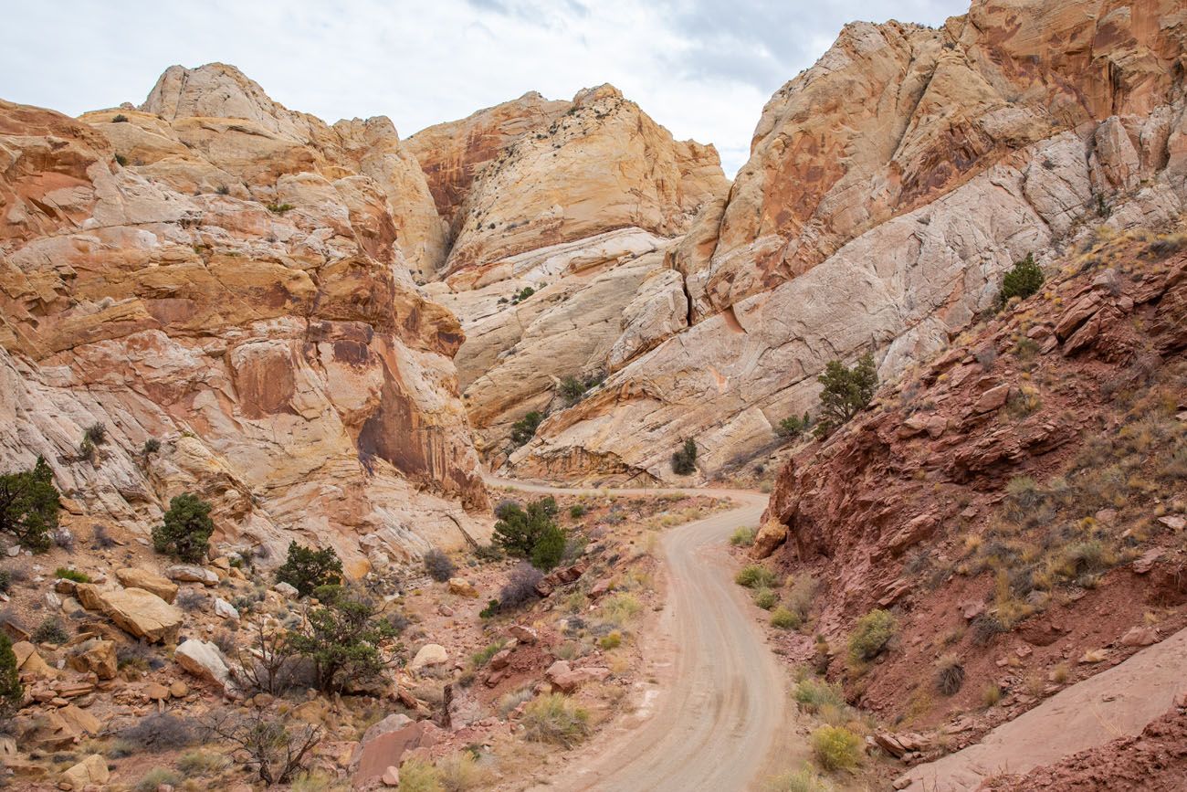
For 2 miles, this road climbs up through the Waterpocket Fold. It is known as being one of the most scenic drives in Utah.
This road dates back to the late 1800’s, when John Atlantic Burr constructed a trail in order to move cattle across the Waterpocket Fold, between summer and winter grazing ranges.
43.7 miles: Top of the Burr Trail Switchbacks
From the top of the switchbacks, enjoy the view over Strike Valley.
44.8 miles: Upper Muley Twist Canyon Road
Turn right on this road for the next detour, a stunning view over Strike Valley.
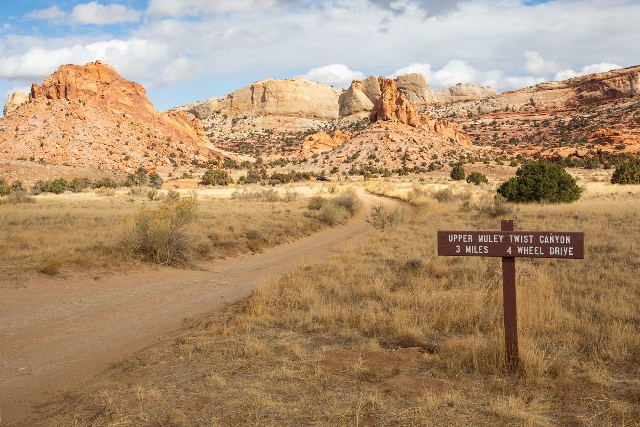
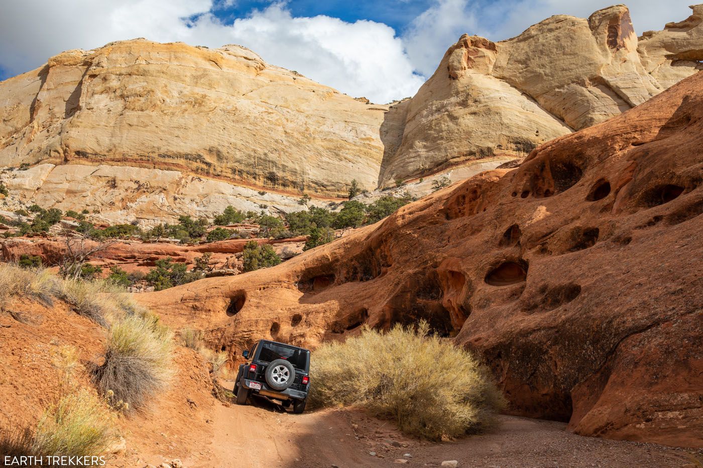
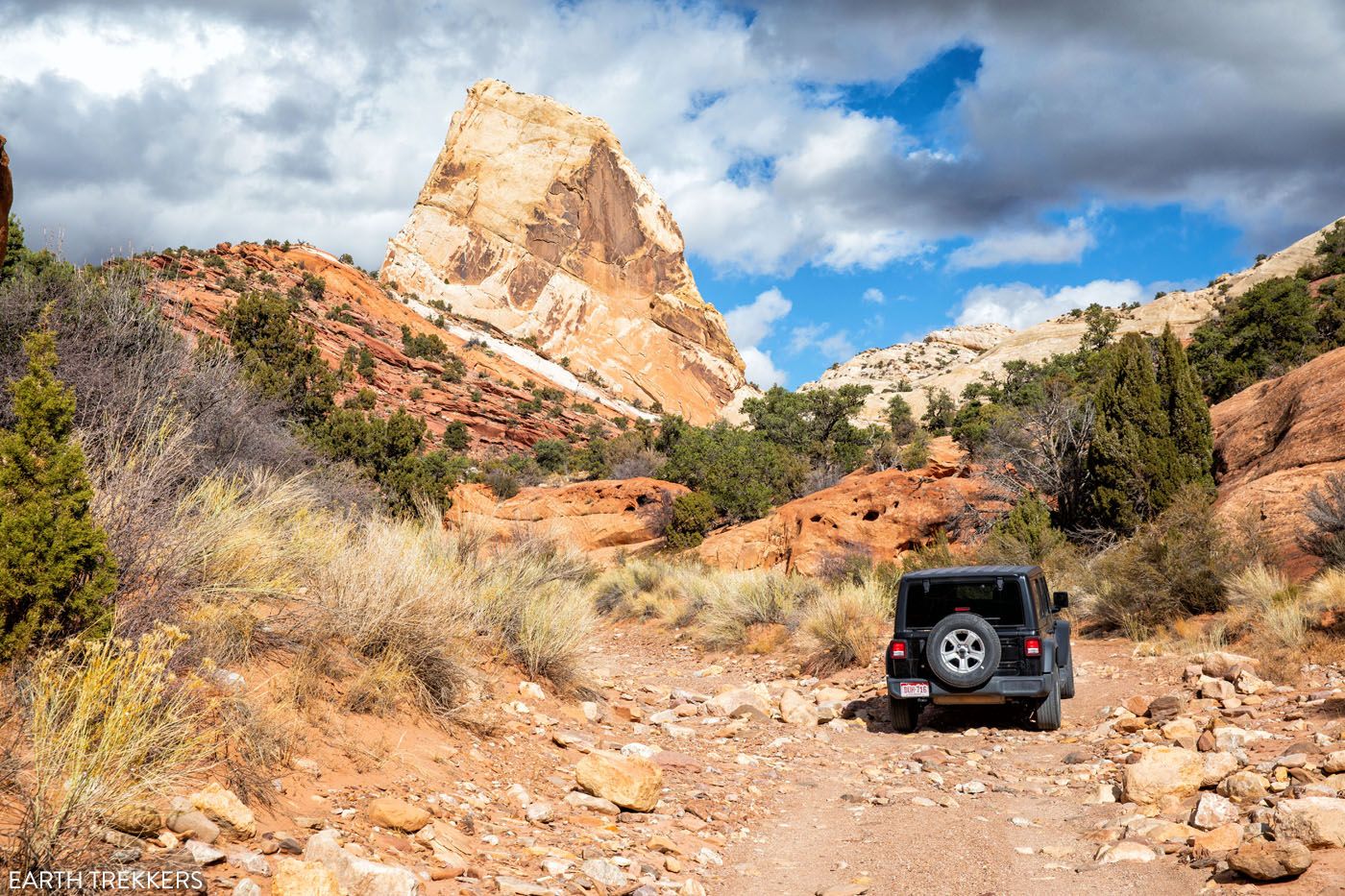
Detour #2: Strike Valley Overlook
There are two ways to get to Strike Valley Overlook: drive the extremely rough Upper Muley Twist Canyon Road to the trailhead (4WD vehicle is necessary) or hike along the road.
Upper Muley Twist Canyon Road is 2.9 miles long, one-way. It ends at the trailhead for Strike Valley Overlook and for the Upper Muley Twist Canyon trail.
If you do not have a 4WD vehicle, there is a parking area that is located 400 meters from Burr Trail Road. To get to the trailhead for Strike Valley Overlook, you will have to walk just over 2.5 miles, one-way, to get to the trailhead.
From the Strike Valley Overlook trailhead, it is a half-mile walk to the viewpoint. Here is the view.
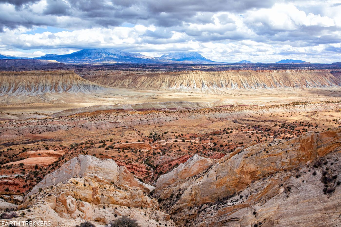
Is it worth it? If you have a high-clearance 4WD vehicle, then it is worth it. However, if you are driving a standard vehicle, it’s about a 6-mile round trip walk to get the view, and in my opinion, it’s probably worth skipping it. You can get a similar but slightly less dramatic view from the top of the Burr Trail Switchbacks.
This detour adds 6 miles of driving and about one hour onto Looping the Fold, if you drive to the trailhead.
47.1 miles: Grand Staircase-Escalante National Monument
At this point, Burr Trail Road turns into a paved road and enters Grand Staircase-Escalante National Monument.
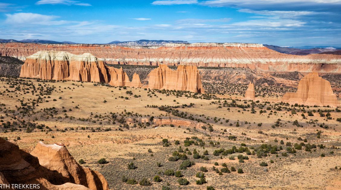
60.9 miles: Viewpoint of Long Canyon
There is a pull-off on the left at the top of the hill for a viewpoint of the Circle Cliffs, Henry Mountains, and colorful hills of the Chinle Formation. You will now enter Long Canyon and have spectacular views of the towering red sandstone walls on both sides of you.
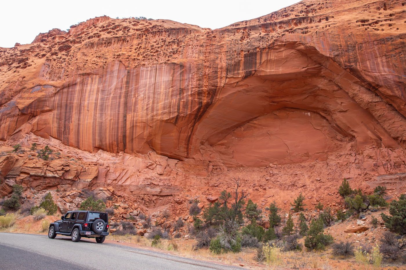
65.6 miles: Arch/Cave formation
There aren’t any signs here but there is a small pull-off area on the right side of the road to stop and take a look at this arch from the side of the road.
66.2 miles: Singing Canyon
Park on the right hand side of the road and walk 100 meters to enter a cool, shady canyon. It is called “Singing Canyon” because the acoustics are perfect for music. There is a chance that you will meet a musician or singer here. We weren’t so lucky.
68.0 miles: Long Canyon Viewpoints
As the road climbs out of Long Canyon, there are several small pull-offs on right that offer an amazing view over the canyon.
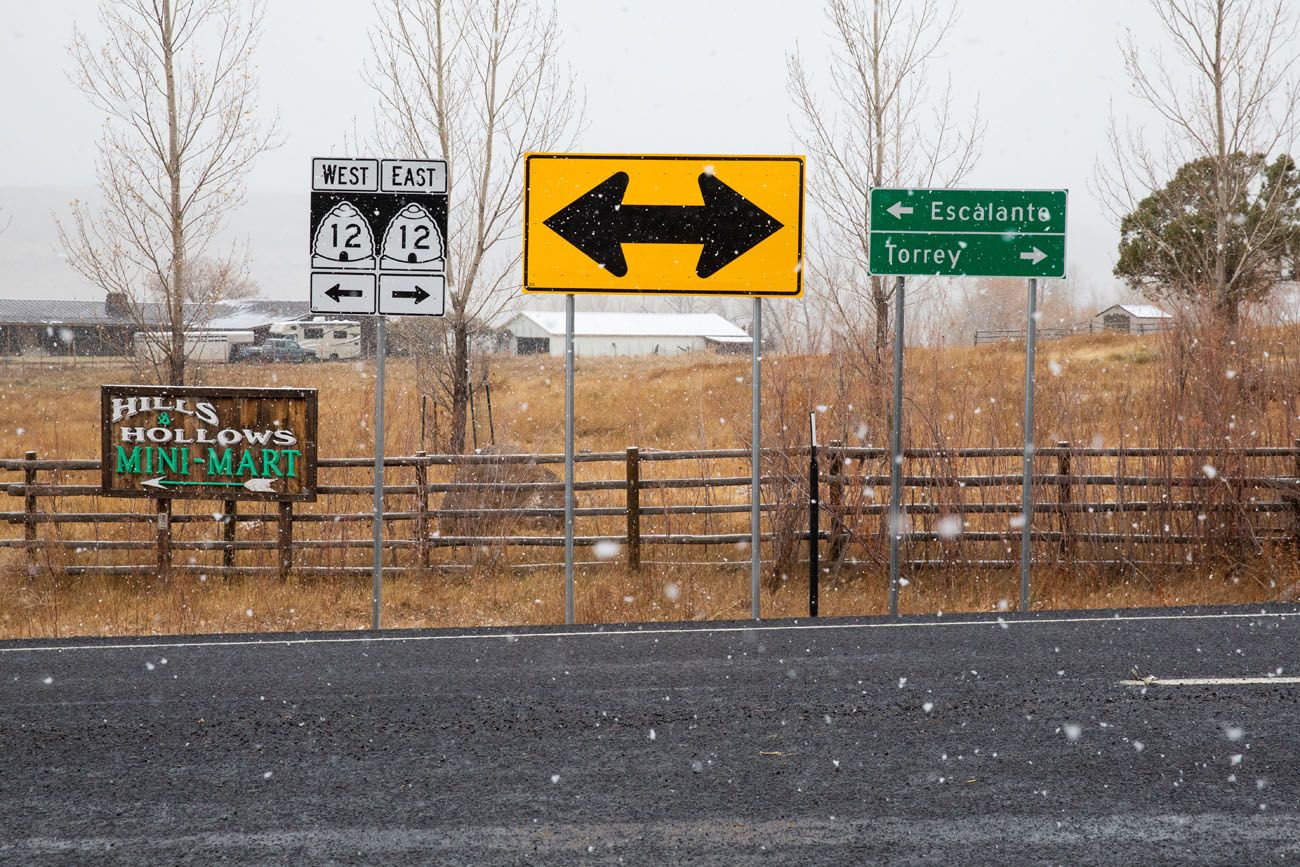
77.7 miles: Boulder, Utah
Burr Trail Road ends at the intersection of Utah State Route 12. To continue on the Looping the Fold route, turn right onto Utah State Route 12.
78.4 miles: Anasazi State Park Museum
Stop here to visit the Anasazi State Park Museum, which contains a partially excavated Puebloan village.
90.7 miles: Homestead Overlook
Turn right here. It is a short drive to Homestead Overlook, for sweeping views across Utah.
Note: We do not have photos of this section of the drive because of a snowstorm that was perched over Boulder Mountain.
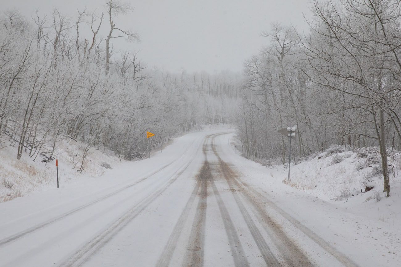
This was our view for the rest of the drive.
92.0 miles: Summit of Boulder Mountain
At this point you reach the summit of Boulder Mountain, at elevation of 9,600 feet.
100.3 miles: Larb Hollow Overlook
Turn right here for panoramic views over Capitol Reef National Park and the San Rafael Swell.
114.5 miles: Torrey, Utah
At this point, you arrive at the intersection of Utah State Route 12 and Utah State Route 24. There is a gas station and food services here. You could go directly back to your accommodations in Torrey. To complete the loop, turn right and you will head towards the Capitol Reef National Park Visitor Center.
125 miles: End of the Route
Now you are back at the visitor center and completed the entire loop.
Route #2: Point-to-Point on Notom-Bullfrog Road and Burr Trail Road
If you are driving north to Capitol Reef National Park from places such as Grand Staircase-Escalante National Monument or Bryce Canyon National Park, then you can drive the best part of Looping the Fold.
If you will be driving from Capitol Reef National Park and Torrey to Grand Staircase-Escalante or Bryce Canyon National Park, you can also follow this one-way route on Notom-Bullfrog Road and Burr Trail Road.
Driving the paved road from Boulder to Torrey is the more direct and faster way to go. But if you are looking for a drive that is more adventurous and more scenic, you can drive Burr Trail Road to Notom-Bullfrog Road and see the highlights of Looping the Fold.
Below we describe the route from south to north (Boulder to Capitol Reef). You can also do this in reverse, basically following the route above, but once you reach Boulder, turn left to go to Bryce Canyon National Park and Grand Staircase-Escalante National Monument.
From Boulder to the Capitol Reef Visitor Center
0.0 miles: Boulder, Utah and the intersection of Utah State Route 12 and Burr Trail Road. Burr Trail Road starts at this intersection. Turn right onto Burr Trail Road and reset your odometer to zero.
9.7 miles: Long Canyon Viewpoints. As you are descending into Long Canyon, there are several small pull-offs on the left that offer amazing views over the canyon.
11.5 miles: Singing Canyon. Park in the pull-off area on the left hand side of the road and walk 100 meters into the shady canyon.
16.8 miles: Viewpoint at the end of Long Canyon.
30.6 miles: Burr Trail Road turns into a dirt road and enters Capitol Reef National Park.
32.9 miles: Optional Detour to Strike Valley Overlook. Turn left on Upper Muley Twist Canyon Road to walk or drive (4WD is necessary) the 2.9 miles to the trailhead for Strike Valley Overlook.
34.0 miles: Top of the Burr Trail Switchbacks. Start your descent down the switchbacks and enjoy the incredible views.
36.1 miles: Road Junction. Turn left onto Notom-Bullfrog Basin Road to head north towards the Capitol Reef National Park Visitor Center. Turn right to take the detour to Surprise Canyon and Headquarters Canyon.
Optional Detour: Hike Surprise and Headquarters Canyons
This detour adds 5 miles of driving and a total of 2 to 2.5 hours, if you hike both canyons. See the route above for stats about these two hikes.
38.3 miles: Viewpoint. Pull over here for a stunning viewpoint of the Waterpocket Fold.
38.4 to 39.0 miles: Viewpoints of Notom-Bullfrog Road. This is a slightly hilly section of the road with awesome views all around you. This portion of the road can be impassable when wet due to the clay consistency of the soil.
45.8 miles: Oyster fossils. Oyster fossils can be seen in the rocks on the right hand side of the road. There is no pull-off area here so you have to park along the side of the road.
49.7 miles: Enter Capitol Reef National Park.
52.4 miles: Notom-Bullfrog Basin Road turns into a paved road.
56.1 miles: Sheets Gulch Trailhead
59.7 miles: Cottonwood Wash Trailhead
60.3 miles: Twin Rocks. Pull over here for views of the hoodoos made of Entrada sandstone.
61.0 miles: Burro Wash Trailhead
68.7 miles: Turn left onto Utah State Route 24 to head to the Capitol Reef National Park Visitor Center
77.7 miles: Capitol Reef National Park Visitor Center
Bonus: Quick Detour on Burr Trail Road
If you are driving between Torrey/Capitol Reef and Bryce Canyon National Park, and want to drive a small portion of this route, here’s how to do it.
Once in Boulder, turn onto Burr Trail Road. If you drive 10 miles along this road, you get to the viewpoints of Long Canyon. You could turn around here (20 miles round trip) or keep going for another 7 miles, as the road twists and turns through Long Canyon.
If you like scenic drives and exploring the remote backcountry, driving the Cathedral Valley Loop is another awesome experience in Capitol Reef National Park. Learn more in our Guide to Cathedral Valley.
Tips to Have the Best Experience
Check the weather forecast before you do this drive. The roads can be impassable during and after storms and snow. A portion of Utah State Route 12 does not have snow removal services from dusk to dawn. Road conditions do change, so it is advisable to stop by the Capitol Reef National Park Visitor Center and ask about the current conditions of the roads before embarking on this adventure. If you are traveling from the south to Capitol Reef National Park, then check with the Escalante Interagency Visitor Center in Escalante, UT on road conditions.
ATV’s are not permitted on national park land so they cannot be driven on this loop.
Bring extra food, water, and clothing, just in case you get stranded. There are very few people out here and there is minimal cellular service, so if you get stuck, have a breakdown, etc., it could be hours or even days until help arrives.
The only food services we saw along this route was the Burr Trail Grill at the intersection of Burr Trail Road and Utah State Route 12 in Boulder, UT. It was closed when we drove past it so don’t rely on it.
Have a full tank of gas before starting this adventure. We didn’t see any gas stations along this route. Google Maps does show a gas station on Utah State Route 12 that is about one mile west of the intersection of Burr Trail Road and Utah State Route 12 in Boulder, UT. We did not drive past it ourselves to confirm it was there, but you don’t want to rely on a single gas station either. So, start your day with a full tank of gas.
If you want to rent a 4×4 for this drive, you can do so at Capitol Reef National Park Jeep Rentals, which is located in Escalante.
Purchase a copy of the National Geographic Capitol Reef National Park Map before your trip. This map has all of the detour roads on the loop as well as other BLM roads in the area. It will also be useful if you plan to visit Cathedral Valley.
Get updates on park conditions as you plan your trip and just before this drive on the National Park Service website.
Please practice the seven principles of Leave No Trace: plan ahead, stay on the trail, pack out what you bring to the hiking trail, leave areas as you found them, minimize campfire impacts, be considerate of other hikers, and do not approach or feed wildlife.
If you have any questions about how to Loop the Fold, or if you want to share your experience, let us know in the comment section below.
More Information about Capitol Reef
If this is part of a bigger road trip through the USA, visit our Utah Travel Guide and our United States Travel Guide for more inspiration and travel planning tips.
Complete Guide to the Cathedral Valley Loop (+ Map & Best Route)
Pinterest Facebook Flipboard Cathedral Valley is a rugged, remote district of Capitol Reef National Park. Few people travel out this way, to see this valley and its sandstone monoliths, colorful Bentonite hills, and vast desert scenery. But that’s part of its appeal. If you like the idea of leaving the crowds behind and exploring the […]
14 Amazing Things to Do in Capitol Reef National Park
Capitol Reef, often an overlooked national park, is full of many wonderful surprises. With two amazing scenic drives, hiking trails that rival those in Zion, rugged, remote areas to explore by 4×4, short, easy slot canyons, historical landmarks, and even delicious pie, this national park is absolutely amazing. In this post, learn about the best […]
15 Best Hikes in Capitol Reef National Park
The hikes in Capitol Reef National Park are some of the most underrated in Utah. From short, easy trails along Highway 24 to scenic routes like Cassidy Arch and Grand Wash, this park is packed with adventure, without the crowds you’ll find in Zion or Arches. Drive deeper into the park and you’ll discover the […]
A Photojourney through Peek-A-Boo and Spooky Gulches
If you are looking for a super fun hike to do, put Peek-A-Boo Gulch and Spooky Gulch on your list. Just their names make this hike sound enticing. These slot canyons are located in Grand Staircase-Escalante National Monument on Hole-in-the-Rock Road. Getting here can be a mini-adventure, driving over 25 miles down a rough, dirt road […]
16 Amazing Things to Do in Arches National Park (+ HELPFUL Tips)
Arches National Park is a wonderland of desert vistas, short hiking trails, strange rock formations, and you guessed it, arches. Not only will you find over 2,000 arches here, but you will also see hoodoos, fins of sandstone rocks, massive mesas, and balanced rocks. Here are the best things to do in Arches National Park. […]
White Rim Road: Detailed Planning Guide and Checklist
Driving the White Rim Road is a bucket list adventure. Over the course of 100 miles, you will circle around the Island in the Sky mesa. Along the way, you will drive along cliff edges, past canyons carved out by the Colorado and Green Rivers, and to viewpoints that will take your breath away. Once […]
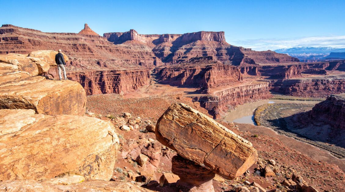
Best Things to Do in Island in the Sky: Canyonlands National Park
Canyonlands National Park is an underrated park located near Moab, Utah. Compared to its smaller and more popular neighbor Arches National Park, Canyonlands feels more rugged, more remote, and a whole lot larger. Island in the Sky, the most popular section of Canyonlands, is filled with jaw-dropping vistas and short but sweet hiking trails. Here […]
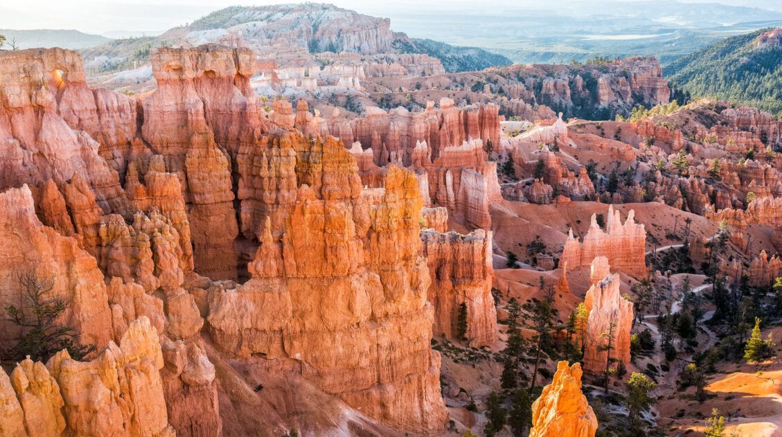
Best of Bryce: 8 Amazing Things to Do in Bryce Canyon
Bryce Canyon is the smallest national park in Utah. Despite its small size, there is still a lot to do here. Walk the Rim Trail, gaze across the amphitheater from numerous overlooks, go on a scenic drive, and journey below the rim to venture into a sea of hoodoos…these all top the list of things […]
Utah Travel Guide: Places to Visit in Utah
Utah Travel Guide If you like rugged, desert landscapes, it is hard to beat the beauty of Utah. Visit the state’s five stunning National Parks, stand among iconic US monuments, kayak on the Great Salt Lake, and climb through photogenic slot canyons. This state is a great one for road trippers as there are many […]
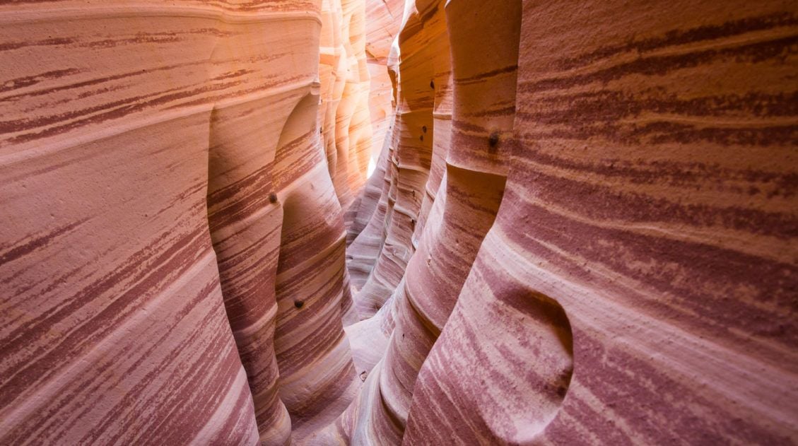
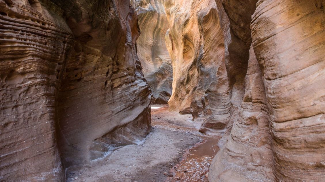
How to Hike Zebra Slot Canyon in Grand Staircase-Escalante
Zebra Slot Canyon is a very short slot canyon, named for its striped canyon walls. It’s a gorgeous spot, maybe not quite as pretty as Antelope Canyon in Arizona, but since you can explore this on your own without a guide or tour group, it’s more fun. Hiking Zebra Slot Canyon can be a little […]
Our 15 Favorite US National Parks: A Few May Surprise You
Stretching from the South Pacific, across the United States and into the Caribbean, are 63 national parks. These national treasures are filled with scenic drives, hundreds of miles of hiking trails, wildlife, historic sites, and endless opportunities for adventure. In this guide, we cover 15 of the best national parks in the USA and what […]
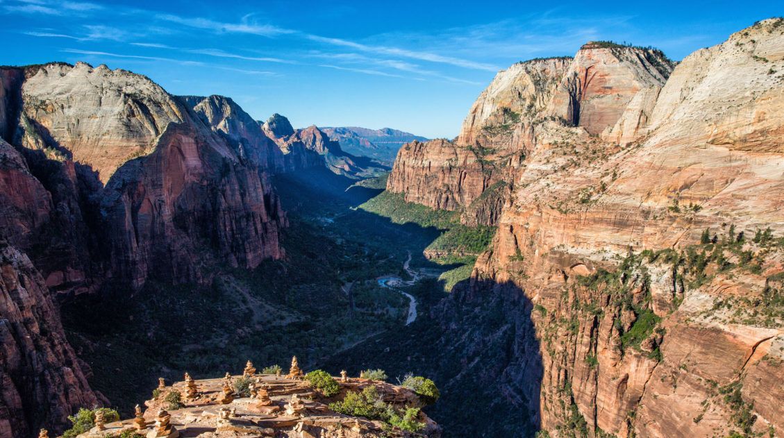
The Ultimate Zion Itinerary: 1 to 6 Days of Hiking & Adventure
If you are planning your Zion National Park itinerary, this is a great place to start. Zion National Park is a hiker’s paradise. This relatively small park is packed with some of the most thrilling hikes in the United States. From the awe-inspiring hike up Angels Landing to the bucket list-worthy Zion Narrows to the family […]

The Ultimate Guide to the 63 US National Parks
Stretching from the South Pacific, across the United States to the Caribbean, are 63 national parks. These national treasures preserve iconic landscapes, majestic mountains, primordial forests, arid deserts, misty coastlines, immense canyons, wildlife, and historic landmarks. We have visited 56 of the 63 US national parks, from the towering granite walls of Yosemite and the […]
Hiking the Willis Creek Slot Canyon in Utah
The hike along the Willis Creek Slot Canyon is so much fun! And to think that we almost skipped this hike. After a long day of hiking and exploring both Bryce Canyon National Park and Kodachrome Basin State Park, we wondered if we should tack on Willis Creek to the end of our day. Would it be […]

Comments 25