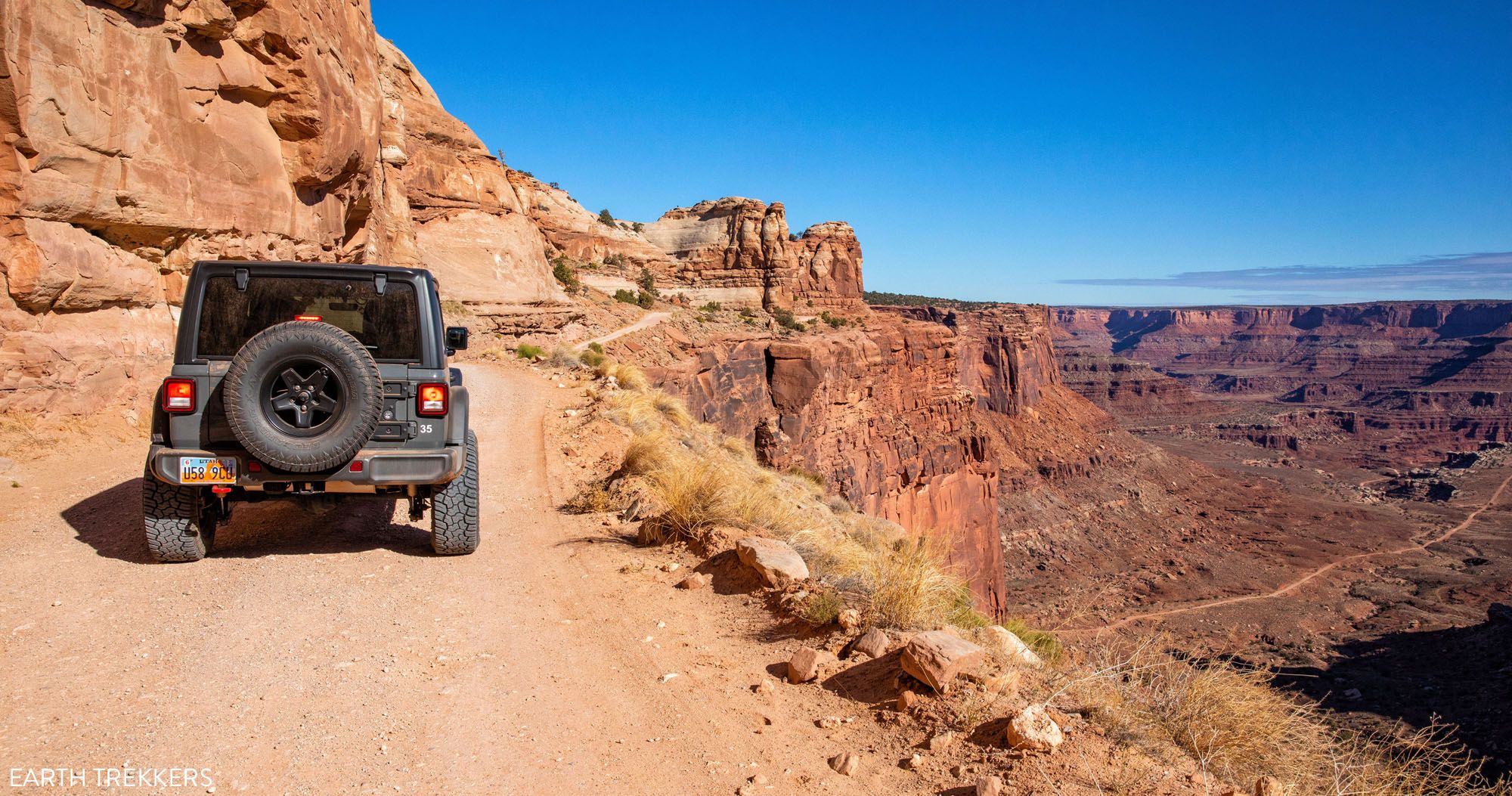
Driving the White Rim Road is one of the best experiences in Canyonlands National Park. For 100 miles, this road circles around the Island in the Sky mesa, taking you past canyons, buttes, and the Colorado and Green Rivers. This drive takes most people two to three days. If you have less time, it is possible to drive the White Rim Road in one day.
If you want to drive the White Rim Road in one day, you have two options.
Option #1 is to drive a portion of the White Rim Road. Starting at Shafer Canyon Road or Mineral Bottom Road, you will drive the first section of the White Rim Road, taking your time at the scenic viewpoints and detours. Midday, turn around and retrace your route back to the start or return to Moab on Potash Road.
Option #2 is to drive the entire 100 mile loop in one day. This is a BIG day and it is not to be underestimated.
In this guide, get the full details on both of these options, with driving tips and our recommendations so you can have the best experience.
About Our Experience
We drove the complete White Rim Road in early November. We did this drive over the course of two days, driving the loop in a counter-clockwise direction. It was awesome and one of our favorite national park experiences.
For those who want to journey below the rim of the Island in the Sky mesa and travel through some of the most beautiful landscapes in Canyonlands, it is hard to beat this experience.
We wrote two posts about how to drive the White Rim Road. If you are considering doing the entire loop, or if you are curious about what to expect, I recommend taking a look at these, in addition to the information provided in this guide.
Overview of the White Rim Road
The entire White Rim Road loop, starting and ending at the Island in the Sky visitor center, is 100 miles long. The majority of this loop is on rough, unpaved roads.
To do the full loop, it takes an average of 2 to 3 days.
There are a few things you MUST have in order to drive the White Rim Road, whether you are doing the full loop or just spending a few hours on the road:
- A high-clearance 4WD vehicle
- A permit
- Entrance fee into Canyonlands National Park
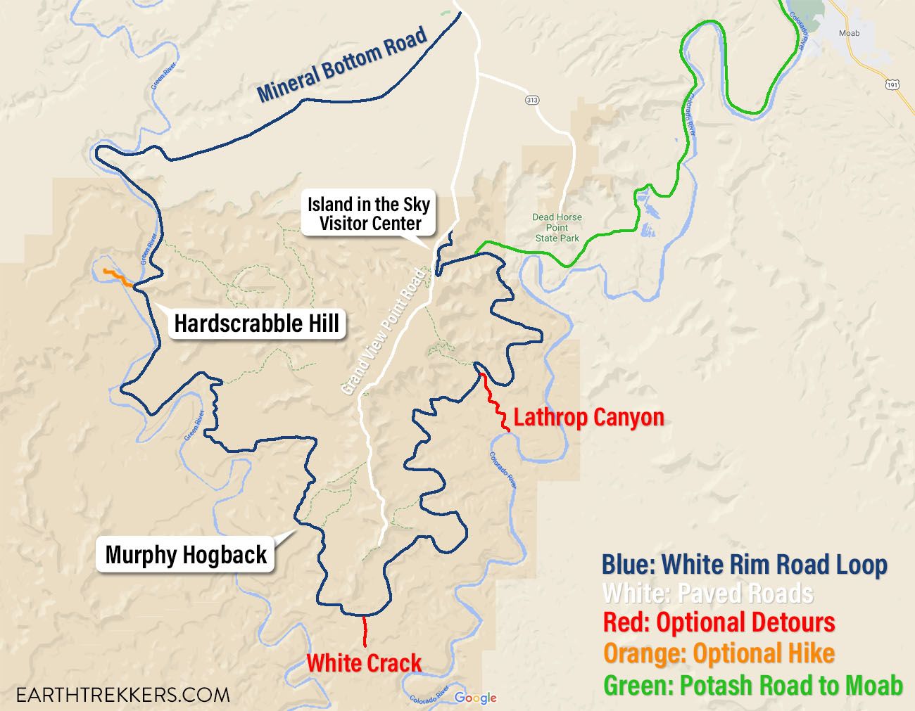
Map of the White Rim Road
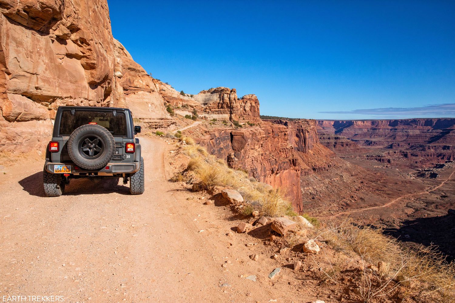
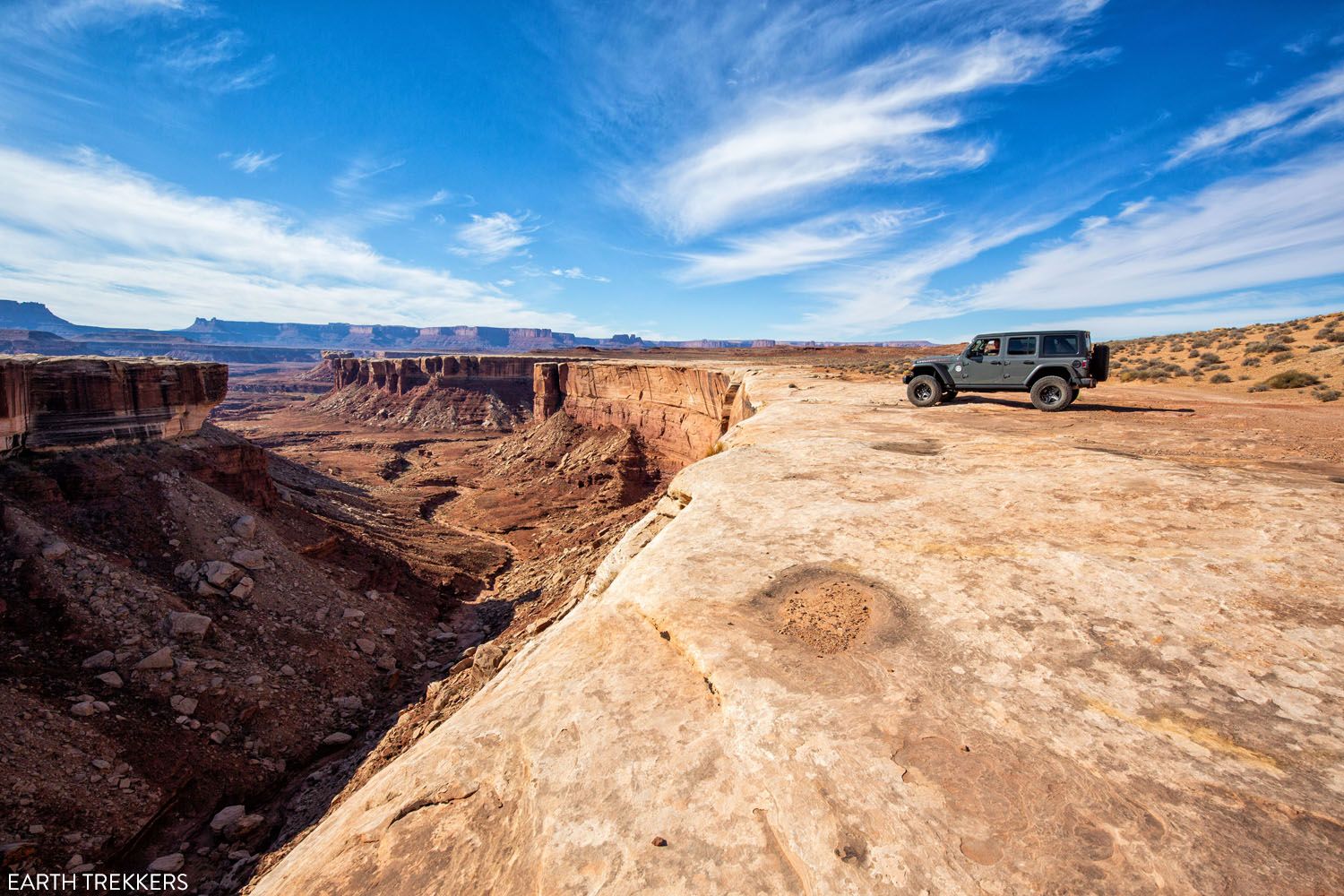
What Type of Vehicle Should You Drive?
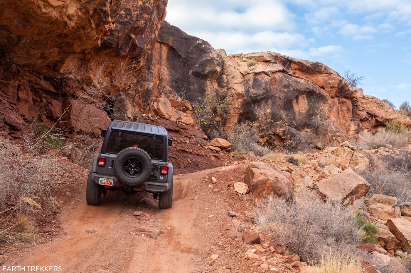
In order to drive the White Rim Road, a high-clearance 4×4 vehicle is required by the National Park Service. It must be a true 4×4 (not AWD) and have high-clearance. You will drive some very rough sections, over large rocks and boulders, and on rutted roads.
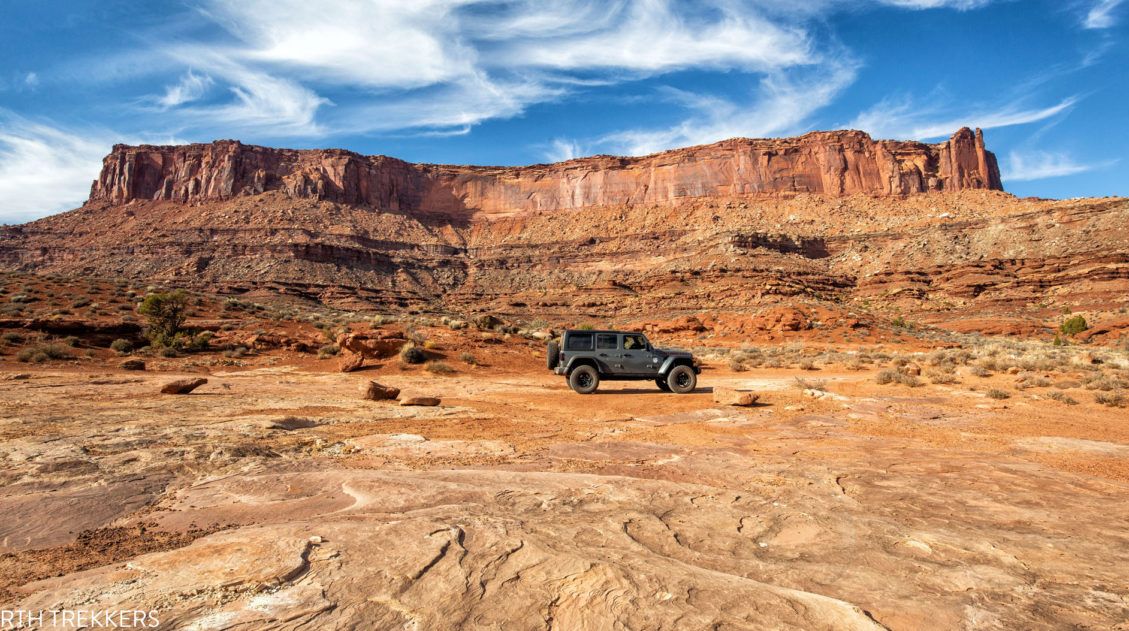
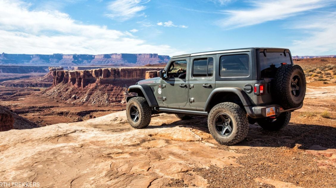
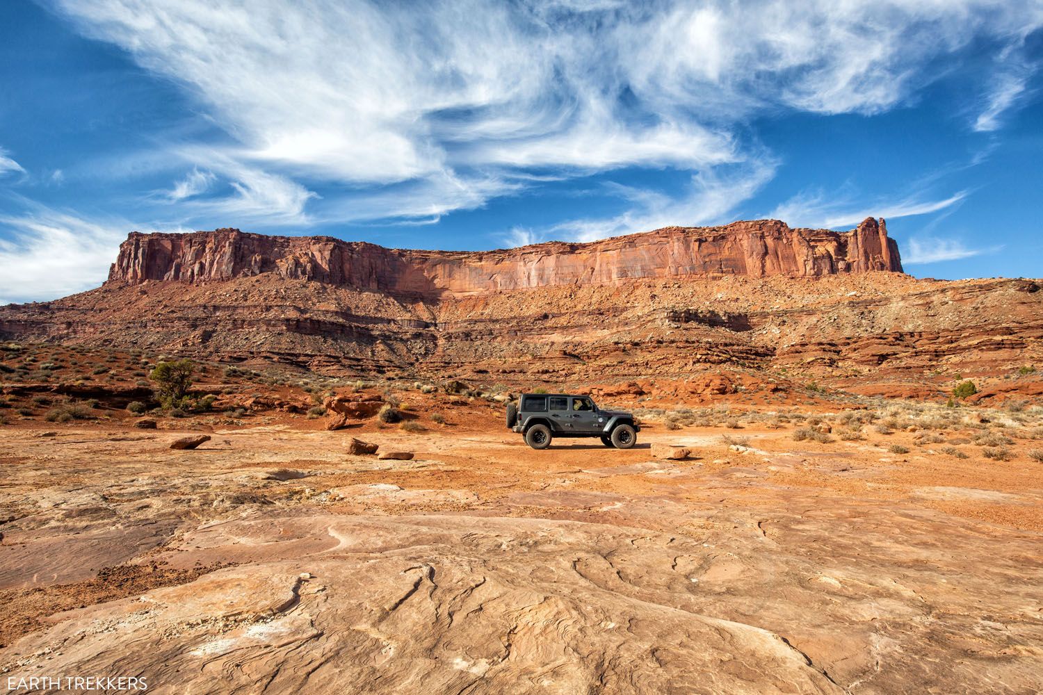
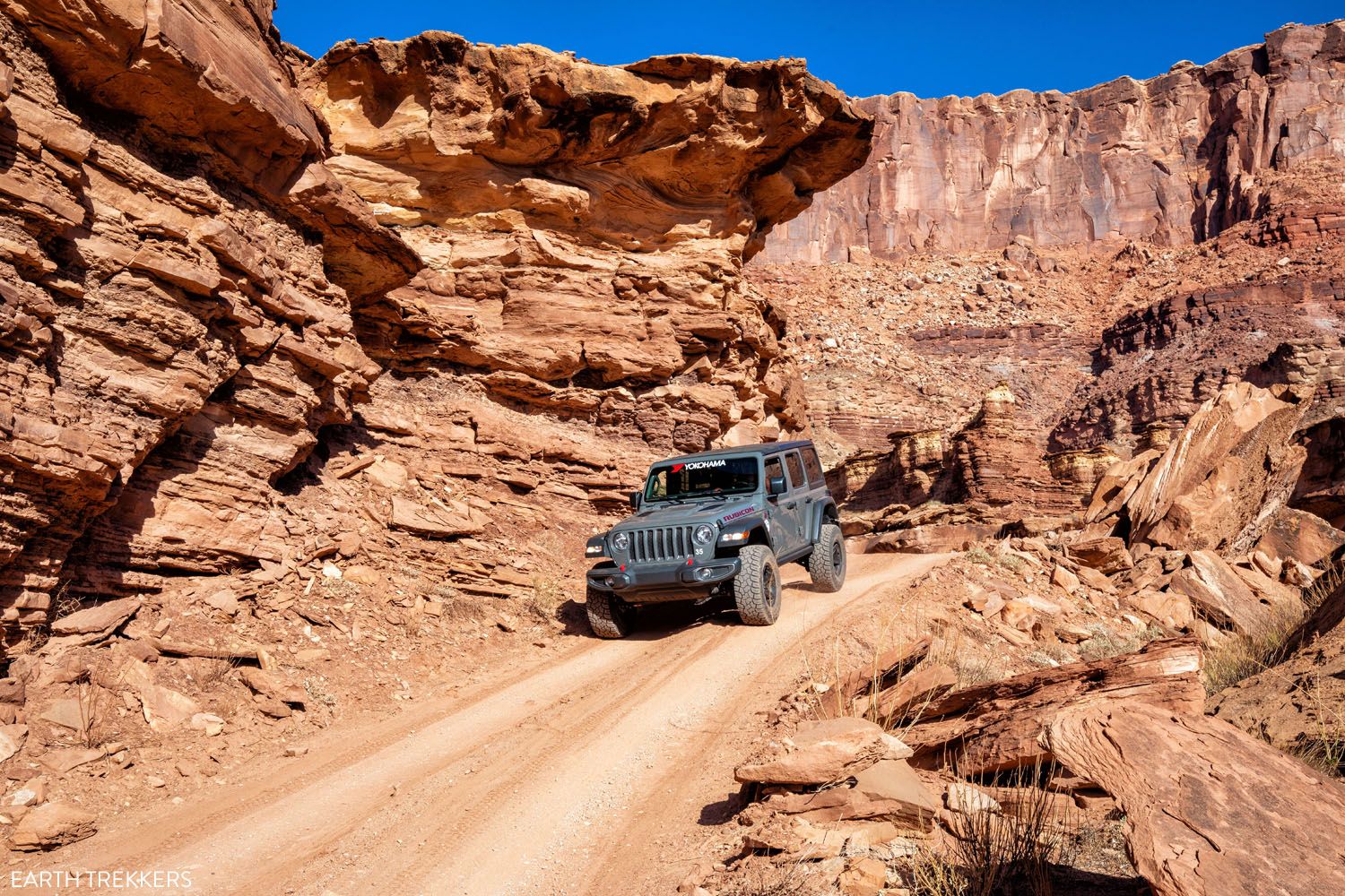
We rented a Jeep Rubicon from Canyonlands Jeep Adventures in Moab. With the extra lift and the rugged tires, it was a great decision. Our Jeep had zero issues on the drive and handled the challenging hills and rough roads like it was nothing.
ATVs, UTVs, and OHVs are not permitted on the White Rim Road. Motorbikes are permitted on the White Rim Road.
What Type of Permit Do You Need?
There are two different permits for the White Rim Road: a day-use permit and an overnight permit.
If you are driving the White Rim Road in one day, you will need a day-use permit.
Day use permits are limited to 50 vehicles per day. 25 of these permits are available online up to 24 hours before your trip. They are available starting at 8:00 am Mountain Time one day in advance. The remainder of the permits will be available at the visitor center. Learn more here.
If you will be doing this drive in a group, each vehicle needs its own permit.
For those who plan to spend two or more days on the White Rim Road, you will need an overnight permit. With this permit, you will also reserve your campsite(s) along the drive. If you plan to drive the White Rim Road in one day, you do not need an overnight permit.
White Rim Road in One Day
Below I cover the different options for driving the White Rim Road in one day.
The first option is to drive just a portion of the loop. And just to keep things interesting, there are two different sections of the road that you can drive: Shafer Canyon Road and the eastern portion of the loop or Mineral Bottom Road and the western portion of the loop.
The second option is driving the full White Rim Road loop in one day.
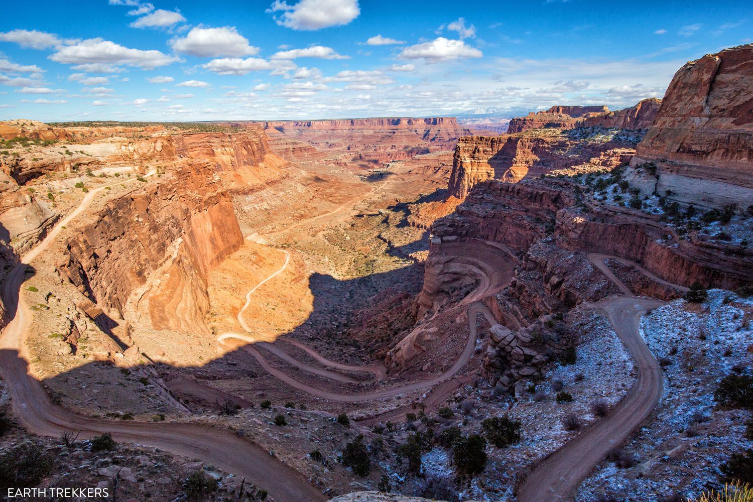
Shafer Canyon Trail. In this photo, you can see the Shafer Canyon switchbacks. Far off in the distance is the White Rim Road and Dead Horse Point State Park.
Option #1: Driving a Portion of the White Rim Road
If you only have one day, this is the option that I recommend. You will get to see some seriously stunning scenery, drive some crazy, white-knuckle roads, and get to experience the remoteness of the White Rim Road. And you get to do all of this without the stress that comes along with trying to do the full loop in one day.
By driving part of the White Rim Road, you will do this out-and-back from your starting point.
What Part of the White Rim Road Should You Drive?
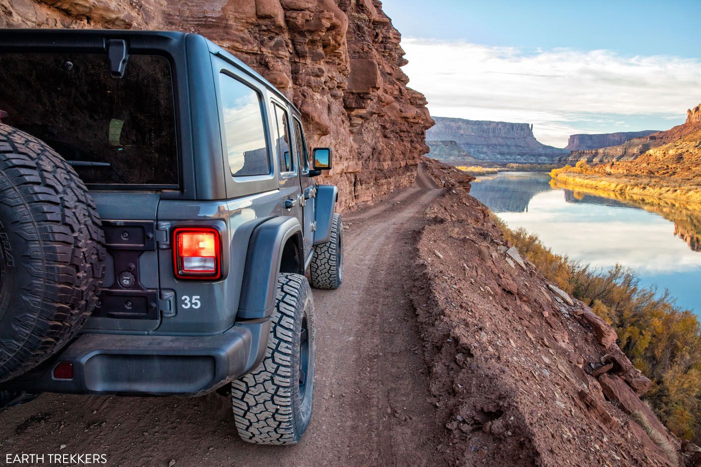
You can either drive Shafer Canyon Trail to the White Rim Road, skirting along the Colorado River on the east side of the loop. Or, you can take Mineral Bottom Road to the Green River and then drive a portion of the west side of the loop.
Of these two options, driving the Shafer Canyon Trail to the east side of the loop is the best pick, in my opinion. You get to drive the legendary Shafer Canyon switchbacks and you will have fantastic views of Dead Horse Point State Park and the Colorado River. You will also get to drive right up the edge of several canyons, which is a very cool experience.
Since this is the most popular section of the White Rim Road, you will encounter more cars here than on the west side of the loop. But even so, because of the limit on the number of cars, it will still feel wonderfully uncrowded.
If you want a more rugged, remote experience, visit the western side of the loop. You will still drive some crazy switchbacks to get below the rim. As you drive along the Green River, you will have views across the river to The Maze. There is also a short hike you can do on this section of the drive.
In my opinion, I think the views and the experience is better on the eastern side of the White Rim Road, so this is the section that I recommend.
Shafer Canyon Road to the White Rim Road
Driving Distance: 72 miles if you start and end at the top of Shafer Canyon Road and turn around at Monument Basin; 100 miles if you start at the top of Shafer Canyon Road and drive Potash Road to Moab
Time: All day
Below I list the overlooks and detours along the drive. The mileage markers include the distances of the detours (for example, the drive through Lathrop Canyon).
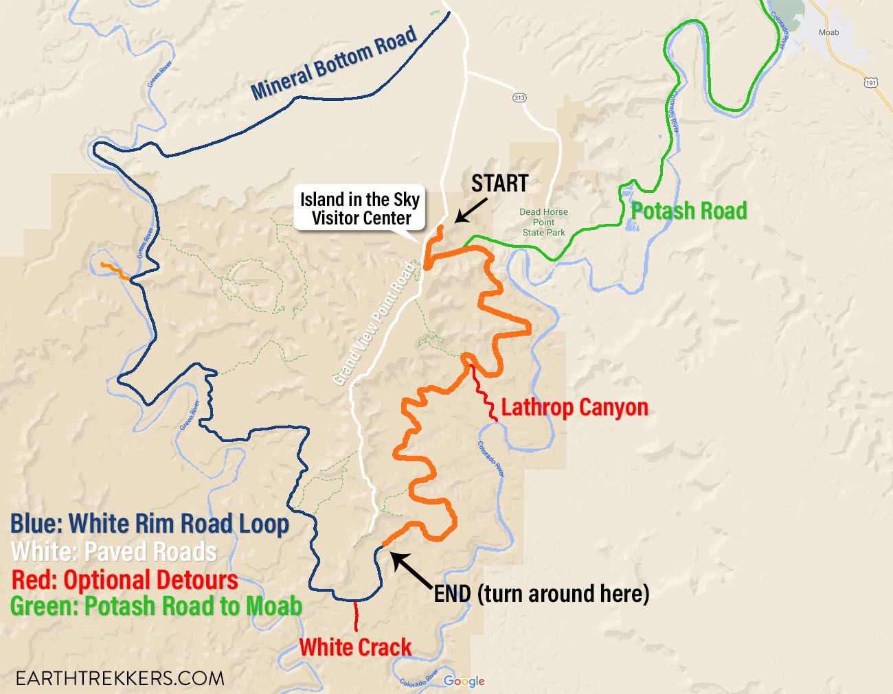
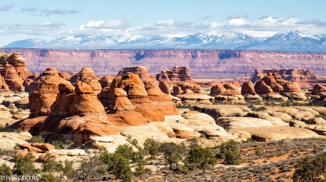
Map of the White Rim Road. The orange route is what you can cover in one day, starting on the Island in the Sky mesa and turning around at Monument Basin.
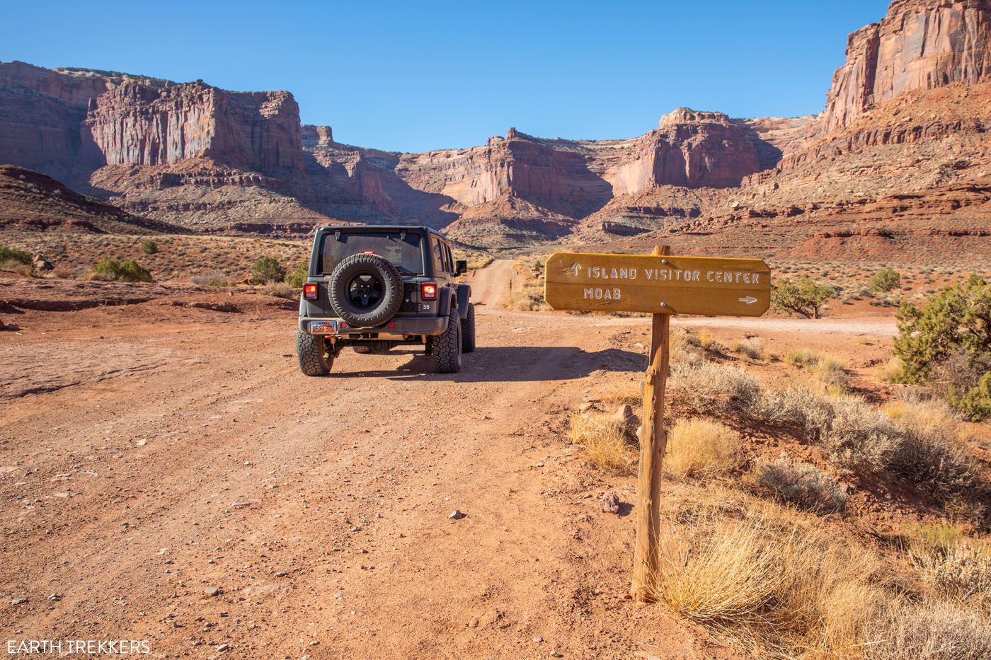
Start: Shafer Canyon Road
Shafer Canyon Road starts one mile north of the Canyonlands Visitor Center on Island in the Sky Road. Turn onto the gravel road. Reset your odometer to 0 and follow our mileage markers. Keep in mind that odometer measurements can vary between vehicles.
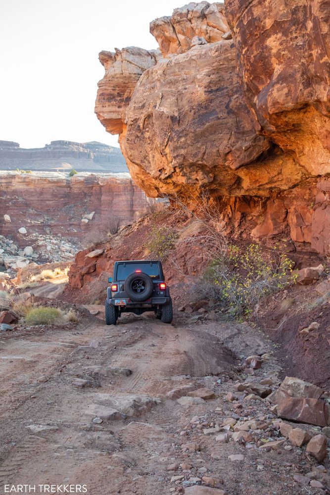
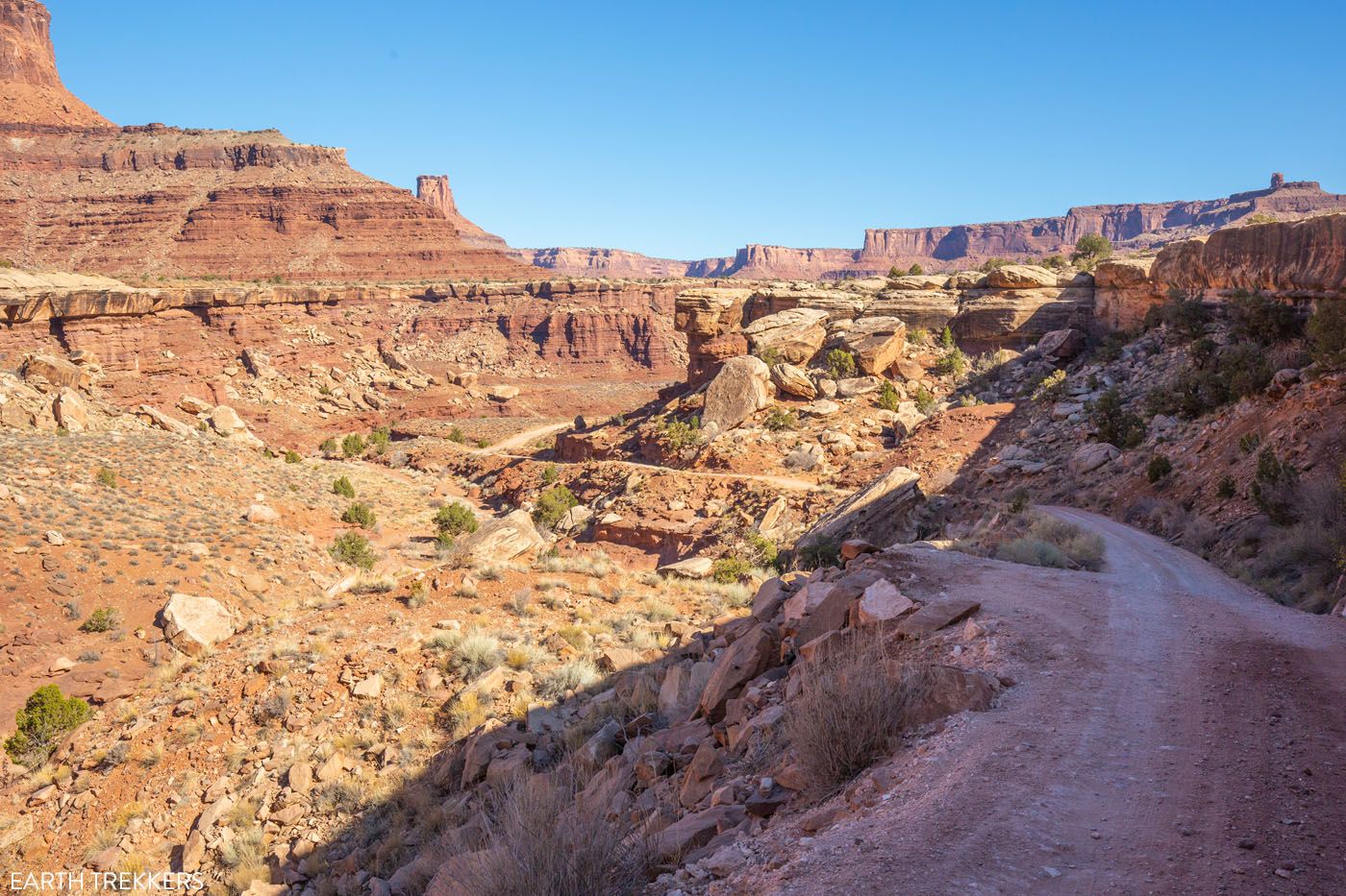
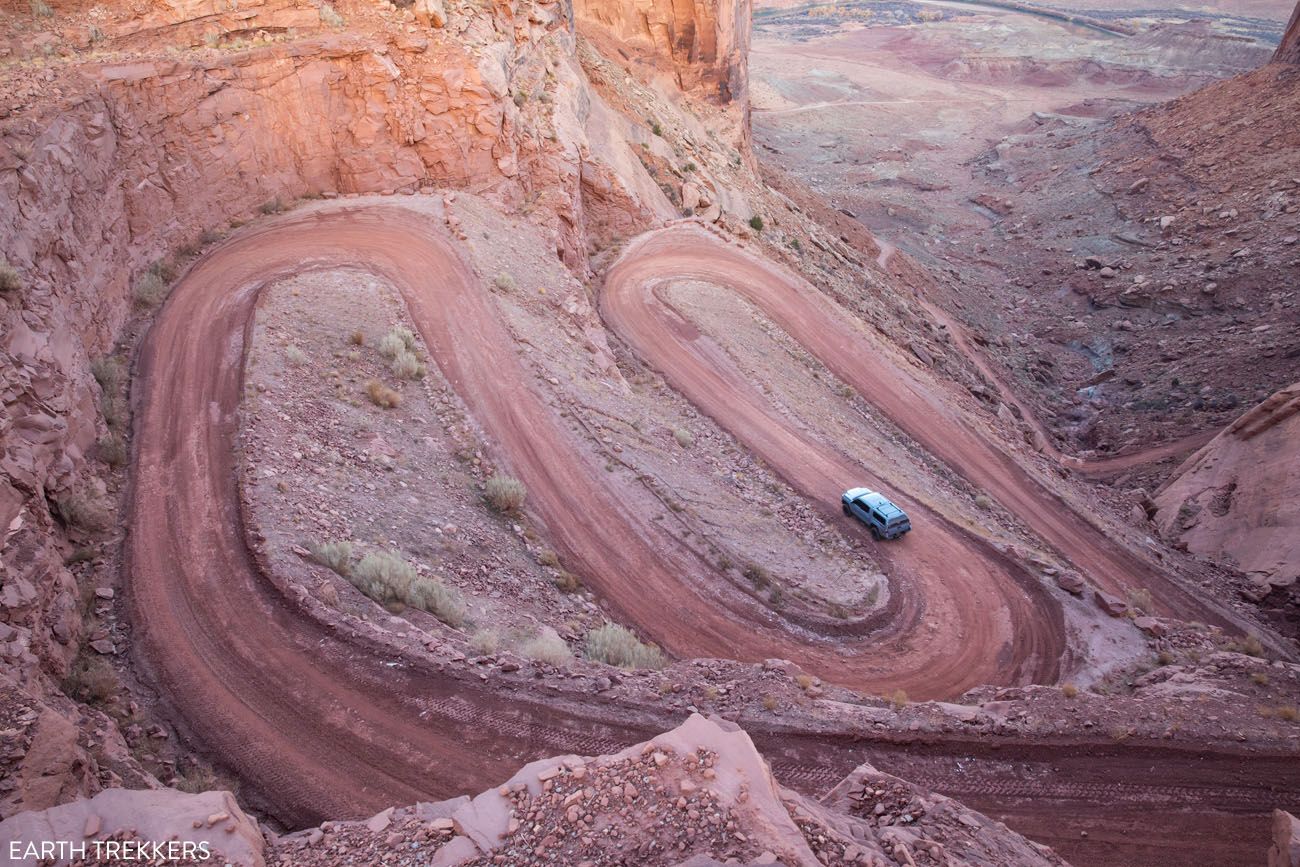
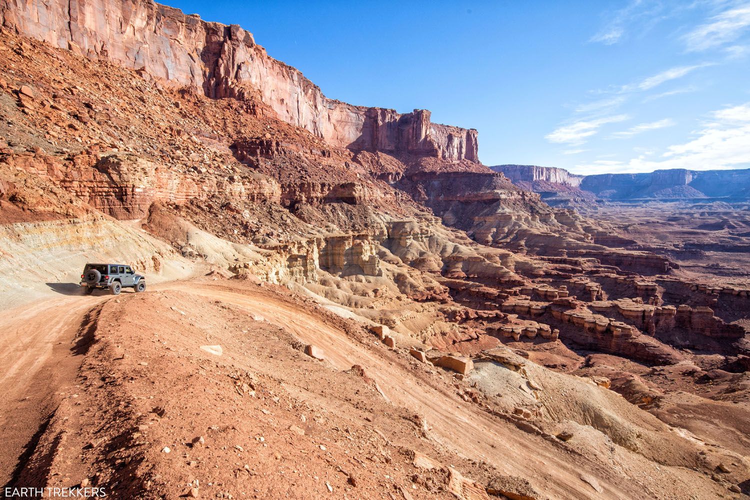
For the first five miles, you will drive from the top of the Island in the Sky mesa to the White Rim. This part of the drive takes you down the Shafer Canyon switchbacks. For some, this will be the most hair-raising and thrilling part of the drive.
Just before the switchbacks, the Shafer Canyon Road heads along the rim. There are big drop offs here, which is thrilling, if you like this sort of thing.
The view from the top of Shafer Canyon Road
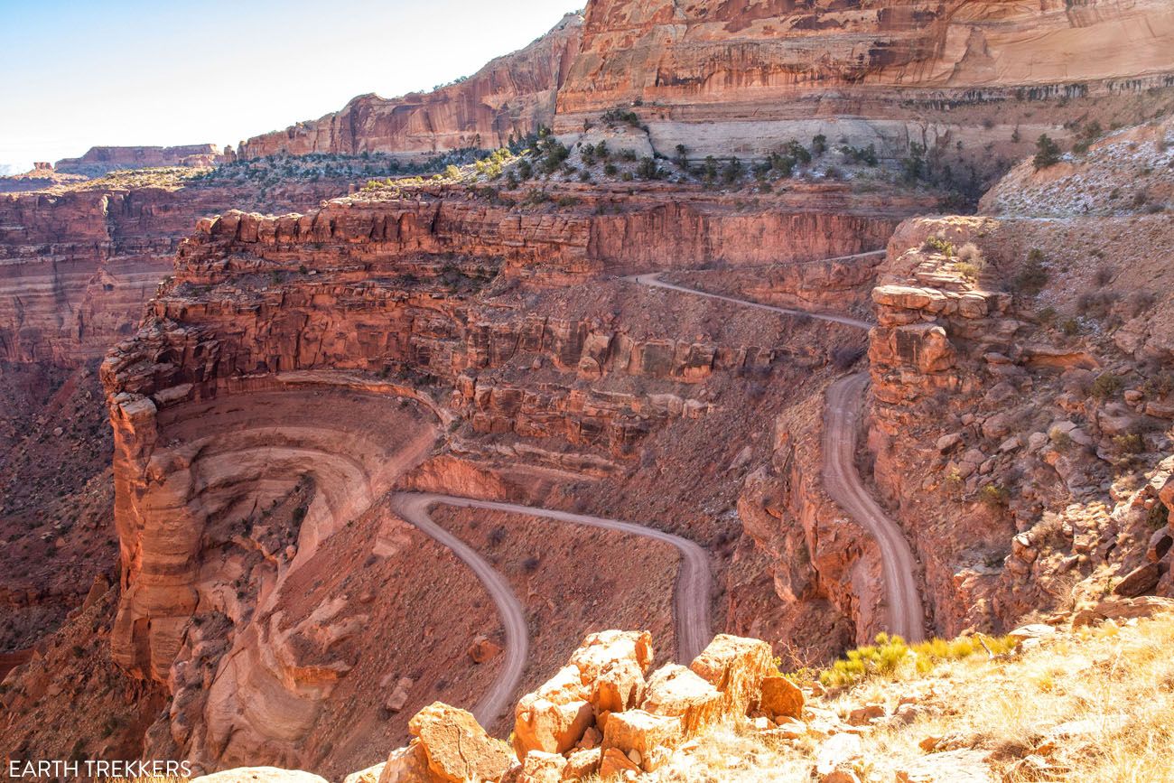
I think that the Shafer Canyon switchbacks look a lot more dangerous from the viewpoints than when you are actually driving on them. This part of the road is relatively smooth and very well maintained. It is also quite wide, at least compared to the White Rim Road. There are many places to pull over and allow oncoming traffic to pass.
Take your time here and scan the road for oncoming cars. Cars driving uphill have the right of way. If you see an approaching car, pull over and allow them to pass.
Once past the Shafer Canyon switchbacks, the road levels out. Now, you are below the rim but the views are still pretty awesome. For a cool view, turn around and look up at the rim. Even though you just did it, it is still somehow unbelievable that you just drove down that steep canyon wall.
The view back to Shafer Canyon and the Island in the Sky mesa.
Mile 5: Potash Road and White Rim Road Junction
At the five mile mark, you reach a road junction. Continue straight to drive the White Rim Road. If you turn left, you will take Potash Road to Moab. This is an option for later in the day.
Mile 6.2: Gooseneck Overlook
Just before the posted sign for Gooseneck Overlook there is a pullout on the right for parking. It is a 0.3 mile walk to the overlook. The overlook doesn’t allow you to see the full gooseneck of the Colorado River (you’ll need to go to Dead Horse Point in Dead Horse Point State Park to see that), but you still get a great view of one of the horseshoe bends that makes up the gooseneck.
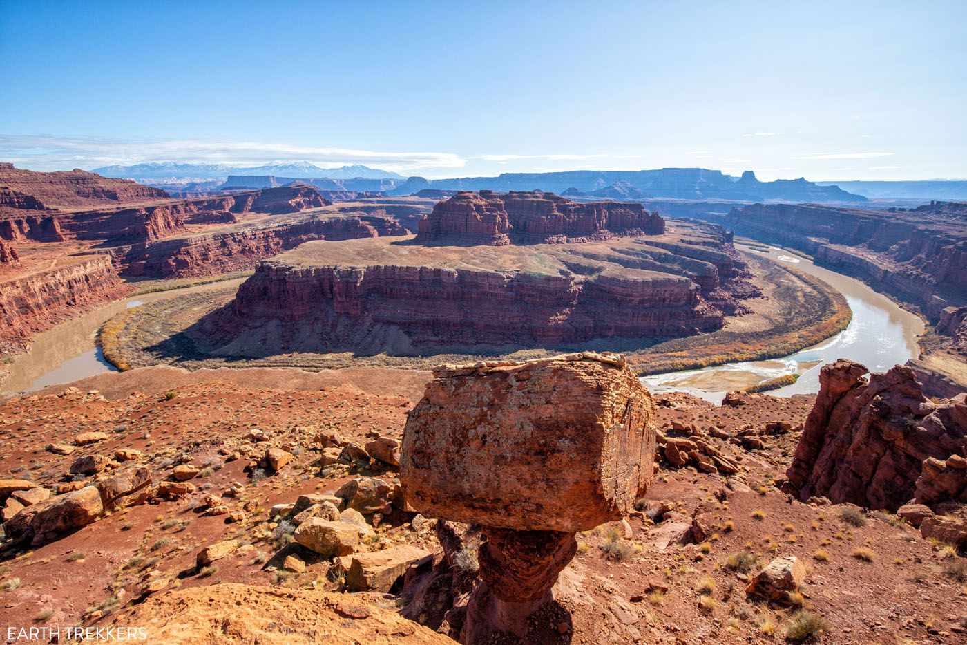
Gooseneck Overlook
Another view from Gooseneck Overlook.
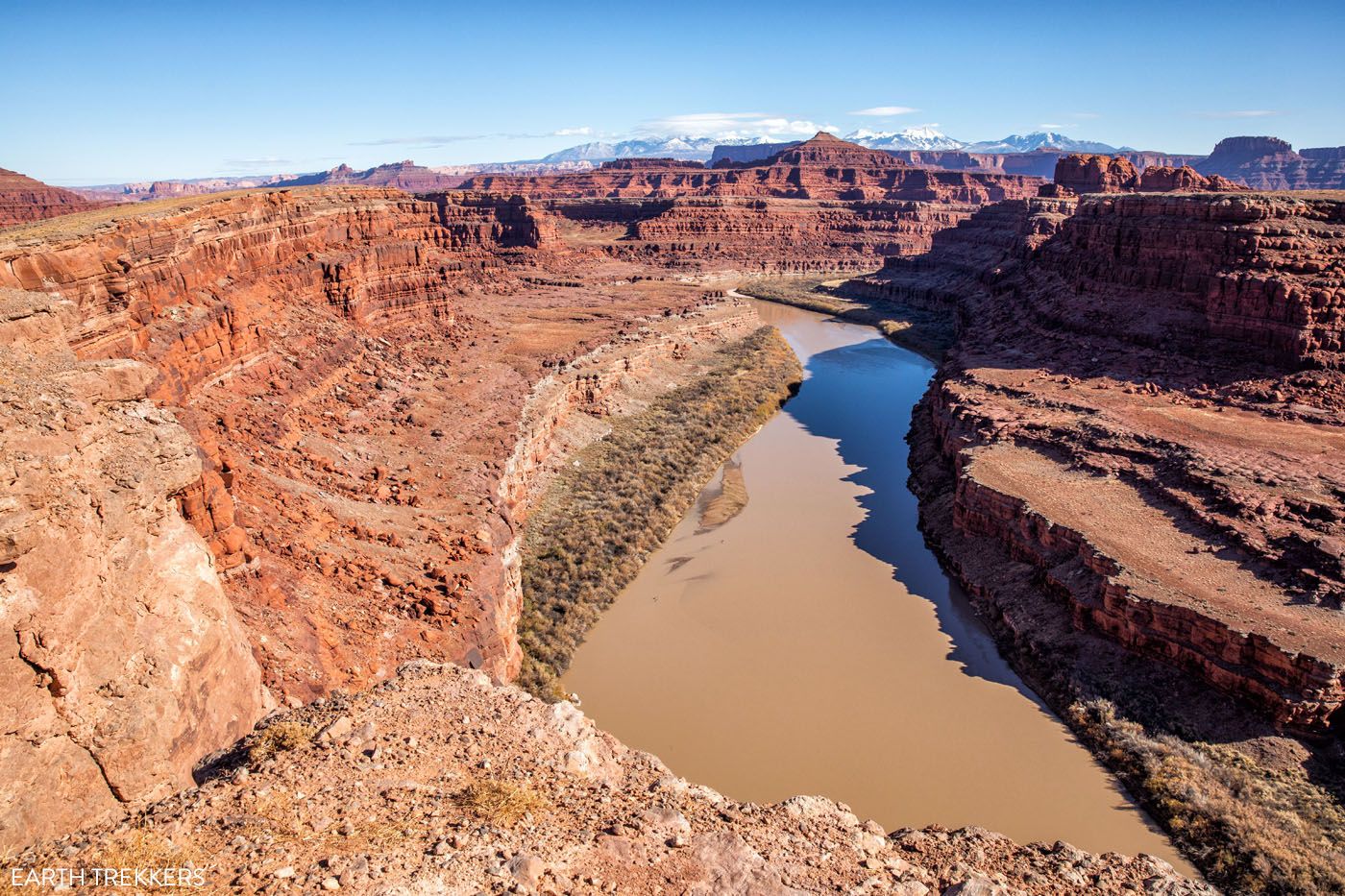
Mile 8.0: Colorado River Overlook
Turn left at the posted sign and follow the short but rough road to the overlook.
Colorado River Overlook
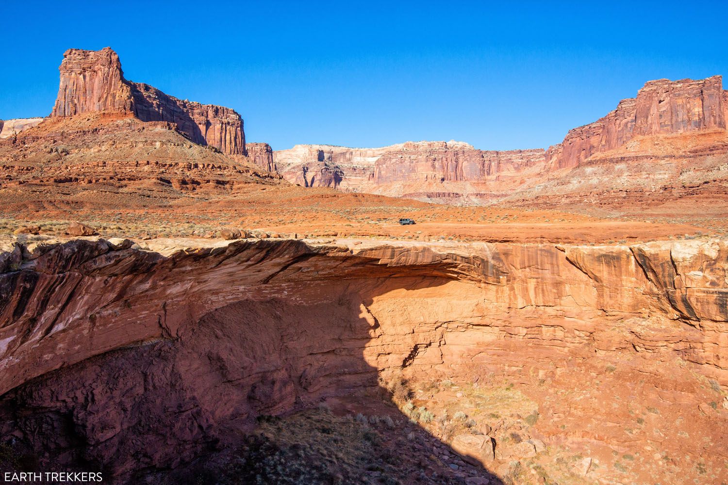
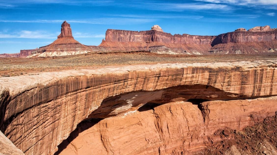
Mile 8.3: Musselman Arch
Turn left into the parking area at the posted sign. It is a short walk to the arch. Note: do not stand on the arch.
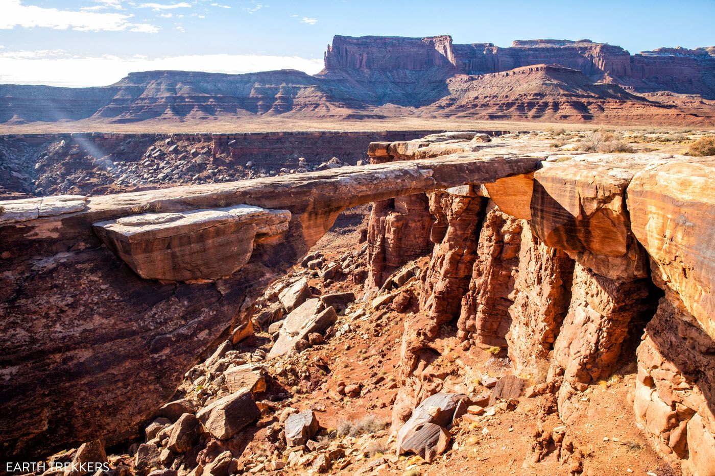
Musselman Arch
Mile 9.4: Musselman Canyon Viewpoint
For a stunning view of Musselman Canyon with the Island in the Sky mesa as a backdrop, stop here.
Musselman Canyon
Mile 12.3: Little Bridge Canyon Viewpoint
This stop offers a view across the canyon with a mesa as the backdrop.
Little Bridge Canyon
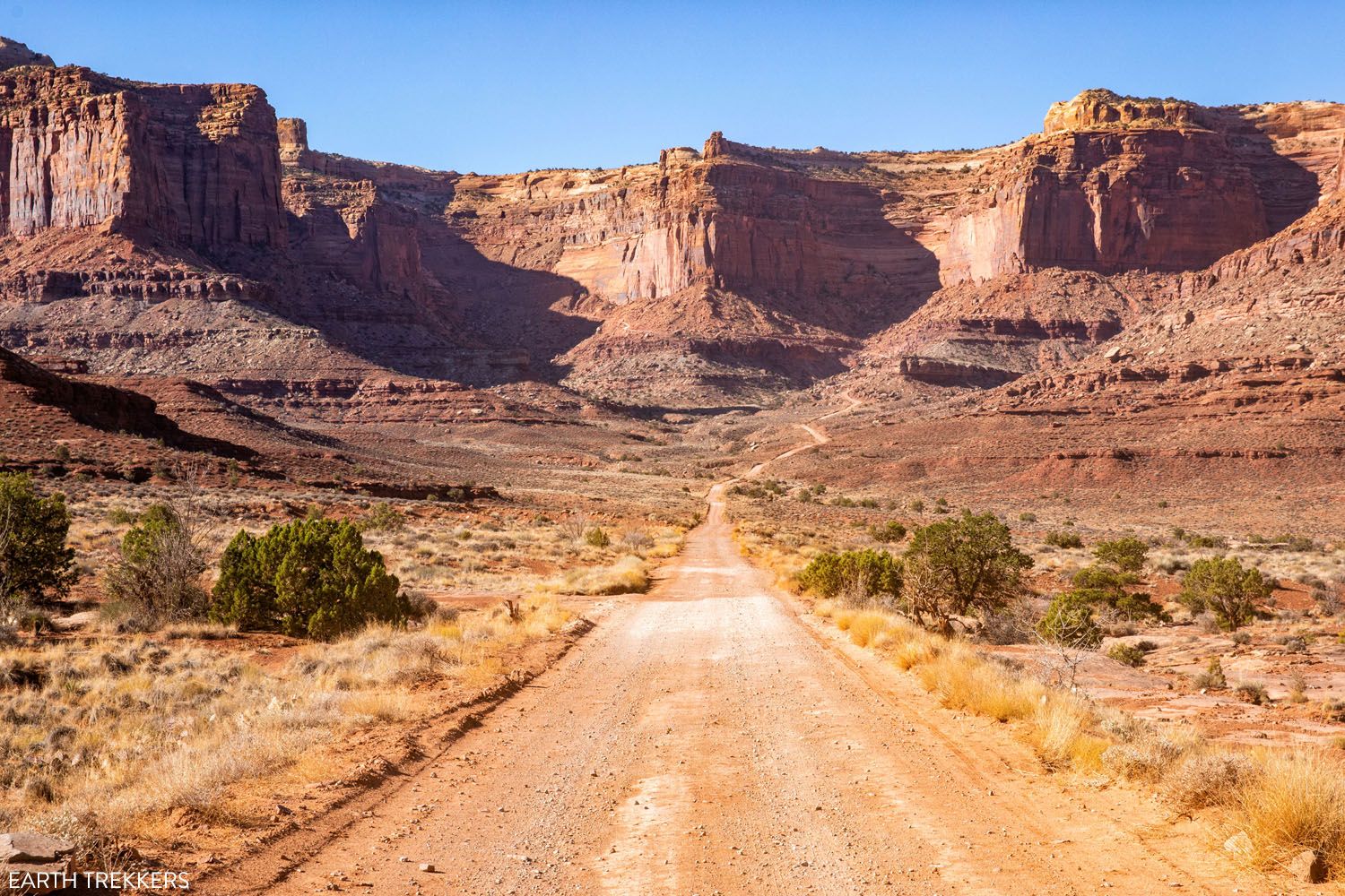
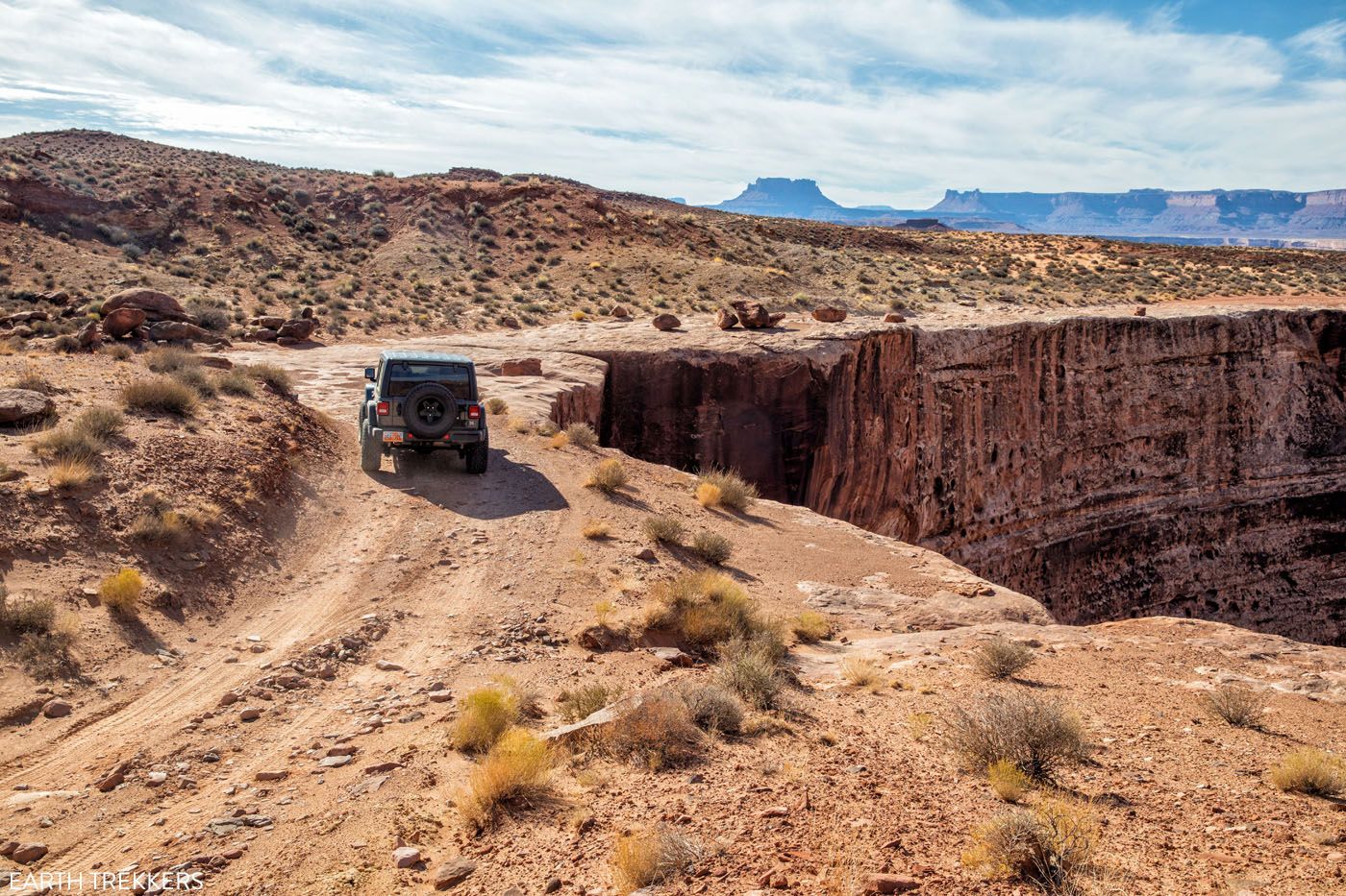
Mile 15.9: Lathrop Canyon Road Junction
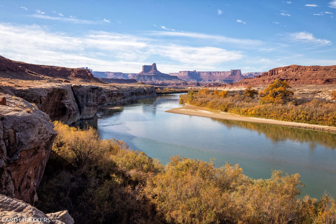
This detour will take you 4 miles one-way through Lathrop Canyon, ending at the Colorado River. It is a rough rocky descent that eventually gives way to a sandy track.
This is optional. The drive through Lathrop Canyon is slightly more difficult than the White Rim Road, with narrower, rougher roads. Since you are driving down into a canyon, it is a fun drive, and as the canyon walls close in around you, this short detour looks and feels a lot different than being on the White Rim Road. This detour adds about one to one and a half hours onto the drive.
The first descent into Lathrop Canyon
Driving out of Lathrop Canyon
Note, the mileage markers for the rest of the drive includes the 8 mile detour into Lathrop Canyon. If you choose to skip Lathrop Canyon, subtract 8 miles from the remainder of these mileage markers.
PRO TRAVEL TIP: You can save Lathrop Canyon for the second half of the drive, doing this on the way back to Island in the Sky/Potash Road.
Mile 23.9: End of the Lathrop Canyon Detour
Once you emerge from Lathrop Canyon, turn left to continue south on the White Rim Road.
Mile 24.7: Airport Campground
At this point you will pass Airport Campground. There is a toilet here if you need one.
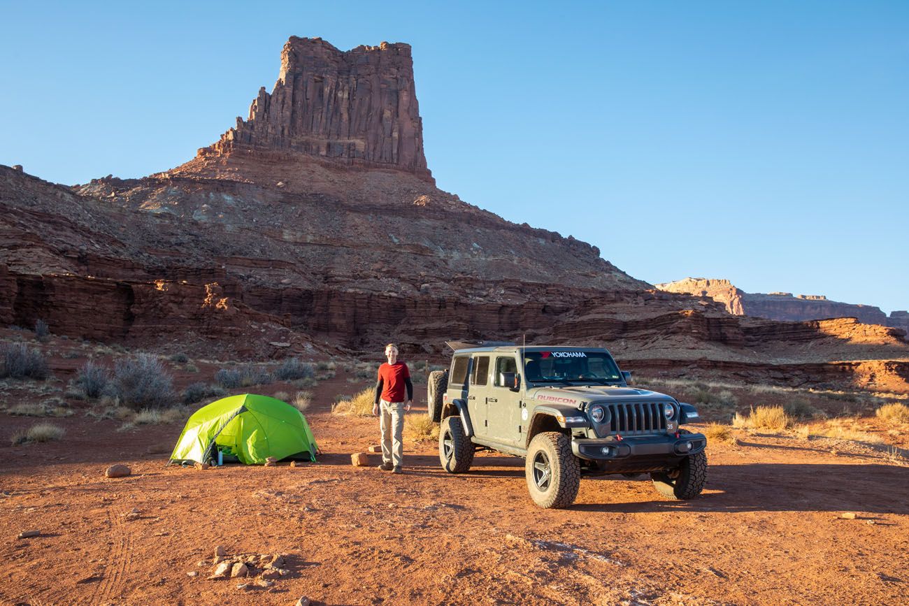
Our campsite at Airport Campground
Mile 27: Airport Tower Viewpoint
At this point you will have a great view of Airport Tower.
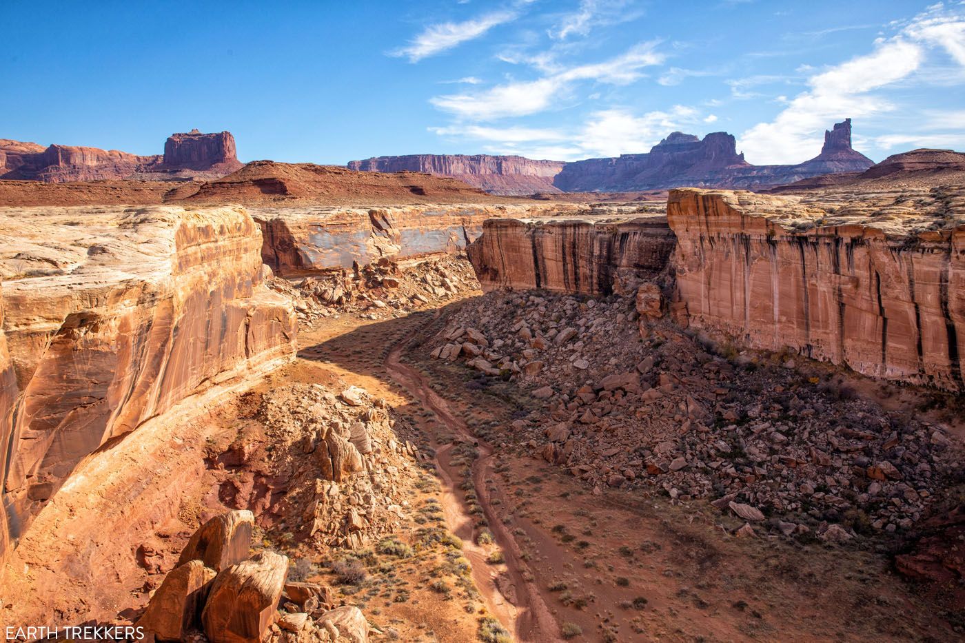
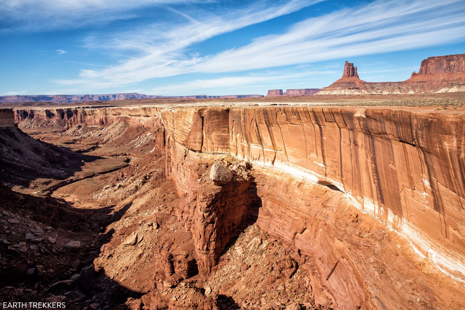
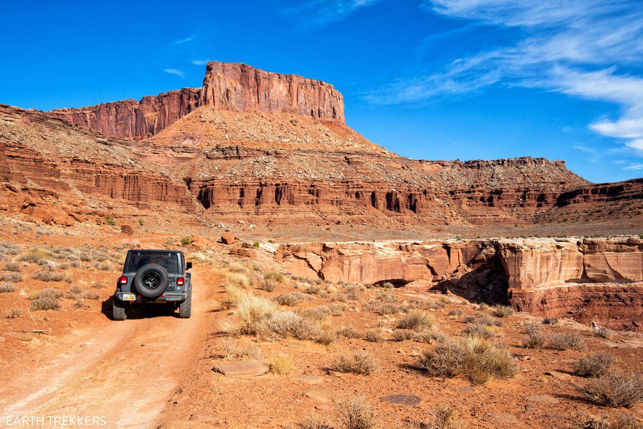
Mile 28.6: Monster Tower Viewpoint
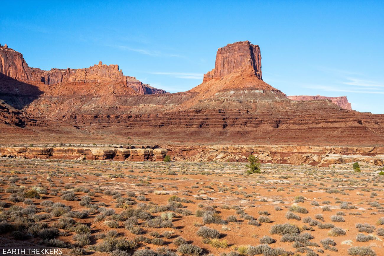
Look back to see Monster Tower, which will be towering above you. The Middle Fork of Buck Canyon is to your left. As you drive from this viewpoint to the Monument Basin viewpoints, you will pass by two more canyons, the South Fork of Buck Canyon and Gooseberry Canyon.
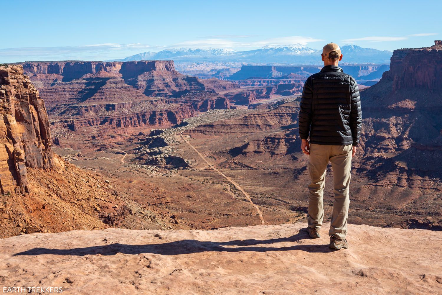
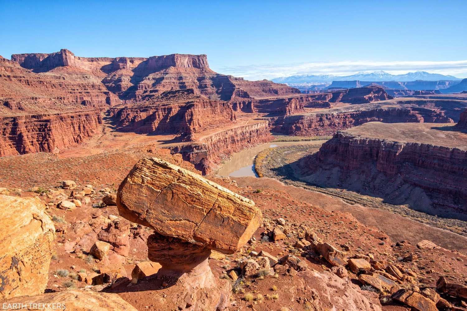
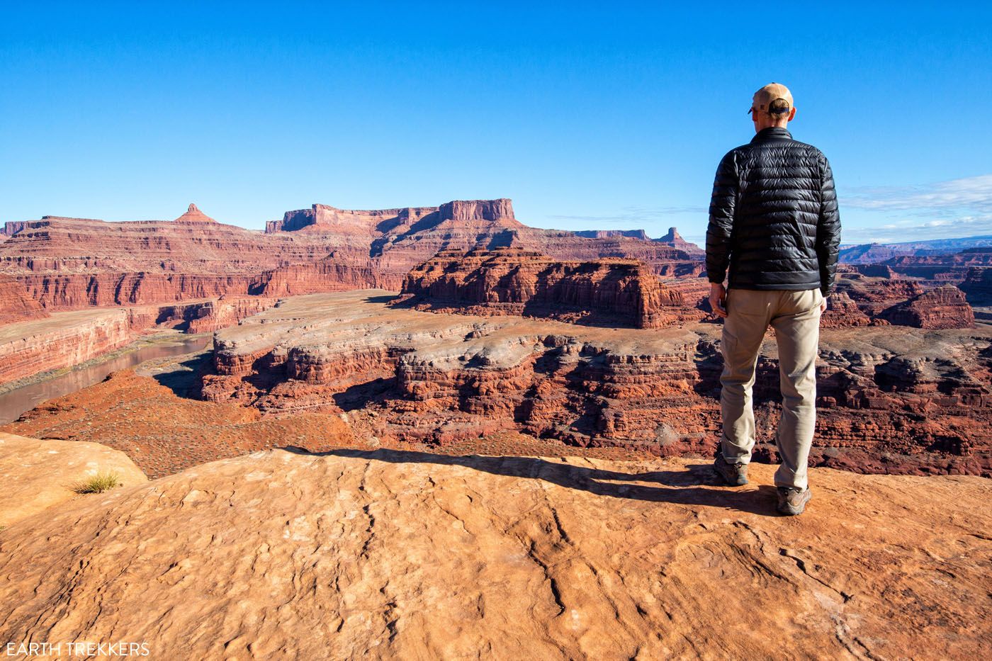
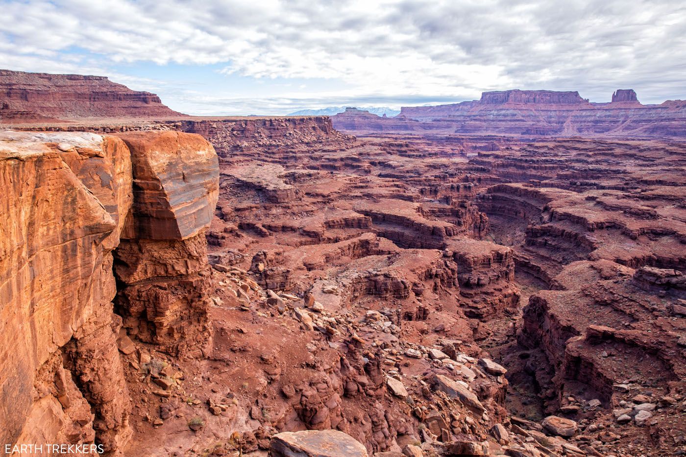
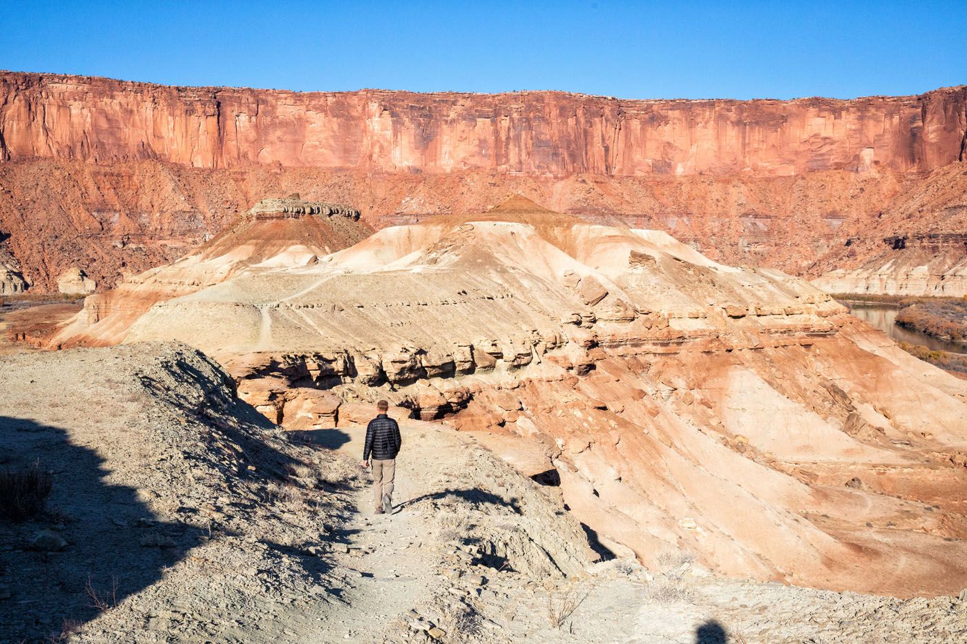
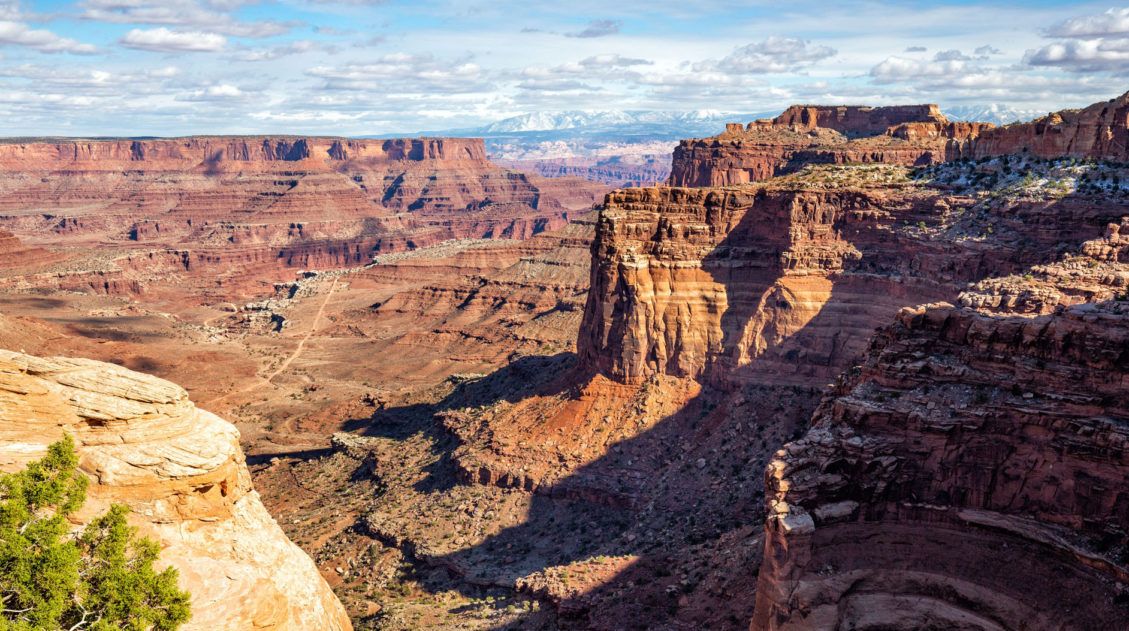
Mile 40: Monument Basin Overlook
This is one of my favorite viewpoints on the White Rim Road. This stop offers a great view of the Monument Basin Canyon. The Island in the Sky’s mesa with Grand View Point towers above you.
View from Monument Basin. The Island in the Sky mesa and Grand View Point loom overhead on this part of the drive.
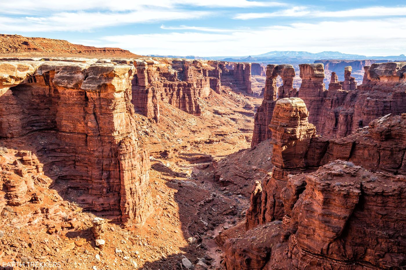
Monument Basin
At Monument Basin, I recommend turning around. At this point, you have driven 40 miles (if you included the detour to Lathrop Canyon), and by now it’s most likely midday. There are still 56 miles to go on the White Rim Road, if you were to drive the full loop.
Mile 67: Potash Road Junction
Now you are back at the Potash Road Junction. And you have a choice to make. From here, you can either drive up the Shafer Canyon switchbacks to get back to the Island in the Sky or you can take Potash Road back to Moab.
If you drive Shafer Canyon Road to Island in the Sky and then drive to Moab, from here it will be 37 additional miles (5 of these on the switchbacks) and it will take about an hour.
If you take Potash Road to Moab, it will be an additional 33 miles and the drive will take between 1.5 and 2 hours. Most of this drive will be on a very rough gravel road.
Potash Road to Moab
Potash Road weaves down through a canyon and then runs right along the Colorado River.
You will pass below Dead Horse Point. You will also pass Thelma and Louise Point. The final scene of the movie Thelma and Louise, when they drove off of the cliff, was not filmed in the Grand Canyon. It was filmed right here, next to the Colorado River, just outside of Dead Horse Point State Park.
The view from Thelma and Louise Point
Past Thelma and Louise Point, the road heads away from the Colorado River and then goes past the Potash evaporation ponds.
Just past the evaporation ponds your tires will hit paved road (UT-279). From here, it is a smooth, easy drive back to Moab. Utah-279 ends at Highway 191. Turn right and in a few minutes, you will be in Moab.
For more photos and details about the drive along Potash Road, read our post How to Drive Shafer Canyon Road and Potash Road from Canyonlands to Moab.
Mineral Bottom Road to the White Rim Road
Driving Distance: 88 miles
Time: All day
If you like the idea of driving a portion of the western section of the White Rim Road, here is a brief overview of the drive, with some photos. For full details, you can see this route in our post How to Drive the White Rim Road.
This drive will be more technical and slightly more challenging than the eastern section of the loop.
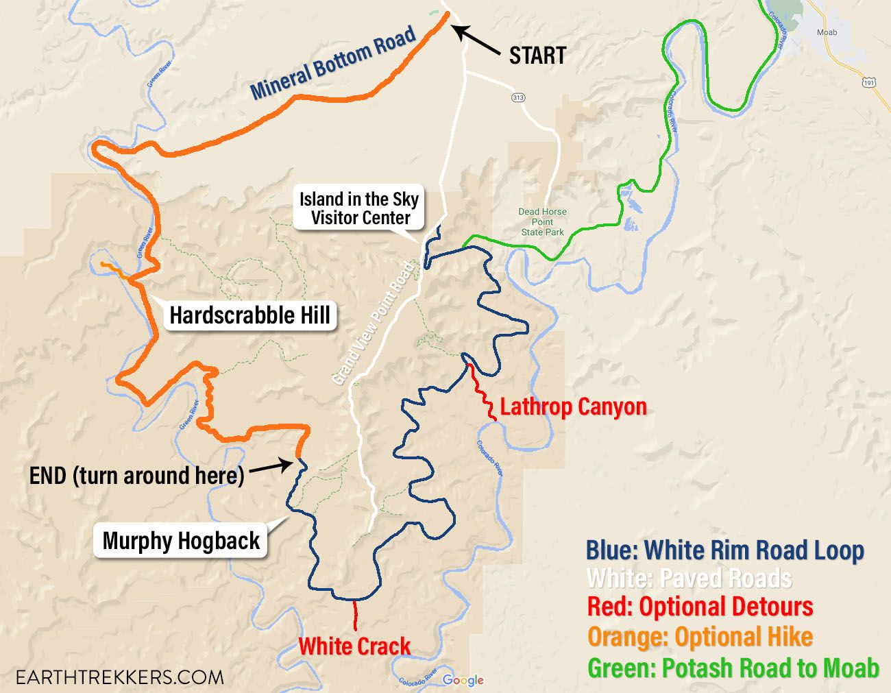
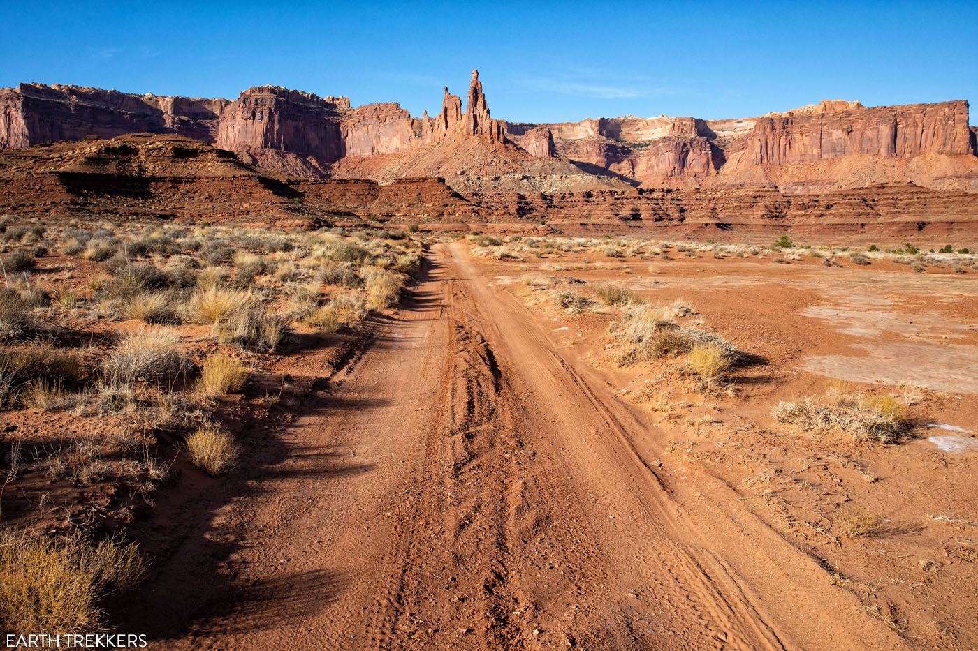
Map of the White Rim Road. The orange route is what you can cover in one day, starting on Mineral Bottom Road and turning around at Soda Spring Canyon.
Mile 0: Turn onto Mineral Bottom Road. This is a well-graded dirt road that is relatively flat and fast.
Mile 13.1: Mineral Bottom Road Switchbacks. Similar to Shafer Canyon, you will drive a series of switchbacks to get down onto the White Rim.
Mile 14.5: End of the Switchbacks. At the bottom of the switchbacks, turn left at the junction onto White Rim Road. The road will now flatten out and will shortly begin to follow along the side of the Green River.
Mile 18.2 At this point you will enter Canyonlands National Park.
Mile 22.5 Hardscrabble Campground
Mile 24.1 Fort Bottom Trailhead & Hardscrabble Hill. This short and easy hike (distance: 3 miles, time: 1 to 1.5 hours) leads to a viewpoint of the Green River.
This point is also the start of the descent down Hardscrabble Hill. This is one of the trickiest parts of the White Rim Road. Scout the view down the hill for oncoming cars. It’s easier to wait at the top than try to pass another vehicle on this stretch of road.
Mile 26.0 Bottom of Hardscrabble Hill & Potato Bottom Campground. Once past Hardscrabble Hill, the White Rim Road runs along the Green River. This portion of the road is noticeably rocky but it offers spectacular river views.
Mile 33.3 Holeman Canyon Viewpoint. This is your first opportunity to look down into one of the lower canyons.
Mile 36.4 Candlestick Campground & Viewpoint. This is another place to look down into a canyon.
Miles 40 to 44. Soda Spring Canyon viewpoints. Along this 4-mile stretch there are several great views of Soda Spring Canyon.
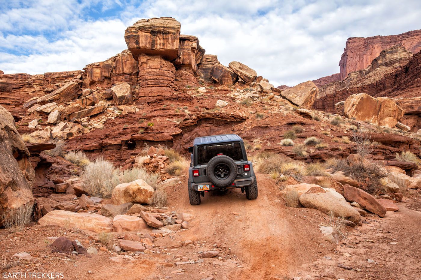
At mile 44 you will be sitting just below Murphy’s Hogback, one of the most challenging sections of the White Rim Road, as you drive up a very rough and narrow road. I recommend turning around before starting this climb.
Option #2: Driving the Complete White Rim Road in One Day
Can you drive the complete White Rim Road loop in one day?
Yes, you can. But this is not to be underestimated. Driving 100 miles on rough, unpaved roads is very different than highway or city driving. The terrain is very rough and rocky and your speeds will be low for most of the drive.
If you have no experience driving on gravel roads, then I do not recommend attempting this drive in one day. There are challenging sections to this drive where you will have to take your time. Plus, things can go wrong. You could get a flat tire, you could have engine problems, or you might run into obstacles along the road that you don’t feel comfortable navigating.
If you run into difficulties, there are very few people out here to offer assistance. And without cellular service you won’t be able to call anyone for help.
If you plan to drive the full White Rim Road in one day, you should have prior experience driving on rough, unpaved roads, know how to change a tire, and have experience driving a vehicle in 4WD.
Plus, I only recommend doing this drive during the months where the days are long.
When we did this, it took us 8 hours to drive 70 miles of this loop (Mineral Bottom Road to the Airport Campground). And we were moving pretty fast and not lingering long at overlooks.
As a rough estimate, it will take you 12 to 14 hours to drive the full loop. You will have to skip some of the detours (such as White Crack and Lathrop Canyon) and maybe even a few of the overlooks. I only recommend doing the White Rim Road in one day when you have at least 13 hours of daylight (mid-April through mid-August). This is not a drive you want to do in the dark.
If you can extend your drive over two days, I highly recommend it. Not only do you get to slow down and enjoy the experience, but camping along the White Rim Road is amazing. The campsites are well spaced out, so you will have some privacy. The night sky is absolutely spectacular since you are so far away from light pollution.
Tips to Drive the Full Loop in One Day
You can do the drive in either direction. Most people drive the loop in a clockwise direction, starting with the Shafer Canyon switchbacks. If you begin to run out of daylight, it’s not a big deal to be on Mineral Bottom Road (which would be the final 13 miles in a clockwise direction) since this road is well-graded and easy to drive.
Start at sunrise. You need to have as much daylight as possible.
Skip the detours to Lathrop Canyon and White Crack. These will take up valuable time.
If it is 2 pm, and you haven’t reached the halfway point, turn around and don’t try to drive the whole loop. There are two technical hill climbs and descents on the western side of the loop and these take extra time. To stay safe, you don’t want to rush through these sections.
If you plan to do the full White Rim Road in one day, read these posts first, which have many more planning tips and details about what to expect along the drive.
When Can You Drive the White Rim Road?
The best time to drive the White Rim Road is the spring and fall seasons, when the temperatures are mild.
Flood season is from early May through late June, so expect wet conditions during this time. Rain can temporarily make the dirt roads impassable, so keep this in mind when choosing your travel dates.
In the summer, daytime temperatures can soar, but the days are long, which gives you more time on the White Rim Road.
In the winter, be prepared for snow and ice on the road and below-freezing temperatures overnight. During the winter months, Shafer Canyon Road can close due to snowfall. If you plan to do this drive during this time, get updated road conditions on the National Park Service website or at the visitor center.
Things to Know Before You Go
Before you go, get an update on current road conditions. Road conditions do change, so stop by the Canyonlands Island in the Sky Visitor Center and ask about the current conditions of the roads before embarking on this adventure. You can also get updates on the National Park Service website.
Before you go, get updates on the weather. Some portions of this route may be impassable when wet.
Cellular service on the White Rim Road is very spotty. We had minimal cell service near the Gooseberry and Airport camping areas. From Airport campground, we had just enough service to send a text and photo home to Tyler and Kara. But for the remainder of the White Rim Road (the entire western part of the drive) we had no cellular service.
Always keep an eye out for mountain bikers. We saw more mountain bikers than we saw cars.
There is no potable water along the White Rim Road. Make sure you bring an adequate supply of water.
Toilets are located at each camping area and camping areas are roughly spaced out 15 miles apart.
Make sure you have a full tank of gas. One tank is enough to drive the entire White Rim Road and to get to and from Moab.
Please practice the seven principles of Leave No Trace: plan ahead, stay on the trail, pack out what you bring to the hiking trail, leave areas as you found them, minimize campfire impacts, be considerate of other hikers, and do not approach or feed wildlife.
If you have any questions about how to drive the White Rim Road in one day, let us know in the comment section below. And if you have done the White Rim Road in one day, whether it was the full loop or just part of the drive, we would love to hear about your experience and any tips you have to offer. Thanks!
More Information about Moab & Canyonlands National Park
Best Things to Do in Island in the Sky: Canyonlands National Park
Canyonlands National Park is an underrated park located near Moab, Utah. Compared to its smaller and more popular neighbor Arches National Park, Canyonlands feels more rugged, more remote, and a whole lot larger. Island in the Sky, the most popular section of Canyonlands, is filled with jaw-dropping vistas and short but sweet hiking trails. Here […]
Where to Stay in Moab: Best Hotels, Resorts & Campsites for Every Budget
Trying to decide where to stay in Moab? From upscale resorts and spacious bungalows to highly rated inns, hotels, and campsites, Moab offers something for every travel style and budget. We’ve visited Moab four times, using this small town as our gateway to the stunning landscapes of southeastern Utah. Surrounded by dramatic red rock formations […]
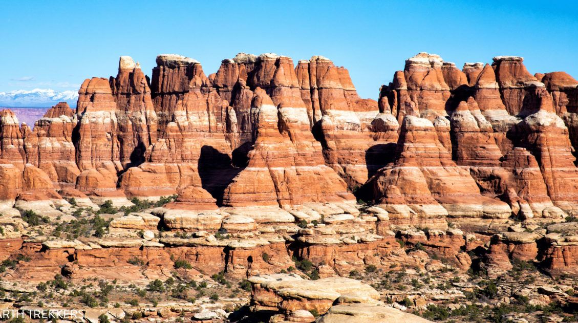
Ultimate Guide to the Chesler Park Loop in the Needles
If you want to get an up-close look at the “Needles,” the sandstone spires that make the Needles district of Canyonlands National Park so uniquely beautiful, put Chesler Park on your list. It is possible to hike out and back to Chesler Park on a short day hike. But if you don’t mind going farther, […]
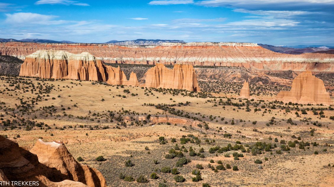
Complete Guide to the Cathedral Valley Loop (+ Map & Best Route)
Cathedral Valley is a rugged, remote district of Capitol Reef National Park. Few people travel out this way, to see this valley and its sandstone monoliths, colorful Bentonite hills, and vast desert scenery. But that’s part of its appeal. If you like the idea of leaving the crowds behind and exploring the backcountry, the Cathedral […]
One Perfect Day in Canyonlands National Park
Canyonlands is an enormous National Park. Over 330,000 acres are filled with arches, buttes, mesas, canyons, hiking trails, dirt roads, campgrounds, and overlooks. It would take days, weeks even, to fully explore all that Canyonlands has to offer. However, if you only have one day in Canyonlands, you have just enough time to visit the […]
12 Amazing Things to Do in The Needles, Canyonlands National Park
The Needles is an often overlooked section of Canyonlands National Park. But those who take the time to visit the Needles are rewarded with thrilling, unique hiking trails, low crowds, and jaw-dropping views of Canyonlands National Park. In this post, we cover the 12 best things to do in the Needles…12 great reasons why this […]
Arches, Canyonlands and Capitol Reef: 7 to 10 Day Road Trip Itinerary
Arches, Canyonlands, and Capitol Reef National Parks are three spectacular parks to visit in Utah. With 10 days, you can visit each of them, plus a few more cool spots, on this epic road trip. Tim and I did this road trip in November 2020. Prior to this trip, we had already visited each of […]
How to Hike the Syncline Loop in Canyonlands National Park
For years, I heard amazing things about the Syncline Loop. This tough hike is known for its outstanding views, and due to the primitive nature of the trail, it is only recommended for experienced hikers. It got such rave reviews in the hiking community and it sounded so thrilling that we couldn’t wait to hike […]
14 Amazing Things to Do in Capitol Reef National Park
Capitol Reef, often an overlooked national park, is full of many wonderful surprises. With two amazing scenic drives, hiking trails that rival those in Zion, rugged, remote areas to explore by 4×4, short, easy slot canyons, historical landmarks, and even delicious pie, this national park is absolutely amazing. In this post, learn about the best […]
How to Loop the Fold in Capitol Reef National Park
Desert vistas, slot canyons, colorful hills made of bentonite and sandstone, marine fossils…these are just a few of the things that you will see when you Loop the Fold in Capitol Reef National Park. This incredibly scenic drive takes you through the remote, southern section of Capitol Reef. On this drive, you will circle around […]
16 Amazing Things to Do in Arches National Park (+ HELPFUL Tips)
Arches National Park is a wonderland of desert vistas, short hiking trails, strange rock formations, and you guessed it, arches. Not only will you find over 2,000 arches here, but you will also see hoodoos, fins of sandstone rocks, massive mesas, and balanced rocks. Here are the best things to do in Arches National Park. […]
Our 15 Favorite US National Parks: A Few May Surprise You
Stretching from the South Pacific, across the United States and into the Caribbean, are 63 national parks. These national treasures are filled with scenic drives, hundreds of miles of hiking trails, wildlife, historic sites, and endless opportunities for adventure. In this guide, we cover 15 of the best national parks in the USA and what […]
Utah Travel Guide: Places to Visit in Utah
Utah Travel Guide If you like rugged, desert landscapes, it is hard to beat the beauty of Utah. Visit the state’s five stunning National Parks, stand among iconic US monuments, kayak on the Great Salt Lake, and climb through photogenic slot canyons. This state is a great one for road trippers as there are many […]

The Ultimate Guide to the 63 US National Parks
Stretching from the South Pacific, across the United States to the Caribbean, are 63 national parks. These national treasures preserve iconic landscapes, majestic mountains, primordial forests, arid deserts, misty coastlines, immense canyons, wildlife, and historic landmarks. We have visited 56 of the 63 US national parks, from the towering granite walls of Yosemite and the […]
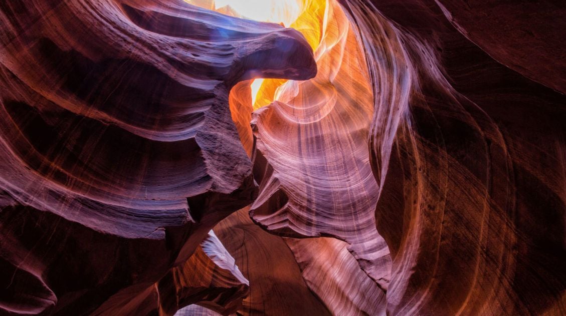
10 Amazing Slot Canyons to Explore in the American Southwest
The American Southwest is a playground for hikers, photographers, and adventurers. Fun to explore and extremely photogenic, slot canyons provide a unique hiking experience. We have assembled a short list of some of the best slot canyons in Utah, Arizona, and Nevada. This is not an all-inclusive list, because there are tons of slot canyons […]

Comments 15