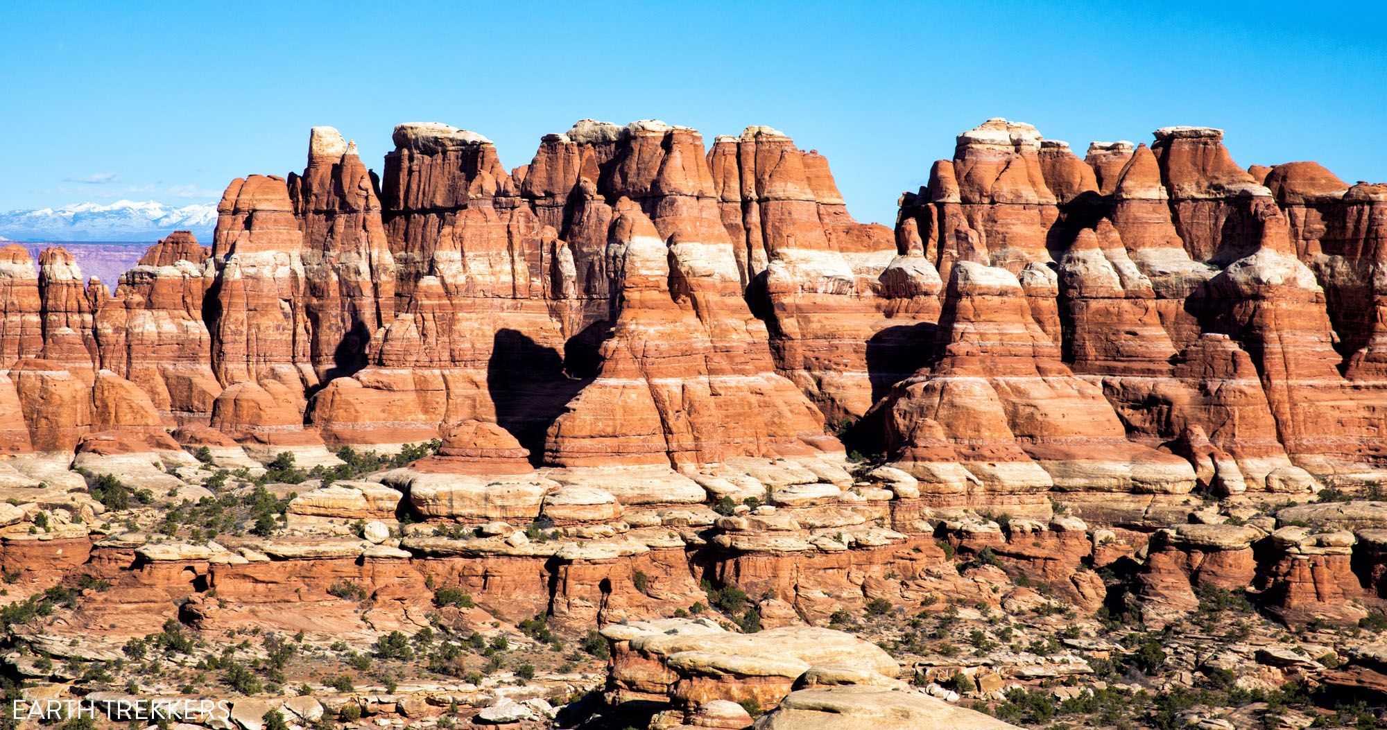
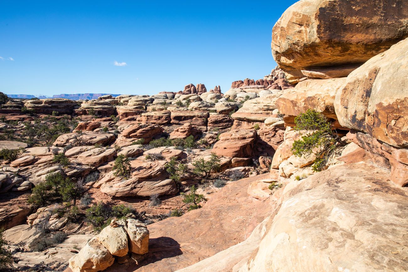
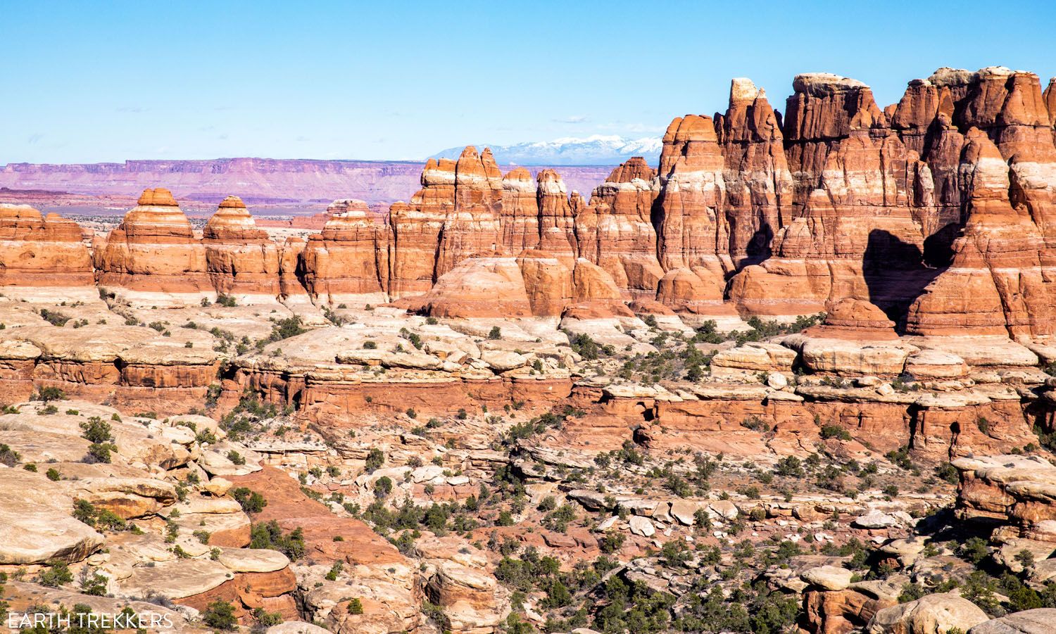
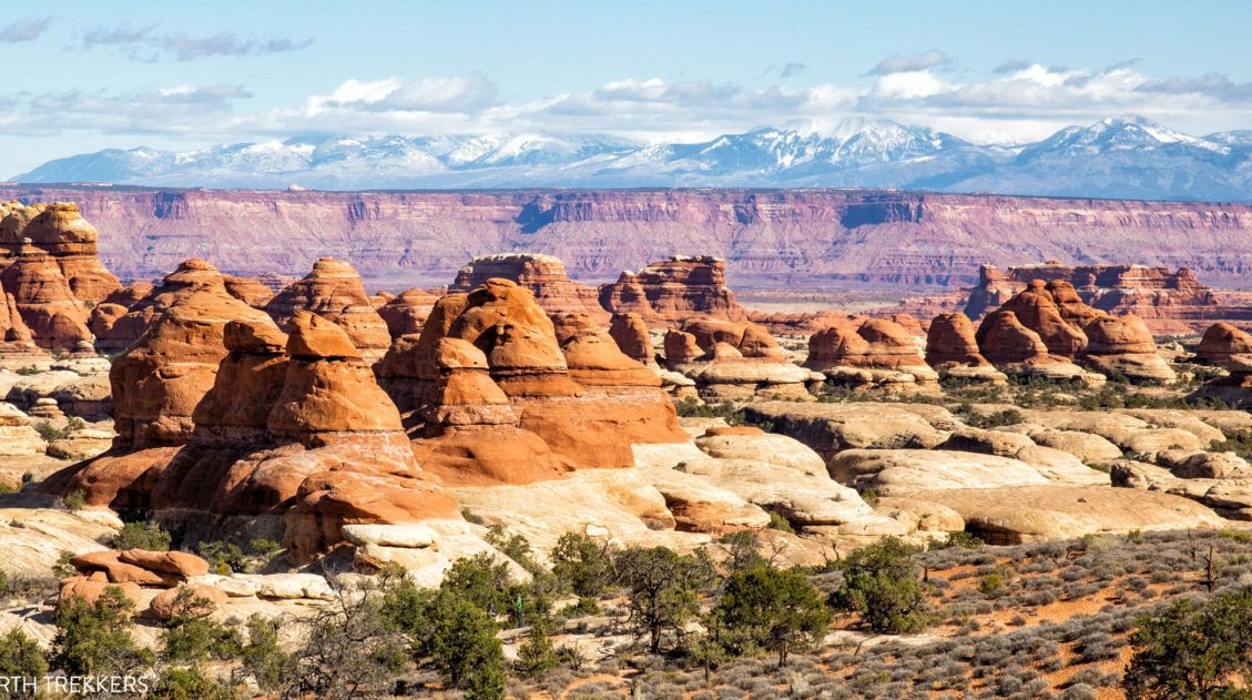
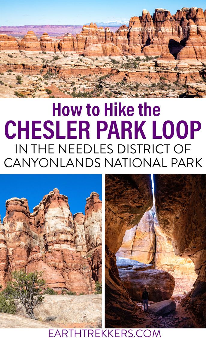
If you want to get an up-close look at the “Needles,” the sandstone spires that make the Needles district of Canyonlands National Park so uniquely beautiful, put Chesler Park on your list. It is possible to hike out and back to Chesler Park on a short day hike. But if you don’t mind going farther, hike the Chesler Park Loop with the Joint Trail for the best experience.
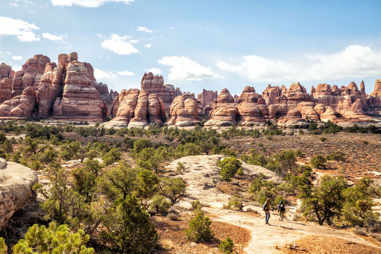
The Chesler Park Loop has a little bit of everything…easy rock scrambling, trails that criss-cross between the orange and red sandstone needles, and sweeping views out to the La Sal Mountains and the Island in the Sky district of Canyonlands National Park. Throw in a cave and a narrow slot canyon and you have a wonderful adventure in Canyonlands National Park.
This is our favorite hike in Canyonlands National Park. We’ve hiked numerous trails in Canyonlands, plus driven the White Rim Road, and this is one of the top experiences in the park. Here’s how to do it.
October 2025 Update: This guide was updated with new photos and related information about Canyonlands National Park.
Chesler Park Loop Hiking Stats
Distance: 10.7 miles (17.1 km)
Difficulty: Moderate to strenuous
Total Ascent: 2,140 feet (650 m)
Starting Elevation: 5,100 feet (1,555 m)
Highest Elevation: 5,675 feet (1,730 m)
Length of Time: 5 to 7 hours
When to Go: You can hike the Chesler Park Loop year round. The best time to do this hike is in the spring and fall, when temperatures are mild. During the summer months, temperatures can soar midday. In the winter, expect cold temperatures and snow is a possibility.
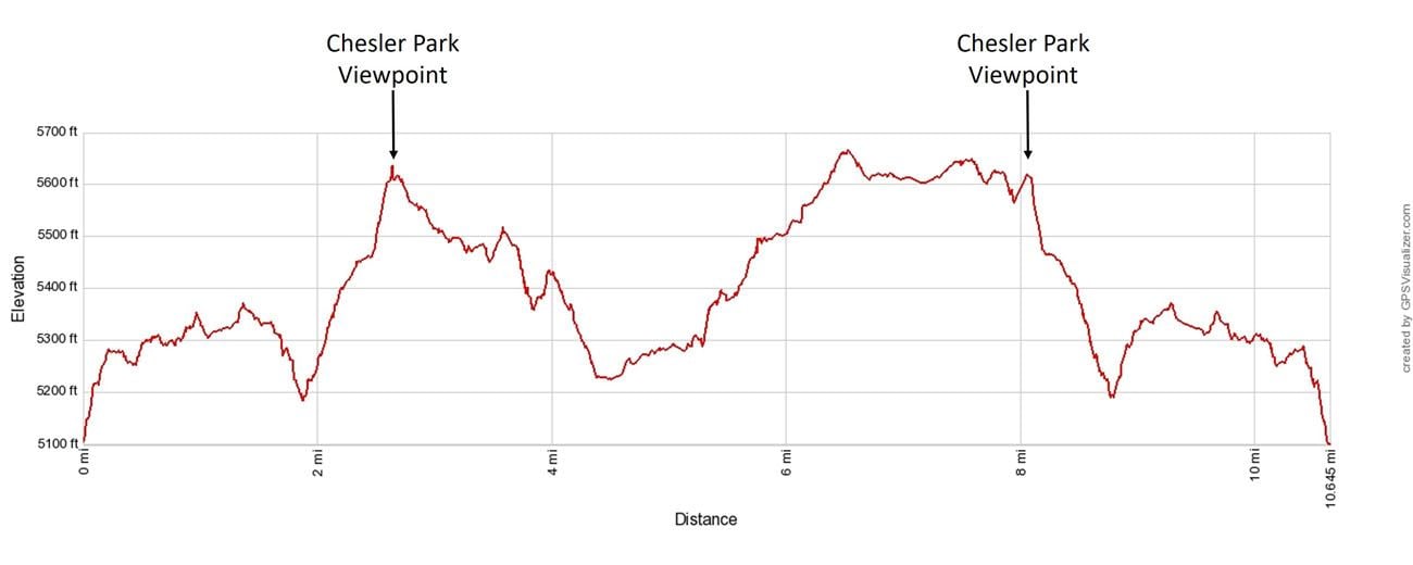
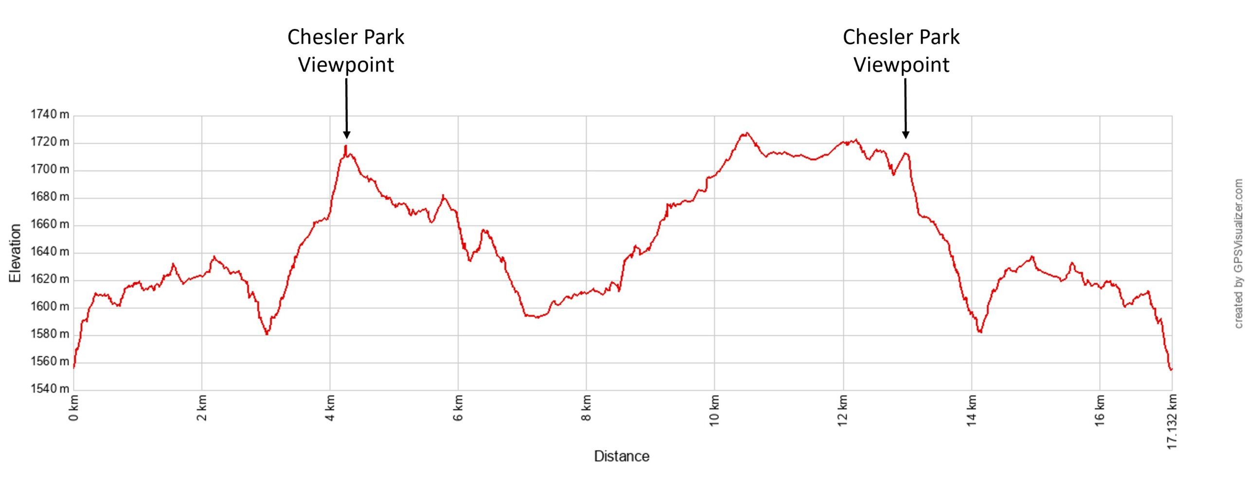
Chesler Park Loop elevation profile
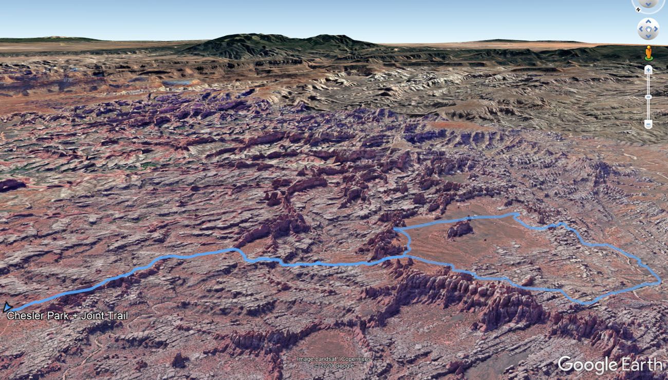
Chesler Park Loop Map
Please practice the seven principles of Leave No Trace: plan ahead, stay on the trail, pack out what you bring to the hiking trail, leave areas as you found them, minimize campfire impacts, be considerate of other hikers, and do not approach or feed wildlife.
Hiking the Chesler Park Loop
Step-By-Step Trail Guide
Getting to the Trailhead
The Chesler Park Loop starts at the Elephant Hill Trailhead in Soda Spring.
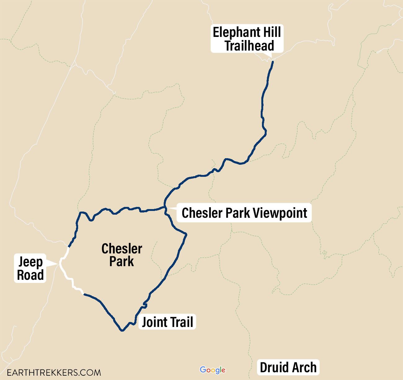
From the Needles Visitor Center, take UT-211 into the park for 3 miles. Turn left onto Federal Route 2444 towards the Needles campground. Just beyond the campground, the road becomes a dirt road that is suitable for standard cars. Follow the signs for Elephant Hill. This road “ends” at the parking lot for Elephant Hill Trailhead. If you have a 4WD, you can drive up Elephant Hill from here, but it requires a day-use permit.
The dirt road to the Elephant Hill Trailhead
Hiking to Chesler Park
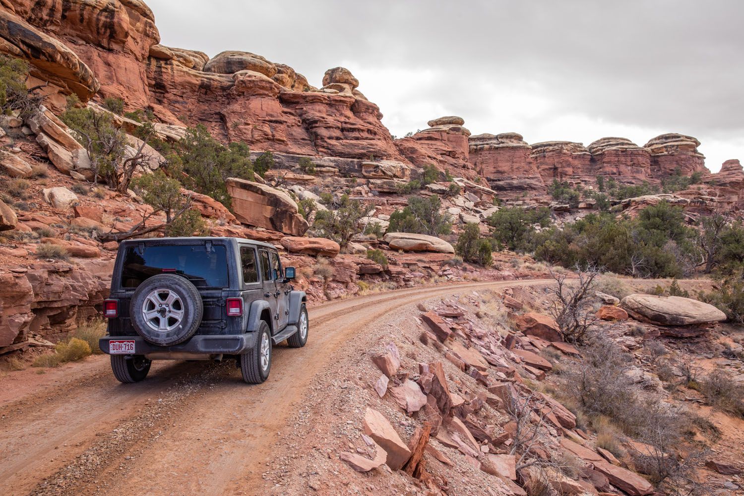
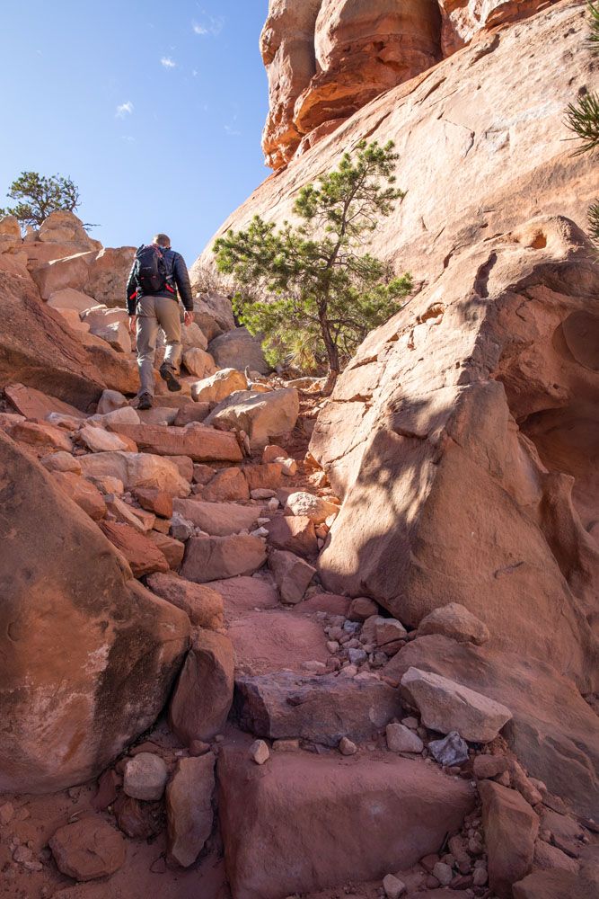
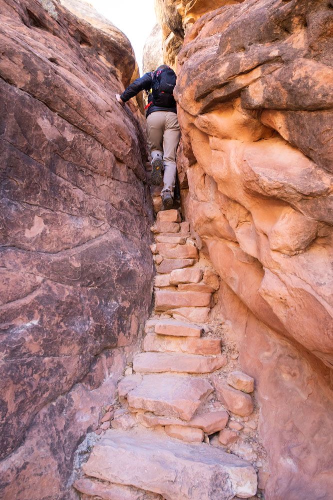
This trail starts off steep and strenuous, but fortunately, it doesn’t stay that way. You will climb up a staircase wedged between two massive boulders and then hike up a small ridge.
The staircase at the start of the hike
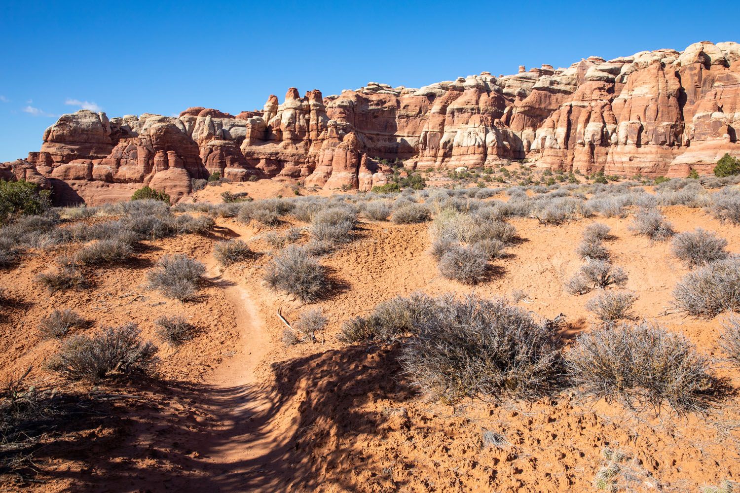
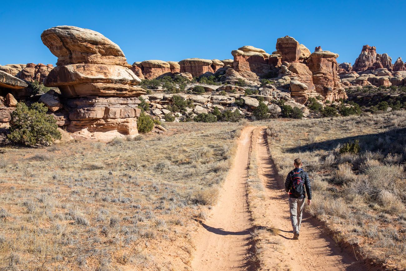
Once at the top, the trail levels out. This part of the hike is very beautiful, as you are hiking between giant knobs of orange sandstone rock.
1.5 miles into the hike, you reach your first trail junction. Continue on the trail to Chesler Park.
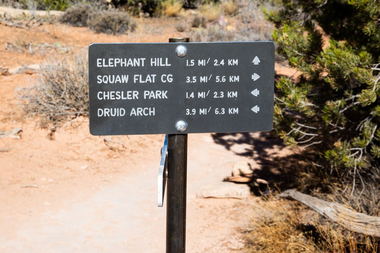
Note: The entire trail is marked with rock cairns that are very easy to follow. At each trail intersection (there will be quite a few on this loop), there is sign with trail names, destinations, and distances.
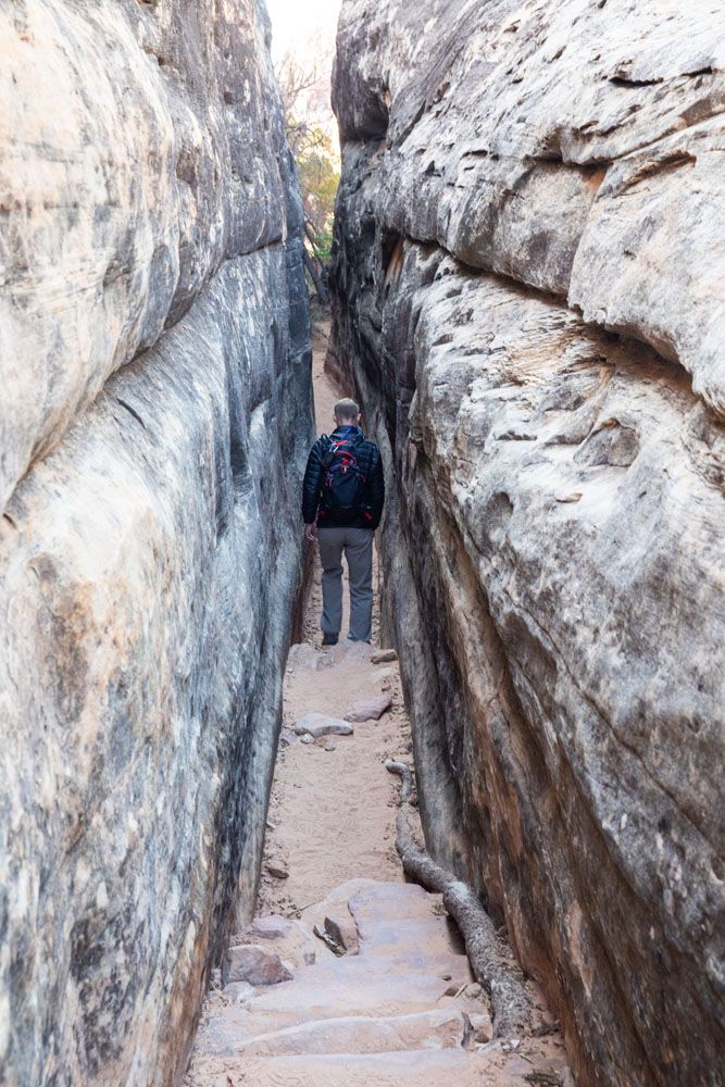
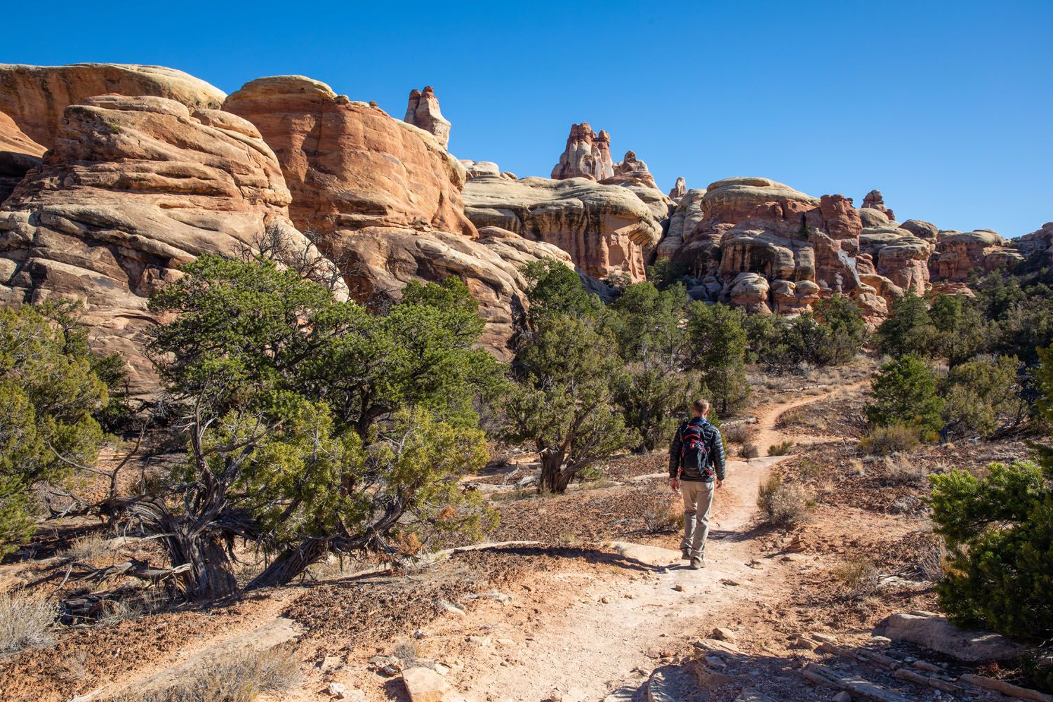
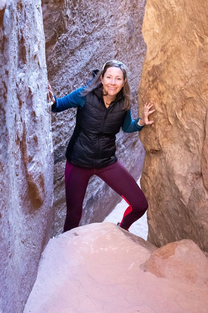
For the next 1.4 miles, the trail gets to be a little more challenging, and a little more interesting. Along the way, you will have short climbs and descents, you will walk through a short, narrow slot canyon, and start to have better views of the needles.
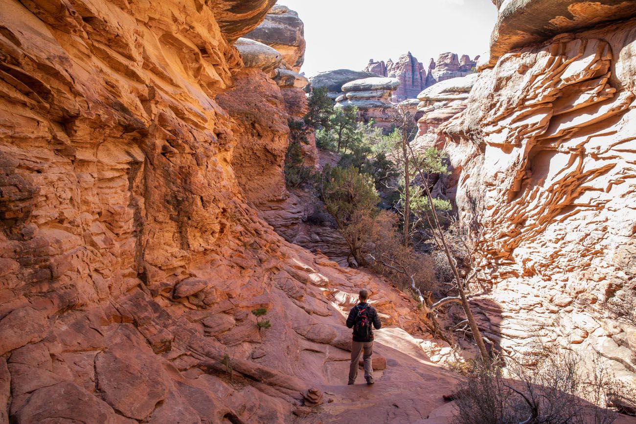
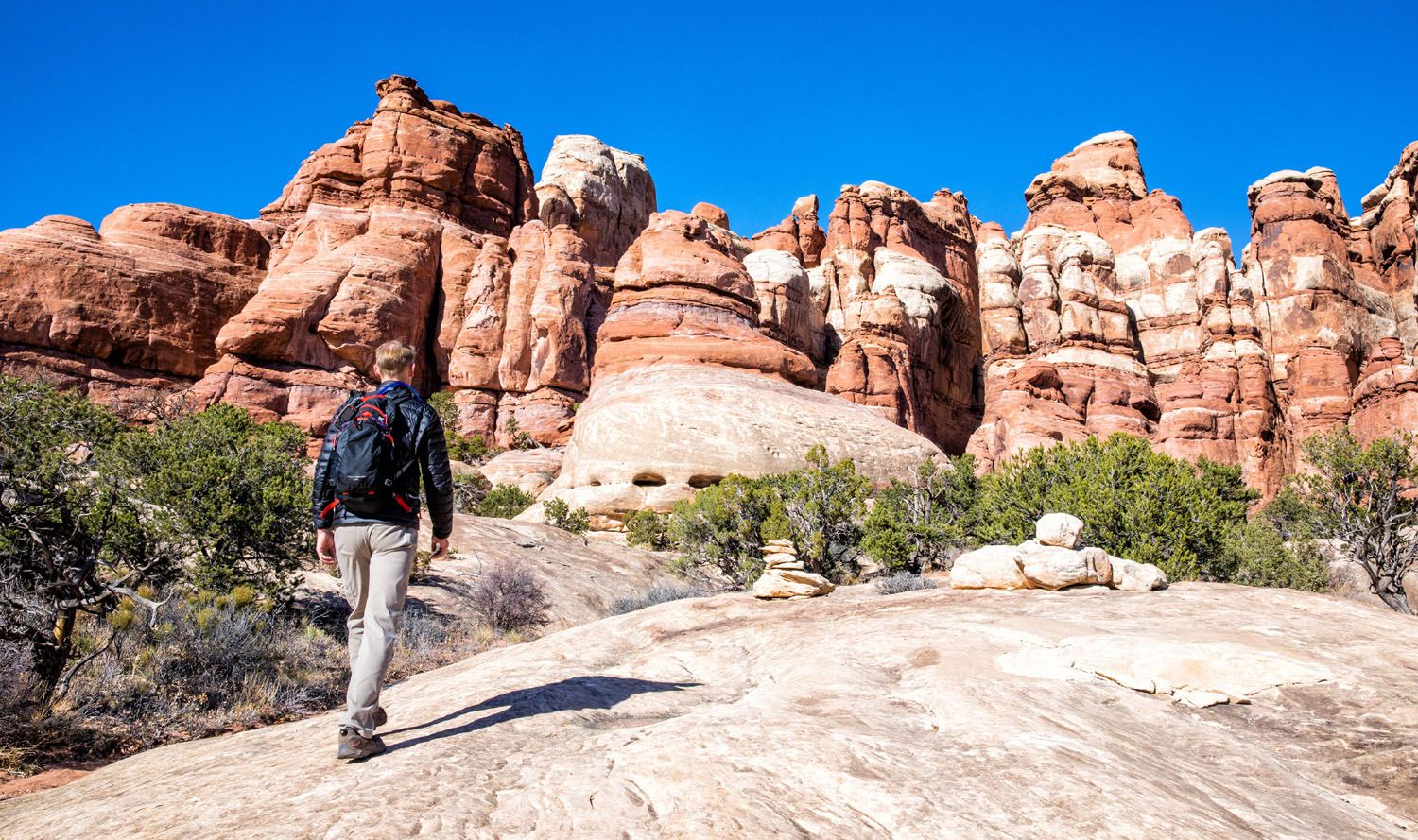
To get to Chesler Park, it’s a short, steep climb up and over a rocky ridge. You will have to do some very easy rock scrambling here.
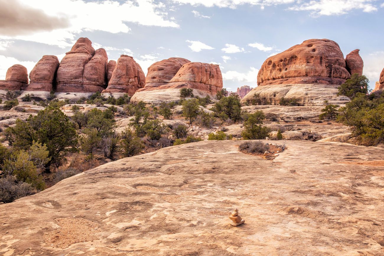
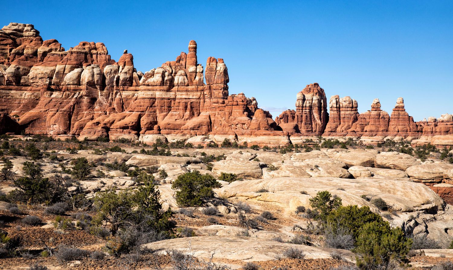
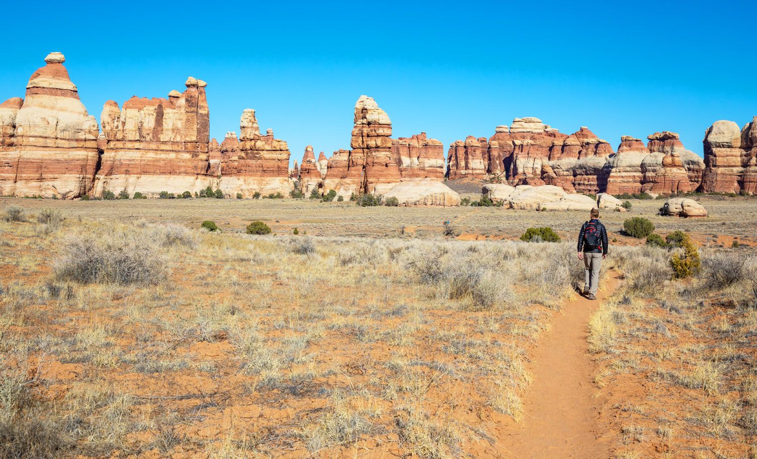
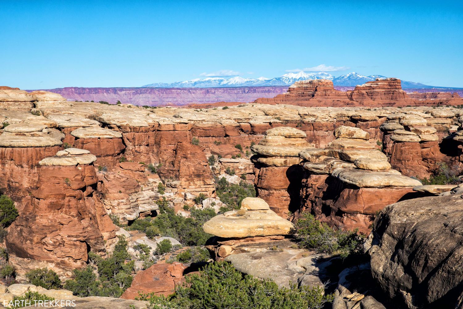
From the ridge (labeled “Chesler Park Viewpoint” on the elevation profile), you have spectacular panoramic views over the Needles. To the northeast, you look out over the trail you just hiked. Off in the distance are the La Sal Mountains. To the south is Chesler Park.
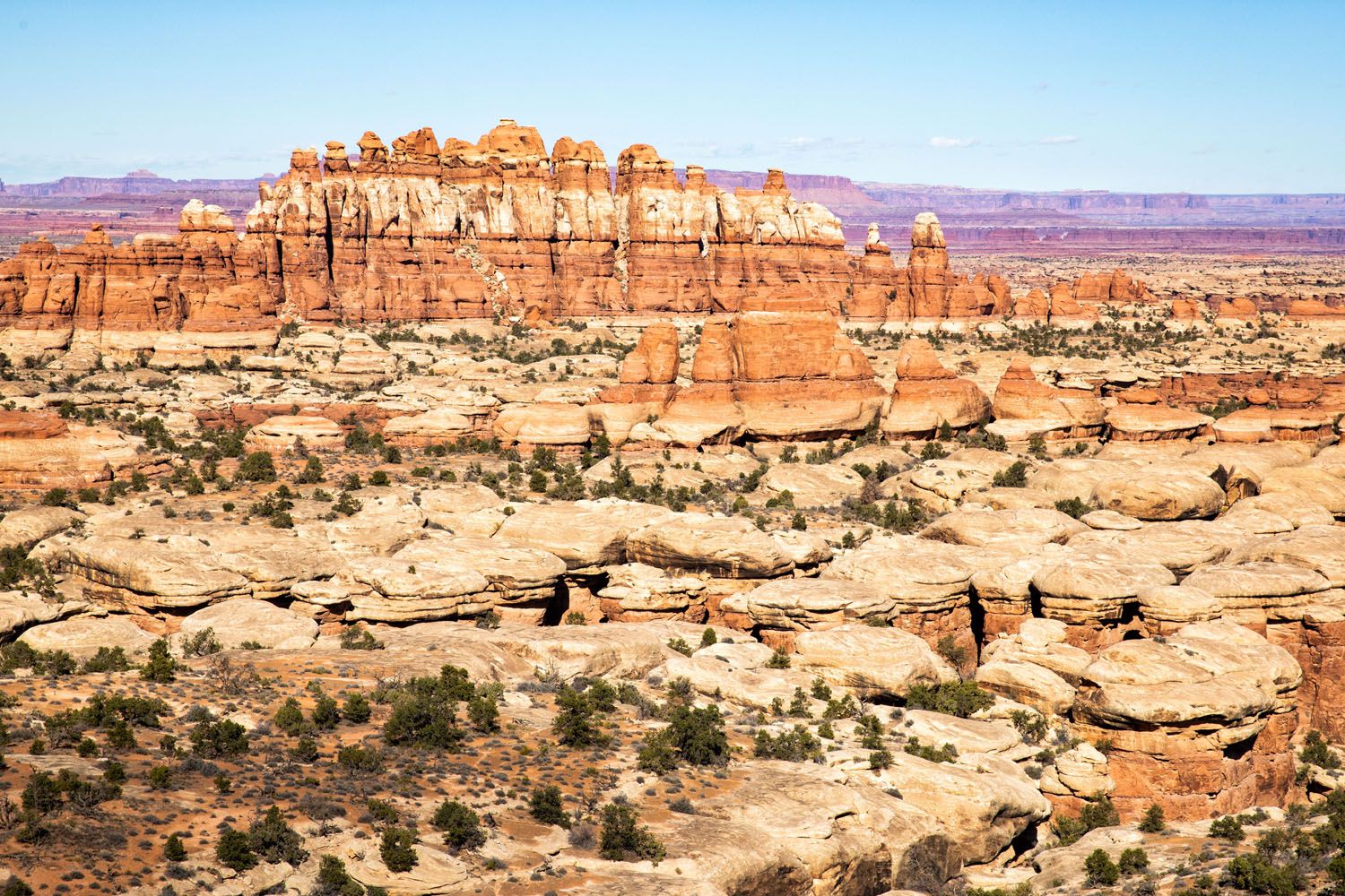
Looking north towards Island in the Sky district of Canyonlands National Park.
You can turn around at this point, making the hike 6 miles out-and-back with a total ascent of 1,250 feet. But if you have the time and energy, it’s well worth it to keep going. The Joint Trail is tons of fun and the walk through Chesler Park is beautiful.
Chesler Park Loop
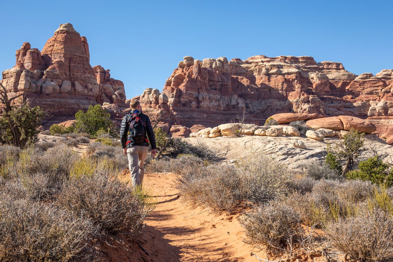
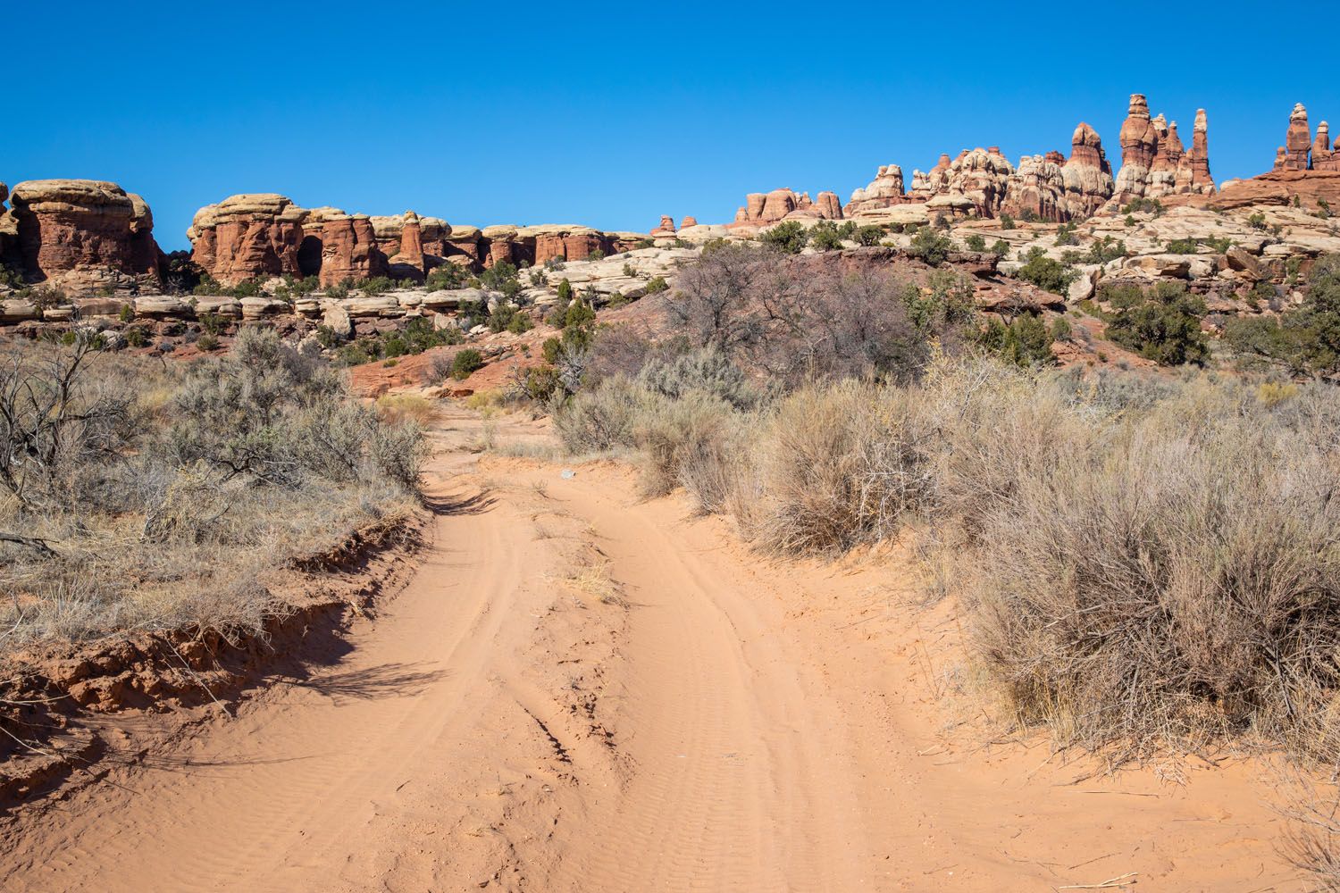
The next part of this hike is a loop. You can do it in either direction. We did it counter-clockwise and this is the way that I recommend. In this direction, you get the tougher parts of the loop over with early and end the loop on a flat, easy trail with spectacular close-up views of the needles.
As you drop down into Chesler Park, you will walk just a tenth of a mile until you reach another trail junction. Turn right to follow the loop counter-clockwise, towards the Joint Trail and Devil’s Kitchen Campground.
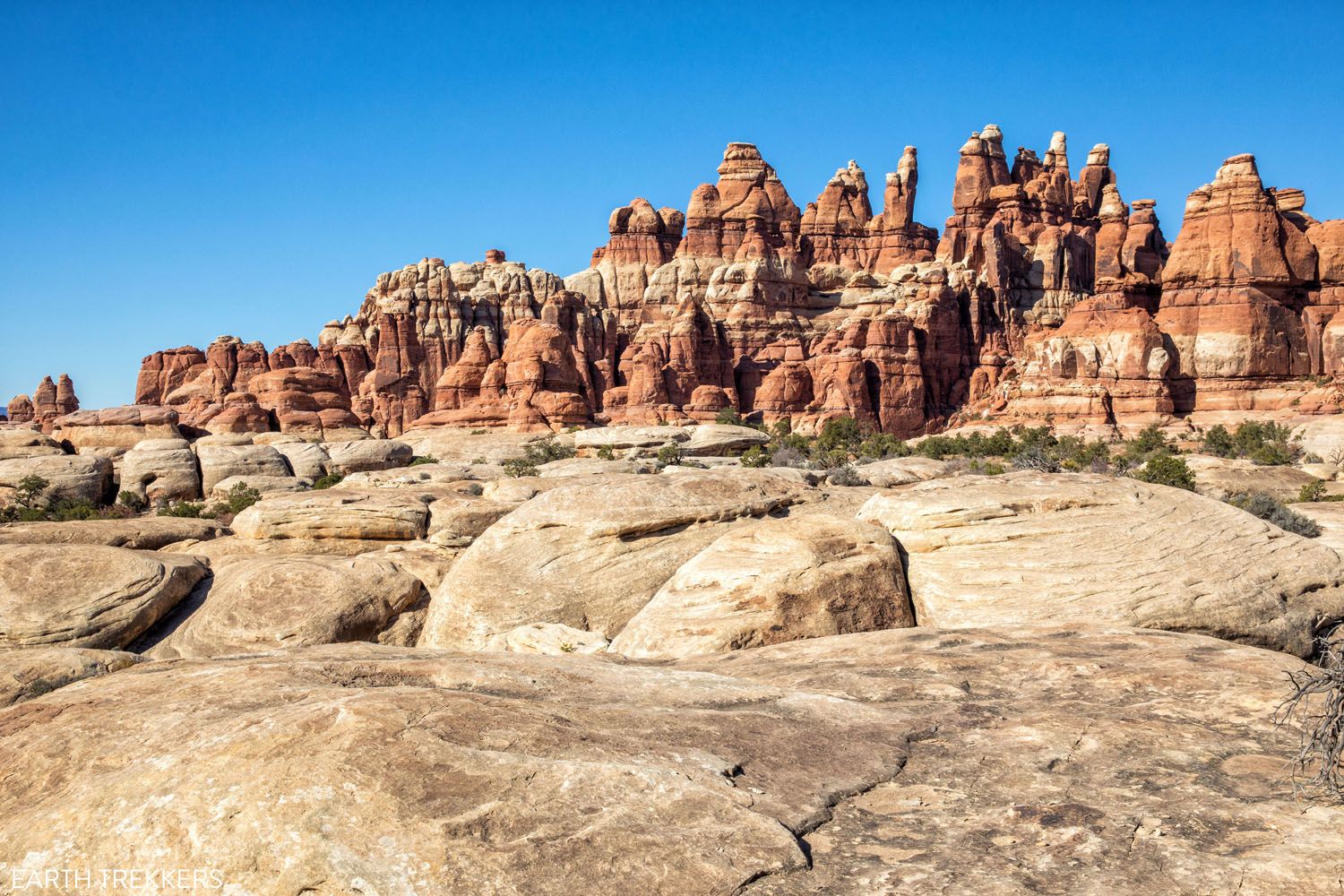
For the next 1.3 miles, you hike alongside a group of sandstone needles. There will be a few short climbs and descents, and the trail is constantly twisting and turning. Keep an eye on the rock cairns so you don’t lose your way.
You will come to another trail junction. At this point, follow the sign for the Jeep road. When the trail hits the Jeep road, turn left to continue on the loop. At the fork in the Jeep road, go left. In 0.5 miles, the Jeep road ends at the Joint trailhead.
On the Joint Trail
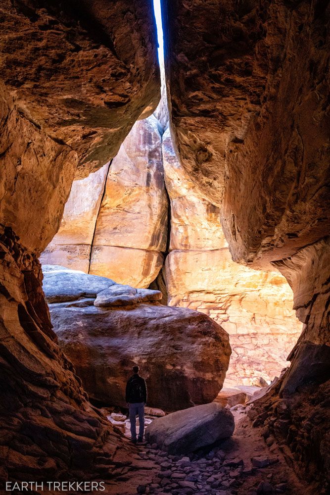
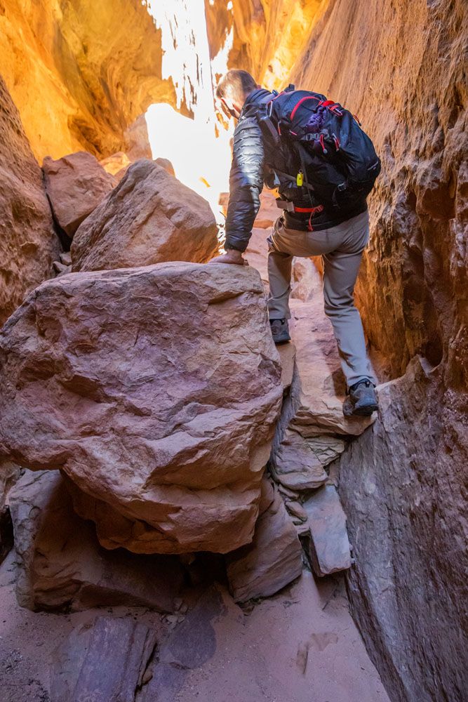
The Joint Trail is 1.5 miles long. Halfway down the trail, you will have a short but steep climb as you hike through a dense collection of the sandstone spires. This is where the hike really gets interesting.
After a short, steep, climb up an extremely narrow staircase, you enter a large cave.
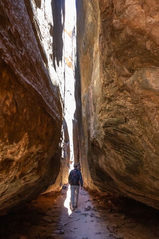
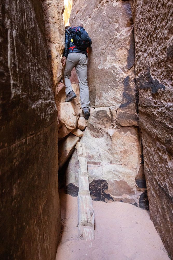
The slot canyon, one of the best parts of this hike, comes next. This slot is long, skinny, with a few brief sections where you will rock scramble up and over obstacles.
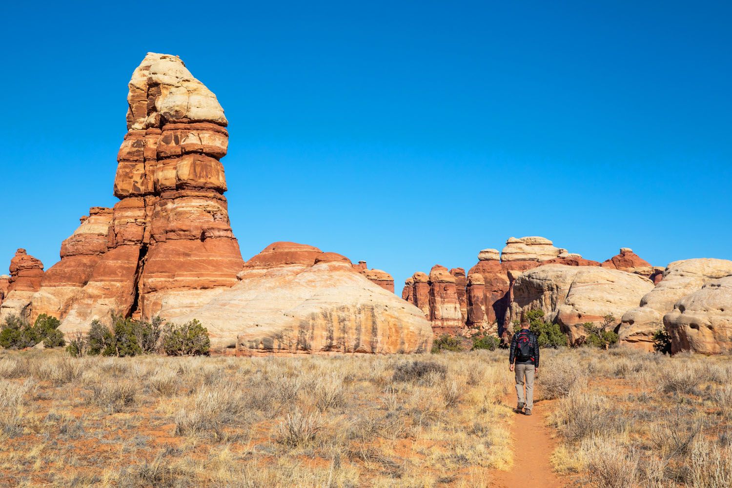
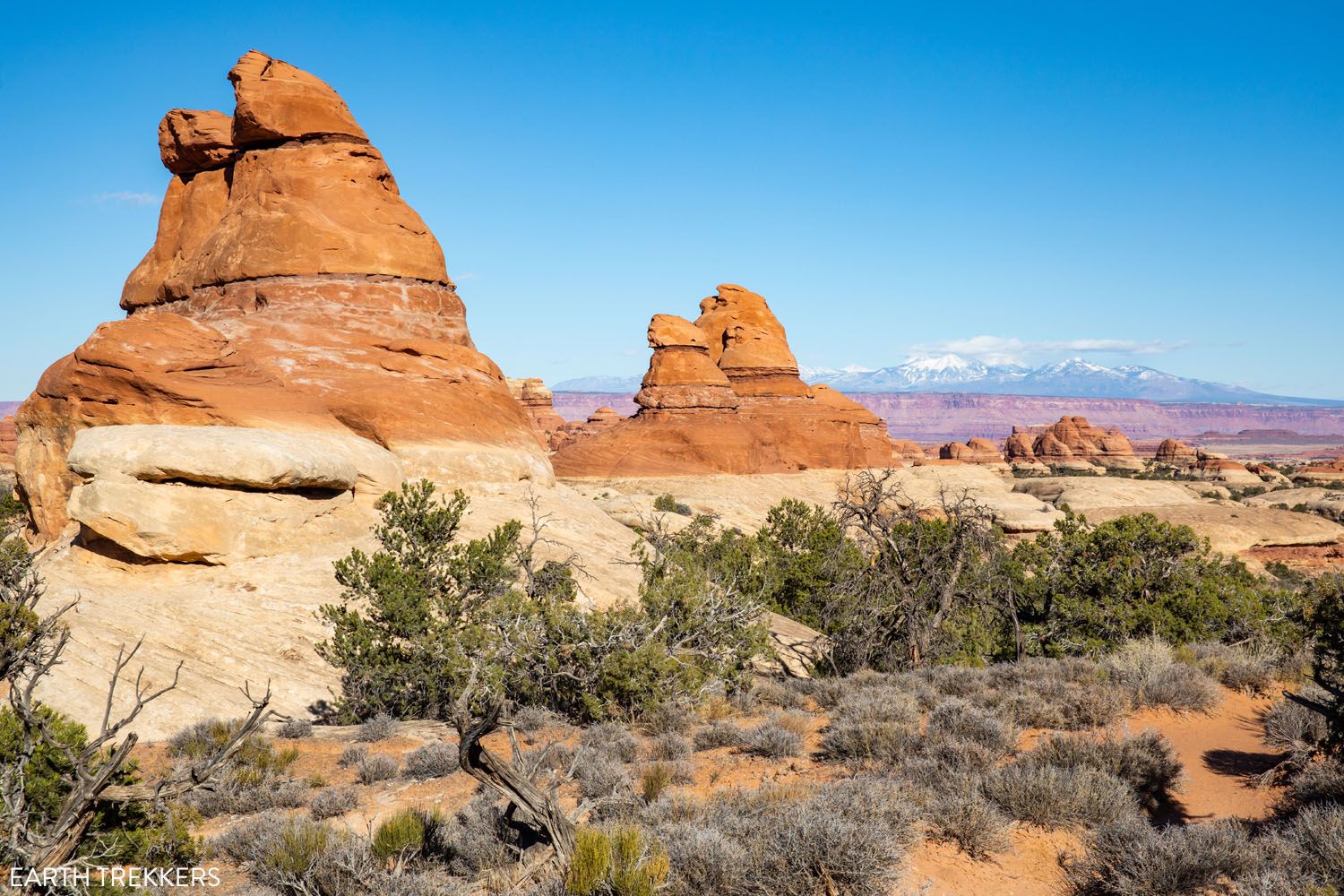
Once you exit the slot canyon, you are back in Chesler Park. The next part of the walk is flat, fast, easy, with more views of the needles. This was one of my favorite parts of the hike. It’s a nice break from the ups and downs along the trail and the views are amazing.
Before getting back to the saddle, where the Chesler Park Loop ends, you will get to another viewpoint out over the Needles District with the La Sal Mountains off in the distance.
The Return Hike
The loop ends back at the saddle (Chesler Park Viewpoint) in the Needles. From this point, it is a 3-mile walk back to the Elephant Hill parking area and mostly downhill.
View on the return hike.
Summary of the Trail
Since there are so many trail junctions, here is a summary of the trail:
- Start at the Elephant Hill Trailhead and follow signs for Chesler Park.
- 1.5 miles from the trailhead, at the trail junction, continue to Chesler Park, which is 1.4 miles from this junction.
- 1.8 miles from the trailhead, cross the sandy wash to continue to Chesler Park.
- 2.7 miles from the trailhead, at the next junction, continue to Chesler Park, which is 0.2 miles from this junction.
- 2.8 miles from the trailhead you reach the saddle and the Chesler Park Viewpoint.
- 2.9 miles from the trailhead is where the Chesler Loop Trail begins. Turn right here to hike it counter-clockwise (follow the trail sign for Joint Trail TH 2.4 miles and Devil’s Kitchen CG 2.6 miles).
- 4.1 miles from the trailhead you reach a junction. Follow signs for Jeep Road, which is 0.4 miles from this junction.
- At the Jeep Road, turn left. In 0.2 miles, the road will fork. Turn left here, following the sign for Chesler Park Trailhead. In 0.5 miles you will reach the Joint Trail.
- The Joint Trail is 1.5 miles long. It ends in Chesler Park. Follow signs back to Elephant Hill to complete the hike.
To simply things, from the trailhead, follow signs for Chesler Park. Once you reach Chesler Park, follow signs for the the Joint Trail. After hiking the Joint Trail, follow signs for Elephant Hill to complete the hike.
Tips to Have the Best Experience
If you plan to visit the Needles from June through September, be aware that it can get brutally hot. Plan to start this hike first thing in the morning, when temperatures are at their coolest.
There is a toilet at the Elephant Hill parking lot.
The trail is well-marked with rock cairns and trail signs. We didn’t have any problems staying on the trail. But with all of the junctions and spur trails, I think it is beneficial to bring along a map. We carry a Garmin GPS and wear Garmin Fenix watches, which come loaded with trail maps. Another option is to purchase the National Geographic Needles District Map, especially if you plan to do more hikes in the Needles. At the very least, take a photo of trail map on the sign at the trailhead with your phone.
Do not expect your cell phone to work. For most of this hike we had zero cellular service. There were a few spots in clearings or at higher elevations where we got a few bars of LTE or 3G, barely enough to send a text message. But don’t depend on your phone to call for help, talk to friends, or send photos to friends and family.
What to Bring on the Hike
Hiking shoes. Don’t do this hike in anything other than hiking shoes or hiking boots.
Hiking poles. Hiking poles take the stress off of your legs and help to ease leg pain and fatigue.
Water and snacks. At least 4 liters of water in the summer.
Sunscreen, hat, and sunglasses. For most of this hike you will be exposed to the sun, with very little shade.
Camera. Even a smartphone will do.

Essential Hiking Gear: What Should You Bring on a Day Hike?
If you are new to hiking or are curious about what you should bring on a hike, check out our Hiking Gear Guide. Find out what we carry in our day packs and what we wear on the trails.More Things to Do in Canyonlands
We LOVE Canyonlands National Park. In fact, it’s one of our favorite US National Parks and we’ve been here multiple times in recent years.
To plan your trip to the Needles, don’t miss our guide on the Best Things to Do in the Needles.
Driving the White Rim Road is our favorite experience in Canyonlands. It requires some advance planning, and you’ll need a permit, but it’s worth the effort.
We also have detailed guides on Things to Do in Island in the Sky plus a list of the Top Experiences in Canyonlands National Park (all districts).
If you have any questions about hiking the Chesler Park Loop, or if you want to share your experience, let us know in the comment section below.
More Information about Canyonlands & Utah
If this is part of a bigger road trip, visit our Utah Travel Guide for more information about Utah and our United States Travel Guide for more inspiration and travel planning tips in the USA.
Canyonlands National Park Travel Guide
Pinterest Facebook Flipboard Canyonlands National Park Canyonlands National Park is one of the most underrated national parks in the USA. It’s also one of our favorites. This sprawling national park preserves the canyons, buttes, mesas, and arches that have been carved out by the Colorado and Green Rivers. It also contains the rock art of […]
12 Amazing Things to Do in The Needles, Canyonlands National Park
The Needles is an often overlooked section of Canyonlands National Park. But those who take the time to visit the Needles are rewarded with thrilling, unique hiking trails, low crowds, and jaw-dropping views of Canyonlands National Park. In this post, we cover the 12 best things to do in the Needles…12 great reasons why this […]
Best Things to Do in Island in the Sky: Canyonlands National Park
Canyonlands National Park is an underrated park located near Moab, Utah. Compared to its smaller and more popular neighbor Arches National Park, Canyonlands feels more rugged, more remote, and a whole lot larger. Island in the Sky, the most popular section of Canyonlands, is filled with jaw-dropping vistas and short but sweet hiking trails. Here […]
Two Week American Southwest Road Trip: Grand Canyon & Utah’s Mighty 5
This is one of the best road trips in the USA. On this American Southwest road trip, you will visit Utah’s Mighty 5, the Grand Canyon, and a handful of wonderful state parks and national monuments. This is the itinerary I wish we had when we planned our first road trip to the American Southwest. […]
Arches, Canyonlands and Capitol Reef: 7 to 10 Day Road Trip Itinerary
Arches, Canyonlands, and Capitol Reef National Parks are three spectacular parks to visit in Utah. With 10 days, you can visit each of them, plus a few more cool spots, on this epic road trip. Tim and I did this road trip in November 2020. Prior to this trip, we had already visited each of […]
Where to Stay in Moab: Best Hotels, Resorts & Campsites for Every Budget
Trying to decide where to stay in Moab? From upscale resorts and spacious bungalows to highly rated inns, hotels, and campsites, Moab offers something for every travel style and budget. We’ve visited Moab four times, using this small town as our gateway to the stunning landscapes of southeastern Utah. Surrounded by dramatic red rock formations […]
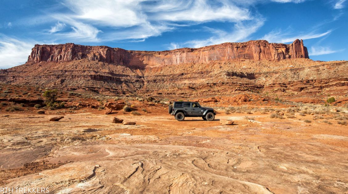
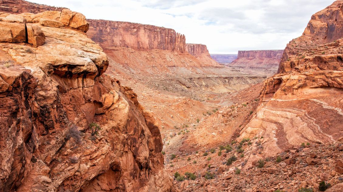
How to Drive the White Rim Road: Map, Photos & Driving Tips
Driving the White Rim Road is the experience of a lifetime. If you are looking for adventure, solitude, incredible views, and a totally different way to experience Canyonlands National Park, put this drive on your list. Along the drive, you will gaze up at the Island in the Sky mesa and peer down into the […]
How to Hike the Syncline Loop in Canyonlands National Park
For years, I heard amazing things about the Syncline Loop. This tough hike is known for its outstanding views, and due to the primitive nature of the trail, it is only recommended for experienced hikers. It got such rave reviews in the hiking community and it sounded so thrilling that we couldn’t wait to hike […]
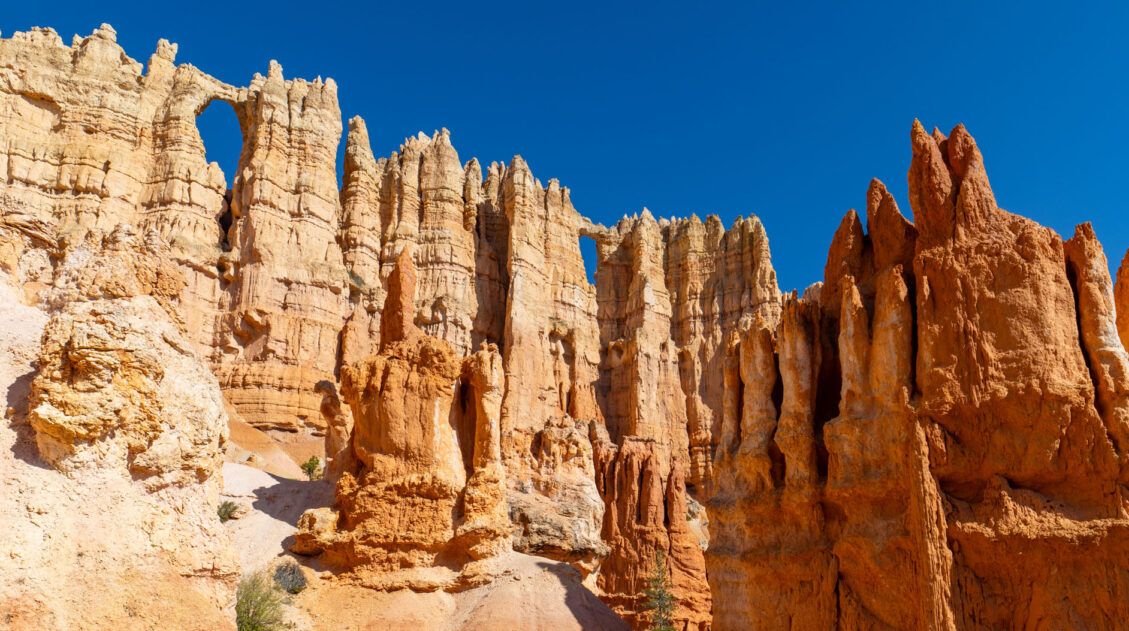
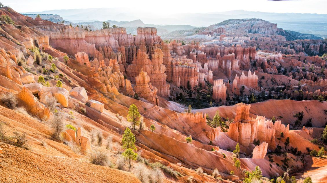
Figure 8 Trail in Bryce Canyon: The Ultimate Trail Guide
The Figure 8 Trail combines three popular trails together into a single hike. This includes the Queen’s Garden Trail, the Peekaboo Loop Trail, and the Navajo Loop Trail. All of these trails take you through the amphitheater at Bryce Canyon National Park, where you will be surrounded by hoodoos and sandstone rock formations. This trail […]
Utah’s Mighty 5: How to Plan the Perfect Road Trip Itinerary
Stretching across southern and central Utah are five stunning national parks. Called the Mighty 5, these parks contain some of the most thrilling hiking trails and iconic landscapes in the United States. Stand atop Angels Landing in Zion. Gaze across a wonderland of hoodoos at Bryce Canyon. Explore the Water Pocket Fold at Capitol Reef. […]
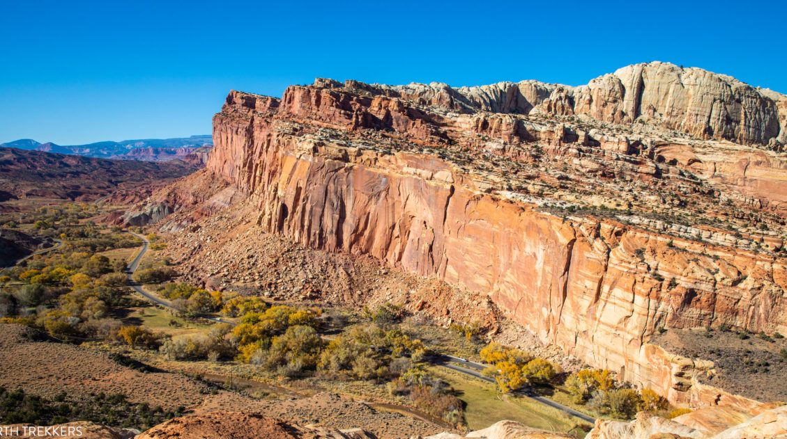
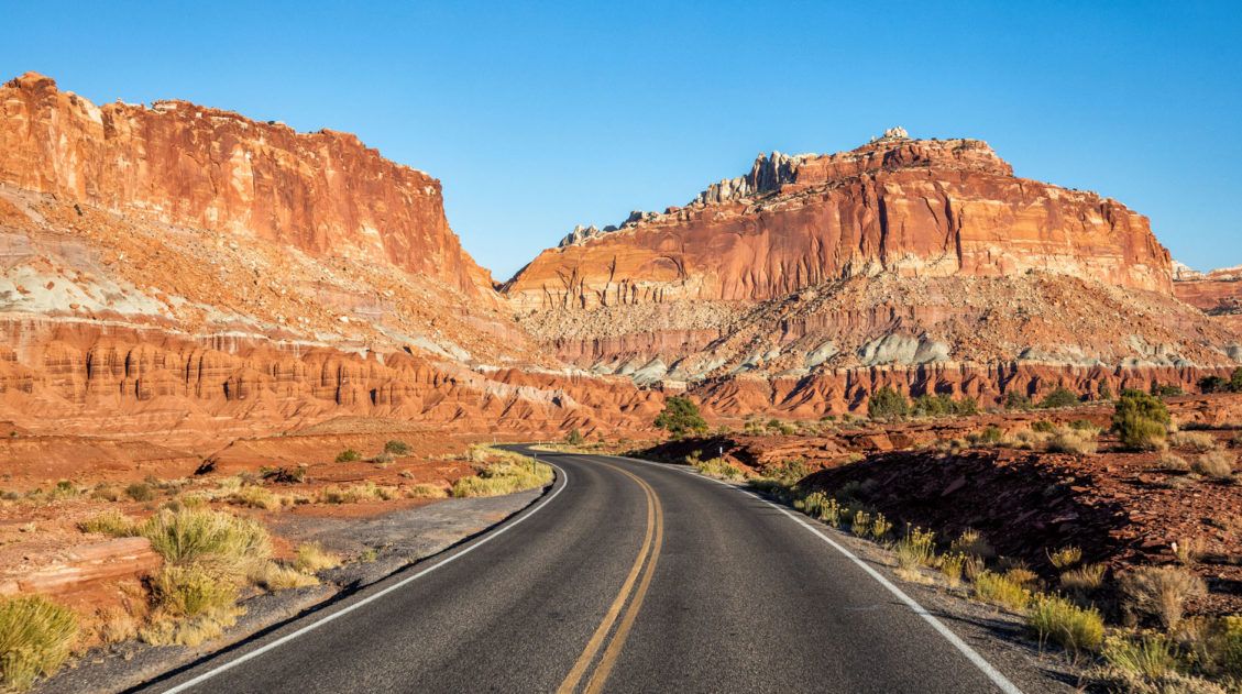
14 Amazing Things to Do in Capitol Reef National Park
Capitol Reef, often an overlooked national park, is full of many wonderful surprises. With two amazing scenic drives, hiking trails that rival those in Zion, rugged, remote areas to explore by 4×4, short, easy slot canyons, historical landmarks, and even delicious pie, this national park is absolutely amazing. In this post, learn about the best […]
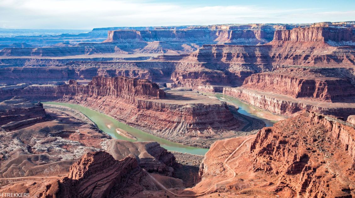
Best Things to Do in Dead Horse Point State Park
Have you ever visited a place where you didn’t quite know what to expect and then it just blew you away? For us, that was Dead Horse Point State Park. Nearby Arches and Canyonlands National Parks get all of the attention (and all of the visitors). When looking for more things to do in the […]
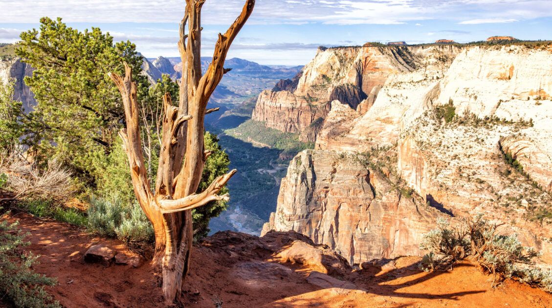
Best Hikes in Zion: 15 Trails from Beginner to Advanced
Zion National Park is one of the best places in the United States to go hiking. From the awe-inspiring hike up Angels Landing to the family-friendly Riverside Walk to multi-day backpacking adventures, there is something here for everyone. In this guide, we cover the best hikes in Zion National Park, from popular trails to hidden gems. […]
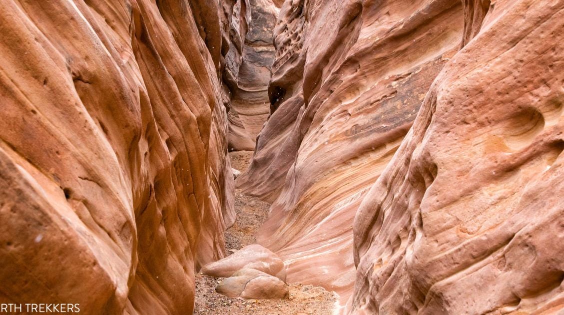
Little Wild Horse Canyon – Bell Canyon Loop: A Step-By-Step Guide
Little Wild Horse Canyon is one of the most thrilling slot canyons in Utah. With tight passageways, curving, scalloped walls, and short sections of easy rock scrambling, this hike is fun for both kids and adults. You can hike the narrowest (and most fun) section of Little Wild Horse as a fast out-and-back hike, or […]

The Ultimate Guide to the 63 US National Parks
Stretching from the South Pacific, across the United States to the Caribbean, are 63 national parks. These national treasures preserve iconic landscapes, majestic mountains, primordial forests, arid deserts, misty coastlines, immense canyons, wildlife, and historic landmarks. We have visited 56 of the 63 US national parks, from the towering granite walls of Yosemite and the […]

Comments 18