Have you ever visited a place where you didn’t quite know what to expect and then it just blew you away? For us, that was Dead Horse Point State Park.
Nearby Arches and Canyonlands National Parks get all of the attention (and all of the visitors). When looking for more things to do in the area, Dead Horse Point State Park caught our eye. First of all, what a unique name! And with it sitting just next door to Canyonlands, I figured, why not stop by and check it out?
Well, I am so glad we did. The place is awesome. It has all of the ingredients of a perfect outdoor destination: easy but fun hiking trails, low crowds, and a jaw-dropping view that just may be better than anything you would get in the nearby national parks. Plus, its small size makes it easy to explore if you are short on time.
Here are five great things to do in Dead Horse Point State Park…5 reasons why you should put this on your Utah to-do list.
Quick Facts About Dead Horse Point State Park
Location: Dead Horse Point State Park is located east of Canyonlands National Park. The closest city is Moab, Utah. To get here from Moab, it is a 45-minute drive (33 miles). From US-191, turn left onto UT-313 and drive until it ends at Dead Horse Point. For reference, if you drove from the Visitor Center of Dead Horse Point to the Canyonlands Island in the Sky Visitor Center, it would take you 20 minutes (14 miles).
Cost: $20 per vehicle for up to 8 people, valid for 2 days; $10 per motorcycle; $10 if you bike-in or walk-in
Hours: 6 am to 10 pm year round
When To Go: The best time to go is during the spring and fall months. It can get very hot during the summer months. During the winter, expect freezing temperatures with the possibility of snow. We were here at the very end of December. The high temperature was 30°F on the day we visited the park.
Official Website: https://stateparks.utah.gov/parks/dead-horse/
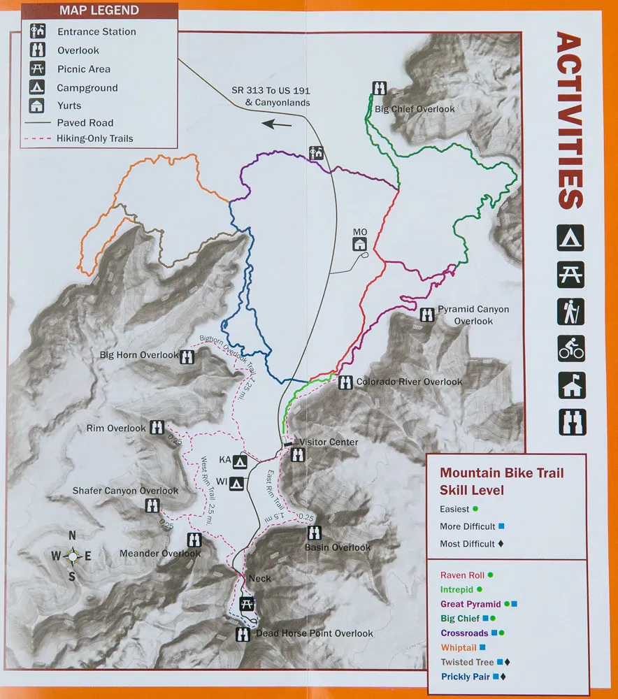
Map of the park
Why is it Called Dead Horse Point?
Dead Horse Point is a long, skinny mesa. The narrowest point of the mesa is called the “neck,” and beyond this is one final outcropping of land with drop offs on all three sides.
Legend has it that cowboys corralled wild mustangs on the tip of this mesa and then fenced off the neck with branches and brush. The cowboys picked the best mustangs and left the rest of the horses trapped on the point, without water, leaving them to die.
Best Things to Do at Dead Horse Point State Park
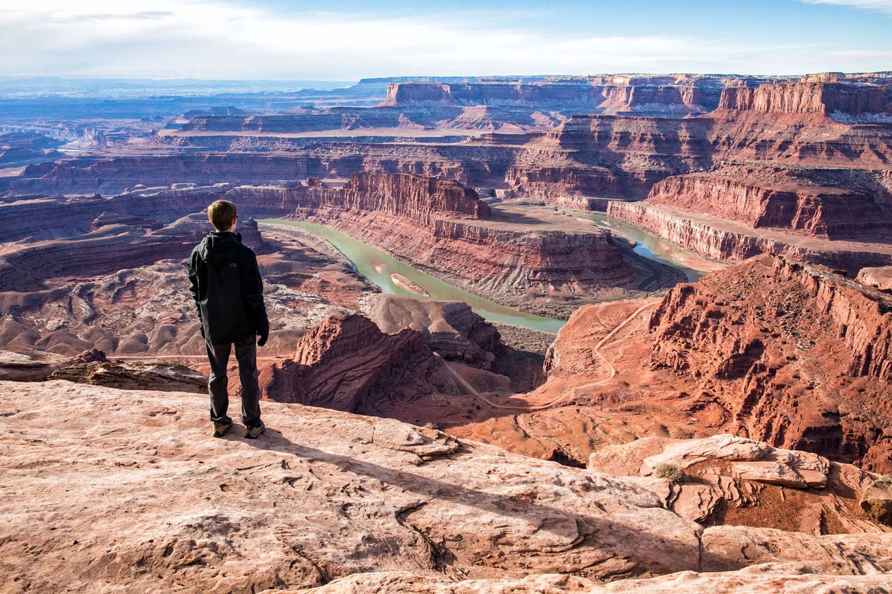
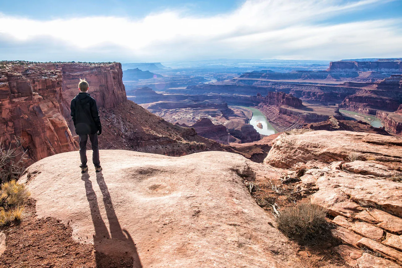
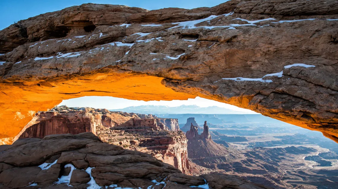
Dead Horse Point Overlook
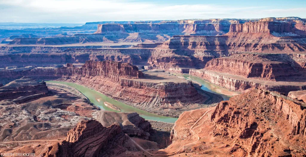
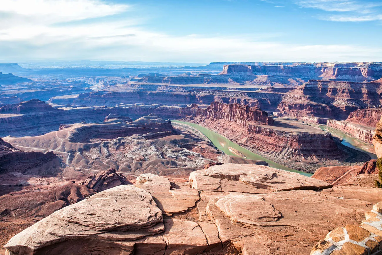
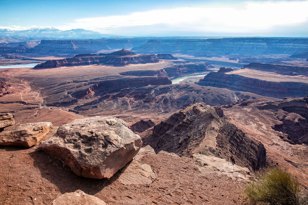
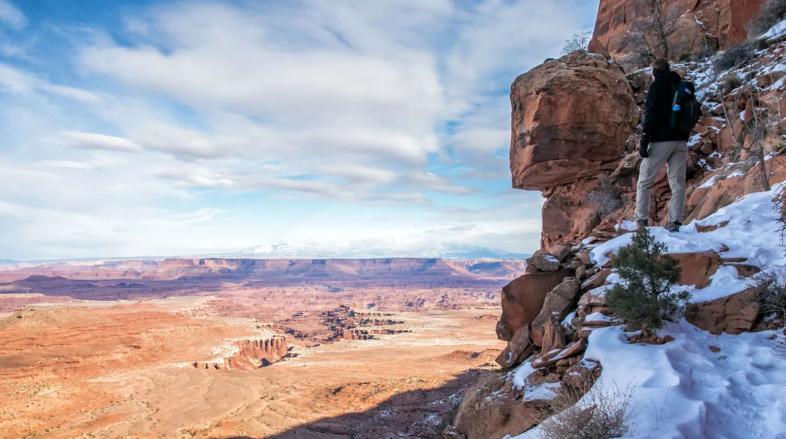
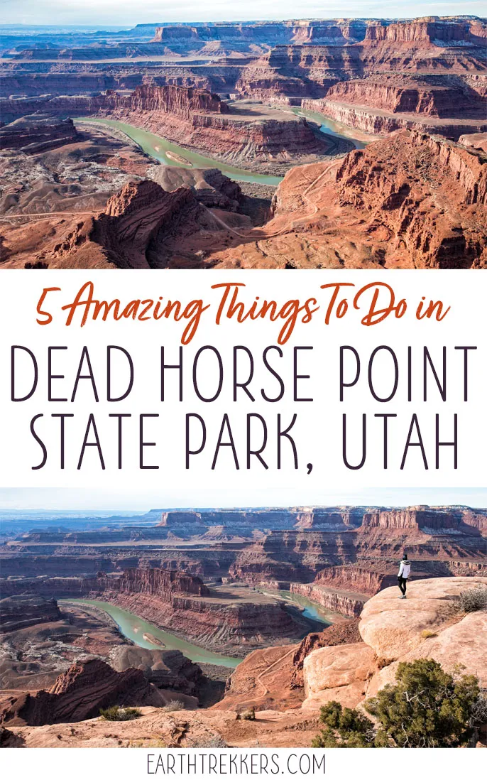
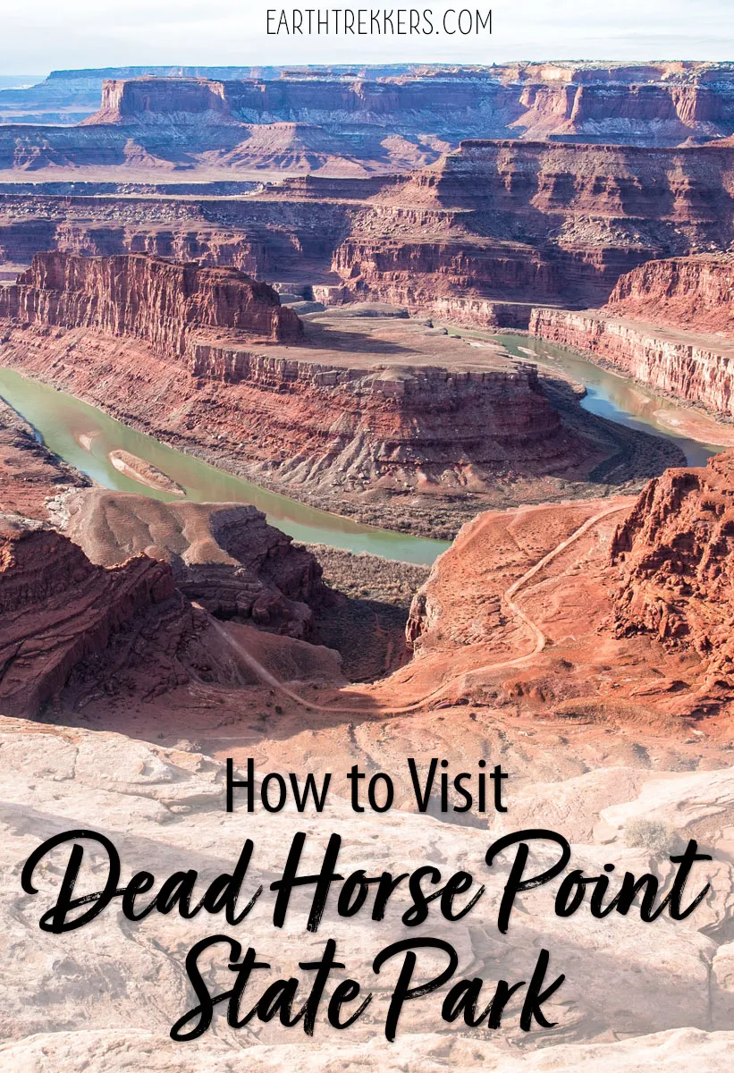
If you only did one thing here, it should be to enjoy view from the Dead Horse Point Overlook. It is incredible!
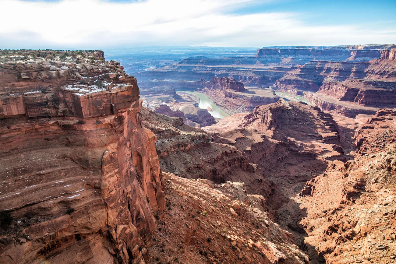
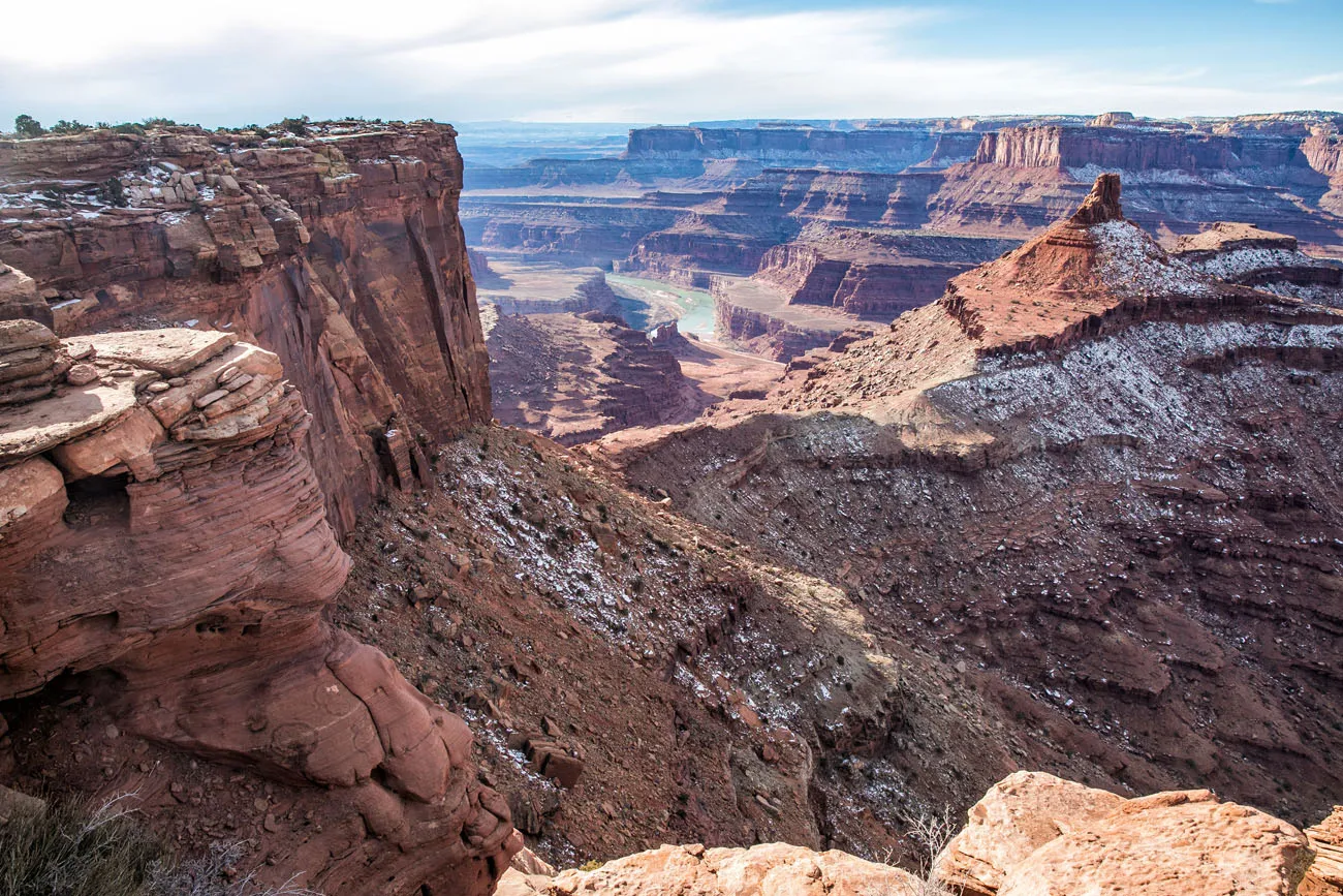
The road through the park ends at small parking lot for this viewpoint. From here, you can look out across a stunning landscape filled with buttes and mesas. Twisting through the canyon 2000 feet below the overlook is the mighty Colorado River.
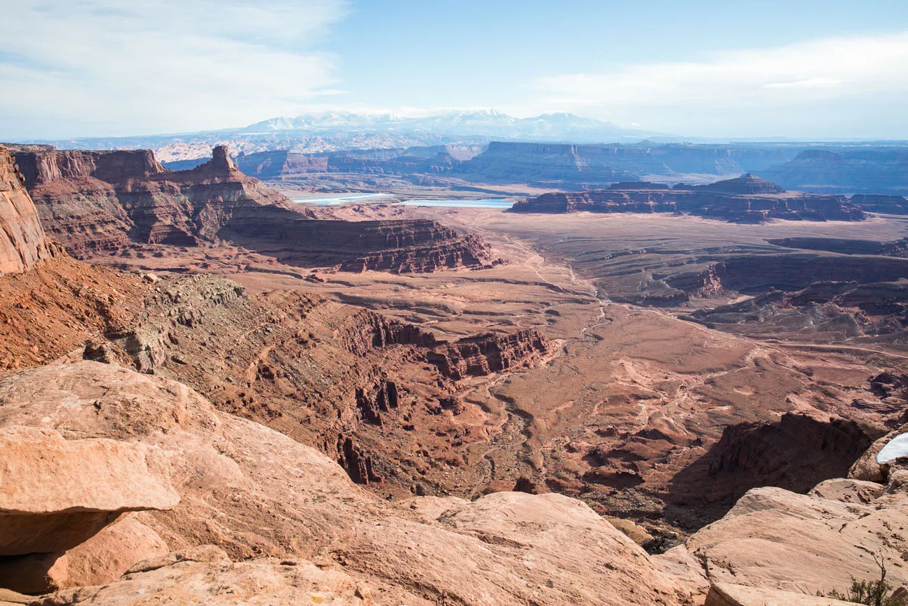
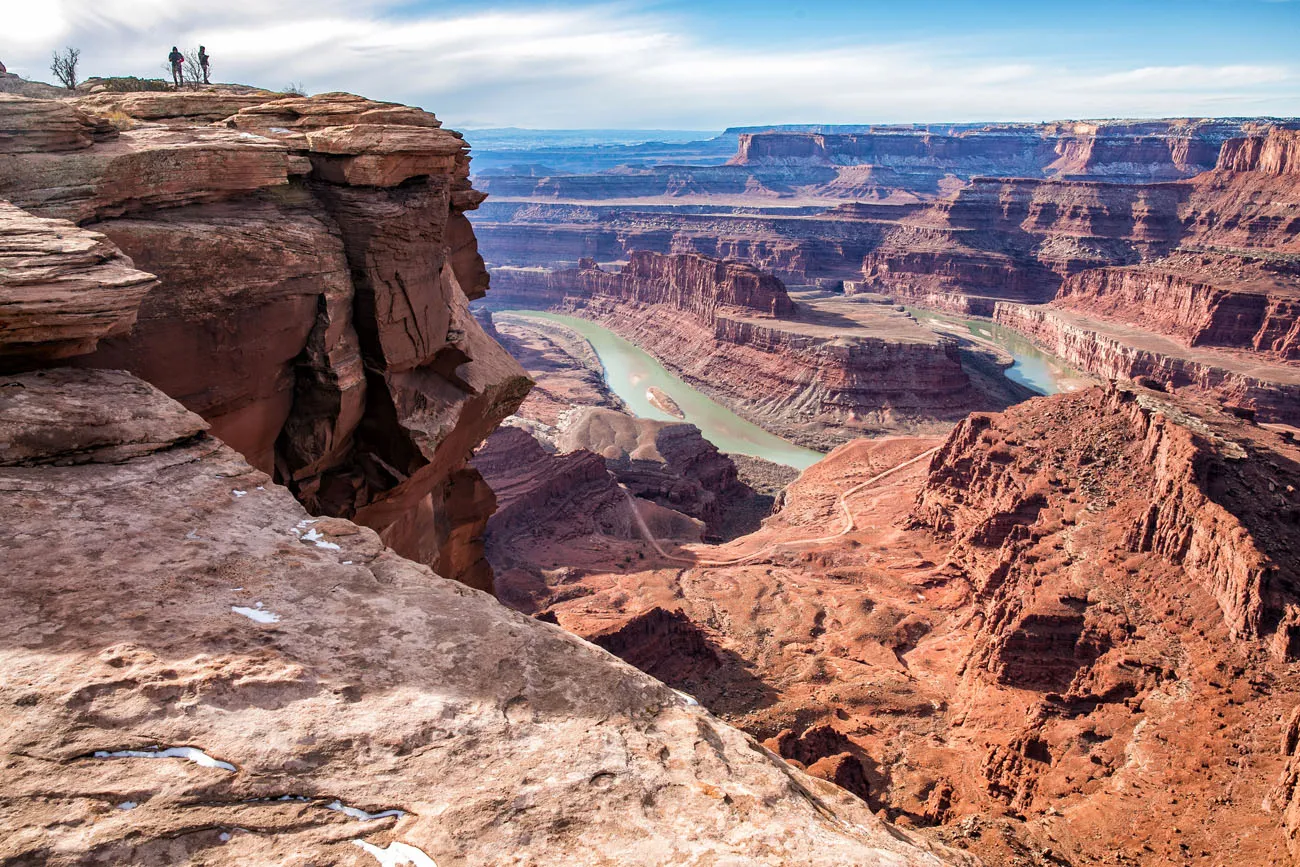
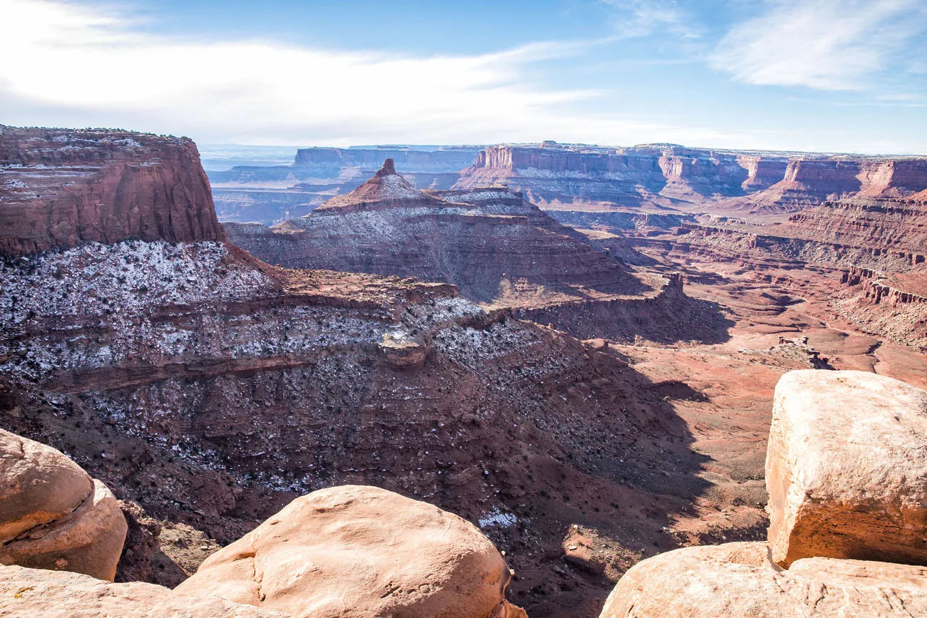
The best view is looking southwest from overlook. From here, you can see the gooseneck of the Colorado River with Canyonlands National Park in the background.
The view looking southwest and out towards Canyonlands
The view looking southeast
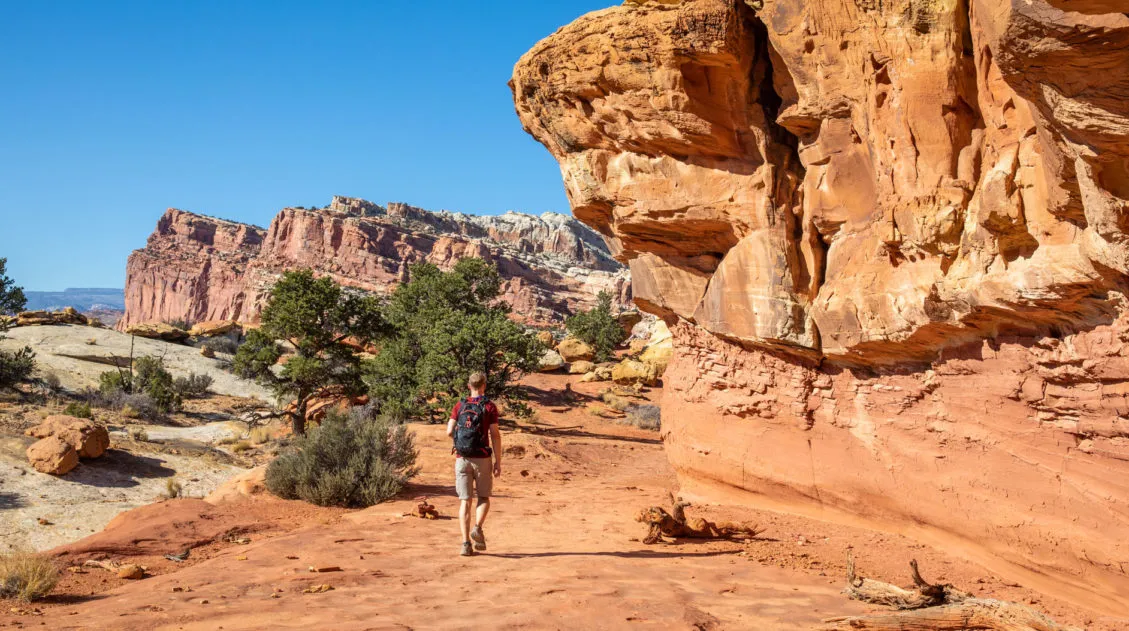
Explore the Hiking Trails
There are several hiking trails to explore. All of them are flat and rated as easy to moderate. You can hike them all (if you plan to spend an entire day in the park) or pick your favorites.
East Rim Trail
The East Rim Trail is 2 miles long, one way, if you hike from the Visitor Center to Dead Horse Point Overlook. The views from this side of the mesa are nice but we thought the West Rim Trail was more spectacular.
View from the East Rim
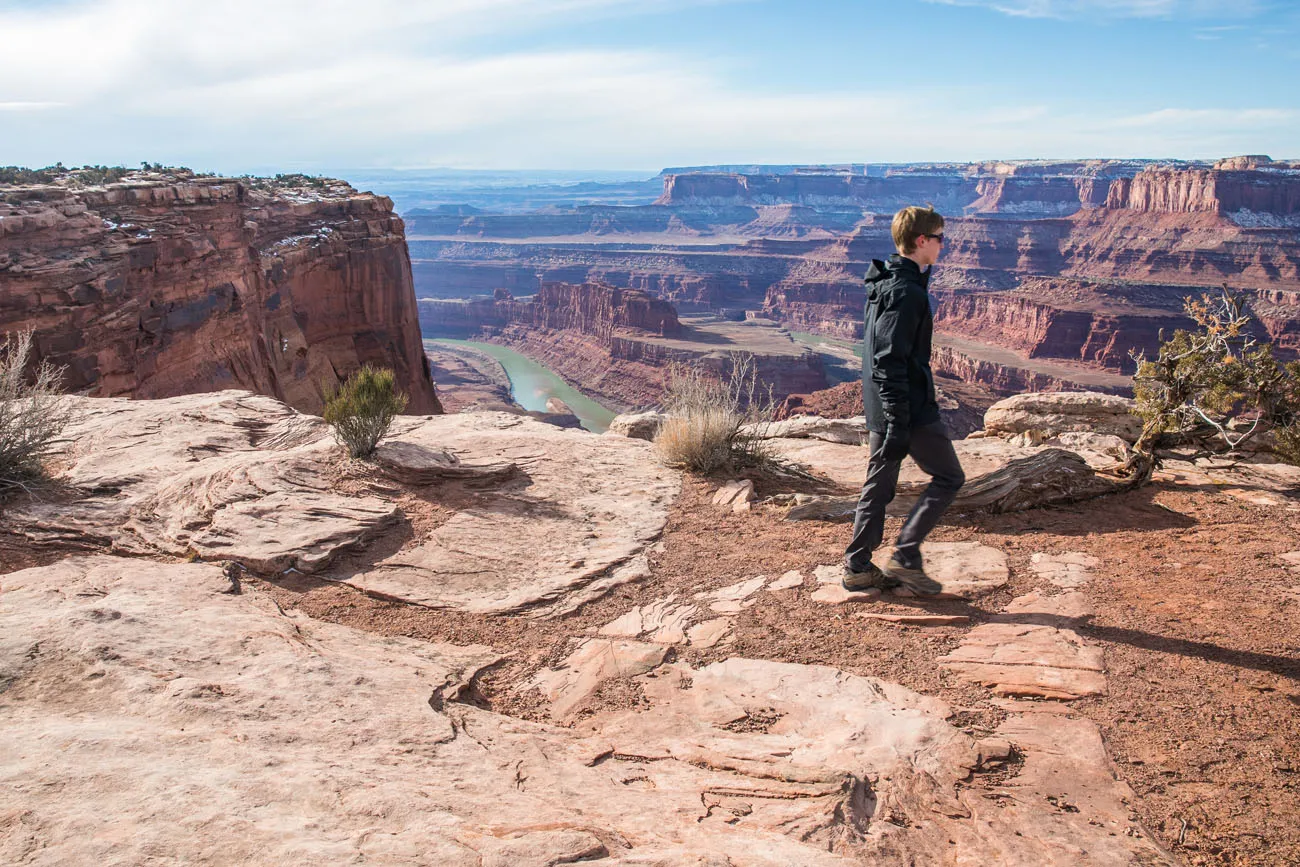
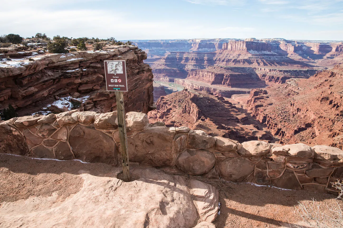
West Rim Trail
The West Rim Trail is 3.5 miles long, one way, if you include the short detours to Shafer Canyon Overlook and Rim Overlook. It starts at Dead Horse Point Overlook and ends at the Kayenta Campground.
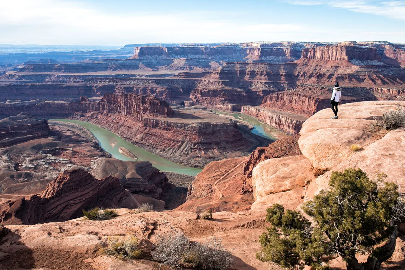
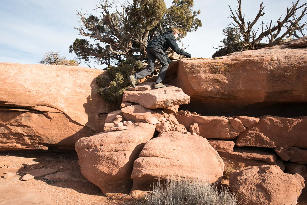
With jaw-dropping views across the Colorado River to Canyonlands National Park and short sections of rock scrambling, this trail was the highlight of our visit here.
This is a “primitive” trail. There are several trail markers along the way, but you will need to do some route finding to stay on the trail. The West Rim Trail is marked by cairns, small piles of rock that mark the trail. Simply walk from one cairn to the next. Most of the trail is tramped down and easy to follow. However, on short sections of slickrock, you will need to follow the cairns to stay on the trail.
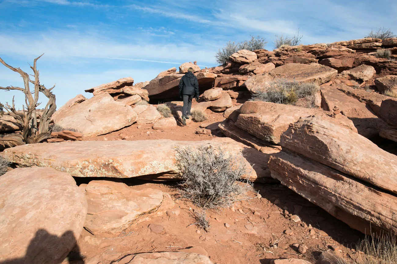
A view of the trail
How We Did This: Tyler and I hiked the West Rim Trail one way. Tim was our shuttle service, dropping us off at Dead Horse Point Overlook and picking us up at Kayenta campground. We would have liked to hike it together, however Kara was recovering from an injury so she was limited in how much walking she could do.
Here are some photos along the trail so you can decide if this hike is worth your time.
Near Dead Horse Point Overlook
In my opinion, the best part of the hike is the section between Dead Horse Point Overlook and Meander Overlook. Along this short section, you get unobstructed views of the Colorado River. Plus, there are a bunch of natural overlooks where you can take some great photographs.
Meander Overlook
Shafer Canyon Overlook
Rim Overlook
Big Horn Overlook
We did not continue on to Big Horn Overlook. This trail is 2.5 miles round trip. It would have taken us another hour and Tyler and I didn’t want to keep Tim and Kara waiting too long. Plus, the farther north we hiked on the West Rim Trail, the views seemed to get repetitive and lose the “wow” factor we had near Dead Horse Point Overlook.
Combining the East and West Rim Trails
You can park at the Visitor Center and hike the East Rim Trail to Dead Horse Point Overlook and then hike back to the Visitor Center via the West Rim Trail. Or, you can do this in the opposite order.
This hike is 5.5 miles total if you include the optional detours to the overlooks on the trail.
Mountain Biking
There are miles of mountain biking trails at Dead Horse Point State Park. Called the Intrepid Trail System, the trails range in difficulty from easy to challenging. Visit the official park website for more information on the trails.
Night Sky Viewing
Dead Horse Point State Park feels like it is out in the middle of nowhere. And that’s perfect if you want to view the night sky.
With very little “light pollution” you can have extraordinary views of the night sky from this state park.
In 2016, Dead Horse Point State Park was recognized as an International Dark Sky Park. This is one of the best places near Moab for stargazing and night sky photography.
Sleep in a Yurt
A yurt is a portable round tent. These were originally used by nomads in Central Asia. Now, yurts seem to be popping up everywhere.
In Dead Horse Point State Park, there are two campgrounds that offer yurts. The Moenkopi Yurts are located near the Intrepid Trail System. The Wingate Yurts are newer (they were constructed in 2018) and are located at Wingate Campground.
Staying in a yurt would be a unique experience. Plus, it is a great alternative to staying in Moab if you want early access to the hiking trails or want to enjoy amazing views of the night sky.
Please practice the seven principles of Leave No Trace: plan ahead, stay on the trail, pack out what you bring to the hiking trail, leave areas as you found them, minimize campfire impacts, be considerate of other hikers, and do not approach or feed wildlife.
How to Plan Your Time
In 2 hours or less: If you only have an hour or two to spend in the park, enjoy the view from Dead Horse Point Overlook and hike to Meander Overlook.
With half of a day: Park at the Visitor Center and hike the East Rim and West Rim trail loop.
With more time: You can also go mountain biking or add in the hike on the Bighorn Overlook Trail.
Visiting Dead Horse Point with Kids
I think this is a great place to bring kids. The trails are easy and with short sections of scrambling and obstacles, they can be a blast for kids.
The trail does follow the edge of the mesa. However, the trail never comes dangerously close to the edge. Usually, you are good 10 or more feet from the edge of the cliff. Along the way, you have the option to detour out to rocky outcroppings for a better view or a cool photograph.
On these trails, you can hike and enjoy the views without getting near the edge of the cliffs. Even so, you should keep an eye on your kids while you are here. Keep them on the trail and don’t let them stray towards the cliff edges.
Where to Stay
You can camp in Dead Horse Point State Park at the Kayenta Campground and Wingate Campground, or stay in one of the yurts mentioned earlier in this guide.
Moab makes a great home base for exploring Dead Horse Point State Park, Arches, and Canyonlands National Parks. We have a detailed guide on Where to Stay in Moab, which lists popular hotels, lodges, and apartments, plus campgrounds with RV hookups ↓
Do you have plans to visit Dead Horse Point State Park or Moab? Comment below if you have any questions or would like to share your experience.
More Information about Utah
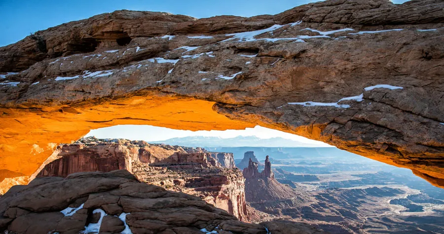
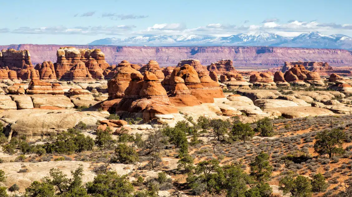
Best Things to Do in Island in the Sky: Canyonlands National Park
Pinterest Facebook Flipboard Canyonlands National Park is an underrated park located near Moab, Utah. Compared to its smaller and more popular neighbor Arches National Park, Canyonlands feels more rugged, more remote, and a whole lot larger. Island in the Sky, the most popular section of Canyonlands, is filled with jaw-dropping vistas and short but sweet […]
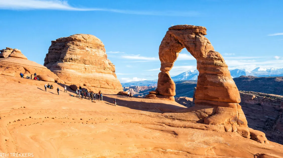
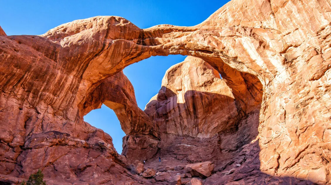
16 Amazing Things to Do in Arches National Park (+ HELPFUL Tips)
Arches National Park is a wonderland of desert vistas, short hiking trails, strange rock formations, and you guessed it, arches. Not only will you find over 2,000 arches here, but you will also see hoodoos, fins of sandstone rocks, massive mesas, and balanced rocks. Here are the best things to do in Arches National Park. […]
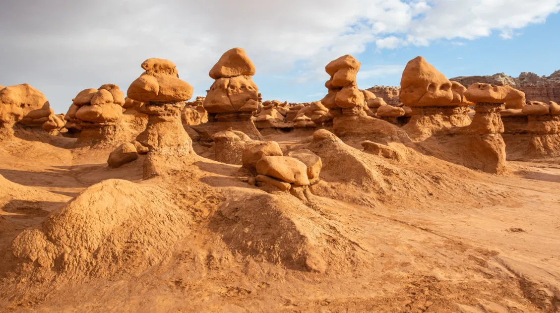
Goblin Valley State Park: Things to Do with Limited Time
Goblin Valley is an easy to visit state park that is located in southeastern Utah. With its hoodoos, toadstools, “goblins,” and short but sweet hiking trails, this park is pure fun to visit. Kids, and kids at heart, will LOVE this park!! The main section of hoodoos and goblins is free to explore…there is no […]

Utah’s Mighty 5: How to Plan the Perfect Road Trip Itinerary
Stretching across southern and central Utah are five stunning national parks. Called the Mighty 5, these parks contain some of the most thrilling hiking trails and iconic landscapes in the United States. Stand atop Angels Landing in Zion. Gaze across a wonderland of hoodoos at Bryce Canyon. Explore the Water Pocket Fold at Capitol Reef. […]
The Ultimate Arches and Canyonlands One Day Itinerary
Canyonlands and Arches are two national parks that sit side-by-side near Moab, Utah. Since these parks are neighbors, it is possible to visit both of them in one very busy day. In this guide, we cover the best way to spend one day in Arches and Canyonlands National Parks. We are frequent visitors to this […]
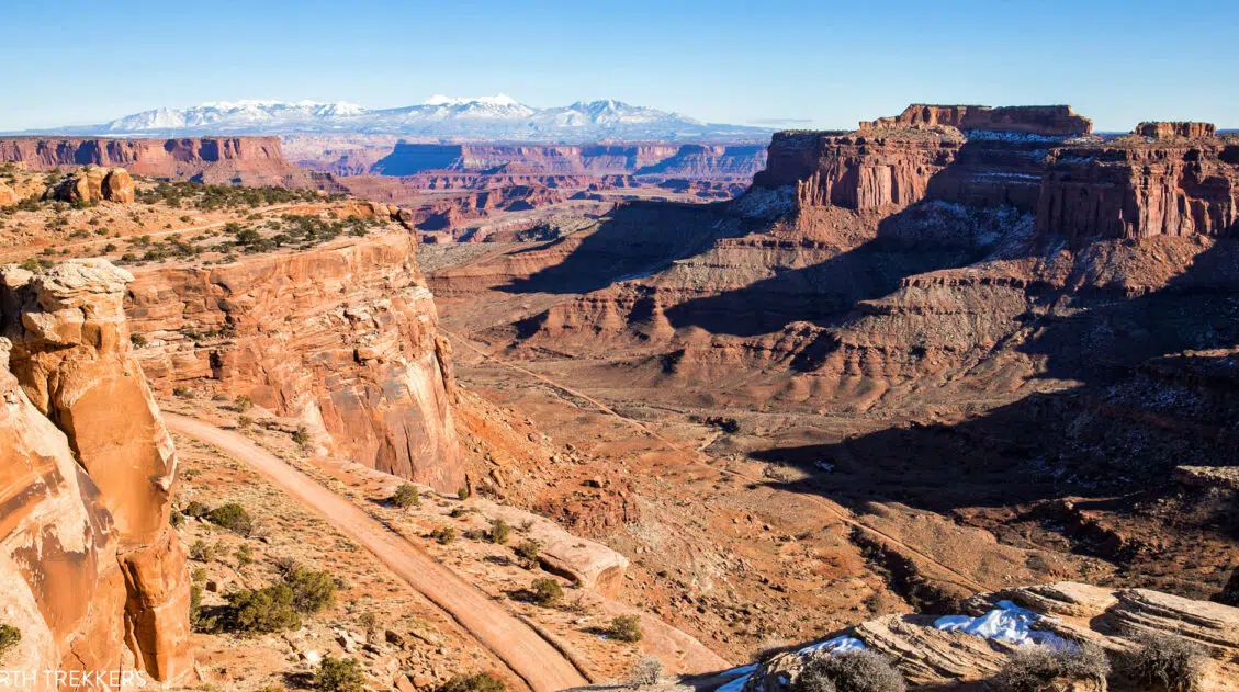
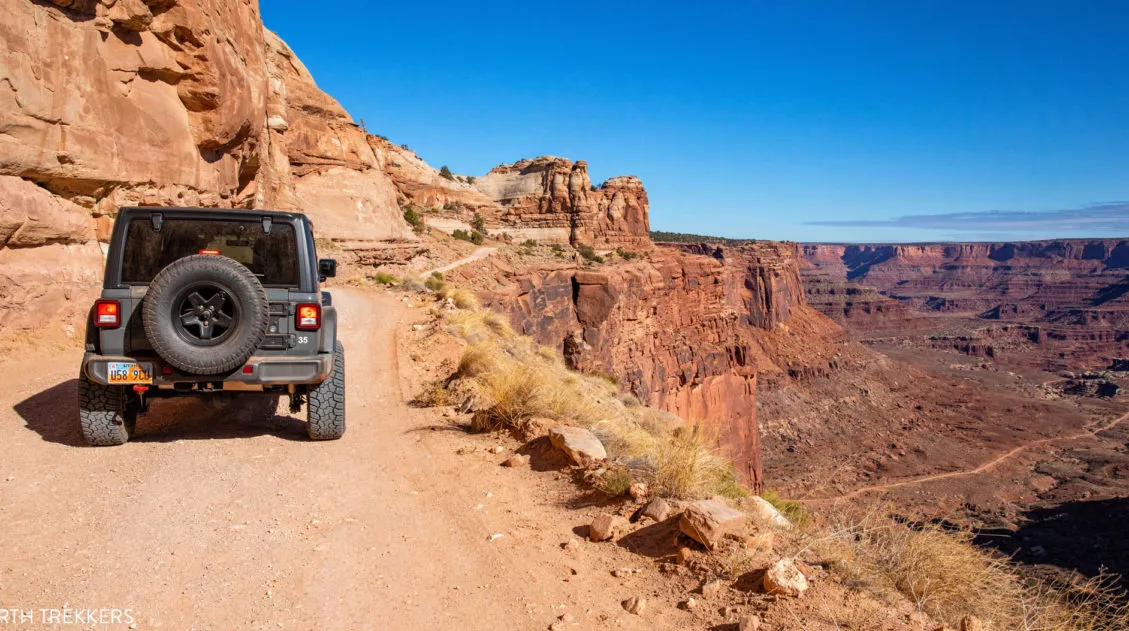
How to Drive Shafer Canyon Road and Potash Road | Moab, Utah
Have you seen photos of the Shafer Canyon switchbacks and said to yourself, wow, I’d really love to drive on that road? Do you like the idea of venturing away from the crowds and driving through some truly dramatic landscapes? Or, do you want to get a unique perspective of Canyonlands National Park and Dead […]
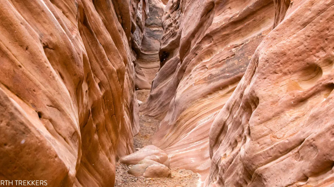
Little Wild Horse Canyon – Bell Canyon Loop: A Step-By-Step Guide
Little Wild Horse Canyon is one of the most thrilling slot canyons in Utah. With tight passageways, curving, scalloped walls, and short sections of easy rock scrambling, this hike is fun for both kids and adults. You can hike the narrowest (and most fun) section of Little Wild Horse as a fast out-and-back hike, or […]
12 Amazing National Parks for Your Next Family Adventure
We’ve visited 56 of the 63 U.S. national parks and almost every single one would make a fantastic family destination. With 63 parks to choose from, the options can feel overwhelming. After years of exploring the national parks, we’ve narrowed it down to 12 that hit the sweet spot for families. These parks are easy […]

One Perfect Day in Bryce Canyon National Park
Bryce Canyon National Park…a fantasyland of hoodoos, bizarre rock formations, and sandstone pillars. This is a crazy beautiful place, and its unique landscape sets it apart from other national parks. Although Bryce may not have the same sweeping, expansive vistas as the Grand Canyon, it’s still a breathtaking experience the first time you see this […]
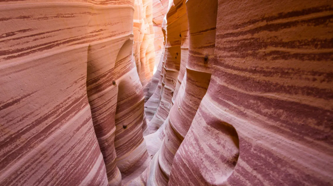
How to Hike Zebra Slot Canyon in Grand Staircase-Escalante
Zebra Slot Canyon is a very short slot canyon, named for its striped canyon walls. It’s a gorgeous spot, maybe not quite as pretty as Antelope Canyon in Arizona, but since you can explore this on your own without a guide or tour group, it’s more fun. Hiking Zebra Slot Canyon can be a little […]
Utah Travel Guide: Places to Visit in Utah
Utah Travel Guide If you like rugged, desert landscapes, it is hard to beat the beauty of Utah. Visit the state’s five stunning National Parks, stand among iconic US monuments, kayak on the Great Salt Lake, and climb through photogenic slot canyons. This state is a great one for road trippers as there are many […]
15 Best Hikes in Capitol Reef National Park
The hikes in Capitol Reef National Park are some of the most underrated in Utah. From short, easy trails along Highway 24 to scenic routes like Cassidy Arch and Grand Wash, this park is packed with adventure, without the crowds you’ll find in Zion or Arches. Drive deeper into the park and you’ll discover the […]
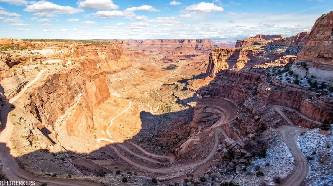
How to Drive the White Rim Road in One Day
Driving the White Rim Road is one of the best experiences in Canyonlands National Park. For 100 miles, this road circles around the Island in the Sky mesa, taking you past canyons, buttes, and the Colorado and Green Rivers. This drive takes most people two to three days. If you have less time, it is […]
Hiking the Gooseberry Trail in Canyonlands National Park
There are a number of hikes in Canyonlands National Park that offer sweeping views over the White Rim. Grand View Point Trail and White Rim Overlook both fit into this category. However, if you want to journey below the level of the mesa and hike onto the White Rim, the Gooseberry Trail is a great […]
United States Travel Guide: Places to Visit in the USA
Plan your visit to the United States. Learn about the best things to do, how to plan your time, road trip ideas, and sample itineraries.

Comments 28