
The Needles is an often overlooked section of Canyonlands National Park. But those who take the time to visit the Needles are rewarded with thrilling, unique hiking trails, low crowds, and jaw-dropping views of Canyonlands National Park. In this post, we cover the 12 best things to do in the Needles…12 great reasons why this part of Canyonlands National Park should be added to your Utah road trip.
We have visited Canyonlands multiple times, and it wasn’t until our third trip that we finally made it to the Needles. And I’m so glad we did. This small part of the national park is incredible. It’s home to our favorite hiking trail in Canyonlands (the Chesler Park Loop), it’s small and quick to visit, and you can get some extraordinary views from the main road.
In this guide, we will cover:
- The best things to do in the Needles
- How to get to the Needles
- Things to know as you plan your visit
What are The Needles?
The Needles is one of four districts that make up Canyonlands National Park. The Island in the Sky district, which is the closest district to Moab, is by far the most visited section of the park.
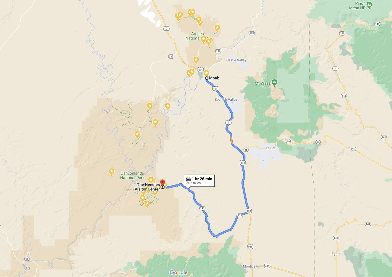
To get to the Needles from Moab, it is a 75 mile drive that takes about an hour and a half. The distance and driving time discourage most people from making the trip down this way. I get it, we felt the same way on our visit here in 2018. But on our third trip to Canyonlands we made it a point to get here, and wow! This place is incredible.
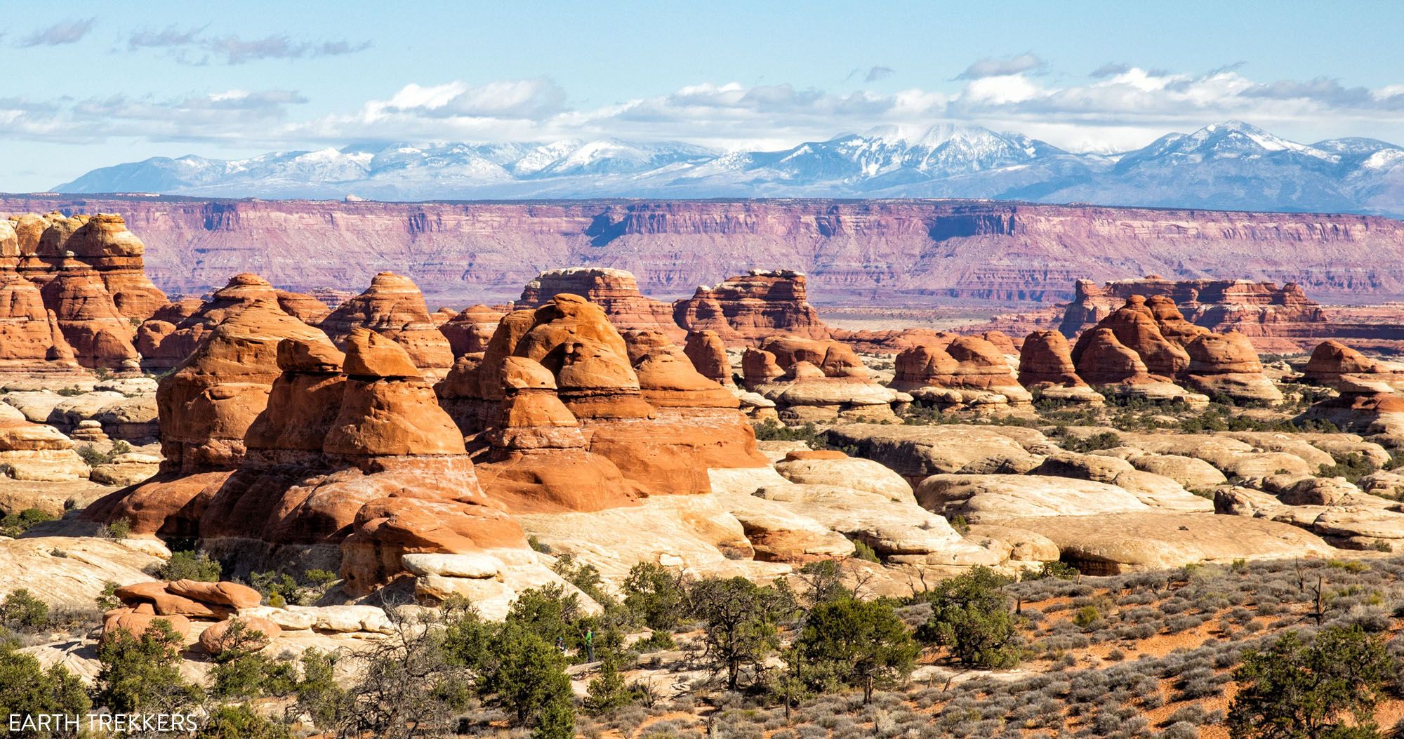
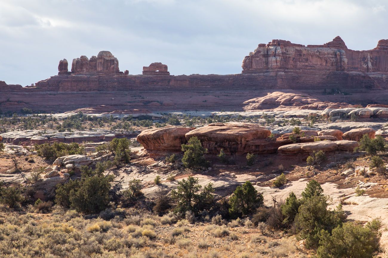
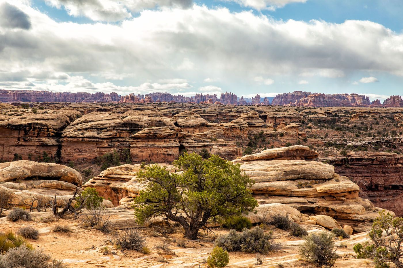
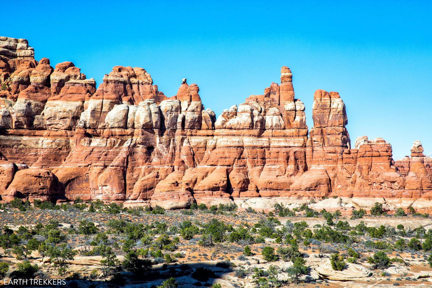
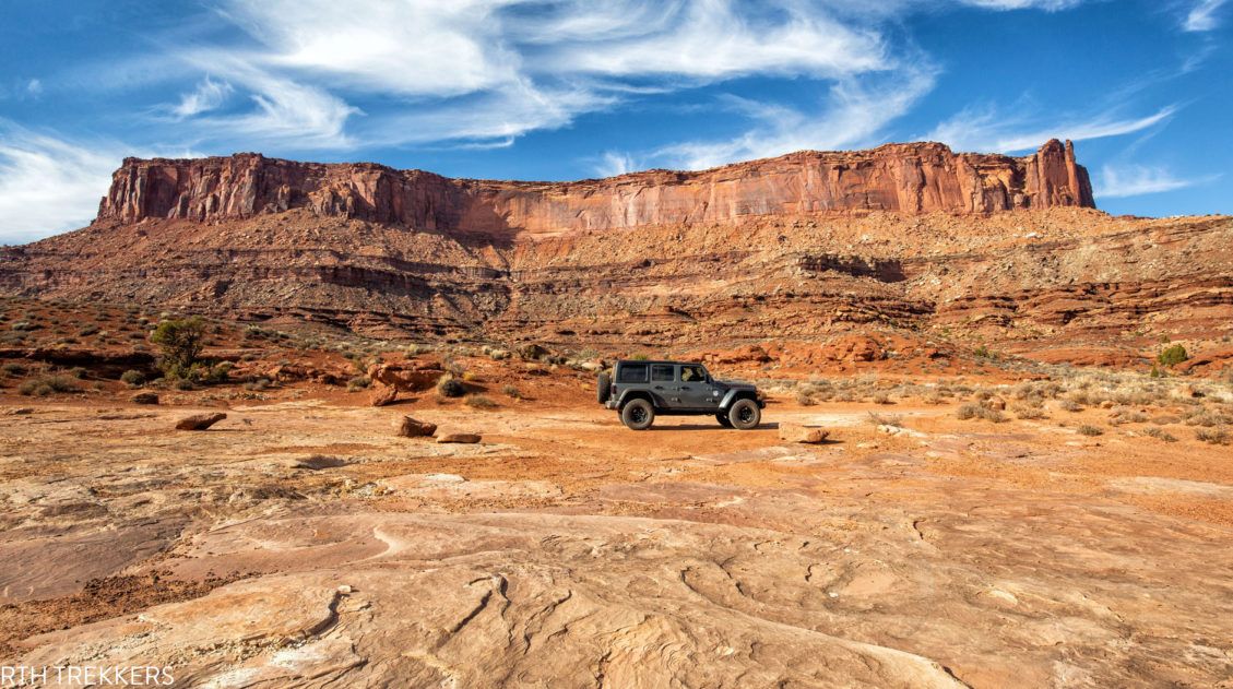
The Needles district looks dramatically different than Island in the Sky, or anywhere else in Utah, for that matter. Think Bryce Canyon meets Zion. Clusters of zebra-striped sandstone spires make up the heart of the Needles, somewhat resembling the hoodoos of Bryce Canyon. Hiking trails weave their way between the needles, making this the top destination in Canyonlands for hiking, in my opinion.
The Needles district is relatively small. The main road that runs through the park is less than 7 miles long and it only takes 10 minutes to drive through the park. However, there are dirt and gravel roads that lead off of this main, paved road. Some of these dirt roads are suitable for standard cars and several of them require a 4×4 and/or a permit.
Don’t think the Needles is worth the extra time? Think again. If you like hiking, unique desert landscapes, and leaving the crowds behind, you will love the Needles.
View of the Needles from the Chesler Park Viewpoint
Where is the Needles District?
The Needles district is located south of Moab. It takes an hour and a half to drive to the Needles Visitor Center. Most of the drive is on Highway 191 and this part goes by fast. Once you turn onto Highway 211, the speed limits drop but the views get better. Now, you drive past massive mesas and a few notable spots that sit right outside of the park, such as Newspaper Rock State Historical Monument and rock climbing areas.
If you look at Canyonlands National Park on a map, The Needles and the Island in the Sky district sit right next to each other. However, there are no roads that connect these two districts. The only way to get to the Needles is on a very long drive from Moab, or visit the Needles while on a road trip through Utah.
The remoteness of the Needles helps keep crowds low, which makes this park a delight to visit.
What Are the Needles?
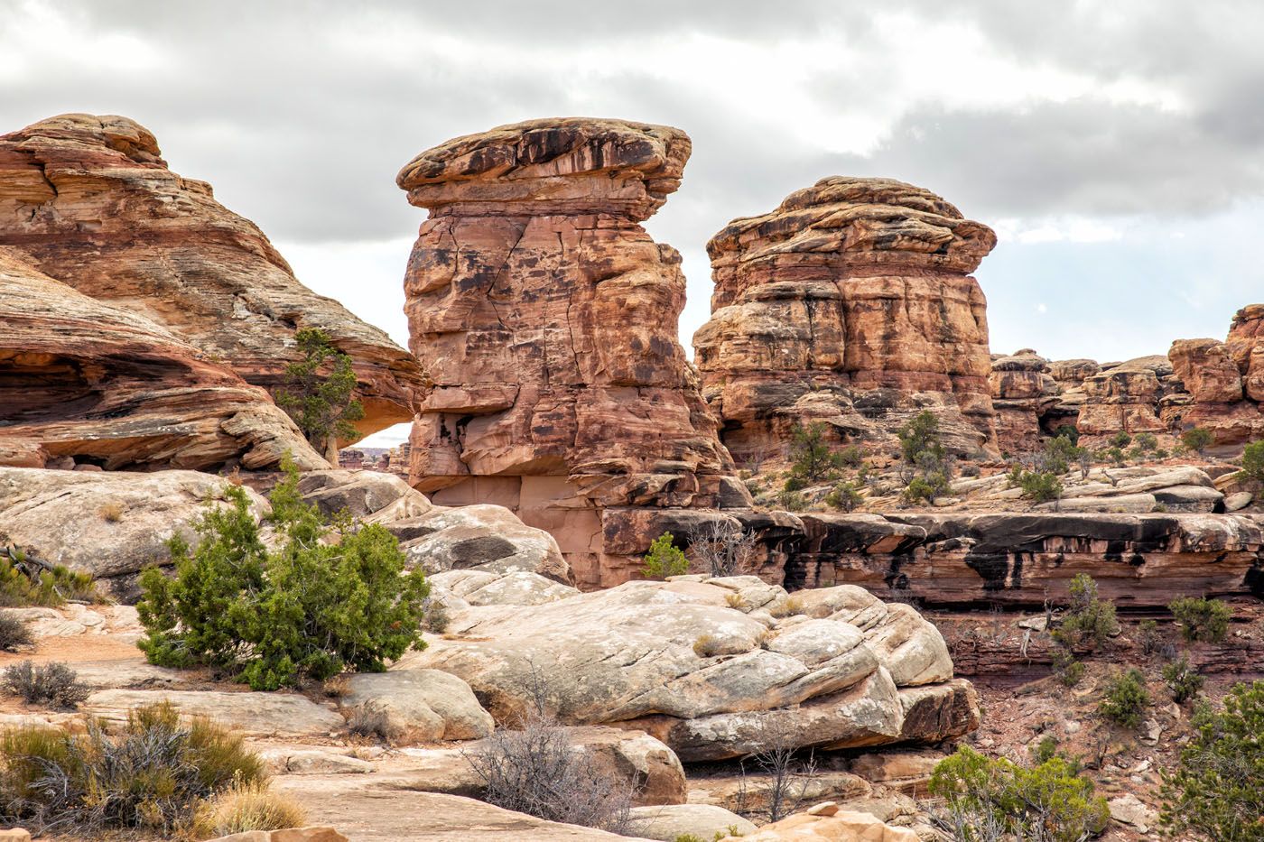
This park gets its name from clusters of sandstone spires, also called Needles.
Hundreds of millions of years ago, this part of the world was an ocean. As the ocean dried up, salt covered what was once the ocean floor. Over time, sand dunes buried the layer of salt. The weight of the sand and rock began to crack the lowest layer of rock, and the salt seeped into these cracks, forming a grid. As the land was further eroded by wind, ice, and rain, the spires (aka Needles), buttes, and canyons formed into what we see today.
Best Things to Do in the Needles
Roadside Ruin
Our Rating: ⭐️⭐️⭐️
This super short walk (just 0.3 miles long) takes you to an ancient Puebloan granary. It is located just past the visitor center as you drive through the park.
Wooden Shoe Arch Overlook
Our Rating: ⭐️⭐️⭐️
This is the first overlook you will come to as you drive through the park. From here you get a view of rock formation that looks like a wooden shoe.
It’s very far away and to get a good photo you need a zoom lens. I really don’t think that this viewpoint is all that spectacular, but it is quick and easy to visit, so why not make the quick stop, right? Don’t worry, it gets a whole lot better from here.
Cave Spring Trail
Our Rating: ⭐️⭐️⭐️ It’s a very short hike but there are more interesting trails in the Needles to do.
Distance: 0.6 miles | Difficulty: Easy | Time: 30 minutes
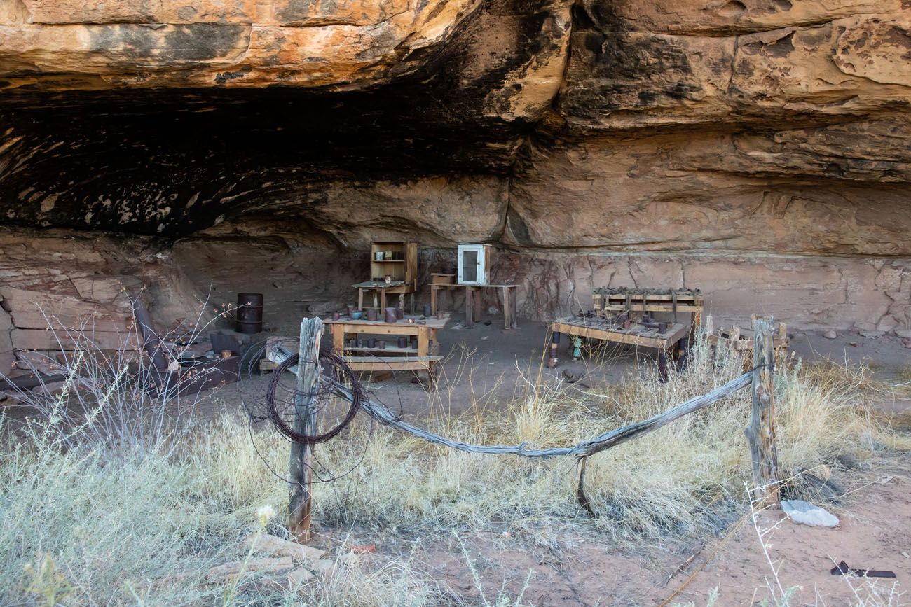
The Cave Spring Trail is a short, easy to walk trail that takes you past historical sites. You will see the remains of a cowboy camp, a year-round spring, and rock paintings that are hundreds of years old.
To get here, drive down Cave Spring Road to the end.
Pothole Point Trail
Our Rating: ⭐️⭐️⭐️⭐️ This is the same distance as the Cave Spring Trail but the views are better.
🥾 HIKING STATS: Distance: 0.6 miles | Difficulty: Easy | Length of Time: 30 minutes
This loop hike is named for depressions in the rocks called potholes. Rainwater collects in these depressions, forming the perfect habitat for snails, shrimp, and other animals to hatch.
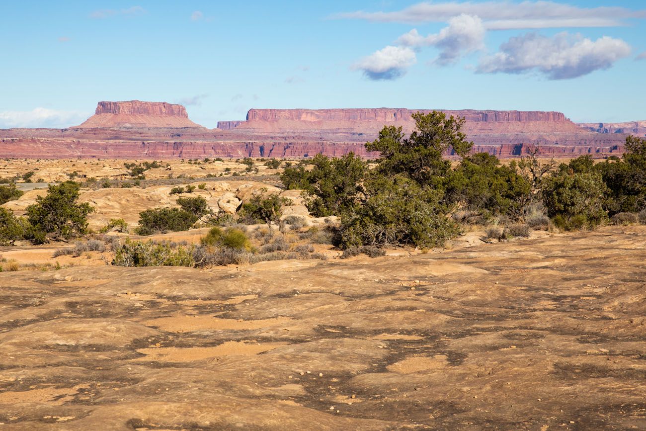
From this trail, you will see hundreds of these depressions. Off in the distance you can spot the mesas of the Island in the Sky district and the needles in Chesler Park area of the park.
View of the depressions in the rock. In the distance is the Island in the Sky district of Canyonlands National Park.
Note: Please do not step in these depressions. This can harm the animals that live here as well as their habitat.
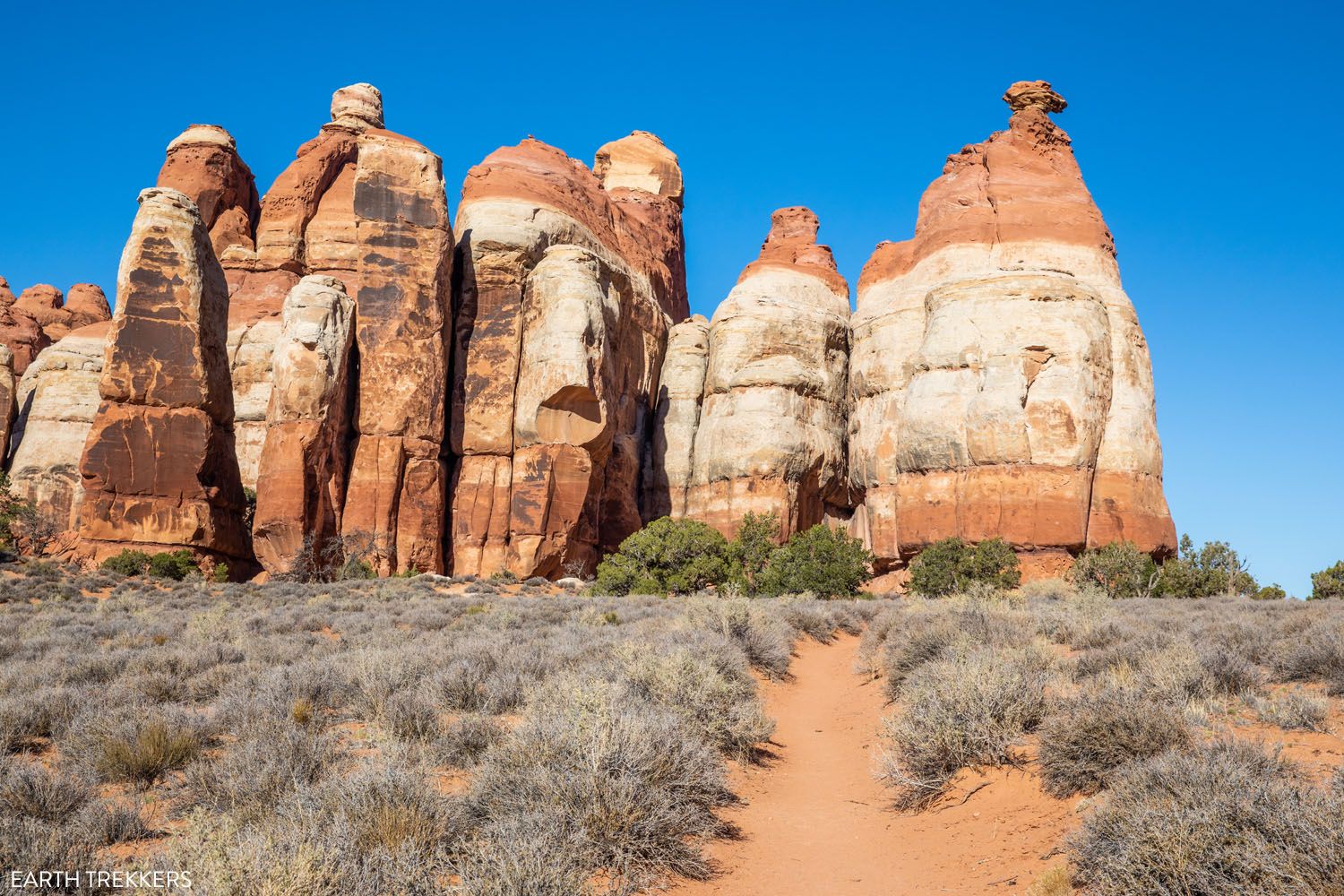
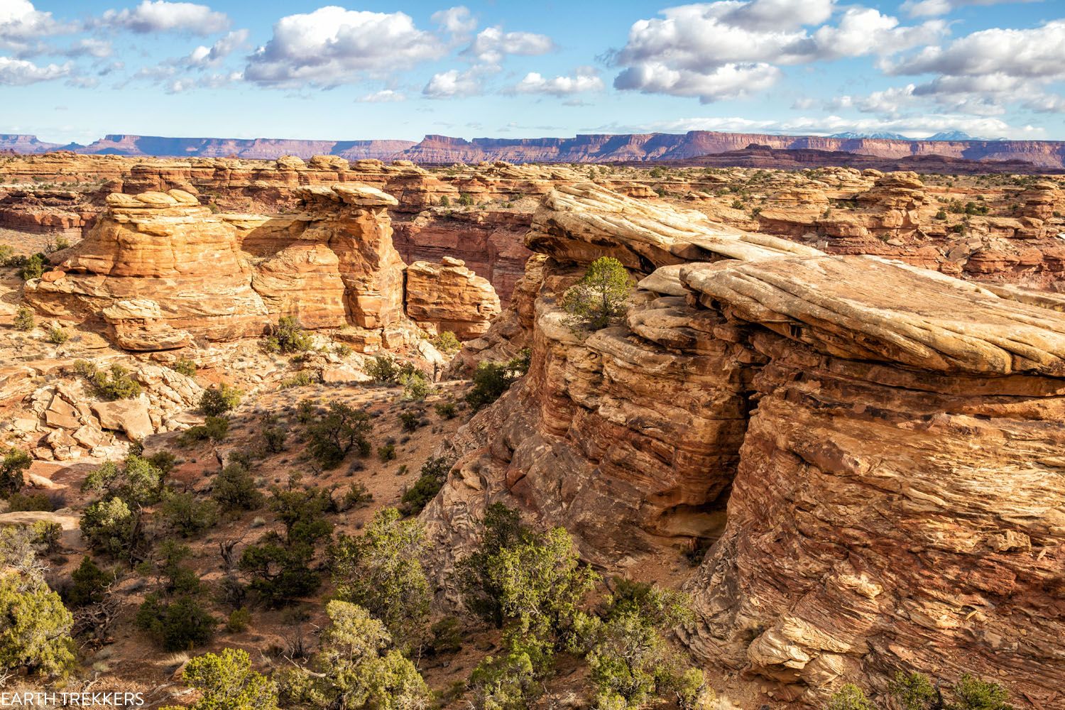
Slickrock Trail
Our Rating: ⭐️⭐️⭐️⭐️⭐️ This is a fun, easy, relatively short hike. If you have limited time and want to go hiking, this is the one we recommend.
🥾 HIKING STATS: Distance: 2.4 miles | Difficulty: Easy | Time: 1.5 to 2 hours
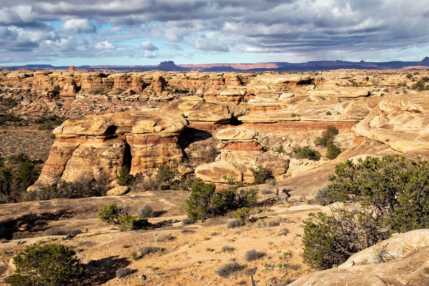
The Slickrock Trail is longer than the Pothole Point Trail but the views are a lot better. This trail forms a loop and along this loop are three very short detours to overlooks.
From these overlooks, you get to peer down into small canyons and get sweeping views of Island in the Sky and The Needles.
View of the Needles
If you only have the time and energy for one hike in The Needles and want something quick and easy (under 5 miles), we recommend the Slickrock Trail.
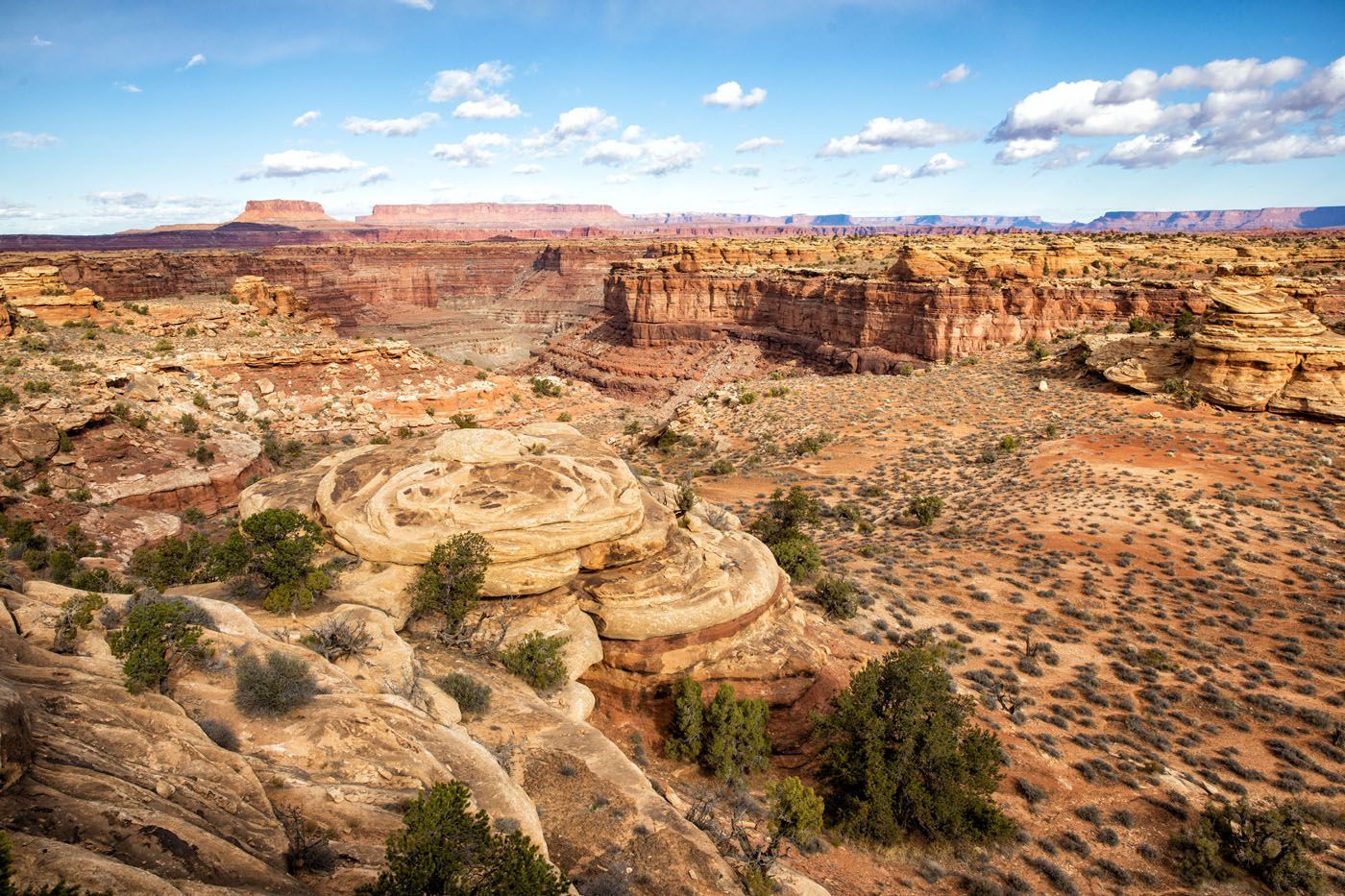
Big Spring Canyon Overlook
Our Rating: ⭐️⭐️⭐️
The main road through the park dead-ends just past the Slickrock Trail at this viewpoint. From here you get a great view of Big Spring Canyon and several massive sandstone spires.
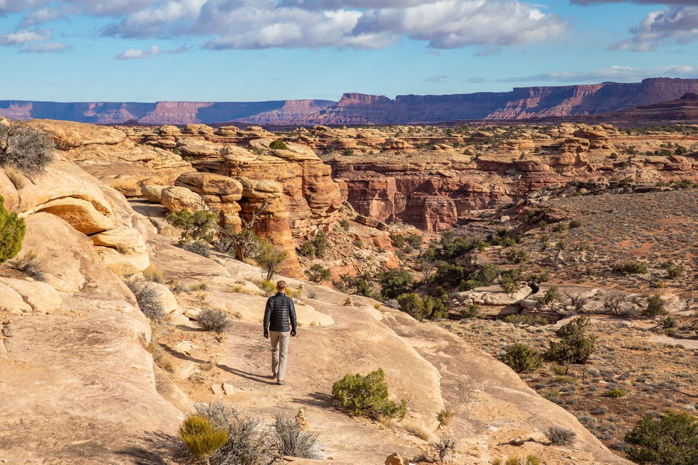
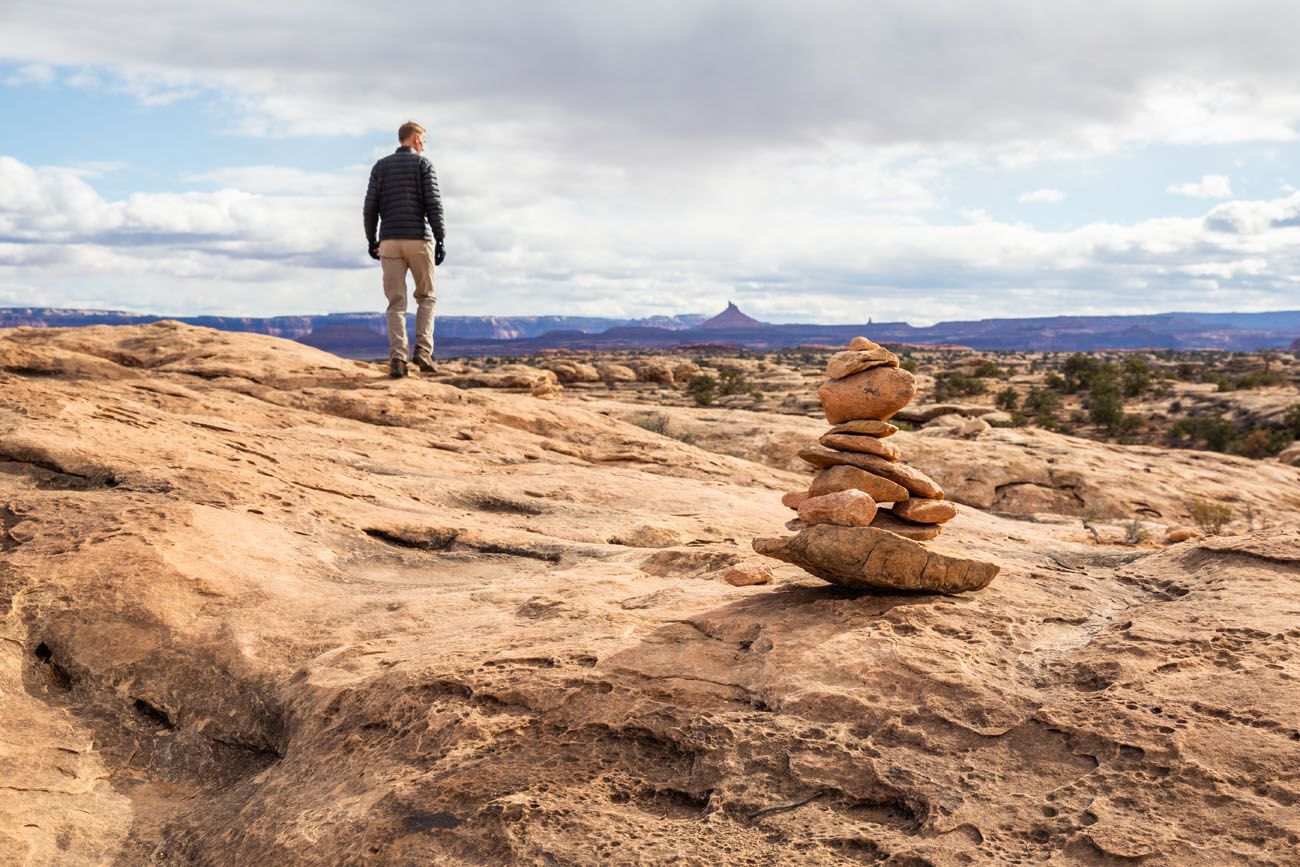
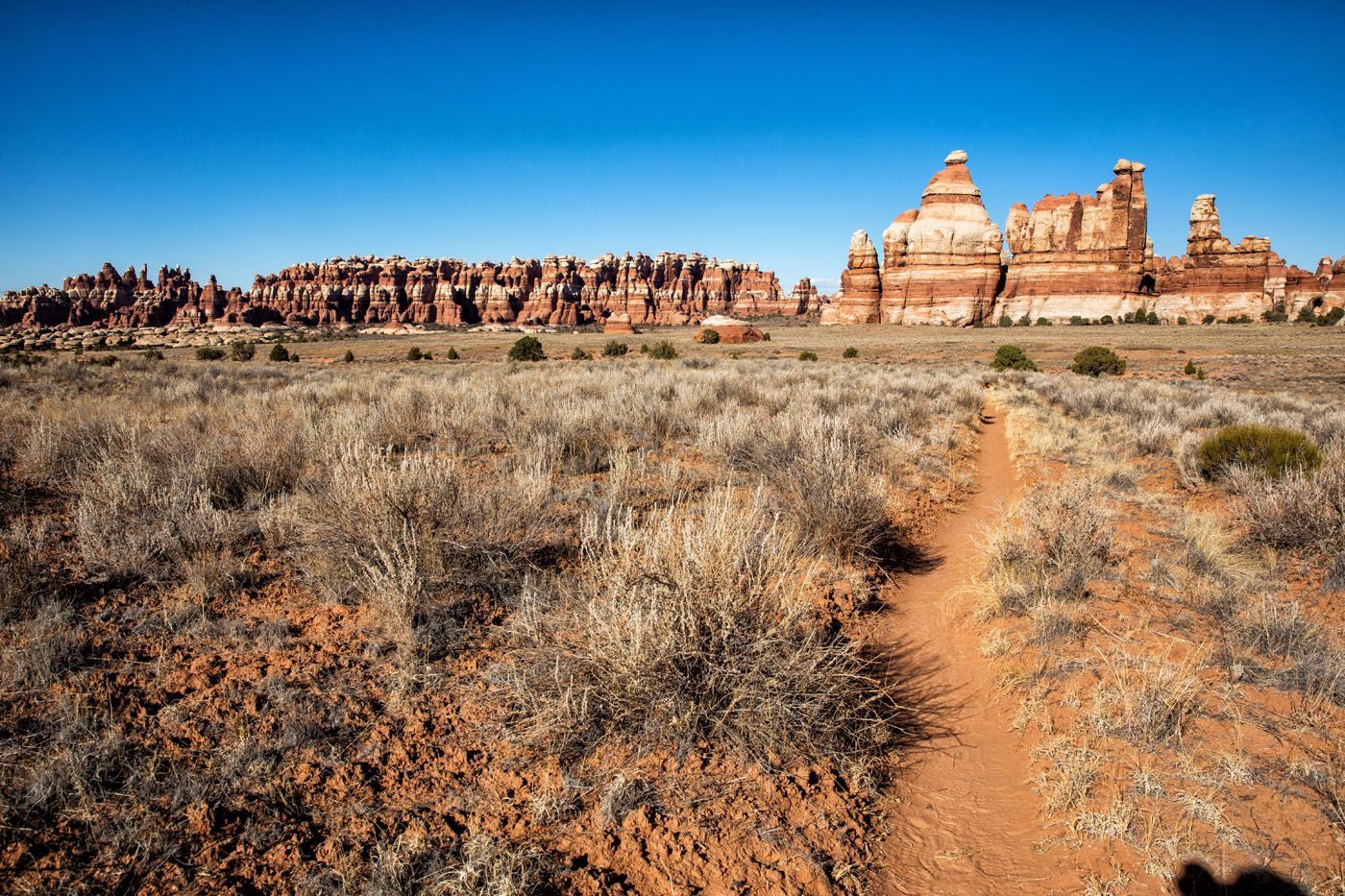
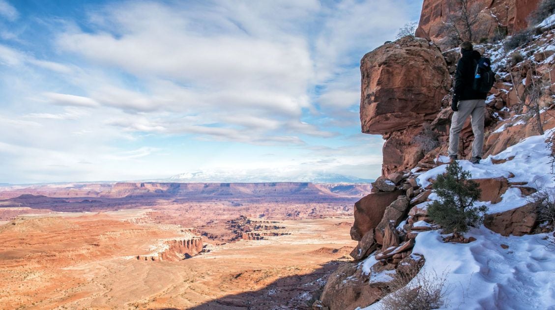
Hike to Chesler Park
Our Rating: ⭐️⭐️⭐️⭐️⭐️ Not only is this our favorite hike in the Needles, it is our favorite hike in Canyonlands National Park.
🥾 HIKING STATS: Distance: 6 to 11 miles | Difficulty: Moderate to Strenuous | Time: 3 to 7 hours
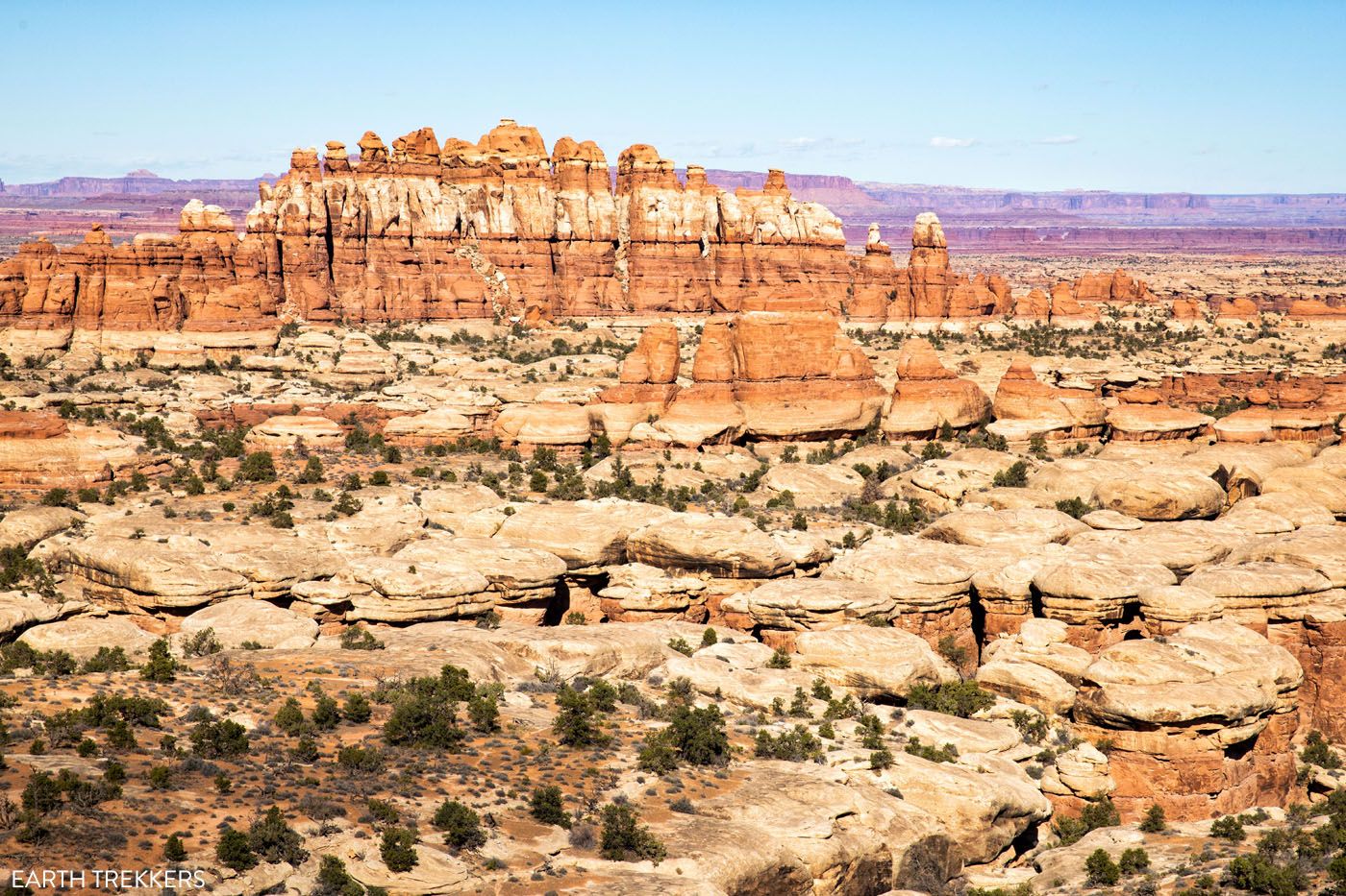
Chesler Park is the best spot in The Needles to see the sandstone spires that make this park so uniquely beautiful.
There are two hiking options: a short one and a long one.
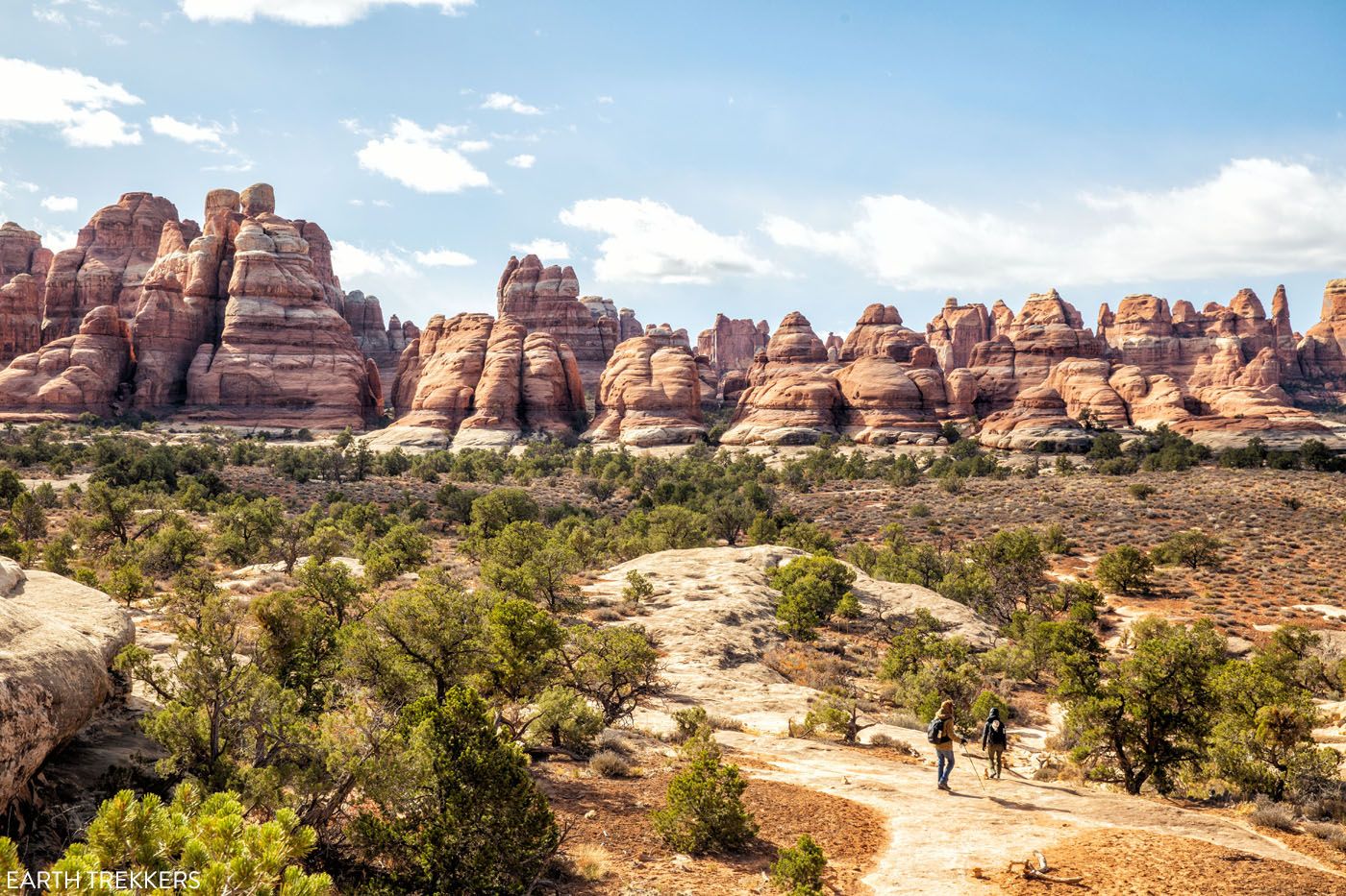
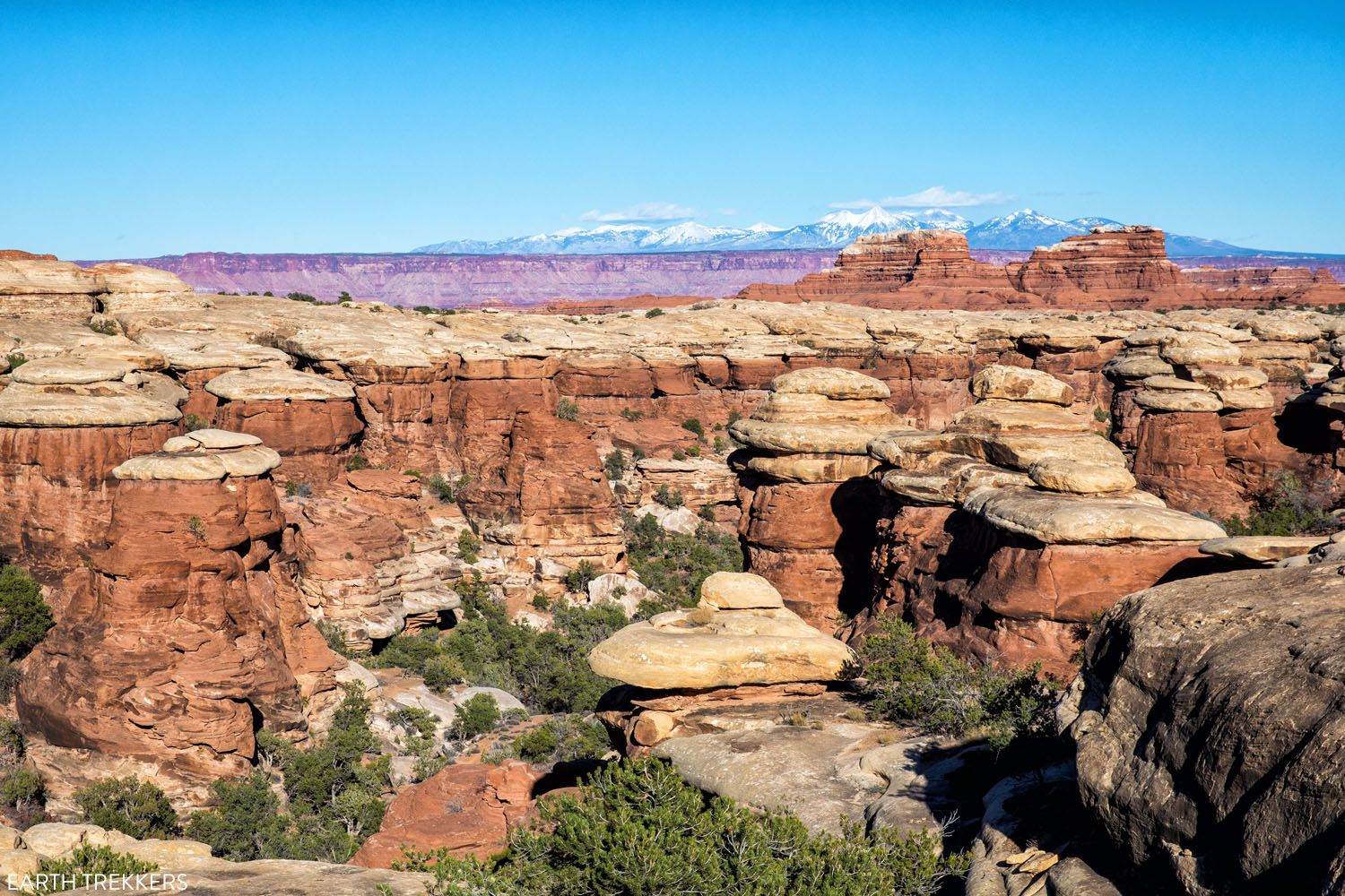
The shorter version is 6 miles round-trip and moderately strenuous. You hike out to the Chesler Park Viewpoint, where you have panoramic views of The Needles district. From this viewpoint, you can see the La Sal Mountains to the north and Chesler Park to the south.
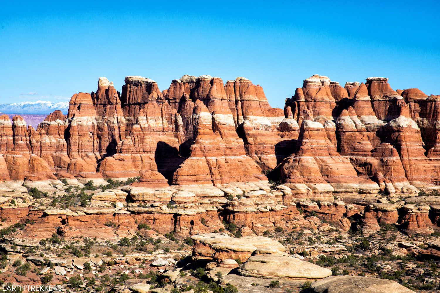
View from the Chesler Park Viewpoint
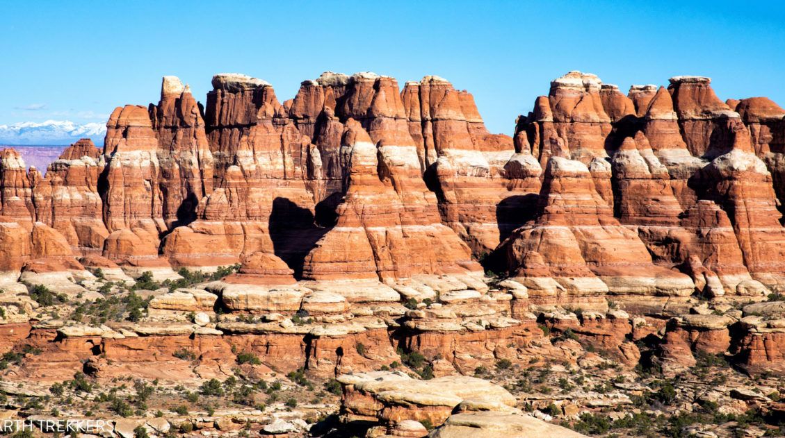
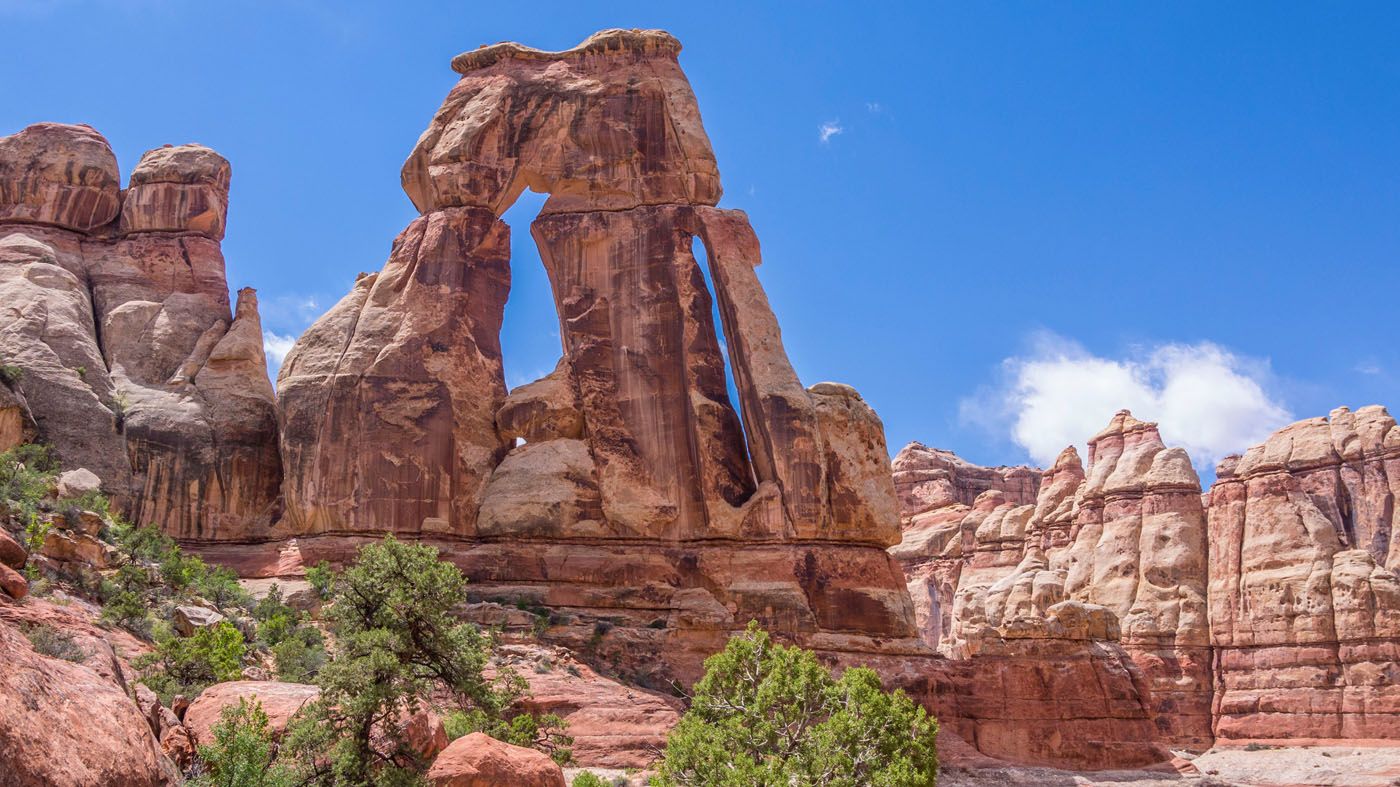
If you continue beyond the Chesler Park Viewpoint, you enter Chesler Park. This part of the hike forms a loop and it is awesome!! Not only do you get close-up views of the Needles, but you also get to hike through a cave and a slot canyon (on the Joint Trail).
This hike is almost 11 miles long and it takes between 5 to 7 hours, but if you like hiking, this is a great way to spend your time in The Needles district.
Ultimate Guide to the Chesler Park Loop in the Needles
Step-by-step trail guide for the Chesler Park Loop.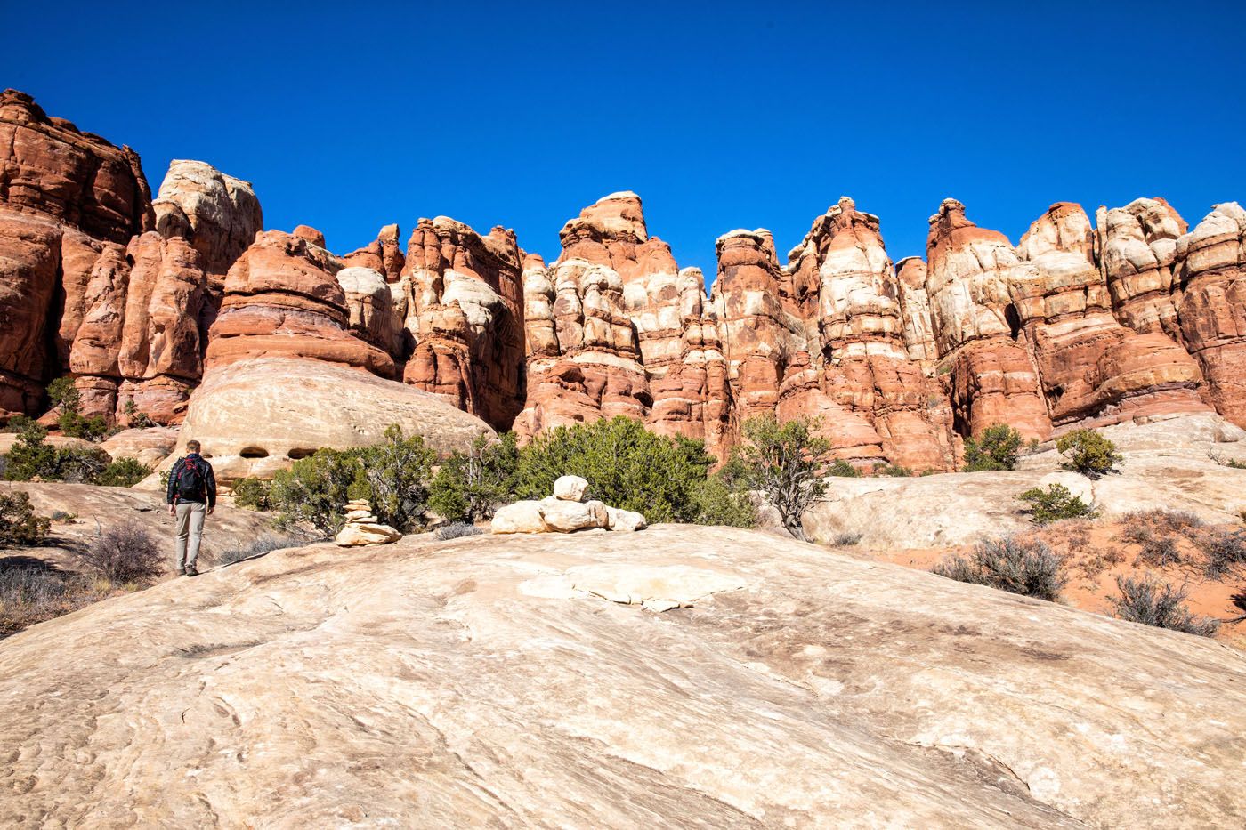
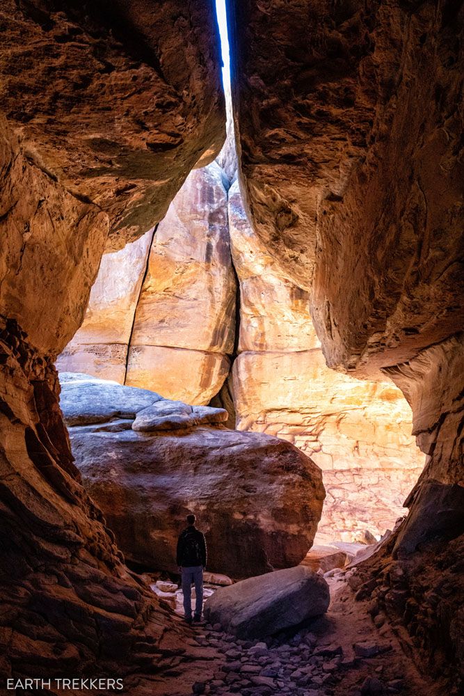
The Joint Trail
Chesler Park
View on the return hike

Hike to Druid Arch
🥾 HIKING STATS: Distance: 11 miles | Difficulty: Strenuous | Time: 5 to 7 hours
This is another long hike in The Needles and it looks spectacular. Unfortunately, we ran out of time so we never got to this one. That’s OK. We don’t mind another reason to come back. 😊
This hike starts at Elephant Hill, like the Chesler Park hike, but breaks off several miles into the hike. The final climb up to the viewpoint is steep and features a ladder and some rock scrambling.
shutterstock.com/William Hager
Go Backpacking in the Backcountry
If you look at The Needles on a map, it looks more like they should have called this district “The Maze.” A network of hiking trails and 4WD roads lead to numerous campsites in the southern section of the park. You could spend days, trekking from campsite to campsite and exploring the quiet, remote corners of The Needles.
In order to camp in the backcountry, you must have a permit. The highest demand for permits is in the spring and fall, peaking in March during Spring Break. Get full details on the national park service website.
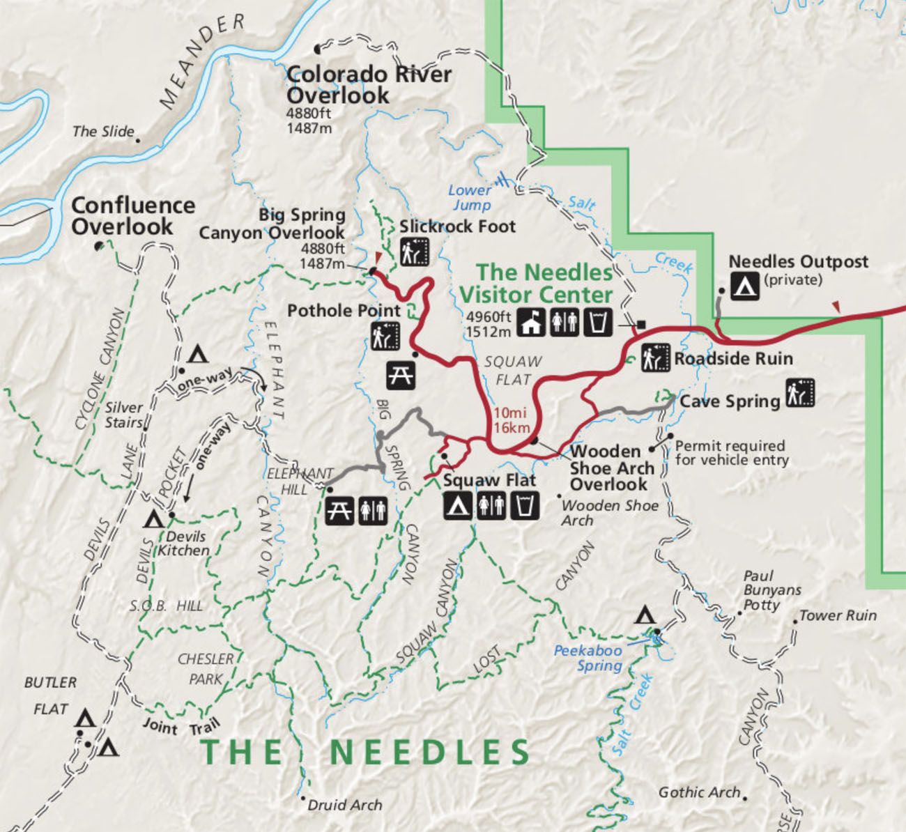
Map of The Needles from npmaps.com. The hiking trails are green and the 4WD roads are the dotted lines.
Elephant Hill
Not only are The Needles laced with a network of hiking trails, this is also a great spot if you want to explore the park by 4WD vehicle.
Elephant Hill is one of the most technical 4×4 roads in The Needles. This road climbs up and over Elephant Hill. Along the way, you will encounter loose rock, steep grades, and hairpin turns.
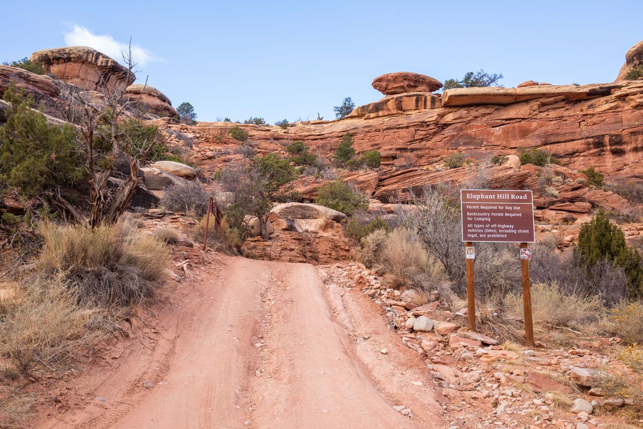
To drive this road, you must have a permit, a high-clearance 4WD vehicle, and prior experience on 4WD roads.
Note: Like Druid Arch, we have not driven Elephant Hill yet, but it is on our to-do list for our next visit to Utah. If you have driven Elephant Hill and want to share your experience, you can do so in the comment section at the end of this post. Thanks!
If you want to read more about Elephant Hill and watch a video that takes you through drive, scroll down to the Comment Section and read the comment left by Mark Doiron. He also leaves a link to a YouTube video from the drive. Thanks Mark!
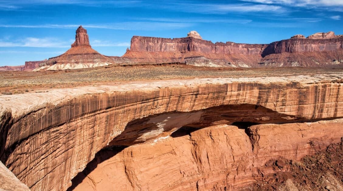
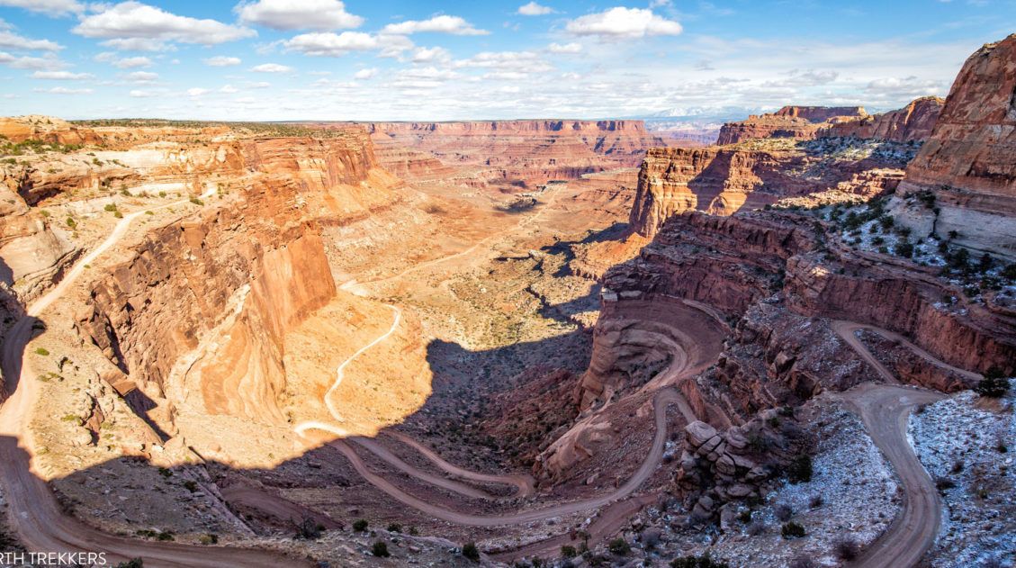
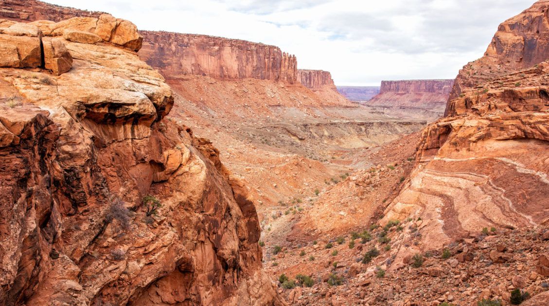
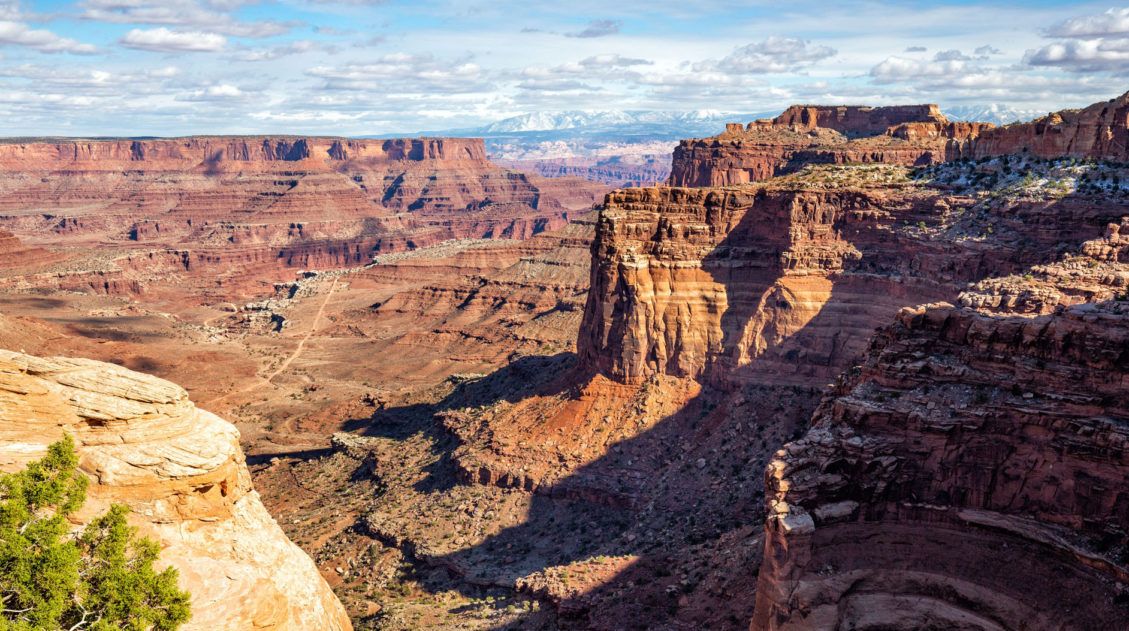
Drive the 4WD Road to the Colorado River Overlook
This 4WD road is less technical than Elephant Hill and does not require a permit. If you want to drive a 4WD in The Needles, this is the one that is recommended by the park rangers in the visitor center. This road is 7 miles long (one-way) and ends at an overlook of the Colorado River.
Confluence Overlook
From the Confluence Overlook, you can look out over the spot where the Green River and the Colorado River meet. To get here, you can either hike from the Big Spring Canyon Overlook (10 miles, strenuous) or drive the 4×4 roads to this overlook.
Best of the Needles: On a Map
How to Use This Map: Click the icons on the map to get more information about each point of interest. To take this map with you, click the star next to the title of the map which adds it to your Google account. Next, within your Google Maps app, select ‘Saved’ and then select ‘Maps’. This map title will now appear in your list.
Things to Know Before You Go
Entrance Fees: It costs $30 per vehicle to enter the park and this is good for seven days. This entrance fee includes all four districts of Canyonlands National Park. For $55 you can purchase a Southeast Utah parks pass, which also gets you into Arches National Park. You can also purchase an annual National Parks pass (called the America the Beautiful Pass) for $80. With this pass you can visit over 2,000 federal recreation sites. This is worth it if you also plan to visit more of Utah’s Mighty 5, including Arches, Capitol Reef, Zion, Bryce Canyon, or any other US National Park within the year.
When you get to The Needles, the first thing you will come to is the Visitor Center. If you plan to do any hiking or drive the 4×4 roads, get updates on trail conditions and road conditions from one of the park rangers on duty. You can also get updated conditions on the National Park Service website.
Best Time to Visit The Needles: The spring and fall months are the best times to visit. Weather conditions are pleasant and you can avoid the big crowds that flood the park in the summer. During the summer months, expect soaring temperatures and larger crowds. During the winter months, it is much less crowded, but temperatures get below freezing and snow is likely.
There are no restaurants in the park. If you plan to stay all day you will need to pack a picnic lunch.
Cellular service is spotty/non-existant. We didn’t have great cellular service until we got back onto Highway 191.
Please practice the seven principles of Leave No Trace: plan ahead, stay on the trail, pack out what you bring to the hiking trail, leave areas as you found them, minimize campfire impacts, be considerate of other hikers, and do not approach or feed wildlife.
If you have any questions about the best things to do in The Needles district of Canyonlands National Park, let us know in the comment section below.
More Information about Utah
We have TONS more information about things to do and where to go in Utah in our Utah Travel Guide and in our United States Travel Guide.
Best Things to Do in Island in the Sky: Canyonlands National Park
Pinterest Facebook Flipboard Canyonlands National Park is an underrated park located near Moab, Utah. Compared to its smaller and more popular neighbor Arches National Park, Canyonlands feels more rugged, more remote, and a whole lot larger. Island in the Sky, the most popular section of Canyonlands, is filled with jaw-dropping vistas and short but sweet […]
Where to Stay in Moab: Best Hotels, Resorts & Campsites for Every Budget
Trying to decide where to stay in Moab? From upscale resorts and spacious bungalows to highly rated inns, hotels, and campsites, Moab offers something for every travel style and budget. We’ve visited Moab four times, using this small town as our gateway to the stunning landscapes of southeastern Utah. Surrounded by dramatic red rock formations […]
How to Drive Shafer Canyon Road and Potash Road | Moab, Utah
Have you seen photos of the Shafer Canyon switchbacks and said to yourself, wow, I’d really love to drive on that road? Do you like the idea of venturing away from the crowds and driving through some truly dramatic landscapes? Or, do you want to get a unique perspective of Canyonlands National Park and Dead […]
How to Hike the Syncline Loop in Canyonlands National Park
For years, I heard amazing things about the Syncline Loop. This tough hike is known for its outstanding views, and due to the primitive nature of the trail, it is only recommended for experienced hikers. It got such rave reviews in the hiking community and it sounded so thrilling that we couldn’t wait to hike […]
One Perfect Day in Canyonlands National Park
Canyonlands is an enormous National Park. Over 330,000 acres are filled with arches, buttes, mesas, canyons, hiking trails, dirt roads, campgrounds, and overlooks. It would take days, weeks even, to fully explore all that Canyonlands has to offer. However, if you only have one day in Canyonlands, you have just enough time to visit the […]
Best Things to Do in Dead Horse Point State Park
Have you ever visited a place where you didn’t quite know what to expect and then it just blew you away? For us, that was Dead Horse Point State Park. Nearby Arches and Canyonlands National Parks get all of the attention (and all of the visitors). When looking for more things to do in the […]
Hiking the Gooseberry Trail in Canyonlands National Park
There are a number of hikes in Canyonlands National Park that offer sweeping views over the White Rim. Grand View Point Trail and White Rim Overlook both fit into this category. However, if you want to journey below the level of the mesa and hike onto the White Rim, the Gooseberry Trail is a great […]
6 Epic Utah Road Trip Routes for Your Next Adventure
Utah is home to five of the most stunning national parks in the United States. Throw in some national monuments and a few spectacular state parks and you have a extraordinary road trip destination. If you are planning a Utah road trip itinerary, we have tons of information to share with you. About Our Experiences […]
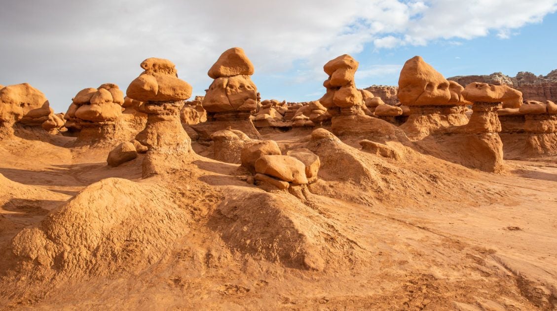
Goblin Valley State Park: Things to Do with Limited Time
Goblin Valley is an easy to visit state park that is located in southeastern Utah. With its hoodoos, toadstools, “goblins,” and short but sweet hiking trails, this park is pure fun to visit. Kids, and kids at heart, will LOVE this park!! The main section of hoodoos and goblins is free to explore…there is no […]
How to Drive the White Rim Road: Map, Photos & Driving Tips
Driving the White Rim Road is the experience of a lifetime. If you are looking for adventure, solitude, incredible views, and a totally different way to experience Canyonlands National Park, put this drive on your list. Along the drive, you will gaze up at the Island in the Sky mesa and peer down into the […]
Utah’s Mighty 5: How to Plan the Perfect Road Trip Itinerary
Stretching across southern and central Utah are five stunning national parks. Called the Mighty 5, these parks contain some of the most thrilling hiking trails and iconic landscapes in the United States. Stand atop Angels Landing in Zion. Gaze across a wonderland of hoodoos at Bryce Canyon. Explore the Water Pocket Fold at Capitol Reef. […]
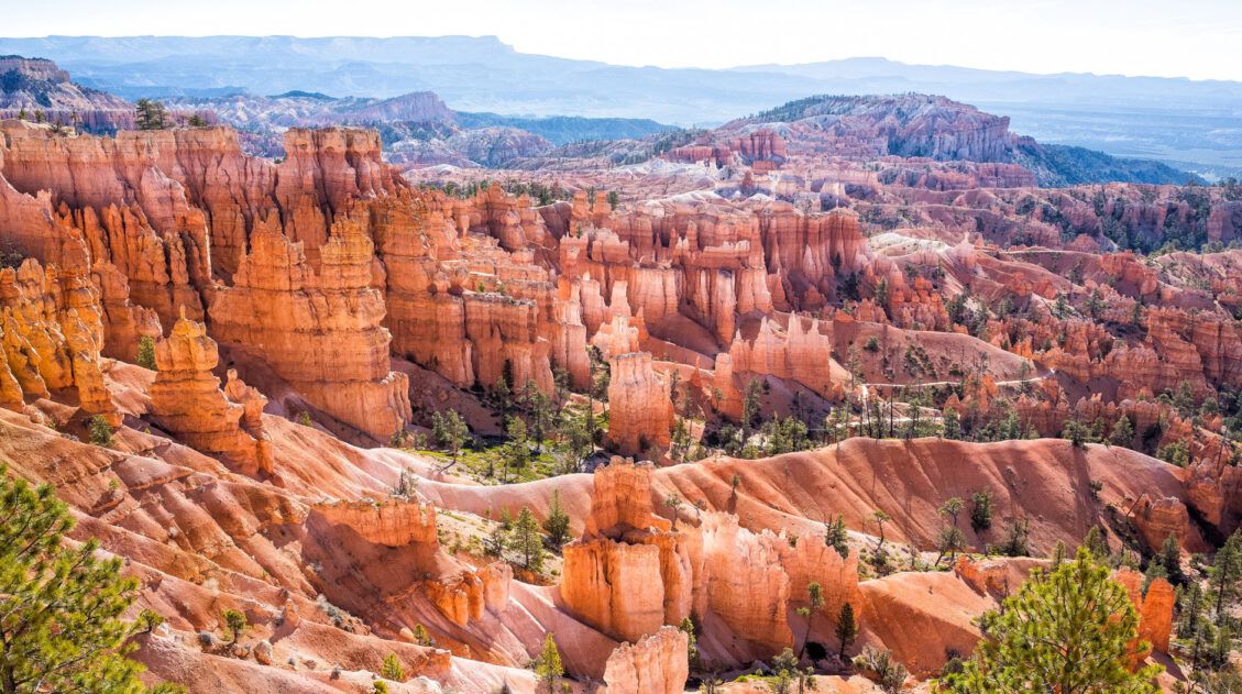
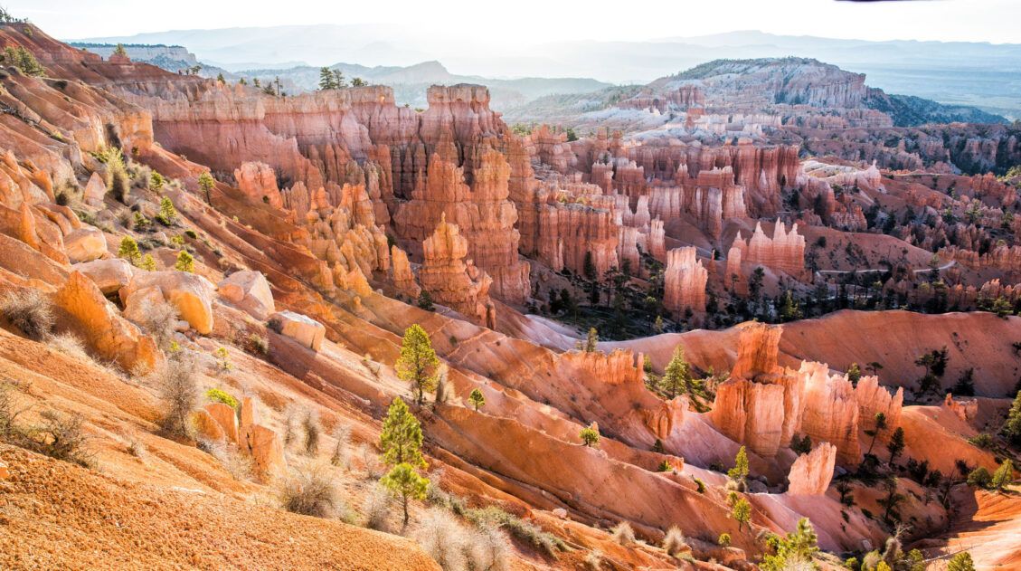
One Perfect Day in Bryce Canyon National Park
Bryce Canyon National Park…a fantasyland of hoodoos, bizarre rock formations, and sandstone pillars. This is a crazy beautiful place, and its unique landscape sets it apart from other national parks. Although Bryce may not have the same sweeping, expansive vistas as the Grand Canyon, it’s still a breathtaking experience the first time you see this […]
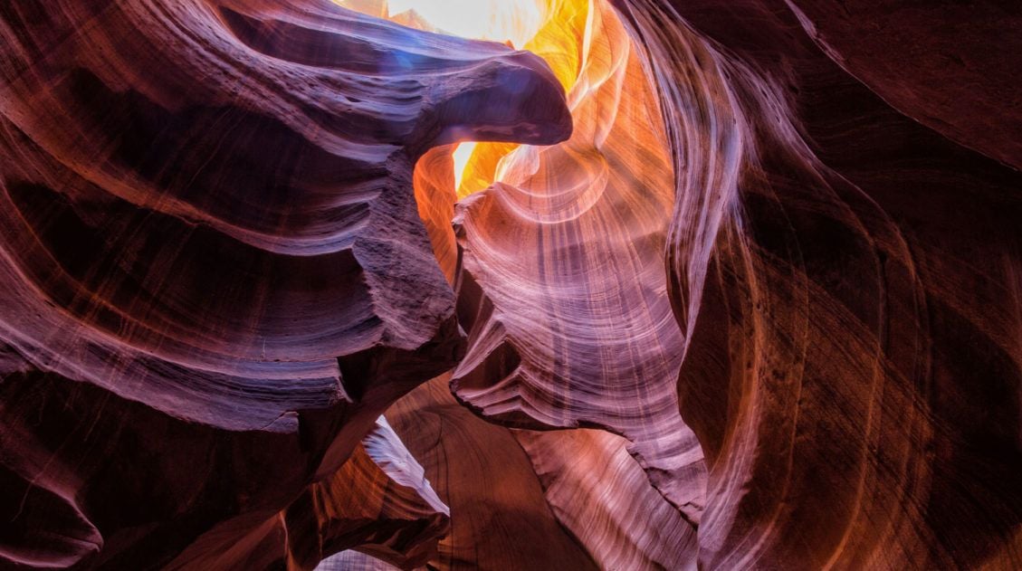
10 Amazing Slot Canyons to Explore in the American Southwest
The American Southwest is a playground for hikers, photographers, and adventurers. Fun to explore and extremely photogenic, slot canyons provide a unique hiking experience. We have assembled a short list of some of the best slot canyons in Utah, Arizona, and Nevada. This is not an all-inclusive list, because there are tons of slot canyons […]
The Ultimate Capitol Reef National Park Itinerary
With beautiful scenic drives, slot canyons, backcountry roads, historical sites, thrilling hikes, and stunning landscapes, Capitol Reef is an unexpectedly amazing national park. If you are planning your Capitol Reef National Park itinerary, we have lots of information to help you plan your trip. Capitol Reef National Park is a highly underrated park. The views […]

The Ultimate Guide to the 63 US National Parks
Stretching from the South Pacific, across the United States to the Caribbean, are 63 national parks. These national treasures preserve iconic landscapes, majestic mountains, primordial forests, arid deserts, misty coastlines, immense canyons, wildlife, and historic landmarks. We have visited 56 of the 63 US national parks, from the towering granite walls of Yosemite and the […]
Comments 26