

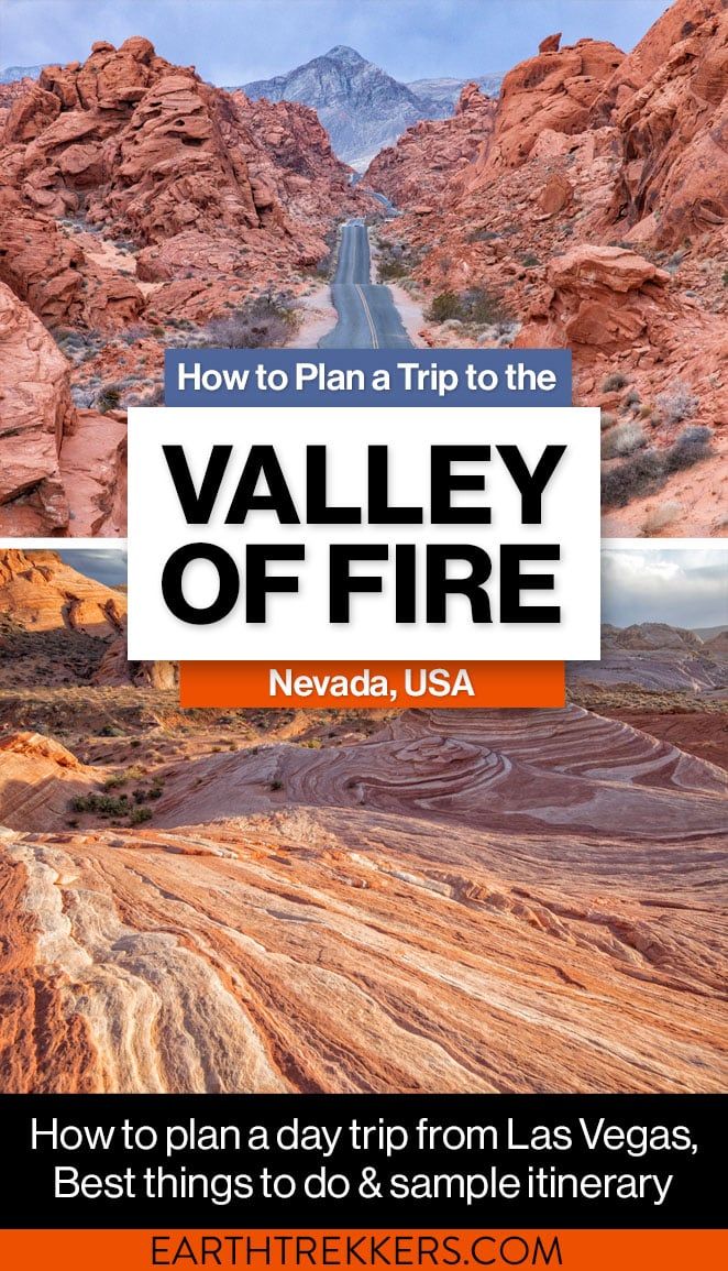
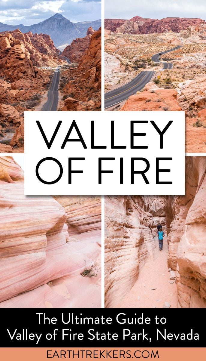
Discover the best things to do in Valley of Fire State Park, along with a streamlined itinerary that covers the highlights efficiently, making it an ideal day trip from Las Vegas.
The Valley of Fire State Park is a brilliant, colorful outdoor destination located in Nevada, just one hour from Las Vegas. Filled with panoramic vistas, hiking trails, petroglyphs, scenic drives, and stunning red and pink rock formations, the Valley of Fire makes an excellent day trip from Vegas. In this guide, we cover the best things to do in the Valley of Fire and how to plan your visit.
So far, we have visited the Valley of Fire twice, first in 2017 and more recently in 2022. On our first visit, Tim and I were totally amazed at the landscapes here…they look like nothing you will see on the drive from Las Vegas. Our second visit was just as good, if not better, as we got to revisit some favorite spots and discover some new ones.
The Valley of Fire is our favorite day trip from Las Vegas. If you are looking for an escape from the neon lights and crowds on the Strip, venture out to this wonderful state park…and don’t forget your hiking shoes and your camera.
The Essentials
WHERE | Nevada, 1 hour from Las Vegas
DON’T MISS | Mouse’s Tank Road, Fire Wave, White Domes Trail, Pink Canyon, Seven Wonders Loop, and the Beehives
HOW MUCH TIME | Half to a full day
COST | $10 in-state residents; $15 out-of-state residents
GOOD TO KNOW | Many trails are closed from May 15 to September 30 due to high temperatures
November 2025 Update: All links and pricing verified. Added new hiking data, tours from Las Vegas, plus updates to the places to visit in the Valley of Fire.
What is the Valley of Fire?
The Valley of Fire is Nevada’s oldest and largest state park. This park is located 50 miles northeast of Las Vegas, Nevada. Its 40,000+ acres are filled with red rock formations made from Aztec sandstone. On a sunny day, these rock formations look like they are on fire, giving the park its name, the Valley of Fire.
Several movies were filmed here, including Total Recall, Viva Las Vegas, The Professionals, and Star Trek Generations.
A visit to the Valley of Fire can last just an hour or two (if you drive through the park, only stopping at scenic overlooks and hiking one or two short trails) or all day, if you choose to explore every nook and cranny of this place.
There are two main roads in the Valley of Fire State Park.
The Valley of Fire Highway runs west to east across the southern part of the park. Both entrances into this park are located on this road (the west entrance and the east entrance). Sights along the Valley of Fire Highway include Atlatl Rock, the Beehives, Elephant Rock, and Seven Sisters.
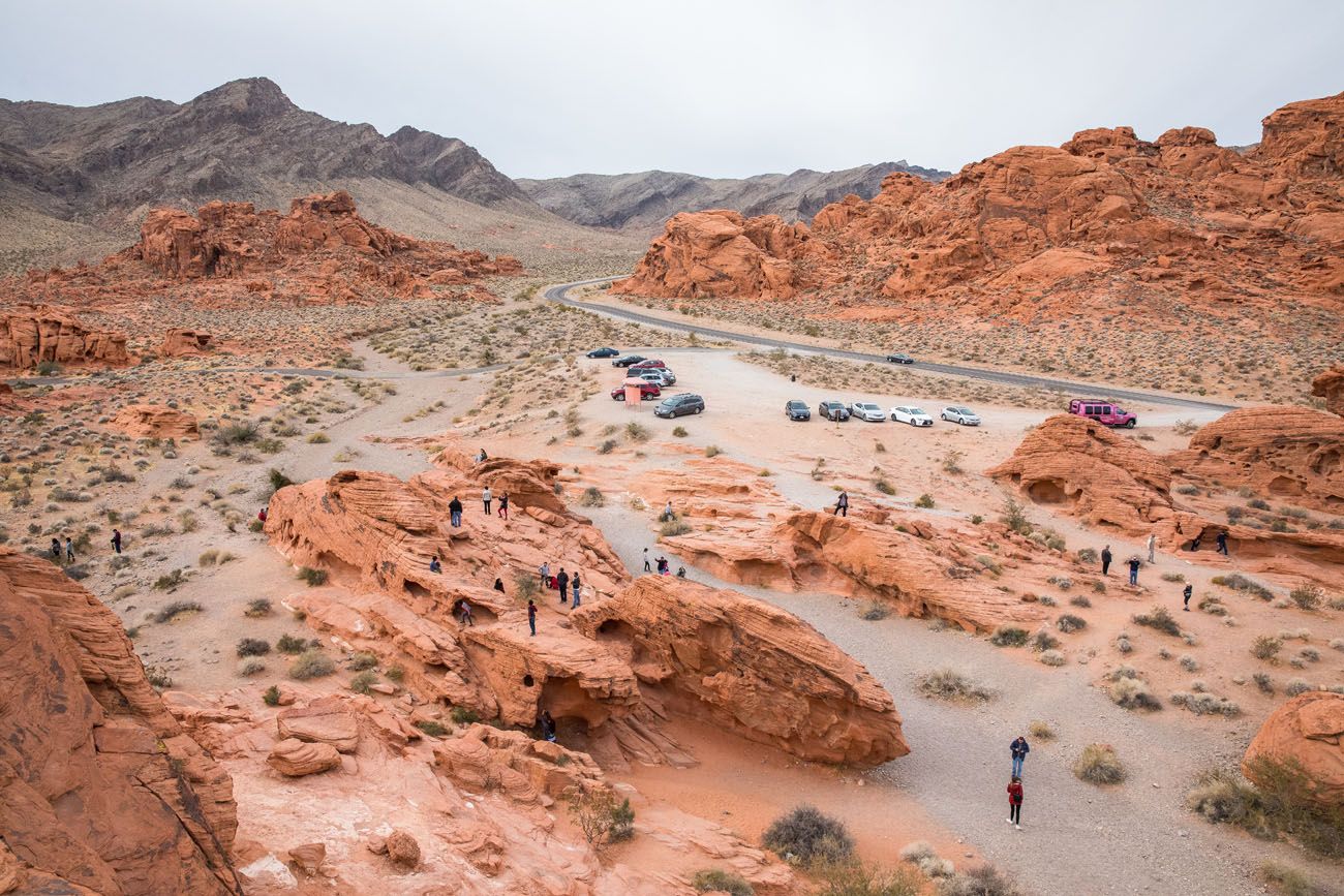
Mouse’s Tank Road (the state park brochure calls this road “White Domes Road” and Google has this road labeled as “Mouse’s Tank Road”) heads north into the heart of the park. Driving this road, and seeing the sights here, is one of the best state park experiences we have had in the United States. The drive is gorgeous and the hiking trails that start along this road are short and sweet and tons of fun. When we visit the Valley of Fire, we spend most of our time along this road.
The visitor center is located next to the intersection of the Valley of Fire Highway and Mouse’s Tank Road.
Best Things to Do in the Valley of Fire State Park
Here is a map of the best things to do in the Valley of Fire, with hiking trailheads and photography locations.
How to Use This Map: Click the icons on the map to get more information about each point of interest. To take this map with you, click the star next to the title of the map which adds it to your Google account. Next, within your Google Maps app, select ‘Saved’ and then select ‘Maps’. This map title will now appear in your list.
#1 Enjoy the Landscapes
One of the best things about the Valley of Fire State Park is that you don’t have to be a hiker to enjoy it. Many of the most beautiful sights in the park can be seen right from the roads.
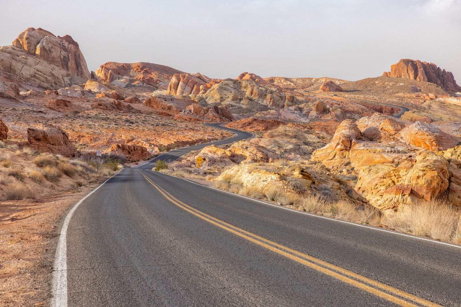
Mouse’s Tank Road | Best Things to Do in the Valley of Fire
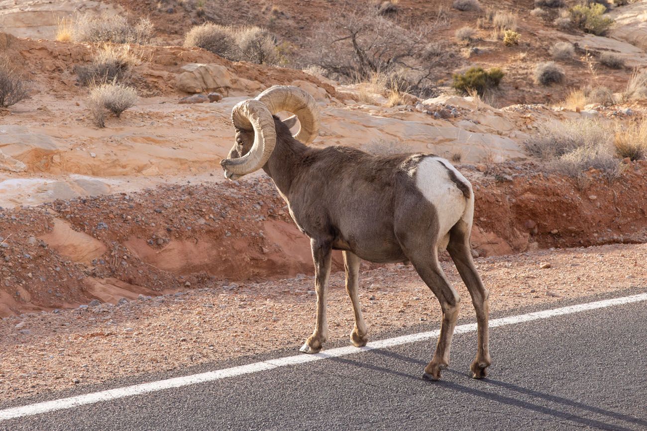
Bighorn Sheep on Mouse’s Tank Road
Driving through the Valley of Fire is the easiest way to enjoy the view. Pink, red, and orange sandstone rocks create amazing vistas that you can see from your car.
#2 The Beehives
These strange looking sandstone formations can be seen in just a few minutes. Get out of your car, take some photos, or climb up to the top of the highest dome for great views over the park.
This is a fantastic activity for kids. Tyler and Kara enjoyed climbing these rocks, and Tim and I appreciated the views from the top. It’s a great introduction to the park.
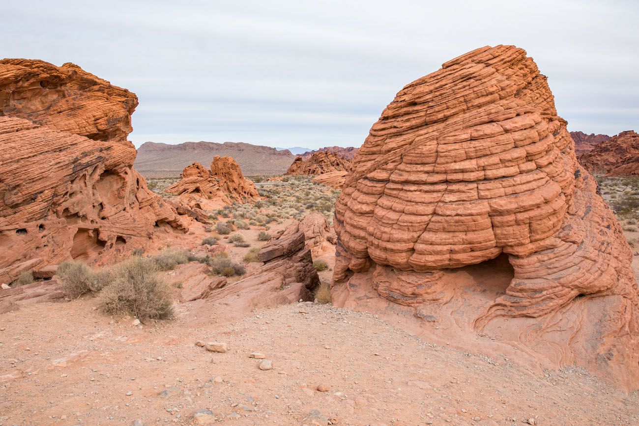
The Beehives
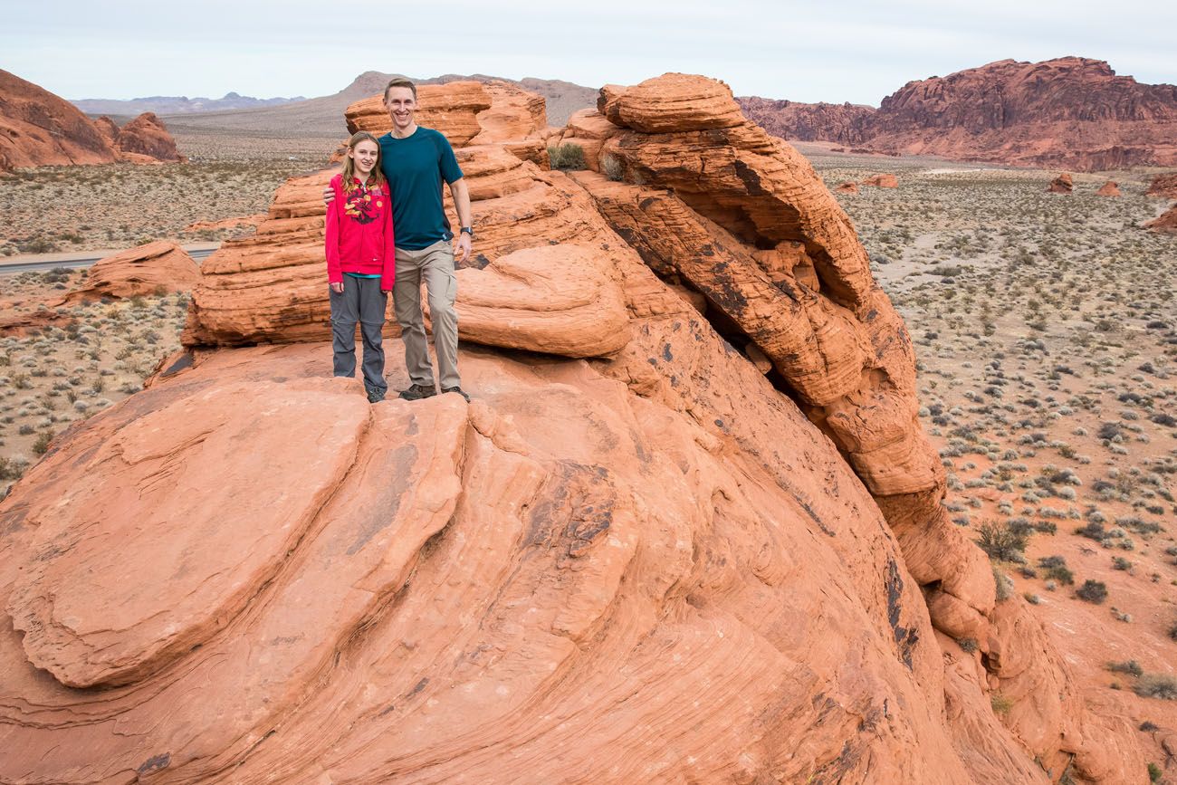
LOCATION: The Beehives are located on Valley of Fire Highway, near the west entrance. If you enter the park through the west entrance, this is the first sight that you will see.
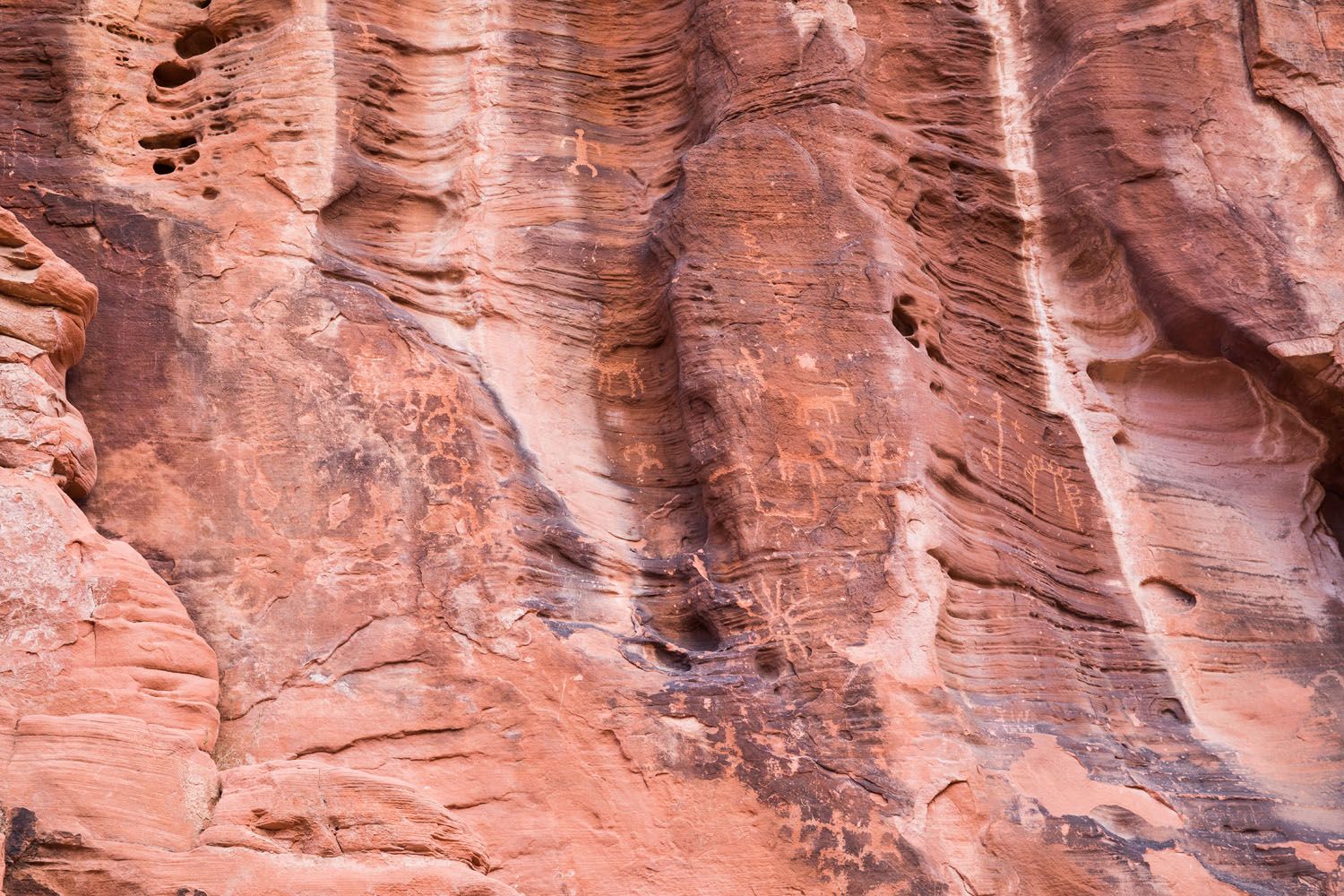
#3 Atlatl Rock
Climb the staircase at Atlatl Rock to see the best display of petroglyphs in the Valley of Fire.
These petroglyph panels were created by Indigenous peoples thousands of years ago. The carvings include an atlatl (a spear-thrower) with a hunter, bighorn sheep, human and shaman-like figures, and a variety of abstract symbols such as circles and zigzags.
While the exact meanings are unknown, the images are generally interpreted as a blend of hunting scenes, clan or group symbols, and spiritual or natural-world elements.
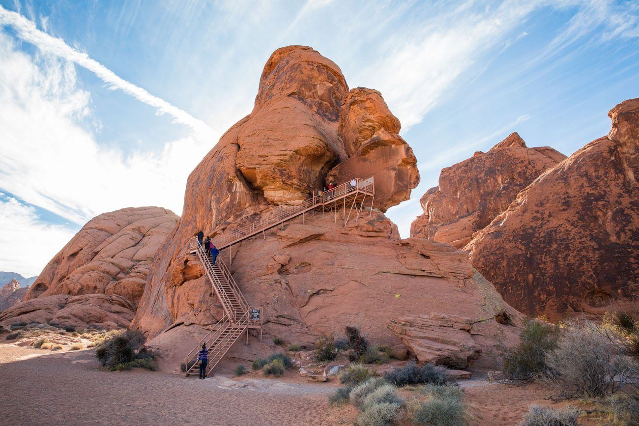
Atlatl Rock | Best Things to Do in the Valley of Fire
#4 Arch Rock
This large arch in the sandstone can be seen from the Scenic Loop Road near Atlatl Rock. Arch Rock is a delicate natural sandstone arch formed over millions of years by wind and water slowly eroding the softer rock layers. It’s a quick but worthwhile stop in Valley of Fire.
#5 Fire Cave
Also located on the Scenic Loop Road is the Fire Cave. We are listing it here so you know about it, just in case you read about it on other sites. This was a popular photography destination but recently the arch collapsed. Now it’s best to put your time into other places in the Valley of Fire.
#6 Seven Sisters
Located on the Valley of Fire Highway, this is a quick stop to see a cluster of seven sandstone rock formations. They were created as softer surrounding rock eroded away over time. They’re an easy roadside stop in the Valley of Fire and a great place for photos and a short walk.
#7 Elephant Rock
Located next to the east entrance, this arch rock formation resembles an elephant, with a little bit of imagination.
It is a 0.2-mile out-and-back walk to get to Elephant Rock from the parking lot or you can hike the 1.25 mile loop.
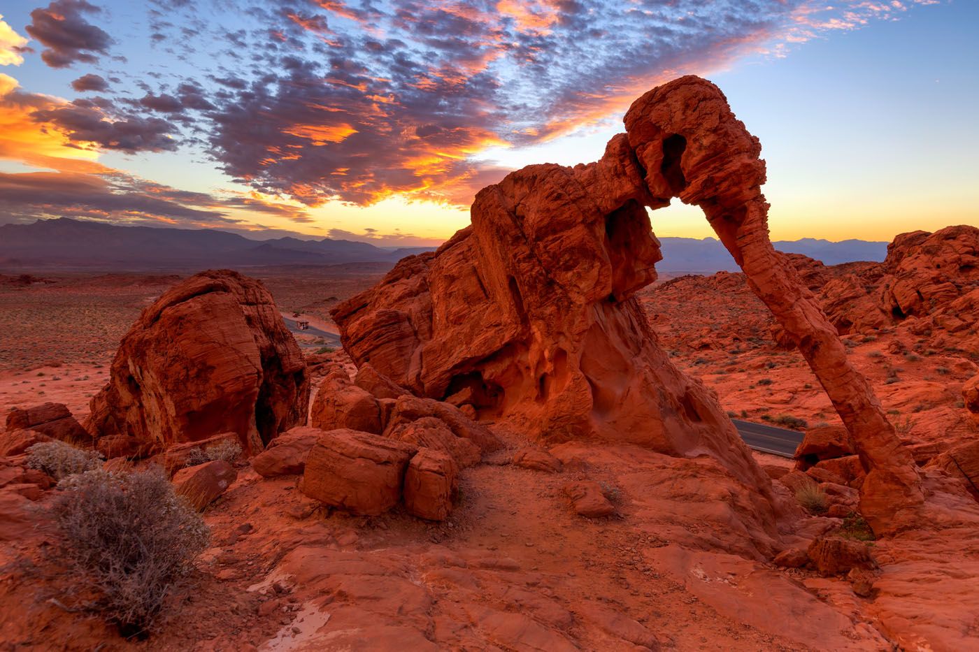
Bill45/shutterstock.com
#8 Mouse’s Tank
Distance: 0.75 miles out-and-back | Difficulty: Easy | Time: 30 minutes
The hike to Mouse’s Tank is relatively short (only .75 miles round trip), ending at a natural rock basin where water collects after rainfall.
We thought that this was an easy but unexciting hike, and along the way, you can spot petroglyphs on the rocks. If you are short on time, I’d skip this hike and save your time for some of the better trails in the park.
LOCATION OF MOUSE’S TANK: Mouse’s Tank Road, just north of the visitor center.
#9 Rainbow Vista
Distance: 1 mile out-and-back | Difficulty: Easy | Time: 30 to 60 minutes
This hike is more worthwhile than Mouse’s Tank. Only 1 mile round trip, this hike ends with a climb up onto a large hill for a panoramic view over the Valley of Fire.
Rainbow Vista tends to get fewer visitors places like the Fire Wave and White Domes, so if you like to leave the crowds behind, put this short hike on your list. Plus, we really liked the view from here.
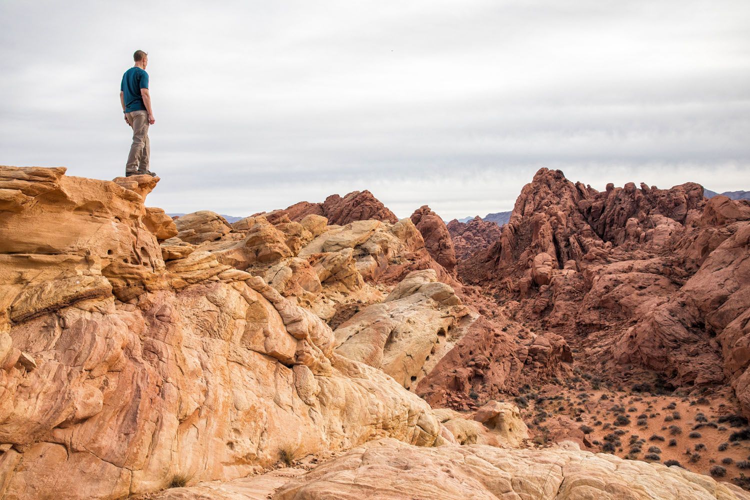
Tim at Rainbow Vista
LOCATION: Mouse’s Tank Road, just a short drive north of the trailhead for Mouse’s Tank.
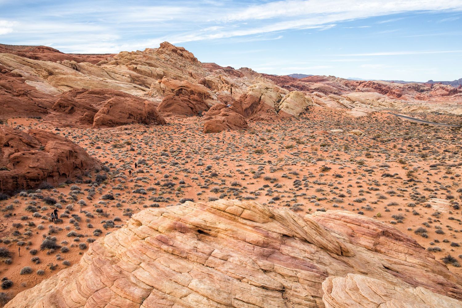
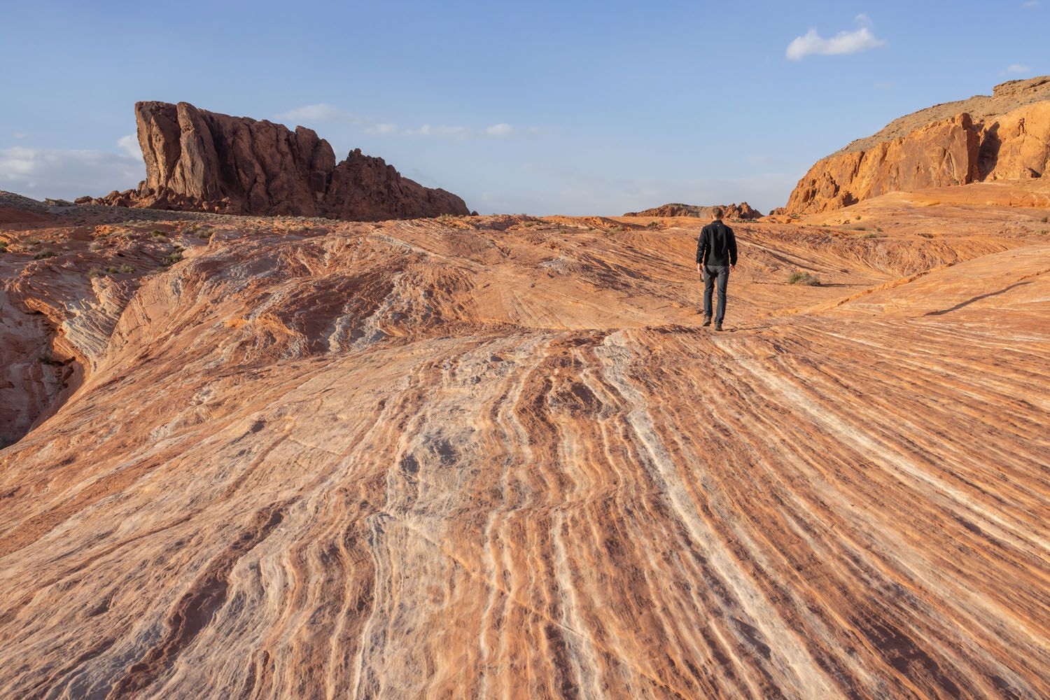
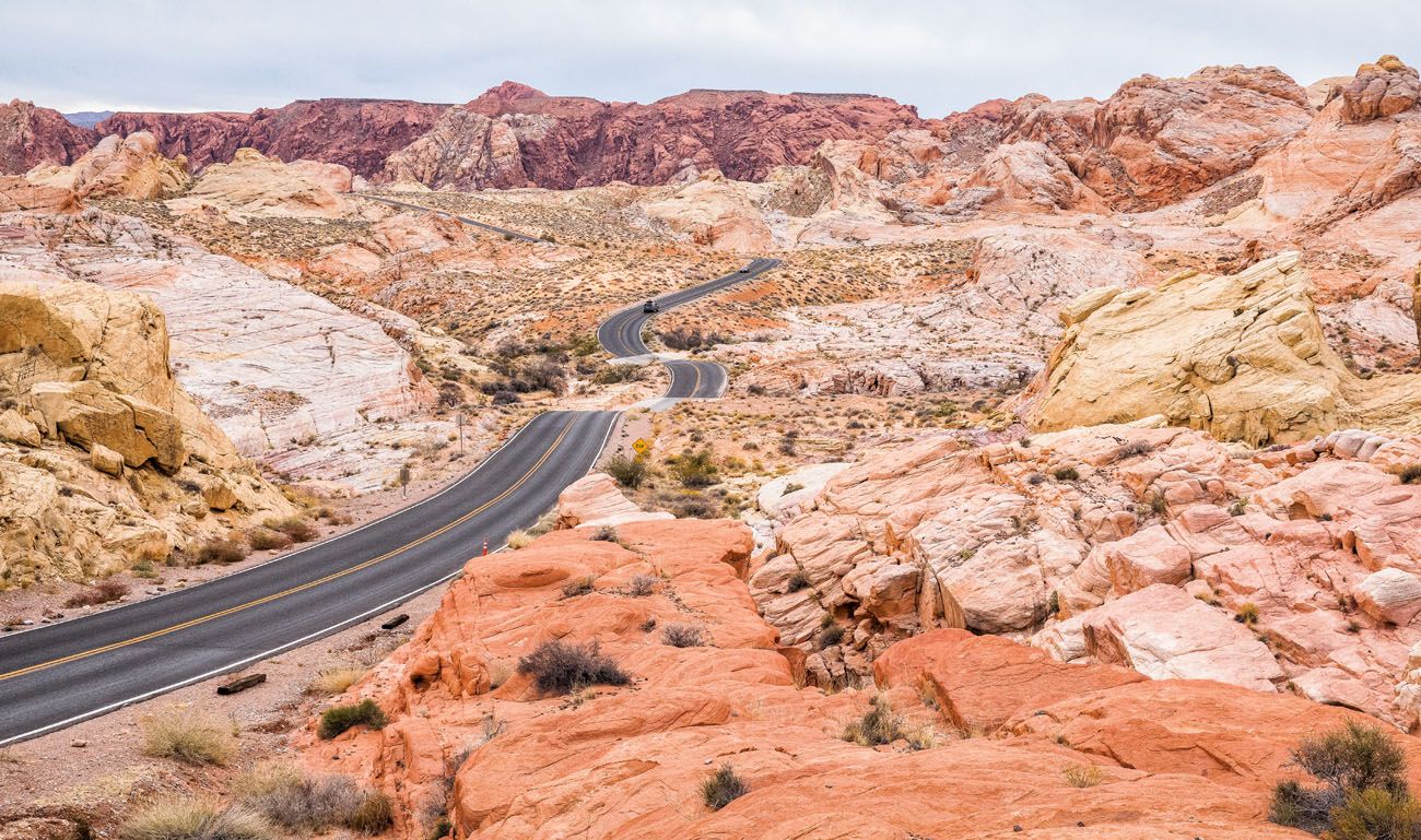
#10 Viewpoint of Mouse’s Tank Road
This view of Mouse’s Tank Road is one of the most photographed spots in the Valley of Fire.
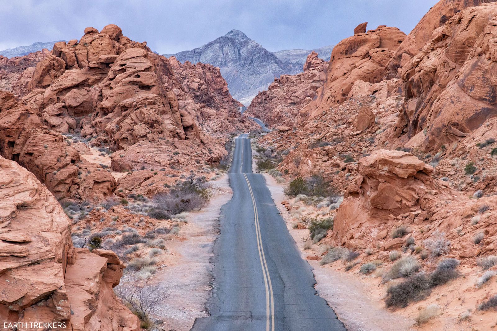
The first time we were here, we didn’t know about this viewpoint. On our most recent visit, Tim and I spent some time trying to find the exact location. We found several places to get a great view of Mouse’s Tank Road.
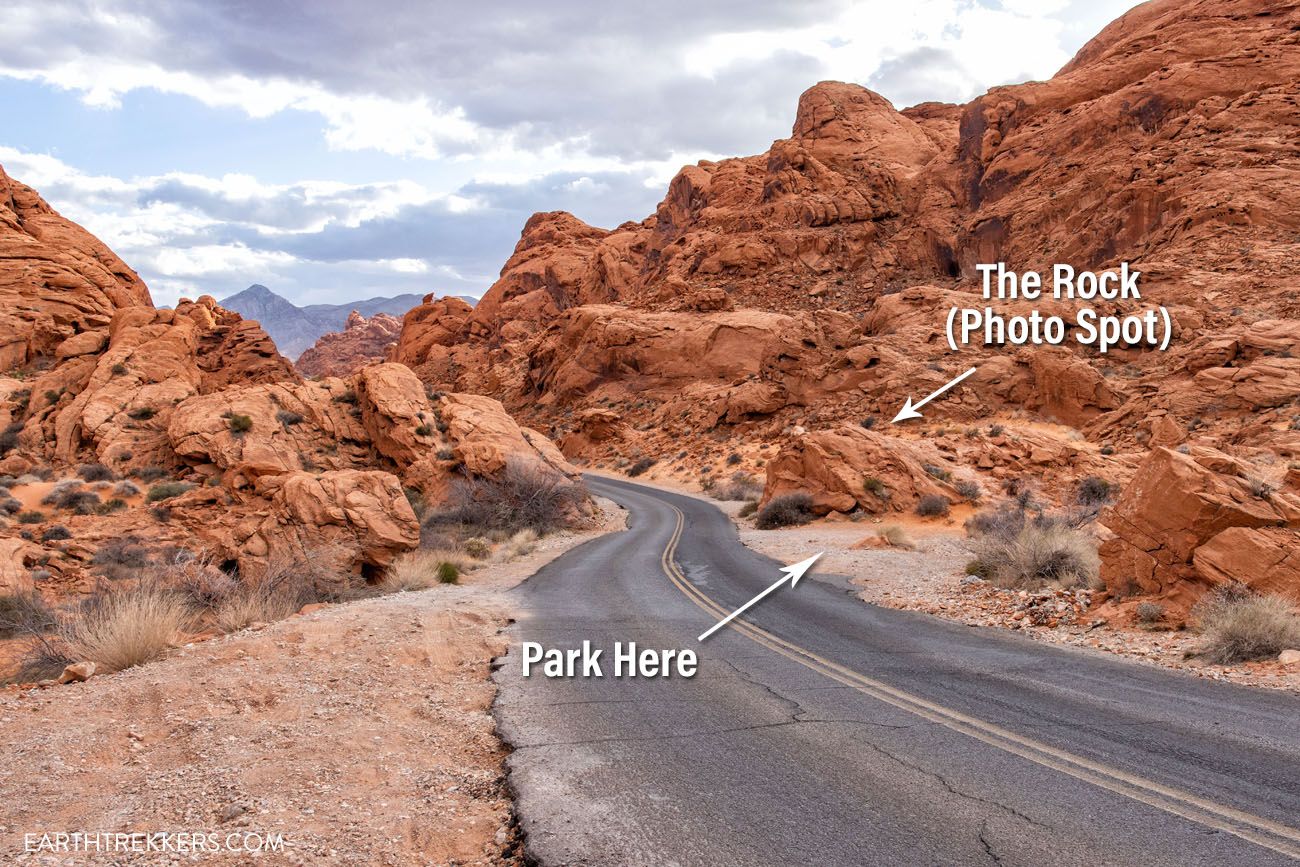
For the view in the photo above, you will park in a pull out and climb on top of a rock. To get to this pull out from the Rainbow Vista parking lot, drive south on Mouse’s Tank Road (like you are heading out of the park). The road will go downhill and bend to the right. Park in the pullout on the right side of the road and climb the rock for the view.
Below is a photo of parking location and the rock. The GPS coordinates of the parking area are 36°26’56.2″N 114°30’56.3″W.
You can also get a great view of Mouse’s Tank Road near the parking lot for Rainbow Vista. From the Rainbow Vista parking lot, cross the street and hike up onto the rocks for this view:
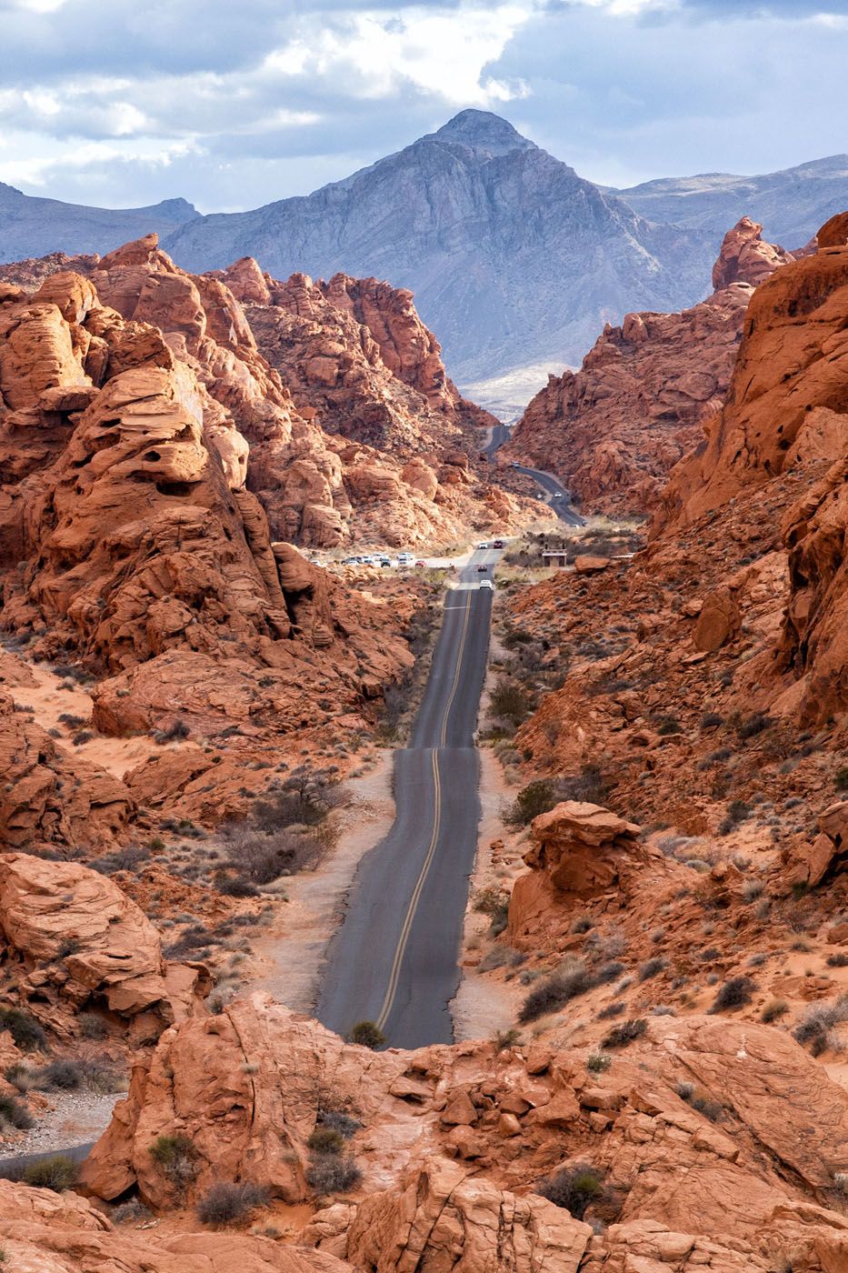
Mouse’s Tank Road
#11 Fire Canyon/Silica Dome
Located at the end of Fire Canyon Road, this overlook offers views of the Fire Canyon and Silica Dome. It only takes a few minutes to drive here and enjoy the view.
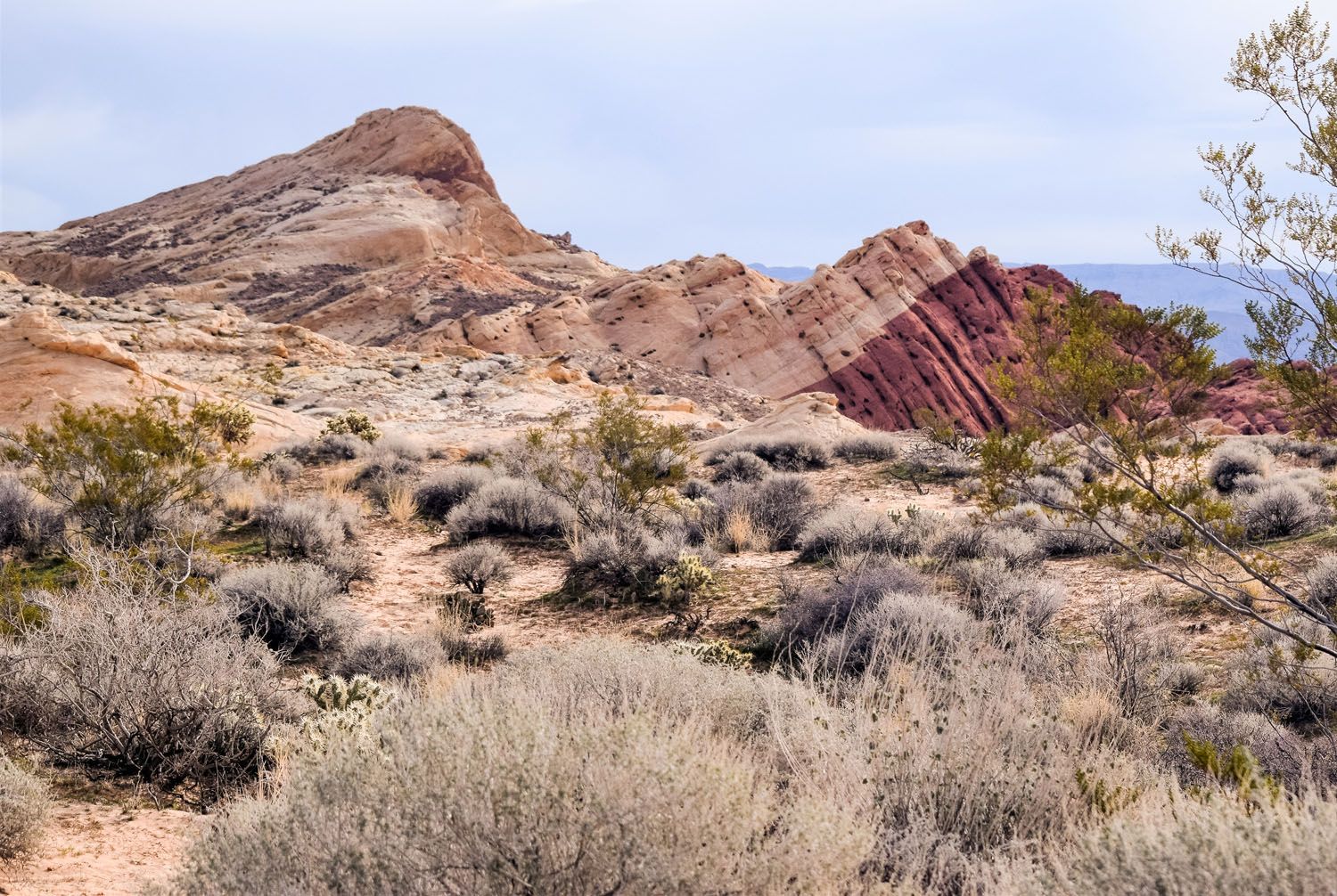
Photo courtesy Valley of Fire State Park
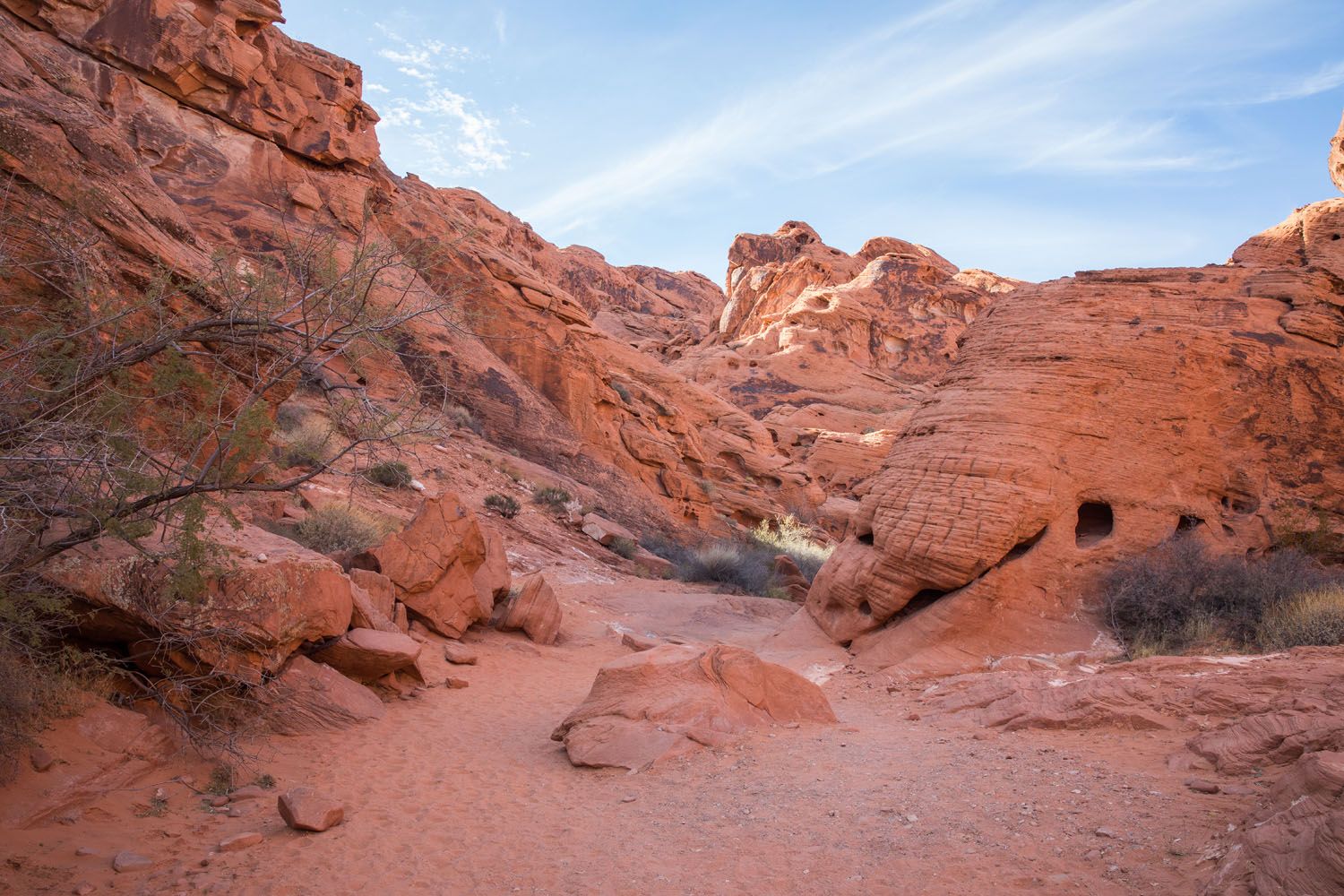
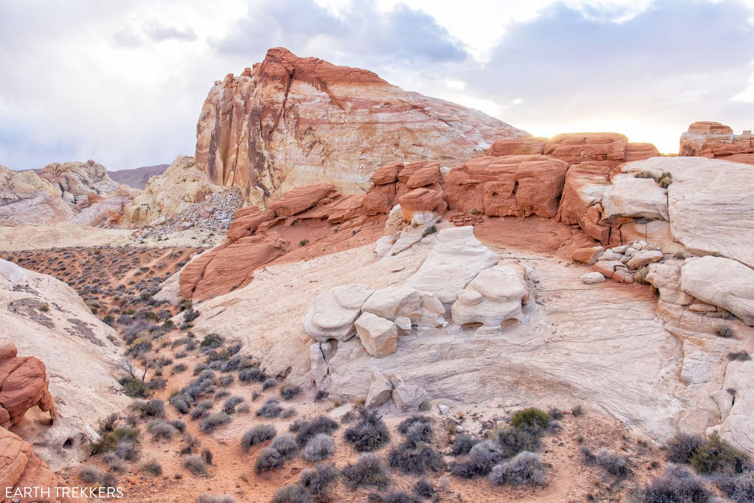
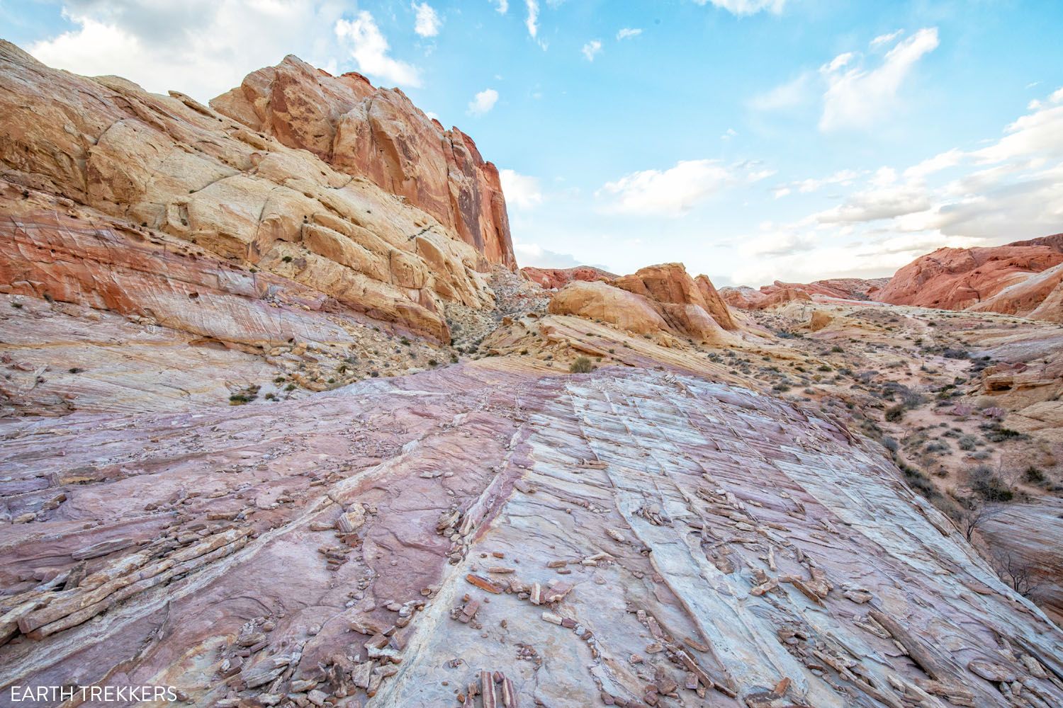
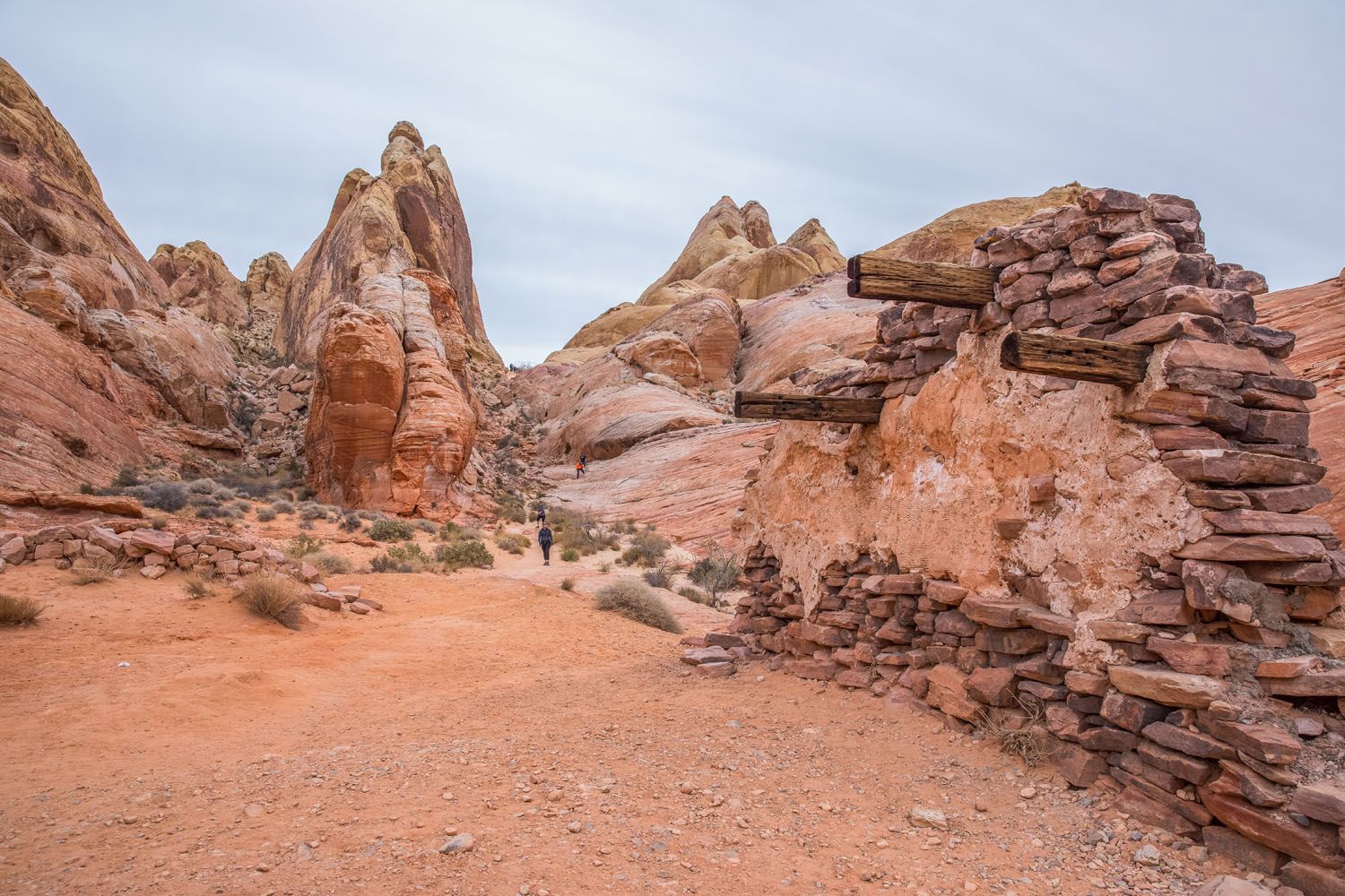
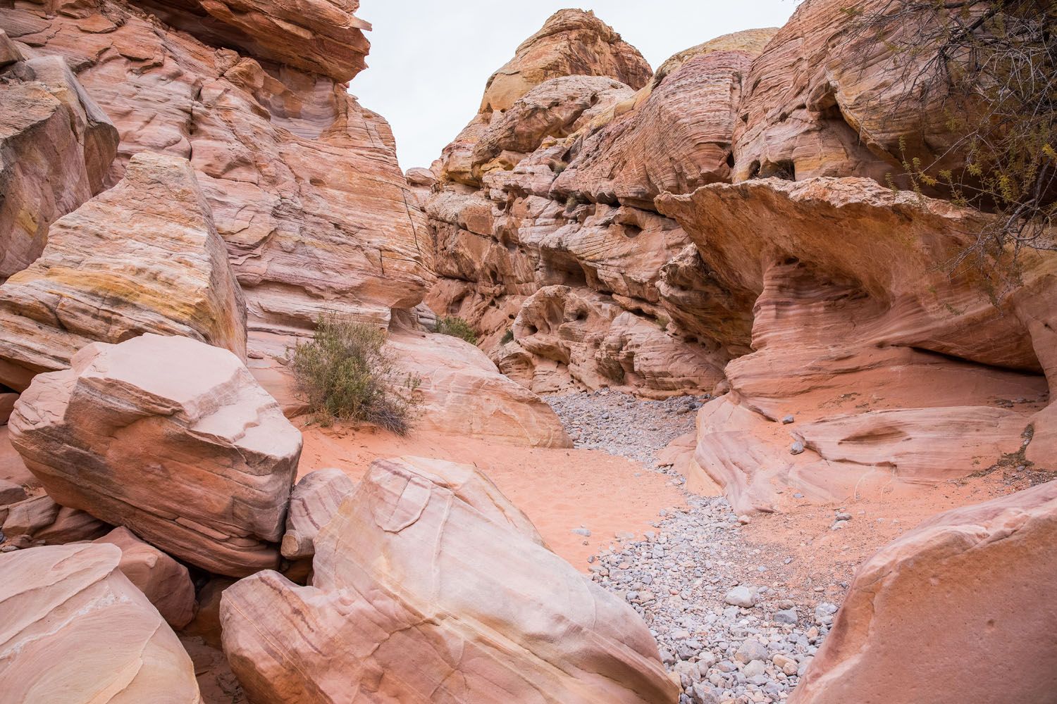
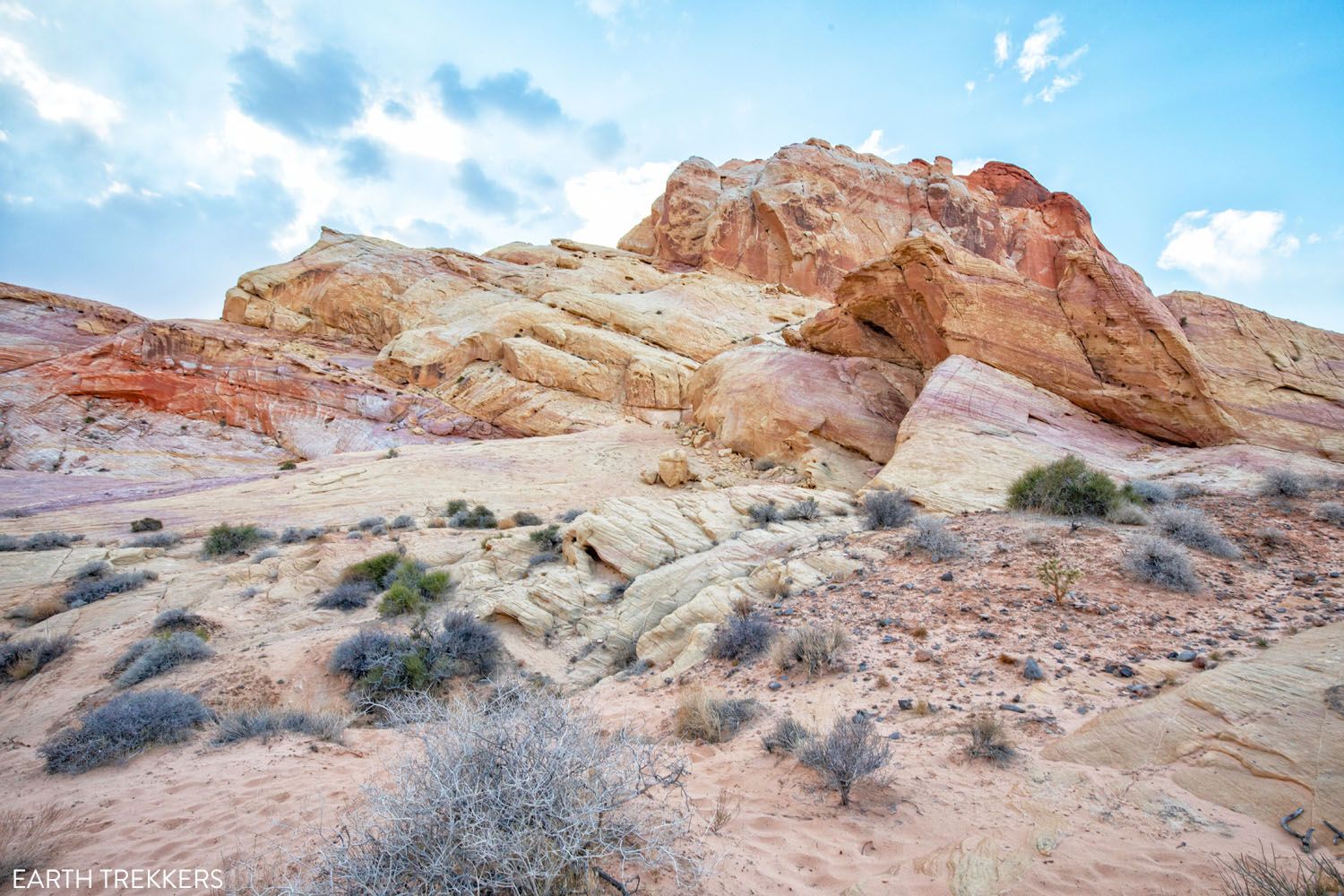
#12 Pink Canyon
Pink Canyon, also called Pastel Canyon, is one of the prettiest places we saw in the Valley of Fire. Parking is limited to only one or two cars (GPS coordinates: 36°28’47” N 114°31’36” W). From the parking spot, head east into the canyon.
It only takes about 10 minutes to walk through this short, shallow canyon, and with its pink scalloped walls, it’s a beauty.
Pink Canyon can be combined with the Fire Wave to create a loop hike called the Seven Wonders. Keep reading for more information on how to do this.
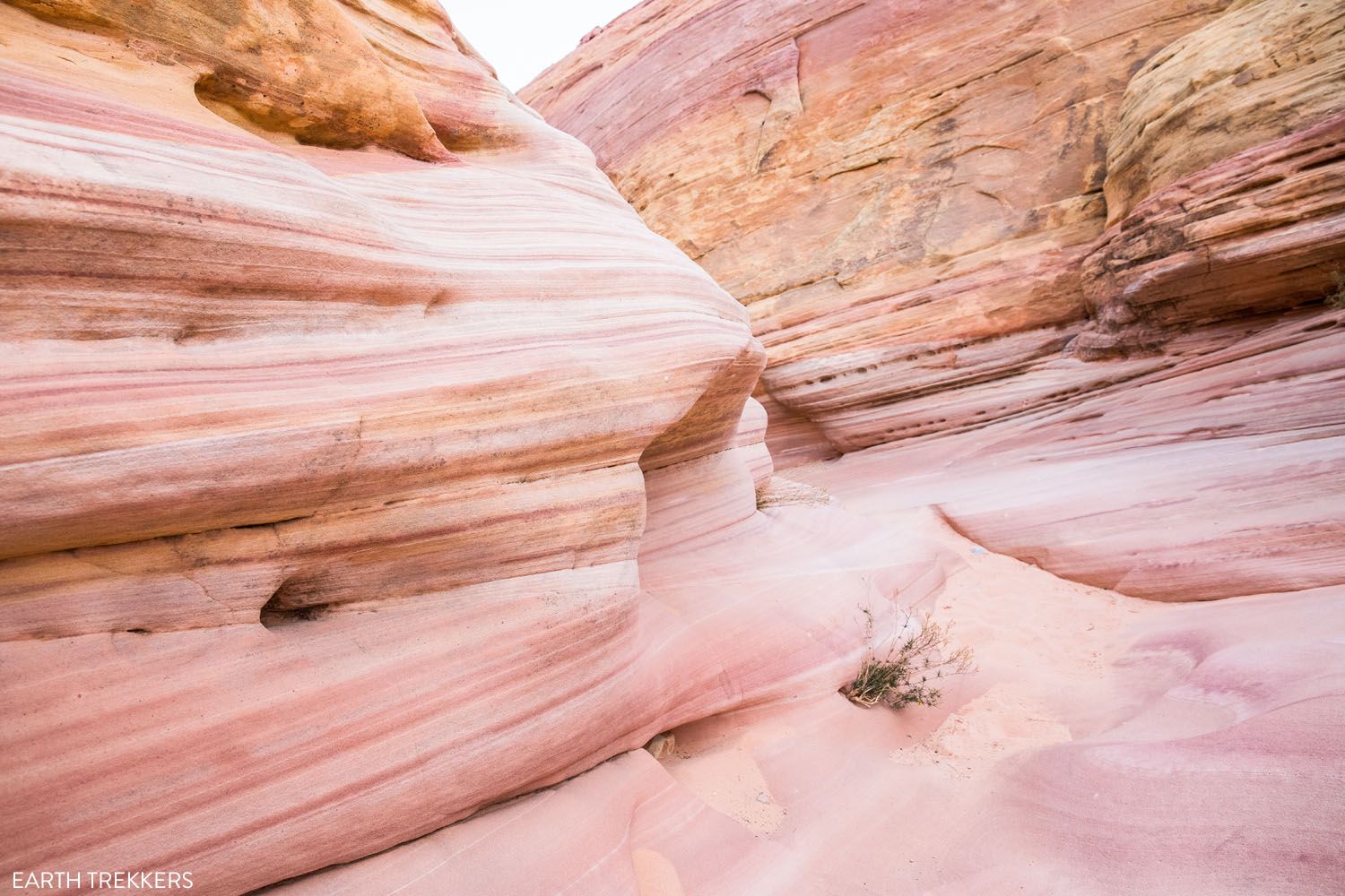
Pink Canyon | Best Things to Do in the Valley of Fire
Please practice the seven principles of Leave No Trace: plan ahead, stay on the trail, pack out what you bring to the hiking trail, leave areas as you found them, minimize campfire impacts, be considerate of other hikers, and do not approach or feed wildlife.
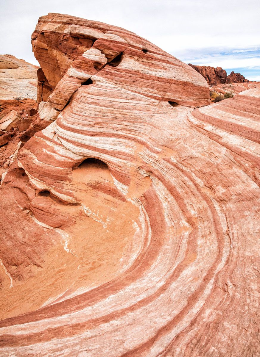
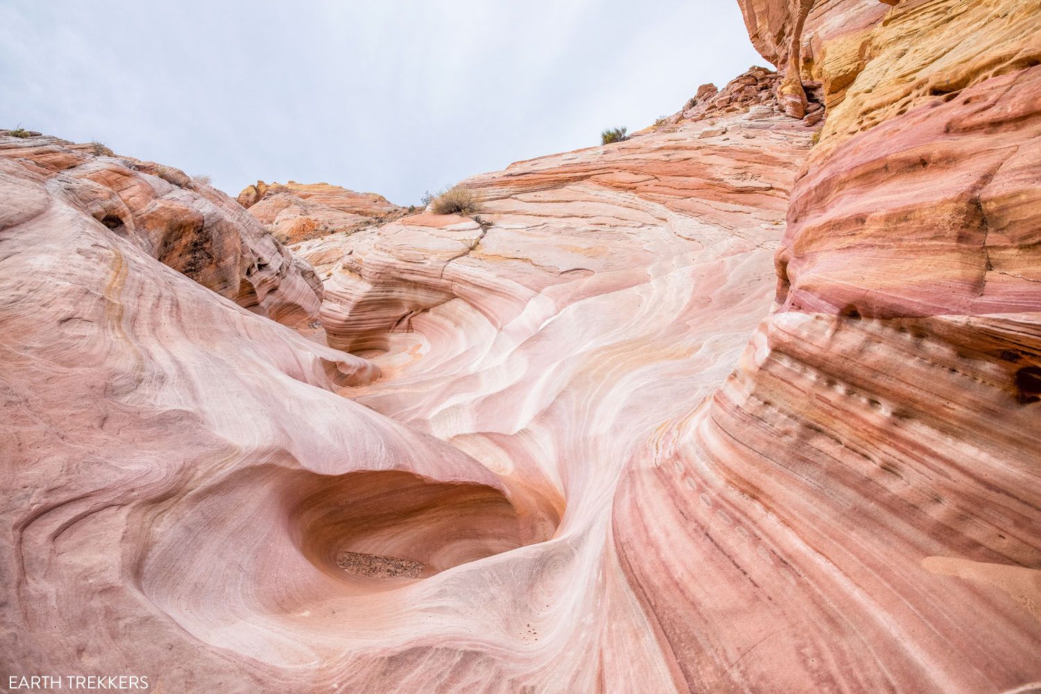
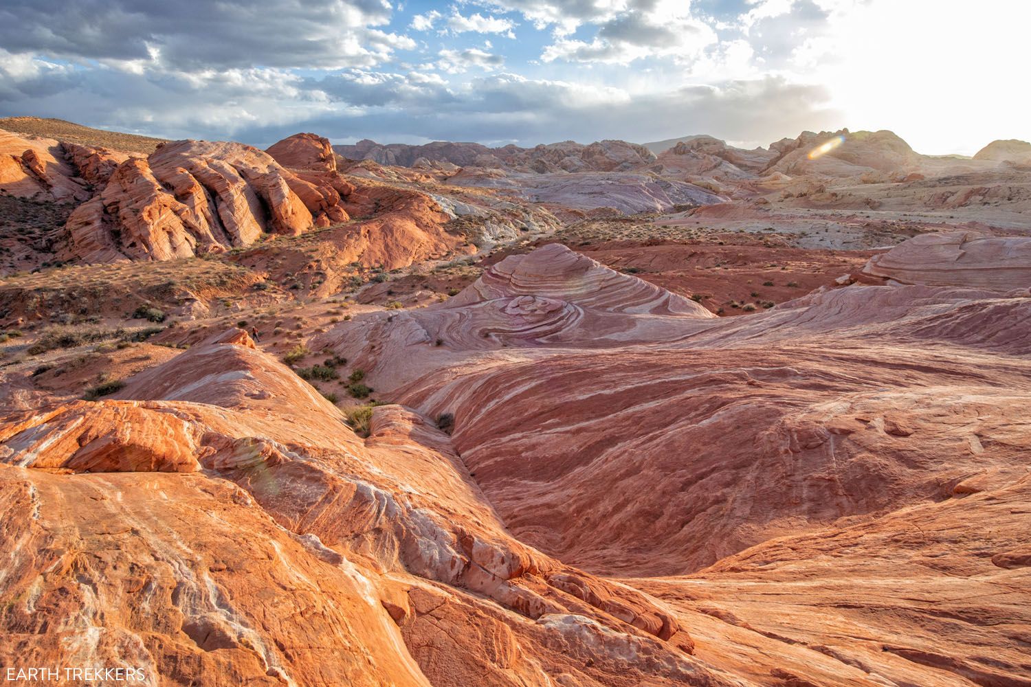
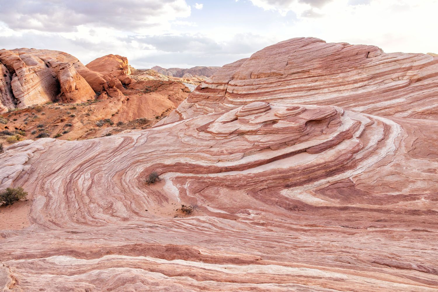
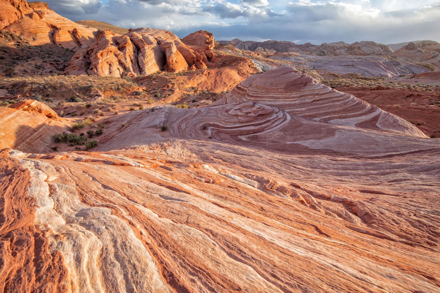
#13 The Fire Wave
Distance: 1.5 mile out-and-back | Difficulty: Easy to moderate | Time: 30 to 60 minutes
This is one of the most gorgeous spots in Valley of Fire State Park. White and red zebra print sandstone creates a great photo opportunity. It’s a 1.5-mile round trip hike out to the Fire Wave.
On our second visit to the Valley of Fire, we arrived at the park a few hours before sunset. By the time we made it to the Fire Wave, most people were leaving, so we had it all to ourselves. If you want to visit the Valley of Fire with low crowds, plan your visit for the beginning or the end of the day.
All of our photos below were taken in the late afternoon.
PRO TRAVEL TIP: From mid-May through September 30, the Fire Wave trail is closed to visitors. Learn more here.
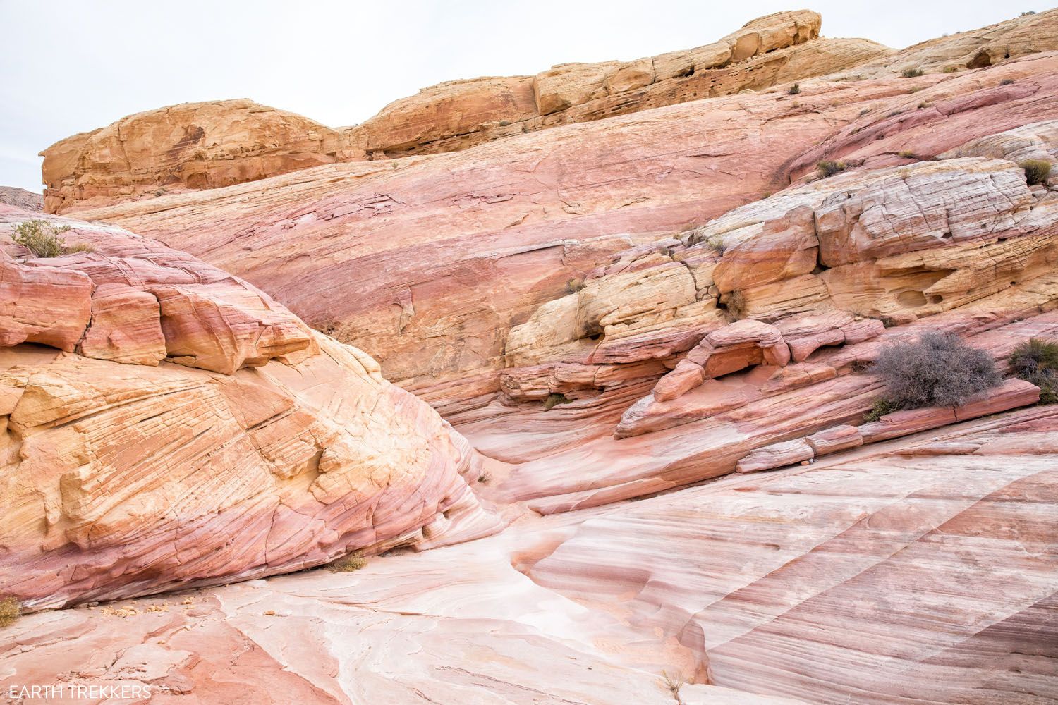
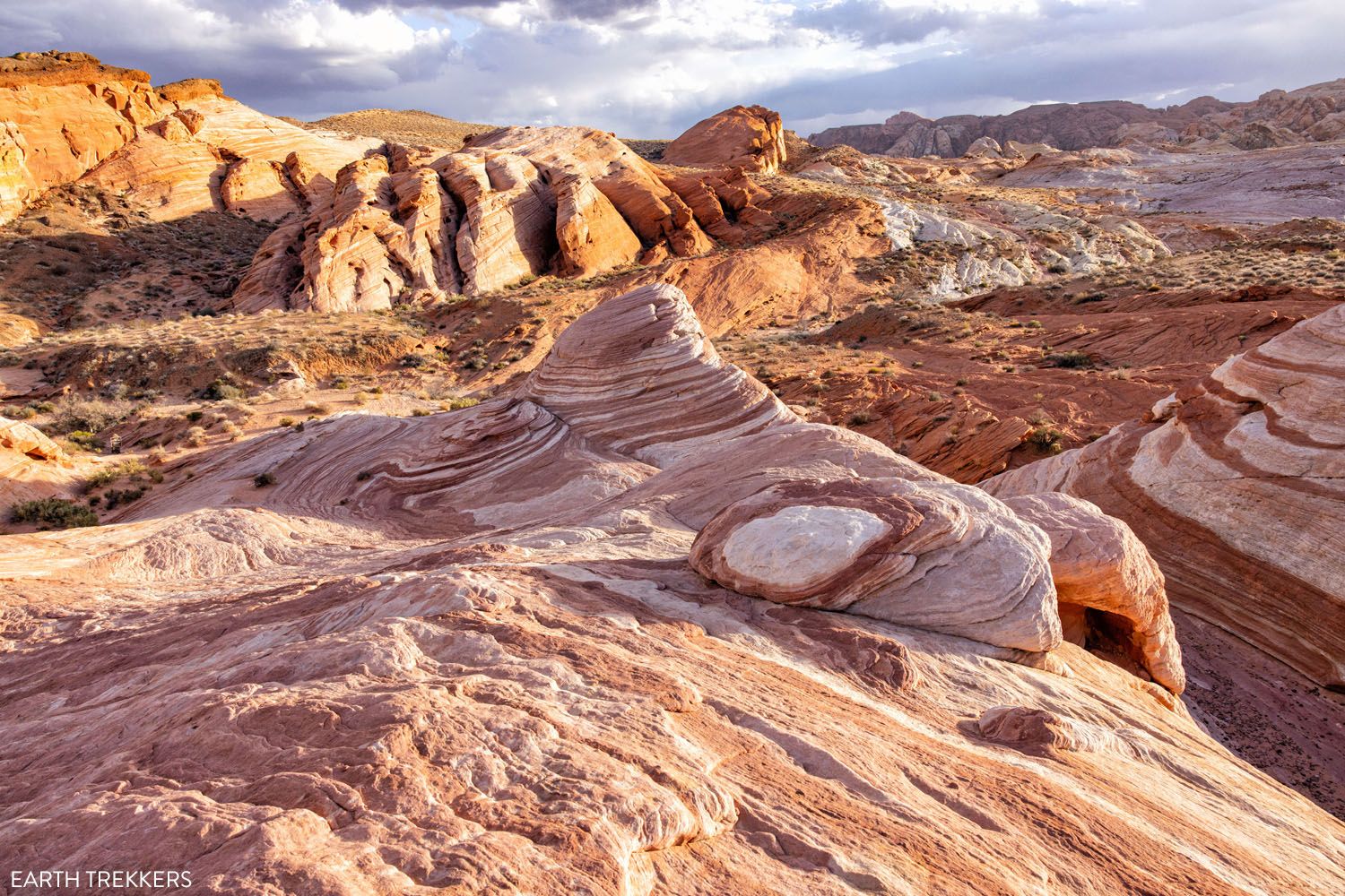
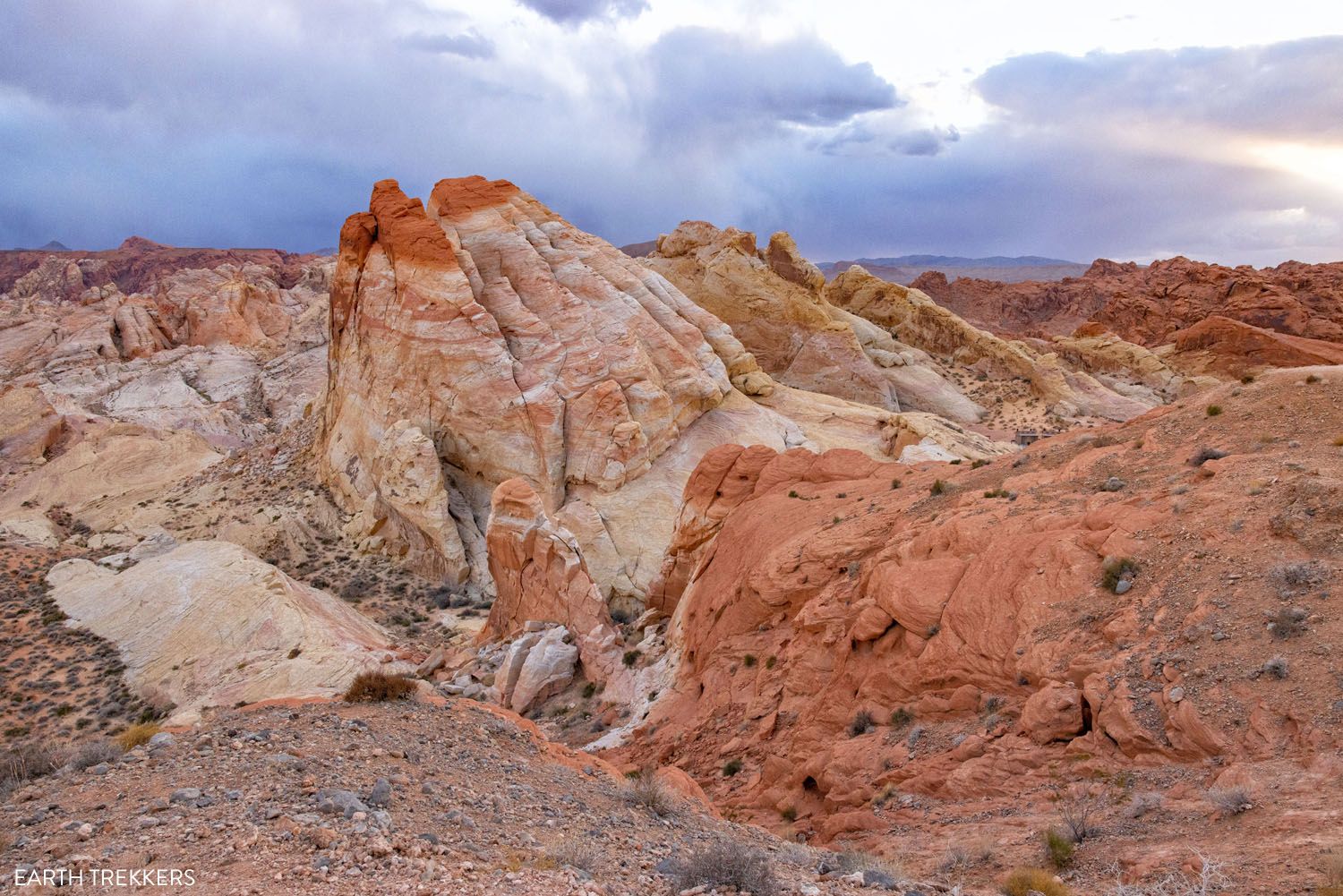
#14 Seven Wonders Loop
Distance: 1.8 miles | Difficulty: Moderate | Time: 1 to 2 hours
This 1.8-mile loop combines some of the best scenery in the Valley of Fire into one hike. Hike the Fire Wave, walk through the Pink Canyon, and explore the pastel landscapes in this part of the park.
This is our favorite hike in the Valley of Fire State Park.
To do this hike, the best place to park is the parking lot for the Fire Wave. There are two parking lots here, one on either side of the road. I recommend parking in the one on the west side (the left side as you drive north on Mouse’s Tank Road). From this lot, you can also hike up to the viewpoint that I mention next.
You can hike the loop in either direction. I recommend doing this in a clockwise direction so you see the Fire Wave first. It’s super fun to hike down into the Fire Wave and see the surrounding vistas of yellow, orange, and pink rocks.
After visiting the Fire Wave, continue to the Pink Canyon. Cross the road and then you will head back to the parking lot, hiking through a beautiful landscape of pink, yellow, and coral sandstone. It is a beautiful hike!
All of our photos were taken at sunset.
Seven Wonders Trail | Best Things to Do in the Valley of Fire
PRO TRAVEL TIP: This trail does not show up on Google Maps. It is shown in the park brochure that you receive when you enter the park.
#15 Viewpoint of White Domes
For a great view over White Domes and a panoramic view across the park, we have another short hike to recommend.
From the Fire Wave parking lot (on the west side of Mouse’s Tank Road), there is a trail that starts on the north side of the parking lot. It heads uphill to a viewpoint on top of a large hill.
To do this, it’s about 0.3 miles out-and-back and takes 30 minutes. Here is the view:
White Domes Viewpoint
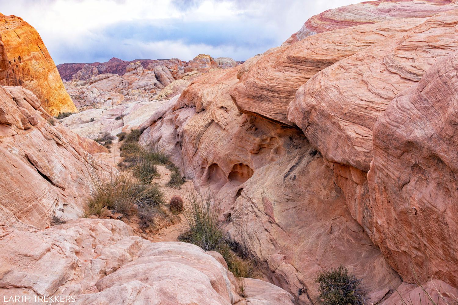
#16 White Domes Trail
Distance: 1.25 mile loop | Difficulty: Moderate | Time: 1 to 2 hours
This 1.25-mile loop hike is our second favorite hike in the Valley of Fire. It’s also the most challenging, with a descent at the beginning and then a climb back up to the parking lot at the end. Even so, it’s not difficult, and it’s a great place to bring kids to let them climb over boulders on the trail.
You even get to walk through a narrow slot canyon.
This is another great hike for adventurous kids. Hike through the slot canyon, on rugged trails with stone steps and obstacles, and up and down small hills. The scenery is constantly changing, which keeps kids interested the entire hike.
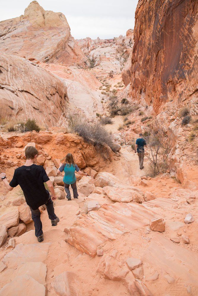
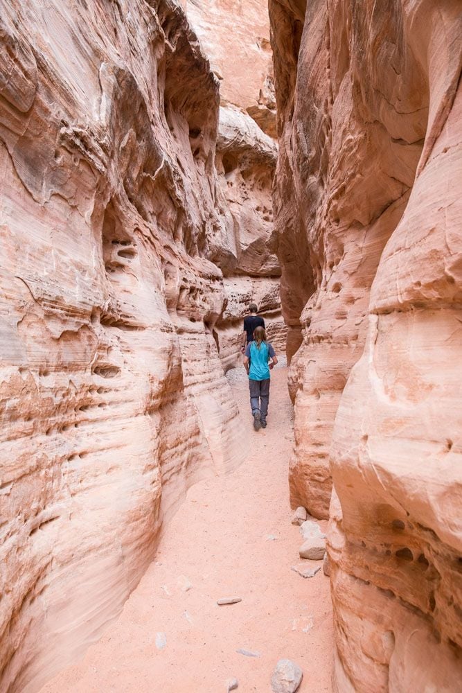
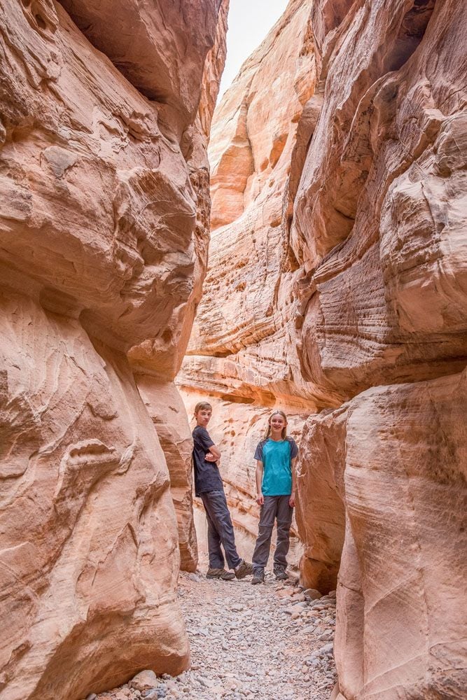
The easiest way to do this hike is to go clockwise, starting and ending in the car park. By doing it this way, you walk down the relatively steep, rocky path and later walk up a more gentle incline on a singletrack trail.
LOCATION: The parking lot for White Domes is located at the very end of Mouse’s Tank Road. There are restrooms here.
Our Top 5 Favorite Experiences
If you are short on time and want to see the highlights, here are our five favorite things to do in the Valley of Fire:
- Fire Wave: This 1.5 mile hike takes you out to one of the most photogenic parts of the Valley of Fire.
- Mouse’s Tank Road: The main road through the park. There’s an amazing view around every turn.
- Pink Canyon (Pastel Canyon): A short but very pretty walk through a pastel pink slot canyon.
- The Beehives: Scramble up to the top of the Beehives for a panoramic view over the Valley of Fire.
- White Domes Hike: Another short hike that’s fun for all ages.
BONUS! If you hike the Seven Wonders Loop, you’ll see the Fire Wave, the Pink Canyon, plus other great views of the park in one hike.
5 Best Hikes in the Valley of Fire
Here is a table of our five favorite hikes, with hiking stats and highlights of each trail. All hiking distances are round-trip.
| Distance | Difficulty | Time | Highlights | |
| Fire Wave | 1.5 miles | Easy to moderate | 30-60 minutes | Iconic landscape |
| Pink Canyon | .25 miles | Easy | 10 minutes | Stunning pink slot canyon |
| Seven Wonders Loop | 1.8 miles | Easy to moderate | 1 to 2 hours | Fire Wave, Pink Canyon, plus more great Valley of Fire views |
| White Domes | 1.25 miles | Moderate | 1 to 2 hours | Slot canyon and interesting desert scenery |
| Rainbow Vista | 1 mile | Easy | 30-60 minutes | Great view, few people |
Mouse’s Tank Road | Best Things to Do in the Valley of Fire
How to Get to the Valley of Fire
The Valley of Fire is located 50 miles northeast of Las Vegas. It takes roughly one hour to drive here. Most of the drive is on Interstate 15, a wide highway. Once you turn onto the Valley of Fire Highway, it becomes a two-lane road through a desert landscape.
If you don’t have plans to rent a car during your visit, there are numerous day trip tours to choose from, like this guided hiking tour from Las Vegas.
Day Trip Tours
When is the Best Time to Visit the Valley of Fire?
Spring and fall are the best seasons to visit the Valley of Fire. During this time, temperatures are mild and the days are relatively long.
Winter is also a great time to visit the Valley of Fire. Temperatures are cool but rarely get below freezing. However, the days are short so you will have limited daylight.
Summer is the worst time to visit. The Valley of Fire will be hot and high temperatures can reach 120°F.
From May 15 to October 1, some trails close in the park. These include the Fire Wave, White Domes Loop, and the Seven Wonders Loop, and a few others. Get the full list and learn more on the official website.
We visited the Valley of Fire in December and February. During both visits, the high temperature was in the upper 60’s.
Seven Wonders Hike
How Much Time Do You Need in the Valley of Fire?
Plan on spending at least half a of a day here, although even more time is better.
With half of a day, you can do everything on our Top 5 list: visit the Beehives, take your photos of Mouse’s Tank Road as you drive through the park, visit the Pink Canyon and hike the Fire Wave (consider hiking the full loop) and end at White Domes.
With more time, you can add on Rainbow Vista, Elephant Rock, and Atlatl.

Valley of Fire Day Trip from Las Vegas
The Valley of Fire makes a great day trip from Las Vegas. Here’s how to do it.
Start early. The Valley of Fire is the least crowded early in the morning. It might be a bit tough to get here at sunrise, but if you did, I imagine you would have some parts of the park all to yourself. I recommend getting here by the more reasonable hour of 8 am, but that means that you will have to leave Las Vegas no later than 7 am.
Here is how to plan your time. Doing it in this order allows you to visit some of the more popular sights early, before they get crowded, leaving the less popular sights for the end of your visit.
- Enter at the west entrance
- Visit the Beehives
- Drive Mouse’s Tank Road and take lots of photos
- Visit the Pink Canyon
- Hike the Fire Wave (1.5 miles out-and-back). Consider hiking the entire Seven Wonders Loop, since it is only 0.3 miles longer and includes the Pink Canyon.
- Optional: Hike up to the viewpoint over White Domes
- White Domes Hike
- As you drive back down Mouse’s Tank Road, you have the option to hike Rainbow Vista and/or Mouse’s Tank.
- Optional: Elephant Rock
- Atlatl Rock
- Return to Las Vegas
There are no restaurants in the Valley of Fire State Park. Pack a picnic lunch if you plan to stay here for more than half of a day.
Fire Wave
Important Information about the Valley of Fire
To enter the park, it costs $10 per vehicle for in-state residents and $15 per vehicle for out-of-state residents, which you will pay at the fee booth before entering. You will be given a map of the park with suggested spots to visit.
If you plan to camp at the Valley of Fire, the cost is $20 per night ($25 for out of state residents). Make a reservation in advance.
The Valley of Fire is open year round from sunrise to sunset. A brand new visitor center is opening at the end of November 2025. It is open from 9:00 am to 4:00 pm.
Get updates about park conditions and road and trail closures on the official Valley of Fire website before your visit.
Frequently Asked Questions
Is the Valley of Fire worth it?
The Valley of Fire is one of the best outdoor destinations near Las Vegas. The landscapes are gorgeous here, with red and pink zebra painted rock formations, slot canyons, and unique vistas. It’s fun to drive through, the hikes are short and sweet, and this is a great place to visit for all ages.
How much time do you need at the Valley of Fire?
Plan on spending at least 3 to 4 hours here, to drive through the park and hike one or two short trails. With more time, you can visit more places in the park and/or add another hike to your list. There is plenty to do in the Valley of Fire, enough to keep you busy all day.
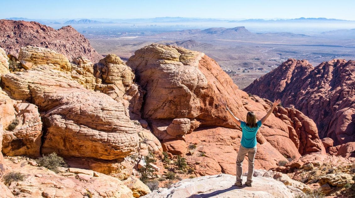
Which is better, the Valley of Fire or Red Rock Canyon?
Both the Valley of Fire and Red Rock Canyon are hiking destinations just outside of Las Vegas. Tim and I love the Valley of Fire, with its slot canyons, short but incredibly scenic hiking trails, and jaw-dropping vistas throughout the park. When Tyler and Kara were teenagers, we visited both the Valley of Fire and Red Rock Canyon and they both insist that Red Rock Canyon is more interesting, with its rock scrambling and views of Las Vegas. Both are a joy to explore and you won’t go wrong with either one.
Can you just drive through the Valley of Fire?
Yes, you can drive through Valley of Fire State Park. Mouse’s Tank Road offers amazing scenery, and even without hiking, you’ll see dramatic red rock formations, viewpoints, and quick roadside stops like Atlatl Rock, Arch Rock, and the Seven Sisters. Just be aware that it is not a through road, so you’ll need to backtrack through the park to exit.
Are pets allowed in the Valley of Fire?
Yes, pets are allowed in Valley of Fire State Park but they must be kept on a leash that is no longer than six feet.
Can you fly drones at Valley of Fire State Park?
No, you can’t fly a drone recreationally at Valley of Fire State Park without special permission.
If you have any questions about the best things to do in the Valley of Fire, or if you would like to share your experience, let us know in the comment section below.
Plan Your Trip to Las Vegas

10 Amazing Things to Do in Las Vegas: The Ultimate City Guide
Pinterest Facebook Flipboard Discover the very best things to do in Las Vegas, including a long list of day trips that could be the highlight of your trip. Las Vegas…also known as Sin City, Lost Wages, the Gambling Capital of the World, the City that Never Sleeps, and the Entertainment Capital of the World, is […]
Two Fun, Short Hikes to Do at Red Rock Canyon, Las Vegas
Just 30 minutes from downtown Las Vegas is Red Rock Canyon, an outdoor playground for hikers, families, and outdoor adventurers. Go mountain biking, rock climbing, explore the hiking trails, and enjoy the view on the scenic drive through the park. If you want to escape the bright, neon lights and all-you-can-eat food buffets for a […]
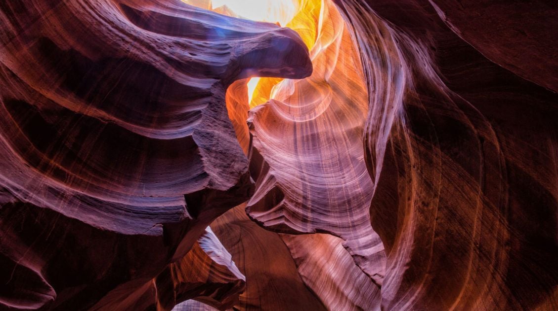
10 Amazing Slot Canyons to Explore in the American Southwest
The American Southwest is a playground for hikers, photographers, and adventurers. Fun to explore and extremely photogenic, slot canyons provide a unique hiking experience. We have assembled a short list of some of the best slot canyons in Utah, Arizona, and Nevada. This is not an all-inclusive list, because there are tons of slot canyons […]
Las Vegas to San Diego 10 Day Road Trip Itinerary
If you are planning a road trip from Las Vegas to San Diego, there are several different ways to do it. Go on a national park road trip, visiting both Death Valley National Park and Joshua Tree National Park on the drive. Or, you can spend some time in the Mojave National Preserve, which is […]
10 Days in the American Southwest: The Ultimate Road Trip
The American southwest is one of the USA’s best road trip destinations. It’s unbelievable how much there is to see and do here. There are the breathtaking vistas of the Grand Canyon, thrilling hiking trails in Zion National Park, and millions of hoodoos to photograph in Bryce Canyon. Are you getting excited yet? The list […]

15 Things to Do in Las Vegas with Teenagers
Is Las Vegas a good place to bring teenagers (or your kids)? Will they have fun? Is there enough for them to do? If you are wondering if you should visit Las Vegas with teenagers, we can help. We are frequent visitors to Las Vegas, using Las Vegas as a starting or ending point for […]
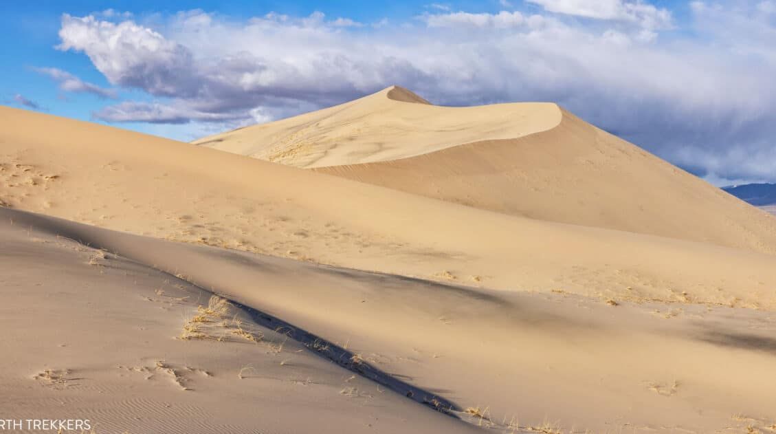
10 EPIC Things to Do in Mojave National Preserve
With enormous sand dunes, cinder cones, lava beds, and the densest population of Joshua Trees in the world, Mojave National Preserve is home to a wide variety of landscapes. This is a fun place to explore and makes a great addition to a southern California road trip. In this guide, we cover the best things […]
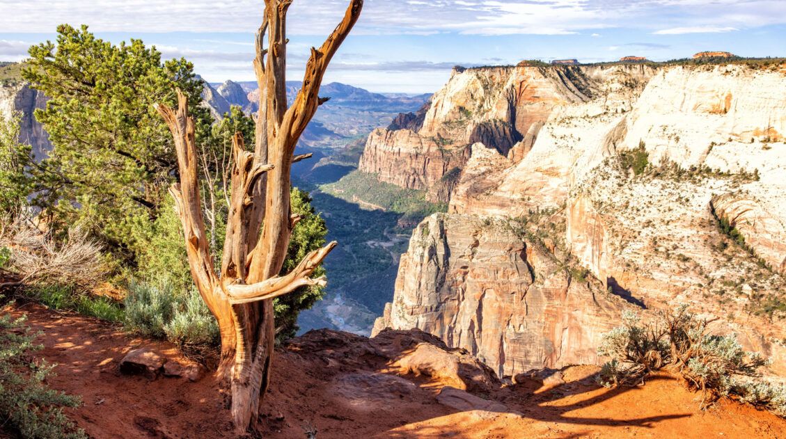
Best Hikes in Zion: 15 Trails from Beginner to Advanced
Zion National Park is one of the best places in the United States to go hiking. From the awe-inspiring hike up Angels Landing to the family-friendly Riverside Walk to multi-day backpacking adventures, there is something here for everyone. In this guide, we cover the best hikes in Zion National Park, from popular trails to hidden gems. […]
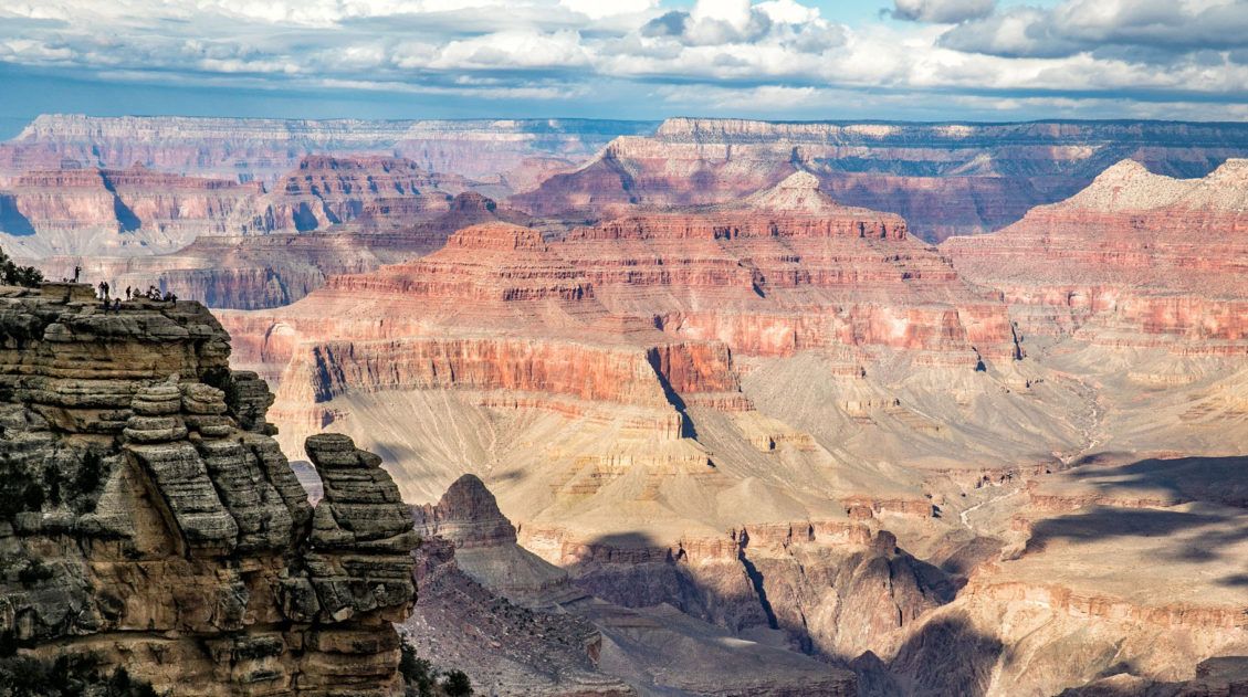
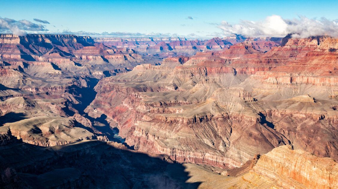
11 EPIC Things to Do on the South Rim of the Grand Canyon
For millions of years, the Colorado River has carved its way through the Colorado Plateau, forming this expansive, awe-inspiring landscape that we call the Grand Canyon. And it certainly is grand. Words cannot describe what it is like to gaze across the Grand Canyon for the first time. On a visit to the Grand Canyon, […]
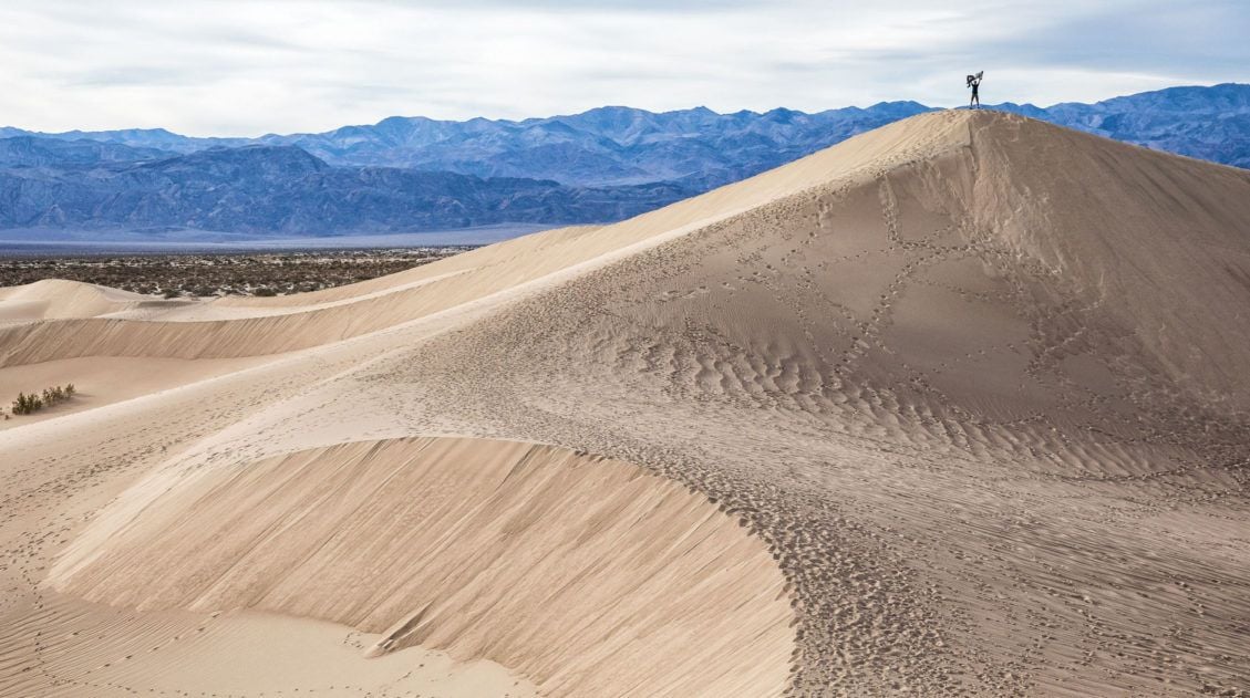
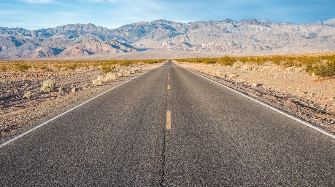
Exactly How to Plan Your Death Valley Day Trip from Las Vegas
Death Valley is the hottest, driest, and lowest place in the United States. But don’t let its mysterious name and seemingly barren landscape discourage you from planning a trip here. This park is full of wonderful surprises. In this article, get the details on how to plan a Death Valley day trip from Las Vegas. […]
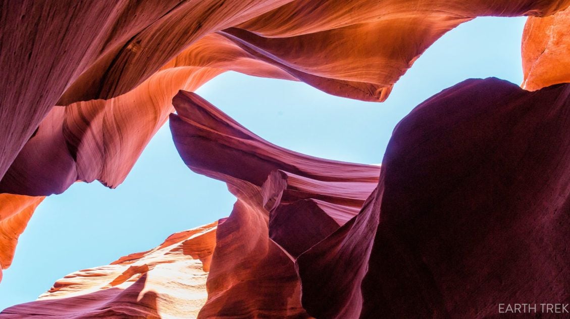
Lower Antelope Canyon: Tours, Pricing & What to Expect
Lower Antelope Canyon lives in the shadow of its more famous neighbor up the road, but Tim would argue it shouldn’t. When we visited both canyons on the same day, Upper was my favorite and Lower was his, and we’ve never quite agreed on which one wins. What makes Lower different is hard to describe […]
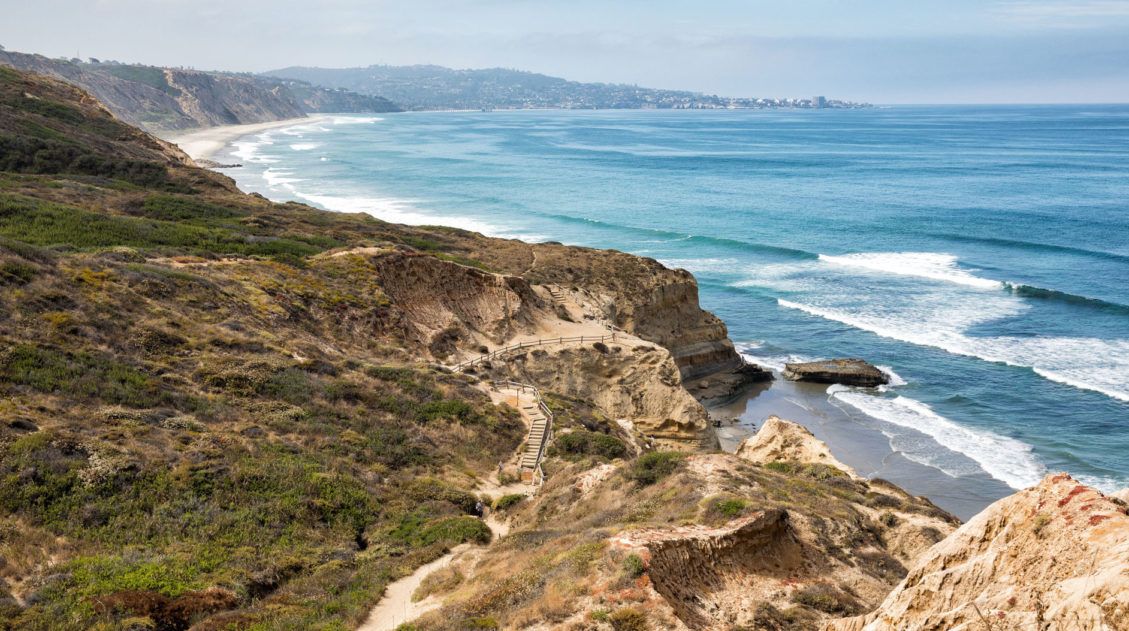
10 Best Things to Do in San Diego, California
San Diego is famous for its beautiful beaches, family friendly activities, and its near perfect year-round weather. Tour an aircraft carrier, say hello to the elephants at the world famous San Diego Zoo, go on a day trip to La Jolla, and take your pick of numerous bars and restaurants in the Gaslamp Quarter. San […]
12 Amazing National Parks for Your Next Family Adventure
We’ve visited 56 of the 63 U.S. national parks and almost every single one would make a fantastic family destination. With 63 parks to choose from, the options can feel overwhelming. After years of exploring the national parks, we’ve narrowed it down to 12 that hit the sweet spot for families. These parks are easy […]
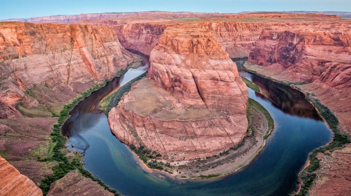
Grand Canyon Road Trip: 5 Itineraries from Las Vegas
If you planning a trip to the Grand Canyon, there are many different ways to plan your perfect road trip, depending on how much time you have and your interests. The American Southwest is packed with stunning parks and landscapes, and it is easy to add on places like Antelope Canyon, Zion National Park, and […]
Comments 105