
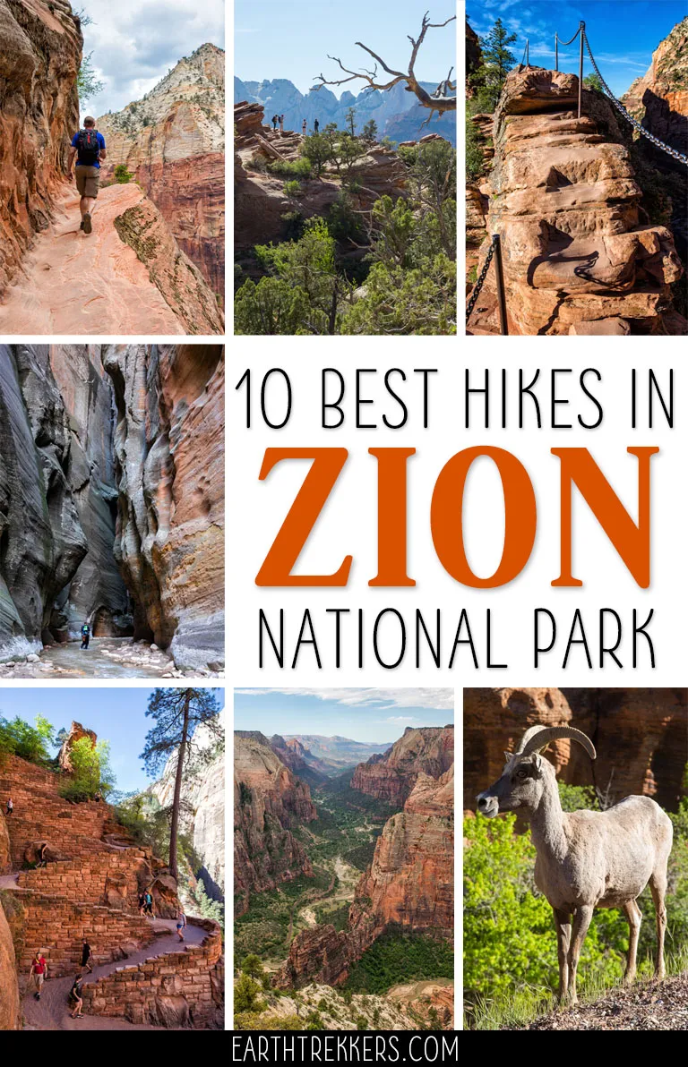
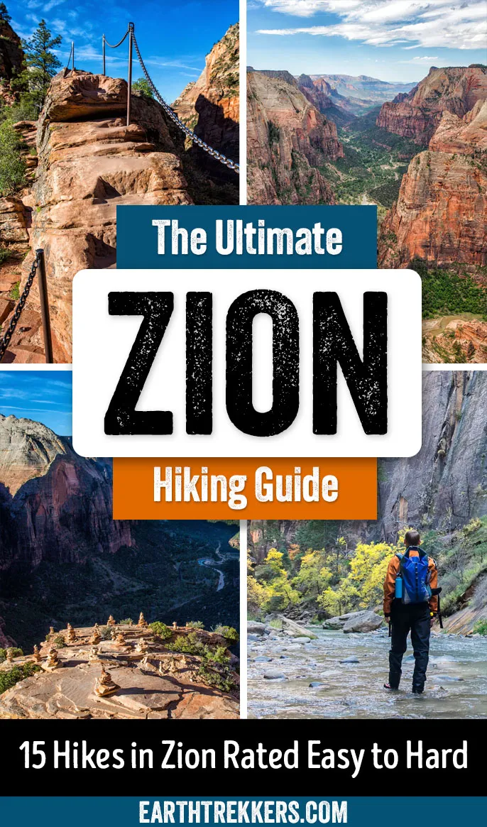
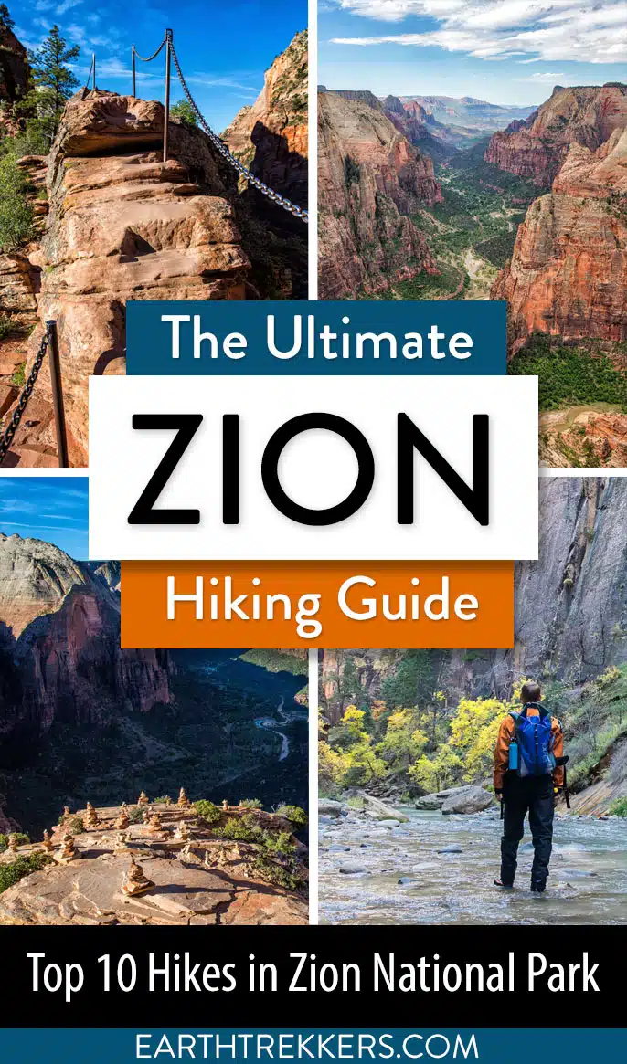
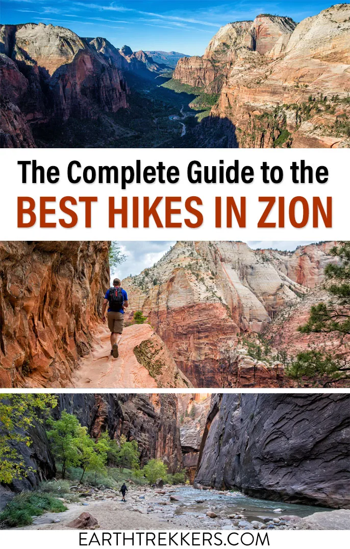
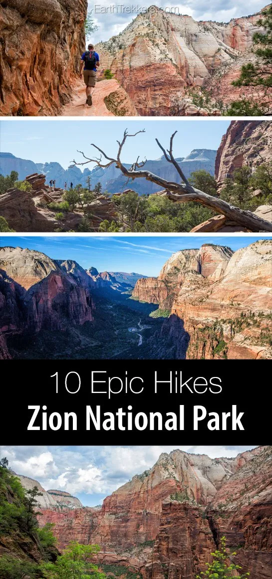
Zion National Park is one of the best places in the United States to go hiking. From the awe-inspiring hike up Angels Landing to the family-friendly Riverside Walk to multi-day backpacking adventures, there is something here for everyone. In this guide, we cover the best hikes in Zion National Park, from popular trails to hidden gems.
Over the past few years, we have visited Zion National Park multiple times, with our most recent visit in May 2025. This park just keeps calling us back. This relatively small park is literally packed with some of the most thrilling hikes in the United States, if not the entire world.
Two of our favorite hikes in the US National Parks are located in Zion: Angels Landing and the legendary Zion Narrows. Both are challenging hikes but must-dos for avid hikers and adventurers.
One of the things we love about Zion is its variety of hikes. From short, easy strolls to full-day adventures, there’s no shortage of ways to explore this incredible park.
Get ready to be inspired…and have fun picking out which ones you would like to do!
Please practice the seven principles of Leave No Trace: plan ahead, stay on the trail, pack out what you bring to the hiking trail, leave areas as you found them, minimize campfire impacts, be considerate of other hikers, and do not approach or feed wildlife.
Best Hikes in Zion
This list begins with the shortest and easiest hikes, and continues with the longer and more challenging efforts. All distances are round-trip.
We have done every hike on this list, some of them multiple times, with the exception of the Subway. We’ve rated them from 1 to 5 stars: ⭐️⭐️⭐️⭐️⭐️ being one of our favorites and ⭐️ indicating that it’s good to know about.
How to Use This Map: Click the icons on the map to get more information about each point of interest. To take this map with you, click the star next to the title of the map which adds it to your Google account. Next, within your Google Maps app, select ‘Saved’ and then select ‘Maps’. This map title will now appear in your list.
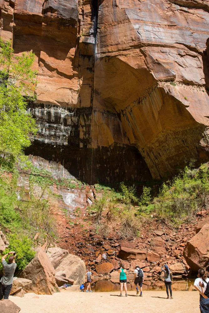
1. Weeping Rock
Our Rating: ⭐️⭐️ It’s short but deceptively challenging, with its steep uphill walk and the view is just OK.
Distance: 0.4 miles/0.6 km
Length of Time: 0.5 hours
Difficulty: It’s a steep, uphill walk to Weeping Rock
Zion Shuttle Stop: Weeping Rock, stop #7
The Weeping Rock trail is one of the most popular hikes in the park. Just 0.4 miles round trip, this short but steep trail ends at Weeping Rock, a large overhang of rock that is dripping with water.
This hike just recently reopened, after a long-term closure due to a rockfall.
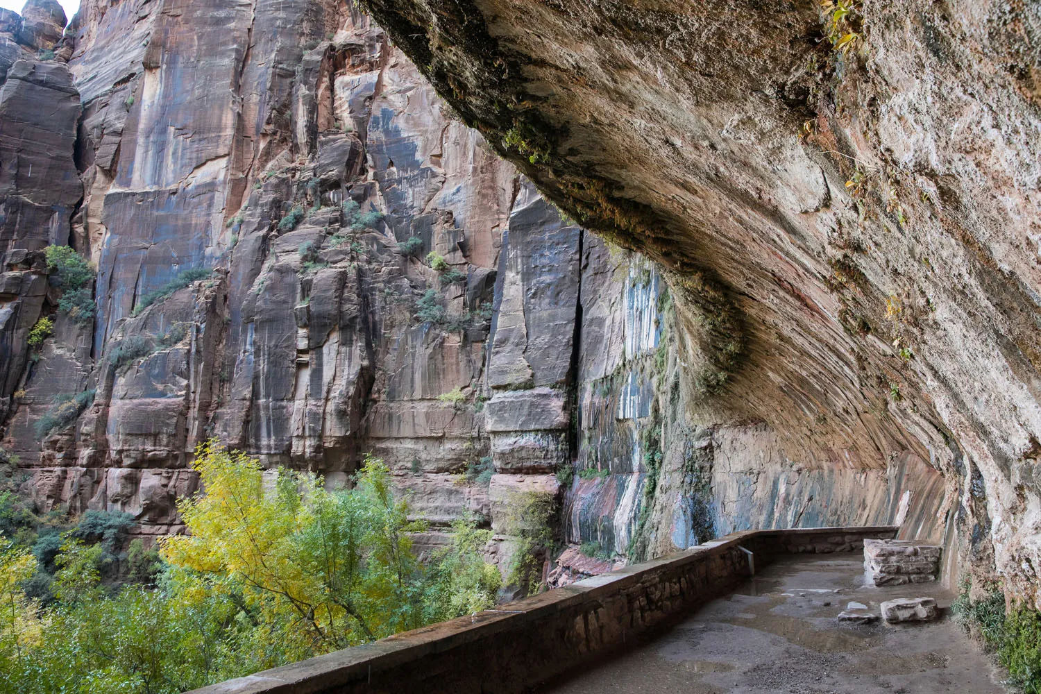
Weeping Rock
2. The Petroglyphs Trail
Our Rating: ⭐️⭐️⭐️ Good for those who want to see petroglyphs and venture off the beaten path, but not a “must-do” in Zion.
Location: East Zion
Distance: 0.67 miles (1.1 km)
Difficulty: Easy
Elevation Gain: 100 feet (30 meters)
Time: 30 minutes
Trailhead: Zion – Mount Carmel Highway (Highway 9); GPS Coordinates: 37°13’29.1″N 112°54’33.2″W
This very short trail may be one that you haven’t heard of. It’s one of the most off-the-beaten-path hikes on this list.
The Petroglyphs Trail runs through a sandy wash, leading to an area where hikers can see petroglyphs that have been carved onto the rock walls. This trail ends at a very short slot canyon.
Parking is on a small turnout on Zion – Mount Carmel Highway. This hike lacks the wow factor of many others on this list, but it is a good option for those interested in seeing petroglyphs.
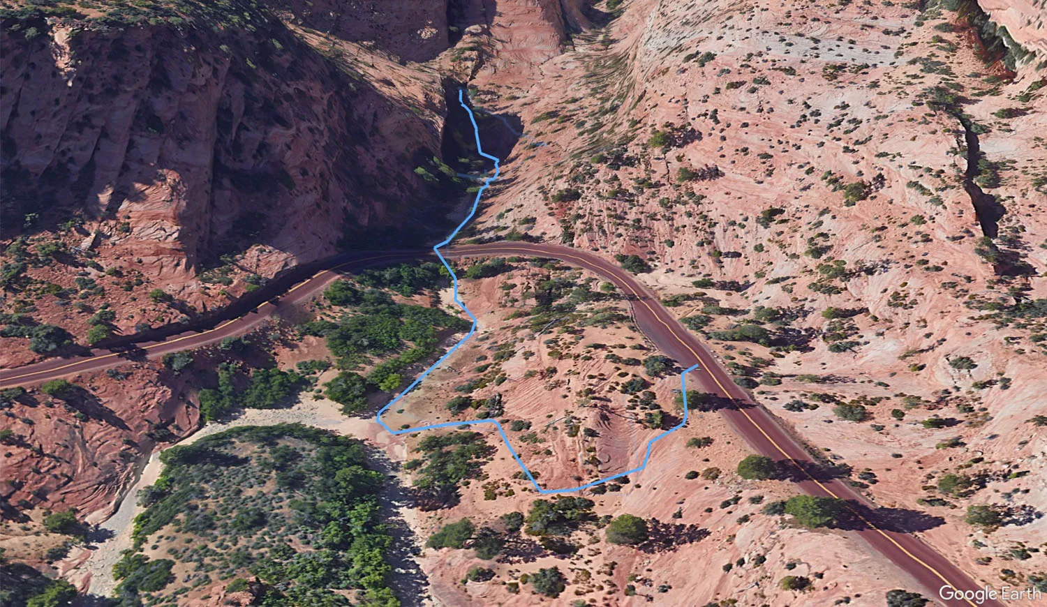
Map of the Petroglyphs Trail
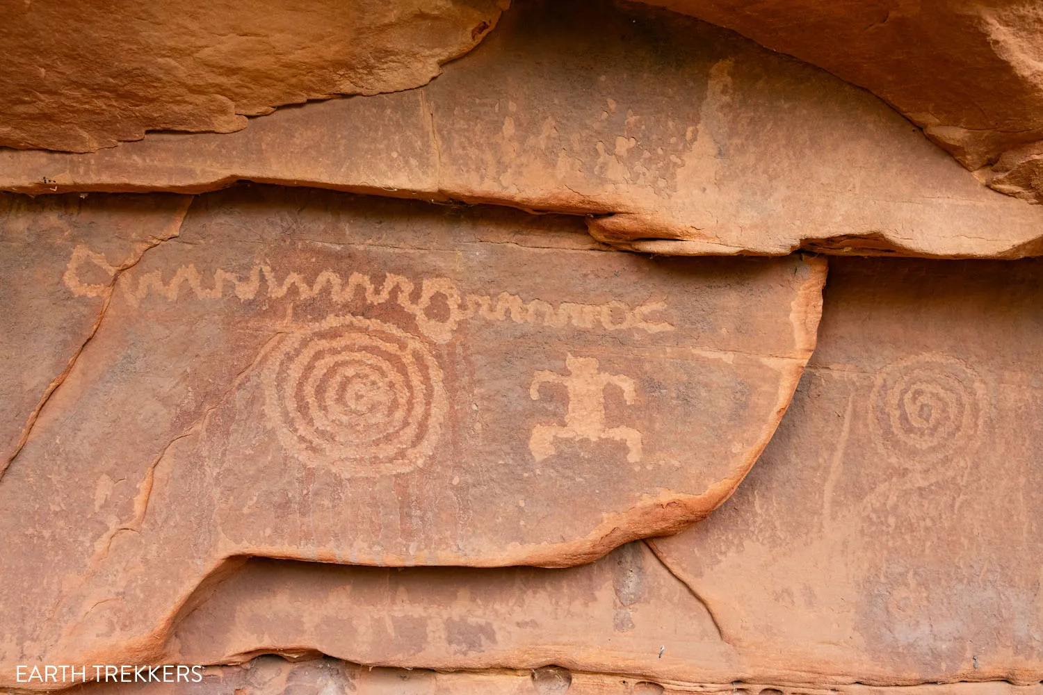
The Petroglyphs
3. Canyon Overlook Trail
Our Rating: ⭐️⭐️⭐️⭐️⭐️ It’s fun, it’s short, it’s easy, and the views are awesome.
Location: East Zion
Distance: 1 mile
Difficulty: Easy to moderate
Elevation Gain: 160 feet (46 meters)
Time: 1 hour
Trailhead: Highway 9, just east of the Mount Carmel Tunnel (no shuttle necessary)
The Canyon Overlook Trail is a gem of a hike in Zion National Park. It’s short, it’s fun, and it takes you to an awesome viewpoint overlooking Zion Canyon. This is a hike that is perfect for all ages and ability levels. So, if this is your first, or even your second time in Zion, put the Canyon Overlook Trail on your list of things to do.
Tim at Canyon Overlook
The Canyon Overlook Trail, One of Zion’s Essential Hikes
Trail guide, parking, and photos of the Canyon Overlook Trail.4. Timber Creek Overlook Trail
Our Rating: ⭐️⭐️⭐️ Quick and easy to do, with great views of the Kolob Canyons section of the park.
Location: Kolob Canyons
Distance: 1.2 miles (1.9 km)
Difficulty: Easy
Elevation Gain: 200 feet (60 meters)
Time: 30 to 60 minutes
Trailhead: End of Kolob Canyon Road
This is the shortest, easiest hike in Kolob Canyons, making it a great option for all ages and ability levels. Most of this trail runs along a ridgeline, offering sweeping views of the sandstone cliffs.
Timber Creek Overlook Trail
5. Emerald Pools Trail
Our Rating: ⭐️⭐️⭐️ When we did this, the trail was very busy, which might have affected our experience, but overall, we think this is an overrated trail in Zion.
Location: Zion Canyon
Distance: 1.2 to 3 miles, depending on how far you hike
Difficulty: Easy to moderate
Elevation Gain: 35 feet (10 meters) to 230 feet (70 meters)
Time: 1 to 4 hours
Zion Shuttle Stop: Zion Lodge, stop #5 or The Grotto, stop #6
The trail to the Emerald Pools is one of the most popular hikes in Zion. This is a trail that starts off easy and gets more strenuous the farther you go.
From Zion Lodge, it’s an easy walk to Lower Emerald Pools. Beyond this, the trail starts climbing, but the scenery gets better. The final climb to Upper Emerald Pool is more challenging but it leads you to a large pool surrounded on three sides by tall cliffs.
The most common way to hike to the Emerald Pools is via the Zion Lodge. You can also get to the pools via the Kayenta Trail from The Grotto.
Tim and I hiked to the Emerald Pools on the Kayenta Trail and maybe our timing was wrong, but we did not enjoy this hike. It was hot, it was crowded, and we were not impressed with Upper Emerald Pool. If you are looking for a short but scenic hike in Zion, we recommend the Canyon Overlook Trail over Emerald Pools.
6. Many Pools Trail
Our Rating: ⭐️⭐️⭐️⭐️ This underrated, hidden gem is tons of fun. It’s one of our new favorite hikes in Zion.
Location: East Zion
Distance: 1.9 miles (3.0 km) out-and-back
Difficulty: Easy to moderate
Total Elevation Gain: 625 feet (190 meters)
Time: 1 to 2 hours
Trailhead: Zion Mount Carmel Highway (no shuttle necessary!)
This is a great hike for those who prefer a short trail, easy to moderate in difficulty, and don’t mind a little bit of rock scrambling.
It’s also one of the best hikes in Zion for those who want to leave the crowds behind. This trail gets very little foot traffic, but don’t let that fool you. This short trail is a lot of fun to hike.

This is not an official trail in Zion. There are no trail signs, no trail markers, and no defined trail to follow. On this hike, you will walk through sandy washes and sections of slickrock, alongside small pools of water. We did this hike on our third trip to Zion and loved it, with the lower crowds and more remote feel.
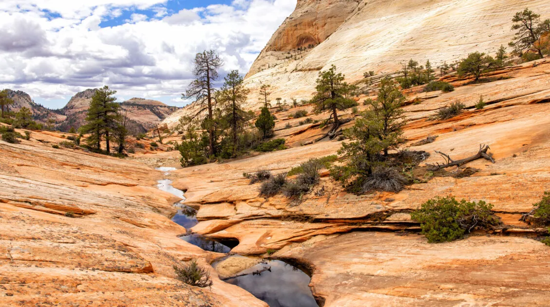
Many Pools Trail – A Hidden Gem in Zion National Park
Step-by-step guide to one of Zion’s most underrated hikes.7. Riverside Walk
Our Rating: ⭐️⭐️⭐️⭐️ The best easy, scenic stroll in the park.
Location: Zion Canyon
Distance: 2.2 miles round trip
Difficulty: Easy
Elevation Gain: 300 feet (90 meters)
Time: 1.5 hours
Zion Shuttle Stop: Temple of Sinawava, stop #9
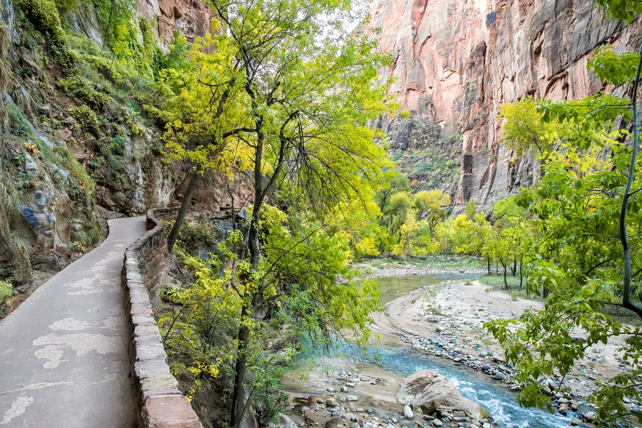
Riverside Walk in October
This flat, paved trail follows the Virgin River and ends where the Narrows begins. This trail is paved for its entire distance, making this the most accessible hike in Zion National Park.
The Riverside Trail is perfect for those looking to do more of a stroll than a hike. Since it is flat and paved, it is one of the easiest hikes on this list. Plus, the views are beautiful.
8. Pa’rus Trail
Our Rating: ⭐️⭐️⭐️ We didn’t do this until our 3rd visit to Zion and Tim and I both liked it. It’s easy and the views are nice, but I only think it’s worth it if you have several days in the park.
Location: Zion Canyon Visitor Center
Distance: 3.2 miles out-and-back
Difficulty: Easy
Elevation Gain: 300 feet (90 meters)
Time: 2 to 3 hours
Trailhead: Par’us Trailhead, next to the Zion Canyon Visitor Center
This paved trail runs from the Zion Canyon Visitor Center to Canyon Junction Bridge. It follows alongside the Virgin River, occasionally crossing the river by bridge.
The views from the bridges are beautiful and fantastic photography spots, especially at sunset. Each bridge is numbered, starting at the trailhead next to the visitor center. Bridge #4 is the spot to get the iconic view of the Watchman (the photo above). It is near Canyon Junction Bridge, so if you are walking or biking here from the visitor center, it is about one mile, one-way.
Bikes and pets are allowed on this trail. If you plan to rent bikes in Springdale and cycle into the canyon, you’ll do so on the Pa’rus Trail.

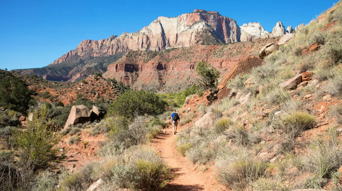
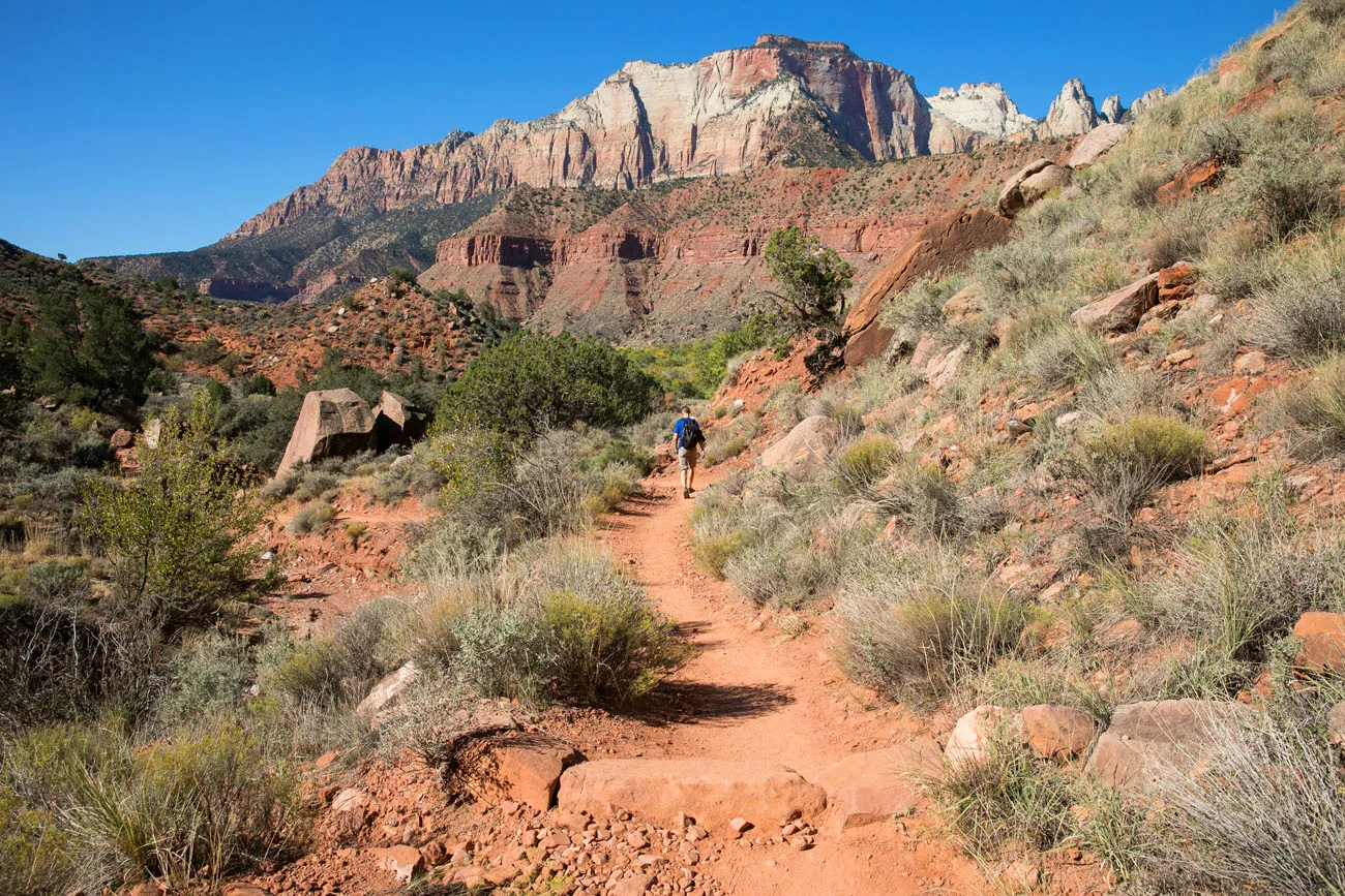
9. The Watchman Trail
Our Rating: ⭐️⭐️⭐️ A good hiking option for those who don’t want to ride the shuttle, since this hike starts next to the Visitor Center.
Location: Zion Canyon Visitor Center
Distance: 3.3 miles round-trip
Difficulty: Easy to moderate
Elevation Gain: 370 feet
Time: 2 hours
Trailhead: Next to the Zion Canyon Visitor Center
How to Hike the Watchman Trail in Zion National Park
Everything you need to know to hike the Watchman Trail.The Watchman Trail is a relatively easy hike that offers nice views over Springdale and the southern end of Zion National Park.
This hike is a good option if you are looking for a short, easy trail, like the convenience of starting right from the visitor center, and/or do not want to ride the shuttle.
Tim on the Watchman Trail
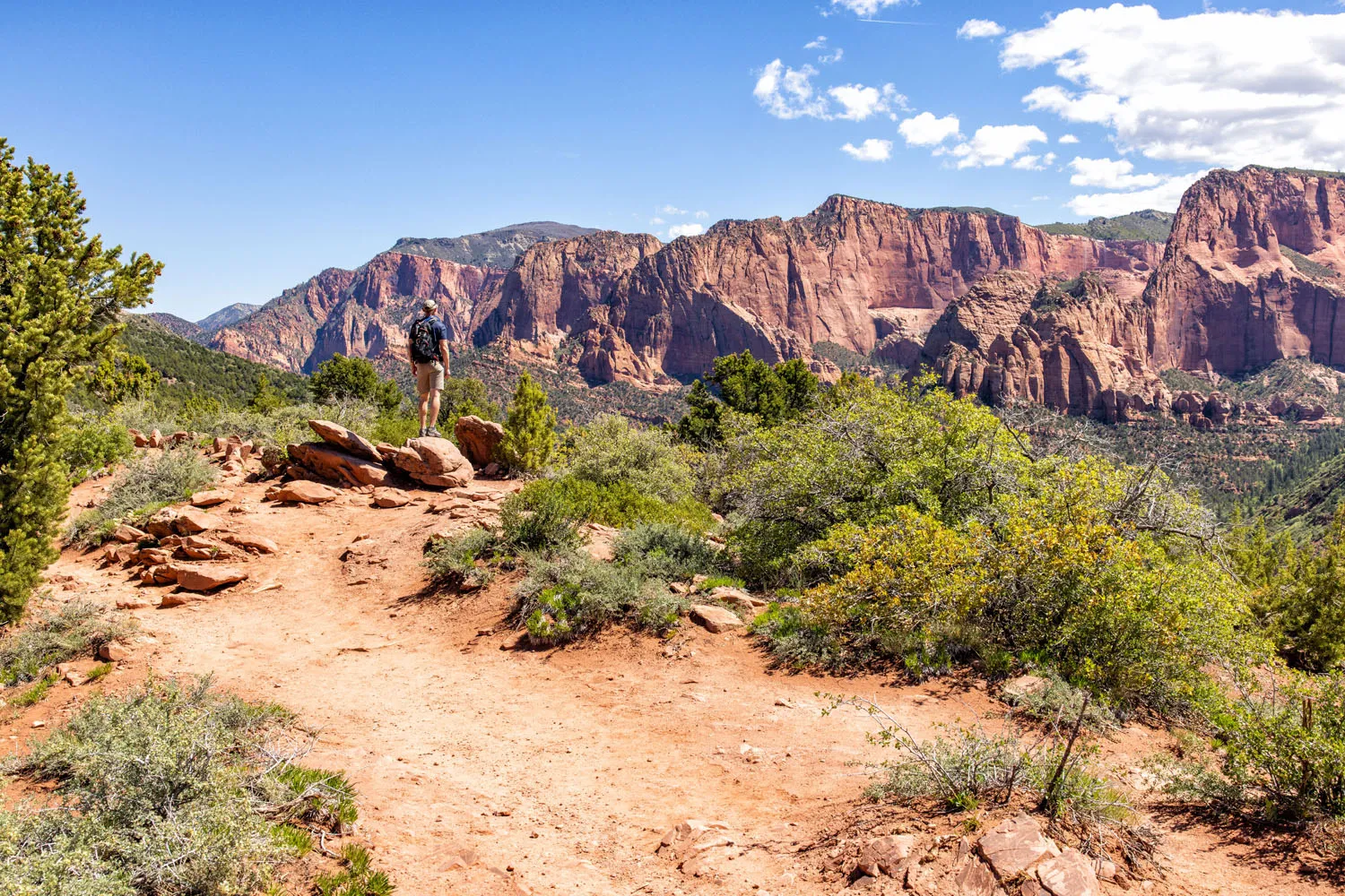
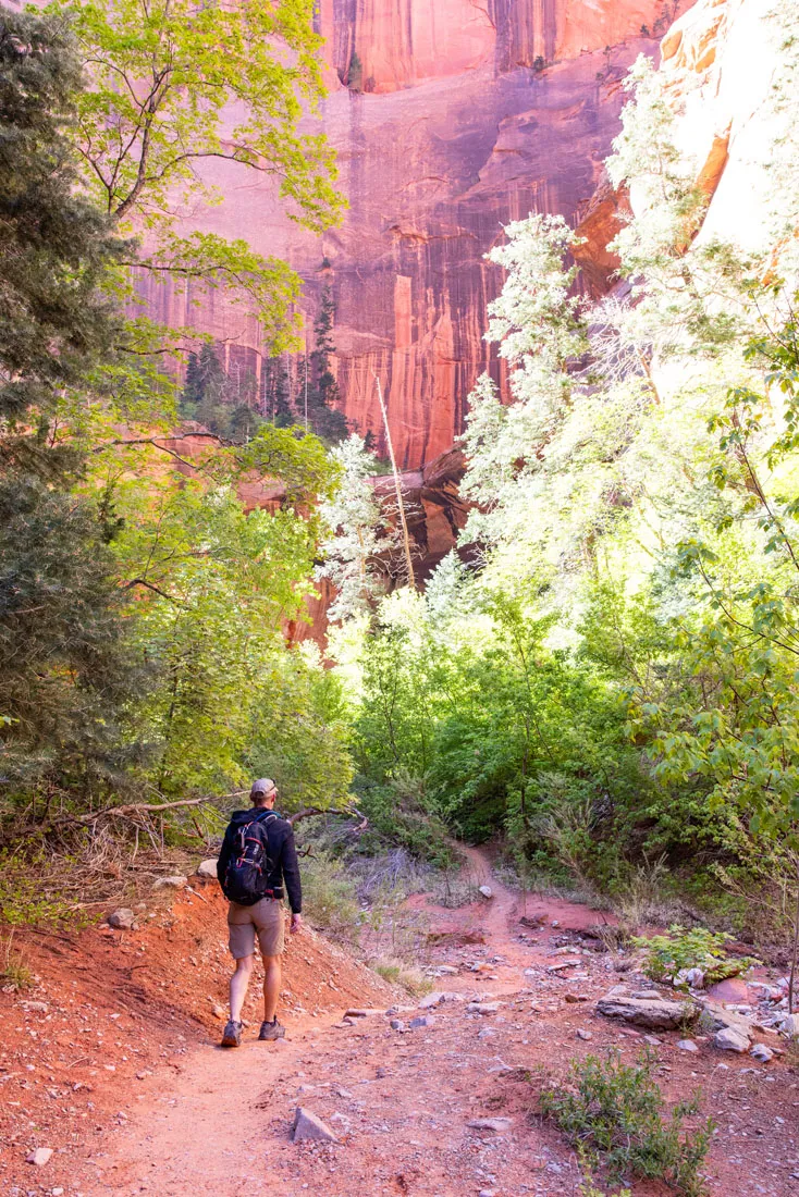
10. The Taylor Creek Trail
Our Rating: ⭐️⭐️⭐️ This hike is somewhat unique, with its frequent river crossings, but it is on the longer side and lacks some of the iconic views you get in Zion Canyon.
Location: Kolob Canyons
Distance: 5.1 miles (8.1 km)
Difficulty: Moderate
Elevation Gain: 800 feet (245 meters)
Time: 2.5 to 4 hours
Trailhead: Taylor Creek Trailhead
This is the best hike in the Kolob Canyons section of Zion National Park.
The Taylor Creek Trail runs alongside the Middle Fork of Taylor Creek, making many, many creek crossings. The trail ends in a narrow box canyon and Double Arch Alcove. It is a beautiful, tranquil spot and well worth the hike to get here.
Taylor Creek Trail
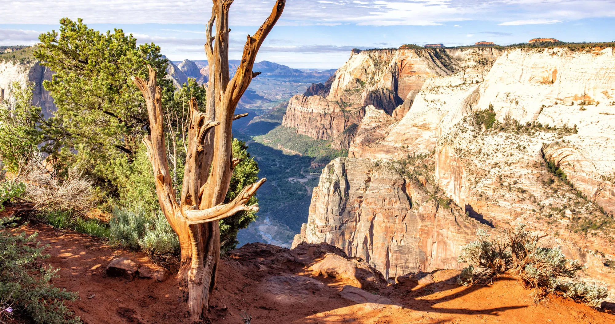
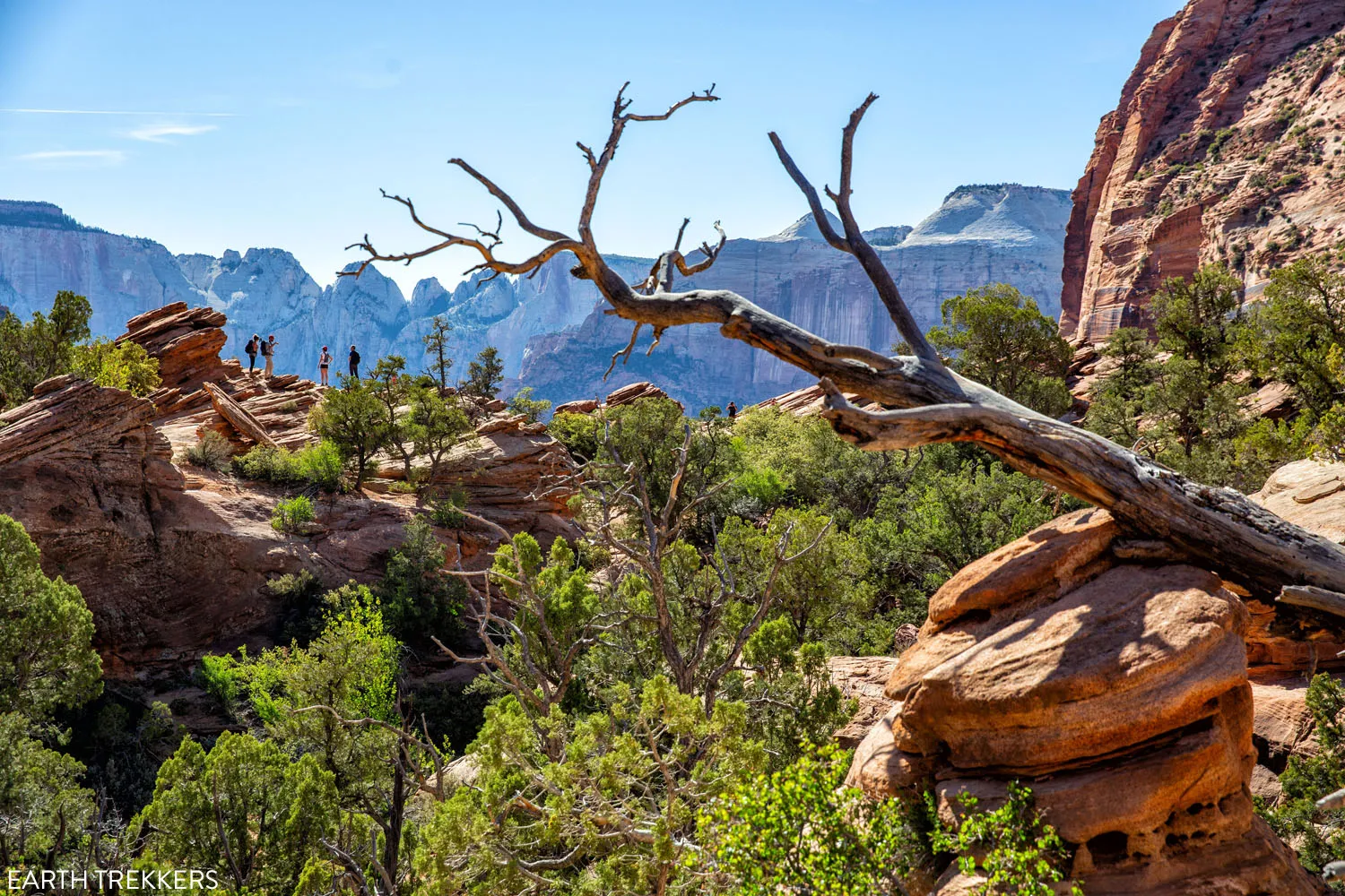
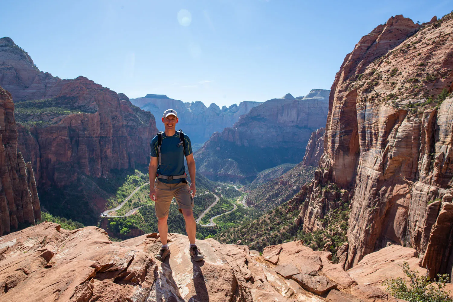
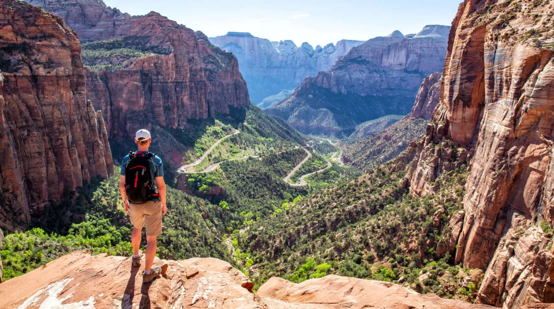
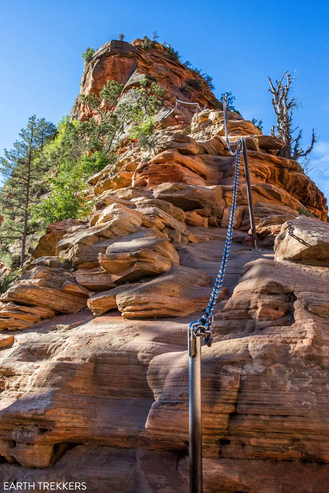
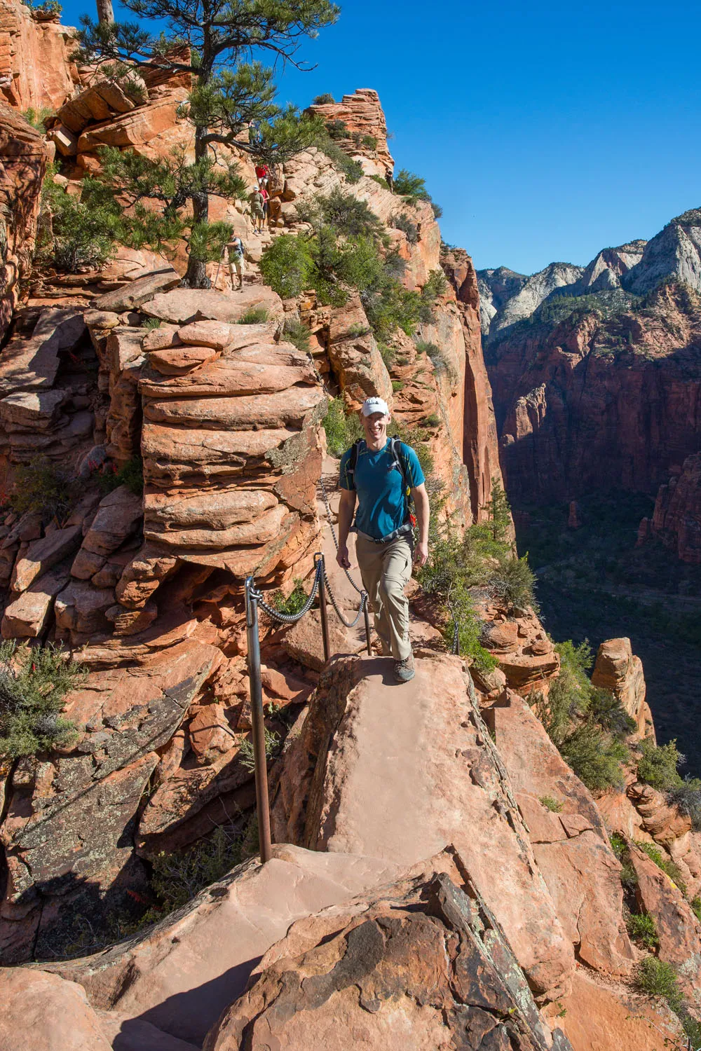
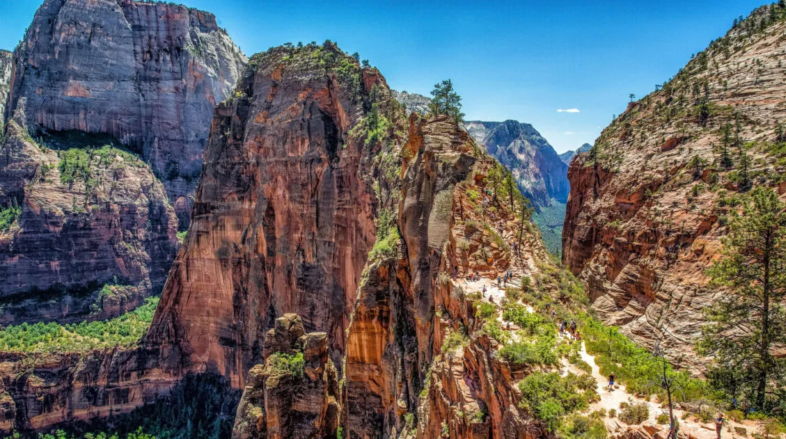
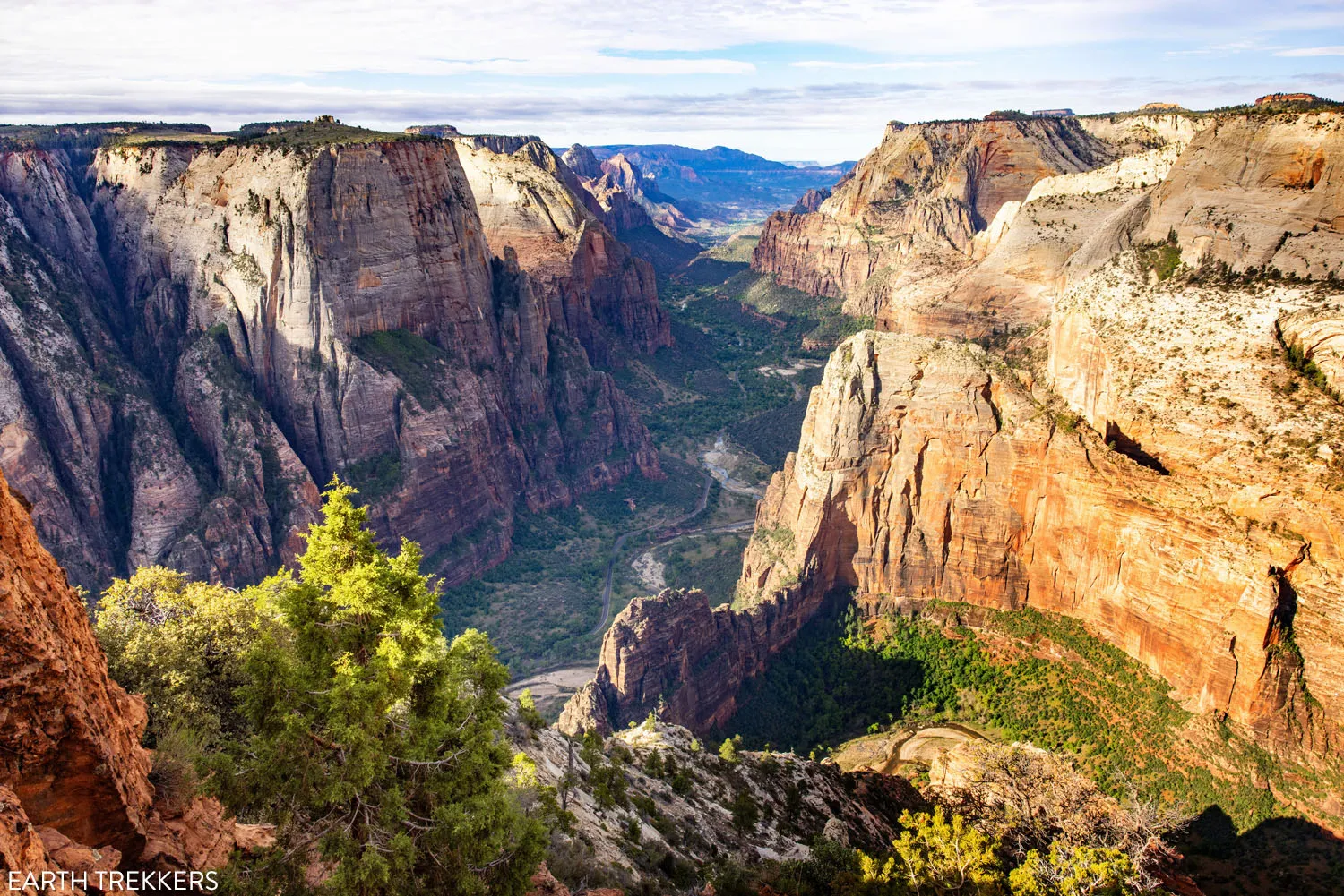
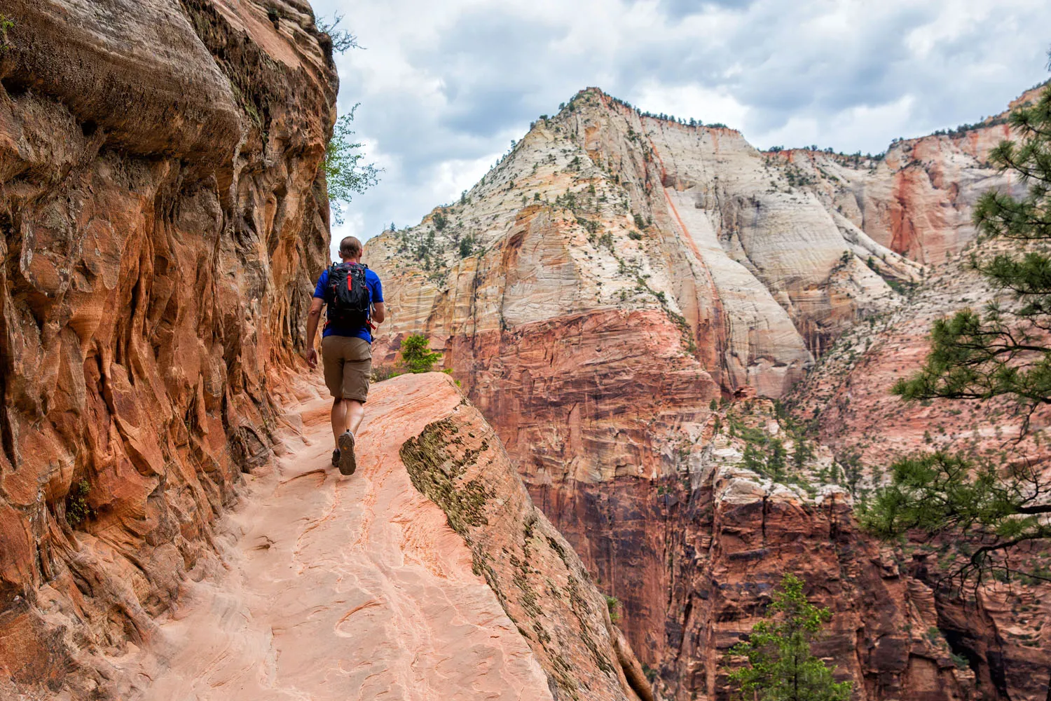
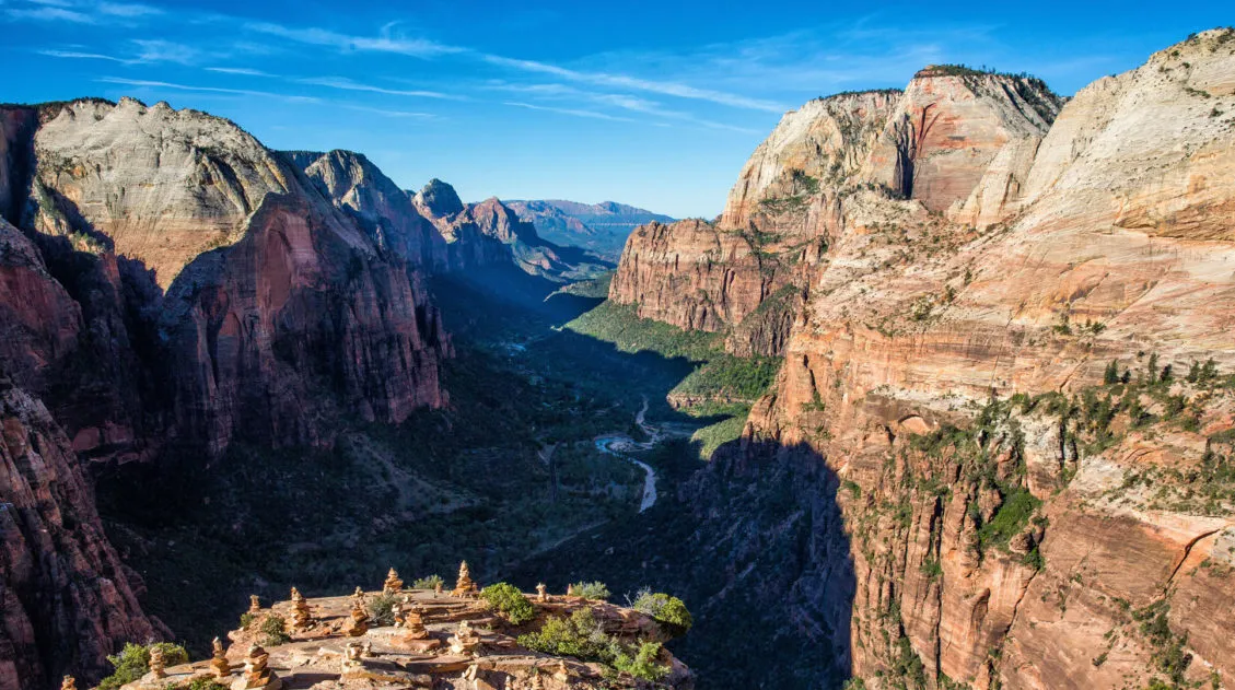
11. Angels Landing
Our Rating: ⭐️⭐️⭐️⭐️⭐️ This hike is popular for a reason. It’s the most thrilling hike on this list.
Location: Zion Canyon
Distance: 5.4 miles (8.7 km)
Difficulty: Strenuous
Elevation Gain: 1,500 feet (458 meters)
Time: 3 to 5 hours
Zion Shuttle Stop: The Grotto, stop #6
Angels Landing is the most popular hike in Zion National Park. The final climb of the hike involves scaling a narrow ridge high above the valley floor. With chain-assisted rock scrambling sections, stunning views, and vertigo-inducing heights, this really is a thrilling hike.
For adventure seekers, this is definitely a great hike to put on your bucket list. We have hiked in many places around the world, and this hike is one of our favorites.
If you plan to hike to Angels Landing, you must have a permit. Learn more in our Guide to Angels Landing.
How to Hike Angels Landing: Trail Guide, Permits & Video
Step-by-step guide for the Angels Landing hike.12. Observation Point via the East Mesa Trailhead
Our Rating: ⭐️⭐️⭐️ The hike itself isn’t all that interesting, and it’s a long drive to get to the trailhead, but the view from Observation Point is spectacular.
Location: East Zion
Distance: 6.8 miles (11 km)
Difficulty: Moderate
Elevation Gain: 775 feet (235 meters)
Time: 3 to 4 hours
Trailhead: East Mesa Trailhead
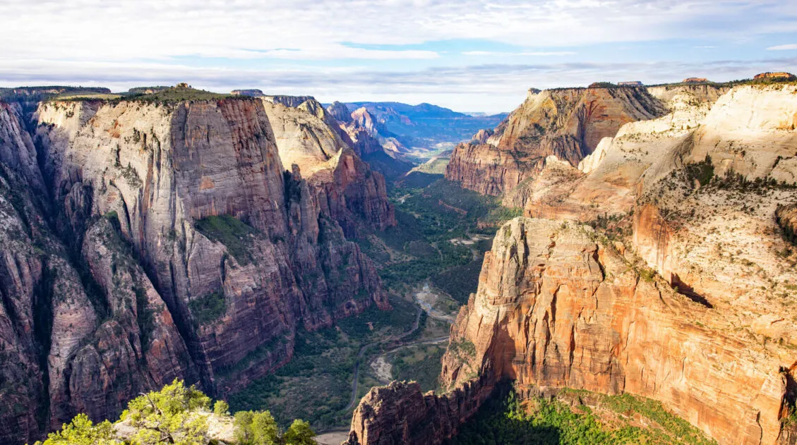
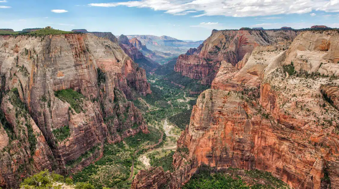
For jaw-dropping views over Zion National Park, it’s hard to beat Observation Point. From Observation Point, not only do you get an incredible view of Zion canyon, but you can also look down at the spine of Angel’s Landing.
The “original trail” to Observation Point started at the Weeping Rock Trailhead in Zion Canyon. We hiked this tough but incredibly scenic trail in 2017, two years before it closed due to a rockfall.
In 2025, we returned to hike this trail again, this time doing it from the East Mesa Trailhead.
Now, hikers can get to Observation Point via the East Mesa Trailhead. This trailhead sits outside of Zion National Park and takes a bit of work and planning to get to. Although it’s a less exciting hike to get to Observation Point, it’s still well worth it, as the view is truly extraordinary. We cover exactly how to do it in our Guide to Observation Point ↓
How to Hike to Observation Point for Jaw-Dropping Views of Zion
Step-by-step trail guide for Observation Point.13. The Subway
The Subway is a very popular hike in Zion and there are two ways to do it.
Left Fork of the North Creek (Bottom-Up)
Location: West Zion
Distance: 9 miles
Difficulty: Strenuous
Elevation Gain: 1,300 feet (400 meters)
Time: 6 to 10 hours
Trailhead: Left Fork Trailhead on Kolob Terrace Road
This “trail” runs along the North Creek. Along the way, hikers need to be prepared to rock scramble and hike through the creek and this hike requires route finding, so it’s recommended for those who are fit with ample hiking experience.
A permit is necessary to do this hike. On our most recent visit to Zion (May 2025), we put our names into the daily lottery five days in a row and, unfortunately, were never one of the lucky few to score a permit. If this is a hike you would like to do, we recommend planning ahead and putting your name into the seasonal lottery.
Top-Down Canyoneering Route
Location: West Zion
Distance: 9.5 miles (15 km)
Difficulty: Strenuous
Elevation Change: 2,400 feet (730 meters)
Time: 6 to 12 hours
Trailhead: Wildcat Canyon Trailhead
The top-down route is a canyoneering route that is technically challenging, requires rappelling skills and gear, extensive route-finding experience, and exposure to cold water. It is a point-to-point route, ending at the Left Fork Trailhead.
A permit is required to do this hike.
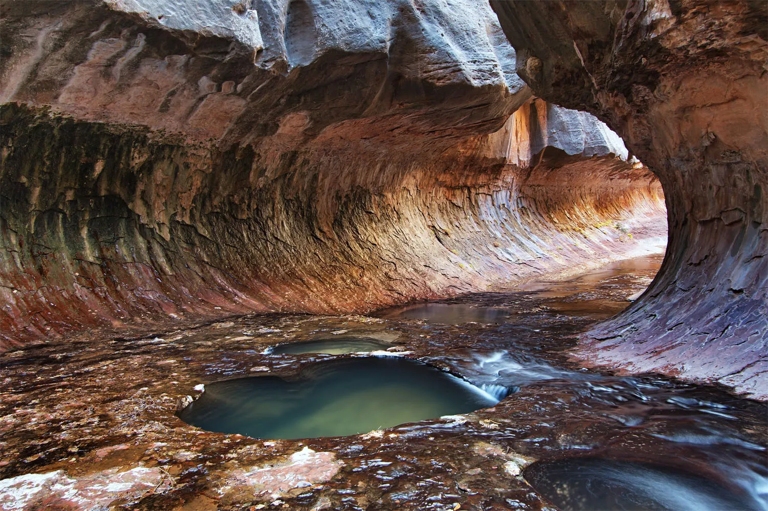
The Subway
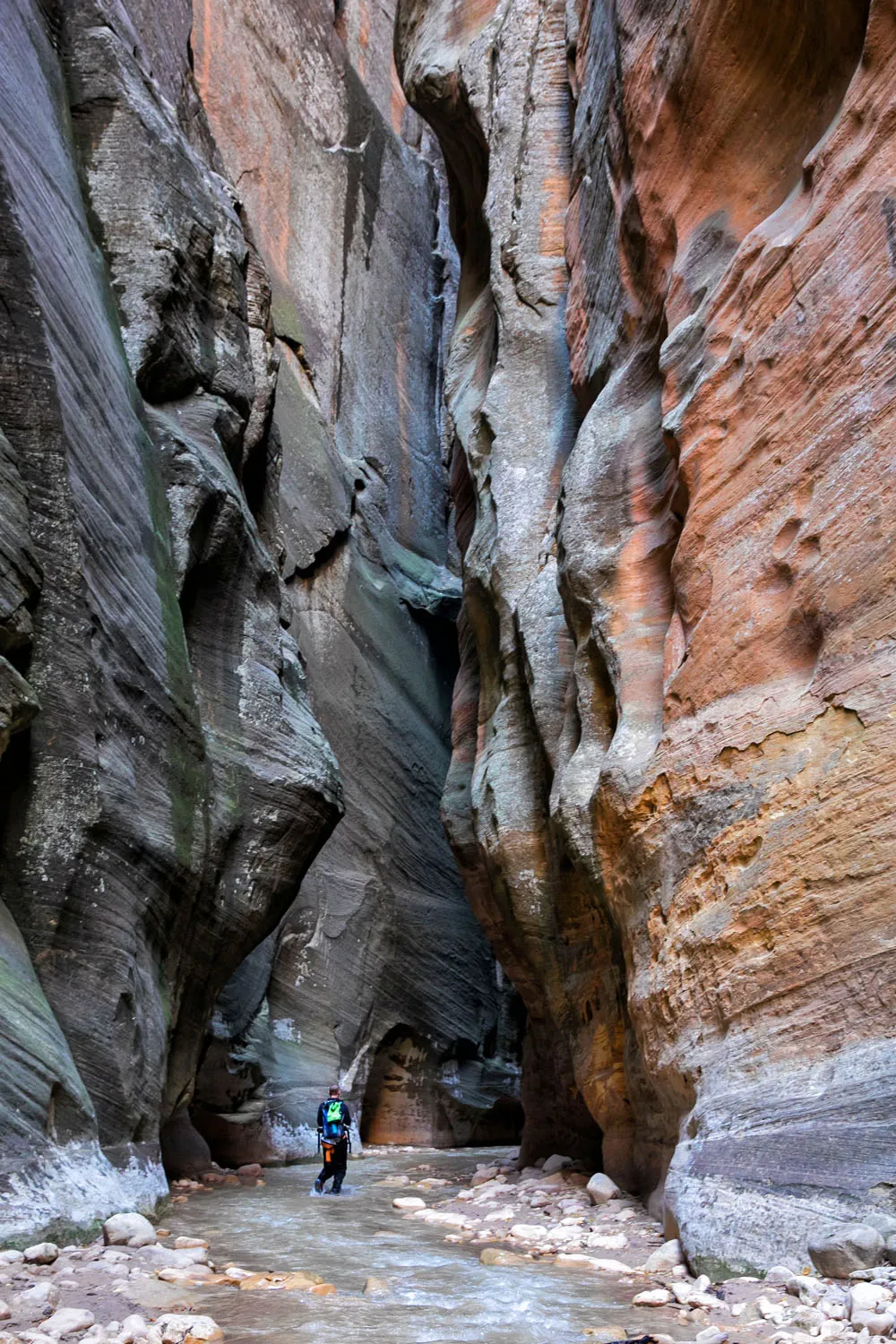
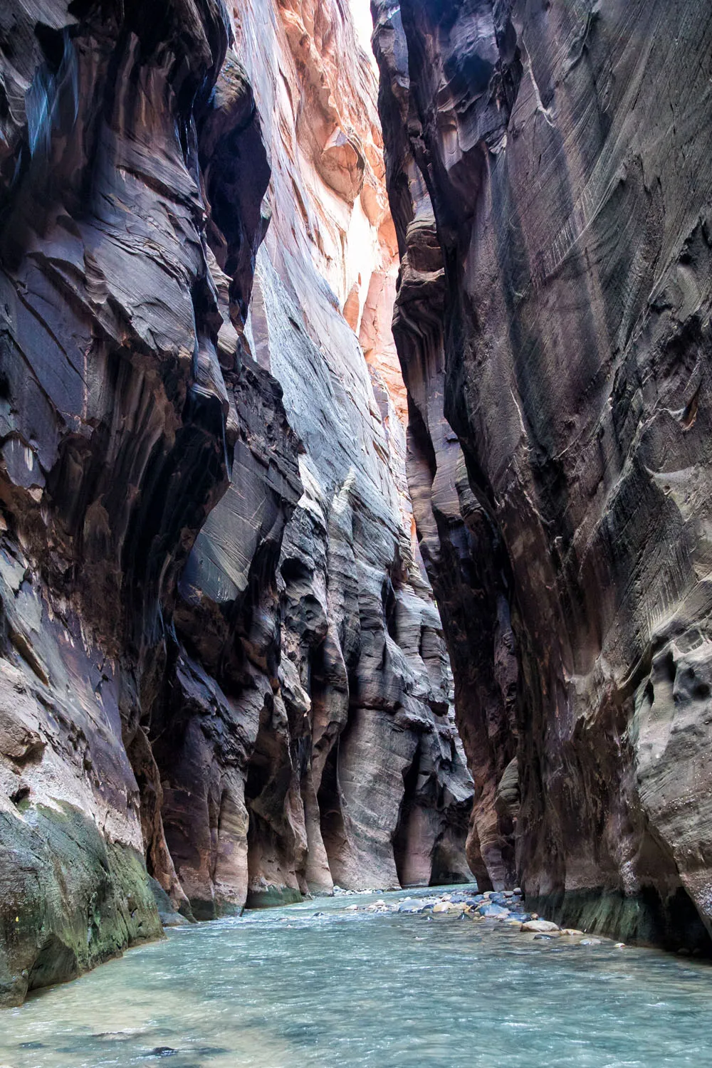
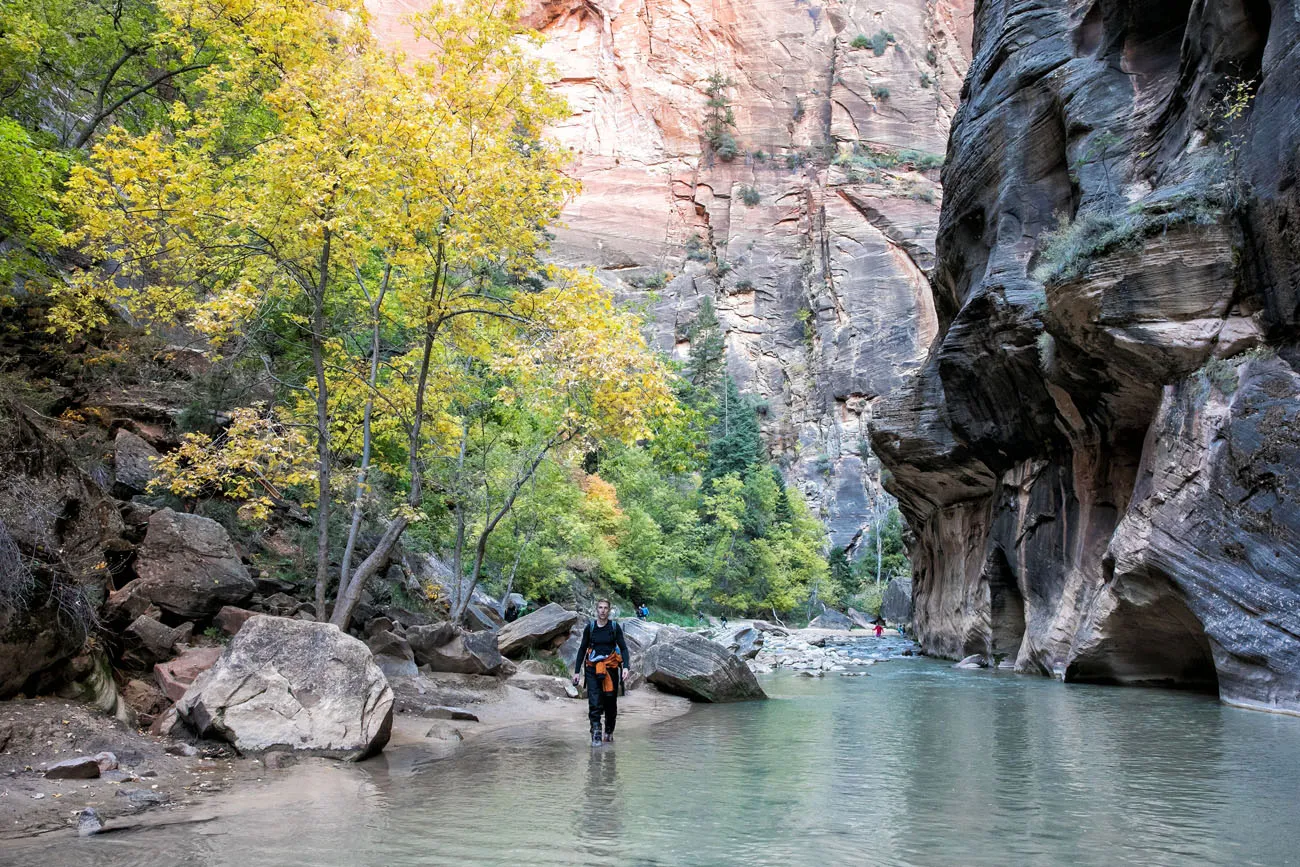
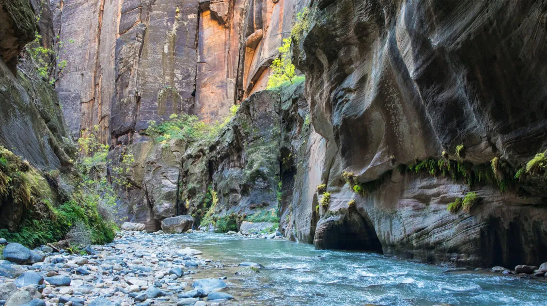
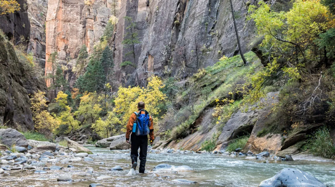
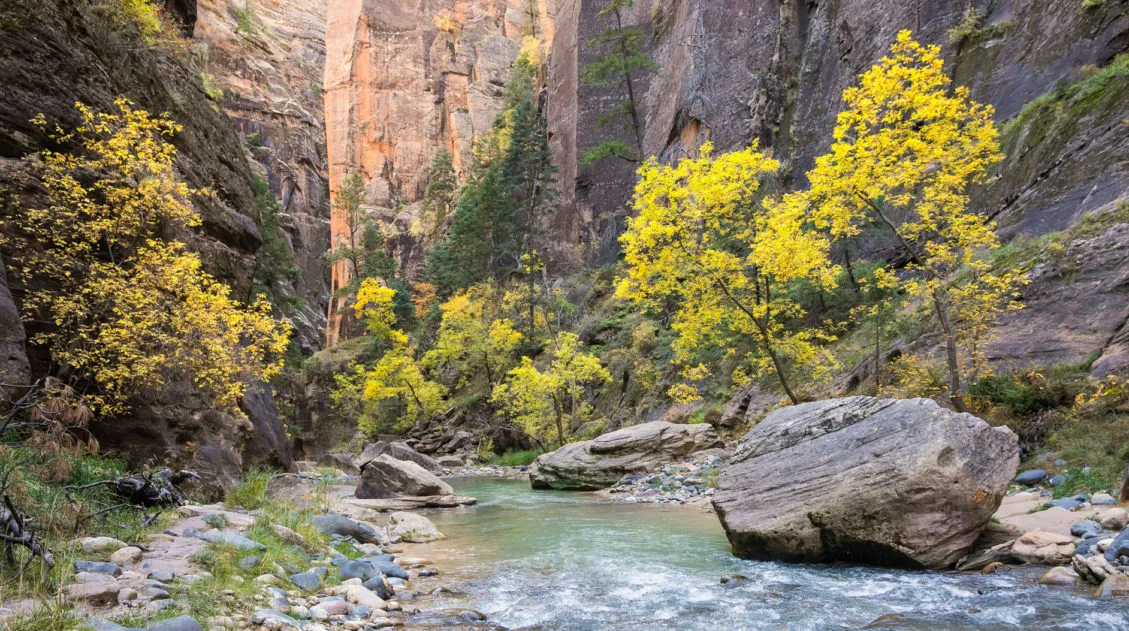
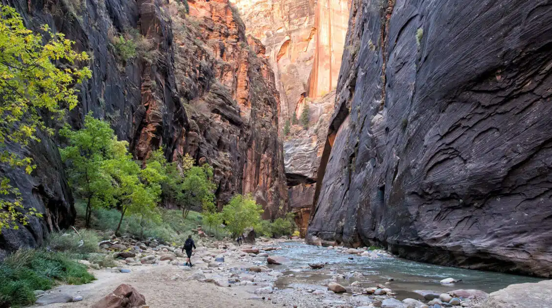
14. The Narrows
Our Rating: ⭐️⭐️⭐️⭐️⭐️ If we could give a hike 6 stars, the top-down route would be the one. We hiked the Narrows from the top-down and it is one of our favorite hikes of all time, which is really saying a lot (we’ve done a lot of hikes around the world).
Like the Subway, there are two ways to hike the Narrows. The easier hike is from the bottom-up, which is the most popular way to experience the Narrows. For the ultimate adventure, hike the Narrows from the top-down, one of the best overall hiking experiences you can have in the US national parks.
The Narrows from the Bottom-Up
Location: Zion Canyon
Distance: Up to 12 miles
Difficulty: Varies depending on the Virgin River flow rate, but overall it is easy to moderate. The most challenging section is Wall Street, where there can be sections of chest-deep (or higher) water.
Time: 2 to 8 hours
Zion Shuttle Stop: Temple of Sinawava, stop #9
This is the most popular way to hike the Narrows. Starting at the Riverside Walk, you hike upriver for several miles and then turn around and hike back the way you came. Along the way, you get to see some of the best scenery in the Narrows, including Wall Street. Wall Street is the iconic section where the canyon gets very narrow and the sheer rock walls close in overhead. It’s an awesome sight to see.
From the bottom-up, the farthest you go is Big Springs. Beyond this point, a permit is necessary. If you hike to Big Springs, your entire journey will be 10 miles round trip.
You also have the option to hike one mile into Orderville Canyon, for a total of 2 miles for this detour.
No permit is necessary to hike the Narrows from the bottom-up.
PRO TRAVEL TIP: The Narrows is typically closed during the spring months while the snow is melting, creating high flow rates in the river.
The Narrows from the Top-Down
Location: Zion Canyon
Distance: 16 miles
Difficulty: Strenuous
Elevation Loss: 1500 feet (460 meters)
Time: 10 to 13 hours average
Trailhead: Chamberlain’s Ranch
In our opinion, this is the ultimate Zion Narrows experience since you hike the entire length of the Narrows.
Hiking the Narrows from the Top-Down is a 16-mile journey that takes you from Chamberlain’s Ranch to the Temple of Sinawava. It can be done as an epic day hike or as a two-day backpacking trip. A permit is necessary for both options.
We hiked the Zion Narrows as a day hike and it is one of our favorite hiking experiences of all time. To stand in this narrow canyon, dwarfed by the immense height of these walls, was incredible. Our favorite section of the Narrows, where the walls towered over our heads, can only be seen on the top-down route.
Read More about the Narrows
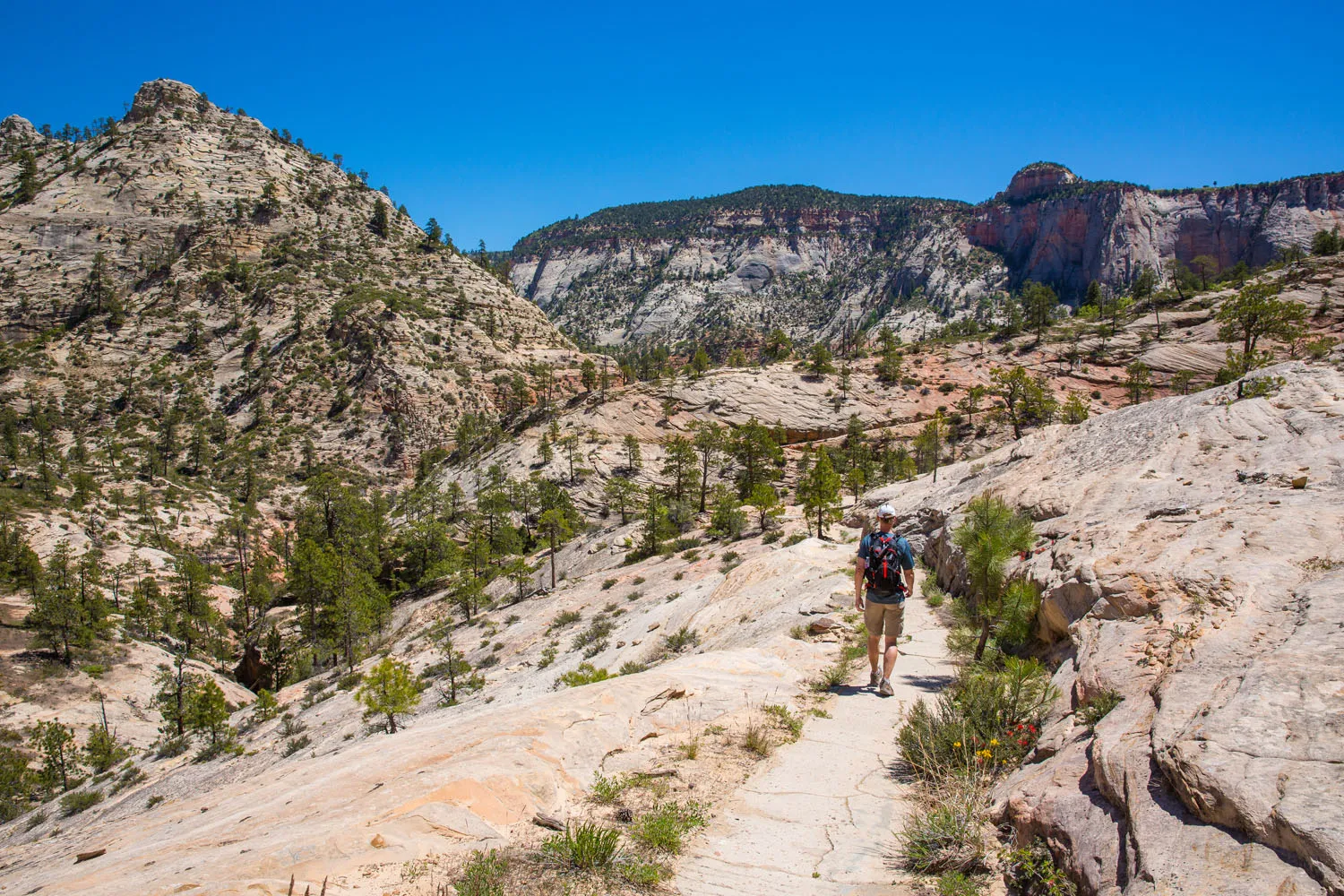
15. The West Rim Trail
Our Rating: ⭐️⭐️⭐️⭐️ This long-distance trail takes 1 to 2 days, so it isn’t for everyone. For avid hikers and those who want to leave the crowds behind, this is a hike to consider.
Location: West Zion
Distance: 16.2 miles point-to-point
Difficulty: Strenuous
Elevation Loss: 3,156 feet (960 meters)
Elevation Gain: 1,486 feet (453 meters)
Time: 9 to 12 hours
Trailhead: Lava Point Campground
The West Rim Trail is a long-distance hike through Zion National Park. With amazing views, very few hikers on the trail, and a chance to walk the length of Zion National Park, this hike rewards your efforts. The West Rim Trail can be hiked as a long day hike or as a two-day backpacking trip. We did it as a day hike on our first visit to Zion.
West Rim Trail
Trails that Have a Long-Term Closure
There are two trails that have a long-term closure due to a rockfall at the Weeping Rock Trailhead, which occurred in 2019. We are listing them here since they are fantastic hikes, and we hope they will eventually reopen.
Hidden Canyon
Hidden Canyon is one of our favorite hikes in the park and it blew away our expectations. This hike is tons of fun, with trails that cling to the side of a cliff and a scenic canyon to explore.
Sections of this hike are similar to Angels Landing, with vertigo-inducing trails that come with chains to help you keep your balance. This hike starts at the Weeping Rock Trailhead, stop #7 on the Zion Shuttle.
Tim hiking the Hidden Canyon trail
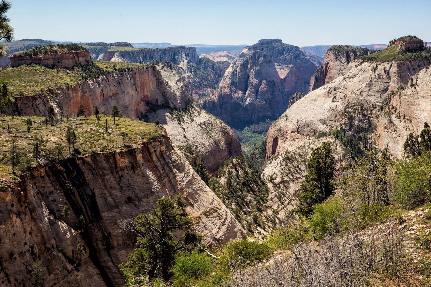
Observation Point
As stated earlier, Observation Point can be done several ways. The best way to hike to Observation Point is via the Weeping Rock Trailhead, but this is currently closed. From this trailhead, a series of switchbacks lead from the Zion Canyon floor up into the mountains. It’s a tough hike but incredibly scenic.
Currently, you can hike to Observation Point via the East Mesa Trail. It’s a rather boring hike but you still get the sweeping views over Zion from the overlook.
Pick Your Perfect Hike in Zion
Our Favorite Zion Hikes
- The Narrows
- Angels Landing
- Canyon Overlook Trail
- Observation Point
- West Rim Trail
What Are the Best Hikes for Families?
- Riverside Walk
- Emerald Pools
- Canyon Overlook Trail
- Many Pools Trail
- Timber Creek Trail (Kolob Canyons)
Which Hikes Have the Best Views of Zion?
- Observation Point
- Angels Landing
- West Rim Trail
- Canyon Overlook Trail
- Pa’rus Trail
The Most Adventurous Hikes
- The Subway
- The Narrows
- Angels Landing
- West Rim Trail
Most Accessible Hikes
- Riverside Walk
- Pa’rus Trail
Multi-Day Backpacking Trips
- West Rim Trail
- The Narrows from the Top-Down
Leave the Crowds Behind
- West Rim Trail
- Many Pools Trail
- The Narrows from the Top-Down
- Petroglyphs Trail
- The Subway
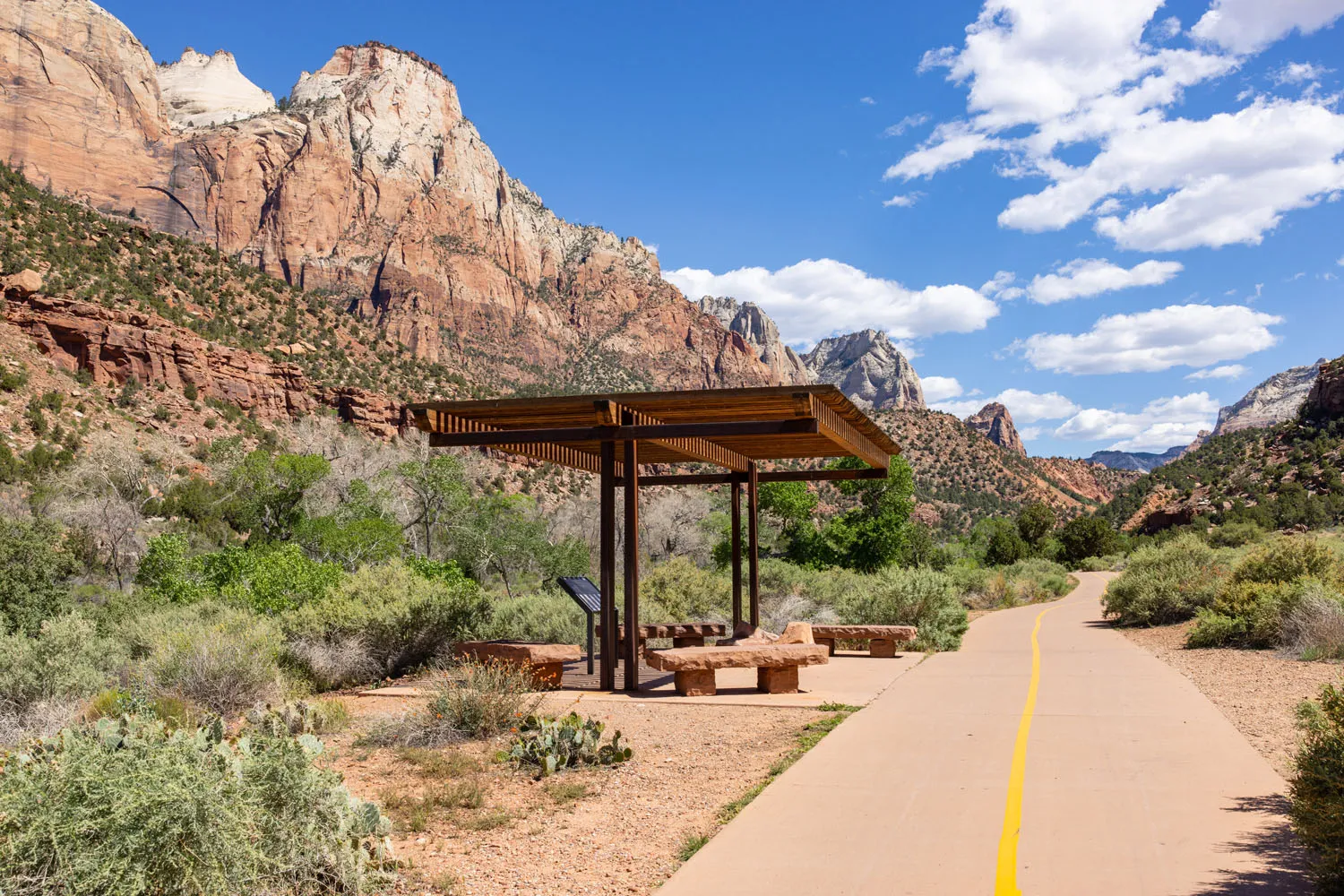
How to Get Around Zion
For most of the year (mid-February through November), the Zion Shuttle is in operation. During this time, private vehicles are not permitted to drive on Zion Canyon Scenic Drive.
From mid-February through mid-March, the shuttle operates on the weekends and private vehicles are allowed on Zion Canyon Road on the weekdays. The shuttle operates 7 days a week beginning mid-March. For the full schedule and hours of operation, visit the National Park Service website.
Park at the Visitor Center or take the Springdale Shuttle to the main entrance. You can hop on the shuttle at the Visitor Center and ride the various shuttle stops along Zion Canyon Scenic Drive. If you are heading into the park to go hiking, make sure you know the correct shuttle stop for your hike.
You are permitted to drive from the Visitor Center to the east entrance all year.
When the shuttle is not in operation (December, January, and February) you are permitted drive along Zion Canyon Scenic Drive. Just be aware that parking is limited so it still helps to get an early start. When parking lots fill, Zion Canyon Scenic Drive may temporarily close.
There is a second shuttle system, the Springdale Shuttle, that connects the hotels in Springdale with the main entrance of Zion.
Starting mid-morning, lines to board the Zion Shuttle can be very long. We are talking an hour wait or longer. To have the best experience, plan on being on one of the first two shuttles of the day. During peak season and holiday weekends, plan to get in line at least 30 minutes before the first shuttle.

The view from Angels Landing
Tips to Have the Best Experience
Start Early!! For the best experience, plan to be on one of the first shuttles of the day. This is very important if you plan to hike the more popular trails, such as the Zion Narrows from the bottom-up.
Don’t forget your permit! If you plan to hike Angels Landing, the Subway, or the Narrows from the top-down, you must have a permit.
To hike the trails with low crowds, we visit the park twice in one day. In the morning, we get on the first shuttle or drive to one of the trailheads of a longer, more strenuous hike (such as Angels Landing or Observation Point). We take a break midday, have lunch in Springdale, and return to the park in the late afternoon, once the crowds start to lessen. This is a nice time to hike an easier trail and maybe even catch sunset in the park.
The best time to visit Zion National Park is during the spring and fall months. The weather will be warm during the day and cool at night. During the summer months, temperatures can soar and there is the risk of flash floods. Winter is a nice time to visit Zion, if you don’t mind cold temperatures.
With high crowd levels, trail closures, and high levels of cyanobacteria in the Virgin River, Zion can be a challenging park to visit. If you are planning a visit to Zion, make sure you read our article 5 Things to Know Before Visiting Zion to avoid any unfortunate surprises.
Visit the National Park Service website for more information on hikes in Zion, as well as to check trail status and get important updates.
Frequently Asked Questions
What is the most popular hike in Zion?
Angels Landing is the most popular hike in Zion, followed by the Narrows. Both of these trails get a massive number of hikers every day in the summer. In response to this, a permit is now necessary to hike Angels Landing, in order to control the number of people on the trail.
What is the easiest hike in Zion?
There are several short, easy trails in Zion. The Riverside Walk is flat, paved, and roughly 2 miles round trip, making it the most accessible hike in the park. The Canyon Overlook Trail is just 1-mile round-trip, mostly flat, fun to hike, and leads to a jaw-dropping view of the park. The Lower Emerald Pools Trail and the Pa’rus Trail are also paved, mostly flat, and accessible.
When is the best time to go hiking in Zion?
Spring and fall are the best seasons for hiking. The weather is warm and dry during this time. Summer can be very hot, especially midday. The weather is cool to cold in the winter, with the occasional chance for snow.
If you have any questions about the best hikes in Zion, or if you want to share your favorites, let us know in the comment section below.
More Information about Utah and the National Parks
First Trip to Zion: 10 Things to Know (From a Frequent Visitor)
Planning your first trip to Zion? You’ve come to the right place. We are frequent visitors to Zion National Park, and through multiple visits, we have hiked the full length of the Narrows, stood atop Angels Landing, explored Kolob Canyons, and ventured off the beaten path within the park. With the park shuttle, trail reservations, […]
10 Things to Do in Zion National Park (No Hiking Required)
While Zion is world-famous for bucket list trails like Angels Landing and the Narrows, there’s a lot more to do here than hike a trail or two. Whether you’re visiting with kids, taking a rest day, or simply prefer to skip the trails, Zion offers a surprising variety of things to do that don’t involve […]
The Ultimate Zion Itinerary: 1 to 6 Days of Hiking & Adventure
If you are planning your Zion National Park itinerary, this is a great place to start. Zion National Park is a hiker’s paradise. This relatively small park is packed with some of the most thrilling hikes in the United States. From the awe-inspiring hike up Angels Landing to the bucket list-worthy Zion Narrows to the family […]
Zion National Park Travel Guide
Zion National Park Zion National Park is a hiker’s paradise. This relatively small park is packed with some of the most thrilling trails in the United States. Angels Landing and the Narrows are two hikes that attract most people to Zion National Park. But there are many more trails to choose from…hikes that range from short, […]
5 Things to Know Before Visiting Zion National Park
Zion National Park and its epic hiking trails have become an extremely popular place to visit in recent years. This is a spectacular destination and one of our favorite national parks in the USA. However, due to crowd levels, trail closures, and cyanobacteria in the Virgin River, Zion has become a challenging park to visit. […]
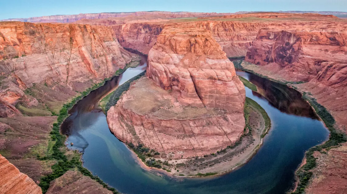
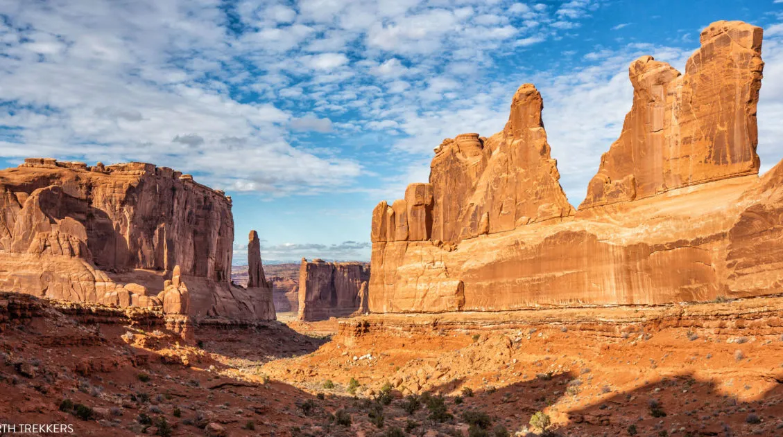
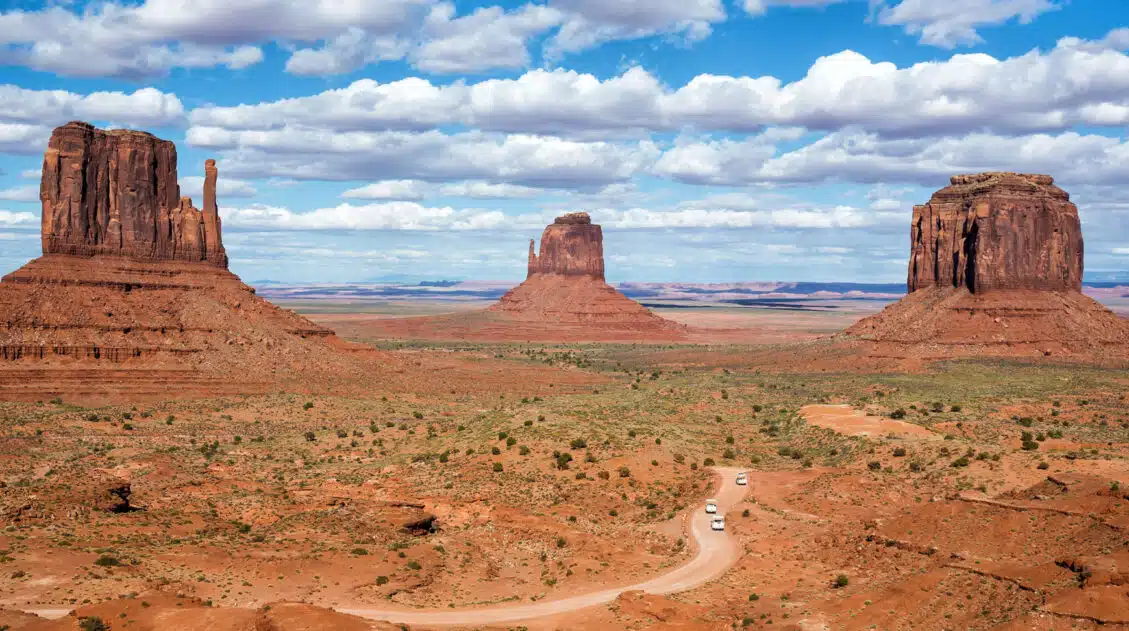
10 Days in the American Southwest: The Ultimate Road Trip
The American southwest is one of the USA’s best road trip destinations. It’s unbelievable how much there is to see and do here. There are the breathtaking vistas of the Grand Canyon, thrilling hiking trails in Zion National Park, and millions of hoodoos to photograph in Bryce Canyon. Are you getting excited yet? The list […]
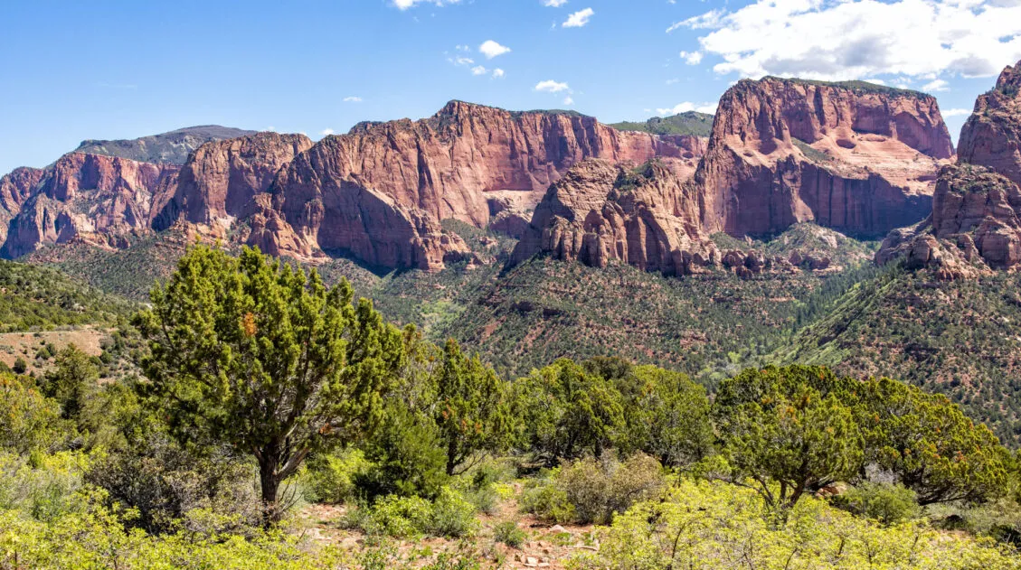
Kolob Canyons in Zion: Best Things to Do & Is It Worth It?
Kolob Canyons is a small, remote section of Zion National Park. Located in the northwestern area of the park, Kolob Canyons is known for its quieter hiking trails, sandstone cliffs, and narrow canyons. For those looking to escape the crowds of Zion, or those who want to thoroughly explore this national park, Kolob Canyons is […]
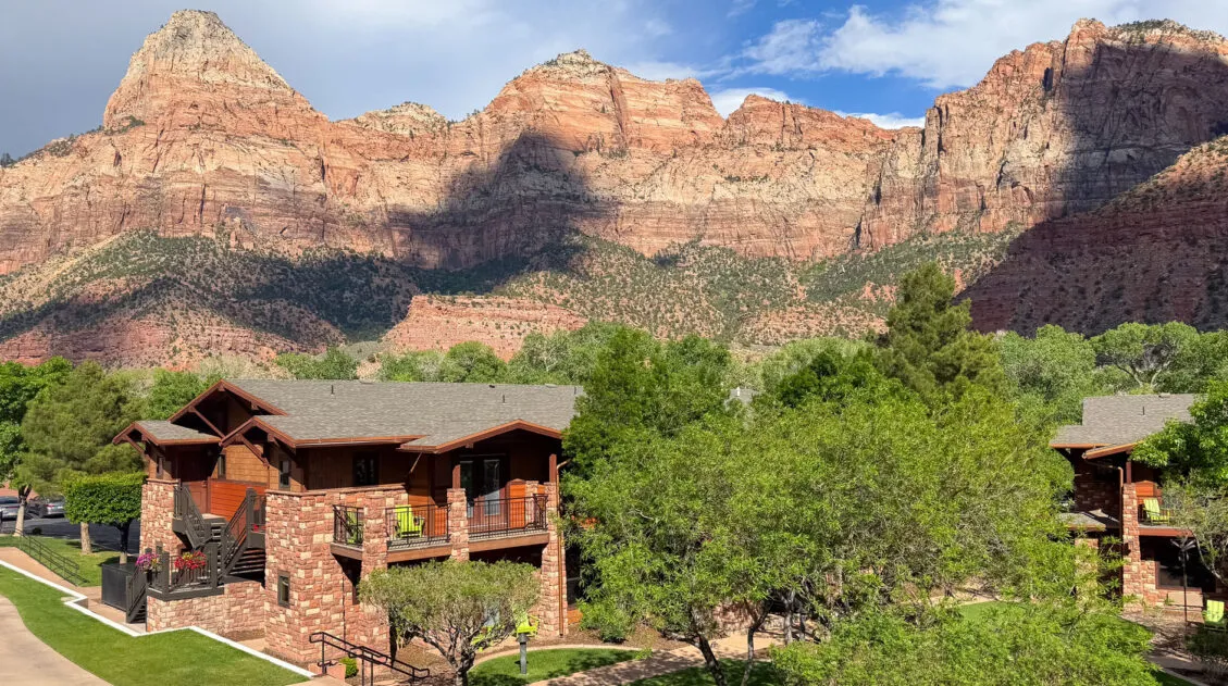
Where to Stay in Zion: Best Hotels, Lodges & Glamping Resorts
If you are deciding on where to stay in Zion, and it is your first time visiting this park, chances are you may have a lot of questions. Can I stay in the national park? What are my cheapest options? What are the best properties for families? We are frequent visitors to Zion, having visited […]
6 Epic Utah Road Trip Routes for Your Next Adventure
Utah is home to five of the most stunning national parks in the United States. Throw in some national monuments and a few spectacular state parks and you have a extraordinary road trip destination. If you are planning a Utah road trip itinerary, we have tons of information to share with you. About Our Experiences […]
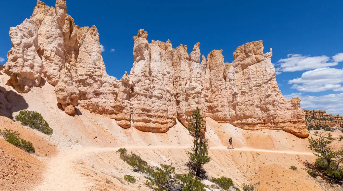
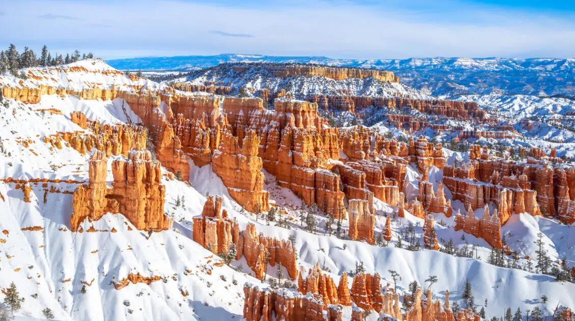
12 Epic Hikes in Bryce Canyon Rated from Easy to Hard
If you ask us, putting one foot in front of the other on a hiking trail is the best way to experience Bryce Canyon National Park. These hiking trails take visitors to jaw-dropping viewpoints and hidden canyons. Hike the short but sweet Rim Trail, descend down into the amphitheater on the Queen’s Garden Trail, or […]
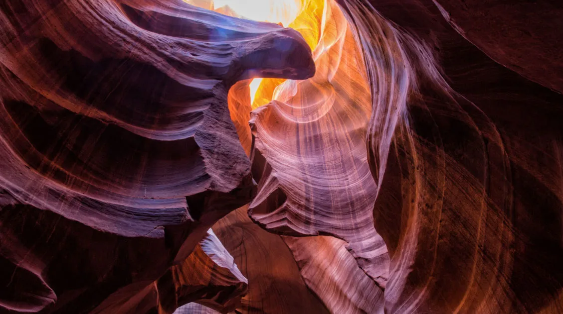
10 Amazing Slot Canyons to Explore in the American Southwest
The American Southwest is a playground for hikers, photographers, and adventurers. Fun to explore and extremely photogenic, slot canyons provide a unique hiking experience. We have assembled a short list of some of the best slot canyons in Utah, Arizona, and Nevada. This is not an all-inclusive list, because there are tons of slot canyons […]
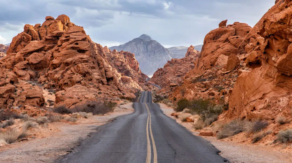
16 Best Things to Do in Valley of Fire State Park
Discover the best things to do in Valley of Fire State Park, along with a streamlined itinerary that covers the highlights efficiently, making it an ideal day trip from Las Vegas. The Valley of Fire State Park is a brilliant, colorful outdoor destination located in Nevada, just one hour from Las Vegas. Filled with panoramic […]
12 Best US National Parks to Visit in November
Planning a trip to the US national parks in November and don’t know which ones to visit? The cooler weather in November makes this one of the best times of the year to visit the parks across the southern part of the USA. Road trip through Utah’s Mighty 5, go sledding on sand as white […]
The Ultimate Guide to the 63 US National Parks
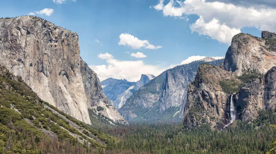
Stretching from the South Pacific, across the United States to the Caribbean, are 63 national parks. These national treasures preserve iconic landscapes, majestic mountains, primordial forests, arid deserts, misty coastlines, immense canyons, wildlife, and historic landmarks. We have visited 56 of the 63 US national parks, from the towering granite walls of Yosemite and the […]
Ultimate Hiking Guide: Europe, Asia, Africa, Americas & Oceania
Are you looking for the perfect hike? With hikes on six continents ranging from a few miles to multi-day adventures, explore some of the best hikes from around the world.
United States Travel Guide: Places to Visit in the USA
Plan your visit to the United States. Learn about the best things to do, how to plan your time, road trip ideas, and sample itineraries.
Comments 85