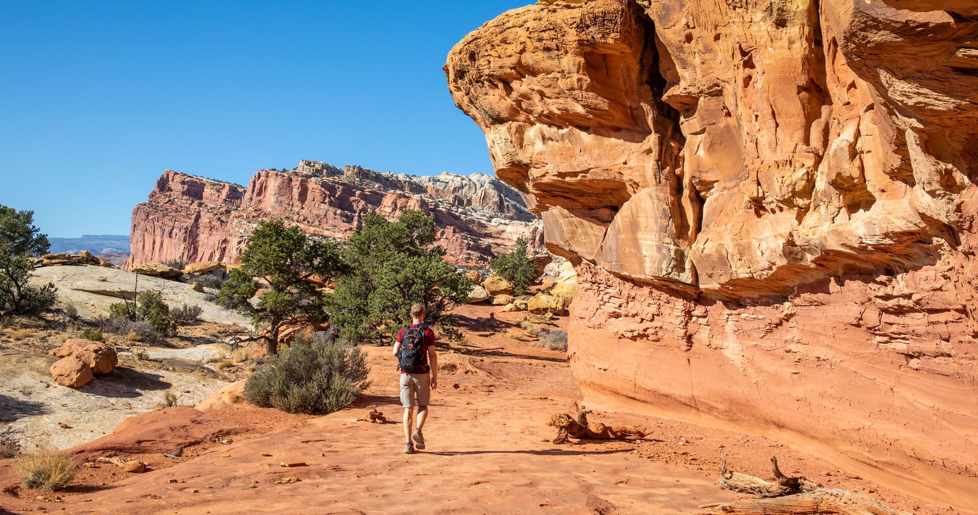
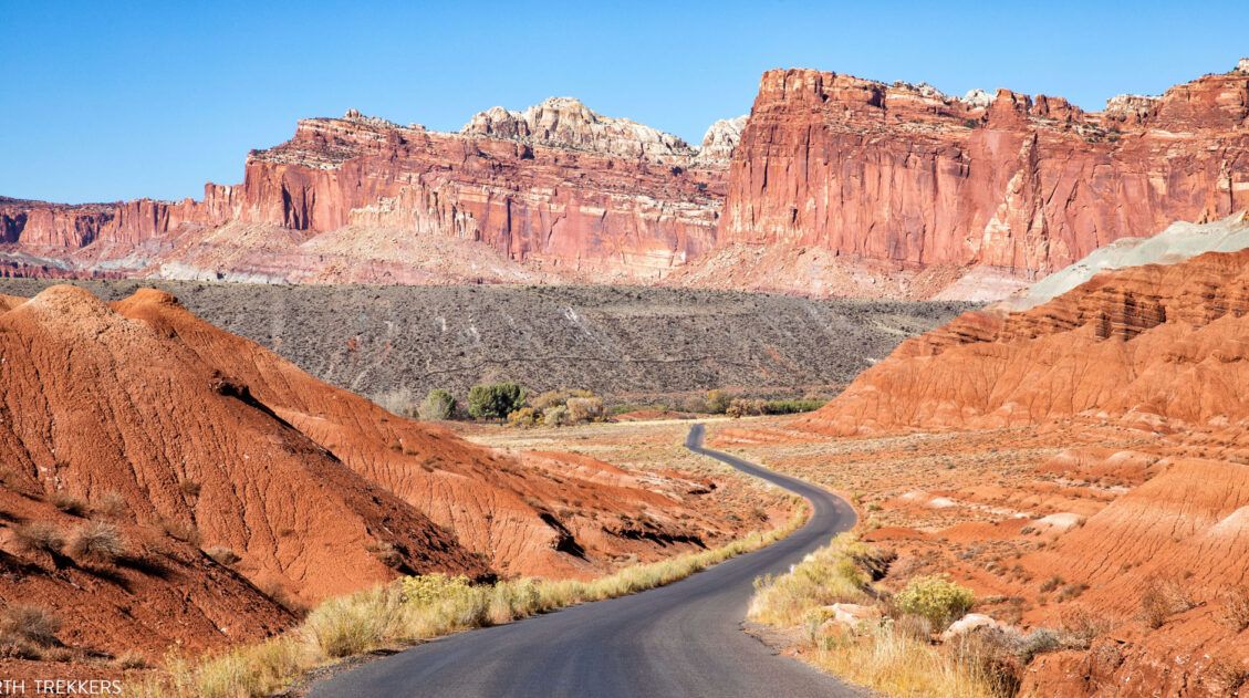
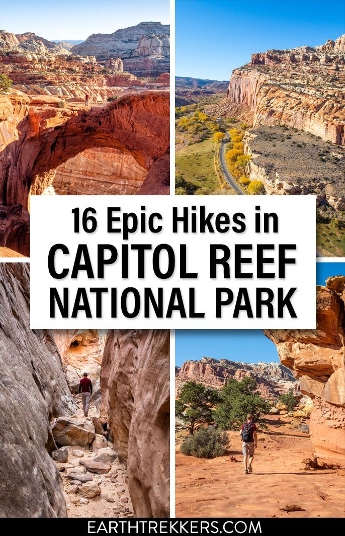
The hikes in Capitol Reef National Park are some of the most underrated in Utah. From short, easy trails along Highway 24 to scenic routes like Cassidy Arch and Grand Wash, this park is packed with adventure, without the crowds you’ll find in Zion or Arches.
Drive deeper into the park and you’ll discover the real gems: remote slot canyons, sweeping overlooks, and backcountry trails through the Waterpocket Fold and Cathedral Valley. These lesser-known hikes are some of the most rewarding and photogenic hikes in Capitol Reef National Park.
On our first visit, we stuck to the short hikes along Highway 24. More recently, we spent nearly a week in Capitol Reef, and we were amazed by the incredible variety of hikes in this park, stunning hikes that are short, scenic, and surprisingly uncrowded.
Most guides only highlight the popular hikes along Highway 24 and Scenic Drive, but that’s just scratching the surface. We will take you into the backcountry, to some of the very best hikes in the park.
In this guide, we share the best hikes in Capitol Reef, organized by location, so you can experience both the easy classics and the unforgettable backcountry routes that make this park one of Utah’s most underrated destinations.
Please practice the seven principles of Leave No Trace: plan ahead, stay on the trail, pack out what you bring to the hiking trail, leave areas as you found them, minimize campfire impacts, be considerate of other hikers, and do not approach or feed wildlife.
Best Hikes in Capitol Reef National Park
The hikes on this list are organized by geographical area.
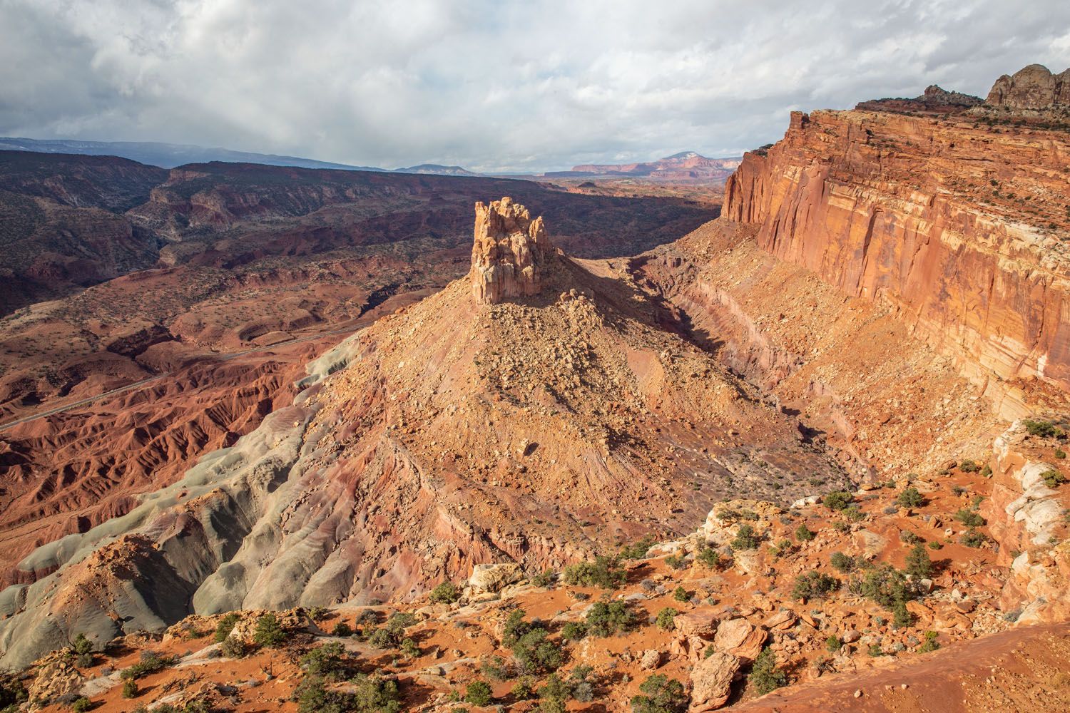
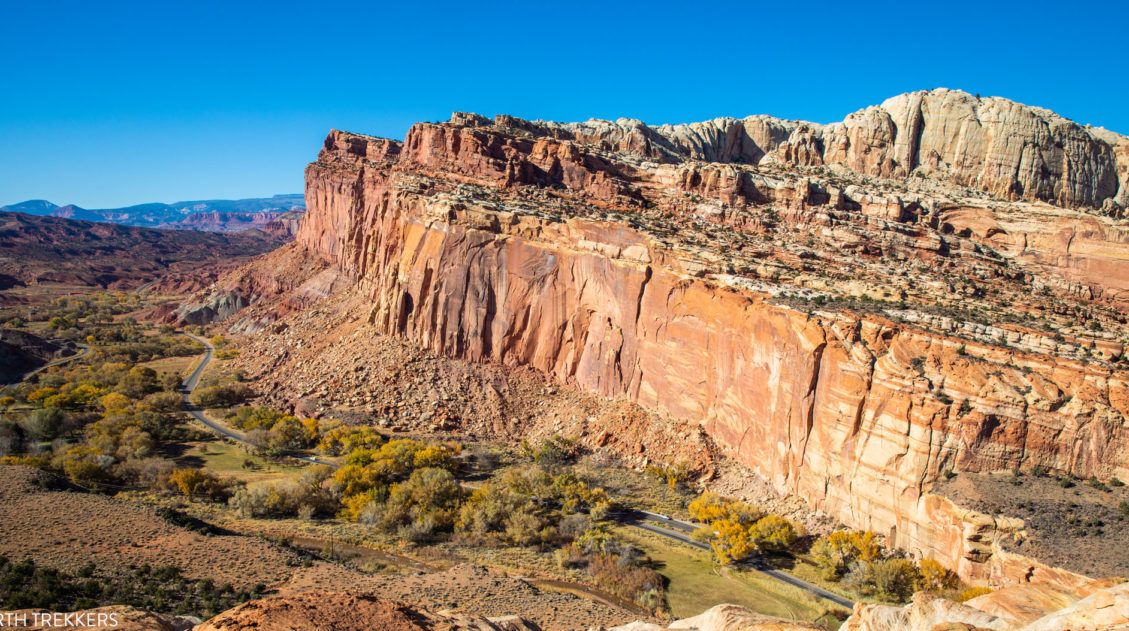
The sights and hiking trails along Highway 24 and Scenic Drive form the core of Capitol Reef National Park. But you can also leave the crowds behind and venture into the backcountry. Exploring Cathedral Valley and Looping the Fold are amazing adventures to put on your Capitol Reef to-do list, and it is here that you will find some of the most beautiful and least crowded hiking trails in Utah.
At A Glance: Our Favorite Capitol Reef Hikes
In this guide, we list 15 hikes, which is quite extensive (I wasn’t joking when I said this parked is filled with great hikes to do). That’s a lot to choose from, so here are our 5 favorite hikes in Capitol Reef:
- Cassidy Arch: A fun, relatively easy hike with the chance to have your photo taken on an arch. Adding on Grand Wash is nice bonus.
- Rim Overlook & Navajo Knobs: The toughest hike on this list (9.5 miles with almost 3,000 feet of elevation gain) but the reward is panoramic views over the park, plus it’s located right on Highway 24.
- Cohab Canyon: This is similar to Navajo Knobs, with gorgeous aerial views, but it’s a lot easier (3.4 miles) and also located in the main part of the park.
- Headquarters Canyon: This very short, easy hike (2.6 miles) through a slot canyon is also one of the most remote, on the Loop the Fold scenic drive (we had it all to ourselves!)
- Sunset & Gooseneck Point: This is a hike we always do when we visit Capitol Reef. It’s located on Highway 24, a short and easy route, and offers more great views of the park.
Map of the Hiking Trails
How to Use This Map: Click the icons on the map to get more information about each point of interest. To take this map with you, click the star next to the title of the map which adds it to your Google account. Next, within your Google Maps app, select ‘Saved’ and then select ‘Maps’. This map title will now appear in your list.
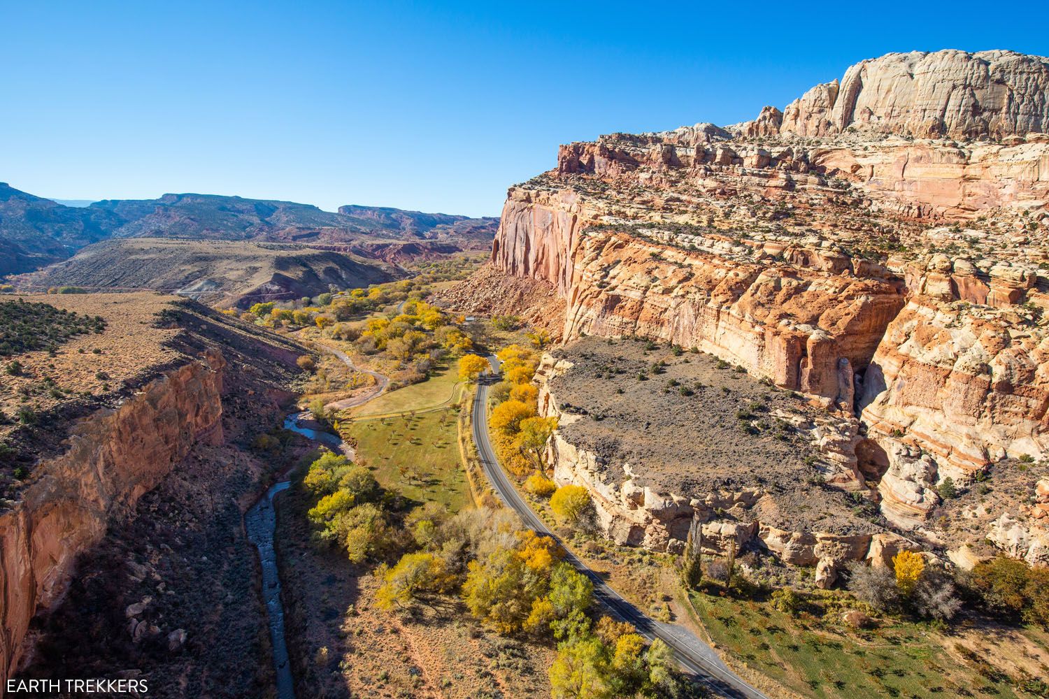
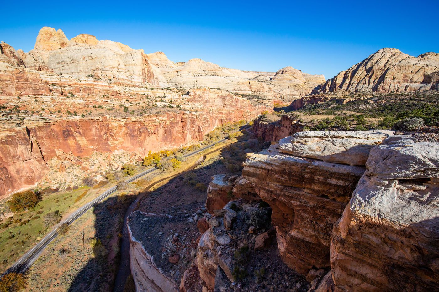
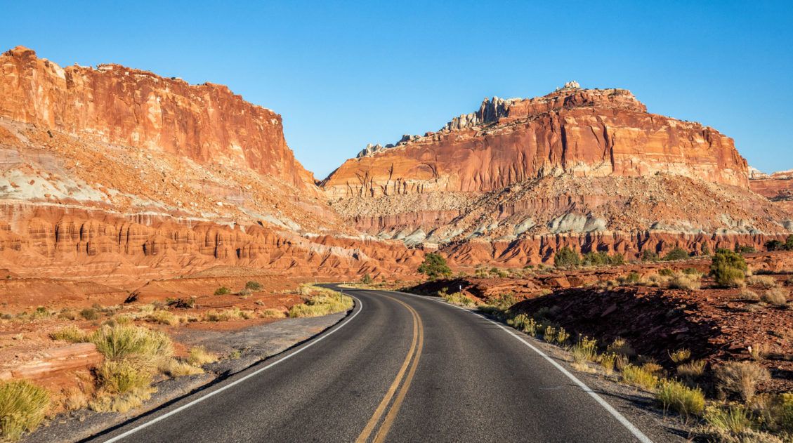
Hikes Along Highway 24 and Scenic Drive
Along Highway 24 and Capitol Reef Scenic Drive you will find the largest concentration of hiking trails. These are all easy to get to (no high-clearance vehicle or 4×4 necessary) and are centrally located within the park.
These trails also tend to be the most crowded. Midday during peak travel times, you may have trouble getting a parking space, as the parking lots are notoriously small in Capitol Reef. I recommend getting an early start if possible, just so you don’t struggle to get a parking space.
🥾 These hikes are perfect for:
- Those with limited time (a day or less in Capitol Reef), since they are easy to get to
- Those who want to hike an easy trail or two; some of the shortest, easiest hikes are located in this part of the park (we recommend Hickman Bridge, Gooseneck & Sunset Point, or Cassidy Arch)
Goosenecks & Sunset Point
Our Rating: ⭐️⭐️⭐️⭐️⭐️ It’s short, it’s easy, and it’s quick to drive to. This is a great first hike in the park and perfect for kids and those looking to do just one or two quick hikes in the park.
Two very short hikes start from one parking lot. From Highway 24, turn onto the gravel road for Panorama Point and Sunset Point. Panorama Point will be the first overlook you will come to. Simply step out of your car and enjoy the view. Then, continue down the gravel road to the end and park in the parking lot. This road is suitable for standard cars.
Sunset Point
Distance: 0.8 miles | Difficulty: Easy | Time: 20 to 30 minutes
This is a short, easy hike out to a gorgeous overlook. It gets its name because it is one of the best spots in Capitol Reef to watch the sunset, but the views are beautiful all day long.
Sunset Point
Goosenecks Overlook
Distance: 0.2 miles | Difficulty: Easy | Time: 10 minutes
This short walk takes you to an overlook where the Sulphur Creek carved out a canyon, its curving path resembling that of a gooseneck.
Goosenecks Overlook
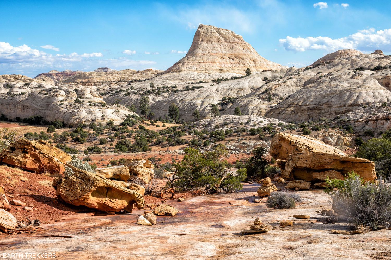
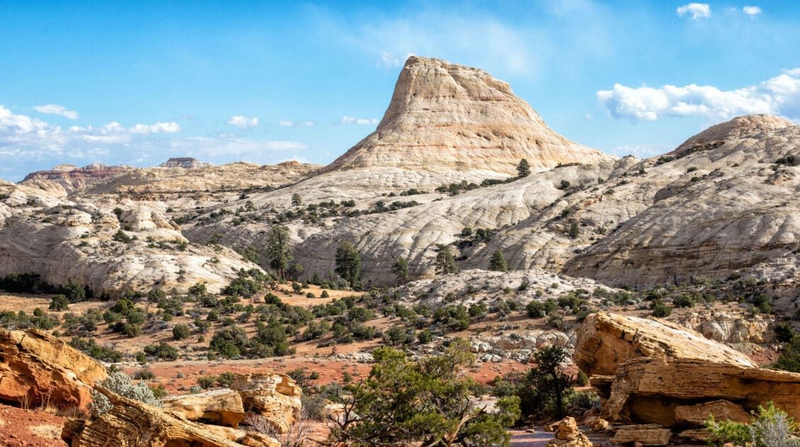
Chimney Rock
Our Rating: ⭐️⭐️⭐️⭐️ This is a popular hike to do along Highway 24.
Distance: 3.6 miles | Difficulty: Moderate | Total Ascent: 600 feet | Time: 2 to 4 hours
If you are looking for a relatively short hike that isn’t too challenging and offers great views over the park, hike the Chimney Rock loop. After a short and strenuous climb, this trail stays relatively flat, as it makes a loop along the sandstone mountains. The views of Fruita and the waterpocket fold are spectacular.
Chimney Rock (photo taken from the Navajo Knobs Trail)
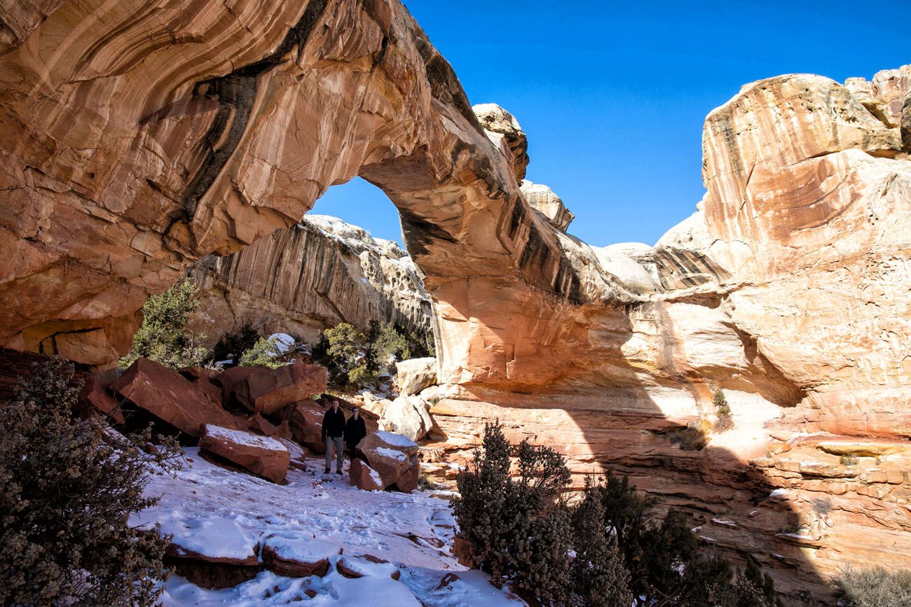
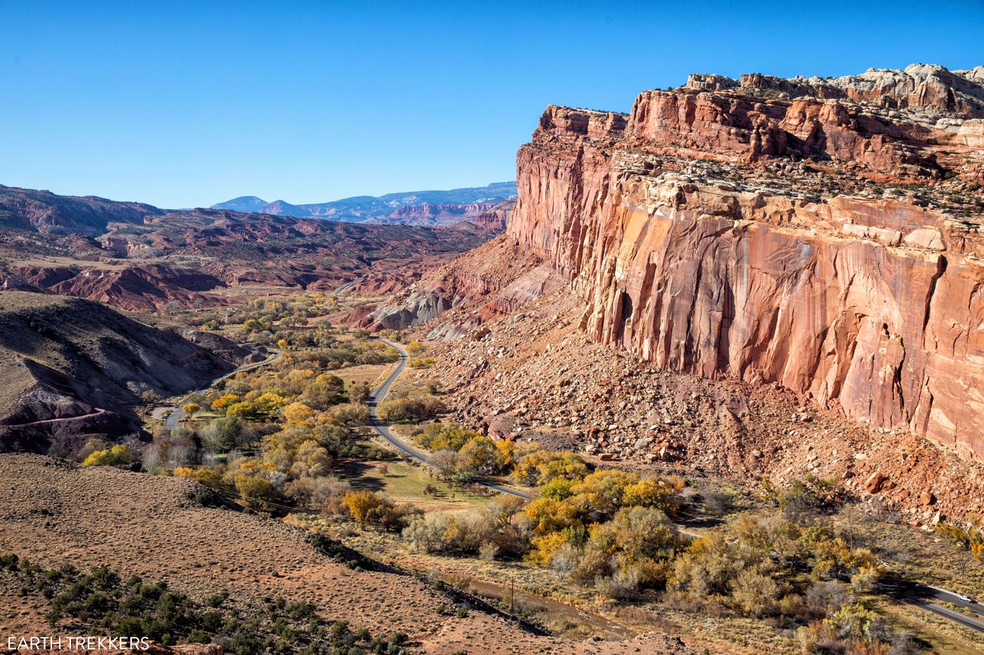
Hickman Bridge
Our Rating: ⭐️⭐️⭐️⭐️ This is one of the most popular hikes. It’s a nice hike, but it can be crowded, which is why we are only giving it four stars.
Distance: 1.8 miles | Difficulty: Moderate | Total Ascent: 400 feet | Time: 2 to 3 hours
This is one of the best short hikes to do in Capitol Reef. Walk along the Fremont River and then hike up to a spectacular viewpoint where you can look out over Highway 24. The trail ends at Hickman Bridge, a large, natural arch that is tucked away near the back of the canyon.
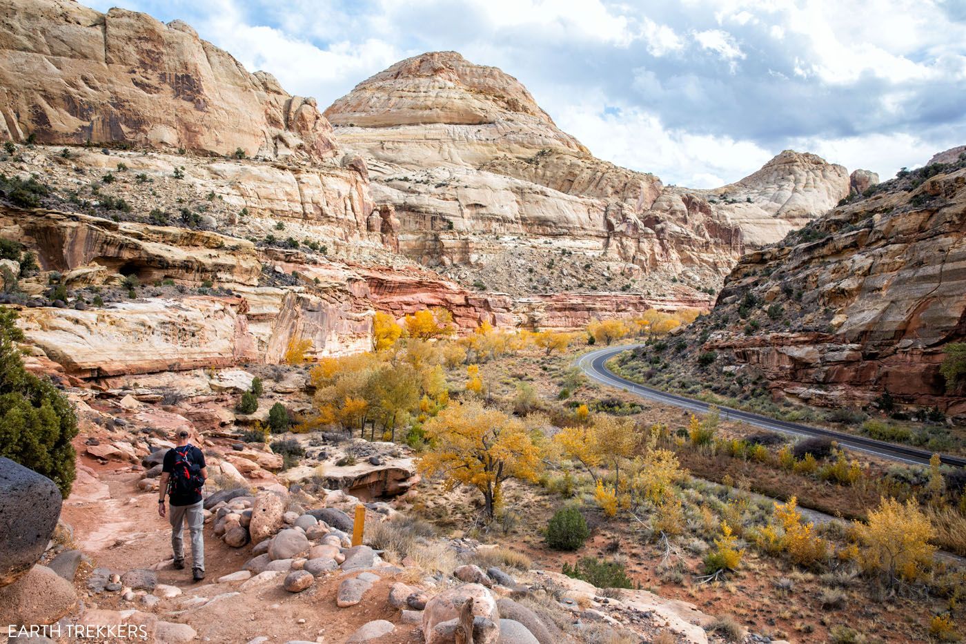
The view of Highway 24 from the hiking trail
Hickman Bridge
Capitol Gorge Trail
Our Rating: ⭐️⭐️⭐️ One of the least scenic hikes in the park (Grand Wash is similar but more interesting), but worth it for those who want to see the Pioneer Register).
Distance: 1.5 miles | Difficulty: Easy | Total Ascent: Minimal | Time: 45 minutes
The Capitol Gorge Trail is a flat trail that heads through a wide canyon. It was the only road through the waterpocket fold until Highway 24 was constructed.
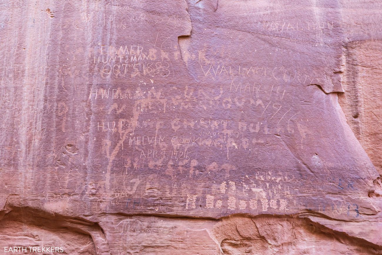
It is a 1.5 mile round trip walk to get to the Pioneer Register. When Mormon settlers passed through this area in the late 18th century and early 19th century, they scrawled their names on the canyon walls. This collection of names is called the Pioneer Register. Basically, it is historic graffiti. In this same canyon, you can also see American Indian petroglyphs.
Note: Do not write your name or leave any marks on the canyon walls. This area is under surveillance by the national park service and the fine is huge if you get caught writing on the walls.
To get to this trailhead, it is a beautiful drive through Capitol Gorge. Capitol Gorge Road is a 2.3 mile gravel road that is suitable for standard vehicles under 27 feet length.
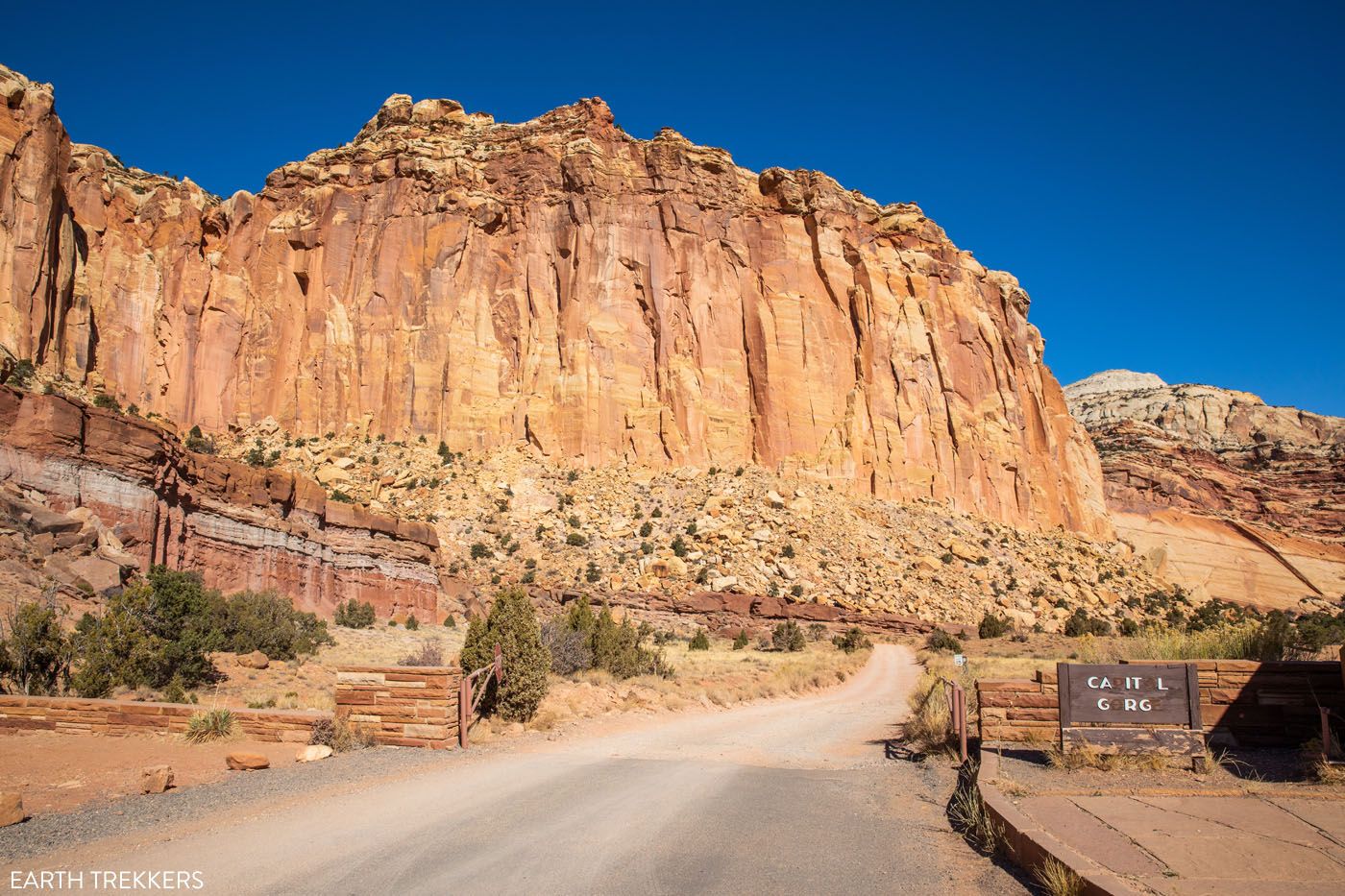
Capitol Gorge Road
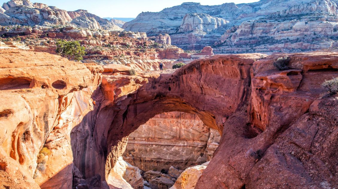
Cassidy Arch
Our Rating: ⭐️⭐️⭐️⭐️⭐️ If you only do one hike in Capitol Reef, make it this one. It’s short, it’s fun, and taking a photo on the arch is a unique photo opportunity. Add on Grand Wash as a bonus.
Distance: 3.4 miles | Difficulty: Moderate | Total Ascent: 845 feet | Time: 2 to 3 hours
The hike to Cassidy Arch is one of the most thrilling trails in Capitol Reef National Park. It’s also one of our favorites.
Easily accessible from Scenic Drive, this short hike features stunning scenery, views over the Grand Wash, and the chance to stand on Cassidy Arch. On this hike, you can view the arch from afar or walk across it for one of the most unique photo ops in Capitol Reef National Park.
Cassidy Arch, An Essential Hike in Capitol Reef National Park
Everything you need to know to hike to Cassidy Arch.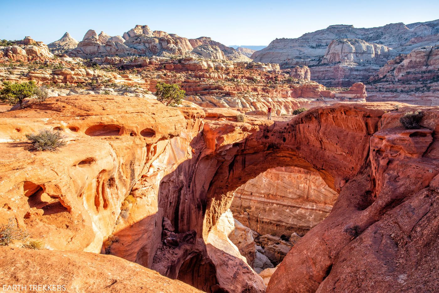
Tim on Cassidy Arch
Grand Wash
Our Rating: ⭐️⭐️⭐️⭐️ It’s flat, it’s easy, and if you’ve never hiked through a canyon before, this is a good hike to put on your list.
Distance: 4.8 miles* | Difficulty: Easy | Total Ascent: Minimal | Time: 2 hours
The Grand Wash is a very wide canyon, similar to the Narrows in Zion, only without the Virgin River. If you like the idea of hiking something similar to the Narrows, and keeping your feet dry, this is a very nice hike to do.
The Grand Wash and Cassidy Arch share the same parking lot. You will actually hike a small portion of the Grand Wash to get on the Cassidy Arch Trail.
This is a long hike if you walk the entire length of the canyon, but you can turn around when you are ready. The best part of the hike, where the canyon is the narrowest (called The Narrows), is about one mile from the start, so you can see the best of the Grand Wash if you only hike 2 to 3 miles round trip.
I really see no need to hike the entire length of the Grand Wash. We did and it gets to be a bit boring, especially on the walk back, since you are repeating the same views. If you are short on time, or want to save your energy for another hike, go as far as the Narrows and turn around (2.5 miles, about 1 hour).
Note: There are two trailheads for the Grand Wash: one on Highway 24 and one at the end of Grand Wash Road, the same place where the hike to Cassidy Arch begins. If you have two cars and drivers, you can hike this point to point. The Narrows is the central section of the Grand Wash, and it is roughly 1 mile from both of these trailheads. So, you can hike to the Narrows from either starting point and it is the same distance.

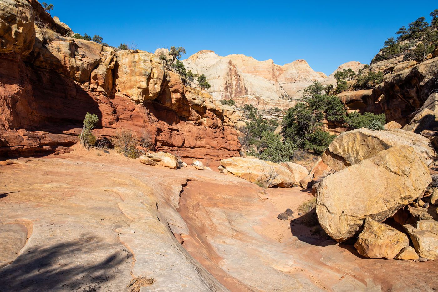
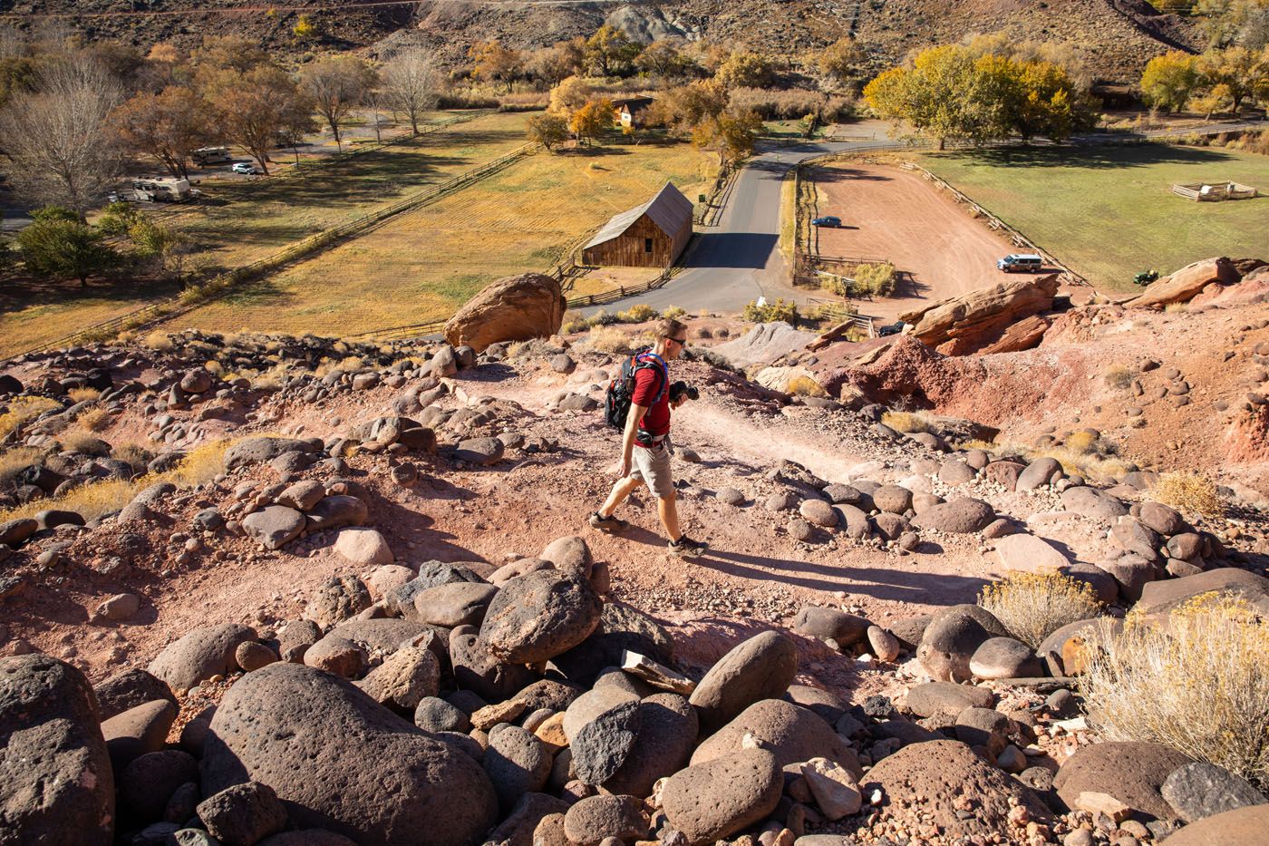
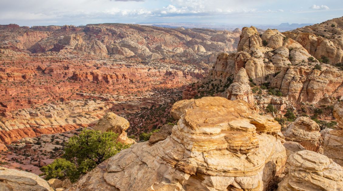
Cohab Canyon
Our Rating: ⭐️⭐️⭐️⭐️⭐️ This underrated hike rewards hikers with panoramic views over Fruita. Again, it’s one of our favorites, as we love the views over Highway 24 and the historic barn.
Distance: 3.4 miles | Difficulty: Strenuous | Total Ascent: 800 feet | Time: 1.5 to 3 hours
The main reason to do this hike is for aerial views over Fruita. This trail starts in historic Fruita and then rapidly climbs up into the sandstone cliffs. It meanders through a canyon (Cohab Canyon) before climbing one final time. Once on top of the mesa, the trail splits to two different viewpoints, the north overlook and the south overlook.

Julie on the Cohab Canyon Trail
Cohab Canyon
North Overlook
North Overlook
Tim on the trail to the south overlook
South Overlook
The hike starts and ends with these switchbacks
PRO HIKING TIP: You can combine the Cohab Canyon hike with Cassidy Arch. The Frying Pan Trail is a 2.9 mile trail (one-way) that connects Cassidy Arch and Cohab Canyon.
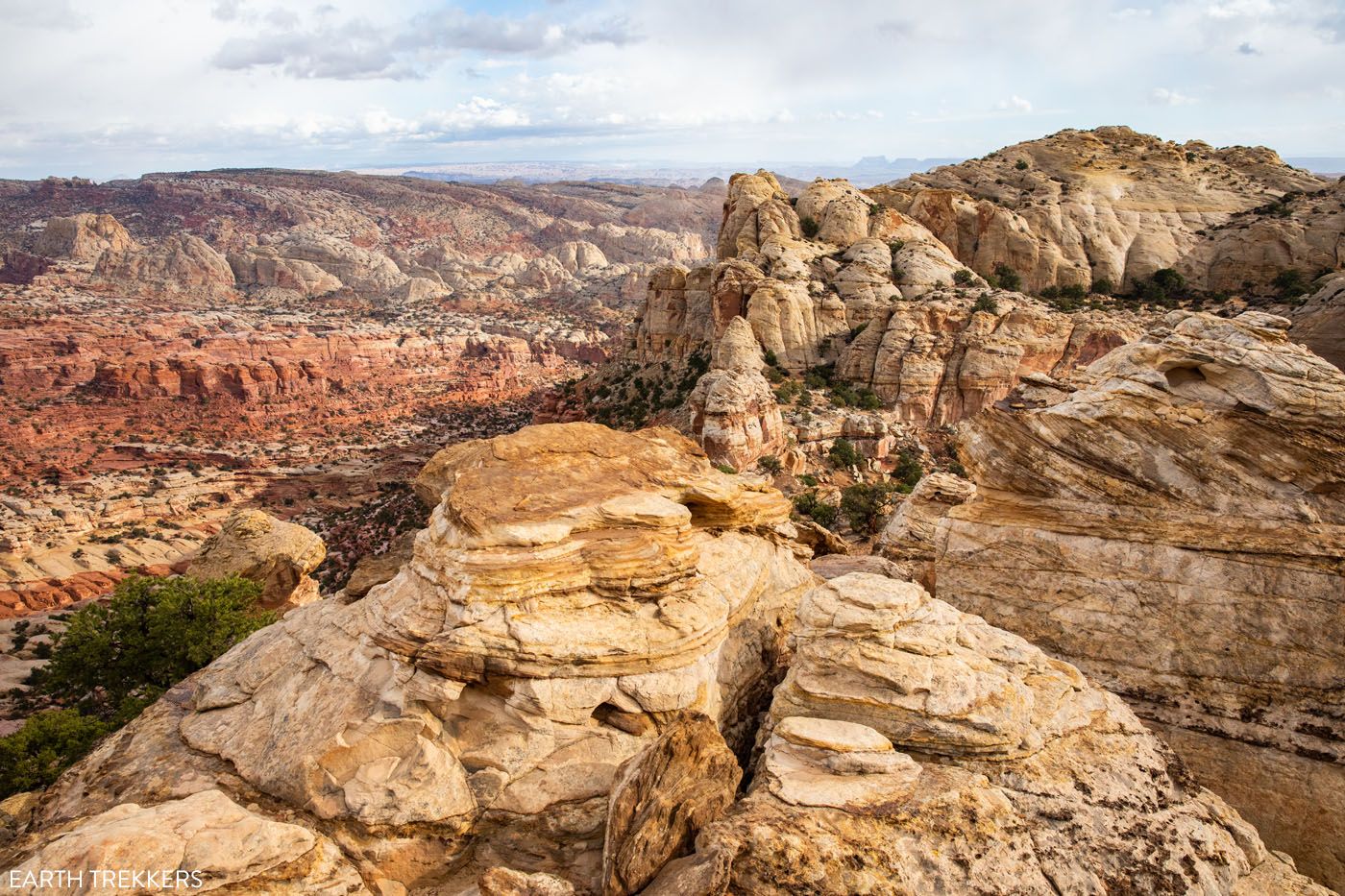
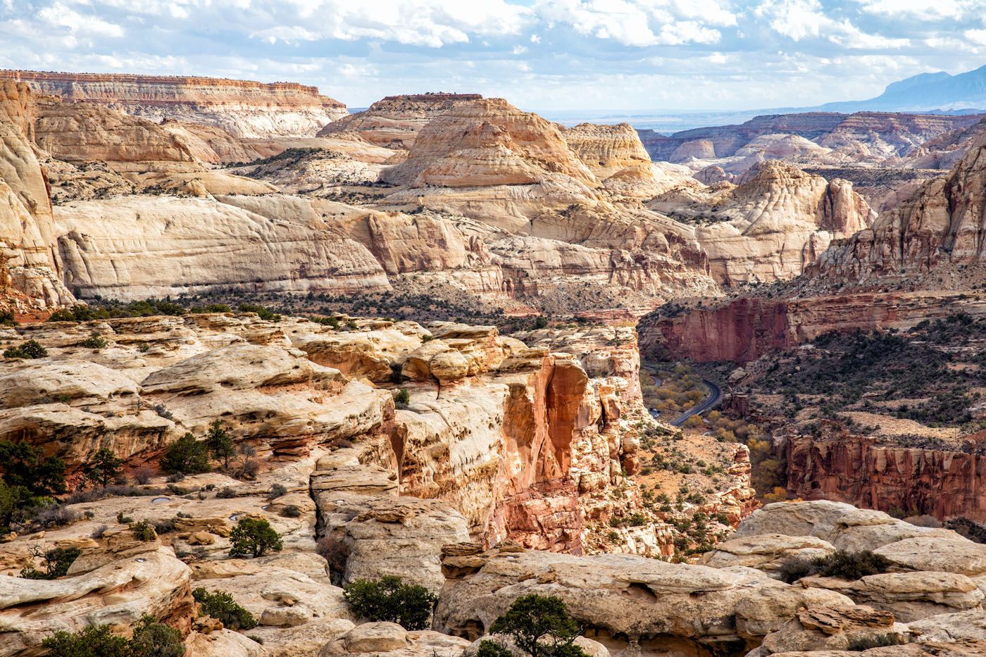
Rim Overlook
Our Rating: ⭐️⭐️⭐️⭐️⭐️ The views are jaw-dropping but it’s a tough hike.
Distance: 4.6 miles | Difficulty: Moderate | Total Ascent: 1,300 feet | Time: 2 to 3 hours
Similar to Cohab Canyon, the main reason for doing this hike are for jaw-dropping views of Fruita and Capitol Reef National Park. It is a truly incredible view as you get to look right along Scenic Drive and the waterpocket fold.
At the start or end of this hike, you can add on Hickman Bridge, which shares the same trailhead.
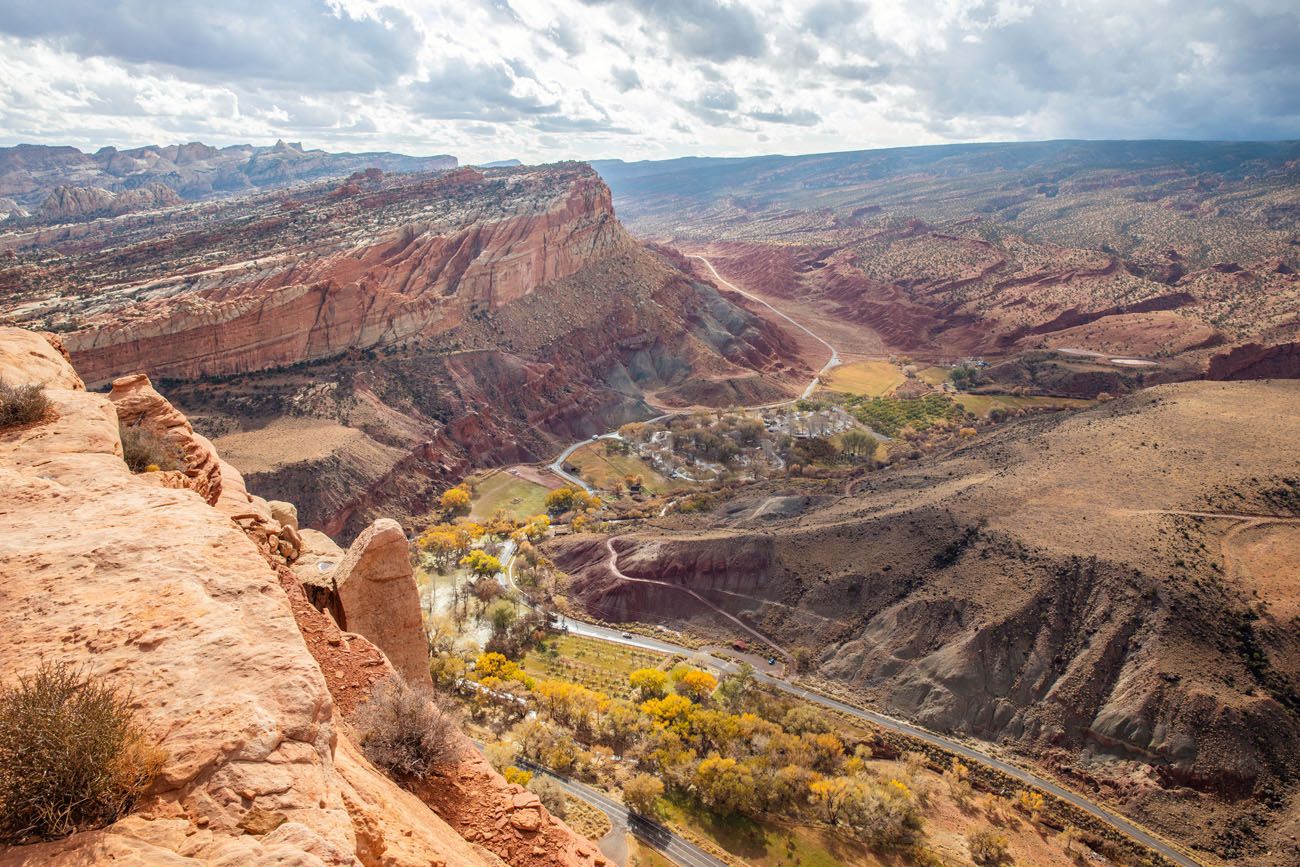
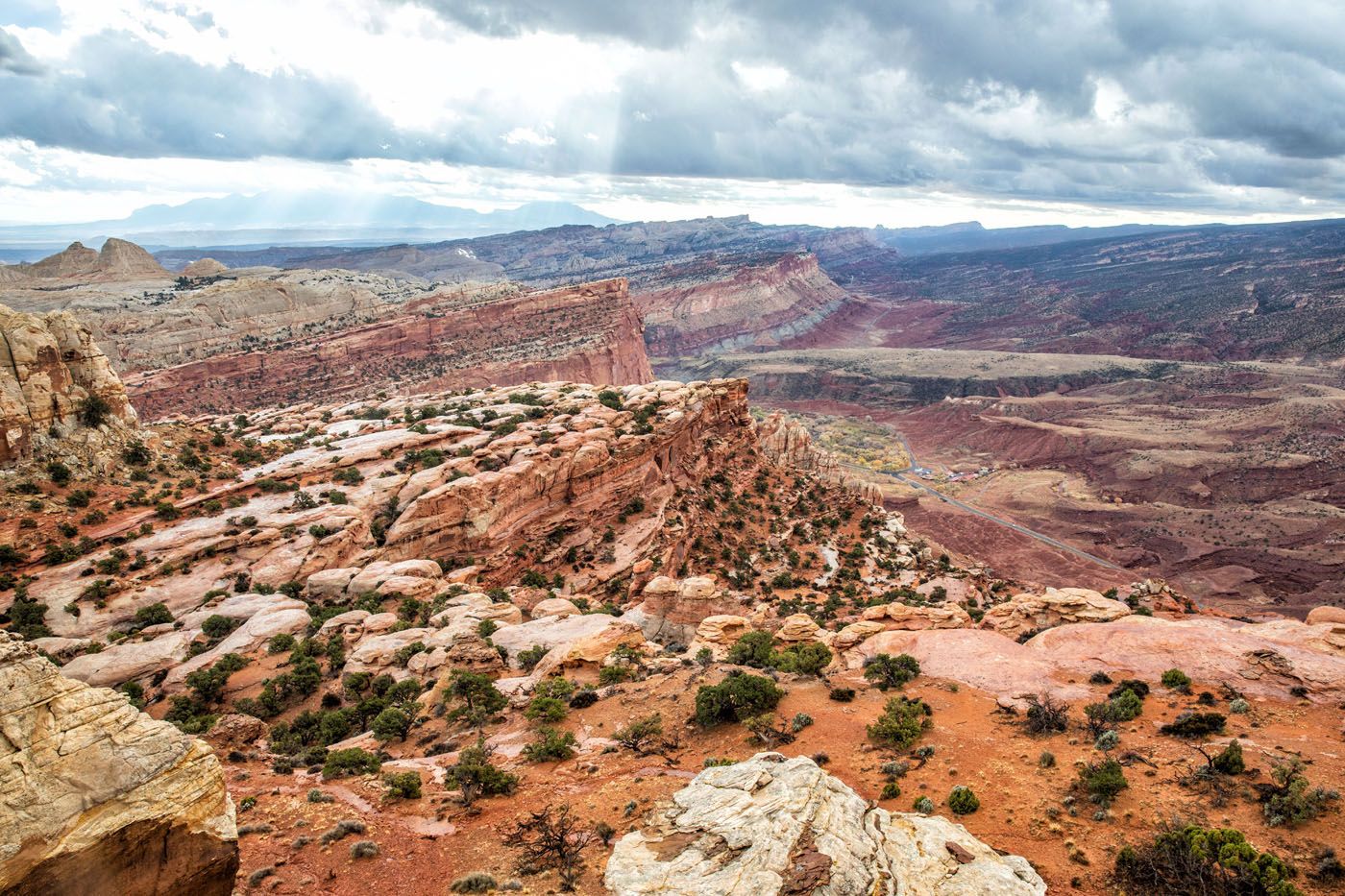
Navajo Knobs
Our Rating: ⭐️⭐️⭐️⭐️⭐️ This is our favorite hike, but also the most challenging. The views are incredible, it includes Rim Overlook and the option to add on Hickman Bridge, and the entire trail is very interesting. If you are an avid hiker, this is the #1 hike to put on your list.
Distance: 9.5 miles | Difficulty: Strenuous | Total Ascent: 2,725 feet | Time: 4 to 7 hours
The hike to Navajo Knobs is one of the longest, toughest hikes on this list, but it is an awesome experience.
Rim Overlook & Navajo Knobs Trail | Capitol Reef National Park
Step-by-step trail guide for the Rim Overlook and Navajo Knobs Trails.From the valley floor, you will steadily hike up to the Rim Overlook, for jaw-dropping views over Fruita, Highway 24, and Scenic Drive. The trail continues its climb for another 2.5 miles, with views over Castle Rock and waterpocket fold.
One final steep climb, with a bit of rock scrambling thrown in, and you’ll be standing on top of the Navajo Knobs. From here, the views are truly epic. From the Navajo Knobs you have 360° views, arguably one of the best viewpoints in Capitol Reef National Park.
On top of the Navajo Knobs
Looking west along Highway 24
View down the waterpocket fold and over Fruita
View from the trail
One more view from the trail
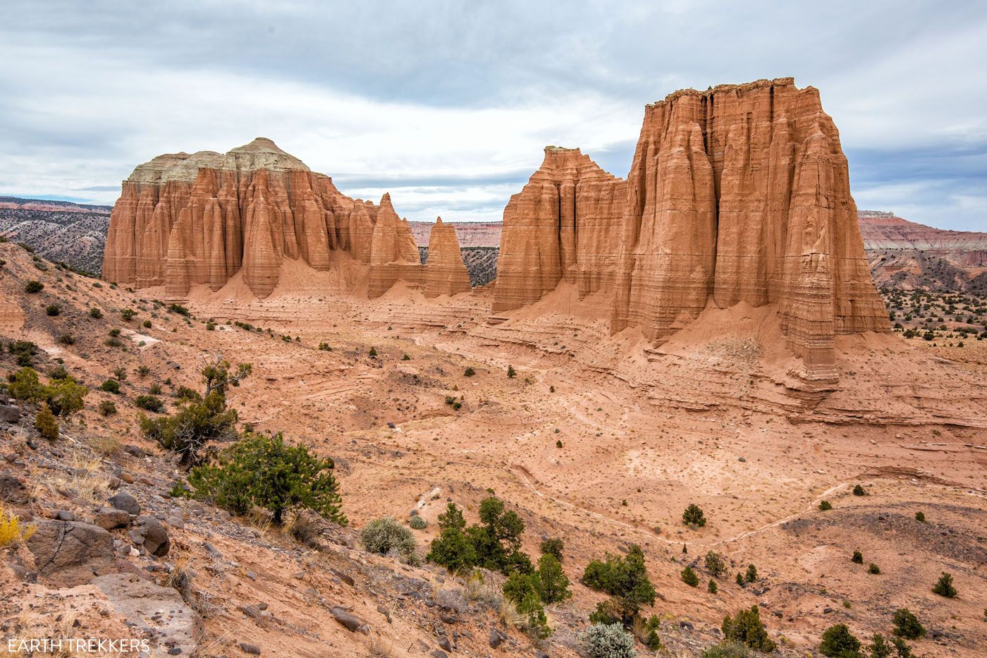
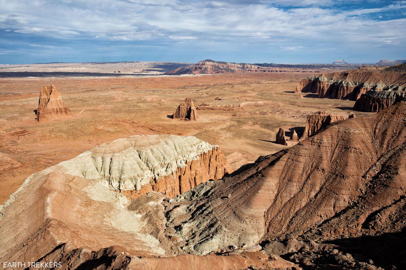
Hikes in Cathedral Valley
Cathedral Valley is the rugged, remote northern district of Capitol Reef National Park. On this 58-mile loop, you drive on gravel roads through unique landscapes that are unlike those you get to see in other parts of Utah.
To get here, you must have a high-clearance vehicle, although a 4×4 is ideal. Get the full details here ↓
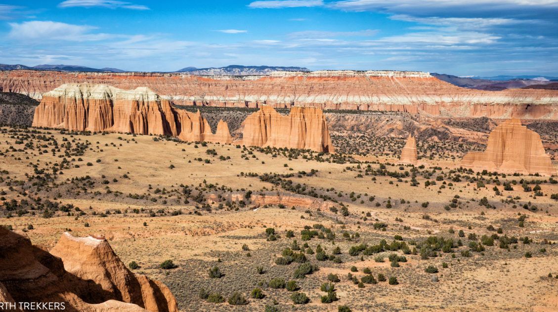
Complete Guide to the Cathedral Valley Loop (+ Map & Best Route)
What you need to know to drive the amazing Cathedral Valley Loop.Cathedral Valley is amazing, one of the best experiences in the park. If venturing into the backcountry sounds like something you want to do (it’s easier than you might think), definitely take a look at our guide. We LOVED this drive.
On the Cathedral Valley Loop, there are two hikes that we recommend.
Cathedrals Trail
Our Rating: ⭐️⭐️⭐️⭐️ This cool, easy hike is worth the hour of hiking time to get unique views of the monoliths of Cathedral Valley.
Distance: 2.5 miles | Difficulty: Easy | Total Ascent: 400 feet | Time: 1 hour
This easy hike offers very nice views of the monoliths of Cathedral Valley. The best part of this hike, in my opinion, is the first half, as you walk alongside this chain of sandstone formations. The trail ends on top of hill where you have panoramic views of Cathedral Valley.
Cathedrals Trail
Lower Cathedral Valley Overlook
Our Rating: ⭐️⭐️⭐️ It’s not the most exciting trail (this hike is all about getting to the viewpoint), but the view from the overlook is beautiful.
Distance: 1.8 miles | Difficulty: Easy | Time: 1 to 1.5 hours
For aerial views over the Temple of the Sun and the Temple of the Moon, this is a relatively quick and easy hike. Most of the hike is flat and fast. It ends with a short but strenuous hike up to the viewpoint. There is a sketchy trail that heads up the hillside for even higher views.
Lower Cathedral Valley Overlook
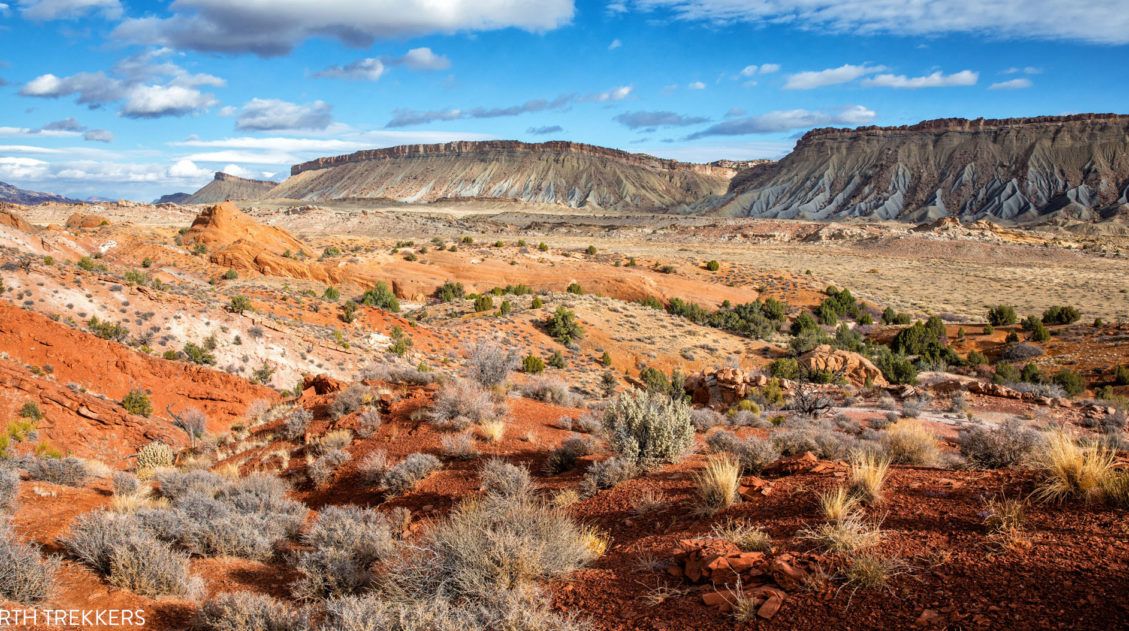
Hikes along the Waterpocket Fold
Capitol Reef National Park preserves a portion of the Waterpocket Fold, a 100-mile long wrinkle in the Earth’s crust. It is basically a long chain of sedimentary rock layers that are being eroded, revealing arches, canyons, massive domes, and monoliths.
One of the best things to do in Capitol Reef is to “Loop the Fold,” or drive around the waterpocket fold. Often overlooked by most visitors to Capitol Reef, this road, and the hiking trails that lead away from it, get very few visitors. When we did this, we had the hiking trails to ourselves and saw very few people.
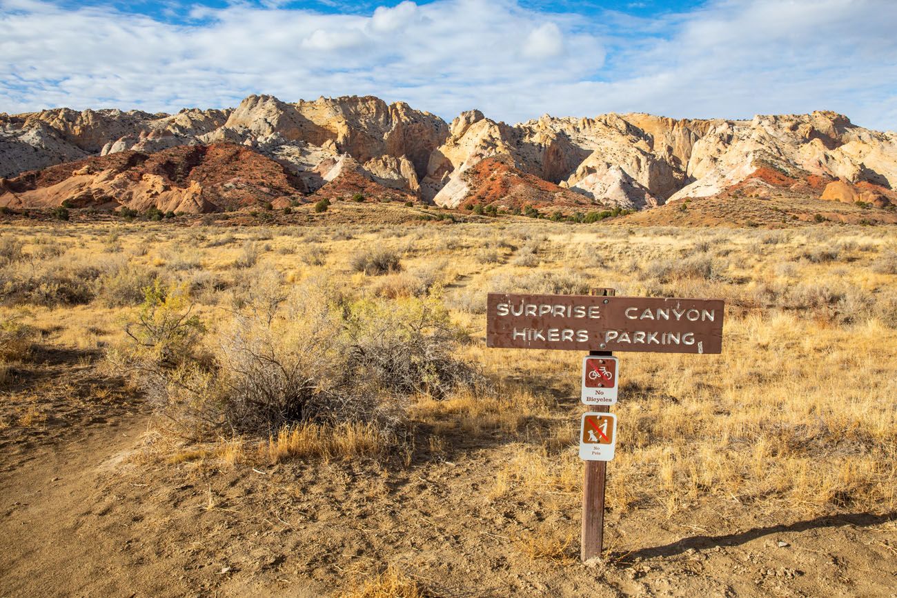
This backcountry drive gets even fewer visitors than Cathedral Valley. But that doesn’t mean it’s not worth the time and effort. Two of our favorite Capitol Reef hikes are located on this drive: Surprise Canyon and Headquarters Canyon. Learn more about how to Loop the Fold ↓
How to Loop the Fold in Capitol Reef National Park
A detailed guide to the Loop the Fold experience in Capitol Reef.Surprise Canyon
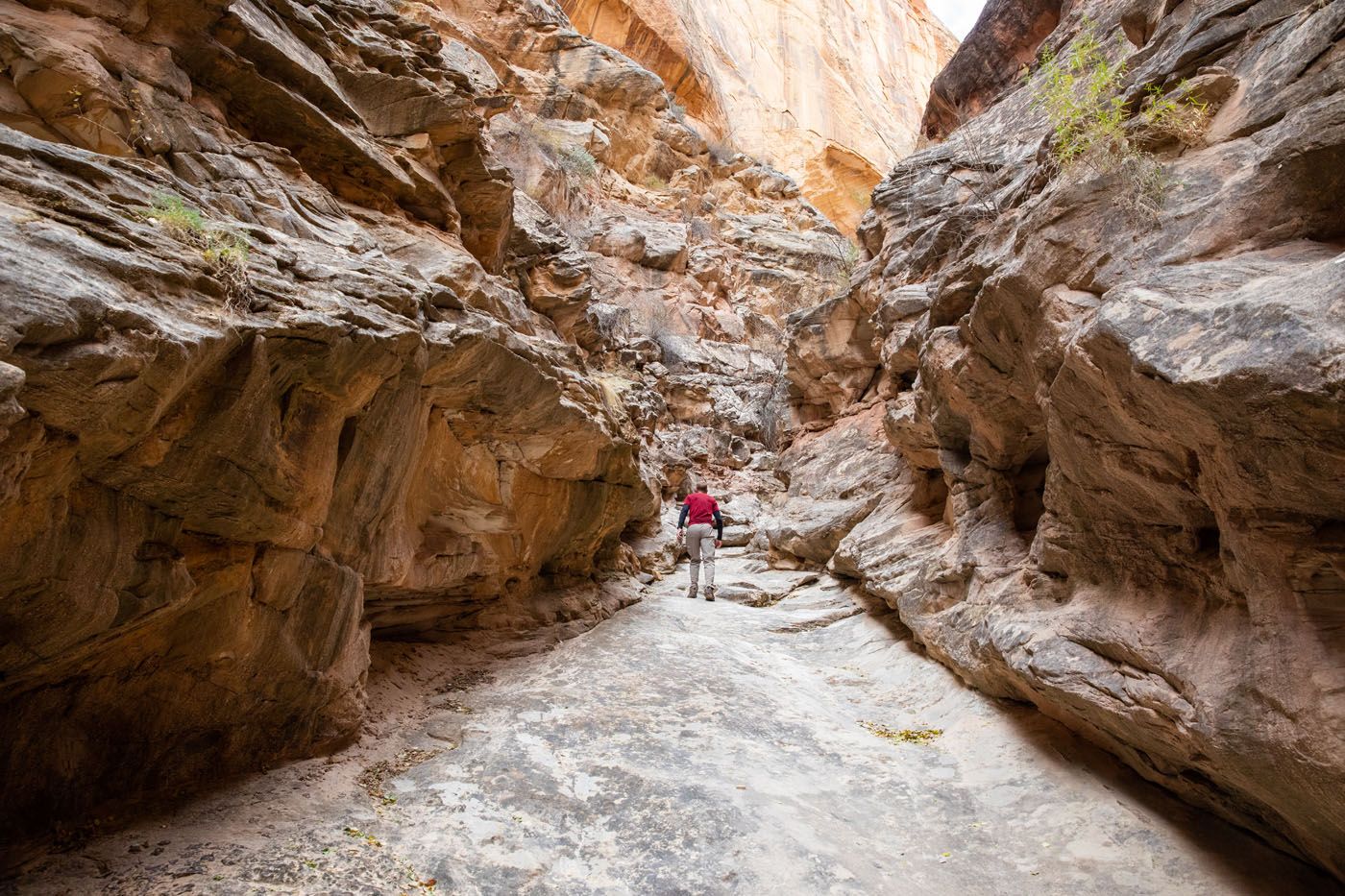
Our Rating: ⭐️⭐️⭐️½ The canyon is gorgeous but if you only have the time and energy for one hike on this scenic drive, Headquarters Canyon is our favorite.
Distance: 2.2 miles | Difficulty: Easy | Time: 1 hour
This hike is mostly flat, except for a few very small ups and downs as you approach the canyon. The trail enters the waterpocket fold and it is here that you get to walk through a wide slot canyon. The trail dead ends at a rockfall.
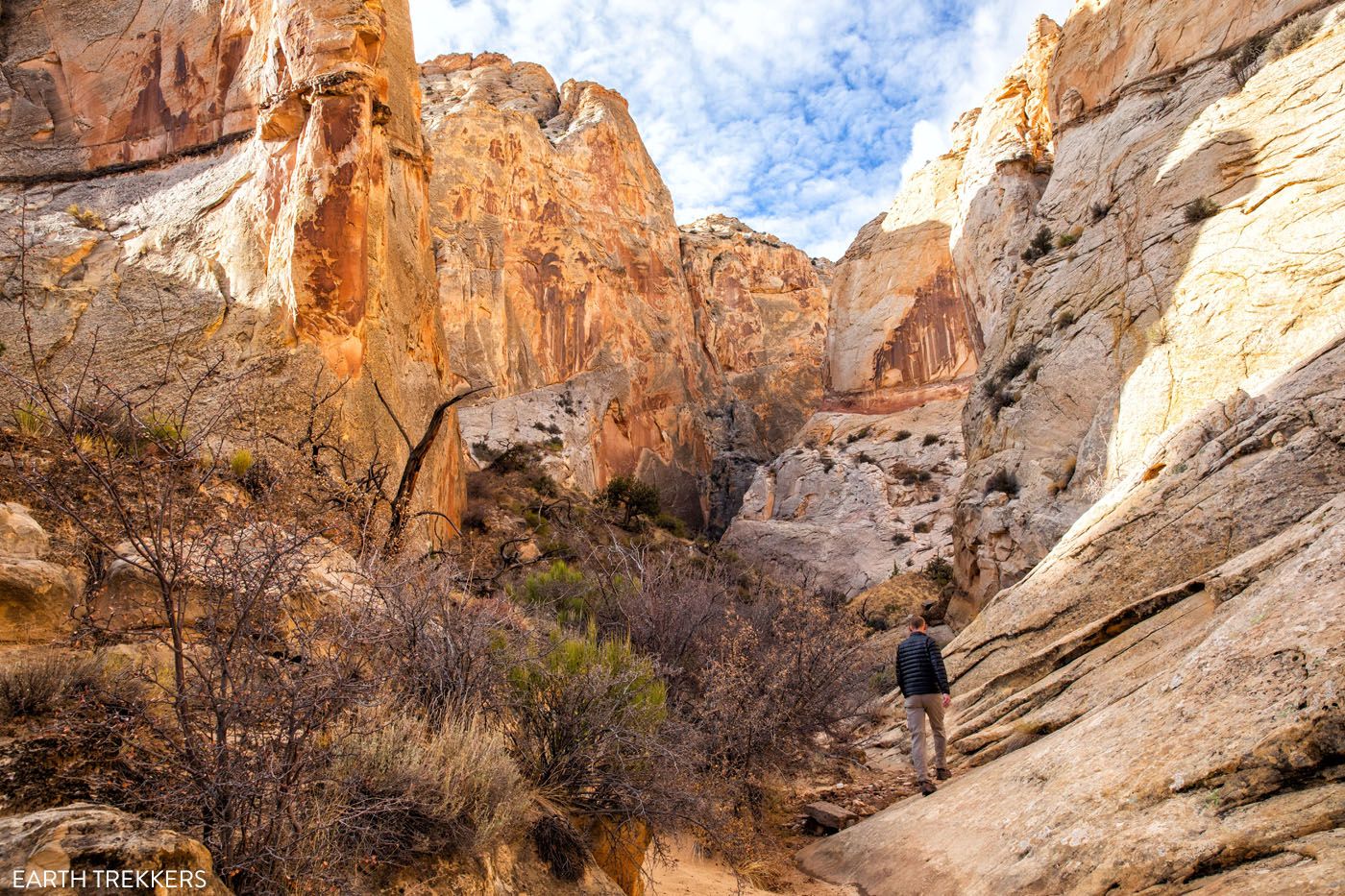
Surprise Canyon
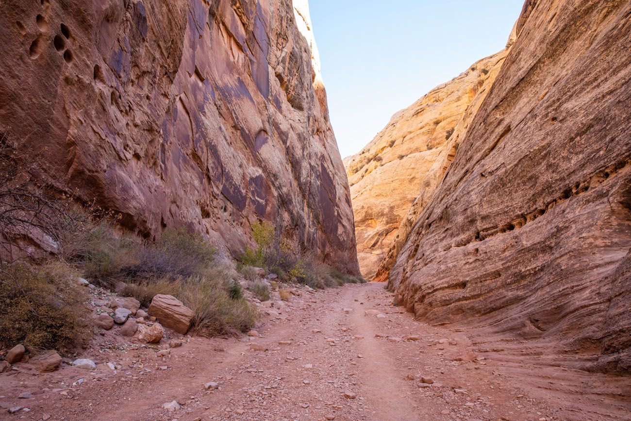
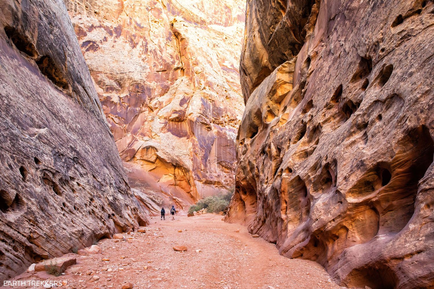
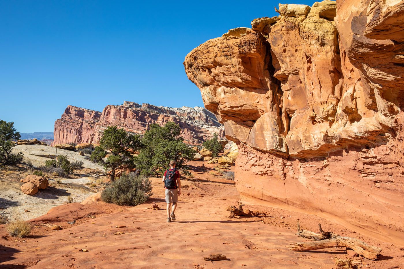
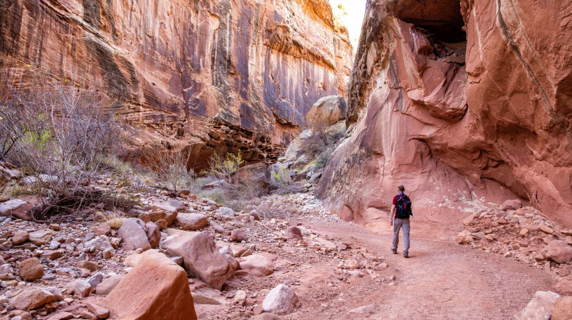
Headquarters Canyon
Our Rating: ⭐️⭐️⭐️⭐️⭐️ A remote slot canyon located along a gorgeous scenic drive, this is a hidden gem in Capitol Reef, and one of the best experiences in the park, especially for those who want to go off-the-beaten-path.
Distance: 2.6 miles | Difficulty: Easy | Time: 1 to 1.5 hours
Like Surprise Canyon, this trail heads directly into the Waterpocket Fold. Headquarters Canyon is also very easy to hike. But with its narrower sections this is the more thrilling of the two slot canyons here. If you only have the time and energy for one hike, I recommend Headquarters Canyon over Surprise Canyon.
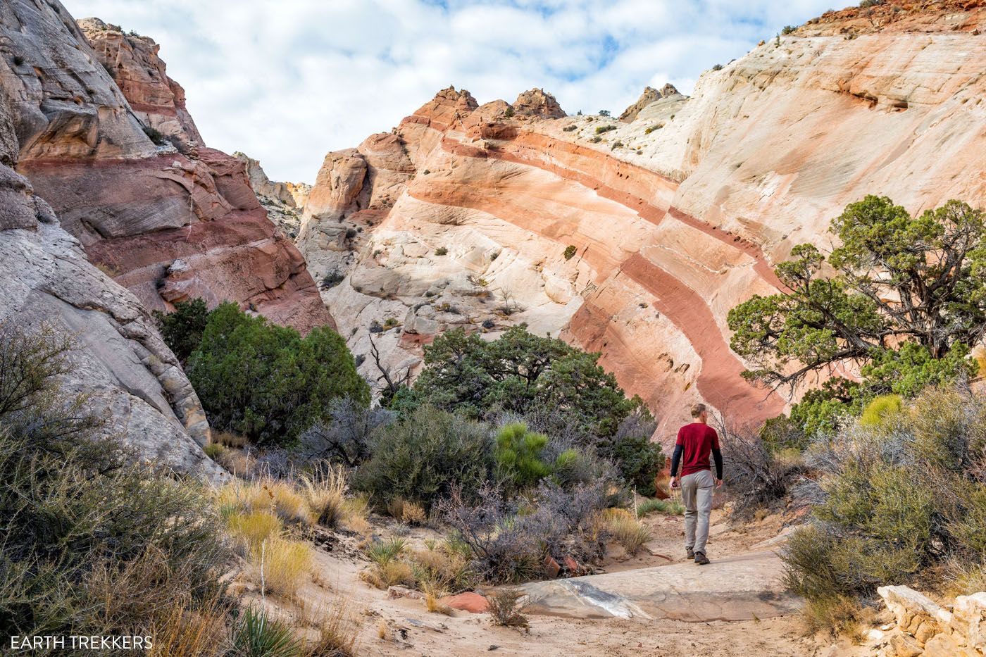
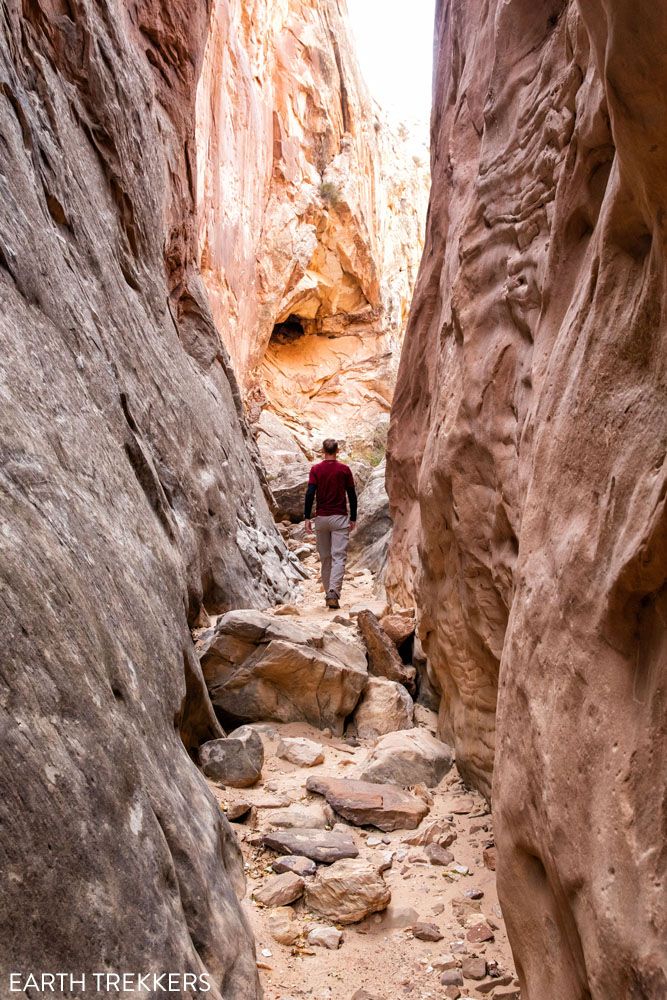
Headquarters Canyon
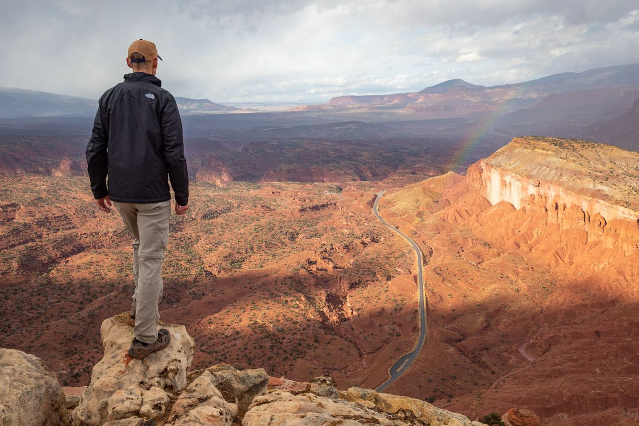
Strike Valley Overlook
Our Rating: ⭐️⭐️⭐️⭐️ The view is amazing, but it’s best to have a 4WD vehicle to shorten the hike (but that means you could have it all to yourself, we did, since it is so remote).
Distance: 1 mile* | Difficulty: Easy | Time: 30 minutes
The Strike Valley Overlook is a beautiful viewpoint. From here, you are standing on top of the waterpocket fold and have sweeping views over Strike Valley.
There are two ways to get to Strike Valley Overlook: drive the extremely rough Upper Muley Twist Canyon Road to the trailhead (a 4WD vehicle is necessary) or hike along the road.
Upper Muley Twist Canyon Road is 2.9 miles long, one-way. It ends at the trailhead for Strike Valley Overlook and for the Upper Muley Twist Canyon trail.
If you do not have a 4WD vehicle, there is a parking area that is located 400 meters from Burr Trail Road. To get to the trailhead for Strike Valley Overlook, you will have to walk just over 2.5 miles, one-way, to get to the trailhead. This makes your hike 6 miles round trip.
Is it worth it? If you have a high-clearance 4WD vehicle, then it is worth it. However, if you are driving a standard vehicle, it’s about a 6-mile round trip walk to get the view, and in my opinion, it’s probably worth skipping it. You can get a similar but slightly less dramatic view from the top of the Burr Trail Switchbacks.
Slot Canyons
On Notom-Bullfrog Road, there are several longer hikes through slot canyons that you can do. There can be pools of water in these canyons. But if you are looking for a challenging slot canyon, these are hikes to consider.
Burro Wash is 7.5 miles long, Cottonwood Wash is 6 miles long, and Sheets Gulch, at 14 miles, is the longest and most challenging of the bunch.
Backcountry Hikes in Capitol Reef
In addition to the day hikes listed above, there are several longer hikes in Capitol Reef. These are typically done as multi-day backpacking trips but several can be done as very long day hikes.
Halls Creek Narrows is over 20 miles round trip and typically done as a 3 to 4 day backpacking trip. You will hike through a wide slot canyon, similar to the Zion Narrows.
Upper Muley Twist Canyon is 9 miles round trip. You will hike through a slot canyon, past several arches, and have views over Strike Valley. This hike starts at the same trailhead for Strike Valley Overlook.
Lower Muley Twist Canyon is a 23 mile loop that is typically done as an overnight backpacking trip. On this hike you will see caves, canyons, and a cowboy camp.
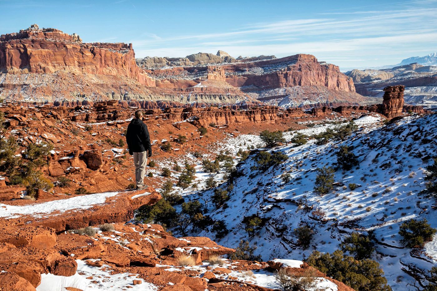
When is the Best Time to Go Hiking in Capitol Reef?
The spring (mid-March through late May) and fall (mid-September through early November) are the best times to visit Capitol Reef National Park. Weather conditions are pleasant and you can avoid the larger crowds that are here in the summer.
In the summer, temperatures can soar, making hiking uncomfortable, and even dangerous midday. This is also when crowds will be at their peak.
The winter months are cool to cold, snow is a possibility, but crowds are very low (with the exception of the week between Christmas and New Year’s Eve).
Our most recent visit was the first week of November. Weather wise, we had a little bit of everything. A cold front moved in during our visit, bringing with it colder than average temperatures for this time of year. The weather ranged from 65°F, sunny days to 30°F days with snow.
Capitol Reef National Park appears in our Best National Parks to Visit by Month series for March, April, November, and December.
Planning a Trip to Capitol Reef
We have lots of great info about Capitol Reef to help you plan your trip.
If you are just getting started, learn more about the park with our guide to the Best Things to Do in Capitol Reef.
To help you plan your time and recommendations on where to stay, don’t miss our articles How to Spend One Day in Capitol Reef and how to plan a Capitol Reef Itinerary.
You can see all of our articles, plus great road trips through Utah that include Capitol Reef, in our Capitol Reef Travel Guide.
Before you go, get updated trail conditions on the National Park Service website.
If you have any questions about these hikes in Capitol Reef National Park, let us know in the comment section below.
More Information about Utah
We have TONS more information about Utah in our Utah Travel Guide.
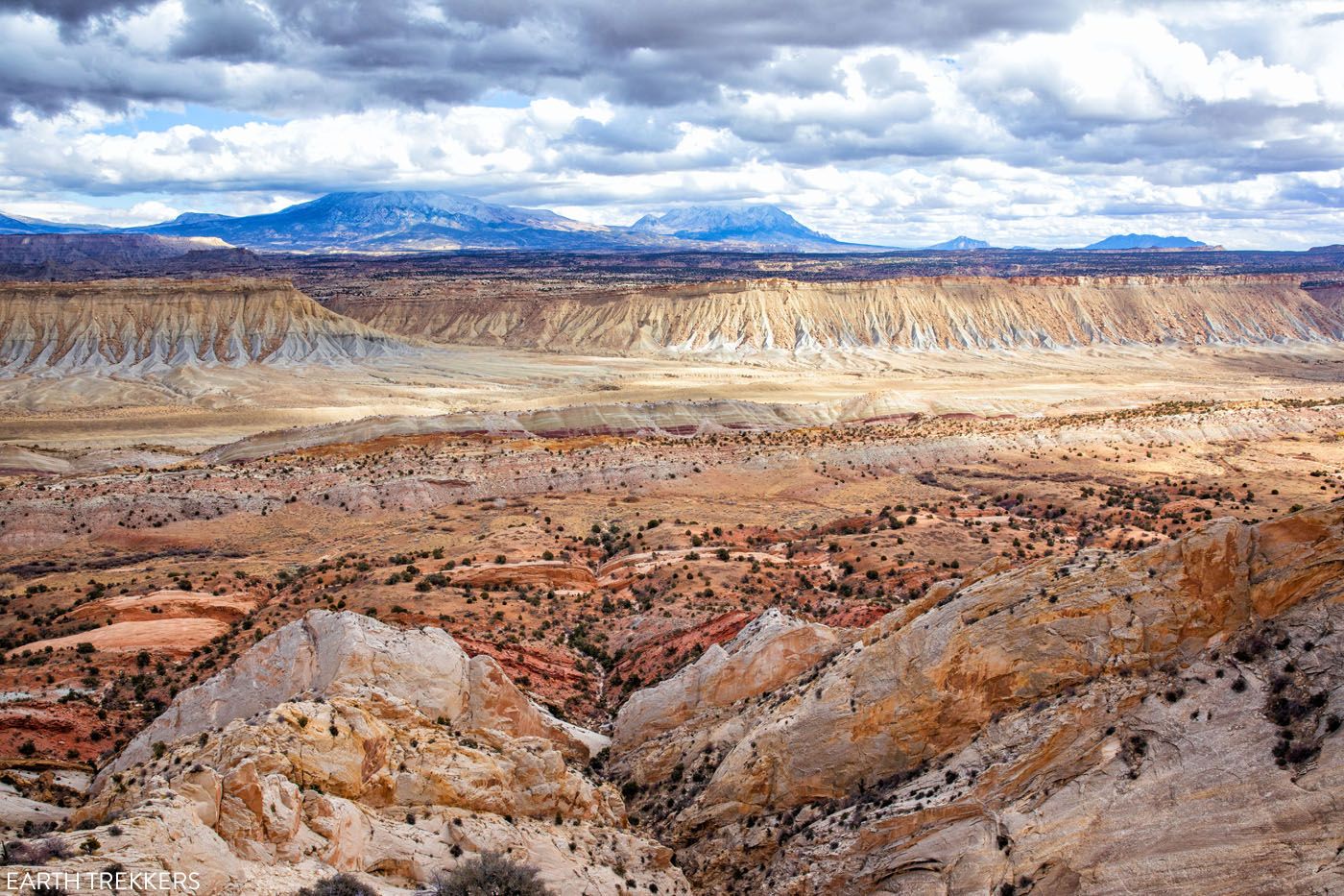
The Ultimate Capitol Reef National Park Itinerary
With beautiful scenic drives, slot canyons, backcountry roads, historical sites, thrilling hikes, and stunning landscapes, Capitol Reef is an unexpectedly amazing national park. If you are planning your Capitol Reef National Park itinerary, we have lots of information to help you plan your trip. Capitol Reef National Park is a highly underrated park. The views […]

Essential Hiking Gear: What Should You Bring on a Day Hike?
In this post, find out what we carry with us on day hikes. Whether you are a new hiker, shopping for a friend or family member, or just curious about what hiking gear you should bring on a day hike, we have a lot of great information to share with you. We have hiked thousands […]
Arches, Canyonlands and Capitol Reef: 7 to 10 Day Road Trip Itinerary
Arches, Canyonlands, and Capitol Reef National Parks are three spectacular parks to visit in Utah. With 10 days, you can visit each of them, plus a few more cool spots, on this epic road trip. Tim and I did this road trip in November 2020. Prior to this trip, we had already visited each of […]
14 Amazing Things to Do in Capitol Reef National Park
Capitol Reef, often an overlooked national park, is full of many wonderful surprises. With two amazing scenic drives, hiking trails that rival those in Zion, rugged, remote areas to explore by 4×4, short, easy slot canyons, historical landmarks, and even delicious pie, this national park is absolutely amazing. In this post, learn about the best […]
One Perfect Day in Capitol Reef (3 Different Ways)
If you only have one day in Capitol Reef National Park, what should you do? There are several different ways that you can spend one day in Capitol Reef. For some people, “one day” might mean a very quick visit, as you tour Capitol Reef while driving between two different locations in Utah. Or, you […]
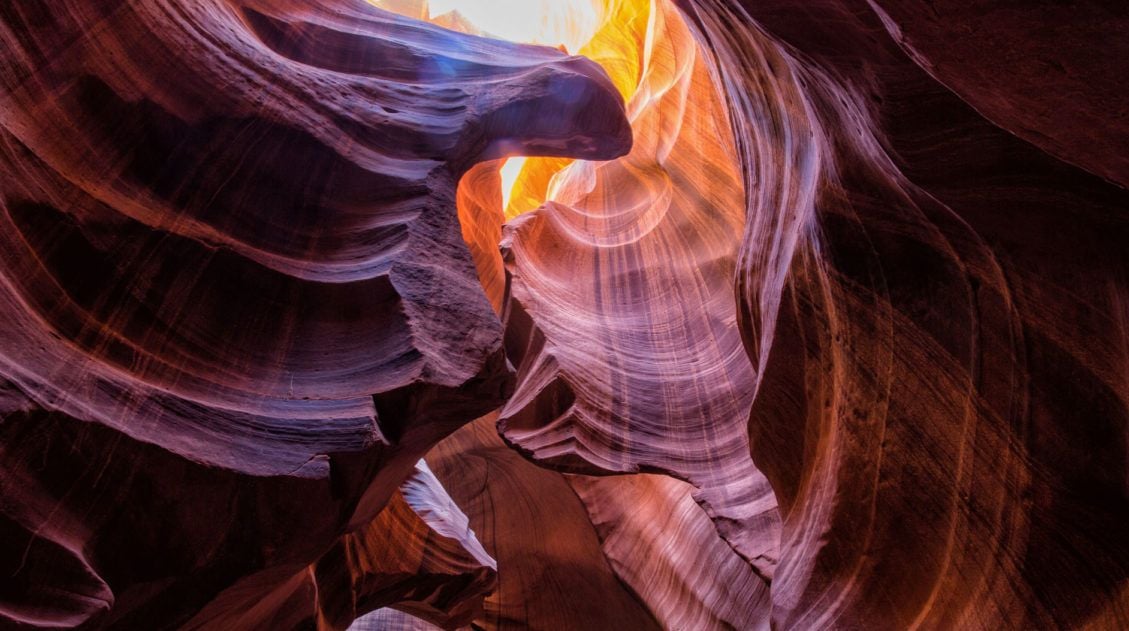
10 Amazing Slot Canyons to Explore in the American Southwest
The American Southwest is a playground for hikers, photographers, and adventurers. Fun to explore and extremely photogenic, slot canyons provide a unique hiking experience. We have assembled a short list of some of the best slot canyons in Utah, Arizona, and Nevada. This is not an all-inclusive list, because there are tons of slot canyons […]
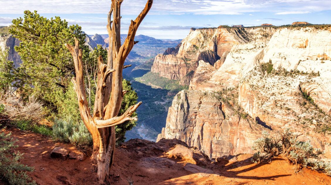
Best Hikes in Zion: 15 Trails from Beginner to Advanced
Zion National Park is one of the best places in the United States to go hiking. From the awe-inspiring hike up Angels Landing to the family-friendly Riverside Walk to multi-day backpacking adventures, there is something here for everyone. In this guide, we cover the best hikes in Zion National Park, from popular trails to hidden gems. […]
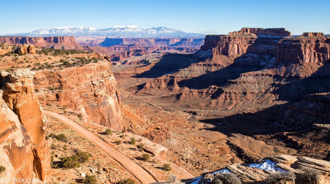
The Ultimate Arches and Canyonlands One Day Itinerary
Canyonlands and Arches are two national parks that sit side-by-side near Moab, Utah. Since these parks are neighbors, it is possible to visit both of them in one very busy day. In this guide, we cover the best way to spend one day in Arches and Canyonlands National Parks. We are frequent visitors to this […]
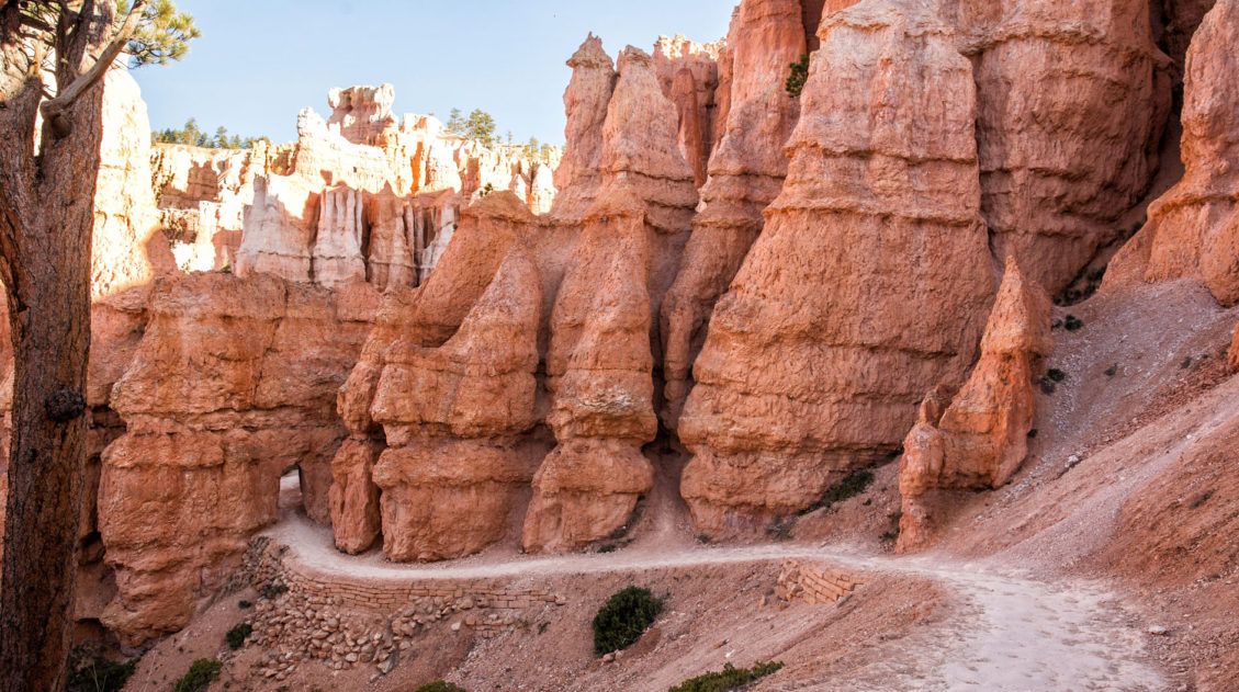
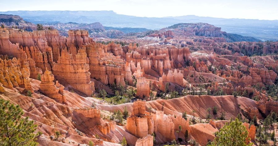
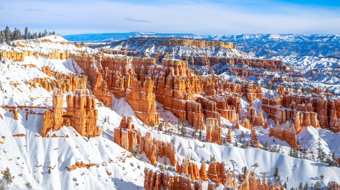
Hiking Bryce Canyon: Queen’s Garden and Navajo Loop Trails
Bryce Canyon National Park may be small in size but it has an enormous wow factor. With its orange and pink hoodoos and sandstone rock formations, Bryce Canyon is one of the most unique national parks in the United States. By hiking Bryce Canyon and visiting its numerous viewpoints, you can have the best experience […]
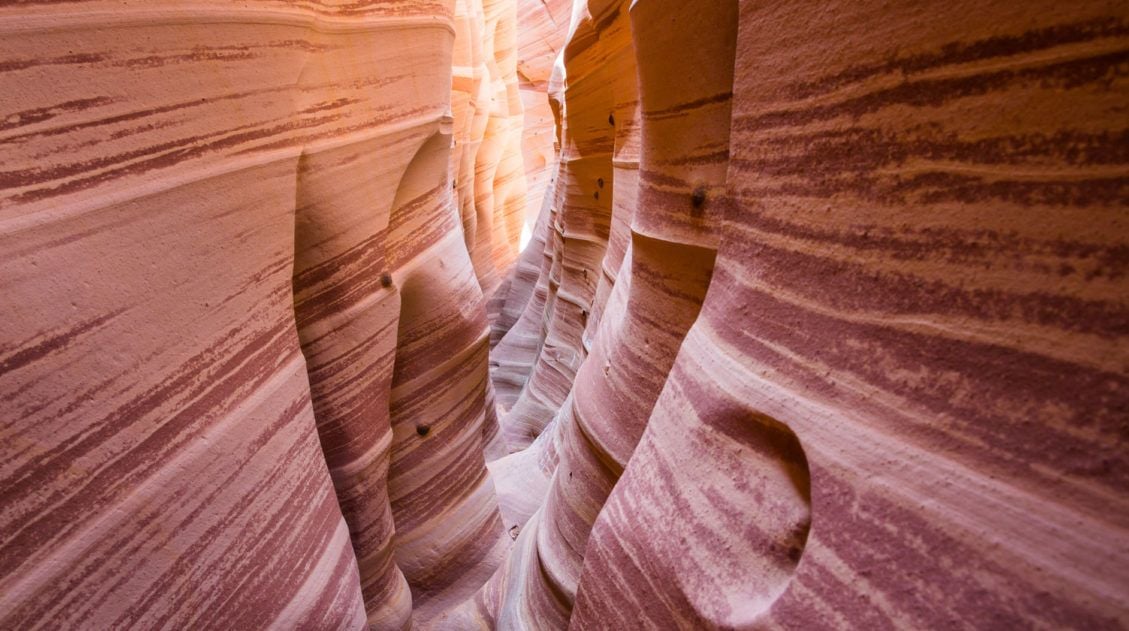
How to Hike Zebra Slot Canyon in Grand Staircase-Escalante
Zebra Slot Canyon is a very short slot canyon, named for its striped canyon walls. It’s a gorgeous spot, maybe not quite as pretty as Antelope Canyon in Arizona, but since you can explore this on your own without a guide or tour group, it’s more fun. Hiking Zebra Slot Canyon can be a little […]
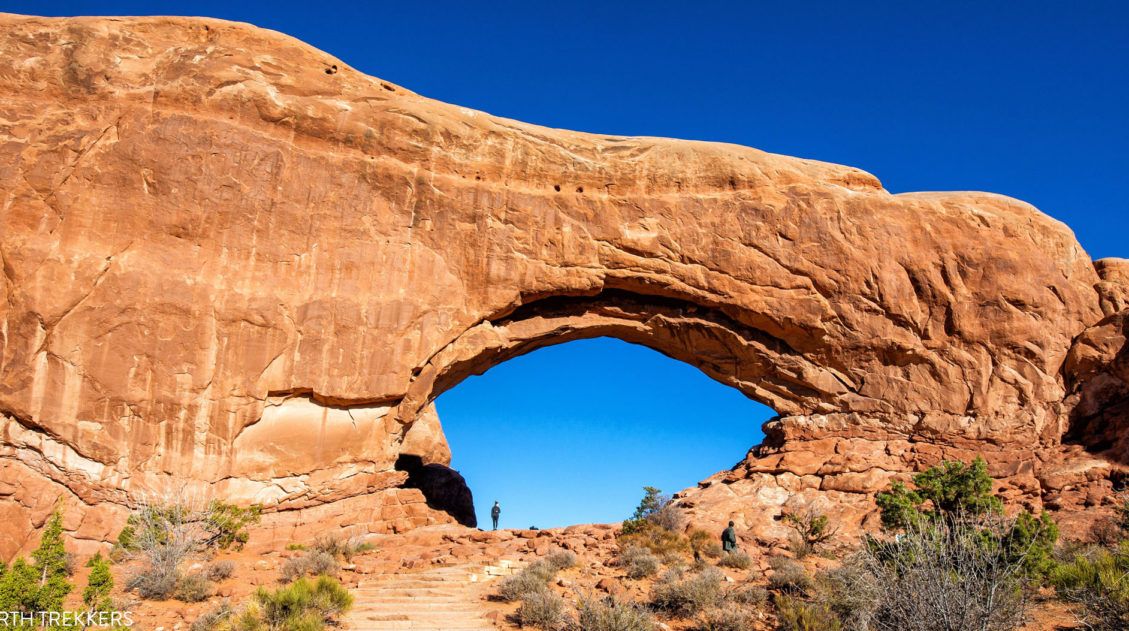
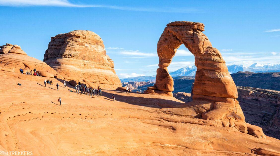
One Perfect Day in Arches National Park (+ Avoid the Crowds)
If you only have one day in Arches National Park, what should you do? Arches National Park is a relatively small national park with a handful of must-see sights. With one day in Arches, you can visit these top sights and a few off-the-beaten-path places. After multiple visits to Arches National Park, we have learned […]
5 Reasons Why You Should Visit Devils Garden in Grand Staircase-Escalante
Devils Garden is a fun to explore, scenic spot to visit in Grand Staircase-Escalante National Monument. If you have plans to drive down Hole-in-the-Rock Road, here are five reasons why you should visit Devils Garden. #1 This Place is a Beauty! With hoodoos, crazy rock formations, and arches, Devils Garden is a beautiful spot to […]

The Ultimate Guide to the 63 US National Parks
Stretching from the South Pacific, across the United States to the Caribbean, are 63 national parks. These national treasures preserve iconic landscapes, majestic mountains, primordial forests, arid deserts, misty coastlines, immense canyons, wildlife, and historic landmarks. We have visited 56 of the 63 US national parks, from the towering granite walls of Yosemite and the […]
United States Travel Guide: Places to Visit in the USA
Plan your visit to the United States. Learn about the best things to do, how to plan your time, road trip ideas, and sample itineraries.

Comments 9