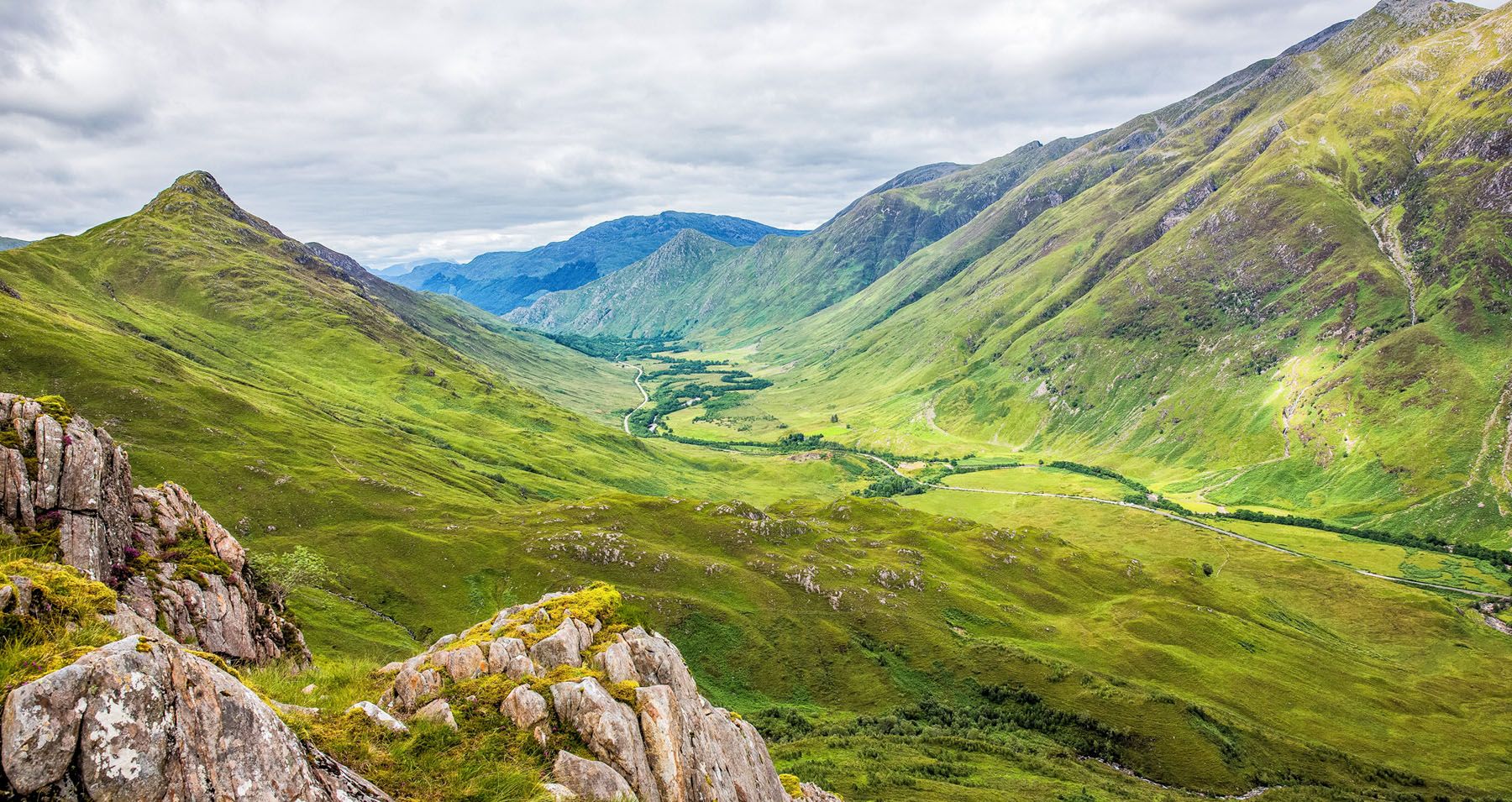
Our hiking shoes got a lot of use in Scotland. But the most memorable hike, the one that had our legs trembling with fatigue and our eyes wide open with amazement, was the Kintail Saddle.
Before flying to Scotland, I did a lot of research looking for that perfect Scottish hike. For us, the perfect hike involves summiting a mountain and being rewarded by spectacular views. We love lots of changes in scenery, some rock scrambling, and sections just challenging enough to keep things interesting. The Kintail Saddle ticked all of the boxes on our list.
Of course, this is Scotland. Rain is almost ever-present, especially during the summer months. It’s one thing planning to do the hike. It’s another to get lucky enough to have clear weather. For us, the three days prior to the Kintail Saddle hike was spent in the rain on the Isle of Skye. One of our big hikes (Bla Bheinn) was already disrupted due to the rain.
Fortunately, mother nature cooperated today. The sky was overcast with a threat of rain, but conditions actually improved during our hike. We had a fabulous day, we were able to see those epic high altitude Scottish views, and we completed another very memorable hike. This was a tough one but one we will not soon forget.
Hiking the Kintail Saddle
The Saddle is described as one of the most magnificent mountains in the Highlands of Scotland. It is located near Shiel Bridge and Invershiel and is just a short drive from the Isle of Skye.
This is a challenging hike. Over 8 miles in length with 1300 meters of climbing, this hike involves summiting two Munros.
What is a Munro? A Munro is any mountain in Scotland over 3,000 ft. There are 282 Munros in Scotland. So far, over 5,000 people have bagged all of the Munros.
Most people hike up the Kintail Saddle (Munro #1 for the day) then cross over to Sgurr na Sgine (Munro #2 for the day) before descending back down to Glen Shiel. Prior to the hike, numerous people warned us not to take Tyler and Kara on the Forcan Ridge, a knifelike ridge leading up to the summit. It was beginning to sound like this would be one of the most challenging hikes we have ever attempted!
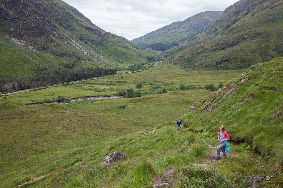
Start of the Hike
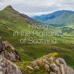
The hike starts just south of Shiel Bridge. Park at the lay-by (narrow car park) on the side of A87 (GPS coordinates: 57.175749, -5.363888). When driving southeast from Glen Shiel, the lay-by is about a ¼ mile past the Achnagart Farm.
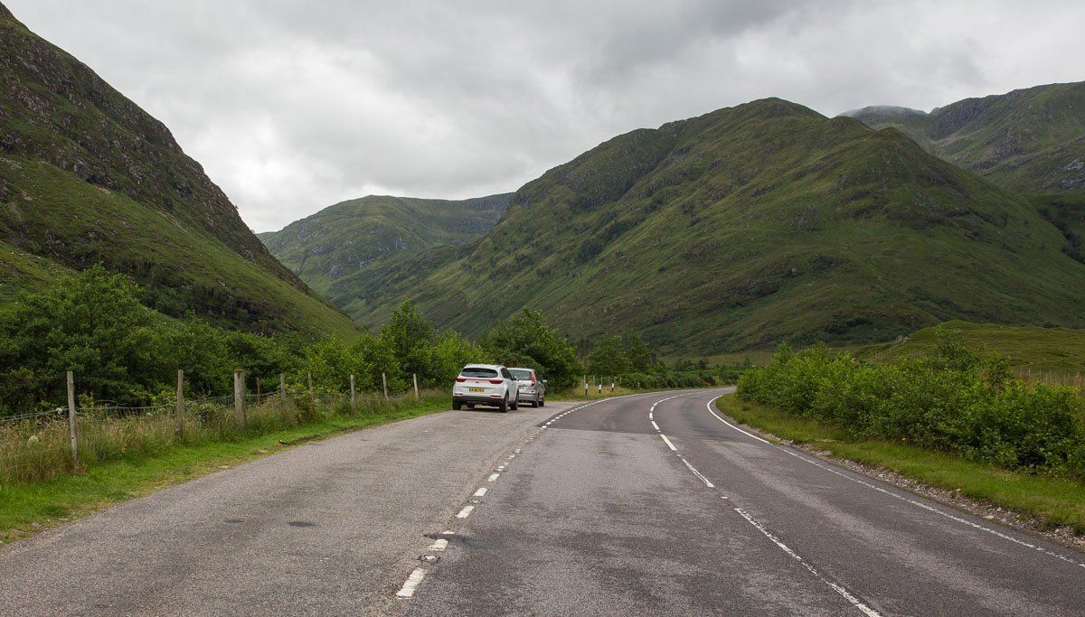
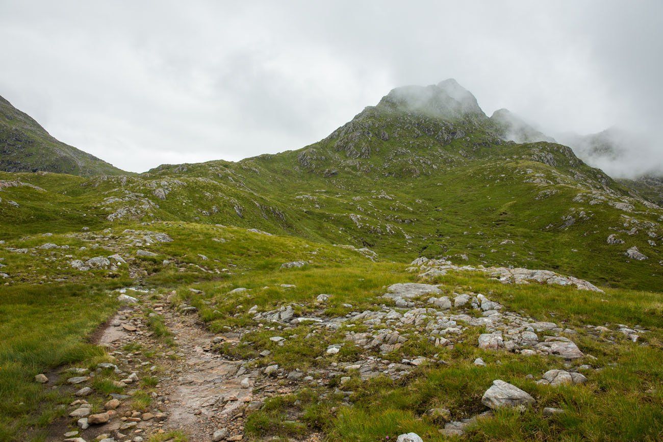
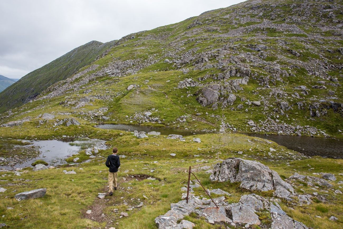
From the lay-by, continue to walk southeast down A87 (away from Shiel Bridge). Cross the road and enter the trailhead. There is a wide, gravel path leading through a gate and up the hillside in front of you.
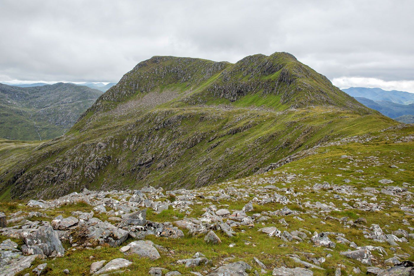
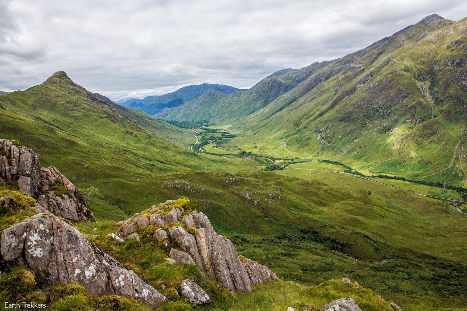
In this photo ↓, the darker green ridge in the background is Faochag, the final ridge you will walk before descending back down to A87:
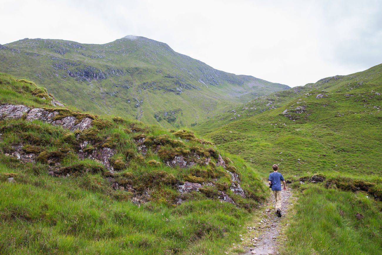
First Ascent
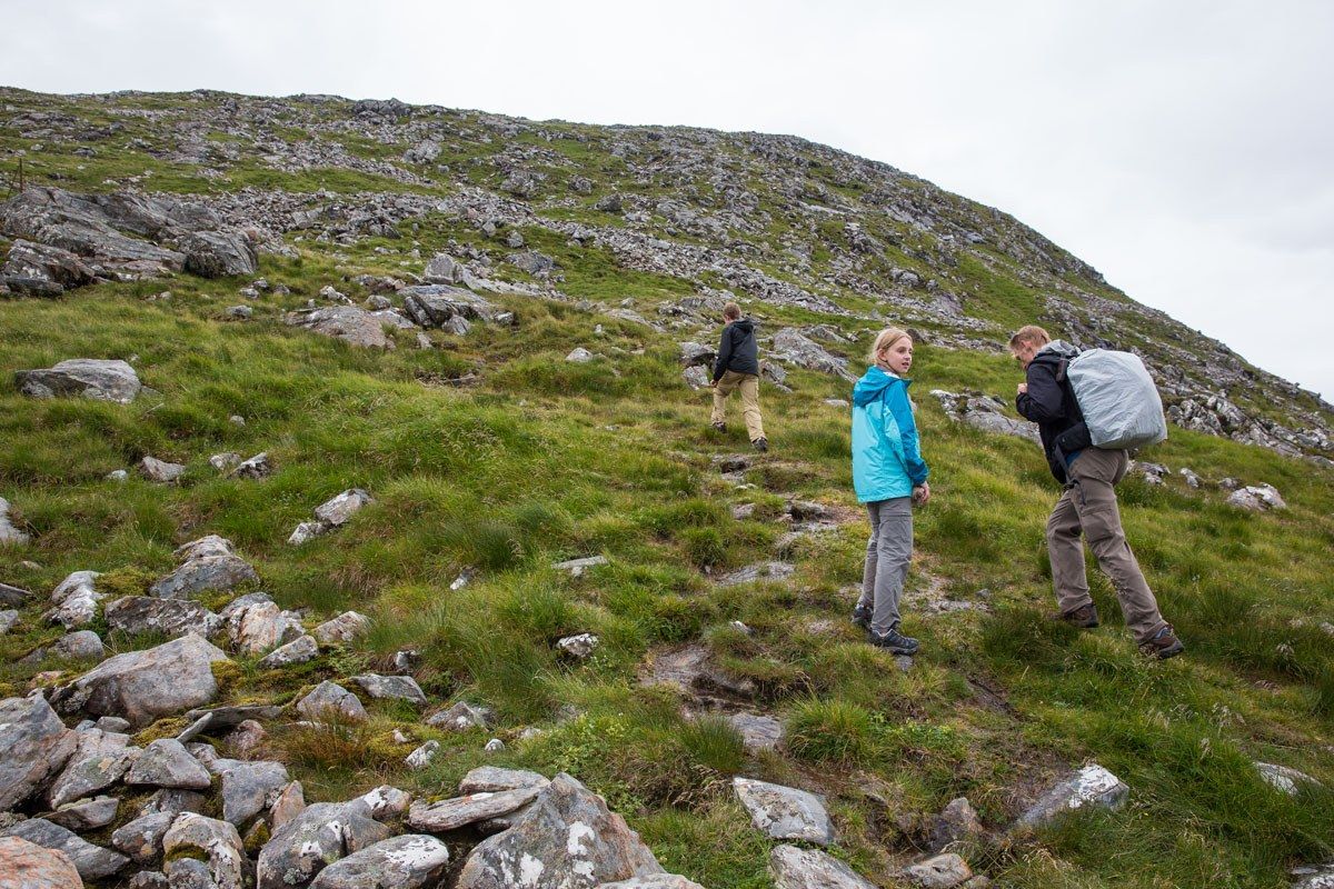
A steady climb winds its way up the hillside, taking you to the col (a ridge or saddle between two peaks, acting as a bridge between the peaks) between Biod an Fhithich and Meallan Odhar. The path is very easy to follow and it does not take long until you are high above the valley.
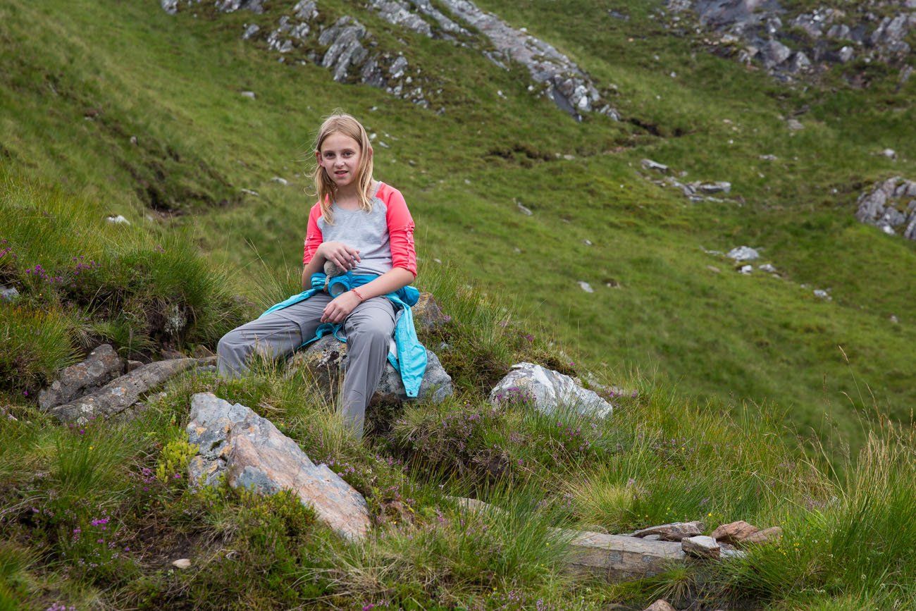
Once at the col, turn left and begin the climb up Meallan Odhar. It’s a gradual climb and not very strenuous. We took a break here to enjoy the views, have a snack, and fly our drone. Meanwhile, we were pestered by those very annoying midges!!
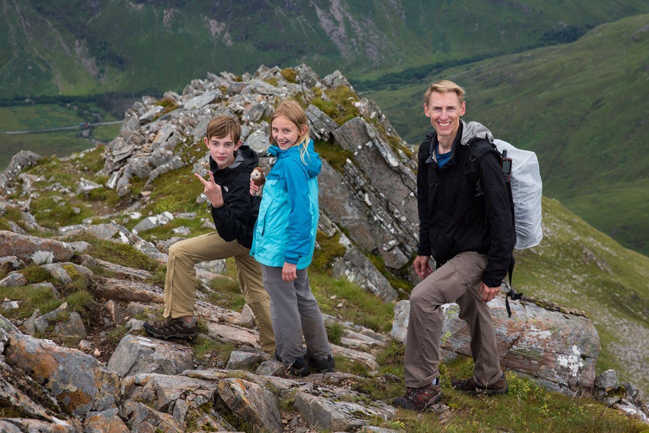
Meanwhile, we kept looking over at the next stage of the hike, the Forcan Ridge. Even though we were warned to keep Tyler and Kara off of this section of the hike, still, we were tempted to do it. However, the cloud cover obscuring the knifelike ridge was changing our minds. We wanted adventure but we did not want to endanger our kids.
The Forcan Ridge
The Forcan Ridge is a knifelike ridge leading up to the summit of The Saddle. This is the most common path to The Saddle. During bad weather, for those with limited hiking experience, or for those hiking with kids, there is an alternate, safer path. Very soon we had a decision to make.
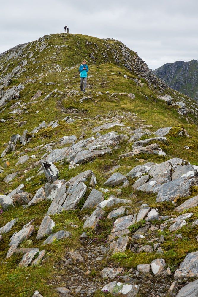
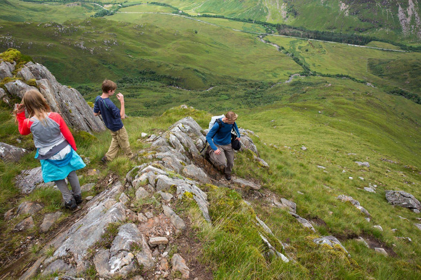
The path leading up to the Forcan Ridge
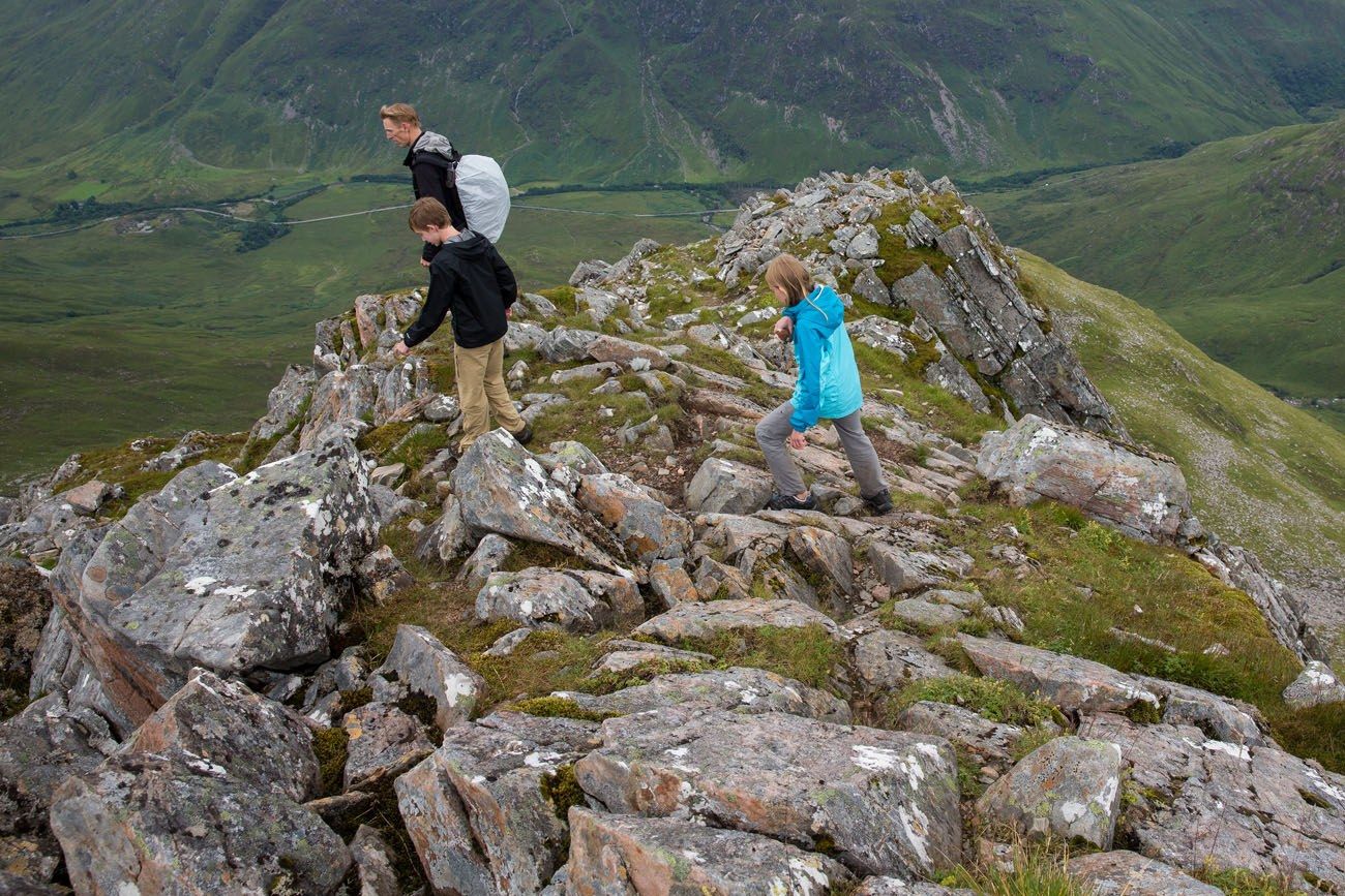
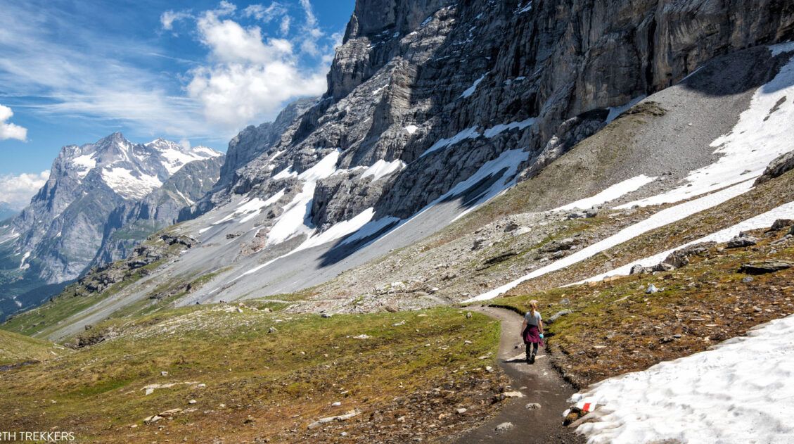
Thinking we were unstoppable, we decided to give the Forcan Ridge a try. It gets steep rather quickly, so it would not take us long to find out if we could handle it.
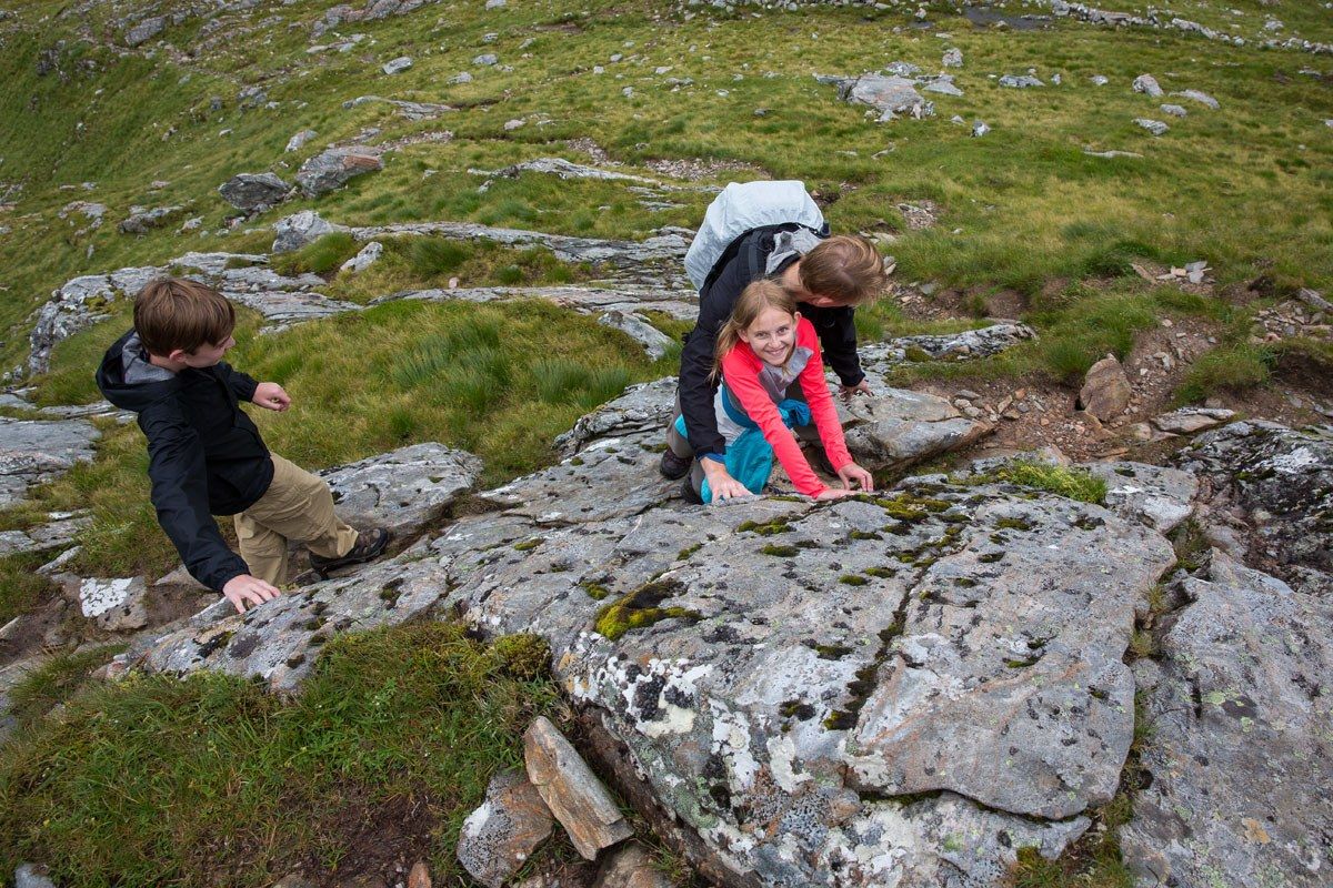
The ascent up Forcan Ridge is challenging! Too challenging for Kara and Tyler. A few years from now…sure, they’d be able to handle it. But today, it was not worth risking their safety to bag a Munro. We turned around, deciding to continue on with the safer option.
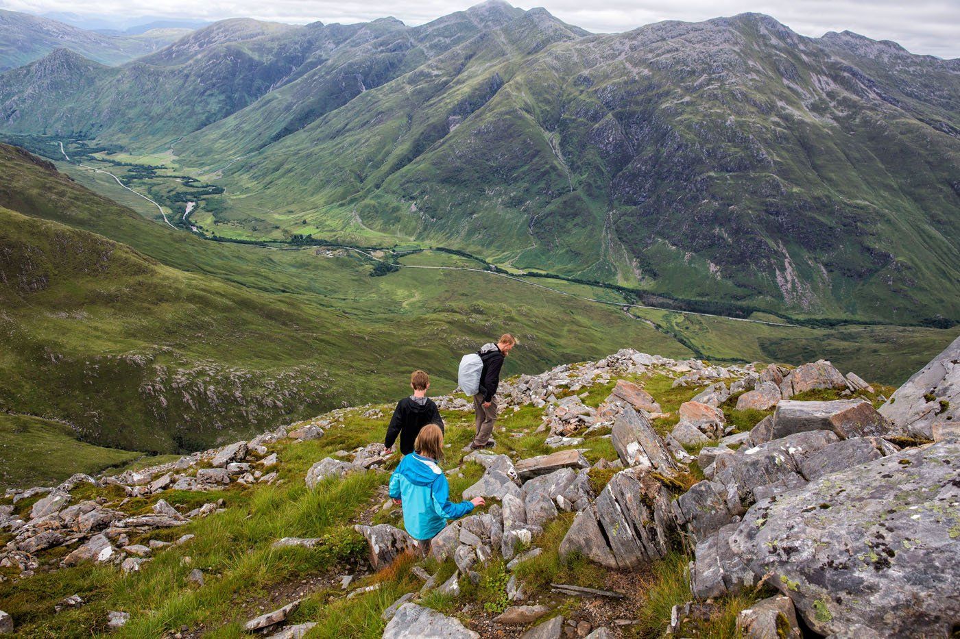
Finding Our Way
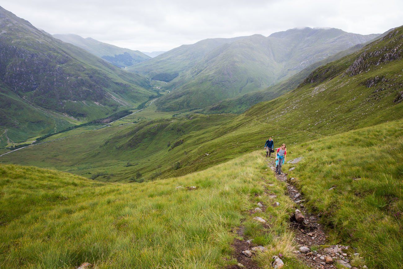
Just before the Forcan Ridge the path splits. The trail to the right leads up the Ridge and the trail to the left follows the contour of the slope. We walked across a rocky hillside, ending at another col. And this is where staying on the trail got a little tricky.
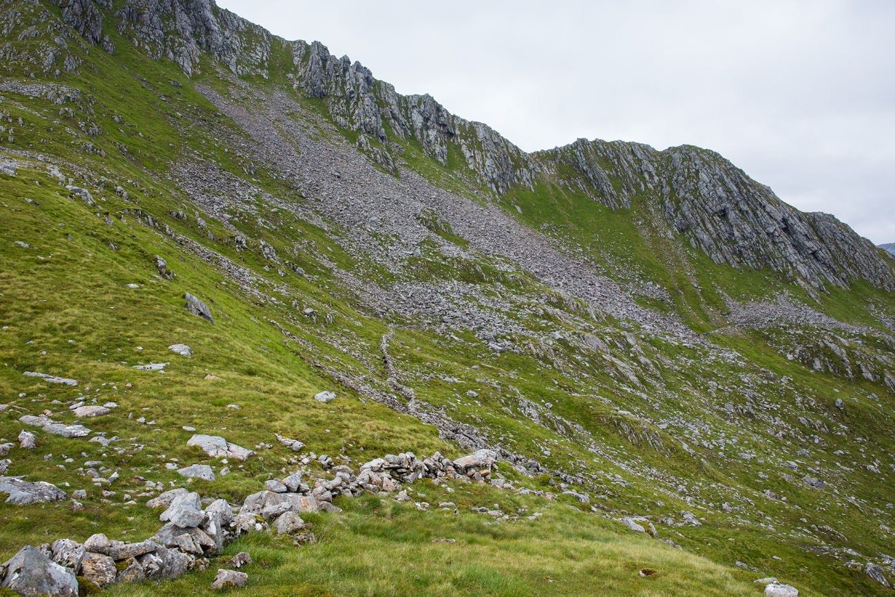
Looking back at the Forcan Ridge and the alternate path lower down on the mountain
We were using printed directions from the Walk Highlands website. Their instructions were good, but the landmarks they listed used Gaelic names for the mountains. This was our first time here and we had no idea what we were looking at. I had also made the assumption that we would be able to use Google Maps to help identify landmarks. Wrong. We had zero cell service here. Tim and I were left deciphering written words from a Scottish website that assumed you already knew the names of the mountain peaks towering around you.
We were in no danger. During the entire hike we could see A87 and in the worst case scenario we would just retrace our steps to our car. But we wanted to get as high as possible, bag at least one Munro, and be rewarded with awesome views over Scotland.
Bealach Coire Mhalagain
Bealach Coire Mhalagain is another col. This one connects The Saddle with Sgurr na Sgine. The path down from the summit of The Saddle and the alternate, safer path both connect here.
There are rusted metal poles sticking up from the ground here. They are placed in the ground every 15 to 20 feet. If you follow them, they climb up the next slope.
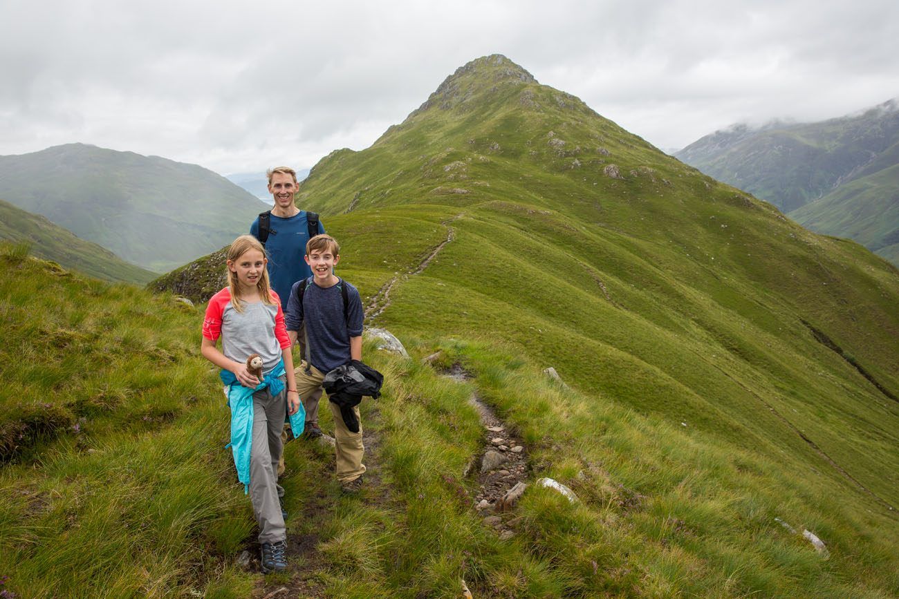
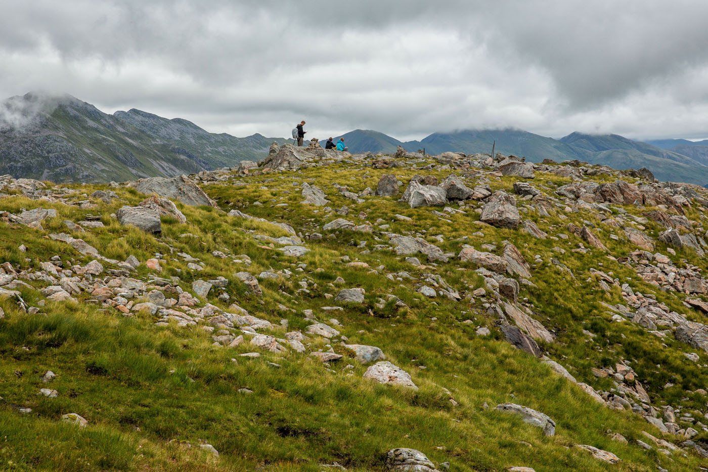
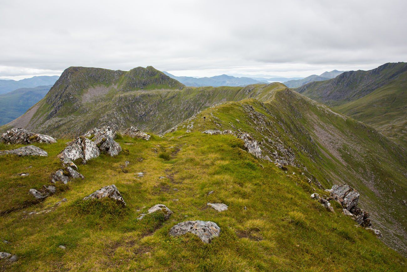
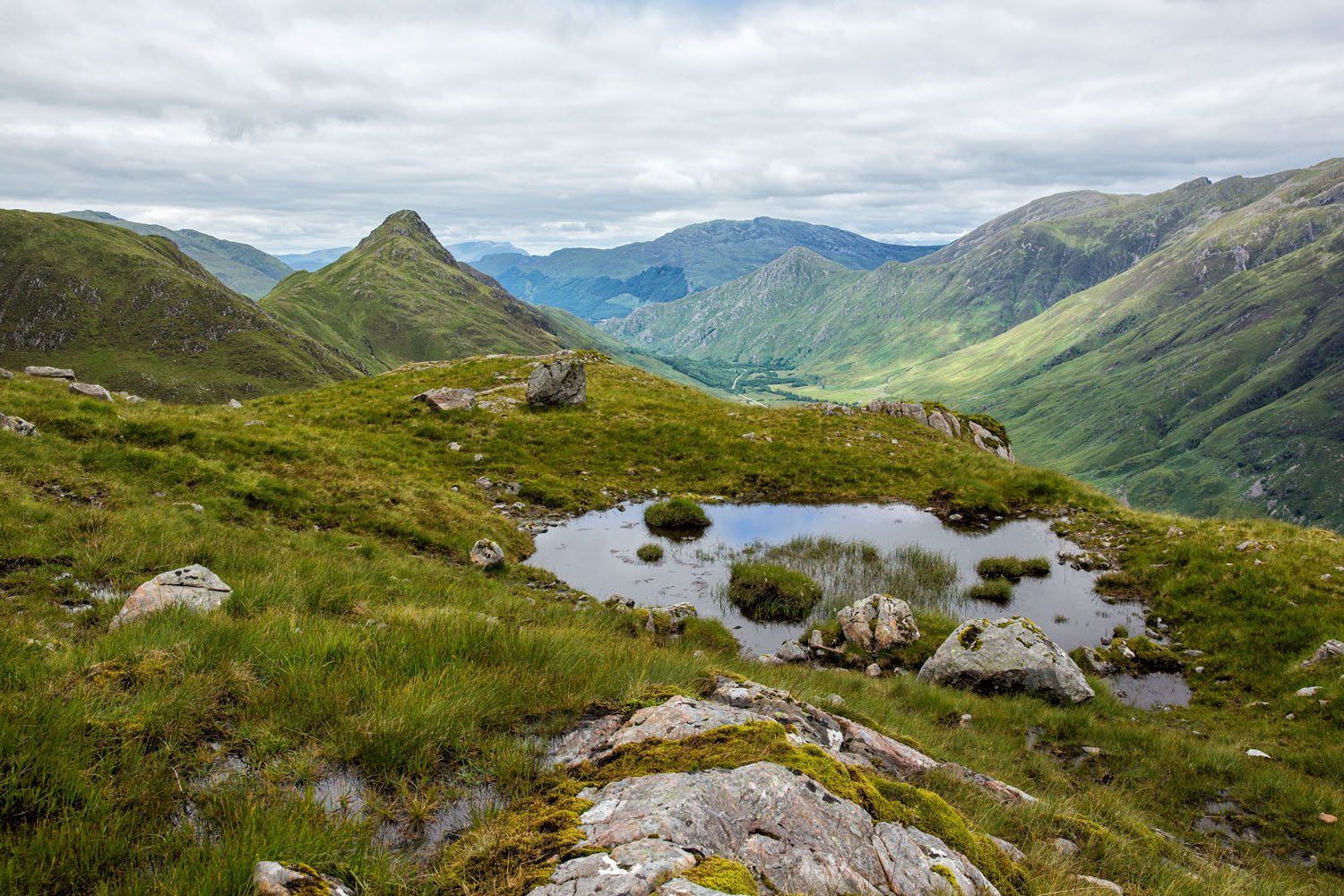
Sgurr na Sgine and Faochag
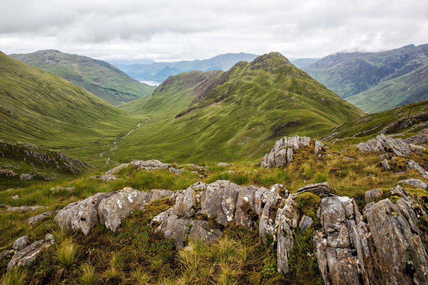
Climb the hillside on the faint, hard to follow path. Basically, just head straight up the hill the safest way possible. Another awesome view awaits.
At the top of this hill, you can see down Faochag, the ridge heading towards A87. The peak looming over you to your right is Sgurr na Sgine.
Faochag
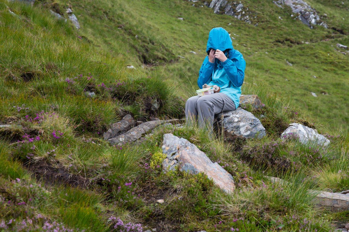
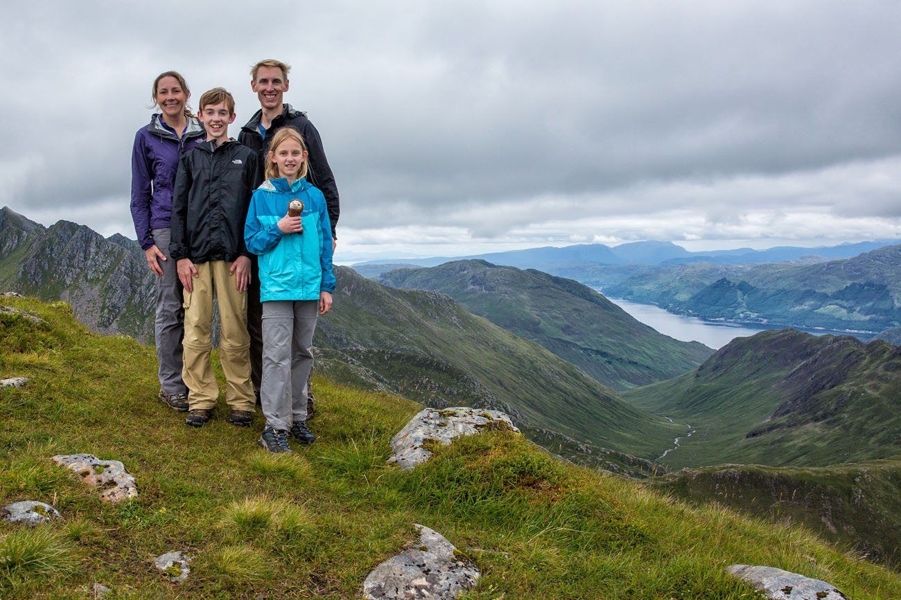
Again, we had a difficult time following the Walk Highlands instructions. What we thought was Sgurr na Sgine was really Faochag. So nope, we never climbed the official peak of Sgurr na Sgine, which means we never officially bagged a Munro today. Sure, I am a wee bit disappointed, but we were about to be rewarded with some phenomenal views. And to be honest, at this point, Kara was running out of steam. The thought of climbing even higher sounded like torture to her.
So, to climb Sgurr na Sgine, turn right on the ridge (walking away from A87) and head up the summit. Enjoy the view, retrace your steps, and then begin the walk out onto Faochag.
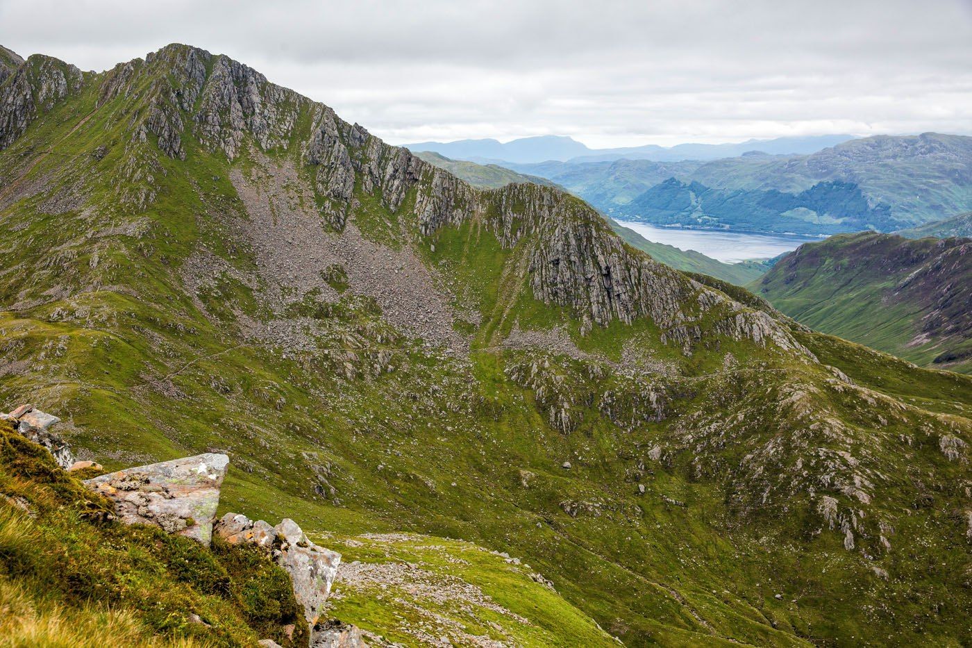
Another view of the Forcan Ridge (and the alternate path)
Faochag
Tim and Tyler flying the drone as Kara and I walk along the ridge
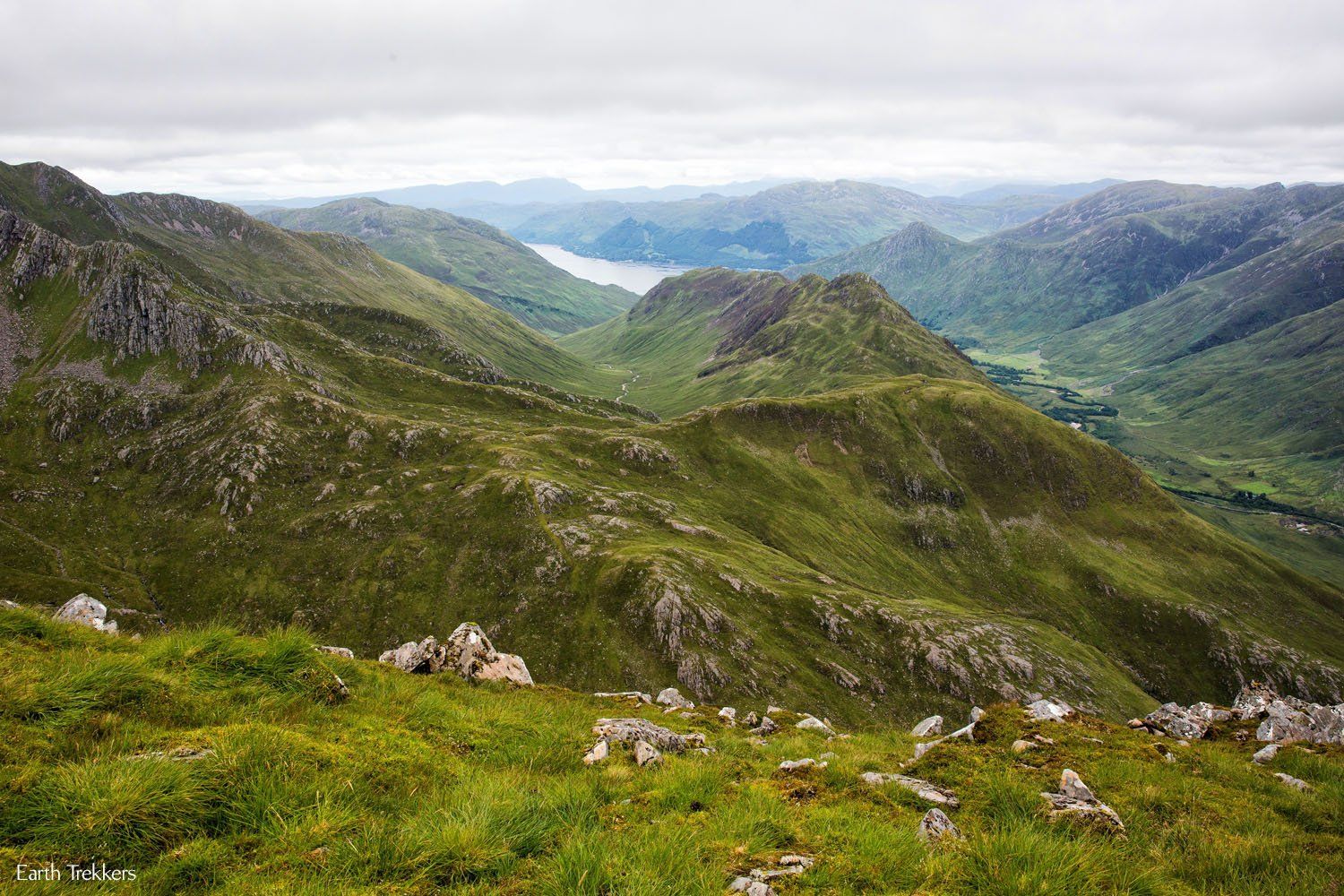
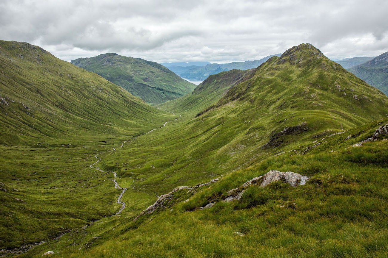
View from Faochag
The Descent
Continue along Faochag. The path rapidly descends, and yes, at times, it looks as though you will slide right off the side of the mountain.
Way down there is A87
Don’t forget to enjoy the view
The descent is difficult. Maybe the most difficult part of the day (unless you did the Forcan Ridge). It’s a slippery, rocky, muddy drop back down to the valley.
Once at the bottom, the last step is to cross the stream (Allt Mhalagain). Usually this is easy as there is a path of stones crossing the stream. However, if it has recently rained, which it had in our case, the stream becomes a river. The water is much too high for the bridge of stones to be sufficient. It took us 10 minutes of hiking upstream to find a narrower, safer place to cross. With two tired kids, the last thing we wanted to do at this point was to walk farther than necessary.
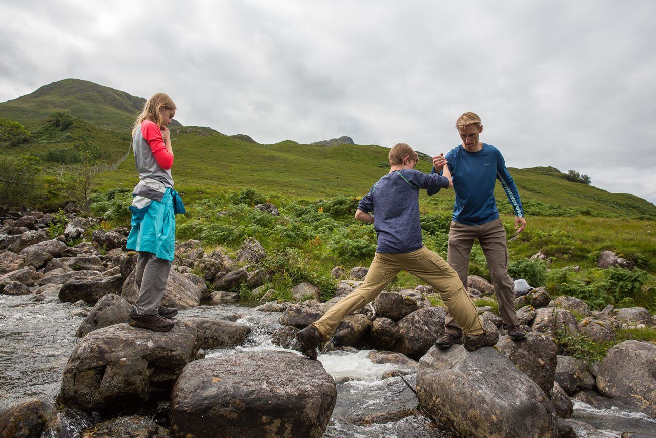
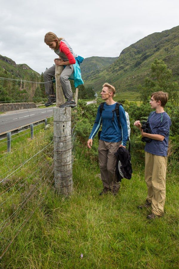
Since we crossed the stream at a different point, we lost the trail. The four of us trudged through boggy, wet ground to A87. A climb over the fence and a short walk to our car and our journey was over.
About the Kintail Saddle Hike
Length: 8.25 miles, 1350 meters of climbing
Allow 6 to 8 hours for the hike.
There are no signs or markers on the trail. In most places, the trail itself is easy to follow. Print out a copy of the map on the Walk Highlands website for reference.
Do not expect your cell phone to work!
Wear waterproof hiking shoes. This hike takes you through very wet, boggy marshes and your feet will get soaked.
Do not attempt the Forcan Ridge in the rain, snow, or even when it is very cloudy. Do not underestimate the danger of this ridge.
For more details on the hike, visit the Walk Highlands website. Print out this post as a PDF so you can reference it while hiking.
Even during the peak summer month of August, we had this trail almost to ourselves. We saw just two other hikers during the entire hike.
Hiking with Kids: Tyler was 13 and Kara was 11 when we did this hike. Even with Kara’s rock climbing experience we did not think it was safe for her to attempt the Forcan Ridge. If your child is 14 years or older with lots of hiking experience, the Forcan Ridge might be possible. If you are in doubt, climb a short distance up and if it seems too challenging, turn around and take the alternate path along the hillside.
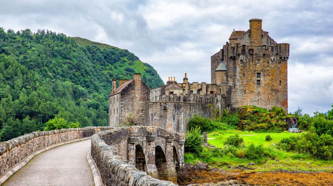
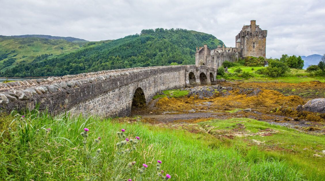
Where to Stay: We stayed at the Grianan Guest House, located in Inverinate of Kintail, just a 10 minute drive from The Saddle hike (it looks as if it is no longer open). This small B&B has only four rooms and has a beautiful setting overlooking Loch Duich. We loved it here!! Plus, it is just 15 minutes away from Eilean Donan Castle.
Where to Eat: The Glenelg Inn. It’s a half an hour away from Kintail but the food is awesome here. This pub serves excellent Scottish food and ale. Just make sure you make a reservation in advance.
Please practice the seven principles of Leave No Trace: plan ahead, stay on the trail, pack out what you bring to the hiking trail, leave areas as you found them, minimize campfire impacts, be considerate of other hikers, and do not approach or feed wildlife.
If you have any questions about hiking the Kintail Saddle, or if you would like to share your experience, let us know in the comment section below.
Plan Your Trip to Scotland
We have a lot more information about Scotland in our Scotland Travel Guide, including the Isle of Skye, Edinburgh, and Glasgow.
10 Day Scotland Itinerary: Edinburgh, Glasgow & the Isle of Skye
Pinterest Facebook Flipboard The ultimate Scotland road trip starts here. In 10 days, explore Edinburgh, drive through Glencoe, visit Loch Ness, and experience the dramatic landscapes of the Isle of Skye. Scotland may look small on a map, but planning the perfect route can feel overwhelming. With castles, whisky distilleries, Highland road trips, and the […]
12 Wonderful Things to Do on the Isle of Skye (2026 Guide & Map)
The Isle of Skye is Scotland’s most dramatic destination — a wild landscape of jagged cliffs, hidden waterfalls, fairy-tale hills, and rugged mountain peaks. We spent several days exploring Skye’s most iconic viewpoints and lesser-known corners, hiking the Quiraing, watching the sunset at Neist Point, and discovering quiet spots like Brother’s Point. In this guide, […]
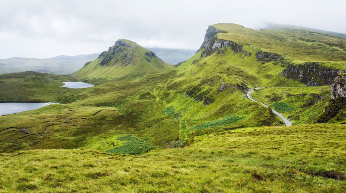
Hiking the Quiraing on the Isle of Skye
For one of the most spectacular views on the Isle of Skye, do not miss the Quiraing. These dramatic cliffs are gorgeous, rain or shine. The hike around the Quiraing was high on our list. There is no better way to see the scenery than hiking around the Quiraing. Of course, this is Scotland, and […]
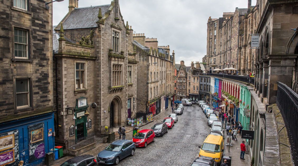
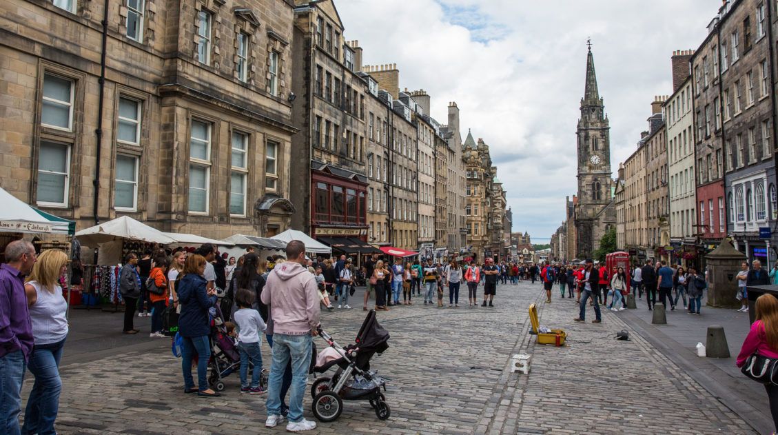
2 Days in Edinburgh: The Perfect Itinerary for Your First Visit
Edinburgh is one of those cities that feels made for a short visit: historic streets you can explore on foot, dramatic viewpoints, cozy pubs, and world-class sights packed into a compact Old Town. With just two days in Edinburgh, you can see the city’s highlights without feeling rushed, from Edinburgh Castle and the Royal Mile […]
The Ultimate Scotland Travel Guide
In this Scotland Travel Guide, learn how to visit Edinburgh, the Isle of Skye, Glen Coe, Glasgow, hike the Kintail Saddle, and take an epic road trip in Scotland.
Best Hikes in Europe: 25 Incredible Hikes for Every Level
From the dramatic cliffs of Norway to the jagged peaks of the Dolomites and the volcanic landscapes of Iceland, Europe is packed with some of the most unforgettable hikes in the world. In this guide, we share our favorite hikes in Europe, trails that stand out for their scenery, uniqueness, and overall experience from start […]
The Perfect Isle of Skye Itinerary (1, 2 & 3 Days)
The Isle of Skye is Scotland’s most dramatic destination, a dramatic landscape of sea cliffs, towering rock formations, and some of the most unforgettable scenery in the UK. In this detailed Isle of Skye itinerary, we show you exactly how to spend 1, 2, or 3 days exploring the Trotternish Loop, the Old Man of […]
Fairy Glen: The Cutest Place to Explore on the Isle of Skye
The Fairy Glen is a lesser-known attraction on the Isle of Skye. It’s also one of the cutest places on the island to explore. The Fairy Glen was the first place we visited on the Isle of Skye. Located on the Trotternish Peninsula, it is easy to combine the Fairy Glen with a visit to […]
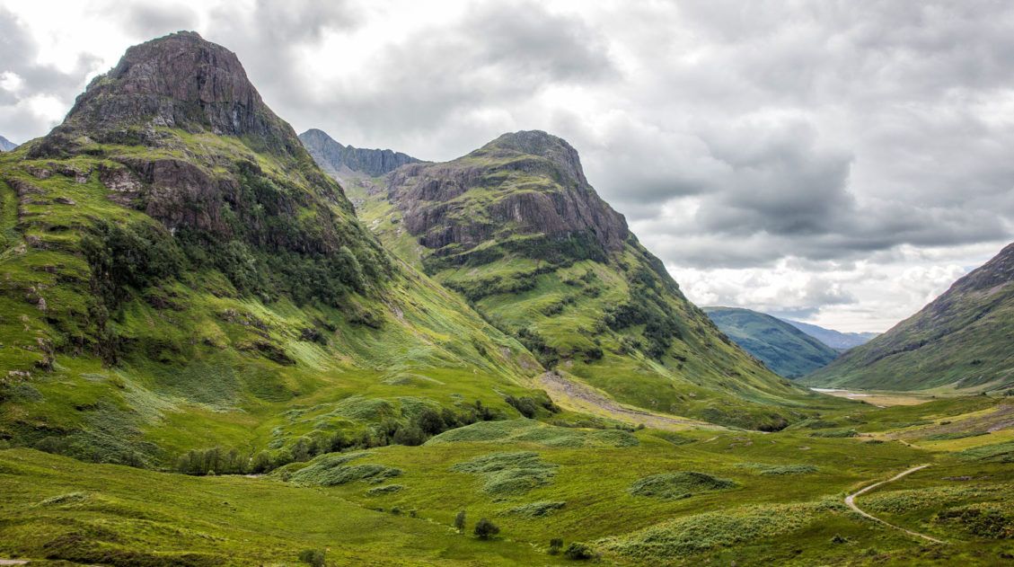
Postcards from Glencoe, Scotland
If you are taking a road trip through Scotland, Glencoe should be on your list of places to visit. This gorgeous valley is a great place for families, hikers, and those that love the great outdoors. You can either drive through it, spending just an hour here, or you could easily spend an entire day hiking […]
11 Awesome Things to Do in Edinburgh with Kids
Edinburgh is one of the best cities in Europe to take your kids. Visit a castle, climb an extinct volcano, take a Harry Potter tour, learn about medieval history, and pay a visit to a spooky dungeon. What kid would not find this interesting? If you plan on visiting Edinburgh with kids, we have great […]
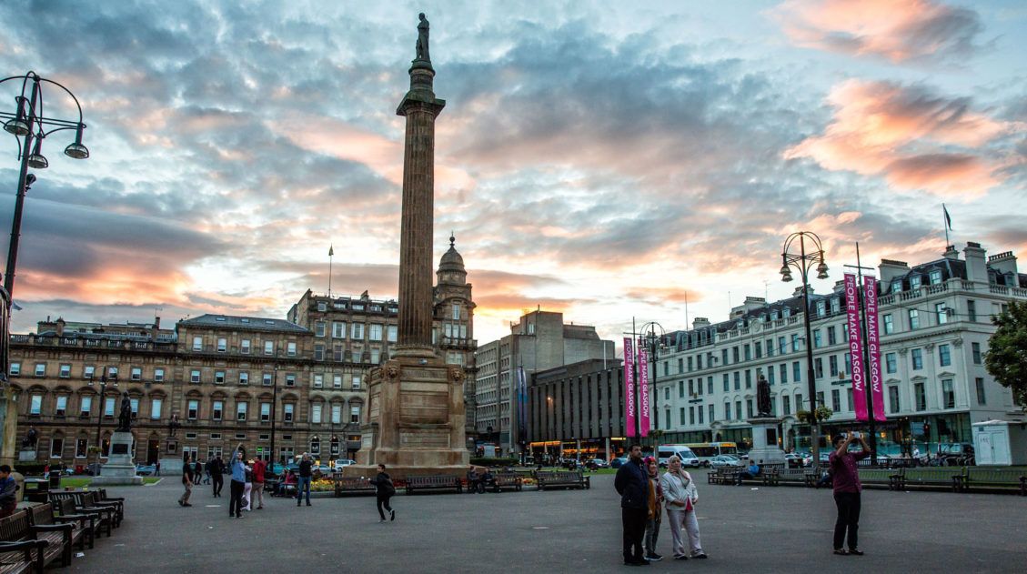
Glasgow, Scotland: 24 Hours of Fun for the Whole Family
Glasgow is often an overlooked destination in Scotland. Most people tour Edinburgh and then head to the Highlands, for good reason, as both of these places are amazing. But Glasgow is worth a visit. It’s a great Scottish city and all you need is 24 hours to see the best of it. Whereas Edinburgh is […]
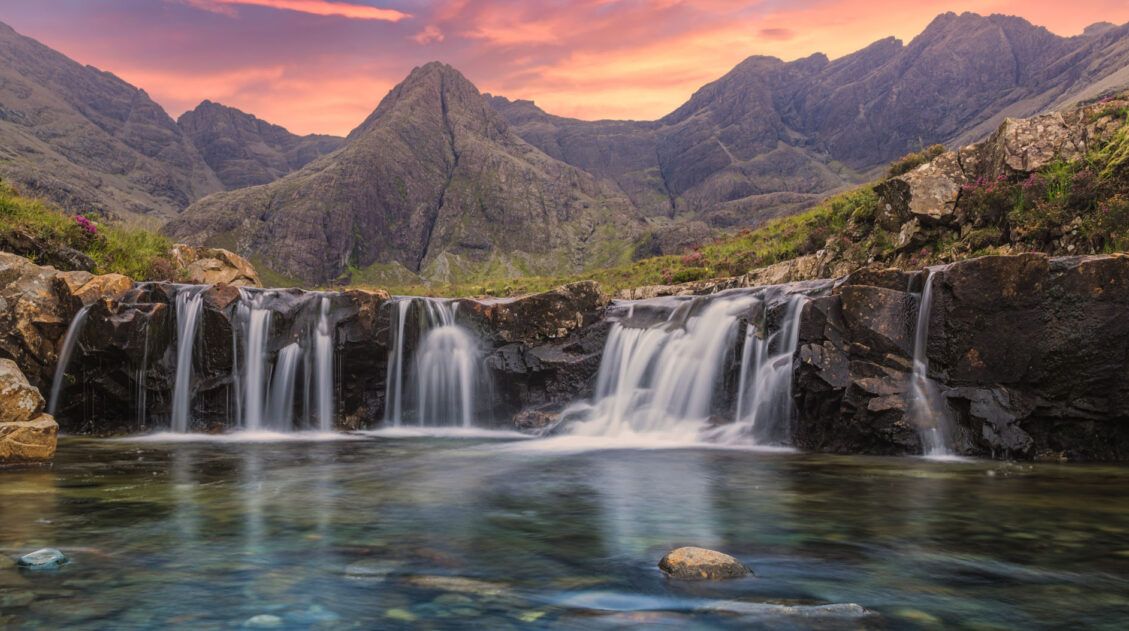
How to Visit the Fairy Pools on the Isle of Skye
The Fairy Pools are one of the most visited sites on the Isle of Skye of Scotland. Why? It’s an easy walk along a series of small waterfalls with the Cuillin Mountains as a backdrop. We were here under less than ideal conditions. Once again, we awoke to cloudy, rainy skies. It drizzled off and […]
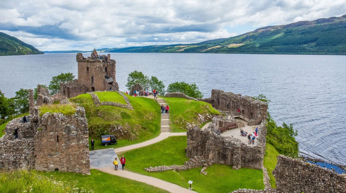
Loch Ness and Urquhart Castle…Are They Worth Visiting?
Without a doubt, Loch Ness is Scotland’s most famous loch. Legend has it that this lake is home to Nessie, the Loch Ness monster. People travel all over the world to visit this famous loch, hoping to get a chance to spot the elusive underwater monster. But does that make Loch Ness worth visiting? Our […]
United Kingdom Travel Guide: How to Plan a Trip to the UK
United Kingdom Travel Guide The United Kingdom is an island nation off northwestern Europe and it is made up of the countries England, Scotland, Wales, and Northern Ireland. This collection of nations offers an fascinating blend of history to learn, culture to take part in, and natural beauty to explore. Dive into royal lineage in […]

Comments 8