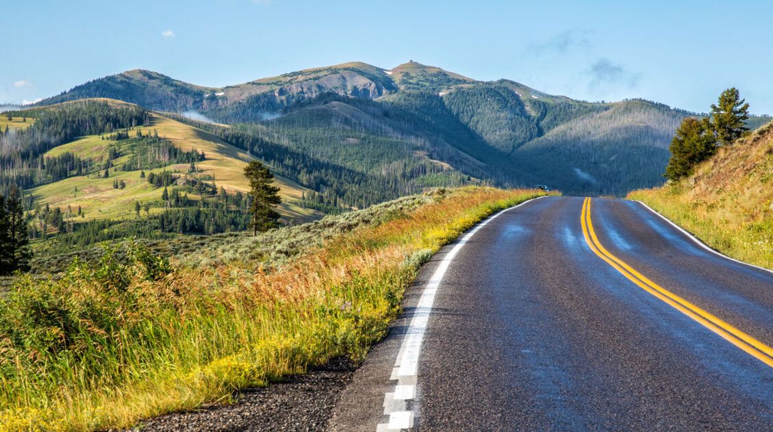
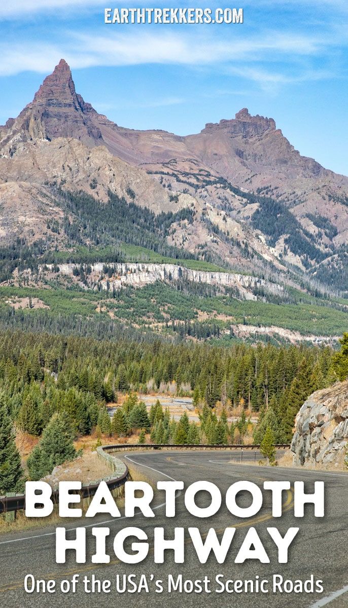
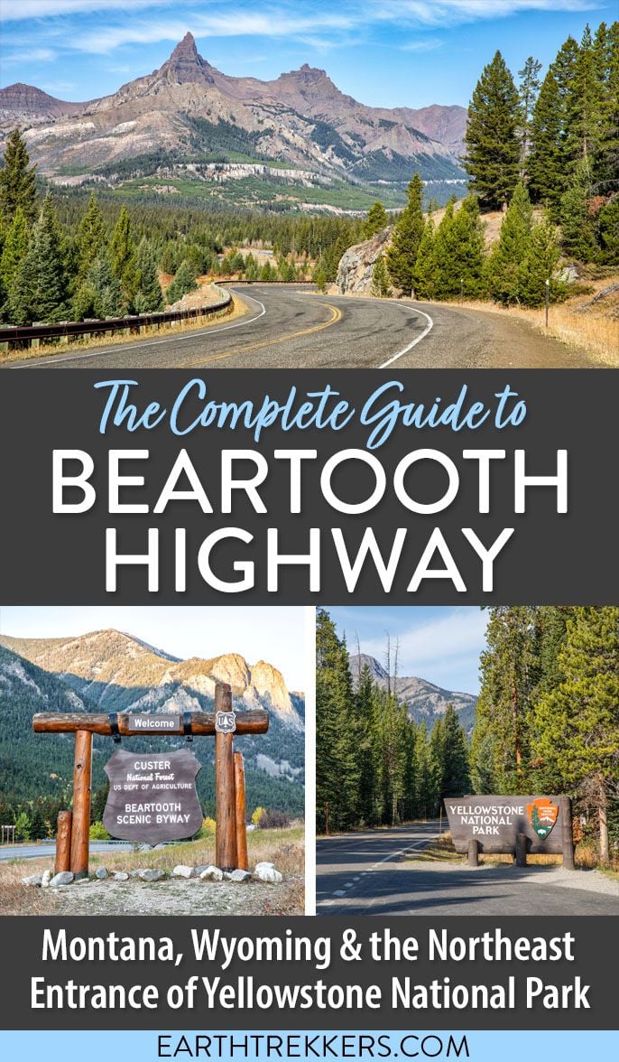
Beartooth Highway is one of the most scenic drives in the United States, climbing to nearly 11,000 feet while passing alpine lakes, mountain passes, and sweeping views on the way to Yellowstone National Park. Connecting Red Lodge, Montana, with Cooke City near Yellowstone’s northeast entrance, this unforgettable road trip is often called the most beautiful drive in America.
We have driven many of America’s most scenic mountain roads, including Going-to-the-Sun Road in Glacier National Park and Trail Ridge Road in Rocky Mountain National Park, and Beartooth Highway ranks among our favorites.
In this guide, learn how to drive Beartooth Highway, the best stops along the route, how long the drive takes, when the road opens, and how to add it to your Yellowstone itinerary.
Many visitors drive Beartooth Highway while visiting Yellowstone National Park. If you are planning your trip, start with our Yellowstone National Park Travel Guide or see our Yellowstone itinerary for ideas on how to include this drive.
Beartooth Highway: The Essentials
DISTANCE | 68 miles
DRIVE TIME | Roughly 3 hours (longer with stops)
HIGHEST ELEVATION | 10,947 feet (Beartooth Pass)
START | Red Lodge, Montana
END | Cooke City/Yellowstone NE Entrance
BEST DIRECTION | Red Lodge → Yellowstone
OPEN | Late May to early October
TIME NEEDED | Half to a full day
Is Beartooth Highway Worth It?
Yes, Beartooth Highway is absolutely worth driving, and it ranks among our favorite scenic roads in the United States. This spectacular mountain road climbs high into the mountains, where you’ll pass alpine lakes, sweeping viewpoints, and dramatic switchbacks with nonstop scenery along the way.
What makes Beartooth Highway especially rewarding is how easy it is to experience. You don’t need to do a long hike to enjoy the views, since many of the best panoramas are just steps from your car. For travelers visiting Yellowstone National Park, driving Beartooth Highway is also one of the most memorable ways to enter or exit the park, arriving near wildlife-rich Lamar Valley.
On our drive, we stopped again and again for photos and viewpoints, and the scenery easily rivaled some of the most famous mountain roads we’ve driven in the USA.
Beartooth Highway is best for:
- First-time visitors to Yellowstone
- Scenic drive lovers
- Photographers
- Road trip itineraries through Montana and Wyoming
You may want to skip it if:
- The road is closed due to snow (typically October through late May)
- You are uncomfortable driving high mountain roads with switchbacks
Ready to start planning your drive? Here’s what to know before you go, from how much time you’ll need to the best viewpoints and stops along Beartooth Highway.
Map of Beartooth Highway
Below is a map of Beartooth Highway, highlighting the main stops along the drive.
How to Use This Map: Click the tab in the top left corner of the map to see a list of the points of interest and to turn layers on/off. Click the icons on the map to get more information about each point of interest.
To take this map with you, click the star next to the title of the map which adds it to your Google account. Next, within your Google Maps app, select ‘Saved’ and then select ‘Maps’. This map title will now appear in your list.
How Long Does It Take to Drive Beartooth Highway?
It takes about 2.5 to 3 hours to drive Beartooth Highway without extended stops. However, most visitors spend half a day or longer, stopping at overlooks, alpine lakes, and short hiking trails along the route.
It took us just under 3 hours and we stopped frequently for photos. We did not do any of the optional hikes, since we had a lot already planned for the day. But if you plan to do the short hikes and detours listed below, this drive can take a half of a day or longer.
PRO TRAVEL TIP: For photography and lighting, the best time of day to drive Beartooth Highway is between 10 am and 5 pm. Early and late in the day, the sun is not quite high enough in the sky to illuminate the valleys, making photography tricky. We started this drive at 8 am and you will see a lot of shadows in our early photos. But we had no choice, since we had a big driving day ahead of us (we drove through Yellowstone and out to Cody, Wyoming).
Which Direction Should You Drive Beartooth Highway?
Beartooth Highway can be driven in either direction, but the best way to drive it is from Red Lodge, Montana toward Yellowstone National Park.
Starting in Red Lodge, the road gradually climbs into the Beartooth Mountains, taking you up a series of dramatic switchbacks to Beartooth Pass at 10,947 feet. In this direction, the scenery keeps getting better as you gain elevation, building toward some of the most spectacular views along the drive. Ending near Yellowstone’s northeast entrance also makes for an unforgettable arrival into the park, just minutes from Lamar Valley, one of the best places in Yellowstone for wildlife viewing.
Driving the highway from Yellowstone to Red Lodge is still beautiful, but many travelers find the views to be slightly less dramatic in this direction.
Best direction: Red Lodge → Cooke City → Yellowstone National Park
Good alternative: Drive it out-and-back if you are staying inside Yellowstone or near Cooke City.
When is Beartooth Highway Open?
Beartooth Highway is typically open from Memorial Day through early October.
We drove Beartooth Highway on October 5, 2021. Beartooth Highway closed on October 7, during the first snowfall of the season. Did we get lucky or what?!
The owner of our lodge in Red Lodge, who has lived here for over 40 years, said that this was the latest he could remember Beartooth Highway being open.
Once the road closes, it remains closed until the spring. This road gets a massive amount of snowfall and in some years, it can be as high as 26 feet. In May, and sometimes as late as June (if snowfall has been especially heavy), the road is finally plowed.
Opening and closing dates vary from year to year. To check the status of Beartooth Highway, visit the Montana.gov website. You can also call the Red Lodge Area Chamber of Commerce at 406-446-1718 for current conditions.
When is the Best Time to Drive Beartooth Highway?
The best time to drive Beartooth Highway is from late June through September, when the road is fully open and driving conditions are typically clear. July and August offer the warmest weather and easiest access to viewpoints, while September brings lighter crowds and early fall color.
For the best views and photography, plan to drive between late morning and mid-afternoon, when sunlight fully illuminates the mountain scenery.
PRO TRAVEL TIP: Weather can change quickly at high elevations, so always check road conditions before starting the drive.
Driving Beartooth Highway: Important Tips Before You Go
Road Conditions & Driving Difficulty
Beartooth Highway is a paved mountain road with steep switchbacks and high elevations, but it is generally easy to drive in good weather. Guardrails and frequent pullouts make it safe for most drivers who are comfortable driving mountain roads.
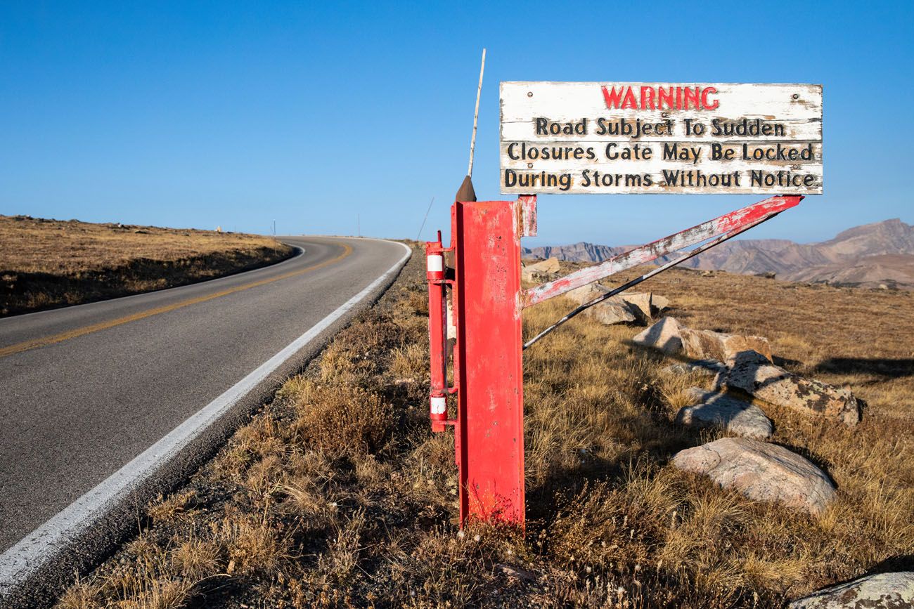
Check Weather and Road Status
Snow can occur even in summer at higher elevations. Always check current conditions before your visit, as the road can temporarily close due to snow or construction delays.
Fuel Up Before the Drive
There are limited services along Beartooth Highway. Fill your gas tank in Red Lodge or Cooke City before starting the drive.
Altitude Awareness
Beartooth Pass reaches 10,947 feet, and some visitors may notice mild altitude symptoms, such as shortness of breath or fatigue, when walking to viewpoints.
Can RVs and Large Vehicles Drive Beartooth Highway?
RVs and motorhomes are permitted on Beartooth Highway, but drivers need to be comfortable handling steep grades and narrow switchbacks. Smaller RVs typically have an easier drive.
Allow Plenty of Time
Even though the drive can be completed in about three hours, most visitors spend half a day enjoying viewpoints, short hikes, and photography stops.

Things to Do on Beartooth Highway
Overview of the Drive: Red Lodge to Yellowstone
When driving from Red Lodge toward Yellowstone, the experience unfolds in three distinct sections:
Red Lodge to Rock Creek Vista (Miles 0–20)
The drive begins with a steady climb into the mountains, featuring dramatic switchbacks and expanding views over Rock Creek Canyon.
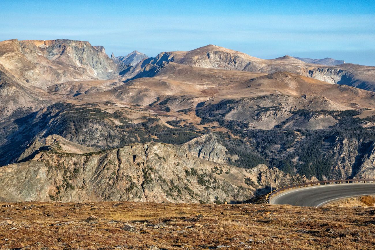
High Alpine Plateau & Beartooth Pass (Miles 20–45)
After reaching the plateau, the landscape opens into alpine tundra dotted with lakes, sweeping mountain scenery, and roadside pullouts before crossing Beartooth Pass.
Descent to Cooke City & Yellowstone (Miles 45–68)
The road gradually descends past alpine lakes and viewpoints before arriving in Cooke City, just minutes from Yellowstone’s northeast entrance and Lamar Valley.
Most visitors stop frequently along the way, turning the drive into a half-day adventure rather than a simple point-to-point route.
This list of things to do on the Beartooth Highway starts in Red Lodge and ends at Yellowstone National Park, since that is the direction we took this drive.
Red Lodge, Montana
This charming town sits at the base of the Beartooth Mountains. If you are road tripping across the USA with plans to visit Yellowstone, this town is a great place to stay. There are numerous small hotels and lodges to choose from, boutique shops, and several great restaurants.
Tim and I stayed in a cabin at the Alpine Lodge and had dinner at Prerogative Kitchen (both are highly recommended!). Other recommended restaurants are Carbon County Steakhouse, Piccola Cucina at Ox Pasture (Italian), and Red Lodge Pizza Company.
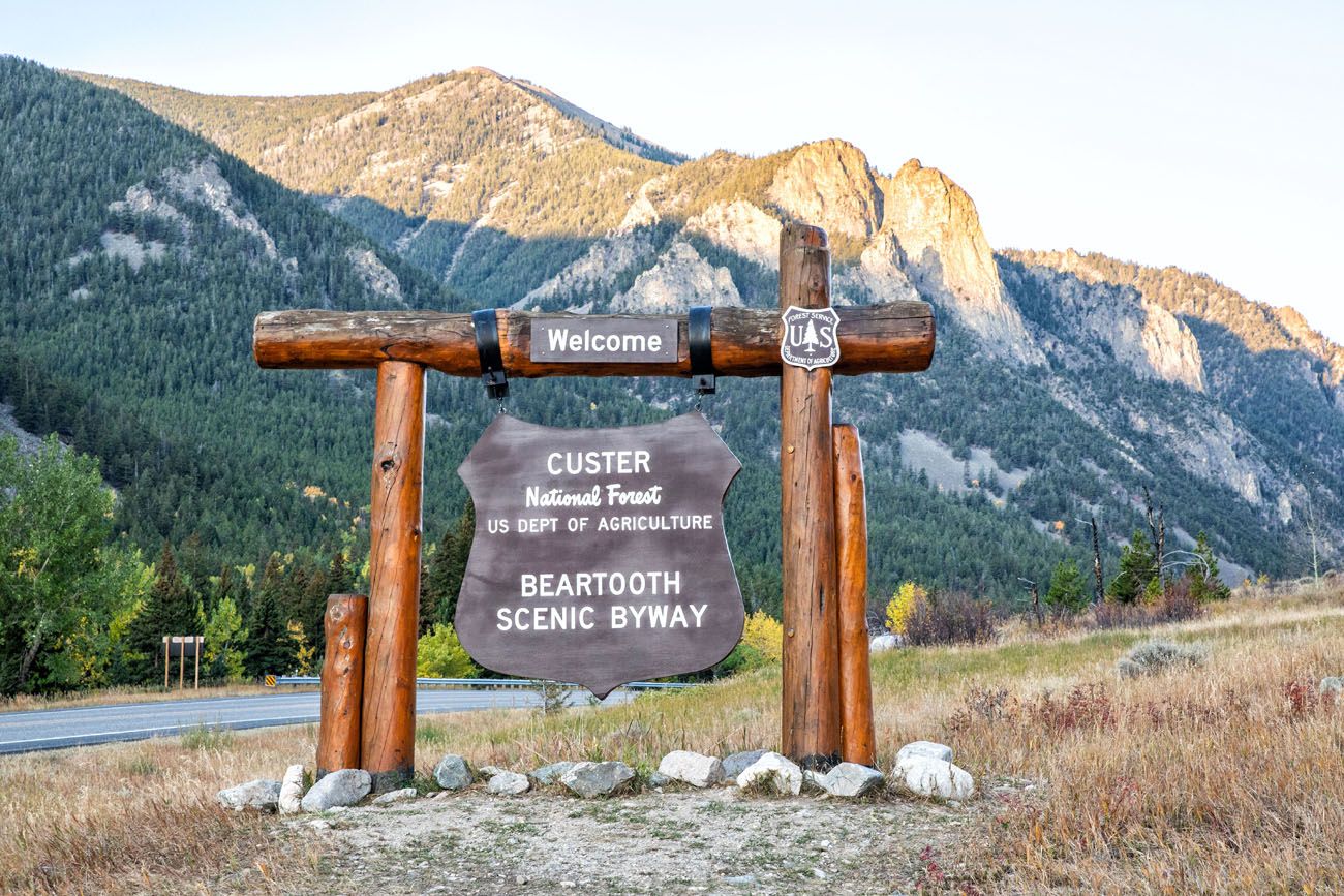
Beartooth Scenic Byway Welcome Sign
Several miles outside of Red Lodge is the welcome sign for Beartooth Highway. Just beyond this sign, the road begins its thrilling climb up into the mountains.
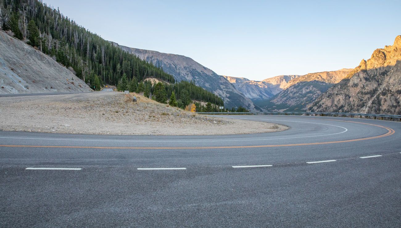
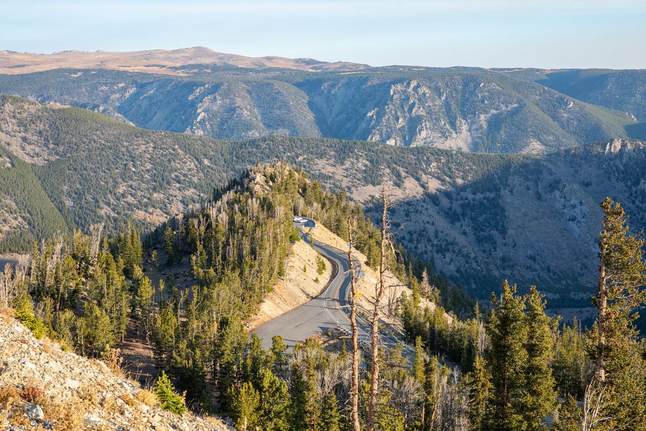
Beartooth Highway Switchbacks
Over the course of several miles, Beartooth Highway steeply ascends up into the mountains. You will drive long, winding switchbacks. The higher you go, the better the views.
The road is very wide with guardrails, so it is safe and easy to drive, just keep your eyes on the road. There are turn outs along the road where you can safely stop to enjoy the view.
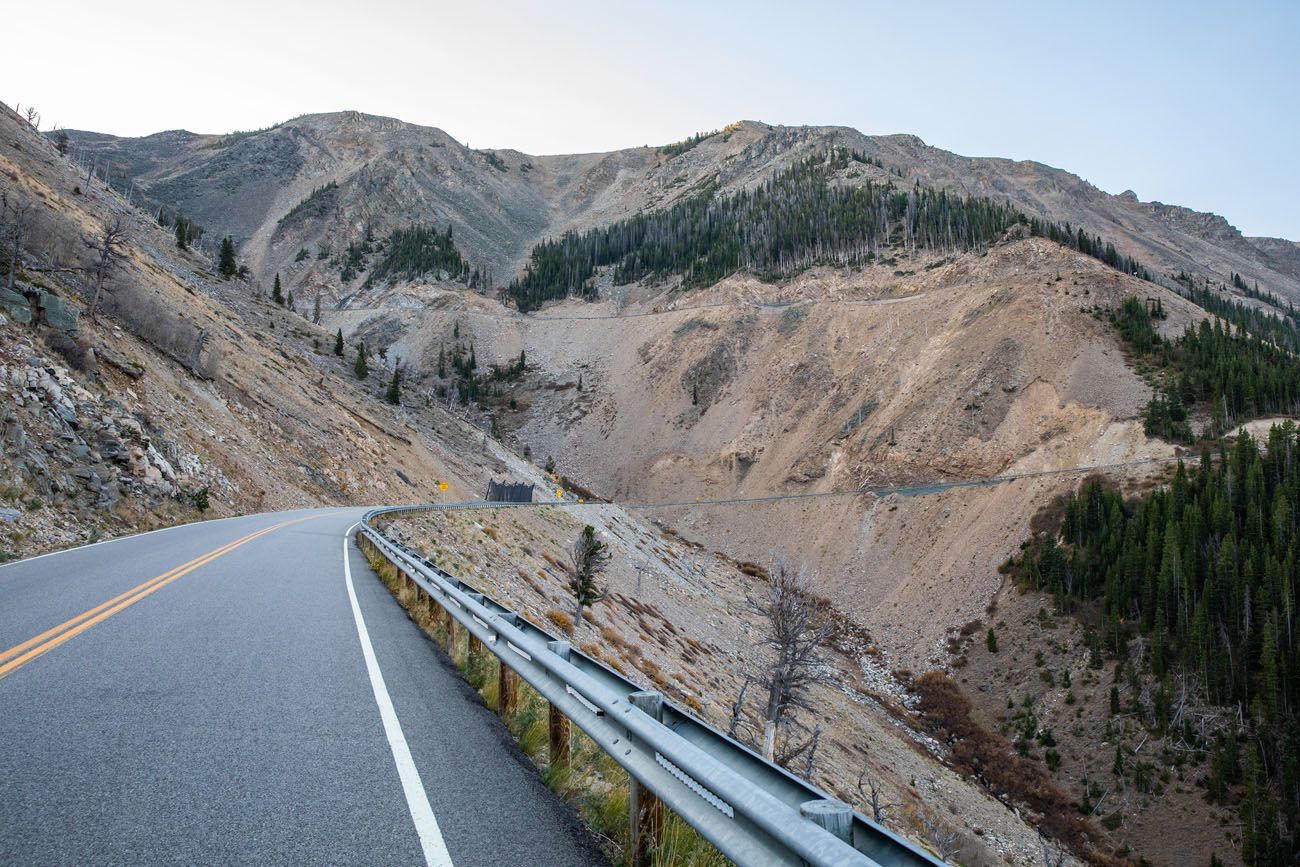
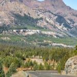
A view of the Beartooth Highway switchbacks.
Rock Creek Vista
This viewpoint is located near the top of the switchbacks. At this point, you are at 9,190 feet and already 21 miles from Red Lodge. There is a short paved trail to an overlook where you have an awesome view of Rock Creek Canyon and Hellroaring Plateau.
Hellroaring Plateau is the mountain range on the opposite side of Rock Creek Canyon.
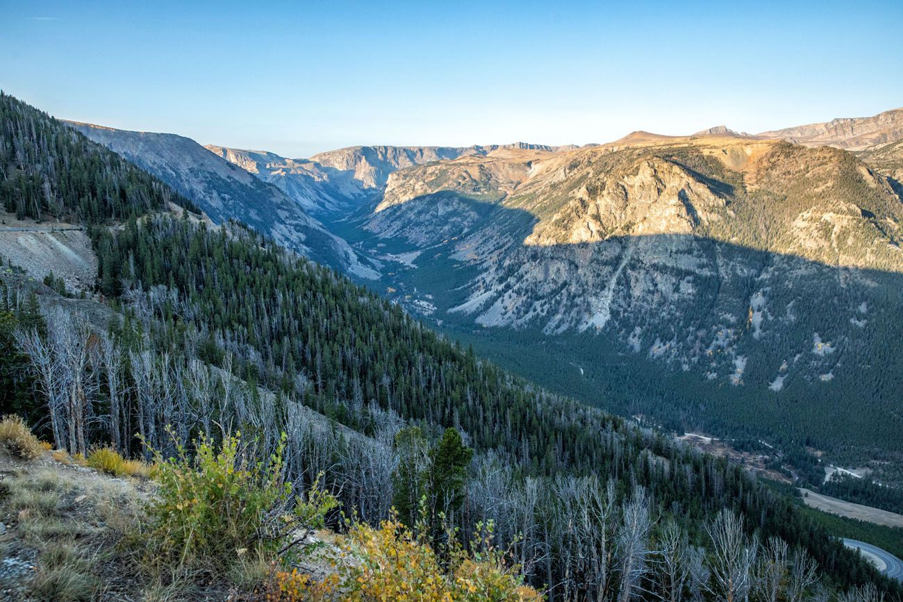
Rock Creek Vista
A little farther up the road, you get a view down to Rock Creek Vista.
45th Parallel
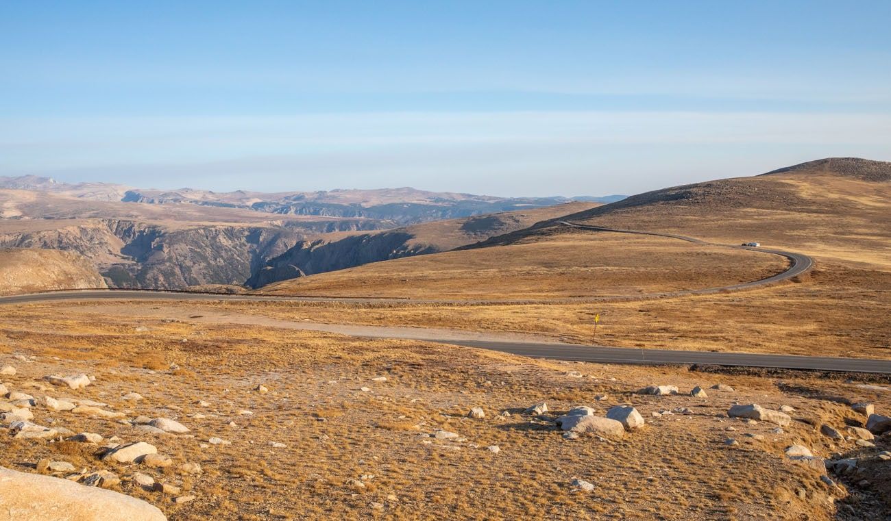
The road continues to climb past Rock Creek Vista, although no longer as steeply. Now, you are driving through alpine tundra. Trees and shrubs have disappeared and the landscape is a lot more barren.
You will cross the 45th parallel, which is the halfway point between the North Pole and the equator.
Alpine lakes along the drive.
Beartooth Basin
Beartooth Basin is one of North America’s oldest alpine ski training areas. It is open for skiing in late spring and early summer, as long as the snow lasts.
Gardner Lake Pullout
From this pullout, you can hike the Beartooth Loop Trail. This 12 mile hike is rated as strenuous and takes a full day. From this trail, you get to see incredible alpine vistas, forests, and meadows.
Bear’s Tooth (Na Piet Say)
Another short series of switchbacks takes you up to Beartooth Pass. Just before reaching the pass, you come to a marker indicating the Bear’s Tooth. Na Piet Say means “bear’s tooth” by the Crow Indians. This small, pyramidal rock is what gives the Beartooth Mountains its name.
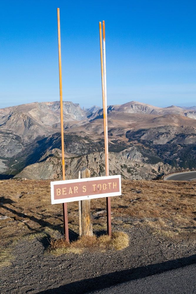
It’s hard to see it in this photo, but Bear’s Tooth is the tiny pyramidal-shaped spire located in between the two posts.
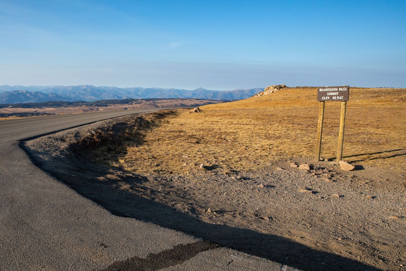
Beartooth Pass
At 10,947, this is the highest point along Beartooth Highway. There is a short road to Beartooth Pass Overlook where you can take in the view.
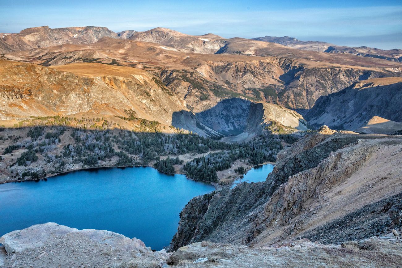
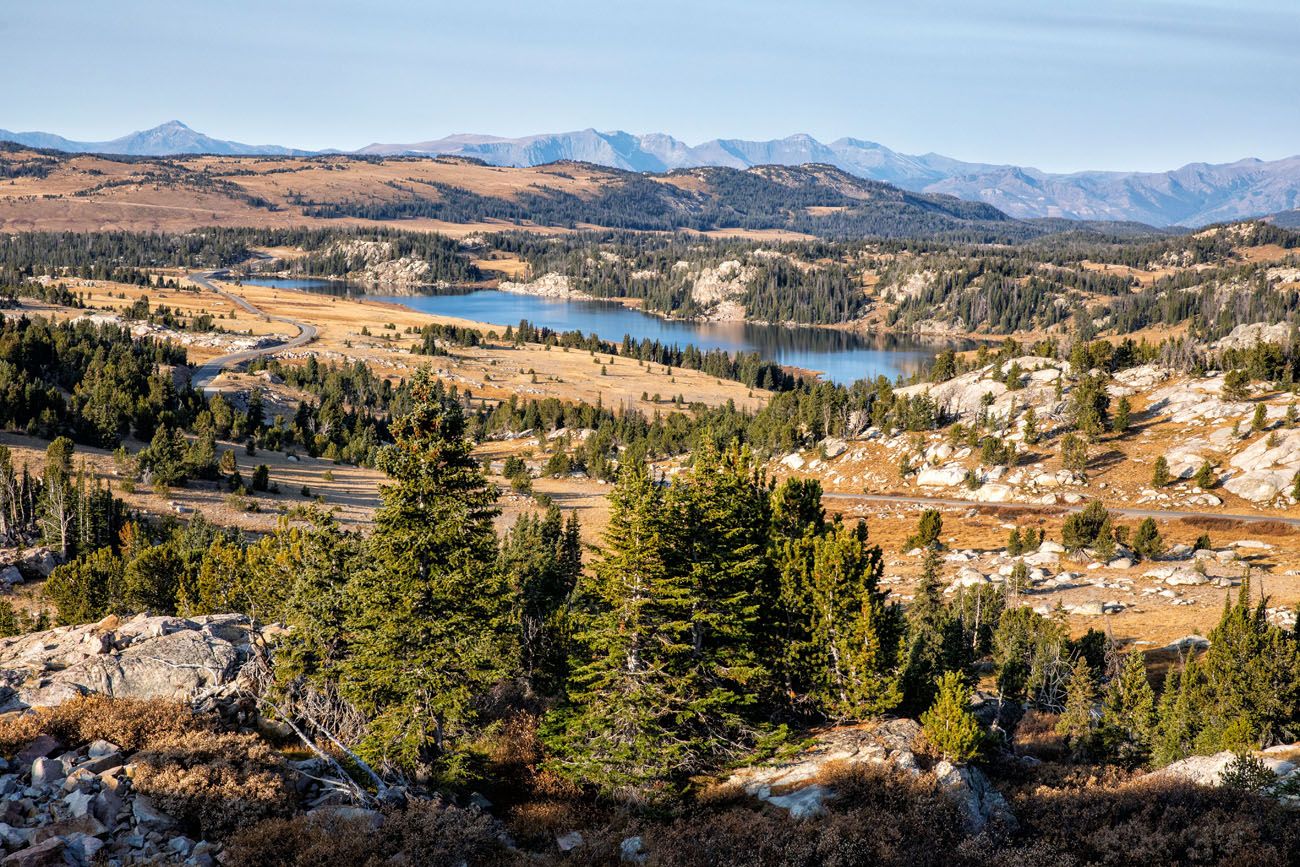
Alpine Lakes
Beyond Beartooth Pass, the road begins to make its descent. A short series of switchbacks brings you to a plateau that is filled with alpine lakes. This is a beautiful part of the drive.
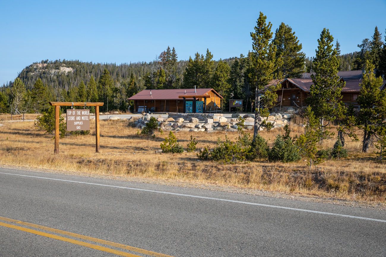
Top of the World Store
This is a great place to stop if you need food, gas, souvenirs, or lodging. At this point, you are 38 miles from Red Lodge and 25 miles from Cooke City.
Beartooth Ravine
Past Top of the World Store, you reach Beartooth Lake. This is also the location of a multi-million dollar road construction project, where a 420 foot long bridge was erected over Beartooth Ravine.
Clay Butte Fire Lookout Tower
To get here, it is a 3-mile drive up a gravel road. From the overlook, you have a great view of Granite Peak, Montana’s highest peak.
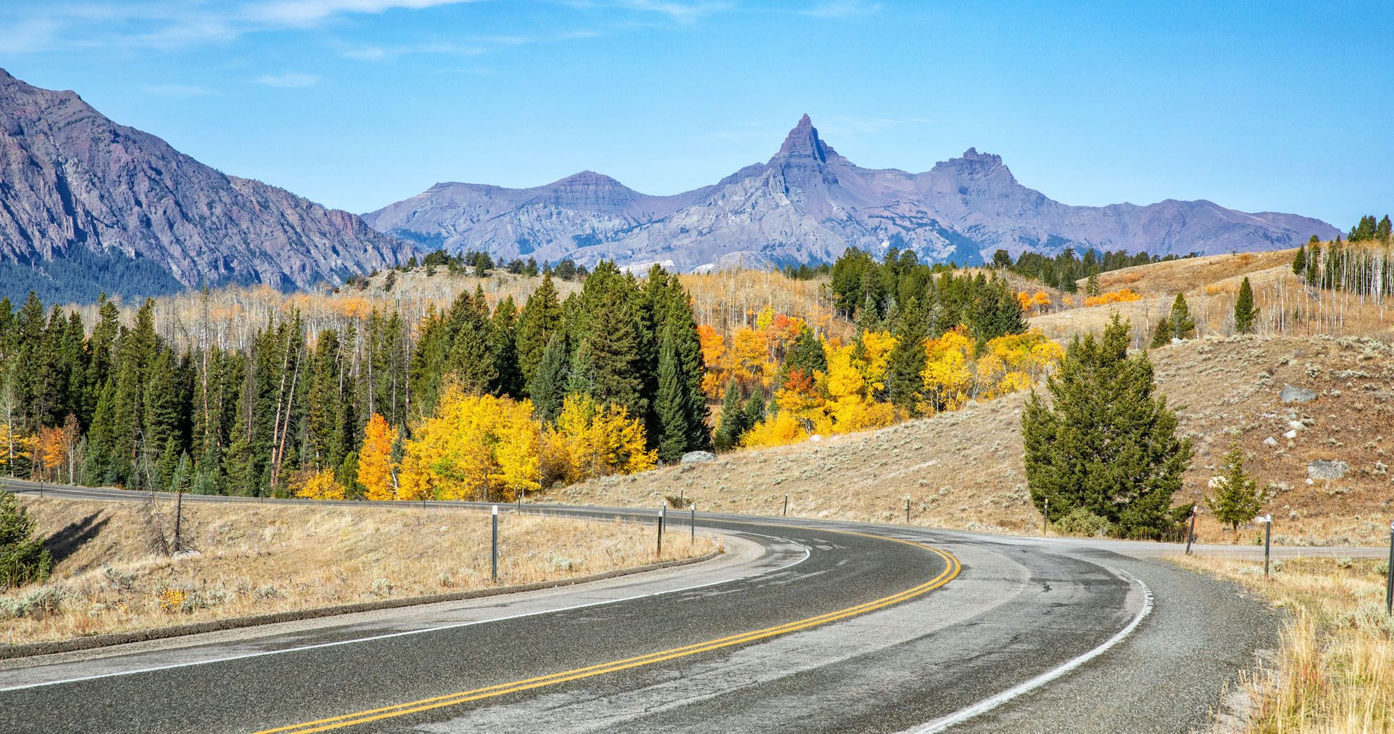
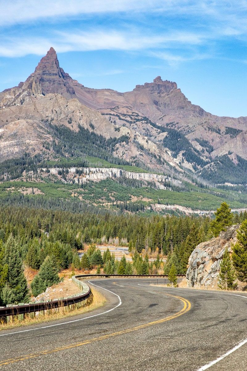
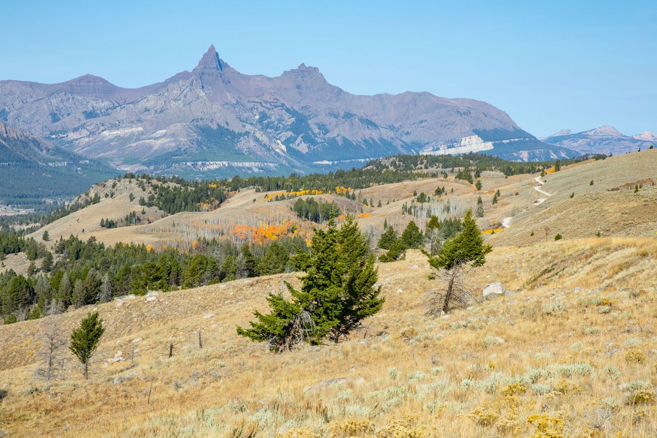
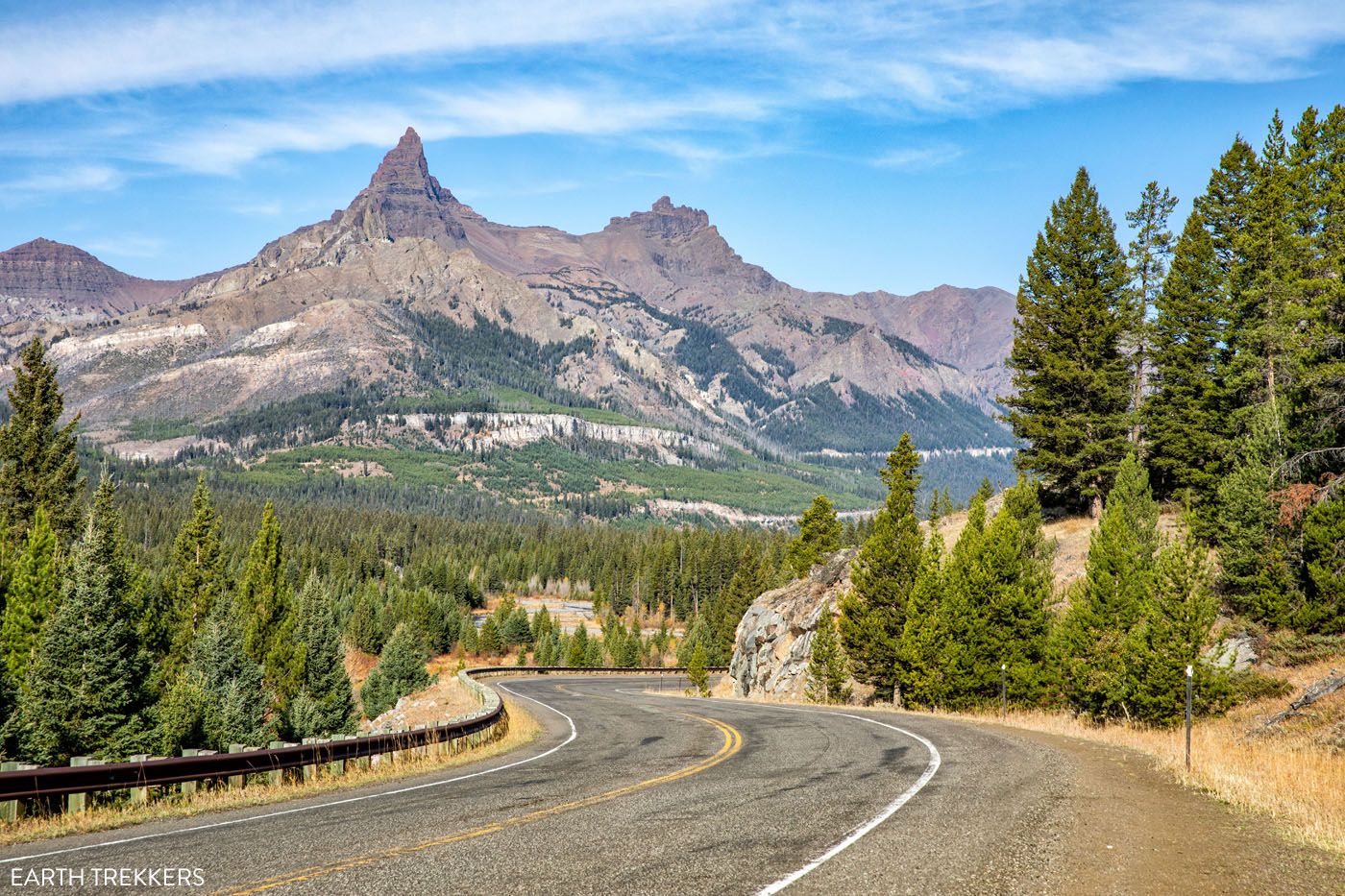
Pilot and Index Peaks Overlook
This overlook, which is also called “Yellowstone Overlook” on Google Maps, offers your first good view of Pilot and Index Peaks. As you drive farther along Beartooth Highway, the views will get even better, but this overlook is still well worth the stop. From this overlook, you also look out over Clark’s Fork River Valley and the Absaroka-Beartooth Wilderness Area.
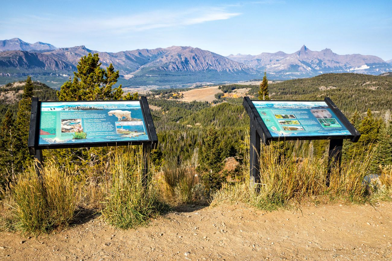
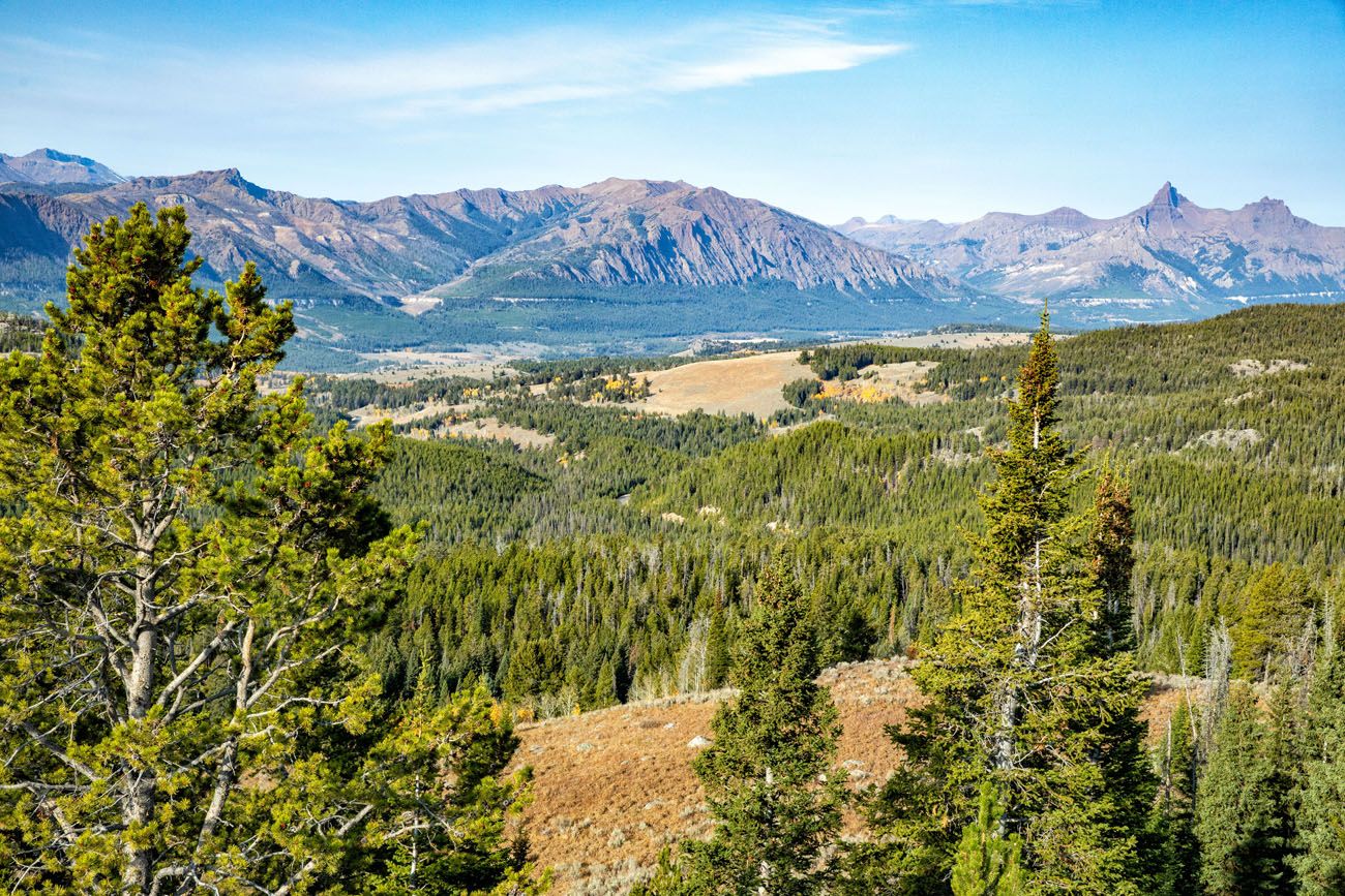
The view from Pilot and Index Peaks Overlook (aka Yellowstone Overlook).
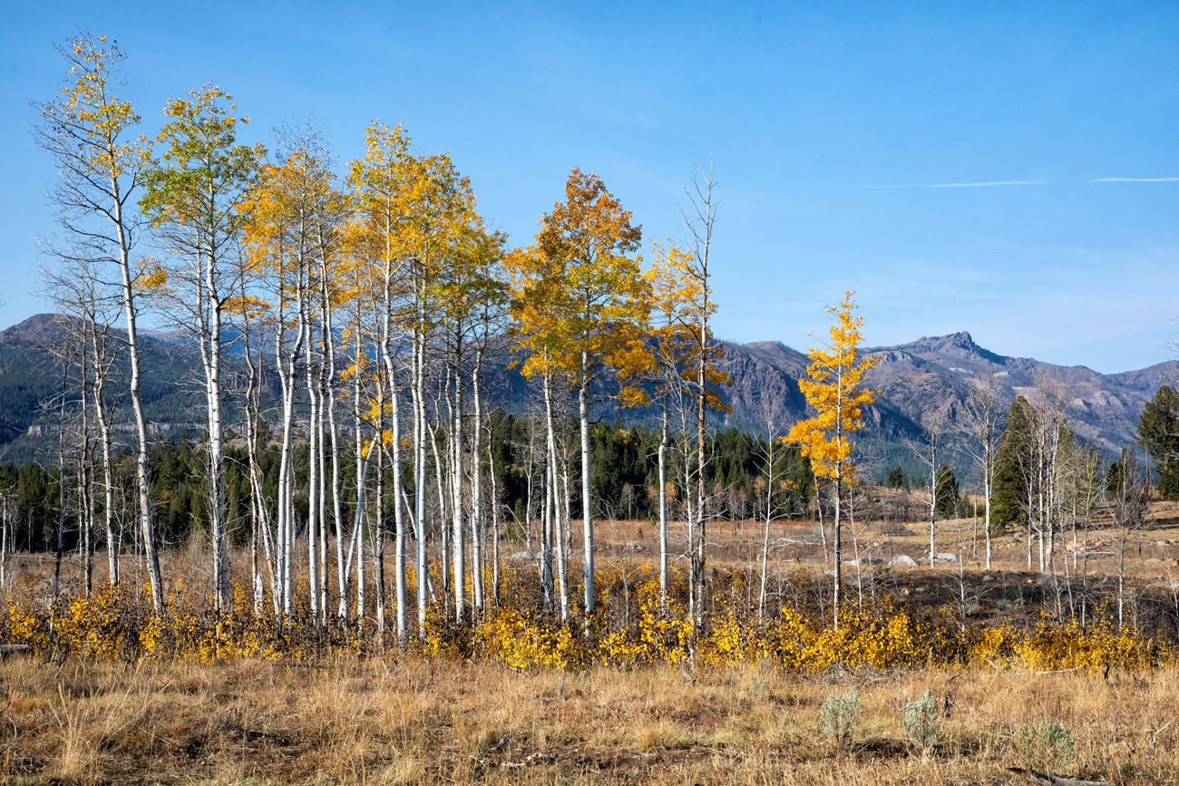
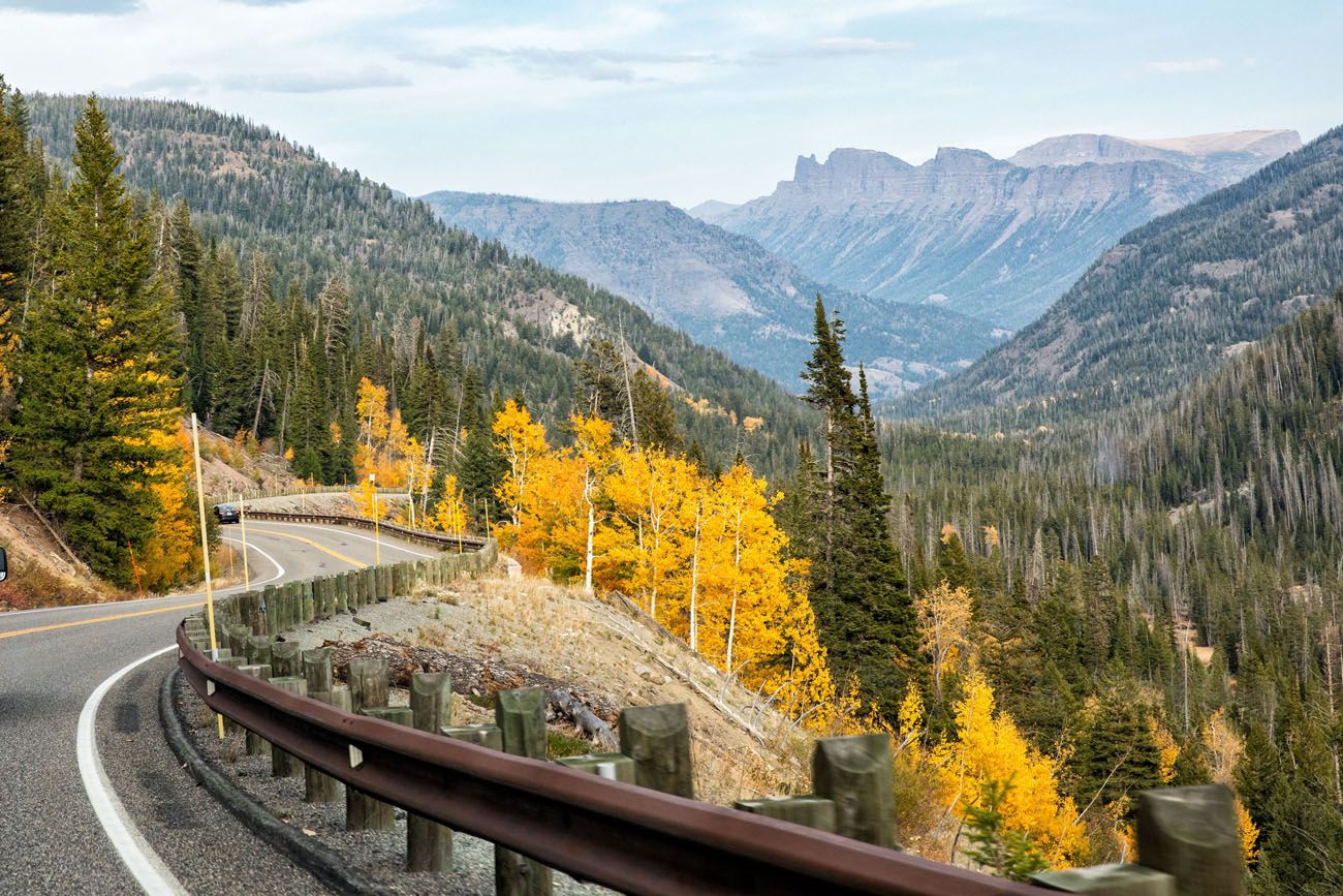
Fall colors in October
Clark’s Fork Overlook
From this pullout, you have another nice view of Clark’s Fork River Valley. There are also restrooms here.
Lake Creek Falls
A 200-yard hike takes you to a viewpoint of this waterfall.
Beartooth Highway
Chief Joseph Scenic Byway
At this intersection, you can turn left to take Chief Joseph Scenic Byway.
This road is named for the last chief of the Nez Perce Indians. Signs along the drive tell the tale of the flight of Chief Joseph’s band of Nez Perce. This scenic drive leads to Cody, Wyoming. It is a maintained road and is open all year, although it can briefly close after a big snowfall.
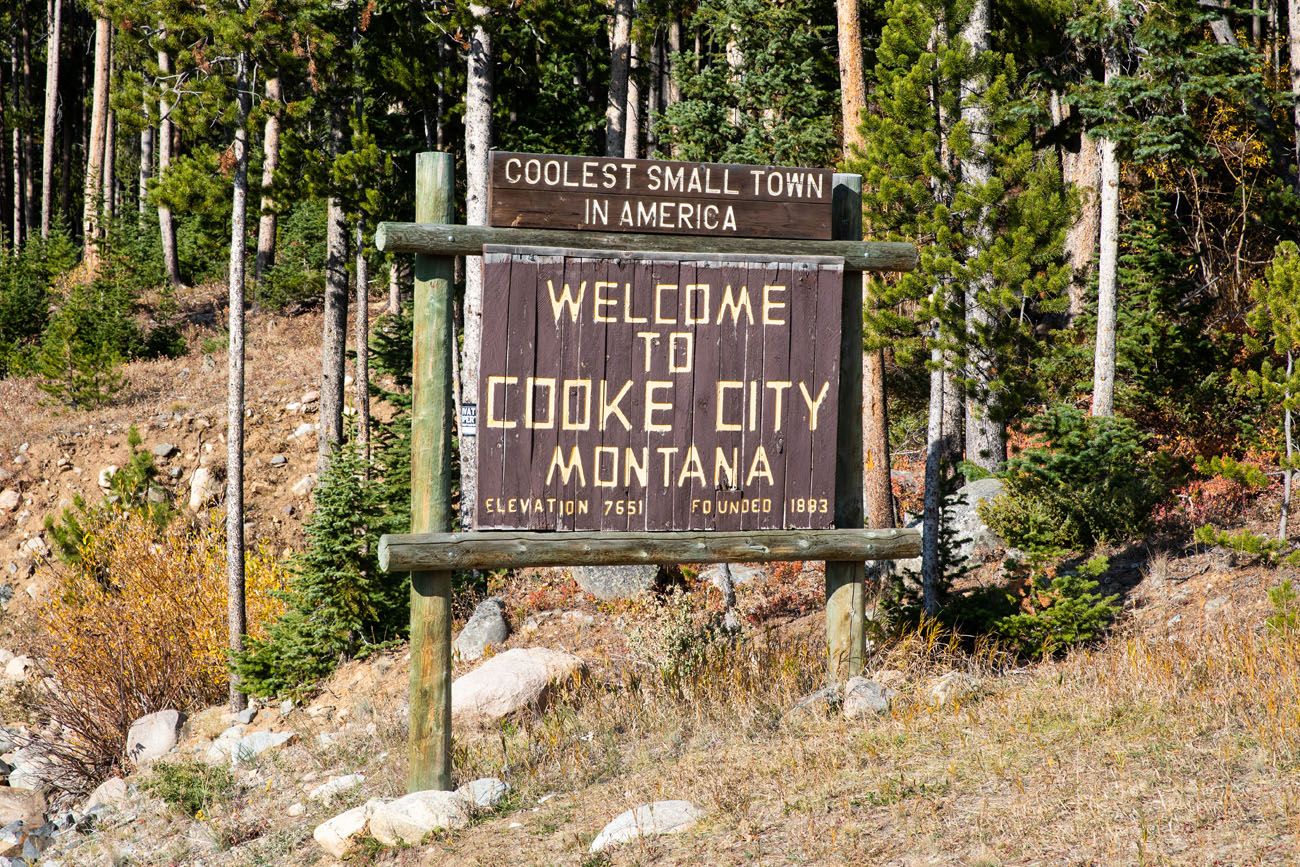
Cooke City – Silver Gate
At 7,600 feet, Cooke City lies 4 miles east of Yellowstone National Park. It was founded as a mining camp and is now a haven for tourists, with restaurants, souvenir shops, and lodging.
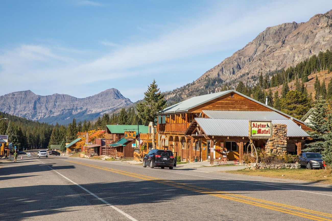
Cooke City
A little farther down the road is Silver Gate, another cluster of lodges and restaurants.
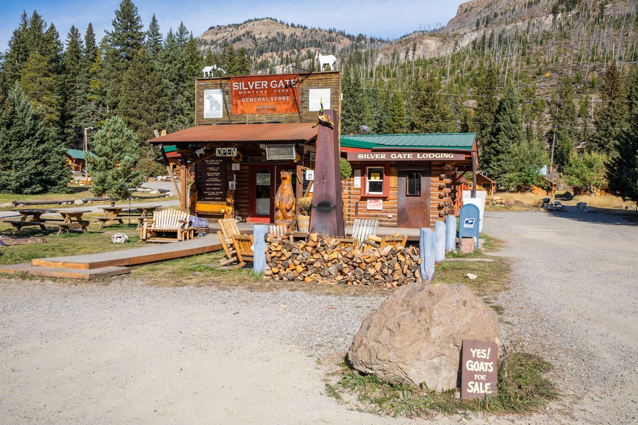
If you need a bite to eat before entering Yellowstone National Park, this is your last stop. From here, the next facilities are at Tower and Mammoth, inside the park.
This is the end of Beartooth Highway. Beyond this point, you enter Yellowstone National Park through the northeast entrance. Just beyond this entrance lies Lamar Valley, one of the best places in the park for wildlife viewing.
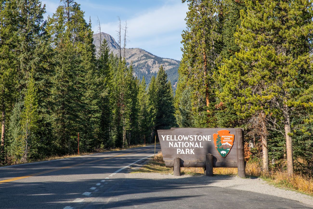
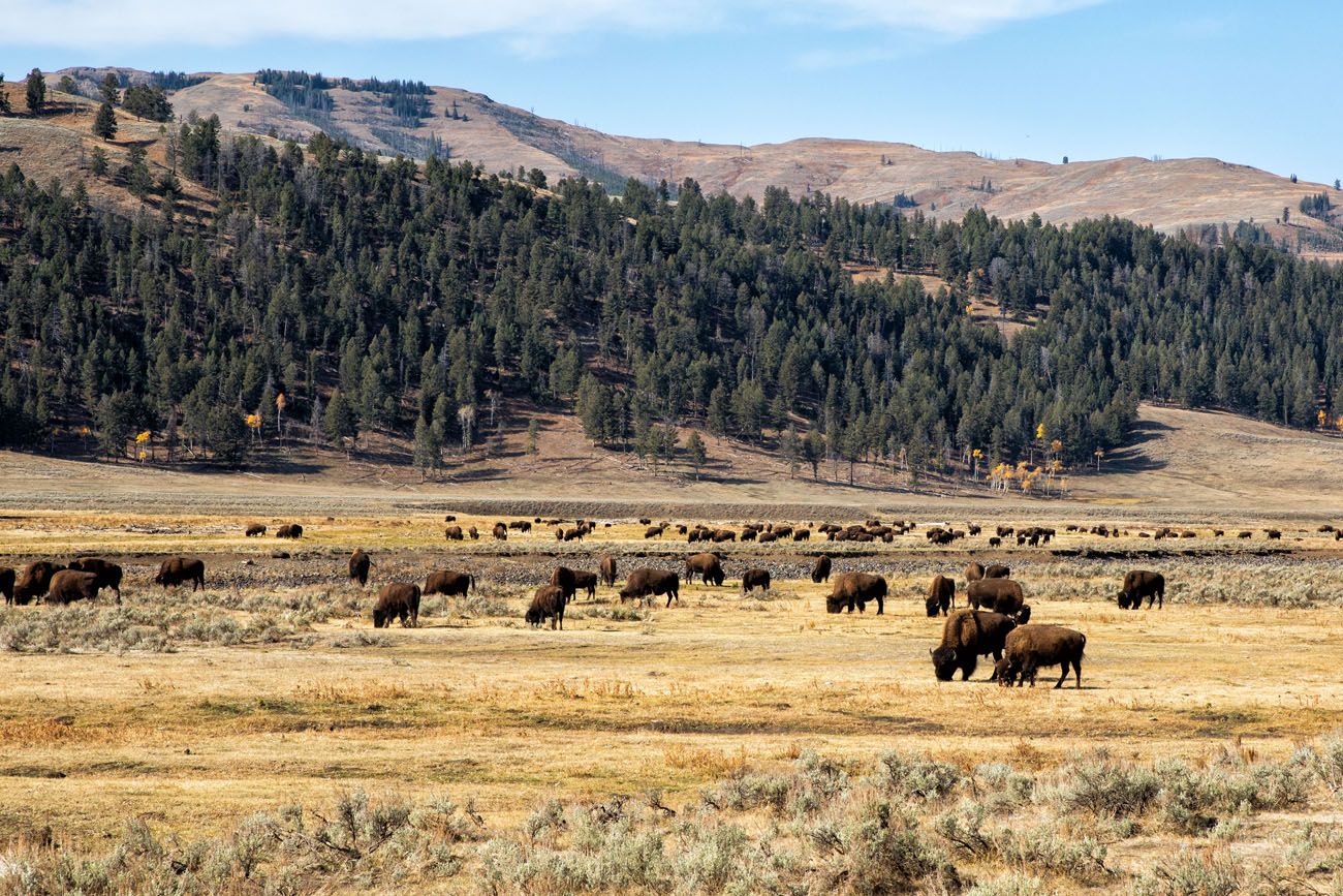
Lamar Valley
Is Beartooth Highway Dangerous?
Beartooth Highway is not considered dangerous for most drivers, but it is a high-elevation mountain road with steep grades and winding switchbacks. The road is fully paved and well maintained, with guardrails and frequent pullouts along much of the route.
Drivers should use caution during poor weather, as snow, fog, or strong winds can occur even in summer at higher elevations. Taking your time, driving slowly on curves, and checking weather conditions before your trip will make the drive safe and enjoyable.
Our Experience Driving Beartooth Highway
The Beartooth Highway is one of the most spectacular scenic drives we have done in the USA, rivaling Going-to-the-Sun Road in Glacier National Park, Trail Ridge Road in Rocky Mountain National Park, and the Big Sur Coast Highway in California.
It is a thrilling drive from start to finish. And what an awesome way to enter Yellowstone National Park.
We unfortunately did not have time to drive Chief Joseph Scenic Byway, which I have also heard is very nice. We had one day to drive Beartooth Highway, through Yellowstone, and out to Cody. And the drive from the east entrance of Yellowstone to Cody is another underrated scenic drive.
Wild Bill Cody Scenic Byway
How to Add Beartooth Highway onto Your Visit to Yellowstone
One of the best ways to experience Beartooth Highway is by adding it to a Yellowstone National Park road trip, either as a scenic entrance into the park or as a half-day excursion from Yellowstone.
Driving Beartooth Highway When Entering Yellowstone
If you have plans to enter or exit Yellowstone through the northeast entrance, or if you plan to stay in Cooke City-Silver Gate, you will be at the start of Beartooth Highway, so adding on this drive is easy. Just make sure your dates of travel are from June through early October, when this road is typically open.
Driving Beartooth Highway as a Day Trip from Yellowstone
If you have a few days in Yellowstone and want to add on this scenic drive, you will have to set aside at least half of a day.
From the northeast entrance, it will take about an hour and a half to drive to the Rock Creek Vista, which is the overlook just before the big switchbacks into Rock Creek Canyon. You can turn around at this point, or go all the way to Red Lodge, stopping in town for lunch.
To return to Yellowstone, you can retrace the route along Beartooth Highway, and then drive through Lamar Valley in the afternoon, a great time to be here.
Or, if you really like scenic drives, return on Beartooth Highway, turn left onto Chief Joseph Scenic Byway, and take this to Cody. From Cody, it takes an hour to drive to the east entrance but it is another beautiful drive (this is called the Buffalo Bill Cody Scenic Byway).
If you do Beartooth Highway → Chief Joseph Scenic Byway → Buffalo Bill Cody Scenic Byway → east entrance of Yellowstone, this will take one full day.
Plan Your Yellowstone Trip
Planning to visit Yellowstone National Park? Beartooth Highway makes an incredible addition to a Yellowstone road trip, especially when entering or exiting the park through the northeast entrance near Lamar Valley.
To help you plan your visit, take a look at our detailed Yellowstone guides:
- Yellowstone National Park Travel Guide – everything you need to know about when to visit, where to stay, and how to plan your trip
- Yellowstone Itinerary Ideas – suggested routes for 1 to 5 days in the park
- Best Things to Do in Yellowstone – geysers, wildlife viewing areas, and must-see highlights
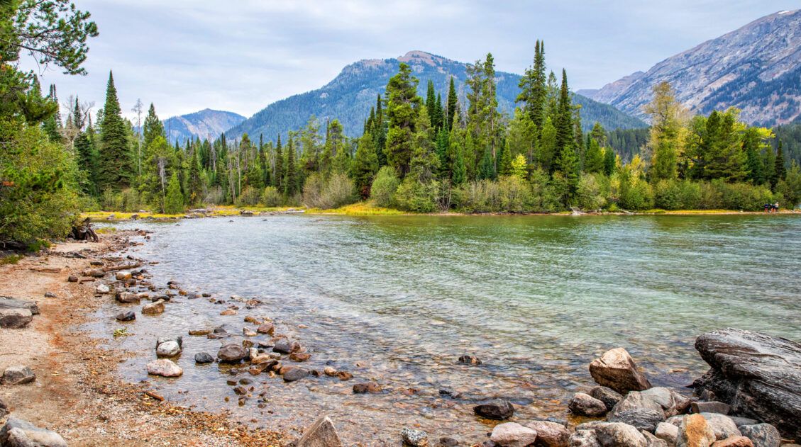
If you are road-tripping through the region, you can also combine Yellowstone with nearby destinations such as Grand Teton National Park or continue east toward Cody, Wyoming via another scenic drive.
For more ideas and travel inspiration in Yellowstone and the surrounding region, explore our guides below.
If you have any questions about Beartooth Highway, or if you would like to share your experience, let us know in the comment section below.
The Ultimate Yellowstone & Grand Teton Itinerary for First Timers
Yellowstone and Grand Teton are two of the most popular national parks in the USA. These two parks sit by side and together they create an incredible vacation destination. Hike into the Tetons, explore the geyser basins and hot springs in Yellowstone, and spot elk, bison and bear as you tour the parks. If you […]
Where to Stay in Yellowstone in 2026: Best Hotels and Locations
When planning a trip to Yellowstone, one of the biggest questions you might have is “where should I stay?” Yellowstone National Park is massive, with multiple park entrances and thousands of acres of land to explore. Choosing where to stay in Yellowstone might feel overwhelming, but it doesn’t have to be. In this guide, we […]
Yellowstone, Devils Tower, and Mount Rushmore: 10 Day Road Trip Itinerary
This is one of the best road trips in the USA. With 10 days, you can visit Yellowstone, Devils Tower, and Mount Rushmore, but that’s not all. You also have enough time to visit the highlights of Grand Teton, day trip out to Badlands National Park, spend some time at Wind Cave National Park, and […]
Best USA Road Trips: 18 Ideas for Your Next Big Adventure
One of the best ways to explore the USA is on a good old-fashioned road trip. Cruise along Route 66, road trip through the Florida Keys, explore the American Southwest, or even drive from coast to coast. In this guide, we share 18 of the best USA road trips…18 great ideas for your next big […]
How to Drive between Mount Rushmore and Yellowstone
At first you might be wondering, why write a post about how to drive from Mount Rushmore to Yellowstone? Sounds easy, right? Just connect the two points on a map and pick the quickest route. But what if I told you that you had several options and each of these included a different but very […]
The Ultimate Guide to the 63 US National Parks
Stretching from the South Pacific, across the United States to the Caribbean, are 63 national parks. These national treasures preserve iconic landscapes, majestic mountains, primordial forests, arid deserts, misty coastlines, immense canyons, wildlife, and historic landmarks. The opportunities for adventure are endless. Hiking, rock climbing, rafting, mountain biking, sand boarding, horseback riding, mountaineering, canyoneering, and […]
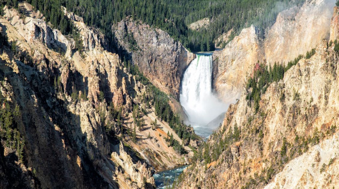
Exactly How to Visit the Grand Canyon of the Yellowstone
The Grand Canyon of the Yellowstone is one of Yellowstone National Park’s top attractions. With two rims to visit, multiple viewpoints, and several hiking trails, there is a lot to do here. In this guide, we share the best things to do at the Grand Canyon of the Yellowstone with tips to help you plan […]
Grand Teton, Yellowstone and Glacier National Parks: 10 Day Road Trip Itinerary
Grand Teton, Yellowstone, and Glacier National Parks are three of the most spectacular parks in the United States, and with 10 days, you can visit all three on one unforgettable road trip. Start in Grand Teton, where the lakes and the jagged mountain range create a hiker’s and photographer’s paradise. Journey north to Yellowstone, a […]
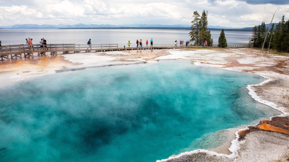
Geyser Basins in Yellowstone: Which Ones Are Worth the Visit?
Yellowstone National Park has the highest concentration of geothermal features of anywhere else on earth. The land literally smokes, bubbles and hisses. Numerous geysers erupt on a regular basis, including the most famous geyser in the world, Old Faithful. In this post, learn how to visit the geyser basins in Yellowstone National Park and which […]
Best US National Parks to Visit Month-By-Month
Best National Parks to Visit Month-By-Month When planning a trip to the national parks, one of the most important things to consider is the time of year that you are planning your visit. With a few exceptions, most national parks have an optimal time to visit, based on factors such as weather, crowd levels, and […]
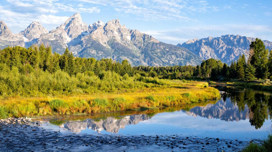
15 Best Things to Do in Grand Teton National Park
Jagged mountain peaks, lush meadows, scenic lakes, the winding Snake River, historical sites, and miles of hiking trails…this is Grand Teton National Park. If you are looking for the best things to do in Grand Teton National Park, we have lots of great information to share with you. There is something here for everyone. Families […]
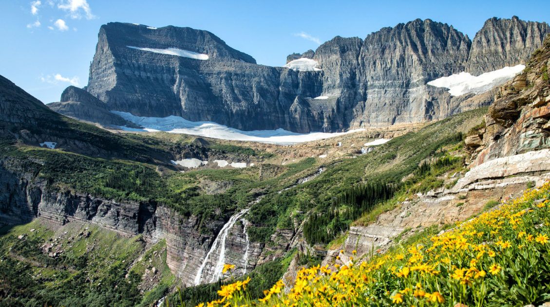
10 Best Hikes in Glacier National Park (Easy Walks to Epic Day Hikes)
Looking for the best hikes in Glacier National Park? From the breathtaking Highline Trail and the scenic walk to Hidden Lake Overlook to the unforgettable hike to Grinnell Glacier, Glacier National Park is home to some of the most spectacular trails in the United States. We’ve visited Glacier National Park multiple times, hiking trails across […]
United States Travel Guide: Places to Visit in the USA
Plan your visit to the United States. Learn about the best things to do, how to plan your time, road trip ideas, and sample itineraries.
Montana Travel Guide: Places to Visit in Montana
Montana Travel Guide Experience Montana, a state nicknamed the Big Sky Country for its beautiful natural scenery and vast untouched lands. Here you can explore the mountains in Glacier National Park, ski at one of America’s top resorts, and embrace the western culture of Montana’s cities. Additionally, the state is rich in gold rush history […]

Comments 25