From bridges, caves, hamlets, and impressive views of the finish line, the final stage of the Walker’s Haute Route has it all. Every step brings you closer to the end goal of Zermatt, a beautiful town that’s renowned for its skiing and hiking. Enjoy the views along the way, as they only get better the further you go.
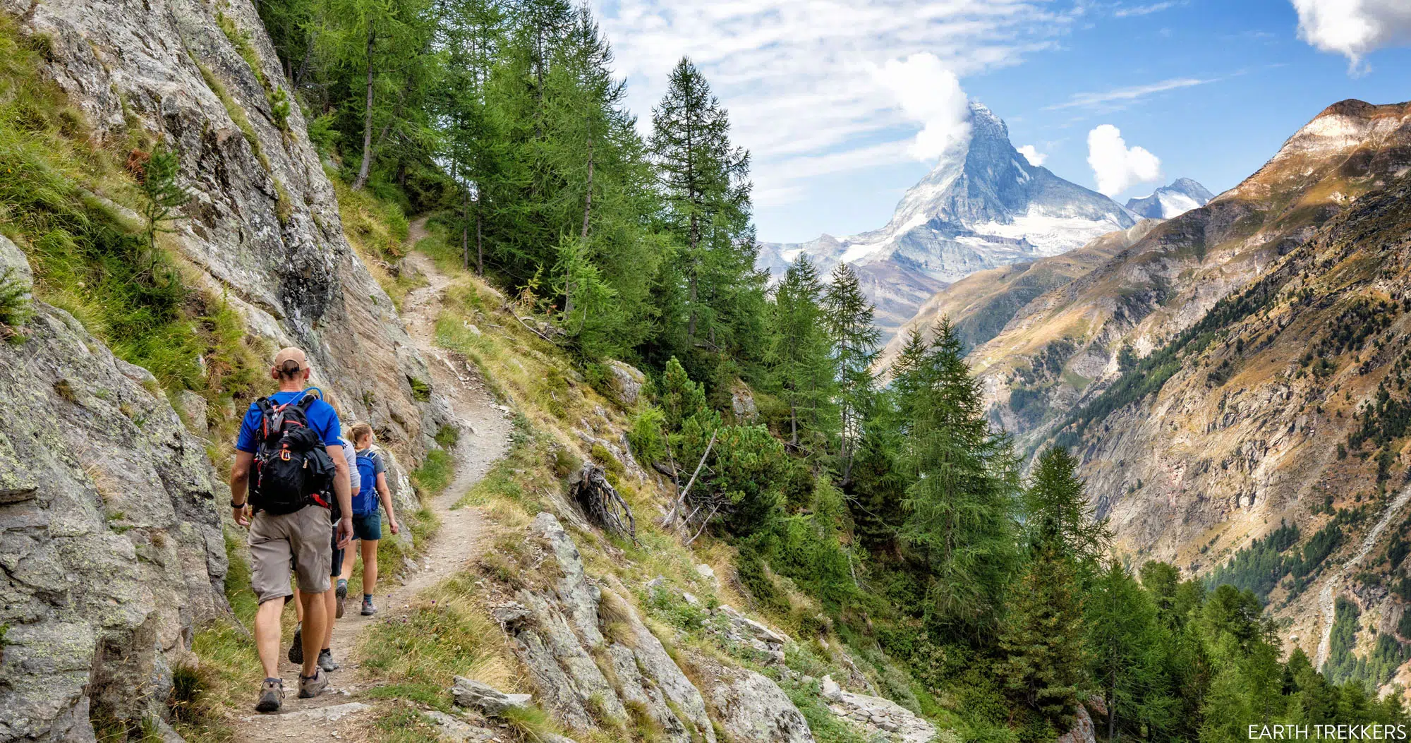
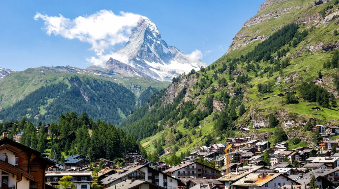
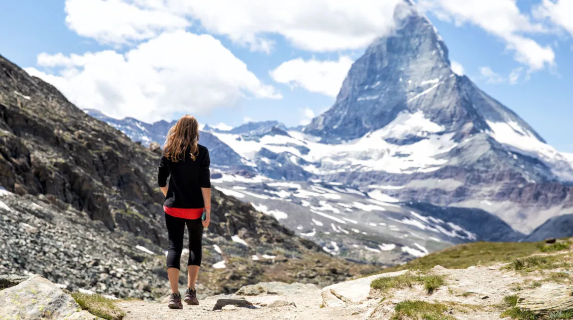
The Haute Route really saves the best for last, as this was one of our favorite stages of the entire trek. Early in the day, the Matterhorn comes into view, and wow, it’s thrilling to finally see it in all of its majesty.
This final stage is fun to hike, not overly difficult (although it is one of the longest stages in terms of distance), and the views truly are some of the best of the entire Haute Route.
Savor this final day, take tons of photos, and enjoy those spectacular views of the Matterhorn and Zermatt.
IMPORTANT: A portion of the Europaweg is closed due to a recent rockfall. This post on the Hiking Club explains where the rockfall is located and how to detour around it.
Walker’s Haute Route Stage 14 Hiking Stats
Distance: 20.7 km (12.8 miles)
Difficulty: Moderate to strenuous
Total Ascent: 915 m (3,000 feet)
Total Descent: 1,525 m (5,000 feet)
Lowest Elevation: 1,640 m (5,380 feet)
Highest Elevation: 2,340 m (7,680 feet)
Elevation at Europahütte: 2,275 m (7,465 feet)
Elevation in Zermatt: 1,640 m (5,380 feet)
Average Time: 7 hours; our time: 6 hours 15 minutes (including stops)
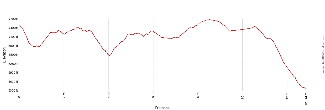
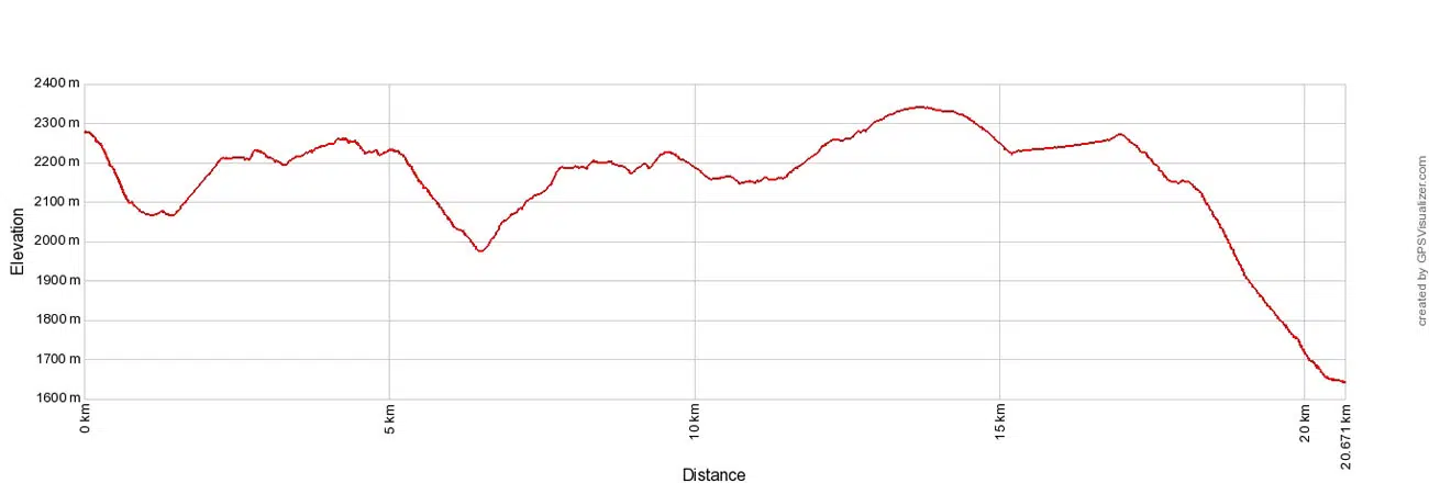
Walker’s Haute Route Stage 14 Europahütte to Zermatt Elevation Profile
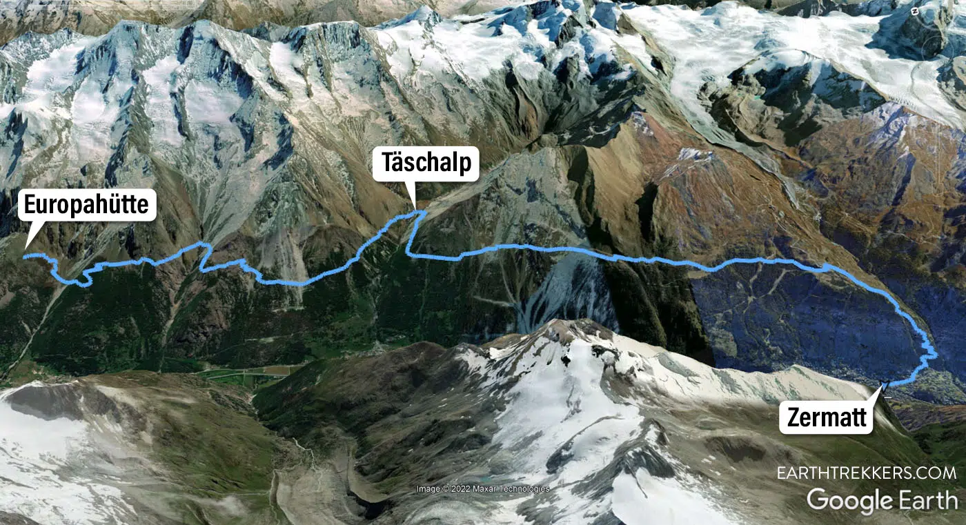
Walker’s Haute Route Stage 14 Map
Please practice the seven principles of Leave No Trace: plan ahead, stay on the trail, pack out what you bring to the hiking trail, leave areas as you found them, minimize campfire impacts, be considerate of other hikers, and do not approach or feed wildlife.
Walker’s Haute Route Stage 14 Trail Overview
To hike the Haute Route, we highly recommend following the trail descriptions in the book Trekking Chamonix to Zermatt, The Classic Walker’s Haute Route by Kev Reynolds. Below we list an overview of the day, so you know what to expect along the way. We also provide advice on where to eat and where to stay. Later in this guide, we list a few tips and trail clarifications to be used with the Trekking Chamonix to Zermatt book.
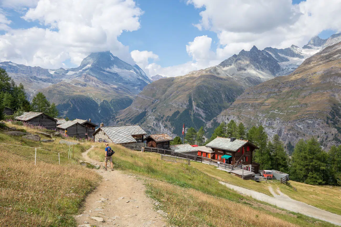
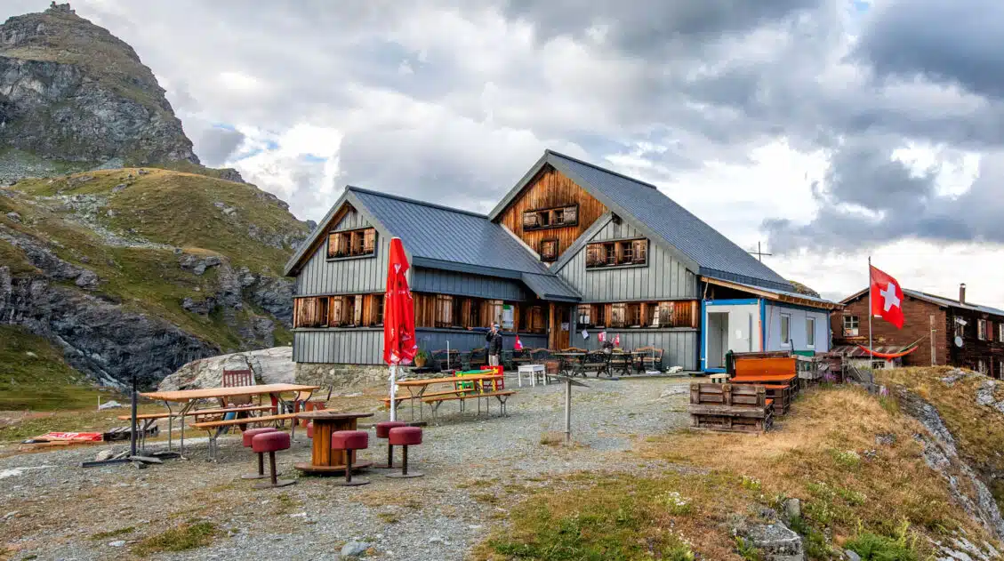
Europahütte to Täschalp
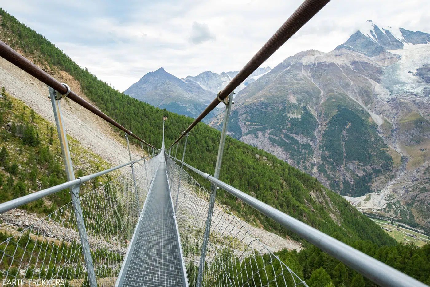
Departing from Europahütte, you’ll follow a short but steep rocky trail that descends to the Charles Kuonen Suspension Bridge.
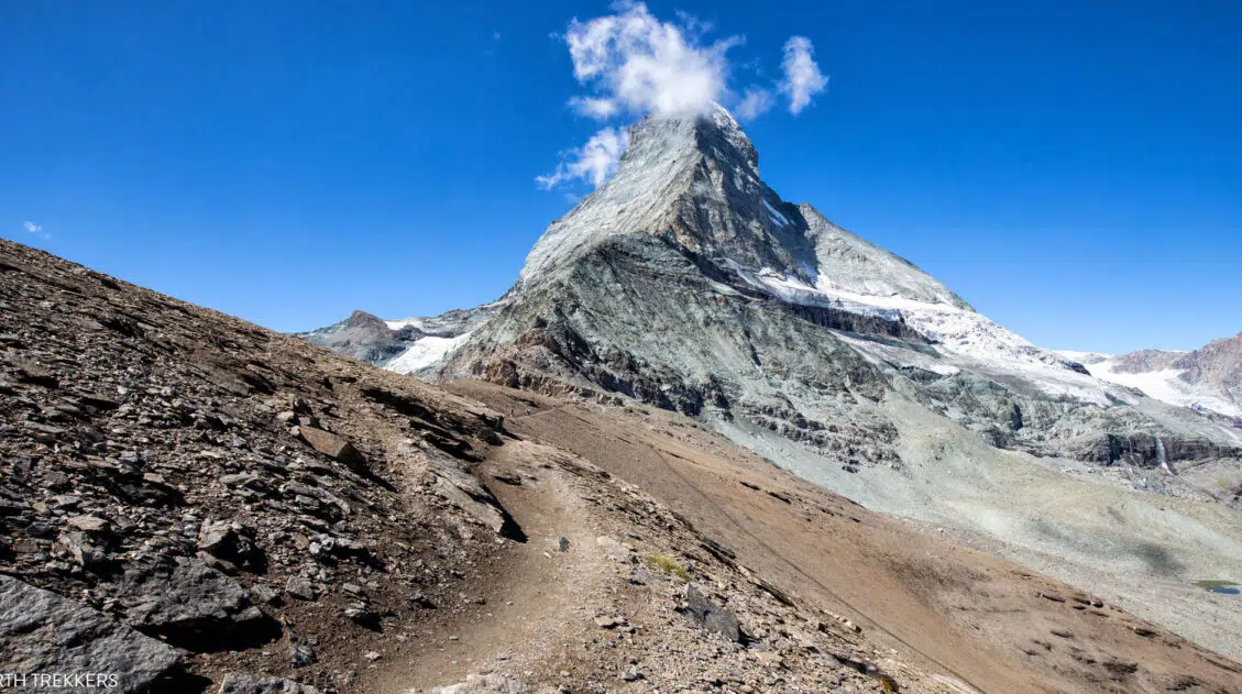
You may have noticed this bridge while at Europahütte, as it is hard to miss. As you approach the bridge, on a clear day you’ll even get your first view of the peak of Matterhorn (but it only lasts a moment and you will have to hike several more kilometers until it comes into view again).
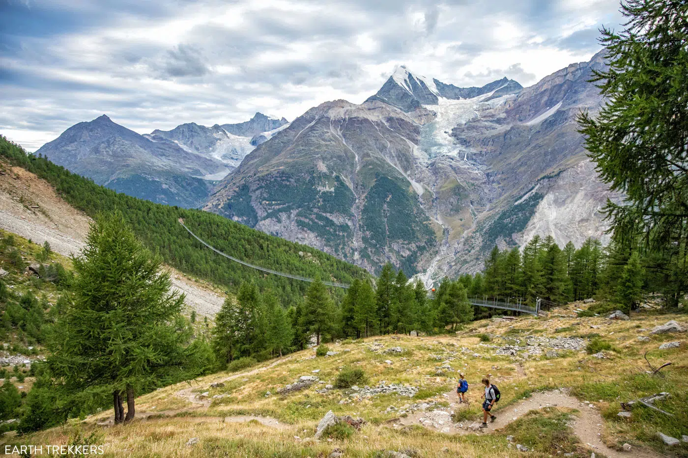
You’ll reach the suspension bridge 30 minutes into today’s stage. When it was built in 2017, this was the longest suspension footbridge in the world. Since that time, it has been surpassed by other suspension bridges, such as the Sky Bridge 721 in 2022. However, the Charles Kuonen Suspension Bridge remains the longest suspension bridge in the Alps (as of 2024).
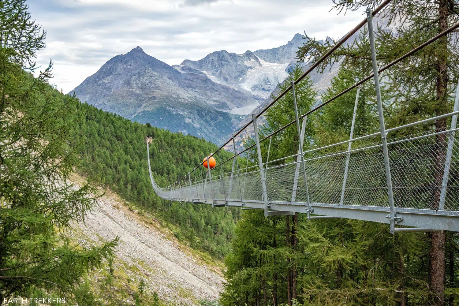
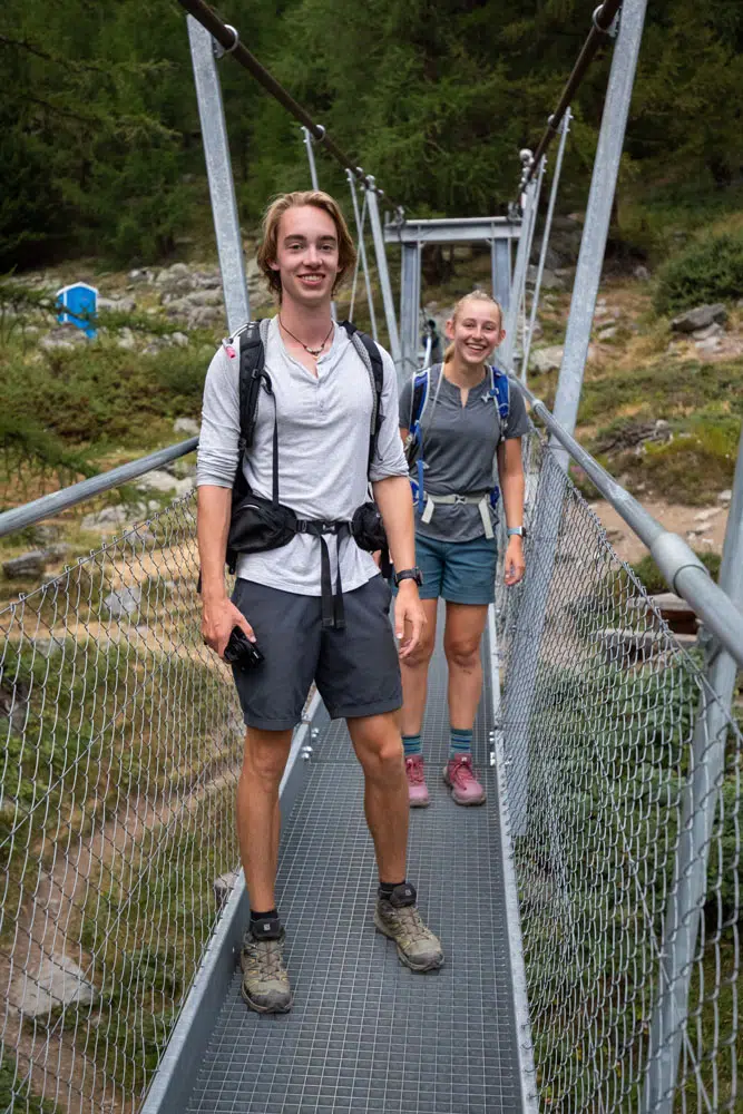
If you get an early start, you could have the bridge all to yourself.
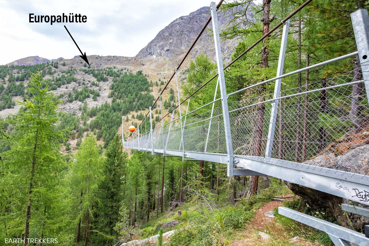
This is the view from the opposite end of the bridge so you can see the location of the Europahütte.
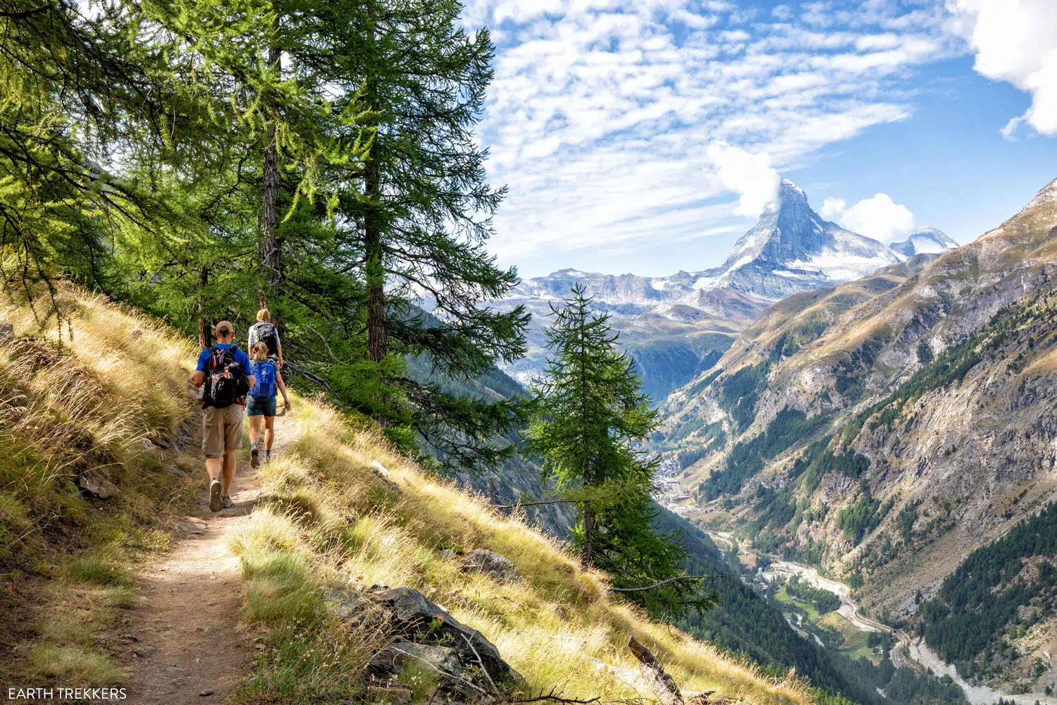
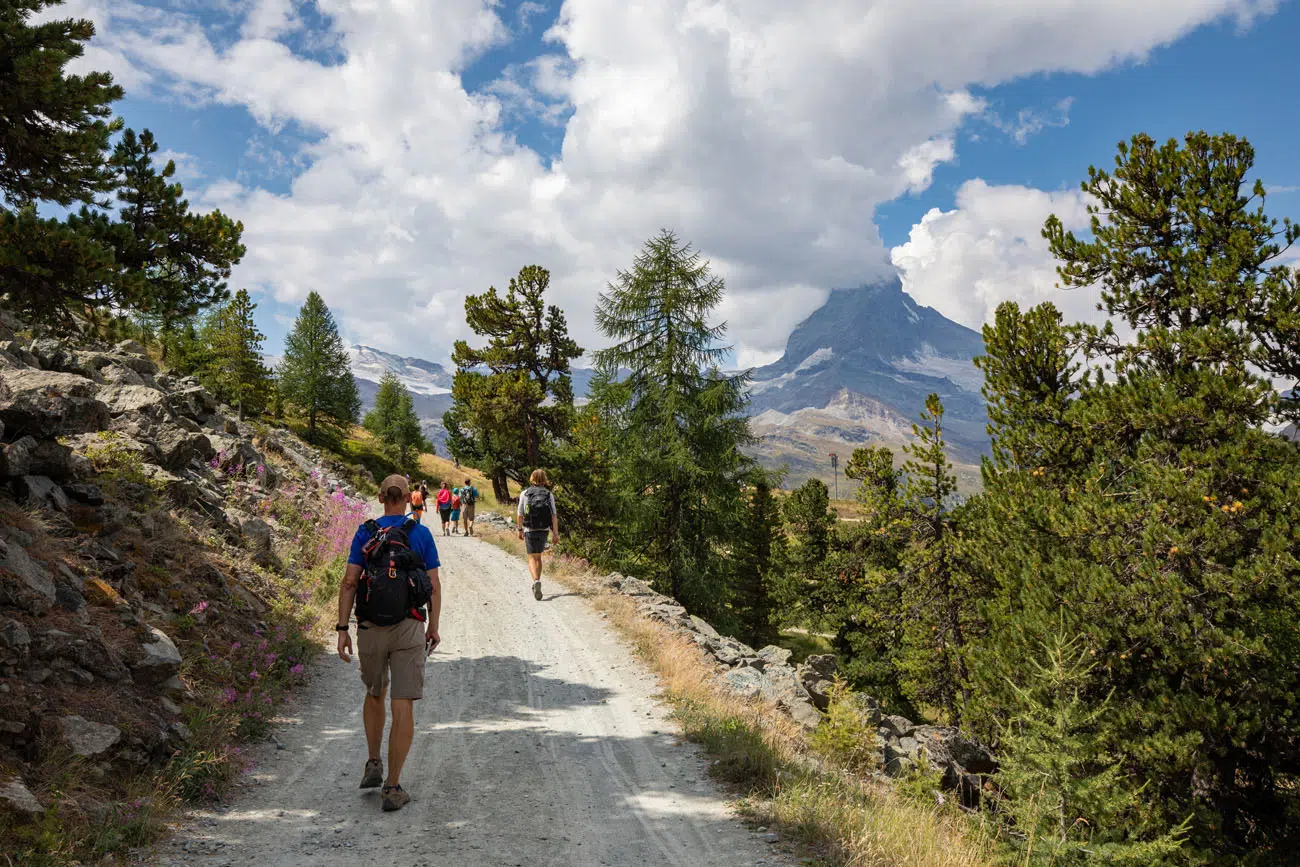
After crossing the bridge, the trail will climb gradually through the woods. From here on out, follow trail signs for Zermatt!
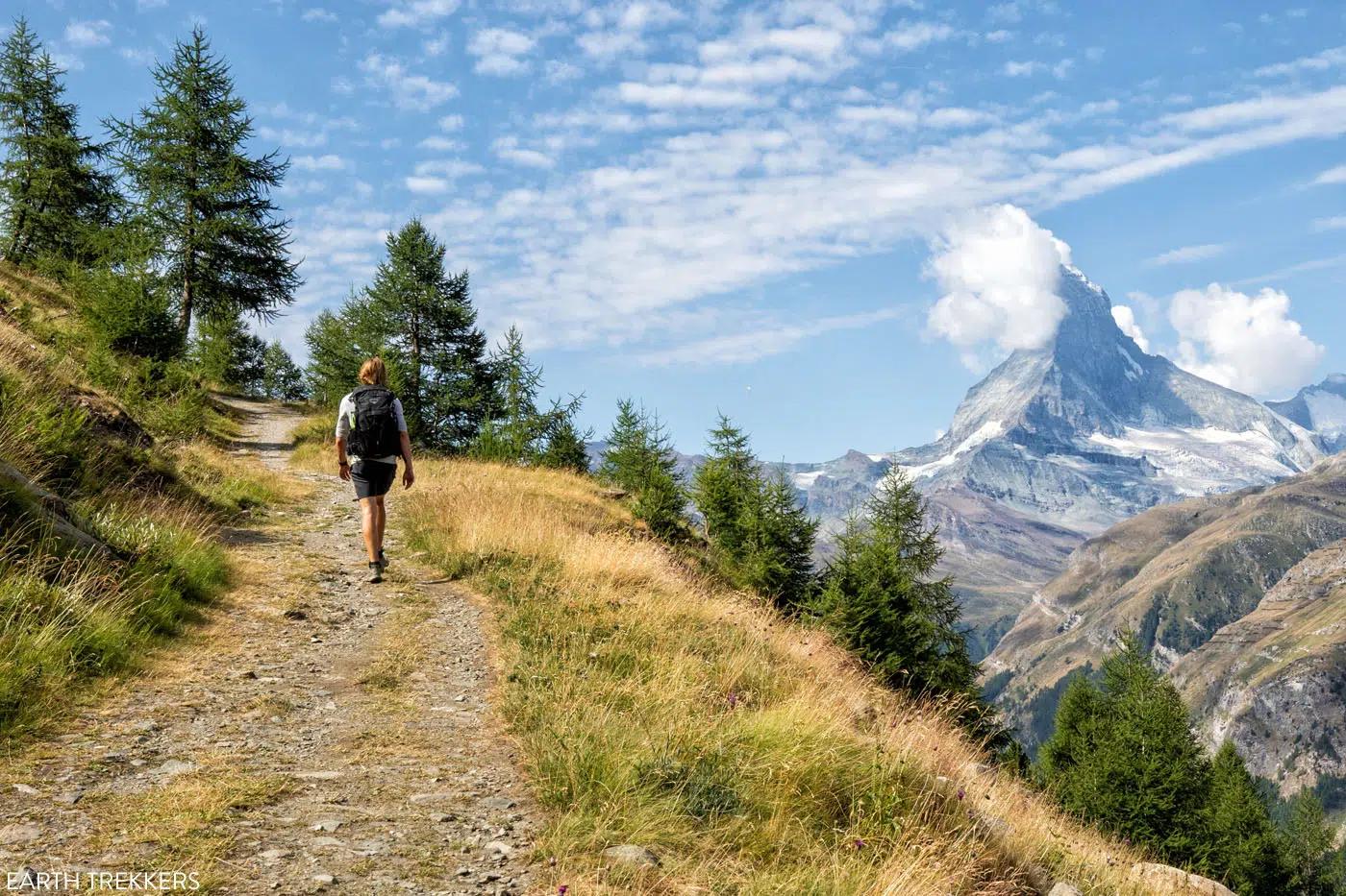
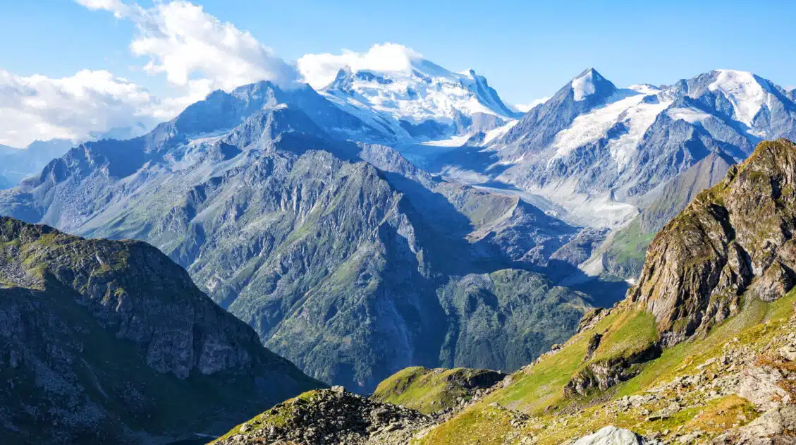
Once you exit the woods, you’ll be able to see the tip of the Matterhorn. As you near Zermatt, the views will only get better and you will be able to see more of this iconic mountain (given that it’s a clear day).
It’s hard to see, but you can see a sliver of the Matterhorn in the distance.
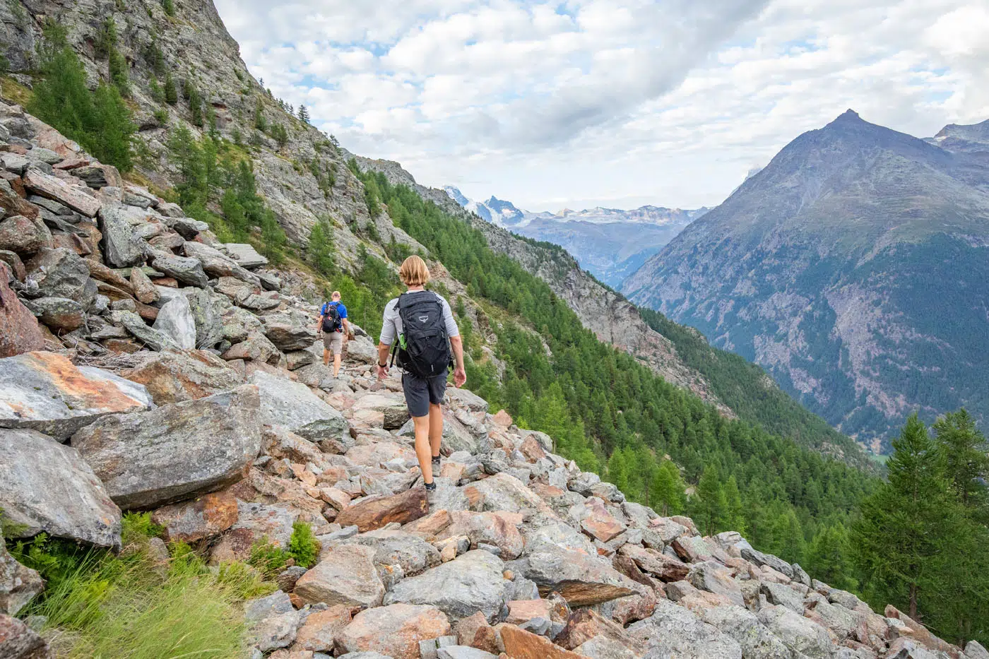
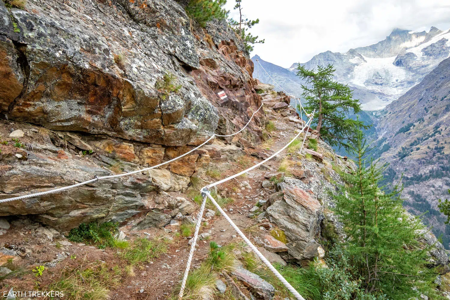
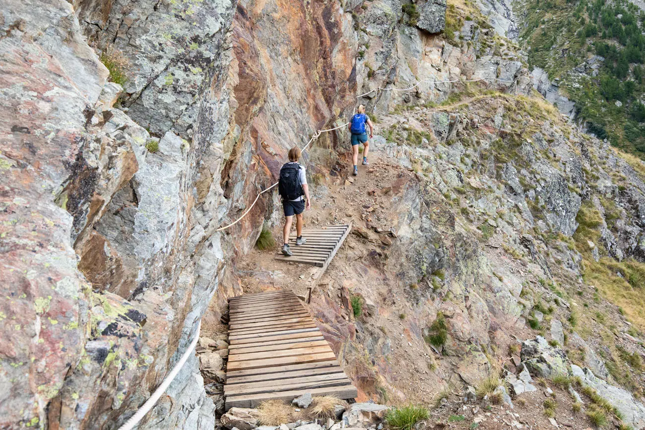
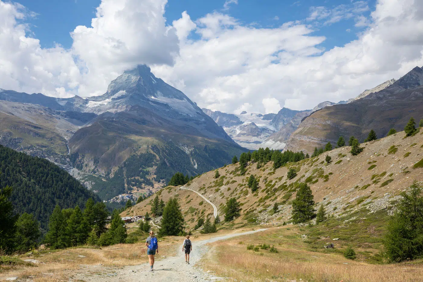
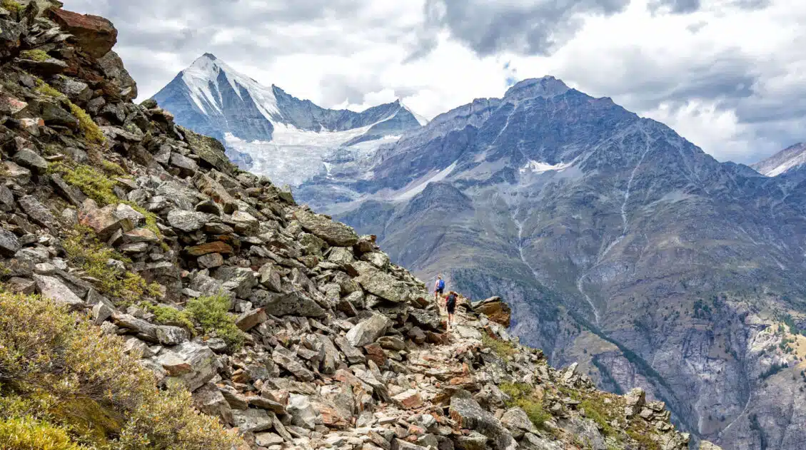
You’ll follow a rocky trail for a while that loops around the mountainside. There will be some steep sections with rope to help yourself up, but these are short and otherwise the trail stays pretty much flat. This part of the trail is a lot of fun to hike.
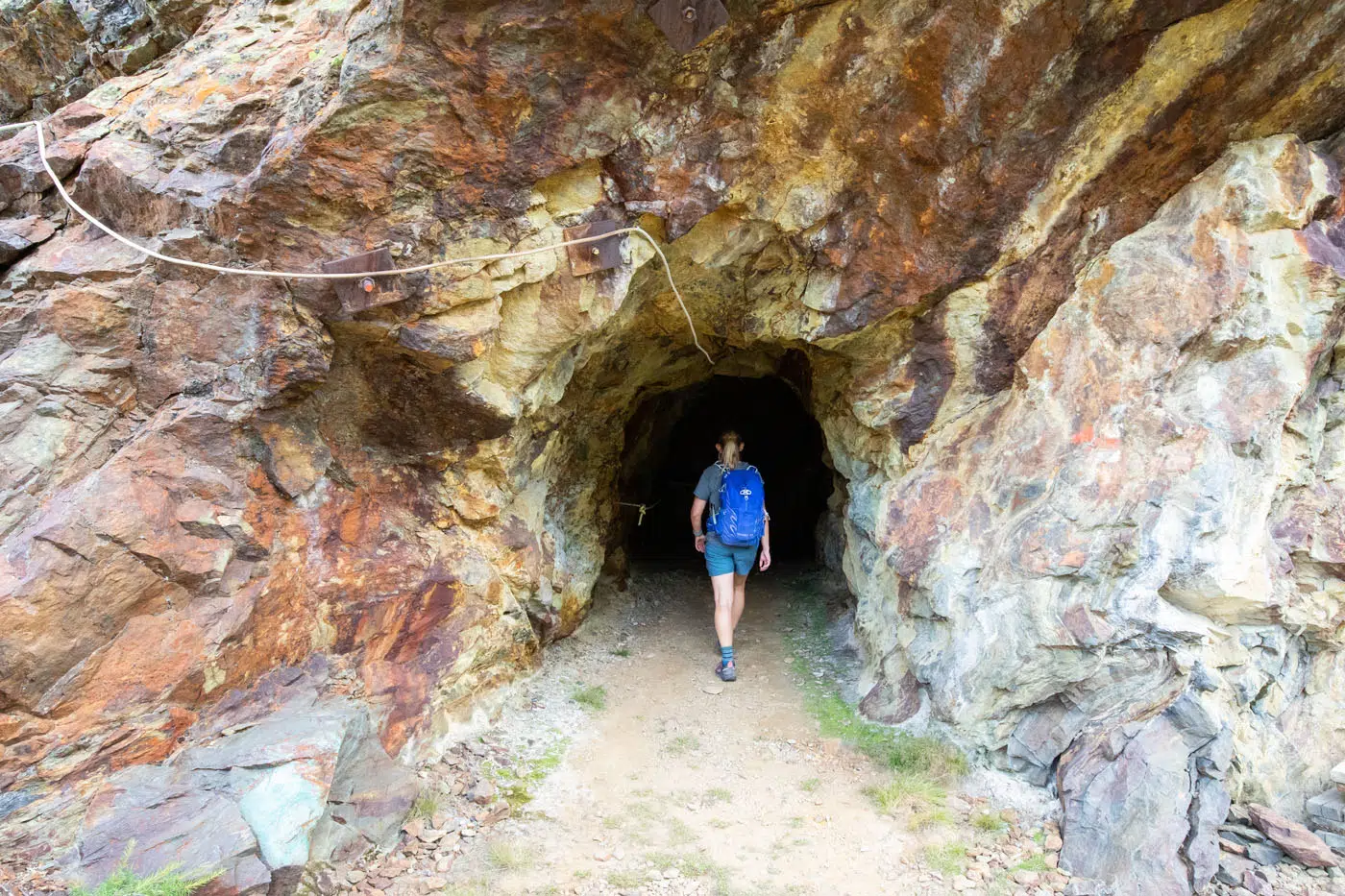
The trail will even lead you through a cave.
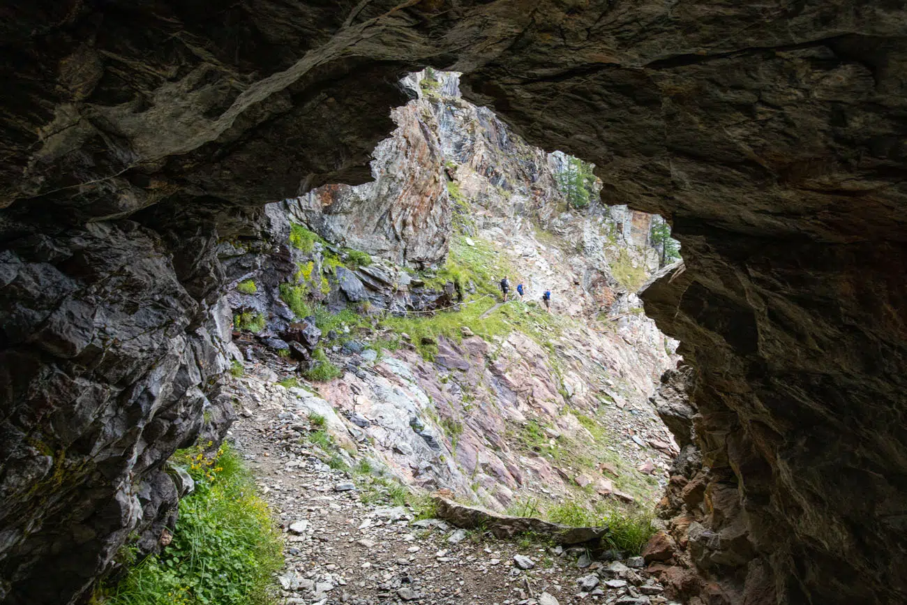
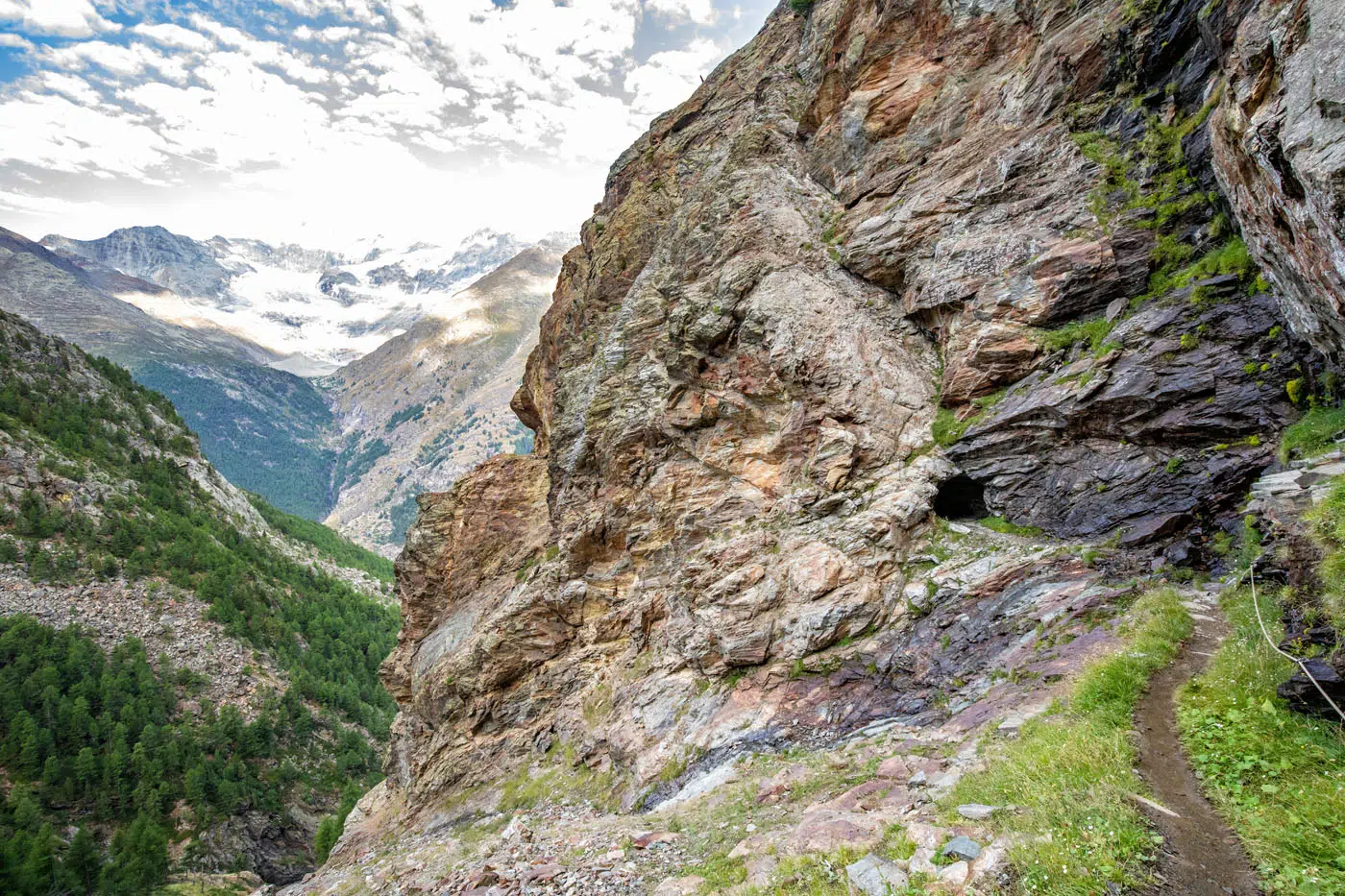
Looking back at the tunnel.
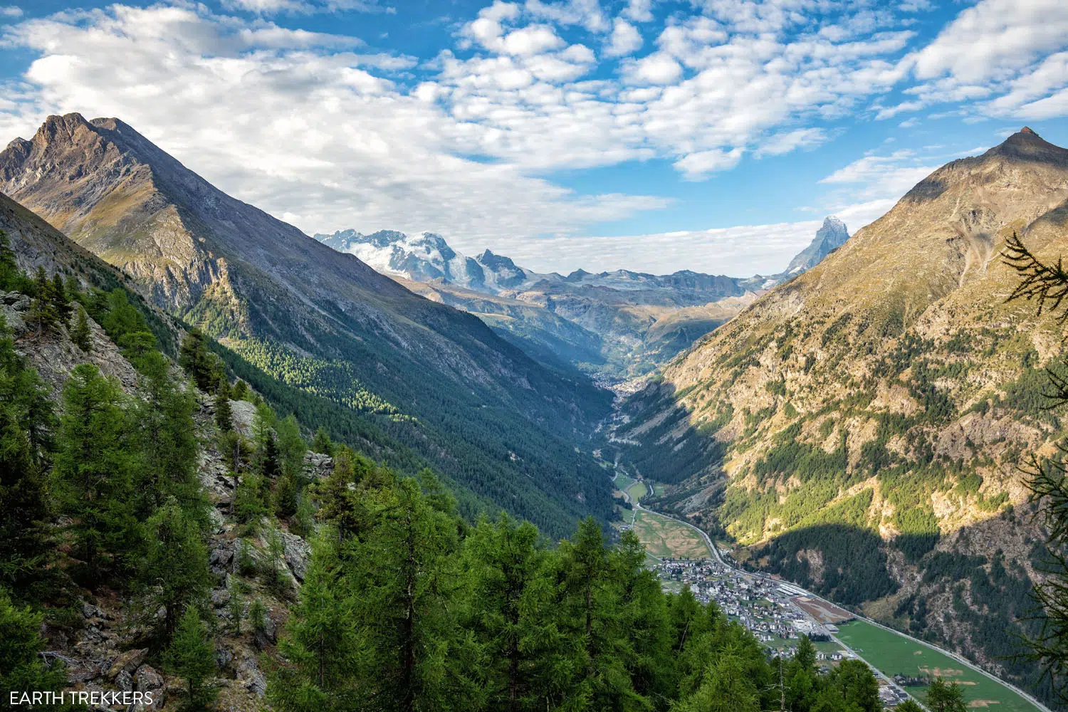
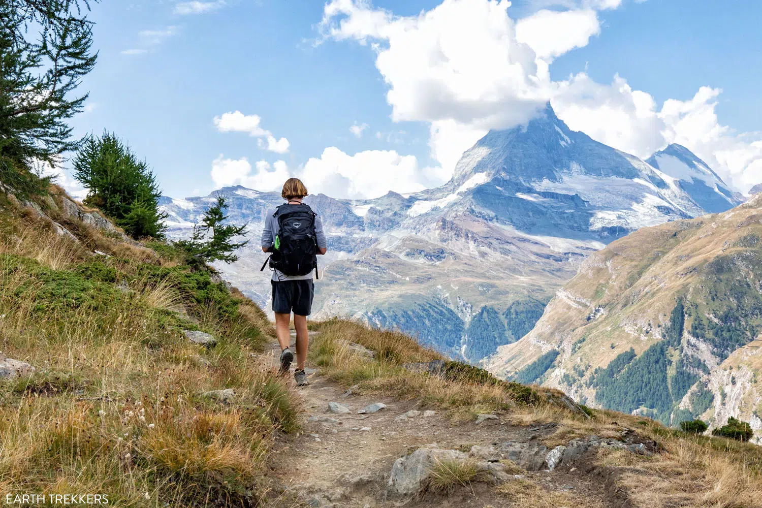
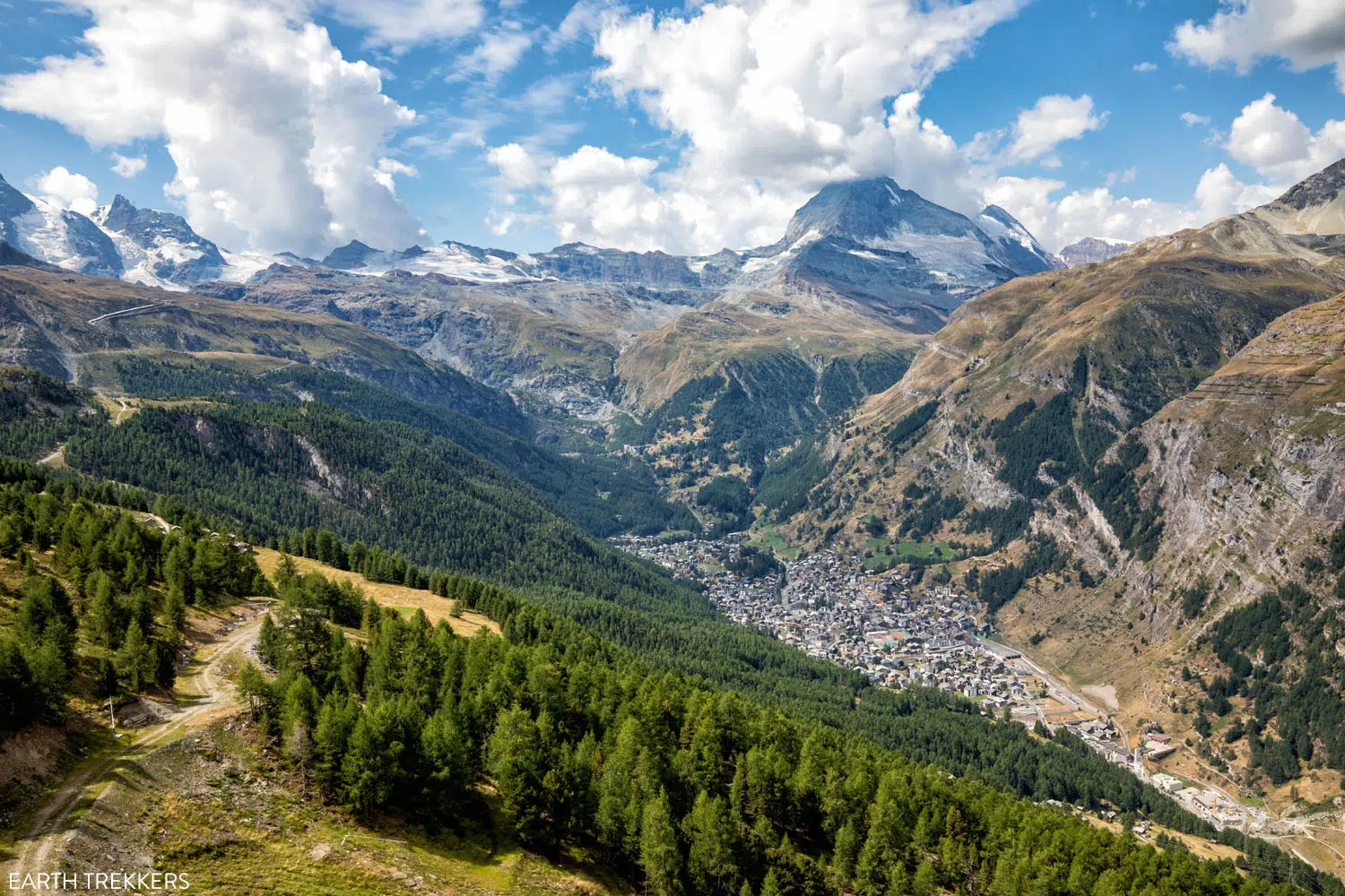
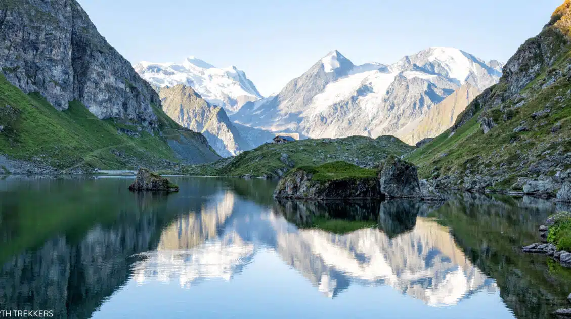
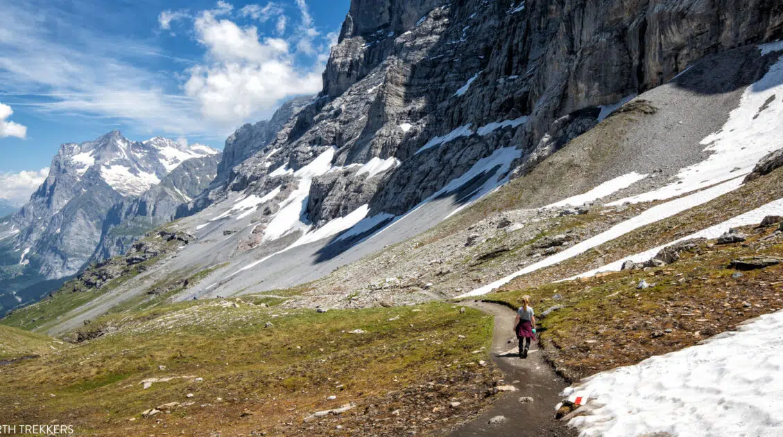
A little over 5 km (3 miles) into Stage 14, views will really open up. From here you can see most of Matterhorn, Zermatt, and most of the surrounding mountains. The views here are incredible!
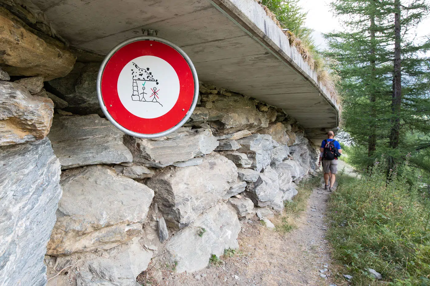
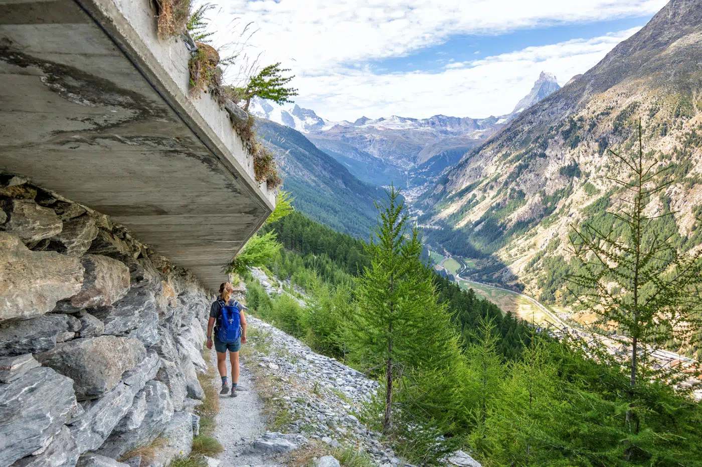
Following another steep descent, the trail features some pretty serious rockfall protection. A concrete overhang runs above for roughly 800 meters, although at points this barrier looked pretty sketchy. The concrete is damaged in some spots and you can see huge chunks that have broken free and look like they could fall on you at any moment. You’ll also walk through a few more tunnels.
Note: It is my understanding that this is the area damaged by the recent rockfall.
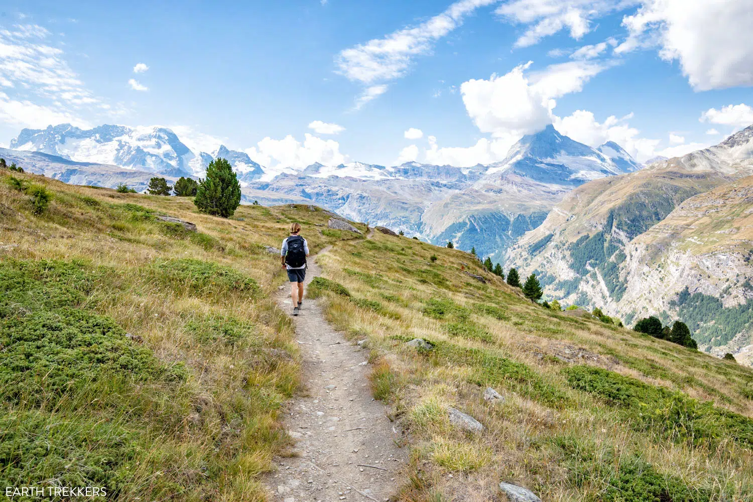
You’ll climb back up another steep trail composed of dirt and loose rock before flattening out again. Fortunately, the trail stays flat for a while, which we were so happy to encounter. After 12 days of crossing over mountain passes, our bodies were exhausted. We knew we could use the long section of flat trail to get our speed up. Even with the incredible views, we were anxious to keep moving since we knew we were only hours away from Zermatt (and thunderstorms were in the forecast).
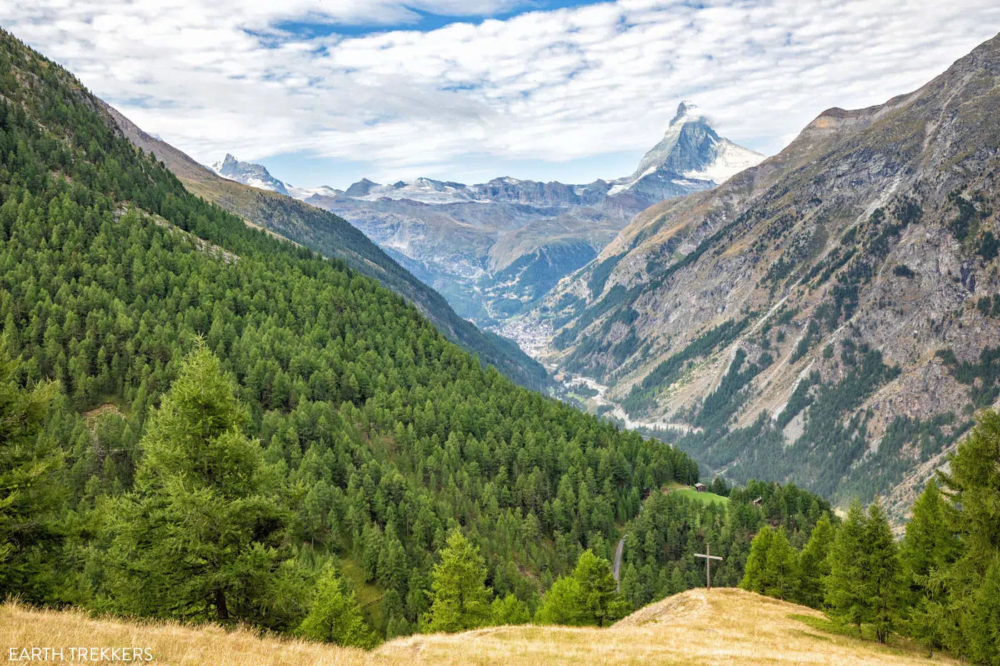
View of Zermatt and the Matterhorn before making the turn to Täschalp.
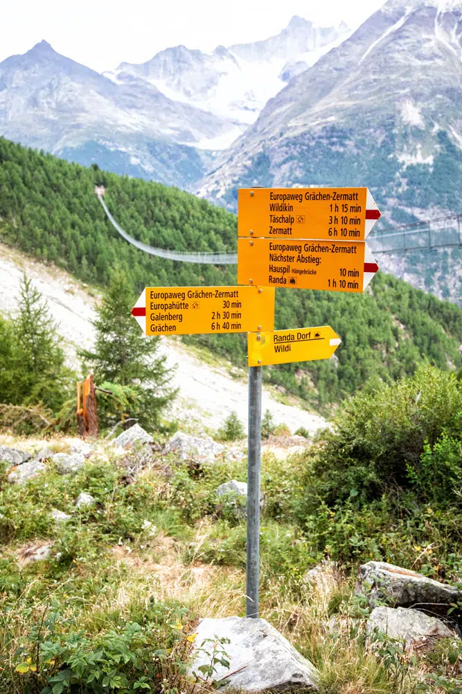
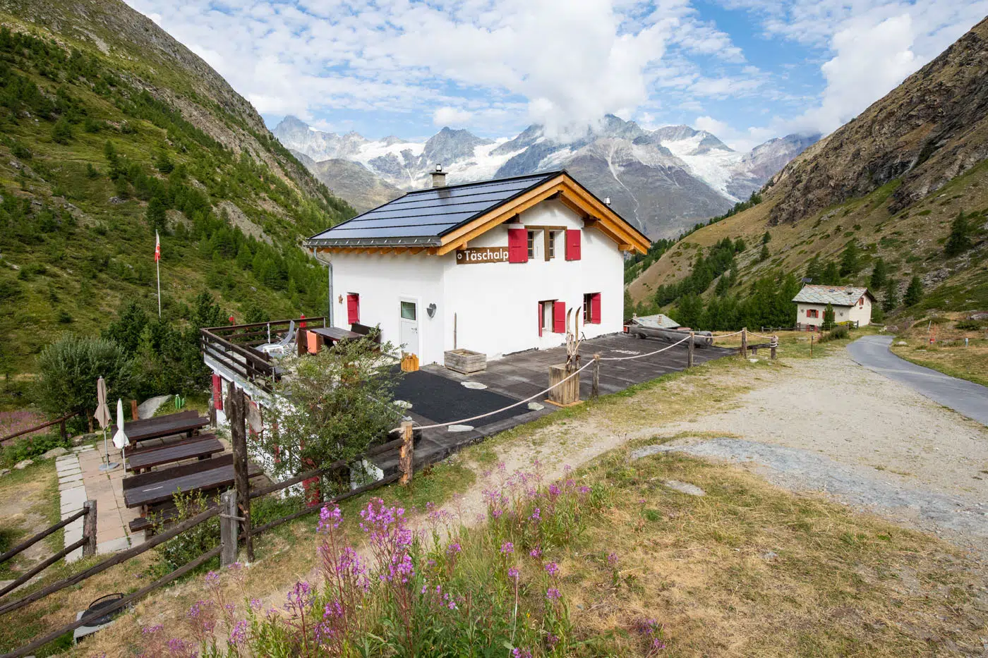
A little under 6 miles (10km) into the hike you’ll pass through Täschalp, a small, picturesque hamlet. Here you can stop for food if you need to refuel or use the bathroom at Restaurant Täschalp.
Täschalp to Tufteren
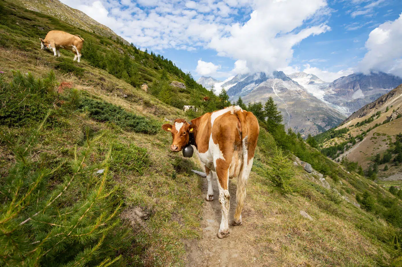
As we hiked above the hamlet we got stuck behind a herd of cattle blocking the trail. Fortunately, Julie busted out some unknown cattle herding skills as she was able to clear the trail in no time.
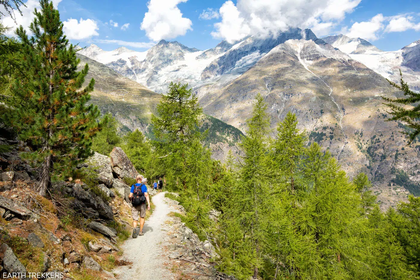
About 30 minutes after leaving the hamlet, the trail will slowly start to climb up a few hundred feet as you approach Zermatt. As you ascend higher, more of the valley opens up for some spectacular photo opportunities. This is our favorite part of Stage 14.
Zermatt
VIEWS OF THE MATTERHORN: Based on our experiences visiting Zermatt, the best time to see the Matterhorn is in the early morning. Starting as early as 9 am, clouds can begin to cover the peak and sometimes by noon, it’s completely covered. This doesn’t happen everyday, but from what we saw, it happens almost every day. We left the Europahütte at 6:50 am by the time we reached Tufteren, it was 11:40 am. By this point, most of the Matterhorn was covered by clouds.
About 10 miles (16 km) from Europahütte you’ll reach another hamlet, Tufteren, where you can also get food if you need it.
From Tufteren, you have two options. You can follow signs for Zermatt and descend through the hamlet on a more direct route into town (about 1 hour 15 minutes into Zermatt). The alternative is to follow signs for Sunnegga (this route takes between 2 and 2.5 hours to get to Zermatt), which is a longer walk but you get more big views of the Matterhorn.
Tufteren
Tufteren to Sunnegga to Zermatt
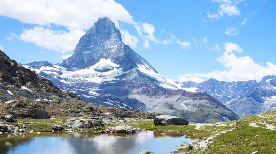
Although we were tired and anxious to reach Zermatt, we elected to hike towards Sunnegga. We hiked along a gravel road in the trees for 30 minutes, which itself was boring. However, upon reaching Sunnegga, we realized our decision was worth it.
Along the road between Tufteren and Sunnegga.
Looking out at Zermatt and Matterhorn was once again jaw-dropping.
The trail from Sunnegga to Zermatt.
From Sunnegga, it is a downhill walk the remainder of the way to Zermatt. This trail goes through a cluster of very highly rated restaurants (Adler Hitta, Chez Vrony, Restaurant Enzian, and Findlerhof), which is also called the “Gourmet Trail.” If you are in no rush and want a good meal before entering Zermatt, you can make a pitstop at one of these restaurants.
In our experience, thunderstorms were beginning to roll in so we didn’t have time to sit and eat.
PRO HIKING TIP: If you feel like you’re totally exhausted and can’t continue into Zermatt by foot, or thunderstorms are moving into the area, you can ride the funicular from Sunnegga that will take you right into town. Or choose to take the shorter route to Zermatt through Tufteren.
From Sunnegga, signs will tell you that it’s a 2 hour walk downhill into Zermatt. We quickly learned that the time the sign gave was extremely generous, and we hiked from Sunnegga to Zermatt in a little under one hour. The trail descends steeply through the woods and opens up to a wider path about halfway down the mountain.
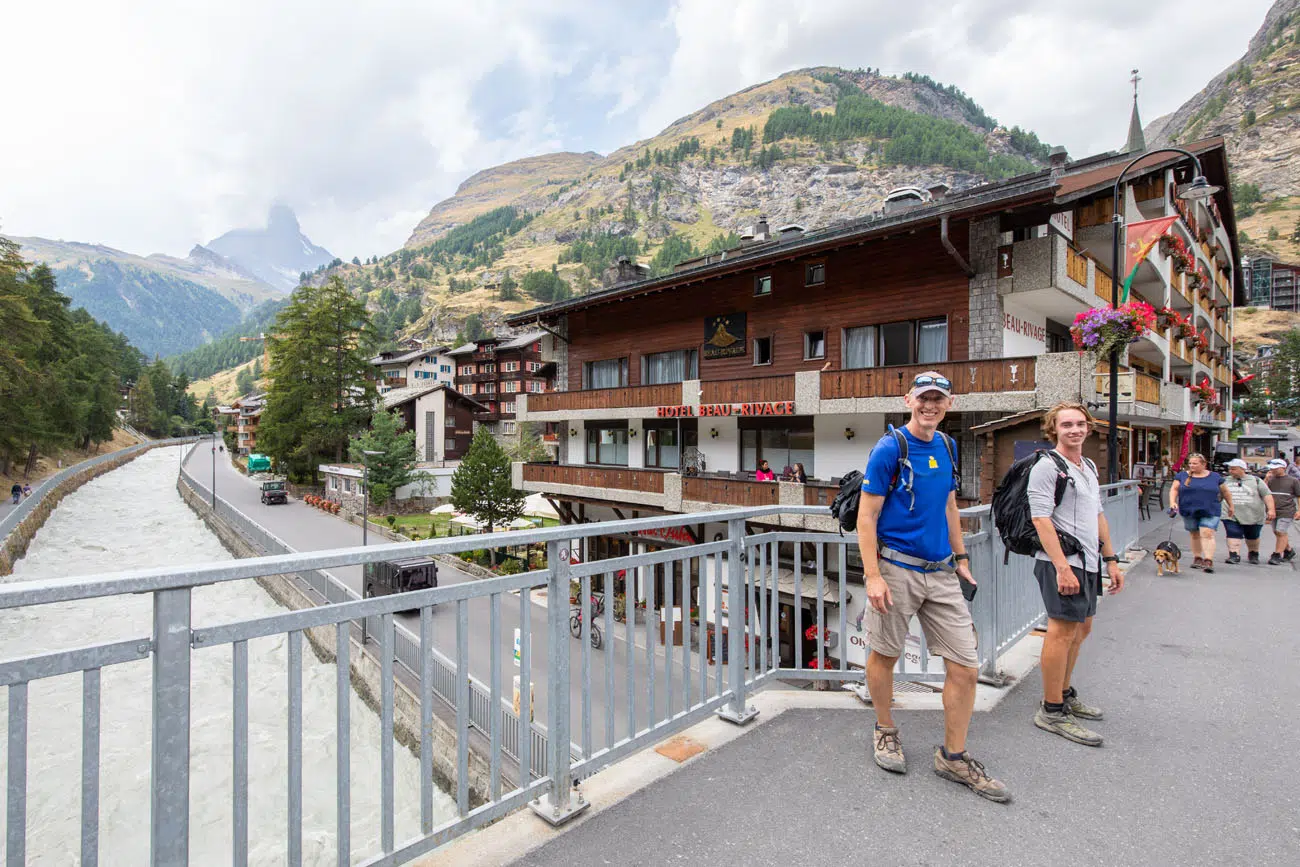
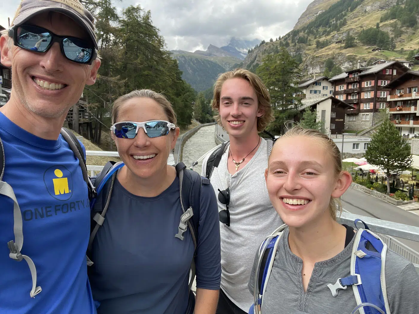
Before entering Zermatt, you will cross over train tracks for the Gornergratbahn, the train that connects Zermatt and Gornergrat. A quick 10-minute walk through town and you’ll reach the center of Zermatt where you will have finally finished the Haute Route. Congratulations!
We took a selfie on Kirchbrücke (a popular photo spot in Zermatt of the Matterhorn, but by this point, because of the rainy weather, the Matterhorn was covered in clouds) and then had lunch at Old Zermatt.
Where we Stayed
In Zermatt we spent 4 nights at the Hotel Matterhorn Lodge, where we booked a three-bedroom apartment. This was our favorite accommodation of our entire five week trip through Europe. The apartment was massive and the plethora of space allowed us all to spread out and enjoy a sense of privacy. It is centrally located in Zermatt and from our balcony, we had views of the St. Mauritius Parish Church and the Matterhorn. We would definitely recommend staying here. You can get more recommendations on where to stay in our article Best Things to Do in Zermatt.
Things to Do in Zermatt
Now that you made it to Zermatt, you can relax, go shopping and go out to dinner, ride the cable cars and trains to outstanding viewpoints of the area, or keep right on hiking.
If you still have time in your schedule, we recommend spending a few days in Zermatt. Your first day should be a low-key day, as your body will need some recovery time (ours did!), but there are some great hikes that we recommend.
For more information, read our articles Best Things to Do in Zermatt and 12 Epic Hikes in Zermatt. But the top experiences that we recommend are riding the train to Gornergrat and doing the very easy hike to Riffelsee and Riffelberg, riding the cable car to Rothorn for more spectacular views, and visiting Matterhorn Glacier Paradise. The hike to Hornlihütte is one of our favorites and takes you to the hut used by climbers on their way to the peak of the Matterhorn. And finally, if you want to add on one more epic experience, climb to the summit of the Breithorn, one of the easiest 4000+ meter peaks in the Alps.
Clarifications for the Walkers Haute Route Book
We have no clarifications for Stage 14. The Europaweg is very well signed and easy to follow.
More Information about the Haute Route
In our Walker’s Haute Route Planning Guide, we have links to all of our articles about the Walker’s Haute Route, including information about each stage, how to plan your trek, what to expect, and more.
For an overview of all 14 stages of the Walker’s Haute Route, with overall hiking stats, map, elevation profile, and lists of the most difficult stages, easiest stages, and our personal favorites, check out our Guide to the Walker’s Haute Route Stages.
Stages of the Haute Route: Below are our guides to each stage of the Haute Route.
- Haute Route Stage 1: Chamonix to Argentière
- Haute Route Stage 2: Argentière to Col de Balme to Trient
- Haute Route Stage 3: Trient to Fenetre d’Arpette to Champex-Lac
- Haute Route Stage 4: Champex-Lac to Le Chable
- Haute Route Stage 5: Le Chable to Cabane du Mont Fort
- Haute Route Stage 6: Cabane du Mont Fort to Cabane de Prafleuri
- Haute Route Stage 7: Cabane de Prafleuri to Arolla
- Haute Route Stage 8: Arolla to Les Haudères
- Haute Route Stage 9: Les Hauderes to Col du Tsate to Lac de Moiry
- Haute Route Stage 10: Lac de Moiry to Zinal
- Haute Route Stage 11: Zinal to Forcletta to Gruben
- Haute Route Stage 12: Gruben to Augstbordpass to St. Niklaus
- Haute Route Stage 13: St. Niklaus to the Europahütte
If you have any questions about how to hike the Haute Route Stage 14, or if you want to share your experience, let us know in the comment section below.
More Information about Switzerland & Hiking in Europe
Switzerland Travel Guide: How to Plan a Trip to Switzerland
Pinterest Facebook Flipboard Switzerland Travel Guide Looking to hike some of the world’s most beautiful mountain landscapes, stroll through colorful old towns, and dine on some fondue? Then Switzerland is the perfect place for you! Visit the Bernese Oberland, a hikers paradise filled with towering mountains, alpine meadows, historic cogwheel trains, and quaint villages. Or, […]
Walker’s Haute Route Stages: An Overview of All 14 Stages
The Walker’s Haute Route is a multi-day trek from Chamonix, France to Zermatt, Switzerland. On this walk, hikers will cross 10 mountain passes, walk through small towns and through rugged, remote landscapes, and get to experience a less touristy side of the Swiss Alps. There are several routes that take hikers from Chamonix to Zermatt. […]
Walker’s Haute Route: 21 Important Things to Know & FAQ
The Walker’s Haute Route is one of the most rewarding and memorable multi-day walks in Europe. On this journey, hikers will cross 10 of the highest mountain passes in the Alps, while walking from Chamonix, France to Zermatt, Switzerland. It’s an extraordinary journey but not without its challenges. With 14 stages, multiple variations to the […]
Ultimate Guide to the Walker’s Haute Route
Walker’s Haute Route The Walker’s Haute Route is one of the most rewarding and memorable multi-day walks in Europe. On this trek, hikers cross 10 of the highest mountain passes in the French and Swiss Alps, as they walk from Chamonix, France to Zermatt, Switzerland. Walking from Chamonix to Zermatt takes you to remote mountain huts, to tiny […]
How To Book Your Walker’s Haute Route Accommodations
Along the Walker’s Haute Route, there are a variety of accommodation types, from mountain huts to 5-star hotels, from dormitories to apartments, and from shared bathrooms to private bathrooms. You will have the opportunity to experience a combination of all of these since you will be staying in a new place at the end of […]
How To Plan Your Walker’s Haute Route Experience
The Walker’s Haute Route is a 14-stage trek from Chamonix, France to Zermatt, Switzerland. It is a tough yet rewarding experience through the French and Swiss Alps that crosses 10 mountain passes and offers incredible scenery along the way. It is a beast of a trek! It took us 13 days, averaging 16 km (10 […]
Best Hikes in Europe: 25 Incredible Hikes for Every Level
From the dramatic cliffs of Norway to the jagged peaks of the Dolomites and the volcanic landscapes of Iceland, Europe is packed with some of the most unforgettable hikes in the world. In this guide, we share our favorite hikes in Europe, trails that stand out for their scenery, uniqueness, and overall experience from start […]
20 Amazing Things to Do in Zermatt, Switzerland
Zermatt is an idyllic mountain village tucked away in the Swiss Alps. The mighty Matterhorn dominates the skyline, creating one of the most unique alpine landscapes in Europe. Explore the hiking trails, journey up higher into the mountains by cable car and train, stroll the scenic streets of Zermatt, and go skiing all year long. […]
Complete Guide to the Hörnlihütte Hike (Map, Trail Stats & Photos)
The Hörnlihütte (Hörnli Hut) is a lodge built at the base of the Matterhorn. For thrill seeking rock-climbers, the Hörnlihütte marks the start of the ascent up to the peak of the Matterhorn. Even if you do not wish to stand on top of the Matterhorn, simply hiking to and from the Hörnlihütte makes for […]
12 Epic Day Hikes in Zermatt (+ Trail Stats, Photos & Map)
One of the best ways to explore Zermatt is on foot. Hiking trails climb high into the mountains above Zermatt, past Swiss hamlets, through scenic valleys and rocky gorges, and to some of the best viewpoints of the Matterhorn. The network of cable cars and trains takes you up into the mountains, so for the […]
How to Climb the Breithorn: Photos, Trail Stats & What to Expect
Climbing to the summit of Breithorn is one of Zermatt’s most adventurous experiences. Standing at a height of 4,164 meters (13,660 feet), Breithorn is one of the highest peaks in the area and it is one of the easiest 4,000+ meter peaks to summit in the Alps. Thousands of hikers come to Zermatt to summit […]
How to Visit Gornergrat and Hike to Riffelsee & Riffelberg
For one of the best views of Matterhorn, it’s hard to beat Gornergrat. A scenic, cogwheel train takes you from Zermatt to this alpine paradise. Once at the top station, you can simply enjoy the sweeping views of the Matterhorn and the Swiss Alps from the restaurant and terraces. Or, you can add on the […]
20 Best Day Hikes in the World (+ Map & Photos)
Where can you go to find that perfect day hike? The hike that leaves you breathless as you climb the summit of the mountain. The hike with the awe-inspiring views. The hike that is so enjoyable because the terrain and its views are always changing. The hike that has you saying “Wow!” over and over […]

Comments 5