The Walker’s Haute Route is a multi-day trek from Chamonix, France to Zermatt, Switzerland. On this walk, hikers will cross 10 mountain passes, walk through small towns and through rugged, remote landscapes, and get to experience a less touristy side of the Swiss Alps.
There are several routes that take hikers from Chamonix to Zermatt. The “classic route” typically takes about 14 days. Along this route, there are detours to add on, or, if you are short on time, stages that you can skip.
In this guide, we cover the Walker’s Haute Route stages, starting in Chamonix and ending in Zermatt. At the end of this guide, we list our favorite stages and rank them from toughest to easiest.
Walker’s Haute Route Stats
These are the hiking stats for the route that we took. We hiked the entire distance, didn’t take any shortcuts, and made a few detours along the way, so our hiking distance and total ascent is slightly higher than what you might see listed on other sources.
Distance: 204 km (127 miles)
Total Ascent: 14,300 m (47,000 feet)
Total Descent: 13,700 m (45,000 feet)
Time: 72 hours of hiking (including stops)
Days: 13
Start: Chamonix, France
End: Zermatt, Switzerland
When: July 24 to August 5
We hiked the Walker’s Haute Route in 13 days. That averages out to be 16 km (10 miles) a day with 1,140 meters (3,740 feet) of total ascent. However, some days were much longer than this and there were a few short, easy days thrown into the mix.
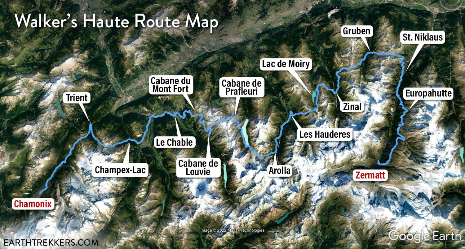
Walker’s Haute Route Map
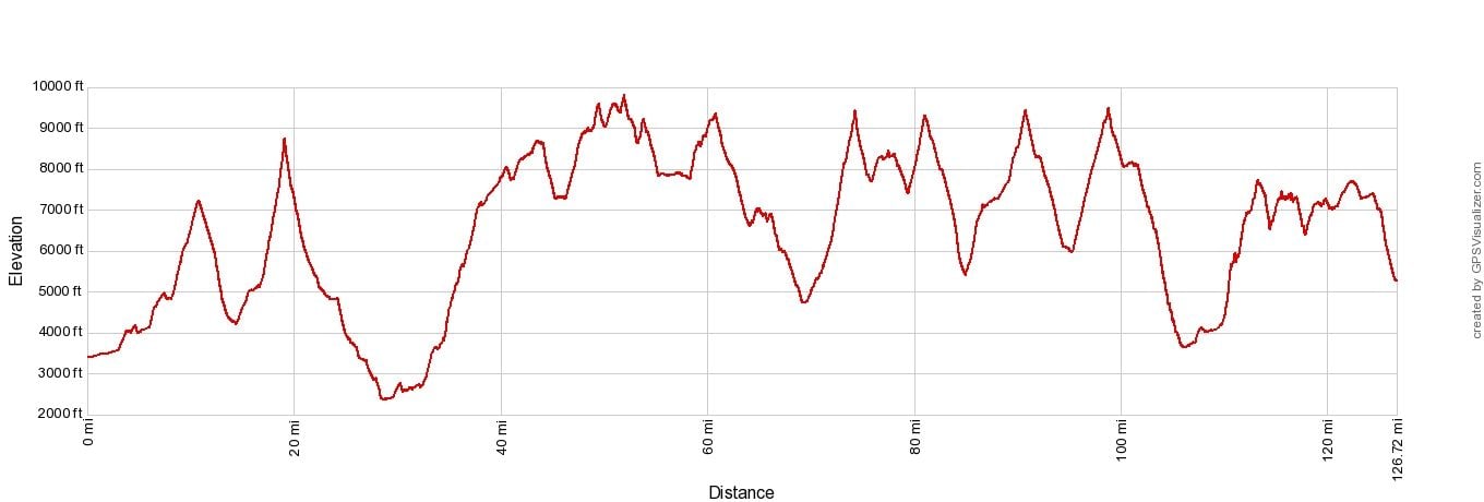
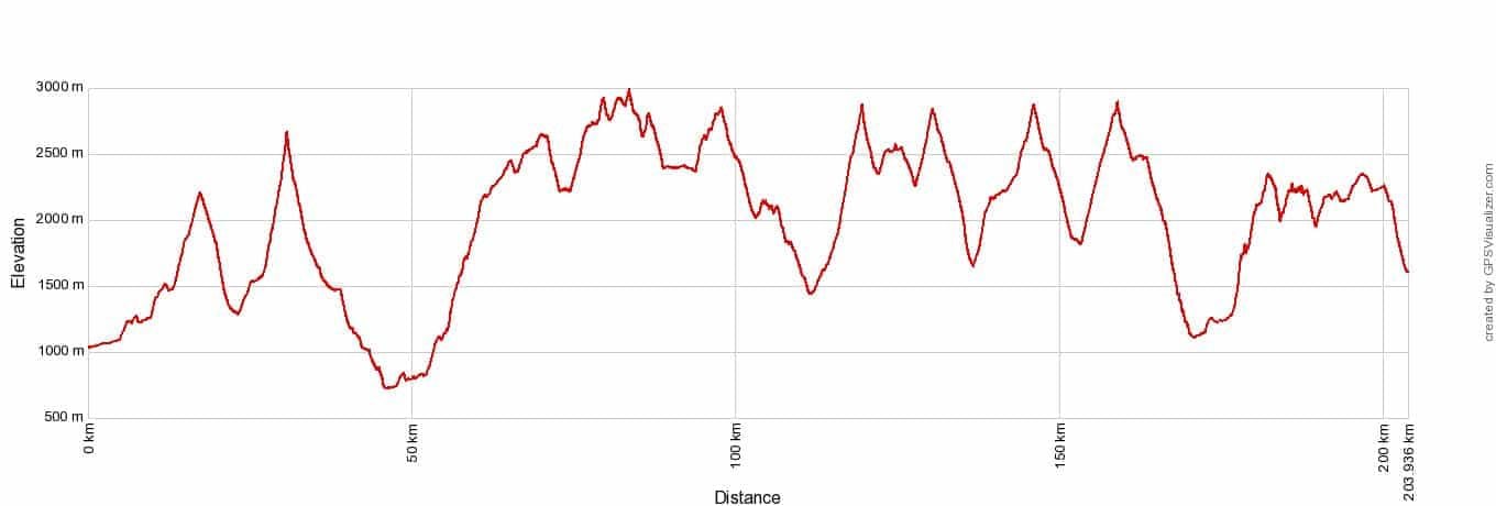
Walkers Haute Route Elevation Profile
If you plan to hike the Haute Route, a 16 km/10-mile day with 1,100 meters/3,500 feet of total ascent should be easy for you, before starting this trek. The day after day hiking does build up a level of fatigue that sticks with you to the end of the trek, so you need to have an excellent level of fitness before starting this walk, or you will be miserably tired and sore for most of it.
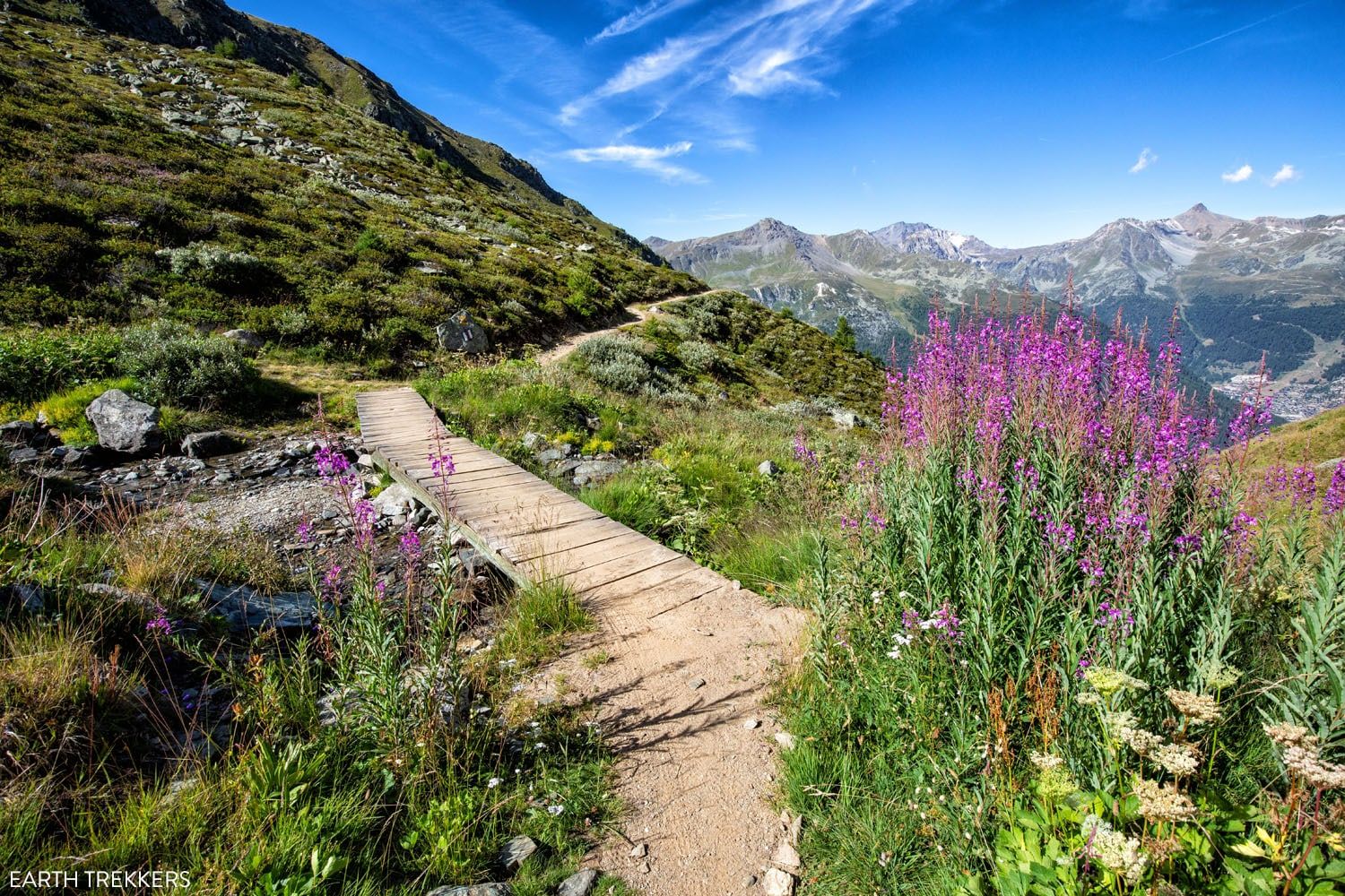
Walker’s Haute Route Stages
Next we list an overview of each of the 14 stages of the Walker’s Haute Route. We used the book Trekking Chamonix to Zermatt, the Classic Walker’s Haute Route as a guide and followed the route described in the book, with a few exceptions.
There are a lot of variations to the Haute Route, and these involve either shortening or skipping stages (cable cars and buses can be used to skip parts of some stages) or you can add on side trips (Cabane de Louvie, Hotel Weisshorn, and Grand Dixence Dam are some of the more popular ones).
We took a few detours as well and I’ll let you know on which stage we did this and if the extra time and distance is worth it.
We have a detailed guide to each stage of the Haute Route, with a map, elevation profile, and lots of photos for each one. The link to each guide will be provided below for each stage.
Note: The times listed for each stage are the average times. It can take several hours more or less than this to complete a stage, depending on your hiking speed.
List of the Walker’s Haute Route Stages
Stage 1: Chamonix to Argentière: 9 km (5.6 miles), total ascent: 315 m (1030 feet), time: 2 to 3 hours, easy
Stage 2: Argentière to Trient: 14.2 km (8.8 miles), total ascent: 980 m (3,215 feet), time: 5 hours 30 minutes, moderate to strenuous
Stage 3: Trient to Champex-Lac: 15.3 km (9.5 miles), total ascent: 1,370 m (4,500 feet), time: 7 hours, strenuous
Stage 4: Champex-Lac to Le Chable: 13.5 km (8.4 miles), total ascent: 213 m (700 feet), time: 4 hours 15 minutes, easy
Stage 5: Le Chable to Cabane du Mont Fort: 13.3 km (8.2 miles), total ascent: 1,700 m (5,570 feet), time: 5.5 hours, very strenuous
Stage 6: Cabane du Mont Fort to Cabane Prafleuri: 15.2 km (9.4 miles), total ascent: 1,100 m (3,600 feet), time: 7.5 hours, moderate to strenuous
Stage 7: Cabane de Prafleuri to Arolla: 17.4 km (10.8 miles), total ascent: 745 m (2,445 feet), time: 6 hours, moderate
Stage 8: Arolla to Le Haudères: 8.9 km (5.5 miles), total ascent: 350 m (1,150 feet), time: 3.5 hours, easy
Stage 9: Les Haudères to Lac de Moiry: 15.8 km (9.8 miles), total ascent: 1,725 m (5,660 feet), time: 6 hours 15 minutes, very strenuous
Stage 10: Lac de Moiry to Zinal: 9.1 km (5.6 miles), total ascent: 605 m (1,985 feet), time: 4 hours, moderate
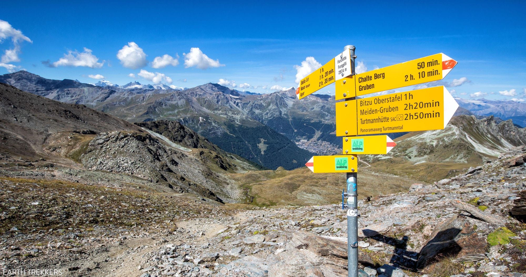
Stage 11: Zinal to Gruben: 16.6 km (10.3 miles), total ascent: 1,255 m (4,120 feet), time: 6 hours, very strenuous
Stage 12: Gruben to St. Niklaus: 16.9 km (10.5 miles), total ascent: 1,135 m (3,725 feet), time: 7 hours, moderate to strenuous
Stage 13: St. Niklaus to the Europahütte: 12.7 km (7.9 miles), total ascent: 1,460 m (4,800 feet), time: 5 to 6 hours, strenuous
Stage 14: The Europahütte to Zermatt: 20.7 km (12.8 miles), total ascent: 915 m (3,000 feet), time: 7 hours, moderate to strenuous
Stage 1: Chamonix to Argèntiere
Distance: 9 km (5.6 miles)
Difficulty: Easy
Total Ascent: 315 meters (1030 feet)
Total Descent: 100 meters (325 feet)
Time: 2 to 3 hours
Learn More: Stage 1: Chamonix to Argentière
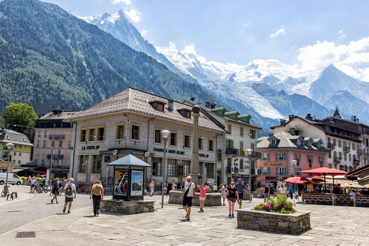
Chamonix, France
The first stage is one of the easiest and also one of the least exciting. It’s a mostly flat walk between Chamonix and Argentière and for most of this stage, you are either walking through towns or through a forest.
This is commonly a stage that people skip if they need to shorten the trek. You aren’t missing much in terms of scenery. However, if you do choose to skip this first stage, technically you are walking from Argentière to Zermatt.
Stage 2: Argentière to Trient
Distance: 14.2 km (8.8 miles)
Difficulty: Moderate to strenuous
Total Ascent: 980 m (3,215 feet)
Total Descent: 940 m (3,085 feet)
Lowest Elevation (Argentière): 1,275 m (4,180 feet)
Highest Elevation (Col de Balme): 2,200 m (7,220 feet)
Time: 5 hours 30 minutes
Learn More: Stage 2: Argentiere to Trient
On this stage, you cross the first mountain pass of the Walker’s Haute Route and get to test out your legs. You leave behind the larger town of Argentière, hike up and over Col de Balme, and enter the tiny town of Trient.
Once you cross over Col de Balme, you also say adieu to France. For the rest of the Walker’s Haute Route, you will be in Switzerland.
The view of Le Tour and Mont Blanc on the hike to Col de Balme.
Trient, Switzerland
STAGE 1 + STAGE 2: Since Stage 1 is so short, many people combine stages 1 and 2 into one big day. That’s what we did, too. It does make for a long day but at this point, your legs are fresh and you are full of excitement, as you start this journey.
Stage 3: Trient to Fenêtre d’Arpette to Champex-Lac
Distance: 15.3 km (9.5 miles)
Difficulty: Strenuous
Total Ascent: 1,370 m (4,500 feet)
Total Descent: 1,190 m (3,900 feet)
Lowest Elevation (Trient): 1,310 m (4,300 feet)
Highest Elevation (Fenêtre d’Arpette): 2,667 m (8,750 feet)
Time: 7 hours
Learn More: Stage 3: Treint to Champex-Lac
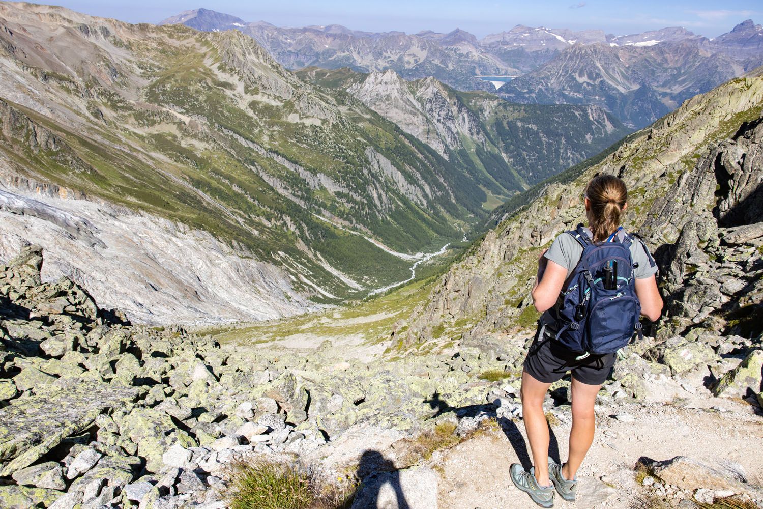
Early into the Walker’s Haute Route you have one of the toughest climbs of the trek. The hike up to Fenêtre d’Arpette is one of the steepest, most challenging ascents of the Haute Route. Along the way, you get a fantastic view of the Trient Glacier.
If you just look at the numbers, 1,370 meters (4,500 feet) of total ascent doesn’t sound too bad, not compared to some later stages. But it’s a beast of a climb to get to Fenêtre d’Arpette since it is so steep and rocky. You will repeat this type of climb over and over again along the Haute Route, and it does get easier as you get fitter.
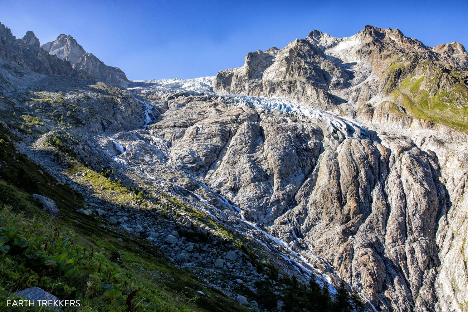
Trient Glacier
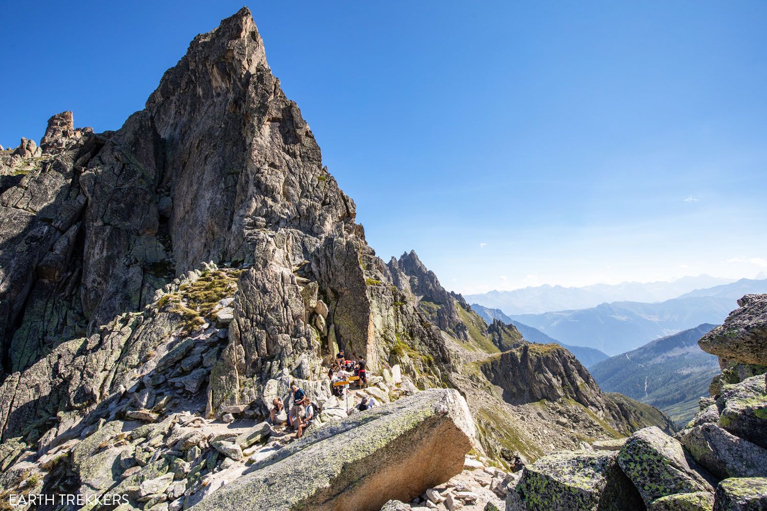
Fenêtre d’Arpette
TOUR DU MONT BLANC: Stage 3 is a busy stage. Those hiking the Tour du Mont Blanc are hiking towards you, from Champex-Lac to Trient. This is the toughest stage of the Tour du Mont Blanc and hikers are almost finished their trek at this point. They have the easier direction, with less ascent and a more gradual grade. This illustrates just how tough the Walker’s Haute Route is, since it’s longer and has several stages that are tougher than this one.
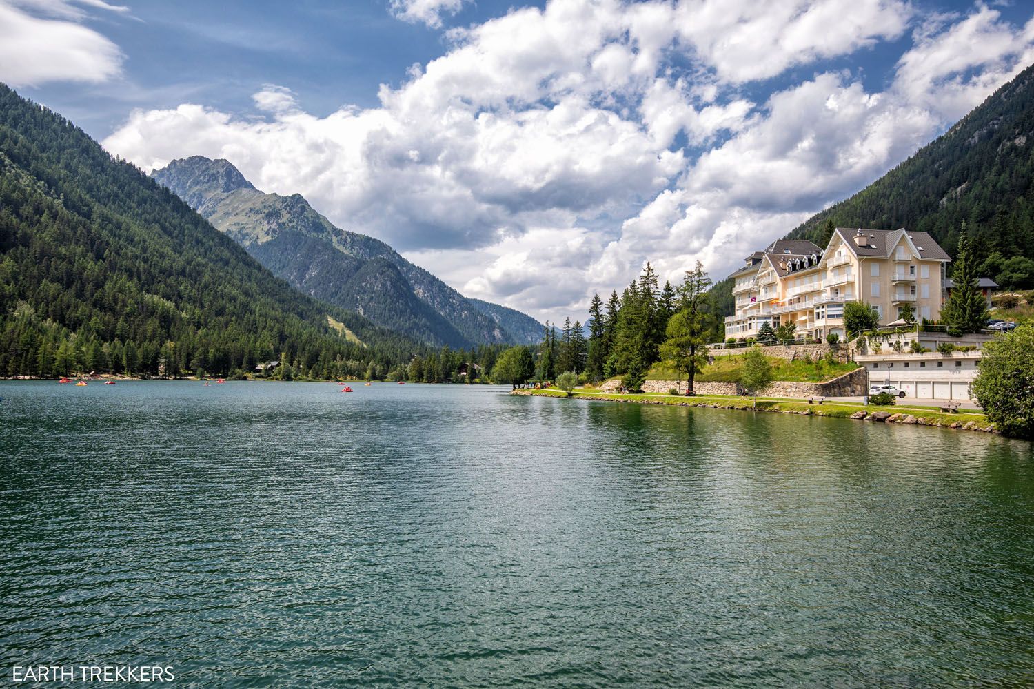
Stage 4: Champex-Lac to Le Chable
Distance: 13.5 km (8.4 miles)
Difficulty: Easy
Total Ascent: 213 m (700 feet)
Total Descent: 865 m (2,840 feet)
Lowest Elevation: 745 m (2,445 feet)
Highest Elevation: 1,490 m (4,890 feet)
Time: 4 hours 15 minutes
Learn More: Stage 4: Champex-Lac to Le Chable
This easy stage comes at a perfect time. Combining stages 1 and 2 and then hiking up and over Fenêtre d’Arpette can leave you exhausted. It’s a great recovery day before hiking one of the toughest stages of the Walker’s Haute Route.
This wonderfully short walk is downhill most of the way and takes you through hamlets and small towns. Walking through the Swiss towns may not sound that exciting, and maybe not what you thought you signed up for with electing to walk the Haute Route, but we loved this day.

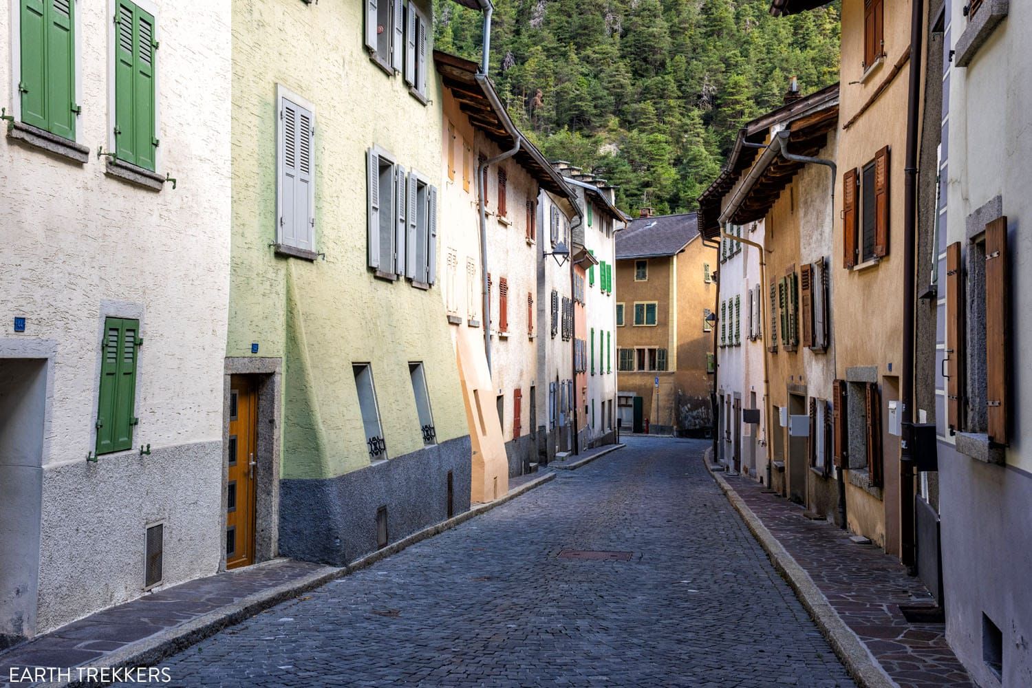
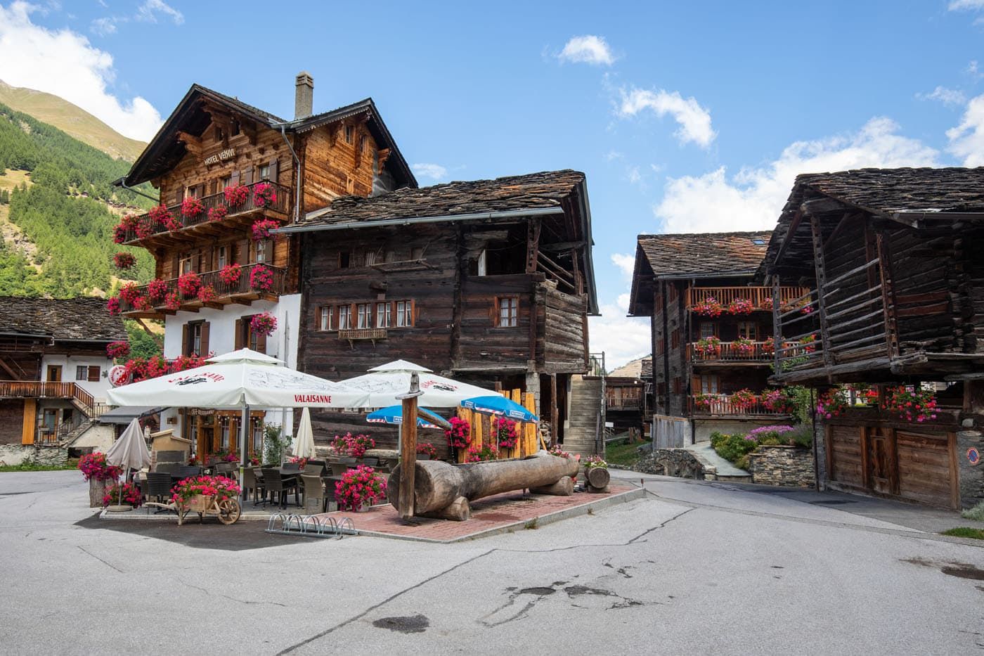
Sembrancher
Stage 5: Le Chable to Cabane du Mont Fort
Distance: 13.3 km (8.2 miles)
Difficulty: Strenuous
Total Ascent: 1,700 m (5,570 feet)
Total Descent: 95 m (310 feet)
Lowest Elevation: 830 m (2,725 feet)
Highest Elevation: 2,455 m (8,055 feet)
Time: 5.5 hours
Learn More: Stage 5: Le Chable to Cabane du Mont Fort
Stage 5 of the Walker’s Haute Route includes one of the largest climbs of the entire route. Beginning in the valley in Le Chable, you will work your way up into the high alpine mountain ranges to Cabane du Mont Fort, where you have the option to spend the night.
Most of this walk is in the woods and the views don’t open up until you get to Les Ruinettes. But once at this higher elevation, you are treated to more wonderful views of the Swiss Alps.
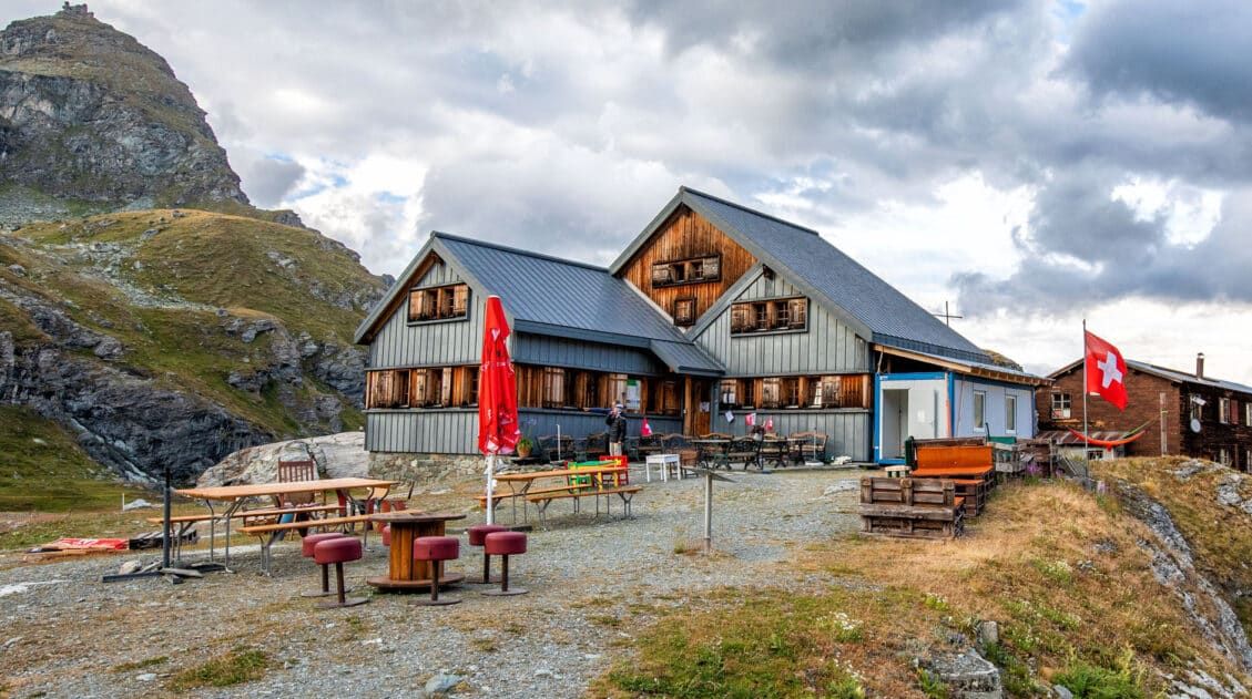
Cabane du Mont Fort is the hut on the hill.
Cabane du Mont Fort
SHORTEN THIS STAGE: If the idea of a massive descent sounds like too much, or you need to shorten the Haute Route, you can ride the cable cars from Le Chable to Les Ruinettes, eliminating most of today’s climb.
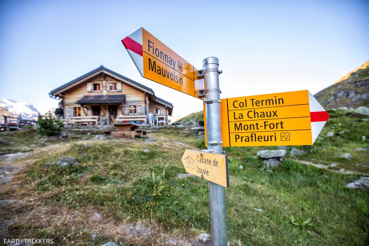
OPTIONAL DETOUR: We chose to stay at Cabane de Louvie, rather than Cabane du Mont Fort, because we heard that Louvie is a nicer place to stay. It adds a lot onto an already big day, making today’s stage 21.7km/13.5 miles with 2,130 meters/7,000 feet of total ascent. This detour includes a portion of stage 6 to get to Cabane de Louvie. With its remote location and beautiful setting on Lac de Louvie, this was our favorite place we stayed in along the Walker’s Haute Route, so we think it is well worth the extra time and distance.
For the full details on how to add on Cabane de Louvie, read our Walker’s Haute Route Stage 4 guide.
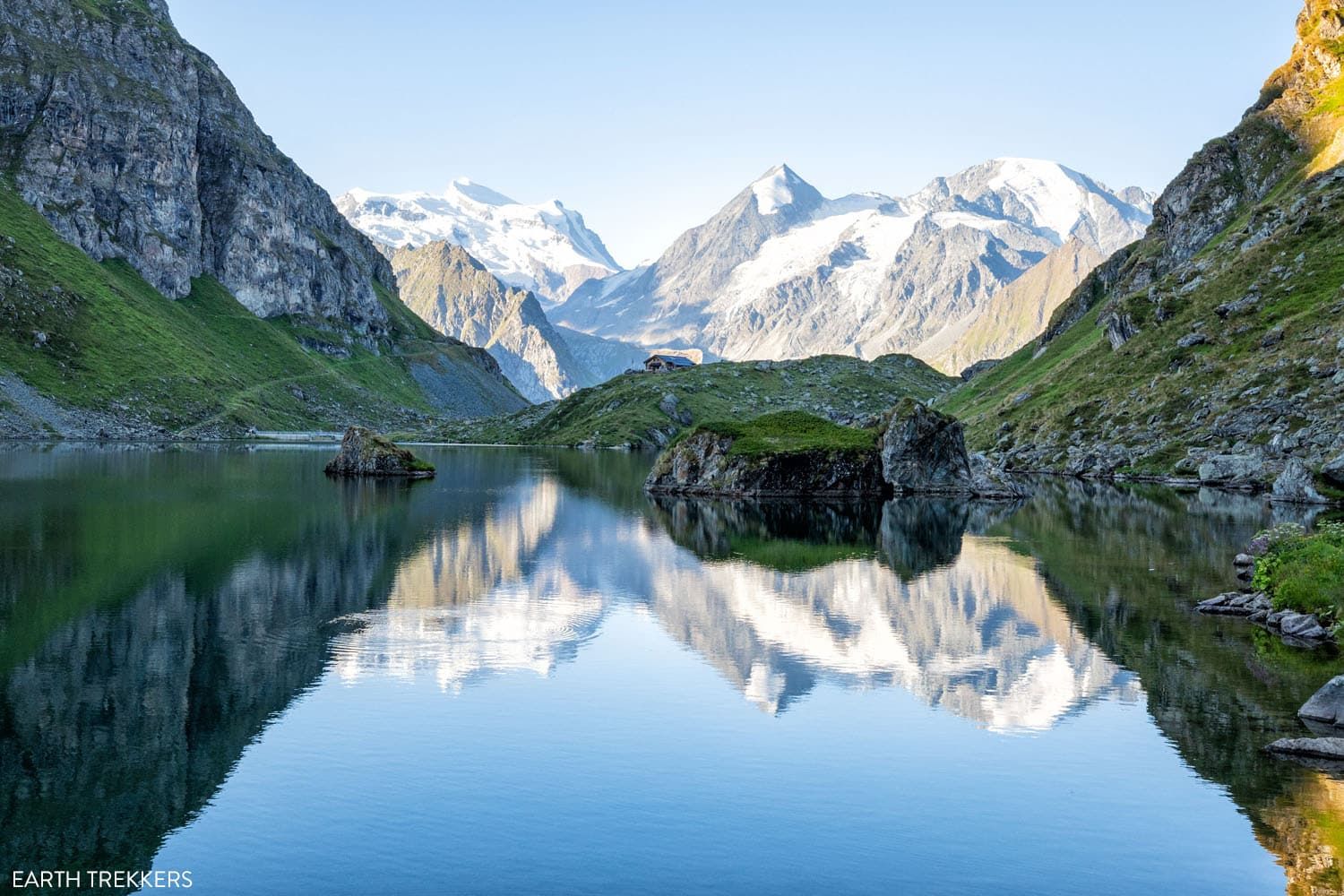
Cabane de Louvie and Lac de Louvie
Cabane de Louvie
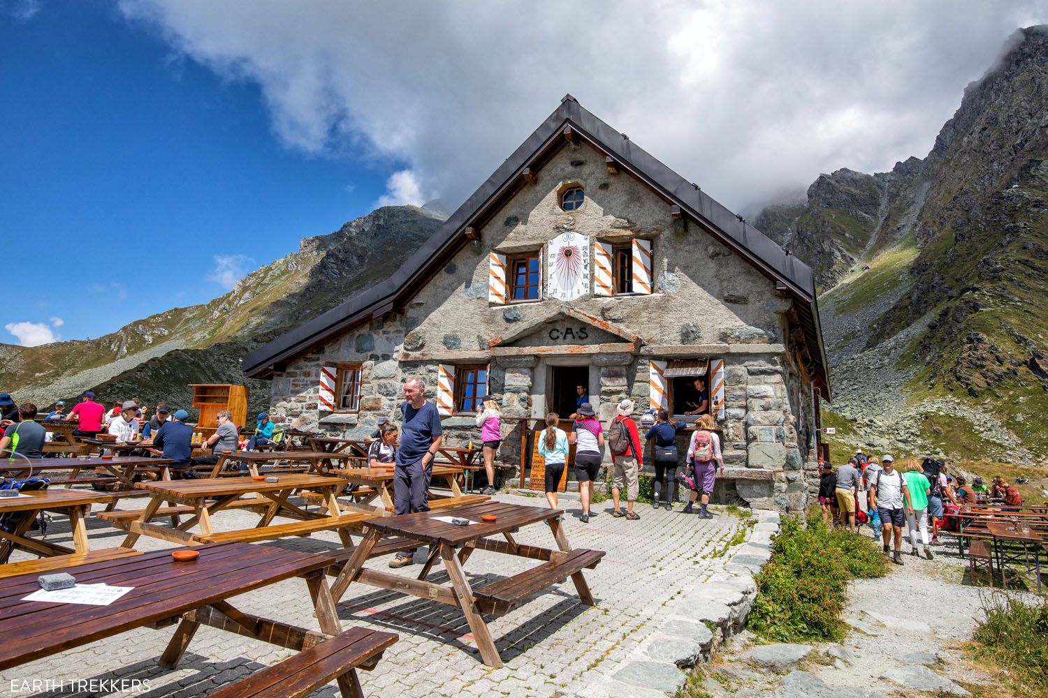
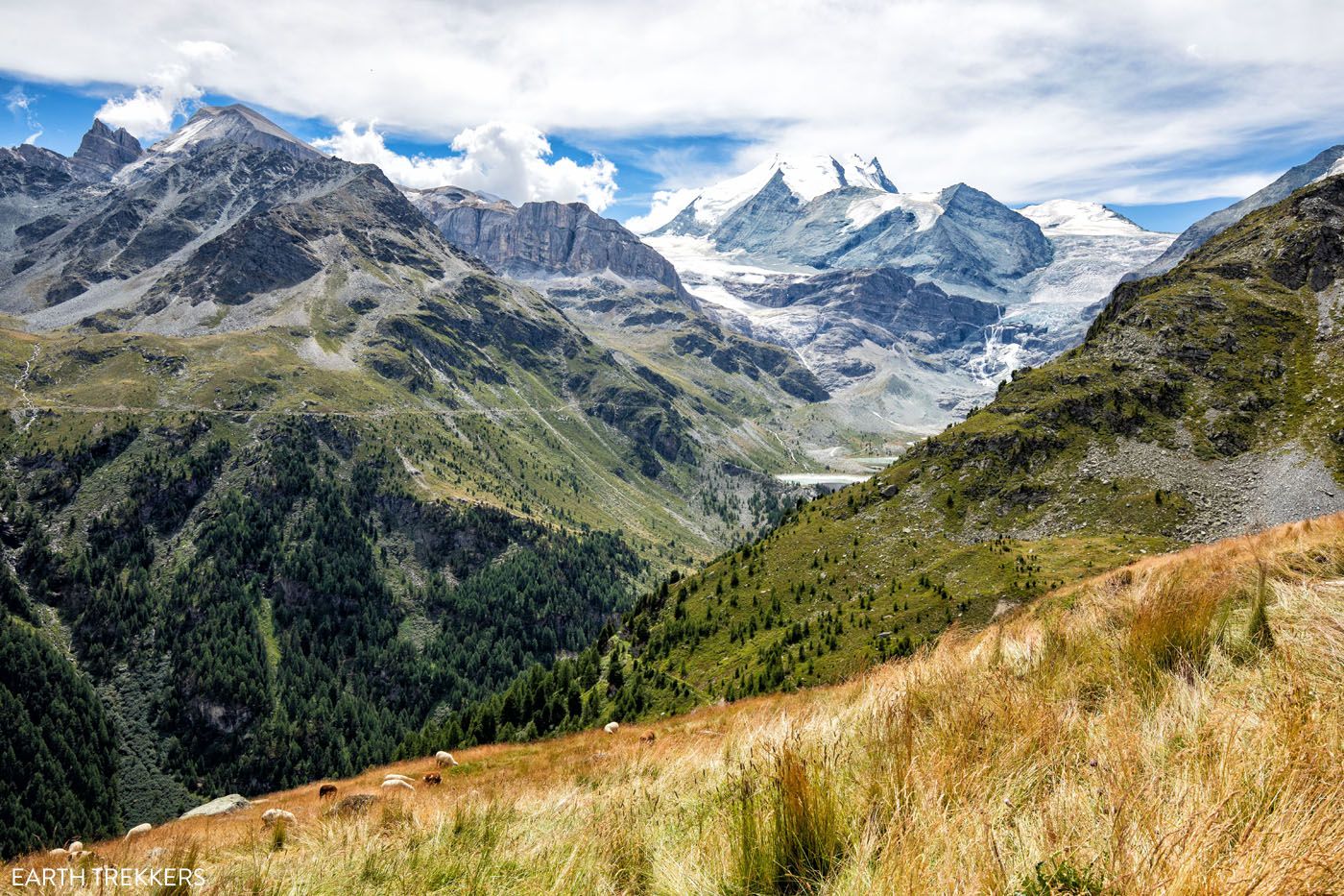
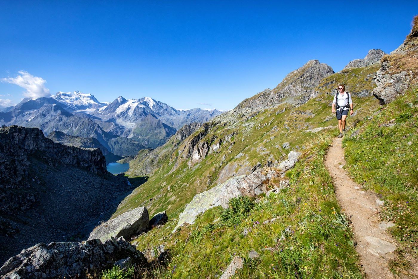
Stage 6: Cabane du Mont Fort to Cabane de Prafleuri
Distance: 15.2 km (9.4 miles)
Difficulty: Strenuous
Total Ascent: 1,100 m (3,600 feet)
Total Descent: 875 m (2,875 feet)
Lowest Elevation: 2,355 m (7,725 feet)
Highest Elevation (Col de Prafleuri): 2,925 m (9,600 feet)
Time: 7.5 hours
Learn More: Stage 6: Cabane du Mont Fort to Cabane de Prafleuri
Stage 6 is one of the most beautiful days of the Walker’s Haute Route. In about 7 hours, you will cross several cols, hike past glacial lakes, and enjoy views of spectacular alpine scenery.
This is another challenging day but we loved it. The views are phenomenal every step of the way. Plus, the landscape frequently changes, from a lush green valley to rocky, jagged hillsides to a barren wasteland of rocks, glaciers, and alpine lakes.
It’s also one of the most remote stages, as you are hiking from one mountain hut to another. No roads, no towns…just a handful of hikers and some of the most spectacular views you will get along this trek.
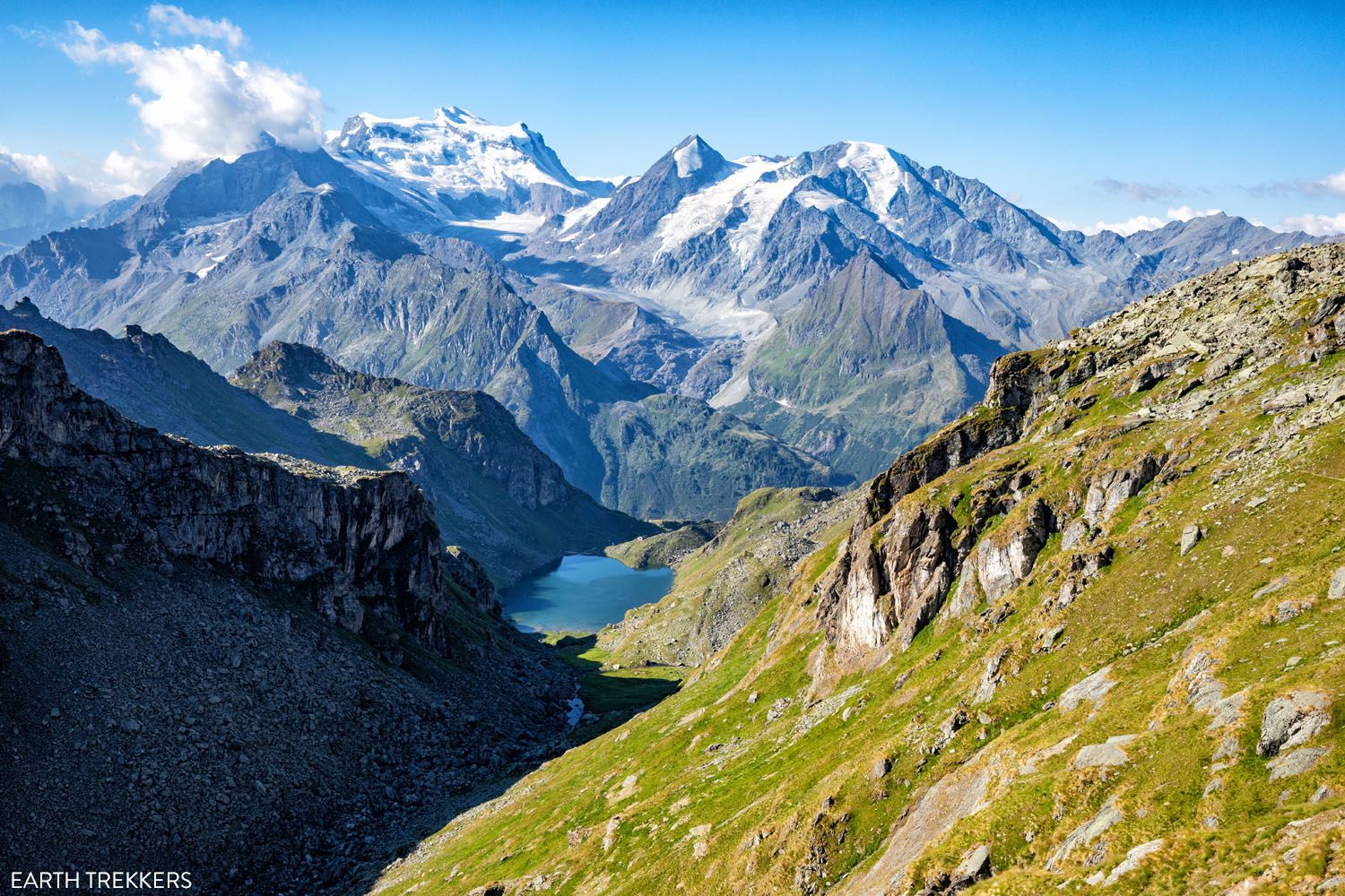
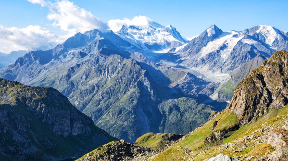
Lac de Louvie and Grand Combin
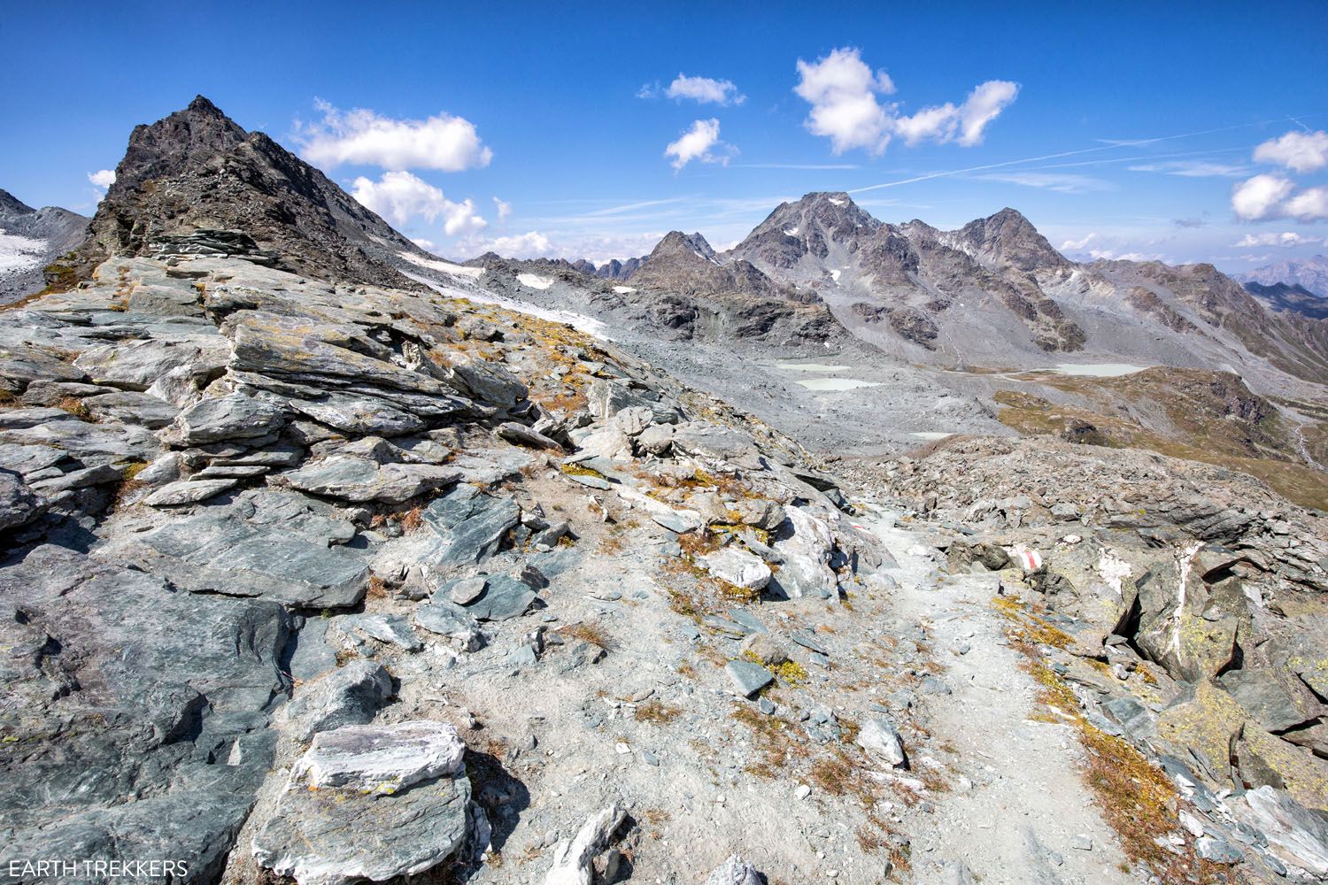
Col de Prafleuri
The daily hiking, climbing, and descending does increase your fitness as you go. It’s amazing how much we adapted to daily mountain ascents. They felt easier and we got faster as we headed into the second week of the Haute Route. So, if some of the later stages, with their massive ascents and descents look daunting, the first half of the stages will prepare you for these.
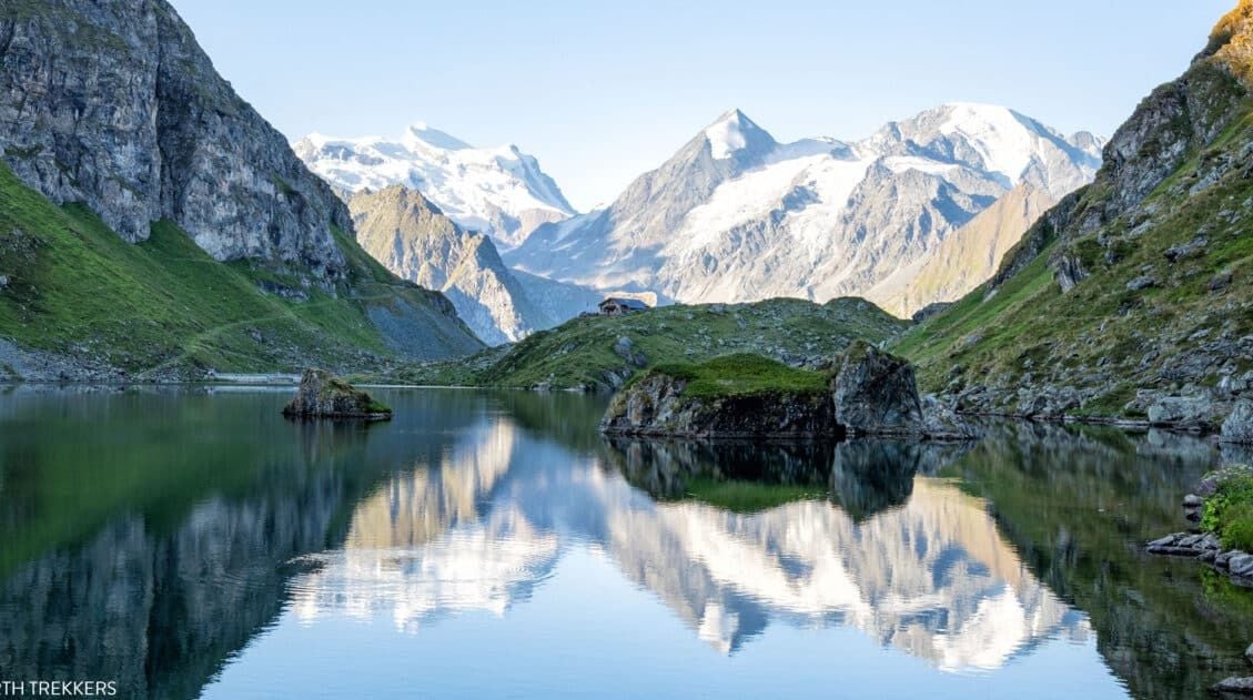
Stage 7: Cabane Prafleuri to Arolla
Distance: 17.4 km (10.8 miles)
Difficulty: Moderate
Total Ascent: 745 m (2,445 feet)
Total Descent: 1,385 m (4,545 feet)
Lowest Elevation (Arolla): 2,035 m (6,675 feet)
Highest Elevation (Col des Roux): 2,860 m (9,380 feet)
Time: 6 hours
Learn More: Stage 7: Cabane Prafleuri to Arolla
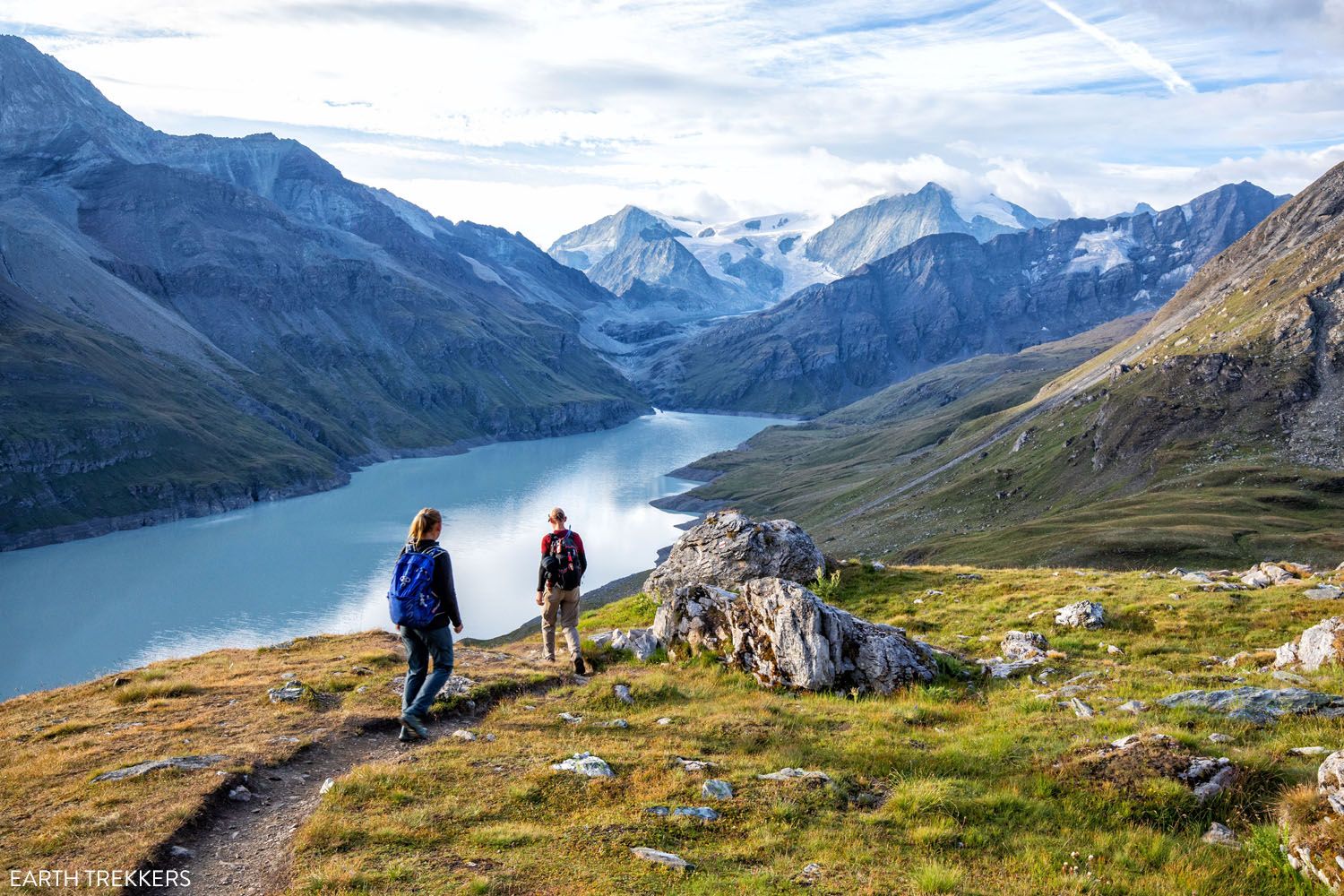
Stage 7 is one of our favorite stages of the Haute Route. Like stage 6, today’s trail covers a wide variety of landscapes, from glacier-covered mountains, a lovely milky-blue lake, forested hills, and wide open grasslands.
In terms of difficulty, stage 7 of the Walker’s Haute Route is relatively easy. You will have one long climb, but for the majority of the stage you will be heading downhill. One of the best parts of Stage 7 is hiking a flat section along a beautiful lake (flat sections of trail are a rare occurrence on the Haute Route). To get to Col des Roux, you’ll climb a series of ladders, another highlight of the day.
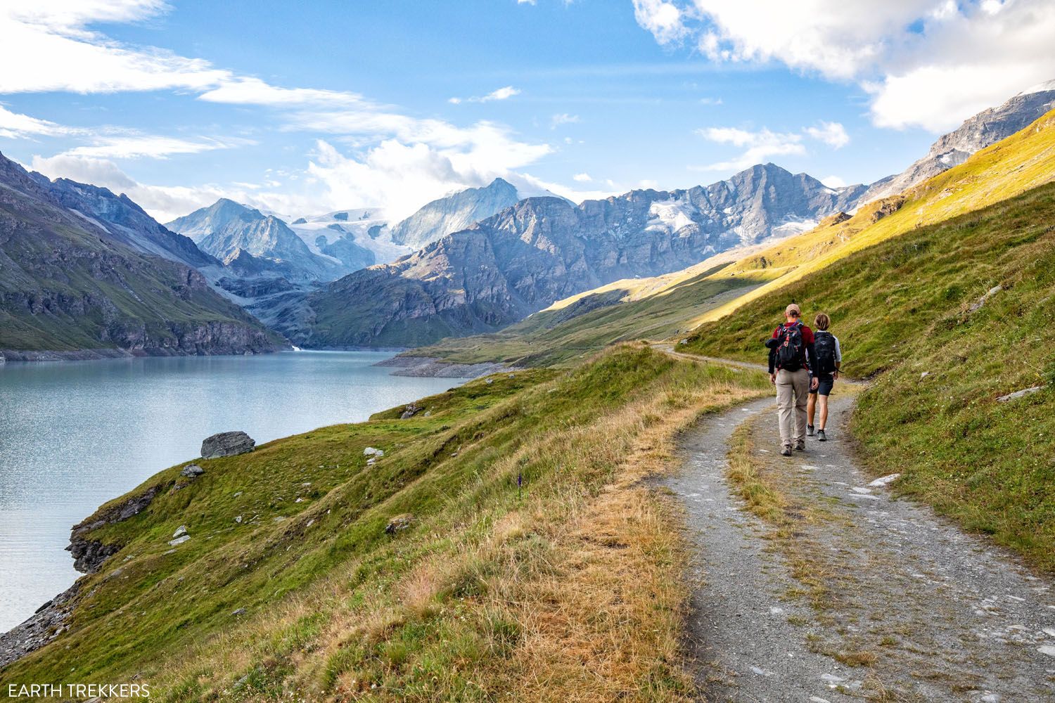
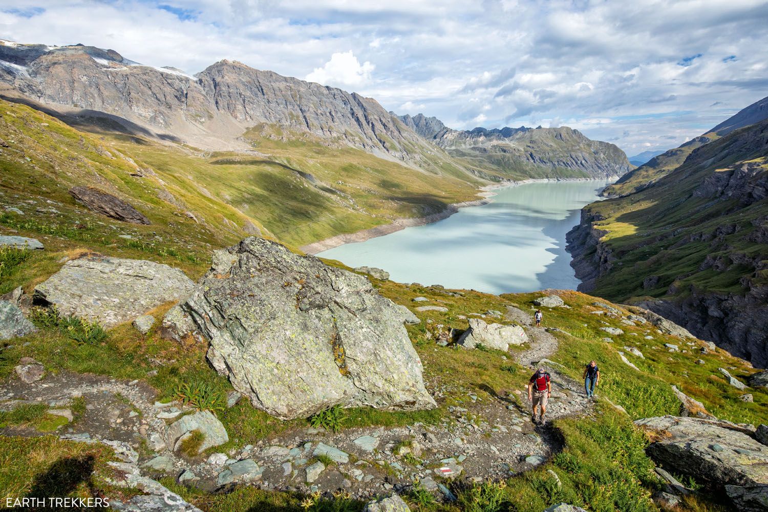
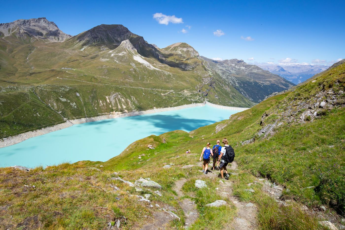
Lac des Dix
Stage 8: Arolla to Les Haudères
Distance: 8.9 km (5.5 miles)
Difficulty: Easy
Total Ascent: 350 m (1,150 feet)
Total Descent: 885 m (2,900 feet)
Lowest Elevation: 1,450 m (4,760 feet)
Highest Elevation: 2,145 m (7,035 feet)
Time: 3.5 hours
Learn More: Stage 8: Arolla to Les Hauderes
Stage 8 is a recovery day. This is both the easiest and shortest of the 14 stages that make up the Walker’s Haute Route and it is a great chance to catch your breath and rest your legs before heading into the final stretches of the Haute Route.
Beginning in Arolla, you will hike up and over hillsides, passing through several quaint hamlets and around Lac Bleu. Then it’s a descent into the valley, where you can stay in Les Haudères or a bit higher in La Sage.
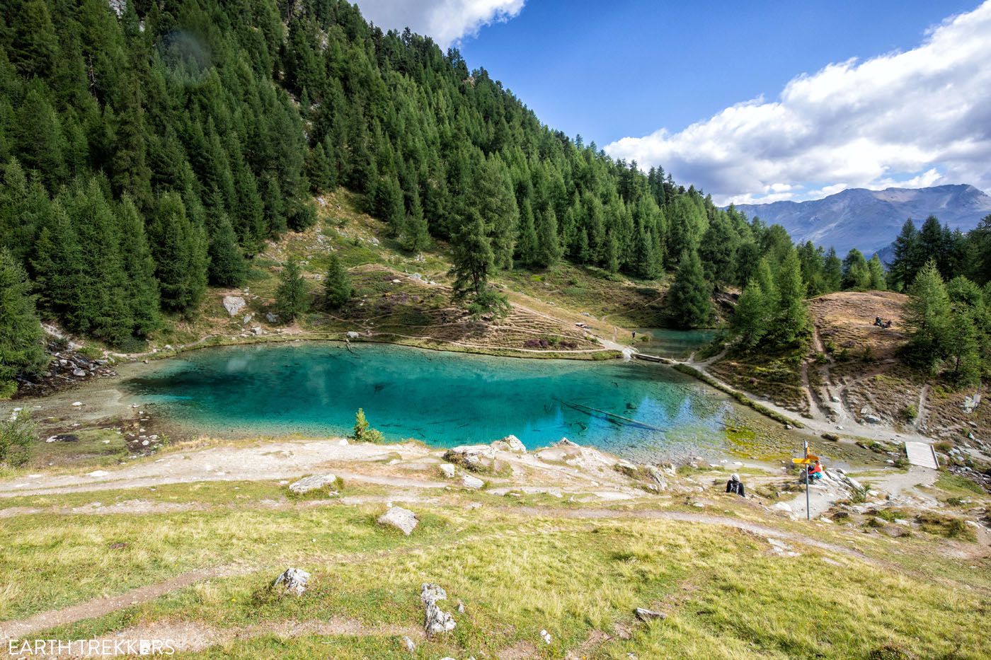
Lac Bleu
Les Haudères
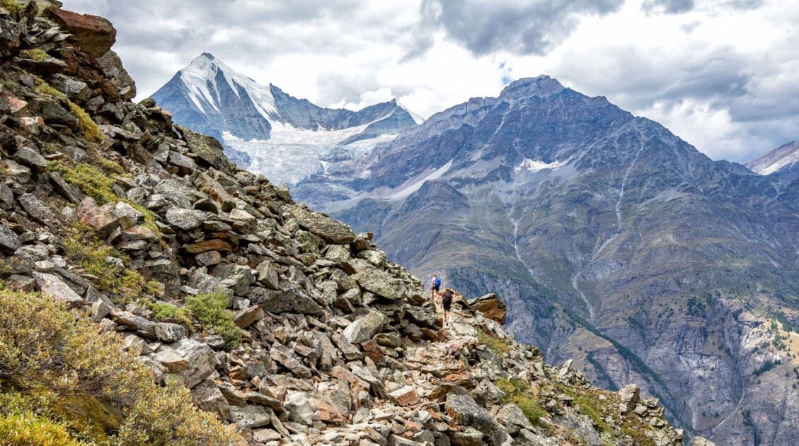
Stage 9: Les Haudères to Lac de Moiry
Distance: 15.8 km (9.8 miles)
Difficulty: Very strenuous
Total Ascent: 1,725 m (5,660 feet)
Total Descent: 975 m (3,200 feet)
Lowest Elevation: 1,470 m (4,825 feet)
Highest Elevation: 2,870 m (9,415 feet)
Time: 6 hours 15 minutes
Learn More: Stage 9: Les Haudères to Lac de Moiry
From Les Haudères or La Sage, it is a challenging hike up to Col du Tsaté. From Col du Tsaté, it is an easier and scenic downhill walk to Lac de Moiry. There are beautiful views as you look out over snow-covered peaks. But the highlight of this stage is seeing the massive Moiry Glacier.
There are several ending points for stage 9. You can either spend the night in Cabane de Moiry or take a bus to Grimentz from Lac de Moiry. We hiked from Les Haudères to Barrage de Moiry, the dam on the far end of Lac de Moiry, and spent the night in Grimentz. The hiking stats above are for this route.
Lac de Moiry
Stage 10: Lac de Moiry to Zinal
Distance: 9.1 km (5.6 miles)
Difficulty: Moderate
Total Ascent: 605 m (1,985 feet)
Total Descent: 1,160 m (3,800 feet)
Lowest Elevation (Zinal): 1,685 m (5,525 feet)
Highest Elevation (Col de Sorebois): 2,840 m (9,315 feet)
Time: 4 hours
Learn More: Stage 10: Lac de Moiry to Zinal
Today’s stage is short but does feature a short, hefty climb up and over Col de Sorebois. More importantly, it’s a mostly downhill walk. The hiking stats make today’s stage look easy, but if big downhills bother your knees, today’s stage can be painful (you can skip the descent and ride the gondola to Zinal).
Since you are walking along hillsides that double as ski slopes in the winter, and into town, today’s stage yet again feels rather urban. We loved Zinal but today’s stage was one of our least favorites.
On the trail to Zinal
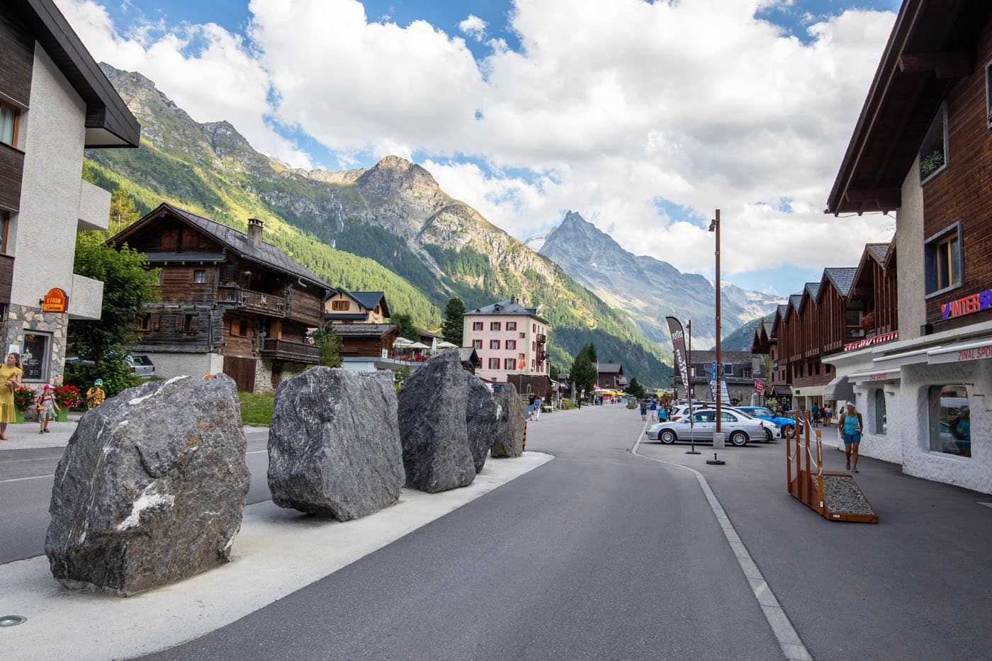
Zinal
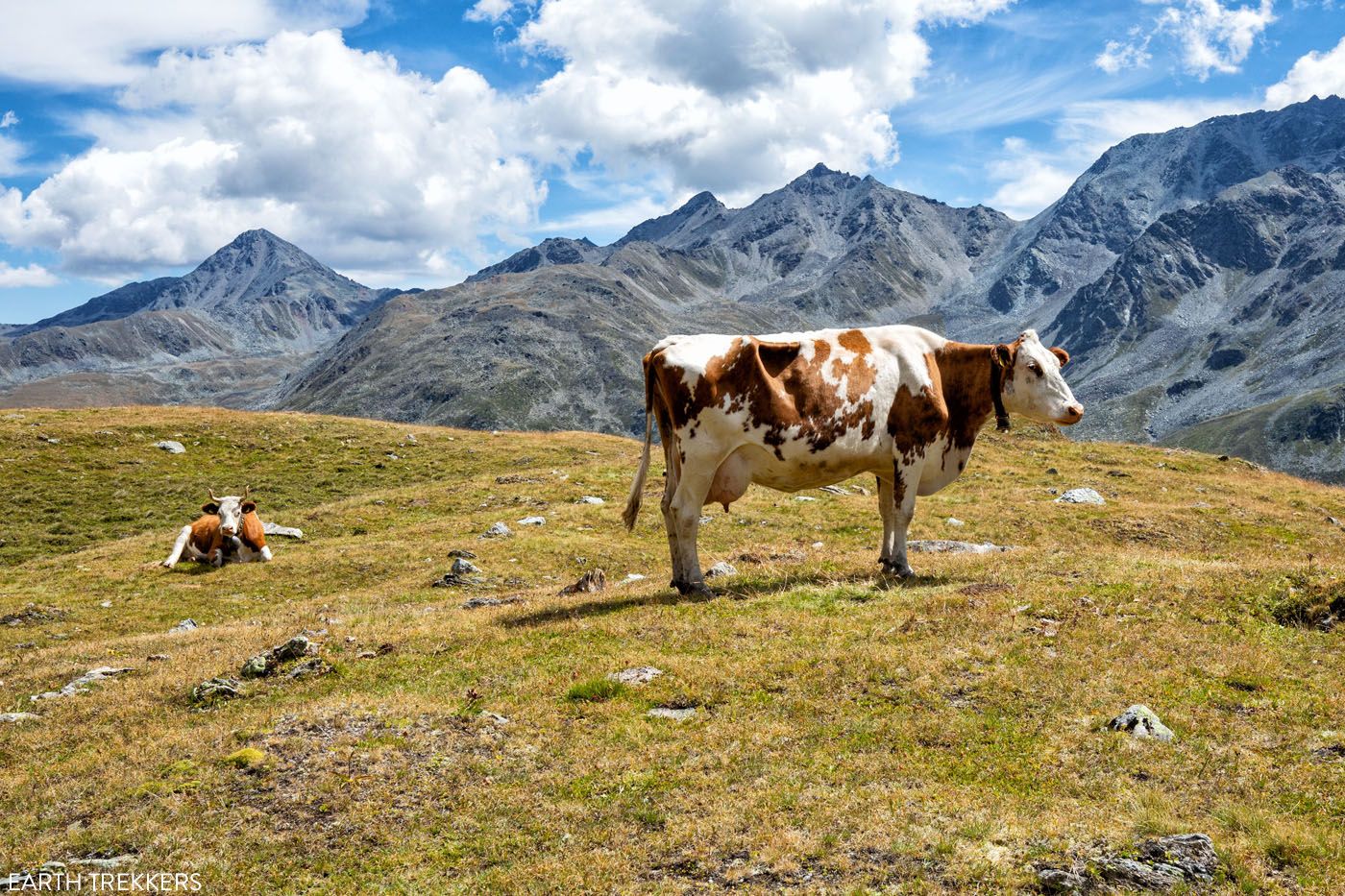
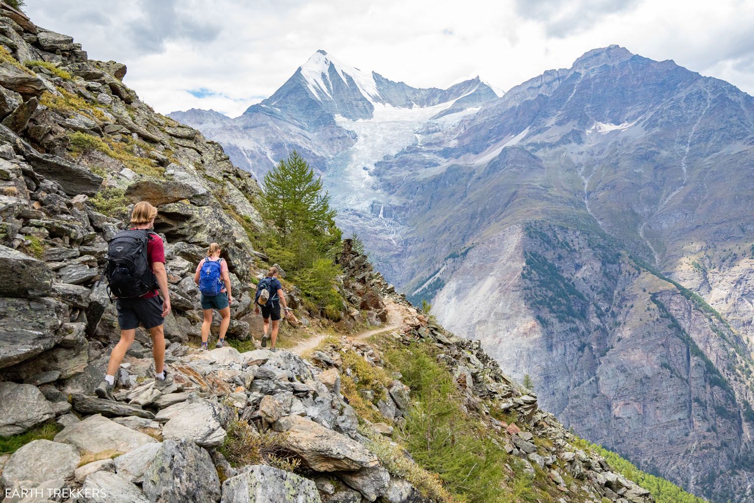
Stage 11: Zinal to Forcletta to Gruben
Distance: 16.6 km (10.3 miles)
Difficulty: Very strenuous
Total Ascent: 1,255 m (4,120 feet)
Total Descent: 1,090 m (3,580 feet)
Lowest Elevation: 1,700 m (5,575 feet)
Highest Elevation: 2,870 m (9,415 feet)
Time: 6 hours
Learn More: Stage 11: Zinal to Gruben
On stage 11, you will yet again hike from a valley up and over a mountain pass, back into another valley.
This is also one of the most beautiful days on the Haute Route. It looks and feels wildly rugged and remote. With jaw-dropping views of the mountains and valleys, low crowds on the trail, and a few cows along the way, this is one of our favorite days on the Walker’s Haute Route.
The stage ends in Gruben, a tiny Swiss village that is only inhabited in the summer months, while the cows graze on grassy hillsides.
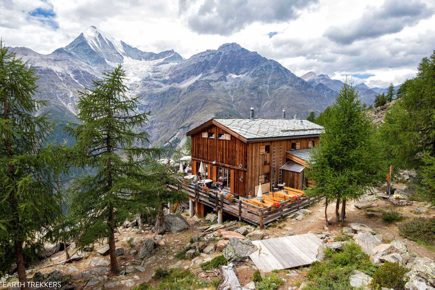
Bishorn
Stage 12: Gruben to Augstbordpass St. Niklaus
Distance: 16.9 km (10.5 miles)
Difficulty: Moderate to strenuous
Total Ascent: 1,135 m (3,725 feet)
Total Descent: 1,830 m (6,000 feet)
Lowest Elevation: 1,160 m (3,800 feet)
Highest Elevation: 2,900 m (9,500 feet)
Time: 7 hours
Learn More: Stage 12: Gruben to Augstbordpass to St. Niklaus
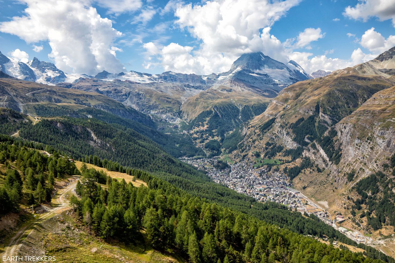
Today’s stage marks the beginning of the end of the Haute Route. With only three stages to go, things once again ramp up in both alpine views and physical challenge in terms of the trail.
Opening up to Mattertal valley and passing through a large hamlet, Stage 12 has little shortage in excellent views. However, with its long ascent and a totally grueling descent, today is one of the hardest stages you’ll complete along the entire Haute Route.
The highlight of stage 12 (and one of the most memorable parts of the entire Haute Route), is rounding the bend and getting your first view of the Mattertal Valley. Not only is it jaw-dropping, but sitting at the far end of the valley is Zermatt, the finish line for the Haute Route.
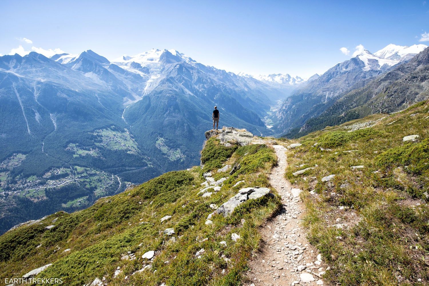
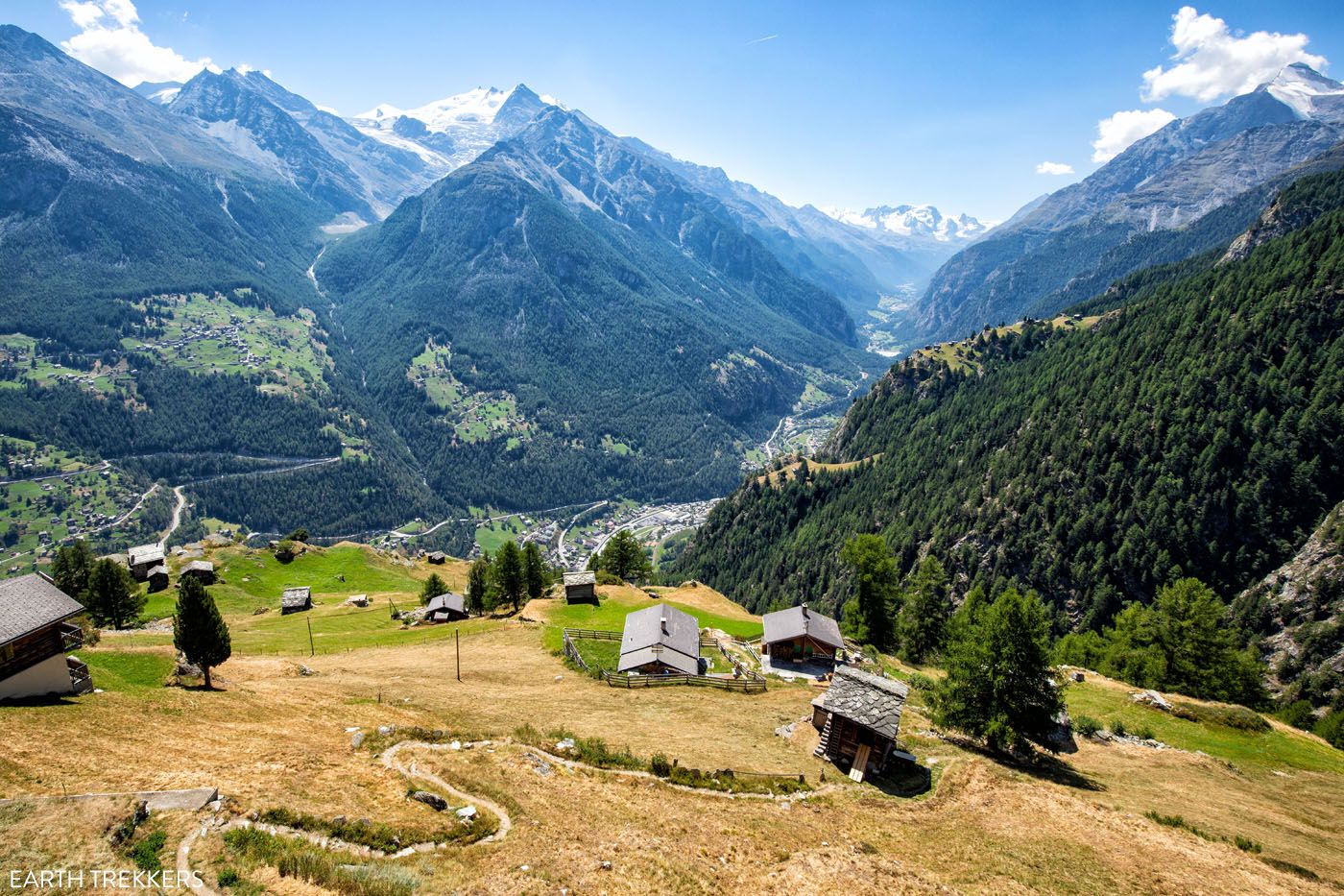
Jungen
Stage 13: St. Niklaus to the Europahütte
Distance: 12.7 km (7.9 miles)
Difficulty: Strenuous
Total Ascent: 1,460 m (4,800 feet)
Total Descent: 350 m (1,150 feet)
Elevation in St Niklaus: 1,160 m (3,800 feet)
Elevation at Europahütte: 2,275 m (7,465 feet)
Time: 5 to 6 hours
Learn More: Stage 13: St. Niklaus to the Europahütte
Stage 13 of the Walker’s Haute Route features the final climb of the trek. There are no more mountain ascents once you reach the Europahütte. Unfortunately, today’s stage features a walk through the Mattertal Valley and then an exhausting uphill slog through a forest to reach the Europahütte.
This is our least favorite stage of the Walker’s Haute Route since most of the time, you are either walking through the valley or hiking up a very steep ascent through a forest.
But it’s still worth it. Spending time at the Europahütte, gazing out across the Mattertal Valley, and seeing the ibex in the evening was one of our favorite moments of the Haute Route. And the walk from the Europahütte to Zermatt (stage 14) was our favorite day of the entire route.
NOTE: The stage 13 route changed in 2021 when the Europaweg was rerouted to a lower route. The original Europaweg is permanently closed between Grat and Galenburg for a rockfall. The “new” stage 13 route runs from St. Niklaus to Herbriggen in the valley. From Herbriggen, it’s a tough climb through the forest to get to the Europahütte.
Europahütte
Stage 14: The Europahütte to Zermatt
Distance: 20.7 km (12.8 miles)
Difficulty: Moderate to strenuous
Total Ascent: 915 m (3,000 feet)
Total Descent: 1,525 m (5,000 feet)
Elevation at Europahütte: 2,275 m (7,465 feet)
Elevation in Zermatt: 1,640 m (5,380 feet)
Time: 7 hours
Learn More: Stage 14: The Europahütte to Zermatt
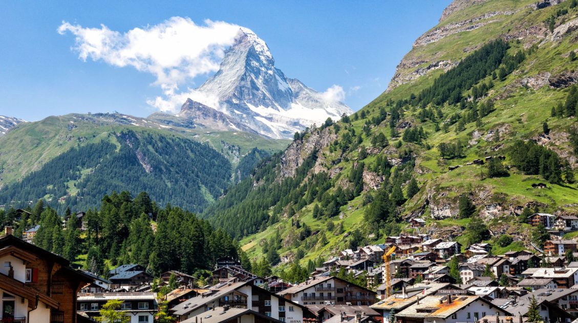
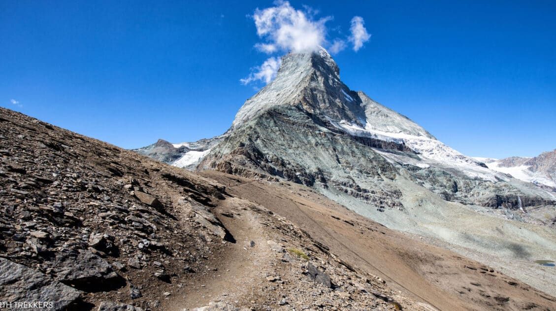
The Haute Route really saves the best for last, as this was our favorite stages of the entire trek. Early in the day, the Matterhorn comes into view, and wow, it’s thrilling to finally see it in all of its majesty.
Every step brings you closer to the end goal of Zermatt, a beautiful town that’s renowned for its skiing and hiking. Enjoy the views along the way, as they only get better the further you go.
This final stage is fun to hike, not overly difficult (although it is one of the longest stages in terms of distance), and the views truly are some of the best of the entire Haute Route.
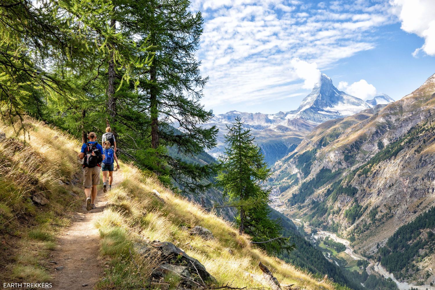
Zermatt & the Matterhorn
Hardest Stages of the Walker’s Haute Route
Here are the 5 toughest stages of the Walker’s Haute Route, starting with the most challenging.
Stage 5: Le Chable to Cabane du Mont Fort (13.3 km/8.2 miles, total ascent: 1,700 meters/5,570 feet). This stage is mostly a mountain climb but flattens out at the top. If you add on Cabane de Louvie, it becomes 21.7km/13.5 miles with 2,130 meters/7,000 feet of total ascent, making it the longest day of the Haute Route with the most elevation gain.
Stage 9: Les Haudères to Lac de Moiry (Barrage de Moiry) (15.8 km/9.8 miles, total ascent: 1,725 meters/5,660 feet). The distance is average but there is a lot of elevation gain on this stage if you hike to Barrage de Moiry or Cabane de Moiry.
Stage 13: St. Niklaus to the Europahütte (12.7 km/7.9 miles, total ascent: 1,460 meters/4,800 feet). This tough climb is mostly through a forest. You don’t have many views along the way to distract you from the big ascent…it feels like a slog most of the way to the Europahütte.
Stage 3: Trient to Champex-Lac (15.3 km/9.5 miles, total ascent: 1,370 meters 4,500 feet). Early in the Haute Route, the climb up and over Fenêtre d’Arpette is one of the toughest climbs of the trek.
Stage 11: Zinal to Gruben (16.6 km/10.3 miles, total ascent: 1,255 m/4,120 feet). This stage’s long distance and big climb combines to make one of the tougher stages (but it’s beautiful!).
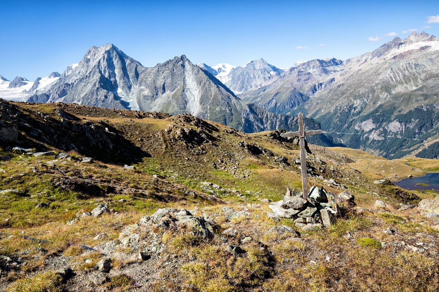
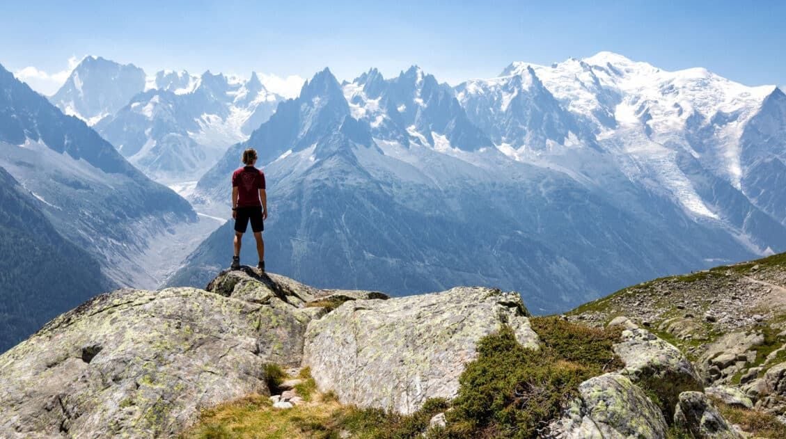
The view from Fenêtre d’Arpette, stage 3 of the Walker’s Haute Route
Easiest Stages
Stage 8: Arolla to Le Haudères (8.9 km/5.5 miles, total ascent: 350 meteres/1,150 feet). This is the shortest, easiest stage of the Walker’s Haute Route.
Stage 1: Chamonix to Argentière (9 km/5.6 miles, total ascent: 315 meters/1030 feet). The first stage is an easy walk from one town to another.
Stage 4: Champex-Lac to Le Chable (13.5 km/8.4 miles, total ascent: 213 meters/700 feet). This is a lovely walk through Swiss village and great rest day between two of the toughest stages of the Walker’s Haute Route.
Stage 10: Lac de Moiry to Zinal (9.1 km/5.6 miles, total ascent: 605 meters/1,985 feet). If you start stage 10 at Barrage de Moiry, this becomes a short day and a good day to rest up before heading into the string of tough days leading to Zermatt.
Stage 7: Cabane de Prafleuri to Arolla (17.4 km/10.8 miles, total ascent: 745 meters/2,445 feet). Stage 7 is one of the most beautiful stages and not overly difficult, with one hill climb and a section where you climb a series of ladders to the high point of the day.
Lac des Dix, stage 5 of the Walker’s Haute Route
Short on Time? Here are Stages to Skip
Stage 1: Chamonix to Argentière. This short stage is one of the least exciting on the Haute Route. Skip it or add it on to stage 2 to make the classic 14-day route a 13-day route.
Stage 13: St. Niklaus to the Europahütte. Walk from St. Niklaus directly to Zermatt in one day, skipping the Europahütte and the Europaweg. This is a very popular way to remove one day from the Walker’s Haute Route, but the downside is that you are missing out on one of the best stages of the Haute Route (stage 14).
Stage 4: Champex-Lac to Le Chable. These two towns can be connected by bus, making it easy to skip. The majority of stages can be skipped this way, should you need to shorten the Haute Route, have bad weather, or just need a rest day.
Champex-Lac
Stages that Can Be Shortened
Stage 3: Trient to Champex-Lac. Rather than hiking up and over Fenêtre d’Arpette, you can take an easier route to Champex-Lac via Col de la Forclaz.
Stage 5: Le Chable to Cabane du Mont Fort. Rather than hiking the entire distance, ride the cable car from Le Chable to Les Ruinettes, lopping of the major climb and most of the stage.
Stage 10: Lac de Moiry to Zinal. Ride the cable car to Zinal to skip the massive, knee crushing descent.
Stage 12: Gruben to St. Niklaus. Ride the cable car from Jungen to St. Niklaus to skip another steep descent.
Stage 13: St. Niklaus to the Europahütte. Ride the train from St. Niklaus to Herbriggen or Randa and hike to the Europahütte from Herbriggen or Randa. This doesn’t eliminate much elevation gain but it does shorten the walk.
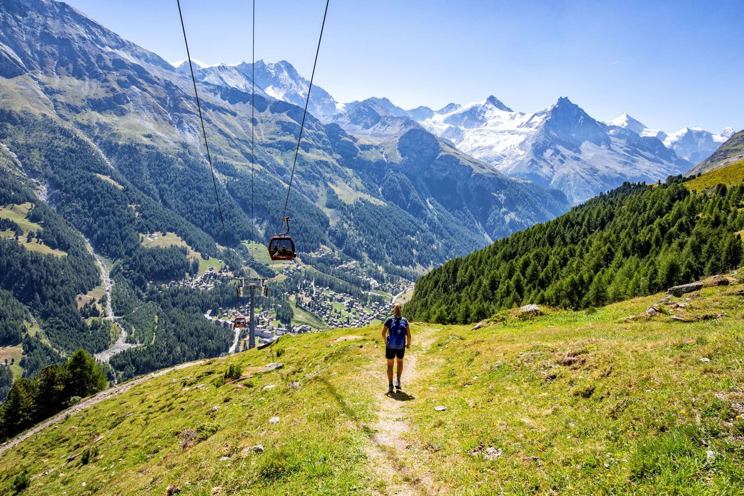
The gondola to Zinal, stage 10 of the Walker’s Haute Route.
Our Favorite Stages
Stage 14: Europahütte to Zermatt. This is our favorite stage, not just because you finally reach Zermatt and the completion of the Haute Route, but the Europaweg is fun to hike and the views of the Matterhorn are thrilling.
Stage 5: Le Chable to Cabane du Mont Fort to Cabane de Louvie. For us, since we continued the hike to Cabane de Louvie, was by far the toughest day of the Haute Route. And I think we loved this day for the challenge of it. Plus, staying at Cabane de Louvie was an all-around wonderful experience.
Stage 6: Cabane de Louvie to Cabane de Prafleuri. On this day, you cross several cols, stand on the highest point along the Haute Route, and hike across the most remote area along the Haute Route.
Stage 7: Cabane de Prafleuri to Arolla. On this relatively easy day, the views are amazing, crowds are low (since there are very few day hikers on this trail), and climbing the ladders is a blast.
Stage 11: Zinal to Gruben. This day also has more of a remote feel. We loved feeling like we were out on our own. Hiking through the cow pastures and seeing Ibex high on the hills were also memorable.
Stage 13: Gruben to St. Niklaus. The first views of the Mattertal Valley are amazing. Not only is the view fantastic, but seeing Zermatt off in the distance is a thrilling experience.
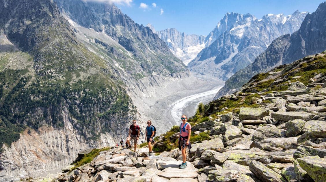
Walker’s Haute Route stage 6
Frequently Asked Questions
How long does the Haute Route take?
In total, the Walker’s Haute Route is 209 km (130 miles) with 14,800 meters (48,500 feet) of total ascent. Most people do this in 13 to 14 days, averaging about 16 km (10 miles) per day.
How hard is the Haute Route?
The Walker’s Haute Route is tough. On the average day, you will hike 16 km (10 miles) with 1,100 meters (3,500 feet) of ascent. And you will do this 13 times in a row, if you complete the Haute Route in 13 days. With the daily long distances, big climbs, and sometimes painful descents, this is a tough trek and it’s known as one of the hardest multi-day walks in Europe.
Do you need a guide for the Haute Route?
No, you do not need a guide for the Walker’s Haute Route. The trails are very well signed and easy to follow in Switzerland. A good guidebook (we recommend Trekking Chamonix to Zermatt, The Classic Walker’s Haute Route by Kev Reynolds) will explain the daily route and give you options to shorten it, should you have bad weather.
A good digital map with the GPS track is also worth having. We recommend using the GPS data provided by TMBTENT in the Gaia app. The Gaia app has good background maps that you can download so you do not have to rely on cellular service.
What do you do with your luggage on the Haute Route?
You can either backpack the Walker’s Haute Route (carrying everything in a backpack) or you can hire a luggage transfer service. The transfer service will transport your luggage from one hotel to another, so you never have to carry your things, other than a small day pack.
If you have any questions about the stages of the Walker’s Haute Route, or if you have done this and want to share your experience, let us know in the comment section below.
More Information Related to the Haute Route
How To Plan Your Walker’s Haute Route Experience
Pinterest Facebook Flipboard The Walker’s Haute Route is a 14-stage trek from Chamonix, France to Zermatt, Switzerland. It is a tough yet rewarding experience through the French and Swiss Alps that crosses 10 mountain passes and offers incredible scenery along the way. It is a beast of a trek! It took us 13 days, averaging […]
Walker’s Haute Route: 21 Important Things to Know & FAQ
The Walker’s Haute Route is one of the most rewarding and memorable multi-day walks in Europe. On this journey, hikers will cross 10 of the highest mountain passes in the Alps, while walking from Chamonix, France to Zermatt, Switzerland. It’s an extraordinary journey but not without its challenges. With 14 stages, multiple variations to the […]
Ultimate Guide to the Walker’s Haute Route
Walker’s Haute Route The Walker’s Haute Route is one of the most rewarding and memorable multi-day walks in Europe. On this trek, hikers cross 10 of the highest mountain passes in the French and Swiss Alps, as they walk from Chamonix, France to Zermatt, Switzerland. Walking from Chamonix to Zermatt takes you to remote mountain huts, to tiny […]
How To Book Your Walker’s Haute Route Accommodations
Along the Walker’s Haute Route, there are a variety of accommodation types, from mountain huts to 5-star hotels, from dormitories to apartments, and from shared bathrooms to private bathrooms. You will have the opportunity to experience a combination of all of these since you will be staying in a new place at the end of […]
24 Best Things to Do in Chamonix, France in the Summer
Discover the best things to do in Chamonix, France in the summer. This guide covers the top cable cars, hiking trails, glaciers, and adventures in Chamonix, based on our firsthand experience hiking and exploring the area. Chamonix is one of the most spectacular mountain destinations in Europe, and in the summer, it’s an outdoor playground […]
Grand Balcon Nord Hike: Best Direction, Hiking Stats & Tips
The Grand Balcon Nord is one of the best hikes in Chamonix. This trail runs above the valley, offering sweeping views of Mont Blanc at one end and Mer de Glace, France’s largest glacier, at the other. Tim, Tyler, Kara, and I hiked it in July as part of a five-day visit to Chamonix before […]
Aiguille du Midi + Panoramic Mont-Blanc: The Ultimate Guide
At 3,842 meters (12,605 feet), Aiguille du Midi is one of the highest places you can reach by cable car in the world and the closest most people will ever get to the summit of Mont Blanc without a rope and crampons. We’ve ridden cable cars across Europe from the Dolomites to Zermatt, and this […]
Best Hikes in Europe: 25 Incredible Hikes for Every Level
From the dramatic cliffs of Norway to the jagged peaks of the Dolomites and the volcanic landscapes of Iceland, Europe is packed with some of the most unforgettable hikes in the world. In this guide, we share our favorite hikes in Europe, trails that stand out for their scenery, uniqueness, and overall experience from start […]
20 Amazing Things to Do in Zermatt, Switzerland
Zermatt is an idyllic mountain village tucked away in the Swiss Alps. The mighty Matterhorn dominates the skyline, creating one of the most unique alpine landscapes in Europe. Explore the hiking trails, journey up higher into the mountains by cable car and train, stroll the scenic streets of Zermatt, and go skiing all year long. […]
The Ultimate Zermatt Itinerary for 1 to 4 Days
How many days do you need in Zermatt? How do you plan the perfect Zermatt itinerary? The answer to these questions depends on several factors. How much time do you have? Do you want to get out and hike the trails or simply ride the cable cars to viewpoints of the Matterhorn? What time of […]
How to Climb the Breithorn: Photos, Trail Stats & What to Expect
Climbing to the summit of Breithorn is one of Zermatt’s most adventurous experiences. Standing at a height of 4,164 meters (13,660 feet), Breithorn is one of the highest peaks in the area and it is one of the easiest 4,000+ meter peaks to summit in the Alps. Thousands of hikers come to Zermatt to summit […]
Complete Guide to the Hörnlihütte Hike (Map, Trail Stats & Photos)
The Hörnlihütte (Hörnli Hut) is a lodge built at the base of the Matterhorn. For thrill seeking rock-climbers, the Hörnlihütte marks the start of the ascent up to the peak of the Matterhorn. Even if you do not wish to stand on top of the Matterhorn, simply hiking to and from the Hörnlihütte makes for […]
Switzerland Travel Guide: How to Plan a Trip to Switzerland
Switzerland Travel Guide Looking to hike some of the world’s most beautiful mountain landscapes, stroll through colorful old towns, and dine on some fondue? Then Switzerland is the perfect place for you! Visit the Bernese Oberland, a hikers paradise filled with towering mountains, alpine meadows, historic cogwheel trains, and quaint villages. Or, relax at Switzerland’s […]

Comments 43