
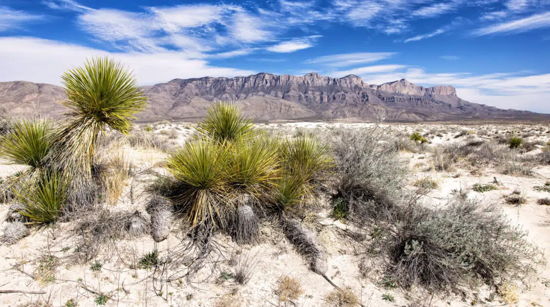
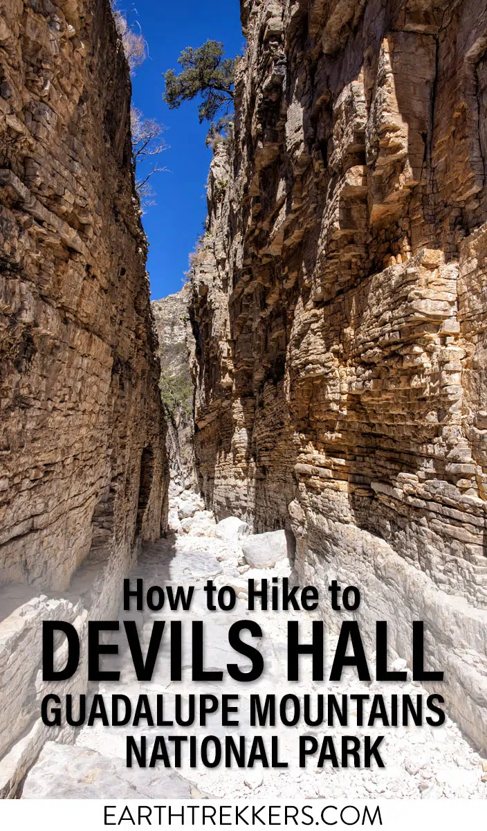
The Devil’s Hall Trail is one of the most unique hikes in Guadalupe Mountains National Park. It’s a 4.2-mile round-trip route through Pine Springs Canyon that ends at a narrow limestone slot canyon with 50-foot walls and just 15 feet of width at its narrowest point. Along the way, you’ll scramble through a rocky wash, navigate your way by cairns, and climb the Hiker’s Staircase, a natural formation of stacked limestone layers that leads directly to the canyon entrance.
Tim and I hiked this after doing Guadalupe Peak the same day, which we only recommend if you’re feeling ambitious. The rock scrambling that’s straightforward when fresh becomes a real concentration exercise on tired legs.
On its own, this is an ideal hike: short enough to finish in a morning, interesting enough to feel like an adventure. If you’re visiting with kids who like to scramble, they’ll love it.
At a Glance: Devils Hall Trail
LOCATION | Guadalupe Mountains National Park
DISTANCE | 4.2 miles (6.8 km) round trip
DIFFICULTY | Moderate to strenuous
TOTAL ASCENT | 800 feet (244 meters)
TIME | 2–4 hours
TRAILHEAD | Pine Springs Trailhead
DOGS | Not allowed on trail
FEES | Park entrance fee required
FLASH FLOOD WARNING | Do not hike in wet or rainy conditions
Is the Devil’s Hall Trail Worth It?
Yes, and it’s one of the most interesting hikes in Guadalupe Mountains National Park precisely because it doesn’t feel like a typical trail. The combination of open canyon walking, boulder scrambling through the wash, the Hiker’s Staircase, and the slot canyon payoff at the end gives you more variety in 4 miles than most hikes twice the length.
That said, it’s not for everyone. Here’s who will get the most out of it:
This hike is a great fit if you:
- Enjoy rock scrambling and don’t mind using your hands
- Are visiting with adventurous kids who like to climb
- Want a shorter hike that still feels like a real adventure
- Are looking for an alternative to the full Guadalupe Peak climb
You may want to reconsider if you:
- Prefer a clear, defined trail underfoot because the wash section has no marked path
- Have knee or ankle issues, as the uneven boulder terrain is demanding on the descent
- Are hiking in wet conditions or with rain in the forecast; the wash becomes dangerous and flash floods are a real risk
Tim and I also combined this with Guadalupe Peak in a single day, but we’d only recommend that if you’re a strong, fit hiker. By the time we reached the wash on tired legs, the scrambling required real concentration to do safely.
Devil’s Hall Hiking Stats & Elevation Profile
Distance: 4.2 miles (6.8 km) round trip
Difficulty: Moderate to strenuous
Total Ascent: 800 feet (244 m)
Lowest Elevation: 5,850 feet (1,783 m)
Highest Elevation: 6,400 feet (1,950 m)
Time: 2 to 4 hours
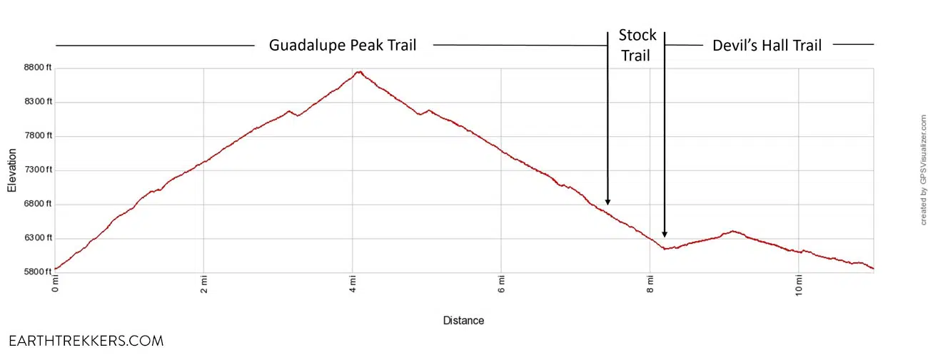
Note: Our GPS recorded 3.75 miles (6 km) round trip; the NPS lists the official distance as 4.2 miles (6.8 km). The elevation profile below reflects our recorded distance.
ABOUT THE DIFFICULTY OF THIS HIKE: The difficulty varies based on conditions. If the wash is dry and you have experience rock scrambling, most people finish in about 2 hours. If the wash is wet, this hike becomes significantly harder and longer and the NPS urges hikers to avoid this trail in wet or rainy conditions due to flash flood risk.
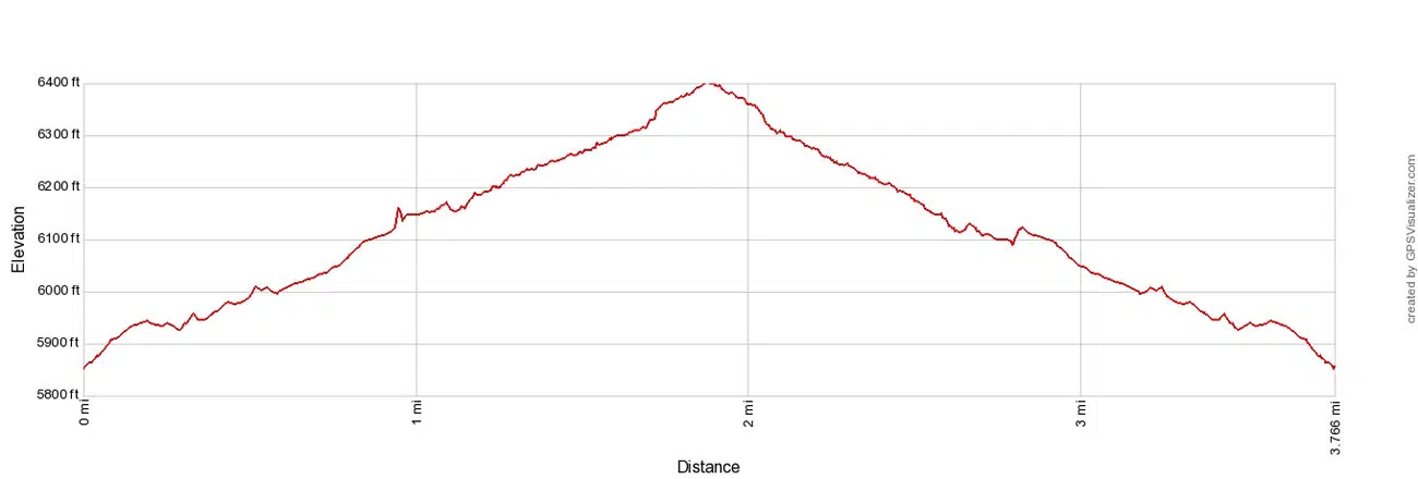
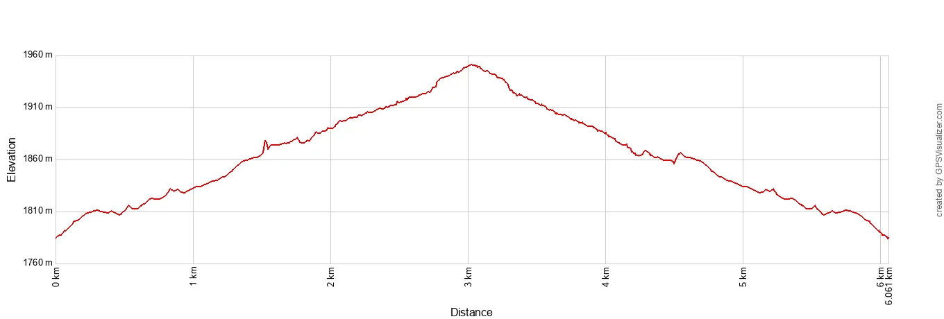
Elevation profile based on our GPS data (3.75 mi / 6 km). The NPS lists the official distance as 4.2 miles (6.8 km) round trip. This elevation profile makes it look like you are climbing a mountain, but the elevation change from the trailhead to Devils Hall is only 550 feet (168 m). It is a gradual uphill walk to get to Devil’s Hall and not as strenuous as it looks on this graph.
Please practice the seven principles of Leave No Trace: plan ahead, stay on the trail, pack out what you bring to the hiking trail, leave areas as you found them, minimize campfire impacts, be considerate of other hikers, and do not approach or feed wildlife.
Getting There: Trailhead & Parking
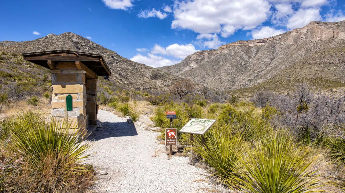
The hike to Devil’s Hall starts at the Pine Springs Trailhead.
The best place to park is at the parking lot right next to the Pine Springs Trailhead. The trick is getting a parking space here because the parking lot fills up early. We were able to get one of the last spots at 7:30 am.
Once this parking lot fills up, the next closest place to park is next to the Pine Springs Visitor Center. From here, it is a flat, 0.4 mile walk one-way to get to the trailhead.
If the visitor center parking lot fills up, the third overflow parking lot much farther away, on Highway 62. From here, it is a 0.8-mile walk to the trailhead, which adds almost 2 miles onto the hiking stats above.
There are restrooms next to the Pine Springs Trailhead.
Before heading out, sign the trail register at the Pine Springs Trailhead kiosk. This is standard practice in Guadalupe Mountains National Park and helps rangers track who is on the trails.
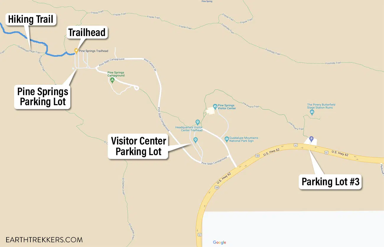
Devil’s Hall Trail parking map
How to Hike the Devil’s Hall Trail
Mile 0 – 1.0: Pine Springs Trailhead to the Wash
The trailhead is located on the northwest corner of the Pine Springs parking lot. Less than a tenth of a mile into the hike you reach a trail junction. Turn right to hike the Devil’s Hall Trail.
For the first mile, the trail is a narrow dirt trail. It gradually heads uphill, as you head into the canyon, but it is nothing too strenuous.
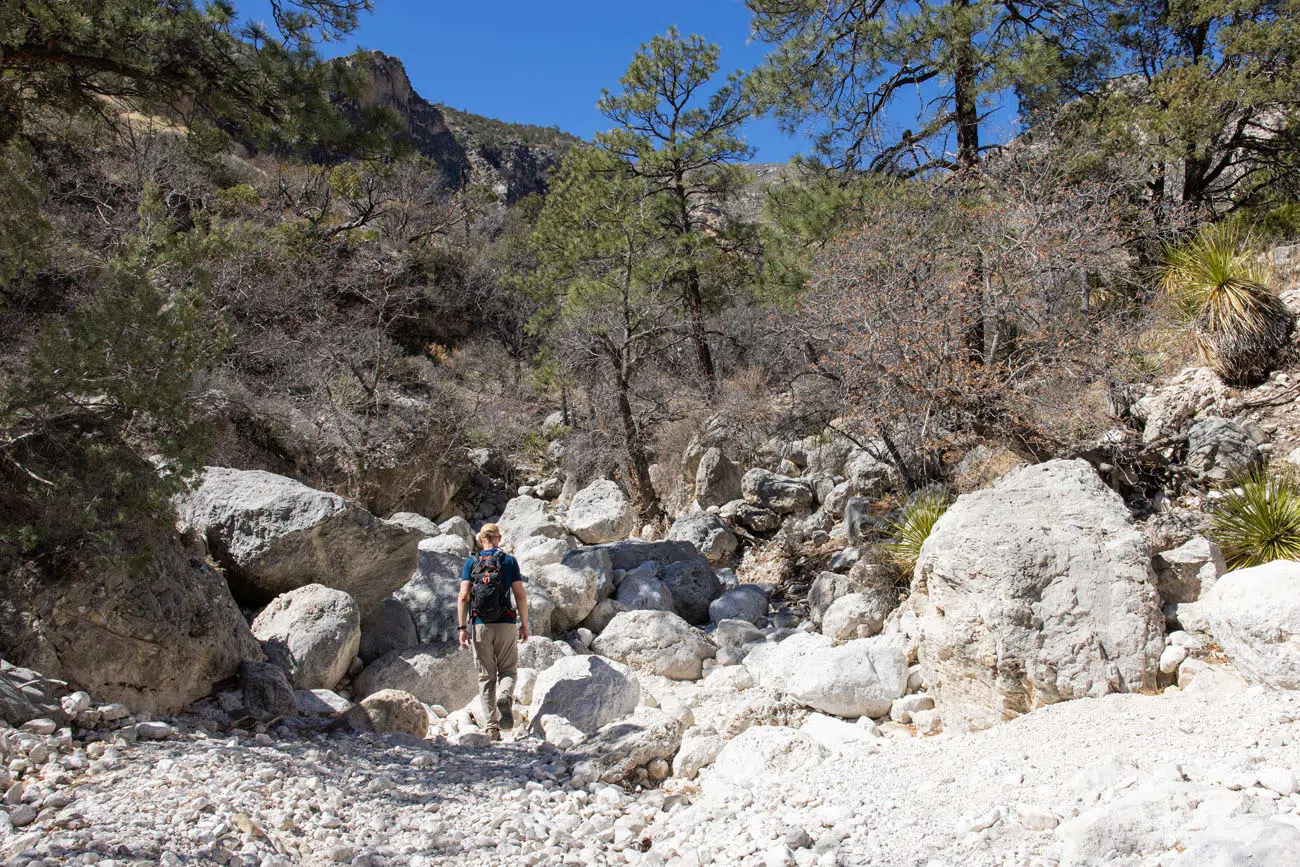
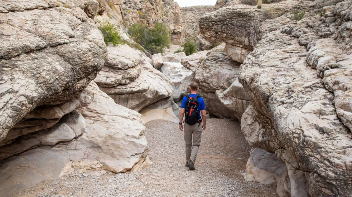
Mile 1.0 – 1.75: Into the Wash
At around the 1-mile point, the trail enters the wash. This is where the hike gets to be a lot more interesting, and a lot more fun if you like rock scrambling.
The terrain here is very uneven, since you are now walking on a riverbed covered with rocks of all sizes. Most of the year the wash is dry, but if it is wet, hiking this part of the trail becomes much more challenging. If rain is in the forecast, skip this hike, because it can be dangerous to be in the wash if flash floods occur.
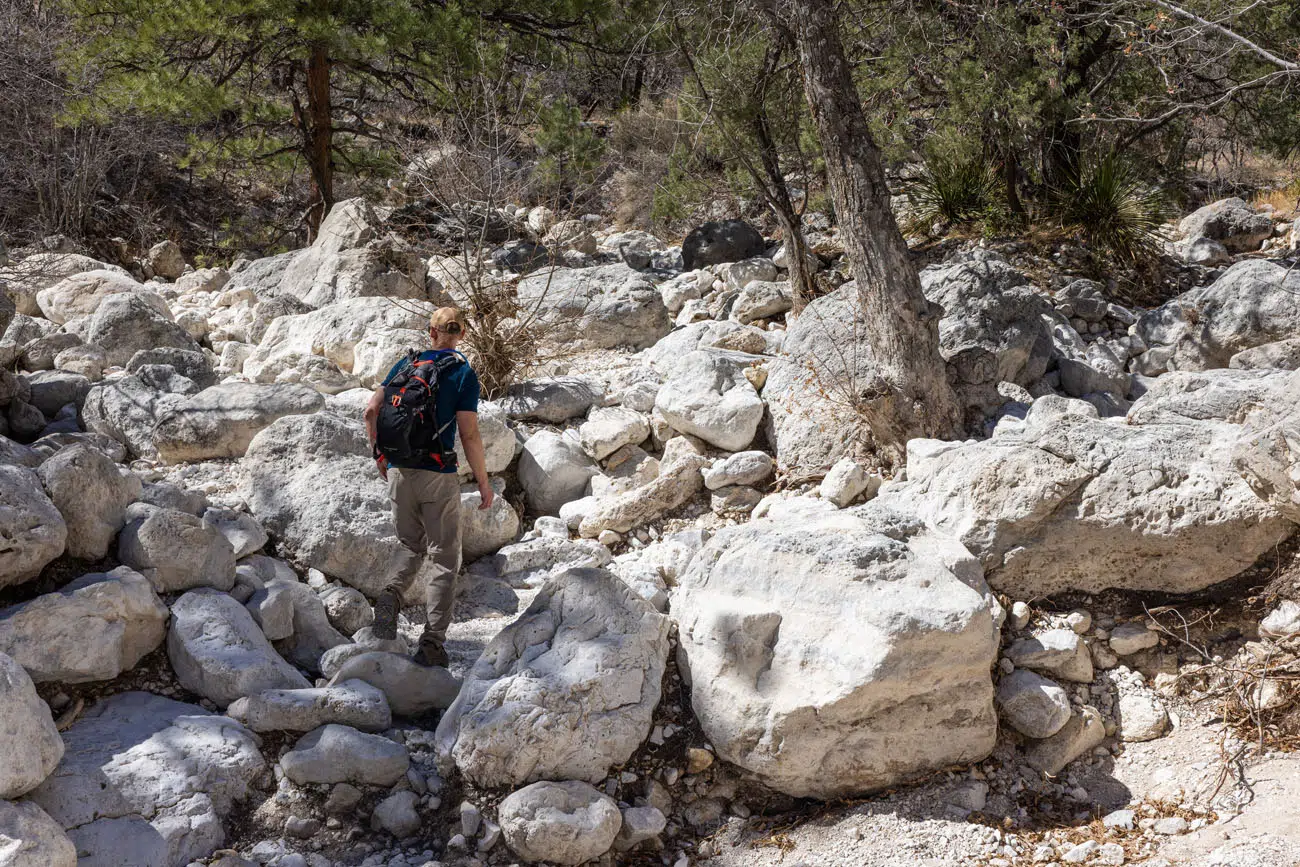
For roughly 0.75 miles, the trail is located in this wash. Periodically, the piles of boulders will be large enough that you will have to do some rock scrambling to get past them. This gets to be tiring, especially the farther you go. There is no defined trail through the wash…you simply pick what you think is the best path through the stacks of boulders.
Devil’s Hall Trail
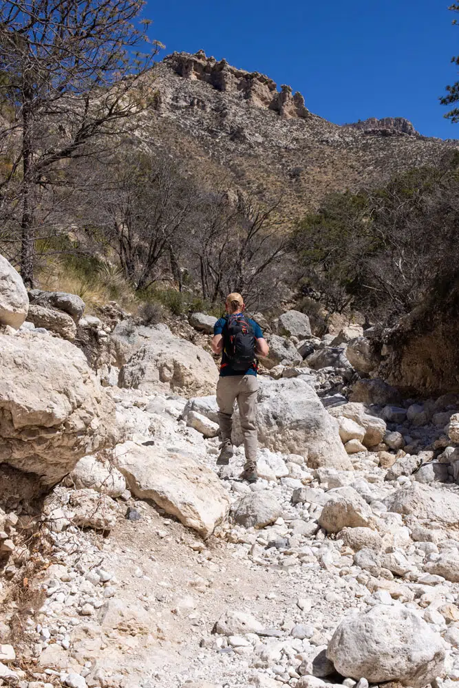
In fall (mid-October through mid-November), the big-toothed maple and oak trees lining the upper wash add color to the canyon walls above, making it one of the better fall foliage hikes in the park.
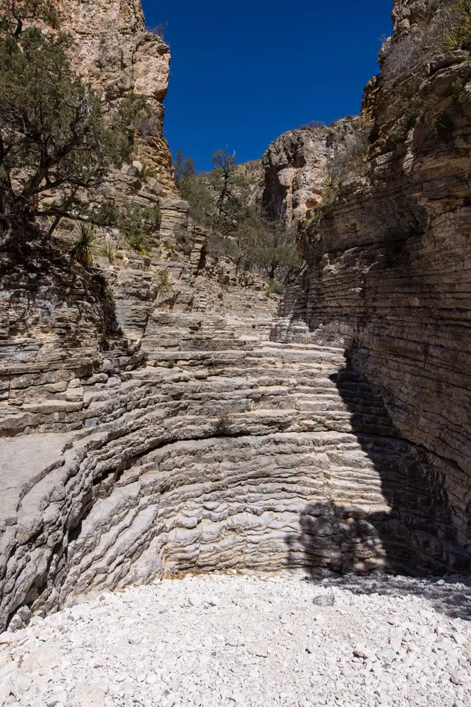
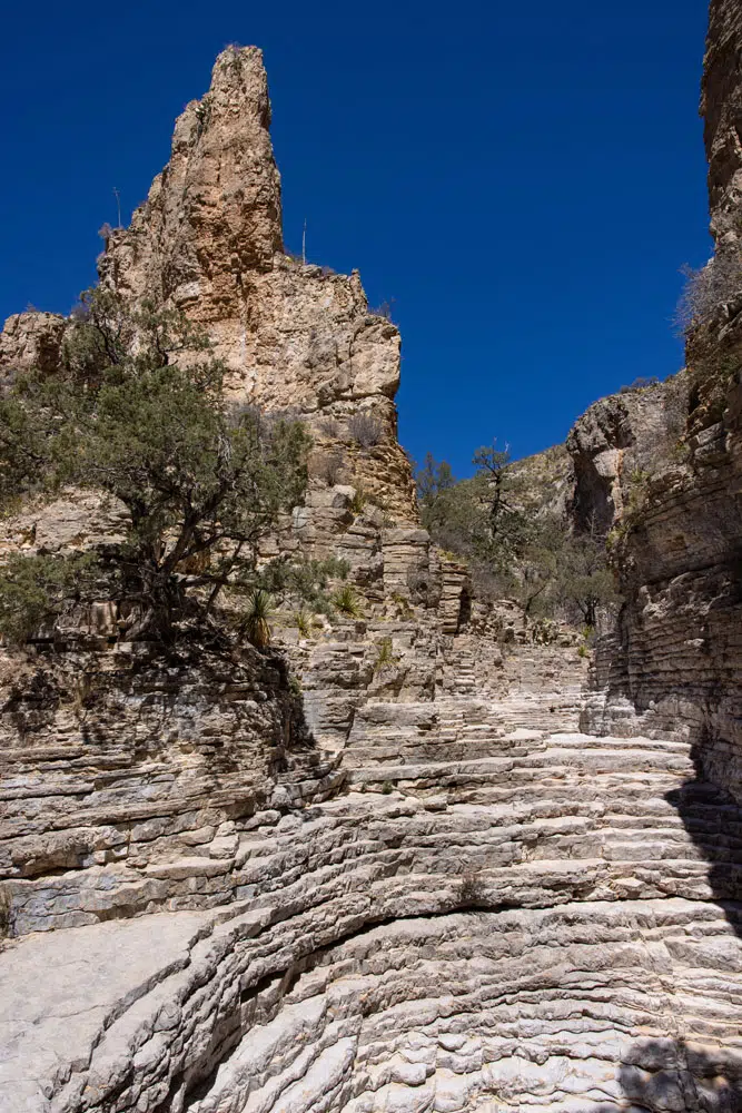
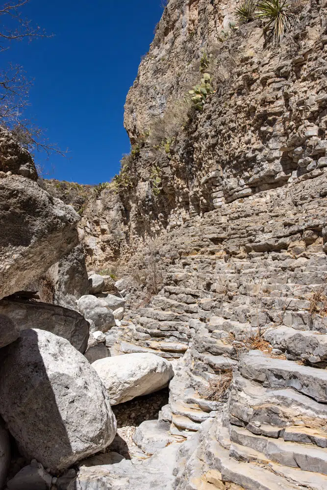
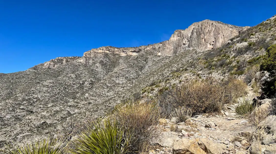
Mile 1.75 – 1.9: The Hiker’s Staircase
Near the end of the trail you reach the Hiker’s Staircase, a natural rock formation where centuries of erosion have carved the layered limestone into a series of stepped ledges. This small canyon has layered rocks on both sides. It looks a lot like Devil’s Hall and it’s easy to mistake this canyon for the “true” Devil’s Hall (that’s still farther up the trail).
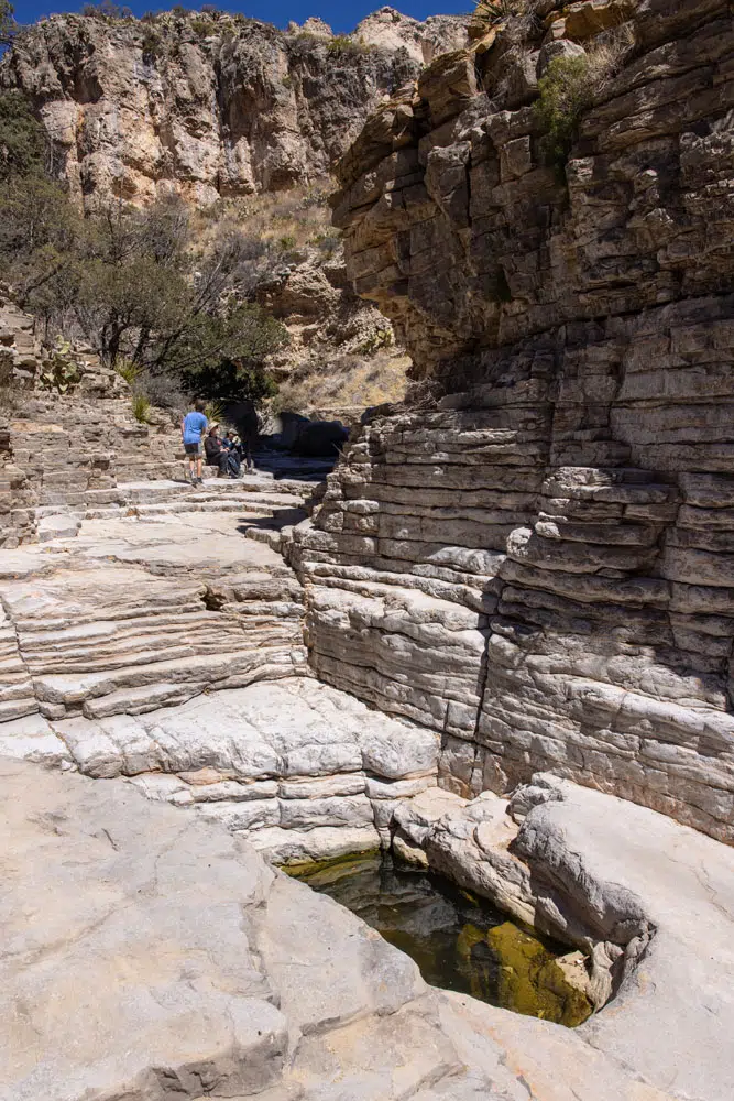
There are two ways to get up the staircase. You can either climb right up the middle, using the layers as a staircase. Or you can climb up the left side of the wall and rock scramble along the side of it. This way is more challenging but this is what we did.
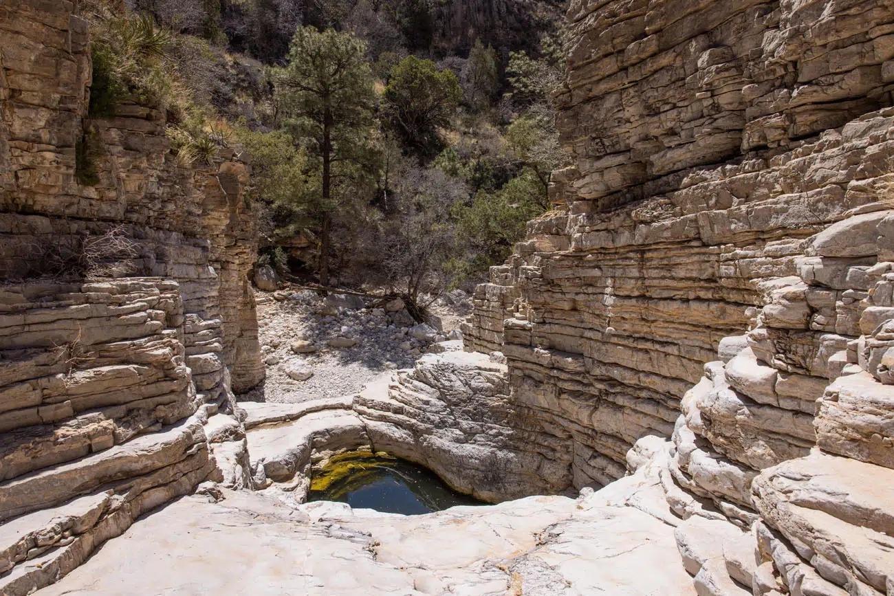
Walk around the small pool of water, climb up the second, smaller staircase, and continue to walk up the wash.
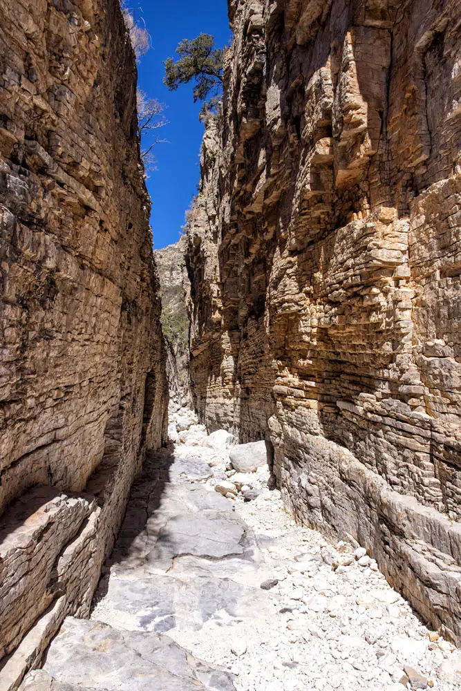
Mile 1.9 – 2.1: Devil’s Hall
Beyond the first hall, it is about a five-minute walk to get to Devil’s Hall. Now you are walking alongside a tall canyon wall and will have a few more sections of rock scrambling before you get to the end of the trail.
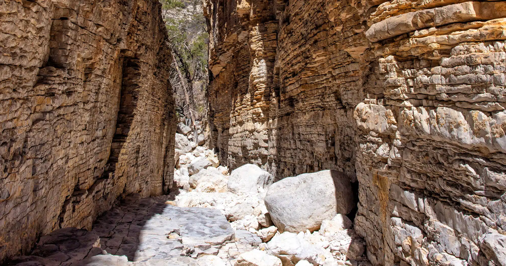
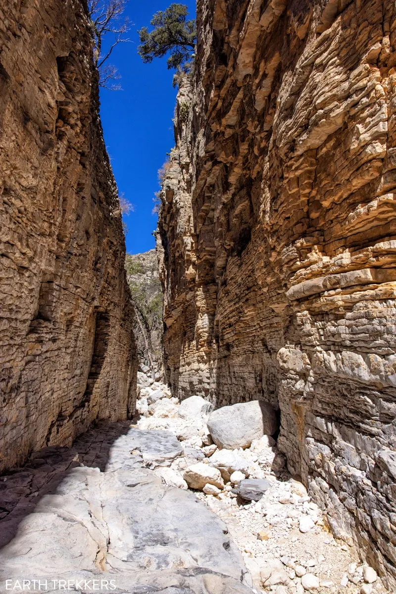
The trail ends at Devil’s Hall, a narrow limestone slot canyon roughly 100 feet long, with sheer walls that rise about 50 feet and close to just 15 feet wide at the narrowest point. The rock here is the same ancient limestone that forms the Guadalupe Mountains themselves, laid down when this entire region sat beneath a shallow inland sea.
It’s quieter here than anywhere else on the trail, and if there’s any breeze moving through the canyon, you’ll feel it.
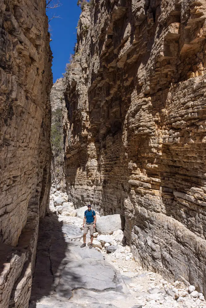
Devil’s Hall
To finish the hike, retrace your steps back to the Pine Springs parking lot.
Adding on Guadalupe Peak
Guadalupe Peak is a very popular hike in Guadalupe Mountains National Park. If you are very fit, it is possible to combine Guadalupe Peak and Devil’s Hall into one big day hike.
Hiking Stats
Distance: 11.25 miles (18.1 km) round trip
Total Ascent: 3,450 feet (1,052 m)
Lowest Elevation: 5,850 feet (1,783 m)
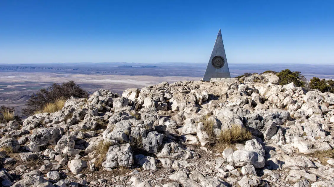
Highest Elevation (Guadalupe Peak): 8,751 feet (2,667 m)
Time: 6 to 10 hours
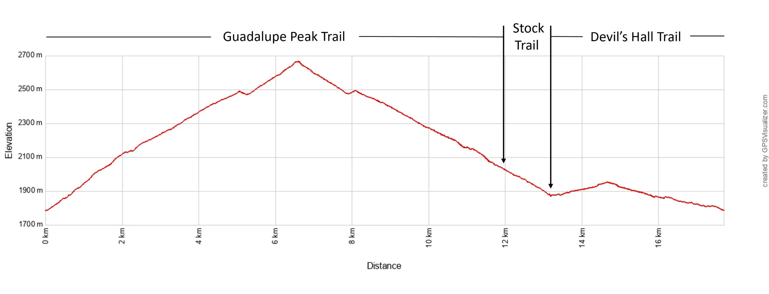
Guadalupe Peak and Devil’s Hall Elevation Profile
Guadalupe Peak Trail Guide: Hiking the Highest Point in Texas
Step-by-step trail guide for Gaudalupe Peak.Hike to Guadalupe Peak first. This is the toughest of the two hikes and on your way back down, you can decide if you still have the energy to hike the Devil’s Hall Trail.
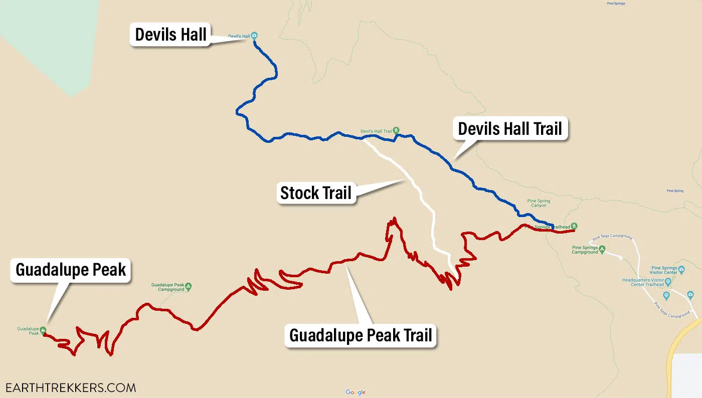
To get to Devil’s Hall, as you hike back to the trailhead, keep a lookout for the trail junction with the sign that reads “no stock beyond this point.” Take this trail to the left. This stock trail heads downhill for 0.75 miles, joining up with the Devils Hall Trail. Basically, it’s a shortcut, so you don’t have to walk to the Pine Springs Trailhead and then start the Devil’s Hall Trail.
Once you reach the Devil’s Hall Trail, continue it to the end (about 1 mile). Then, to finish this hike, walk the Devil’s Hall Trail back to the Pine Springs trailhead.
We did this and it is exhausting. The rock scrambling on the Devil’s Hall Trail is relatively easy, but by the time we got to this point, both Tim and I were tired. The rocks are slippery and it takes some concentration to watch where you are putting your feet. It’s easy to slip and fall even if you aren’t tired…after Guadalupe Peak, this becomes even more challenging.
I only recommend combining Devil’s Hall and Guadalupe Peak if you are a very fit hiker.
Tips to Have the Best Experience
Start early. Aim to be at the trailhead by 7:30 am, earlier on weekends and holidays. The trailhead parking lot fills fast, you’ll beat the crowds in the wash, and you’ll hike the exposed sections in the cooler part of the day.
Check the weather before you go. Flash floods are a serious risk in the wash. If there is any rain in the forecast, even storms far in the distance, skip this hike. The NPS recommends avoiding the trail in wet or rainy conditions.
Watch where you put your hands. The park is home to rattlesnakes and other reptiles. Avoid reaching into rock crevices you can’t see into.
Don’t mistake the Hiker’s Staircase for Devil’s Hall. It’s an easy error to make because the canyon walls close in and it looks like the end of the trail. Keep going. The actual Devil’s Hall is just a few minutes beyond the top of the staircase.
Cellular Service. We did not have cellular service on the Devils Hall Trail.
Get updates on road conditions and trail closures, as you plan your trip and just before your visit, on the National Park Service website.
What to Bring on the Hike
- Hiking Shoes
- Water: 2 liters per person, more if you are doing this hike in the summer or will be adding on Guadalupe Peak.
- Sunscreen
- Hat
- Sunglasses
- Snacks and/or lunch
- Camera or smartphone
Essential Hiking Gear: What Should You Bring on a Day Hike?
If you are new to hiking or are curious about what you should bring on a hike, check out our Hiking Gear Guide. Find out what we carry in our day packs and what we wear on the trails.Frequently Asked Questions About the Devil’s Hall Trail
What is Devil’s Hall?
Devil’s Hall is a narrow limestone slot canyon at the end of the trail. It’s roughly 100 feet long with sheer walls that rise about 50 feet and close to just 15 feet wide at the narrowest point. The canyon was formed from ancient limestone deposited when this region sat beneath a shallow inland sea.
What is the Hiker’s Staircase?
The Hiker’s Staircase is a natural rock formation near the end of the trail where centuries of erosion have carved the layered limestone into a series of stepped ledges. It’s the main obstacle before reaching Devil’s Hall and requires some careful scrambling to get up and over.
Is Devil’s Hall Trail hard?
It’s moderate to strenuous depending on conditions and your fitness level. The first mile is easy. The wash section is where the difficulty picks up. The terrain is uneven, there’s no defined path, and the boulder scrambling is tiring. In wet conditions the hike becomes significantly harder and should be avoided entirely due to flash flood risk.
How long does it take to hike Devil’s Hall Trail?
Most hikers complete it in 2 to 4 hours round trip. Fit hikers comfortable with rock scrambling can finish closer to 2 hours. Allow 3 to 4 hours if you’re hiking with kids, taking photos, or less experienced on uneven terrain.
Can you bring dogs on Devil’s Hall Trail?
No. Dogs are not allowed on trails in Guadalupe Mountains National Park, including Devil’s Hall Trail.
When is the best time to hike Devil’s Hall Trail?
The trail is open year-round. Fall (mid-October to mid-November) is one of the best times, with big-toothed maple and oak trees adding color to the upper canyon. Spring is also popular. In summer, start as early as possible to avoid the heat as the wash offers little shade. Avoid the trail entirely in wet or rainy conditions.
Is there cell service on Devil’s Hall Trail?
No. We did not have cell service on the Devil’s Hall Trail. Download offline maps before your visit.
Plan Your Visit to Guadalupe Mountains National Park
Devil’s Hall is one of several great hikes in this underrated Texas national park. If you’re planning a trip to Guadalupe Mountains, our Guadalupe Mountains National Park guide covers everything from how to get there to how to spend your time across all areas of the park.
If you have more than one day in Pine Springs, the McKittrick Canyon Trail is one of the most scenic hikes in the park, especially in fall. The Permian Reef Trail is a quieter, more demanding option with spectacular ridge views. And if you want to stand on the highest point in Texas, the hike to Guadalupe Peak is tough but worth every step.
Guadalupe Mountains pairs well with nearby parks. Our 10-day Texas and New Mexico National Parks Itinerary strings together Guadalupe Mountains with Carlsbad Caverns, White Sands, and Big Bend National Parks into one great Southwest loop.
If you have any questions about how to hike the Devil’s Hall Trail, or if you want to share your experience, let us know in the comment section below.
More Information for Your Trip to Texas & New Mexico
15 Best Things to Do in Guadalupe Mountains National Park
Pinterest Facebook Flipboard Tim and I have hiked a lot of national parks, and Guadalupe Mountains is one that genuinely surprised us. We expected a remote desert park with a few good trails. What we found instead was a place with incredible variety — a slot canyon, a fossilized coral reef trail with almost no […]
20 Fun, Short Hikes in the US National Parks
One of the best ways to experience the national parks is from a hiking trail. Hike to amazing viewpoints, deep into the forests, through scenic canyons, and to hidden lakes and waterfalls. Along the way, you have a better chance of spotting wildlife and potentially leaving the crowds behind. Here are 20 fun, short hikes […]
15 Best Hikes in Big Bend National Park (By Area & Difficulty)
Big Bend National Park is one of the most underrated hiking destinations in the United States. Tucked into the southwestern corner of Texas along the Rio Grande, it packs an extraordinary range of terrain into one park — slot canyons, volcanic rock formations, a full mountain range, and miles of river canyon trails. We visited […]
How to Hike the McKittrick Canyon Trail to Pratt Cabin, the Grotto & the Notch
I hiked the McKittrick Canyon Trail to the Notch on a March morning during spring break, one of the busiest weeks of the year in Guadalupe Mountains National Park. I started early, around 8 am, and had the canyon almost entirely to myself. By the time I turned around and headed back, I passed hundreds […]
How to Hike the Permian Reef Trail in Guadalupe Mountains
The Permian Reef Trail is an awesome hike in the McKittrick Canyon section of Guadalupe Mountains National Park. Leave the crowds behind as you ascend to the top of a Wilderness Ridge with spectacular views into McKittrick Canyon and the surrounding area. While everyone else is hiking the other two trails in this area, the […]
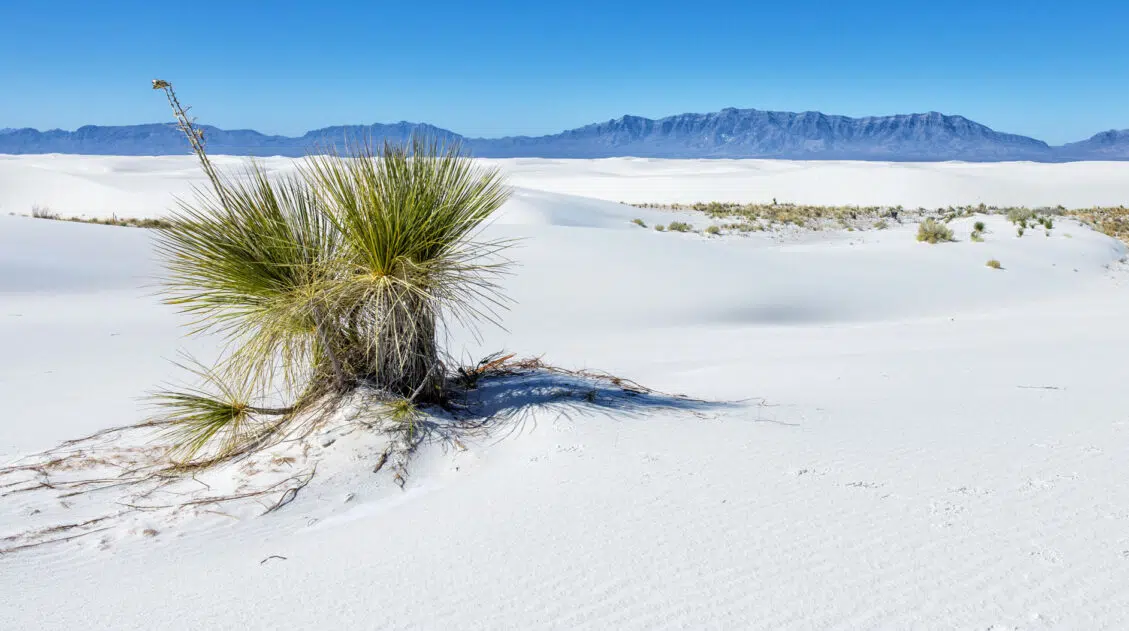
11 Amazing Things to Do in White Sands National Park
White Sands National Park is home to the largest gypsum dunefield in the world. These pure white dunes create a fun place to explore, for both kids and adults. Hike out into the dunes, learn about the wildlife that calls this park home, and go sledding on sand as white as the snow…these are just […]
10 Day Texas New Mexico National Parks Road Trip Itinerary
On this 10-day Texas New Mexico road trip itinerary, you will visit four national parks plus make a quick detour to a gem of a state park that just might be one of the big highlights of the trip. Go hiking in Big Bend and Guadalupe Mountains, explore the underground wonderland of Carlsbad Caverns, and […]
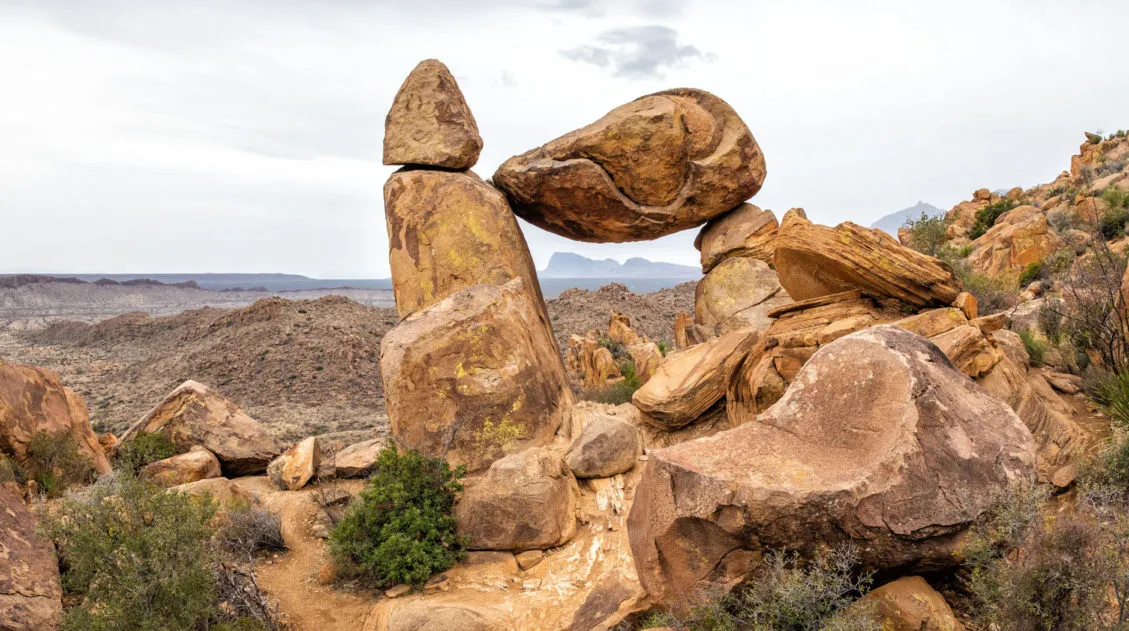
Balanced Rock Hike: A Short but Sweet Hike in Big Bend National Park
The Balanced Rock hike is one of our favorite short hikes in Big Bend National Park and one of the most rewarding for the effort required. The trail is only 2.2 miles round trip, with just a brief stretch of rock scrambling near the end, making it accessible for most hikers and genuinely fun for […]
Emory Peak Trail, Big Bend: Everything You Need to Know
Emory Peak is the highest point in Big Bend National Park and the Chisos Mountains, and the hike to the summit is one of the best things you can do in the park. The 10.4-mile out-and-back gains nearly 2,500 feet of elevation and finishes with a short rock scramble to the top, where 360-degree views […]
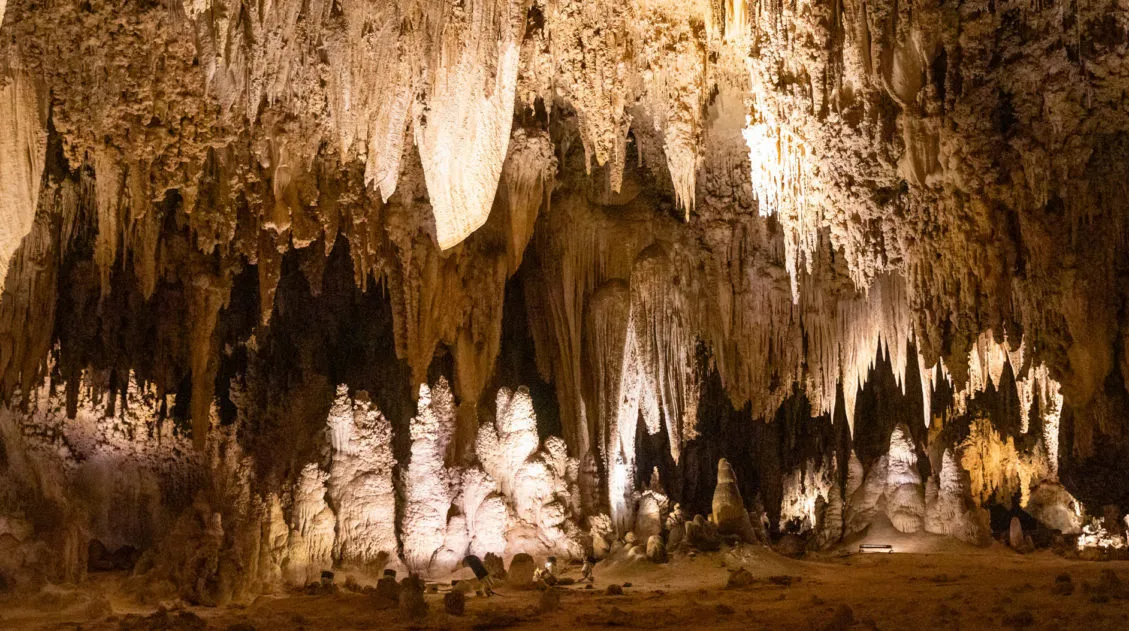
Best Things to Do in Carlsbad Caverns National Park
In this guide, we cover the best things to do in Carlsbad Caverns, tour options (both ranger-guided and self-guided), timed entry reservations, plus lots of helpful information. Located in the Guadalupe Mountains of New Mexico sits an underground fantasy land of limestone chambers, stalactites and stalagmites, and long, twisting tunnels. Carlsbad Caverns is breathtaking in […]
United States Travel Guide: Places to Visit in the USA
Plan your visit to the United States. Learn about the best things to do, how to plan your time, road trip ideas, and sample itineraries.
Best USA Road Trips: 18 Ideas for Your Next Big Adventure
One of the best ways to explore the USA is on a good old-fashioned road trip. Cruise along Route 66, road trip through the Florida Keys, explore the American Southwest, or even drive from coast to coast. In this guide, we share 18 of the best USA road trips…18 great ideas for your next big […]
Texas Travel Guide: How to Plan a Trip to Texas
Texas Travel Guide Texas is bigger than most people expect — and more varied. In the same trip, you can hike volcanic rock formations and slot canyons in Big Bend, stand at the highest point in the state in the Guadalupe Mountains, and eat your weight in barbecue in Austin. Tim and I have visited […]

Leave a Comment