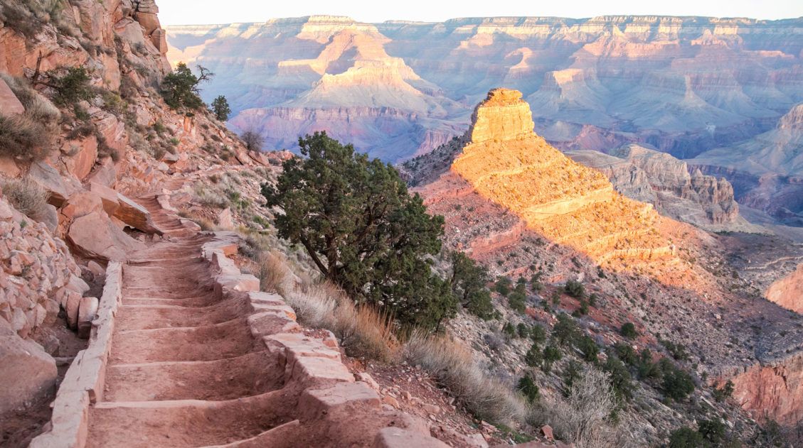
The Permian Reef Trail is an awesome hike in the McKittrick Canyon section of Guadalupe Mountains National Park. Leave the crowds behind as you ascend to the top of a Wilderness Ridge with spectacular views into McKittrick Canyon and the surrounding area.
While everyone else is hiking the other two trails in this area, the McKittrick Canyon Trail and the McKittrick Canyon Nature Trail, you are likely to have the Permian Reef Trail all to yourself. I did!
I didn’t see anyone else on this trail until I was almost back to the starting point, and they were questioning how far they were going to go. I had hours of solitude on this trail during Spring Break when the crowd levels are high and the parking lot was full.
I’m not sure why this is a less popular hike, as I really enjoyed the whole experience. It is a well-designed trail with various features along the way to keep you entertained. The trail passes through a mini slot canyon of sorts, crosses two ridge lines to change up the view a bit, has its own notch (not to be confused by the popular Notch of the McKittrick Canyon Trail), passes by a couple of interesting rock formations, and crosses into another state (at least briefly). So, if you can handle the difficulty level, then the Permian Reef trail is a must do hike.
With that said I would still give higher priority to hiking to the highest point in Texas and rock scrambling along a wash to Devil’s Hall when planning your time at Guadalupe Mountains National Park.
April 2026 Update: Updated with current trail conditions, freshness check on all logistics, and expanded tips to help you plan your hike.
Permian Reef Trail Hiking Stats
Distance: 9.75 miles (15.6 km) round trip (out and back)
Total Ascent: 2,670 feet (814 m)
Lowest Elevation: 4,980 feet (1,518 m)
Highest Elevation: 7,020 feet (2,140 m)
Time: 4 to 6 hours
Difficulty: Strenuous
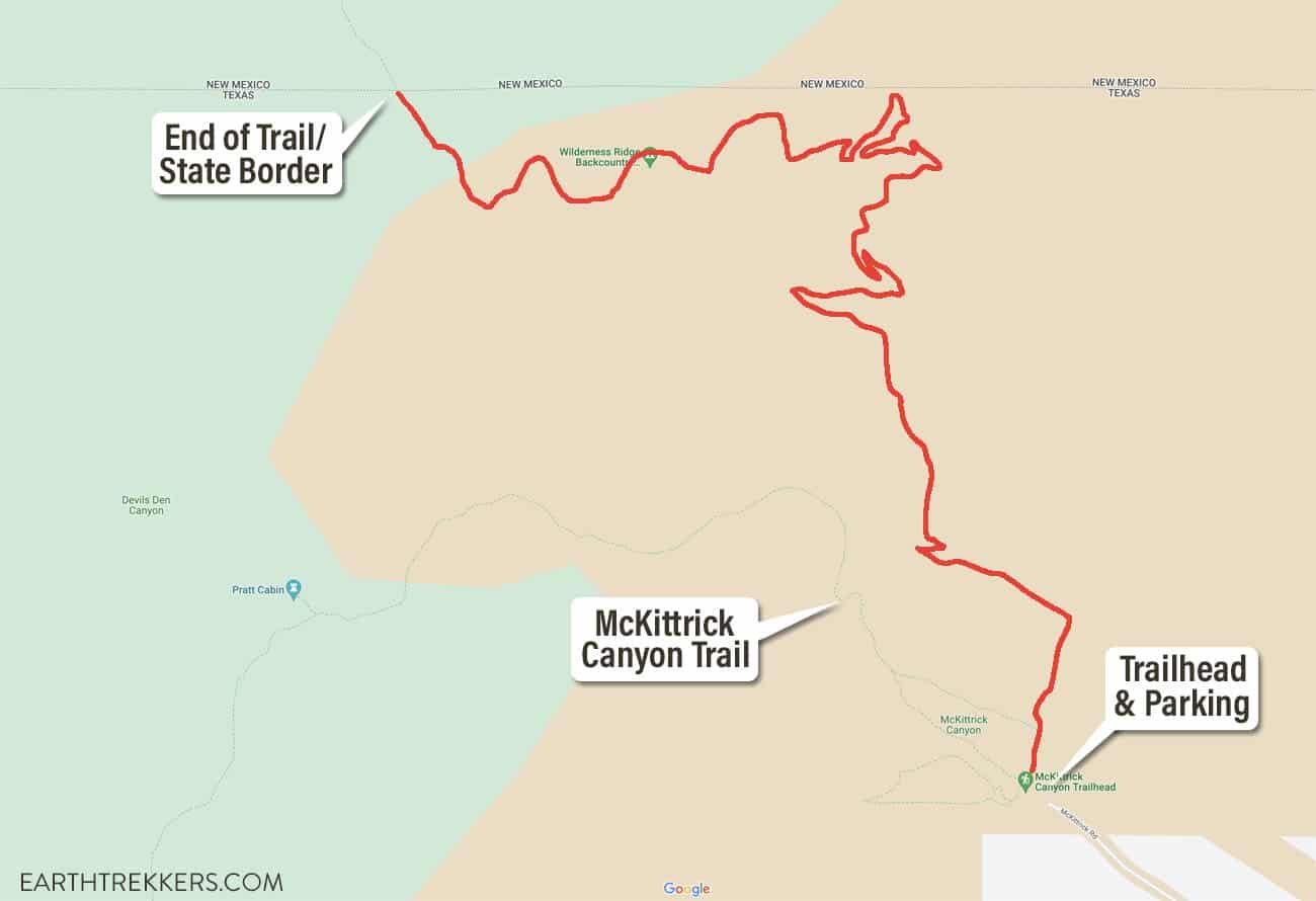
Permian Reef Trail Map
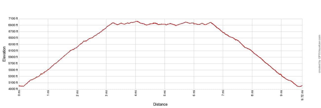
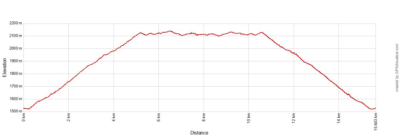
Permian Reef Elevation Profile
Please practice the seven principles of Leave No Trace: plan ahead, stay on the trail, pack out what you bring to the hiking trail, leave areas as you found them, minimize campfire impacts, be considerate of other hikers, and do not approach or feed wildlife.
Note: Since Julie had our camera on the McKittrick Canyon Trail, all of the photos in this guide were taken with my iPhone.
What is the Permian Reef?
Permian refers to the Permian period which began 298.9 million years ago and ended 252.2 million years ago. The reef is actually called the Capitan Reef. It formed from the fossils of marine life (animals and plants) during the Permian period. So, the “Permian Reef Trail” refers to the age of the geologic and fossil features and is not the name of the reef itself.
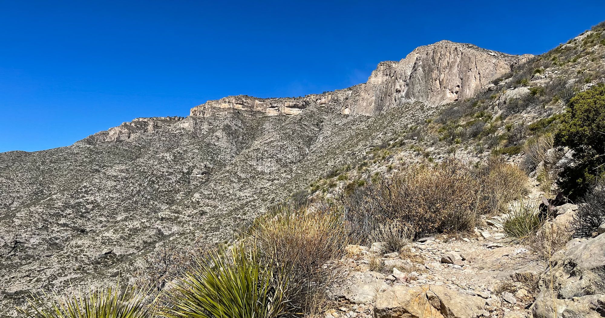
The Capitan Reef can be seen while you are hiking this trail (and in the header photo for this article). It is the vertical cliff with a stone appearance at the top of the north side of McKittrick Canyon. You will hike up to it and then on top of it.
Getting to the Permian Reef Trailhead
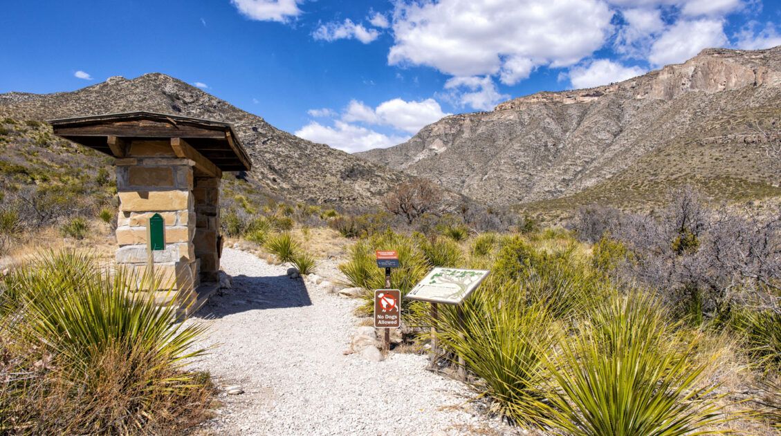
The trailhead is in the McKittrick area of Guadalupe Mountains National Park. From US Highway 62/180, turn onto McKittrick Road and drive to the very end. There is a large parking lot here as well as a ranger station and restrooms. The restrooms have toilets and sinks (they are not vault toilets).
IMPORTANT: The McKittrick Canyon area is day-use only with a locked entrance gate. The gate opens at 8:00 am and closes at 5:00 pm. Confirm hours on the National Park Service website before your visit, as these can change by season. And make sure you have enough time to exit the parking lot before the gate is locked in the afternoon.
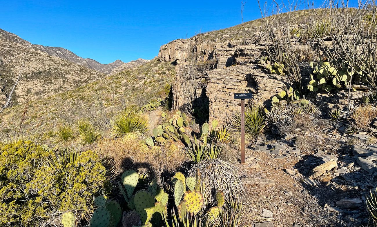
To get to the trailhead, walk through the building to the other side where you will see a large trailhead sign.
Three trails start right at the large sign. With your back at the ranger station the Permian Reef Trail heads off to the right. The McKittrick Canyon Trail goes straight and the McKittrick Canyon Nature Trail heads off to the left.
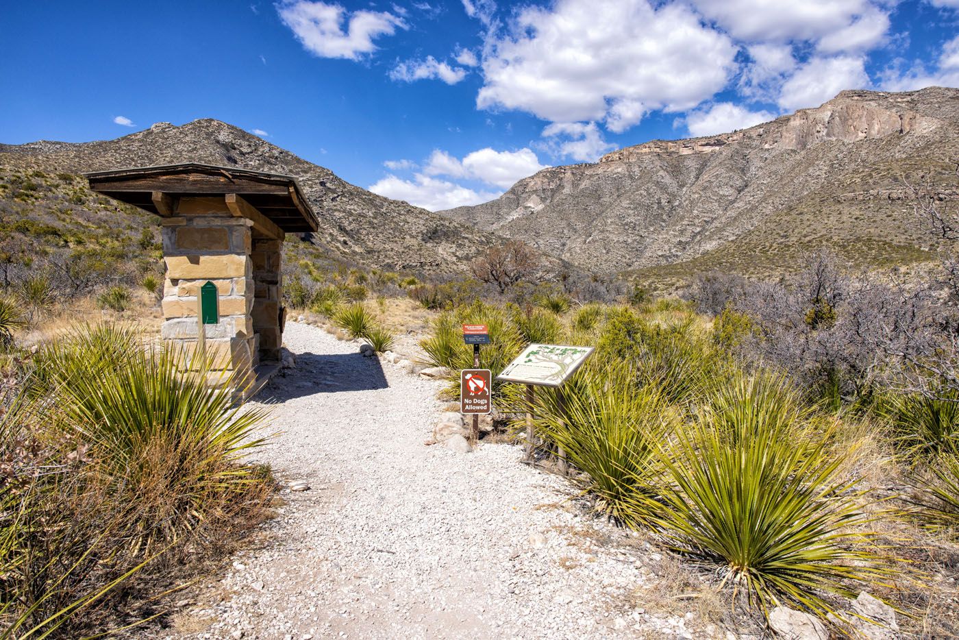
The Trailhead Sign
Step-By-Step Permian Reef Trail Guide
From the large sign at the trailhead, follow the Permian Reef Trail and you will quickly come to a gravel road. There isn’t any signage here, but you want to turn left and follow this road. It will not take long until it crosses a wash and that is when you want to start looking for a thin trail on the right that splits away from the gravel road. It is only a short distance past the wash. There is a trail marker, but it is a few steps into the thin trail, and it is only waist high, so it can easily be missed if you are not looking for it.
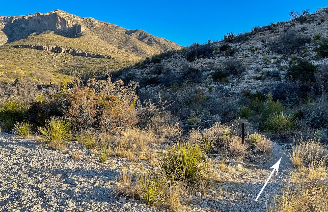
The gravel road is on the bottom left corner of the photo and the trail veers off to the right (the arrow indicates the Permian Reef Trail).
You have only gone 0.13 miles at this point so all of the above happens very quickly.
Follow the thin trail and you will start ascending a rocky path.
At 0.4 miles into the hike, you will reach a sign marking a trail junction (the photo below). Turn left to stay on the Permian Reef Trail. Alternatively, you can follow the Geology Loop trail, which connects back to the Permian Reef Trail just up ahead. Following the Geology Loop trail adds roughly an extra quarter mile of distance. I choose to stay on the Permian Reef Trail.
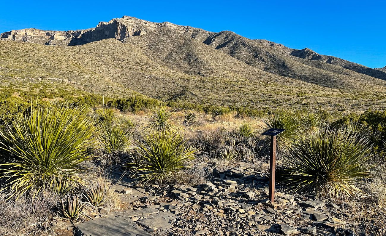
At 0.6 miles into the hike the Geology Loop trail will rejoin the Permian Reef trail from the right side. There is a trail sign indicating this and pointing you in the correct direction to stay on the Permian Reef Trail (the photo below). You want to go slightly left (it’s almost straight) here to stay on the Permian Reef Trail. The gradual ascent continues.
Trail sign indicating where the Geology Loop trail rejoins the Permian Reef Trail.
From here the trail is easy to follow as there are not any other trail splits. And you will pass occasional numbered trail makers in increasing order, ending with number 28 right before you reach the top of Wilderness Ridge.
Guidebooks are available that help you understand the significance of each numbered trail marker, whether it is a geological feature, fossil, or information about the Capitan Reef. You can purchase a guide from the Pine Springs Visitor Center that covers all of the numbered markers along this trail.
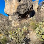
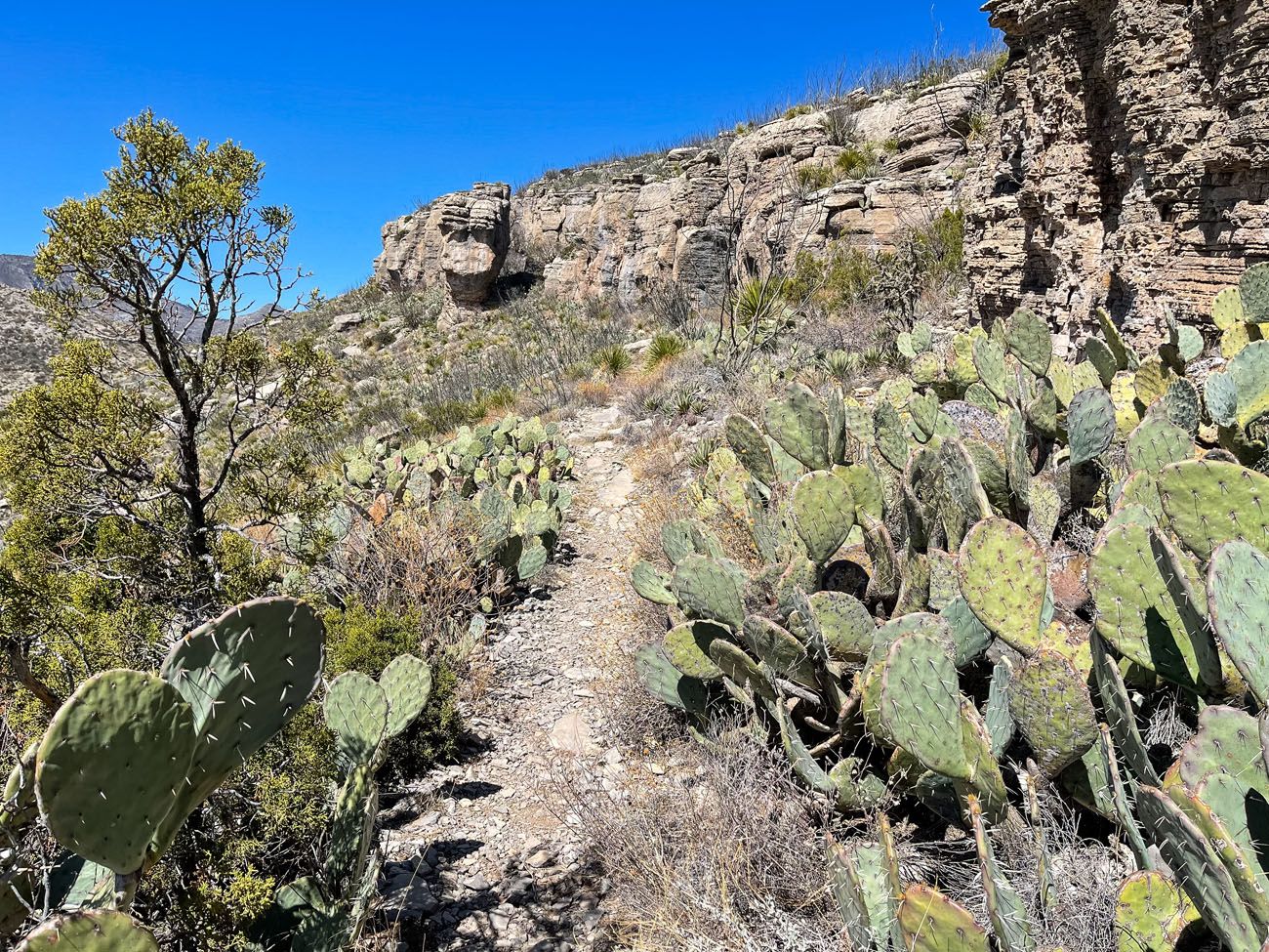
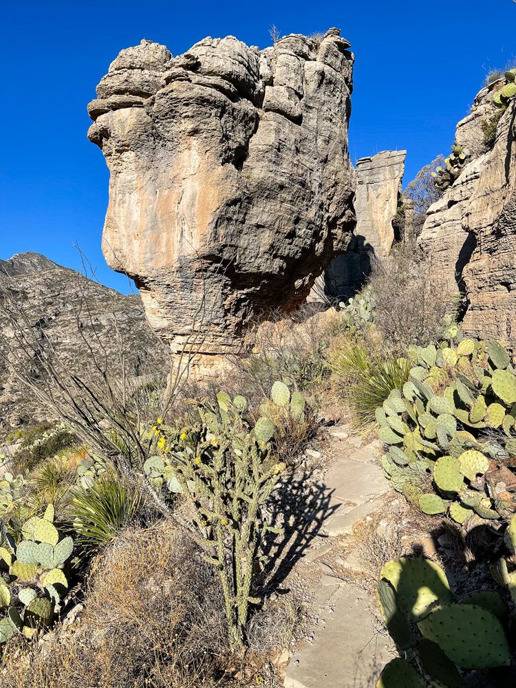
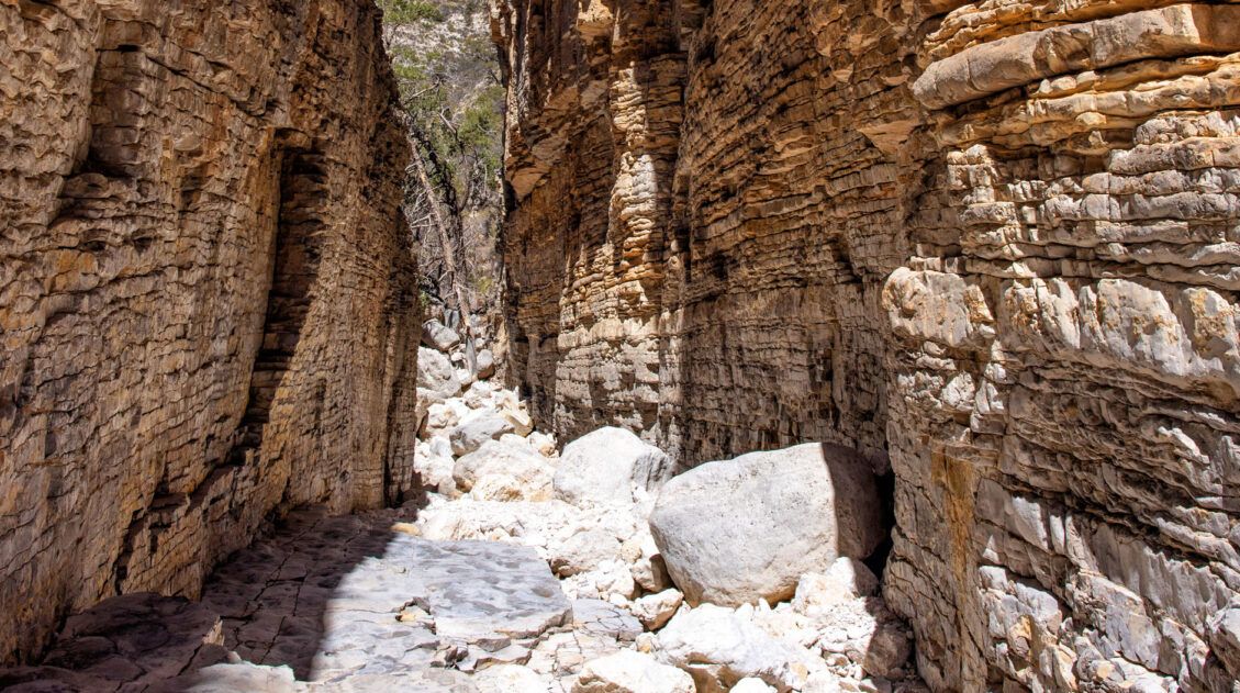
The next quarter-of-a-mile of the trail is great! The trail is lined with beautiful cacti, there is a cliff face to one side of you, an awesome pillar rock formation in front of you, and the trail will lead you into a mini slot canyon of sorts.
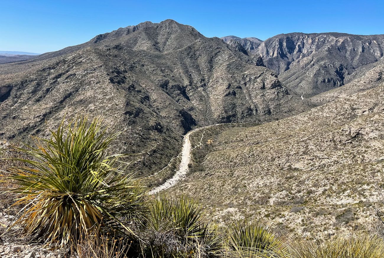
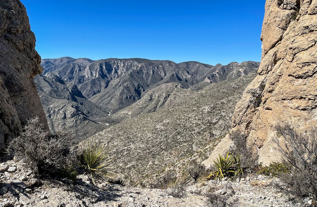
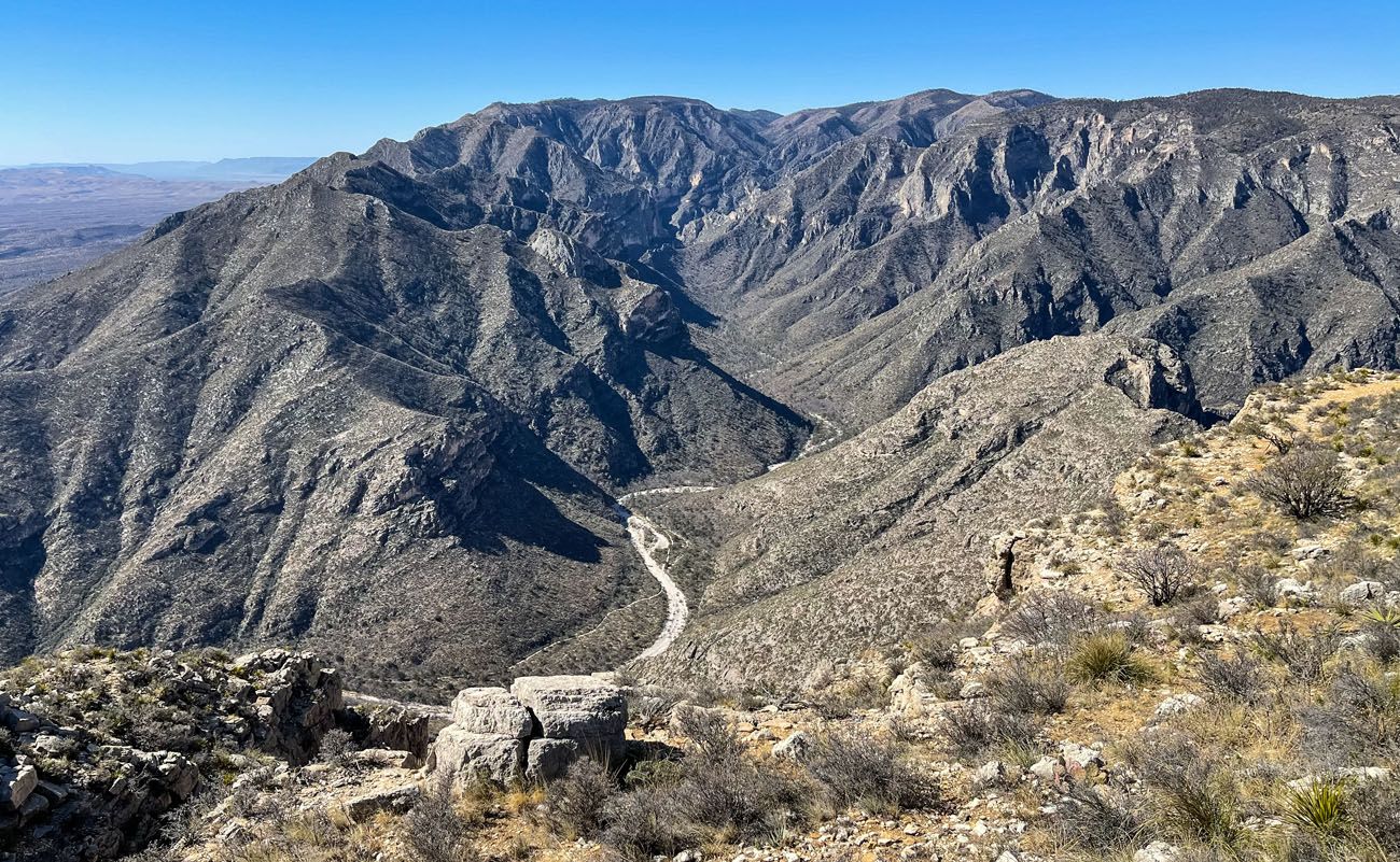
View of McKittrick Canyon.
View of the Permian Reef Trail and the top of Wilderness Ridge (the vertical cliff just below the ridge is the Capitan Reef).
As you continue, the ascent becomes moderate and you will get increasingly better views into McKittrick Canyon as you keep ascending. You will also be getting closer to the top of the ridge where you will eventually be standing. But you don’t actually reach the top from this side of the ridge.
Before reaching the top of the ridge, the trail has a few more surprises for you that helps keep things interesting. At 1.9 miles into the hike, you cross over a ridge line and this opens you up to a new view. Now you are looking east, temporarily leaving behind the McKittrick Canyon view.
View looking northeast from the trail.
I say temporarily because at 2.25 miles into the hike there is an opening in the mountain rock face on your left that allows you to peek back out over McKittrick Canyon. Its own sort of “notch”, but not to be confused by the more crowded Notch of the McKittrick Canyon Trail.
View of McKittrick Canyon from the Permian Reef Trail’s “notch”.
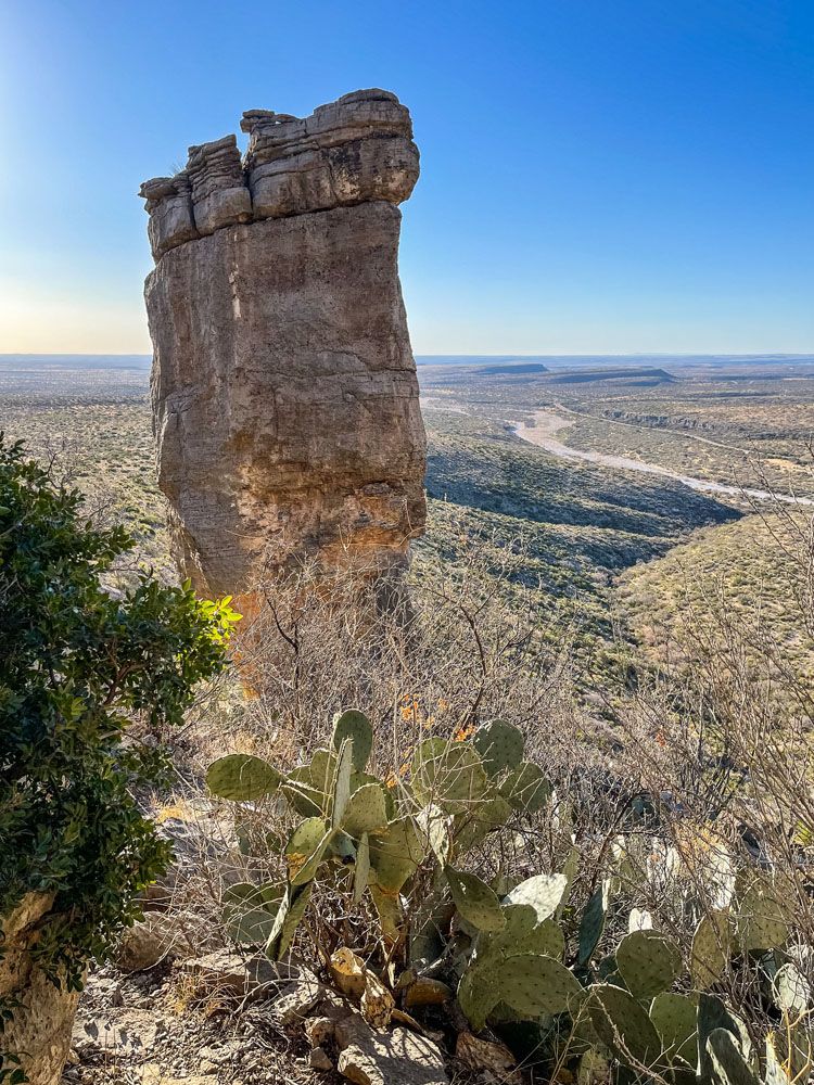
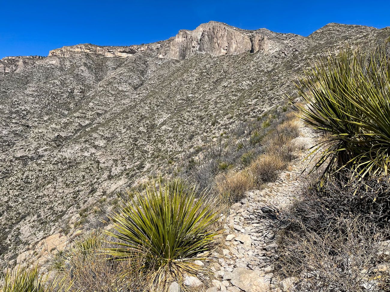
At 3.0 miles into the hike, you approach a neat rock curvature on the side of the mountain.
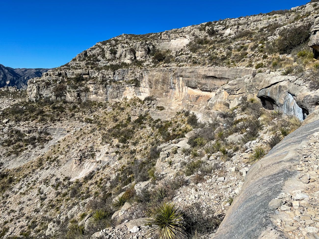
The trail runs along the top of this rock curvature.
And about a tenth-of-a-mile later, and a total of 2,000 feet of total ascent, you reach the top of Wilderness Ridge.
Now that you are on top of the ridge you will immediately notice changes in the surrounding scenery. The trail weaves you through a forested area with trees and shrubs. And the trail itself becomes a combination of compacted dirt and rocks, but it is still very rocky.
You will need to follow the trail for just under a mile before you reach your first of many viewpoints out over McKittrick Canyon. You will now be standing on the top of the ridge that you were looking up at earlier in the hike.
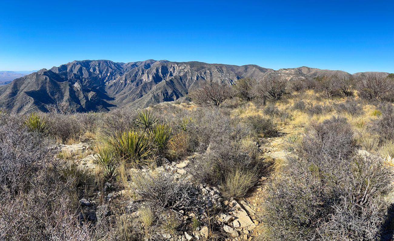
On top of Wilderness Ridge.
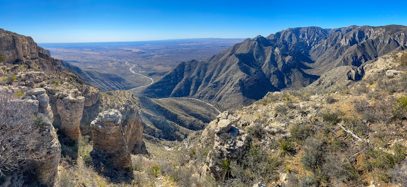
Panorama taken from Wilderness Ridge.
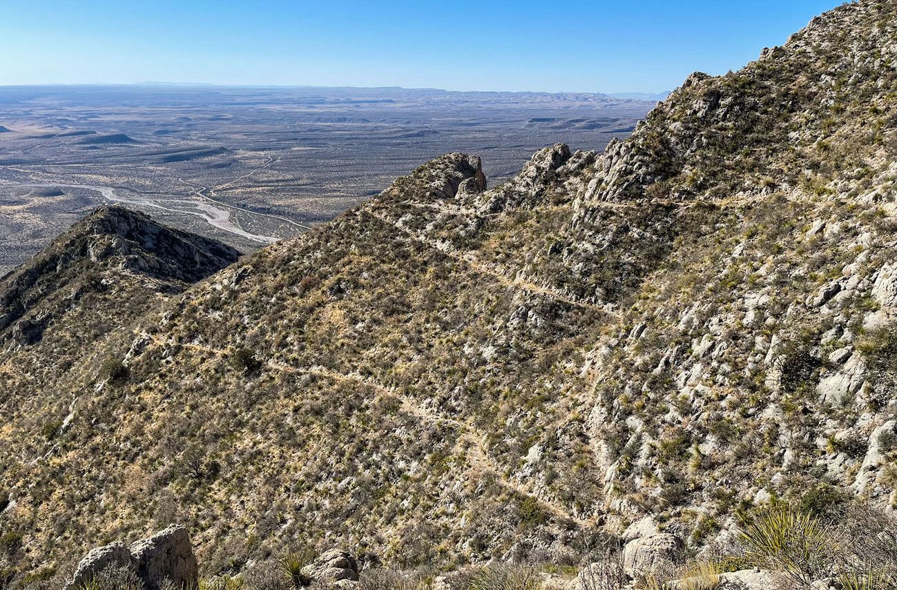
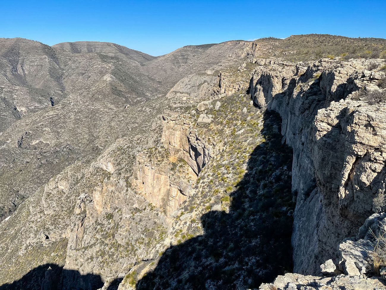
You have now hiked 4 miles with 2,200 feet of total ascent, but don’t turn around yet. It is worth continuing along the Permian Reef Trail until you reach the fence marking the Texas – New Mexico border. Along the way the trail zigzags, sometimes taking you close to the edge of the ridge. Each time it takes you close to the edge you will get another view out over McKittrick Canyon, all of which are worth seeing.
At 4.8 miles into the hike and 2,315 feet in total ascent you reach the fence marking the Texas – New Mexico border. Just for fun make a circle around the revolving door built into the fence so you can officially enter New Mexico and the Lincoln National Forest.
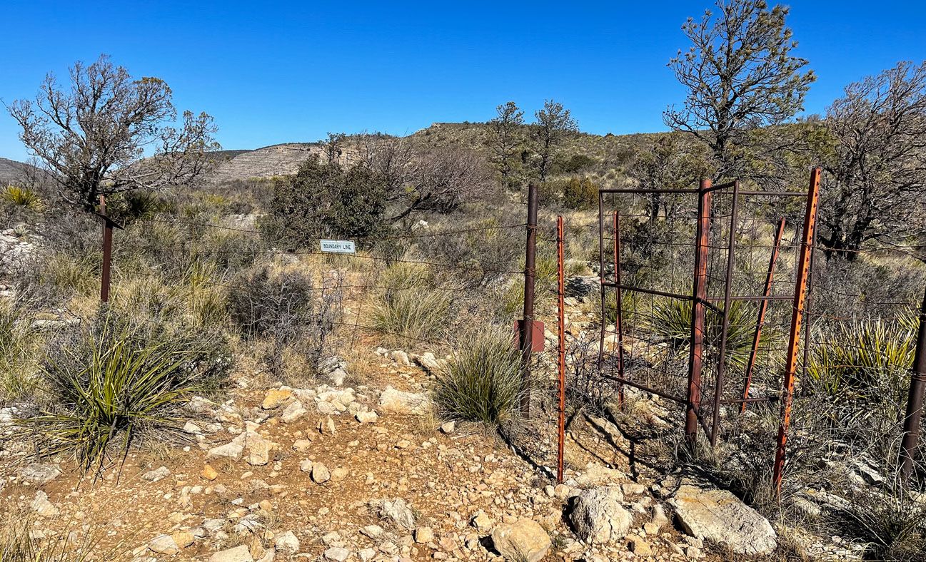
Fence marking the Texas – New Mexico border.
Return Hike
To finish the hike, retrace your steps back down the Permian Reef Trail.
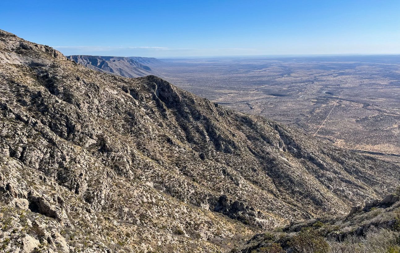
McKittrick Canyon from Wilderness Ridge.
Is Hiking the Permian Reef Trail Worth It?
The Permian Reef Trail is one of the least used trails in Guadalupe Mountains National Park. And because of that I questioned if I should even hike it.
I’m so glad I did!
We only had enough time to do one big hike in the McKittrick area of the park, so Julie and I split up. While I hiked the Permian Reef Trail, Julie hiked the McKittrick Canyon Trail to the Notch. Both trails are about the same distance but the McKittrick Canyon Trail to the Notch has roughly 1,000 feet less elevation gain, making it easier.
The McKittrick Canyon Trail also has the advantage of a gradual ascent through the canyon with short detours to Pratt Cabin and The Grotto & Hunter Line Shack. These serve as interesting landmarks and good turnaround points for anyone looking for an easier hike, avoiding the big ascent to The Notch.
But with those advantages comes more people. We started hiking at about 8 am during the busy Spring Break season and were one of the first cars in the parking lot. Julie only passed two people on her way to The Notch and had the view from there all to herself. But on the way back she passed hundreds of other hikers. After all of her effort, she thought the views and the landmarks were just OK, but not spectacular.
Meanwhile, on the Permian Reef Trail I was all alone. I didn’t see another person until I was almost back to the starting point, and they were questioning how far they were going to go. The trail is well designed and keeps you entertained along the way, including its own “notch”. And the views into McKittrick Canyon and the surrounding area are spectacular.
If you are able, I would strongly recommend hiking the Permian Reef Trail instead of the more popular McKittrick Canyon Trail. The trail is more fun, the views are better, and you’ll have more solitude. But I would still give higher priority to hiking Guadalupe Peak and Devil’s Hall. Don’t skip those.
Can you Camp on the Permian Reef Trail?
There is a designated camping area on top of Wilderness Ridge. The Wilderness Ridge Campsite is located 4.15 miles into the hike. It is just past the first viewpoint of McKittrick Canyon from the top of the ridge. There is a posted sign along the trail. Learn more here.
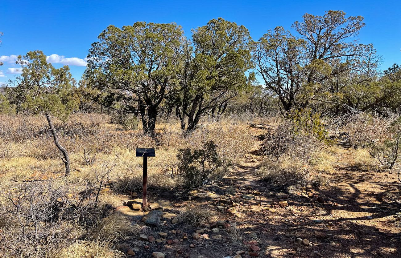
Wilderness Ridge Campsite
Helpful Tips to Have the Best Experience
Start the hike early, ideally by 8 am or earlier. By starting early, you can get one of the parking spaces in the trailhead parking lot. And you will also be able to hike in the cooler part of the day.
Exposure. The trail has a lot of sun exposure and there is some trail edge exposure in a few places so take the necessary precautions.
Cellular Service. I had no cellular service on this trail. Do not expect to be able to call, text, email, or access the internet while in the McKittrick area of Guadalupe Mountains National Park.
What to Bring
Protection from the sun is a must on this trail, sunscreen, sunglasses, hat, etc. I also suggest wearing long pants since there will be overgrowth from the cacti and various shrubs that line the trail scratching your legs.
Bring the appropriate amount of water, food, and electrolytes based on the weather.
Also, while this trail is fairly easy to navigate, it is always good to have some sort of navigational aid when hiking, especially since you’ll be in a more remote part of the park. A GPS device with two-way satellite messaging is the best option in case an emergency arises. For just navigation purposes, a GPS receiver, a watch with GPS and maps, or a GPS based app on your mobile device will work. But don’t expect cellular service, all maps should be downloaded or cached before you arrive at the national park.
- Sunscreen
- Sunglasses
- Hat
- Long Pants
- Water
- Nutrition
- Navigational aid (we recommend having one with two-way satellite messaging for safety reasons)

Essential Hiking Gear: What Should You Bring on a Day Hike?
If you are new to hiking or are curious about what you should bring on a hike, check out our Hiking Gear Guide. Find out what we carry in our day packs and what we wear on the trails.Plan Your Visit to Guadalupe Mountains National Park
The Permian Reef Trail pairs well with the other top hikes in the park.
If you’re deciding how to spend your time, start with our Guadalupe Mountains National Park guide for a full overview.
For the most iconic hikes, don’t miss Guadalupe Peak, the highest point in Texas, and Devil’s Hall, one of the most unique trails in the park. If you’re visiting the McKittrick Canyon area specifically, McKittrick Canyon Trail to the Notch is the popular alternative — but as Tim found firsthand, the Permian Reef Trail offers better views and far more solitude.
If you have any questions about hiking the Permian Reef Trail, let us know in the comment section below.
Where Are You Going Next?
If this is part of a bigger road trip to Texas and New Mexico, here is more information to help you plan your trip.
15 Best Things to Do in Guadalupe Mountains National Park
Pinterest Facebook Flipboard Tim and I have hiked a lot of national parks, and Guadalupe Mountains is one that genuinely surprised us. We expected a remote desert park with a few good trails. What we found instead was a place with incredible variety — a slot canyon, a fossilized coral reef trail with almost no […]
How to Hike the McKittrick Canyon Trail to Pratt Cabin, the Grotto & the Notch
I hiked the McKittrick Canyon Trail to the Notch on a March morning during spring break, one of the busiest weeks of the year in Guadalupe Mountains National Park. I started early, around 8 am, and had the canyon almost entirely to myself. By the time I turned around and headed back, I passed hundreds […]
Devil’s Hall Trail Guide: What to Expect | Guadalupe Mountains NP
The Devil’s Hall Trail is one of the most unique hikes in Guadalupe Mountains National Park. It’s a 4.2-mile round-trip route through Pine Springs Canyon that ends at a narrow limestone slot canyon with 50-foot walls and just 15 feet of width at its narrowest point. Along the way, you’ll scramble through a rocky wash, […]
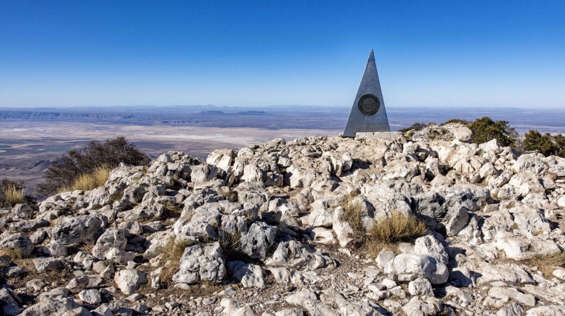
Guadalupe Peak Trail Guide: Hiking the Highest Point in Texas
Guadalupe Peak, at 8,751 feet, is the highest point in Texas, and for hikers who make the goal of standing on the highest point in every state they visit, this one is a must. Tim and I hiked to the summit during Spring Break, arriving at the Pine Springs Trailhead parking lot at 7:30 am […]
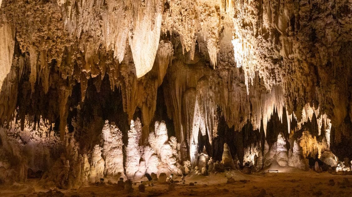
Best Things to Do in Carlsbad Caverns National Park
In this guide, we cover the best things to do in Carlsbad Caverns, tour options (both ranger-guided and self-guided), timed entry reservations, plus lots of helpful information. Located in the Guadalupe Mountains of New Mexico sits an underground fantasy land of limestone chambers, stalactites and stalagmites, and long, twisting tunnels. Carlsbad Caverns is breathtaking in […]
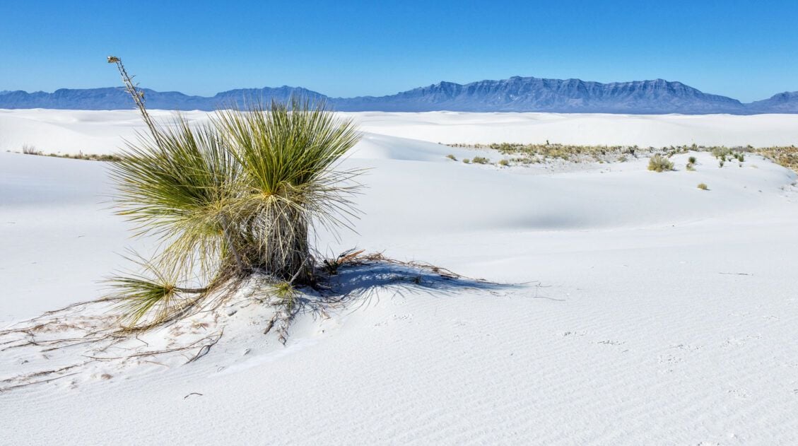
11 Amazing Things to Do in White Sands National Park
White Sands National Park is home to the largest gypsum dunefield in the world. These pure white dunes create a fun place to explore, for both kids and adults. Hike out into the dunes, learn about the wildlife that calls this park home, and go sledding on sand as white as the snow…these are just […]
10 Day Texas New Mexico National Parks Road Trip Itinerary
On this 10-day Texas New Mexico road trip itinerary, you will visit four national parks plus make a quick detour to a gem of a state park that just might be one of the big highlights of the trip. Go hiking in Big Bend and Guadalupe Mountains, explore the underground wonderland of Carlsbad Caverns, and […]
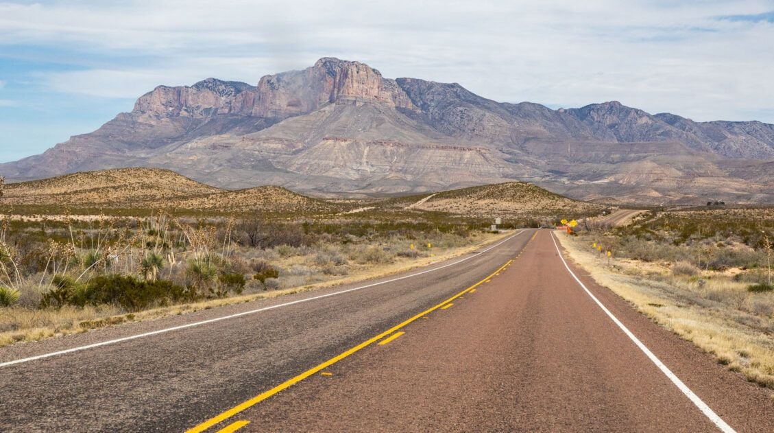
3 Days in Big Bend National Park: The Perfect Itinerary
Three days in Big Bend National Park is the ideal amount of time to experience all three regions of the park: the Ross Maxwell Scenic Drive, the Chisos Basin, and Rio Grande Village. We visited in early March and spent our days hiking slot canyons, crossing the border into Mexico, and standing at the edge […]
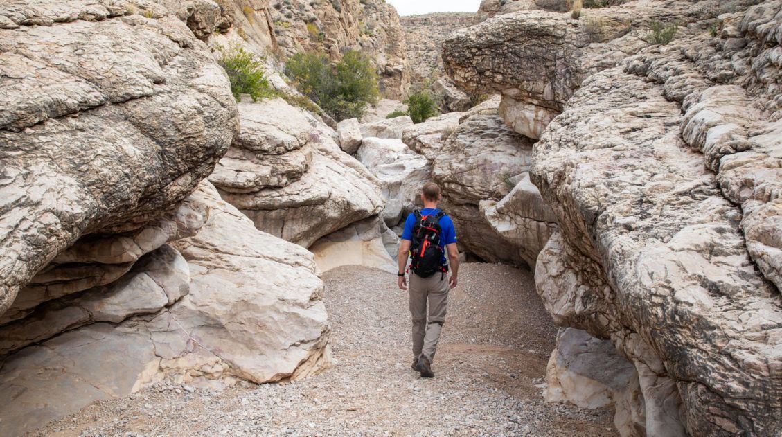
15 Best Hikes in Big Bend National Park (By Area & Difficulty)
Big Bend National Park is one of the most underrated hiking destinations in the United States. Tucked into the southwestern corner of Texas along the Rio Grande, it packs an extraordinary range of terrain into one park — slot canyons, volcanic rock formations, a full mountain range, and miles of river canyon trails. We visited […]
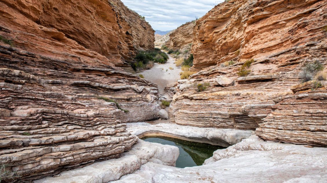
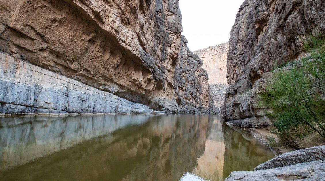
Ernst Tinaja Trail: Big Bend’s Most Underrated Adventure
The Ernst Tinaja Trail is one of the most unique hikes to do in Big Bend National Park. This is a short, easy trail through a slot canyon, featuring a series of waterholes located within colorful layers of limestone rock. Those looking for a little more adventure can continue the hike past the water-filled pools and rock […]
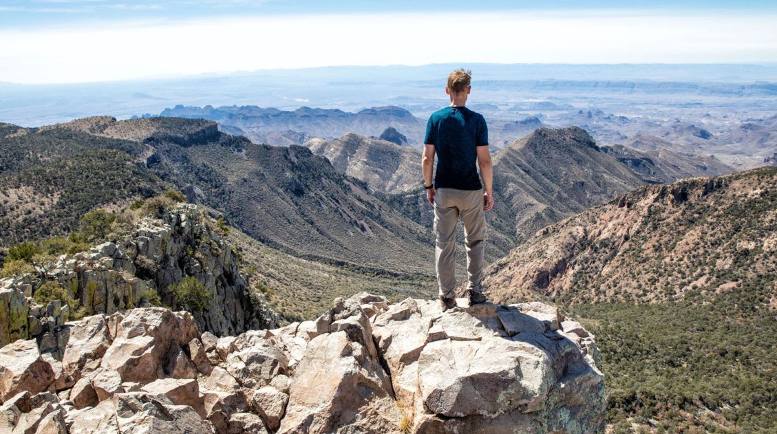
Emory Peak Trail, Big Bend: Everything You Need to Know
Emory Peak is the highest point in Big Bend National Park and the Chisos Mountains, and the hike to the summit is one of the best things you can do in the park. The 10.4-mile out-and-back gains nearly 2,500 feet of elevation and finishes with a short rock scramble to the top, where 360-degree views […]
20 Fun, Short Hikes in the US National Parks
One of the best ways to experience the national parks is from a hiking trail. Hike to amazing viewpoints, deep into the forests, through scenic canyons, and to hidden lakes and waterfalls. Along the way, you have a better chance of spotting wildlife and potentially leaving the crowds behind. Here are 20 fun, short hikes […]

The Ultimate Guide to the 63 US National Parks
Stretching from the South Pacific, across the United States to the Caribbean, are 63 national parks. These national treasures preserve iconic landscapes, majestic mountains, primordial forests, arid deserts, misty coastlines, immense canyons, wildlife, and historic landmarks. We have visited 56 of the 63 US national parks, from the towering granite walls of Yosemite and the […]
United States Travel Guide: Places to Visit in the USA
Plan your visit to the United States. Learn about the best things to do, how to plan your time, road trip ideas, and sample itineraries.

Comments 1