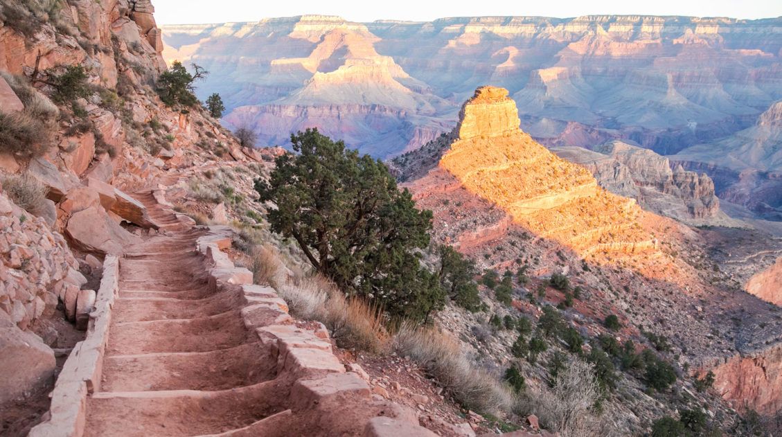
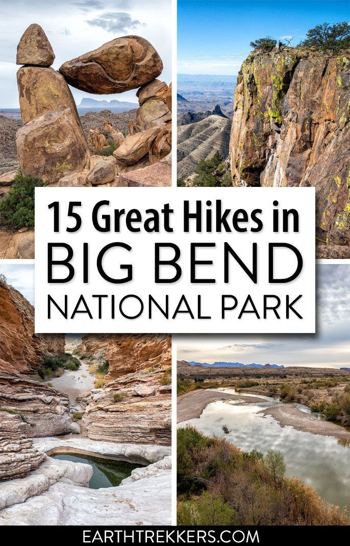
Big Bend National Park is one of the most underrated hiking destinations in the United States. Tucked into the southwestern corner of Texas along the Rio Grande, it packs an extraordinary range of terrain into one park — slot canyons, volcanic rock formations, a full mountain range, and miles of river canyon trails.
We visited Big Bend in early March and spent several days hiking across all three sections of the park: Chisos Basin, the Ross Maxwell Scenic Drive area, and Rio Grande Village. We hiked everything from short canyon walks to the full South Rim Trail + Emory Peak, and left with a very clear sense of which trails are worth your time, and which ones you can skip if time is tight.
We’ve visited 56 national parks across the United States and on trails around the world, and Big Bend stands out for one reason: the sheer variety. In a single day, you can summit a mountain with 360° views in the morning and hike through a desert slot canyon in the afternoon.
This guide is designed for first-time visitors who want to:
- Choose the right trails for their fitness level
- Understand the three areas of the park and plan efficiently
- Avoid wasting time driving between trailheads
- Know which hikes are truly worth the effort
If you’re still in the early planning stages, start with our Big Bend National Park Travel Guide and our 3 Days in Big Bend Itinerary for help planning your time.
Best Hikes in Big Bend
BEST OVERALL HIKE | South Rim Trail
BEST MODERATE HIKE | Lost Mine Trail
BEST EASY HIKE | Santa Elena Canyon
BEST HIDDEN GEM | Ernst Tinaja
BEST FOR FAMILIES | Balanced Rock
BEST SUMMIT | Emory Peak
BEST SUNSET SPOT | Window Trail
BEST FULL DAY ADVENTURE | South Rim + Emory Peak
How to Choose the Best Hike in Big Bend
If you’re short on time, this section will help you quickly narrow down which trails are right for you.
If You Want the Classic Big Bend Experience
- South Rim Trail (+ Emory Peak for the full day)
- Lost Mine Trail
These two deliver the most dramatic, high-elevation views of the Chisos Mountains and the surrounding Chihuahuan Desert.
If You Prefer Short & Easy Hikes
- Santa Elena Canyon
- Balanced Rock
- Lower Burro Mesa Pour-Off
- Tuff Canyon
Big scenery with minimal effort.
If You Want to Avoid Crowds
- Ernst Tinaja
- Balanced Rock
- Mule Ears Spring Trail
The 4WD road to Ernst Tinaja keeps most visitors away. Balanced Rock requires a short drive on a gravel road. Both reward the effort.
If You’re Visiting With Kids
- Balanced Rock (fun rock scramble at the end)
- Santa Elena Canyon (short, flat, stunning)
- Window View Trail (paved, 0.3 miles, great sunset spot)
If You Want a Big Challenge
- South Rim + Emory Peak (15.6 miles, 2,800+ feet of gain)
- Emory Peak out-and-back (10.4 miles, the highest summit in the park)
If You’re Short on Time
- Focus on Chisos Basin and the Ross Maxwell Scenic Drive. The Rio Grande Village area is beautiful but involves significant driving from the other two sections. Save it if you have a full extra day.
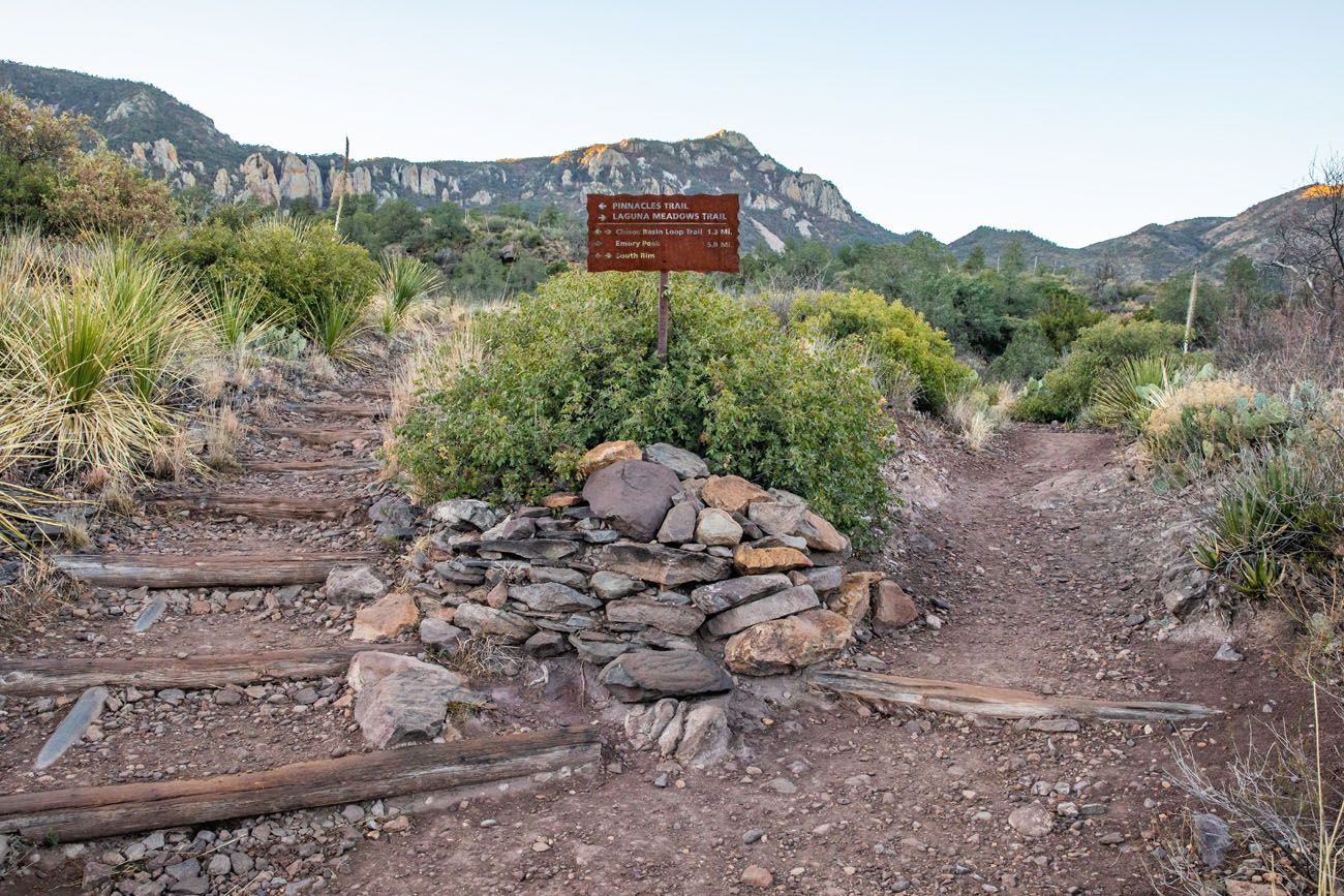
Geography 101: The Three Areas of Big Bend
Big Bend is a large park (over 800,000 acres), and understanding its layout before you arrive will save you a lot of driving and frustration. The park is divided into three main areas, each with its own character, trailheads, and campgrounds.
Chisos Basin sits at the heart of the park, nestled within the Chisos Mountains. This is the only mountain range in the United States located entirely within a national park. Chisos Basin is where you’ll find the most popular and most challenging hikes, including the South Rim Trail, Emory Peak, and Lost Mine Trail. It’s also home to the Chisos Mountain Lodge, the only lodging inside the park. Most first-time visitors spend the majority of their time here. Balanced Rock (Grapevine Hills Trail) is also included in this section as it’s a short drive from Chisos Basin and the most logical base for that hike.
Ross Maxwell Scenic Drive runs 30 miles through the western side of the park, ending at Santa Elena Canyon on the Rio Grande. This area is home to some of Big Bend’s most iconic and accessible hikes — Santa Elena Canyon, Tuff Canyon, and Lower Burro Mesa Pour-Off — as well as dramatic desert scenery, even if you never leave your car.
Rio Grande Village occupies the far eastern end of the park and is best known for the hot springs, the Boquillas Canyon Trail, and the opportunity to cross the river into the Mexican village of Boquillas del Carmen. Ernst Tinaja, one of the park’s best hidden gems, is also accessed from this side of the park via Old Ore Road, but note that reaching the trailhead requires a high-clearance 4WD vehicle.
Planning tip: Driving from one end of the park to the other takes 1.5 hours or more. Plan your days by area — don’t try to combine Chisos Basin hikes with Rio Grande Village hikes in a single day unless you have a very early start.
Best Hikes in Big Bend National Park
We organized this list by region so you can plan your days efficiently and avoid unnecessary driving between sections of the park. Note: all distances in this post are round-trip.
First, here are the best hikes in Big Bend National Park on a color-coded map. Hikes in Chisos Basin are in blue, hikes along Ross Maxwell Scenic Drive are in yellow, and hikes in and around Rio Grande Village are in red.
How to Use This Map: Click the icons on the map to get more information about each point of interest. To take this map with you, click the star next to the title of the map which adds it to your Google account. Next, within your Google Maps app, select ‘Saved’ and then select ‘Maps’. This map title will now appear in your list.
Hikes in Chisos Basin
Chisos Basin is one of the most beautiful areas of Big Bend National Park. Rugged, rocky mountains rise up out of the desert. Sitting within this mountain range is the Chisos Basin Village and visitor center. From this point, you can start several epic hikes in Big Bend.
I also include the Balanced Rock hike on this list, since it is just a short drive from Chisos Basin.
Lost Mine Trail
Distance: 4.8 miles
Total Ascent: 1,224 feet
Difficulty: Moderate
Length of Time: 2.5 to 3.5 hours
Trailhead: There is a small parking lot on Basin Junction Road, one mile before you reach the Chisos Basin Village. This parking lot can only fit about 20 cars, so get here early (sunrise is ideal) to make sure you get a space.
The Lost Mine Trail is one of the most popular hikes in the park. Most of the hike is an unexciting, steady uphill walk, with occasional views across the Chisos Mountains. However, once at the top, the views really open up. Your reward is a panoramic view over the mountains and valleys of Big Bend National Park.
We did this during a rain shower but on a sunny day I imagine that the views would be spectacular!
Best for: First-time visitors who want big mountain views without a full-day commitment
Why it’s worth it: Panoramic views over the Chisos Mountains and valleys with a relatively manageable climb
Skip it if: You’re looking for solitude because this is one of the busiest trails in the park
Lost Mine Trail
View from the Lost Mine Trail
Window View Trail
Distance: 0.3 miles
Difficulty: Easy
Length of Time: 20 minutes
Trailhead: Chisos Basin parking lot
This is the easiest “hike” on this entire list. A 0.3-mile paved path leads to a viewpoint of the Window, a cut-out in the Chisos mountain range that is one of the best sunset points in the park. Expect big crowds at sunset.
Best for: Families, casual walkers, or anyone who wants a great sunset viewpoint with zero effort
Why it’s worth it: One of the best sunset spots in the park on a paved, flat path
Skip it if: You want an actual hike. This is a viewpoint stroll, not a trail
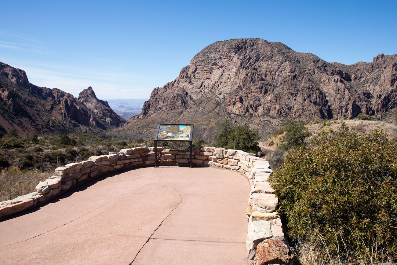
Window View Trail
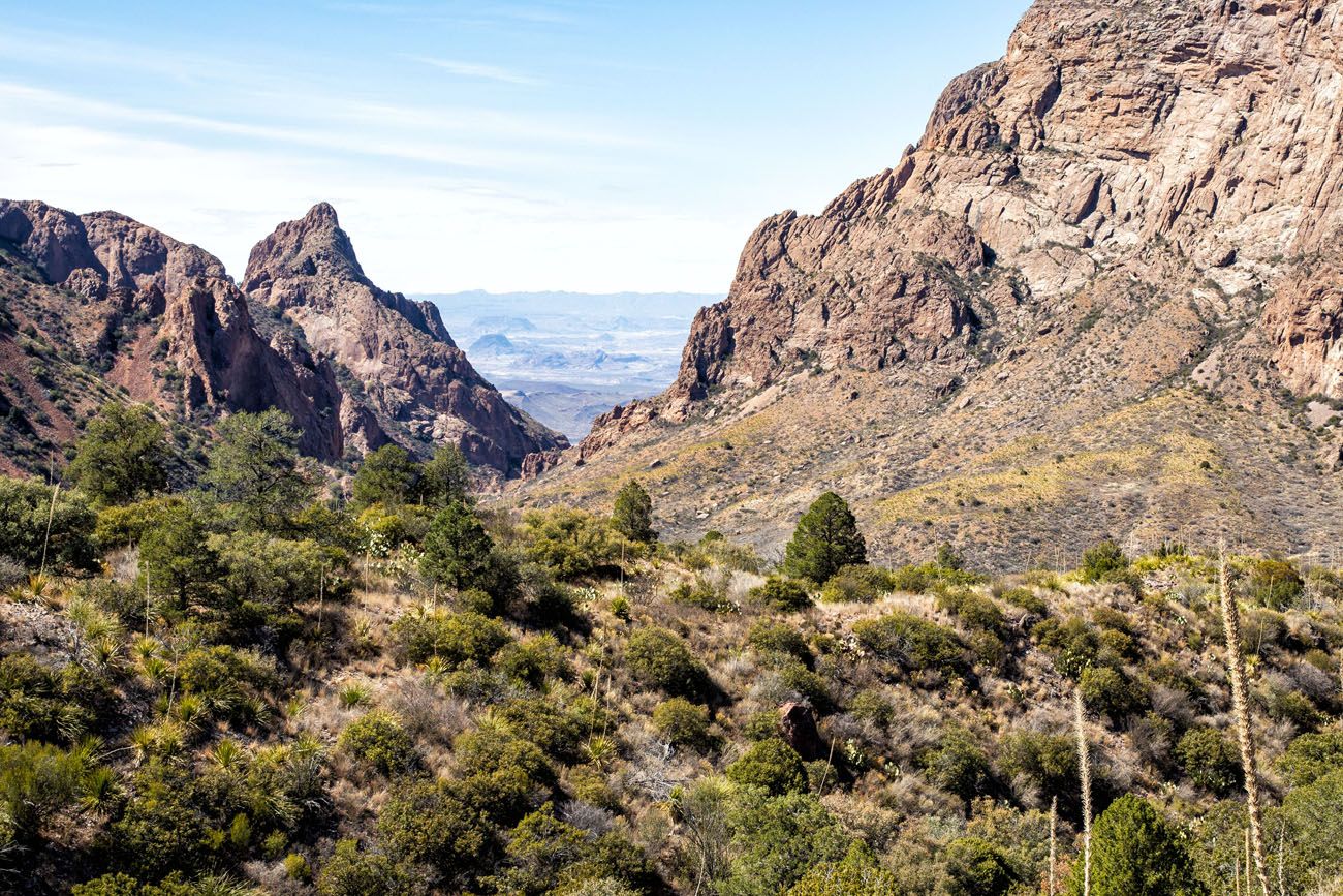
Window Trail
Distance: 5.6 miles
Difficulty: Moderate
Length of Time: 3 to 4 hours
Trailhead: Chisos Basin parking lot
Not to be confused with the Window View Trail, the Window Trail is a moderately strenuous hike that ends at the Window. From here, you have stunning views of Big Bend National Park.
It’s a downhill walk to the Window pour-off, so expect a longer, more difficult walk to get back to the Chisos Basin parking lot.
Best for: Hikers who want to reach the Window itself rather than just view it from a distance
Why it’s worth it: Stunning views of the desert beyond the Chisos Mountains from the Window pour-off — a completely different perspective than the Window View Trail
Skip it if: You’re short on time or energy because the return trip is all uphill back to the basin
Chisos Basin Loop
Distance: 1.8 miles
Difficulty: Easy to moderate
Length of Time: 1 to 2 hours
Trailhead: Chisos Basin parking lot
This loop hike weaves its way through the Chisos Basin valley. You will hike in and out of a forest of oak, juniper, and Mexican pine with occasional views of the mountains that surround the basin. If you have plans to hike to the South Rim or Emory Peak, the hike will start on this same trail. Beware of bear and mountain lion.
Best for: Hikers looking for an easy warm-up hike or a scenic walk between bigger adventures
Why it’s worth it: A pleasant forest walk through the basin with good wildlife spotting opportunities
Skip it if: You’re pressed for time and have bigger hikes on your list because this one is more about the experience than dramatic views
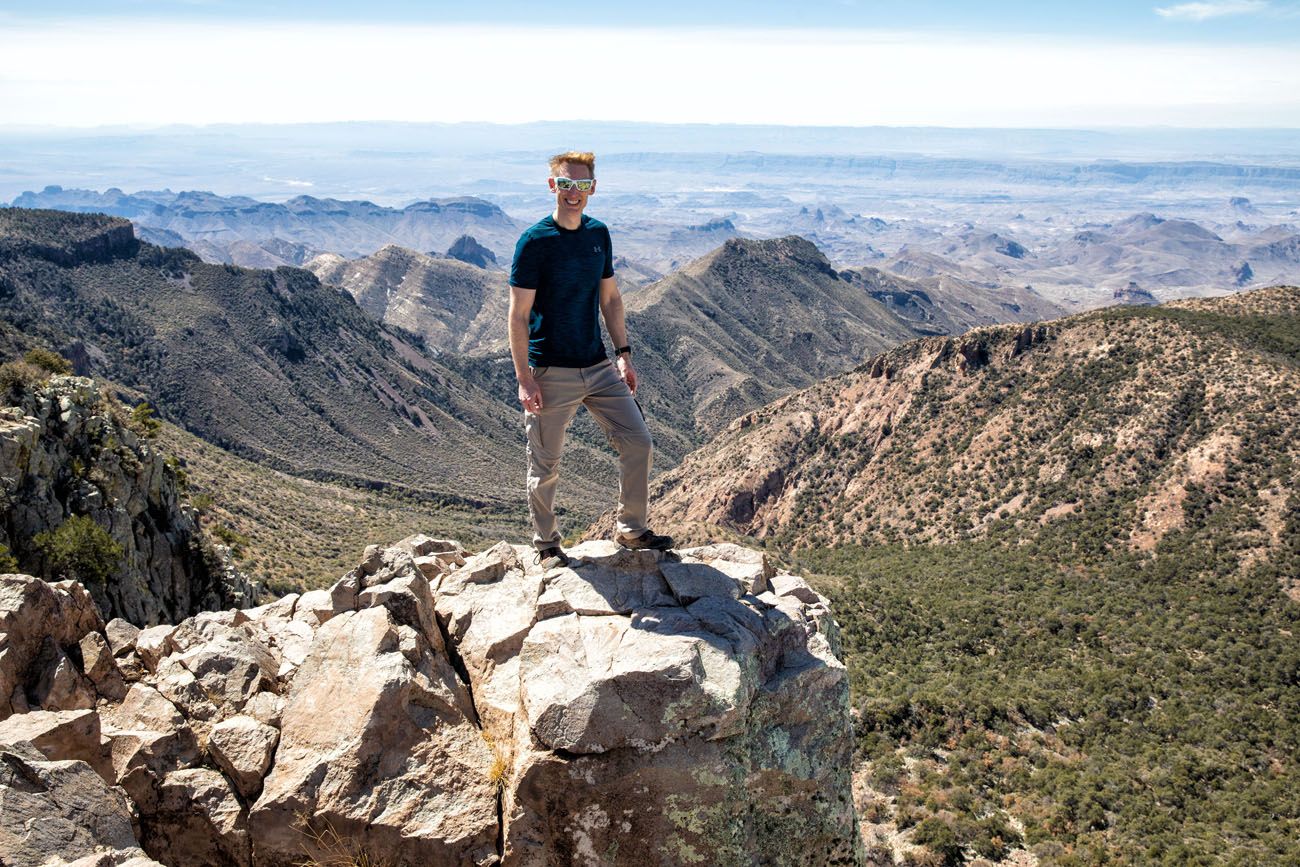
Emory Peak
Distance: 10.4 miles
Total Ascent: 2440 feet
Difficulty: Strenuous
Length of Time: 5 to 7 hours
Trailhead: Chisos Basin parking lot
Emory Peak is the highest peak in the Chisos Mountains and Big Bend National Park. It’s a tough hike but the view over the park is unbeatable.
Emory Peak
We hiked it on our first day in the park, as part of the South Rim Trail, which adds Emory Peak as a detour and makes for one of the best full-day hikes in any U.S. national park. You can also hike it as a standalone out-and-back from the Chisos Basin trailhead if you want a shorter day.
Best for: Strong hikers who want to stand on the highest point in Big Bend National Park
Why it’s worth it: Unobstructed 360° views over the entire park from the summit; nothing in Big Bend tops this perspective
Skip it if: You’re not comfortable with a brief but exposed rock scramble near the summit
Learn more about the hike, and see it in photos, in our Emory Peak Trail Guide ↓
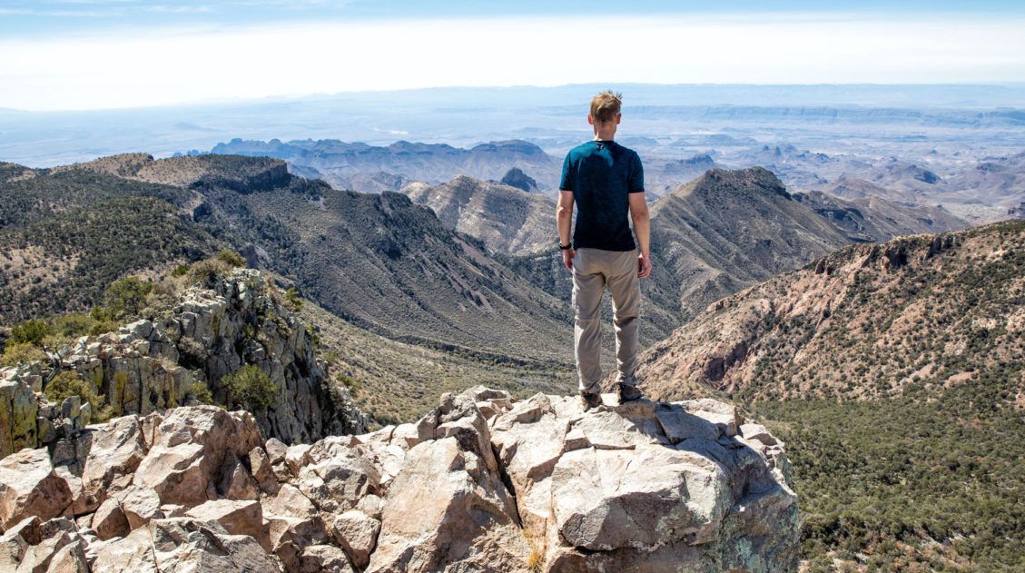
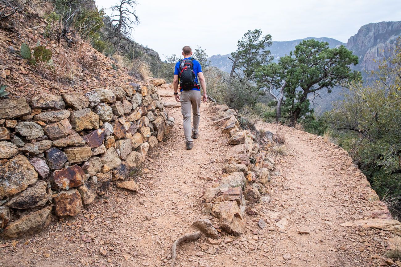
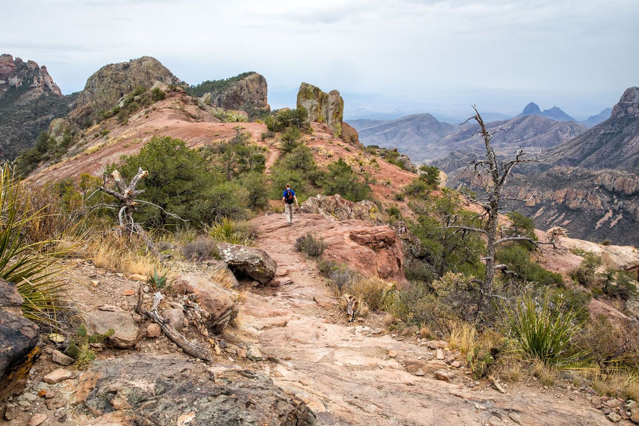
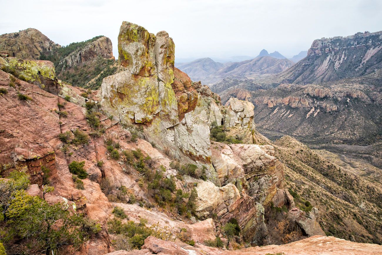
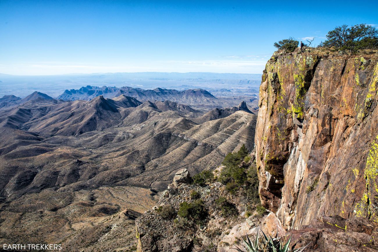
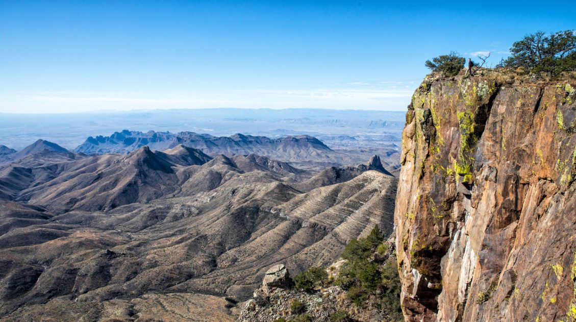
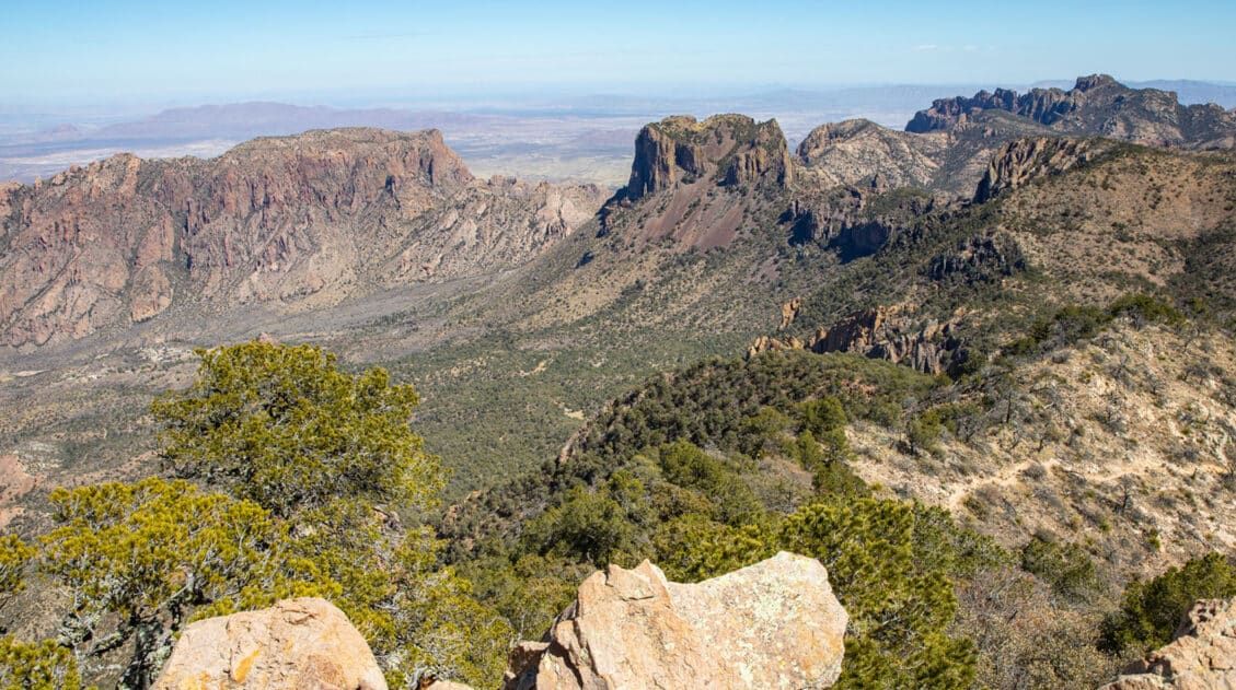
South Rim Trail
Distance: 12.6 miles
Total Ascent: 2,800 feet
Difficulty: Strenuous
Length of Time: 6 to 8 hours
Trailhead: Chisos Basin parking lot
The South Rim Trail is the crown jewel of hiking in Big Bend National Park.
We hiked it combined with the Emory Peak detour — a 15.6-mile day hike that makes for a very memorable day hike.
South Rim Trail
Starting in the Chisos Basin, the trail climbs steadily through pine and oak forest before emerging on the South Rim, where the views over the Chihuahuan Desert are genuinely breathtaking. Add Emory Peak for the ultimate Big Bend day.
Best for: Experienced hikers looking for the single best full-day hike in Big Bend National Park
Why it’s worth it: Jaw-dropping views of the Chihuahuan Desert from the rim, combined with a challenging climb that earns every bit of the scenery
Skip it if: You’re short on time or not prepared for a long, strenuous day
Get all of the details on how to do this hike in our guide to the South Rim Trail ↓
South Rim Trail Loop + Emory Peak | Complete Hiking Guide
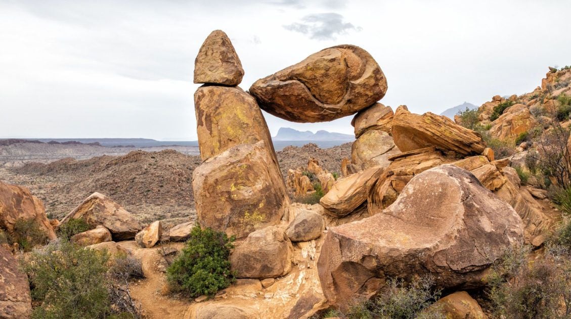
How to hike the South Rim Trail, with the option to add on Emory Peak.Balanced Rock (Grapevine Hills Trail)
Distance: 2.2 miles
Total Ascent: 311 feet
Difficulty: Easy to moderate
Length of Time: 1 to 2 hours
Trailhead: Grapevine Spring Road
We loved this hike!! It’s short, it’s relatively easy, there is a brief section of rock scrambling that is fun for kids and adults, and it features one of the most unique rock formations in the park.
To get here, you will drive 6.3 miles on a well-maintained gravel road named Grapevine Spring. Park at the small parking lot and hike the Grapevine Hills Trail until you get to Balanced Rock.
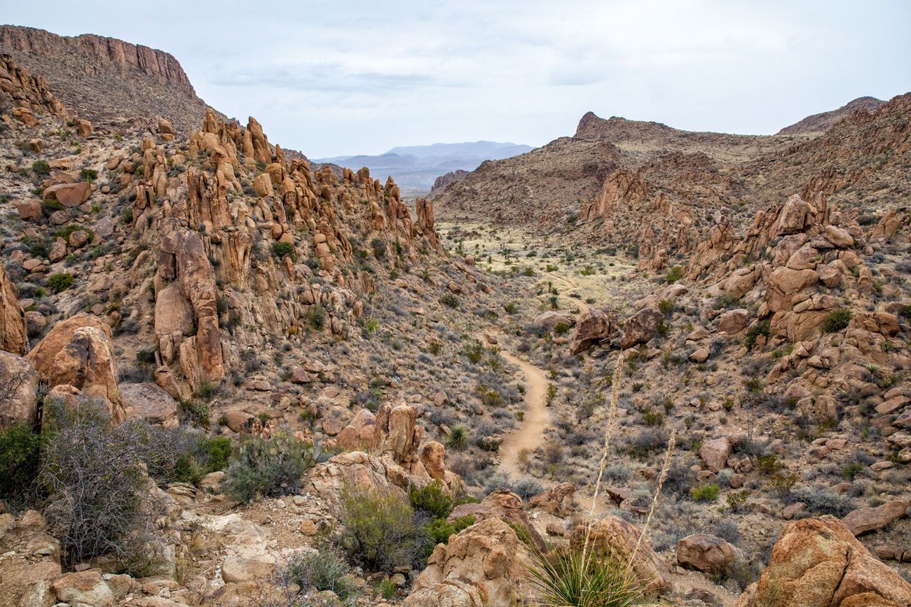
Grapevine Hills Trail
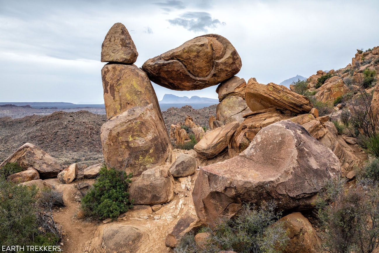
Balanced Rock
Note: This road is suitable for standard cars, however, an SUV or a vehicle with high ground clearance is ideal. The final two miles of this road is very rough. We saw a minivan and a standard car on this road and they were doing just fine, but they had to take things very slowly.
Best for: Families, photographers, and anyone who wants a fun, unique hike without a big time commitment
Why it’s worth it: A short hike with a genuinely wow-worthy payoff — one of the most distinctive rock formations in the park, reached via a fun scramble
Skip it if: You’re not up for a short drive on a gravel road to reach the trailhead
Get all of the details on how to do this hike in our guide to Balanced Rock ↓
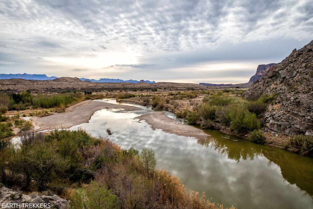
Ross Maxwell Scenic Drive
Ross Maxwell Scenic Drive is a 30-mile road through some of the most beautiful landscapes in Big Bend National Park. Even if you never got out of your car, this is still one of the best experiences in the park.
This drive starts at Panther Junction Drive and ends at Santa Elena Canyon. Along the way, there are several overlooks and hiking trails if you want to stretch your legs and venture farther into the park.
Santa Elena Canyon
Distance: 1.7 miles
Difficulty: Easy
Length of Time: 1 to 2 hours
Trailhead: The endpoint of the Ross Maxwell Scenic Drive
This is one of the best hikes in Big Bend National Park. It’s short, it’s easy, and this is the best up-close experience with the Rio Grande.
For most of this hike, you walk along the edge of the river. There is one brief climb but it’s worth it…the views over the Rio Grande are breathtaking. The trail ends at a beautiful view into the Santa Elena Canyon.
Best for: All skill levels. This is the one hike in the Ross Maxwell area that no one should skip .
Why it’s worth it: The most dramatic up-close experience with the Rio Grande in the park, with towering canyon walls rising hundreds of feet on both sides.
Skip it if: Water levels are very high. The Terlingua Creek crossing at the start can be impassable after heavy rain.
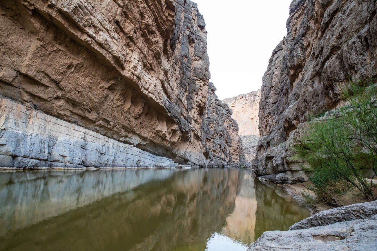
Santa Elena Canyon
View from the Santa Elena Canyon Trail
If you want to explore further, consider taking a canoe trip through Santa Elena Canyon.
Tuff Canyon
Distance: 0.75 miles
Difficulty: Easy
Length of Time: 30 minutes
Trailhead: Tuff Canyon Overlook on Ross Maxwell Scenic Drive
This super easy stroll offers views of Tuff Canyon. You can walk the short loop to overlooks of the canyon, or, take the spur trail and walk through the canyon.
Best for: Visitors driving the Ross Maxwell Scenic Drive who want a quick stretch with a geological payoff
Why it’s worth it: An easy loop with good views into a compact, colorful canyon
Skip it if: You’re short on time and have Santa Elena Canyon on your list — prioritize that first
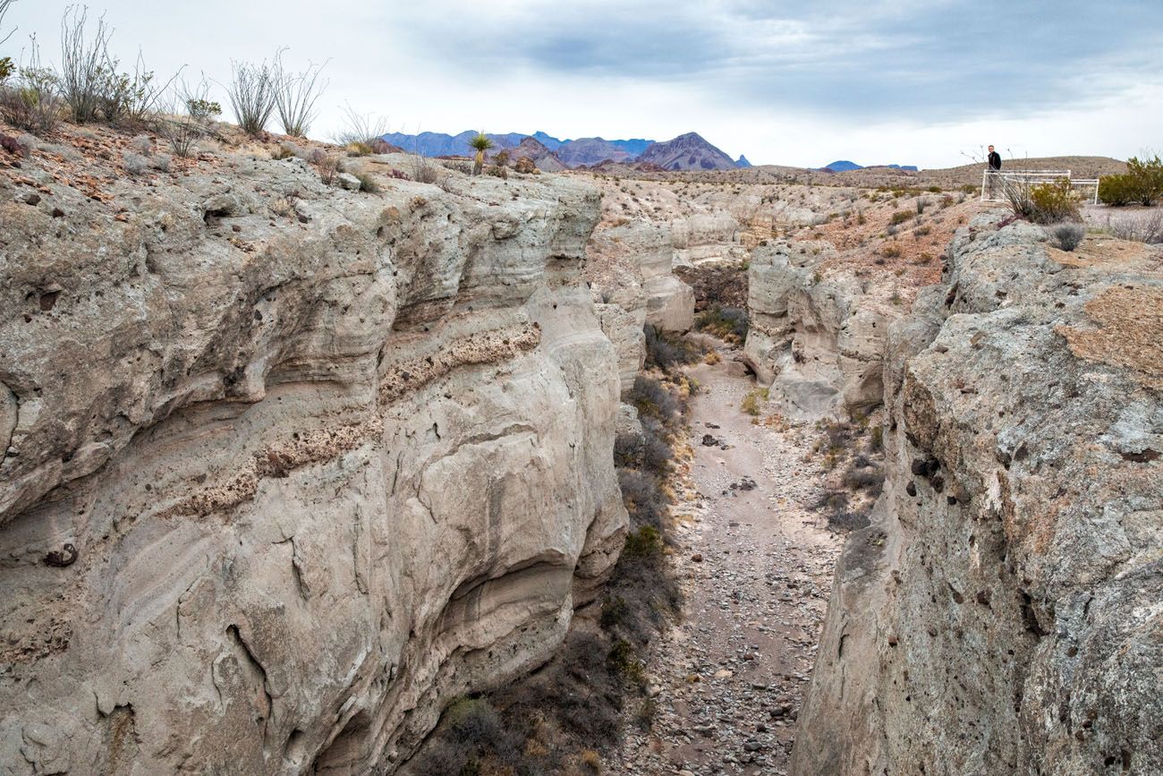
Tuff Canyon
Mule Ears Spring Trail
Distance: 3.8 miles
Difficulty: Moderate
Length of Time: 2 to 3 hours
Trailhead: Mule Ears Overlook parking lot
The Mule Ears are a unique rock formation that looks like, you guessed it, mule ears. You can see the Mule Ears from an overlook along Ross Maxwell Scenic Drive but for a closer view, hike the Spring Trail. This trail ends a spring, so it does not take you all of the way to the Mule Ears.
Best for: Hikers looking to get off the beaten path in the Ross Maxwell area with some solitude
Why it’s worth it: Fewer crowds than most Big Bend trails and a good look at the iconic Mule Ears rock formation up close
Skip it if: You’re expecting to reach the Mule Ears themselves because the trail ends at a spring, not at the formation
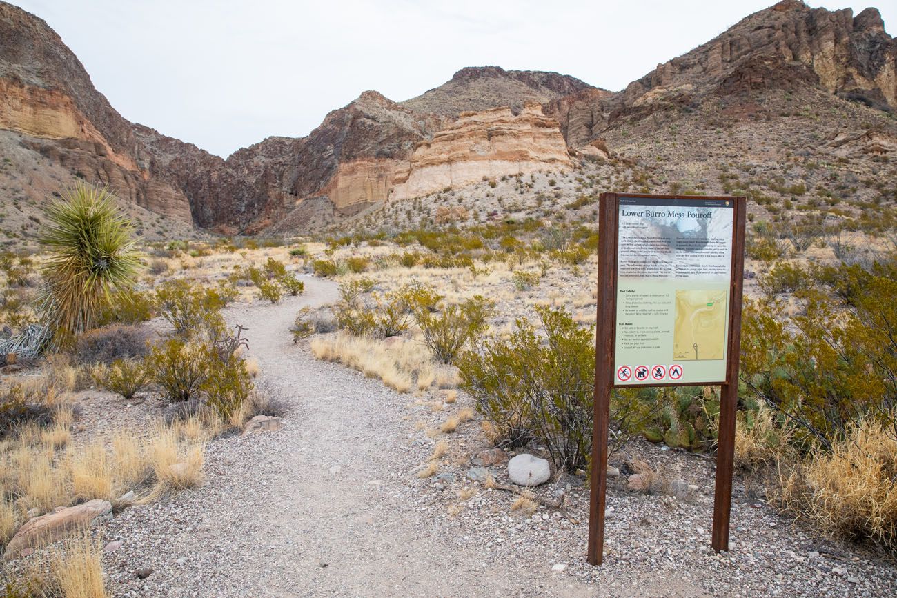
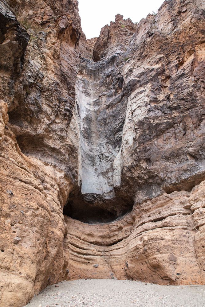
Lower Burro Mesa Pour-Off
Distance: 1 mile
Difficulty: Easy
Length of Time: 45 minutes
Trailhead: The end of Burro Mesa Spur Road
This pretty like hike wanders through a large canyon, ending at the base of a giant cliff. At the end of the trail, you are standing at the base of Burro Mesa and the spot where the water pours off of the cliff during rainstorms.
This is an easy, mostly flat hike, but part of the trail is through gravel and sand, which can make walking feel more difficult in these sections.
Best for: Hikers of all levels who want an easy, scenic canyon walk with a dramatic endpoint
Why it’s worth it: A flat, easy hike through a wide canyon ending at the base of a towering cliff face; great scale and atmosphere for minimal effort
Skip it if: You’ve already done Santa Elena Canyon and are short on time — that’s the higher priority hike in this area
Rio Grande Village
The Rio Grande Village is located at the far eastern side of Big Bend National Park. This area is well-known for its hot springs, views of the Rio Grande, and the opportunity to cross the Rio Grande, in order to visit the Mexican town Boquillas del Carmen.
Hot Springs Historic Trail
Distance: 1 mile
Difficulty: Easy
Length of Time: 30 minutes, longer to relax in the hot springs
Trailhead: Hot Springs parking lot
This short, easy hiking trail takes you to the 105°F hot springs, one of the most popular things to do on this side of Big Bend National Park.
Best for: Visitors who want a short, easy hike with a rewarding soak at the end.
Why it’s worth it: A 105°F natural hot spring right on the edge of the Rio Grande; one of the most unique trail endpoints in any national park.
Skip it if: You’re expecting solitude. This is a popular spot and you’ll likely be sharing the springs with other visitors.
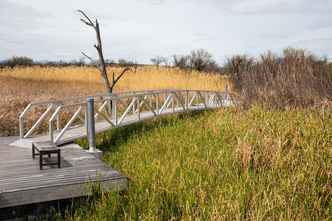
Rio Grande Village Nature Trail
Distance: 0.75 mile
Difficulty: Easy
Length of Time: 30 minutes
Trailhead: Rio Grande Village campground
This short hiking trail loops through a marshy area on the edge of the Rio Grande. This is a great place for wildlife viewing, with the chance to see fish and birds.
Best for: Wildlife watchers and birders; this is one of the best birding spots in the park
Why it’s worth it: A short, easy loop through a marshy riparian area that attracts an impressive variety of birds and other wildlife
Skip it if: You’re prioritizing big views and dramatic scenery because this one is more about nature than landscapes
Rio Grande Village Nature Trail
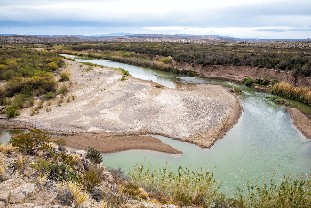
Boquillas Canyon Trail
Distance: 1.6 miles
Total Ascent: 215 feet
Difficulty: Easy to moderate
Length of Time: 1 to 1.5 hours
Trailhead: End of Boquillas Canyon Road
This trail is similar to Santa Elena Canyon in that it follows along the edge of the Rio Grande. The start (and end) of this hike is the most challenging, with a steep but brief climb up and over a good-sized hill (enjoy the view…it’s a better view than what you get at the nearby Boquillas Canyon Overlook). Then, it is a mostly flat and scenic walk along the river.
Best for: Hikers who want a scenic river walk with more solitude than Santa Elena Canyon
Why it’s worth it: A beautiful walk along the Rio Grande with towering canyon walls, a brief climb with great views, and far fewer crowds than the more famous canyon trails
Skip it if: You only have time for one canyon hike; Santa Elena Canyon is the stronger choice for first-timers
Boquillas Canyon Trail
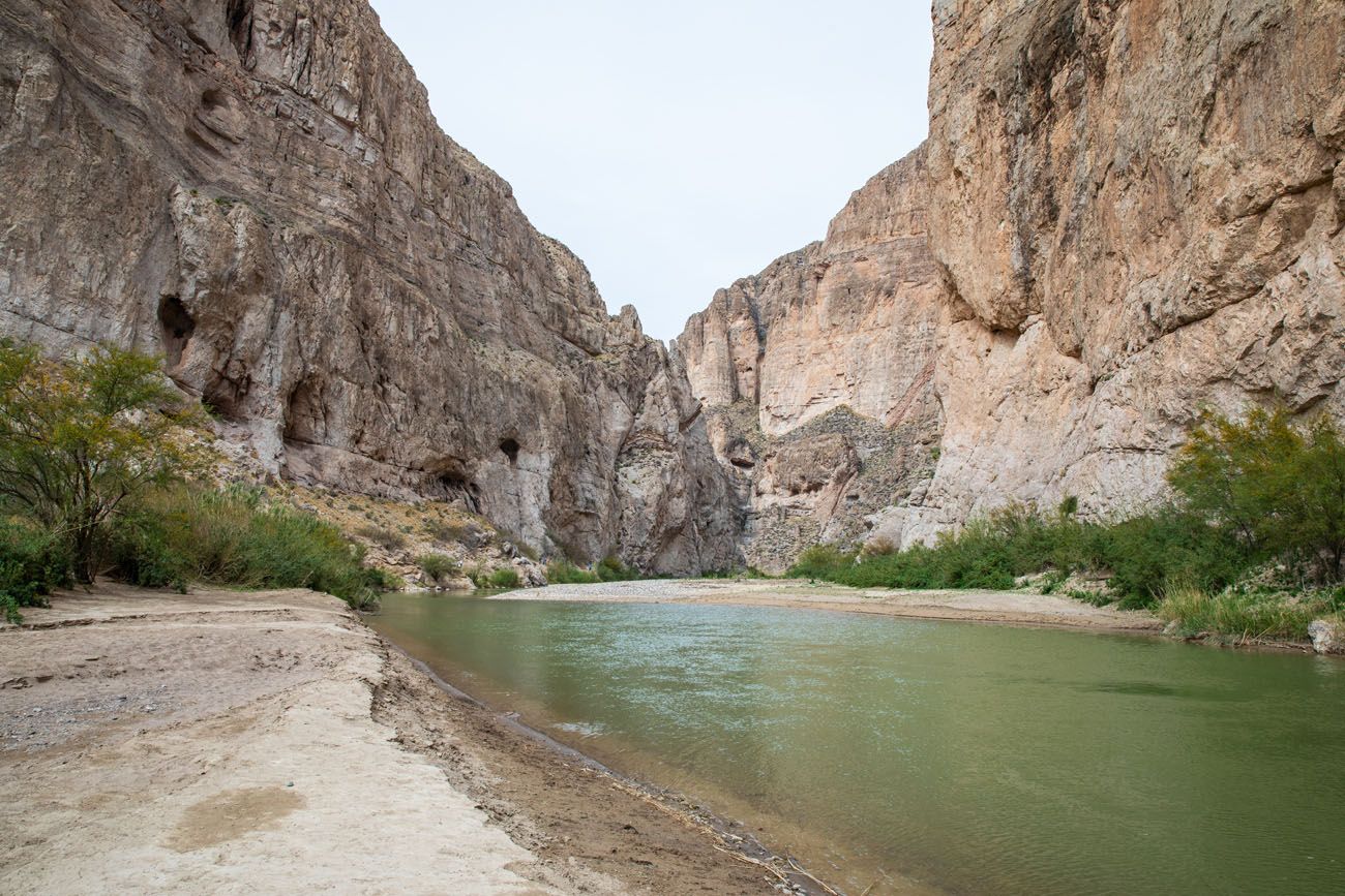
Boquillas Canyon
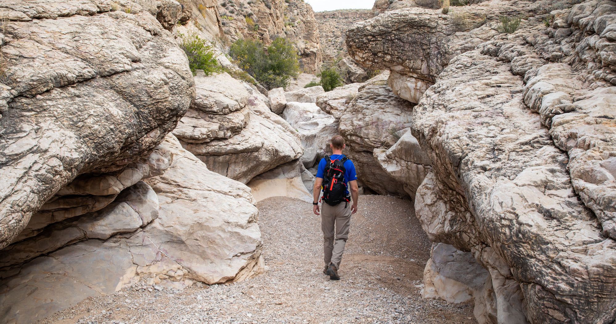
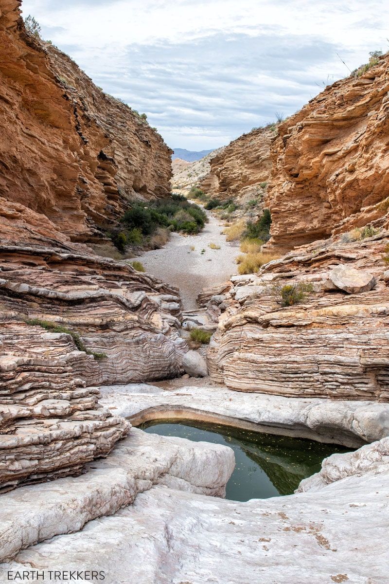
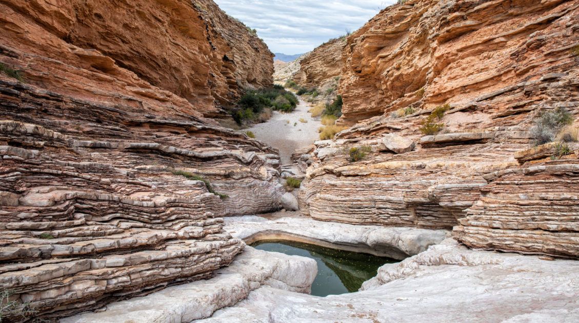
Ernst Tinaja Trail
Distance: 1.6 miles
Total Ascent: 195 feet
Difficulty: Easy to Ernst Tinaja, moderate to challenging if you continue past Ernst Tinaja to go rock scrambling
Length of Time: 1 to 1.5 hours
Trailhead: Old Ore Road
This is arguably one of the best hikes in Big Bend National Park, if not one of the best all-around experiences.
This is a short, easy trail through a slot canyon, featuring a series of waterholes located within colorful layers of limestone rock. Those looking for a little more adventure can continue the hike past the water-filled pools and rock scramble their way to the back of the canyon.
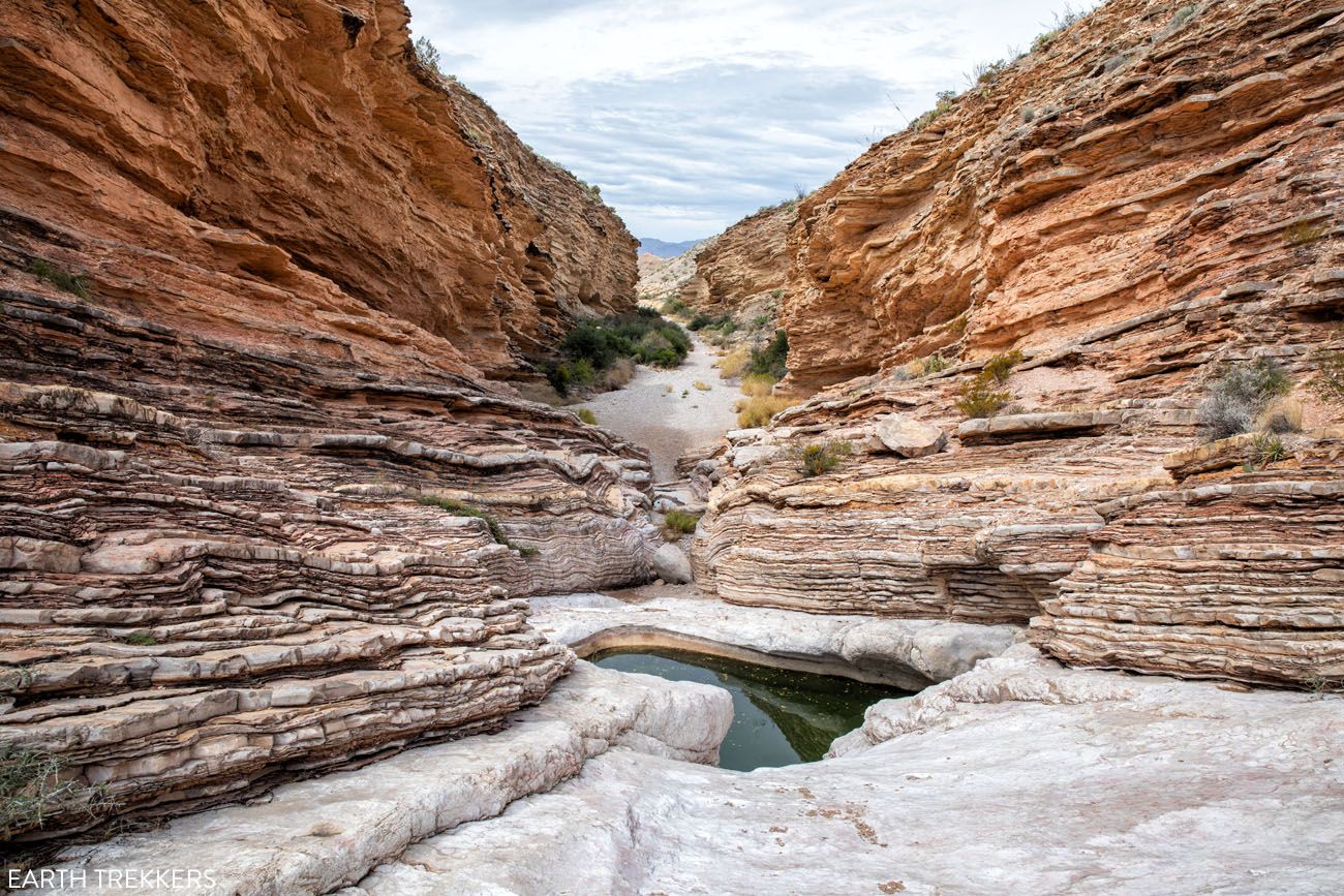
Ernst Tinaja Trail
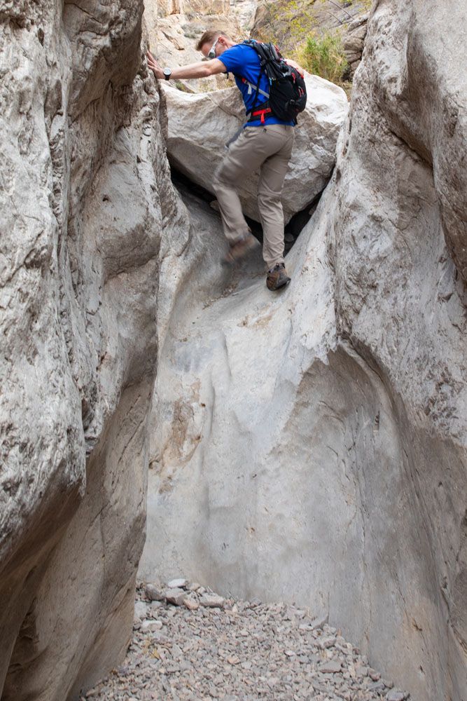
Ernst Tinaja Trail
Getting here can also be an adventure. The Ernst Tinaja trail is located on Old Ore Road, a rough, gravel road that is only suitable for high-clearance vehicles with four-wheel drive. So, in order to do this hike, you will need a 4WD vehicle.
Best for: Adventure seekers with a 4WD vehicle who want one of the most unique and memorable experiences in the park.
Why it’s worth it: A slot canyon hike past a series of stunning water-filled pools set within colorful layers of limestone. It’s unlike anything else in Big Bend.
Skip it if: You don’t have a high-clearance 4WD vehicle; the Old Ore Road trailhead is not accessible without one.
Get all of the details on how to do this hike in our guide to the Ernst Tinaja Trail ↓
How to Hike the Ernst Tinaja Trail
What to expect along Old Ore Road and everything you need to know to hike the Ernst Tinaja Trail.When is the Best Time to Go Hiking in Big Bend?
We visited Big Bend in early March and found the conditions nearly ideal for hiking, with warm, sunny days, cool nights, and trails in great shape. The one caveat: early March overlaps with Texas spring break, and the park was noticeably busy. The Lost Mine trailhead filled up fast, and popular spots like Santa Elena Canyon saw steady crowds throughout the day.
If we were going back, we’d aim for February. Temperatures are slightly cooler than March but still very comfortable for hiking, and historically Big Bend sees roughly half the visitors in February that it does in March. That combination of good weather and thinner crowds is hard to beat.
November is another excellent window. Temperatures are dropping but still mild, the summer heat has passed, and crowd levels are relatively low compared to the spring peak.
Here’s a quick seasonal breakdown:
- Spring (February–April): Best overall conditions for hiking. February is the sweet spot for fewer crowds; March brings spring break traffic. Wildflowers can bloom after winter rains.
- Summer (June–August): Extremely hot in the desert, regularly exceeding 100°F. Hiking in the Chisos Mountains is more manageable due to higher elevation. Not recommended for long desert hikes.
- Fall (September–November): Excellent hiking conditions with cooling temperatures and low crowds. November is a particularly good choice.
- Winter (December–January): Cool to cold, especially at elevation. Snow is possible in the Chisos Mountains. Fewer crowds, but some trails may be icy.
For more help planning when to visit, check out our Guide to the Best National Parks by Season, where you’ll find Big Bend featured in our recommended parks for February, March, and November.
Before you go, get updates on conditions and trail closures on the official National Park Service website.
Please practice the seven principles of Leave No Trace: plan ahead, stay on the trail, pack out what you bring to the hiking trail, leave areas as you found them, minimize campfire impacts, be considerate of other hikers, and do not approach or feed wildlife.
5 Common Mistakes First-Time Visitors Make in Big Bend
1. Underestimating the Size of the Park
Big Bend covers over 800,000 acres, and driving from one end to the other takes well over an hour. Many first-time visitors try to combine hikes from different areas of the park in a single day and end up spending more time in the car than on the trail. Plan your days by area: Chisos Basin one day, Ross Maxwell Scenic Drive another, and Rio Grande Village a third.
2. Arriving at the Lost Mine Trailhead Too Late
The Lost Mine Trail parking lot holds only about 20 cars. On busy days — and early March through spring break can be very busy — that lot fills up fast. If you’re planning to hike Lost Mine, arrive at sunrise. If you miss the parking window, you’ll need to come back later or skip it entirely.
3. Skipping Ernst Tinaja Because of the Road
Many visitors see “4WD required” and write Ernst Tinaja off entirely. That’s a mistake. If you have a high-clearance 4WD vehicle, this trail should be near the top of your list. It’s one of the most unique and crowd-free experiences in the park, and the drive on Old Ore Road is an adventure in itself.
4. Visiting in Summer Without Adjusting Your Plans
Big Bend in summer is brutally hot and temperatures regularly exceed 100°F in the desert. If you’re visiting between June and August, avoid hiking in the lower elevation areas like Santa Elena Canyon and Rio Grande Village during midday. The Chisos Mountains, sitting at higher elevation, are significantly cooler and a much better bet for summer hiking.
5. Skipping Big Bend Ranch State Park
If you like hiking, this is not to be missed. The Closed Canyon hike is spectacular. It’s a very short hike through a slot canyon with some rock scrambling. And just down the road is another short but sweet hike featuring hoodoos and views of the Rio Grande. We cover exactly what to do in our guide to Big Bend Ranch State Park.
Plan Your Big Bend Trip
If hiking is just one part of your visit to Big Bend National Park, these guides will help you plan the rest of your trip.
- Big Bend National Park Travel Guide – When to visit, where to stay, and seasonal tips
- 3 Days in Big Bend Itinerary – How to structure your time in Chisos Basin, Rio Grande Village, and along Ross Maxwell Scenic Drive
- Best Things to Do in Big Bend – Scenic drives, viewpoints, and non-hiking highlights
Big Bend is one of our favorite parks for hiking, but it’s not the only one. See how these trails compare in our guide to the Best Hikes in the US National Parks, featuring standout hikes from 55+ parks across the country.
If you are planning a bigger trip across Texas, we have lots of helpful information our Texas Travel Guide and Guadalupe Mountains National Park Travel Guide.
What do you think are the best hikes in Big Bend National Park? Let us know in the comment section below.
Explore More of Texas & the National Parks
Here are more of our guides on Texas and beyond.
20 Fun, Short Hikes in the US National Parks
Pinterest Facebook Flipboard One of the best ways to experience the national parks is from a hiking trail. Hike to amazing viewpoints, deep into the forests, through scenic canyons, and to hidden lakes and waterfalls. Along the way, you have a better chance of spotting wildlife and potentially leaving the crowds behind. Here are 20 […]
How to Plan a Trip to Big Bend National Park
Big Bend National Park Big Bend National Park sits in the far southwestern corner of Texas, deep in the Chihuahuan Desert, and getting here takes serious commitment. But that remoteness is exactly the point. Crowd levels stay low even at peak times, and the park rewards the effort with an extraordinary range of experiences: hiking […]
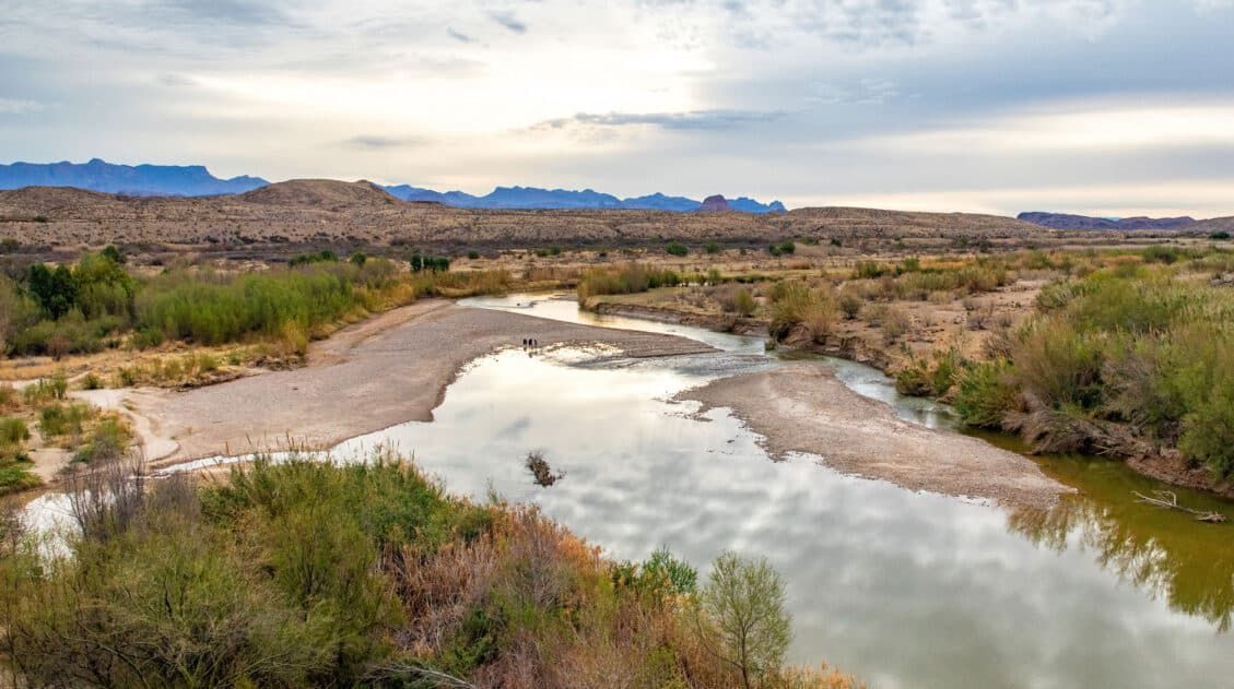
10 Day Texas New Mexico National Parks Road Trip Itinerary
On this 10-day Texas New Mexico road trip itinerary, you will visit four national parks plus make a quick detour to a gem of a state park that just might be one of the big highlights of the trip. Go hiking in Big Bend and Guadalupe Mountains, explore the underground wonderland of Carlsbad Caverns, and […]
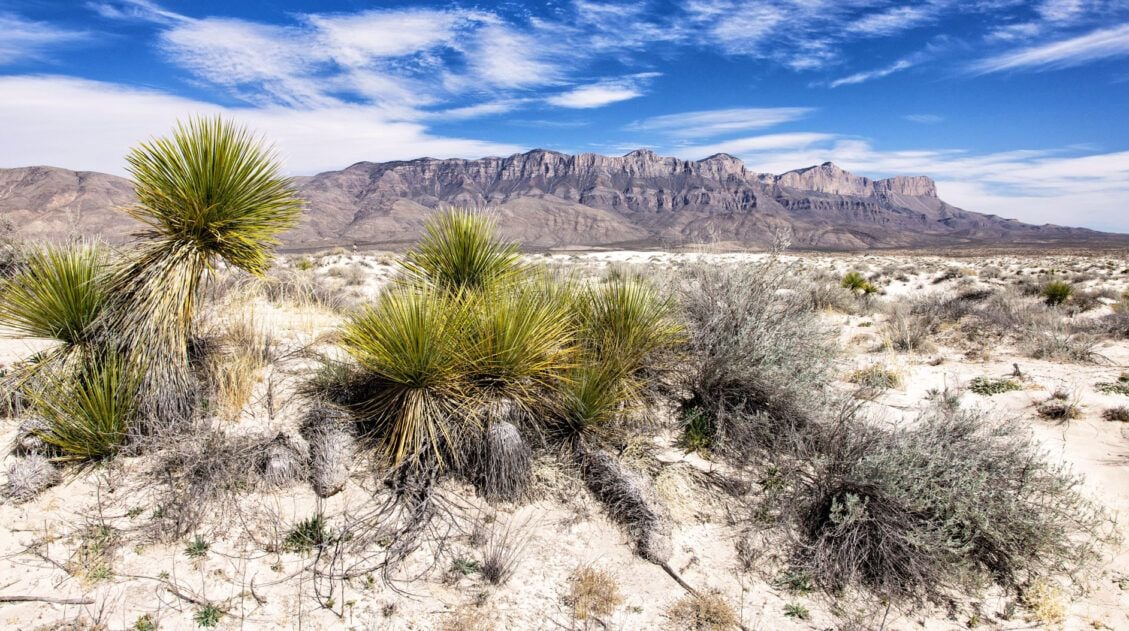
15 Best Things to Do in Guadalupe Mountains National Park
Tim and I have hiked a lot of national parks, and Guadalupe Mountains is one that genuinely surprised us. We expected a remote desert park with a few good trails. What we found instead was a place with incredible variety — a slot canyon, a fossilized coral reef trail with almost no one on it, […]
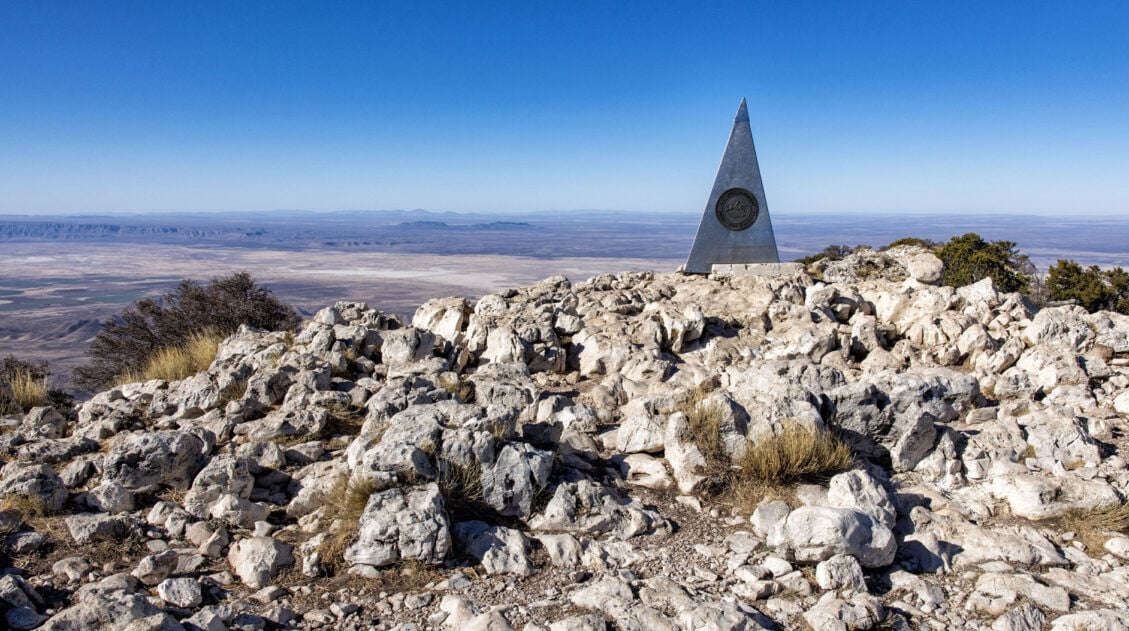
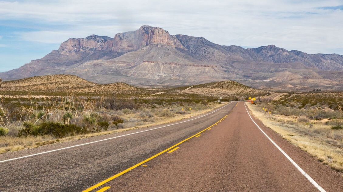
Guadalupe Peak Trail Guide: Hiking the Highest Point in Texas
Guadalupe Peak, at 8,751 feet, is the highest point in Texas, and for hikers who make the goal of standing on the highest point in every state they visit, this one is a must. Tim and I hiked to the summit during Spring Break, arriving at the Pine Springs Trailhead parking lot at 7:30 am […]
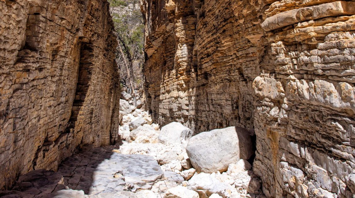
Devil’s Hall Trail Guide: What to Expect | Guadalupe Mountains NP
The Devil’s Hall Trail is one of the most unique hikes in Guadalupe Mountains National Park. It’s a 4.2-mile round-trip route through Pine Springs Canyon that ends at a narrow limestone slot canyon with 50-foot walls and just 15 feet of width at its narrowest point. Along the way, you’ll scramble through a rocky wash, […]
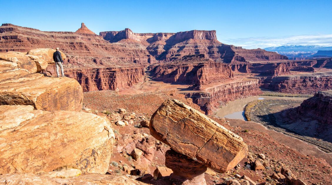
US National Parks List: All 63 Parks, Map & Free Printable Checklist
There are 63 national parks in the United States, and we’ve visited 56 of them, from the remote wilderness of Denali to the coral reefs of the Virgin Islands. We’re a family of avid hikers who have spent over a decade exploring these parks, from multi-day backcountry trips to scenic drives with kids in tow. […]
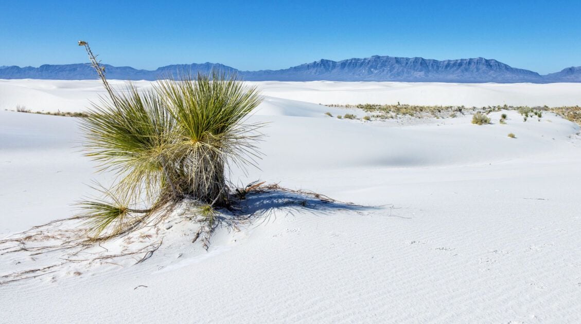
11 Amazing Things to Do in White Sands National Park
White Sands National Park is home to the largest gypsum dunefield in the world. These pure white dunes create a fun place to explore, for both kids and adults. Hike out into the dunes, learn about the wildlife that calls this park home, and go sledding on sand as white as the snow…these are just […]
25 Best Things to Do in Big Bend National Park
Discover the best things to do in Big Bend National Park, including the must-see highlights, unique experiences you won’t find anywhere else, and practical tips to help you plan your visit. Big Bend National Park is one of those places that genuinely surprises you. Tim and I had heard it described as remote and rugged, […]
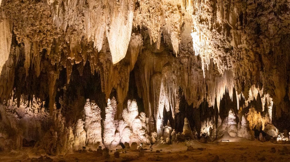
Best Things to Do in Carlsbad Caverns National Park
In this guide, we cover the best things to do in Carlsbad Caverns, tour options (both ranger-guided and self-guided), timed entry reservations, plus lots of helpful information. Located in the Guadalupe Mountains of New Mexico sits an underground fantasy land of limestone chambers, stalactites and stalagmites, and long, twisting tunnels. Carlsbad Caverns is breathtaking in […]
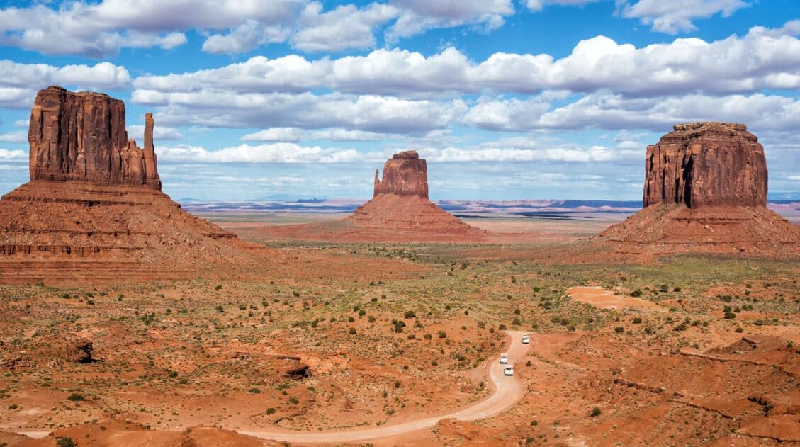
Our 15 Favorite US National Parks: A Few May Surprise You
Stretching from the South Pacific, across the United States and into the Caribbean, are 63 national parks. These national treasures are filled with scenic drives, hundreds of miles of hiking trails, wildlife, historic sites, and endless opportunities for adventure. In this guide, we cover 15 of the best national parks in the USA and what […]

The Ultimate Guide to the 63 US National Parks
Stretching from the South Pacific, across the United States to the Caribbean, are 63 national parks. These national treasures preserve iconic landscapes, majestic mountains, primordial forests, arid deserts, misty coastlines, immense canyons, wildlife, and historic landmarks. We have visited 56 of the 63 US national parks, from the towering granite walls of Yosemite and the […]
United States Travel Guide: Places to Visit in the USA
Plan your visit to the United States. Learn about the best things to do, how to plan your time, road trip ideas, and sample itineraries.

Comments 6