

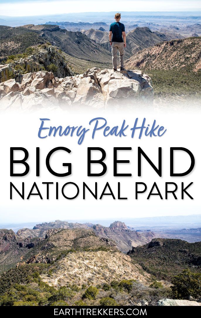
Emory Peak is the highest point in Big Bend National Park and the Chisos Mountains, and the hike to the summit is one of the best things you can do in the park. The 10.4-mile out-and-back gains nearly 2,500 feet of elevation and finishes with a short rock scramble to the top, where 360-degree views over the Chihuahuan Desert and the entire Chisos Mountain Range make every step worth it.
Tim and I hiked to Emory Peak on our first day in Big Bend, folded into the full South Rim loop. We set out just past sunrise and didn’t start seeing other hikers until we hit the climb up to the peak itself, which tells you something about the value of an early start.
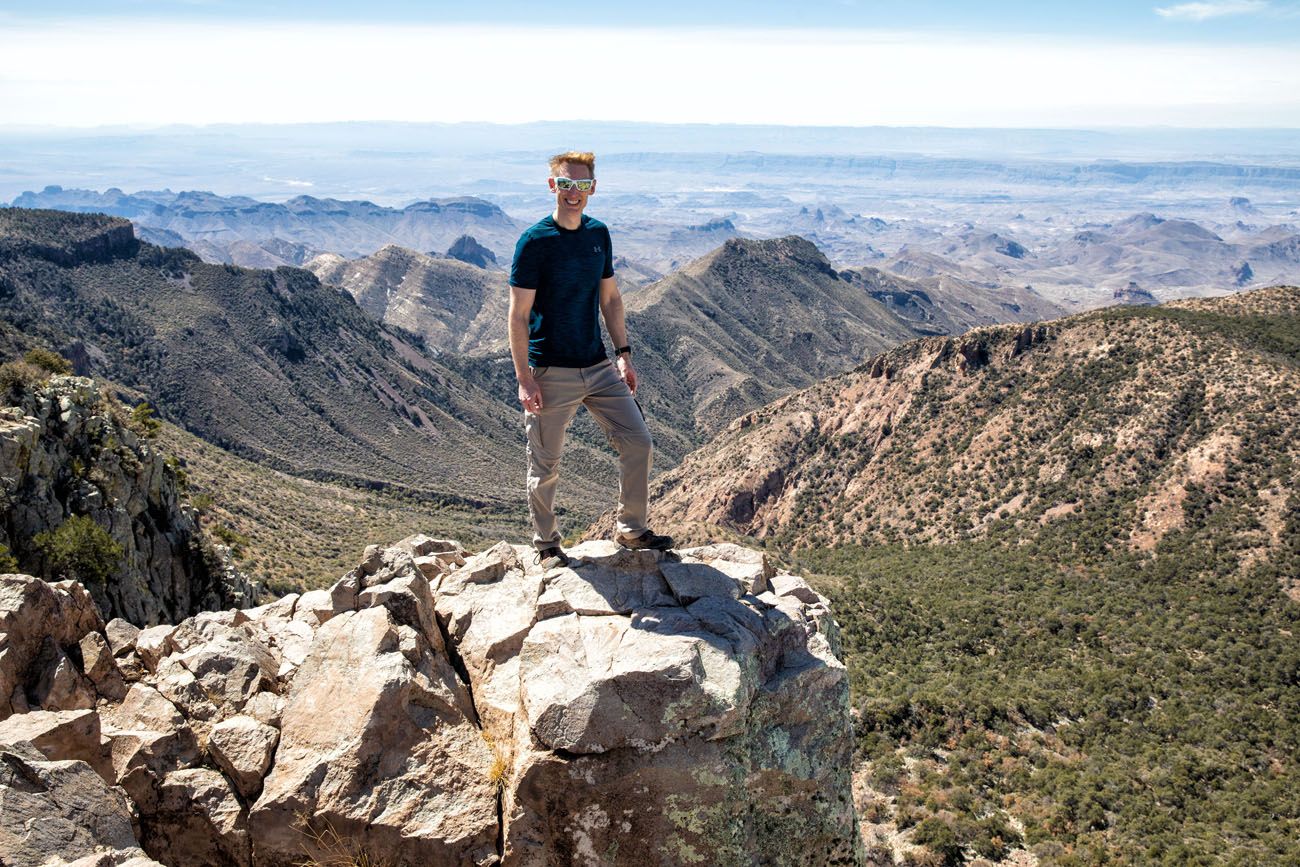
The rock scramble at the summit was the highlight: more fun than intimidating, and very doable. The views from the top are the best in the park, and nothing you see on the way up quite prepares you for the moment you pull yourself onto that summit.
Here’s everything you need to know to hike Emory Peak in Big Bend National Park.
Note: The proposed construction project in Chisos Basin for 2026 has been canceled.
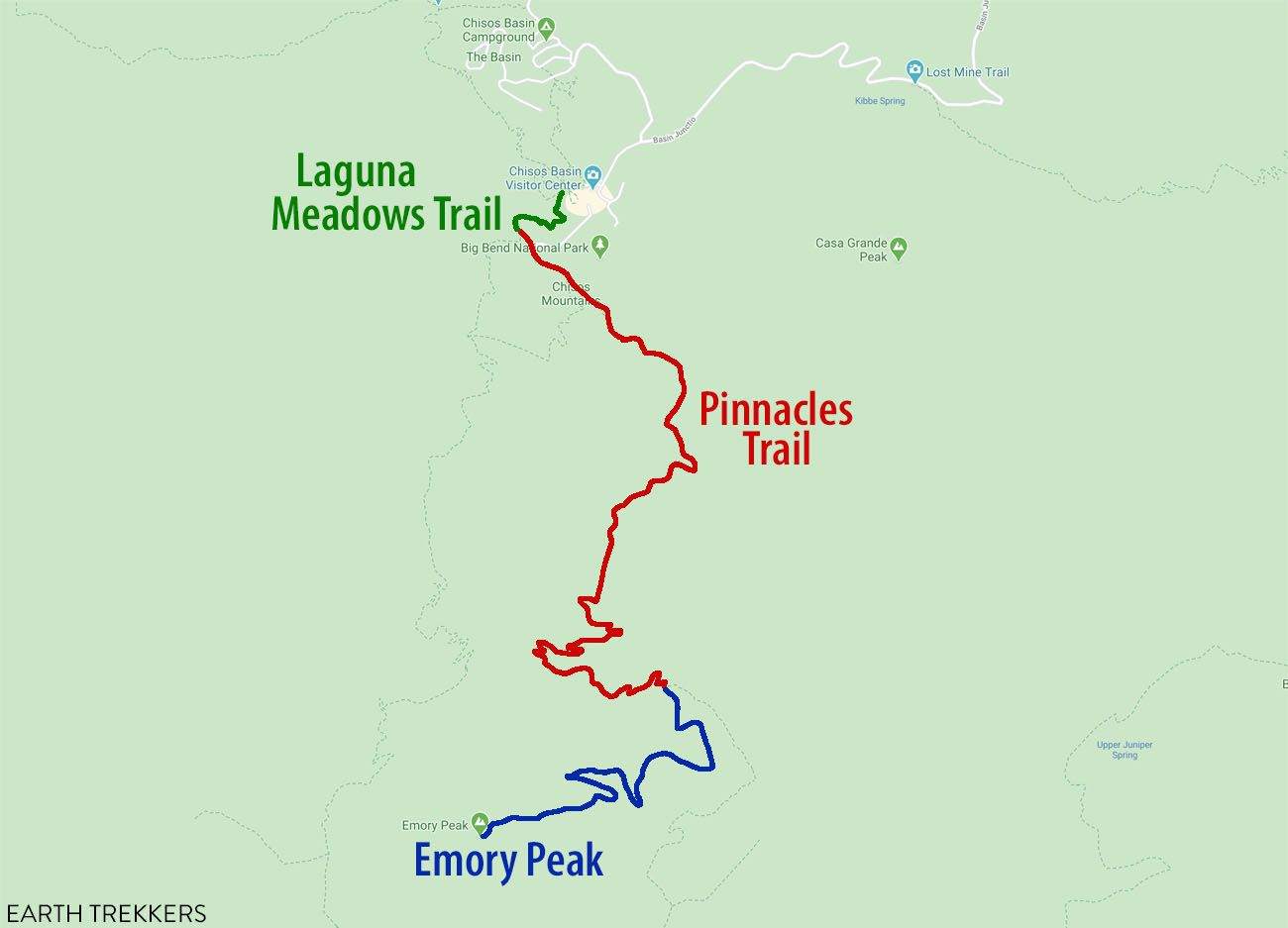
Emory Peak Hiking Stats & Map
Emory Peak Hiking Stats
Distance: 10.4 miles (16.7 km) round trip (out-and-back)
Total Ascent: 2440 feet (745 m)
Difficulty: Strenuous
Length of Time: 5 to 7 hours
Please practice the seven principles of Leave No Trace: plan ahead, stay on the trail, pack out what you bring to the hiking trail, leave areas as you found them, minimize campfire impacts, be considerate of other hikers, and do not approach or feed wildlife.
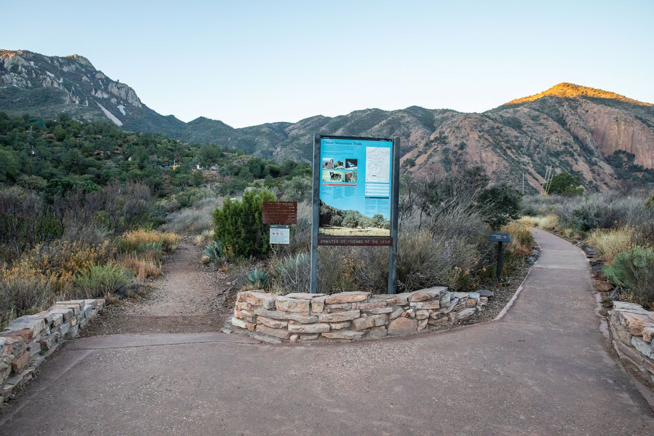
Getting to the Trailhead
This hike starts and ends at the Chisos Basin Visitor Center. There is a large parking lot here, but it can fill up early. I recommend arriving around sunrise, in order to get a parking spot, and to start your hike in the morning, while temperatures are still cool.
There are several trails that start next to the Chisos Basin parking lot (the Window Trail, the Window View Trail, and the Laguna Meadows Trail). From the parking lot, look for the sidewalk that leads to the hiking trails.
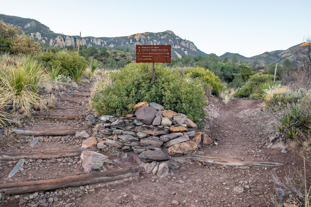
Chisos Basin Trailhead. The trail to the left leads to Emory Peak. The trail to the right is the Window View Trail.
Emory Peak Hike
Laguna Meadows Trail
Distance: 0.3 miles
Time: 5 to 10 minutes
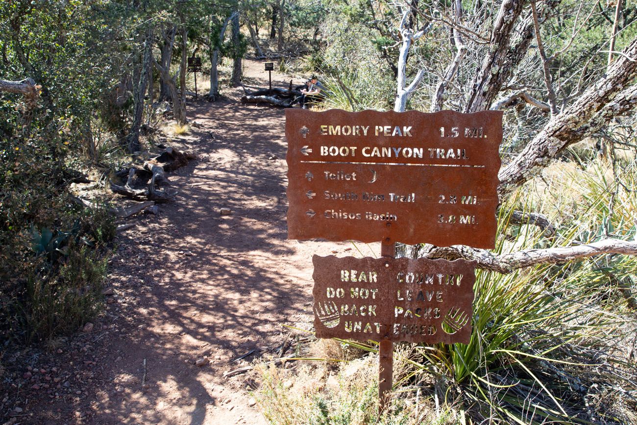
For this hike, follow the signs for Emory Peak. Hike the Laguna Meadows Trail for roughly 0.3 miles until you come to a fork in the trail. Take the trail to the left, following the signs to Emory Peak. This is called the Pinnacles Trail.
The Pinnacles Trail
Distance: 3.4 miles
Time: 1.5 – 2 hours
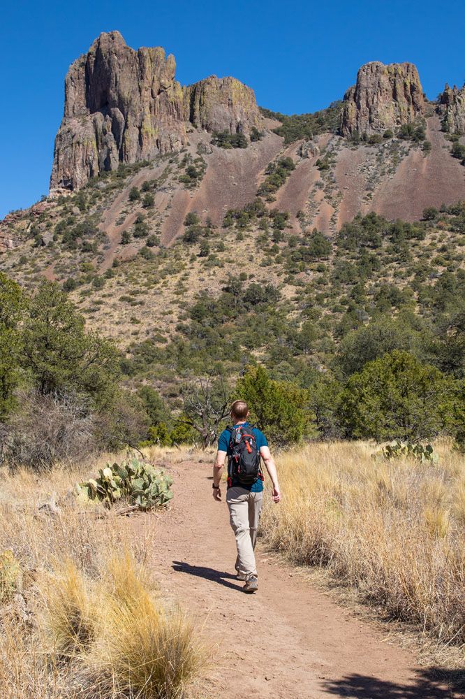
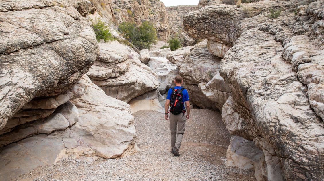
The first mile of the Pinnacles Trail isn’t too strenuous. But that giant peak looming in front of you…that’s your end goal. It looks unbelievably high. And it might feel that way, especially by the time you approach the top.
The Pinnacles Trail steadily gains elevation. Near the end of this trail you will hit the switchbacks and this is where it gets to be more challenging.
The Pinnacles Trail ends at the saddle that sits at the base of Emory Peak. From here, take the Emory Peak Trail. The second trail, the Boot Canyon Trail, leads out to the South Rim.
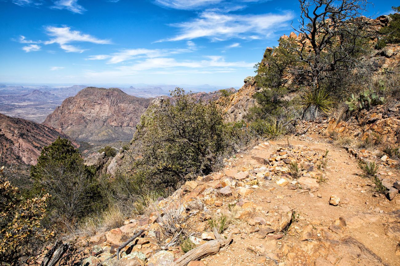
On the Pinnacles Trail (the view along the trail on the way back to Chisos Basin).
View from the saddle, at the start of the Emory Peak Trail.
Emory Peak Trail
Distance: 1.5 miles
Time: 60 to 90 minutes
At the saddle, there is a toilet as well as bear boxes, large boxes where you can store your backpacks, if you don’t want to lug them the rest of the way up the mountain.
From this point, it is a 1.5-mile (2.4 km) hike to Emory Peak with approximately 1,000 feet (305 m) of elevation gain. It is uphill the entire way.
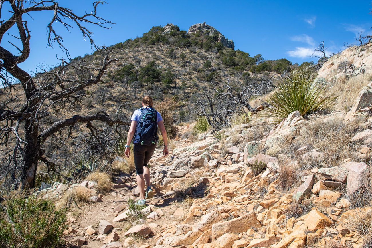
On the Emory Peak Trail, with Emory Peak in the distance.
The trail ends with a 25-foot rock scrambling section to get up onto the peak. If you like rock scrambling, you’ll love this part of the hike. But if you have a fear of heights or climbing up and down massive boulders, this final section can be intimidating.
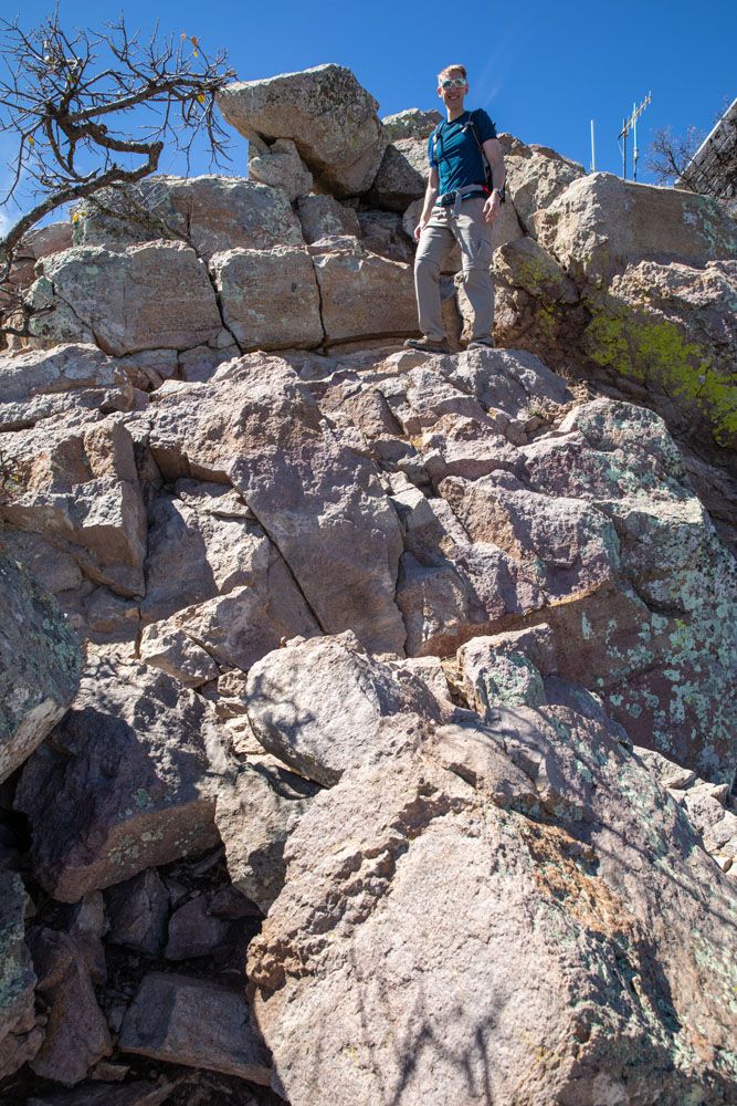
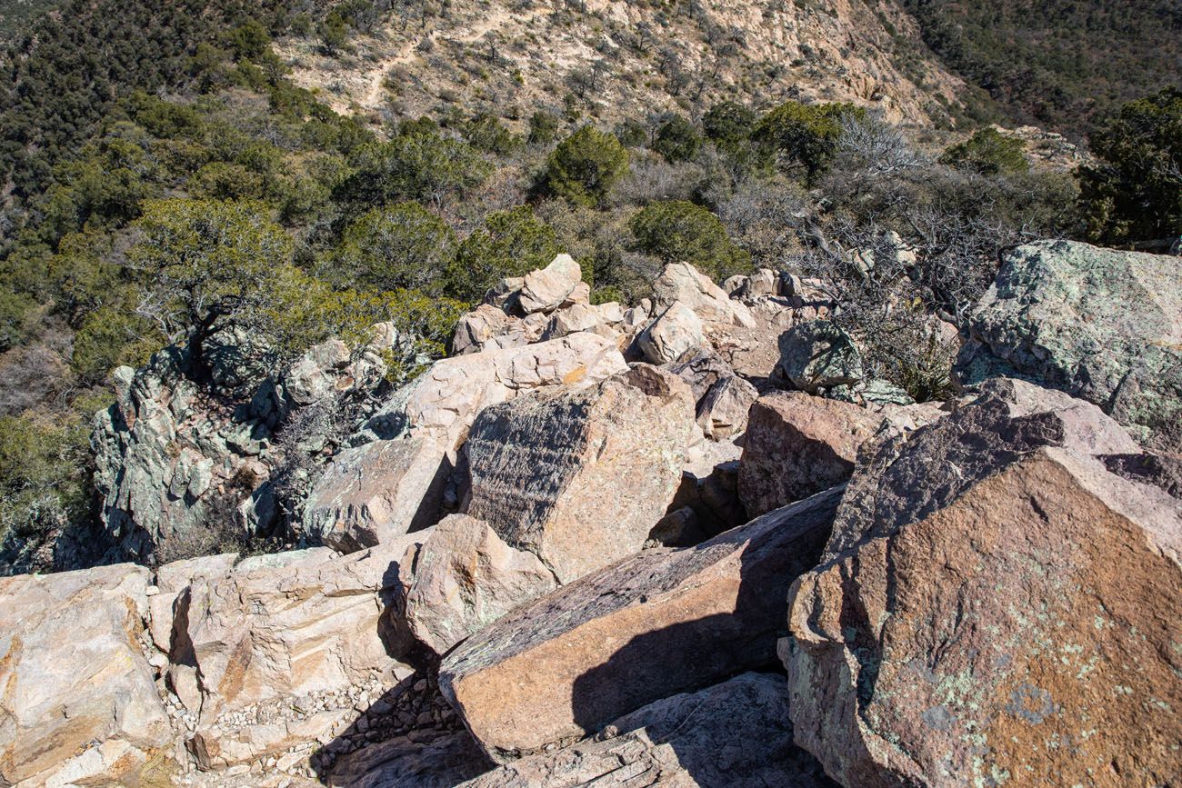
This is looking down from the top of Emory Peak at the final section of rock scrambling.
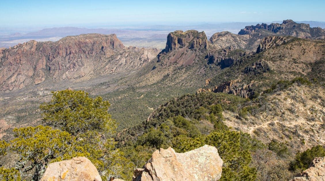
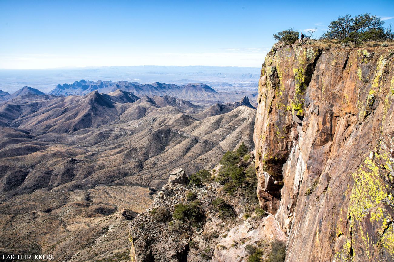
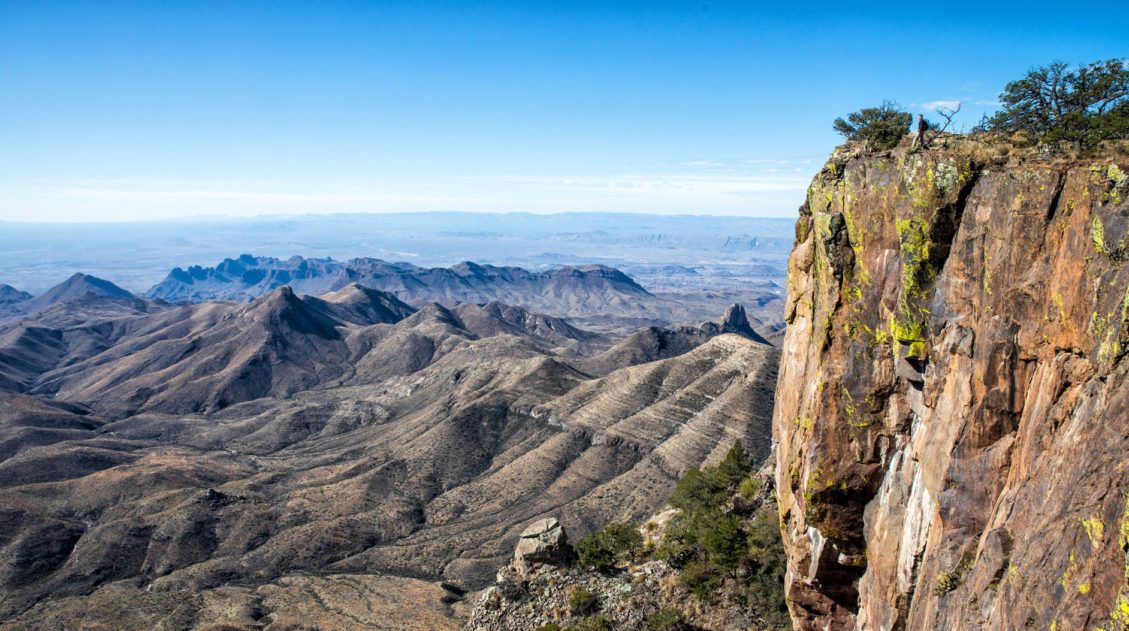
From Emory Peak, enjoy the spectacular 360° views over Big Basin National Park. On a clear day, you can see the Chihuahuan Desert and the entire Chisos Mountain Range.

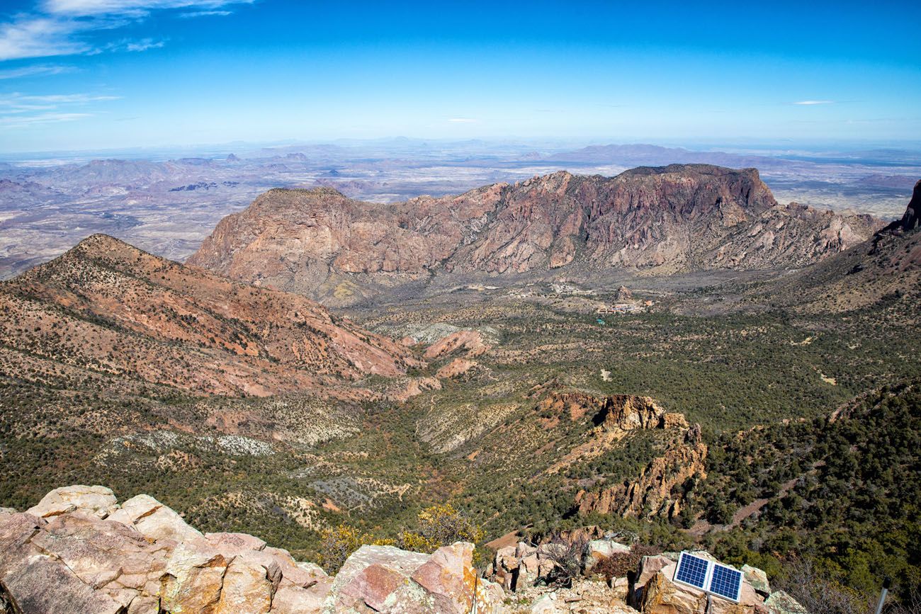
The view over Chisos Basin. If you look carefully, you can see the Chisos Basin visitor center and lodge.
Retrace your steps back to the visitor center.
Summary: Chisos Basin parking lot -> Laguna Meadows Trail (0.3 miles) -> Pinnacles Trail (3.4 miles) -> Emory Peak Trail (1.5 miles)
South Rim Trail + Emory Peak
This is a loop hike that starts and ends in Chisos Basin. This is a much longer and more challenging hike than the out-and-back hike described above. However, the views from the South Rim are amazing. If you already have plans to hike the South Rim Trail, adding on the hike to Emory Peak adds about 3 miles (4.8 km) and 1.5 hours to your day.
You can do this loop in either direction. We hiked it counter-clockwise, hiking the South Rim Trail first and then adding on Emory Peak as we headed back to the Visitor Center.
Distance: 15.6 miles (25.1 km)
Total Ascent: 3640 feet (1110 m)
Difficulty: Strenuous
Length of Time: 8 to 10 hours
For more information about how to combine these two hikes, read our detailed guide on the South Rim Trail ↓
South Rim Trail Loop + Emory Peak | Complete Hiking Guide
Everything you need to know to hike the South Rim Trail and add on Emory Peak.Is Emory Peak Worth It?
Yes. Emory Peak is the standout moment of an already excellent day of hiking in Big Bend National Park.
The summit delivers the best views in the park, full stop. From the top, you get a true 360-degree panorama: the sweeping expanse of the Chihuahuan Desert to the south, the entire Chisos Mountain Range laid out around you, and on a clear day, visibility that stretches for miles in every direction. Nothing else in Big Bend gives you a view quite like this.
The rock scramble to reach the summit is a highlight in itself. The final 25 feet requires you to climb up and over boulders to reach the top, but it’s more fun than intimidating. It doesn’t feel exposed, and most hikers, including those who aren’t experienced scramblers, find it very manageable. It adds a sense of adventure to what is otherwise a straightforward (if demanding) trail.
The main argument against adding Emory Peak is fatigue. If you’re hiking it as part of the South Rim loop, you’re already looking at 12.6 miles before the detour. Adding Emory Peak brings the total to 15.6 miles with nearly 3,640 feet of elevation gain. By the time you reach the saddle at the base of Emory Peak, your legs will already have a lot of miles on them. That said, the summit is only 1.5 miles from the saddle, and most hikers who reach that point find the extra effort very much worth it.
If you’re doing the out-and-back hike specifically for Emory Peak, the views will not disappoint.
The short answer: If you’re hiking in the Chisos Mountains, don’t skip Emory Peak.
When is the Best Time to Hike Emory Peak?
We hiked to Emory Peak in early March, on a day that turned out to be unseasonably warm. Temperatures hit 90°F with clear skies. The views from the summit were spectacular, but the heat was a reminder that even in early spring, Big Bend can surprise you. Starting at sunrise made a significant difference, letting us get the hardest climbing done before the day really heated up.
Best times to hike Emory Peak by season:
- Spring (March–May): Peak season for the park. Wildflowers are possible, skies are often clear, but temperatures can climb fast. Start at sunrise and bring more water than you think you need.
- Fall (October–November): Ideal hiking conditions. Cooler, less crowded than spring, with reliably pleasant weather.
- Winter (December–February): Cold mornings, potentially icy at elevation, but very quiet. A good option for experienced hikers prepared for cold.
- Summer (June–September): Not recommended. The exposed climb and high elevation gain make this hike genuinely dangerous in extreme heat.
Tips to Have the Best Experience
Start early in the day. This is a very long hike, so ideally, start at sunrise to give yourself enough time to complete this hike. Starting early will also let you get the most strenuous part of the hike, the ascent up to Emory Peak, finished before temperatures really heat up.
Bring lots of water. During the warmer months, 4 liters per person is recommended.
Bring sunblock. There is very little shade on the trail.
Check in the Visitor Center and/or the National Park Service website about trail closures before you go.
There is a chance you could cross paths with a black bear or a mountain lion. Click the links for advice from the NPS website on what to do should you encounter one of these animals on the hiking trail.
Frequently Asked Questions about the Emory Peak Hike
How hard is the Emory Peak hike?
It’s a strenuous hike. The 10.4-mile out-and-back gains 2,440 feet of elevation, with the bulk of the climbing on the Pinnacles Trail — a steady, relentless ascent that will tire out even fit hikers. The trail isn’t technical, but the combination of distance, elevation gain, and heat (especially in spring) makes this a demanding day. Plan for 5 to 7 hours.
Is there rock scrambling on Emory Peak?
Yes. The final 25 feet to the summit involves a rock scramble. It’s shorter and more approachable than it sounds. We found it fun rather than intimidating, and it doesn’t feel particularly exposed. Most hikers will have no trouble with it. That said, if you have a strong fear of heights or climbing on boulders, it’s worth knowing about in advance.
What is the highest point in Big Bend National Park?
Emory Peak, at 7,832 feet (2,387 m), is the highest point in Big Bend National Park and the Chisos Mountains.
Can you hike Emory Peak as a day hike?
Yes, the standard route is a day hike, 10.4 miles out-and-back from the Chisos Basin Visitor Center. If you want a longer challenge, you can combine it with the South Rim Trail for a 15.6-mile loop that is one of the best full-day hikes in Texas.
What is the difference between the Emory Peak hike and the South Rim Trail?
The Emory Peak out-and-back (10.4 miles) is the more direct route focused on reaching the summit. The South Rim Trail (12.6 miles, or 15.6 miles with Emory Peak added) is a loop hike that also takes you along the South Rim for sweeping desert views before finishing with the Emory Peak summit. If you have a full day and strong legs, the South Rim loop with Emory Peak is the better experience overall.
Continue Exploring Big Bend National Park
Emory Peak is a highlight of any Big Bend trip, but the park has much more to offer. Our Big Bend Travel Guide is the best place to start planning, our 3 Days in Big Bend Itinerary can help you plan your time, and our guide to the best things to do in Big Bend covers the full picture beyond hiking.
If you want to keep exploring on foot, the best hikes in Big Bend guide covers trails across all difficulty levels, from the easy Ernst Tinaja Trail to the full South Rim Trail loop.
If you have any questions about hiking to Emory Peak, or if you want to share your experience, let us know in the comment section below.
Explore More of Texas & the National Parks
Read all of our articles about Texas in our Texas Travel Guide and the USA in our United States Travel Guide.
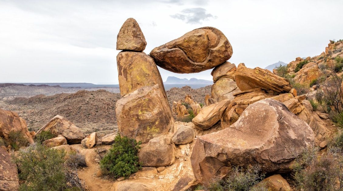
Balanced Rock Hike: A Short but Sweet Hike in Big Bend National Park
Pinterest Facebook Flipboard The Balanced Rock hike is one of our favorite short hikes in Big Bend National Park and one of the most rewarding for the effort required. The trail is only 2.2 miles round trip, with just a brief stretch of rock scrambling near the end, making it accessible for most hikers and […]
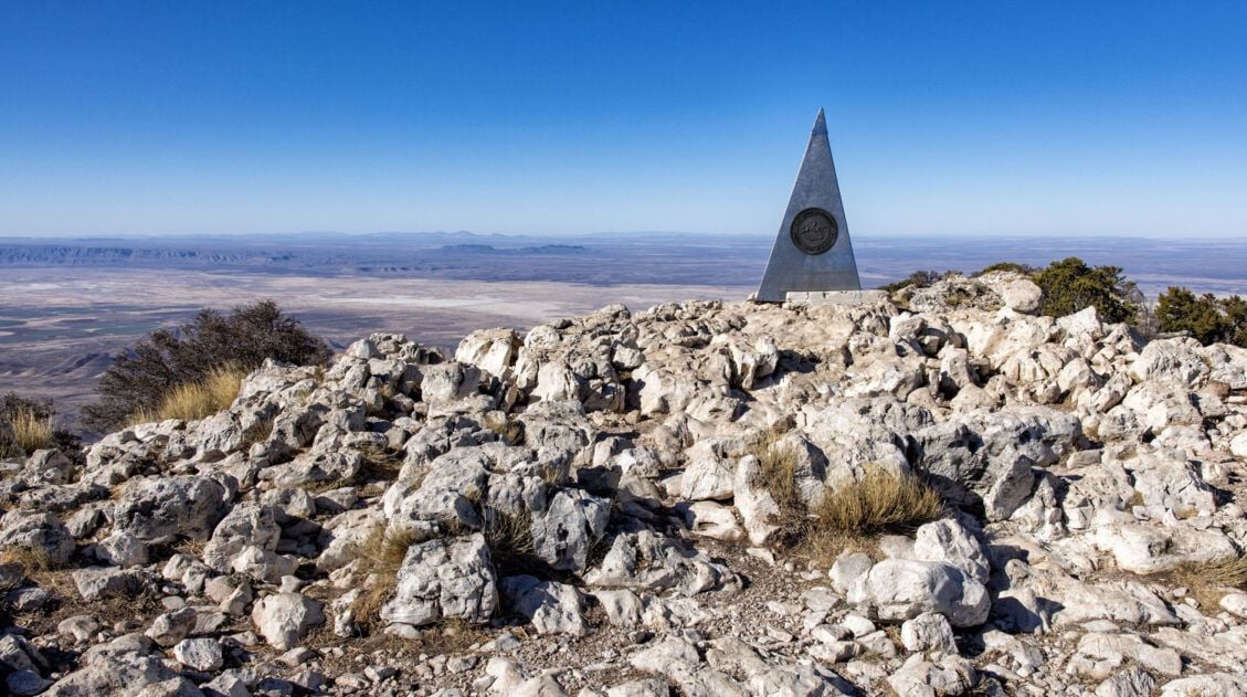
Guadalupe Peak Trail Guide: Hiking the Highest Point in Texas
Guadalupe Peak, at 8,751 feet, is the highest point in Texas, and for hikers who make the goal of standing on the highest point in every state they visit, this one is a must. Tim and I hiked to the summit during Spring Break, arriving at the Pine Springs Trailhead parking lot at 7:30 am […]
3 Days in Big Bend National Park: The Perfect Itinerary
Three days in Big Bend National Park is the ideal amount of time to experience all three regions of the park: the Ross Maxwell Scenic Drive, the Chisos Basin, and Rio Grande Village. We visited in early March and spent our days hiking slot canyons, crossing the border into Mexico, and standing at the edge […]
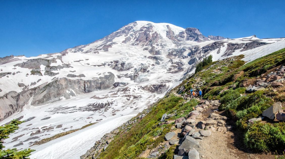
10 Day Texas New Mexico National Parks Road Trip Itinerary
On this 10-day Texas New Mexico road trip itinerary, you will visit four national parks plus make a quick detour to a gem of a state park that just might be one of the big highlights of the trip. Go hiking in Big Bend and Guadalupe Mountains, explore the underground wonderland of Carlsbad Caverns, and […]
15 Best Hikes in Big Bend National Park (By Area & Difficulty)
Big Bend National Park is one of the most underrated hiking destinations in the United States. Tucked into the southwestern corner of Texas along the Rio Grande, it packs an extraordinary range of terrain into one park — slot canyons, volcanic rock formations, a full mountain range, and miles of river canyon trails. We visited […]
25 Best Things to Do in Big Bend National Park
Discover the best things to do in Big Bend National Park, including the must-see highlights, unique experiences you won’t find anywhere else, and practical tips to help you plan your visit. Big Bend National Park is one of those places that genuinely surprises you. Tim and I had heard it described as remote and rugged, […]
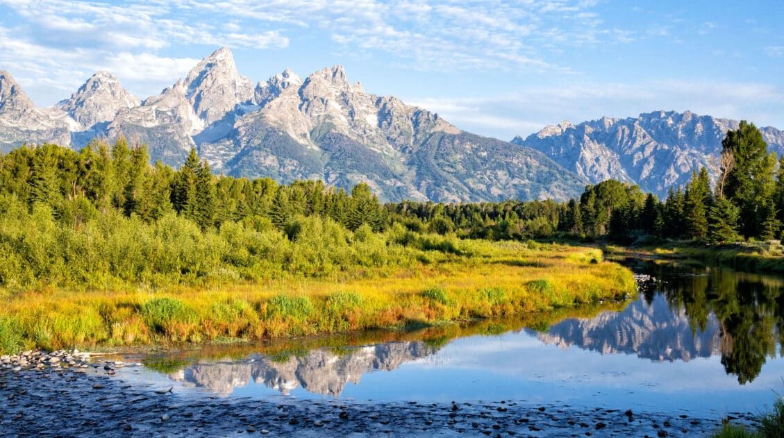
20 Epic Hikes in the US National Parks
With 63 national parks and thousands of miles of hiking trails, your options are endless for exploring the American national parks. We narrowed down the list for you to 20 of the best hikes in the US national parks, 20 amazing ways to explore this beautiful country. Hike to the tallest peaks, through massive canyons, […]
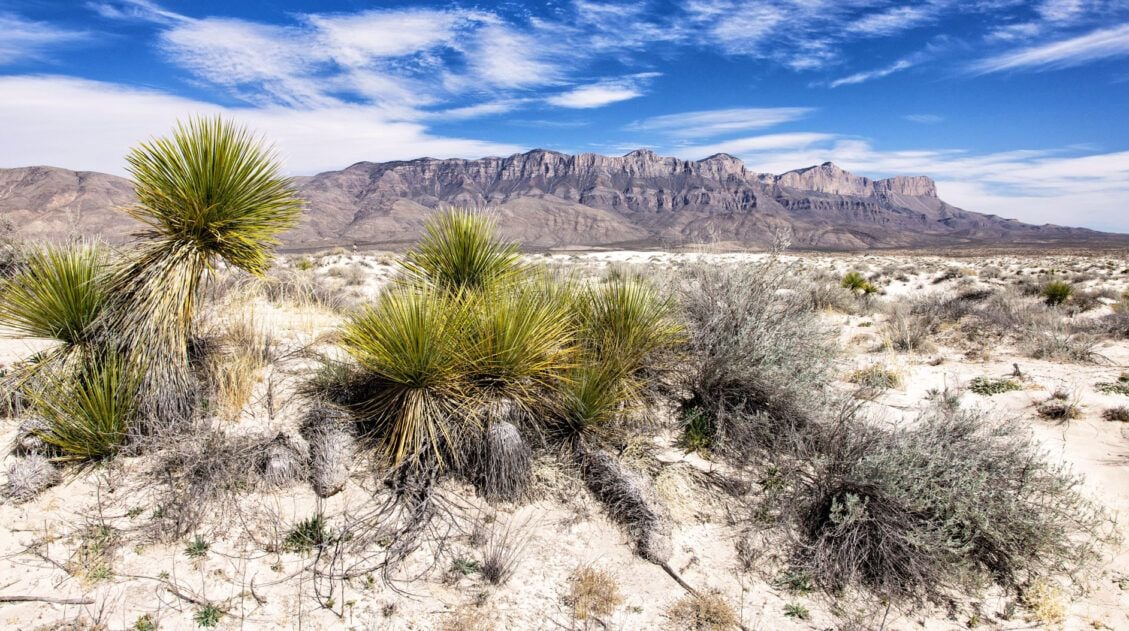
15 Best Things to Do in Guadalupe Mountains National Park
Tim and I have hiked a lot of national parks, and Guadalupe Mountains is one that genuinely surprised us. We expected a remote desert park with a few good trails. What we found instead was a place with incredible variety — a slot canyon, a fossilized coral reef trail with almost no one on it, […]
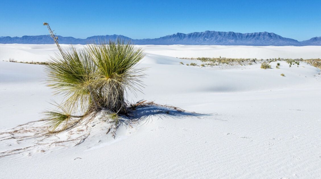
11 Amazing Things to Do in White Sands National Park
White Sands National Park is home to the largest gypsum dunefield in the world. These pure white dunes create a fun place to explore, for both kids and adults. Hike out into the dunes, learn about the wildlife that calls this park home, and go sledding on sand as white as the snow…these are just […]
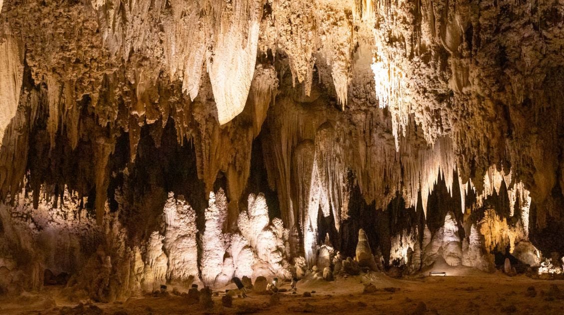
Best Things to Do in Carlsbad Caverns National Park
In this guide, we cover the best things to do in Carlsbad Caverns, tour options (both ranger-guided and self-guided), timed entry reservations, plus lots of helpful information. Located in the Guadalupe Mountains of New Mexico sits an underground fantasy land of limestone chambers, stalactites and stalagmites, and long, twisting tunnels. Carlsbad Caverns is breathtaking in […]
US National Park Itineraries & Road Trip Ideas
National Park Itineraries The national parks are best experienced as a road trip and with 56 parks visited between us, we’ve done a lot of them. Whether you’re dreaming of a two-week American Southwest loop, a classic Yellowstone and Grand Teton combo, or a deep dive into Utah’s Mighty 5, we’ve put together detailed itineraries […]
10 Best US National Parks to Visit in March
Planning a trip to the US national parks in March but don’t know which ones to visit? March brings warmer temperatures to most of the United States. Travel begins to pick up during this month, both because of the warmer weather and because families are hitting the road for spring break. There are a lot […]
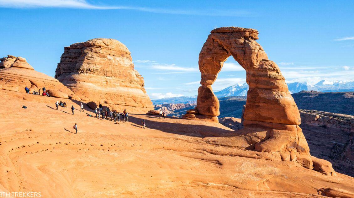
US National Parks List: All 63 Parks, Map & Free Printable Checklist
There are 63 national parks in the United States, and we’ve visited 56 of them, from the remote wilderness of Denali to the coral reefs of the Virgin Islands. We’re a family of avid hikers who have spent over a decade exploring these parks, from multi-day backcountry trips to scenic drives with kids in tow. […]
Best USA Road Trips: 18 Ideas for Your Next Big Adventure
One of the best ways to explore the USA is on a good old-fashioned road trip. Cruise along Route 66, road trip through the Florida Keys, explore the American Southwest, or even drive from coast to coast. In this guide, we share 18 of the best USA road trips…18 great ideas for your next big […]

The Ultimate Guide to the 63 US National Parks
Stretching from the South Pacific, across the United States to the Caribbean, are 63 national parks. These national treasures preserve iconic landscapes, majestic mountains, primordial forests, arid deserts, misty coastlines, immense canyons, wildlife, and historic landmarks. We have visited 56 of the 63 US national parks, from the towering granite walls of Yosemite and the […]

Comments 4