
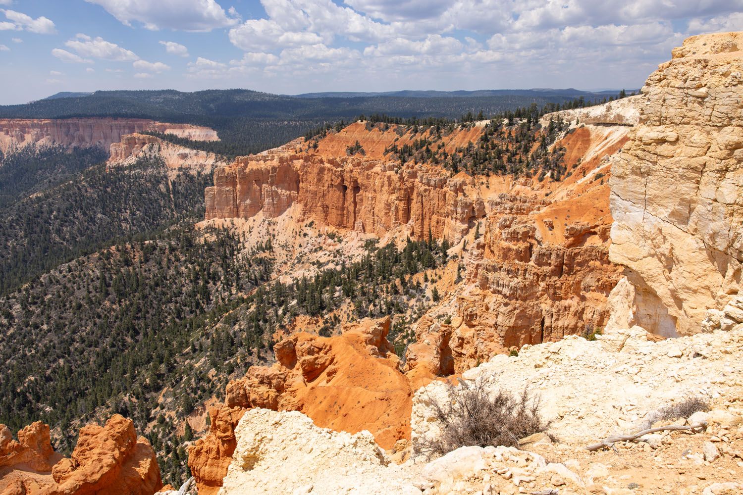
If you ask us, putting one foot in front of the other on a hiking trail is the best way to experience Bryce Canyon National Park. These hiking trails take visitors to jaw-dropping viewpoints and hidden canyons. Hike the short but sweet Rim Trail, descend down into the amphitheater on the Queen’s Garden Trail, or explore a fantasyland of hoodoos on the Peek-A-Boo Trail. Here are 12 amazing hikes in Bryce Canyon, rated from easy to hard.
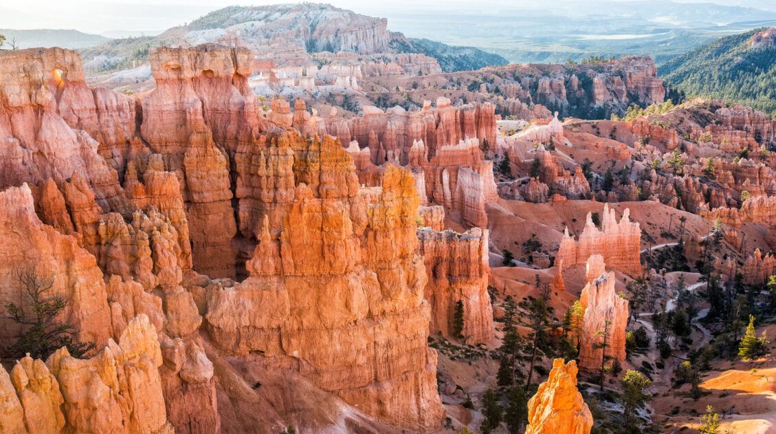
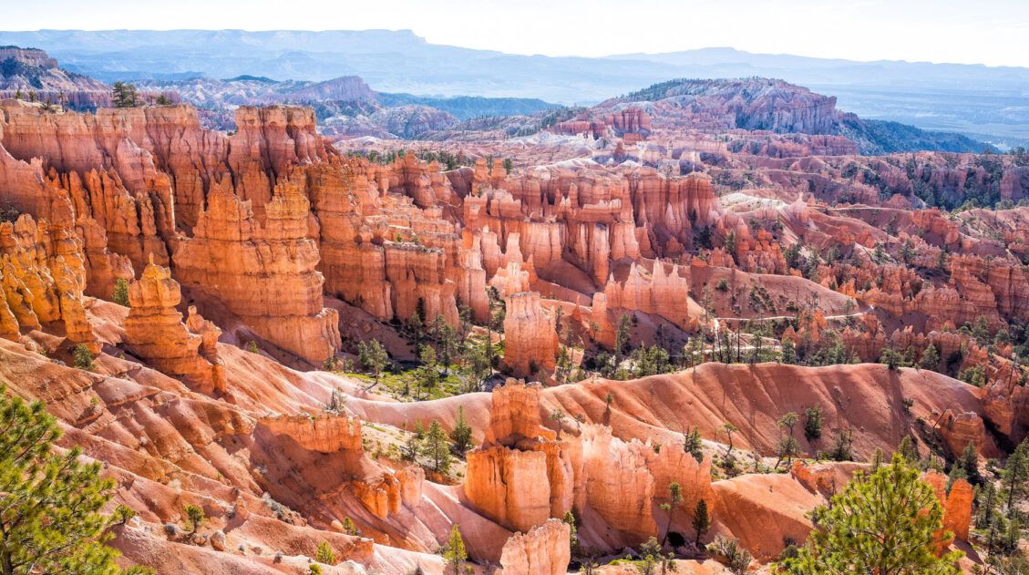
One of the great things about Bryce Canyon is that you don’t have to hike far to get those extraordinary views of the hoodoos and rock formations. There truly is something here for everyone, from the easy Rim Trail and short hikes to viewpoints.
And for those who are looking for something a bit longer and more challenging, you can do that too.
We have visited Bryce Canyon multiple times. This is one of our favorite parks to go hiking, and getting up close with the hoodoos makes this park unique from the others in Utah. This is a place where you will want to pack a camera or bring your cellphone, as you will be taking tons of photos.
In this guide, we cover the top hikes to do in Bryce Canyon, starting with the easiest of the bunch and ending with the most challenging. At the end of this guide, we’ll share our favorites, to help you pick out which ones to do.
Please practice the seven principles of Leave No Trace: plan ahead, stay on the trail, pack out what you bring to the hiking trail, leave areas as you found them, minimize campfire impacts, be considerate of other hikers, and do not approach or feed wildlife.
Best Hikes in Bryce Canyon
This list starts with the shortest, easiest trail and ends with the longest, most difficult trail. These are all day hikes, so they can easily be completed in one day.
All hiking distances are round trip, unless noted otherwise.
Sunset to Sunrise Point on the Rim Trail
Distance: 0.5 miles one-way | Time: 15 to 30 minutes | Difficulty: Easy
This is the shortest, easiest hike in Bryce Canyon and it’s one of the best. Every step of the way, you are treated to spectacular views of the Bryce Canyon amphitheater.
At either end sit two overlooks, each offering panoramic views of the park: Sunset Point and Sunrise Point.
The view from Sunset Point (in the morning)
The view from the Rim Trail, between Sunset and Sunrise Points
This short but sweet hike is a must-do for first timers. It’s also perfect for all ages and ability levels.
If you have plans to hike the Queen’s Garden and Navajo Loop or the Figure 8 Combination, you’ll hike this trail at the beginning or end of the loop (depending on where you park).
Best Place to Park: The large parking lot at the end of Sunset Point Road. Walk to the Sunset Point viewpoint and then hike to Sunrise Point.
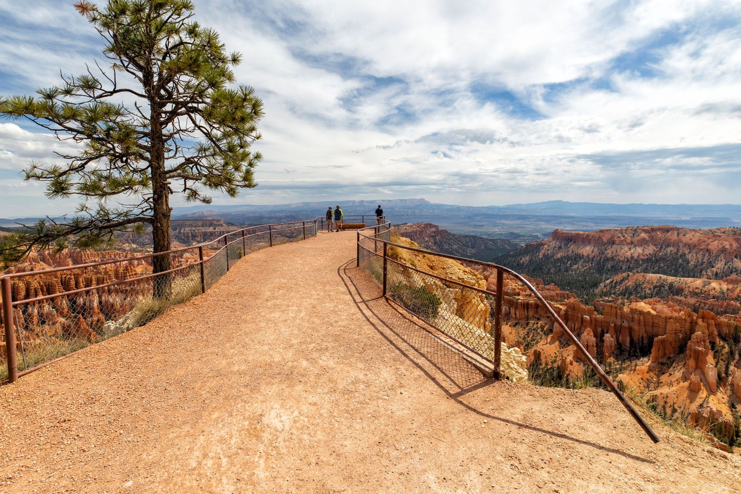
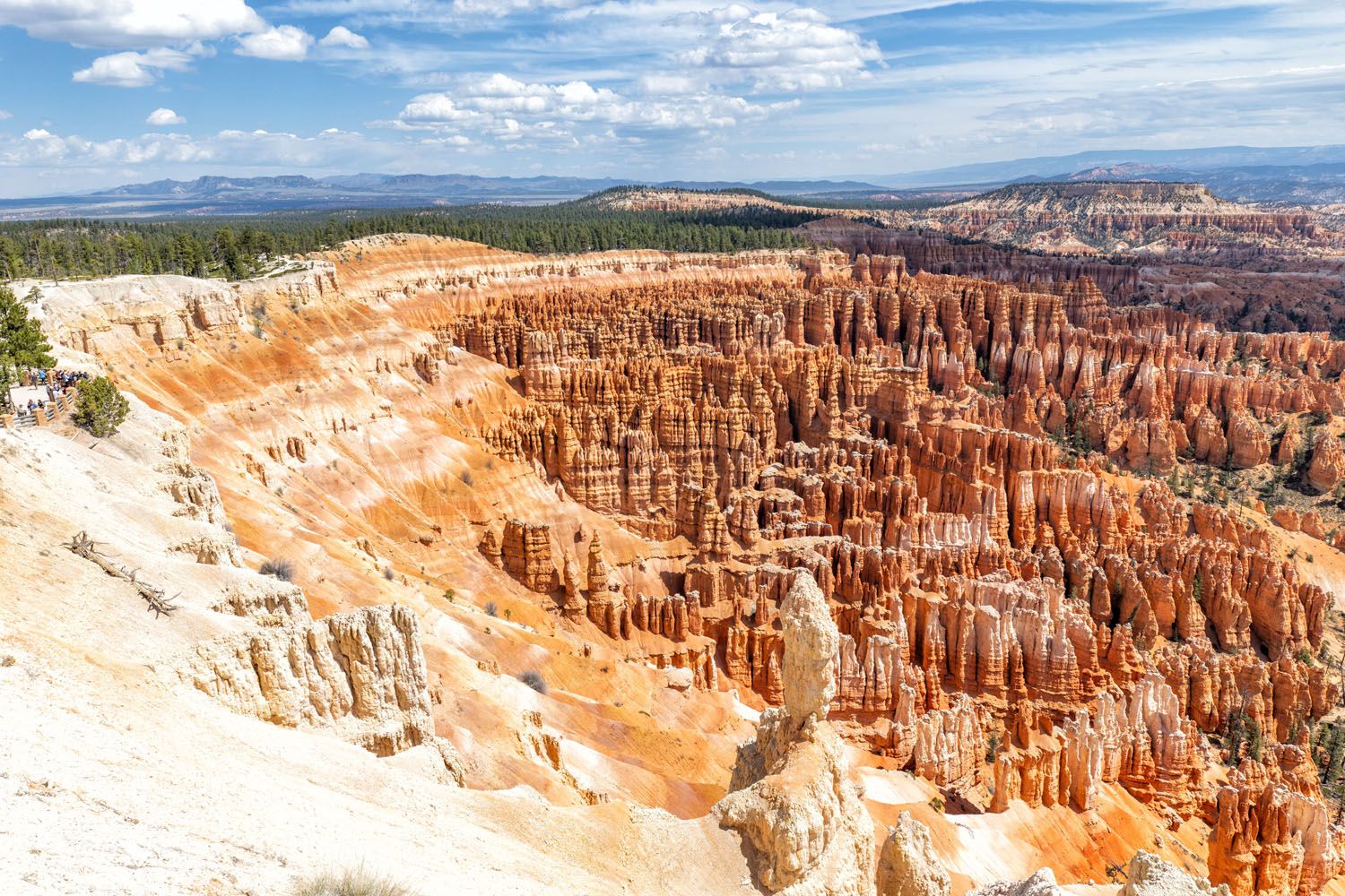
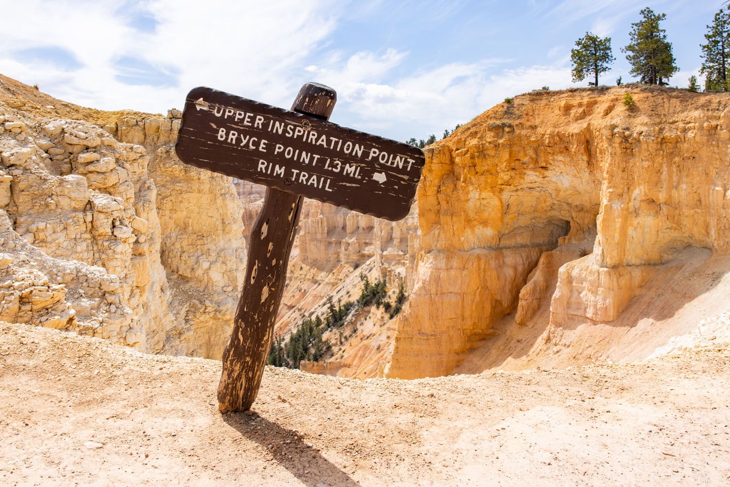
Inspiration Point
Distance: 0.6 miles out-and-back | Time: 20 to 40 minutes | Total Ascent: 165 feet | Difficulty: Easy to moderate
Inspiration Point is one of the best viewpoints in Bryce Canyon National Park. This viewpoint sits next to the parking lot at the end of Inspiration Point Road, so it’s easy to get to.
There are three viewpoints here and if you visit all of them, you’ll do enough walking to qualify as a short hike, especially with the climb to the upper viewpoint.
The hike to the upper viewpoint is the most challenging. It’s a short hill climb but the high elevation makes it feel much more difficult than it looks. But it’s worth it, as the view is amazing.
The view from Upper Inspiration Point
Upper Inspiration Point
Middle Inspiration Point
Mossy Cave
Distance: 1 mile out-and-back | Time: 30 to 60 minutes | Total Ascent: 175 feet | Difficulty: Easy
This fun, short, beautiful trail is great for families, especially on a hot day. A portion of the trail runs through Water Canyon, a great place to put your feet in the water or go for a quick dip. We saw a few families with young kids playing in the water and they were having a blast.
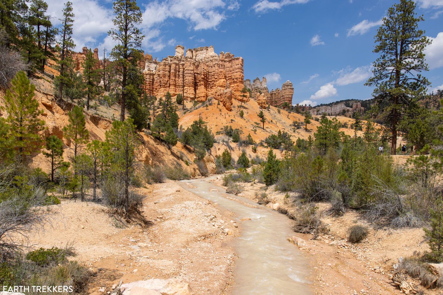
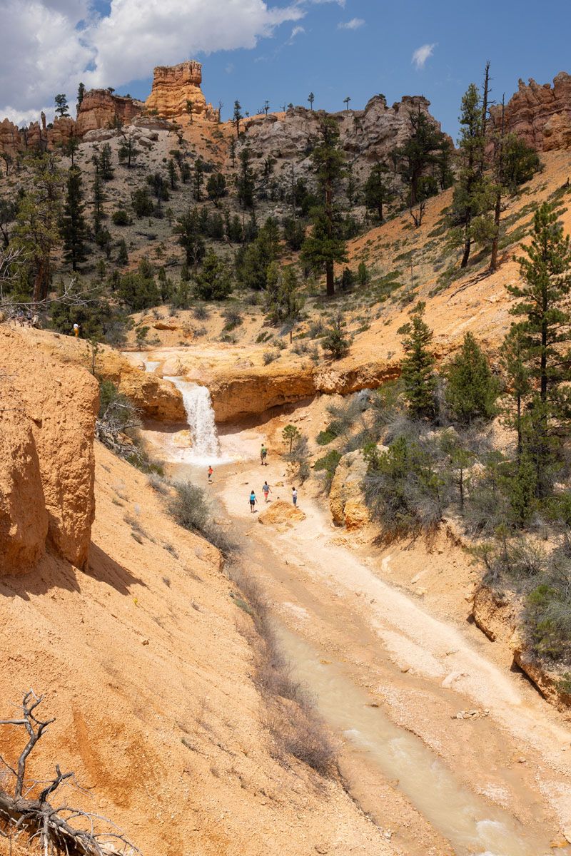
Tropic Ditch Falls
The trail starts off with a short uphill walk and then flattens out, as you walk along the creek, crossing over several bridges. The toughest part of the hike is the hill climb up to Mossy Cave. In the spring through early fall, it looks exactly how it’s named, as a small cave covered in moss and plants. However, in the wintertime, this cave is much more photogenic, when it is snow-covered and filled with icicles.
Along the trail, you can also detour to viewpoints of Tropic Ditch Falls or to the top or bottom of the waterfall itself.
Note: The trailhead is located on Highway 12, outside of the park. There is a very small parking lot here and getting a parking space is the most challenging part of this hike.
Bristlecone Loop
Distance: 1.3 miles | Time: 30 to 60 minutes | Total Ascent: 220 feet | Difficulty: Easy
This short loop trail sits at the very end of Main Park Road (Route 63). Most of the trail runs through a forest, and in some parts, you will see the remains of a recent forest fire. There are a few viewpoints overlooking the southern end of the park.
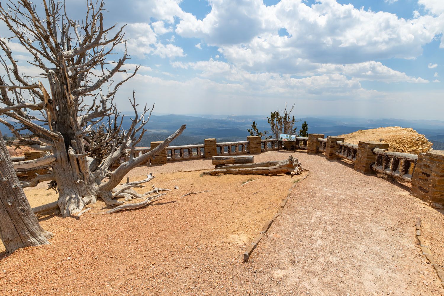
View from the Bristlecone Loop Trail
We did not find this to be the most exciting trail. The trail sits next to the Rainbow and Yovimpa Viewpoints, and the views from these two overlooks are better than what you get from the hiking trail, in our opinion.
But if you want to hike a short trail and leave the crowds behind, this hike ticks both of those boxes.
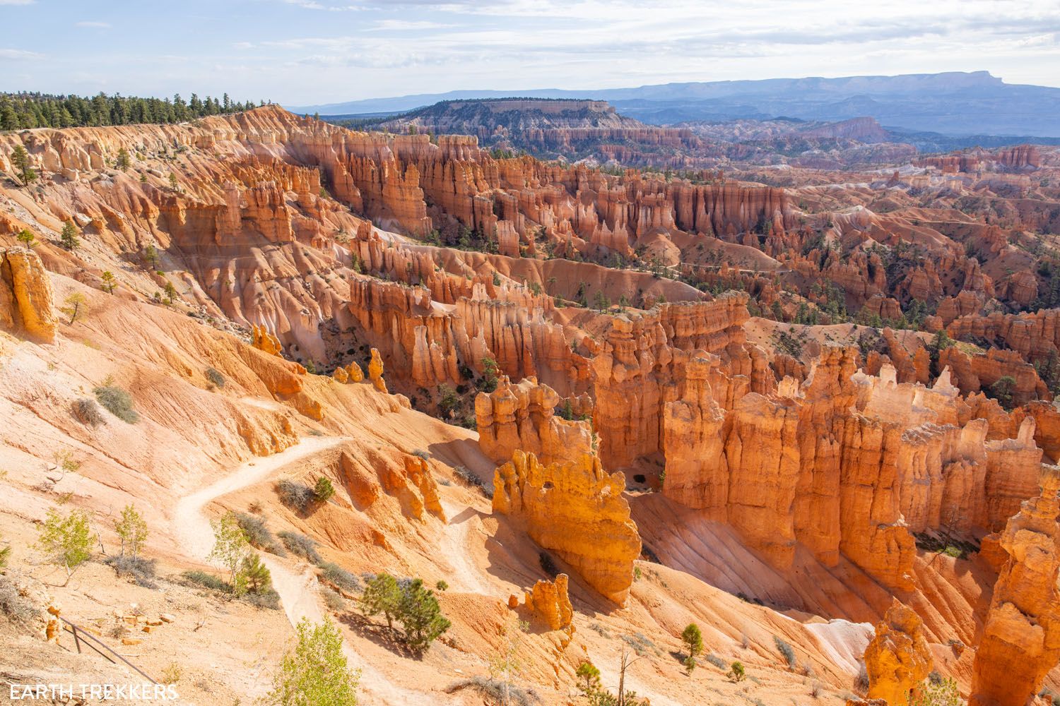
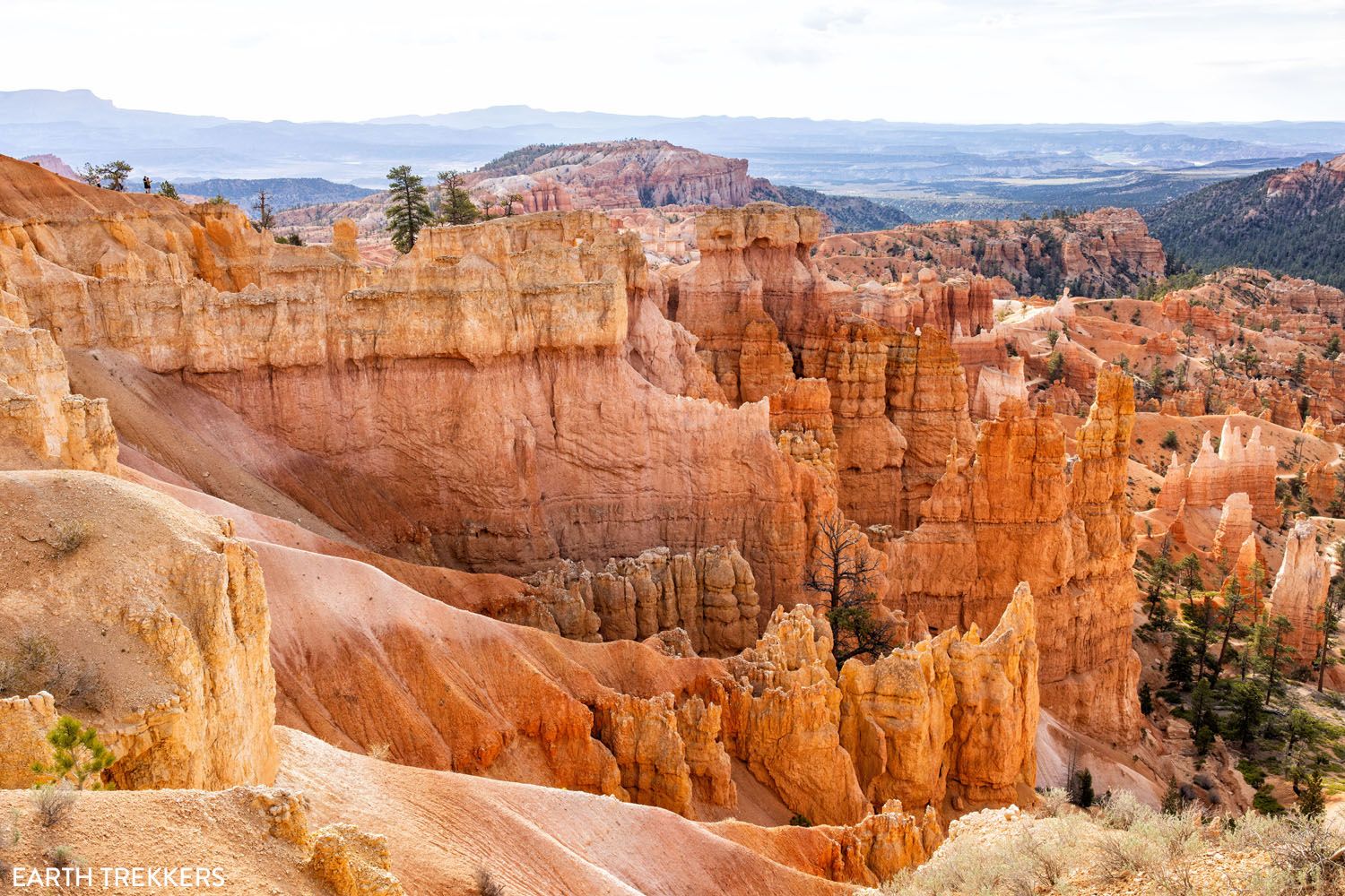
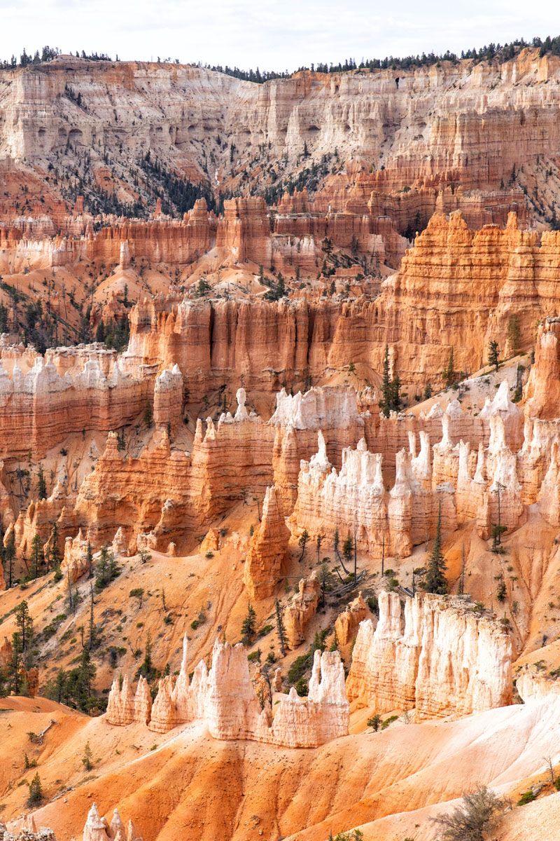
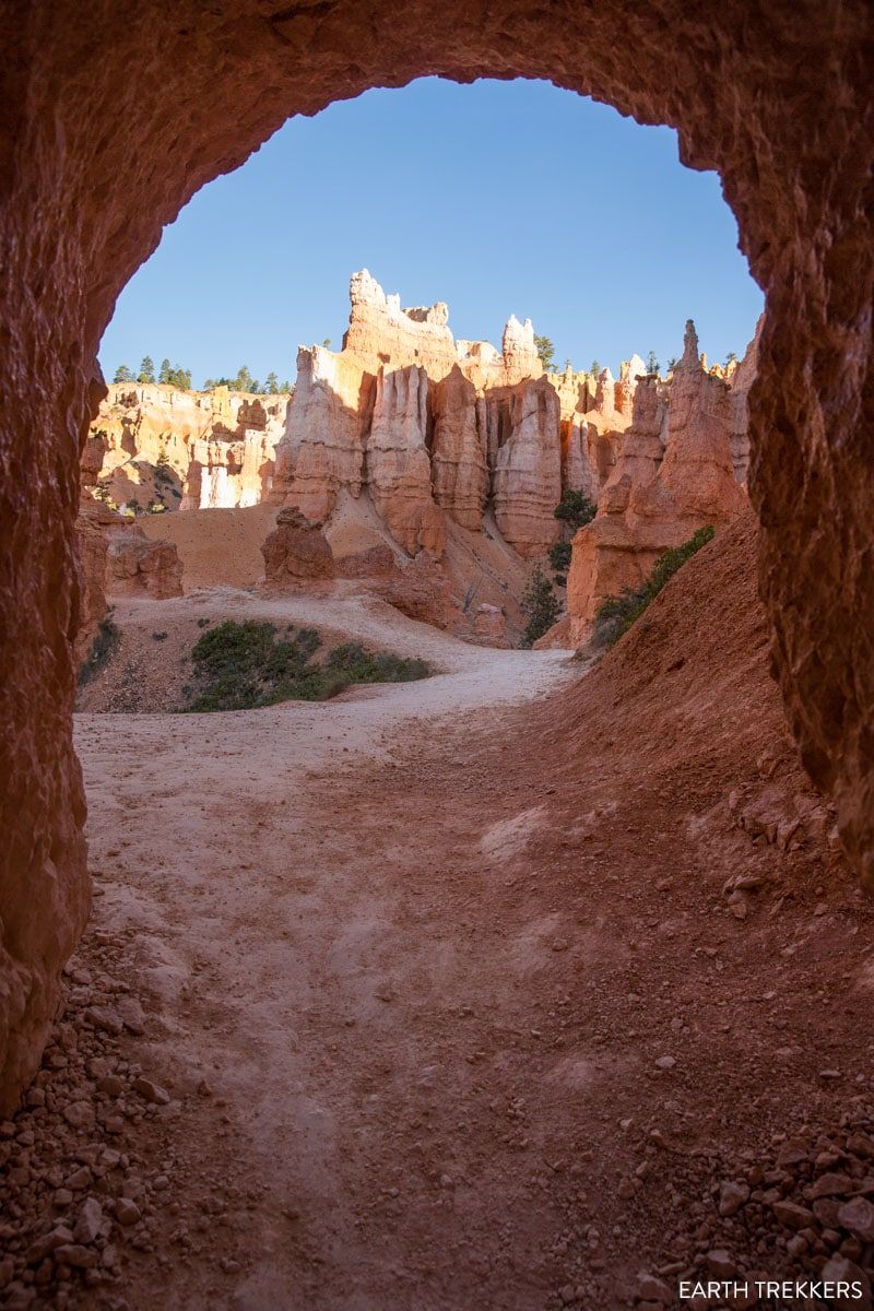
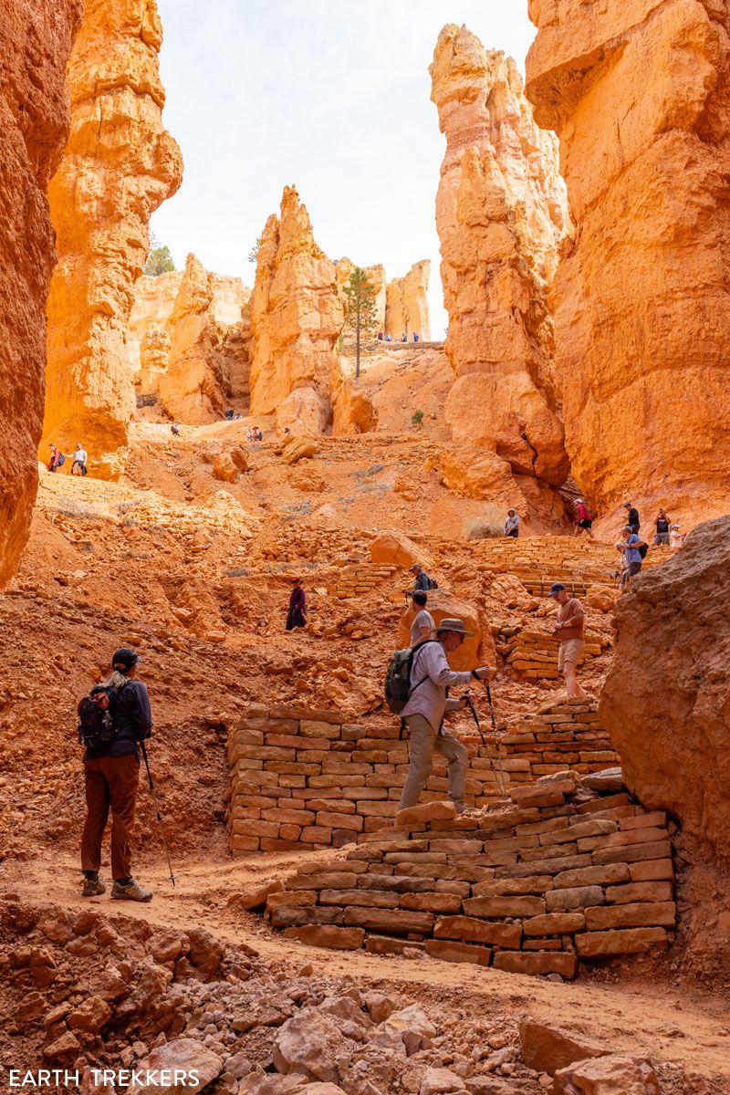
Queen’s Garden & Navajo Loop Combo (with Wall Street)
Distance: 2.75 to 3 miles | Time: 2 to 3 hours | Total Ascent: 620 feet | Difficulty: Moderate
This is one of the best hikes to do in Bryce Canyon. It’s also one of our favorite short hikes in the US National Parks.
We did this hike on our first visit to Bryce Canyon and LOVED it. On this trail, get up close with the hoodoos, take selfies in front of crazy-looking rock formations, walk through shady canyons, and see Thor’s Hammer or walk through Wall Street.
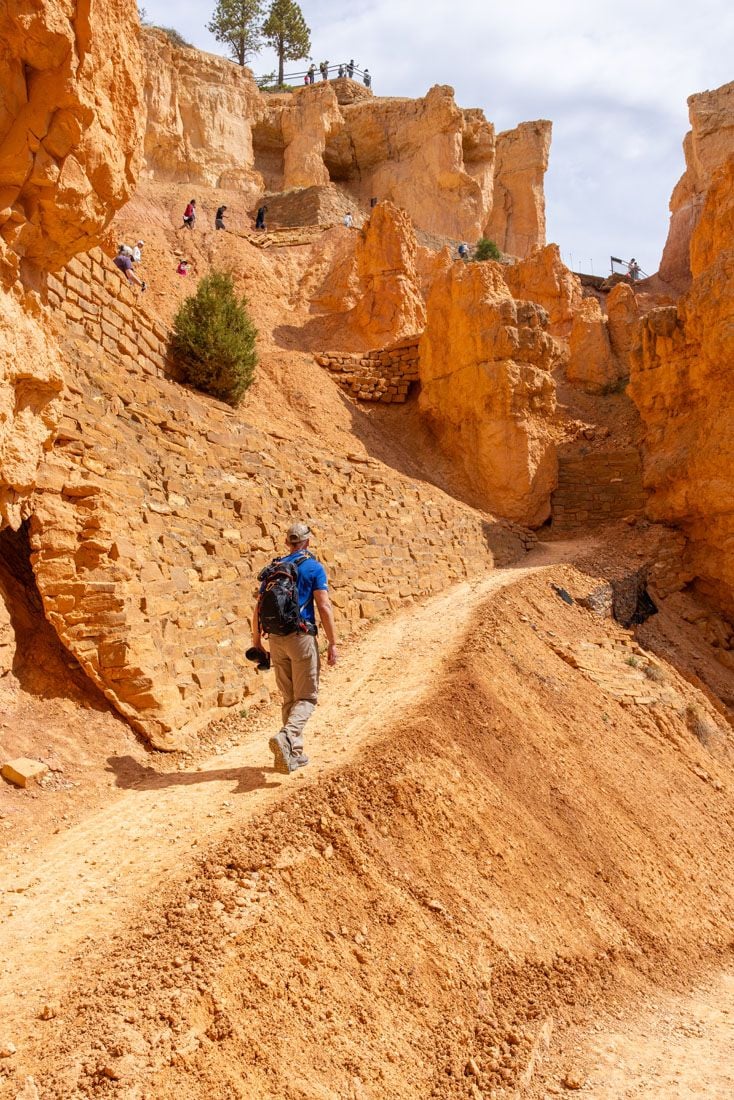
Start at Sunset Point. Walk the Rim Trail to Sunrise Point, enjoying views of the park. Descend into the amphitheater on the Queen’s Garden Trail, which is a short, gorgeous hike with lots of interesting rock pillars and tunnels to photograph.
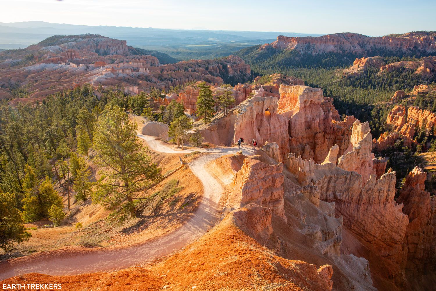
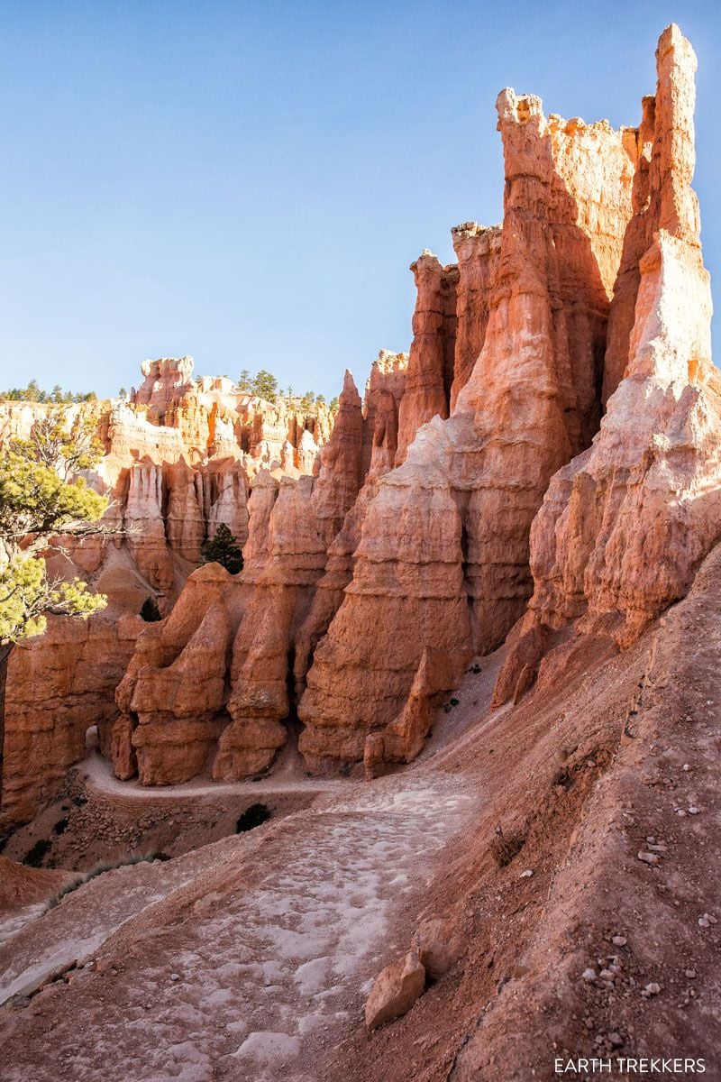
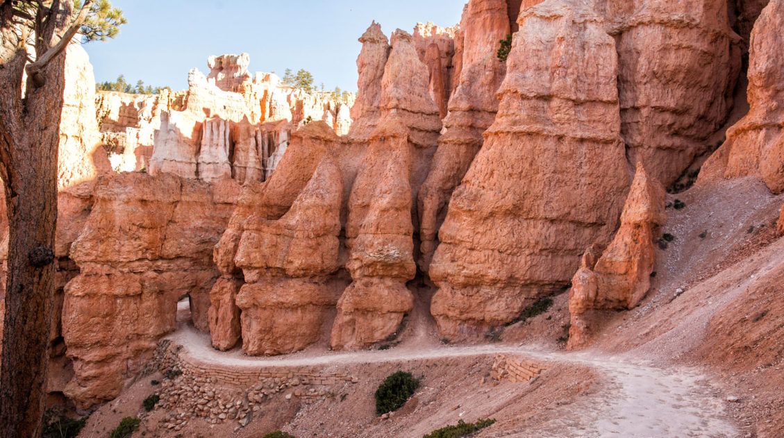
To get back up to the Rim, walk the Navajo Loop Trail. The trail has two sections: Wall Street and the Two Bridges Trail, and you’ll take one of these, depending on what is open and what looks more interesting to you. Both feature lots of switchbacks.
Wall Street is more popular and it is only open from roughly mid-May through the fall, since ice and trail in the winter makes it more dangerous. If it’s closed, you’ll hike up Two Bridges, which is also beautiful, plus you get the best view of Thor’s Hammer from this trail.
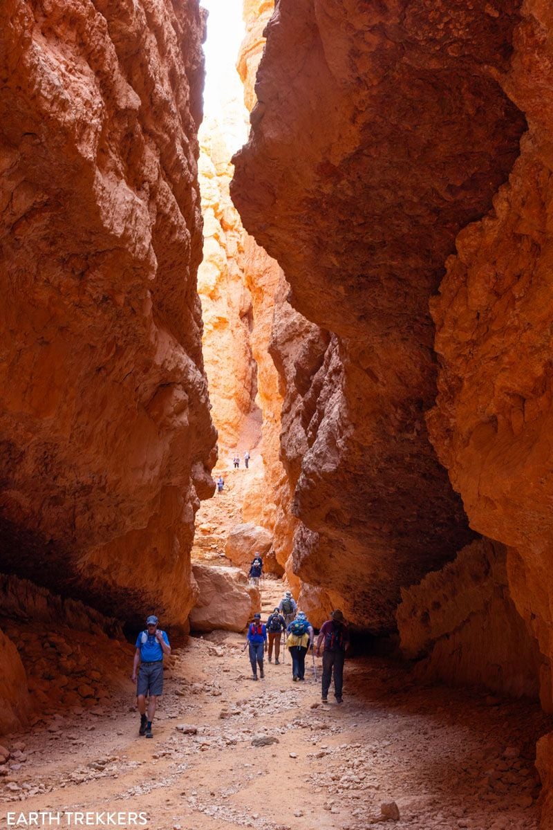
Wall Street
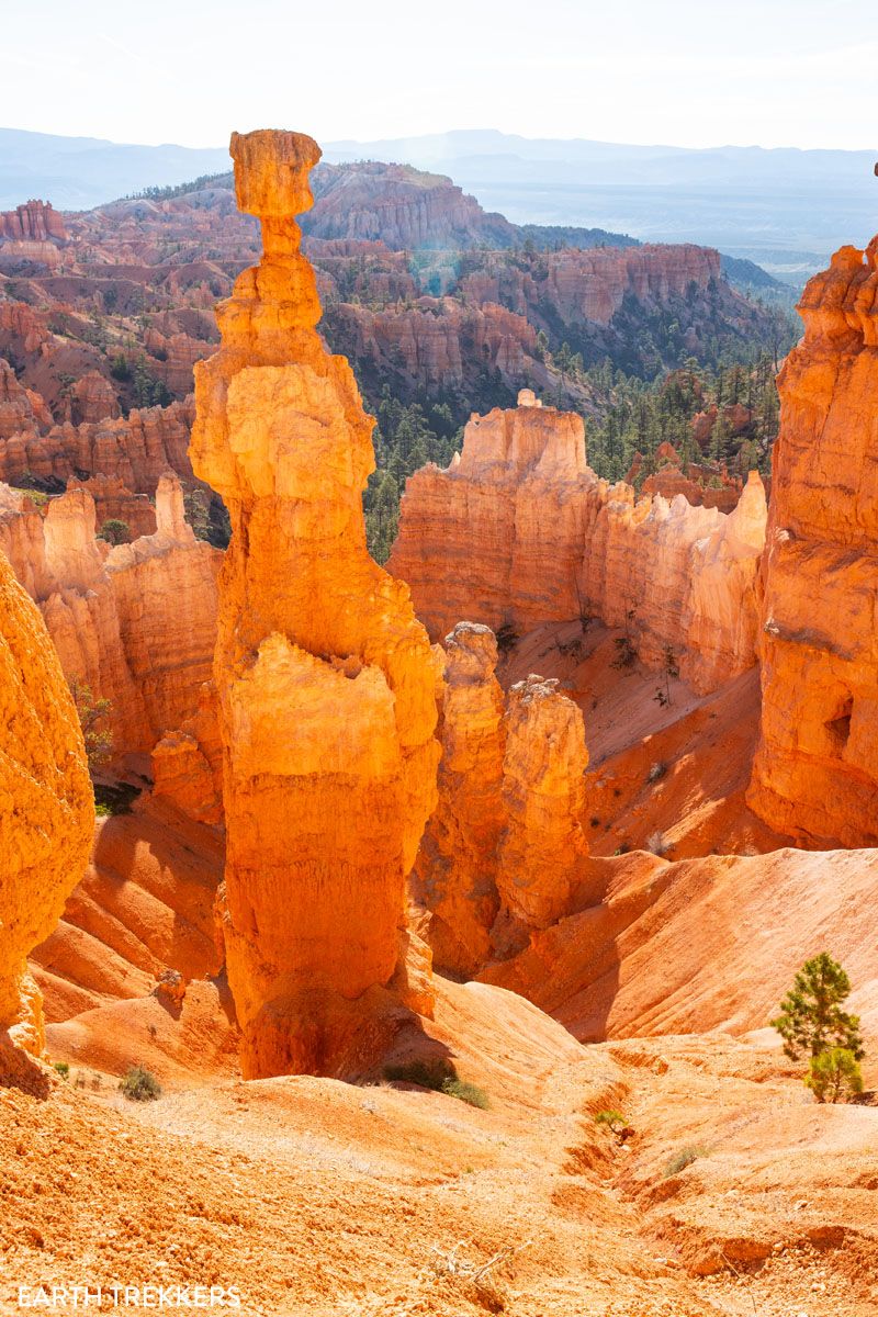
Two Bridges & Thor’s Hammer
We have a detailed guide on how to hike the Queen’s Garden + Navajo Loop Combo ↓
Hiking Bryce Canyon: Queen’s Garden and Navajo Loop Trails
Step-by-step trail guide, with lots of photos. Plus, what to know about the Two Bridges Trail and Wall Street.Tower Bridge
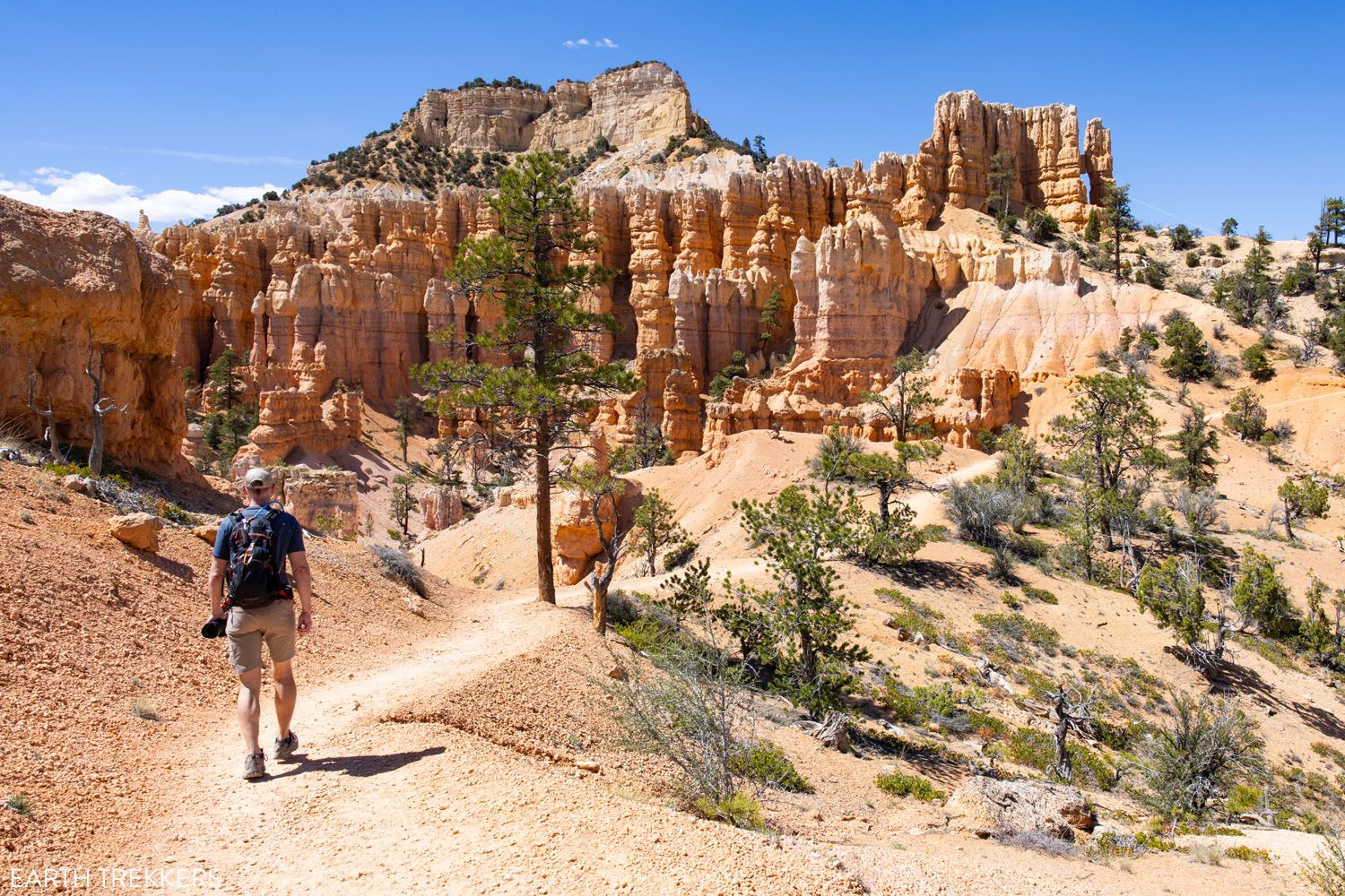
Distance: 3.4 miles out-and-back | Time: 1.5 to 2.5 hours | Total Ascent: 850 feet | Difficulty: Moderate to Strenuous
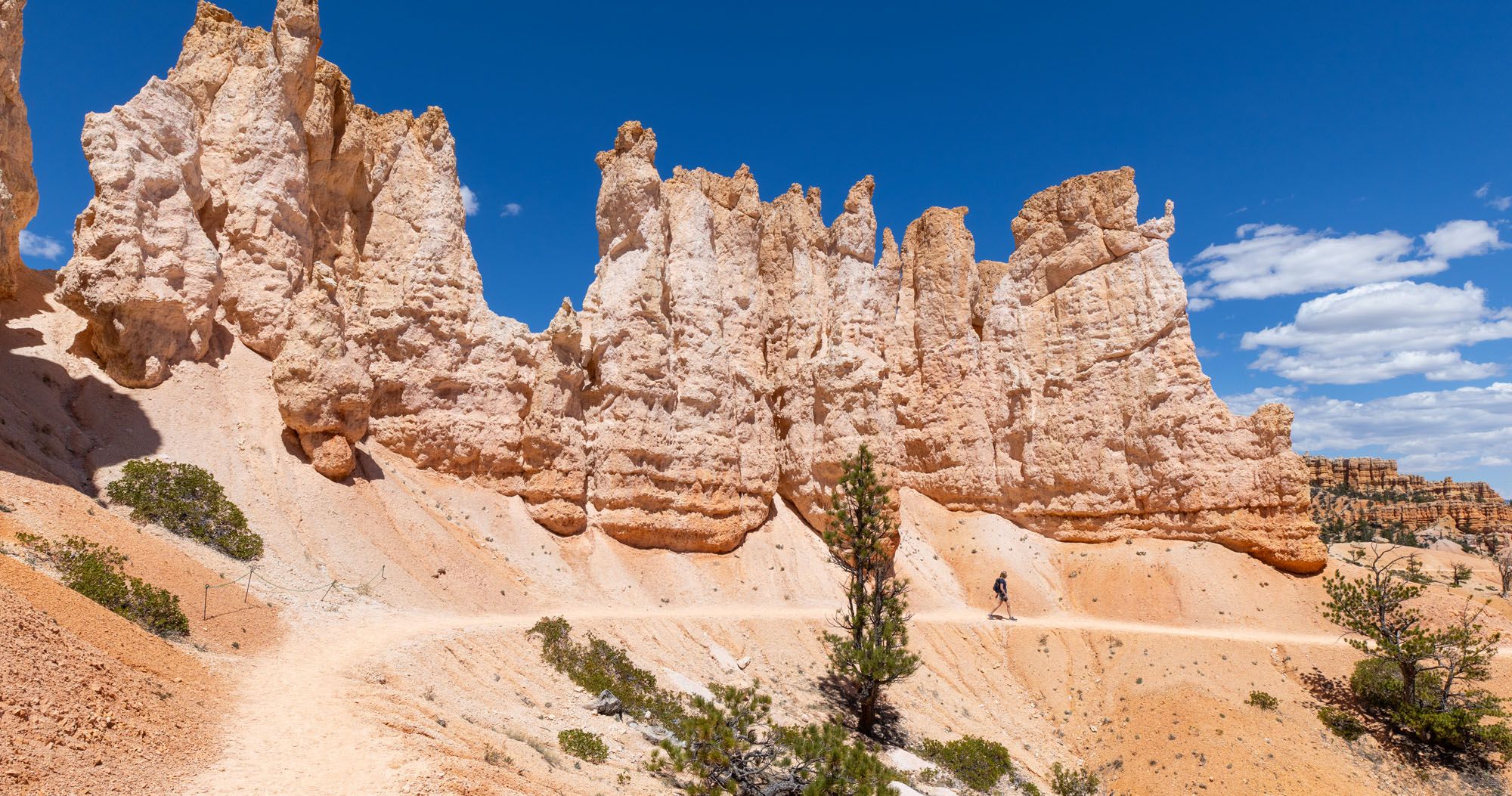
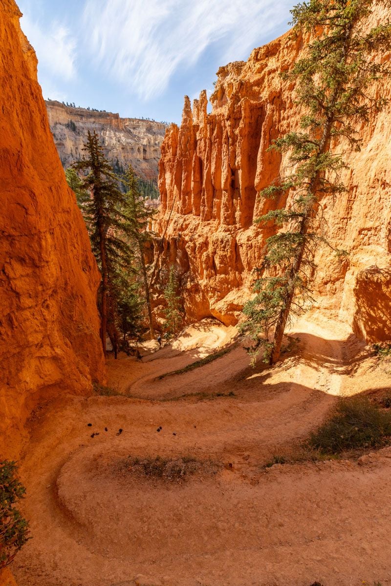
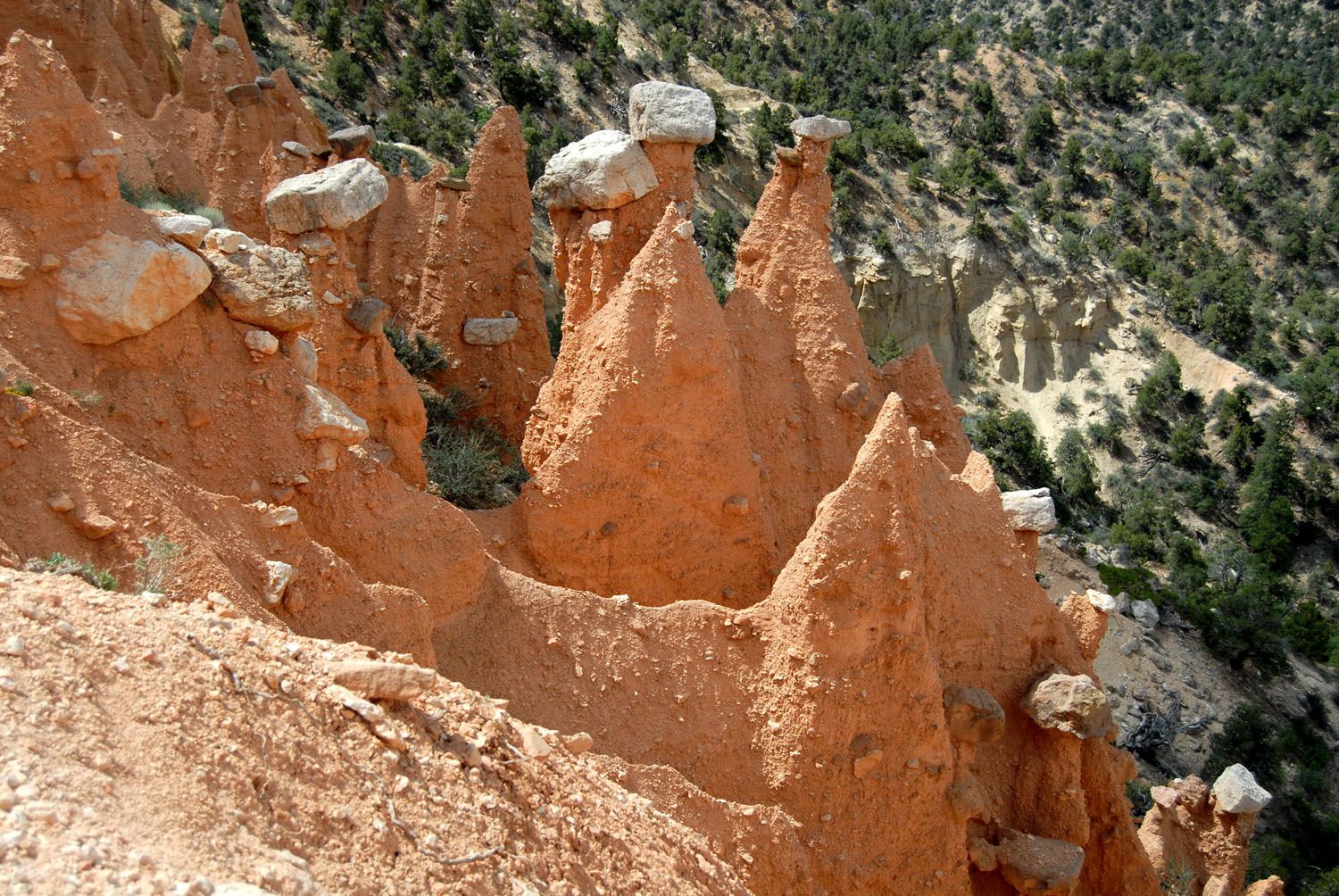
This is a deceptively tough hike. It starts on the Rim Trail, near the North Campground General Store. The trail descends into the amphitheater on the Fairyland Loop Trail. The views are amazing, with hoodoos in all directions.
Near the end of the big descent, take the spur trail to the right to Tower Bridge. It’s a short walk to a viewpoint of this rock formation, which earns its name, because with a little bit of imagination, it looks like Tower Bridge in London.
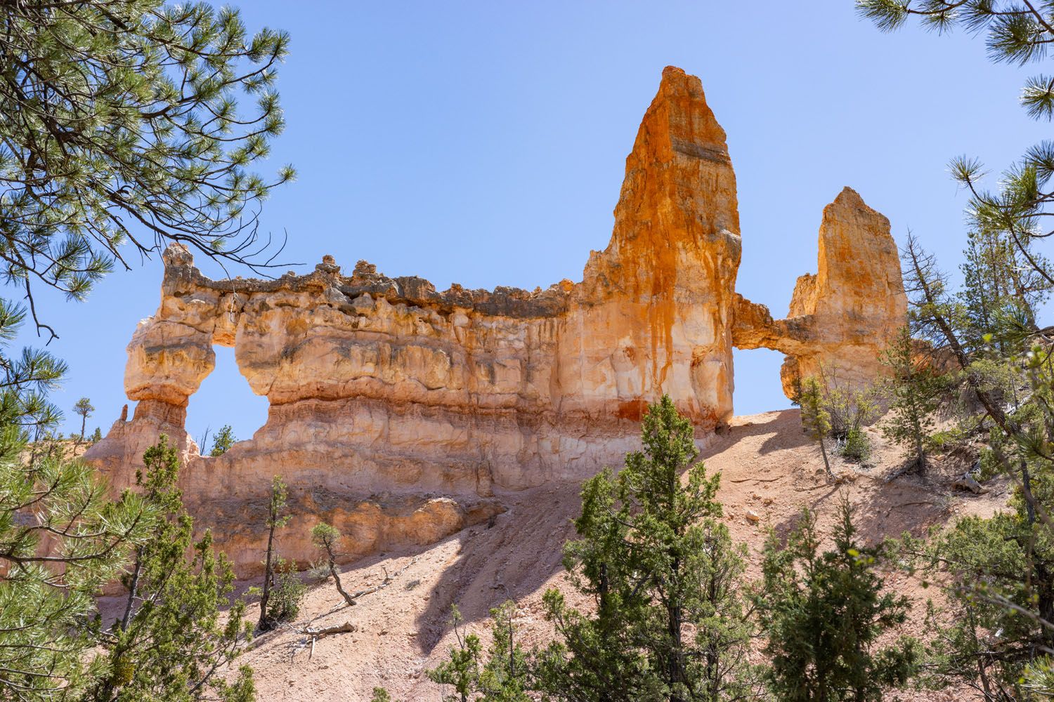
Tower Bridge
Not to be underestimated is the hike back up to the rim, as you retrace your steps on the same trail you came down. It’s a tough hike back to the Rim Trail.
Is It Worth It? I don’t think this hike is worth the effort. Seeing Tower Bridge is not all that interesting in our opinion and the hike out and back to this viewpoint is tough.
If you are looking for a shorter hike in the amphitheater, we recommend the Queens’ Garden and Navajo Loop combo. Another option is to do the full Fairyland Loop. Beyond Tower Bridge, the Fairyland Loop is spectacular with some of the most interesting views (and lowest crowds) in Bryce Canyon National Park.
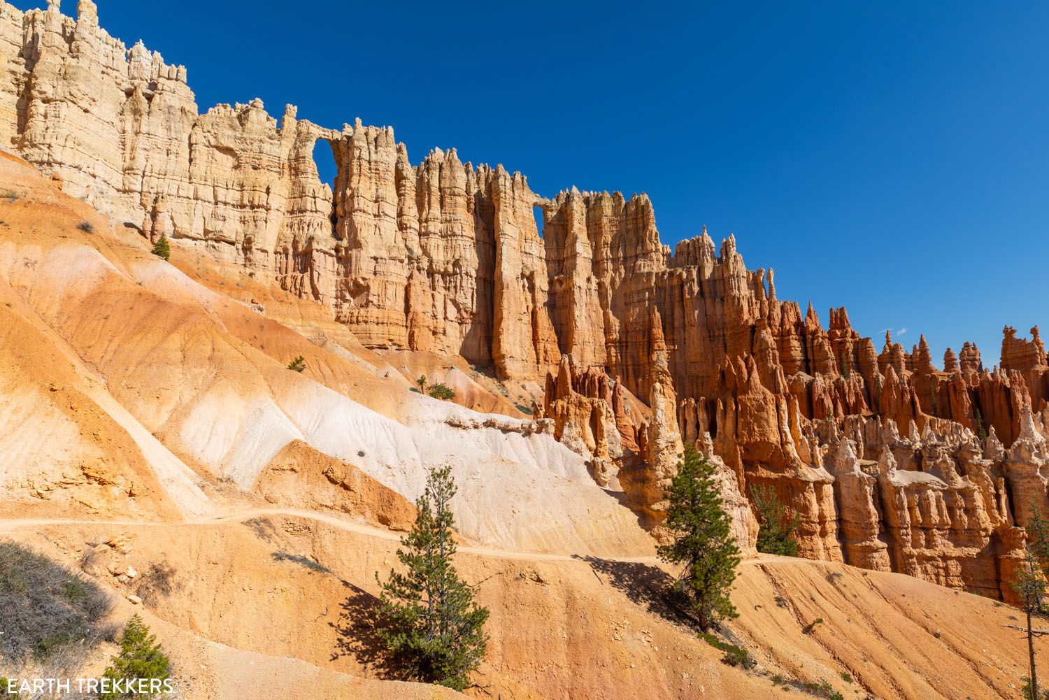
Hat Shop
Distance: 4.0 miles out-and-back | Time: 3 to 4 hours | Total Ascent: 1,400 feet | Difficulty: Strenuous
This trail gets mixed reviews. It’s a tough hike to views hoodoos that look like they are wearing hats made of gray rock.
This hike starts off with a descent down below the rim. It ends at several viewpoints of the rock formations. The tough part is the ascent on the same trail back up to the top of the rim.
The Hat Shop hike starts at Bryce Point. Take the Under the Rim Trail to the viewpoints of the rock formations.

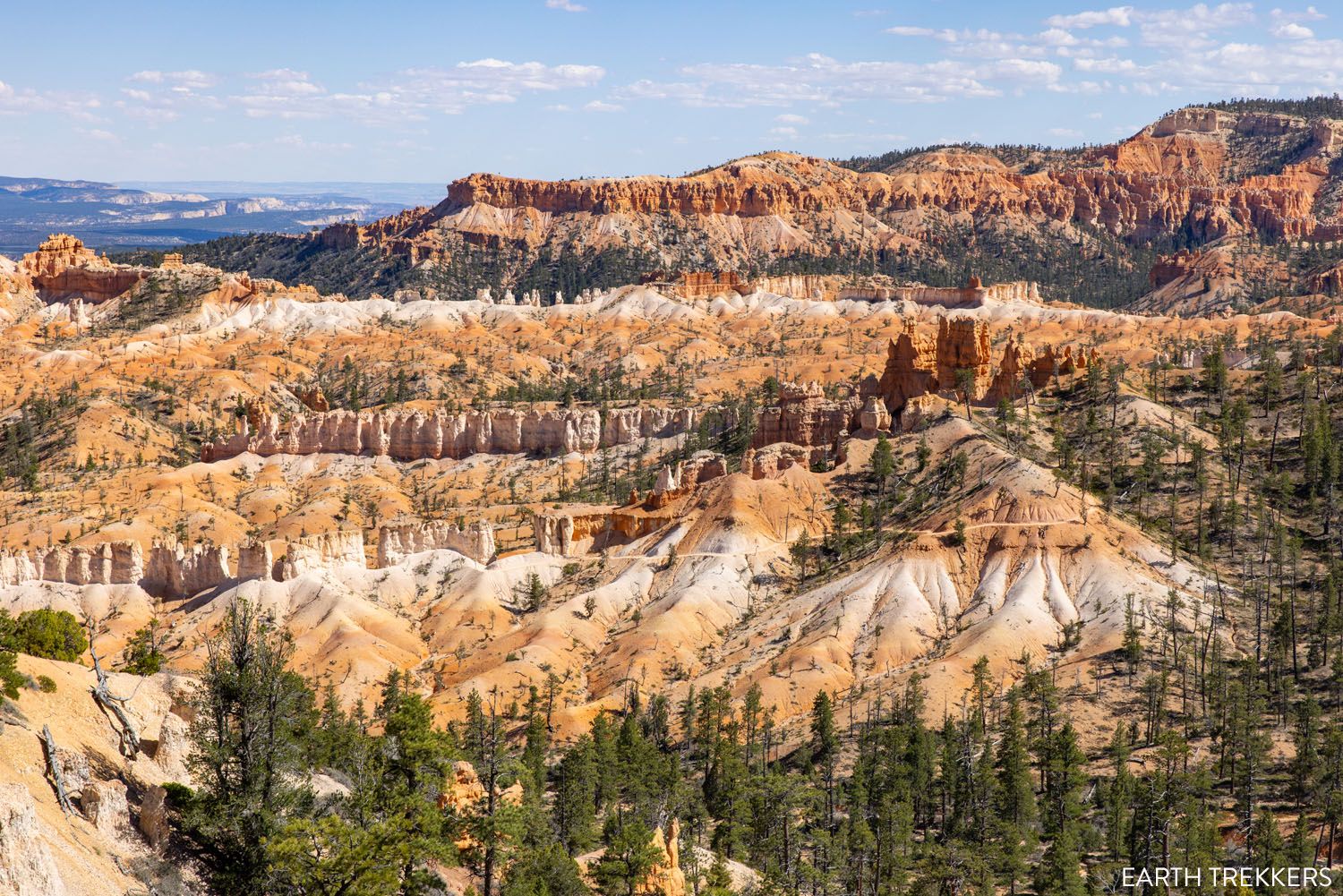
Swamp Canyon Loop
Distance: 4.5 miles | Time: 2 to 3 hours | Total Ascent: 900 feet | Difficulty: Moderate
This is one of the lesser-known hikes in Bryce Canyon. It is located on Main Park Road, outside of the amphitheater.
This trail makes a loop, running through the forested backcountry. Most people do this loop in a counterclockwise direction. It lacks the big views of the hoodoos and rock formations, but it is a quieter, less trafficked trail, so you’ll share it with far fewer people than some of the other hikes on this list.
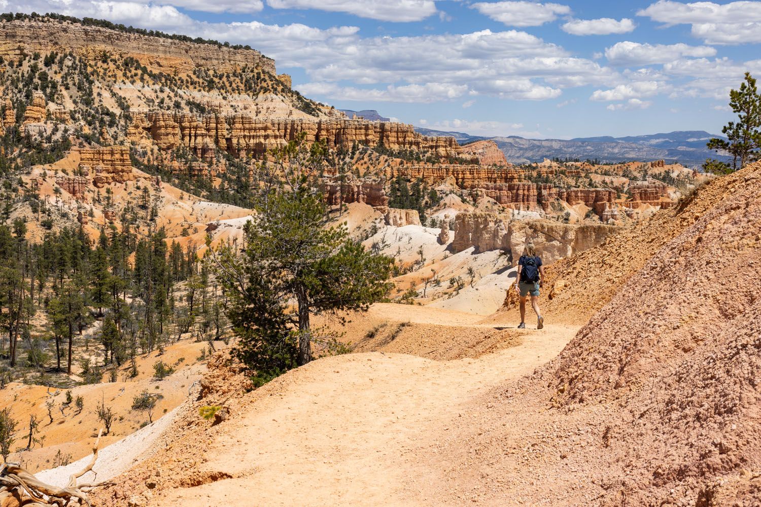
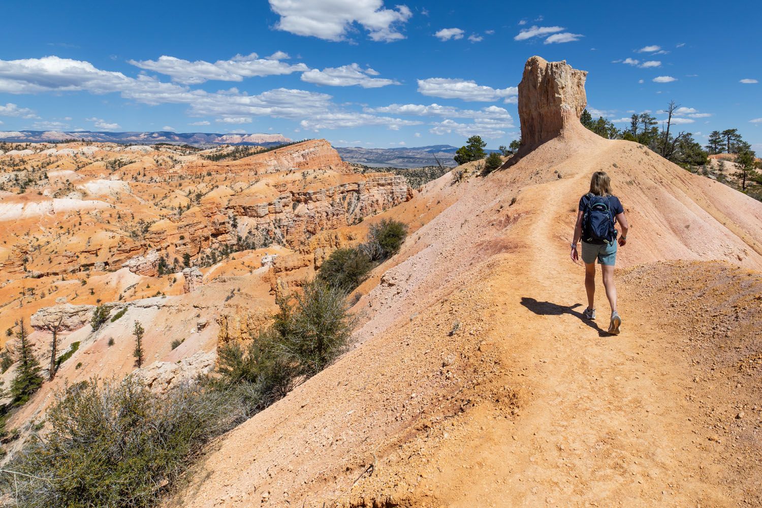
The Rim Trail
Distance: 5.5 miles one-way | Time: 2 to 4 hours | Difficulty: Easy
The Rim Trail runs along the rim of the amphitheater, between Bryce Point and Fairyland Point. It is a relatively flat trail, with a few ups and downs here and there.
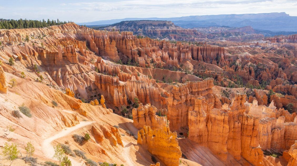
This trail connects five of the best viewpoints in Bryce Canyon: Bryce Point, Inspiration Point, Sunset Point, Sunrise Point, and Fairyland Point.
This trail is a good option for those who want to do a nice hike, without the challenge of the hiking down into the amphitheater. However, it’s good to know that Bryce Point, Inspiration Point, and Fairyland Point are accessible by car or shuttle, so you don’t have to hike the full Rim Trail to get these views.
The view from Bryce Point
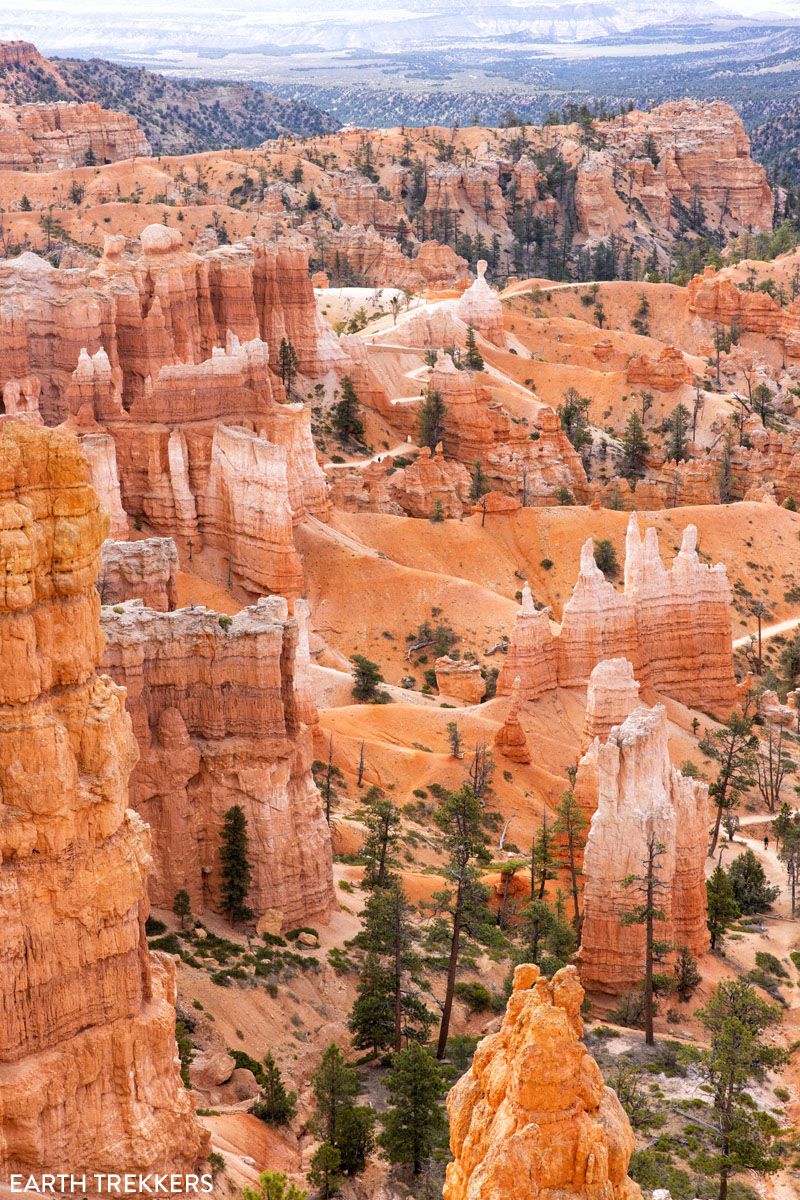
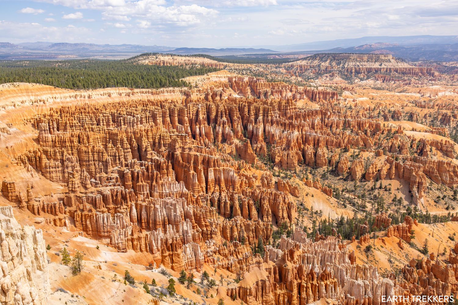
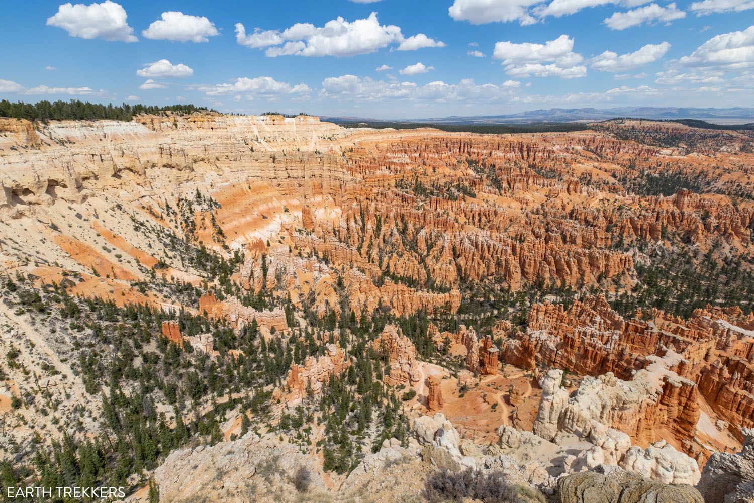
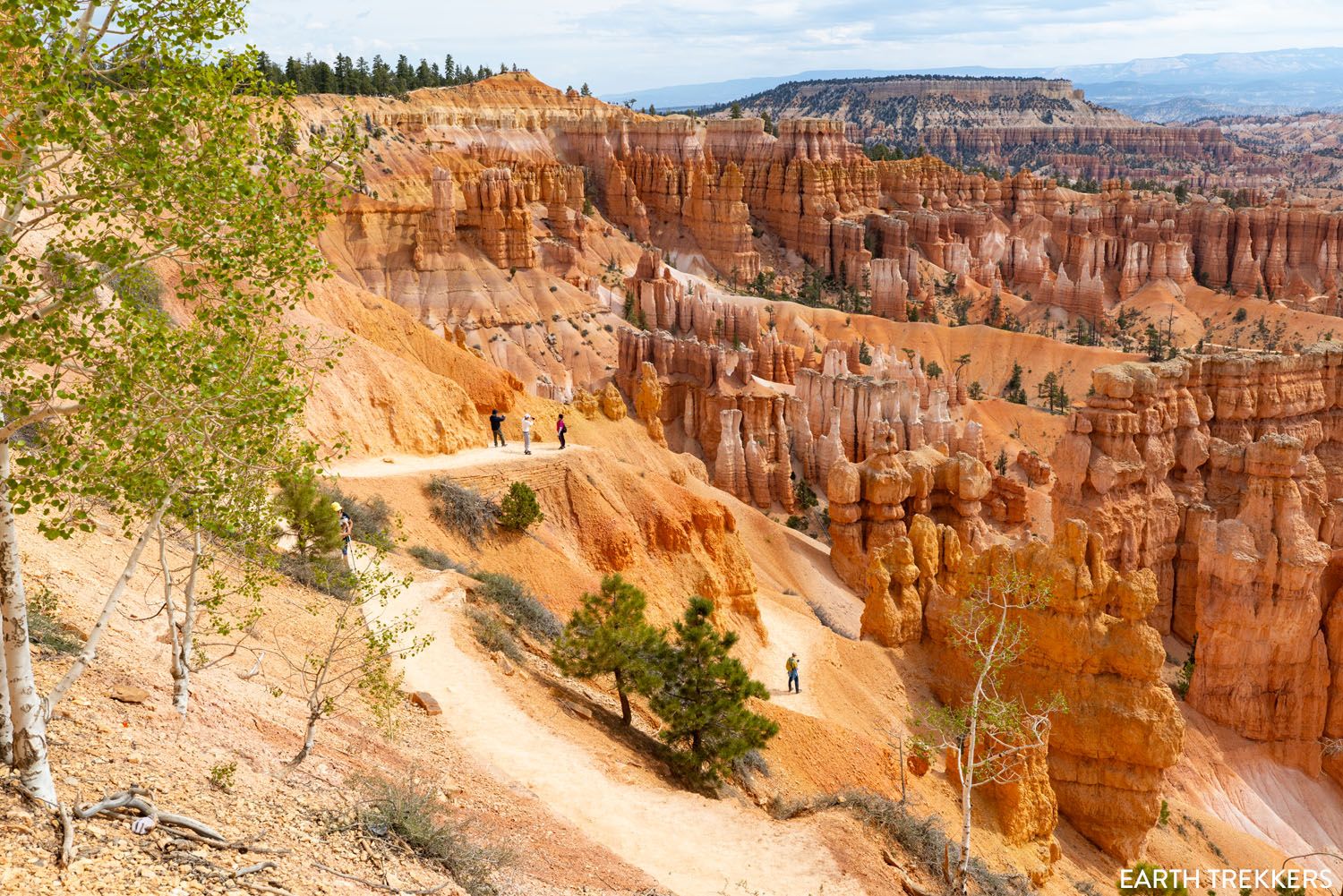
Peekaboo Loop Trail
Distance: 5.5 miles | Time: 3 to 4 hours | Total Ascent: 1,550 feet | Difficulty: Strenuous
This loop trail is one of the most picturesque in Bryce Canyon. It’s a challenging hike, with breathtaking views of bright orange and pink hoodoos, shadowy canyons, and pine forests. Popular rock formations are the Wall of Windows and the Three Wisemen.
Parking is at Bryce Point. Get here early for one of the few parking spots or ride the shuttle.
The Peekaboo Trail can be combined with the Queen’s Garden Trail and the Navajo Loop Trail, mentioned next.
Figure 8 Trail (Queen’s Garden, Peekaboo Loop, and the Navajo Loop Trail)
Distance: 6.1 miles | Time: 3 to 4 hours | Total Ascent: 1,550 feet | Difficulty: Moderate to strenuous
Why Do This Hike: For those who want to hike some of the most iconic trails in the park, this is the hike for you. It combines Queen’s Garden, Wall Street or Two Bridges on the Navajo Loop Trail, and the photogenic Peekaboo Loop Trail into one epic day hike.
This big loop combines several of Bryce Canyon’s best trails into one hike. It is Tim’s favorite hike in the park and he wrote a detailed guide to the Figure 8 Trail.
This hike gets its name because you hike several different trails as a figure 8.
Starting at Sunset Point, walk the Rim Trail to Queen’s Garden. From the Queen’s Garden Trail, hike the Peekaboo Loop. Once finished the Peekaboo Loop, hike back up to the rim on the Navajo Loop Trail, choosing between Wall Street and the Two Bridges Trail. Here’s how to do it ↓
Figure 8 Trail in Bryce Canyon: The Ultimate Trail Guide
Step-by-step guide for the Figure 8 Trail.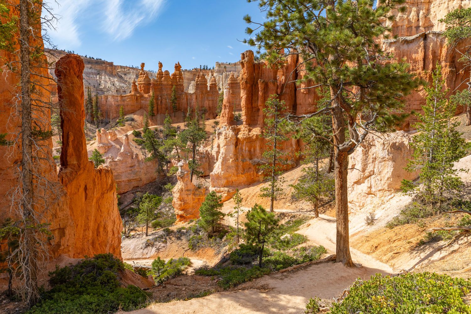
Peekaboo Loop
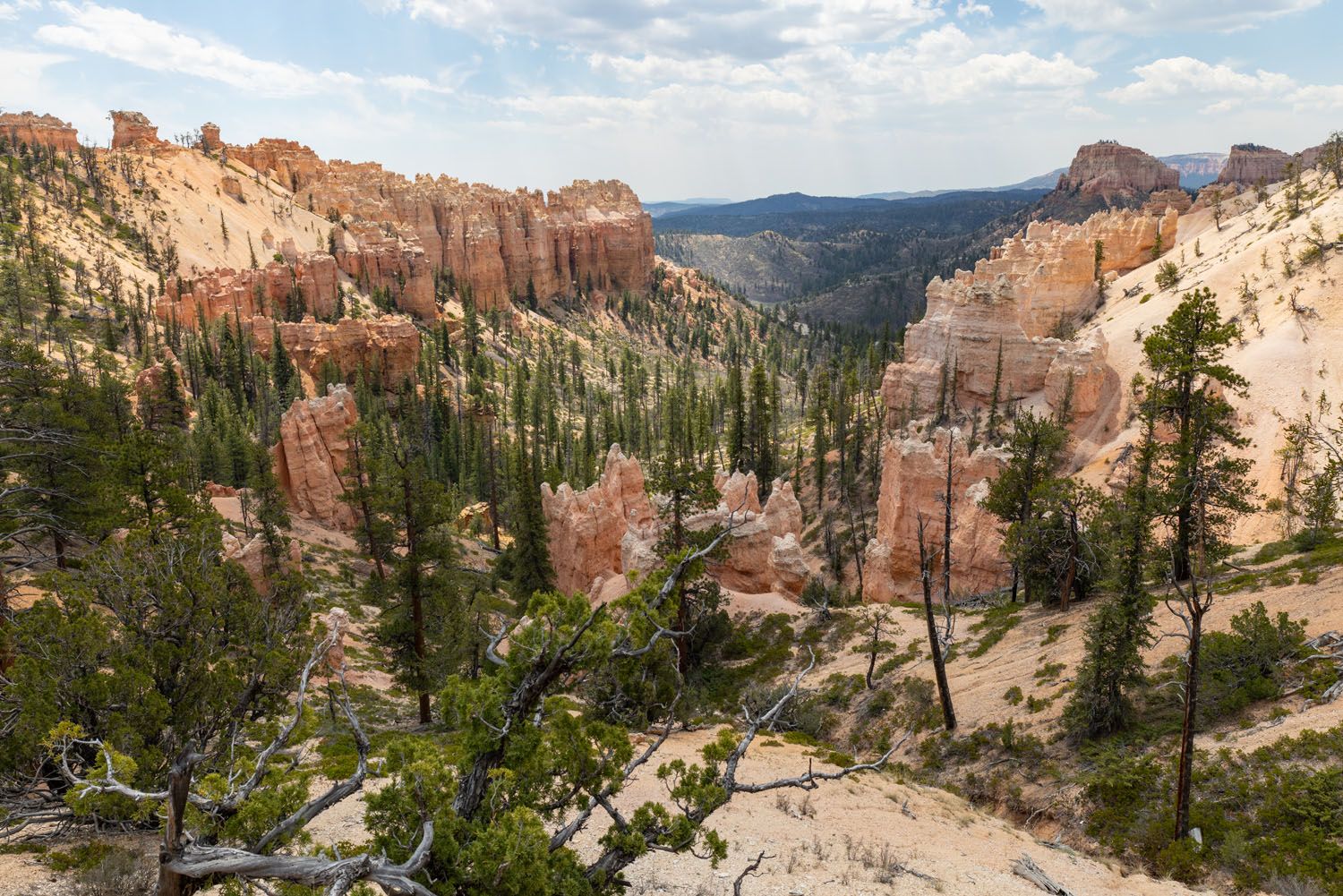
Fairyland Loop
Distance: 7.8 miles | Time: 3 to 5 hours | Total Ascent: 1,650 feet | Difficulty: Strenuous
The Fairyland Loop is my favorite hike in the park. It’s a long, tough hike, but with jaw-dropping views on one of the quieter trails in the park, the Fairyland Loop is an underrated gem in Bryce Canyon.
On this trail, you’ll get panoramic views of brilliantly colored hoodoos, plus views of Tower Bridge. When we did this, we saw just a few other hikers on the trail, making this one of the less trafficked trails in the park.
The Fairyland Loop is done as a loop, with several different starting locations and the option to go clockwise or counterclockwise. We cover all of these logistics in our detailed hiking guide ↓
The Amazing Fairyland Loop: An Underrated Hike in Bryce Canyon
How to hike the Fairyland Loop: best starting point, best direction, plus lots of photos from the trail.Here are a few photos from the trail.
Map of the Bryce Canyon Hiking Trails
How to Use This Map: Click the icons on the map to get more information about each point of interest. To take this map with you, click the star next to the title of the map which adds it to your Google account. Next, within your Google Maps app, select ‘Saved’ and then select ‘Maps’. This map title will now appear in your list.
Pick Your Perfect Hike
Our Favorite Hikes in Bryce Canyon
- The Figure Eight Trail (Queen’s Garden, Navajo Loop & Peekaboo Trail)
- Fairyland Loop
- Queen’s Garden and Navajo Loop
- Sunset to Sunrise Point on the Rim Trail
Best Hikes for First Timers
- Sunset to Sunrise Point on the Rim Trail
- Queen’s Garden and Navajo Loop
- Inspiration Point
Best Hikes for Families
- Queen’s Garden and Navajo Loop
- Mossy Cave
- Sunset to Sunrise Point on the Rim Trail
Leave the Crowds Behind
- Fairyland Loop
- Hat Shop
- Swamp Canyon Loop
- Bristlecone Loop
Most Challenging Hikes
- Fairyland Loop
- The Figure 8 Trail

Hiking at the Higher Elevation of Bryce Canyon
As you pick out which hikes to do, it’s a good idea to be aware of the elevation of Bryce Canyon National Park. Many of these hiking trails sit between 8,000 and 9,000 feet, which is a relatively high altitude. You will experience more breathlessness and fatigue here, even when walking short inclines. There is a risk of altitude sickness in Bryce Canyon, especially in those with heart and lung conditions.
Many of these hikes start on the rim and descend down into the amphitheater. These hikes typically end with an uphill walk back to the level of the rim. Since this comes at the end of the hike, it can be deceptively challenging. Add in the altitude, and even short climbs can be very difficult.
If you are not fit, or suffer from a chronic medical condition, do not underestimate the effects of the altitude and the final climbs of some of these hikes.
If you want to stick to the easier trails, we recommend walking the Rim Trail or hiking to Mossy Cave (this trail sits at a lower elevation). A good test for how you will feel is to hike up to Upper Inspiration Point. If that was challenging for you, do not hike down into the amphitheater, because it will be extremely difficult to do that final climb back up to the rim.
Navajo Loop Trail
Tips to Have the Best Experience
Start Early! Plan on getting into the park and parking before 8 am, to get a parking space.
If you arrive later in the park (9 am or later) consider using the park shuttle to get around.
The best time to go hiking in Bryce Canyon is from mid-April through October. During this time, the trails are free of snow and ice. Bryce Canyon gets quite a bit of snowfall, and some trails can have several feet of snow on them in the winter months. Wall Street typically opens in mid-May, although this does vary year to year.
Visit the National Park Service website for information on the hikes in Bryce Canyon, as well as to check trail status and updates on road and trail closures.
If you have any questions about the best hikes in Bryce Canyon, let us know in the comment section below.
Plan Your Trip to Utah
We have TONS more information about the national parks in Utah and places to visit in our Utah Travel Guide.
Best of Bryce: 8 Amazing Things to Do in Bryce Canyon
Pinterest Facebook Flipboard Bryce Canyon is the smallest national park in Utah. Despite its small size, there is still a lot to do here. Walk the Rim Trail, gaze across the amphitheater from numerous overlooks, go on a scenic drive, and journey below the rim to venture into a sea of hoodoos…these all top the […]
One Perfect Day in Bryce Canyon National Park
Bryce Canyon National Park…a fantasyland of hoodoos, bizarre rock formations, and sandstone pillars. This is a crazy beautiful place, and its unique landscape sets it apart from other national parks. Although Bryce may not have the same sweeping, expansive vistas as the Grand Canyon, it’s still a breathtaking experience the first time you see this […]
Two Week American Southwest Road Trip: Grand Canyon & Utah’s Mighty 5
This is one of the best road trips in the USA. On this American Southwest road trip, you will visit Utah’s Mighty 5, the Grand Canyon, and a handful of wonderful state parks and national monuments. This is the itinerary I wish we had when we planned our first road trip to the American Southwest. […]
Best Hikes in Zion: 15 Trails from Beginner to Advanced
Zion National Park is one of the best places in the United States to go hiking. From the awe-inspiring hike up Angels Landing to the family-friendly Riverside Walk to multi-day backpacking adventures, there is something here for everyone. In this guide, we cover the best hikes in Zion National Park, from popular trails to hidden gems. […]
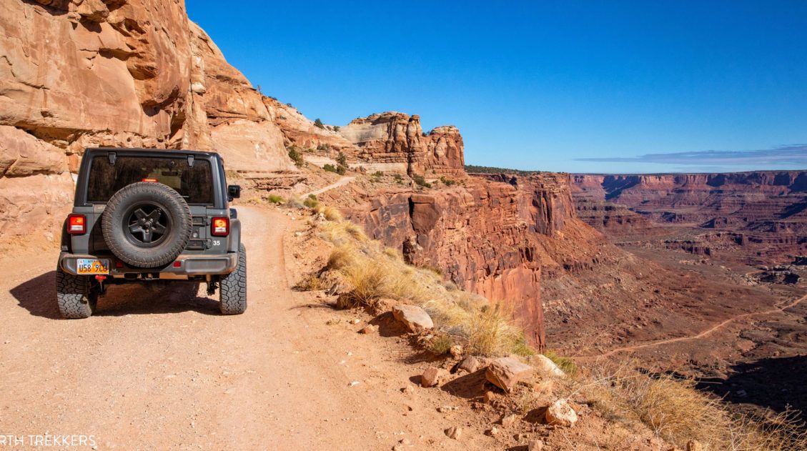
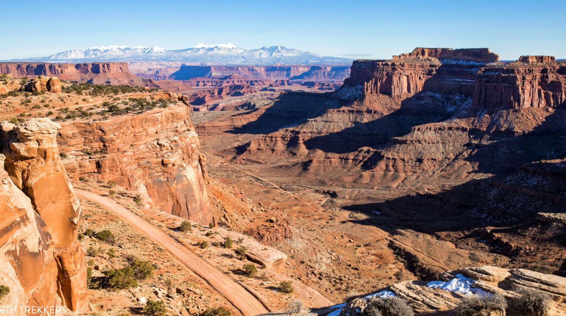
How to Drive the White Rim Road in One Day
Driving the White Rim Road is one of the best experiences in Canyonlands National Park. For 100 miles, this road circles around the Island in the Sky mesa, taking you past canyons, buttes, and the Colorado and Green Rivers. This drive takes most people two to three days. If you have less time, it is […]
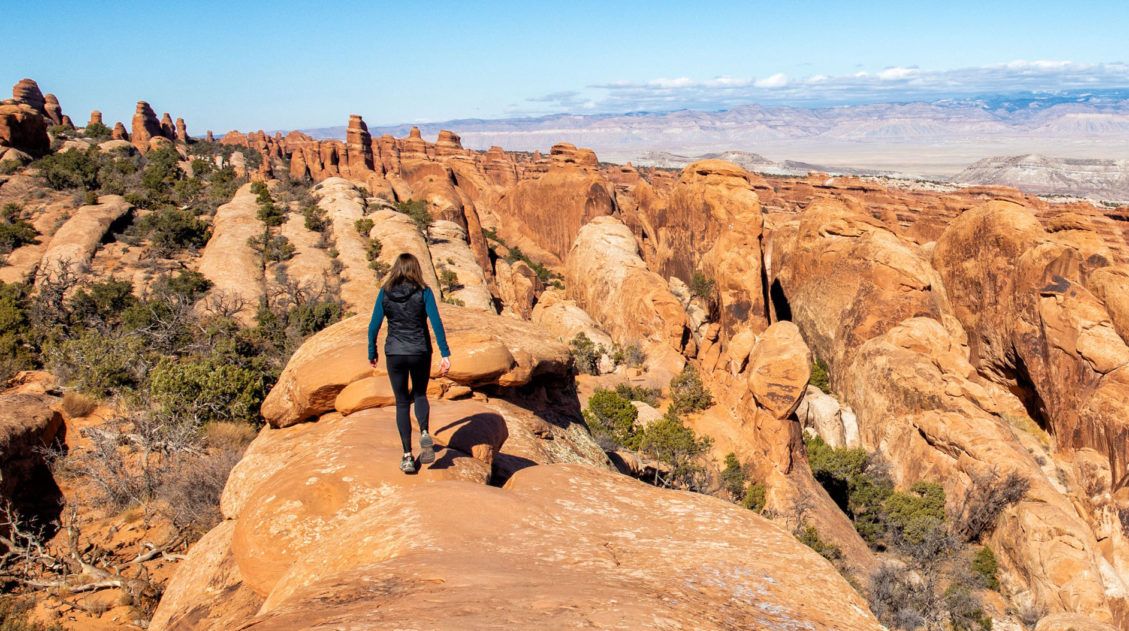
Devils Garden Trail: The Best Hike in Arches National Park
The Devils Garden Trail has all of the ingredients for a perfect hike in Arches National Park. If you hike the entire 7.8-mile loop, you get to see eight arches! Along the way, go rock scrambling, hike along fins of sandstone rock, and enjoy some of the best views of the park. What makes the […]
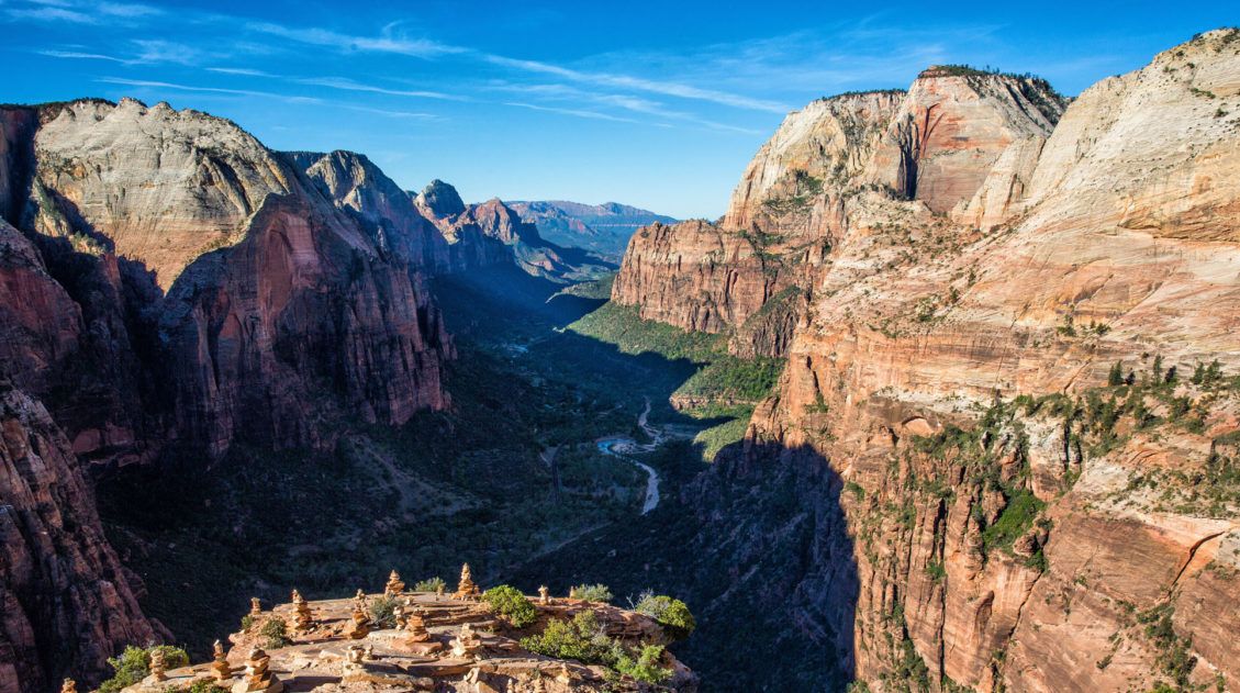
The Ultimate Zion Itinerary: 1 to 6 Days of Hiking & Adventure
If you are planning your Zion National Park itinerary, this is a great place to start. Zion National Park is a hiker’s paradise. This relatively small park is packed with some of the most thrilling hikes in the United States. From the awe-inspiring hike up Angels Landing to the bucket list-worthy Zion Narrows to the family […]
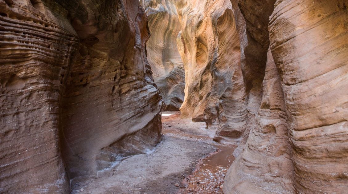
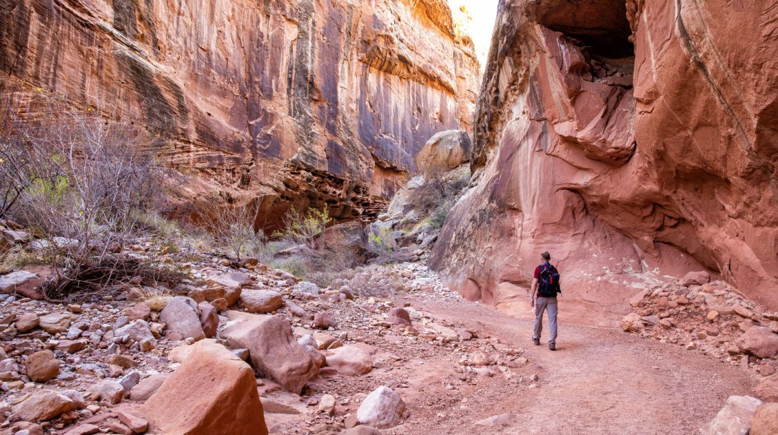
Hiking the Willis Creek Slot Canyon in Utah
The hike along the Willis Creek Slot Canyon is so much fun! And to think that we almost skipped this hike. After a long day of hiking and exploring both Bryce Canyon National Park and Kodachrome Basin State Park, we wondered if we should tack on Willis Creek to the end of our day. Would it be […]
The Ultimate Arches and Canyonlands One Day Itinerary
Canyonlands and Arches are two national parks that sit side-by-side near Moab, Utah. Since these parks are neighbors, it is possible to visit both of them in one very busy day. In this guide, we cover the best way to spend one day in Arches and Canyonlands National Parks. We are frequent visitors to this […]
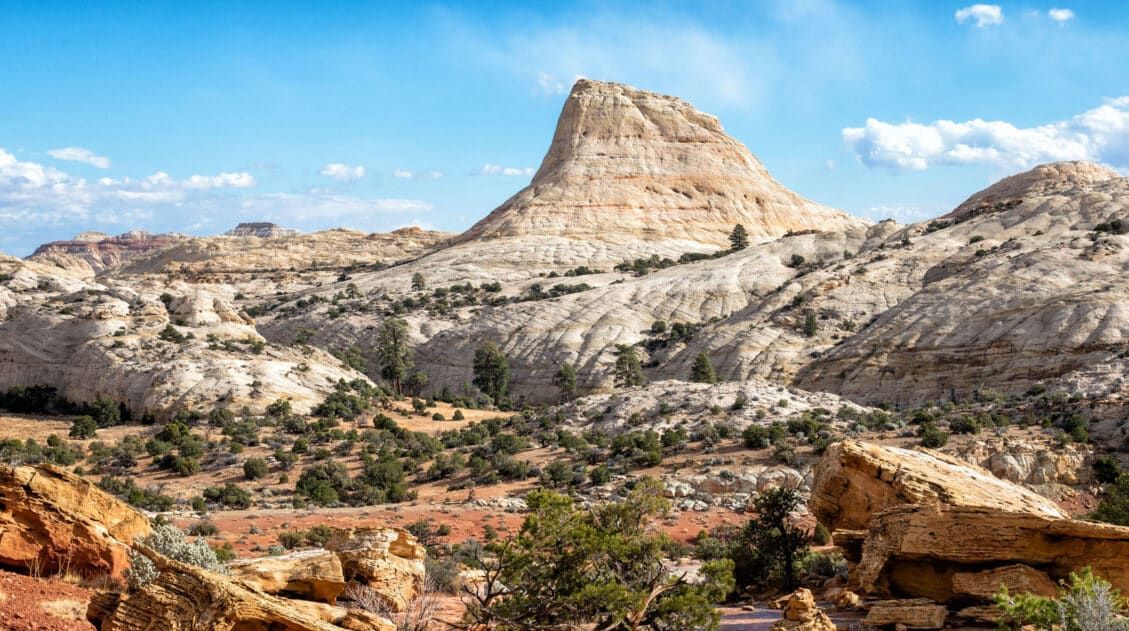
Capitol Reef National Park Travel Guide
Capitol Reef National Park With beautiful scenic drives, thrilling hikes, historical sites, backcountry roads, slot canyons, and unique desert landscapes, Capitol Reef is an unexpectedly amazing national park to visit. The views and the hiking trails easily contend with the other national parks in Utah’s Mighty 5. Not only does Capitol Reef rival Zion when it […]
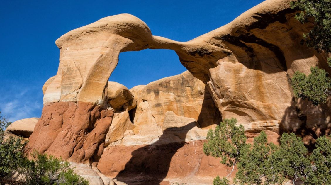
5 Reasons Why You Should Visit Devils Garden in Grand Staircase-Escalante
Devils Garden is a fun to explore, scenic spot to visit in Grand Staircase-Escalante National Monument. If you have plans to drive down Hole-in-the-Rock Road, here are five reasons why you should visit Devils Garden. #1 This Place is a Beauty! With hoodoos, crazy rock formations, and arches, Devils Garden is a beautiful spot to […]
One Perfect Day in Capitol Reef (3 Different Ways)
If you only have one day in Capitol Reef National Park, what should you do? There are several different ways that you can spend one day in Capitol Reef. For some people, “one day” might mean a very quick visit, as you tour Capitol Reef while driving between two different locations in Utah. Or, you […]
A Quick Visit to Kodachrome Basin State Park
With colorful sandstone spires, red rock mountains, and bright blue skies, Kodachrome Basin is a gorgeous little spot to explore. Its name, Kodachrome, fits it perfectly, describing the multitude of vivid colors that are found here. Laced with hiking and horseback riding trails, you could spend a few days here. In fact, Kodachrome Basin makes […]
What’s It Like to Drive Cottonwood Canyon Road?
Cottonwood Canyon Road is a scenic, unpaved road that travels through Grand Staircase-Escalante National Monument. It connects the town of Cannonville with Highway 89, just west of Big Water. Tim and I drove this road during our first road trip through Arizona and Utah (we’ve since been back multiple times). Since we were traveling from Page, […]

Comments 2