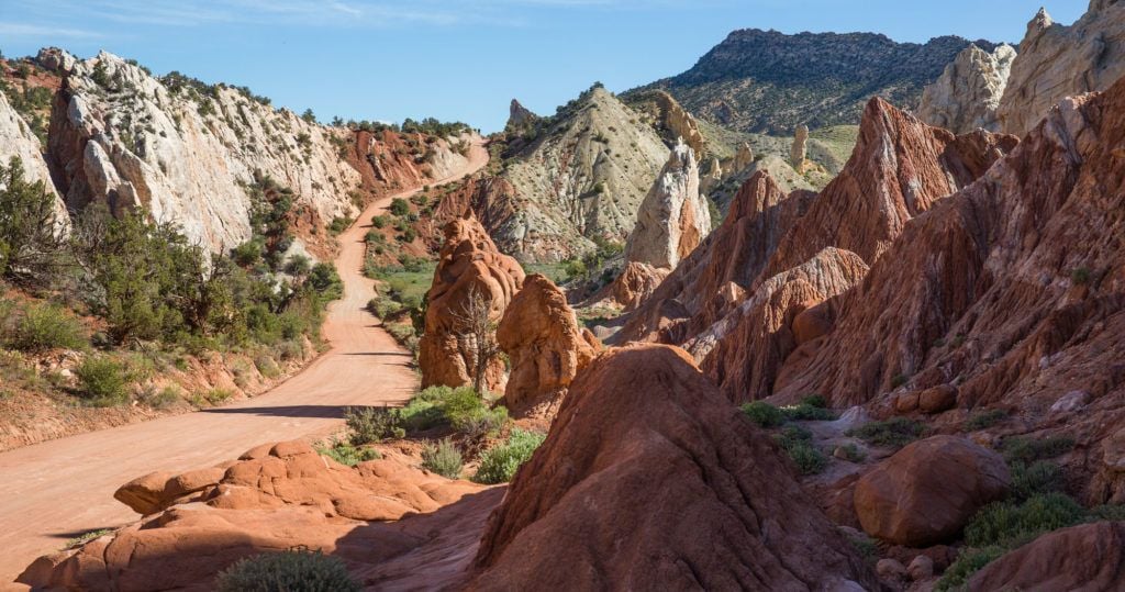
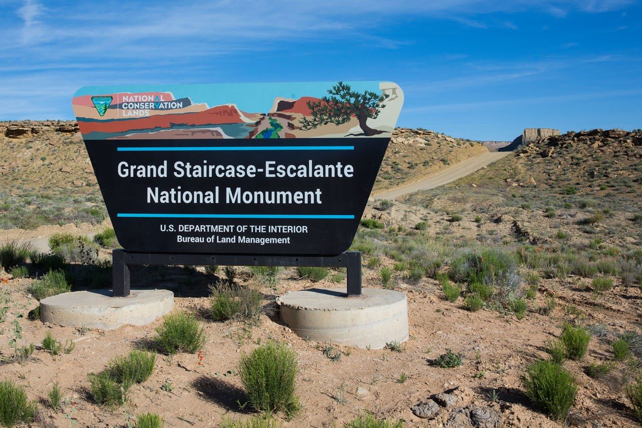
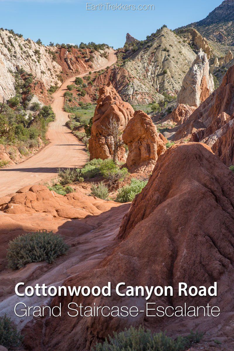
Cottonwood Canyon Road is a scenic, unpaved road that travels through Grand Staircase-Escalante National Monument. It connects the town of Cannonville with Highway 89, just west of Big Water.
Tim and I drove this road during our first road trip through Arizona and Utah (we’ve since been back multiple times). Since we were traveling from Page, Arizona to Escalante, Utah, Cottonwood Canyon Road was the perfect shortcut through Grand Staircase-Escalante. It was a great decision, as this route saved us the time of driving much longer distances on the highways, and we got to see a beautiful part of Utah.
October 2025 Update: Link was added to the Utah UDOT website to check road conditions before starting this drive.
Cottonwood Canyon Road Stats
Distance: 46 miles one way
Road Conditions: Most of the road is a dirt and gravel surface. For nine miles, from Cannonville to Kodachrome Basin State Park, the road is paved.
Endpoints: Cottonwood Canyon Road starts (or ends, depending on the direction you are traveling) in Cannonville. It ends at Highway 89 just west of Big Water (GPS coordinates: 37.104983, -111.846877).
When to go: Year round, although the road can be impassable after it rains, even in a 4×4.
Length of Time for the drive: Roughly 2 hours, but this depends on how often you stop to take photos or enjoy the views.
How to Use This Map: Click the tab in the top left corner of the map to see a list of the points of interest and to turn layers on/off. Click the icons on the map to get more information about each point of interest.
To take this map with you, click the star next to the title of the map which adds it to your Google account. Next, within your Google Maps app, select ‘Saved’ and then select ‘Maps’. This map title will now appear in your list.
Our Experience
We drove Cottonwood Canyon Road from south to north. Our journey took just under two hours and we did stop frequently for photos and for a visit at Grosvenor Arch.
During our drive, there were very few other cars on the road. It is a beautiful drive through desert and mountainous terrain. Cows graze alongside the road, you are treated to numerous panoramic vistas, and there are several spots where the scenery is just amazing.
Photos from Cottonwood Canyon Road
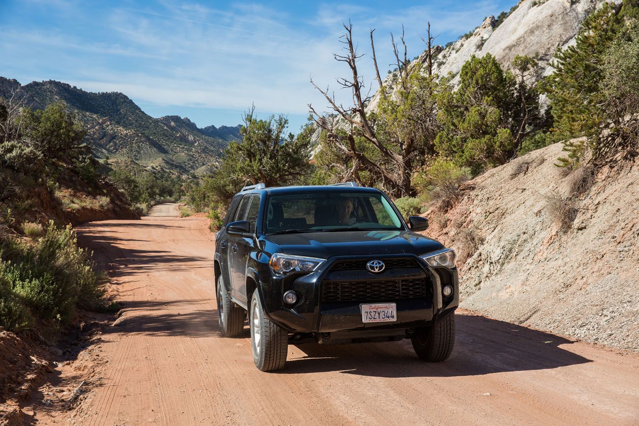
Turning onto Cottonwood Canyon Road from Highway 89
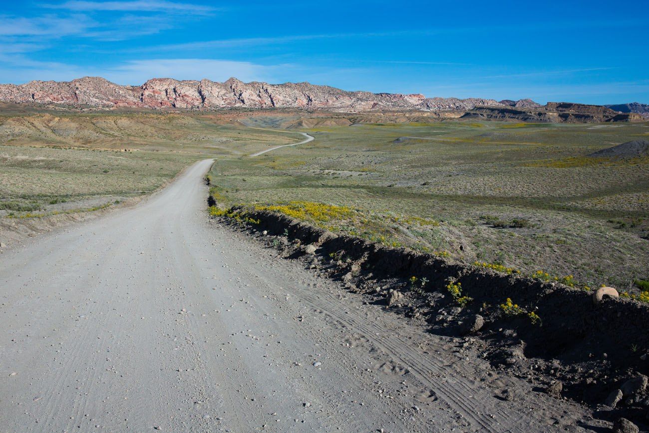
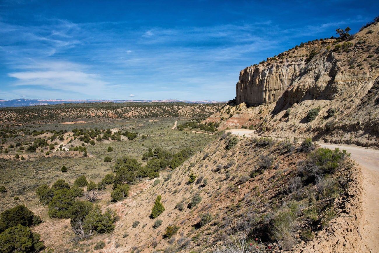
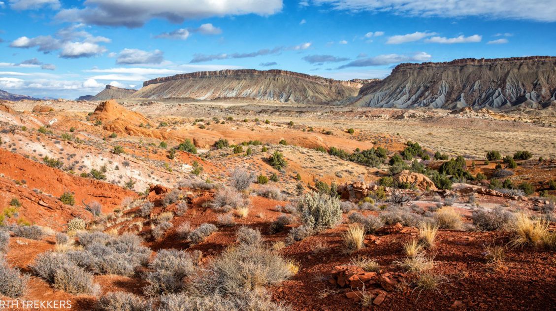
At first, the road is relatively flat and the views are expansive.
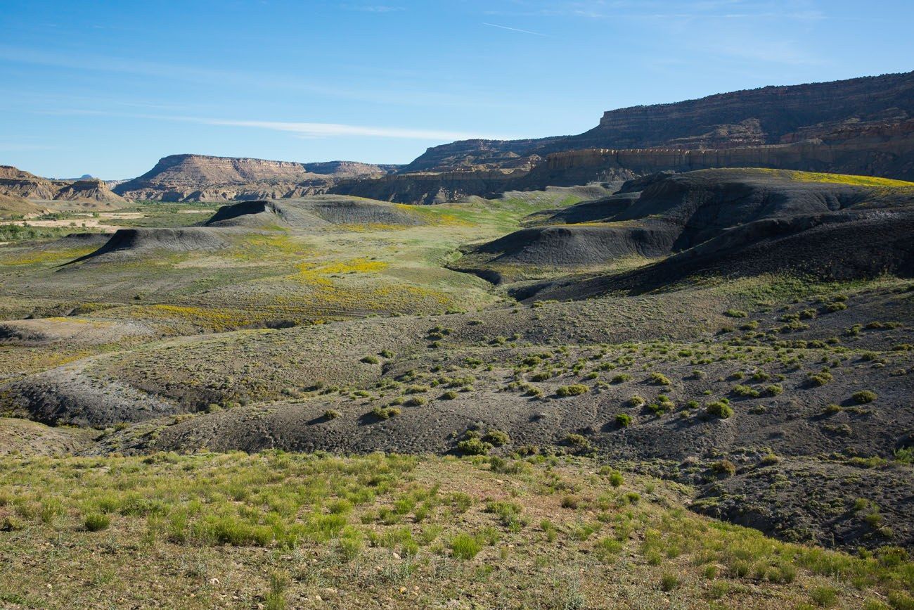
We were amazed to see so much greenery here.
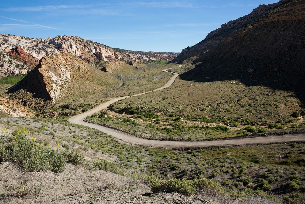
Entering the canyon.
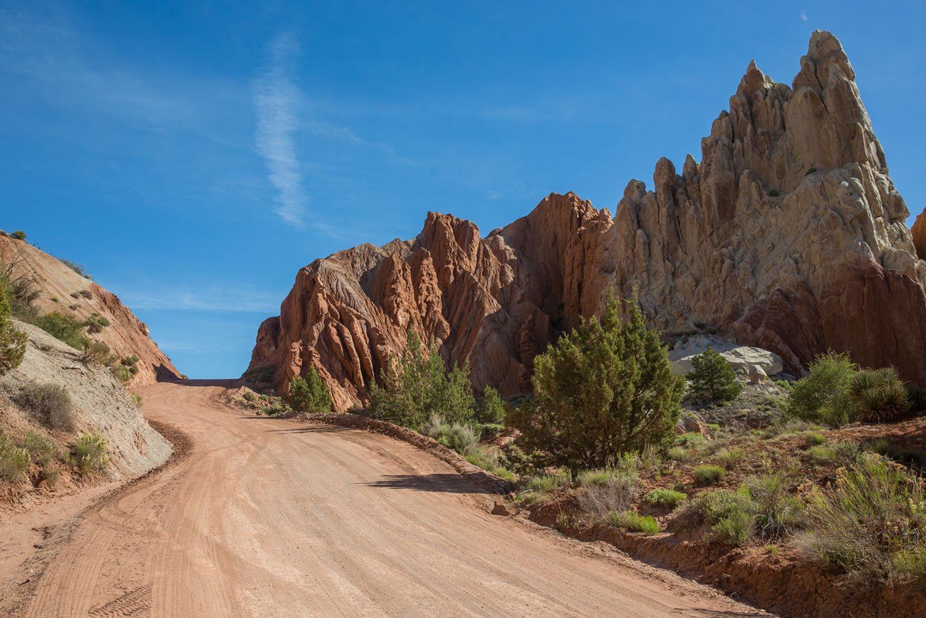
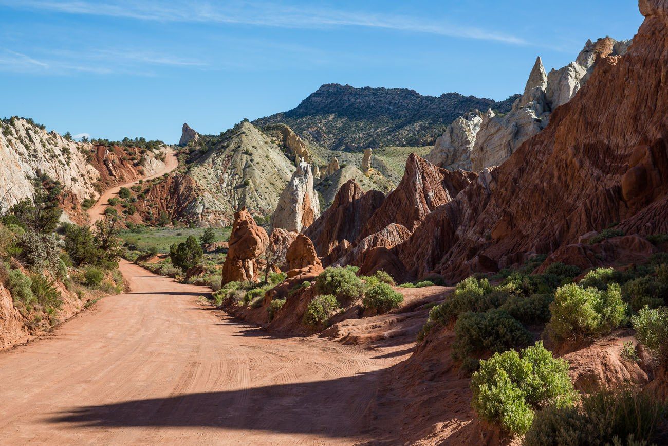
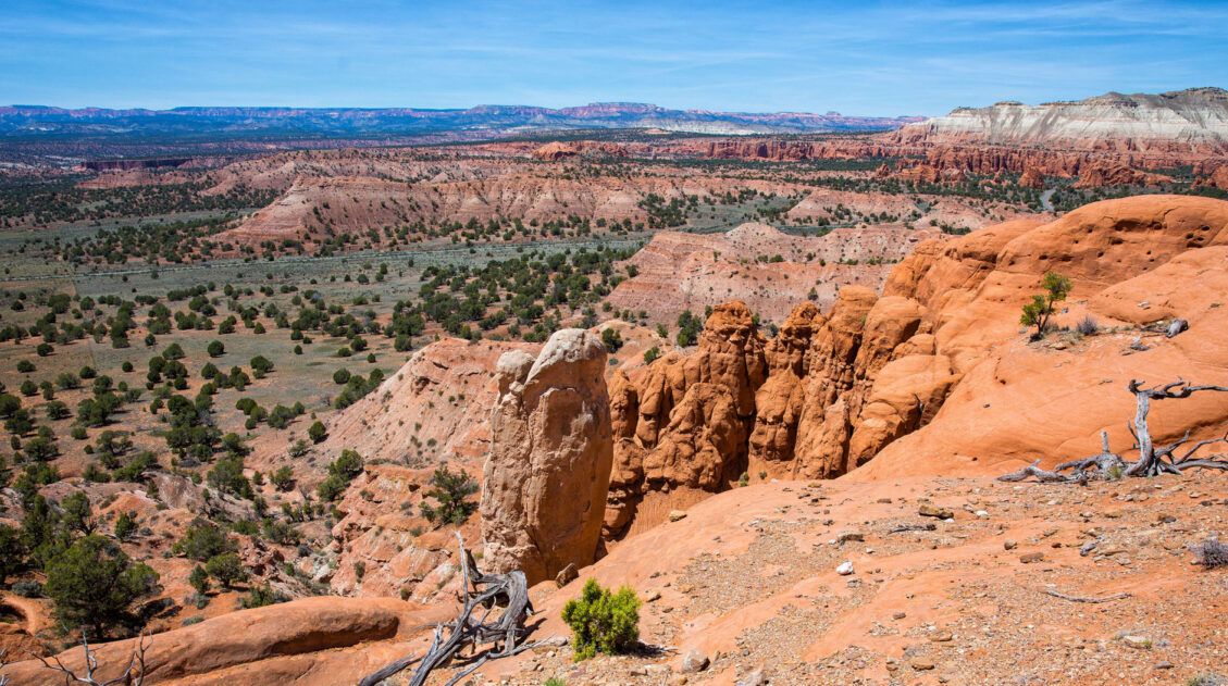
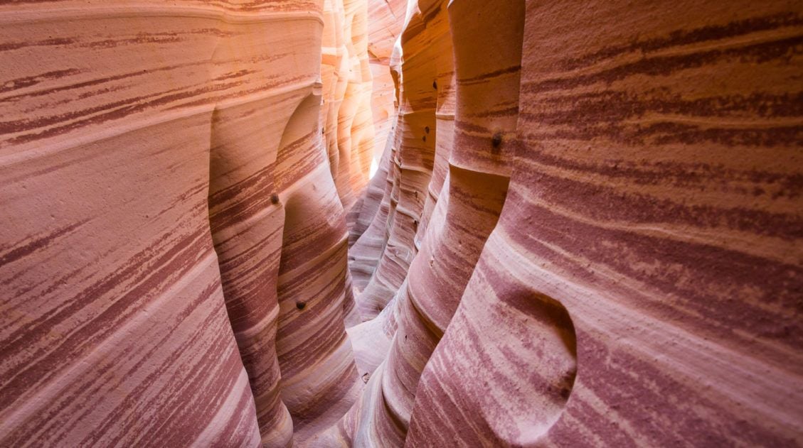
About halfway into the drive, the scenery is really amazing.
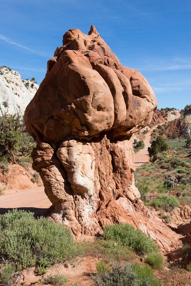
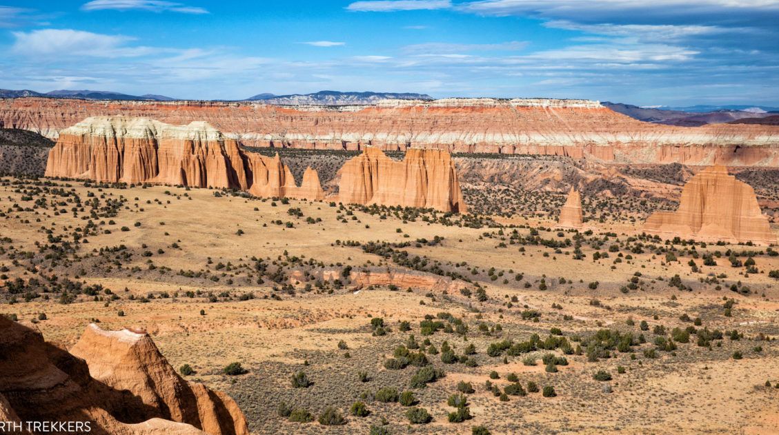
Approaching Kodachrome Basin State Park.
Things to Do on Cottonwood Road
There are several trails and viewpoints to visit during the drive.
Grosvenor Arch
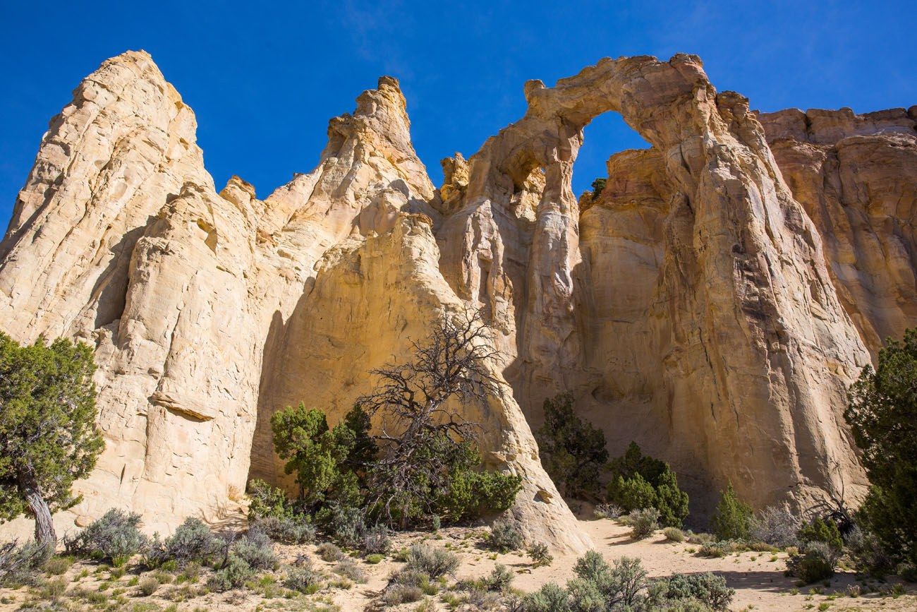
This quick detour is worth it to see these giant, sandstone arches (if you look closely, there are two arches up there). From Cottonwood Canyon Road, it takes just a few minutes to drive to this viewpoint, and then it is just a short walk to get to the arch.
Getting Here: Grosvenor Arch is 30 miles north of Highway 89 and 16 miles south of Cannonville. The GPS coordinates for the parking lot are 37.454383, -111.833030.
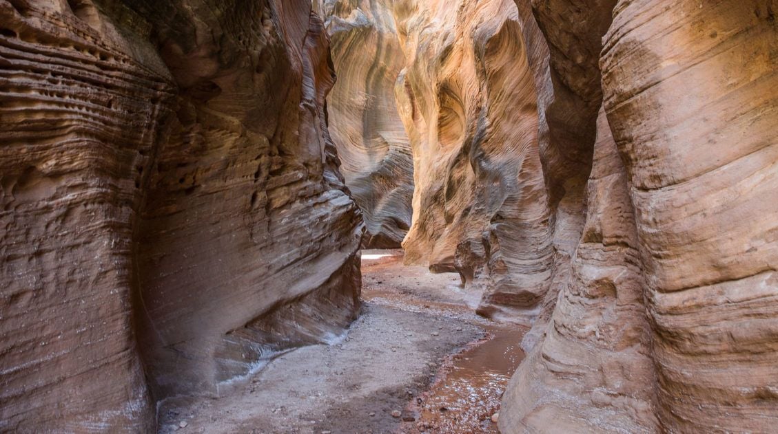
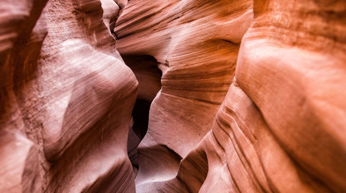
Cottonwood Wash Narrows
This easy, 3-mile hike wanders through a narrow sandstone canyon. You will be walking through a creek. Depending on recent weather conditions, the floor of this canyon could be filled with water so your feet can get wet.
Yellow Rock
This is another short and easy hike that takes you on top of a giant, yellow sandstone rock. From the top, enjoy panoramic views of the area. It is 2.5 miles round trip and takes about 3 hours. The trailhead is at Hackberry Wash, 14 miles north of Highway 18 on Cottonwood Canyon Road.
Hackberry Canyon
This short hike through a slot canyon shares the same trailhead and parking lot with Yellow Rock. It is 4 miles round trip and the slot canyon floor may be covered in shallow water, so your feet may get wet.
Cottonwood Canyon Narrows
This trail takes you through a narrow gorge of Cottonwood Creek. The hike is 3 miles round trip and takes about 2 hours. The trailhead is 25.5 miles north of Highway 89 and 20.5 miles south of Cannonville. See the Visit Utah website for more information.
Things to Know Before You Go
What Kind of Vehicle Do You Need?
You can do this drive in a 2WD car. During our drive, the road was in good condition, mostly flat with very few ruts or bumps along the way. We saw several cars on this road and they were driving without any difficulties. Having a 4×4 is ideal but not necessary.
I recommend checking road conditions at the Visitor Center before you drive on Cottonwood Canyon Road (especially if you do not have a 4×4) or checking road conditions online on the Utah UDOT website. Road conditions can change from month to month and year to year, depending on weather conditions and maintenance. When we did this, the road was in excellent condition. However, that is not always the case. In Cannonville and in Big Water (at the start and end of this drive), there is a Visitor Center where you can get updated information.
If it Rains, the Road May Be Impassable
If it recently rained, Cottonwood Canyon Road can be impassable, even if you have a 4×4. You will have to take a detour around Cottonwood Canyon Road.
More Things to Do in the Area
We did not do any of the short hikes located right on Cottonwood Canyon Road, although we did make the short detour out to Grosvenor Arch. We had limited time, time we were saving for Hole-in-the-Rock Road and the hikes to Zebra Slot Canyon and Peekaboo and Spooky Gulches. For us, Cottonwood Canyon Road was a scenic shortcut between Page, Arizona and Escalante, Utah.
There is plenty more to see and do in Grand Staircase-Escalante. This place is huge and absolutely amazing to explore. It does not have the same popularity as nearby Bryce Canyon and Zion, so the trails are less crowded and this part of Utah feels more remote.
Willis Creek slot canyon is a short, fun, easy hike located near Cannonville. Kodachrome Basin State Park is an underrated state park that is located on Cottonwood Canyon Road, near Cannonville, and is filled with short, easy hikes.
One hike that we did not have time for (but is first on our list on a return visit here) is Coyote Gulch. This is an all day hike, almost 11 miles in length, but some people split the hike into 2 days as a backpacking trip.
If you have any questions about driving Cottonwood Canyon Road, let us know in the comment section below.
More Information about Utah & Arizona
Planning a trip to Utah? Read all of our articles in our Utah Travel Guide.
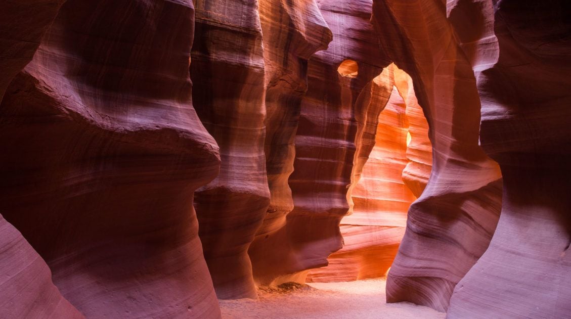
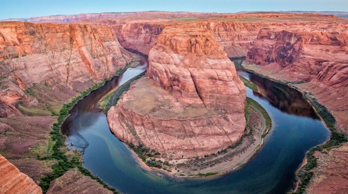
How to Visit Upper Antelope Canyon (+ Lots of Photos!)
Pinterest Facebook Flipboard Isn’t it awesome when a new place completely astounds you? For me, that was Upper Antelope Canyon. I first saw photos years before I visited – those glowing red walls, the twisted, scalloped rock, the famous beams of light cutting through dusty air. I genuinely wasn’t sure a place could look like […]
Hiking the Willis Creek Slot Canyon in Utah
The hike along the Willis Creek Slot Canyon is so much fun! And to think that we almost skipped this hike. After a long day of hiking and exploring both Bryce Canyon National Park and Kodachrome Basin State Park, we wondered if we should tack on Willis Creek to the end of our day. Would it be […]
A Quick Visit to Kodachrome Basin State Park
With colorful sandstone spires, red rock mountains, and bright blue skies, Kodachrome Basin is a gorgeous little spot to explore. Its name, Kodachrome, fits it perfectly, describing the multitude of vivid colors that are found here. Laced with hiking and horseback riding trails, you could spend a few days here. In fact, Kodachrome Basin makes […]
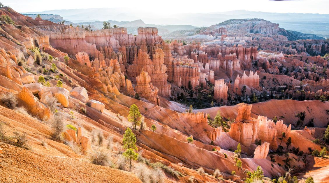
Utah’s Mighty 5: How to Plan the Perfect Road Trip Itinerary
Stretching across southern and central Utah are five stunning national parks. Called the Mighty 5, these parks contain some of the most thrilling hiking trails and iconic landscapes in the United States. Stand atop Angels Landing in Zion. Gaze across a wonderland of hoodoos at Bryce Canyon. Explore the Water Pocket Fold at Capitol Reef. […]
10 Days in the American Southwest: The Ultimate Road Trip
The American southwest is one of the USA’s best road trip destinations. It’s unbelievable how much there is to see and do here. There are the breathtaking vistas of the Grand Canyon, thrilling hiking trails in Zion National Park, and millions of hoodoos to photograph in Bryce Canyon. Are you getting excited yet? The list […]
6 Epic Utah Road Trip Routes for Your Next Adventure
Utah is home to five of the most stunning national parks in the United States. Throw in some national monuments and a few spectacular state parks and you have a extraordinary road trip destination. If you are planning a Utah road trip itinerary, we have tons of information to share with you. About Our Experiences […]
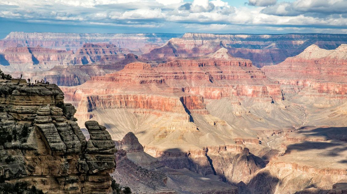
11 EPIC Things to Do on the South Rim of the Grand Canyon
For millions of years, the Colorado River has carved its way through the Colorado Plateau, forming this expansive, awe-inspiring landscape that we call the Grand Canyon. And it certainly is grand. Words cannot describe what it is like to gaze across the Grand Canyon for the first time. On a visit to the Grand Canyon, […]
How to Hike Zebra Slot Canyon in Grand Staircase-Escalante
Zebra Slot Canyon is a very short slot canyon, named for its striped canyon walls. It’s a gorgeous spot, maybe not quite as pretty as Antelope Canyon in Arizona, but since you can explore this on your own without a guide or tour group, it’s more fun. Hiking Zebra Slot Canyon can be a little […]
A Photojourney through Peek-A-Boo and Spooky Gulches
If you are looking for a super fun hike to do, put Peek-A-Boo Gulch and Spooky Gulch on your list. Just their names make this hike sound enticing. These slot canyons are located in Grand Staircase-Escalante National Monument on Hole-in-the-Rock Road. Getting here can be a mini-adventure, driving over 25 miles down a rough, dirt road […]
Complete Guide to the Cathedral Valley Loop (+ Map & Best Route)
Cathedral Valley is a rugged, remote district of Capitol Reef National Park. Few people travel out this way, to see this valley and its sandstone monoliths, colorful Bentonite hills, and vast desert scenery. But that’s part of its appeal. If you like the idea of leaving the crowds behind and exploring the backcountry, the Cathedral […]
How to Loop the Fold in Capitol Reef National Park
Desert vistas, slot canyons, colorful hills made of bentonite and sandstone, marine fossils…these are just a few of the things that you will see when you Loop the Fold in Capitol Reef National Park. This incredibly scenic drive takes you through the remote, southern section of Capitol Reef. On this drive, you will circle around […]
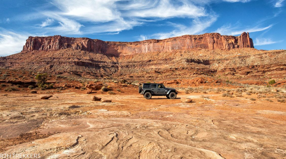
How to Drive the White Rim Road: Map, Photos & Driving Tips
Driving the White Rim Road is the experience of a lifetime. If you are looking for adventure, solitude, incredible views, and a totally different way to experience Canyonlands National Park, put this drive on your list. Along the drive, you will gaze up at the Island in the Sky mesa and peer down into the […]
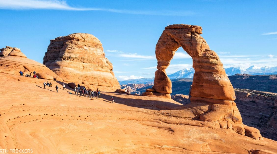
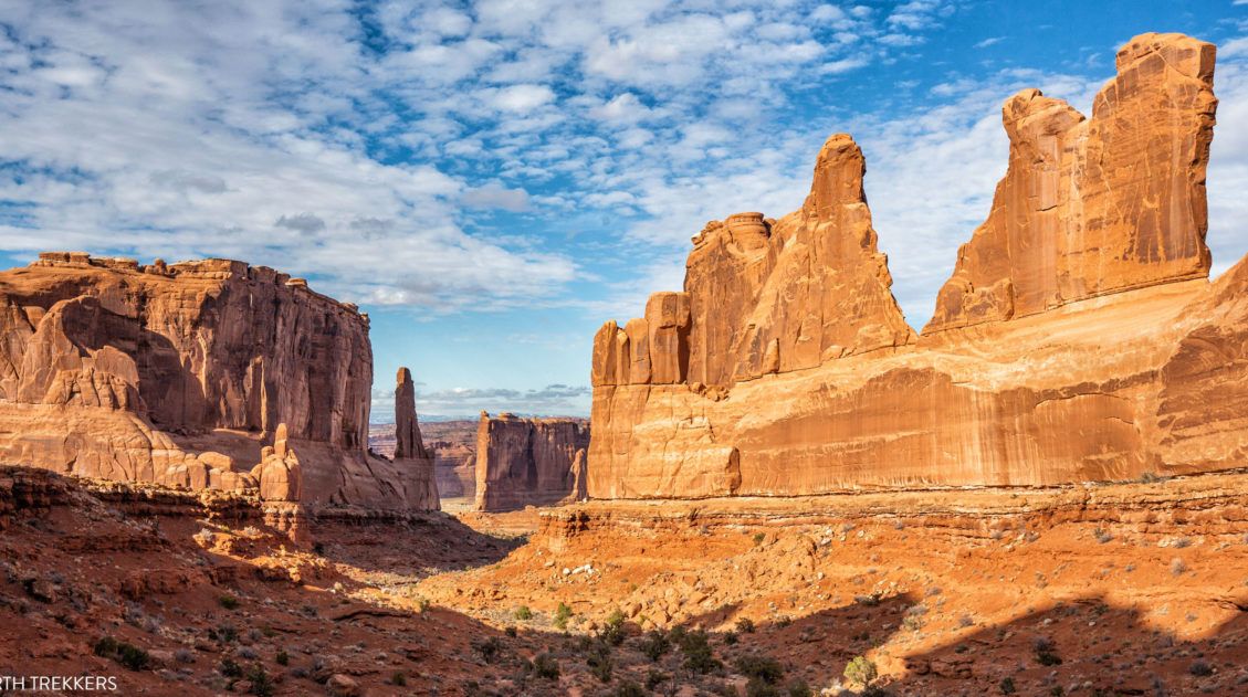
16 Amazing Things to Do in Arches National Park (+ HELPFUL Tips)
Arches National Park is a wonderland of desert vistas, short hiking trails, strange rock formations, and you guessed it, arches. Not only will you find over 2,000 arches here, but you will also see hoodoos, fins of sandstone rocks, massive mesas, and balanced rocks. Here are the best things to do in Arches National Park. […]
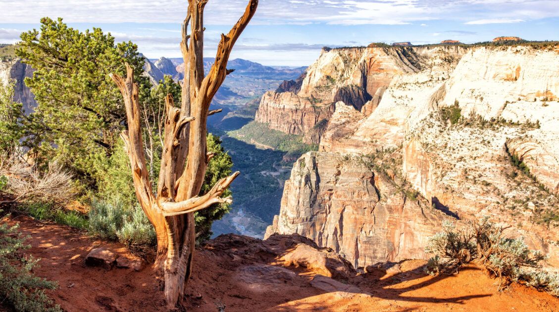
Best Hikes in Zion: 15 Trails from Beginner to Advanced
Zion National Park is one of the best places in the United States to go hiking. From the awe-inspiring hike up Angels Landing to the family-friendly Riverside Walk to multi-day backpacking adventures, there is something here for everyone. In this guide, we cover the best hikes in Zion National Park, from popular trails to hidden gems. […]

Comments 34