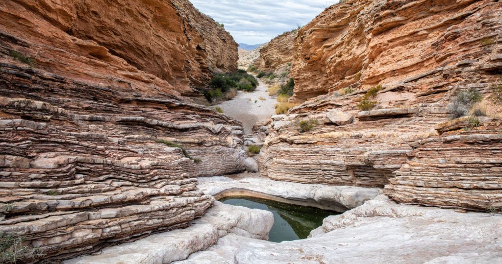
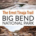
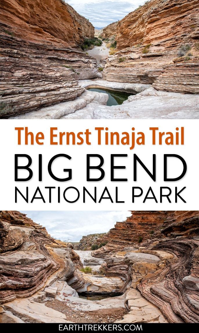
The Ernst Tinaja Trail is one of the most unique hikes to do in Big Bend National Park. This is a short, easy trail through a slot canyon, featuring a series of waterholes located within colorful layers of limestone rock. Those looking for a little more adventure can continue the hike past the water-filled pools and rock scramble their way to the back of the canyon.
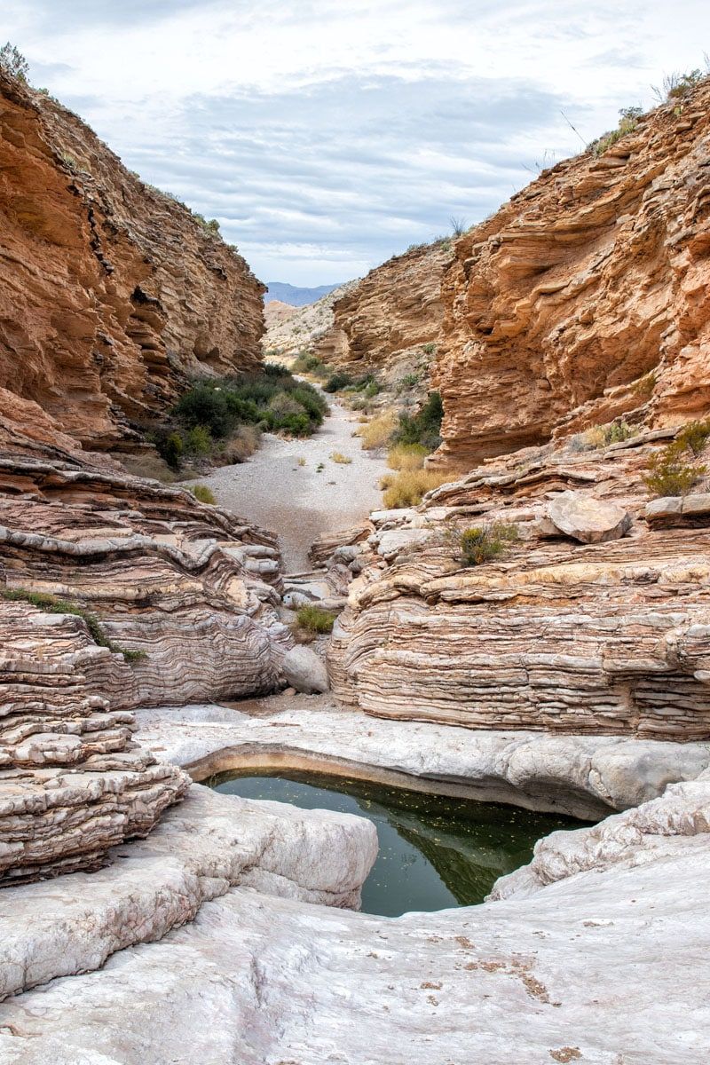
Getting here can also be an adventure. The Ernst Tinaja trail is located on Old Ore Road, a rough, gravel road that is only suitable for high-clearance vehicles with four-wheel drive.
Tim and I loved the combination: an adventurous backcountry drive, a genuinely unique slot canyon hike, challenging rock scrambling, and a trail we had almost entirely to ourselves. Ernst Tinaja ended up in our top three favorite experiences in all of Big Bend, alongside Balanced Rock and the Emory Peak/South Rim combo, which is saying something in a park full of exceptional hikes.
If you have a capable vehicle and you’re looking for something a little off the beaten path in Big Bend National Park, don’t skip this one.
Quick Facts: Ernst Tinaja Trail
DISTANCE | 1.6 miles round trip
ELEVATION GAIN | 195 feet
DIFFICULTY | Easy to the tinajas; moderate to challenging beyond
TIME | 1–1.5 hours
TRAILHEAD | Old Ore Road, ~5 miles from the southern entrance near Rio Grande Village
VEHICLE REQUIRED | High-clearance 4WD
PETS | Not allowed
BEST TIME | October through April
Getting to Ernst Tinaja: The Old Ore Road
The Ernst Tinaja trailhead is located in the eastern section of Big Bend National Park, about five miles down Old Ore Road near Rio Grande Village. Getting here is half the adventure, and a legitimate test of your vehicle.
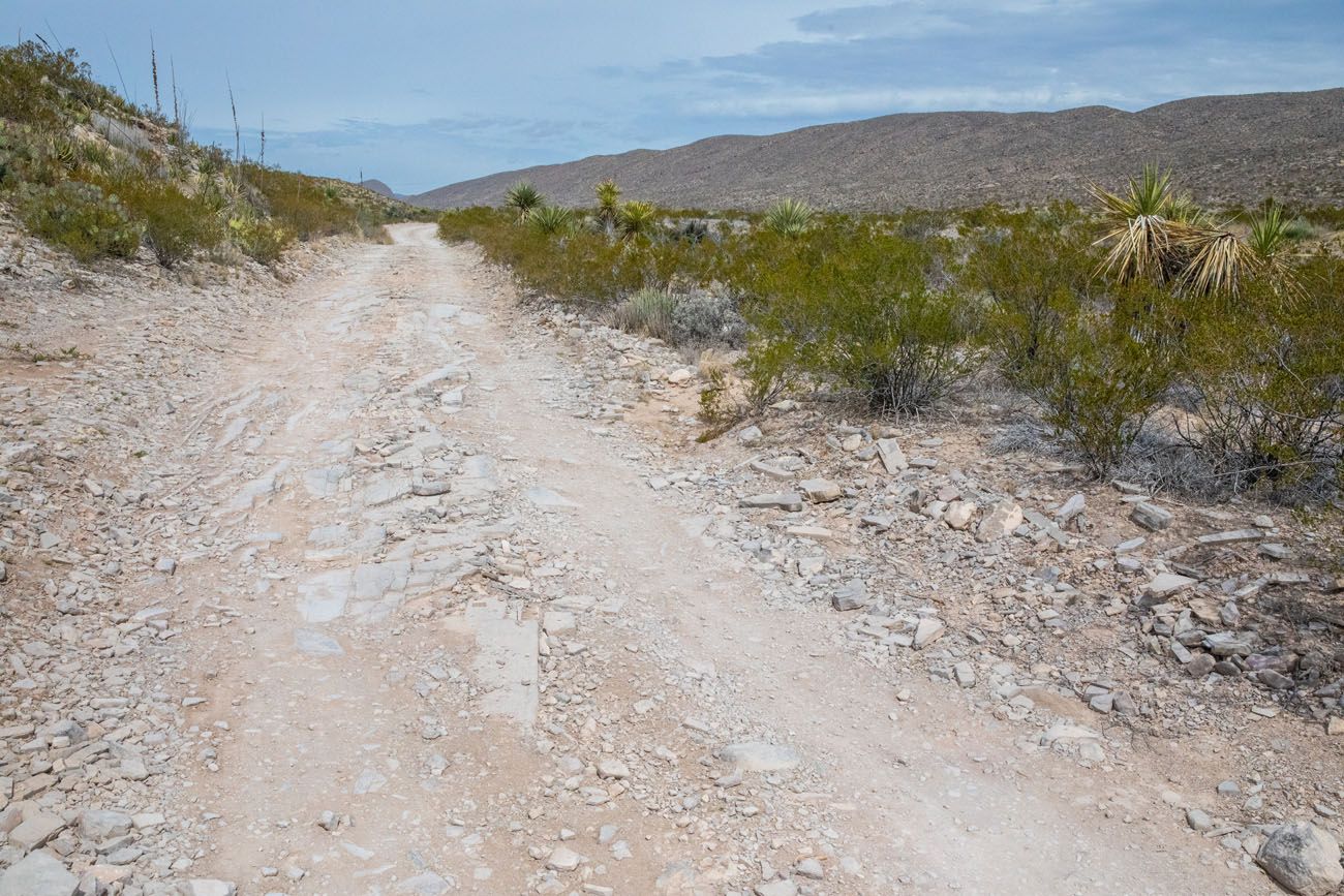
Old Ore Road is a primitive, unpaved backcountry road. In the early 1900s, it was used to transport lead, zinc, and silver ore from Mexican mines to the railroad station in Marathon. Today it remains much as it was then: narrow, rocky, and rough.
The National Park Service signs it clearly — Four Wheel Drive Required — and they mean it. The road is full of potholes, loose rock, and uneven surfaces, and photos don’t do justice to how rugged it actually is. After rain, it can become completely impassable.
The entrance to Old Ore Road is 0.8 miles west of the Rio Grande overlook. Drive five miles north until you see a small stone sign for Ernst Tinaja. Turn right there, and it’s a short drive to the trailhead parking area.
Don’t have a 4WD vehicle? Tour operators out of Terlingua offer off-road excursions that can get you to the trailhead. Check with local outfitters before your trip.
To get to the Ernst Tinaja trail, it is a five-mile drive on Old Ore Road. Once you get to the small Ernst Tinaja sign, turn right and it is a very short drive to the trailhead parking lot.
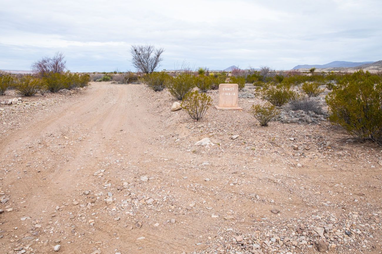
This small stone sign marks the turn to the Ernst Tinaja trail.
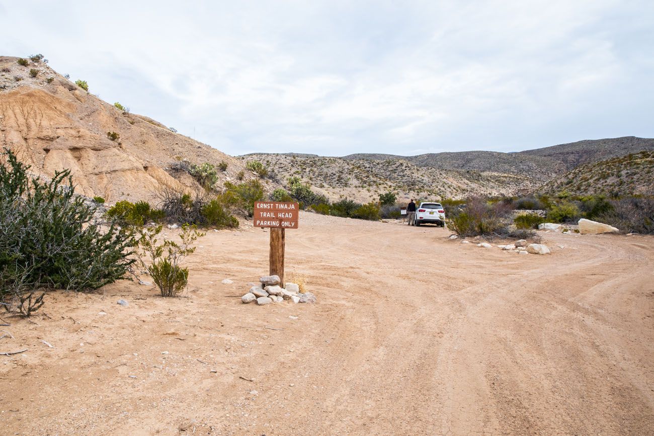
Parking lot for the Ernst Tinaja trail.
Ernst Tinaja Trail Hiking Stats
Distance: 1.6 miles round trip
Total Ascent: 195 feet
Difficulty: Easy to Ernst Tinaja, moderate to challenging if you continue past Ernst Tinaja to go rock scrambling
Length of Time: 1 to 1.5 hours (this does not include the drive on Old Ore Road)
When to go: Year round
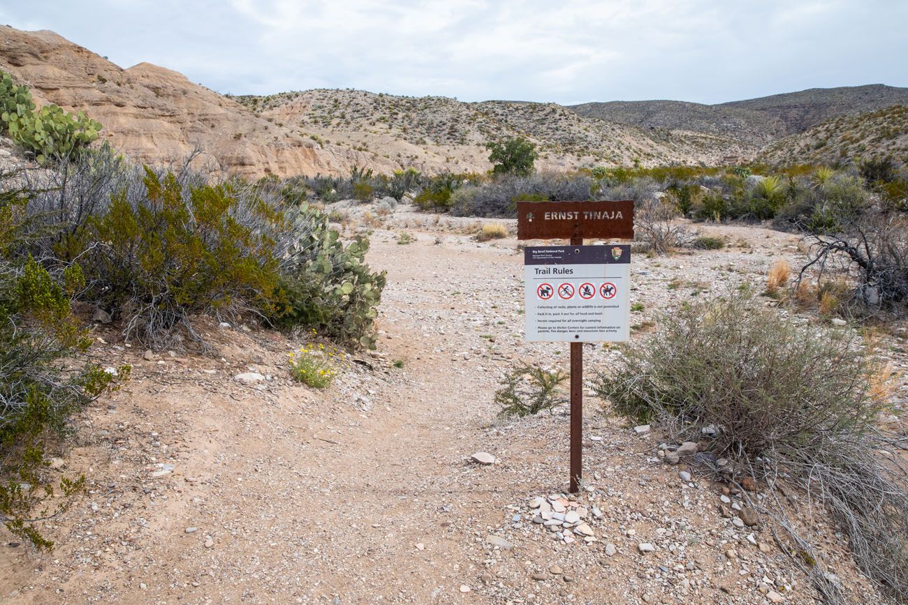
Please practice the seven principles of Leave No Trace: plan ahead, stay on the trail, pack out what you bring to the hiking trail, leave areas as you found them, minimize campfire impacts, be considerate of other hikers, and do not approach or feed wildlife.
Ernst Tinaja Trail: Step-By-Step Guide
This is an out-and-back hike. The farther you go, the better it gets. This hike is great for all ability levels, since it starts off easy, and stays that way, until you get to Ernst Tinaja, the water filled pools. Beyond Ernst Tinaja, the trail gets to be more challenging, with sections of rock scrambling.
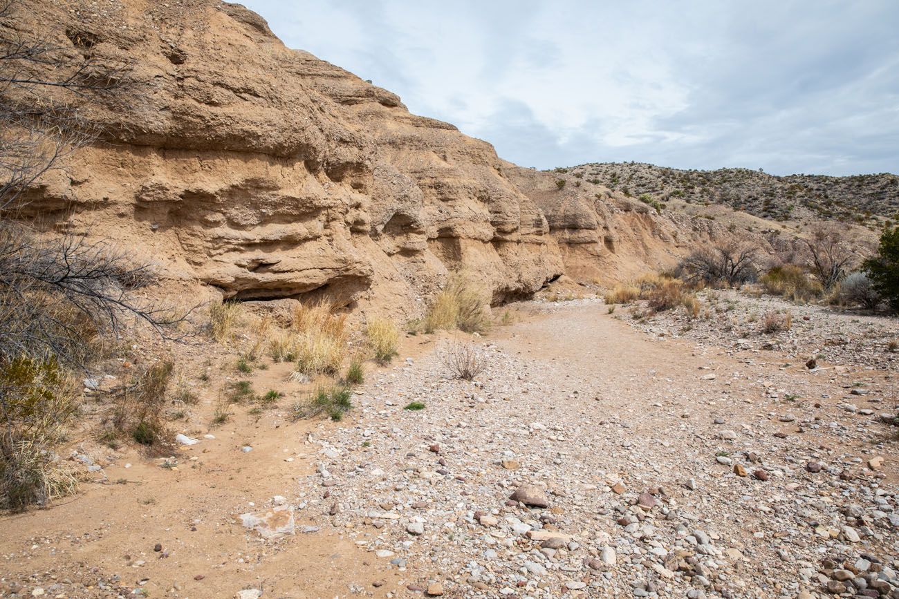
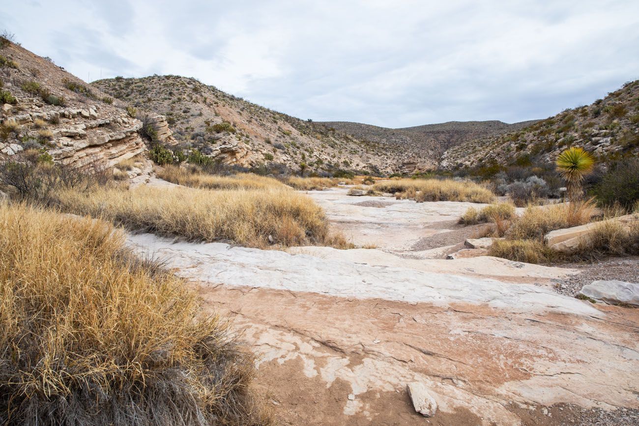
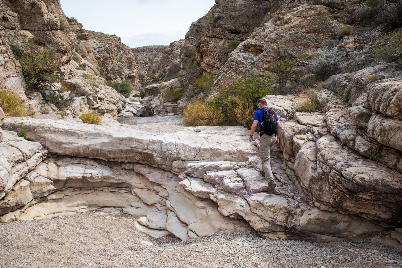
From the parking lot to Ernst Tinaja, it is a flat, easy walk through a dry creekbed.
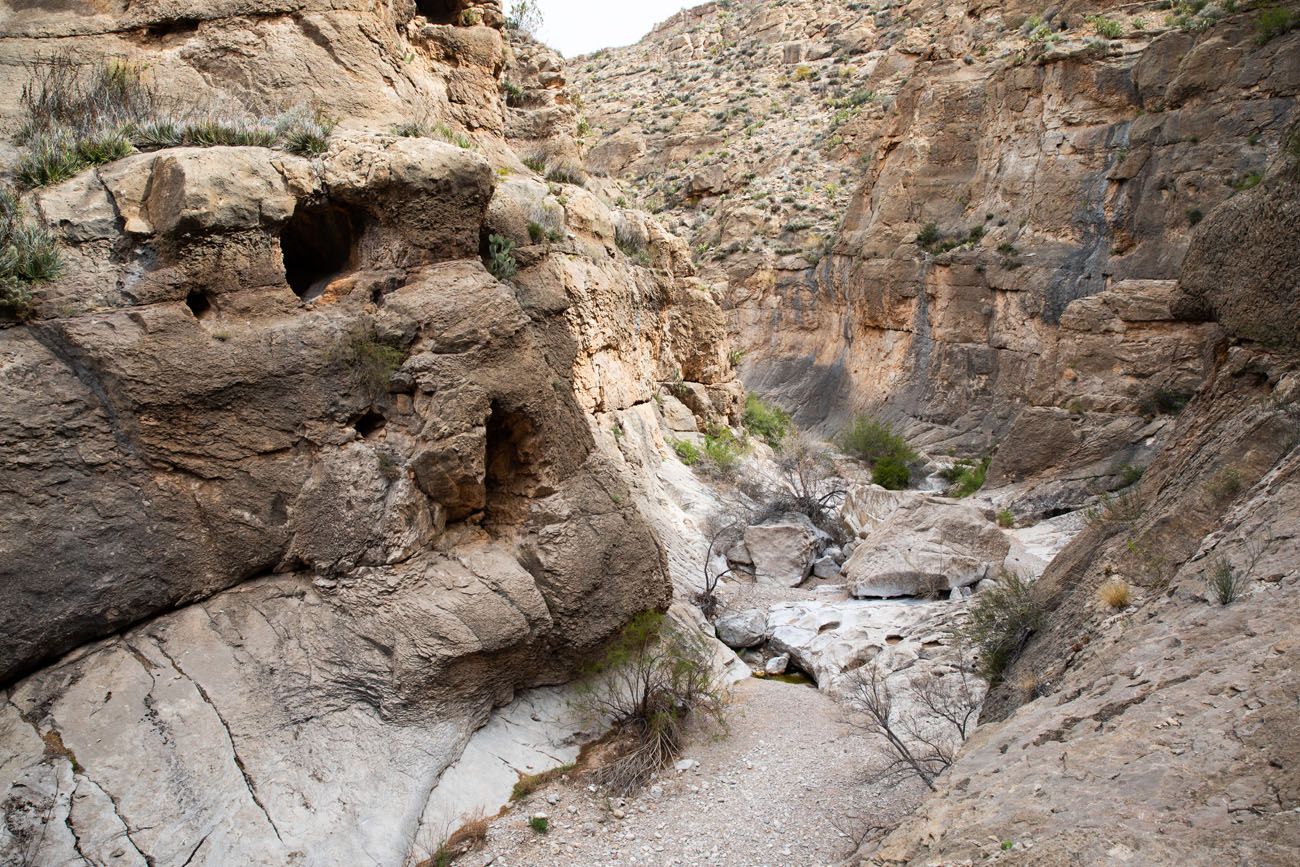
The Canyon Walk
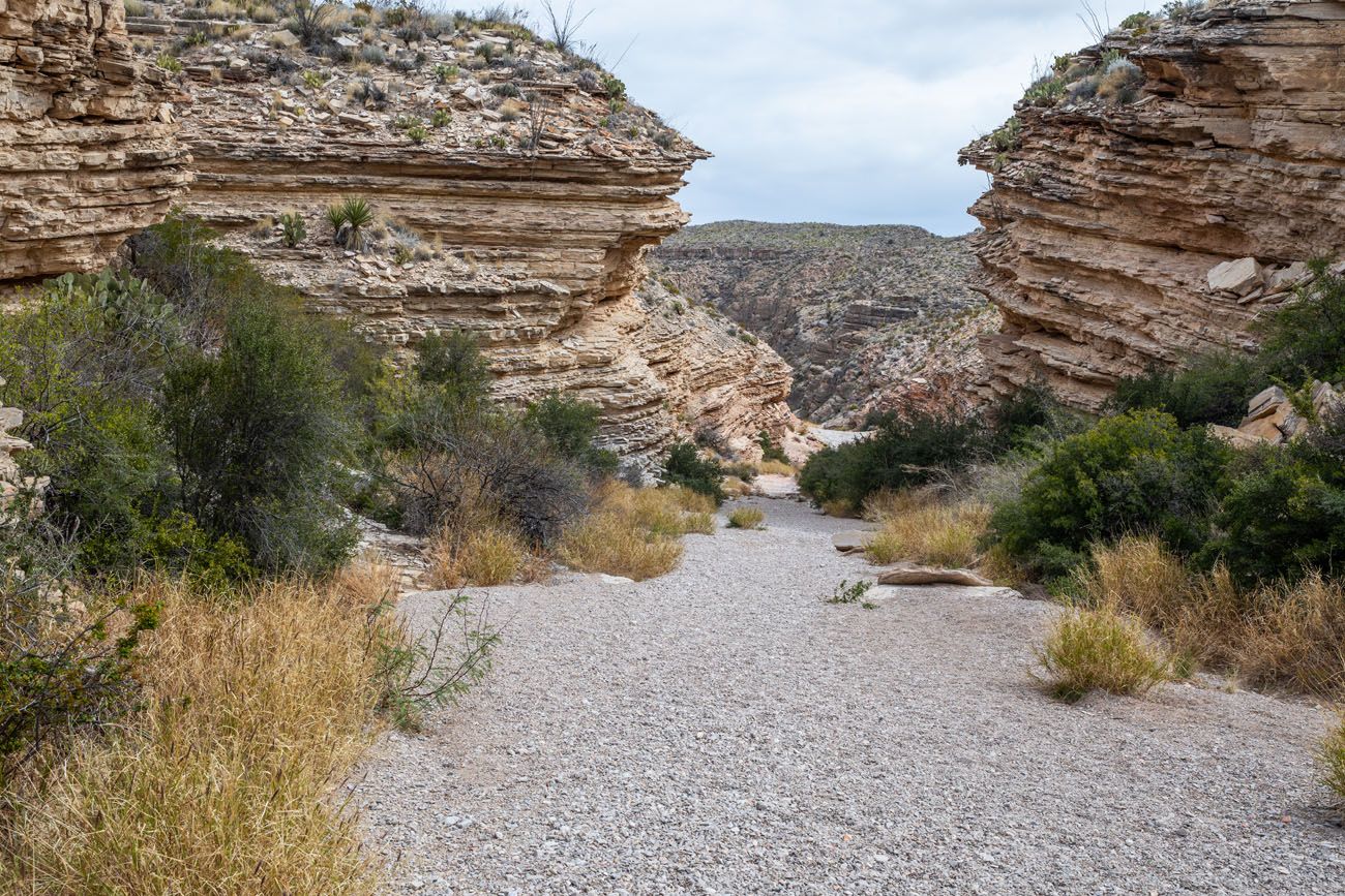
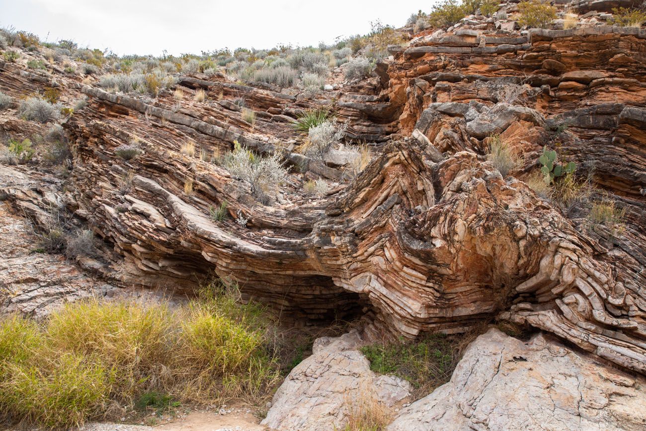
Gradually, the canyon walls rise up around you, revealing one of the most visually striking geological features in Big Bend.
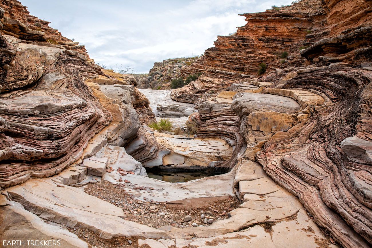
The colorful, striated layers you’ll see in the rock are part of the Boquillas Formation – sedimentary limestone deposited at the bottom of an ancient sea during the Cretaceous period, then uplifted and twisted by volcanic and tectonic activity over millions of years. The result is a canyon walls of bent, folded rock in shades of red, orange, and cream that look almost painted.
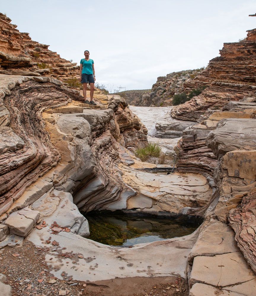
Ernst Tinaja
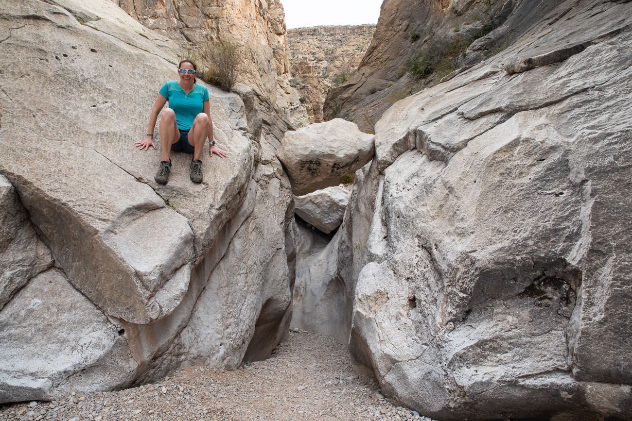
The highlight for many visitors is Ernst Tinaja, the watering holes that are located in the colorful, layered limestone rocks in this canyon. This is a uniquely beautiful spot and it looks vastly different from the other landscapes in Big Bend National Park.
Tinaja is Spanish for a large water jar. In the American Southwest, it is a term for pockets that are formed in the bedrock and are filled with water. These tinajas serve as watering holes for the local wildlife.
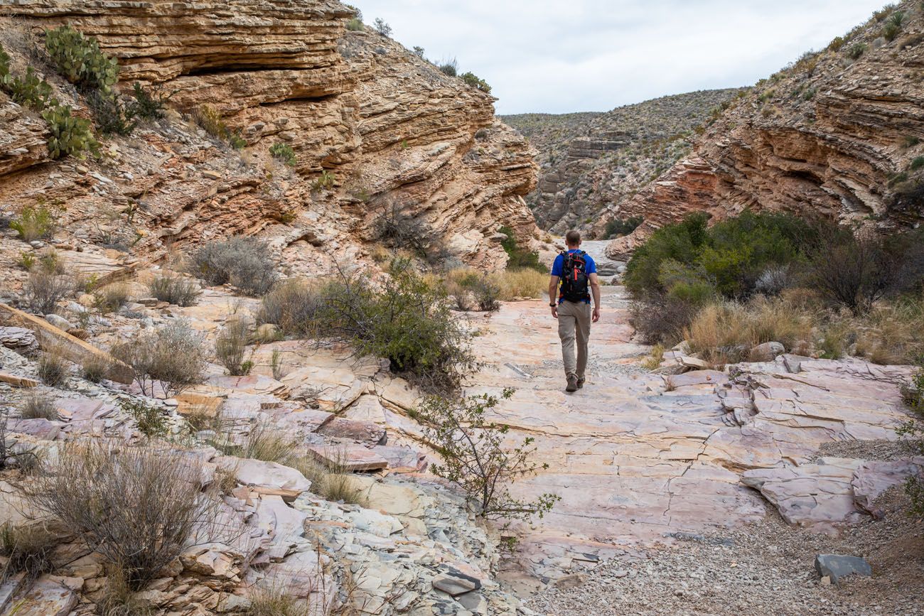
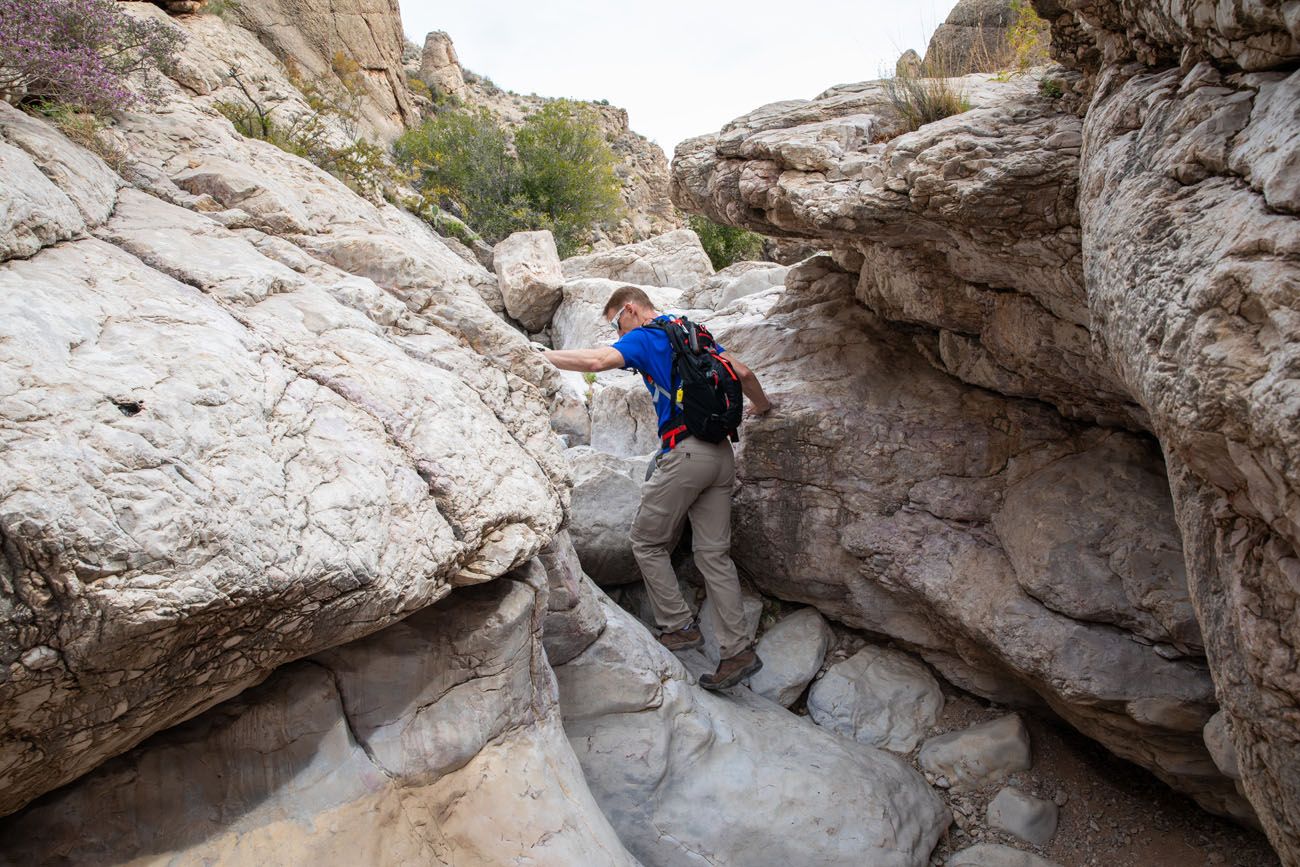
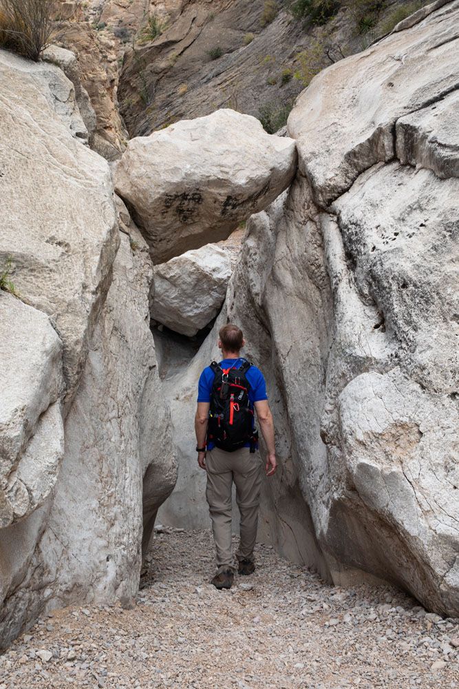
To continue through the canyon, and for one of the best views on this hike, you will have to scramble up and over this striated rock. Be careful, because the crumbling rock can be slippery.
Enjoy the view down through the canyon. You can turn around here or continue into the depths of the canyon, if you like the idea of rock scrambling.
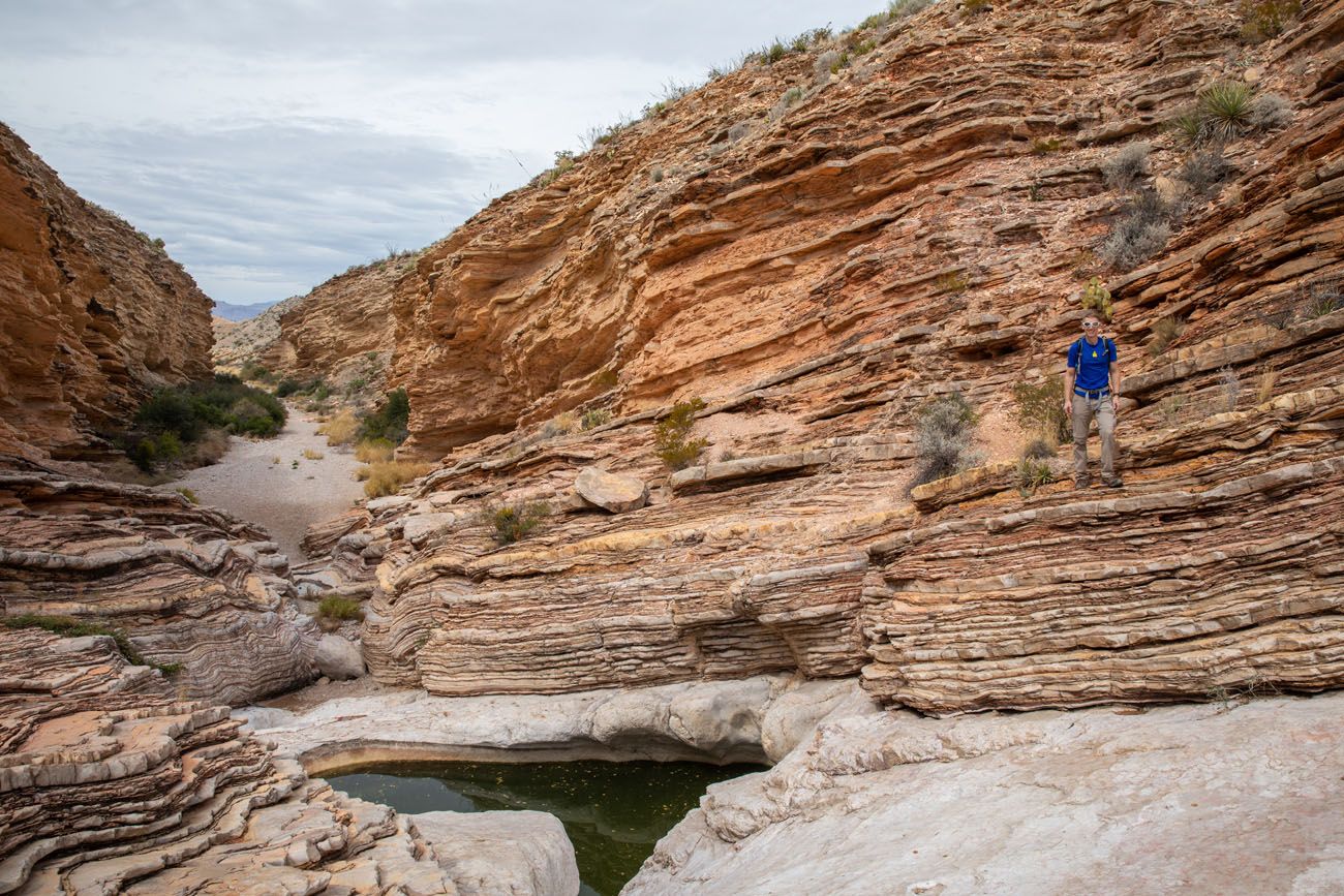
Beyond the Tinajas: Rock Scrambling
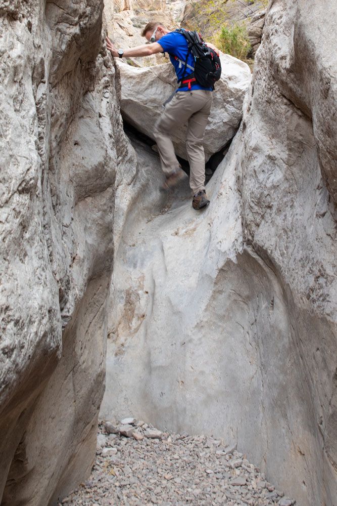
Past the tinajas, the trail transforms into a rock scrambling adventure through the deeper canyon. The first few obstacles are manageable for most adults and adventurous kids. Tim and I found this section to be the most exciting part of the hike.
The first few obstacles are relatively easy to navigate. Most adults and adventurous kids can handle the first few rock scrambles.
The trail beyond Ernst Tinaja
Layers of sedimentary rock
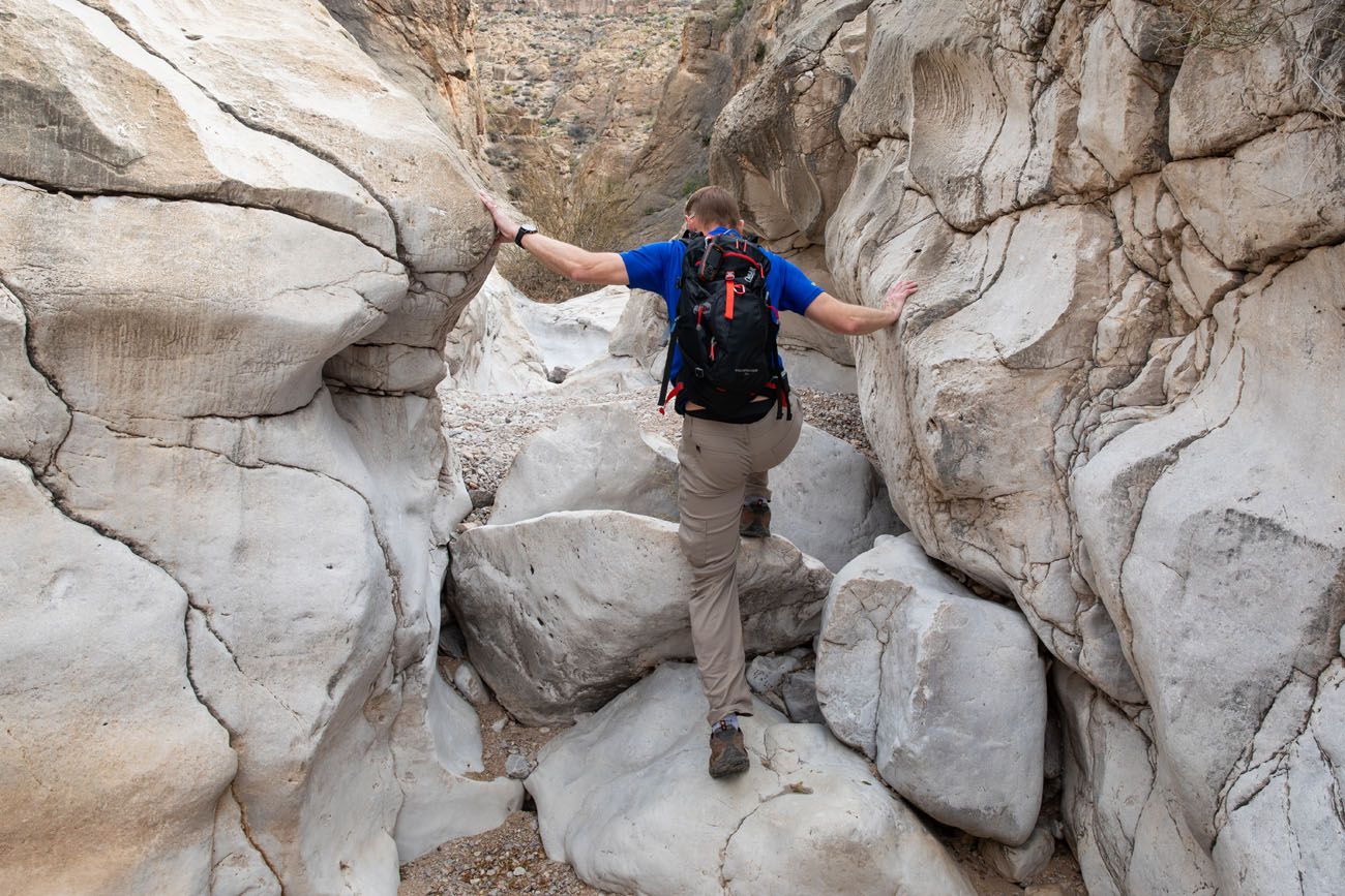
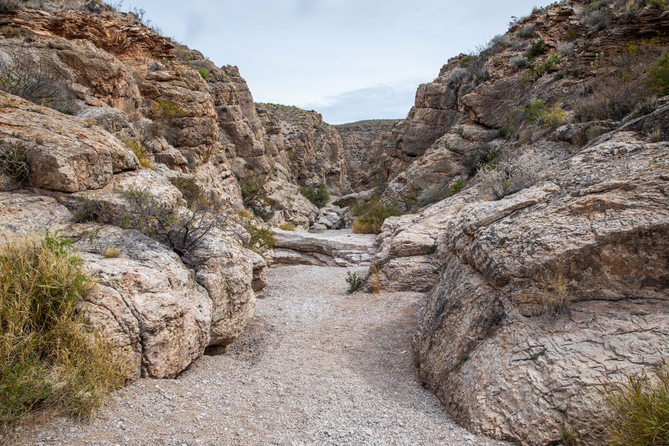
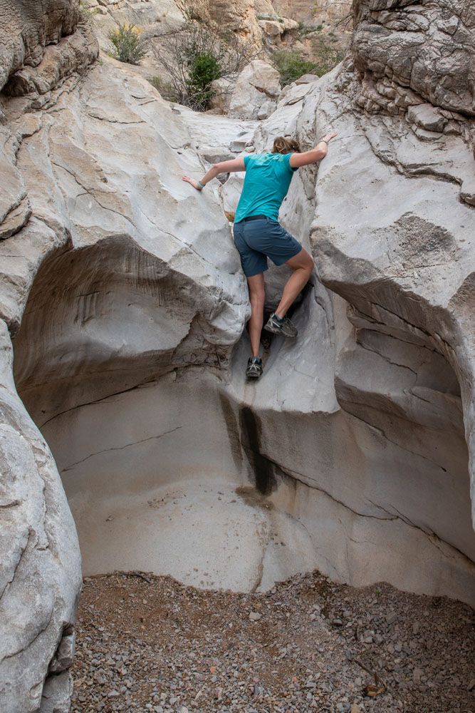
Near the far end of the canyon, the difficulty level spikes once you get to this rock arch. To continue on, you will have to climb up this chute and up and over the boulder. It is not too challenging to climb up this obstacle, but getting back down it later can actually be more difficult (keep reading for an alternative route past this chute). Keep in mind that the only way out of this canyon is the same way you got here.
There is one more big obstacle before you reach the end of the trail.
We made it to the point where the canyon bends to the west. At this point, we were able to climb up a huge slab of rock for this view of the canyon (the photo below), but to safely get down the other side, you either need a lot of experience bouldering or you need rock climbing gear.
This was our turn-around point, which is almost one mile from the parking lot.
To get back to the parking lot, retrace your steps through the canyon.
As we headed back to the car, the most difficult obstacle to get past was the chute with the boulder. We found it to be easier to hike up and over the giant slab of rock that is located next to the chute, then to climb down the chute. Tim and I both crab-walked down this rock with little difficulty. Near the edge of the rock there are a lot of depressions where you can put your left hand and hold on as you scoot down the rock.
Tips for Hiking the Ernst Tinaja Trail
Start early if you can. Midday is peak time on the trail, and if you want it to yourself, earlier is better. That said, we hiked in early March in the early afternoon and had the trail almost entirely to ourselves, so crowds are rarely a serious issue here, given the 4WD requirement.
Check road and trail conditions before you go. Stop at a visitor center and ask a ranger about Old Ore Road conditions, especially after rain. You can also check the NPS website for current closures.
Bring more water than you think you need. The NPS recommends at least one liter of water per person per hour in Big Bend’s dry desert climate. The tinaja holds water year-round, but it’s not safe to drink.
Protect yourself from the sun. The approach to the canyon is exposed and the desert heat is no joke, even in spring. Sunscreen, a hat, and lightweight long sleeves are all worth it.
Watch for rattlesnakes. Not just where you step. Pay attention to where you put your hands during the rock scrambling sections, too.
Consider camping at the trailhead. There’s a primitive campsite right next to the parking lot, bookable through the NPS website. Staying here lets you hit the trail at first light before anyone else arrives.
Summer visitors: Big Bend’s summer heat is extreme. If you’re visiting June through September, an early morning start isn’t just a preference, it’s a safety consideration.
Frequently Asked Questions About the Ernst Tinaja Trail
Is Ernst Tinaja Trail worth it?
Absolutely. It was one of our top three favorite experiences in all of Big Bend National Park, alongside Balanced Rock and the Emory Peak/South Rim combo. The combination of an adventurous drive, a stunning slot canyon, and optional rock scrambling makes it feel like a lot more than a 1.6-mile hike. The fact that most visitors skip it due to the road requirements means you’ll likely have it to yourself.
Do you need a 4WD to hike Ernst Tinaja?
Yes. The National Park Service signs Old Ore Road as Four Wheel Drive Required, and the road lives up to that warning. It’s rough, rocky, and can become impassable after rain. If you don’t have a high-clearance 4WD vehicle, look into off-road tour operators out of Terlingua who can get you there.
How long does the Ernst Tinaja hike take?
Plan for 1 to 1.5 hours for the hike itself. Add at least 30 to 45 minutes for the drive each way on Old Ore Road.
What is a tinaja?
Tinaja is a Spanish word meaning large earthen jar. In the American Southwest, it refers to natural pockets or depressions carved into bedrock that collect and hold rainwater. Ernst Tinaja is one of the largest in Big Bend and has served as a water source for wildlife and humans for generations.
Planning Your Big Bend Trip
If you’re still putting your visit together, our Big Bend National Park Travel Guide covers everything you need to know.
See how Ernst Tinaja fits into the bigger picture in our roundup of the best hikes in Big Bend, or get a full itinerary in our Big Bend itinerary. For more inspiration on what else to do in the park beyond hiking, visit our guide to things to do in Big Bend.
If you have any questions about hiking the Ernst Tinaja trail, or if you want to share your experience, you can do so in the comment section below.
More Information about Big Bend National Park & Texas
Read all of our articles about Texas in our Texas Travel Guide and the USA in our United States Travel Guide.
How to Plan a Trip to Big Bend National Park
Pinterest Facebook Flipboard Big Bend National Park Big Bend National Park sits in the far southwestern corner of Texas, deep in the Chihuahuan Desert, and getting here takes serious commitment. But that remoteness is exactly the point. Crowd levels stay low even at peak times, and the park rewards the effort with an extraordinary range […]
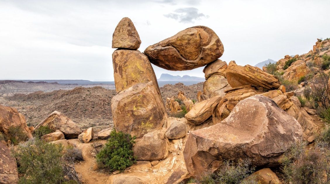
Balanced Rock Hike: A Short but Sweet Hike in Big Bend National Park
The Balanced Rock hike is one of our favorite short hikes in Big Bend National Park and one of the most rewarding for the effort required. The trail is only 2.2 miles round trip, with just a brief stretch of rock scrambling near the end, making it accessible for most hikers and genuinely fun for […]
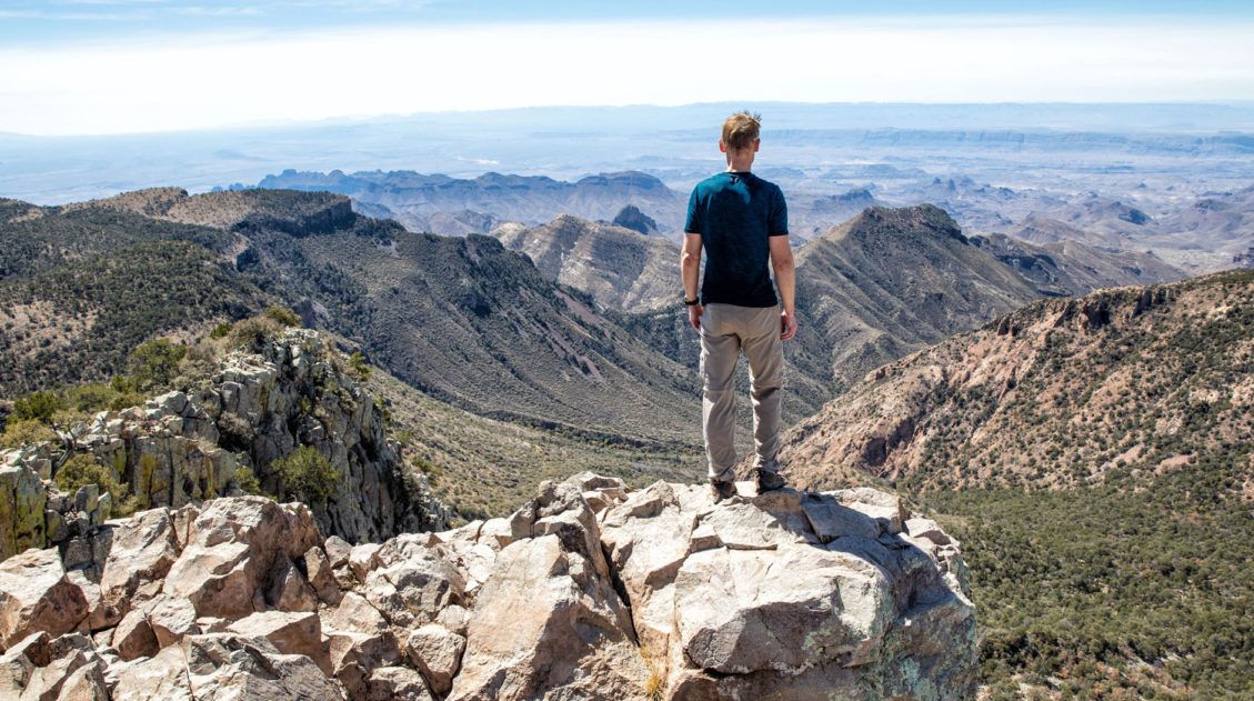
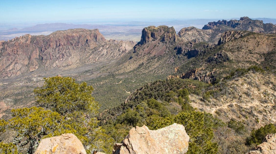
Emory Peak Trail, Big Bend: Everything You Need to Know
Emory Peak is the highest point in Big Bend National Park and the Chisos Mountains, and the hike to the summit is one of the best things you can do in the park. The 10.4-mile out-and-back gains nearly 2,500 feet of elevation and finishes with a short rock scramble to the top, where 360-degree views […]
20 Fun, Short Hikes in the US National Parks
One of the best ways to experience the national parks is from a hiking trail. Hike to amazing viewpoints, deep into the forests, through scenic canyons, and to hidden lakes and waterfalls. Along the way, you have a better chance of spotting wildlife and potentially leaving the crowds behind. Here are 20 fun, short hikes […]
South Rim Trail Loop + Emory Peak | Complete Hiking Guide
The South Rim Trail is the best full-day hike in Big Bend National Park. This 12.6-mile loop starts in the Chisos Basin and climbs steadily to the South Rim, where sweeping views over the Chihuahuan Desert make every switchback worth it. Add on the short but steep scramble up Emory Peak, the highest point in […]
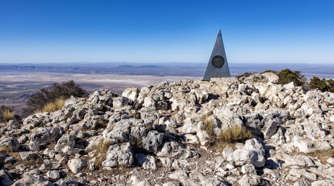
Guadalupe Peak Trail Guide: Hiking the Highest Point in Texas
Guadalupe Peak, at 8,751 feet, is the highest point in Texas, and for hikers who make the goal of standing on the highest point in every state they visit, this one is a must. Tim and I hiked to the summit during Spring Break, arriving at the Pine Springs Trailhead parking lot at 7:30 am […]
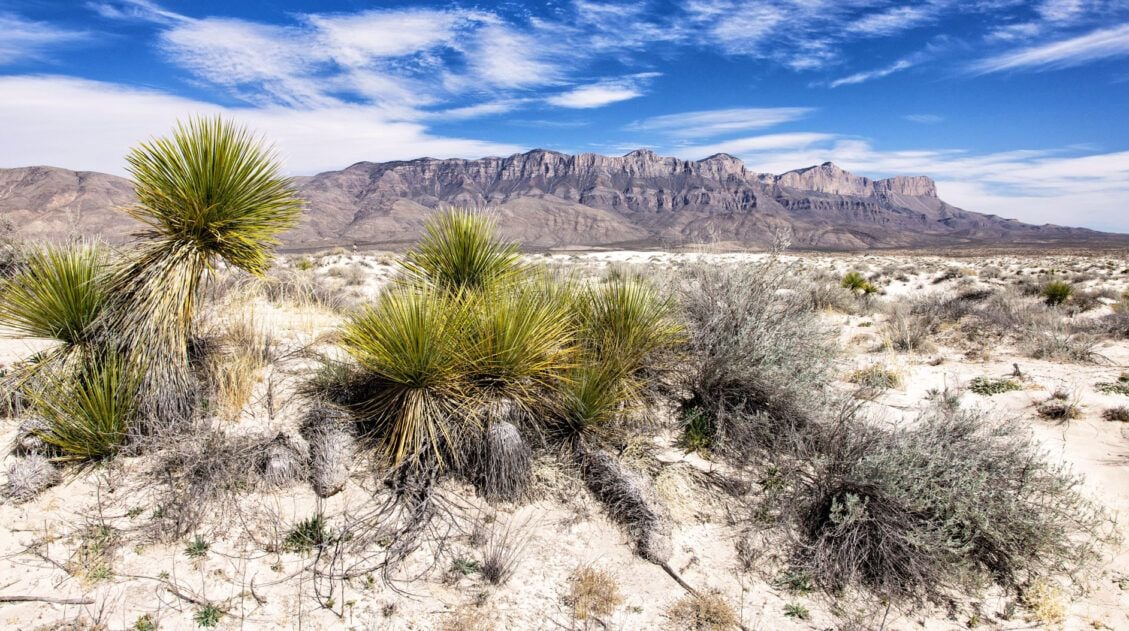
15 Best Things to Do in Guadalupe Mountains National Park
Tim and I have hiked a lot of national parks, and Guadalupe Mountains is one that genuinely surprised us. We expected a remote desert park with a few good trails. What we found instead was a place with incredible variety — a slot canyon, a fossilized coral reef trail with almost no one on it, […]
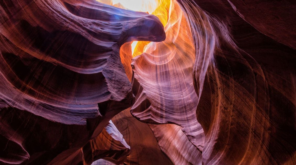
10 Amazing Slot Canyons to Explore in the American Southwest
The American Southwest is a playground for hikers, photographers, and adventurers. Fun to explore and extremely photogenic, slot canyons provide a unique hiking experience. We have assembled a short list of some of the best slot canyons in Utah, Arizona, and Nevada. This is not an all-inclusive list, because there are tons of slot canyons […]
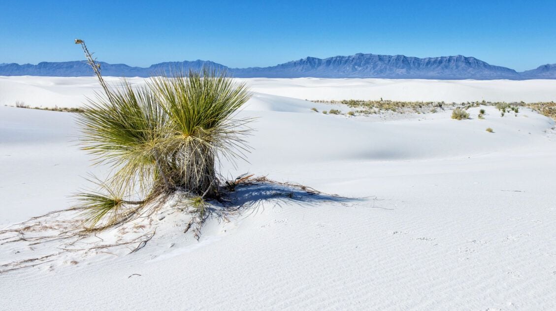
11 Amazing Things to Do in White Sands National Park
White Sands National Park is home to the largest gypsum dunefield in the world. These pure white dunes create a fun place to explore, for both kids and adults. Hike out into the dunes, learn about the wildlife that calls this park home, and go sledding on sand as white as the snow…these are just […]
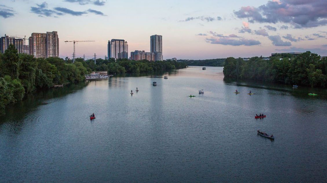
Best Things to Do in Austin, Texas (+ Where We Ate)
Austin surprised us. We went expecting live music and barbecue, and we got both, but what caught us off guard was how much fun the city itself is. There’s a loose, come-as-you-are energy here that makes it easy to just wander, eat, and stay out too late. Tim and I spent a long weekend here […]

Essential Hiking Gear: What Should You Bring on a Day Hike?
In this post, find out what we carry with us on day hikes. Whether you are a new hiker, shopping for a friend or family member, or just curious about what hiking gear you should bring on a day hike, we have a lot of great information to share with you. We have hiked thousands […]

Comments 3