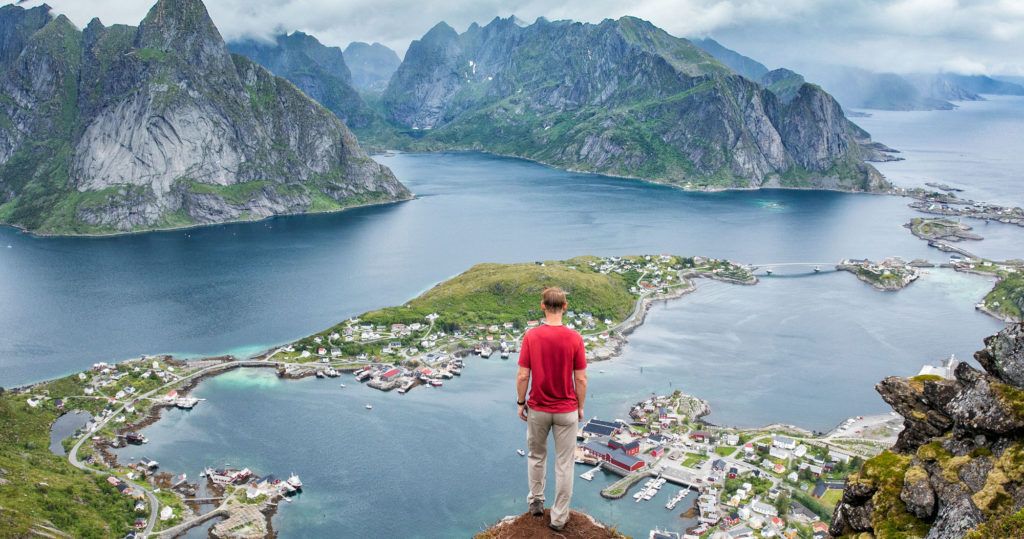
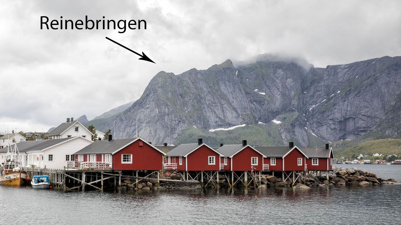
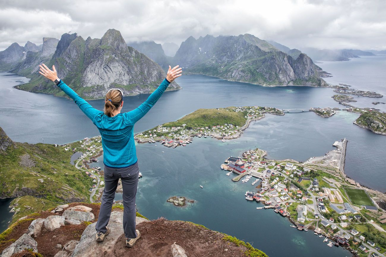
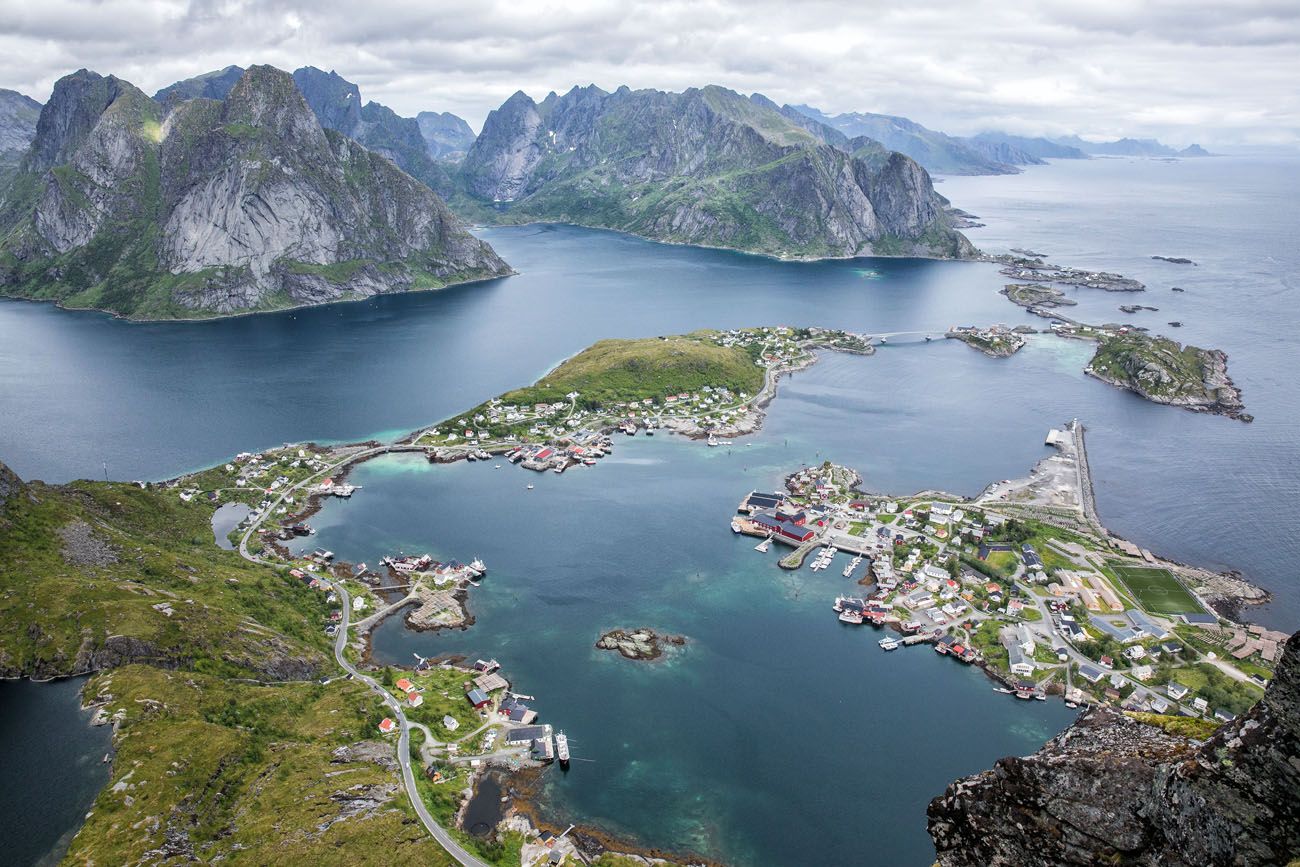
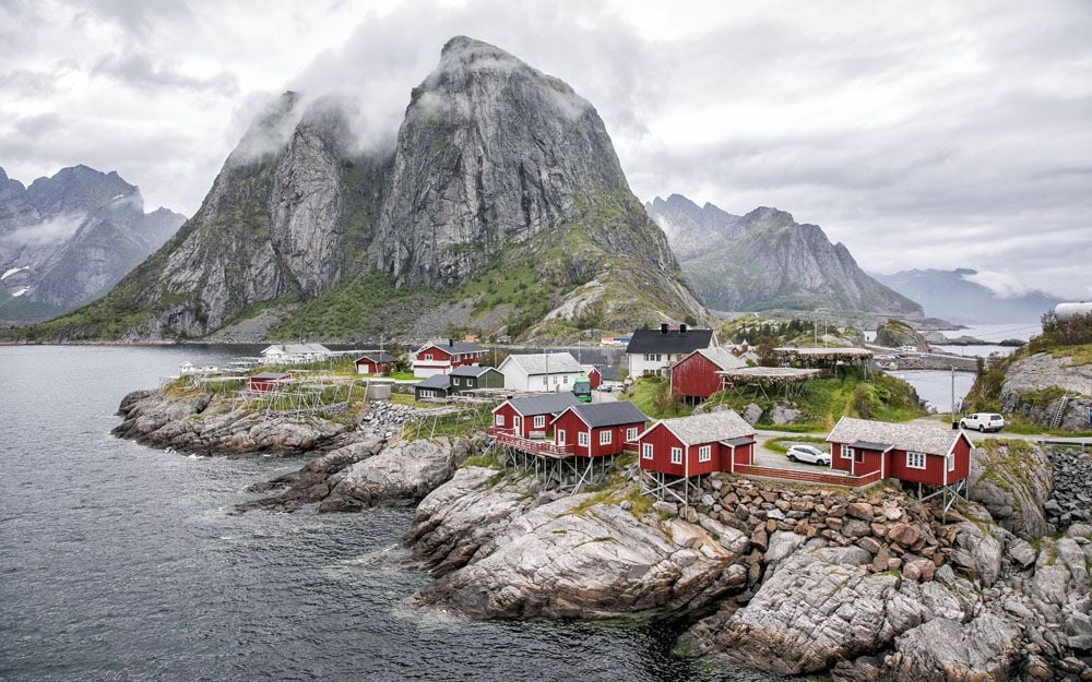
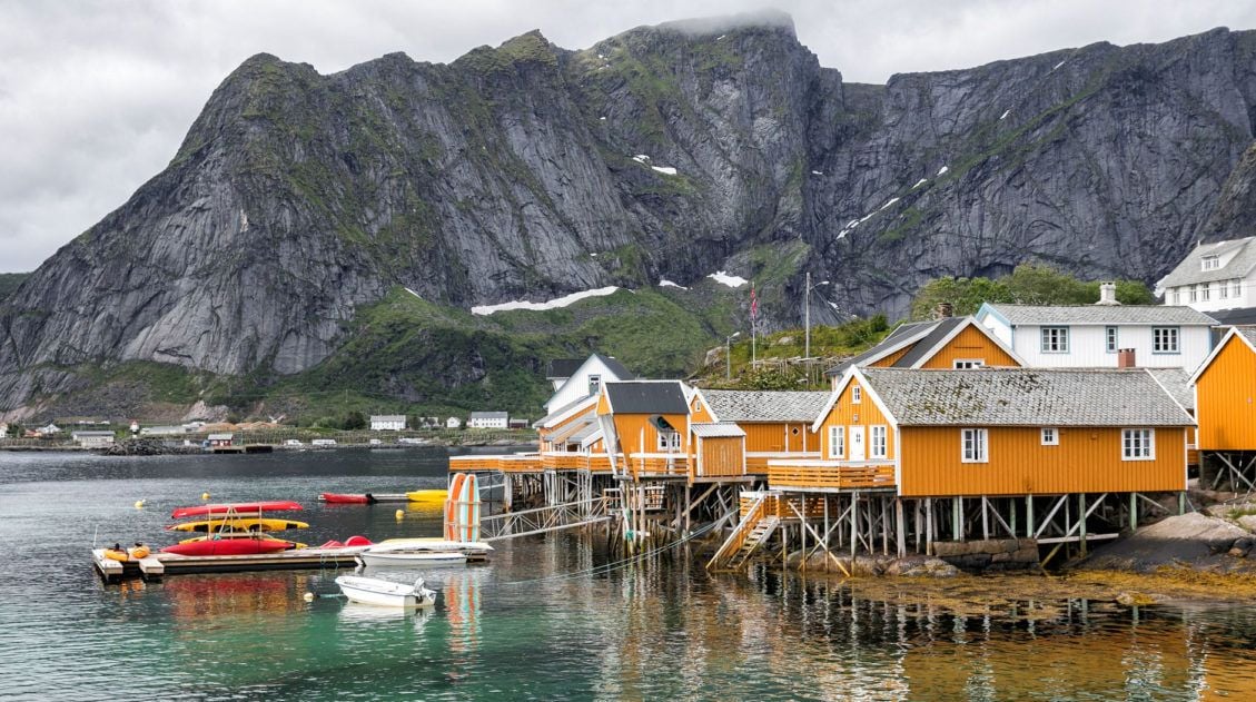
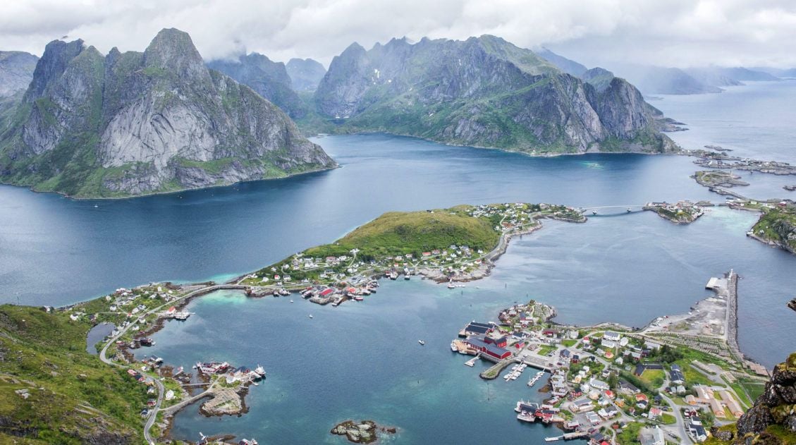
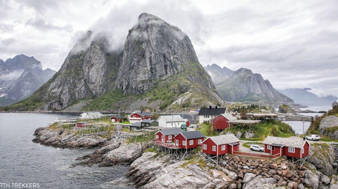
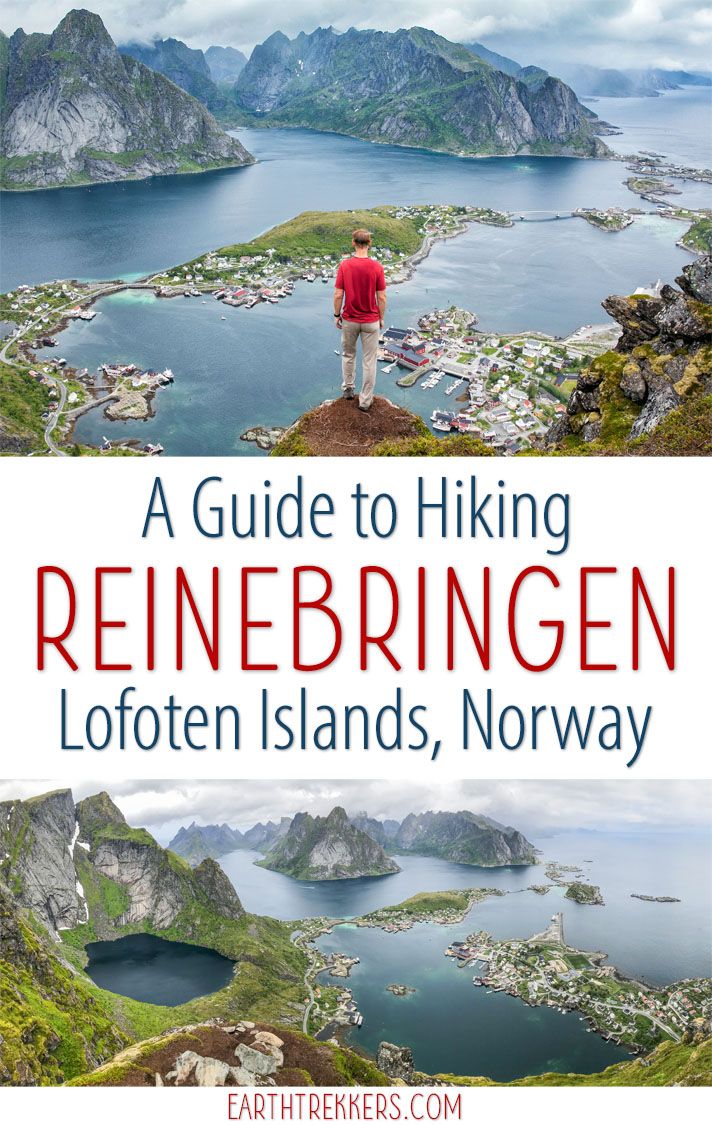
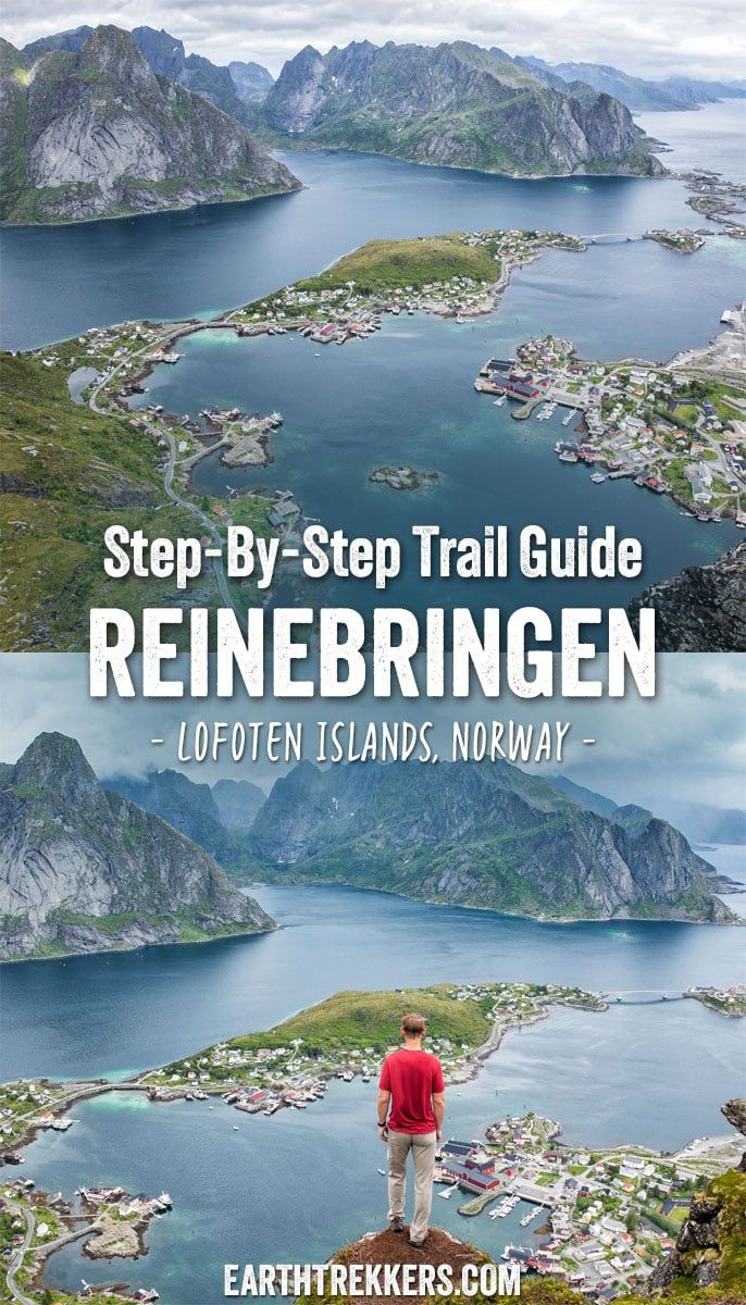
Reinebringen, with its dazzling view over the fishing villages of Reine, Sakrisøy, and Hamnøy, is the most popular hike in the Lofoten Islands, and one look at the panorama from the top tells you exactly why.
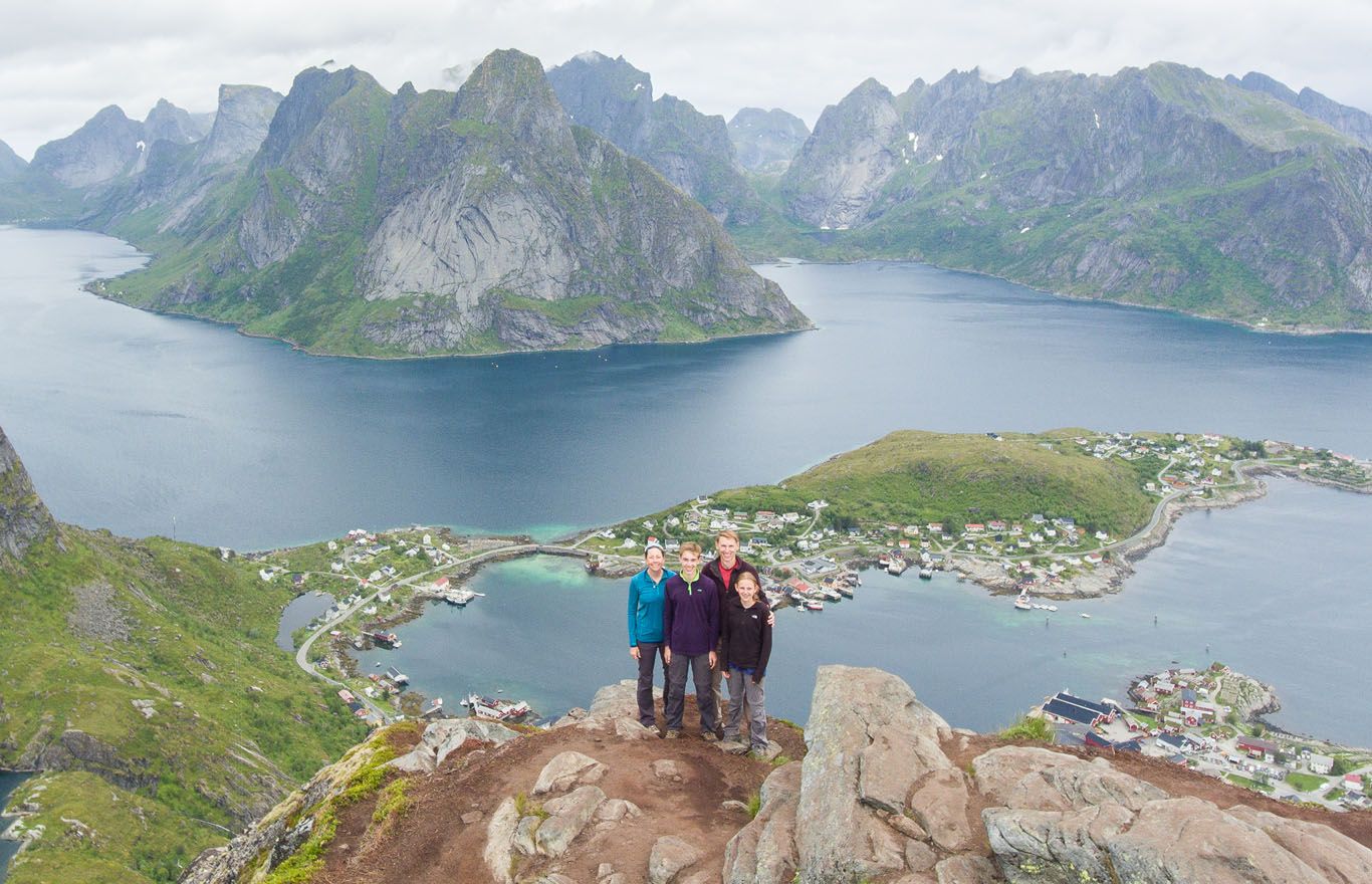
We hiked Reinebringen in 2018 with our kids, who were 13 and 15 at the time, before most of the stone steps had been added to the trail. Even then, both of them handled it well. The hike is steep and relentless, but if your kids have a solid base of hiking experience, it’s absolutely doable for older children and teenagers.
The distance looks almost laughably short on paper. What the numbers don’t tell you is that nearly 2,000 stone steps are crammed into that 1 km ascent. It’s less of a hike and more of a vertical stair machine.
This is a hike that is all about the destination. The view from the top is spectacular and completely worth the effort, but we won’t pretend the climb itself is enjoyable. It isn’t. It’s just a long, steep staircase, and you earn every meter of it.
Over the years, we’ve worked hard to keep this guide accurate and up to date, including with photos submitted by readers who’ve made the climb more recently, which you’ll see some of those in the trail section below. Finding a parking spot has also become one of the bigger challenges of this hike, so we’ve paid particular attention to keeping that section current.
Reinebringen Hiking Stats
Distance: 3 km (1.8 miles) round trip
Total Ascent: 510 meters (1677 feet)
Difficulty: Moderate to strenuous
Length of Time: 3 hours
These statistics include hiking to both viewpoints on Reinebringen, which accounts for the longer distance than you may read on other blogs. These stats do not include the walk to and from the parking lots.
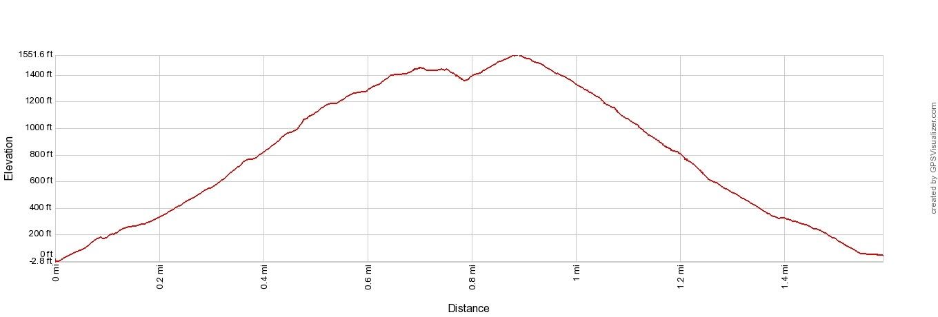
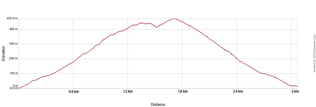
Reinebringen Elevation Profile
Should You Hike Reinebringen?
Before we get into how to hike Reinebringen, we have to ask the question, should you hike Reinebringen?
Instagram and Facebook have made this a very popular hike. The view from the top of Reinebringen truly is spectacular. When I first saw this view several years ago, the Lofoten Islands got bumped up to the top of my travel wish list. This is just another example of how social media is influencing where people choose to travel.
The high traffic on Reinebringen seriously damaged the trail. Trail erosion and rock falls became a common occurrence, sometimes injuring other hikers on the trail. In fact, on August 24, 2019, a lady was injured when she was struck on the head by a falling rock and she had to be airlifted off of the mountain.
Between 2016 and 2021, stone steps were added to the trail to help cut down on erosion and make the trail safer to hike.
Since the reopening of the trail in 2021, Reinebringen has received a record breaking number of hikers. Reinebringen’s popularity is also putting a strain on the local infrastructure. There is just not enough parking for the number of people who want to hike this trail.
So, if you absolutely must have this view, then hike Reinebringen. However, if you are looking for a hike that is more enjoyable and still gives you breathtaking views of the Lofoten Islands, take a look at our recommendations at the end of this post.
Please practice the seven principles of Leave No Trace: plan ahead, stay on the trail, pack out what you bring to the hiking trail, leave areas as you found them, minimize campfire impacts, be considerate of other hikers, and do not approach or feed wildlife.
Where to Park for the Reinebringen Hike
The town of Reine is receiving so many visitors that there is not enough parking for those who want to hike Reinebringen. It’s become such an issue , with cars parking along roads and in places they shouldn’t, that the Moskenes community reached out to us directly. The parking rules are also continuously evolving, so we do our best to keep this section current.
Important update as of May 2025: The entire area of Reine is now a designated no-parking zone. Once you drive into the zone, parking is prohibited on all roads, sidewalks, side streets, and open spaces, unless a specific sign permits it. Parking is only allowed in the designated areas listed below. This is actively enforced by municipal parking authorities.
If you want to hike Reinebringen, here are the approved parking areas:
Reine Parking (Steffenakken). This free parking area is located on E10, about 1.3 km south of the trailhead. Walk north along the side of the road to reach the trail start. There are roughly 20 spaces, but it fills quickly in summer, and because it’s also a popular spot for campervans and motorhomes, many spaces are taken even early in the morning. Important update as of June 2025: Norwegian road authorities have decided to install a time limit at Steffenakken (likely 4 hours). This means it will no longer be usable as a free overnight camping spot.
Reine Cultural Center (Kulturhuset). Located in central Reine. You’ll also find tourist information, a souvenir shop, and a public toilet here (open during store hours). Parking rates: 50 NOK per hour, 150 NOK for 3–5 hours, or 300 NOK for 24 hours.
Reine Harbor (Municipality Parking). Located at the outer harbor (Ytre Havn) in Reine, about 1.8 km from the trailhead. This is the largest parking area and has space even for larger motorhomes. Pay via the EasyPark app or parking automat, approximately 44 NOK per hour. There are paid public toilets here (10 NOK, credit card), an EV charging station, and a grey water disposal station for motorhomes.
Reine Harbor (Fellesdrift Reine Ytre Havn). Located a bit further into the harbor area, this is a separate private lot. 250 NOK per day. Payment by Vipps (Norwegian app), Sumup (international), credit card (call ahead), or exact cash. No facilities at this lot.
The hike itself is short, but keep in mind that the walk from any of these parking areas to the trailhead adds significant distance. In most cases, you’ll walk further between your car and the trailhead than between the trailhead and the summit.
DO NOT PARK:
- Reinehalsen. This is a turnout on E10, meant to be a quick photo spot. It is now closed for parking for the Reinebringen hike.
- Along E10. If you park along the highway, you will get a 900 NOK parking ticket.
- Along any road, sidewalk, or unmarked space within Reine. The entire village is now a no-parking zone. Enforcement is active.
How to Hike Reinebringen
Step-By-Step Trail Guide
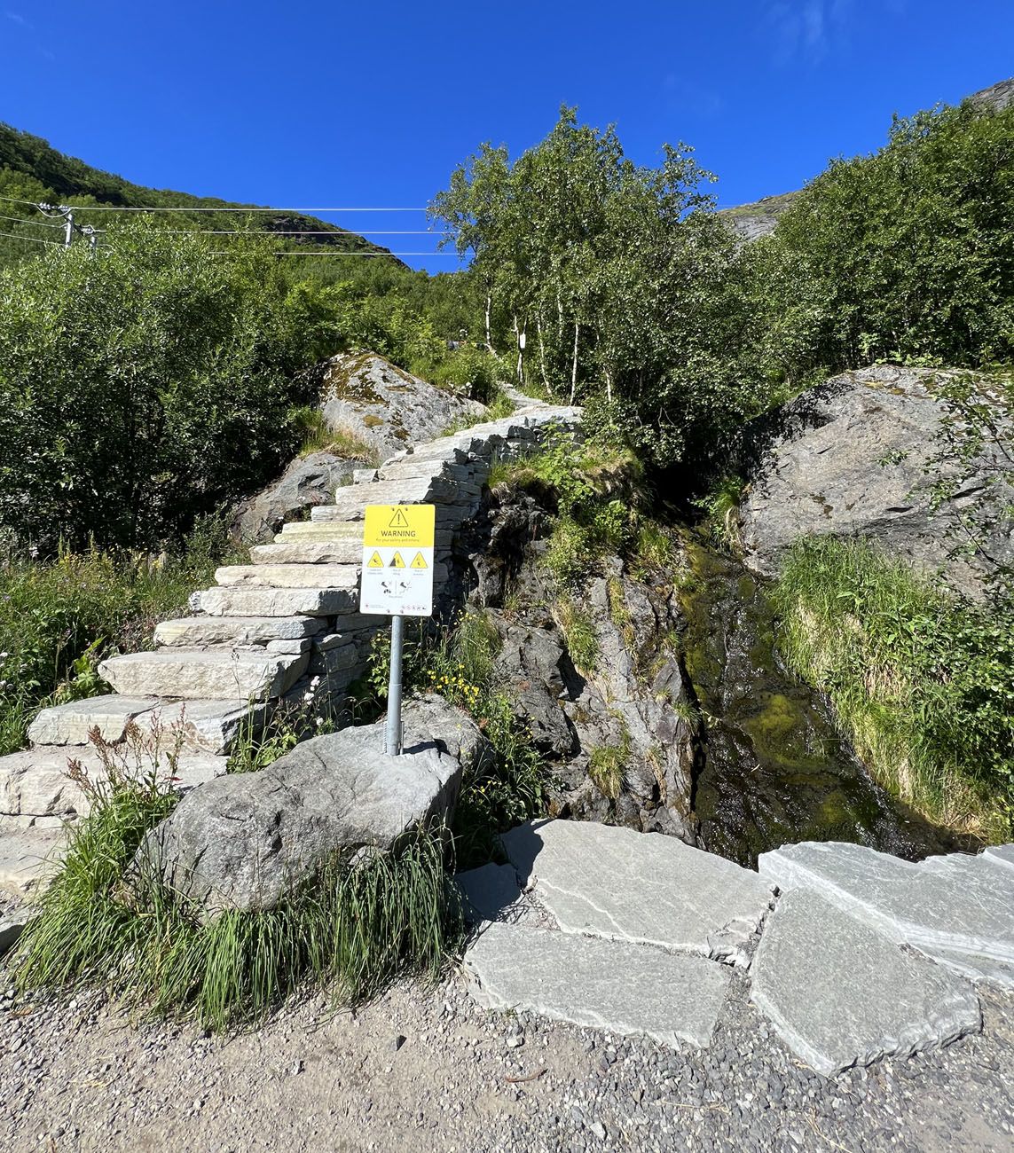
The trailhead is located on the road that runs along the outside of the Ramsvik tunnel. Look for the stairs and the sign in the photo below.
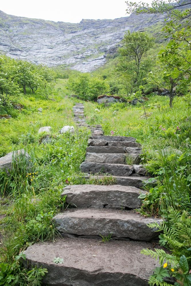
It’s only about 1 km to hike up to the viewpoint. It’s basically one long stair climb to almost the very top of Reinebringen.
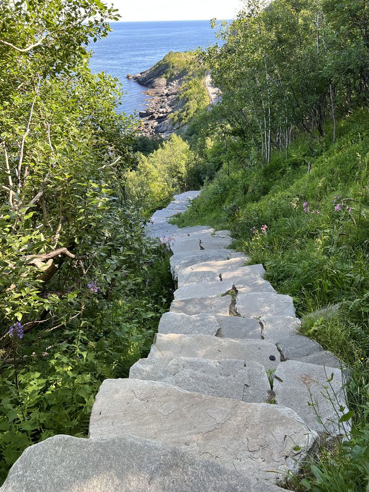
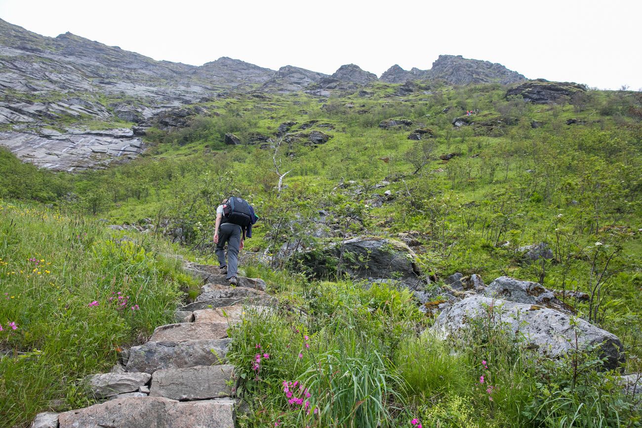
As you get higher, the steps continue. Here are the steps just before you get to the Reinebringen summit.
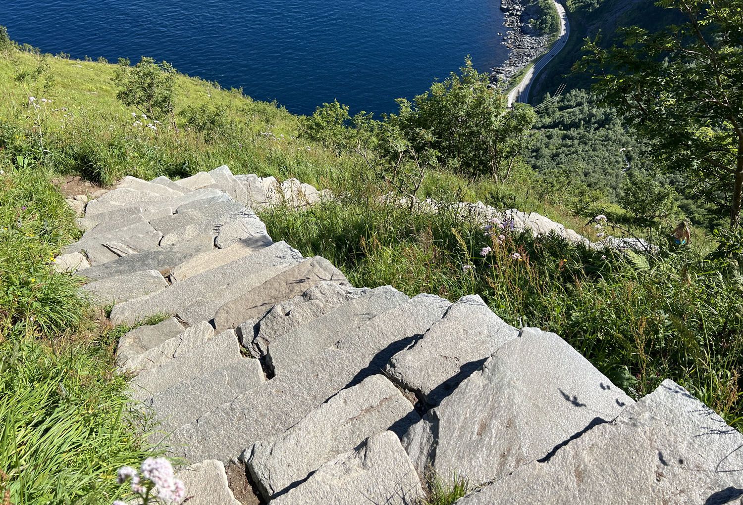
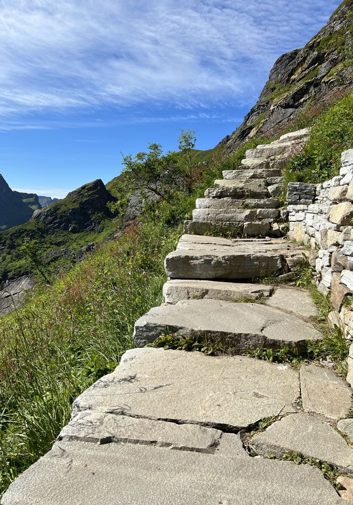
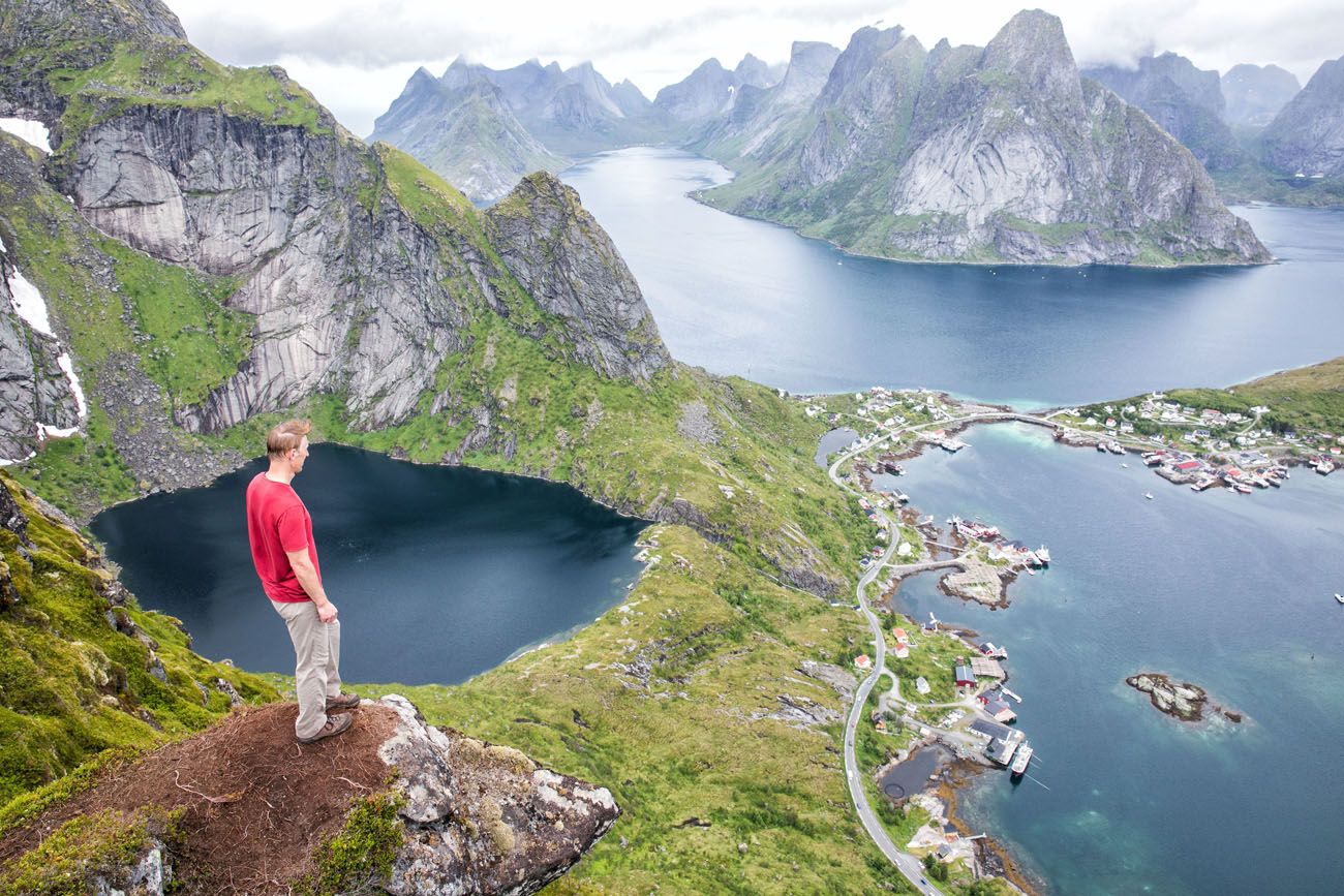
The steps lead right to the summit. There are several viewpoints in this area, some from the steps and some from a sandy trail that leads off of the steps. Our photos below were taken before the steps were added, so the area will look a bit different when you are here.
Sprawling out in front of you are the tiny islands of Reine, Hamnøy, and Sakrisøy, with a backdrop of tall, rocky mountains.
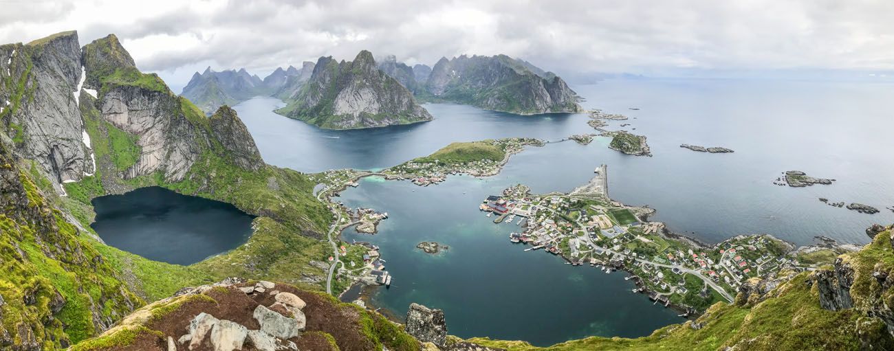
Panorama that Tim took with his iPhone
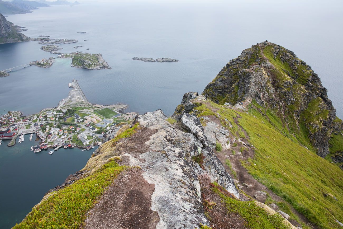
The view from the higher viewpoint.
Hike back down the same way and take your time.
Helpful Tips for Hiking Reinebringen
Use the bathroom in Reine before you start. There are no public toilets at the trailhead or anywhere along the trail. Before you leave the village, stop at one of the paid toilets at the harbor, the Circle K gas station, or the Kulturhuset (open during store hours). Don’t wait until you’re at the trailhead.
Bring enough water. There is no water source on the trail. The climb is steep and sustained, so plan accordingly, especially in warm weather.
Avoid hiking Reinebringen in rainy or wet conditions. The stone steps become slippery and significantly more dangerous when wet. You’ll also have little to look at once you get to the top. On our visit, we spent a full rainy day in Reine and the summit was buried in clouds from morning until night.
The trail is busiest in the middle of the day. Go early in the morning or in the evening to avoid the crowds. In summer, the midnight sun gives you the flexibility to hike late into the evening in beautiful light.
Stick to the trail. If the trail is muddy, resist the temptation to walk around the mud on either side. Leaving the trail creates new erosion tracks, which damages the mountain and contributes to rockslides.
Camping on Reinebringen is no longer permitted. Since 2021, camping on the summit and ridge has been prohibited. You may see older photos online of tents pitched at the top. That is no longer allowed, and signs at the trailhead make this clear.
Dogs are welcome, but keep them on a leash on the ridge. The exposed ridgeline is narrow, and with the volume of hikers, an off-leash dog creates real safety risks.
Park only in designated areas. A 900 NOK fine isn’t worth it, and parking illegally puts real pressure on a small community that’s already stretched thin managing the crowds.
Is It Safe to Hike Reinebringen in Winter?
The short answer is no, not unless you are an experienced mountaineer with proper equipment.
Reinebringen looks accessible in winter. The mountain isn’t especially tall, and the lower section of the trail can appear easy to walk on when there’s fresh snow. But the conditions change drastically as you gain elevation. The upper section of the stairs becomes icy and treacherous, and the ridgeline at the top is lined with cornices that shift with the wind direction. The rock slabs higher on the mountain regularly shed ice and avalanche debris across the trail. A wrong step near the summit ridge means a fall of hundreds of meters.
Multiple rescues are needed on Reinebringen every winter, many involving hikers who made it up but couldn’t safely get back down in deteriorating conditions. There have also been fatal accidents in recent years, including a Norwegian woman in her 20s in December 2021 and an American tourist in June 2022. Local rescue teams are the ones responding to these calls and their frustration with preventable incidents is understandable.
If the conditions warrant crampons and ice axes, and you don’t own either of those things, this is not your hike. If you have to ask whether it’s safe to hike Reinebringen in winter, that’s already a good sign that you should skip it and come back in summer. The views will still be there.
For winter hiking in the Lofoten Islands, look for trails that are better suited to the season and don’t carry the same avalanche and ice risk.
Our Thoughts on the Hike
Honestly, there is really nothing fun about this hike. It’s just an uphill stairclimb to the top, but what you do get is an amazing view. It is worth hiking Reinebringen for the view, but we did several other hikes in the Lofoten Islands (and northern Norway) that we liked a lot more.
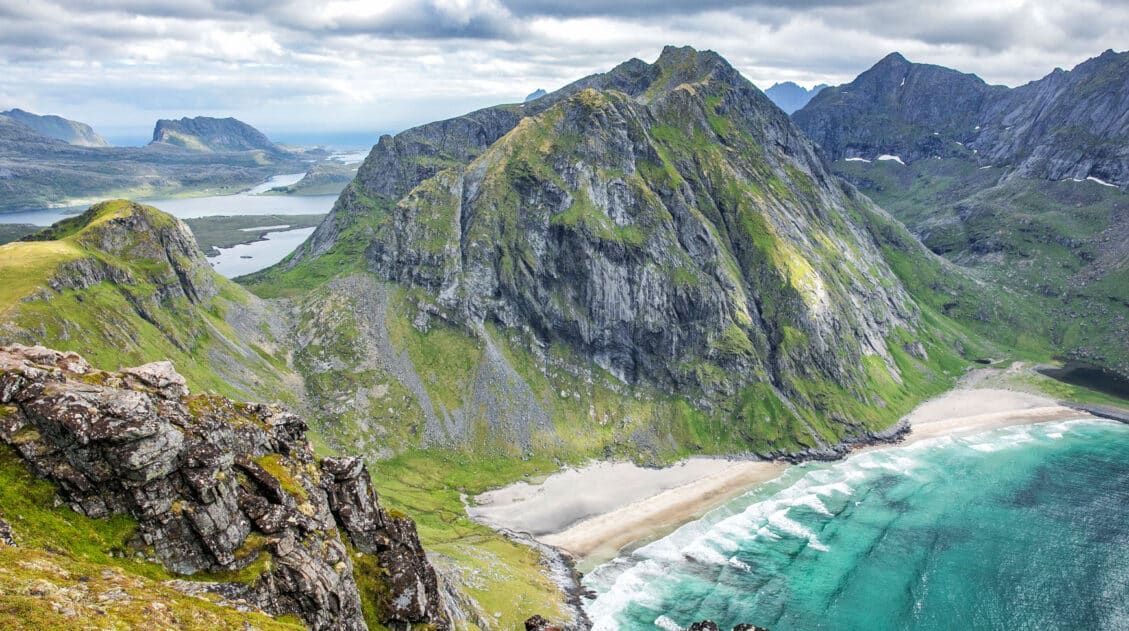
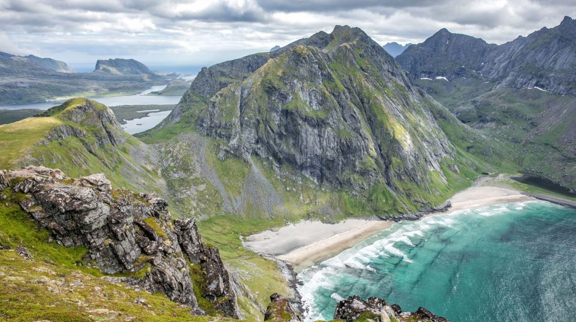
Ryten is a longer hike but what you get is a very cool view over Kvalvika Beach and a stunning mountain landscape. It was unexpectedly awesome.
Svolvaer Fløya and Festvågtind are similar to Reinebringen, where you hike to a viewpoint and look out across a series of islands.
Our final day in the Lofoten Islands was a rainy one, so we missed out on hiking Munken, which is a shame, because it looks and sounds amazing. It’s just around the corner from Reinebringen, so if you are looking for great hike near Reine, this is a good one to add to your list.
Where We Stayed
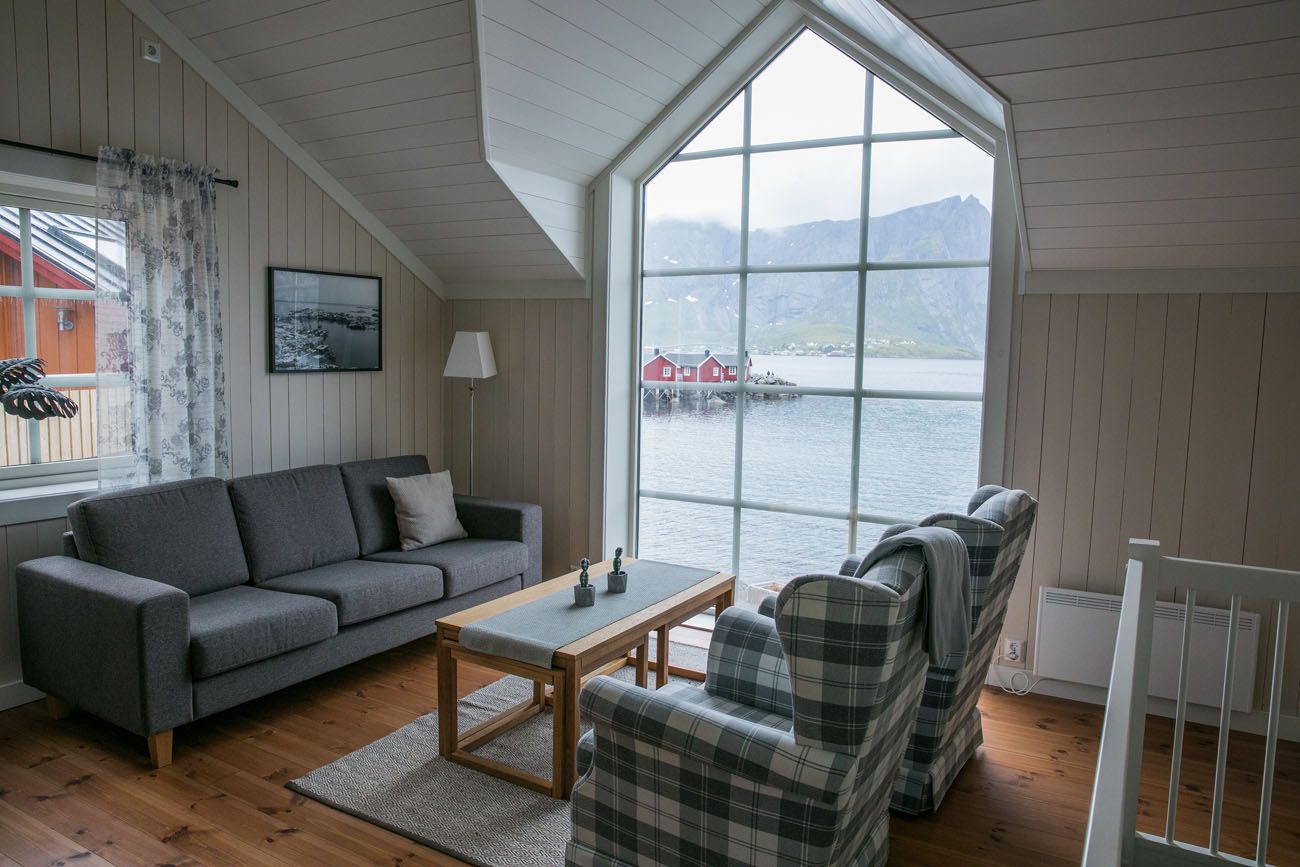
We stayed in Hamnøy at Reinefjorden Sjohus. This place is wonderful. We stayed in a 2 bedroom apartment, which is really a two-level cabin with a kitchen and a living area. The view from the living room was AMAZING! We could look across the water to Sakrisøy and Reine and see Reinebringen in the background. My only complaint is that they do not have black out curtains, so with the midnight sun, I did find it difficult to sleep. That’s easy to fix by bringing along a sleeping mask. But without a doubt, we would stay here again.
FAQ: Hiking Reinebringen
How hard is the Reinebringen hike?
Reinebringen is a strenuous hike, not because the terrain is technical, but because of the sheer sustained effort involved. Nearly 2,000 stone steps climb roughly 450 meters in about 1 km. There is no flat section, no gradual warm-up; it goes up from the first step to the last. Most reasonably fit hikers can complete it, but don’t underestimate it. When we hiked it with our kids at ages 13 and 15, before the steps were fully in place, both of them managed it fine, but they were experienced hikers with plenty of mountain miles behind them.
How long does it take to hike Reinebringen?
Plan for about 3 hours total, which includes hiking to both viewpoints at the summit. The ascent alone takes most hikers 1 to 1.5 hours depending on fitness level. Factor in additional time for the walk between your parking spot and the trailhead, which can add 15 to 30 minutes each way depending on where you park.
Where do you park for Reinebringen?
Parking is one of the biggest challenges of this hike. As of May 2025, the entire village of Reine is a no-parking zone, and parking is only allowed in designated areas. Your main options are the free Steffenakken lot (about 20 spaces, fills early, and a time limit is being introduced), paid parking at Reine Kulturhuset (50 NOK/hour or 150 NOK for 3–5 hours), or the municipal harbor lot at Ytre Havn (approximately 44 NOK/hour). Do not park along E10 because the fine is 900 NOK. See the full parking section above for current details.
Is Reinebringen suitable for kids?
Older kids and teenagers with hiking experience can handle Reinebringen. We did it with our kids at ages 13 and 15 and they did great. That said, the steps are tall and the climb is long, so younger or less experienced children may find it very difficult. The exposed ridge at the top also requires caution. If your kids aren’t yet confident on steep, sustained climbs, there are other excellent hikes in the Lofoten Islands that would be a better fit.
What is the best time of day to hike Reinebringen?
Early morning or late evening. The trail is busiest in the middle of the day, and the parking situation is most competitive then too. In summer, the midnight sun gives you the option of hiking well into the evening in beautiful golden light with far fewer people on the trail.
Plan Your Trip to the Lofoten Islands
If Reinebringen has you wanting more of the Lofoten Islands, our Lofoten Islands itinerary covers how to structure your time across the archipelago, and our guide to the best things to do in the Lofoten Islands covers the highlights beyond hiking.
For hikers specifically, our roundup of the best hikes in Norway puts Reinebringen in context alongside some of the country’s other iconic trails, many of which we found more rewarding than this one.
If you’re building out a bigger trip through the north, our 10-day Northern Norway itinerary takes you from Tromsø through Senja and the Vesterålen Islands down to the Lofoten Islands, and our Norway Travel Guide is the best place to start planning the full picture.
If you have any questions about hiking Reinebringen, leave them in the comments section below.
More Places to Visit in Norway
The Ultimate Norway Travel Guide: How to Plan a Trip to Norway
Pinterest Facebook Flipboard Norway Travel Guide Breathtaking, adventurous, rugged, inspiring, photogenic, extraordinary…these are all words that can be used to describe Norway. It is hard to look at photos of Norway without saying “Wow!” over and over again. Norway is the land of fjords, quaint coastal towns, the Northern Lights, Vikings, trolls, dramatic photo spots, […]
Where to Stay in the Lofoten Islands: Rorbuer, Hotels & More
If you’re trying to figure out where to stay in the Lofoten Islands, the first thing you need to know is this: the islands have their own iconic accommodation type, and it’s unlike anything else in the world. Rorbuer, traditional Norwegian fishermen’s cabins, typically perched on stilts over the water, are the reason so many […]
Norway Bucket List: 20 Epic Things to Do in Norway
Norway is the land of fjords, quaint fishing villages, Vikings, trolls, the northern lights, the midnight sun, scenic drives, and some of the best hikes in the world. If you are planning a visit to this amazing country, here are 20 of the best things to do in Norway. So far, we have visited Norway […]
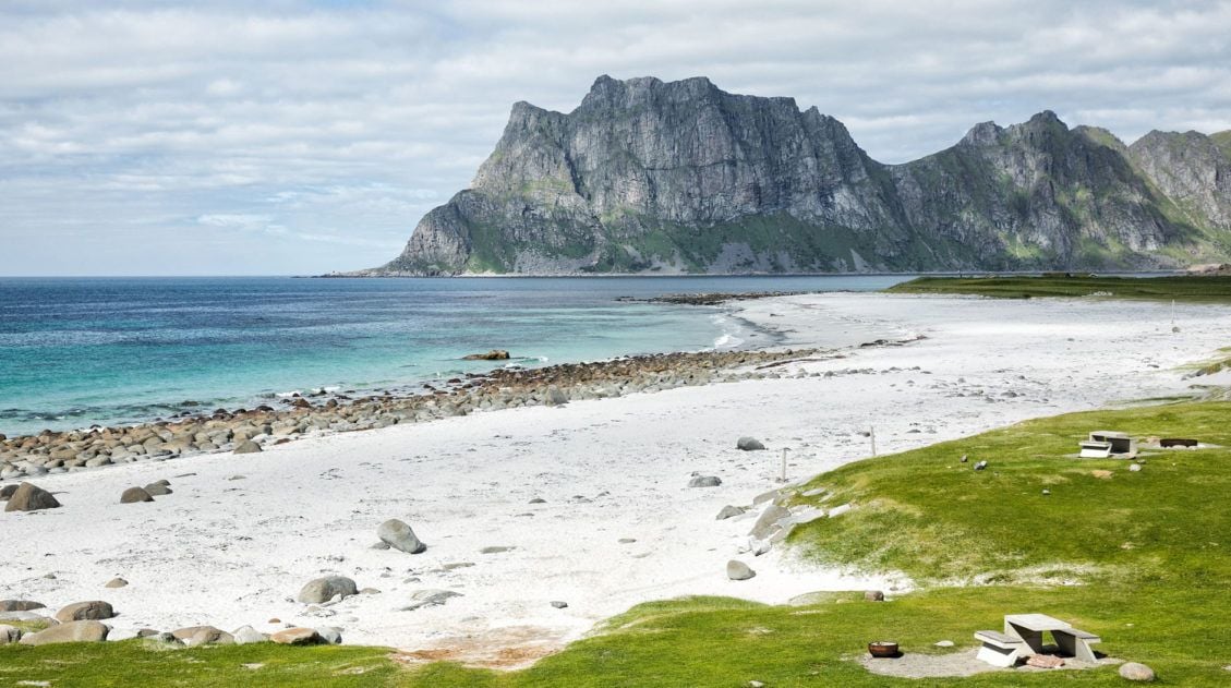
Hiking Ryten: Kvalvika Beach Views & Lofoten’s Mini-Trolltunga
The hike to Ryten has all of the ingredients of a perfect Lofoten Islands hike: sweeping vistas across the mountains and fjords, a fun but slightly strenuous hike to a mountain peak, and a breathtaking view of a white, sandy beach. The icing on the cake is a “mini Trolltunga,” an outcropping of rock where […]
How to Hike Svolvaer Fløya & Djevelporten in the Lofoten Islands
There are two ways to get a spectacular view over the town of Svolvaer…hike to the top of Svolvaer Fløya or climb Svolvaergeita. We did both on the same afternoon, making this one of our most memorable days in the Lofoten Islands. Svolvaer is one of the largest towns in the Lofoten Islands. Fløya is […]
10-Day Northern Norway Itinerary: Tromsø to the Lofoten Islands
We’ve done a lot of road trips in Europe, through the Italian Dolomites, across the Scottish Highlands, and down into the fjord region of southern Norway. This Northern Norway itinerary is one of our all-time favorites. We drove this route in early July, starting in Tromsø and working our way south through Senja and the […]
14 Epic Hikes in Norway to Put on Your Bucket List
If you ask us, putting one foot in front of another on a hiking trail is the best way to experience Norway. Hike along the jagged mountain peaks of the Lofoten Islands, the picture perfect fjords in southern Norway, and through some of the world’s most awe-inspiring landscapes. Stand on iconic Trolltunga and Pulpit Rock […]
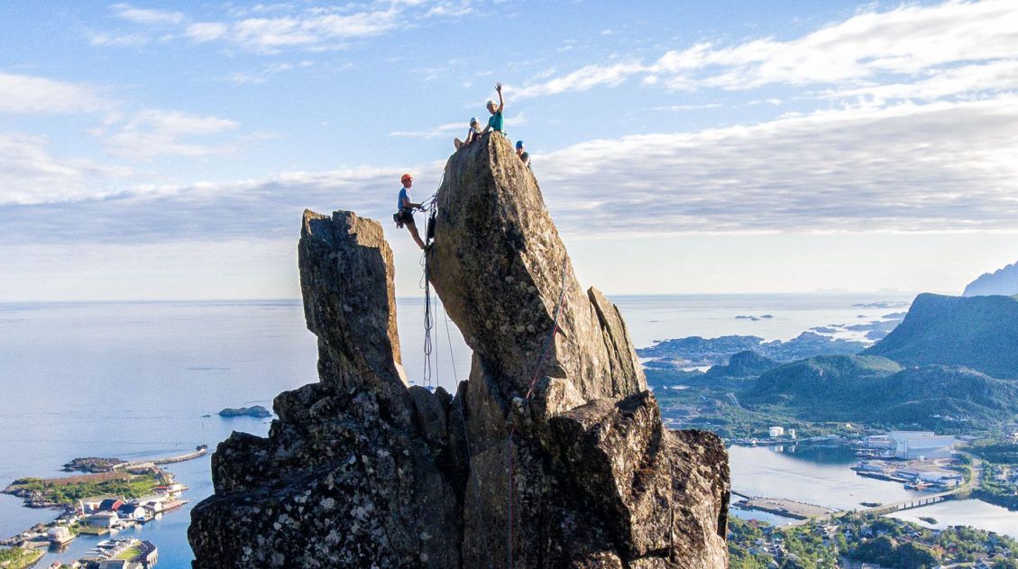
Complete Guide to Climbing Svolvaergeita in the Lofoten Islands
Svolvaergeita, also called “The Goat,” is a pinnacle of rock that is a popular rock climbing spot in the Lofoten Islands. It is named The Goat because of the two horns of rock that sit atop the rock. Those with a sense of adventure can climb to the top of Svolvaergeita and those who are […]
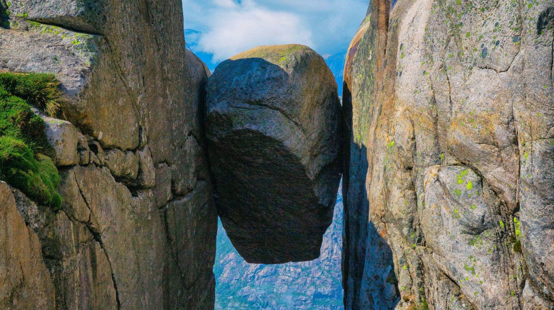
Hiking Kjeragbolten: Is It as Scary as It Looks?
The Kjeragbolten hike is one of the most spectacular hikes in the world. We have hiked on some amazing trails around the globe, in countries like Australia, South Africa, China, and Nepal. The four of us agree that the Kjeragbolten hike is still our favorite in the world. To read about our 20 favorite hikes in the […]
Lofoten Islands Itinerary: 4 to 5 Days in Norway’s Most Spectacular Islands
There are places that stop you in your tracks the moment you arrive. The Lofoten Islands are one of them. We pulled over constantly, not because we planned to, but because we couldn’t drive past another mountain plunging straight into the fjord, another stretch of white sand beach backed by jagged cliffs, or another cluster […]
10 Days in Norway: The Fjords and the Lofoten Islands
10 days in Norway…the options are endless for the best way to explore this gorgeous country. We have been to Norway twice and after each trip we wrote a 10-day Norway itinerary. Our 10 Day Norway Itinerary only covers the fjord region, from Stavanger to Ålesund, with epic hikes, fjord cruises, kayaking, and more. Our […]
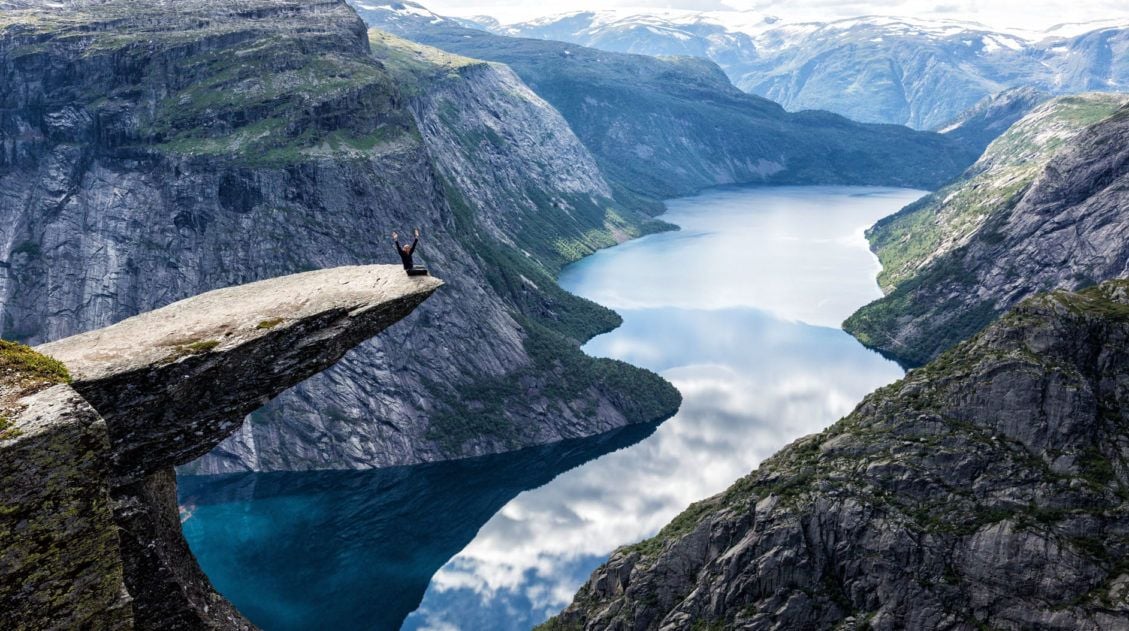
Exactly How to Hike Trolltunga: Cost, Parking, Stats & Hiking with Kids
Trolltunga is one of Norway’s most popular hikes for good reason. It is an incredibly scenic hike, ending at the Troll’s tongue, a thin sliver of rock perfect for creative photographs. This is definitely a hike to add to your bucket list. We did the Trolltunga hike on our first visit to Norway. On that trip, […]
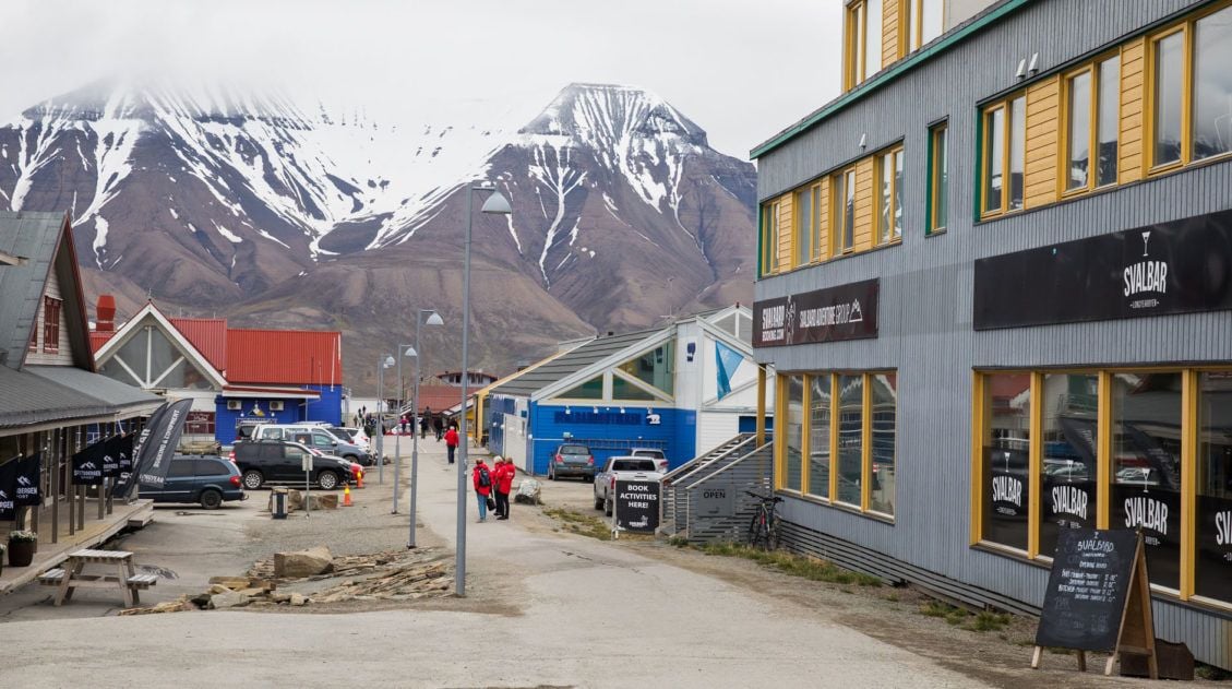
Top Ten Things to Do in Longyearbyen, Svalbard
Longyearbyen is the world’s northernmost city. This is a town where the streets have no names, reindeer wander through town, and there are more snowmobiles than people. If you have plans to visit Svalbard, Longyearbyen is where you will eat, sleep, and fill your time in between arctic adventures. The best thing to do in […]

Comments 10