There are two ways to get a spectacular view over the town of Svolvaer…hike to the top of Svolvaer Fløya or climb Svolvaergeita. We did both on the same afternoon, making this one of our most memorable days in the Lofoten Islands.
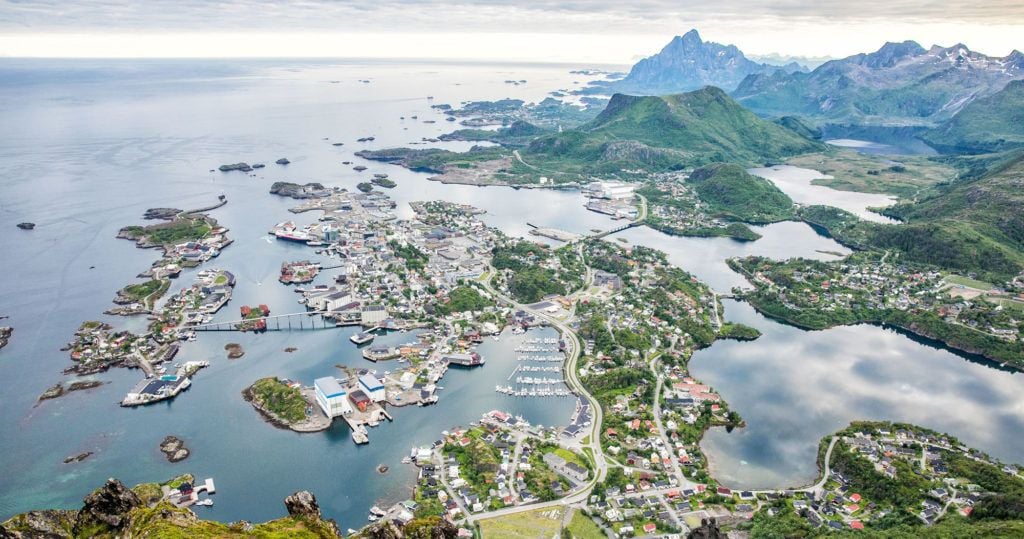
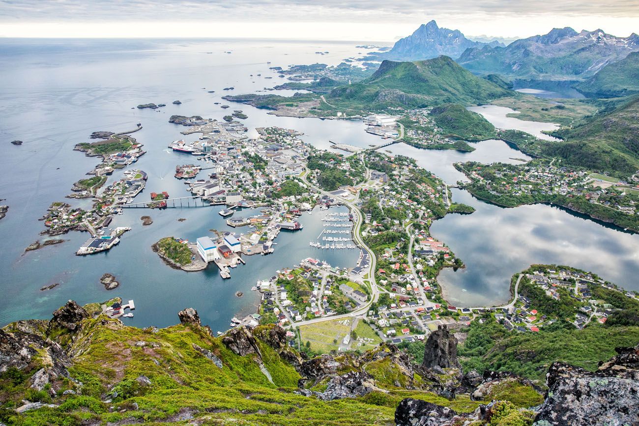
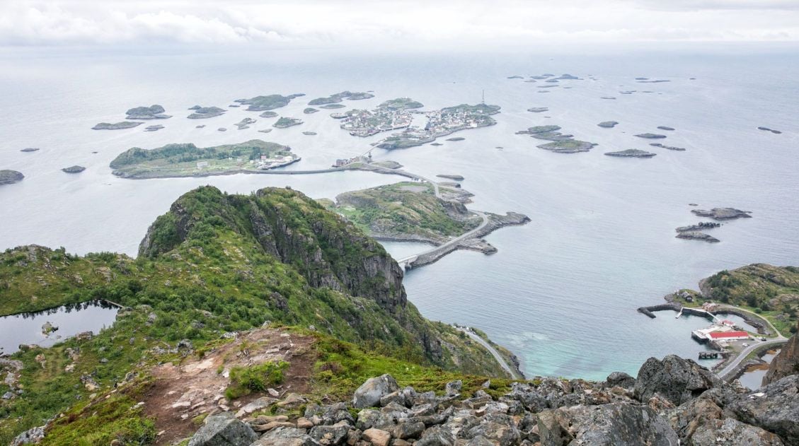
Svolvaer is one of the largest towns in the Lofoten Islands. Fløya is the mountain that forms the backdrop of the town. From the top of Fløya, you can look over not only the town of Svolvaer, but over nearby mountain peaks and islands off in the distance.
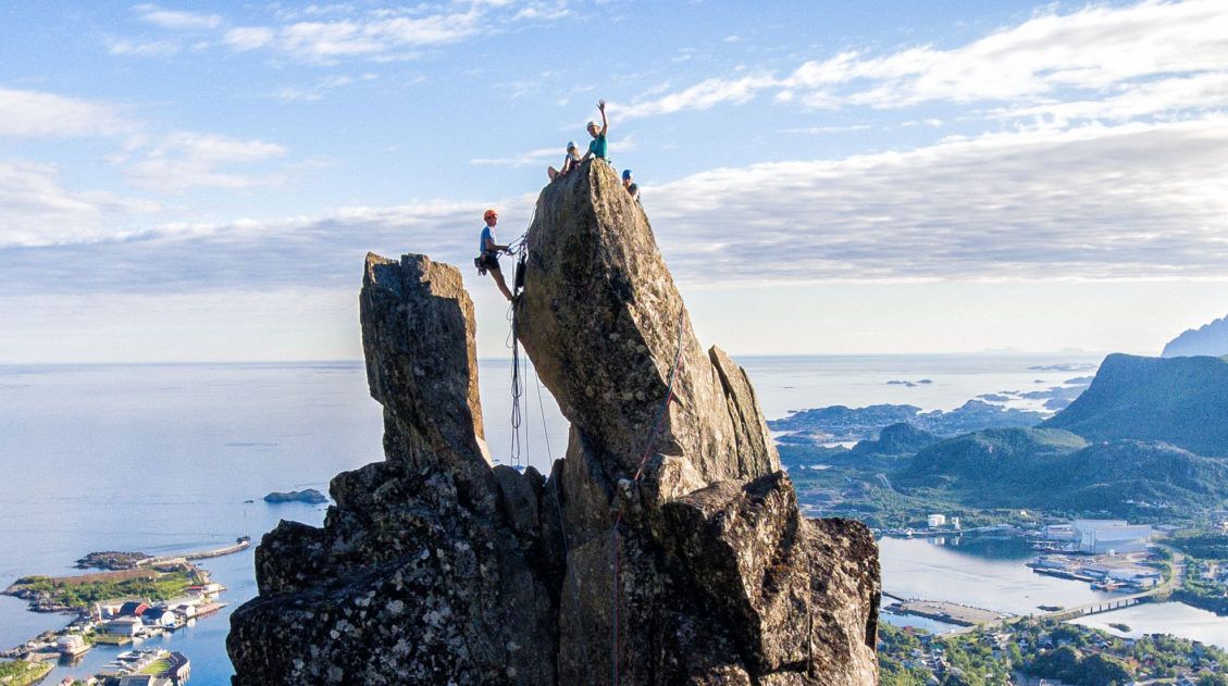
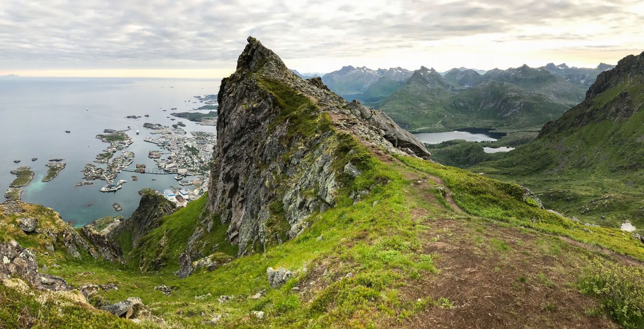
Svolvaergeita, also called The Goat, is a pinnacle of rock that is very popular with rock climbers. It’s located on the slope of Fløya and it’s from the top of this rock that you get one of the most unique views over Svolvaer.
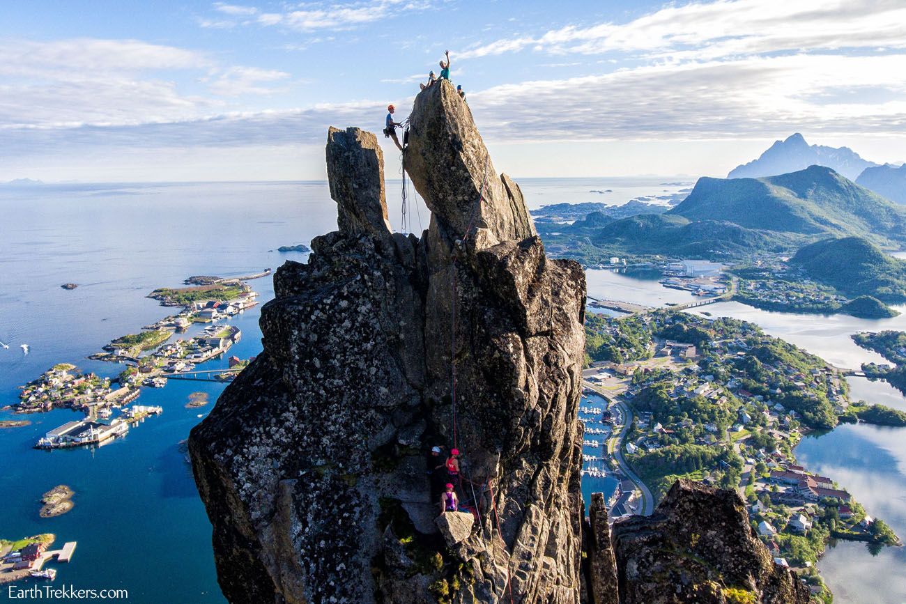
Svolvaergeita
Complete Guide to Climbing Svolvaergeita in the Lofoten Islands
Everything you need to know to climb Svolvaergeita, one of the most adventurous things to do in the Lofoten Islands.We combined the climb up Svolvaergeita with the hike up Fløya. This made for a very long day, but it was worth it. However, we were not able to get to all of the viewpoints on the hike, but I will provide a link to give you all of the details so you can have the full “Fløya experience.”
We did not even start the hike to Svolvaer Fløya and Svolvaergeita until 4 pm, which was our climbing time with Northern Alpine Guides. Good thing it never gets dark in Svolvaer during the summer months!! Our hike up to Fløya started at the very late time of 7:30 pm. For us, it was a race up the mountain and then back down, so we could get into Svolvaer by 10:30 pm to get some dinner in our bellies.
How to Hike Svolvaer Fløya
Svolvaer Fløya Hiking Stats
Distance: 4.5 km (2.8 miles) out-and-back
Difficulty: Moderate
Total Ascent: 580 meters (1900 feet)
Length of Time: 3 to 4 hours
Please practice the seven principles of Leave No Trace: plan ahead, stay on the trail, pack out what you bring to the hiking trail, leave areas as you found them, minimize campfire impacts, be considerate of other hikers, and do not approach or feed wildlife.
Svolvaer Fløya Step-By-Step Trail Guide
Getting to the Trailhead
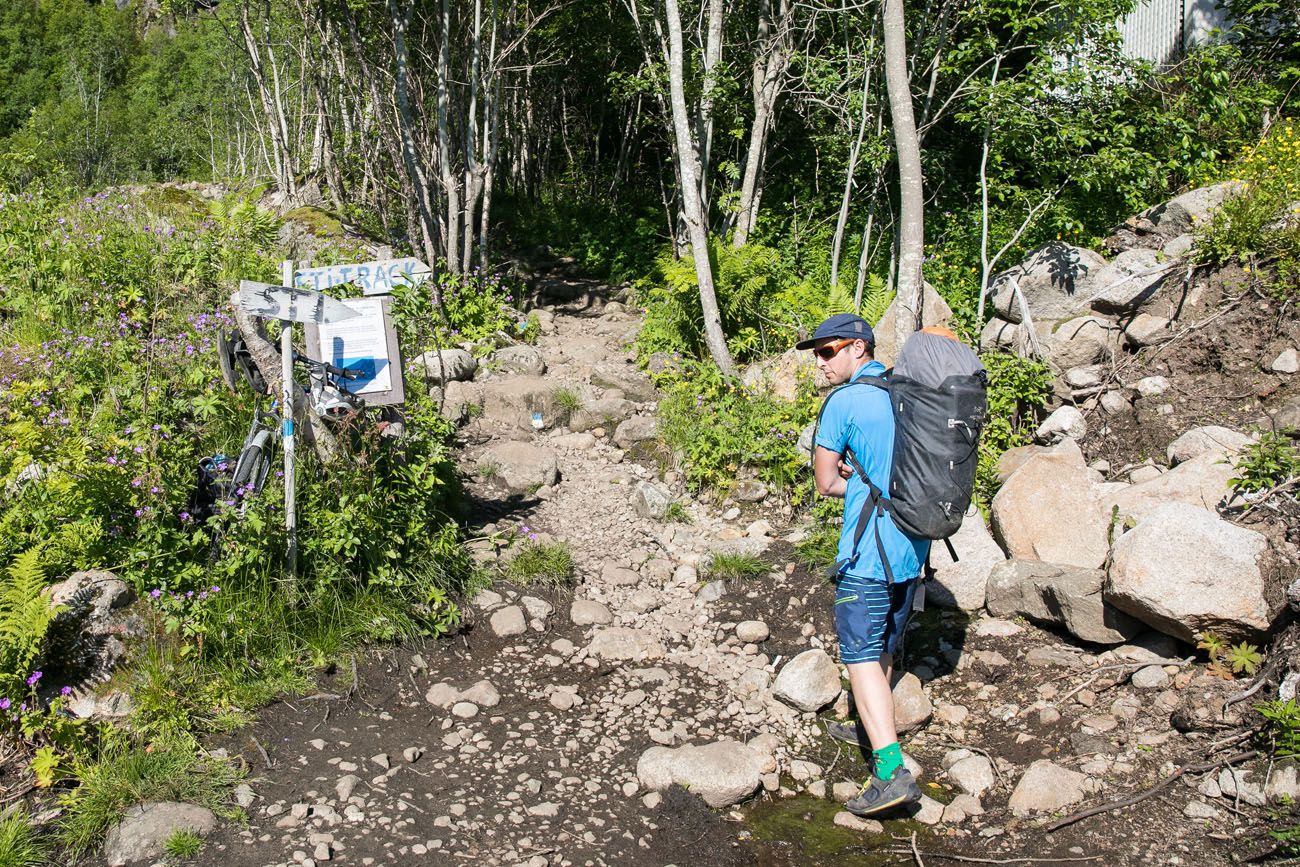
The trailhead is located next to the Svolvaer cemetery. Nice way to start a hike, don’t you think?
We found parking on Blåtindveien, just a few steps from the trailhead. There is a small parking lot next to the trailhead, here on Google Maps.
Hiking Fløya
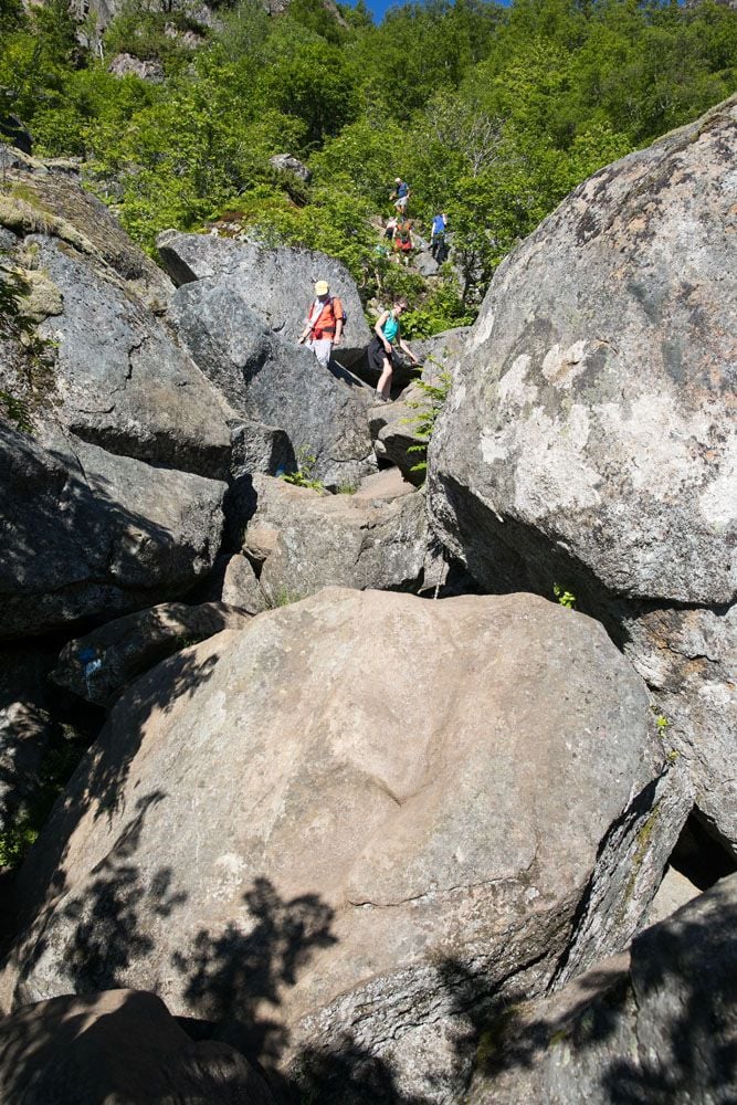
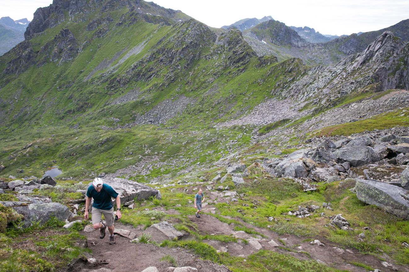
The first part of the trail is the most difficult, in my opinion. This section is steep and you need to be prepared to use your hands to rock scramble up the steeper sections. There is one 10 meter section of smooth granite rock where you can pull yourself up with a chain.
Since we did this hike (in 2018), two sets of sherpa stairs have been added to this section of the hike. You will still have to do some rock scrambling but the stairs have made the trail easier and faster to do this hike.
The trail is marked with white and blue blazes.
At the top of this first section, the trail forks. To the right is the trail that takes you to the base of Svolvaergeita. Go to the left to continue hiking up Fløya.
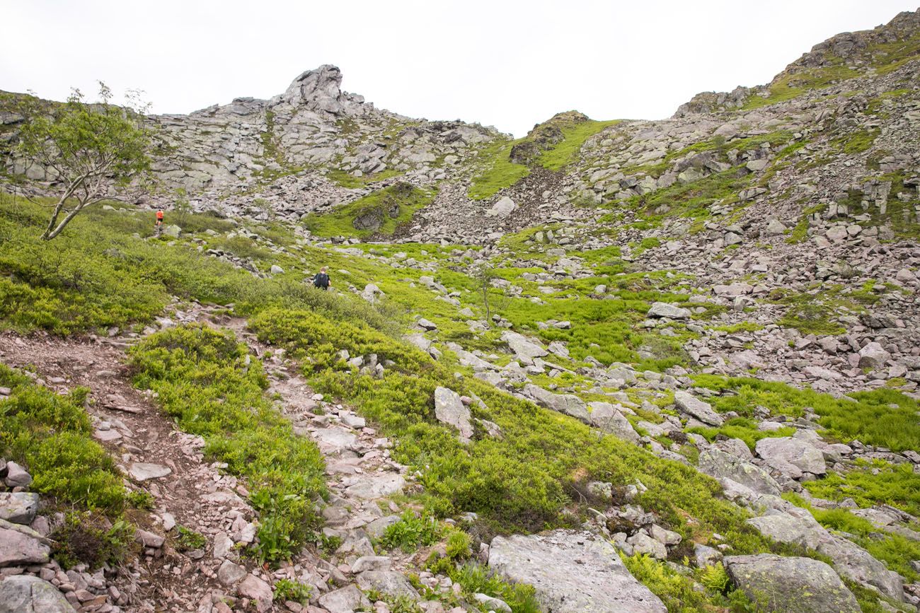
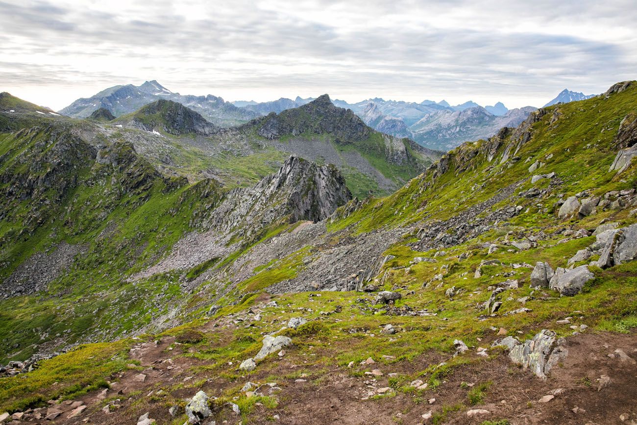
At this point, the trail gets less steep. It doesn’t exactly level out, but at least for a little bit it’s a shallow, easy incline. However, it can be very muddy here, especially if it has recently rained. At this point, it looks as if you are hiking away from the peak, and you are, just for a little bit.
Looking up at the final climb to the summit.
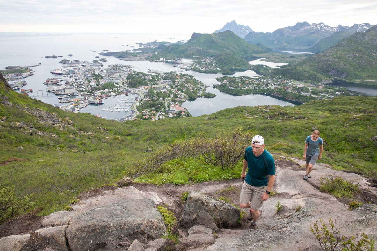
Finally, the trail turns toward the peak and you have one final climb to the summit.
Once on the ridge, you can turn left to officially summit Fløya. We did not do this since it was now 9 pm and we were exhausted from also climbing Svolvaergeita.
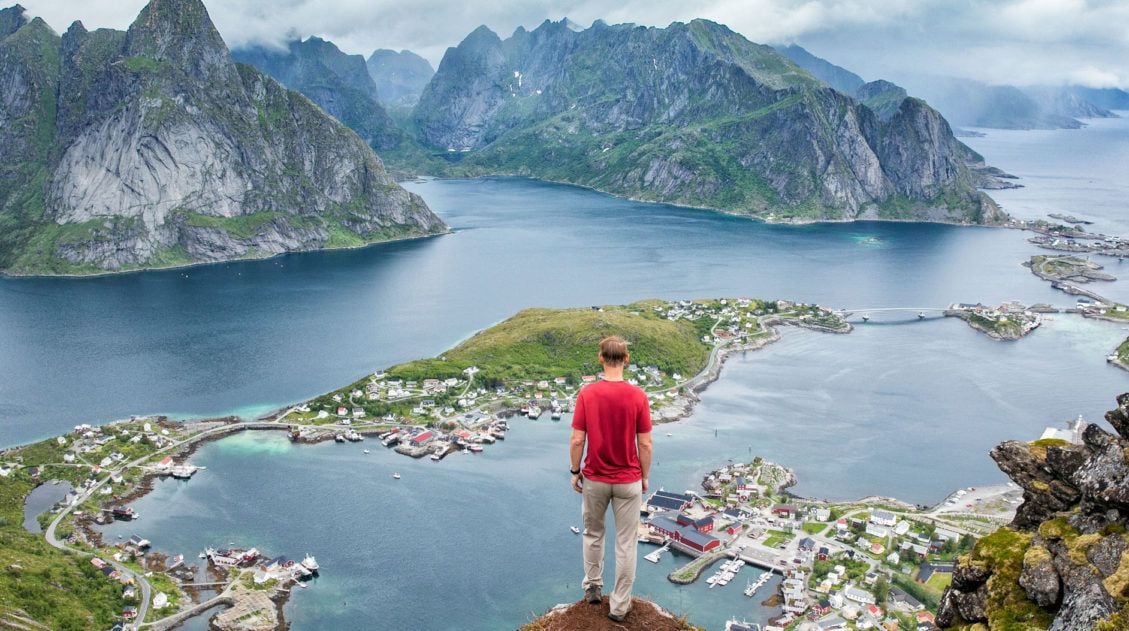
Turn right to walk out to the viewpoint over Svolvaer. Be careful here…the trail is narrow with a long drop-off on the left side of the trail.
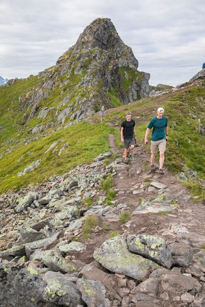
Walking along the ridge. The Fløya peak is in the background and Tim, Tyler, and Kara are walking to the Svolvaer viewpoint.
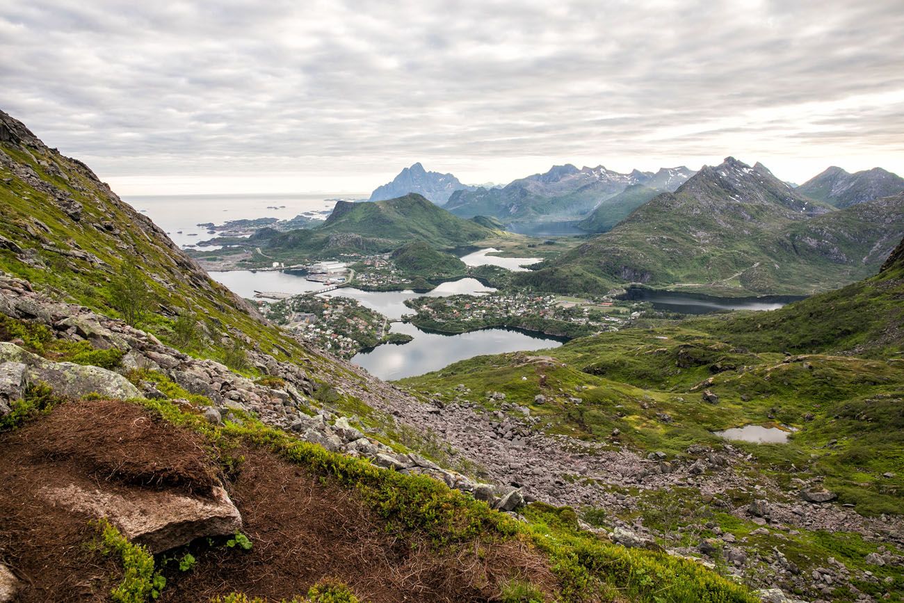
This is a panorama of the Fløya viewpoint with Svolvaer in the background, taken with Tim’s iPhone.
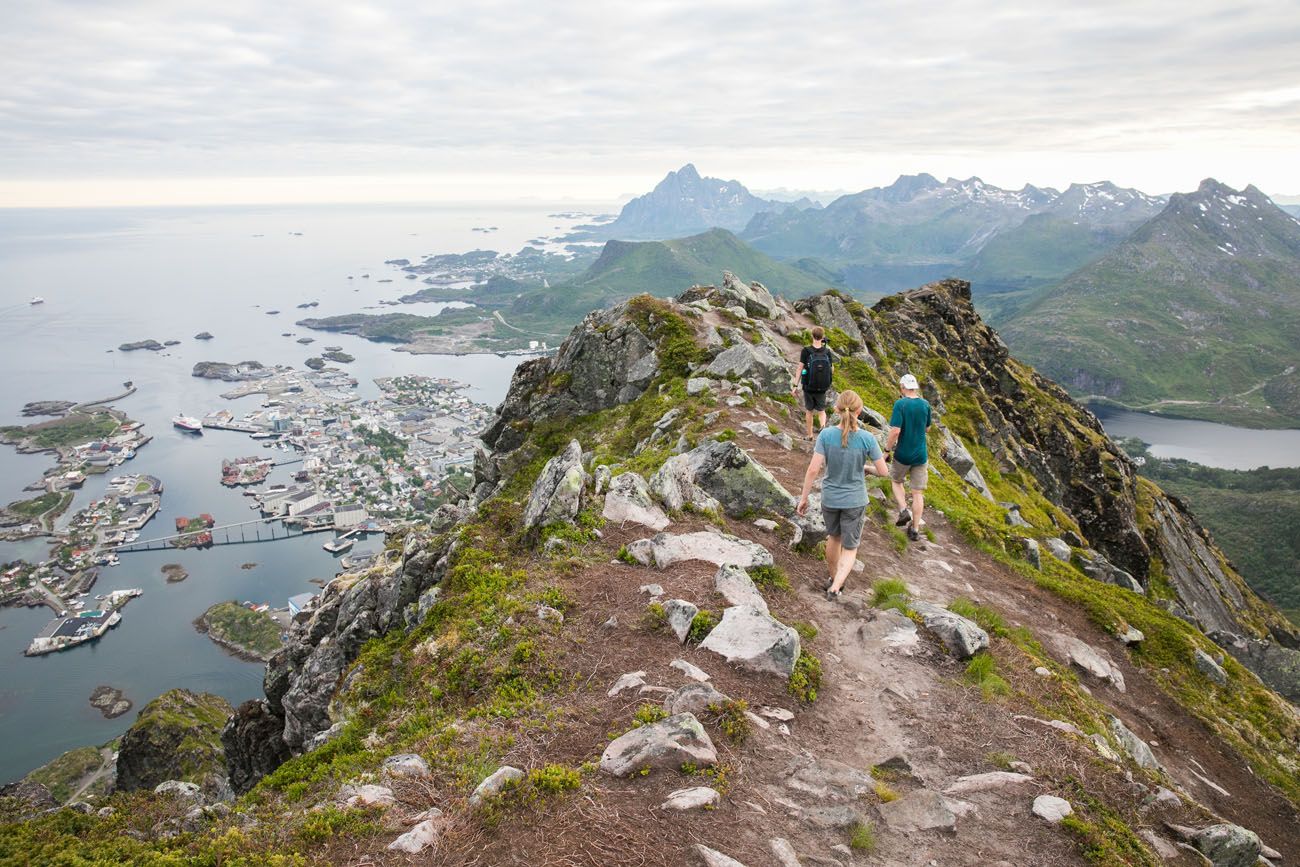
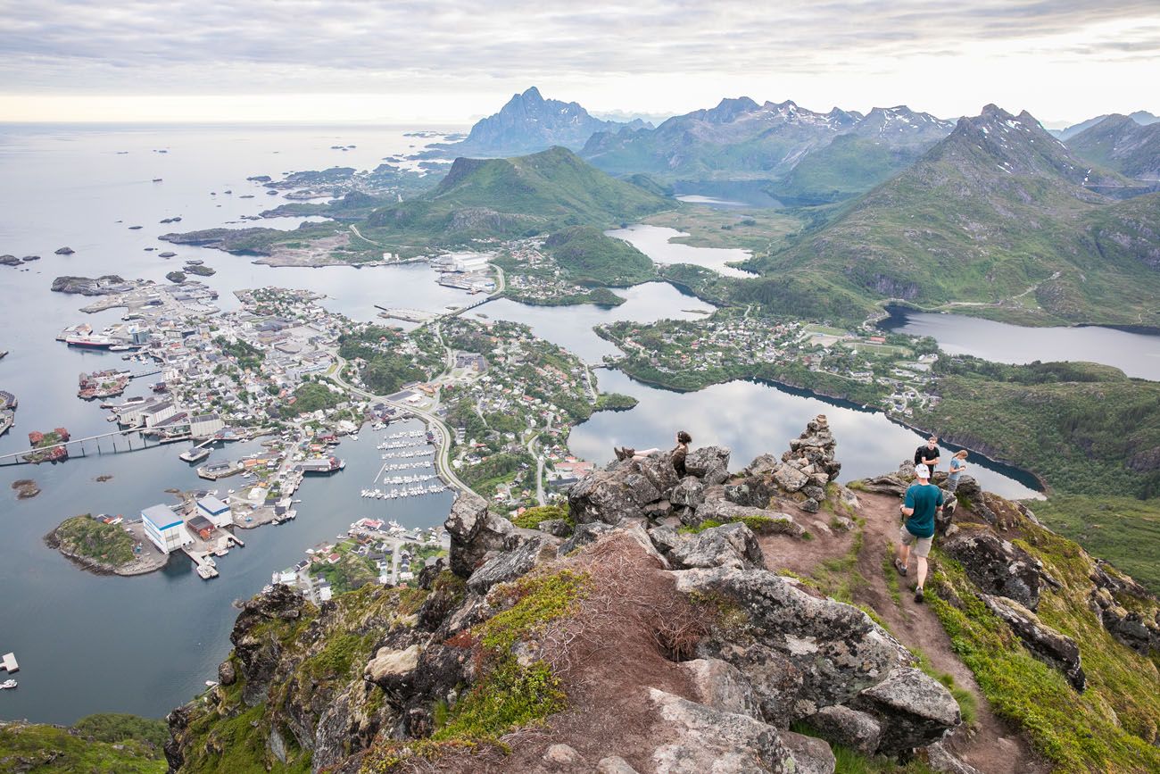
The view over Svolvaer is magnificent! Below you, you can see the rocky pinnacle of Svolvaergeita.
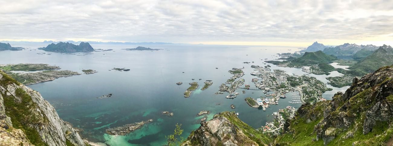
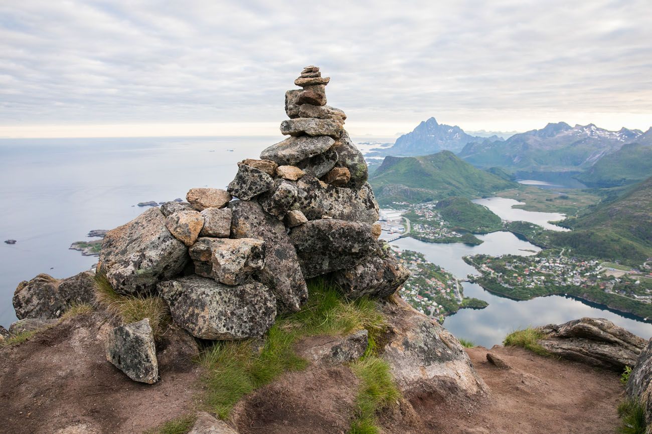
Another panorama that Tim took with his iPhone.
To get back into Svolvaer, retrace your steps down the mountain. It’s much faster going back down!
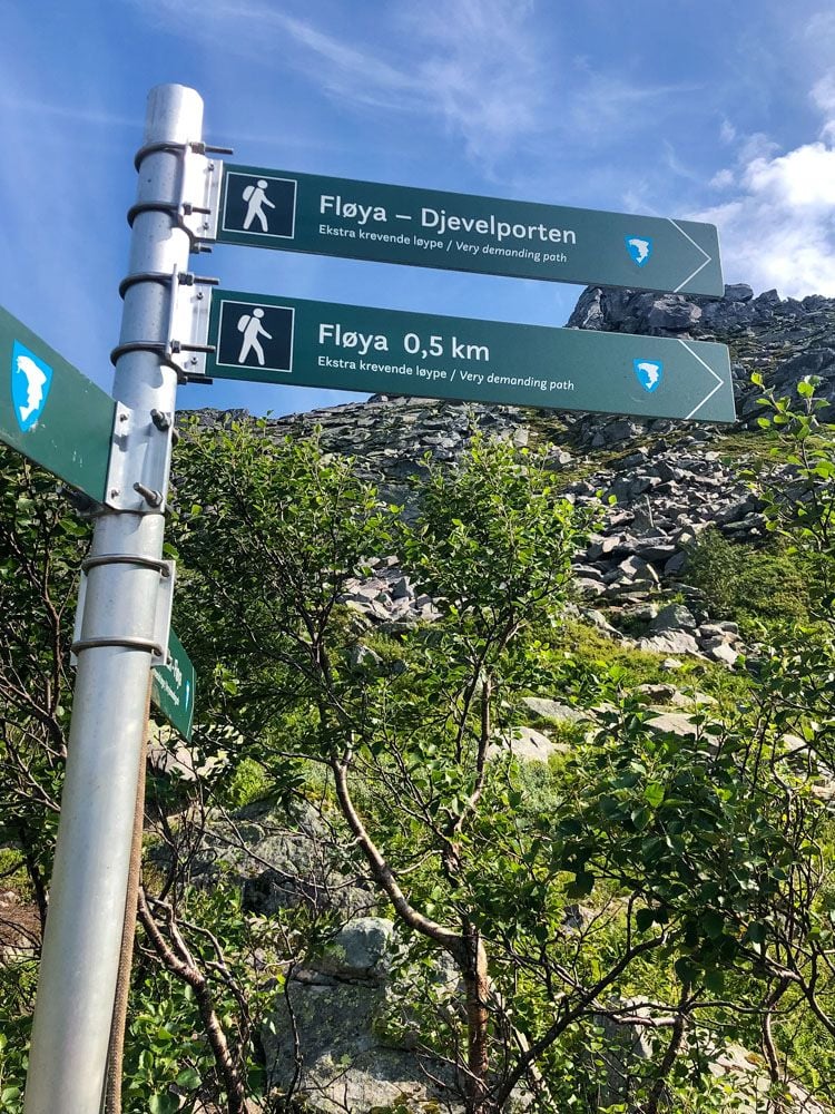
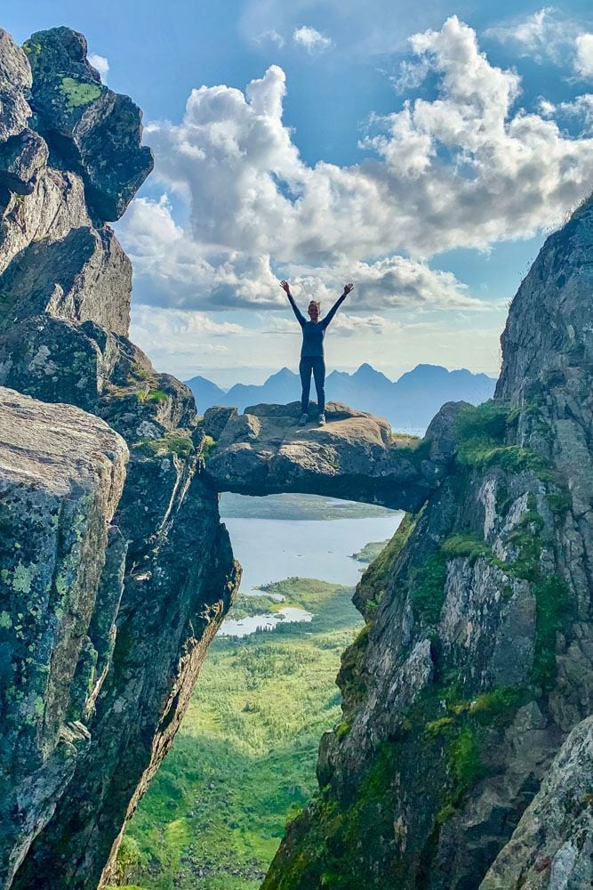
The Devil’s Gate (Djevelporten)
This post would not be complete without including the Devil’s Gate (Djevelporten). This is a chunk of rock, wedged between two cliffs, almost like a mini Kjeragbolten. Sadly, we missed this. We just never came across it on our hike up the mountain. And since it was so late in the day, we had zero interest in searching for this rock.
Since our visit, the sherpa stairs were added to the first part of the trail. Signs have also been added that point you right to Djevelporten. Beyond the sherpa stairs, as you hike up Fløya, you will reach this sign. You can either hike out to Djevelporten now or save it for the return hike.
Trail sign/ photo credit: Jessica Huffman
One of our awesome readers wrote in to us with this updated trail information and photos. Jessica says that going to Djevelporten first was a nice break from hiking up the trail. In comparison to Kjeragbolten, she says that Djevelporten is wider and flatter, and also not as high off of the ground (it’s just a few meters off of the ground), so it is much less intimidating. Thanks Jessica!
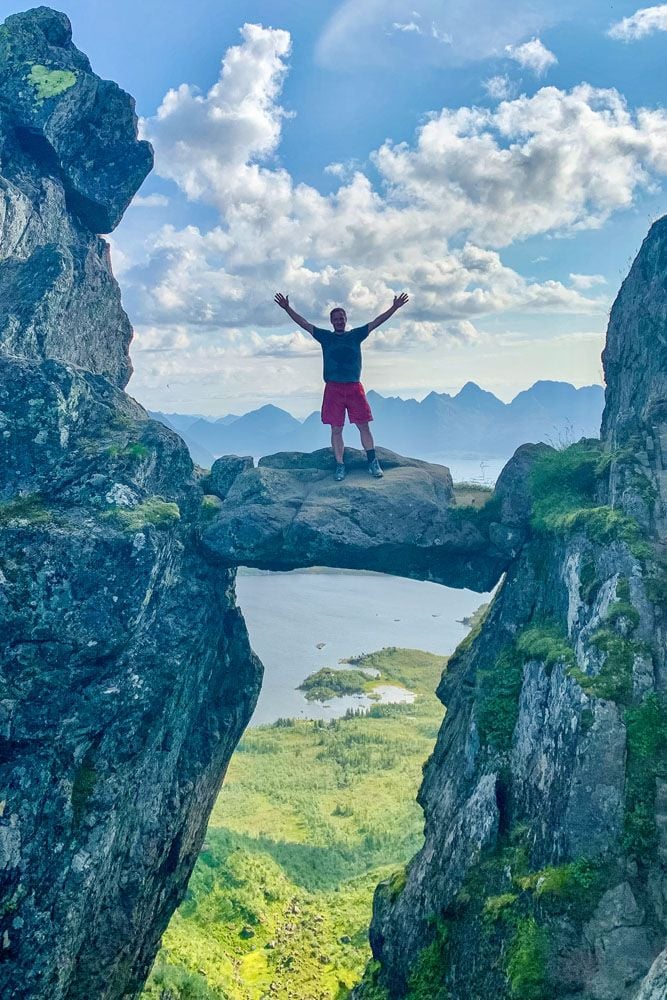
Jessica and her husband on Djevelporten/photo credit: Jessica Huffman
Best Time to Hike Svolvaer Fløya
We hiked Fløya in July, starting at 7:30 pm and it was completely fine. That’s the magic of summer in the Lofoten Islands. The midnight sun means you can hike late into the evening with full daylight, which is exactly what we did after a long afternoon climbing Svolvaergeita. The views over Svolvaer were just as stunning at 9 pm as they would have been at noon.
That said, the weather in the Lofoten Islands is famously unpredictable. We had clear skies, but rain and clouds can roll in quickly at any time of year. Always check the forecast before heading out, and be prepared for a wet trail. The middle section of the hike can get very muddy after rain.
- Summer (June–August): Best conditions for this hike. Long days, mild temperatures, and the midnight sun give you maximum flexibility. Expect the most foot traffic, especially on weekends.
- Spring (May) / Fall (September): Quieter on the trail, with beautiful light. Snow can linger at higher elevations into May. Fall colors add to the scenery in September.
- Winter (October–April): This hike is not recommended in winter without mountaineering experience. Ice and snow make the rock scrambling sections dangerous, and daylight is extremely limited.
Tips for Hiking Svolvaer Fløya
- Start early if you can. Summer mornings are usually calmer and less crowded than afternoons. That said, we started at 7:30 pm and had no issues — the midnight sun gives you a lot of flexibility in summer.
- Watch for the Djevelporten sign. The trail sign pointing to The Devil’s Gate is easy to miss on the way up if you’re focused on the climb. Look for it just beyond the sherpa stairs section.
- The trail gets muddy. Especially in the middle section after the initial steep climb, the trail can be boggy after rain. Waterproof boots or trail runners are a good call.
- Check the weather before you go. Lofoten weather changes fast. A clear morning can turn overcast by afternoon. The views from the top are the whole point, so it’s worth waiting for a good weather window.
- Bring layers. It can be surprisingly cool and windy at the summit even on a warm day.

Essential Hiking Gear: What Should You Bring on a Day Hike?
If you are new to hiking or are curious about what you should bring on a hike, check out our Hiking Gear Guide. Find out what we carry in our day packs and what we wear on the trails.Post-Hike Restaurant Recommendation
Now that you burned all of those calories to get to the top of Fløya, how about a great meal? Fellini Pizza makes awesome pizza and pasta. Plus, they are open until 10:30 pm, perfect if you finish your hike late in the evening (we got here right at 10:28…just in time to pick up our pizzas that Tim called in as we hiked back down the trail).
Where We Stayed
We stayed at Nyvågar Rorbuhotel in Kabelvåg, a 15 minute drive south of Svolvaer. A rorbuer is a classic fisherman’s cottage that has been converted into a hotel room, that usually comes equipped with a kitchen, living room, and private bedroom. We had a two bedroom cabin with the bedrooms on the second floor and the kitchen and living area on the lower floor. While visiting the Lofoten Islands, it’s worth staying in a rorbuer at least one time. Nyvågar Rorbuhotel also has an onsite restaurant and breakfast was included during our stay.
Plan Your Trip to the Lofoten Islands
Our Lofoten Islands itinerary covers how to plan time across the archipelago, and our guide to the best things to do in the Lofoten Islands covers the highlights beyond hiking.
For hikers specifically, our roundup of the best hikes in Norway puts Fløya in context alongside some of the country’s other iconic trails. If you’re looking for another great hike near Svolvaer, don’t miss our guide to climbing Svolvaergeita. We combined both on the same afternoon, and it made for one of the most memorable days of our entire trip.
If you’re building out a bigger trip through the north, our 10-day Northern Norway itinerary takes you from Tromsø through Senja and the Vesterålen Islands down to the Lofoten Islands, and our Norway Travel Guide is where you’ll find all of our guides on Norway.
Does this look like something you would like to do? Comment below if you have any questions about how to hike Svolvaer Fløya or if you have advice for our readers.
More Places to Visit in Norway
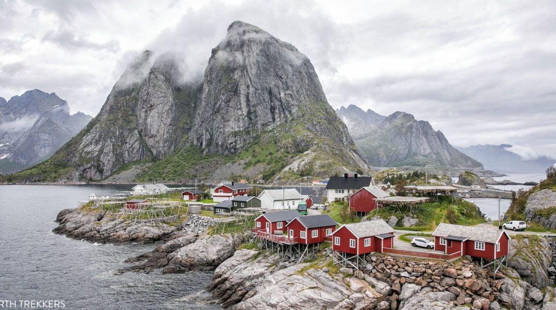
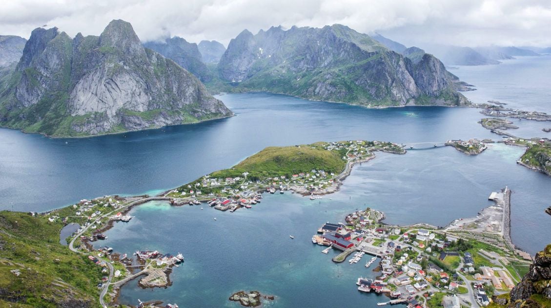
How to Hike Reinebringen (+ Where to Park)
Pinterest Facebook Flipboard Reinebringen, with its dazzling view over the fishing villages of Reine, Sakrisøy, and Hamnøy, is the most popular hike in the Lofoten Islands, and one look at the panorama from the top tells you exactly why. We hiked Reinebringen in 2018 with our kids, who were 13 and 15 at the time, […]
Where to Stay in the Lofoten Islands: Rorbuer, Hotels & More
If you’re trying to figure out where to stay in the Lofoten Islands, the first thing you need to know is this: the islands have their own iconic accommodation type, and it’s unlike anything else in the world. Rorbuer, traditional Norwegian fishermen’s cabins, typically perched on stilts over the water, are the reason so many […]
Lofoten Islands Itinerary: 4 to 5 Days in Norway’s Most Spectacular Islands
There are places that stop you in your tracks the moment you arrive. The Lofoten Islands are one of them. We pulled over constantly, not because we planned to, but because we couldn’t drive past another mountain plunging straight into the fjord, another stretch of white sand beach backed by jagged cliffs, or another cluster […]
Hiking to Måtind on the Stave-Bleik Coastal Trail, Vesteralen, Norway
Norway has a way of exceeding every expectation, and the Stave-Bleik Coastal Trail on Vesteralen’s Andøya island is a perfect example. We hiked to Måtind in early July as part of a road trip from Tromsø to the Lofoten Islands, squeezing it in after a morning ferry crossing from Senja, and it turned out to […]
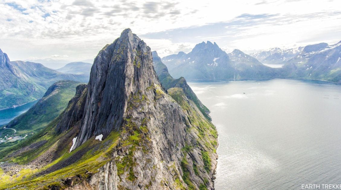
How to Hike Segla, An Iconic Peak in Senja, Norway
The hike up to the summit of Segla is one of Senja’s most popular hikes. And this was our main reason for visiting Senja. Many visitors skip past Senja, heading directly to the Lofoten Islands. But those people are missing out seeing a gorgeous part of Norway and some hidden gems. That’s fine…that means less […]
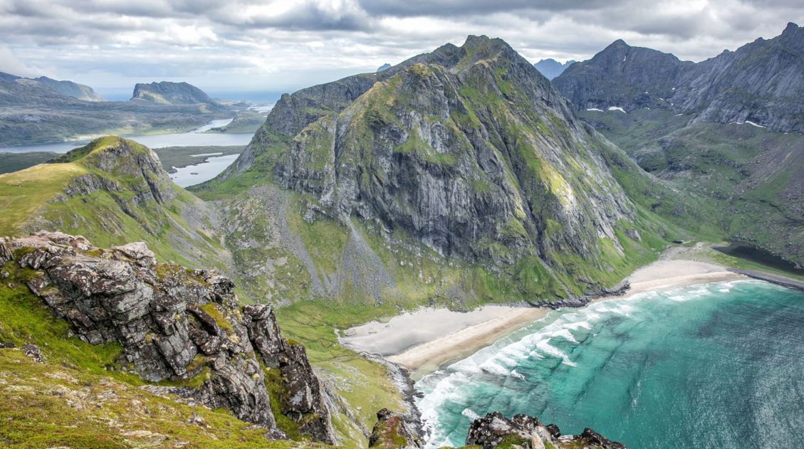
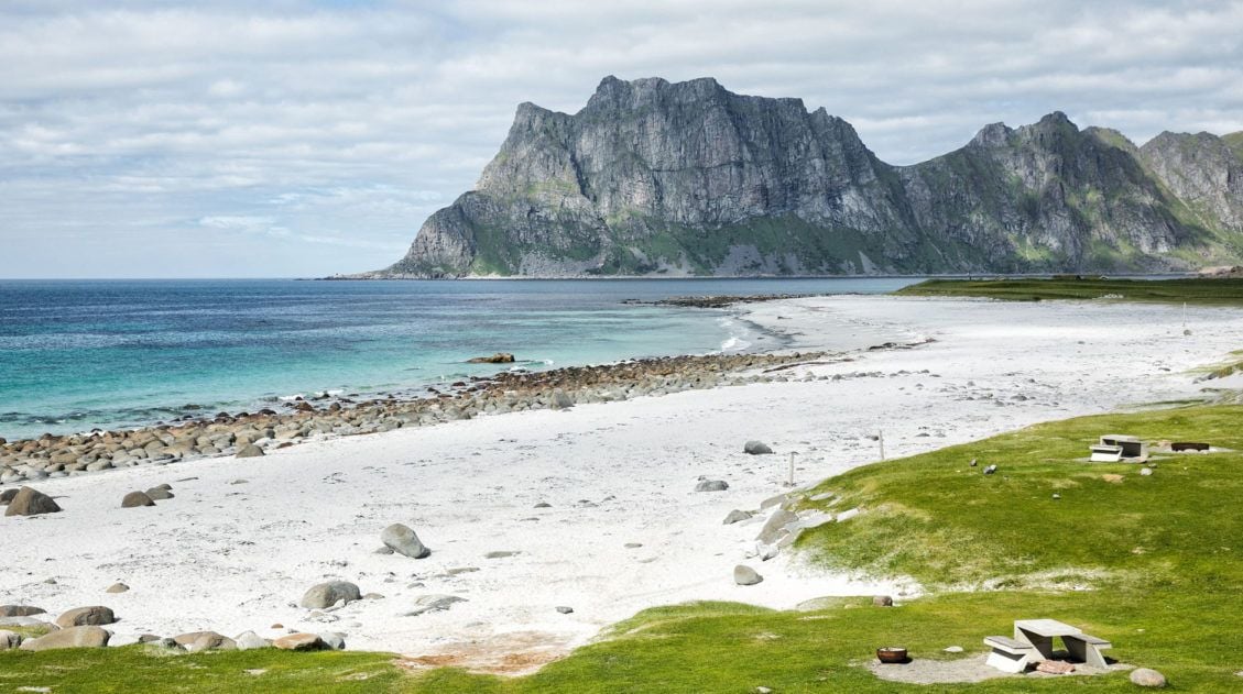
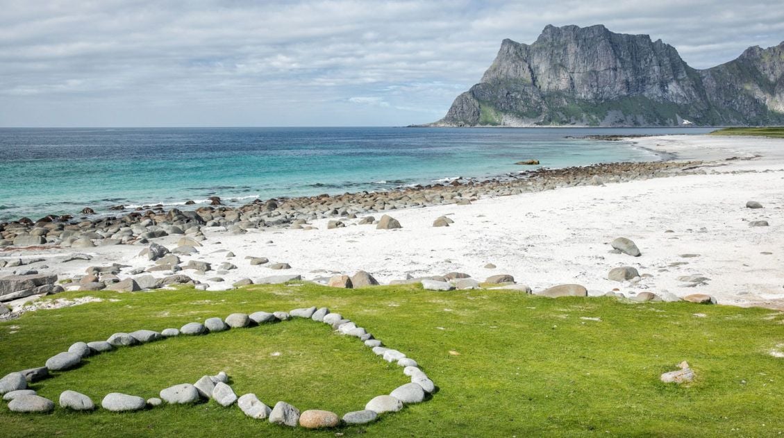
Hiking Ryten: Kvalvika Beach Views & Lofoten’s Mini-Trolltunga
The hike to Ryten has all of the ingredients of a perfect Lofoten Islands hike: sweeping vistas across the mountains and fjords, a fun but slightly strenuous hike to a mountain peak, and a breathtaking view of a white, sandy beach. The icing on the cake is a “mini Trolltunga,” an outcropping of rock where […]
Best Things to Do in the Lofoten Islands: 16 Epic Experiences
We arrived in the Lofoten Islands after driving down from the Vesterålen Islands, and on our very first day, we climbed Svolvaergeita and hiked Svolvaer Fløya. It was a long, exhausting, unforgettable day, and somehow, it set exactly the right tone for everything that followed. By the time we left four days later, we were […]
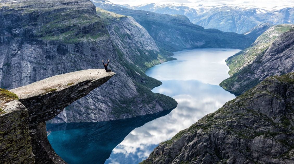
How to Hike Trolltunga: Everything You Need to Know
Trolltunga was the third hike on our first Norway trip, and by then we had a pretty good read on what Tyler and Kara could handle. They’d already done Pulpit Rock and Kjeragbolten, two hikes that would have been on most adults’ bucket lists, and they hadn’t complained once. Tyler was 10. Kara was 8. […]
Best Hikes in Norway: 14 Epic Trails for Every Level
For hikers, few places in Europe can match Norway. The hikes in Norway are endlessly varied and genuinely world-class, from the fjords of southern Norway, the jagged peaks of the Lofoten Islands, and the remote coastline of Vesterålen and Senja. Alongside the Dolomites and the Swiss Alps, this is one of our absolute favorite places […]
10-Day Northern Norway Itinerary: Tromsø to the Lofoten Islands
We’ve done a lot of road trips in Europe, through the Italian Dolomites, across the Scottish Highlands, and down into the fjord region of southern Norway. This Northern Norway itinerary is one of our all-time favorites. We drove this route in early July, starting in Tromsø and working our way south through Senja and the […]
Hiking Festvågtind in the Lofoten Islands, Norway
From the top of Festvågtind, the views over the fishing village of Henningsvaer are breathtaking. This hike is very similar to Svolvaer Fløya and Reinebringen, in that it’s a steep, somewhat unexciting climb to an awesome viewpoint. It’s absolutely worth it on a clear day but consider skipping this hike on a cloudy, rainy day. […]
20 Best Things to Do in Norway: Fjords, Lofoten & Svalbard
Norway is one of our favorite countries in the world, and narrowing down the best things to do in Norway for this list was genuinely hard. There’s just so much worth doing. We’ve been twice so far, and we’re already dreaming about a third trip. Our first visit was a family trip with the kids […]
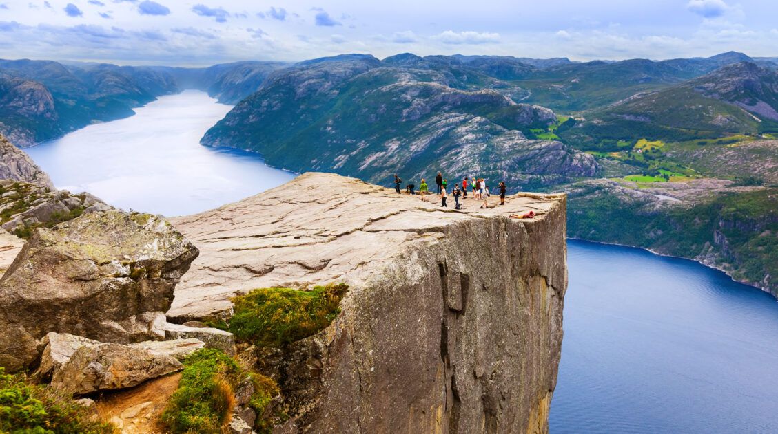
Hiking Pulpit Rock (Preikestolen): What to Expect, Trail Guide & Tips
The hike to Pulpit Rock (Preikestolen) was the first hike our kids ever did in Norway and it set the bar high. Tyler was 10, Kara was 8, and we’d spent the previous months wondering whether they were really ready for Norwegian hiking. We’d taken them on Old Rag in Shenandoah as a test run, […]

Comments 13