
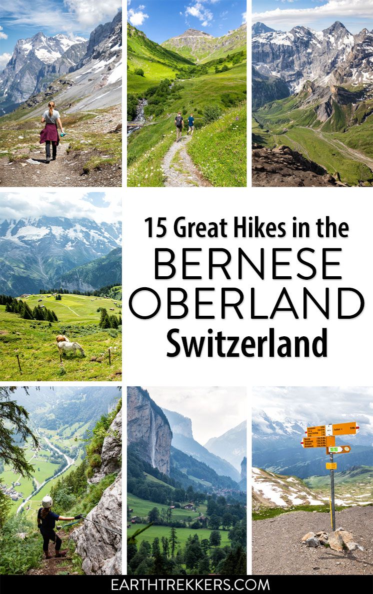
The Bernese Oberland is a hiker’s paradise. Alpine trails crisscross their way through the towns, valleys, and the mountain peaks of this gorgeous place. Take your pick from short, easy, family-friendly trails to cliff walks to thrilling trails. Here are 15 of the best hikes to do in the Bernese Oberland.
All of the hikes on this list are located in the Jungfrau region of Switzerland. The Jungfrau region is the most popular area of the Bernese Oberland, encompassing the region around Interlaken, Lauterbrunnen, Grindelwald, and Mürren. This is the touristy heart of the Bernese Oberland and the area where many visitors spend most of their time.
Best Hikes in the Bernese Oberland
How to Use This Map: Click the icons on the map to get more information about each point of interest. To take this map with you, click the star next to the title of the map which adds it to your Google account. Next, within your Google Maps app, select ‘Saved’ and then select ‘Maps’. This map title will now appear in your list.
This list starts with the shorter, easier hikes and continues on with the longer and more challenging efforts.
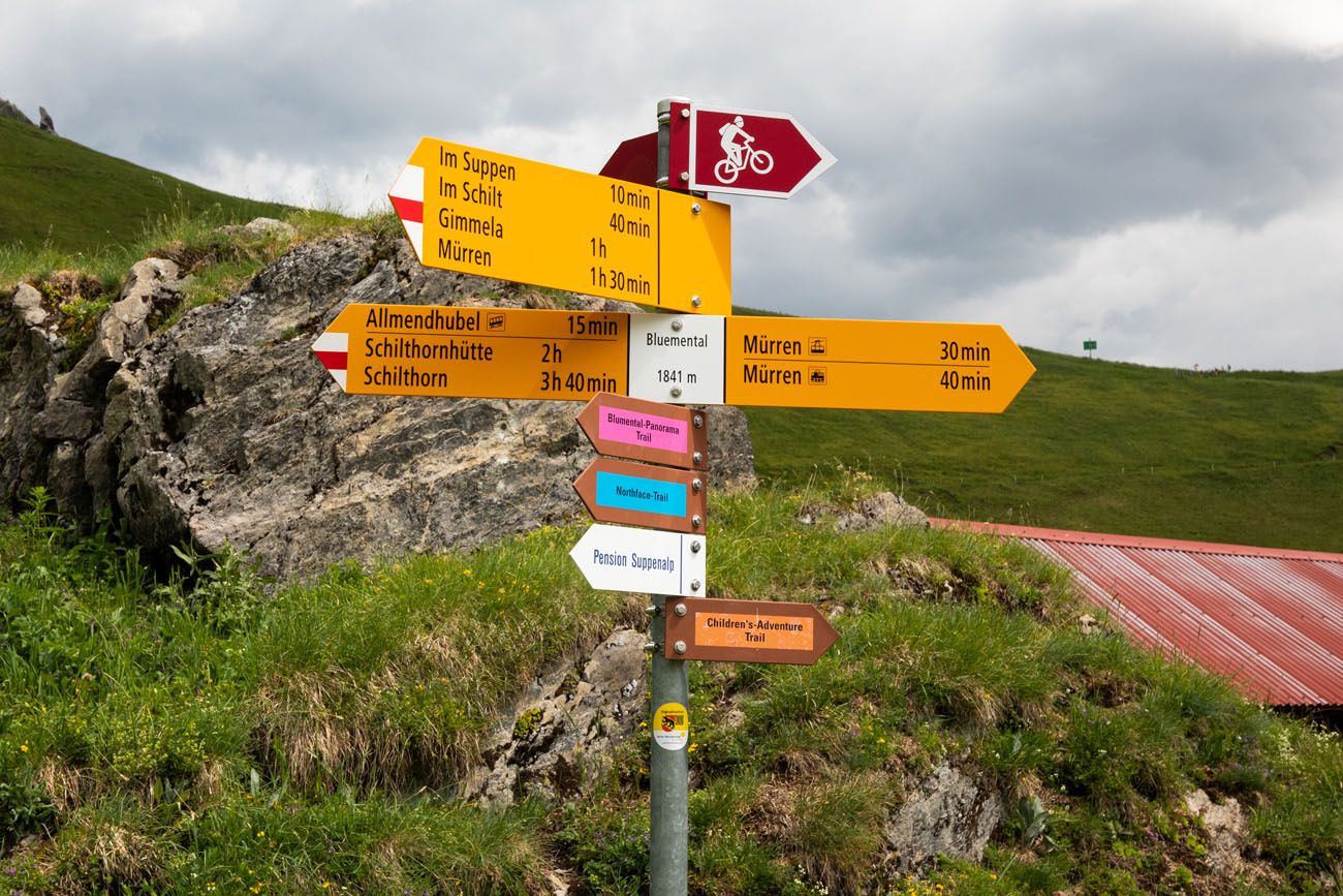
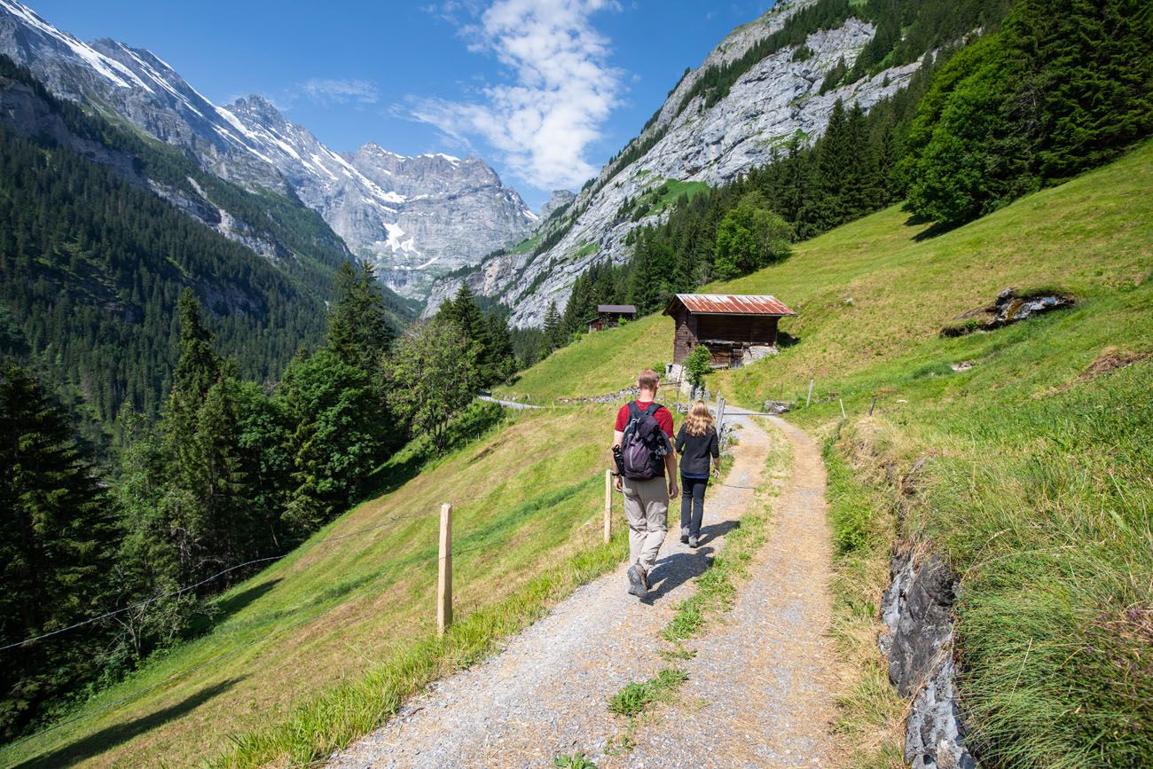
Blumental Panorama Trail
Distance: 3.2 km (2 miles)
Length of Time: 1 to 1.5 hours
Elevation Loss: 300 meters
Difficulty: Easy
Location: Mürren
This is a shorter version of the Northface Trail (mentioned later in this post). From Mürren, ride the Allmendhubel funicular and enjoy the views of Mürren and of the mighty Jungfrau massif. The Blumental Trail winds its way downhill through a scenic valley and past pension Suppenalp, before descending into Mürren.
The trail is well-marked, just follow the pink “Blumental Panorama Trail” signs.
Allmendhubel
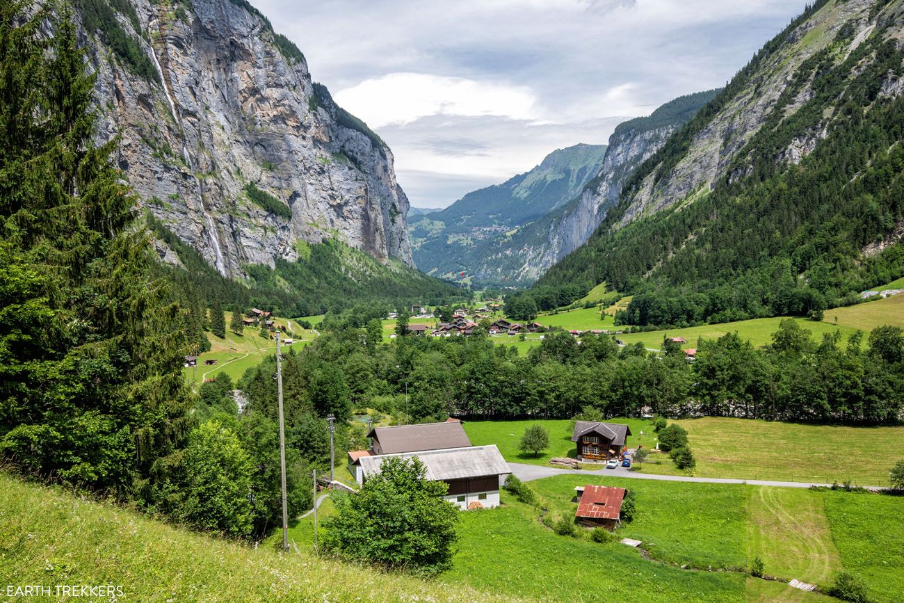
Lauterbrunnen Valley
Distance: 4.3 km (2.7 miles)
Length of Time: 1.5 to 2 hours
Difficulty: Easy
Location: Lauterbrunnen Valley
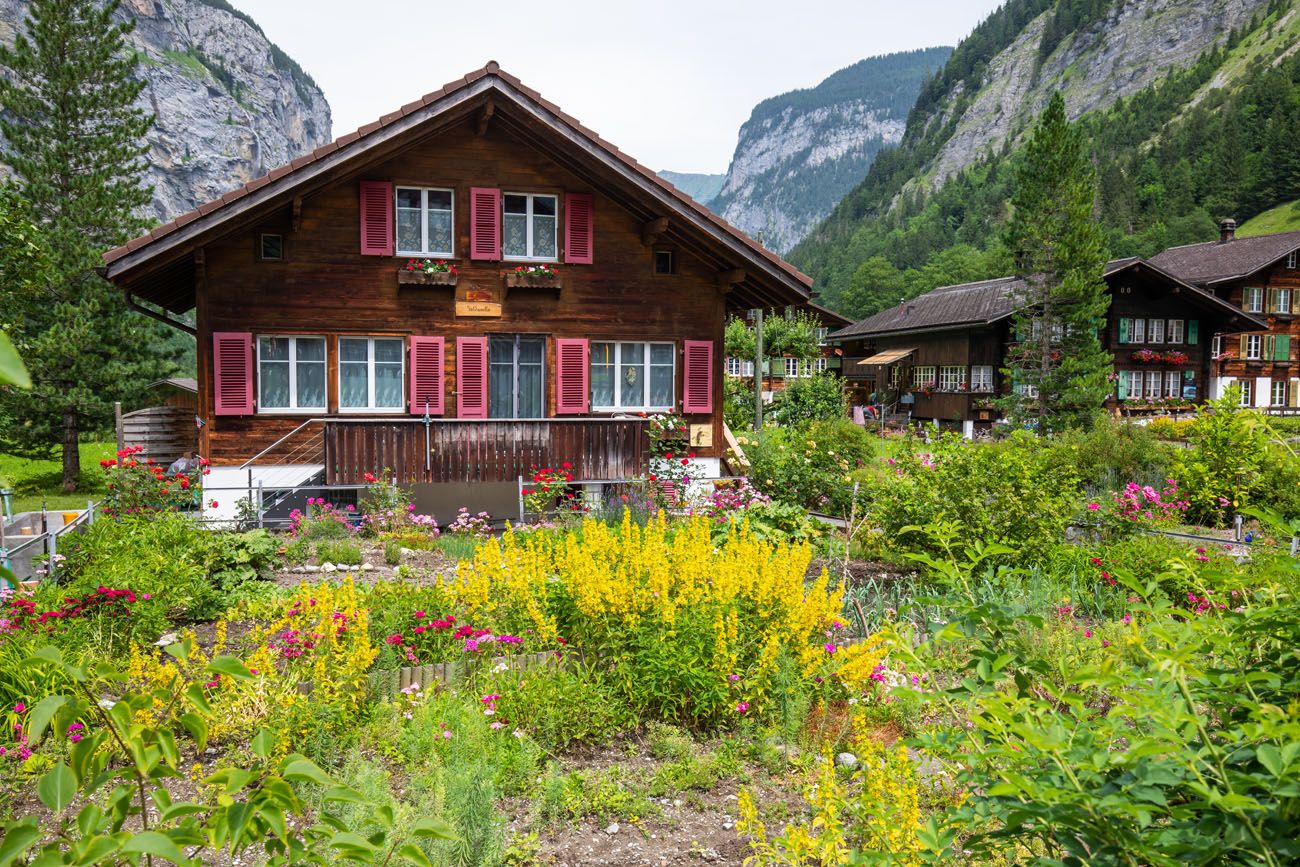
This isn’t so much of a hike as a scenic walk. On this mostly flat, easy walk through the Lauterbrunnen Valley, you are treated to views colorful gardens, towering waterfalls, and the peaks of Mönch, Eiger, and Jungfrau towering over you.
Along the way, add on detours to Trummelbach Falls and Mürrenbach Fall. End your hike with a visit to the fairytale town of Lauterbrunnen and Staubbach waterfall.
Stechelberg and the Lauterbrunnen Valley
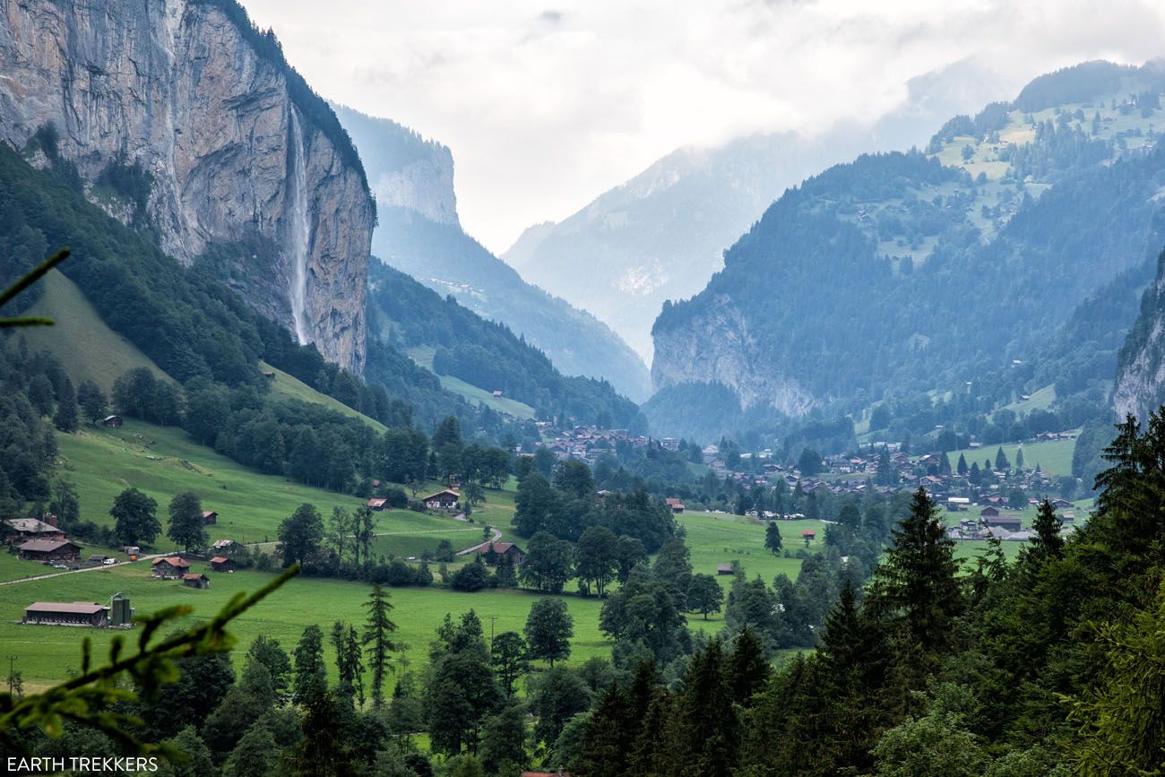
Lauterbrunnen Valley (photo taken from Trummelbach Falls)
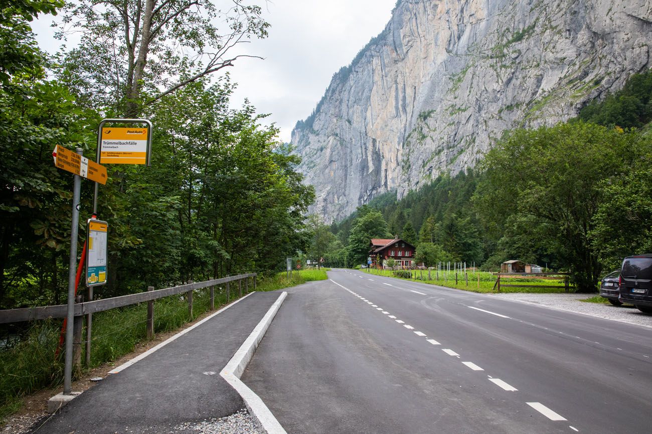
Bus stop on the main road in Lauterbrunnen Valley
PRO TRAVEL TIP: Starting in Lauterbrunnen, take the bus to Stechelberg. Walk from Stechelberg to Lauterbrunnen. There is a paved and gravel pedestrian path that runs parallel to the main road through the valley. If you get tired, simply walk to main road to the nearest bus stop and take the bus back to Lauterbrunnen.
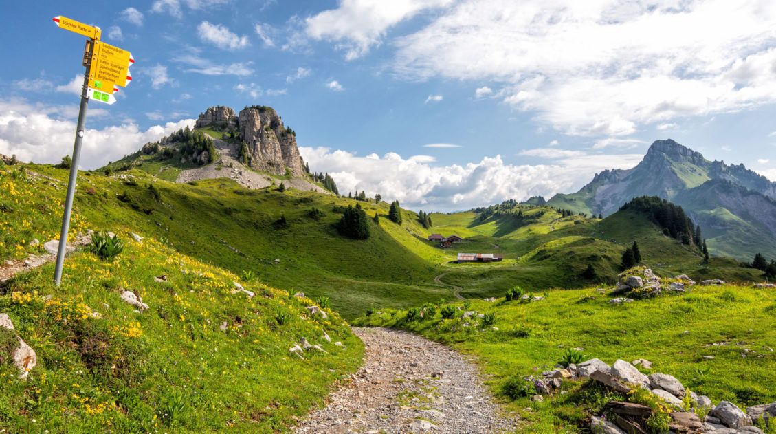
Schynige Platte Panorama Trail
Distance: 3 km (1.9 miles)
Length of Time: 1.25 hours
Elevation Gain: 180 meters
Difficulty: Easy to moderate
Location: Schynige Platte
Learn More on the Jungfrau website
This is a relatively easy trail that is done as a loop from Schynige Platte. Schynige Platte is a mountain summit that offers panoramic views over Interlaken, Lake Brienz, and views of the Jungfrau Massif.
This loop trail winds itself around this mountain peak, through an alpine garden, and offers more sweeping views of the area. Schynige Platte is well worth the visit on your trip to the Bernese Oberland, and this short but sweet hike makes the experience even better.
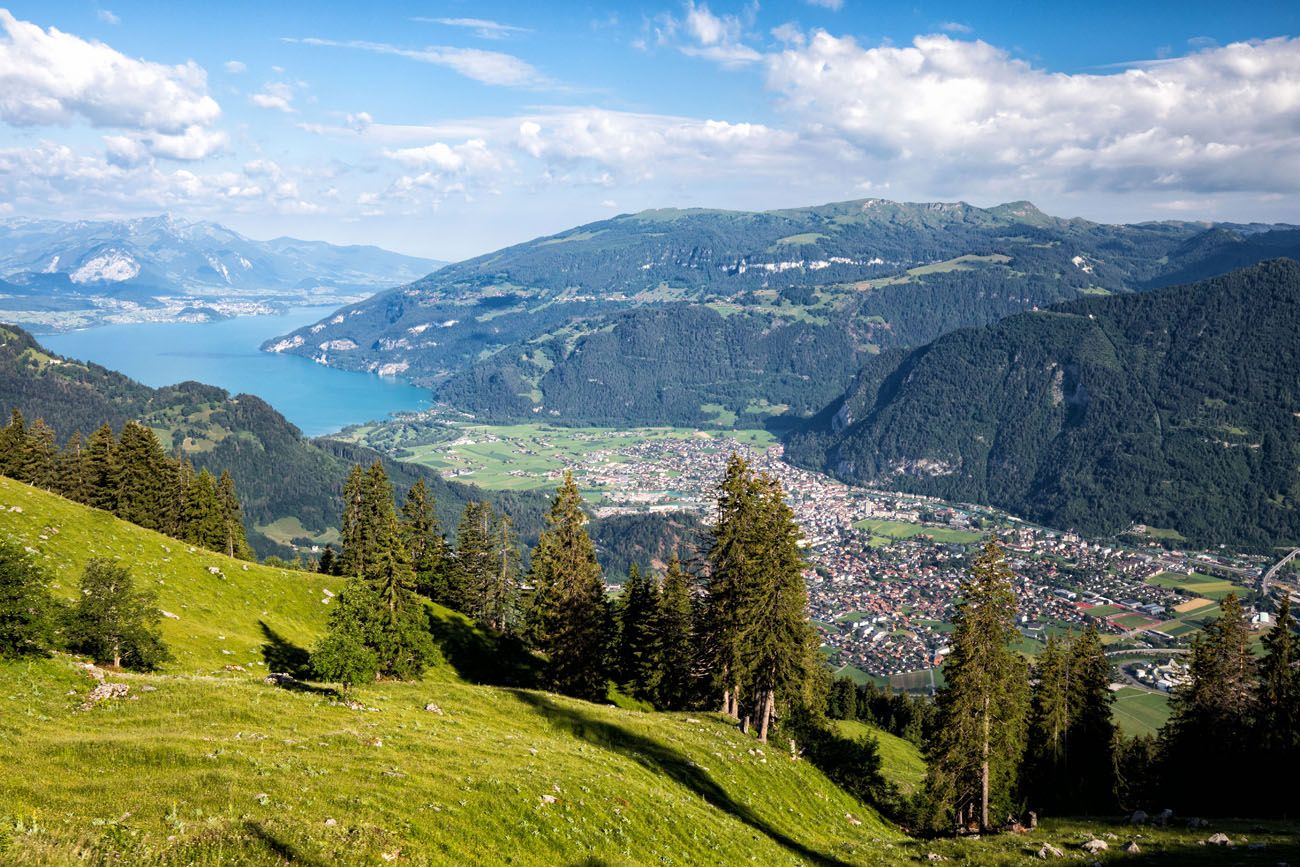
View of Interlaken
Panorama Trail | Best Hikes in the Bernese Oberland
PRO TRAVEL TIP: You have the option to add this hike onto the Schynige Platte to Faulhorn to First hike, mentioned later in this post.
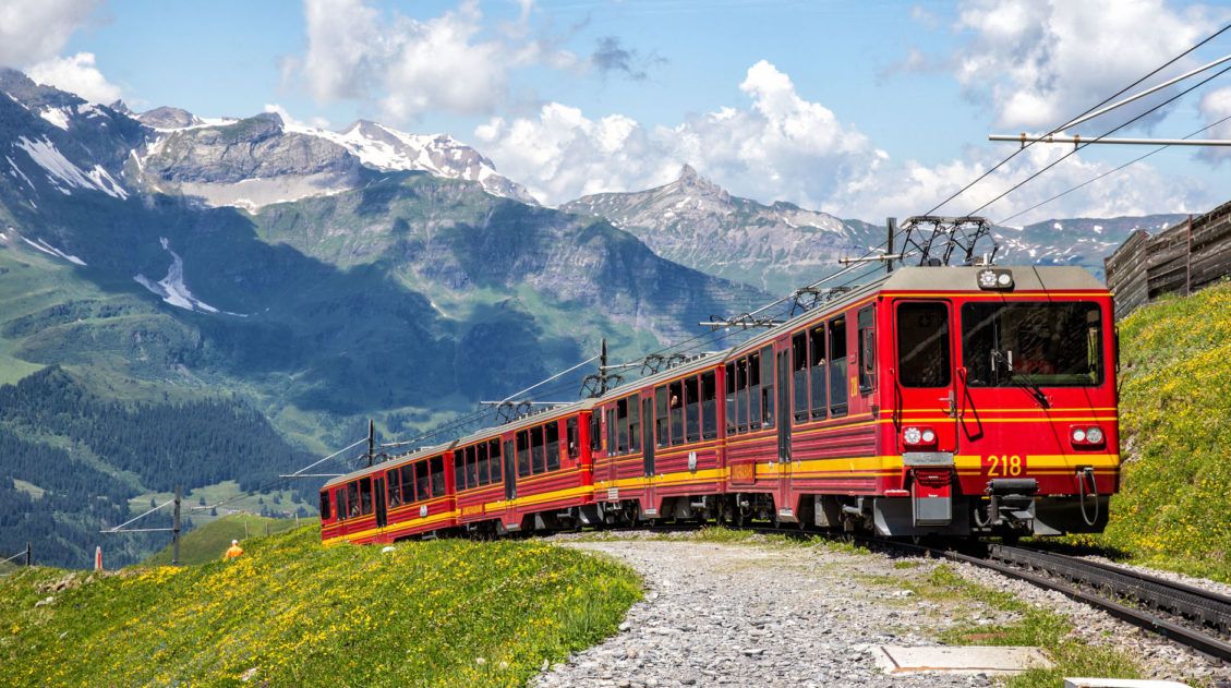
Getting Here: Ride the train from Wildersil to Schynige Platte. It’s best to do this first thing in the morning because this is a popular train ride in the Bernese Oberland.
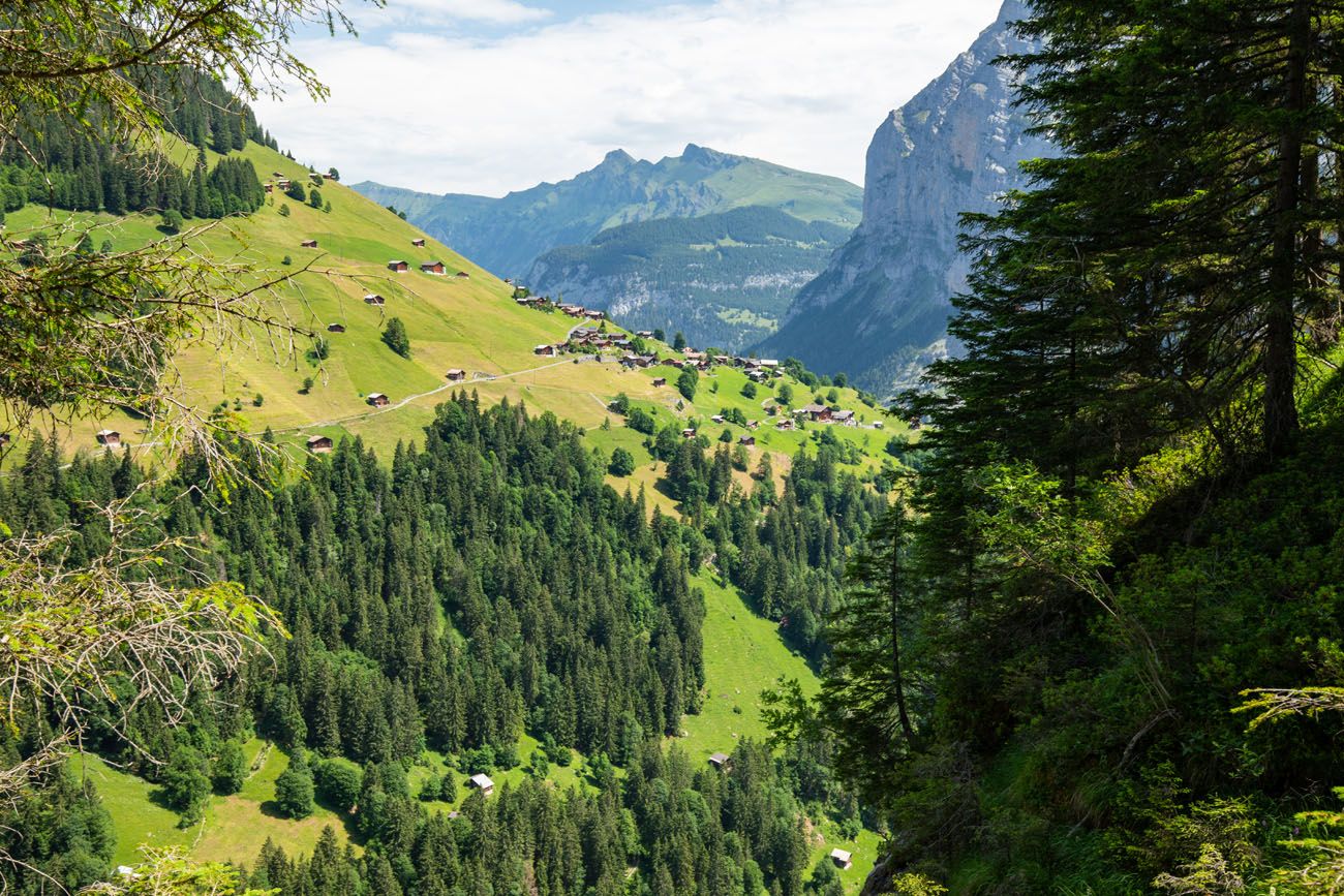
Grütschalp to Mürren
Distance: 4.3 km (2.7 miles) point-to-point
Length of Time: 1.5 hours
Elevation Gain (Grütschalp to Mürren): 200 meters
Difficulty: Easy
Location: Mürren – Grütschalp
The walk from Grütschalp to Mürren is an easy route that offers spectacular views of Eiger, Mönch, and Jungfrau. This is a paved trail that runs parallel to the railway that connects Grütschalp and Mürren.
This walk can be done in either direction. If you start in Grütschalp, it will be a slightly uphill walk to Mürren (or a downhill walk if you do this Mürren to Grütschalp).
Transportation:A cable car links Grütschalp with Lauterbrunnen. A short, narrow-gauge train connects Grütschalp with Mürren. You can ride the cable car to Grütschalp, hike to Mürren, spend some time in Mürren, and then take the train back to Grütschalp.
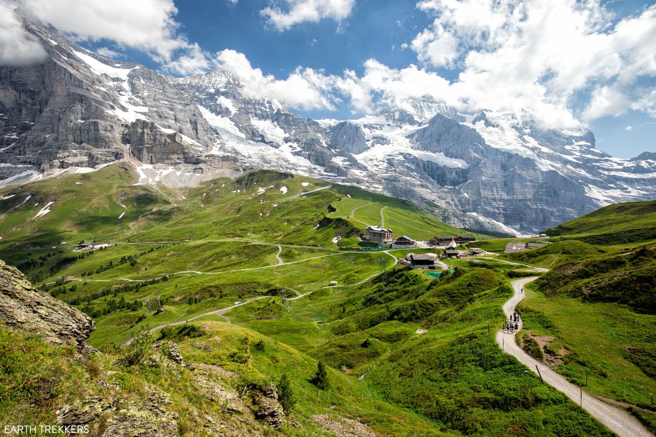
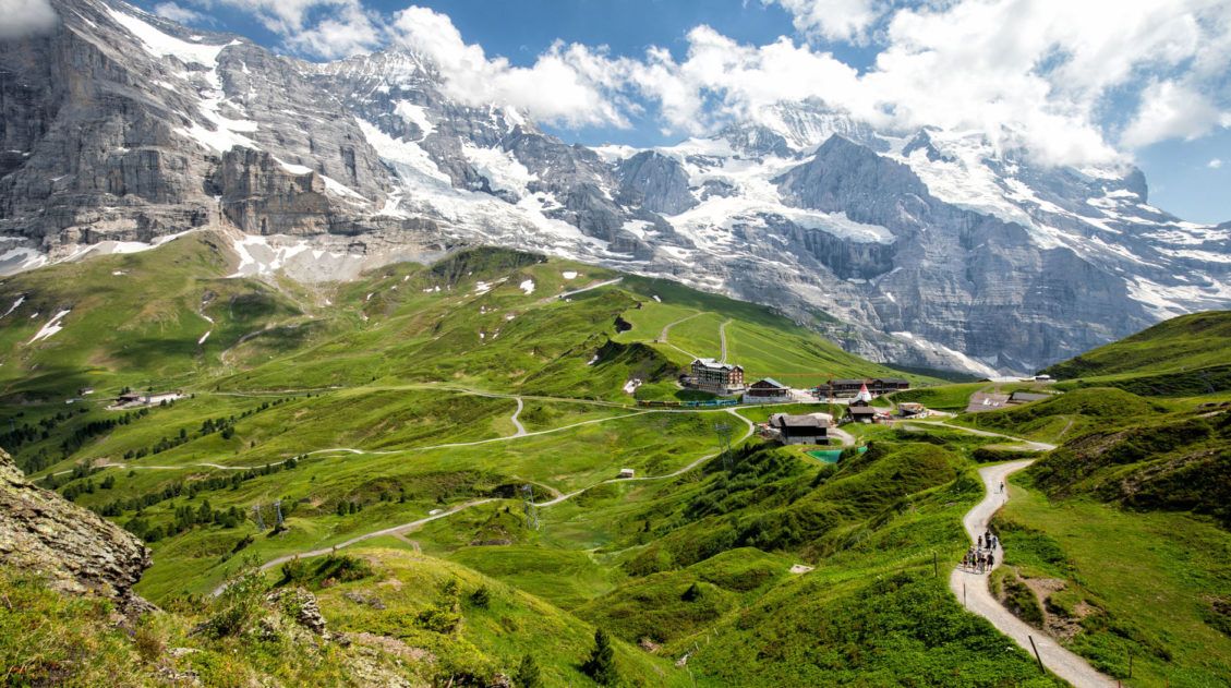
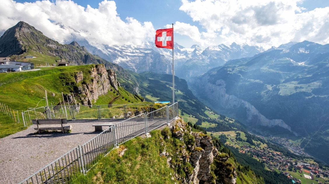
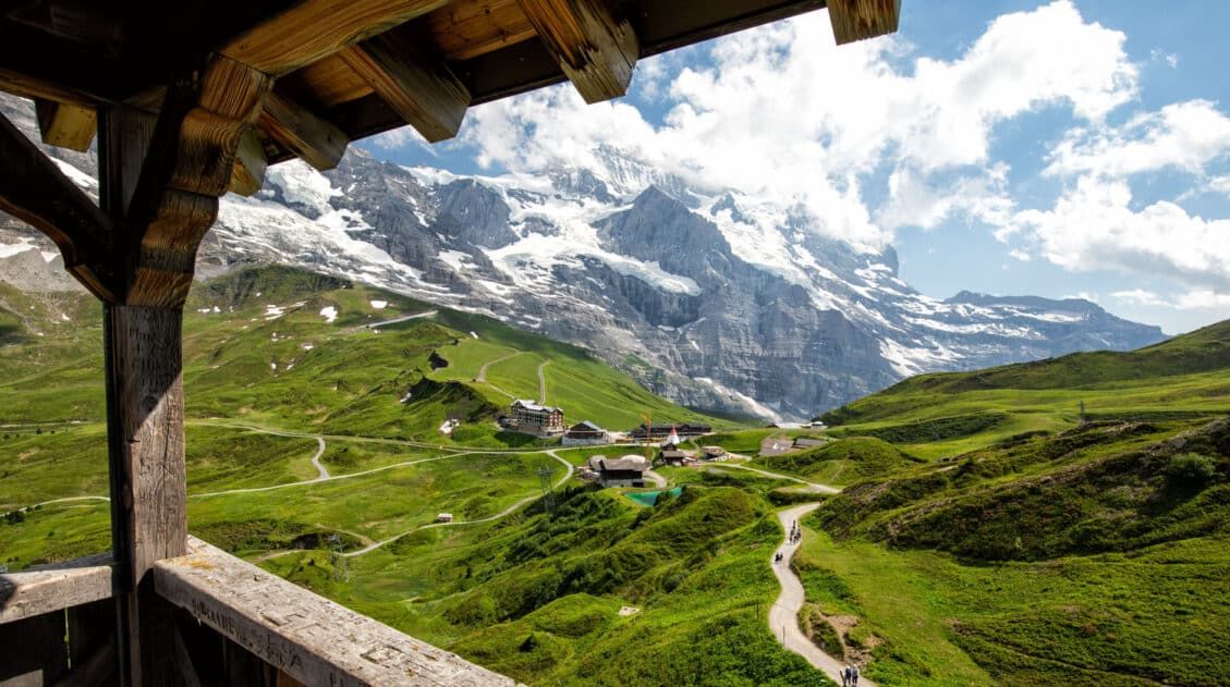
Männlichen to Kleine Scheidegg on the Panorama Trail
Distance: 4.4 km (2.75 miles) point-to-point
Length of Time: 1.5 hours
Elevation Loss: 166 meters (540 feet)
Difficulty: Easy
Location: Männlichen – Kleine Scheidegg
The walk from Männlichen to Kleine Scheidegg is one of the best hikes to do in the Jungfrau region. This easy, mostly downhill trail offers spectacular views of both the Lauterbrunnen Valley and the mountain peaks of Eiger, Mönch, and Jungfrau.
This hike is suitable for all ages and ability levels. It’s perfect for families, travelers with limited time who want to do a short, memorable hike, and those who want jaw-dropping views with minimal effort.
If you only have the time or the desire to do one short, quick hike in the Jungfrau region, this is a good one to consider.
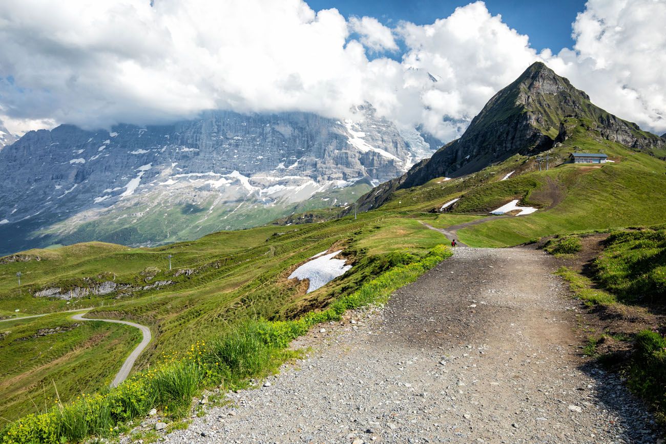
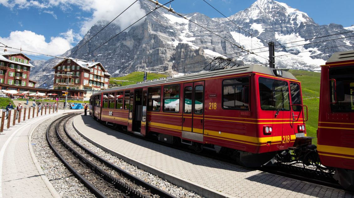
Männlichen to Kleine Scheidegg
Kleine Scheidegg
How to do this Hike: This is a point to point hike. Ride the cable car to Männlichen. Hike to Kleine Scheidegg. From Kleine Scheidegg, ride the train to your next destination (the train goes to Grindelwald and Wengen and from Wengen you can continue to Lauterbrunnen).
Walking from Männlichen to Kleine Scheidegg on the Panorama Trail
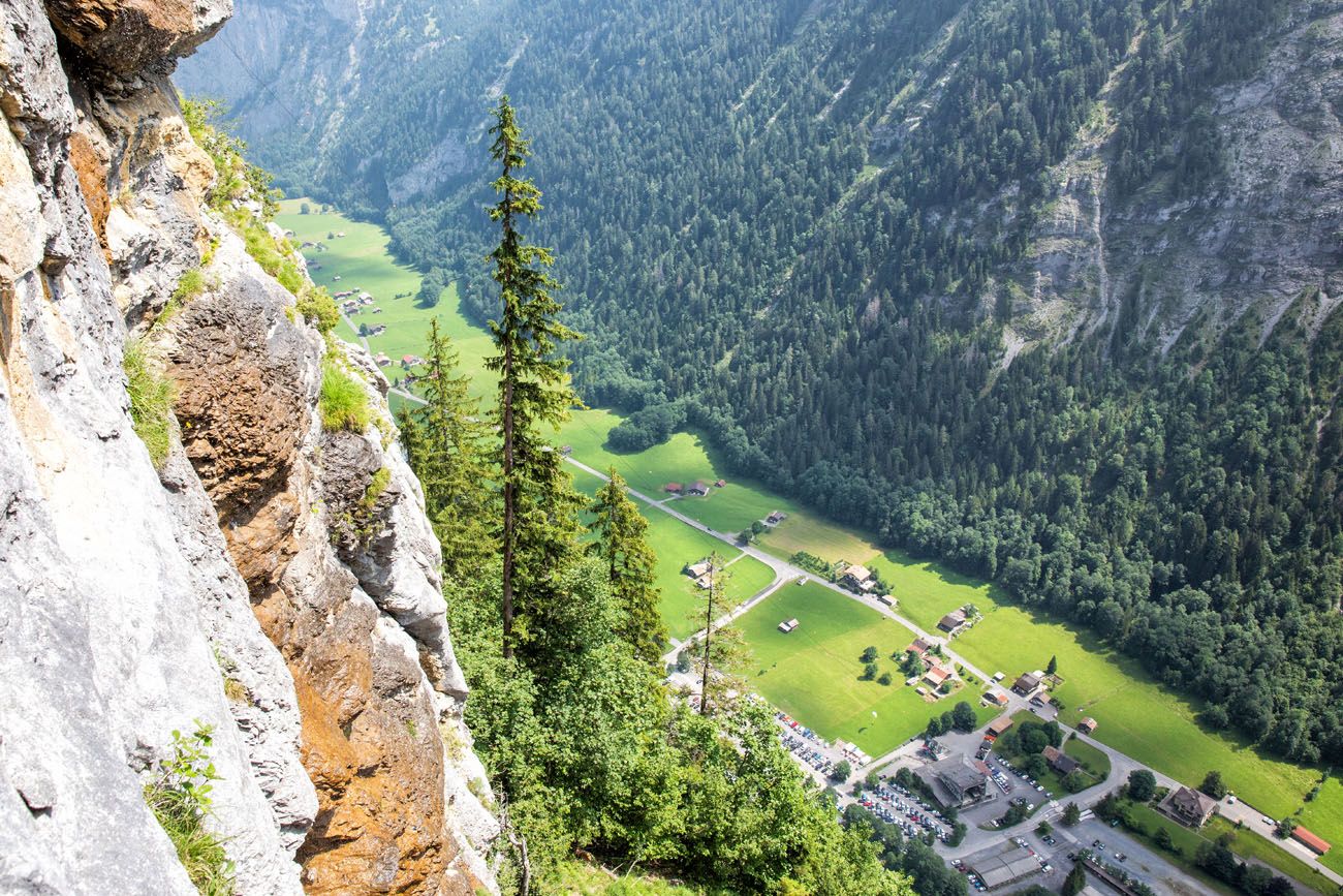
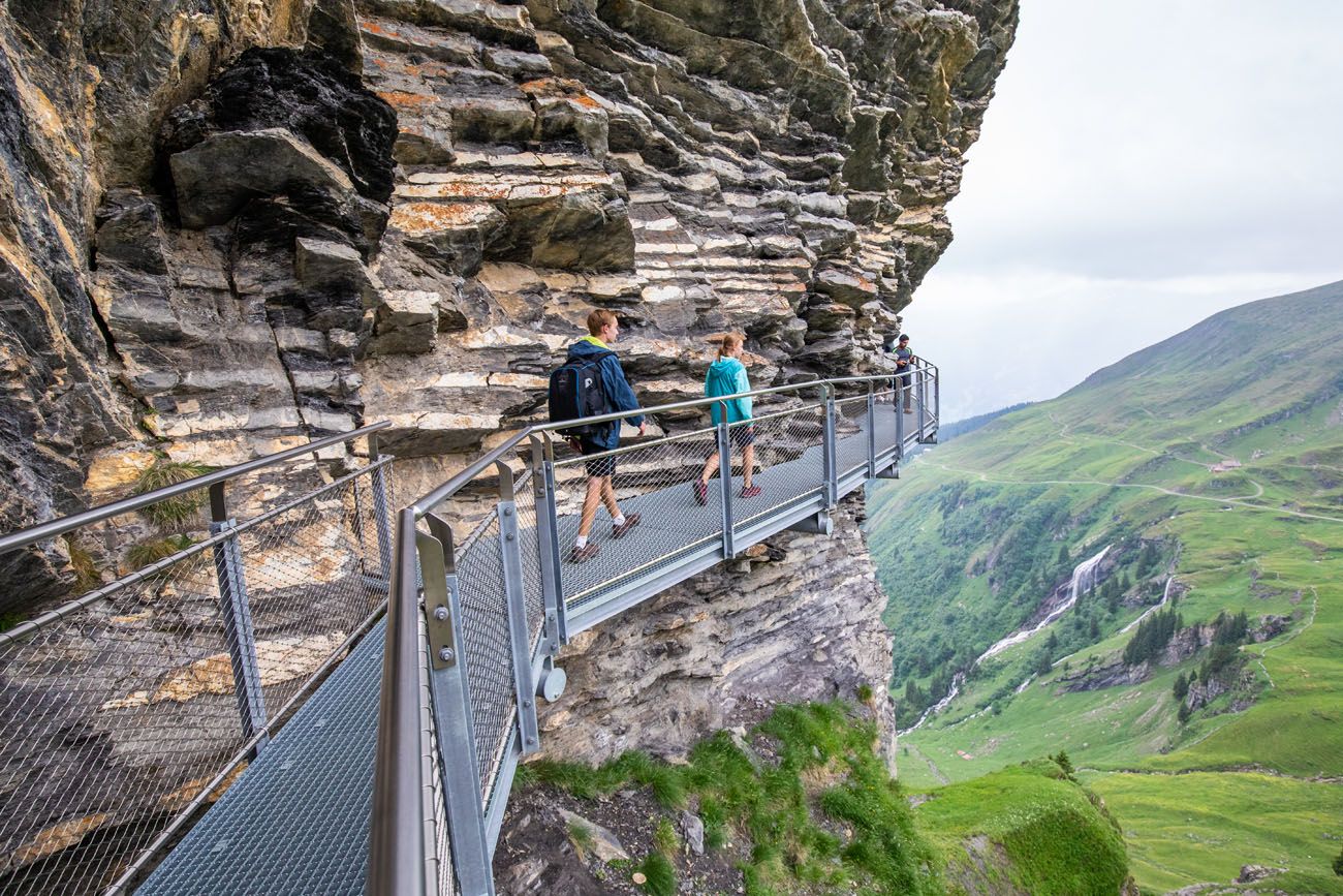
Step-by-step guide for the hike from Männlichen to Kleine Scheidegg.Mürren Via Ferrata
Distance: 2.2 km (1.4 miles)
Length of Time: 3 hours
Difficulty: Moderate
Location: Mürren to Gimmelwald
When: June 1 to October 31, weather permitting
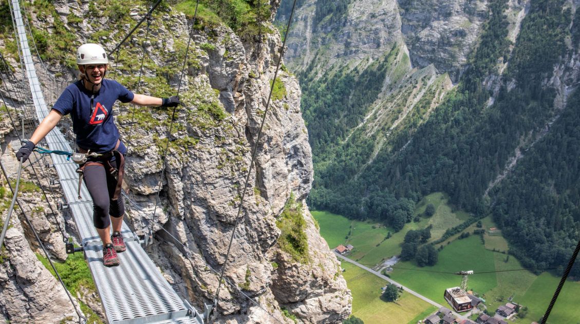
The Mürren Via Ferrata: One of Switzerland’s Most Thrilling Experiences
Everything you need to know to hike the Mürren Via Ferrata.The Mürren via ferrata is a 2.2 km journey, part via ferrata and part hiking trail. You’ll cling to a cliff, climb down steep ladders, walk on a tightrope and a suspension bridge, and (with a guide) zip line across a ravine.
If you are looking for a big thrill, this is one of the best hikes to do in the Bernese Oberland.
View from the Mürren via ferrata
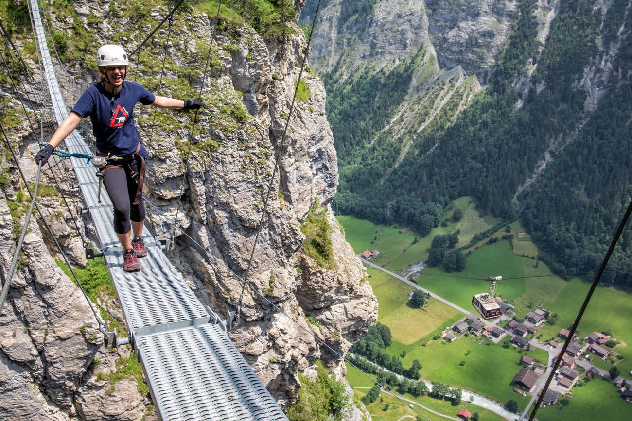
Kara on the suspension bridge
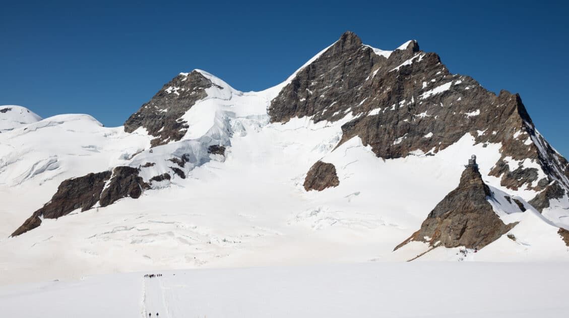
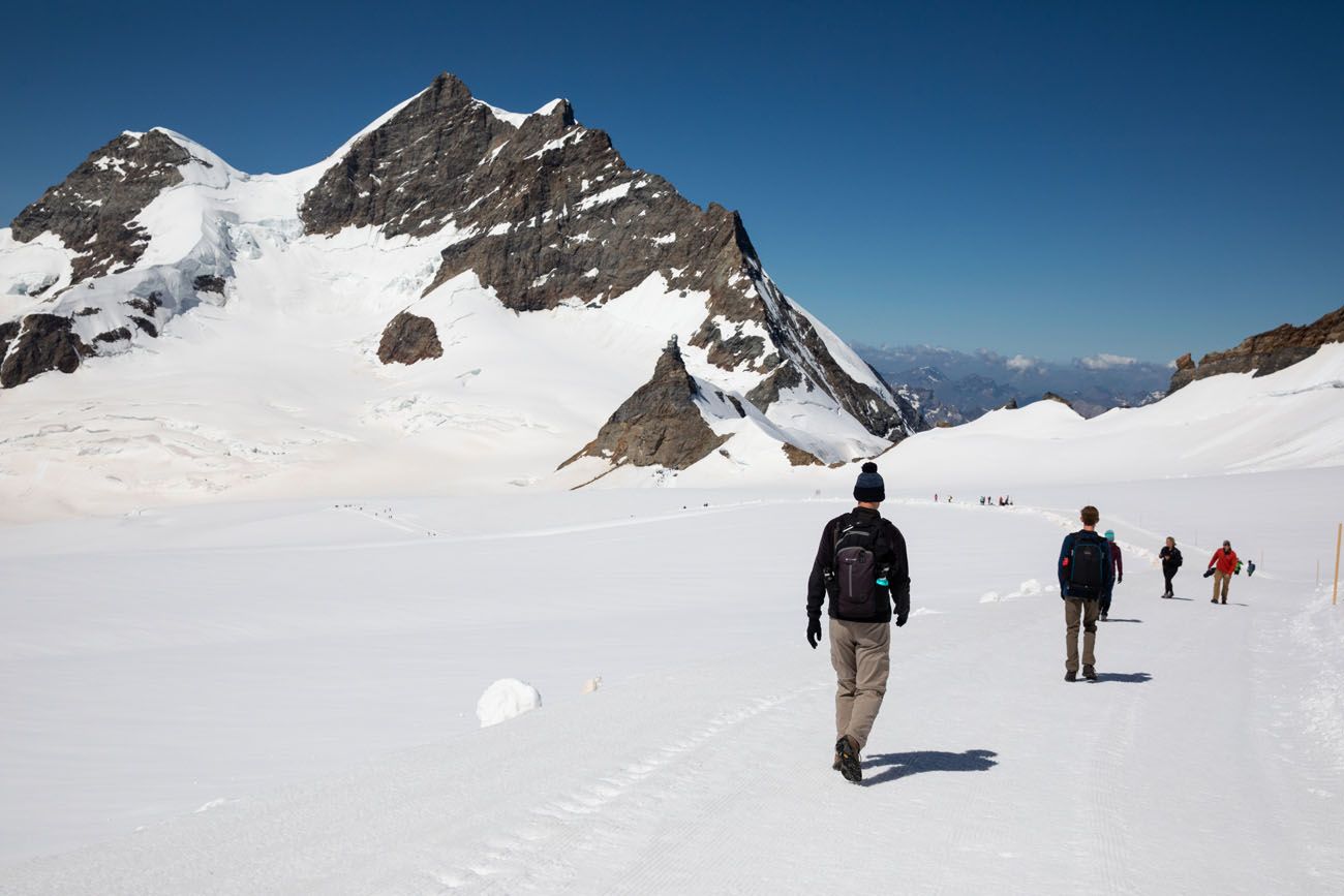
Mönchsjochhütte, Jungfraujoch
Distance: 5 km (3.1 miles) round trip
Length of Time: 2 hours
Difficulty: Moderate
Location: Jungfraujoch
Mönchsjochhütte is an alpine hut located on Jungfraujoch. On a visit to Jungfraujoch, you have the option to hike out to this hut. This was our favorite experience at Jungfraujoch.
To get to Mönchsjochhütte, it is an uphill walk on a well-groomed snow trail. It looks easy in photos, but at this elevation, it’s more challenging than you might expect. Small hills take your breath away. In the summer, as the sun warms up the snow, it can get slushy which makes walking more difficult.
Is Jungfraujoch Worth the Price and Time? An Honest Review
How to visit Jungfraujoch and hike to Mönchsjochhütte.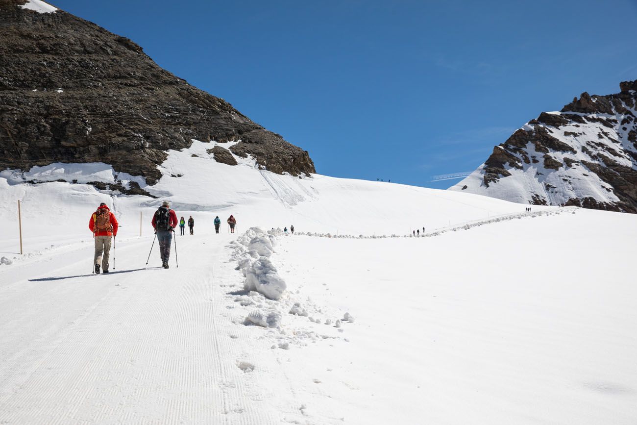
Hiking to Mönchsjochhütte
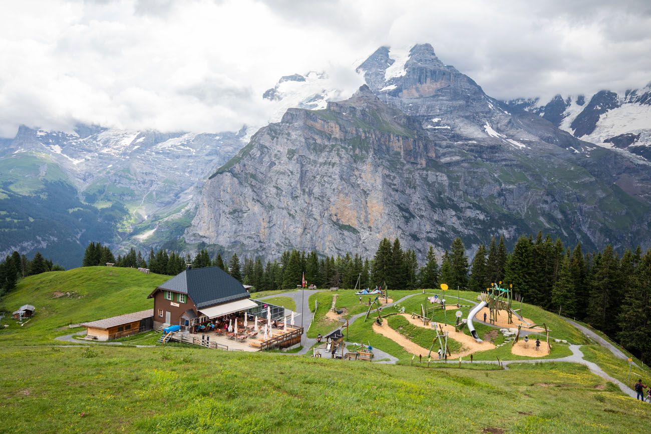
First to Grosse Scheidegg
Distance: 5.5 km (3.4 miles)
Length of Time: 2 hours
Elevation Loss: 200 meters (First to Grosse Scheidegg)
Difficulty: Easy
Location: First to Grosse Scheidegg, near Grindelwald
This easy walking trail starts in First and ends at Grosse Scheidegg, a mountain pass in the Bernese Alps. You will walk through rolling meadows and throughout the hike you are treated to wonderful views of the Jungfrau massif.
This hike can be done in either direction.
How to do this hike: To get to First, ride the cable car from Grindelwald. Hike to Grosse Scheidegg. From Grosse Scheidegg, ride the public bus back to Grindelwald. It is an overall downhill walk if you go from First to Grosse Scheidegg.
First Cliff Walk to Bachalpsee
Distance: 6 km (3.7 miles)
Length of Time: 2 hours
Elevation Gain: 100 meters
Difficulty: Easy to moderate
Location: First, near Grindelwald
In First, walk the short and somewhat thrilling First Cliff Walk. Then, follow the wide gravel and dirt trail away from First to Bachalpsee, a pretty alpine lake. This is done as an out-and-back hike, so you start and end in First.
This is a relatively easy, family-friendly hike and another very popular hike to do in the Bernese Oberland, so expect big crowds on this trail.
First Cliff Walk
Bachalpsee
How to do this hike: Ride the cable car from Grindelwald to First. Hike to Bachalpsee and return to First. Kids, and kids at heart, can fly like a bird or zip-line on the First Flyer or First Glider for a quick thrill. Or, ride go-karts downhill on a wide gravel path. The First Cliff Walk is free to visit but you will have to pay to ride the zip-lines and go-karts.
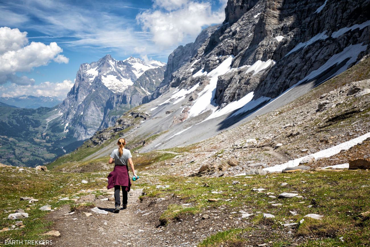
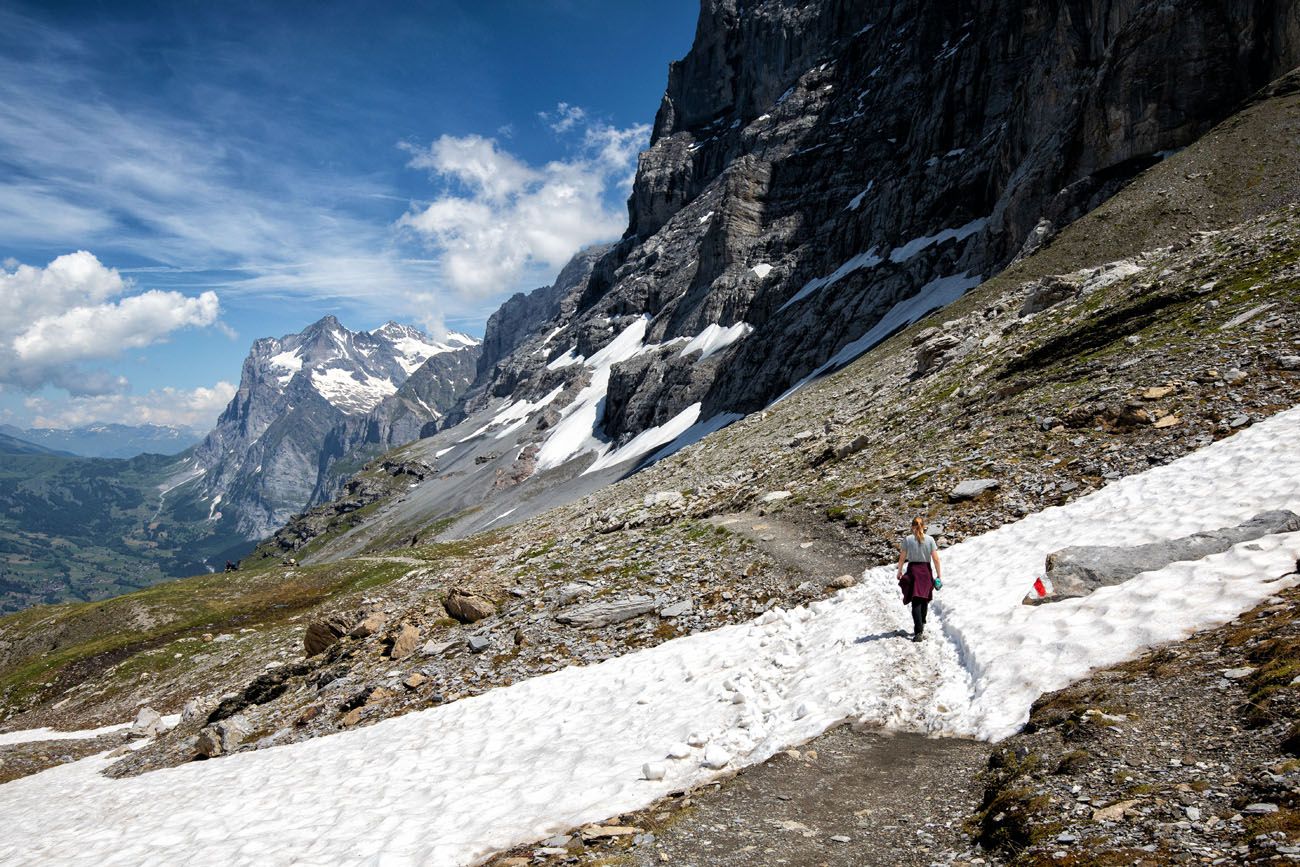
The Eiger Trail
Distance: 7.25 km (4.5 miles) point-to-point
Length of Time: 2 to 3 hours
Elevation Change: 140 meters up, 800 meters down
Difficulty: Easy to moderate
Location: Kleine Scheidegg
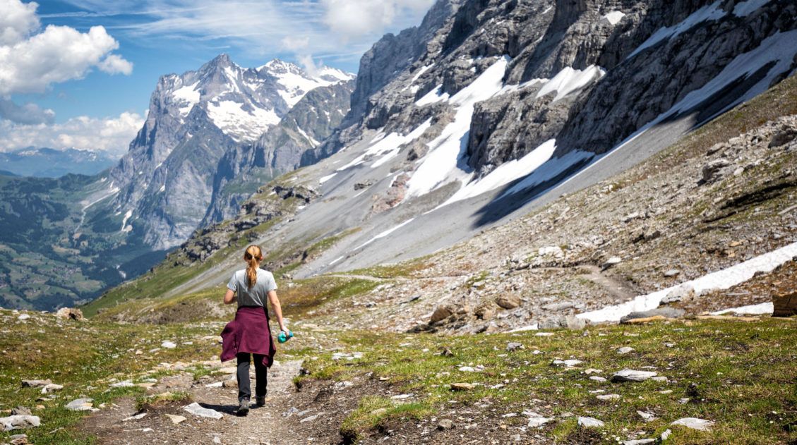
How to Hike the Eiger Trail: A Step-By-Step Trail Guide
Everything you need to know to hike the Eiger Trail, one of the best, short hikes in the Jungfrau region.This point-to-point hike follows the north face of the Eiger mountain. Along the way, you get jaw-dropping views across the Lauterbrunnen Valley to Mürren and also down to Grindelwald.
This was one of our favorite hikes in the region. The views are unbeatable, it is mostly a downhill walk so you don’t have to be super fit to hike this trail, and it can be easily added onto a visit to Jungfraujoch or Kleine Scheidegg.
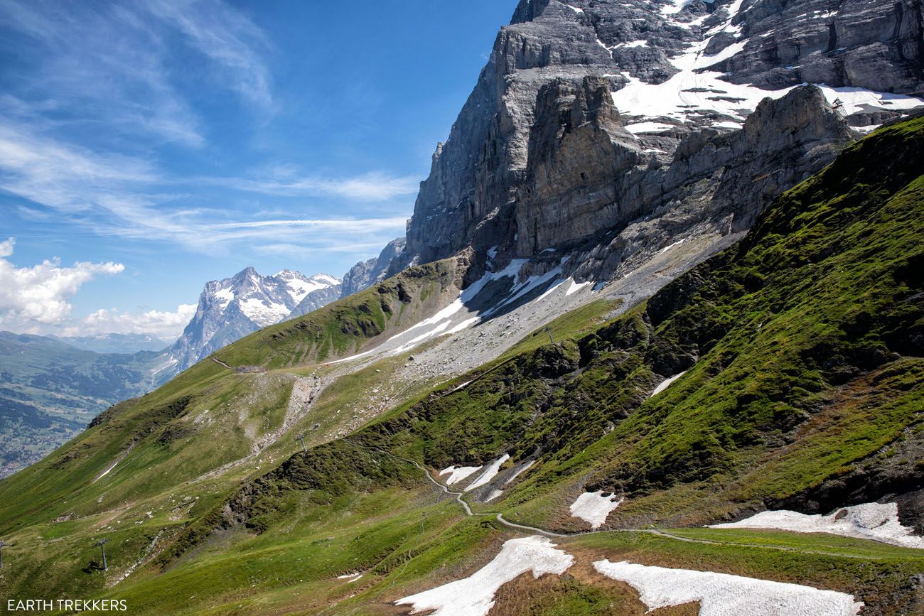
Eiger Trail
Northface Trail
Distance: 7.4 km (4.6 miles)
Length of Time: 2.5 hours
Elevation Gain: 380 meters (1,250 feet)
Difficulty: Easy
Location: Mürren
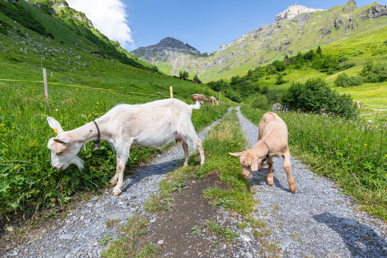
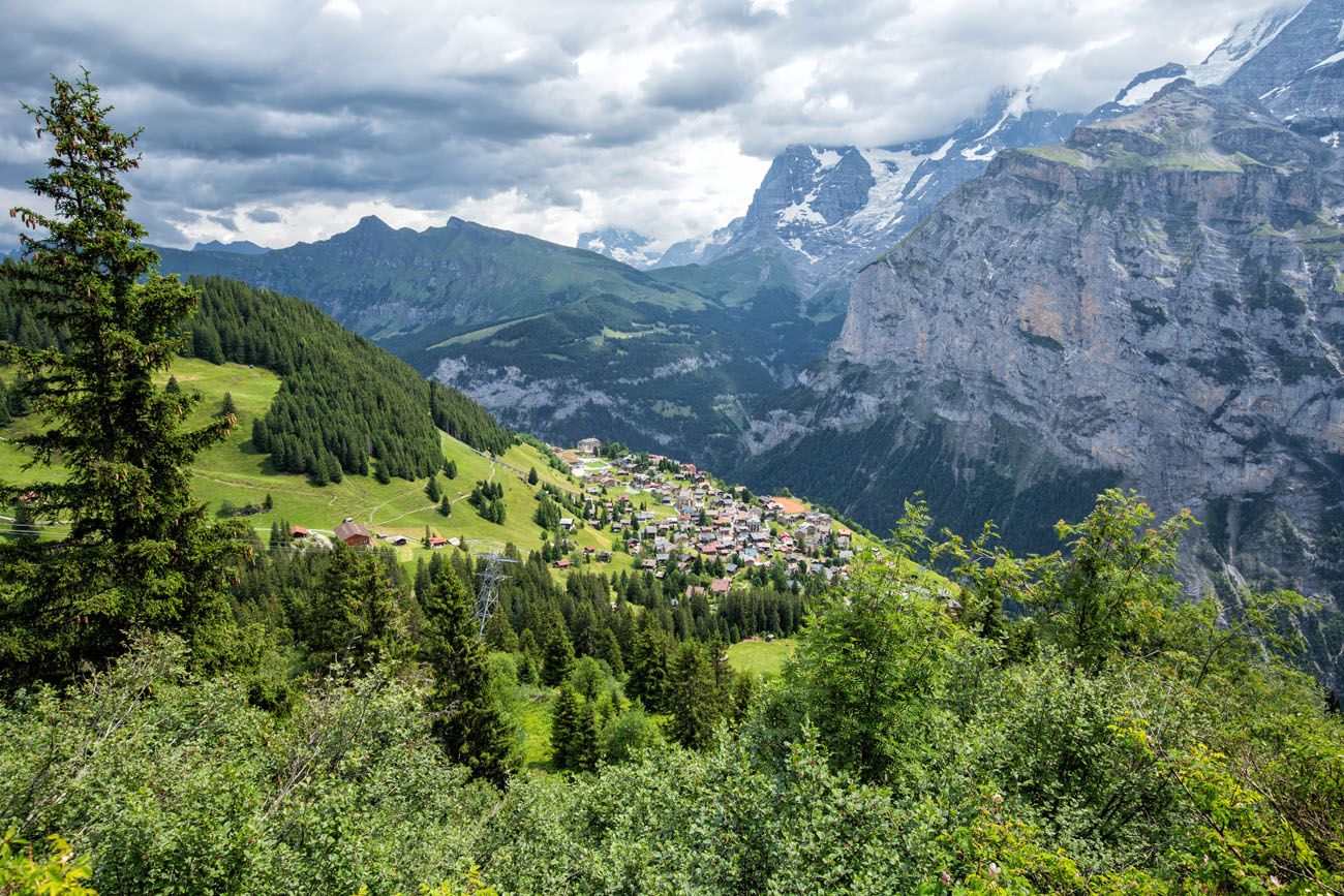
The Northface Trail in Mürren has a little bit of everything…stunning mountain views, small hamlets and chalets tucked away amidst the mountains, flower-filled alpine meadows, and pastures filled with cows and their musical bells.
This is an easy walking trail that is done as a loop from Mürren. Along the way, you are treated to spectacular views of Mönch, Eiger, and Jungfrau as well as views over the Lauterbrunnen Valley. You also have the option to add on Sprutz waterfall.
If you are visiting Switzerland with kids, this is a great hike to put on your list.
View of Mürren from the hike
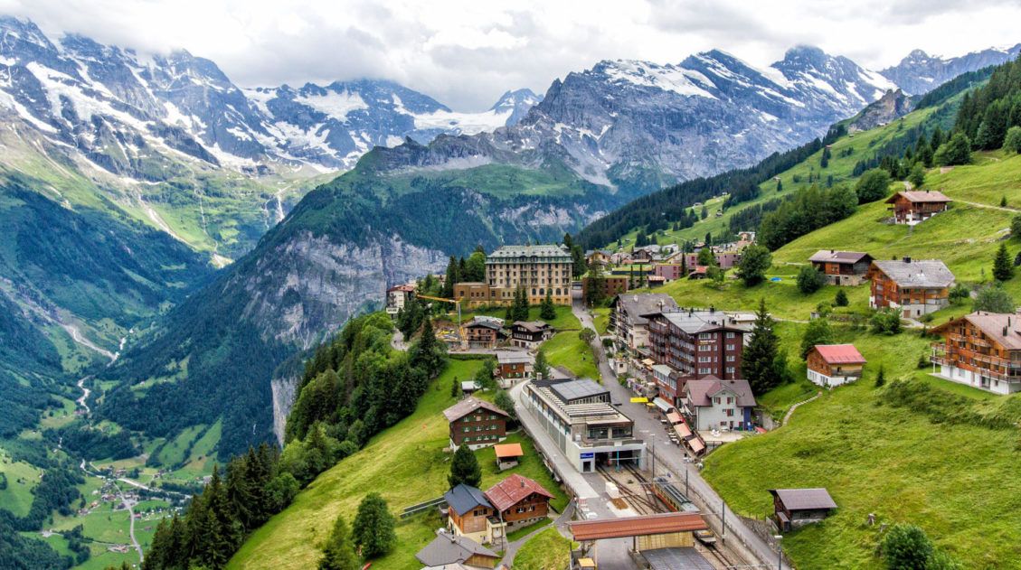
Schilthorn to Mürren
Distance: 13 km (8 miles)
Length of Time: 5 to 6 hours
Elevation Change: 1600 meters
Difficulty: Moderate to difficult
Location: Schilthorn – Mürren
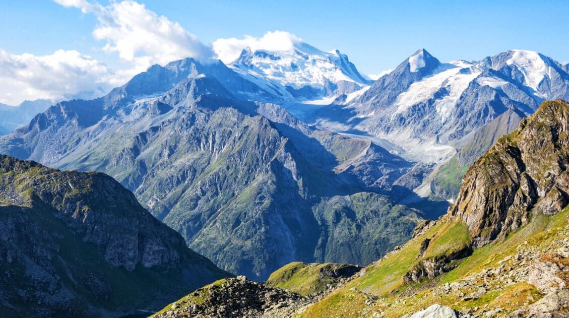
Schilthorn is one of the highest peaks in the Jungfrau region and it is one of the best places to go for panoramic views of the Swiss Alps. From here, you get jaw-dropping views of the Jungfrau massif.
Starting in Schilthorn, you will descend down through the mountains. Along the way, the view over the towns of Mürren and Gimmelwald, the Lauterbrunnen Valley, and the Jungfrau massif are truly spectacular.
Due to the gradient, this hike is challenging whether you choose to hike the trail up or down. It’s steep, so it can be killer on your knees, should you choose to hike downhill from Schilthorn to Mürren. Going up is even more difficult, since it is a steep ascent the entire way. You can shorten the hike by starting (or ending) in Birg rather than Schilthorn.
How to do this Hike: Ride the cable car from Mürren to Schilthorn. Enjoy the views from Piz Gloria, have brunch in the revolving restaurant, and visit Bond World. Hike from Schilthorn to Mürren.
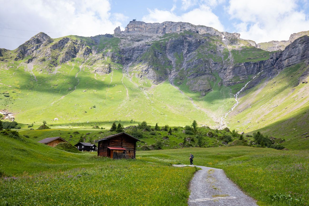
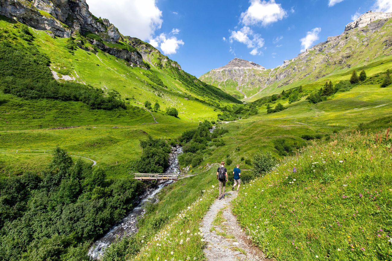
Gimmelwald to Tanzbödeli to Obersteinberg to Stechelberg
Distance: 14 km (8.7 miles)
Length of Time: 6 to 8 hours
Elevation Gain: 1000 meters
Difficulty: Strenuous
Location: Gimmelwald – Obersteinberg – Stechelberg
Learn more here
This is a challenging, long distance hike that will take the better part of the day. The view from Tanzbödeli is one of the best you can have of the Jungfrau region.
Start in the charming village of Gimmelwald, walk through farmland and dense pine forests, before climbing up to the Tanzbödeli meadow. From this meadow, enjoy panoramic views and get a different perspective of the Jungfrau massif.
Continue onto Obersteinberg for more amazing high alpine views. Have lunch or a snack here before hiking to Stechelberg.
Hiking trail outside of Gimmelwald
View of Gimmelwald from the trail. Due to time constraints, we had to end this hike early, so only have photos from the first part of the hike.
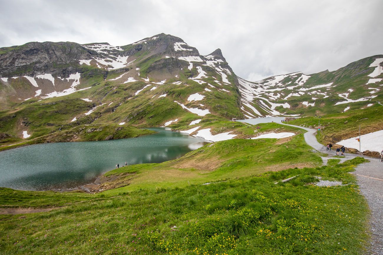
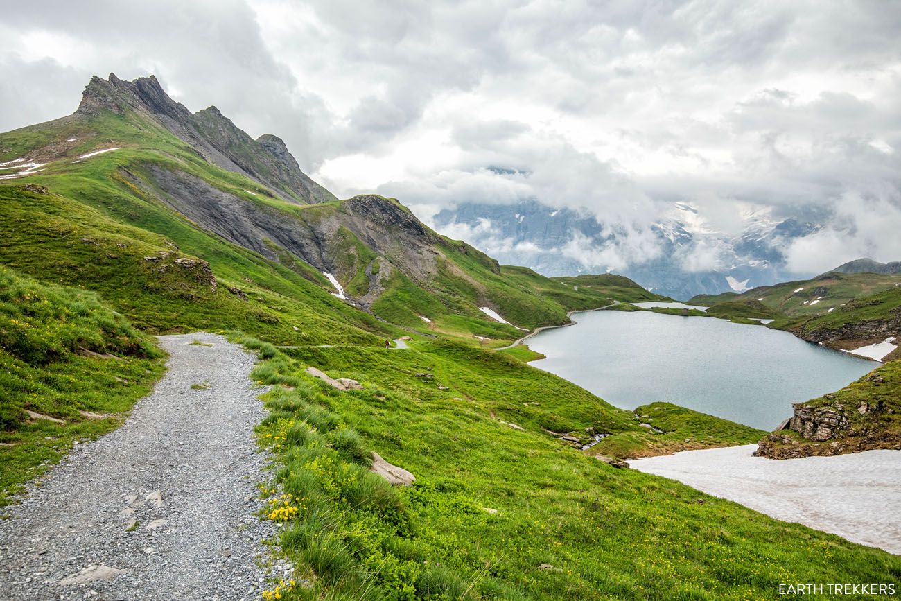
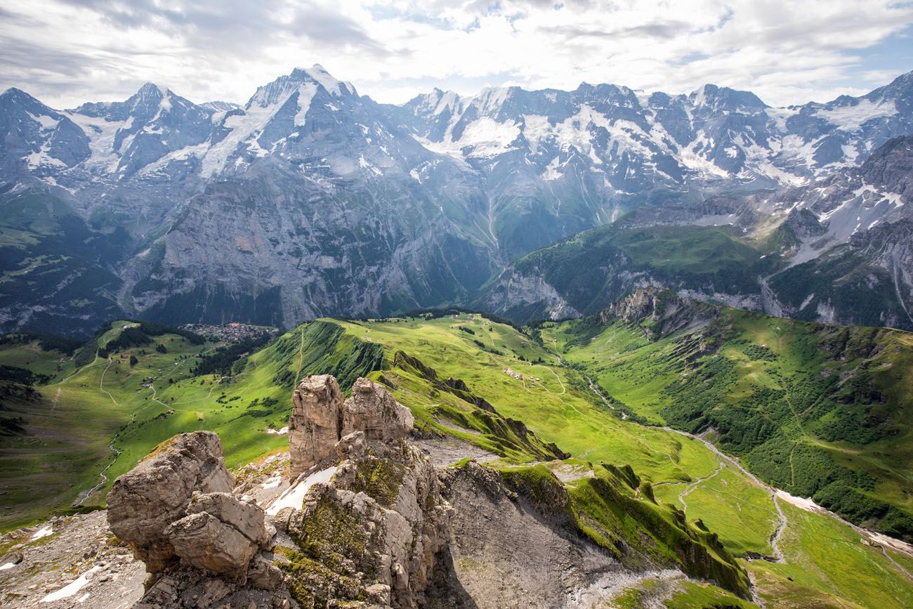
Schynige Platte to Faulhorn to First
Distance: 16 km (10 miles) point-to-point
Length of Time: 6 hours
Elevation Gain: 860 meters (2820 feet)
Elevation Loss: 690 meters (2260 feet)
Difficulty: Strenuous
Location: Schynige Platte to First
Schynige Platte to Faulhorn to First Hike: Step-By-Step Trail Guide
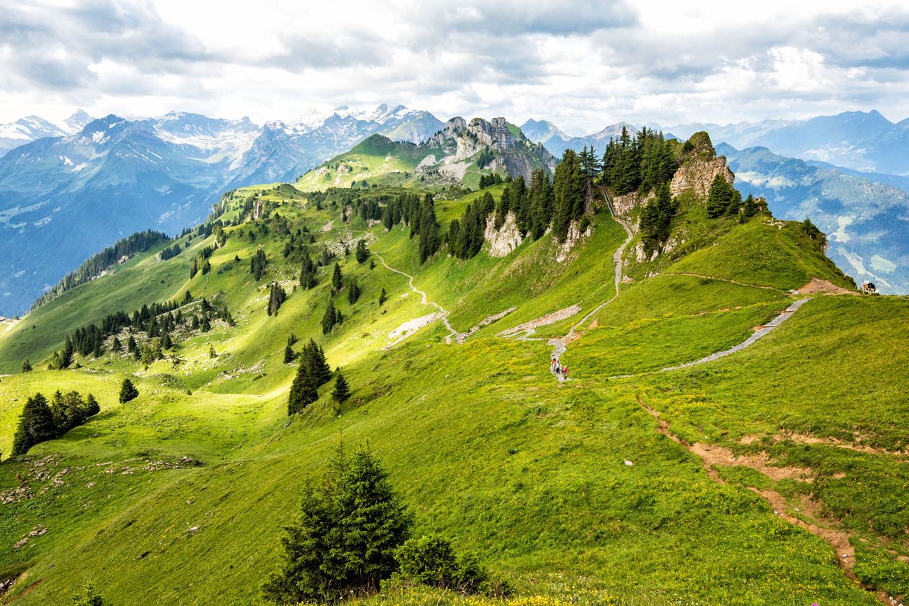
Complete guide to hiking Schynige Platte to Faulhorn to First.The hike from Schynige Platte to Faulhorn to First is a big day hike in the Jungfrau region of Switzerland, but what a spectacular day. A scenic ride on a cogwheel train, alpine lakes, rustic mountain huts, snow-covered trails, and some of the best views of Swiss Alps…these are just a few highlights of this thrilling hike.
With views of the Jungfrau massif, Lake Brienz, and numerous alpine lakes, this is often labeled as one of the best day hikes to do in the Jungfrau region.
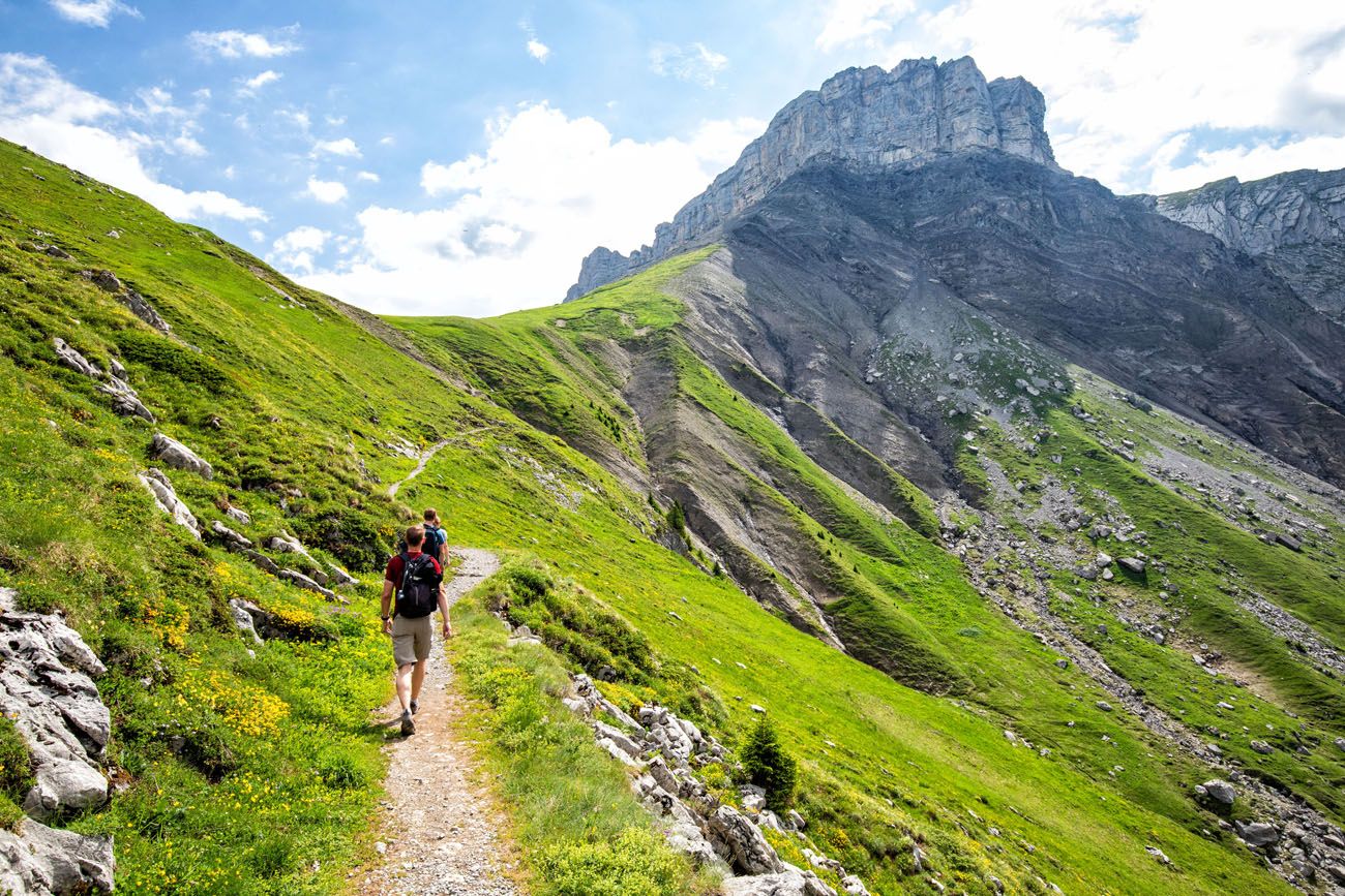
Trail between Schynige Platte and Faulhorn
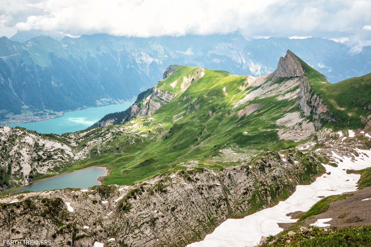
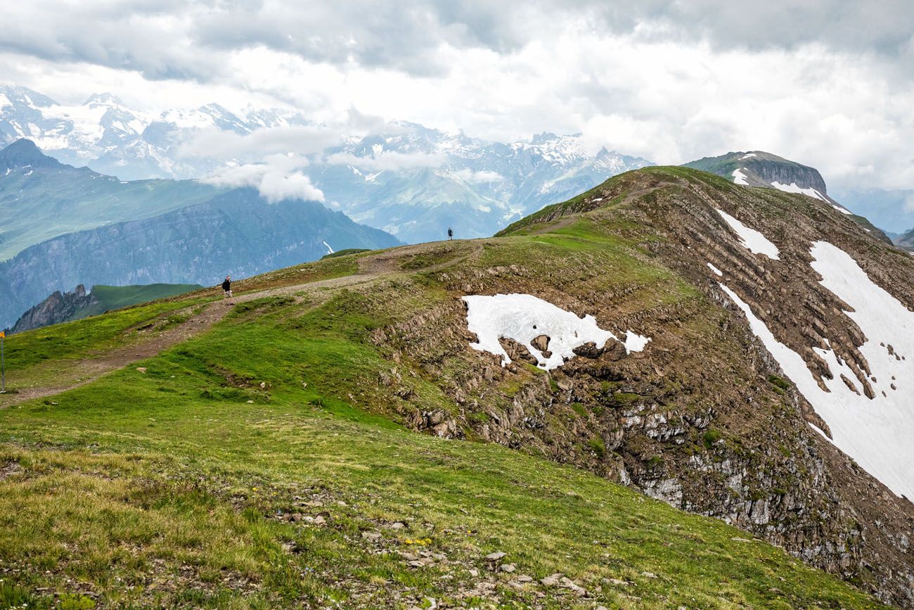
Hiking to Faulhorn
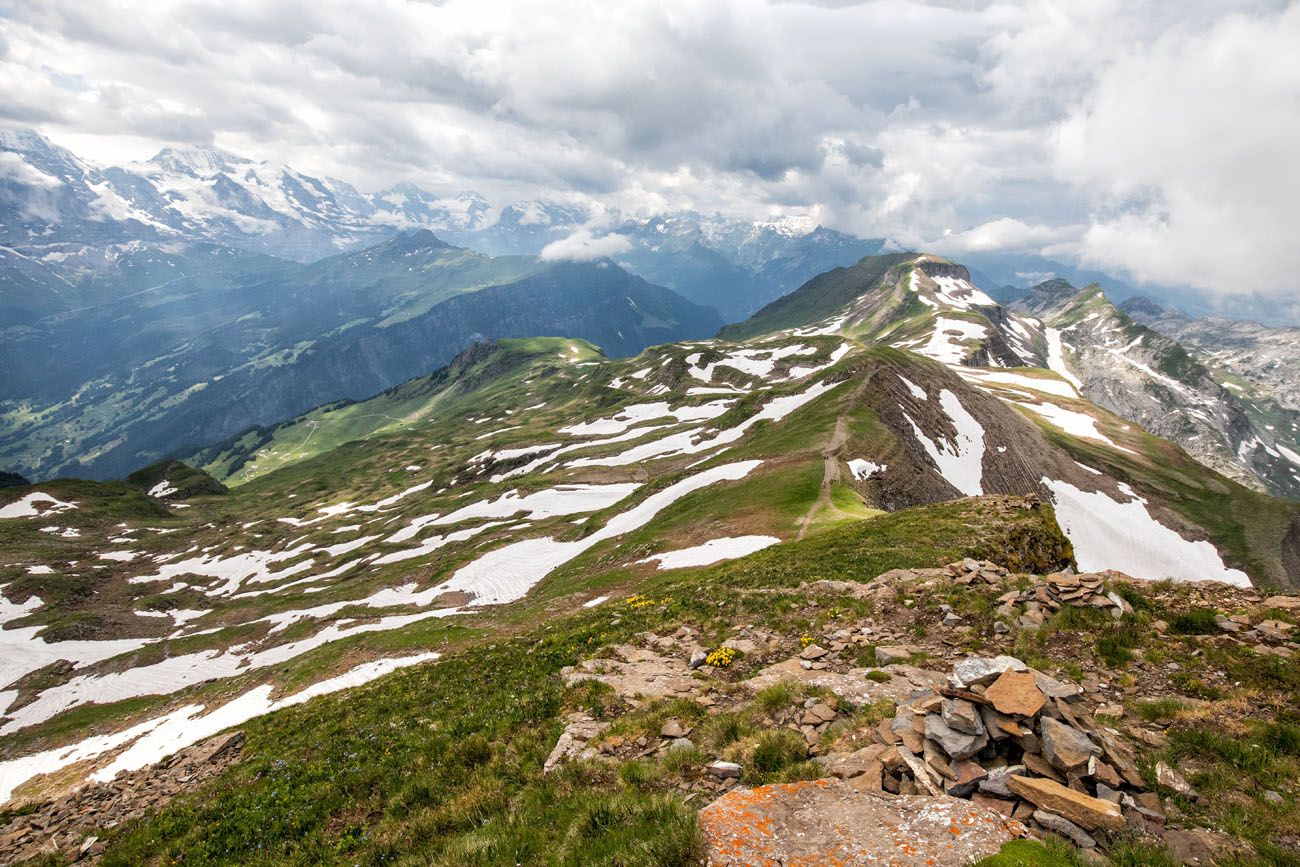
The view from Faulhorn. The header photo for this post was also taken during this hike.
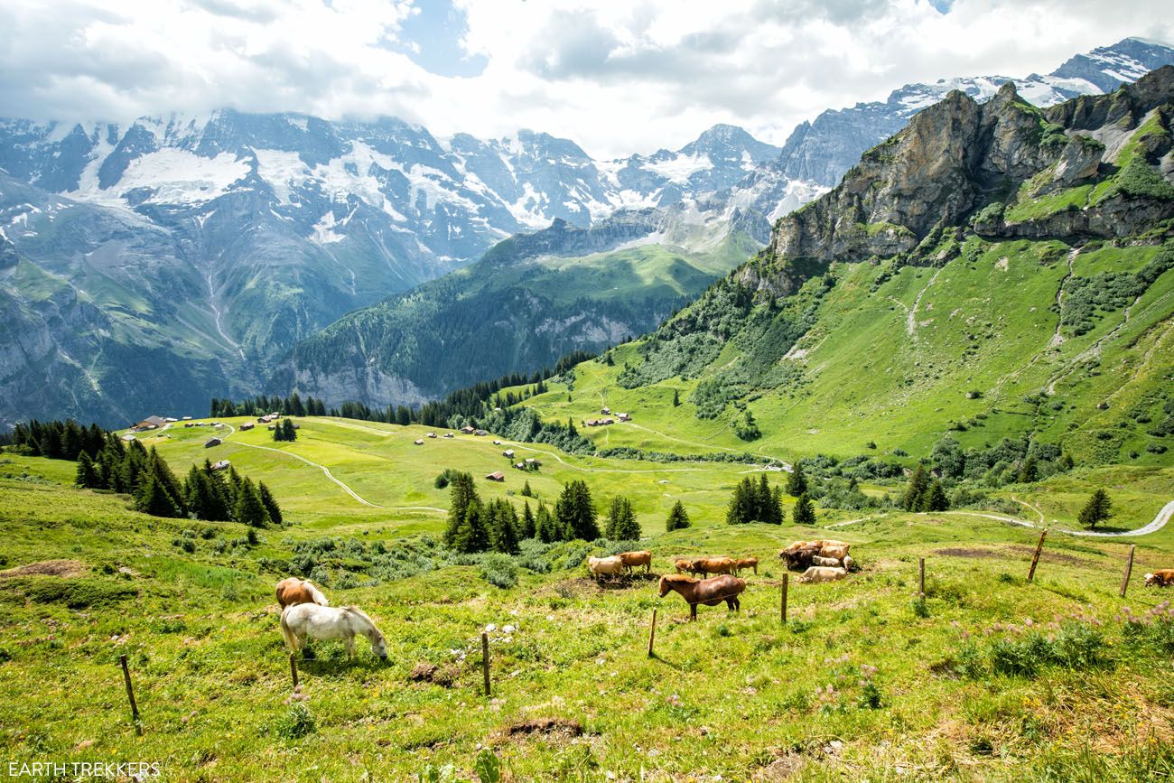
The Hardergrat Trail
Distance: 24 km point-to-point
Length of Time: 10 hours
Elevation Gain: 3000 meters
Difficulty: Challenging
Location: Interlaken
Read more here
The Hardergrat Trail is one of the most famous day hikes in Switzerland and some people say that it is one of the most beautiful hikes in the world. This is a tough day hike and for part of the way, the trail follows along a very narrow ridge. With drop-offs and brief sections of rock scrambling, this is a dangerous hike and only recommended for those with a high level of physical fitness and lots of hiking experience.
When to Go Hiking in the Bernese Oberland
The best time to go hiking in the Bernese Oberland is from mid-June through October. Much of the area is snow-covered through May, so the trails do not open until June.
If you are planning a trip to Switzerland during the spring months, most of these trails will still be closed.
The graphs below depict the average monthly temperatures and precipitation for the nearby town of Interlaken, which will help you plan your Bernese Oberland trip. Expect colder temperatures as you hike higher into the mountains.
Our Recommendations
If you are visiting Switzerland with kids (or want to do an easy hike), our top picks are the Northface Trail, Männlichen to Kleine Scheidegg on the Panorama Trail, the Blumental Panorama Trail, or the Schynige Platte Panorama Trail.
For relatively easy hikes that offer jaw-dropping views, it’s hard to beat the Eiger Trail and the Männlichen to Kleine Scheidegg hike.
If you want to leave the crowds behind (and like the day of a full day hike), hike to Tanzbödeli.
For a big thrill, dangle over the Lauterbrunnen Valley on the Mürren via ferrata.
If you want to walk on the snow, visit Jungfraujoch and hike out to Mönchsjochhütte.
For an epic hiking experience, we loved hiking from Schynige Platte to Faulhorn to First. On a future trip to Switzerland, hiking the Hardergrat trail will be #1 on our to-do list.
What do you think are the best hikes in the Bernese Oberland? Let us know in the comment section below.
More Places to Go in Switzerland
We have TONS more information about Switzerland in our Switzerland Travel Guide, including Zürich, Lucerne, the Bernese Oberland, Zermatt, Lugano, and Lausanne.
20 Amazing Things to Do in the Jungfrau Region of the Bernese Oberland
Towering mountains, alpine meadows, soaring cable cars, historic cogwheel trains, scenic walking trails, quaint villages and hamlets…this is the Jungfrau region of the Bernese Oberland. In this guide, we cover the very best things to do in the Jungfrau region, ranging from scenic cable car rides to hiking some of the most beautiful trails in […]
Bernese Oberland Travel Guide: Focus on the Jungfrau Region
The Bernese Oberland, this is where mighty, snow-capped mountains tumble down into lush, green valleys. Waterfalls spill over the cliffs, cows and their musical bells wander the fields, charming villages dot the hillsides, and hiking trails connect small hamlets and towns. Located in central Switzerland, the Bernese Oberland is home to some of the most […]
Where to Stay in Jungfrau, Switzerland: Best Towns & Hotels
If you are making a decision about where to stay in the Jungfrau region of Switzerland, you have a lot of options. On a map, the Jungfrau region can look very confusing. With its mountains and valleys, cliffside villages and bustling towns, not to mention its complex transportation network, it can feel overwhelming trying to […]
Jungfrau Itinerary: 1 to 7 Days in Mürren, Lauterbrunnen & Interlaken
The Jungfrau region of Switzerland can seem like a confusing place to visit, particularly to first time visitors. With its unique geography, complicated network of trains and cable cars, and long list of hiking trails and small towns to visit, it may seem like an overwhelming task to plan a trip here. But it doesn’t […]
12 Epic Day Hikes in Zermatt (+ Trail Stats, Photos & Map)
One of the best ways to explore Zermatt is on foot. Hiking trails climb high into the mountains above Zermatt, past Swiss hamlets, through scenic valleys and rocky gorges, and to some of the best viewpoints of the Matterhorn. The network of cable cars and trains takes you up into the mountains, so for the […]
Switzerland Itinerary Ideas: 7 to 21 Days of Alpine Adventures
If you are planning a trip to Switzerland, this is a great place to start. There are many different ways to plan your “perfect Switzerland itinerary,” depending on your interests and how much time you have. In this article, we list five sample itineraries for Switzerland. These range from 7 to 21 days, with suggestions […]
Jungfraujoch or Schilthorn: Which One Should You Visit?
If you are planning a visit to the Bernese Alps and only have the time, or the money, for Jungfraujoch or Schilthorn, which one should you visit? Both are extraordinary experiences, offering panoramic views of the Alps with a few unique differences. Both also come with a big sticker price. In this article, get an […]
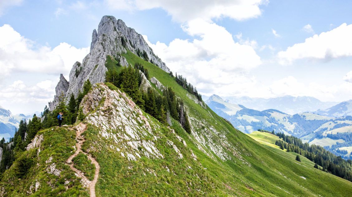
Hiking the Gastlosen Tour, Switzerland: Stats, Map, & Photos
The Gastlosen is a chain of limestone mountains that look very similar to the Dolomites of Italy. For 11 km, the trail loops around these magnificent, jagged mountains and you are treated to sweeping views of Switzerland. This is a gorgeous hike. A chair lift lops off the first big climb (and the final descent), […]
Ultimate Guide to the Walker’s Haute Route
Walker’s Haute Route The Walker’s Haute Route is one of the most rewarding and memorable multi-day walks in Europe. On this trek, hikers cross 10 of the highest mountain passes in the French and Swiss Alps, as they walk from Chamonix, France to Zermatt, Switzerland. Walking from Chamonix to Zermatt takes you to remote mountain huts, to tiny […]
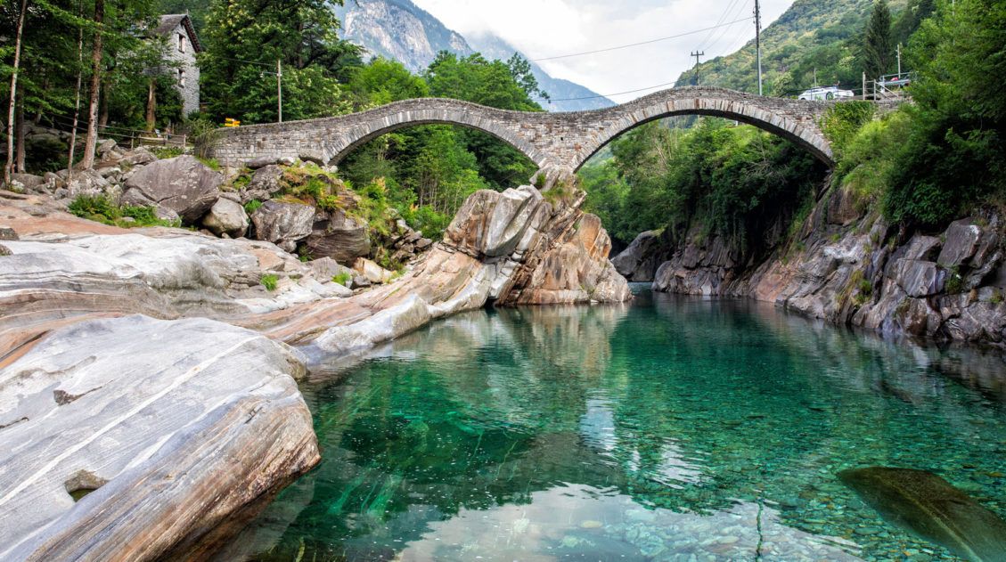
How to Visit Ponte dei Salti, Verzasca Valley, Switzerland
Ponte dei Salti is a medieval-style bridge that is located in the Verzasca Valley in southern Switzerland. It looks like something right out of a fairytale, this double-arched bridge that spans a crystal clear, aquamarine river. Right around the corner is the tiny town of Lavertezzo, and with its stone buildings and church, complements the […]
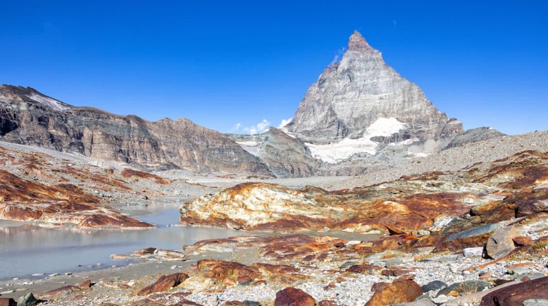
Matterhorn Glacier Trail: Ultimate Trail Guide (+ Map, Photos & HELPFUL Tips)
The Matterhorn Glacier Trail is one of the easiest and most scenic hikes to do in Zermatt. This point-to-point trail weaves its way between alpine lakes and along the way you get up close views of the Matterhorn. Since it is done one-way and is a mostly downhill hike, this is a great trail for […]
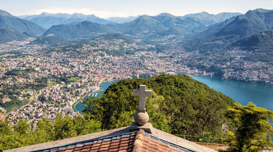
Lugano, Switzerland: What to Do, Where to Eat & Where to Stay
Surrounded by mountains and lining the shore of an enormous lake, Lugano is a city with a beautiful setting. Located in the Italian-speaking Ticino canton of Switzerland, this city is a wonderful blend of Italian, Swiss, and Mediterranean influences. Yes, you may be in Switzerland, but it looks and tastes a lot more like Italy. […]
Walker’s Haute Route Stages: An Overview of All 14 Stages
The Walker’s Haute Route is a multi-day trek from Chamonix, France to Zermatt, Switzerland. On this walk, hikers will cross 10 mountain passes, walk through small towns and through rugged, remote landscapes, and get to experience a less touristy side of the Swiss Alps. There are several routes that take hikers from Chamonix to Zermatt. […]
Comments 47