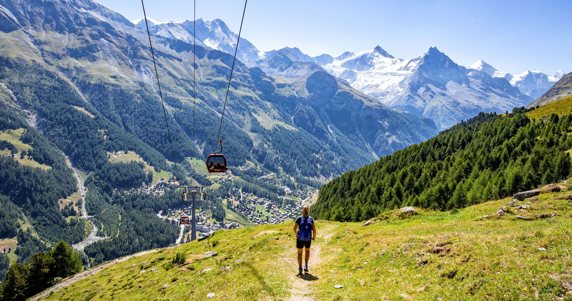
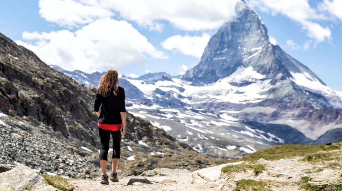
Having completed a segment of Stage 10 on yesterday’s hike, we found ourselves with another short day today. However, that did not make it easy. Today’s hike finds you crossing over another mountain pass as you hike from Lac de Moiry to Zinal.
As is the same for other days of the Walker’s Haute Route, today once again offers incredible views of the Alps. As you climb, you’ll be able to see the stunningly blue Lac de Moiry and during your descent you’ll find yourself gazing at Weisshorn and Zinalrothorn and the town of Zinal below.
Walker’s Haute Route Stage 10 Hiking Stats
Stage 10 has several different starting points, depending on where you ended yesterday. There are also two routes to Zinal, a short, steep descent or a longer, more gradual descent. We took the shorter, steeper descent, which is reflected in the hiking stats below.
Hiking Stats from Moiry Barrage Bus Stop to Zinal:
Distance: 9.1 km (5.6 miles)
Difficulty: Moderate
Total Ascent: 605 m (1,985 feet)
Total Descent: 1,160 m (3,800 feet)
Lowest Elevation (Zinal): 1,685 m (5,525 feet)
Highest Elevation (Col de Sorebois): 2,840 m (9,315 feet)
Elevation at Moiry Barrage Bus Stop: 2,265 m (7,430 feet)
Elevation in Zinal: 1,700 m (5,575 feet)
Average Time: 4 hours; Our Time: 3 hours (including stops)
If You Start from Cabane de Moiry, then Add:
Distance: 6.4 km (4.0 miles)
Total Ascent: 100 m (340 feet)
Total Descent: 680 m (2,230 feet)
Estimated Time: 2 hours
If You Start from the Moiry Glacier Bus Stop, then Add:
Distance: 4.4 km (2.75 miles)
Total Ascent: 175 m (570 feet)
Total Descent: 280 m (925 feet)
Estimated Time: 1 hour 30 minutes (including stops)

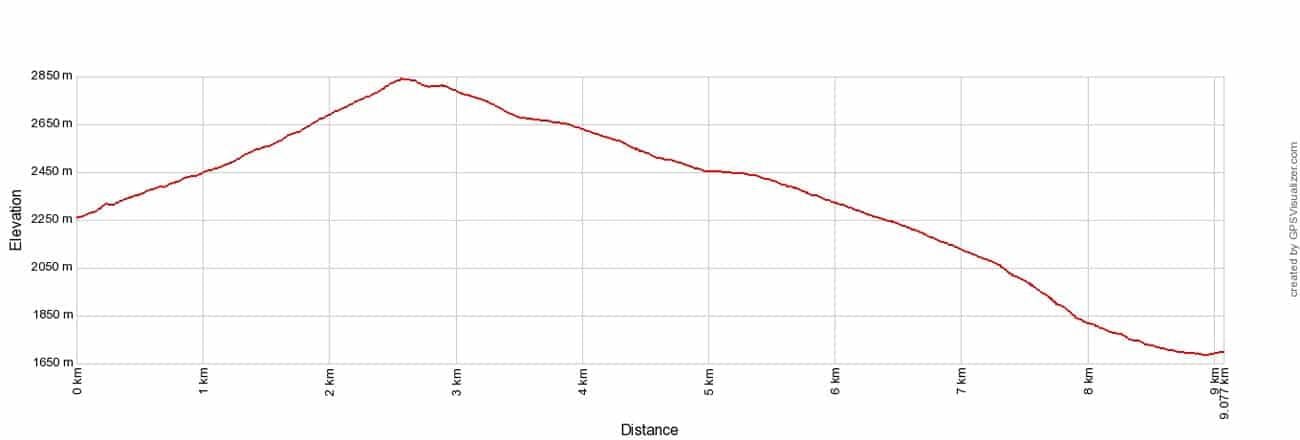
Walker’s Haute Route Stage 10 Elevation Profile
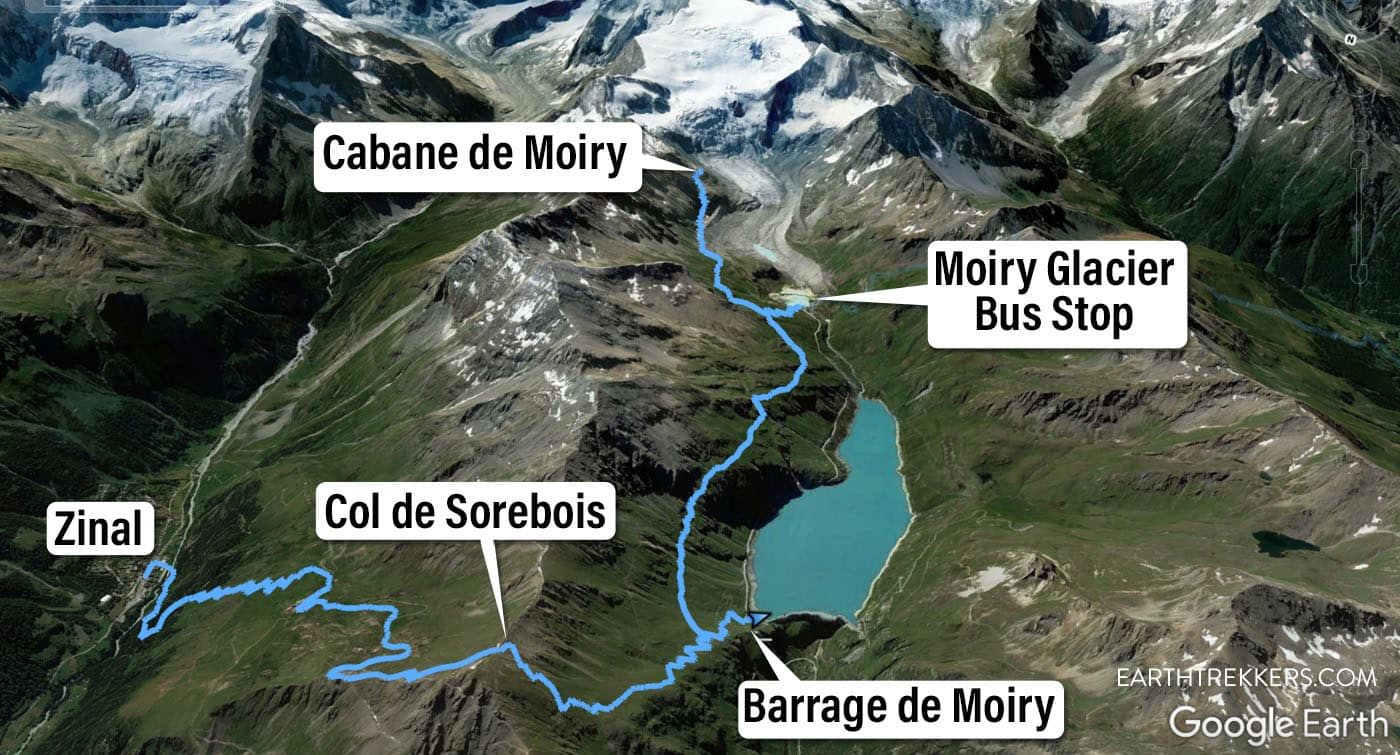
Haute Route Stage 10 Map
Please practice the seven principles of Leave No Trace: plan ahead, stay on the trail, pack out what you bring to the hiking trail, leave areas as you found them, minimize campfire impacts, be considerate of other hikers, and do not approach or feed wildlife.
Walker’s Haute Route Stage 10 Trail Overview
To hike the Haute Route, we highly recommend following the trail descriptions in the book Trekking Chamonix to Zermatt, The Classic Walker’s Haute Route by Kev Reynolds. Below we list an overview of the day, so you know what to expect along the way. We also provide advice on where to eat and where to stay. Later in this guide, we list a few tips and trail clarifications to be used with the Trekking Chamonix to Zermatt book.
Stage 10 has several different starting points, depending on how you ended day 9. For us, our day started at the Barrage de Moiry, so we hiked a portion of Stage 10 yesterday.
Cabane de Moiry is a popular ending point for Stage 9. If you plan to stay at Cabane de Moiry, it is a downhill walk towards the parking area for the glacier, followed by a walk on a trail high above Lac de Moiry.
If you ended stage 9 at the parking area for Moiry Glacier, this is the same spot you will start stage 10. Ride the bus from Grimentz to the Moiry Glacier parking area. The trail briefly leads uphill and then you will walk the high trail above Lac de Moiry to the dam.
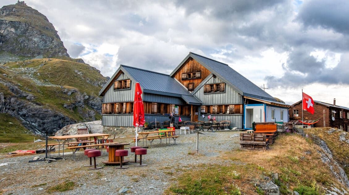
If you ended stage 9 at the dam (Barrage de Moiry), as we did, ride the bus to this parking area from Grimentz. From the dam, it is a 15-minute uphill walk to join the upper trail above Lac de Moiry. This is the junction where the trails from Cabane de Moiry, the parking area for Moiry Glacier, and the trail from the dam meet.
For us, stage 10 started at the dam and our route is described below. For photos and a trail description of the upper trail along Lac de Moiry, read our guide to Stage 9 of the Haute Route.
Barrage de Moiry to Col de Sorebois
Since we stayed overnight in Grimentz, we took the bus to the parking lot for Barrage de Moiry at the north end of Lac de Moiry. For the bus timetable, click here.
The parking lot for the dam is the same spot where we ended yesterday’s hike. To the east you’ll see rising, grassy peaks with herds of cattle, and may even be able to make out a trail. That’s where you’ll be headed as you begin your climb.
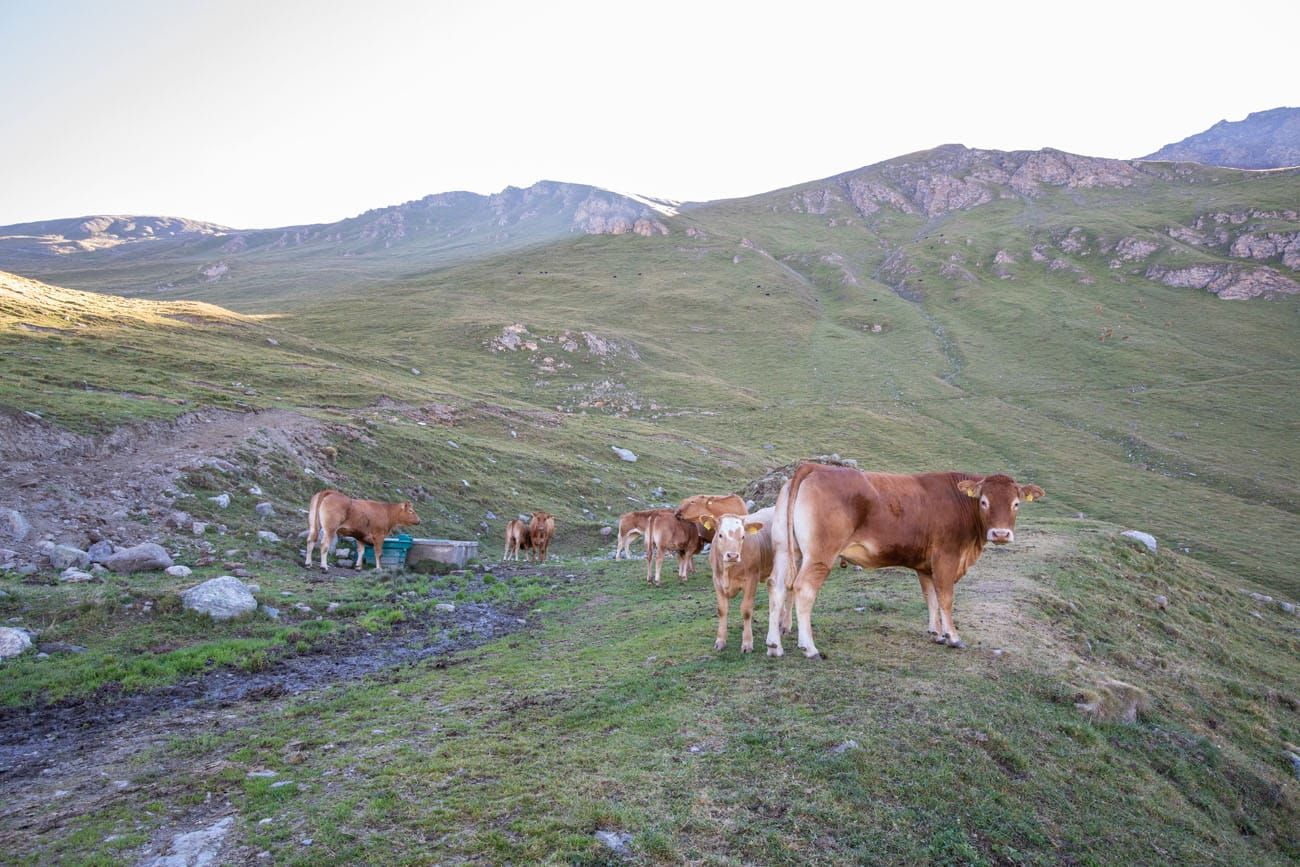
The trail starts as a wide, grass road with a steady ascent. There is also a tiny but steeper dirt path that shortcuts the large bending road, which is what we took. As you climb up, you’ll be listening to the clanging of cowbells as you dodge cow pies that litter the trail. You may even need to navigate through the herd if they block your trail, but the road is wide enough that you can go around.
The climb will stay steady for a while, and about halfway up the mountain the trail will become steeper. Say goodbye to the wide, grass road as you’ll now find yourself on a rocky dirt trail.
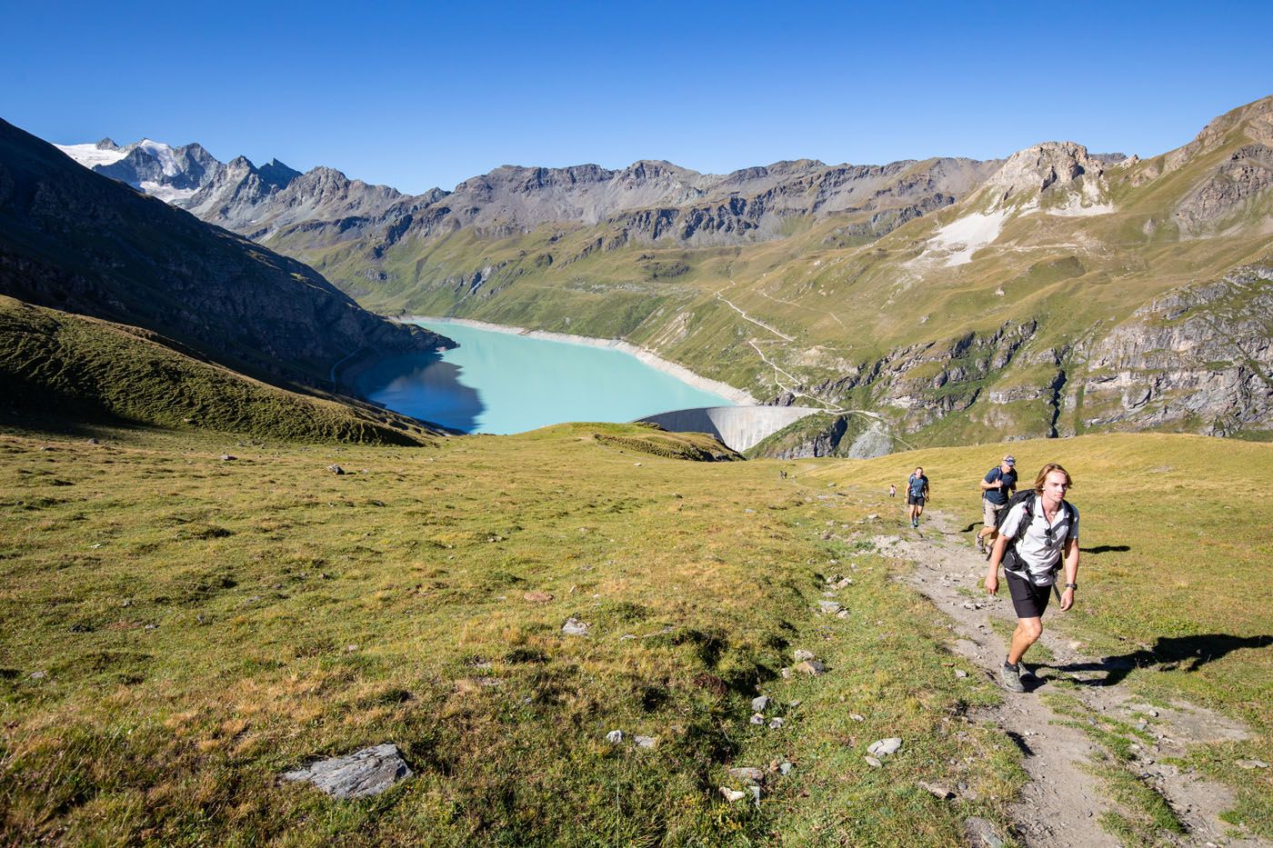
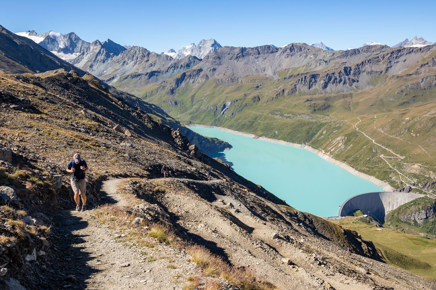
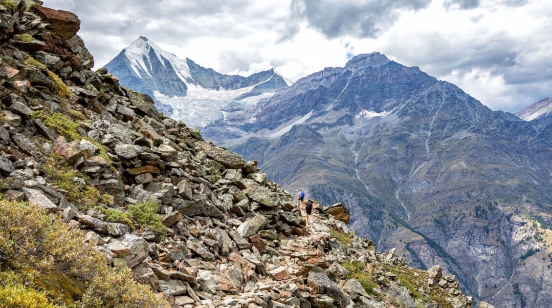
As you continue further up, the climb will get even steeper, and the last segment of the climb you’ll be traveling up numerous switchbacks to reach the summit. Just don’t forget to enjoy the views out over Lac de Moiry as you catch your breath.
Tim is coming up the final switchbacks before reaching Col de Sorebois.
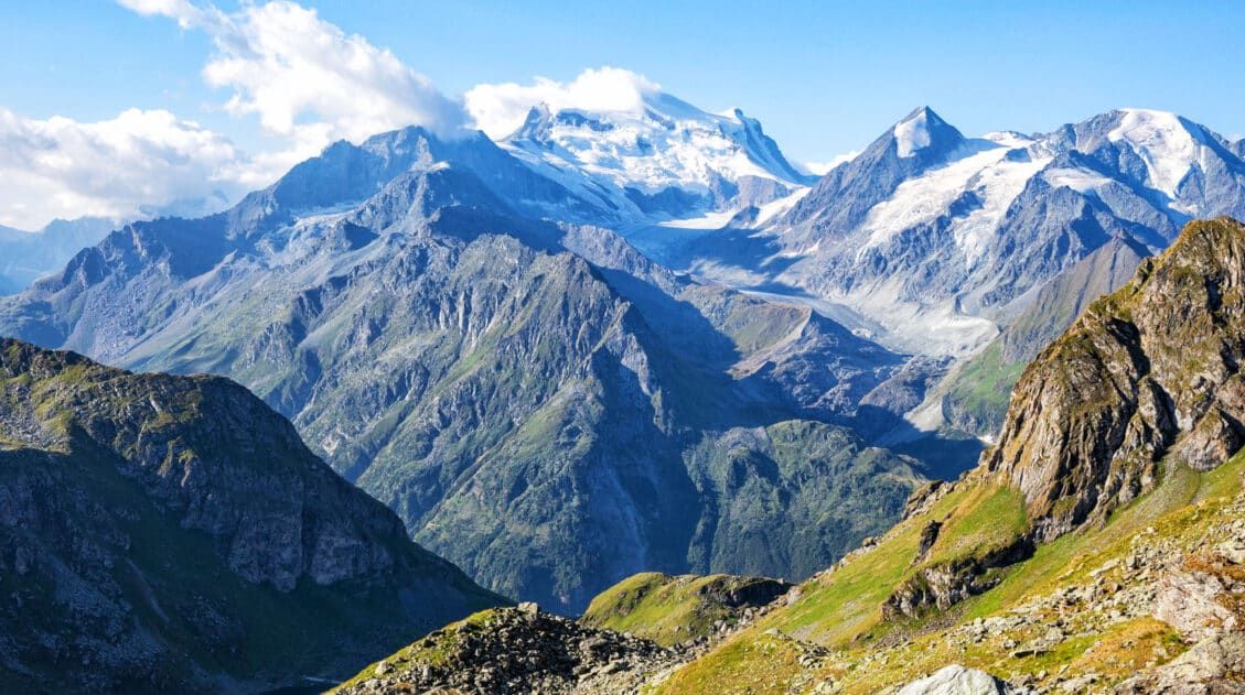
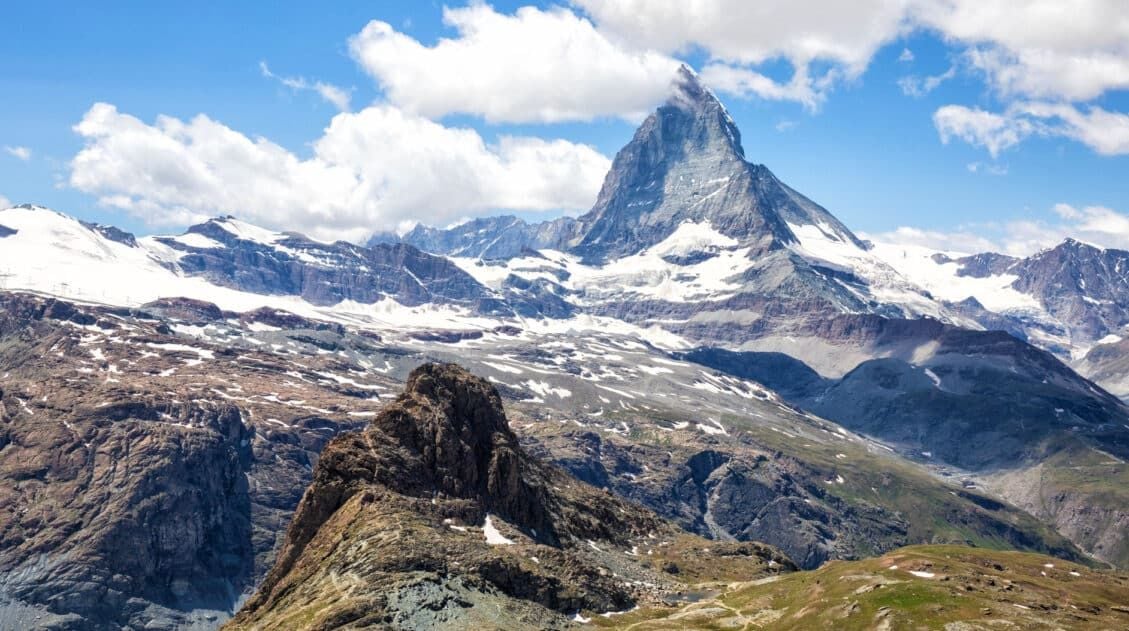
You’ll reach the top, Col de Sorebois, where you’ll be treated to incredible 360° views of the Alps. At this point, you are standing at 2,840 meters (9,315 feet). From here, it is a massive descent to Zinal.
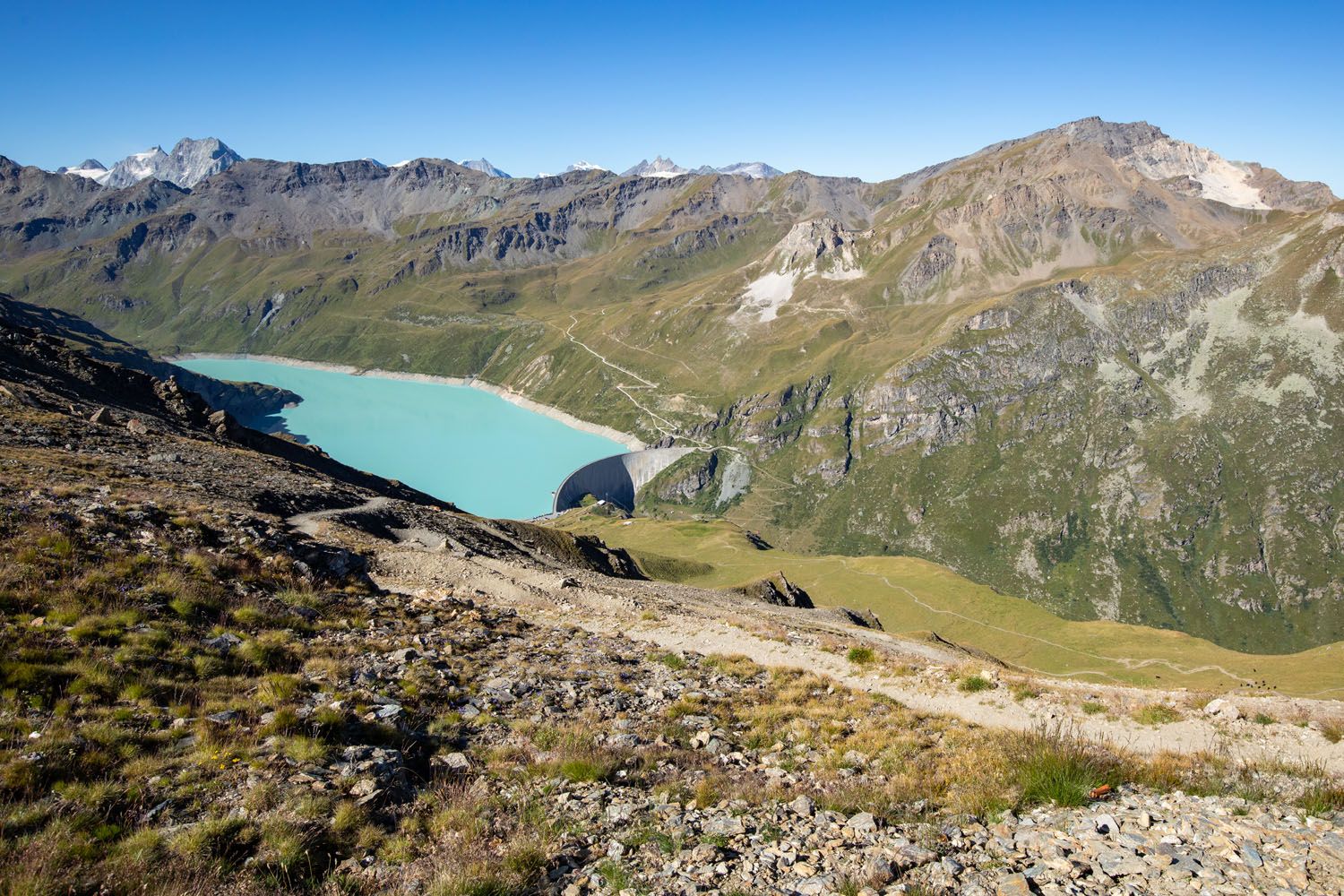
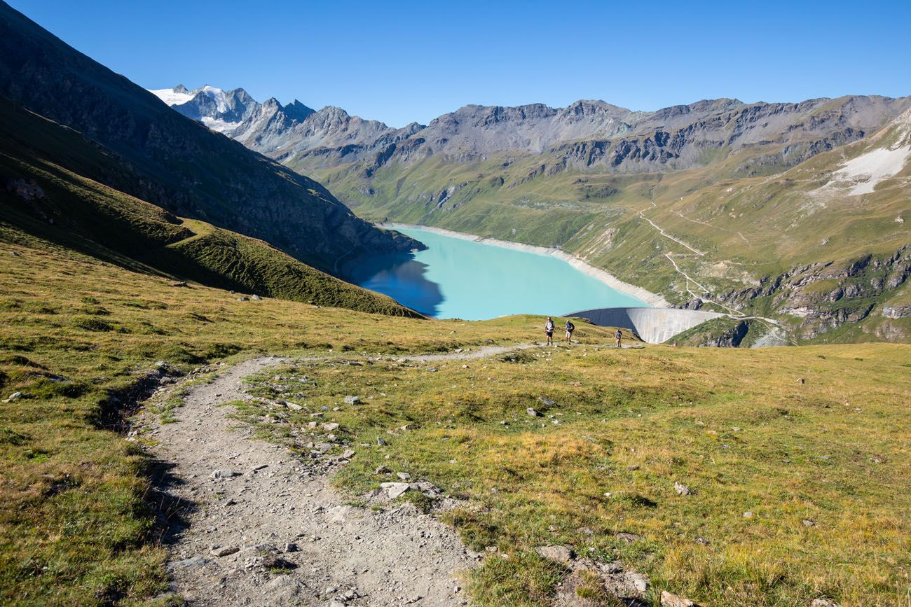
The view from Col de Sorebois over Lac de Moiry.
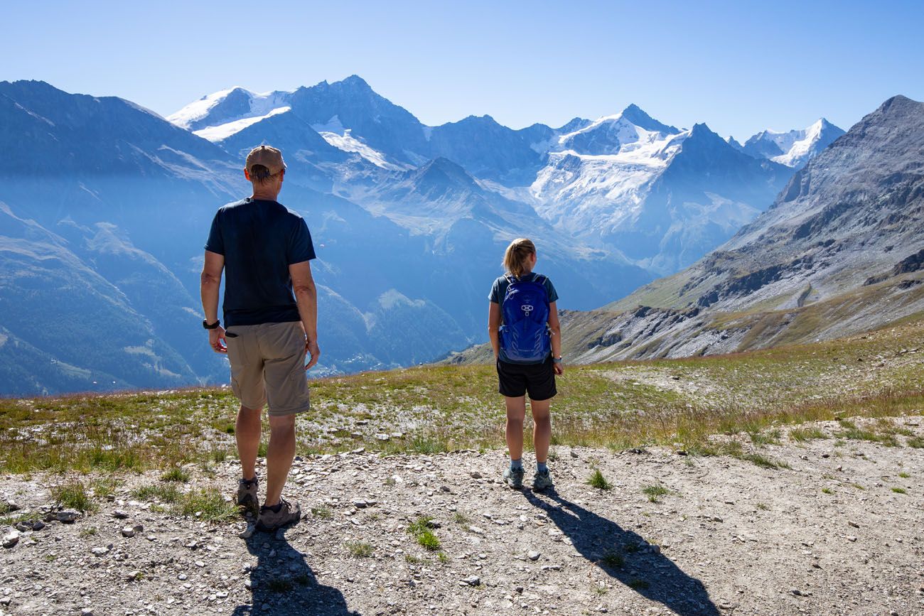
The view in the other direction to Weisshorn and Zinalrothorn.
Col de Sorebois to Zinal
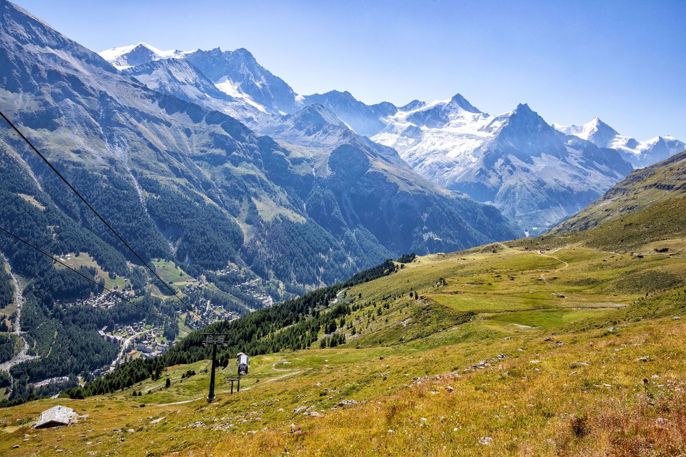
You’ll descend down the opposite side of the mountain along a large, steep gravel road. As you continue, you’ll pass cable car and chairlift stations. The mountain side here doubles as a ski slope in the winter and has mountain biking paths for the summer. If you’re hiking in the summer, you’ll be sharing the same path that the bikers use, so keep an eye out for any approaching from behind.
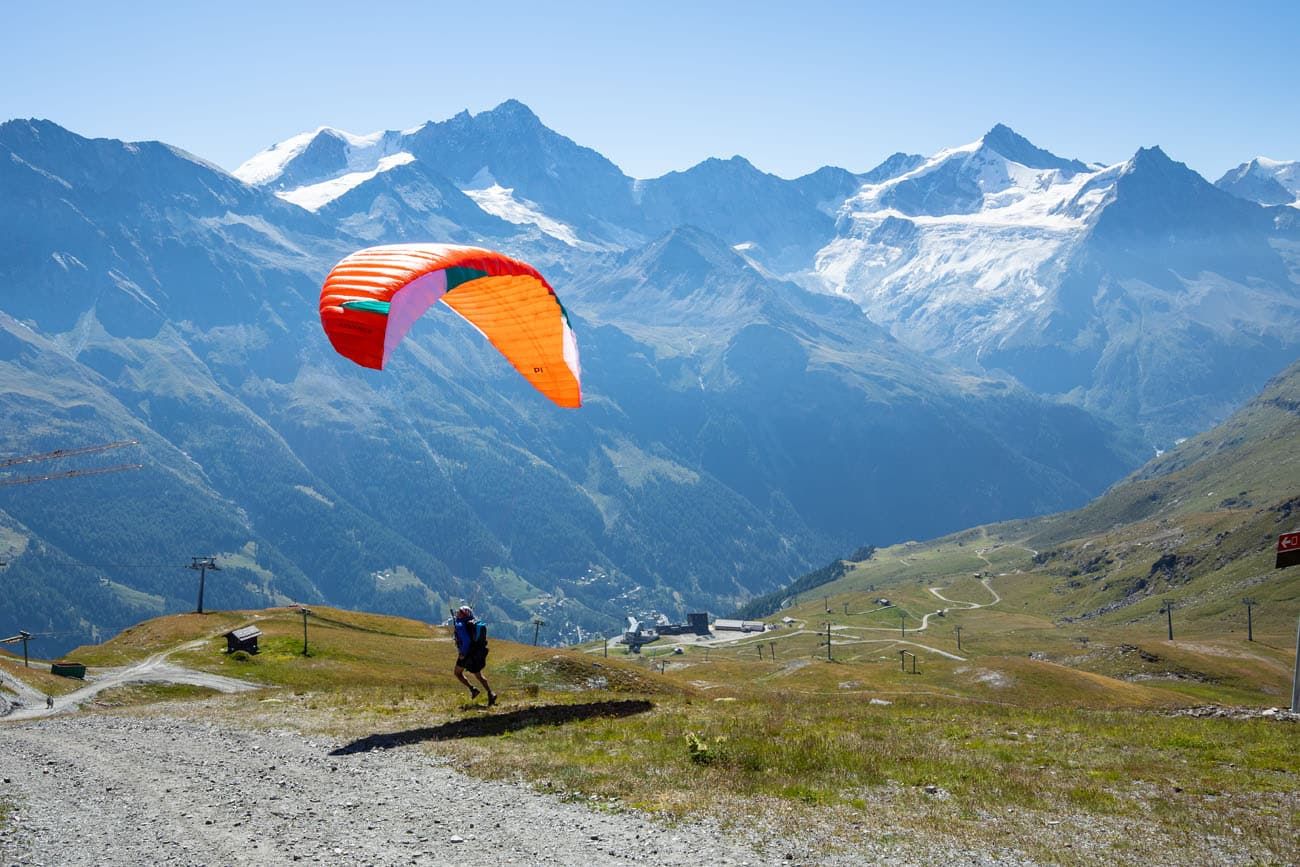
A paraglider near Col de Sorebois.
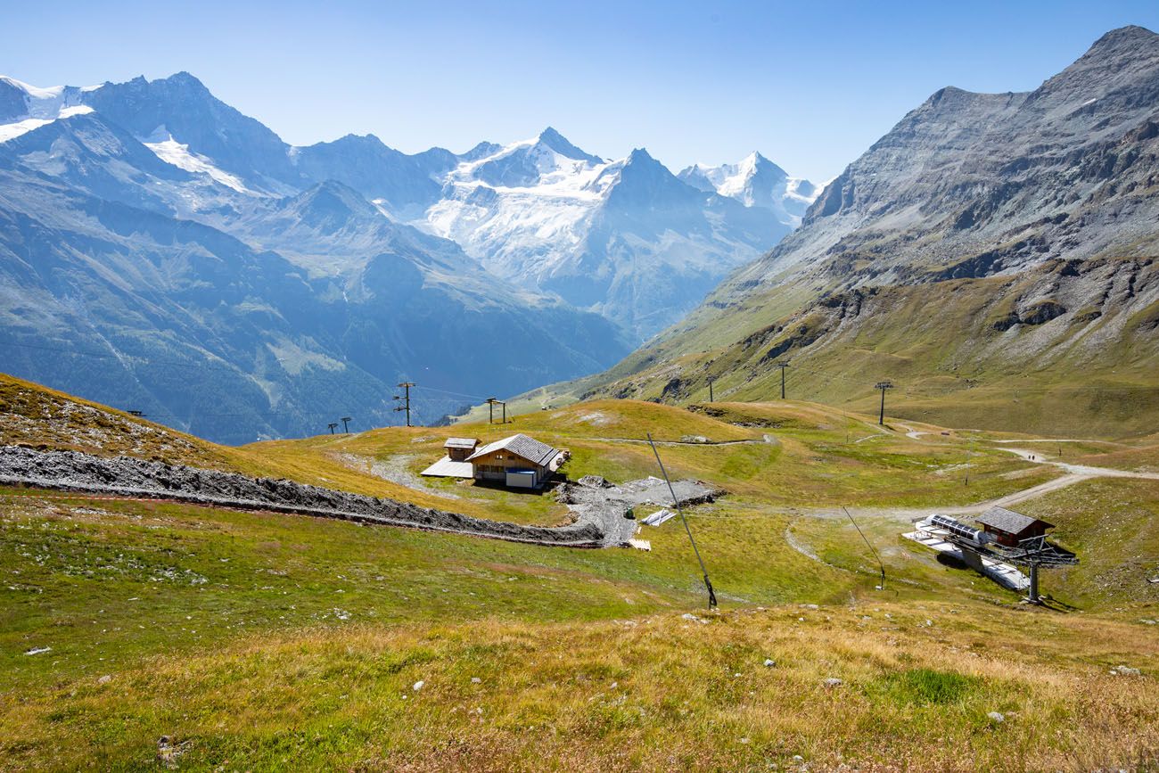
The Ski Resort in Summer
The road will continue descending, where you’ll take a dirt path at a signed junction that directs you towards Zinal. The trail will remain steep all the way down to Zinal and will only have brief instances where it flattens out.
You’ll hike along grassy slopes with incredible views of Weisshorn (you will see the mountain quite a bit in the upcoming days). Down in the valley, you’ll also be able to spot Zinal.
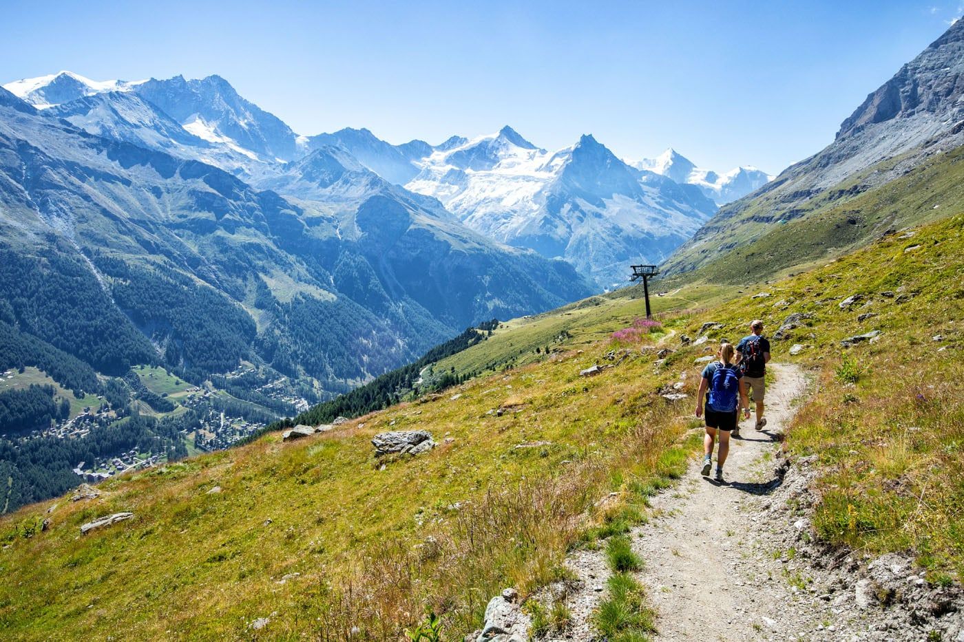
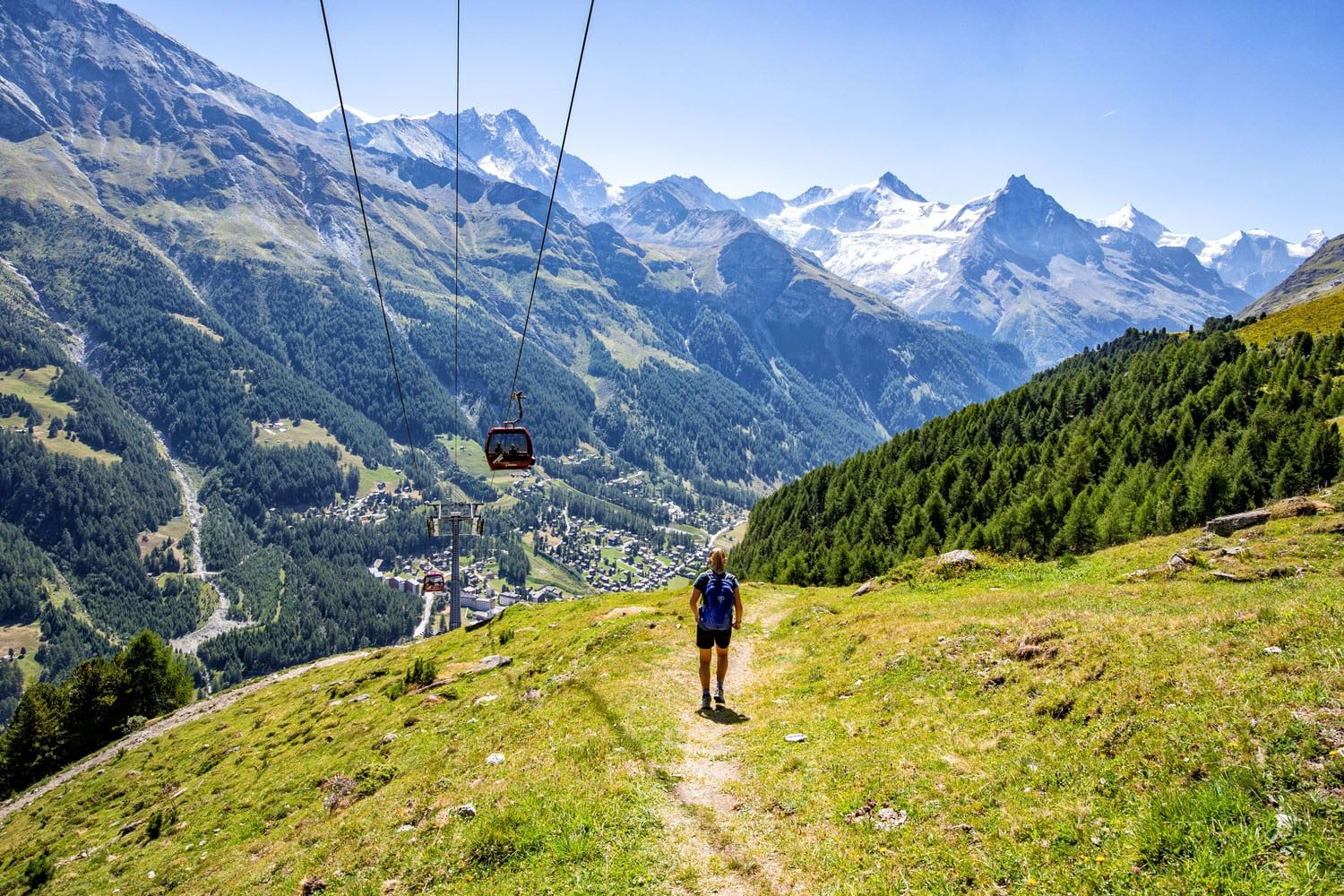
If you want to skip the big descent into Zinal you can ride the gondola instead.
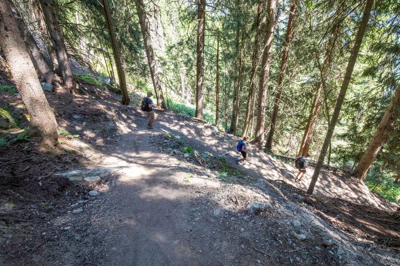
About 7 km into the hike, not far from Zinal, you’ll enter the treeline where the trail becomes much steeper. This section of the climb for us felt never-ending, even though it only took us roughly 40 minutes. It’s brutal on your knees, and if you tend to have knee pain with steep descents, this part of the trail could be challenging for you.
Julie Here: This descent into Zinal is steep and relentless, and for me, one of the most painful sections of the Haute Route. My knees were already feeling a bit sore before Stage 10 but this descent really did them in. From Stage 10 through the rest of the Haute Route (and even for weeks after doing this), my knees were very sore. If you have trouble with your knees, Kev Reynolds describes a longer, more gradual path to Zinal…take it! And make sure you have hiking poles. Or, skip it all together and ride the gondola to Zinal.
The trail may be covered with loose pine needles or dirt that makes it slippery, so don’t expect a fast descent.
Yet soon enough, we made it into Zinal and completed yet another stage of the Haute Route. To celebrate, we grabbed a meal of pasta and the best rosti we’ve ever had! We ate lunch at Pension de la Poste.
Food Options on Stage 10
There is a restaurant next to the parking area for the Lac de Moiry dam. Your next chance for food is at a restaurant located along the trail between Col de Sorebois and Zinal. And once you get to Zinal, you have numerous restaurants to choose from. We had lunch at Pension de la Poste and dinner at Le Trift and both were wonderful.
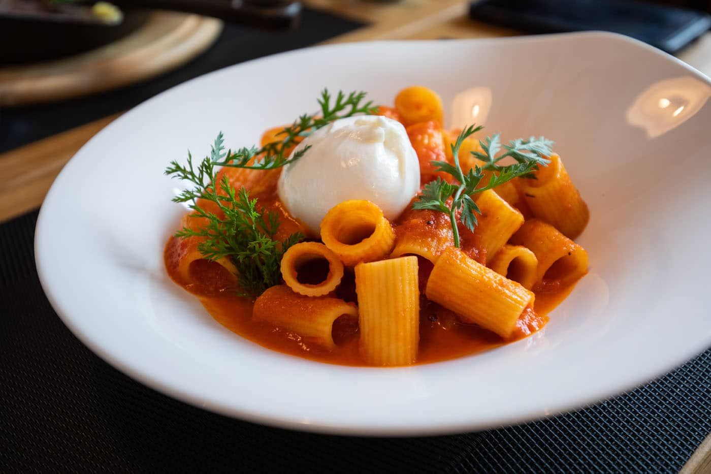
Pasta at Pension de la Poste
How to Shorten Stage 10
You can skip the 4-mile segment between the Moiry Glacier parking lot and the parking lot for the dam. However, we really liked this section and the views over Lac de Moiry.
Once you start the descent into Zinal, you can ride the gondola into town. This eliminates the massive, painful descent through the forest and into town and something to consider if you have bad knees.
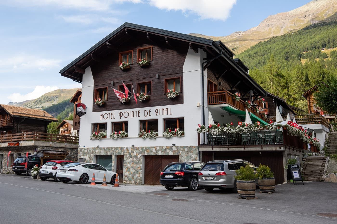
Where We Stayed
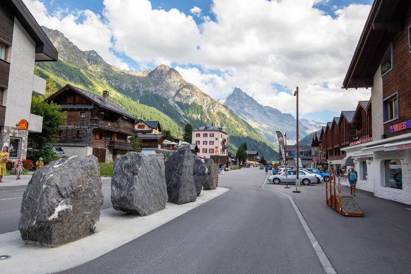
In Zinal we stayed at Hotel-Restaurant La Pointe. We had two rooms which had very nice views of the town and the mountains above, and we can definitely say we enjoyed our time here. Zinal is a pretty big ski town in Switzerland, and our hotel provided a locker room where occupants could store their ski gear.
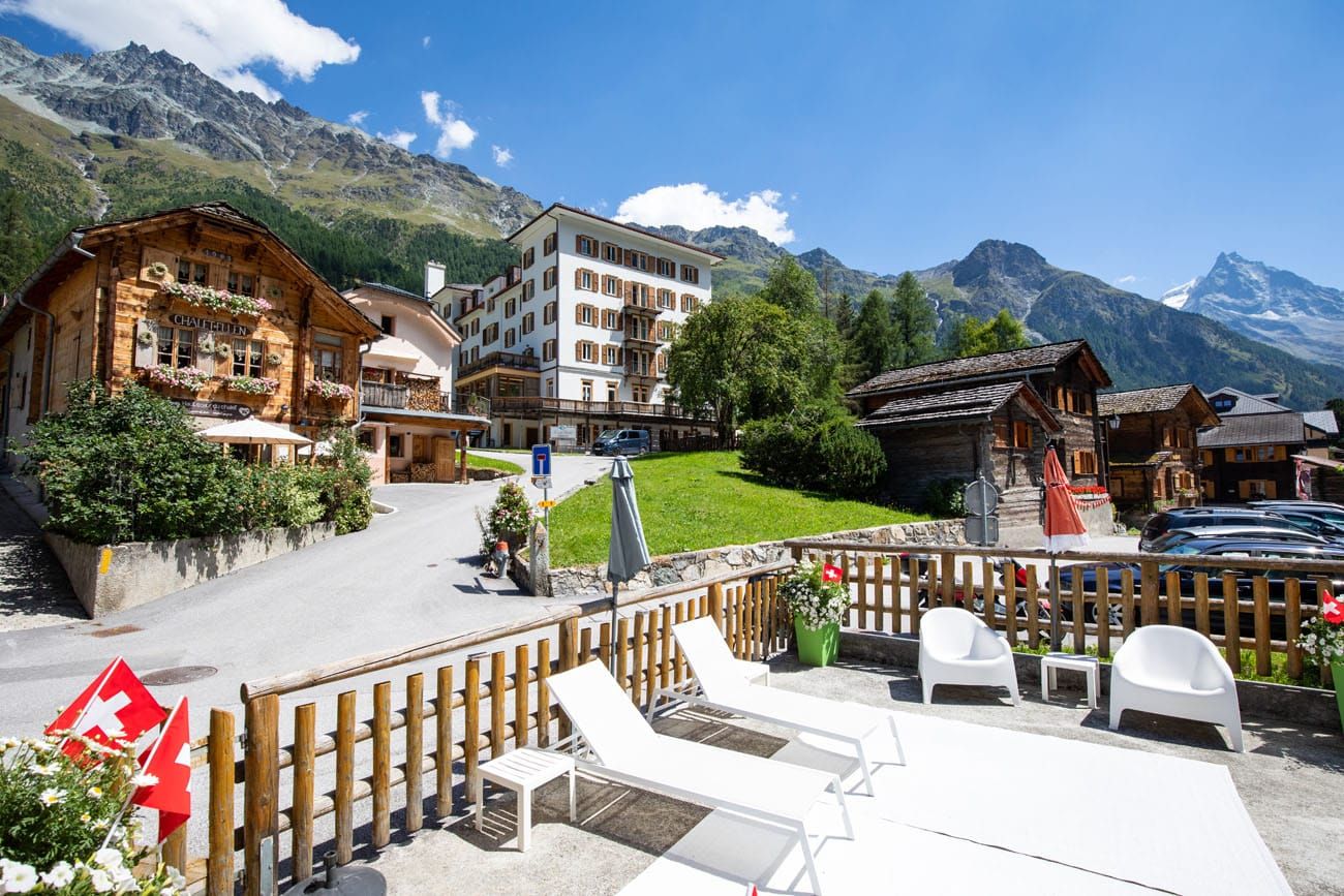
View from our hotel room
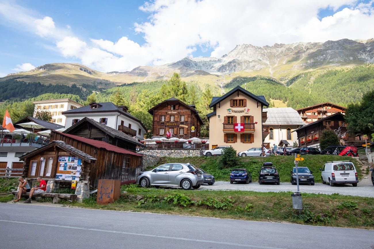
We were in Zinal on August 1, which is Swiss National Day. In the afternoon, a parade moved through the small town, there were food stands and games set up for children, and the entire town was in a very festive mood.
In town, there is a grocery store and an Intersport (should you need any new hiking gear or clothing).
Alternative hotels are Pension de la Poste, Hôtel – Restaurant Le Trift, Besso, and Hotel Europe.
For a detailed list of accommodations for each stage, along with information on making your reservations, see our guide on How To Book Your Haute Route Accommodations.
Here are a few more photos of Zinal.
Clarifications for the Walkers Haute Route Book
We were able to follow the Walker’s Haute Book by Kev Reynolds (the sixth edition from 2019; there is now an updated version) without ever needing to backtrack. But there were a few times during this stage we felt a little more clarification would have helped so we are providing that clarification here based on our experience. These notes were taken related to following Stage 10A, including what the book refers to as the “steep descent” to Zinal.
Barrage de Moiry to Col de Sorebois:
We started where vehicles coming out of the tunnel enter the parking area. With the restaurant/cafe and restrooms at our back we followed a dirt path that led up to a wide gravel track, which we then followed in the uphill direction. Soon after, a narrow path leaves the gravel track to shortcut the long loops of the gravel track. If you take this steep shortcut then you will need to turn right and go a tad downhill when you rejoin the gravel track in order to pass through a cattle gate.
After passing through the gate you have a choice again. You can take follow the wide gravel track or take the steeper dirt track to shortcut the long loops of the wide gravel track. They both rejoin into a single track at a signpost. This is the junction for the trail coming from Cabane de Moiry. Follow the sign in the direction of Zinal.
The path now turns into a wide grass track where you have several opportunities to shortcut the long loops of the grass track by taking a steeper dirt path that reconnects with the grass track. At these junctions keep an eye out for a rock with a red-white trail symbol painted on it. This is when you have to take the steeper dirt path up since the grass track starts heading in the wrong direction (the book refers to the grass track heading in the wrong direction as “when your track makes a long sweep to the right”).
Closer to the top there became two trails zig-zagging their way up. There didn’t appear to be any difference with these two trails, we could have followed either one to the top.
Col de Sorebois to Sorebois Gondola Station:
Note that a piste is ski run; in the summer the piste here looks like a gravel road.
Note that the “cablecar to Grimentz” is co-located with a gondola station. I point this out because you might see the gondolas before you see the cablecar. Know that this is not the Sorebois gondola station, which is further down the mountain.
The book suggest following the piste until you reach the Sorebois Gondola Station. Once we were below the co-located cablecar and gondola station the piste heads across the hill to the far side where it then makes a wide left turn and descends further. From here you can follow the long loops of the gravel path down to the Sorebois Gondola Station or look for thin trails that shortcut the loops.
There is a restaurant at the Sorebois Gondola Station.
Sorebois Gondola Station to Zinal:
The book mentions “… then forks. Take the right branch …”. After taking that right branch, there are other junctions not mentioned in the book. Some will have a hiker symbol on them which you follow. Some will have a signpost pointing to Zinal which you follow. And some of the signpost might provide two choices to Zinal, a longer easier descent (easy = facile) vs. a shorter steeper descent (difficult = difficile).
More Information about the Haute Route
In our Walker’s Haute Route Planning Guide, we have links to all of our articles about the Walker’s Haute Route, including information about each stage, how to plan your trek, what to expect, and more.
For an overview of all 14 stages of the Walker’s Haute Route, with overall hiking stats, map, elevation profile, and lists of the most difficult stages, easiest stages, and our personal favorites, check out our Guide to the Walker’s Haute Route Stages.
Stages of the Haute Route: Below are our guides to each stage of the Haute Route.
- Haute Route Stage 1: Chamonix to Argentière
- Haute Route Stage 2: Argentière to Col de Balme to Trient
- Haute Route Stage 3: Trient to Fenetre d’Arpette to Champex-Lac
- Haute Route Stage 4: Champex-Lac to Le Chable
- Haute Route Stage 5: Le Chable to Cabane du Mont Fort
- Haute Route Stage 6: Cabane du Mont Fort to Cabane de Prafleuri
- Haute Route Stage 7: Cabane de Prafleuri to Arolla
- Haute Route Stage 8: Arolla to Les Haudères
- Haute Route Stage 9: Les Hauderes to Col du Tsate to Lac de Moiry
- Haute Route Stage 11: Zinal to Gruben
- Haute Route Stage 12: Gruben to St. Niklaus
- Haute Route Stage 13: St. Niklaus to the Europahütte
- Haute Route Stage 14: Europahütte to Zermatt
If you have any questions about how to hike the Haute Route Stage 10, or if you want to share your experience, let us know in the comment section below.
You Might Also Like
Ultimate Guide to the Walker’s Haute Route
Pinterest Facebook Flipboard Walker’s Haute Route The Walker’s Haute Route is one of the most rewarding and memorable multi-day walks in Europe. On this trek, hikers cross 10 of the highest mountain passes in the French and Swiss Alps, as they walk from Chamonix, France to Zermatt, Switzerland. Walking from Chamonix to Zermatt takes you to remote mountain […]
Walker’s Haute Route Stages: An Overview of All 14 Stages
The Walker’s Haute Route is a multi-day trek from Chamonix, France to Zermatt, Switzerland. On this walk, hikers will cross 10 mountain passes, walk through small towns and through rugged, remote landscapes, and get to experience a less touristy side of the Swiss Alps. There are several routes that take hikers from Chamonix to Zermatt. […]
Walker’s Haute Route: 21 Important Things to Know & FAQ
The Walker’s Haute Route is one of the most rewarding and memorable multi-day walks in Europe. On this journey, hikers will cross 10 of the highest mountain passes in the Alps, while walking from Chamonix, France to Zermatt, Switzerland. It’s an extraordinary journey but not without its challenges. With 14 stages, multiple variations to the […]
How To Book Your Walker’s Haute Route Accommodations
Along the Walker’s Haute Route, there are a variety of accommodation types, from mountain huts to 5-star hotels, from dormitories to apartments, and from shared bathrooms to private bathrooms. You will have the opportunity to experience a combination of all of these since you will be staying in a new place at the end of […]
How To Plan Your Walker’s Haute Route Experience
The Walker’s Haute Route is a 14-stage trek from Chamonix, France to Zermatt, Switzerland. It is a tough yet rewarding experience through the French and Swiss Alps that crosses 10 mountain passes and offers incredible scenery along the way. It is a beast of a trek! It took us 13 days, averaging 16 km (10 […]
Switzerland Travel Guide: How to Plan a Trip to Switzerland
Switzerland Travel Guide Looking to hike some of the world’s most beautiful mountain landscapes, stroll through colorful old towns, and dine on some fondue? Then Switzerland is the perfect place for you! Visit the Bernese Oberland, a hikers paradise filled with towering mountains, alpine meadows, historic cogwheel trains, and quaint villages. Or, relax at Switzerland’s […]
20 Amazing Things to Do in Zermatt, Switzerland
Zermatt is an idyllic mountain village tucked away in the Swiss Alps. The mighty Matterhorn dominates the skyline, creating one of the most unique alpine landscapes in Europe. Explore the hiking trails, journey up higher into the mountains by cable car and train, stroll the scenic streets of Zermatt, and go skiing all year long. […]
How to Visit Gornergrat and Hike to Riffelsee & Riffelberg
For one of the best views of Matterhorn, it’s hard to beat Gornergrat. A scenic, cogwheel train takes you from Zermatt to this alpine paradise. Once at the top station, you can simply enjoy the sweeping views of the Matterhorn and the Swiss Alps from the restaurant and terraces. Or, you can add on the […]
How to Climb the Breithorn: Photos, Trail Stats & What to Expect
Climbing to the summit of Breithorn is one of Zermatt’s most adventurous experiences. Standing at a height of 4,164 meters (13,660 feet), Breithorn is one of the highest peaks in the area and it is one of the easiest 4,000+ meter peaks to summit in the Alps. Thousands of hikers come to Zermatt to summit […]
How to Visit Sunnegga, Blauherd, and Rothorn (Best One Day Itinerary)
Riding the series of lifts to Rothorn is one of the best things to do in Zermatt. Rothorn is one of the highest viewpoints in Zermatt, and from here you get a spectacular view of the Matterhorn and the surrounding mountains. On the journey to Rothorn, you will pass through two stations, Sunnegga and Blauherd, […]
The Ultimate Zermatt Itinerary for 1 to 4 Days
How many days do you need in Zermatt? How do you plan the perfect Zermatt itinerary? The answer to these questions depends on several factors. How much time do you have? Do you want to get out and hike the trails or simply ride the cable cars to viewpoints of the Matterhorn? What time of […]
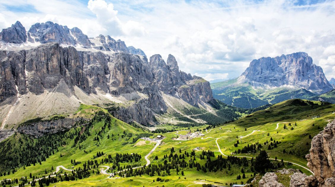
20 Best Day Hikes in the World (+ Map & Photos)
Where can you go to find that perfect day hike? The hike that leaves you breathless as you climb the summit of the mountain. The hike with the awe-inspiring views. The hike that is so enjoyable because the terrain and its views are always changing. The hike that has you saying “Wow!” over and over […]
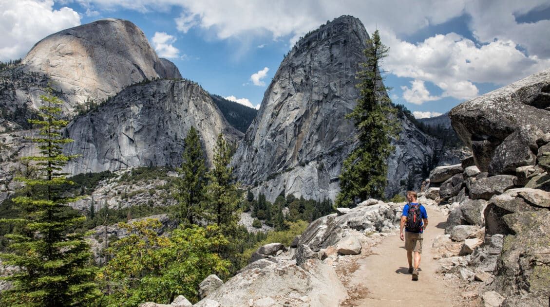
Ultimate Hiking Guide: Europe, Asia, Africa, Americas & Oceania
Are you looking for the perfect hike? With hikes on six continents ranging from a few miles to multi-day adventures, explore some of the best hikes from around the world.

Comments 1