As you enter one of the final stages of the Walker’s Haute Route, you will most likely be sore, a bit fatigued, and growing tired of massive mountain ascents and descents. Plus, the anticipation of seeing Zermatt and the Matterhorn grows.
The good news is that Stage 13 of the Haute Route features the final climb of the trek. There are no more mountain ascents once you reach the Europahütte. The bad news is that today’s stage features a walk through the Mattertal Valley and then an exhausting uphill slog through a forest to reach the Europahütte.
To be honest, this is our least favorite stage of the Haute Route, even if done correctly (next I cover what we did). Today’s stage is all about getting you up to the Europahütte. You’ll spend some time walking through the Mattertal Valley and then it is an unexciting climb through the forest with very few nice views along the way. However, once you emerge from the treeline, which happens just before reaching the Europahütte, the views dramatically improve.
In this guide, we cover the “new Haute Route stage 13” and then some photos and a trail description of what we did, just in case you want to follow our footsteps or just see what the first section of the Europaweg trail looks like.
What We Did (and What You Shouldn’t Do)
We hiked the Haute Route in the summer of 2022. Unfortunately, what we were not aware of is that the route for Stage 13 changed in 2021 (guide books were not yet updated with this new route and the Europaweg website said the trail was open…we were not aware that this meant a newly rerouted trail).
We spent unnecessary time and energy hiking from St. Niklaus to Gasenried, only to find out that the first part of the Europaweg was rerouted to a lower route because of a rock fall. We followed the “new” Europaweg through the forest and back down to Mattertal Valley to Herbriggen, only to hike right back up the mountain slopes to the Europahütte later in the day.
It was exhausting and extremely frustrating.
I even began to wonder if the hike to the Europahütte would be worth it (or should we just finish the walk through the valley to Zermatt, ending one day early?).
Well, it was. Spending time at the Europahütte, gazing out across the Mattertal Valley, and seeing the ibex in the evening was one of our favorite moments of the Haute Route. And the walk from the Europahütte to Zermatt was our favorite day of the entire route.
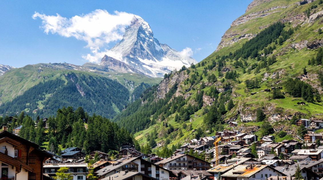
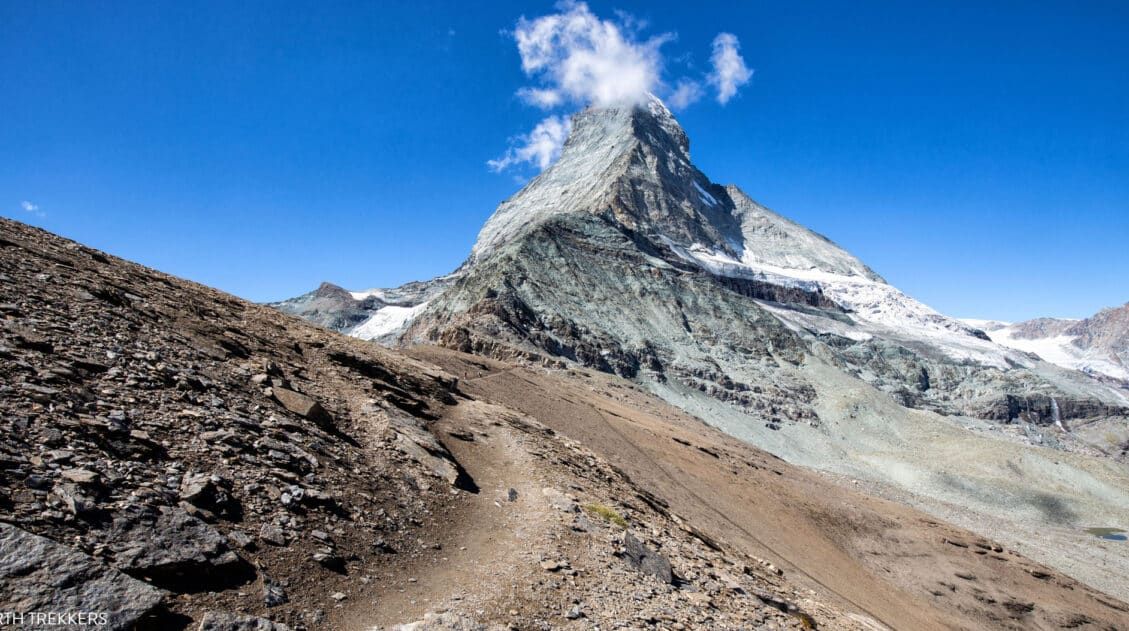
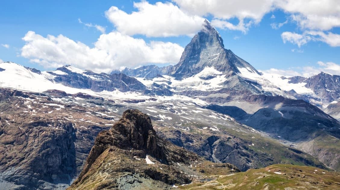
The first views of the Matterhorn are thrilling, even if you’ve seen it before. Once you see this iconic mountain peak, you know you have just a little ways to go until you complete the Haute Route. Zermatt and views of the Matterhorn becomes one of the most memorable finish lines in the world.
So, do your best to enjoy the uphill slog to the Europahütte…it will pay off that evening and following day, as you enjoy extraordinary views of the Matterhorn on one of the most scenic days of the Walker’s Haute Route.
To avoid doing the same thing, we recommend walking through the Mattertal Valley from St. Niklaus to Herbriggen. From Herbriggen, follow signs to the Europahütte.
Walker’s Haute Route Stage 13 Hiking Stats
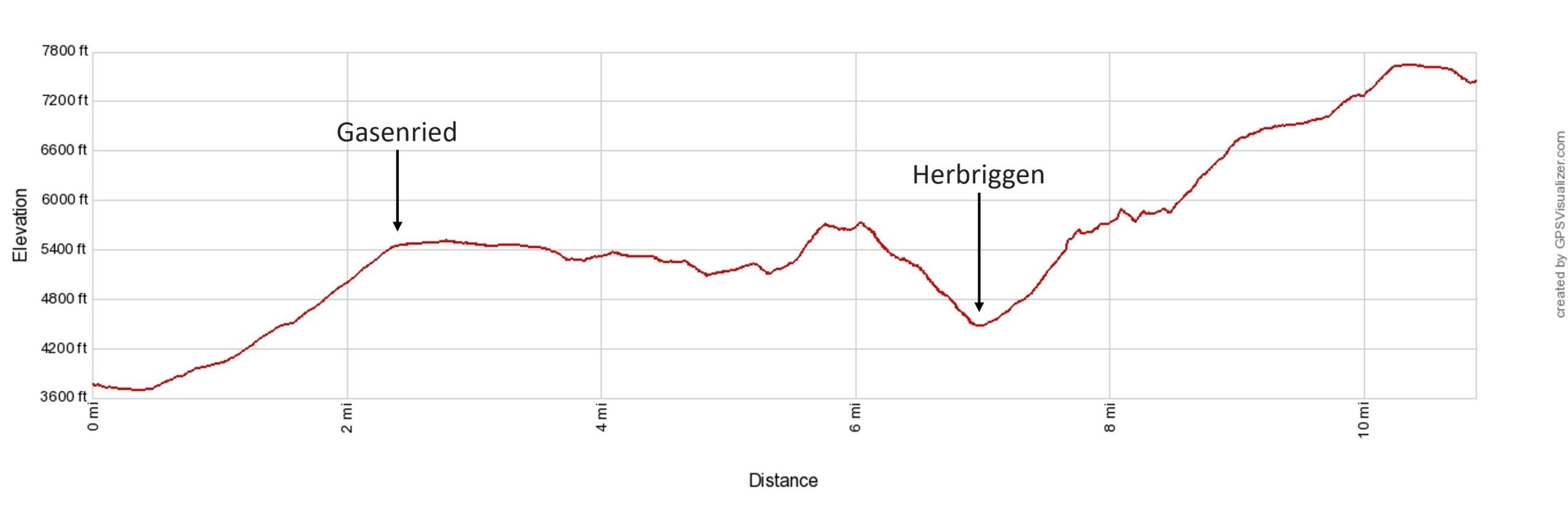
Below are the hiking stats for the recommended route, St. Nicklaus to Herbriggen (through the Mattertal Valley) to the Europahütte.
Distance: 12.7 km (7.9 miles)
Difficulty: Strenuous
Total Ascent: 1,460 m (4,800 feet)
Total Descent: 350 m (1,150 feet)
Lowest Elevation: 1,110 m (3,640 feet)
Highest Elevation: 2,350 m (7,700 feet)
Elevation in St Niklaus: 1,160 m (3,800 feet)
Elevation at Europahütte: 2,275 m (7,465 feet)
Estimated Time: 5 to 6 hours (including stops)
Alternatively, you can walk from St. Niklaus through the valley, past Herbriggen, to Randa and from Randa hike up to the Charles Kuonen Suspension Bridge. From the suspension bridge, it is a short uphill walk to the Europahütte. This route is a little easier since it has a little less elevation gain, but you will be on a trail with a lot of day hikers. If you don’t mind a little extra elevation gain, hike up from Herbriggen for more views along the Europaweg.
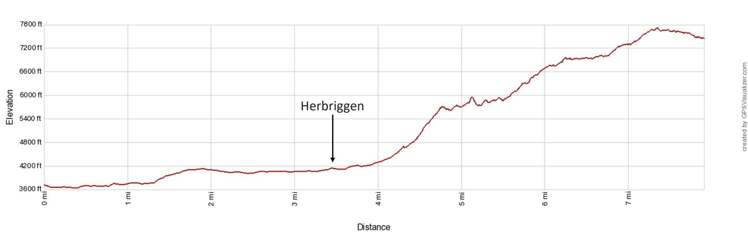
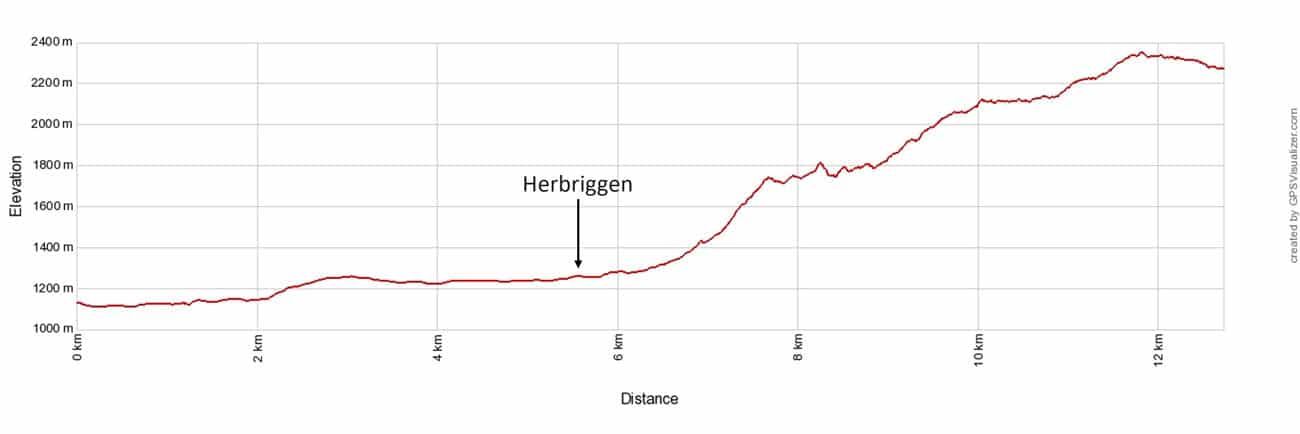
Walker’s Haute Route Stage 13 Elevation Profile: St. Niklaus to Herbriggen to the Europahütte
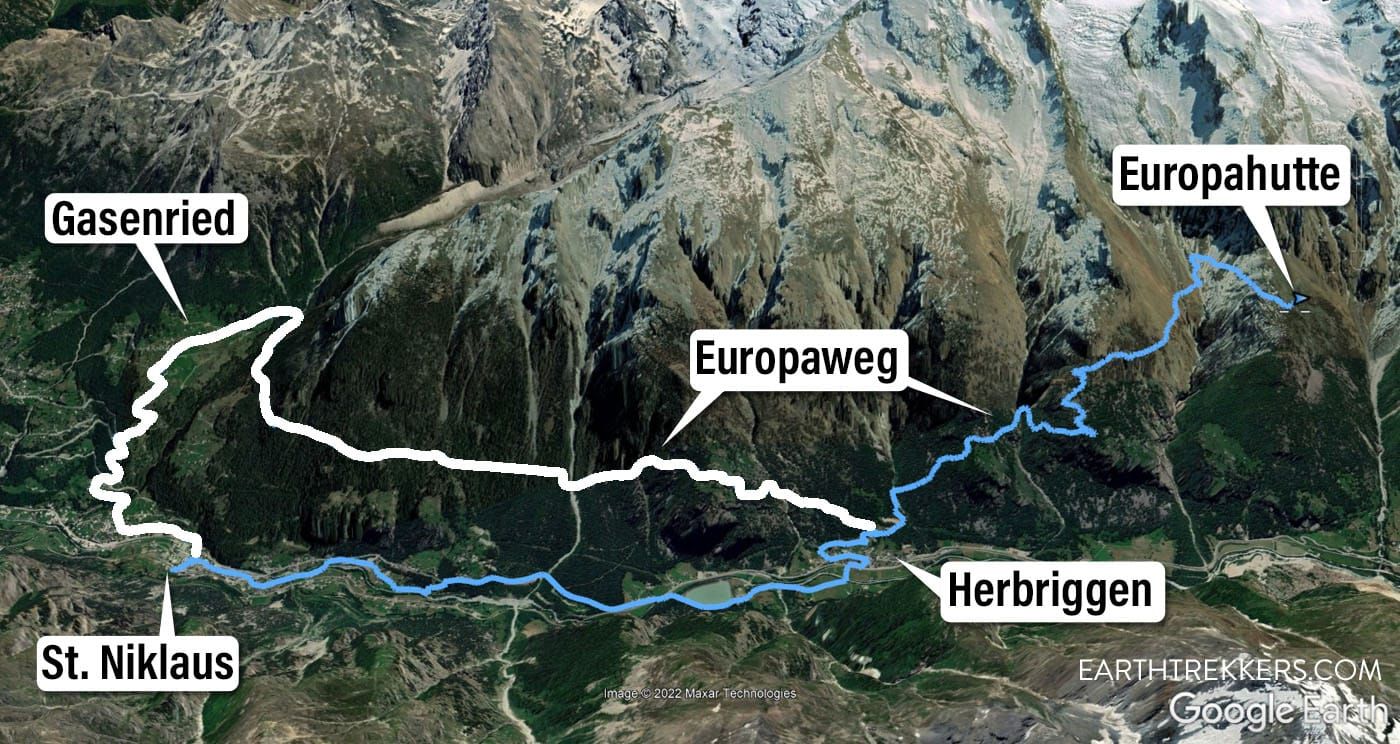
Haute Route Stage 13 trail map. The blue line is the “ideal route” from St. Niklaus through the valley to the Europahutte. The white line is the trail that we took and includes more time on the Europaweg, although this section of the Europaweg is all within a forest. The “original” Europaweg trail was located higher on the mountains and a more thrilling walk than what you can do now.
Below are the hiking stats for what we did: St. Niklaus to Gasenreid to Herbriggen to the Europahütte.
Distance: 17.5 km (10.9 miles)
Difficulty: Very strenuous
Total Ascent: 1,930 m (6,325 feet)
Total Descent: 815 m (2,670 feet)
Lowest Elevation: 1,125 m (3,690 feet)
Highest Elevation: 2,350 m (7,700 feet)
Elevation in St Niklaus: 1,160 m (3,800 feet)
Elevation at Europahütte: 2,275 m (7,465 feet)
Our Time: 7 hours (including stops)
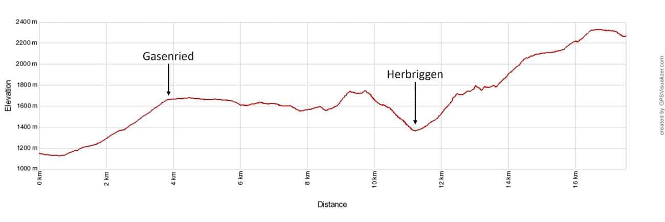
Haute Route Stage 13 Elevation Profile with Gasenried
Please practice the seven principles of Leave No Trace: plan ahead, stay on the trail, pack out what you bring to the hiking trail, leave areas as you found them, minimize campfire impacts, be considerate of other hikers, and do not approach or feed wildlife.
About the Europaweg Trail Closure
The Europaweg between Grat and Galenberg is permanently closed due to a rockfall. In 2021, a portion of the Europaweg was rerouted to the new route which runs through the forest, so it lacks the incredible views that came with walking along the balcony.
The Europaweg was once called the most beautiful 2-day walk in the Alps. Now that a large portion of the trail leads you through a forest (rather than the panoramic views you once had on the higher trail), it’s a pretty walk, but I wouldn’t call it the most beautiful 2-day walk. In my opinion, that is now the walk from Cabane du Mont Fort to Cabane de Prafleuri to Arolla, stages 6 and 7 of the Haute Route.
Learn more on the official Europaweg website. The Hiking Club website also has a great guide to all of your options to detour around the closure.
Walker’s Haute Route Stage 13: Overview of the Trail
To hike the Haute Route, we highly recommend following the trail descriptions in the book Trekking Chamonix to Zermatt, The Classic Walker’s Haute Route by Kev Reynolds. Below we list an overview of the day, so you know what to expect along the way. We also provide advice on where to eat and where to stay. Just be aware that if you are following the 2019 edition, it does not have the updated route listed (make sure you purchase the next revised edition of the book).
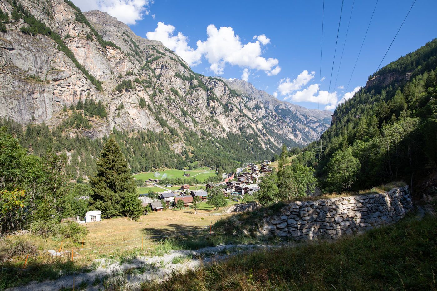
St. Niklaus to Herbriggen
Hike through the valley from St. Niklaus to Herbriggen. This path will very gradually head uphill but it is an easy walk until you get to Herbriggen. As you pass through the small towns, you will have plenty of places to eat or use the bathroom.
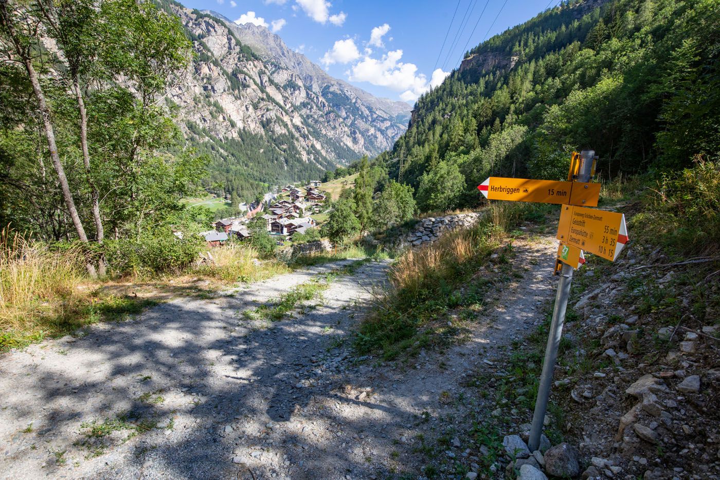
This is the point where the Europaweg trail meets the trail from Herbriggen. Once you make it to Herbriggen, it is a 15 to 20-minute to this point and then the real climb through the forest begins.
Herbriggen to the Europahütte
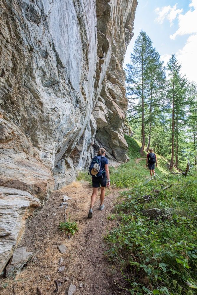
The climb to the Europahütte begins as an incredibly steep ascent through the forest. There will be very few breaks along this climb.
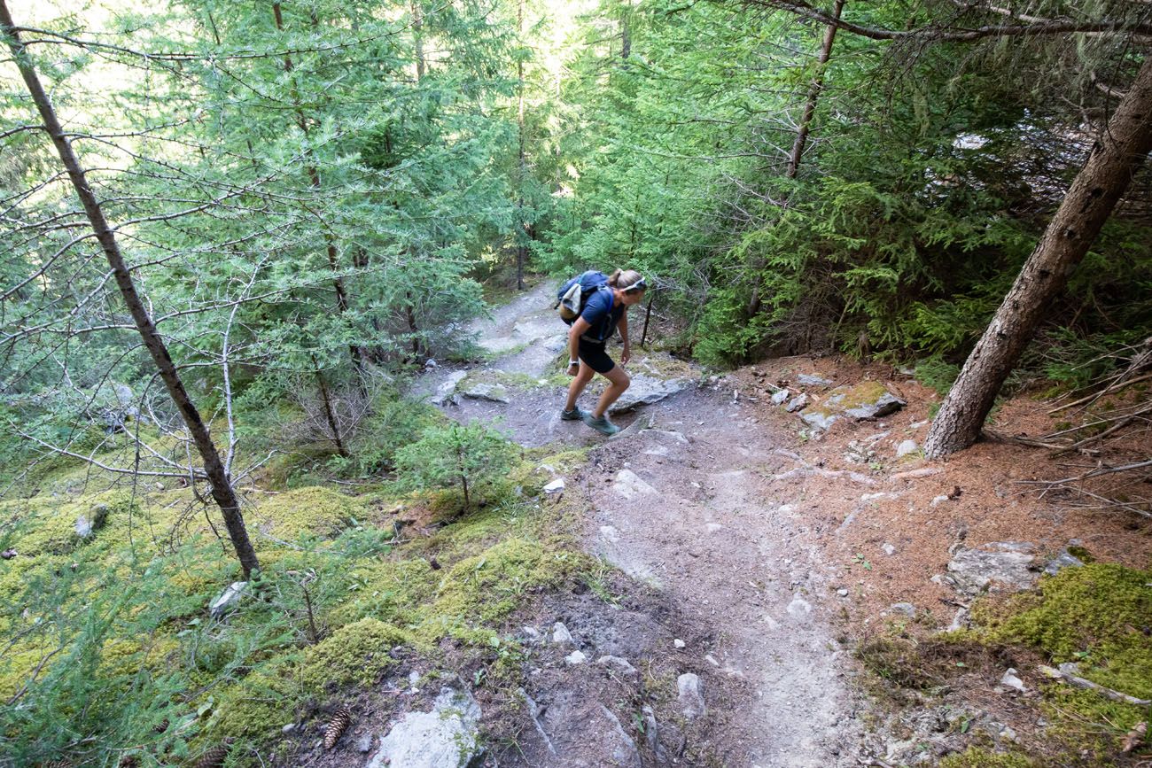
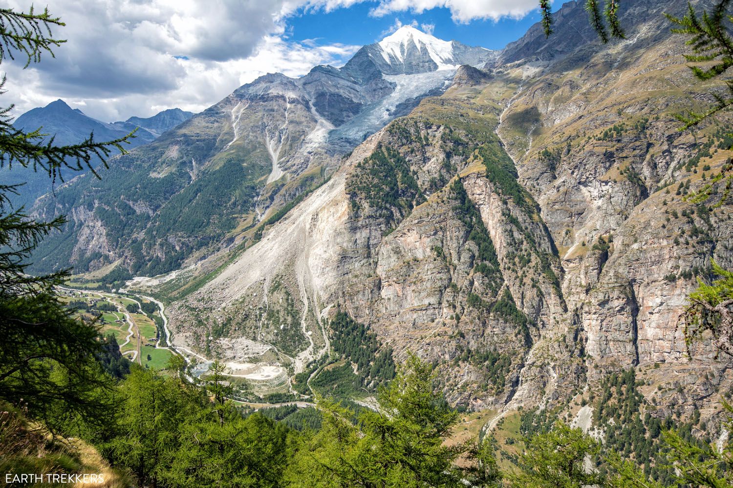
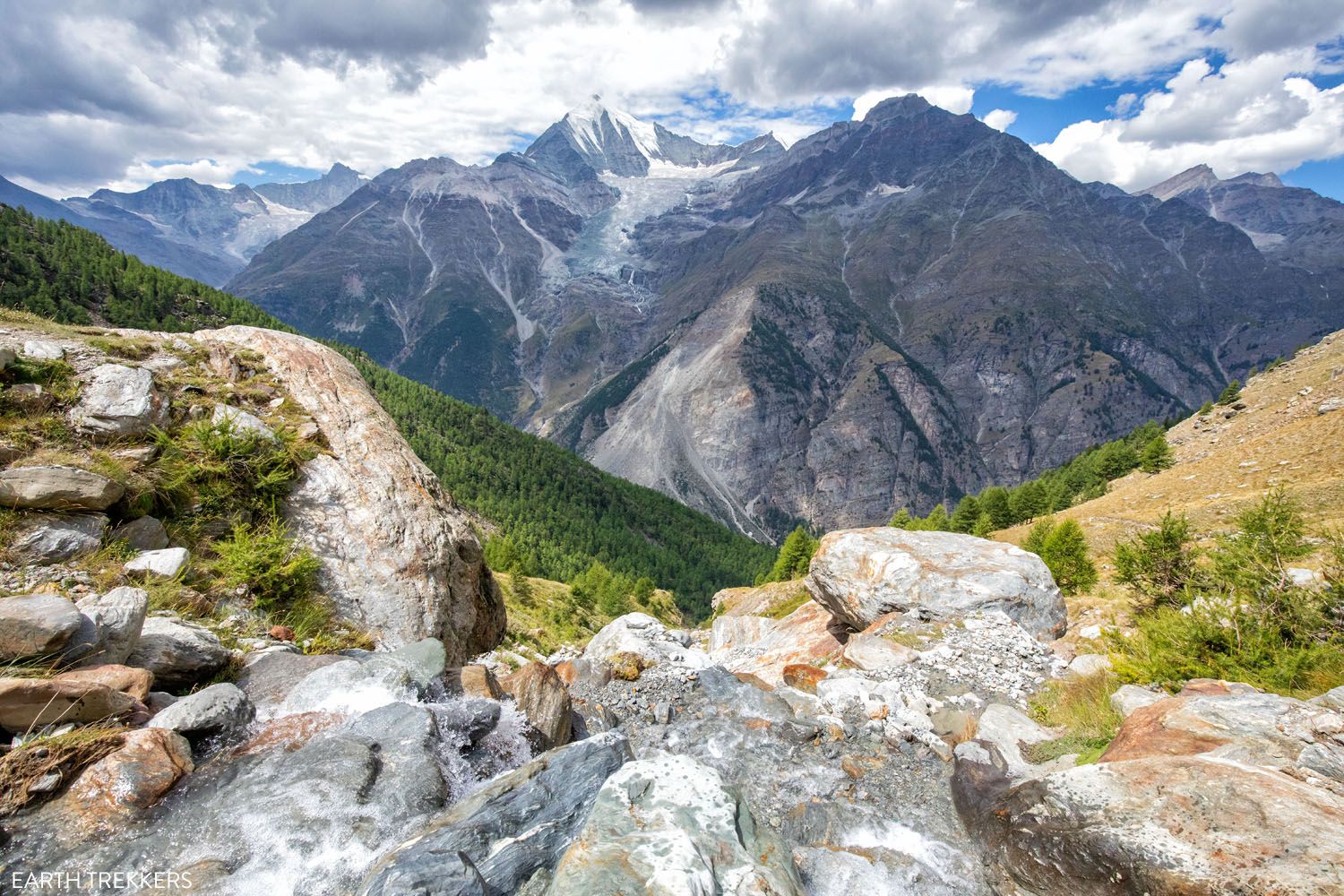
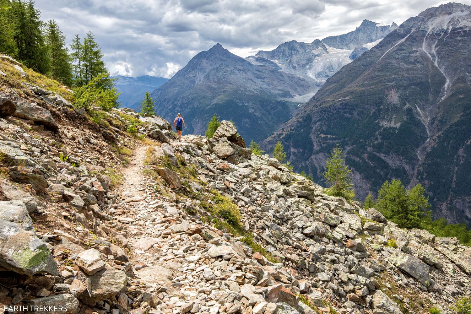
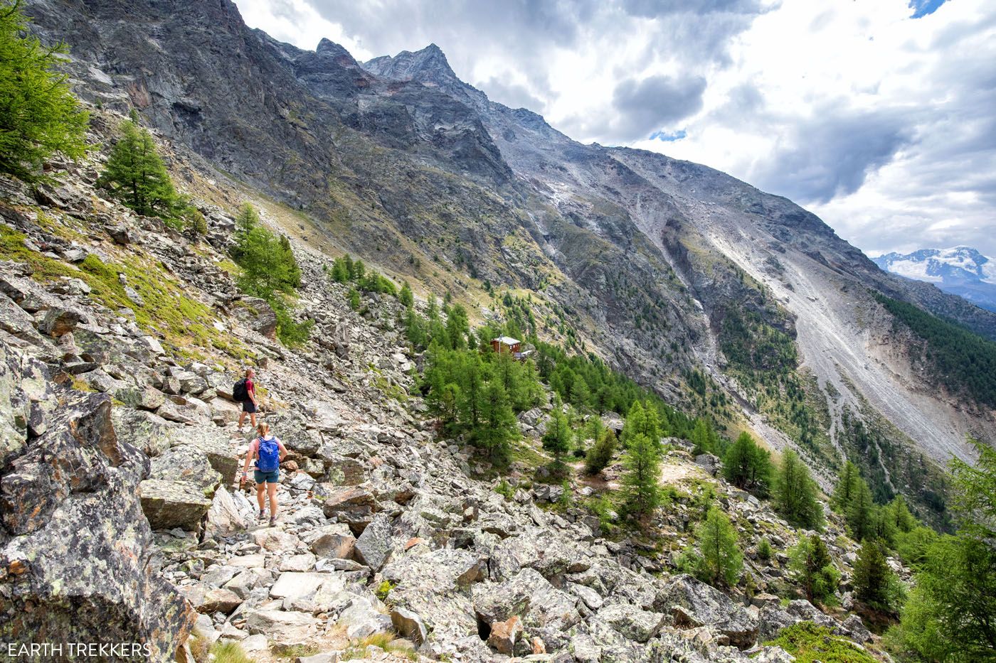
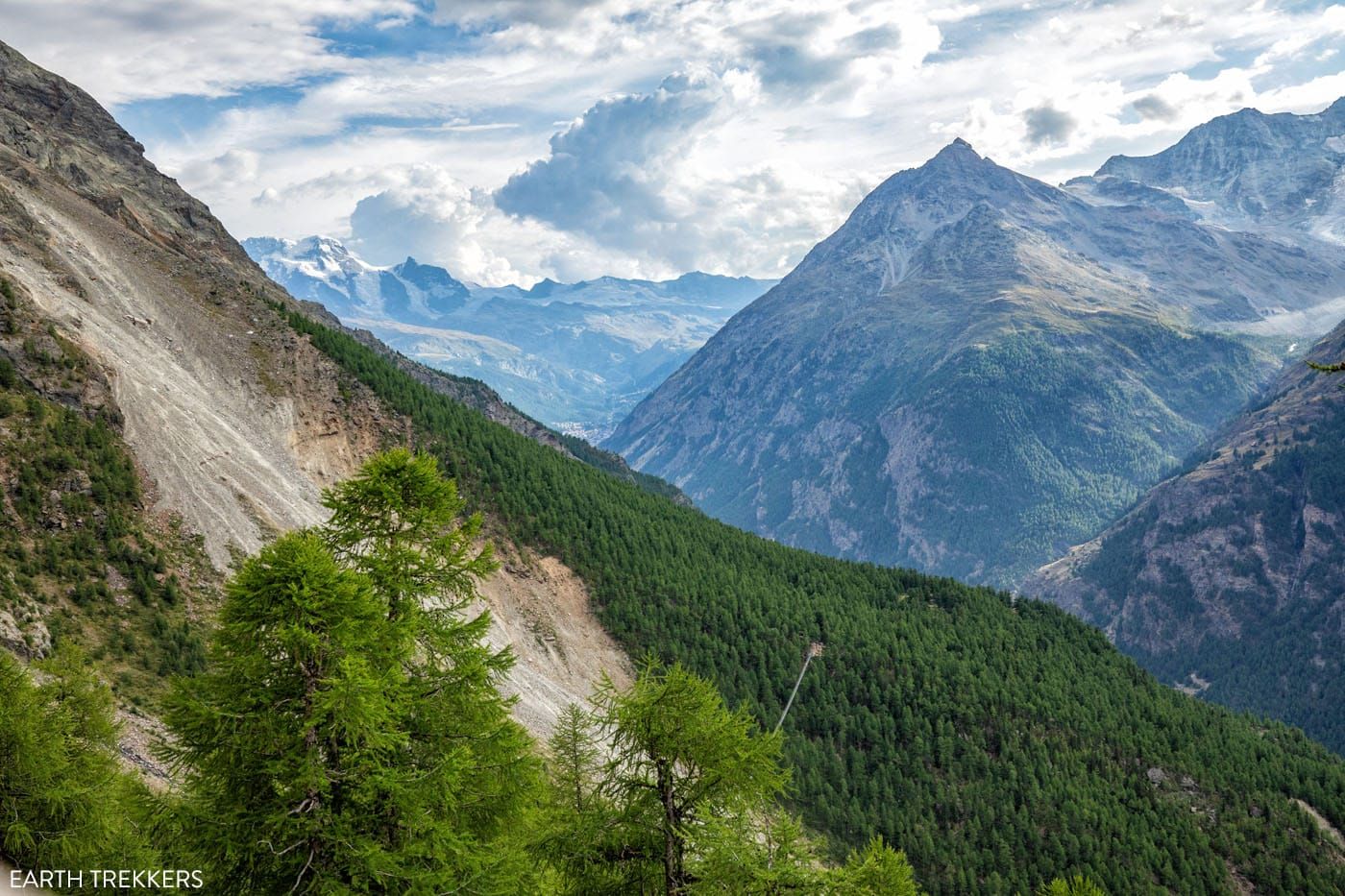
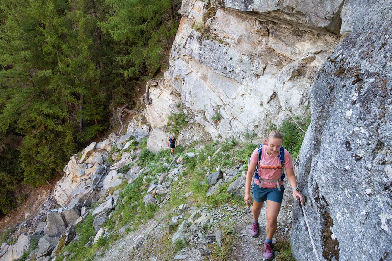
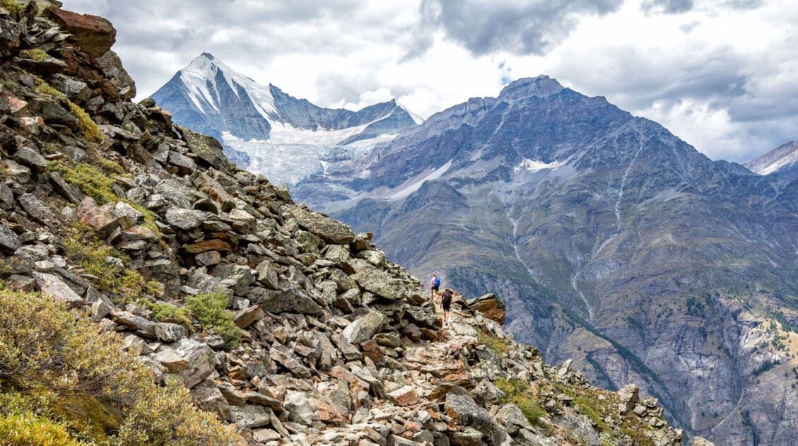
Roughly 2 to 2.5 hours into the climb, you will climb a series of staircases and just a little bit later start to break through the trees. This is when the hike becomes beautiful, as you will have awesome views over the mountains across the valley. In the distance you can see Breithorn with its glistening white peak.
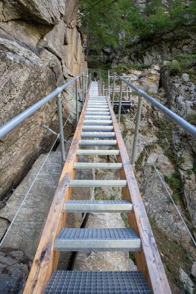
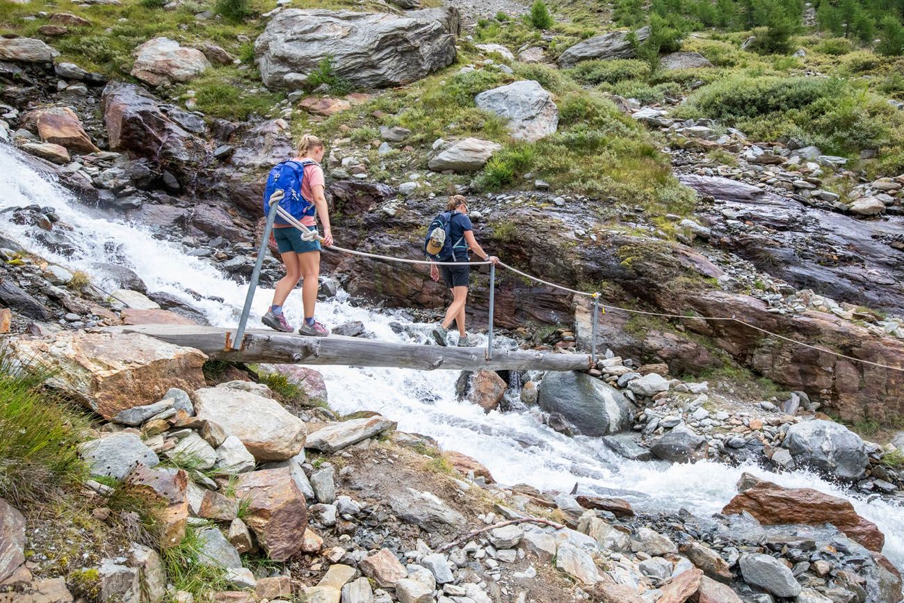
Once out of the trees, you have a short yet steep climb to go. You will cross over two streams, the first by picking your way through rocks and the other by a narrow bridge. Once past the second stream, you are nearly done the upwards climb.
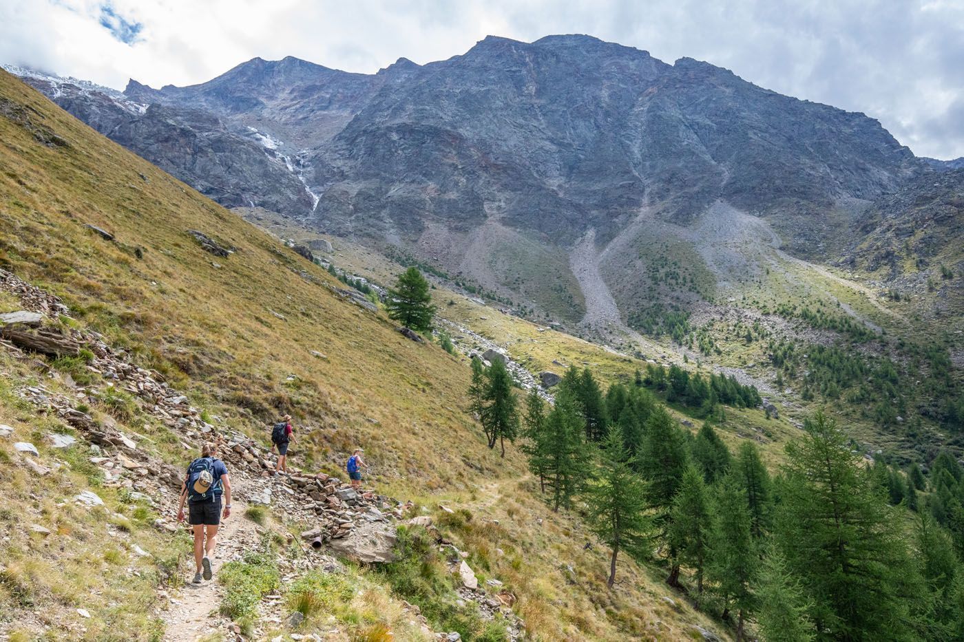
Crossing one of the streams.
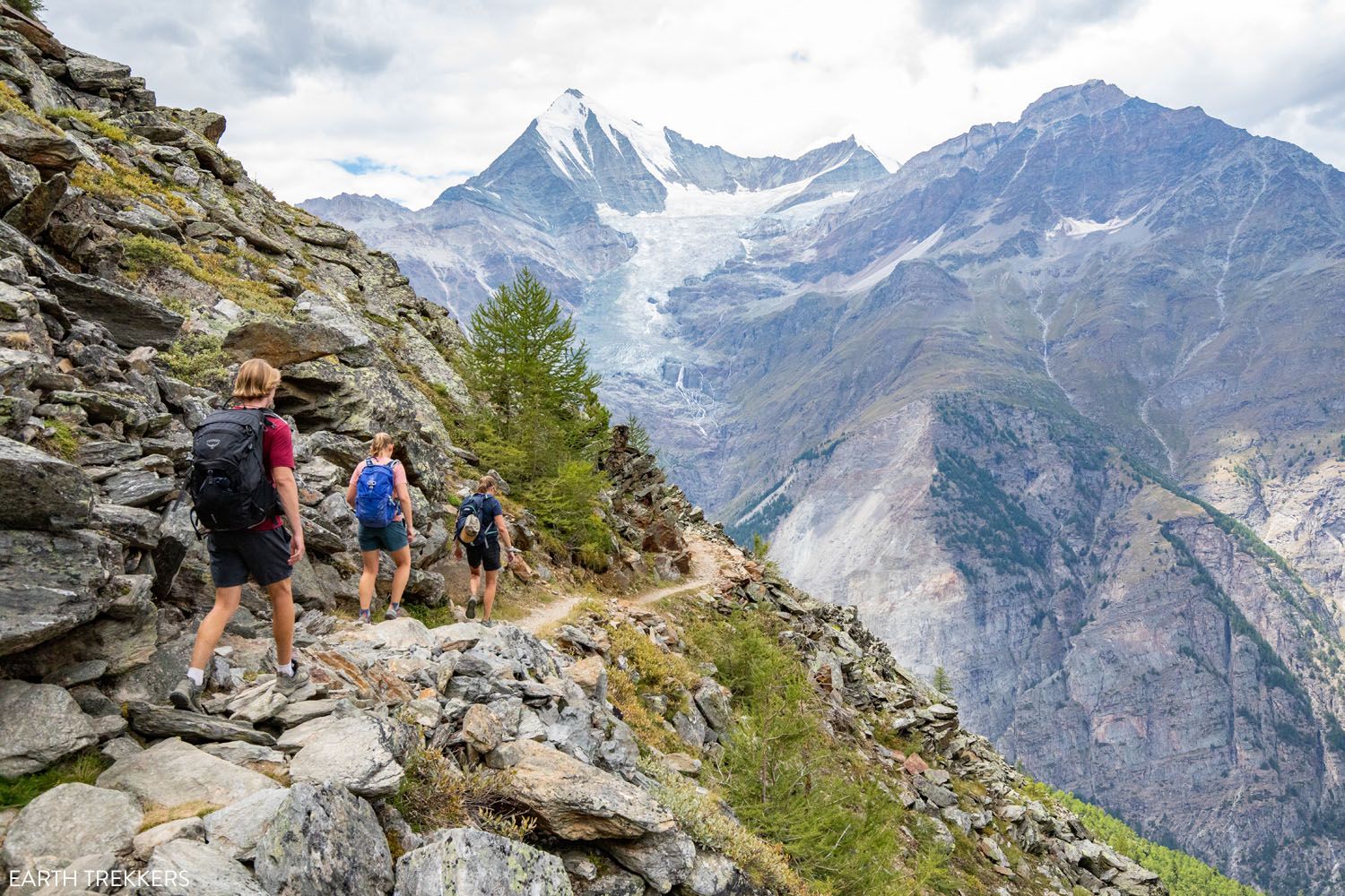
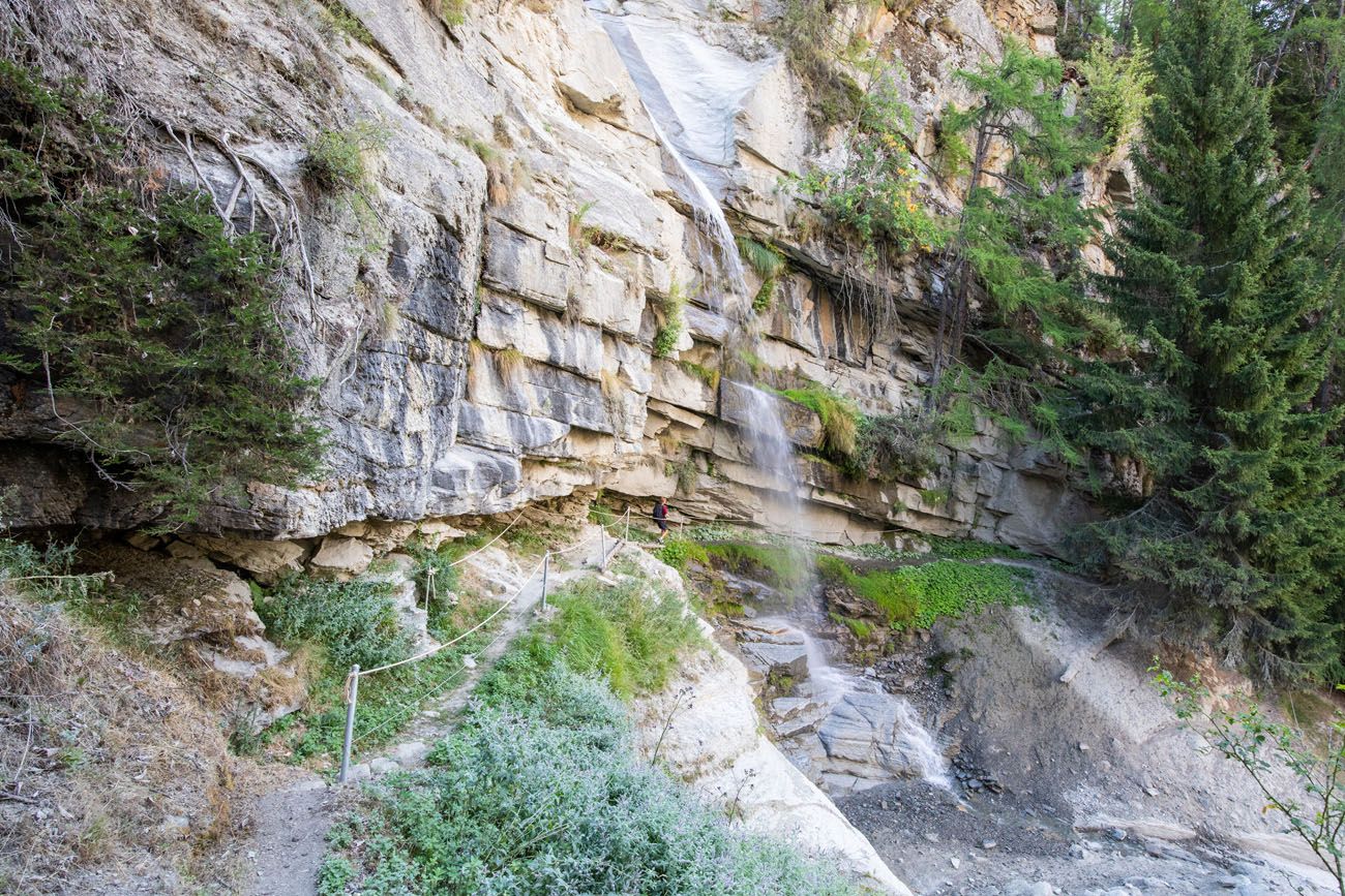
After this bridge, you make one more climb and then you are on the “original” Europaweg.
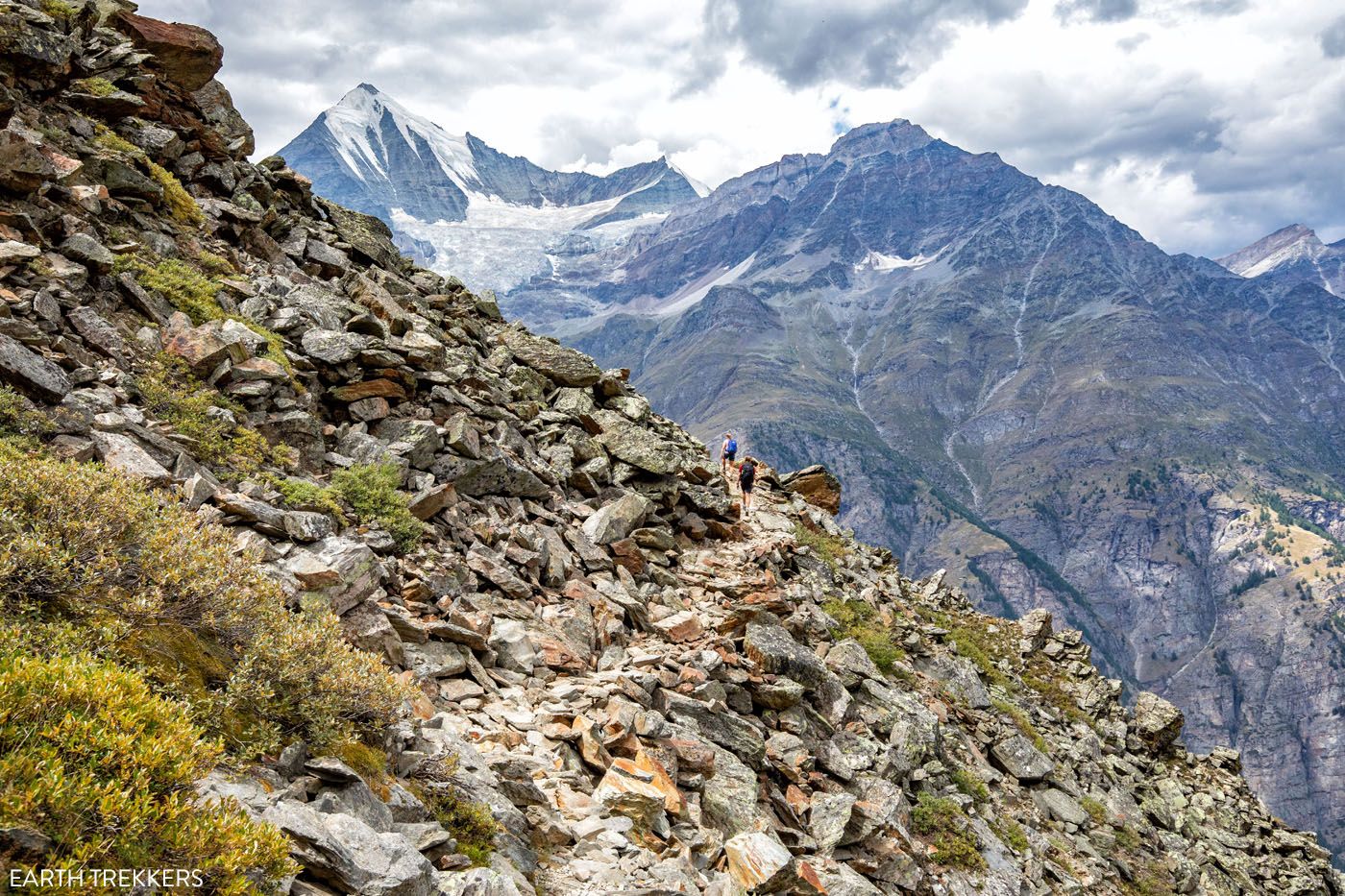
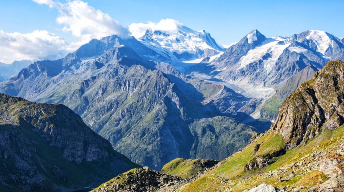
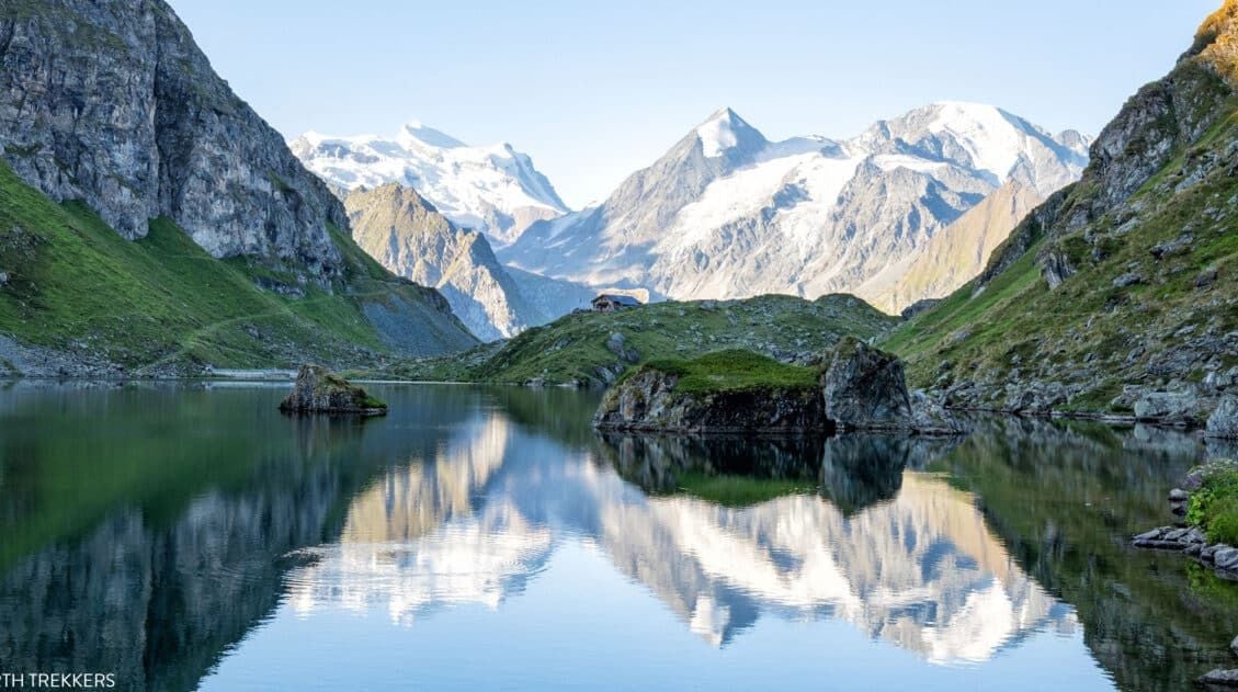
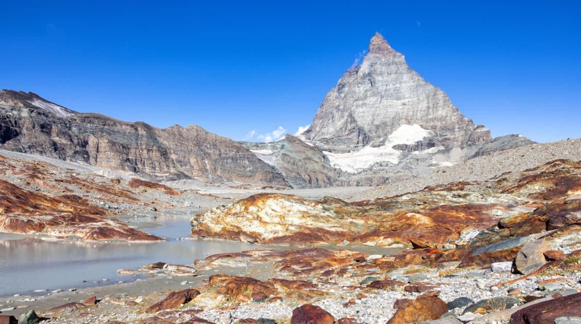
At the end of the ascent, you will connect onto the original Europaweg trail. On this trail you have a flat 30-minute walk along the edge of the mountain to reach the Europahütte. The views are spectacular with glaciers, waterfalls, and high peaks. Once you come around the mountain the Europahütte will come into view, as well as Zermatt in the distance.
The Europahütte comes into view and it is a beautiful sight to see!
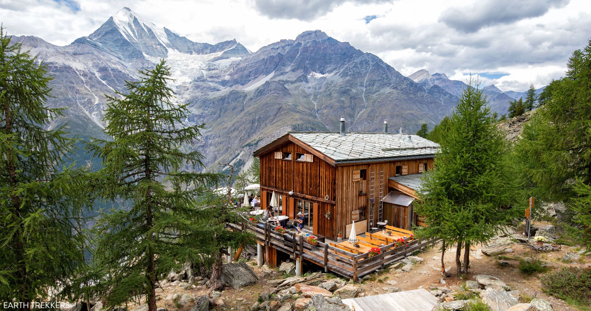
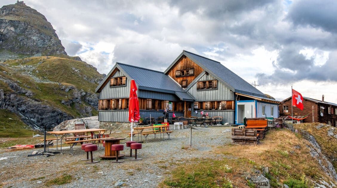
The Europahütte
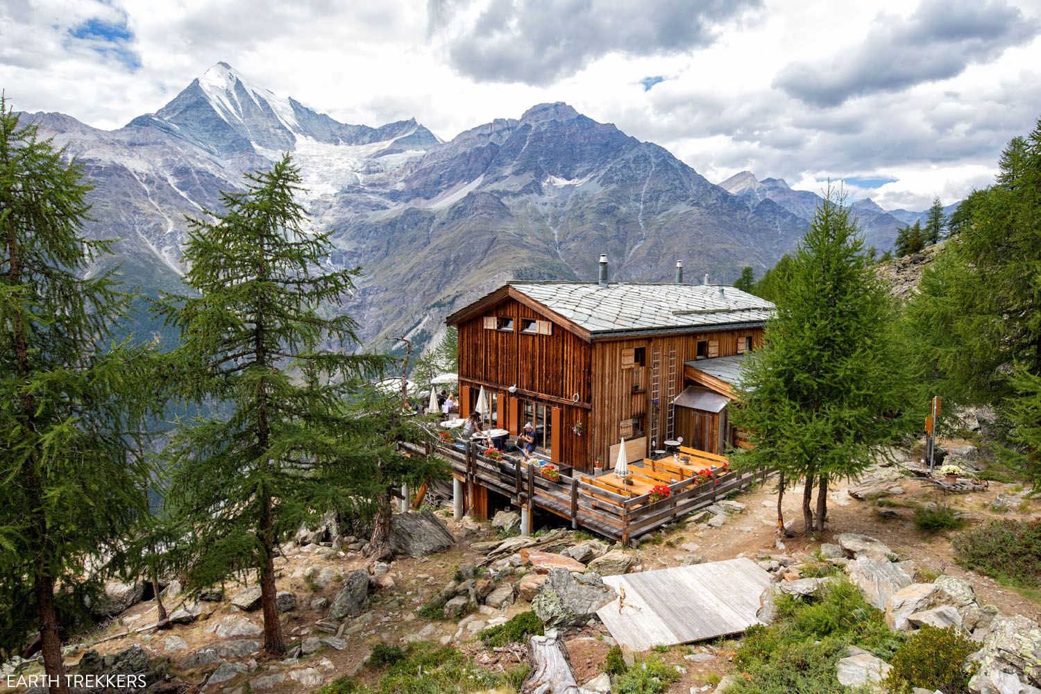
The Europahütte
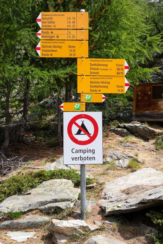
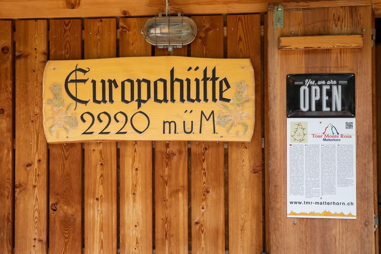
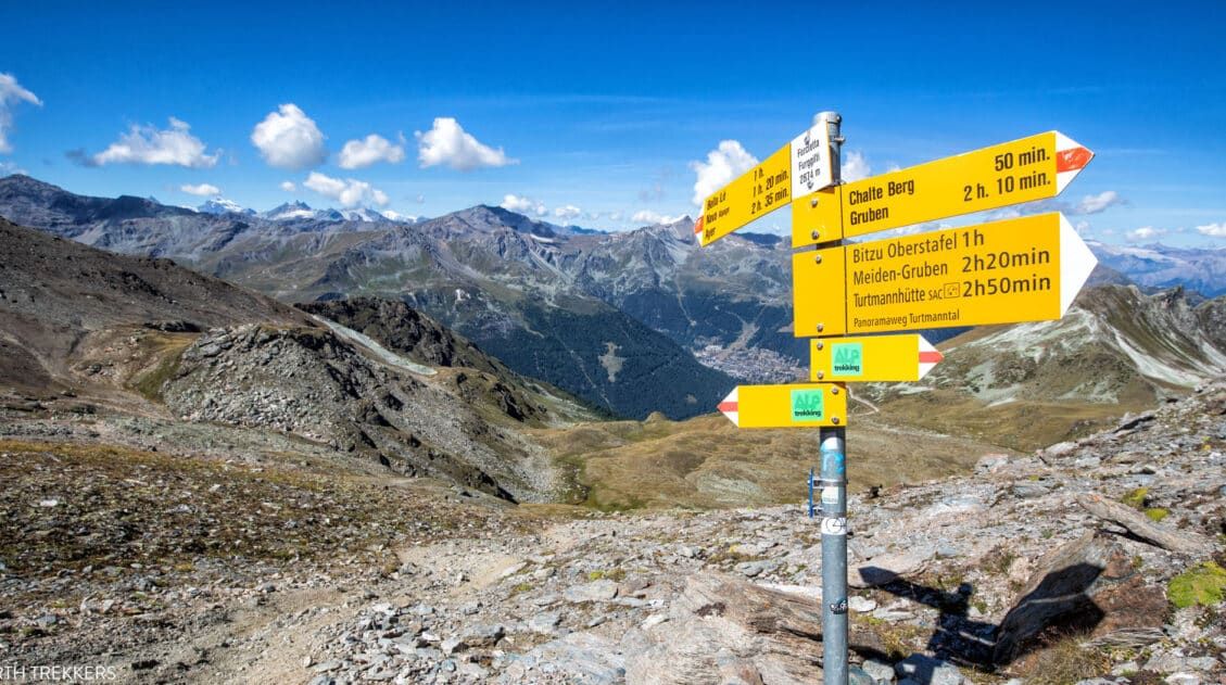
The trail sign next to the Europahütte. Just 6 hours until Zermatt!!
We enjoyed our stay at the Europahütte. The rooms were clean, the beds were comfortable, and the food was delicious. Dorm rooms come in a variety of sizes, holding anywhere for 4 to 6 to 10 people. We reserved our spot early and were lucky enough to get the 4-person dorm.
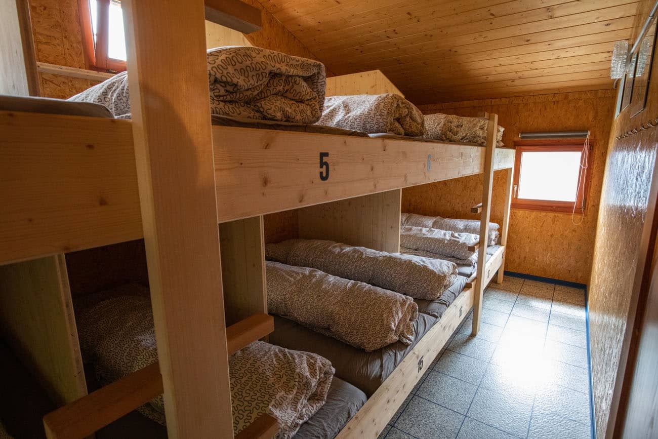
There is one bathroom with 2 showers. One token gets you 2 minutes of water. You can pause this timer, however, by turning the water off, and then you can start again it by turning the water on.
Downstairs are two more bathrooms: a male and female bathroom with a sink and two toilets.
We found one outlet with which to charge our phones. This was located above the sink in the shower room. But this is a busy, steamy spot in the hut, with people showering once they arrive, so don’t plan on being able to charge any devices at the Europahütte.
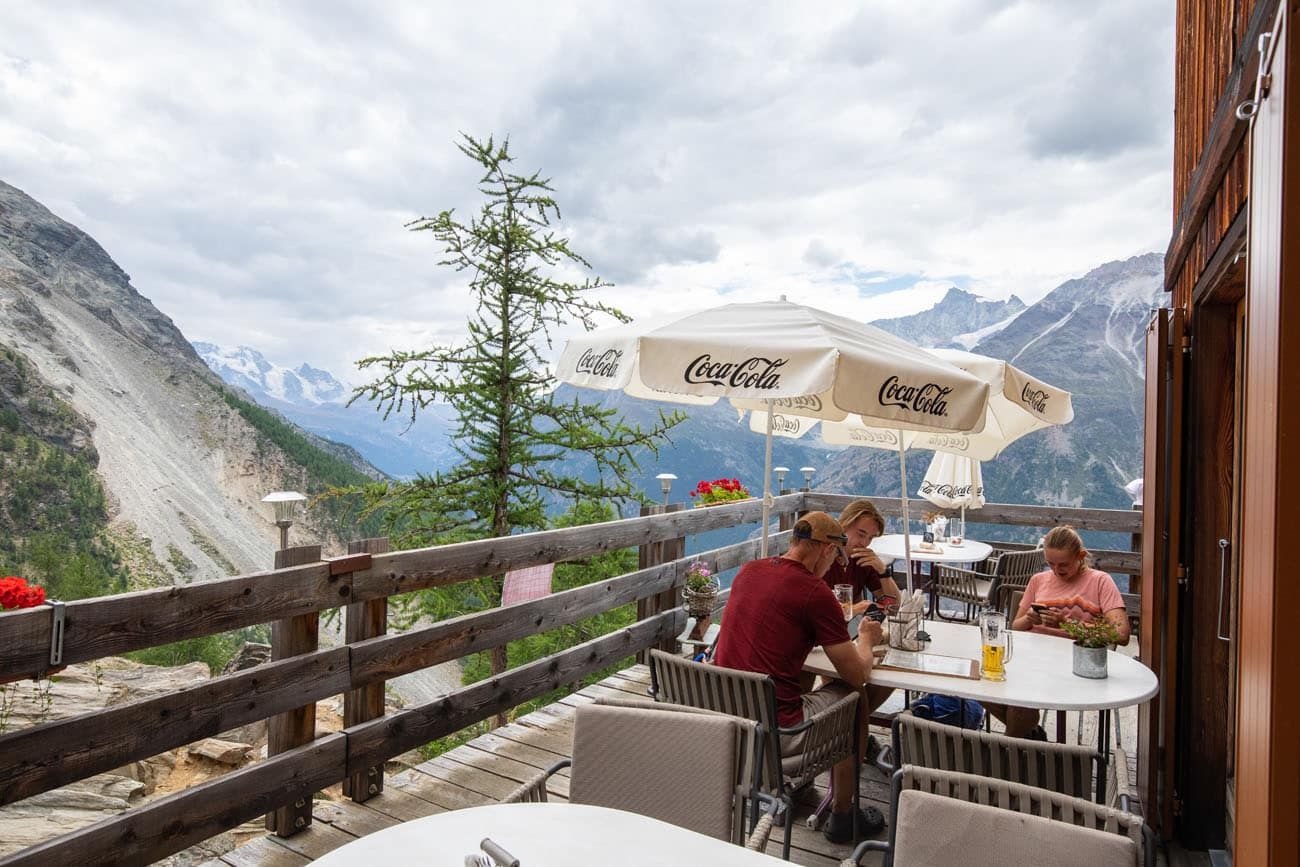
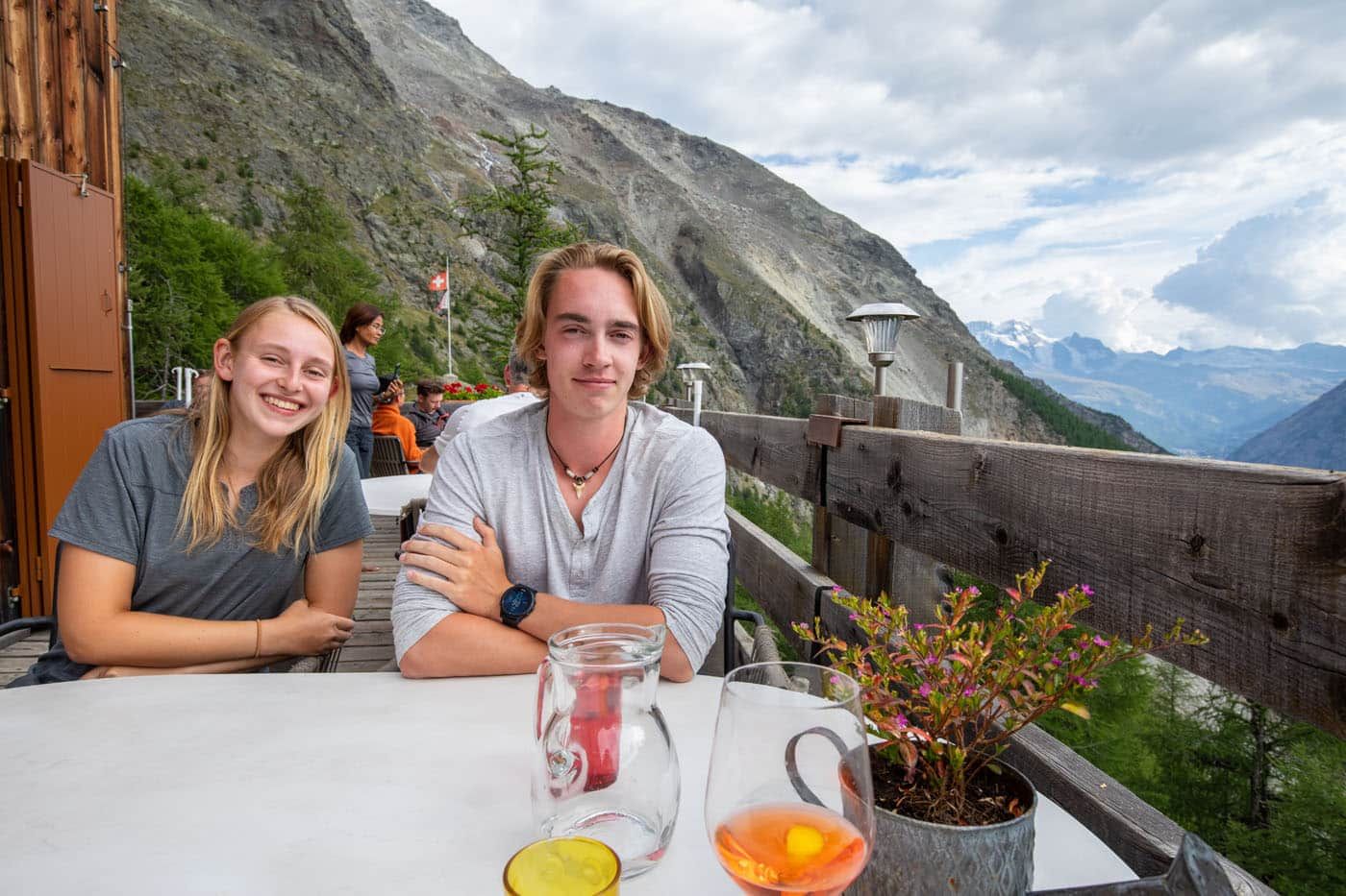
The cabin has a large inside seating area with wide open windows to admire the view over the valley. Outside is a large balcony with many more seats.
When we reached Europahütte, we sat outside here and had a delicious late lunch while enjoying the amazing view.
You can order food and drinks from a menu here, however dinner is a set 3 course meal at 6:30 pm.
View of the Charles Kuonen Suspension Bridge. Zermatt is off in the distance…it’s awesome to be able to see the finish point of the trek. And just a short walk into Stage 14 you will be able to see the Matterhorn.
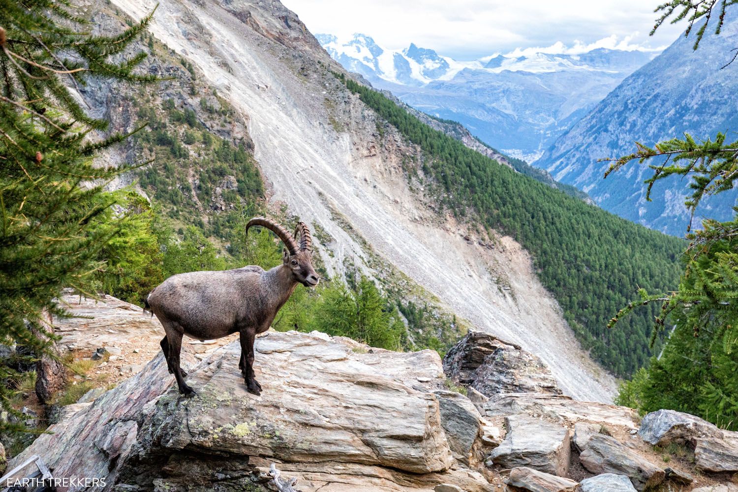
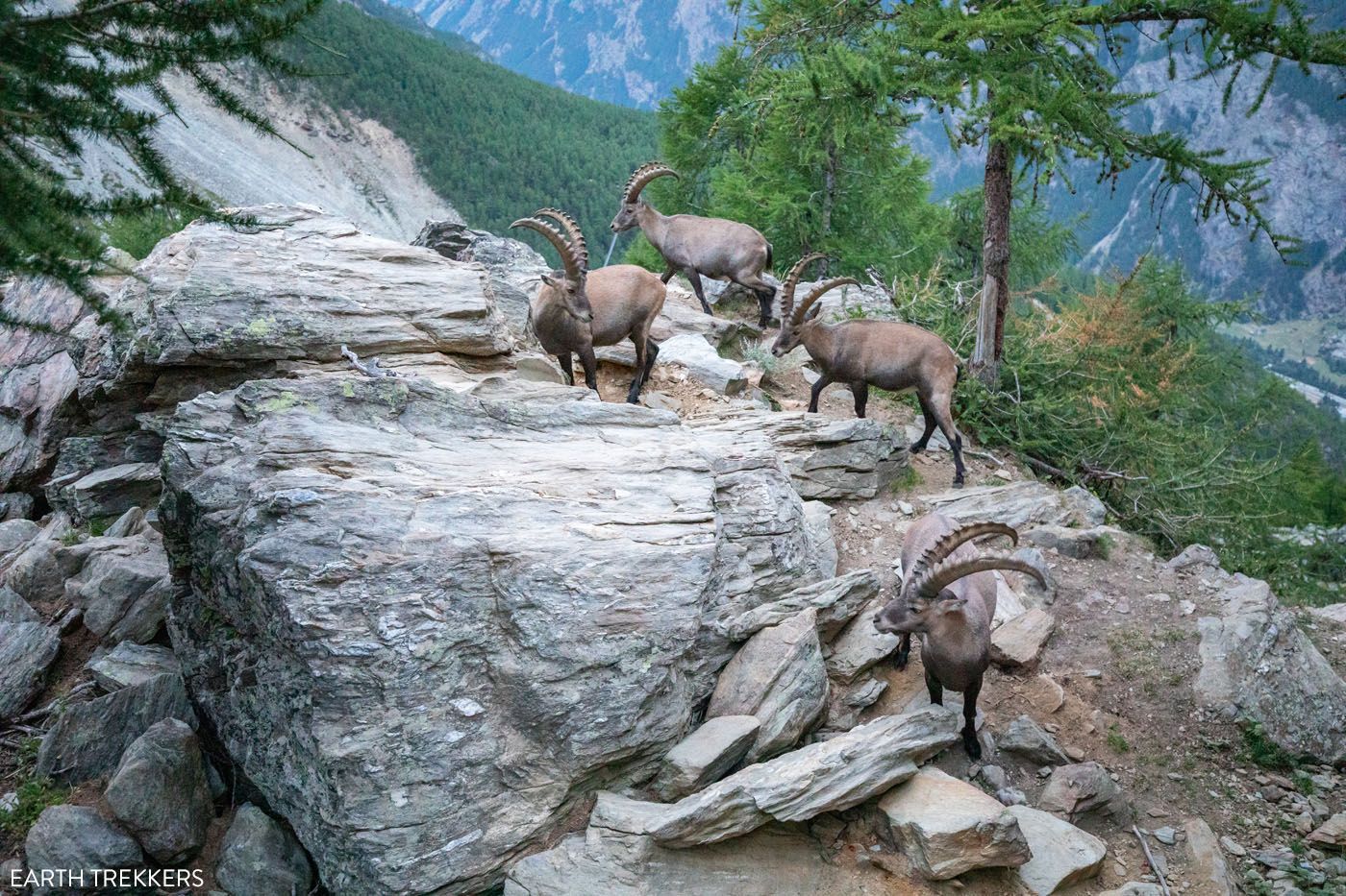
After dinner, six ibexes joined us at the Europahütte. They crowded around next to the balcony and licked the rocks. Every now and then some of the ibex would pick a fight with each other and they would clash their horns together. It was a very cool sight to see.
Alternative Route: St. Niklaus to Gasenreid to the Europahütte
If you are curious about the route from Gasenreid to Herbriggen, which is what we did, here is a brief trail description and some photos.
From St. Niklaus, it is a steep uphill walk to get to Gasenried. This is on a mix of paved roads and trails through forests and farms.
Once in Gasenried, the trail levels out. You will come to a trail junction just outside of town. It is here that, in the past, you would go left to hike up to the original Europaweg. You can do this now and go as far as Grat, but beyond Grat the trail is closed. This will add tons of elevation gain and time to your day, but it can be done. But you will then have to hike back down to this trail junction and then hike to Herbriggen on the lower trail.
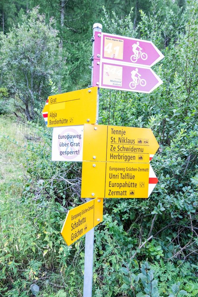
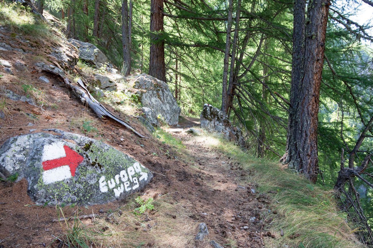
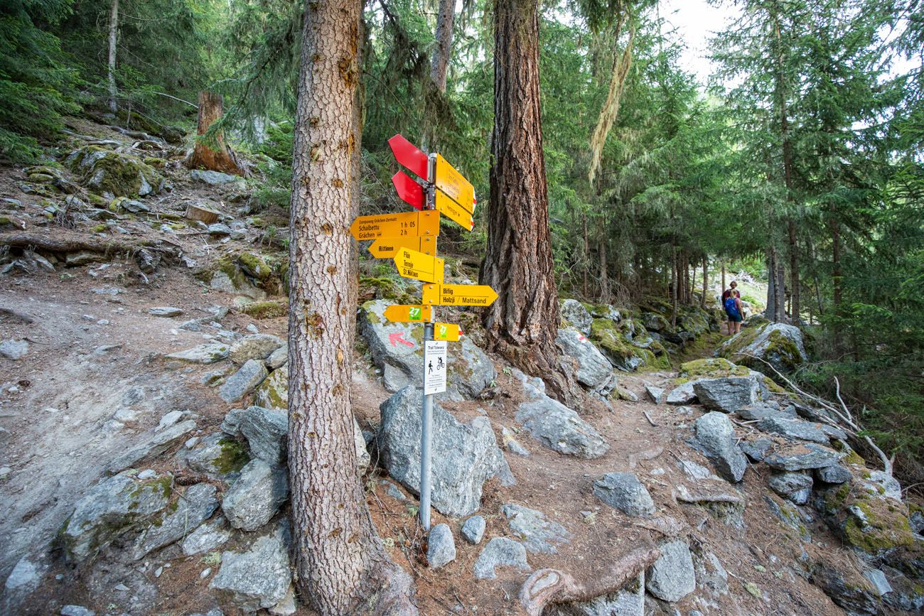
The trail sign near Gasenried. It’s at this point that the Europaweg starts its descent through the forest.
At this trail junction, stay to the right to hike the “new” Europaweg trail to Herbriggen. This trail runs through a forest. It’s mostly flat and you won’t see much more than the forest you are hiking through.
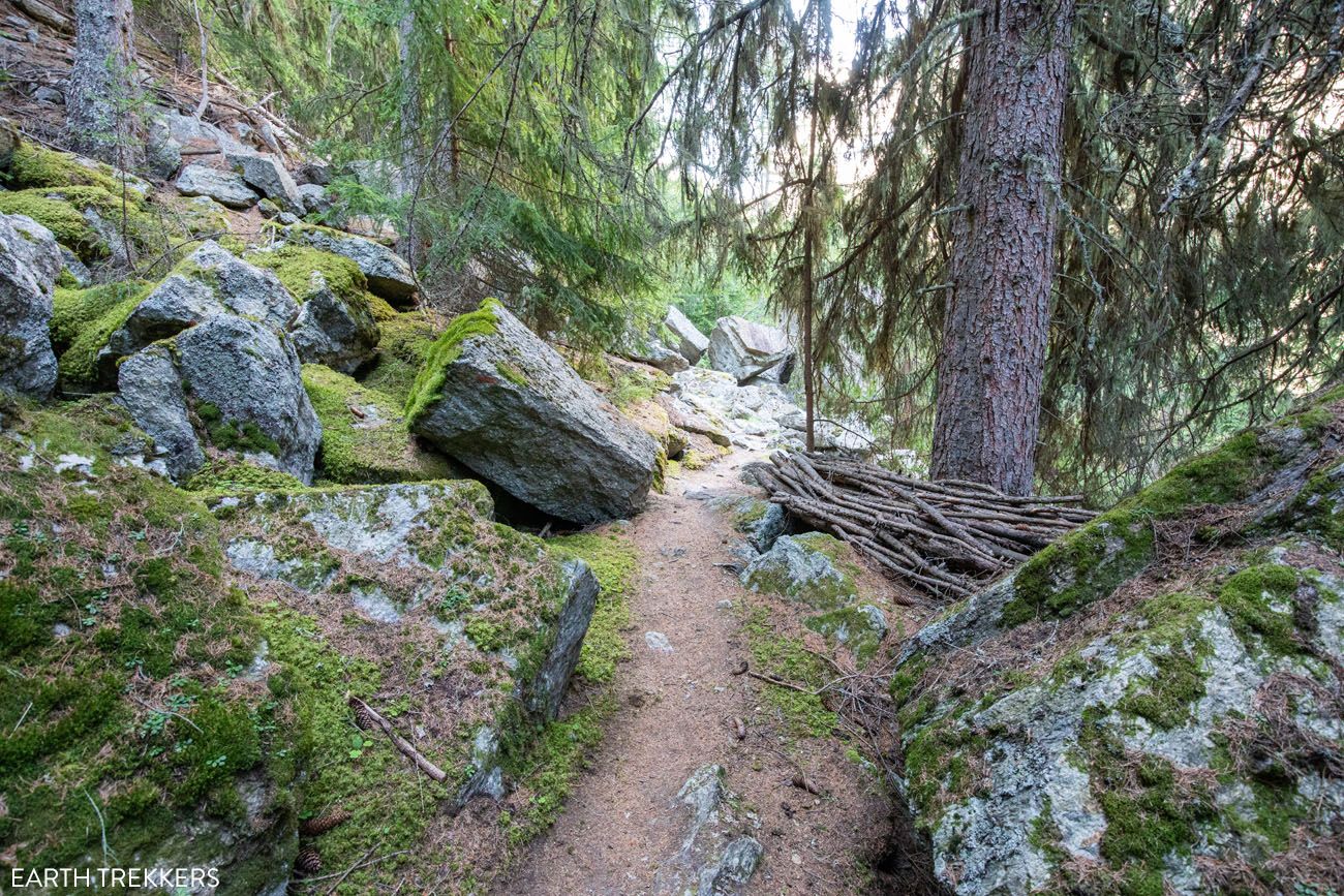
For most of the walk from Gasenried to Herbriggen, this is the view.
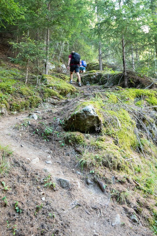
Shortly before reaching Herbriggen, the trail makes a big ascent followed by a longer descent. Once in Herbriggen, continue to follow signs for the Europaweg.
Part of the ascent on the way to Herbriggen.
Herbriggen
For strategies on how to shorten the Haute Route see our guide on How To Plan Your Haute Route Experience.
Clarifications for the Walkers Haute Route book
We have no clarifications for Stage 13. We did not walk the route through the valley from St. Niklaus to Herbriggen. Once on the Europaweg, the trail is very well signed and super easy to follow.
More Information about the Haute Route
In our Walker’s Haute Route Planning Guide, we have links to all of our articles about the Walker’s Haute Route, including information about each stage, how to plan your trek, what to expect, and more.
For an overview of all 14 stages of the Walker’s Haute Route, with overall hiking stats, map, elevation profile, and lists of the most difficult stages, easiest stages, and our personal favorites, check out our Guide to the Walker’s Haute Route Stages.
Stages of the Haute Route: Below are our guides to each stage of the Haute Route.
- Haute Route Stage 1: Chamonix to Argentière
- Haute Route Stage 2: Argentière to Col de Balme to Trient
- Haute Route Stage 3: Trient to Fenetre d’Arpette to Champex-Lac
- Haute Route Stage 4: Champex-Lac to Le Chable
- Haute Route Stage 5: Le Chable to Cabane du Mont Fort
- Haute Route Stage 6: Cabane du Mont Fort to Cabane de Prafleuri
- Haute Route Stage 7: Cabane de Prafleuri to Arolla
- Haute Route Stage 8: Arolla to Les Haudères
- Haute Route Stage 9: Les Hauderes to Col du Tsate to Lac de Moiry
- Haute Route Stage 10: Lac de Moiry to Zinal
- Haute Route Stage 11: Zinal to Forcletta to Gruben
- Haute Route Stage 12: Gruben to Augstbordpass to St. Niklaus
- Haute Route Stage 14: Europahütte to Zermatt
If you have any questions about how to hike the Haute Route Stage 13, or if you want to share your experience, let us know in the comment section below.
You Might Also Like
Walker’s Haute Route: 21 Important Things to Know & FAQ
Pinterest Facebook Flipboard The Walker’s Haute Route is one of the most rewarding and memorable multi-day walks in Europe. On this journey, hikers will cross 10 of the highest mountain passes in the Alps, while walking from Chamonix, France to Zermatt, Switzerland. It’s an extraordinary journey but not without its challenges. With 14 stages, multiple […]
Walker’s Haute Route Stages: An Overview of All 14 Stages
The Walker’s Haute Route is a multi-day trek from Chamonix, France to Zermatt, Switzerland. On this walk, hikers will cross 10 mountain passes, walk through small towns and through rugged, remote landscapes, and get to experience a less touristy side of the Swiss Alps. There are several routes that take hikers from Chamonix to Zermatt. […]
How To Plan Your Walker’s Haute Route Experience
The Walker’s Haute Route is a 14-stage trek from Chamonix, France to Zermatt, Switzerland. It is a tough yet rewarding experience through the French and Swiss Alps that crosses 10 mountain passes and offers incredible scenery along the way. It is a beast of a trek! It took us 13 days, averaging 16 km (10 […]
How To Book Your Walker’s Haute Route Accommodations
Along the Walker’s Haute Route, there are a variety of accommodation types, from mountain huts to 5-star hotels, from dormitories to apartments, and from shared bathrooms to private bathrooms. You will have the opportunity to experience a combination of all of these since you will be staying in a new place at the end of […]
20 Amazing Things to Do in Zermatt, Switzerland
Zermatt is an idyllic mountain village tucked away in the Swiss Alps. The mighty Matterhorn dominates the skyline, creating one of the most unique alpine landscapes in Europe. Explore the hiking trails, journey up higher into the mountains by cable car and train, stroll the scenic streets of Zermatt, and go skiing all year long. […]
Complete Guide to the Hörnlihütte Hike (Map, Trail Stats & Photos)
The Hörnlihütte (Hörnli Hut) is a lodge built at the base of the Matterhorn. For thrill seeking rock-climbers, the Hörnlihütte marks the start of the ascent up to the peak of the Matterhorn. Even if you do not wish to stand on top of the Matterhorn, simply hiking to and from the Hörnlihütte makes for […]
Switzerland Itinerary Ideas: 7 to 21 Days of Alpine Adventures
If you are planning a trip to Switzerland, this is a great place to start. There are many different ways to plan your “perfect Switzerland itinerary,” depending on your interests and how much time you have. In this article, we list five sample itineraries for Switzerland. These range from 7 to 21 days, with suggestions […]
Matterhorn Glacier Trail: Ultimate Trail Guide (+ Map, Photos & HELPFUL Tips)
The Matterhorn Glacier Trail is one of the easiest and most scenic hikes to do in Zermatt. This point-to-point trail weaves its way between alpine lakes and along the way you get up close views of the Matterhorn. Since it is done one-way and is a mostly downhill hike, this is a great trail for […]
The Ultimate Zermatt Itinerary for 1 to 4 Days
How many days do you need in Zermatt? How do you plan the perfect Zermatt itinerary? The answer to these questions depends on several factors. How much time do you have? Do you want to get out and hike the trails or simply ride the cable cars to viewpoints of the Matterhorn? What time of […]
How to Visit Matterhorn Glacier Paradise …and is It Worth It?
Does a trip to the highest cable car station in Europe sound thrilling to you? How about having 360° views across the Alps? If so, then put Matterhorn Glacier Paradise on your Swiss to-do list. Matterhorn Glacier Paradise is an alpine wonderland of ski slopes, panoramic vistas, ice carvings, and a unique view of the […]
Jungfrau Itinerary: 1 to 7 Days in Mürren, Lauterbrunnen & Interlaken
The Jungfrau region of Switzerland can seem like a confusing place to visit, particularly to first time visitors. With its unique geography, complicated network of trains and cable cars, and long list of hiking trails and small towns to visit, it may seem like an overwhelming task to plan a trip here. But it doesn’t […]
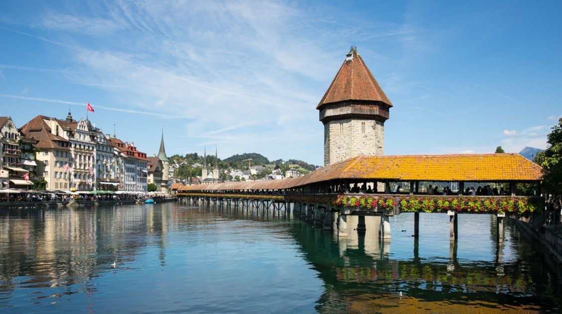
How to Visit Lucerne and Mt. Pilatus in One Perfect Day
Lucerne (also spelled Luzern) is a gorgeous Swiss city that sits at the foot of the Alps. This is the perfect kind of town to explore in one day. The city center is compact with just a few key places to visit. The best things to do are to wander the old town, eat, drink, […]
20 Best Day Hikes in the World (+ Map & Photos)
Where can you go to find that perfect day hike? The hike that leaves you breathless as you climb the summit of the mountain. The hike with the awe-inspiring views. The hike that is so enjoyable because the terrain and its views are always changing. The hike that has you saying “Wow!” over and over […]

Comments 12