
After two long, strenuous climbs and steep descents offered by the last two stages of the Walker’s Haute Route, Stage 4 provides a much needed day of recovery. Although you will still end up hiking roughly 14 km (8 miles), Stage 4 is much less challenging and one of the easiest days of the entire Walker’s Haute Route.
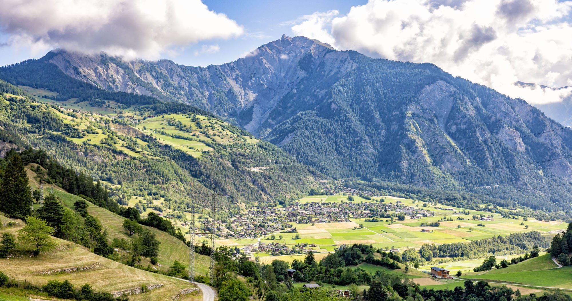
Taking a break from high-alpine views that were featured in the previous stages, Stage 4 takes you low into the valley for views of the many different Swiss mountain towns.
Walker’s Haute Route Stage 4 Hiking Stats
Distance: 13.5 km (8.4 miles)
Difficulty: Easy
Total Ascent: 213 m (700 feet)
Total Descent: 865 m (2,840 feet)
Lowest Elevation: 745 m (2,445 feet)
Highest Elevation: 1,490 m (4,890 feet)
Elevation in Champex: 1,485 m (4,870 feet)
Elevation in La Châble: 830 m (2,725 feet)
Average Time: 4 hours 15 minutes; our time: 3.5 hours (including stops)
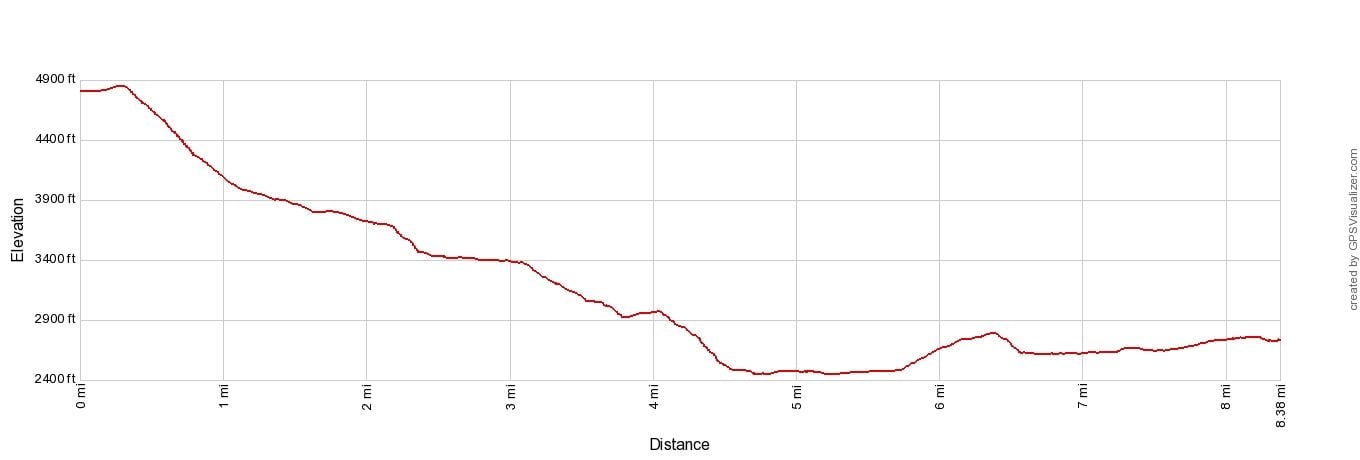
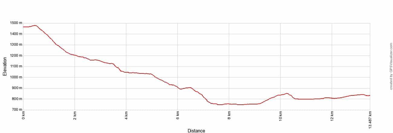
Walker’s Haute Route Stage 4 Elevation Profile
Please practice the seven principles of Leave No Trace: plan ahead, stay on the trail, pack out what you bring to the hiking trail, leave areas as you found them, minimize campfire impacts, be considerate of other hikers, and do not approach or feed wildlife.
Walker’s Haute Route Stage 4 Map
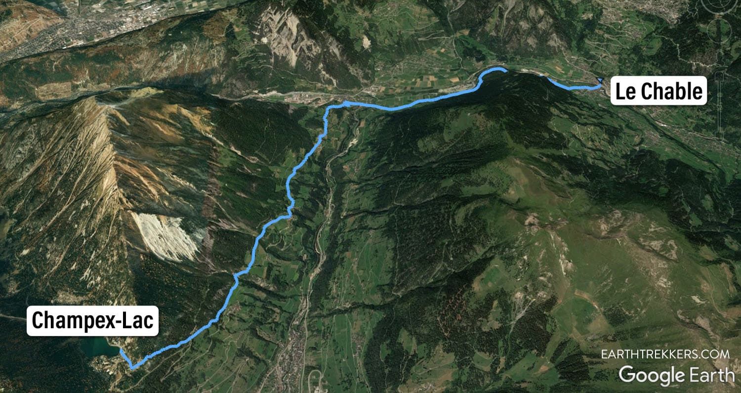
Haute Route Stage 4 map: Google Earth image of the route.
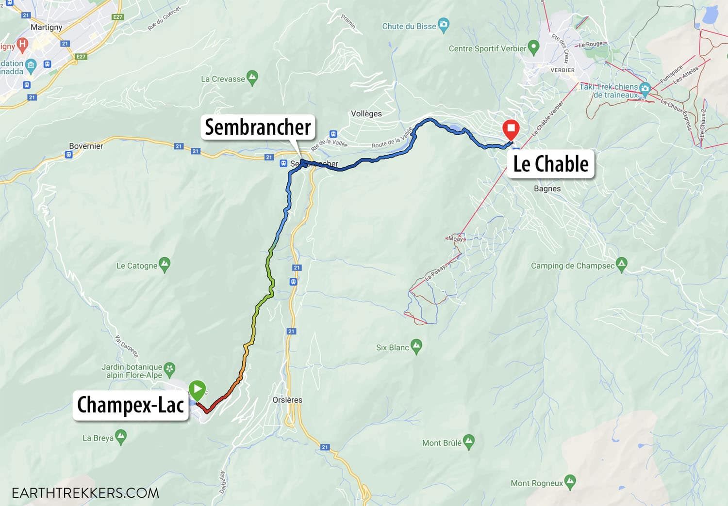
Haute Route Stage 4 map from my Garmin Fenix watch. The red color is the trail at the highest elevation and it transitions to blue, the lowest elevation.
Walker’s Haute Route Stage 4: Trail Overview
To hike the Haute Route, we highly recommend following the trail descriptions in the book Trekking Chamonix to Zermatt, The Classic Walker’s Haute Route by Kev Reynolds. Below we list an overview of the day, so you know what to expect along the way. We also provide advice on where to eat and where to stay. Later in this guide, we list a few tips and trail clarifications to be used with the Trekking Chamonix to Zermatt book.
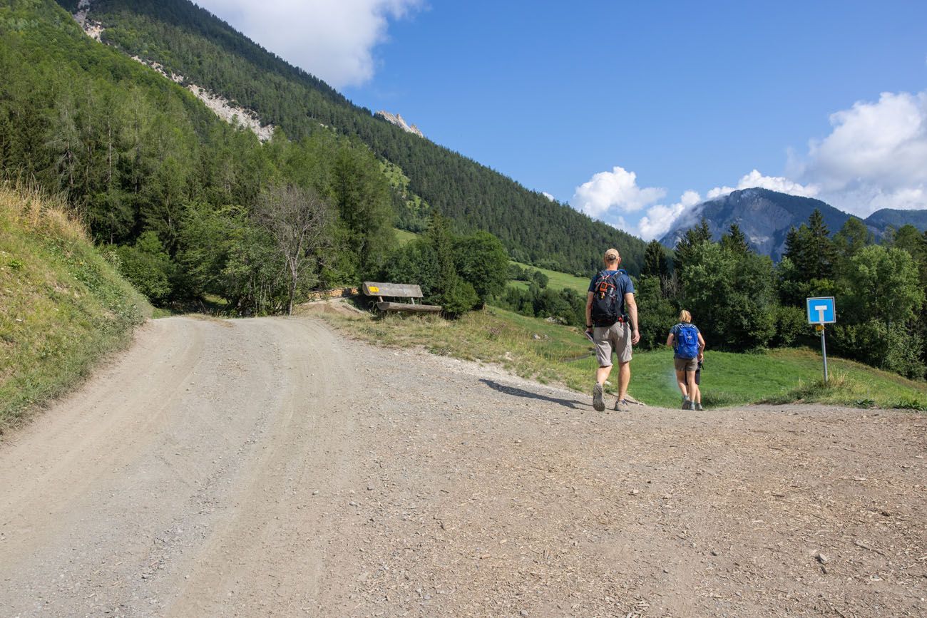
Champex-Lac to Sembrancher
Starting from Champex-Lac, the trail runs alongside the lake where you can enjoy your last views of paddle boarders and the beautiful town of Champex.
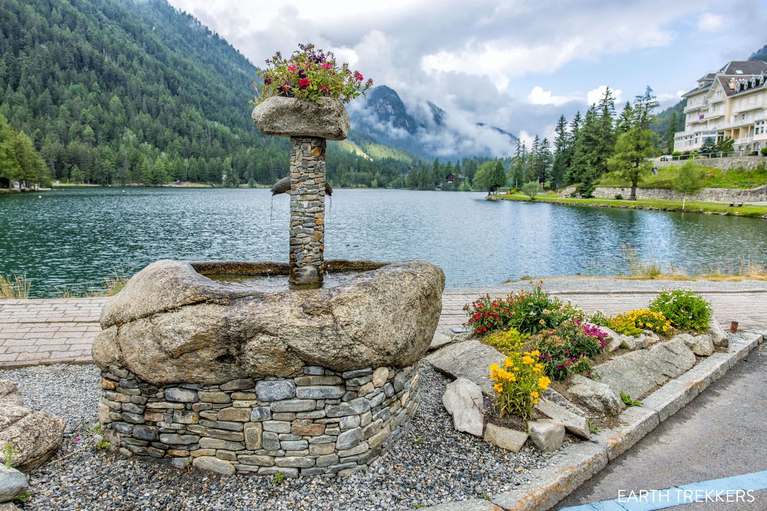
Champex-Lac Water Fountain
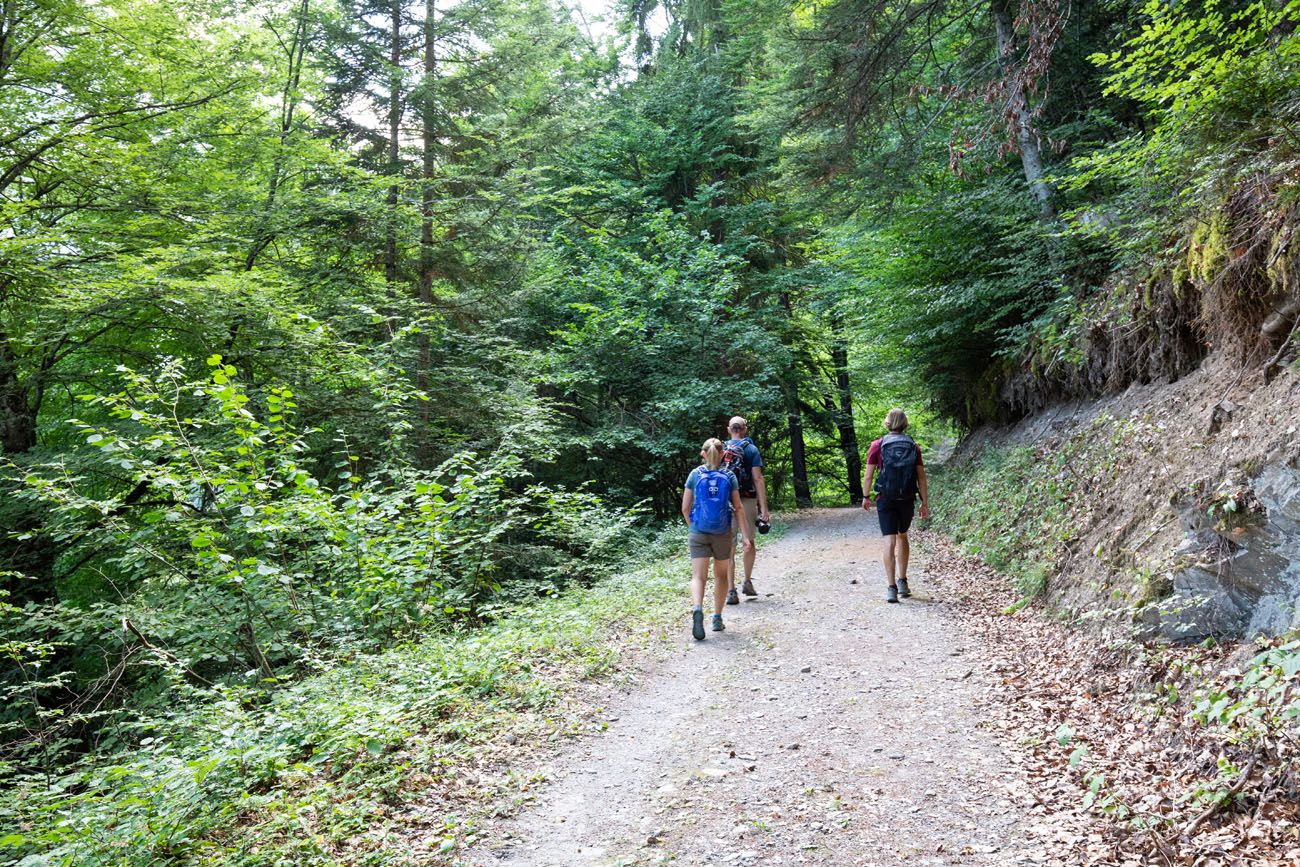
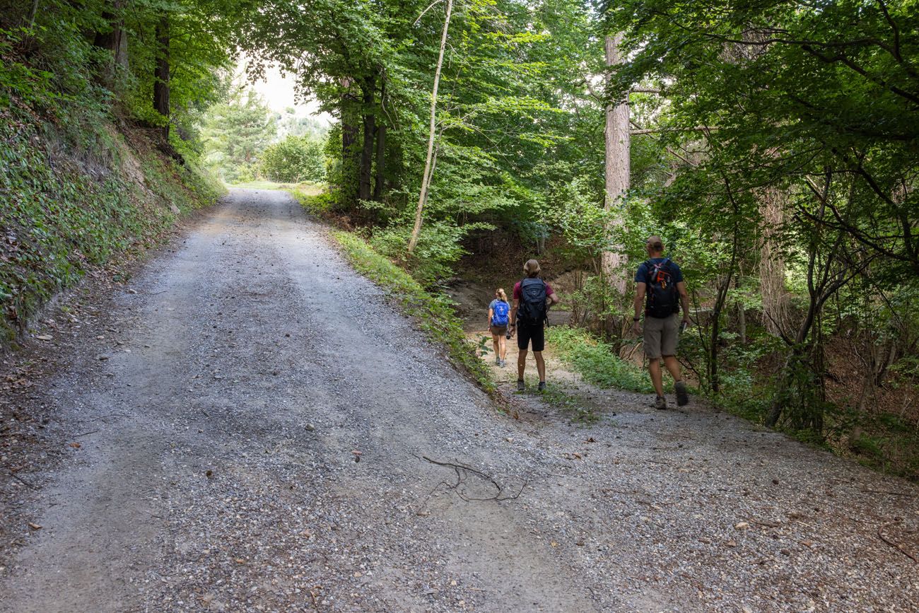
Once you have left town, the trail loops around the neighboring mountain, where you will slowly begin your descent. The dirt trail drops through the woods and can be somewhat steep at times so be careful of your footing. However, unlike the descent of Stage 3, the trail mostly consists of packed soil and occasional rocks or roots, so we were able to keep up a pretty high speed with relative ease.
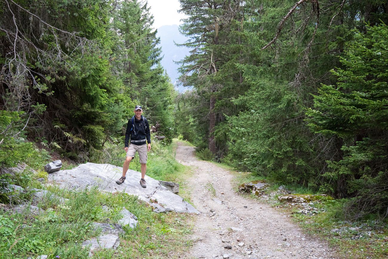
Tim on the trail
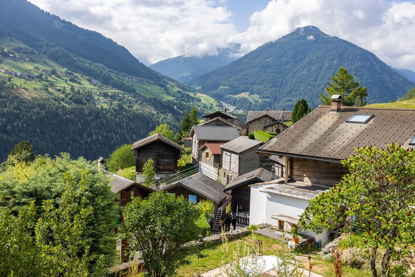
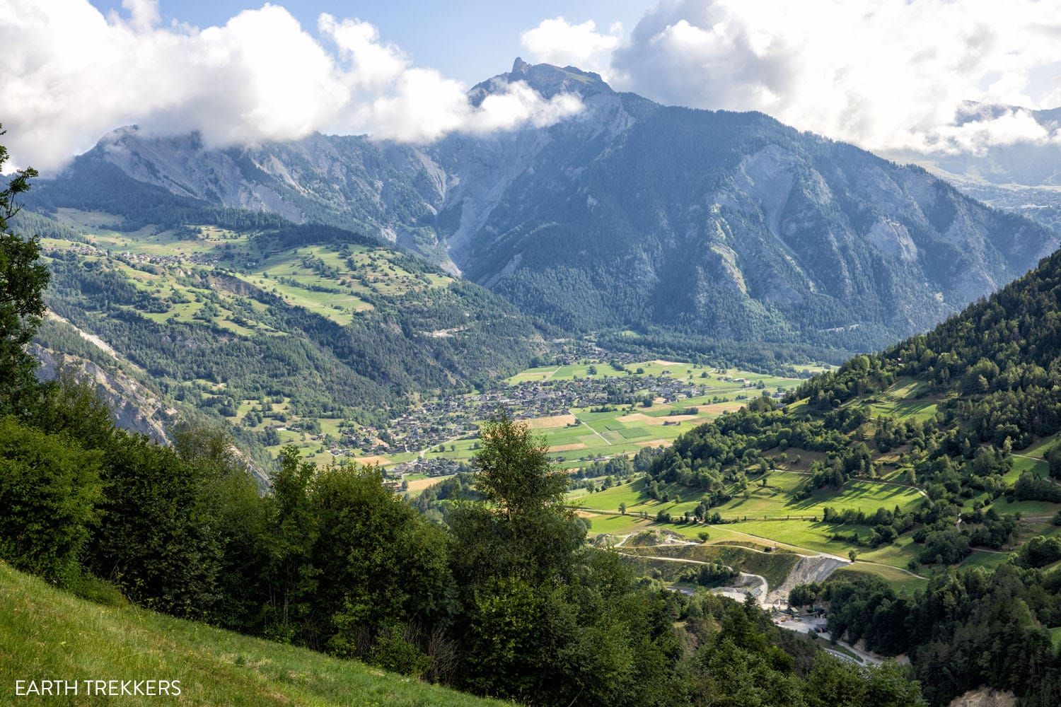
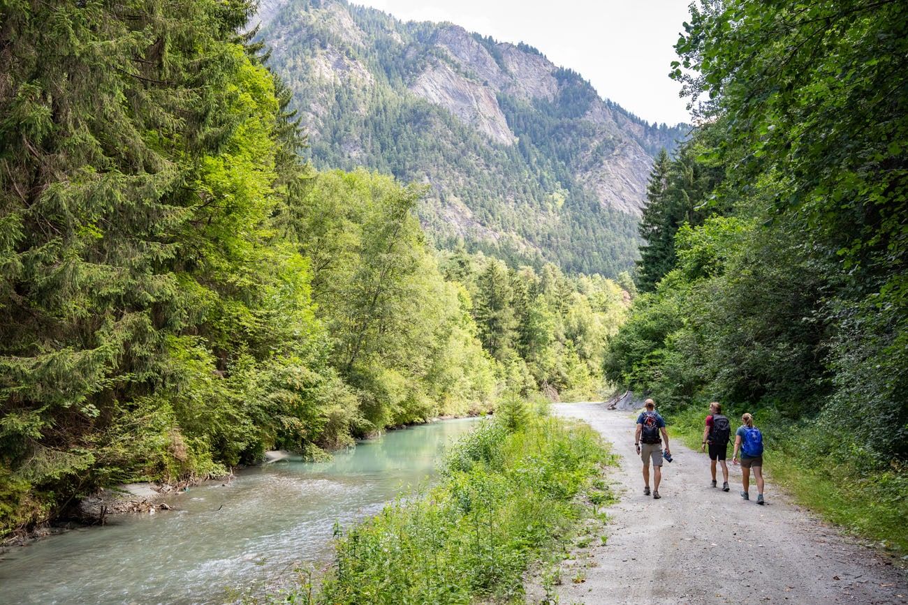
Early on into the hike you’ll find breaks in the trees that offer up incredible views of the towns sitting in the valley below, shaded by mountains looming high above.
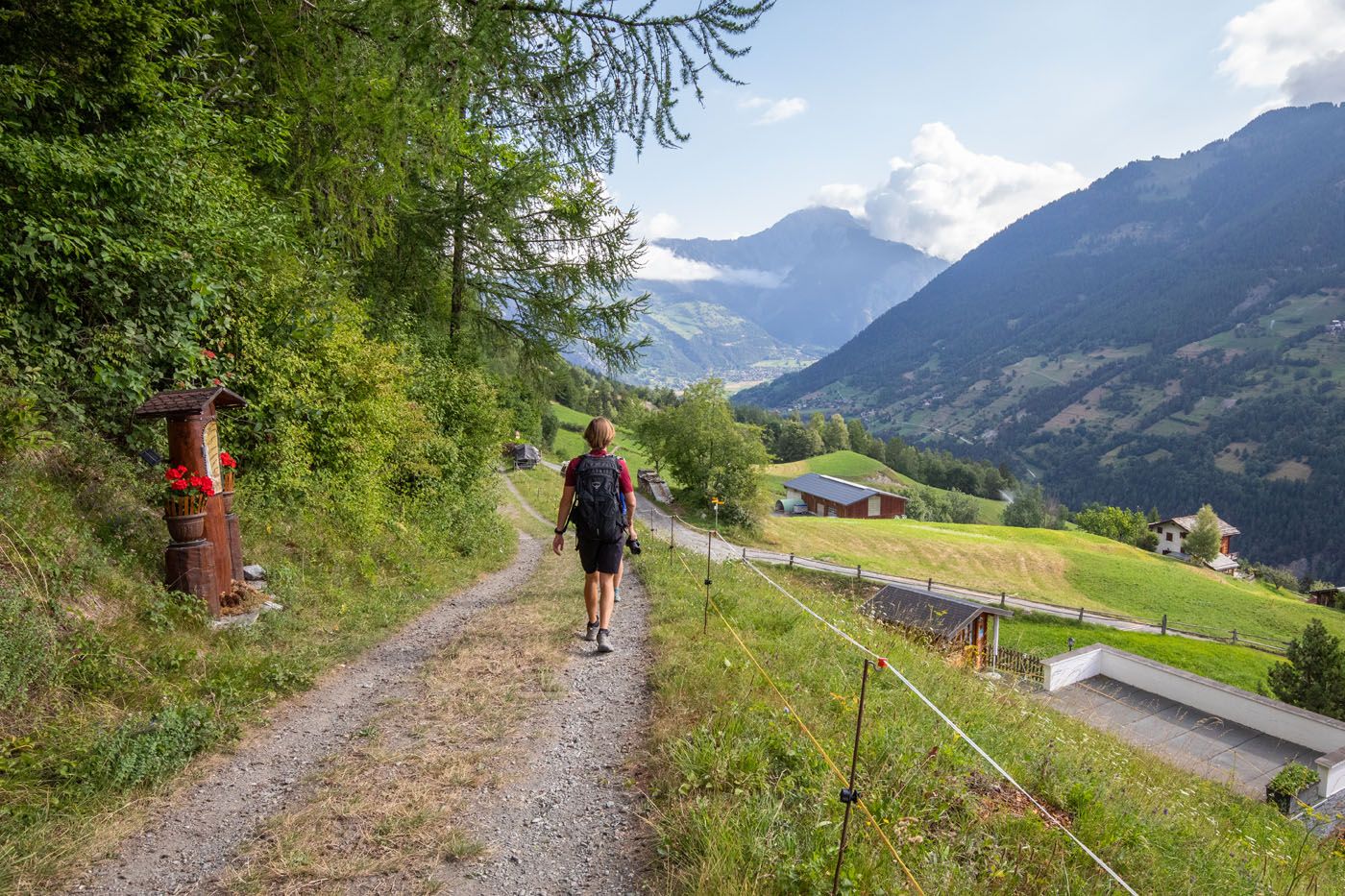
The trail will continue to clear up, and as you slowly exit the woods, you will end up on grass paths leading you along the mountainside. The trail still continues to descend, although now it’s much less steep and pretty much flat at times.
Chez-les-Reuses

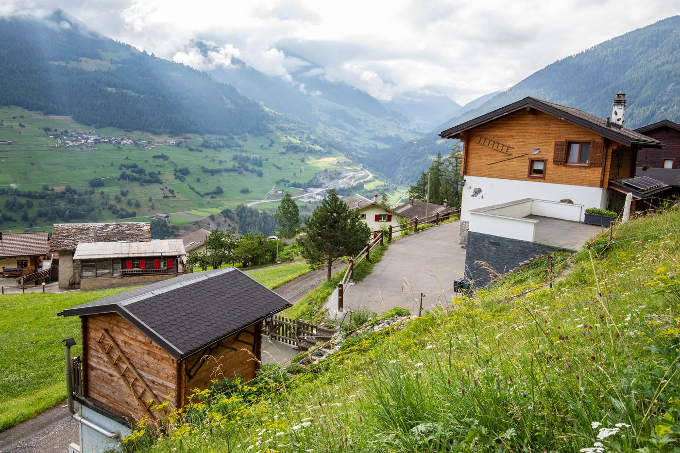
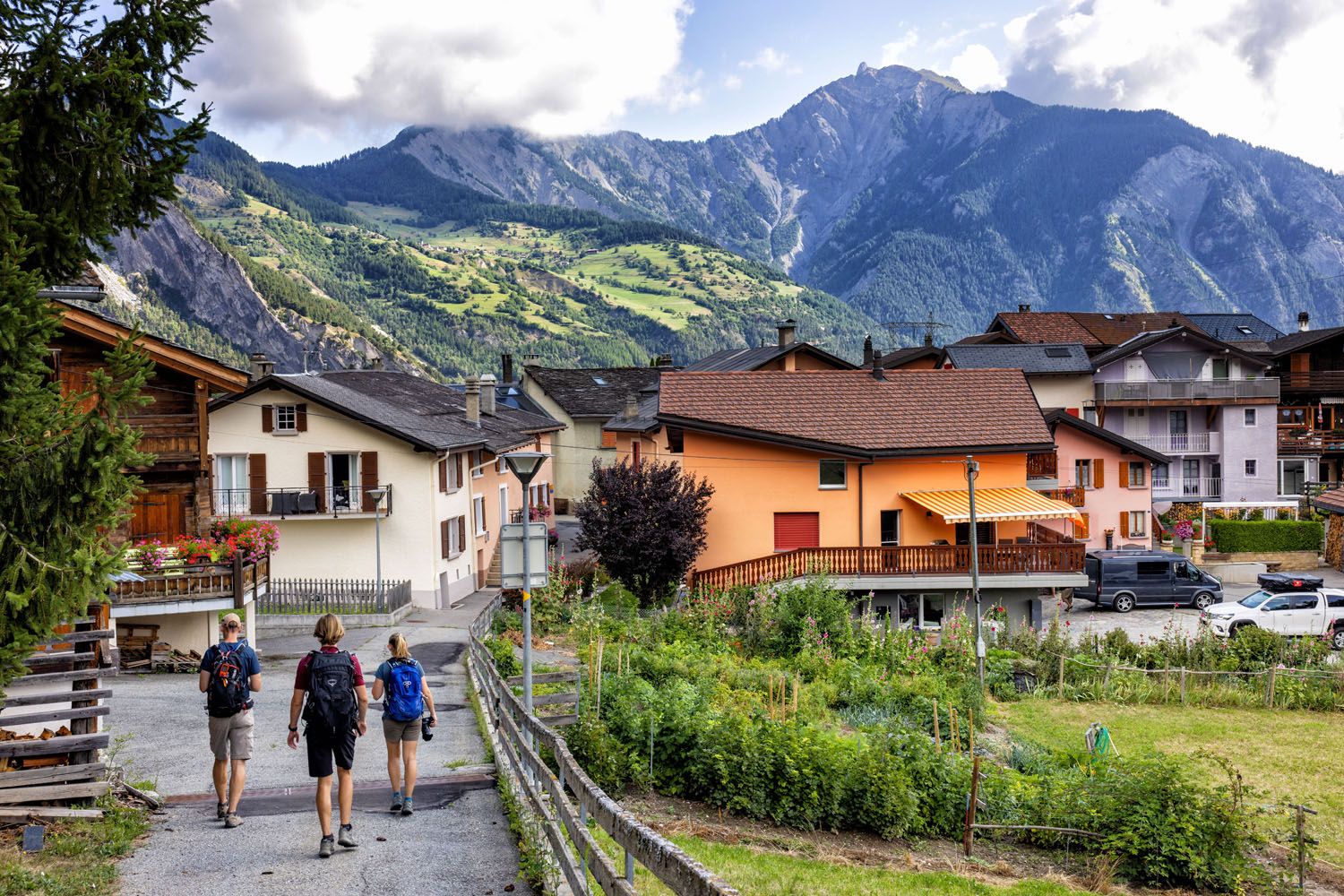
About 4 km (2.5 miles) into the hike you’ll pass through the small town of Soulalex, one of several Swiss towns you’ll encounter today.
Soulalex
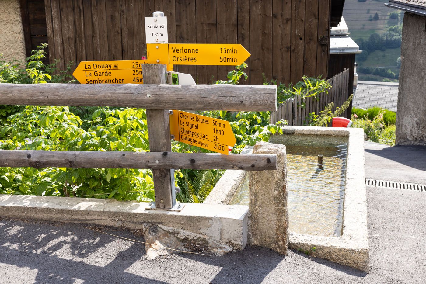
Trail sign and water trough in Soulalex.
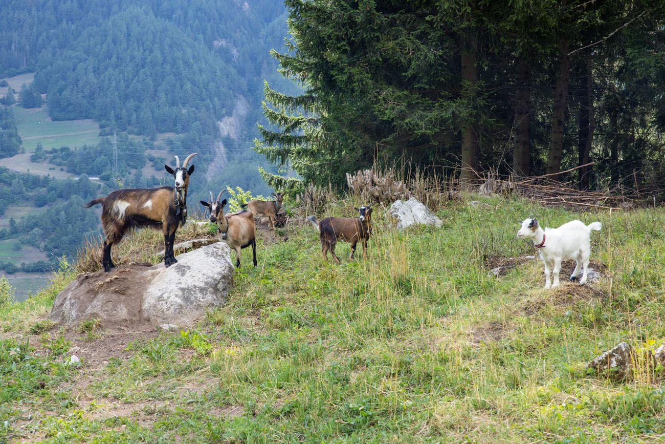
Shortly after we stumbled across a tiny goat pen, one of the day’s highlights.
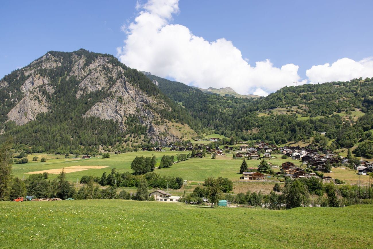
Continue to enjoy views of the valley and follow signs pointing you in the direction of Sembrancher. The town is hard to miss as it’s much larger than others in the valley, and it is also the same town you have been looking out at for a few miles.
Entering La Garde, another small town before you get to Sembrancher.
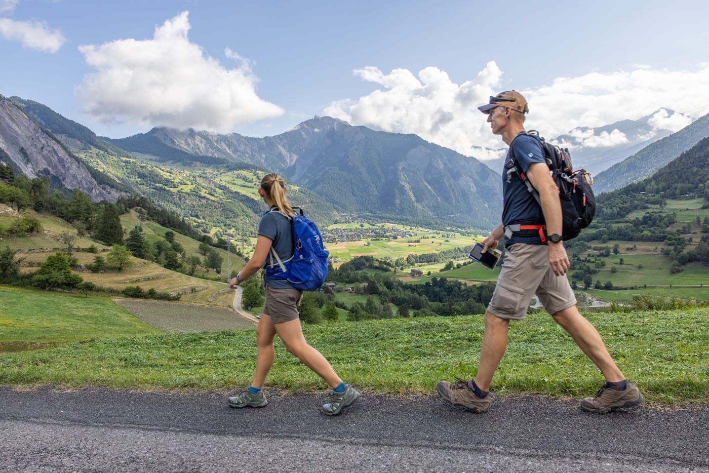
Tim and Kara on the “trail.” A lot of the walk today is on paved roads with quick walks through the towns. It may not be what you expect as a day on the Haute Route, be we really enjoyed this day. It’s an easy walk and you get to see a less touristy side of Switzerland.
As you near the town, the trail will once again lead into the woods, where you will descend faster.
At about 7 km (4.5 miles) you’ll exit the woods and begin entering Sembrancher.
The descent for today is pretty much finished. You may not have noticed it while hiking, but you’ll have descended about 700 meters (2,300 feet) since leaving Lac-Champex-Lac.
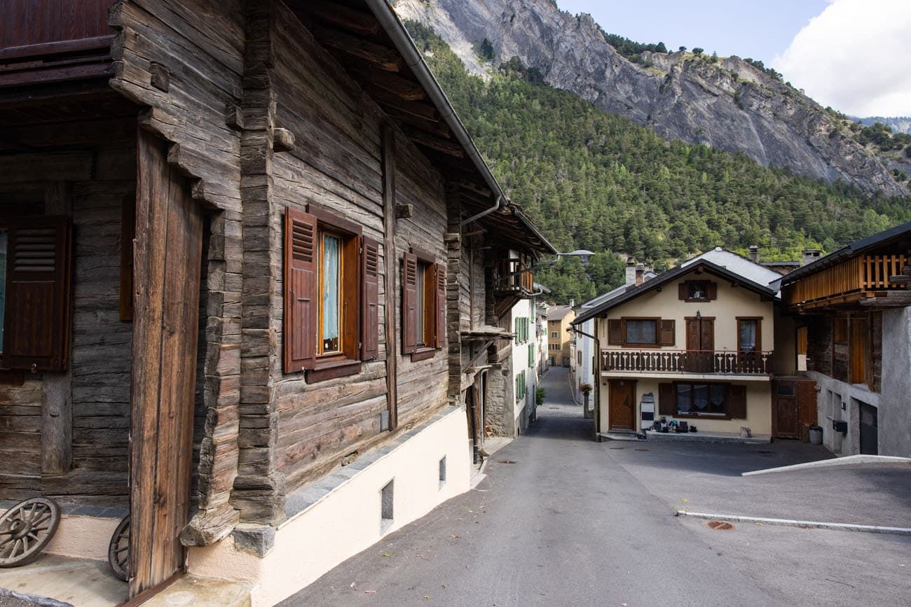
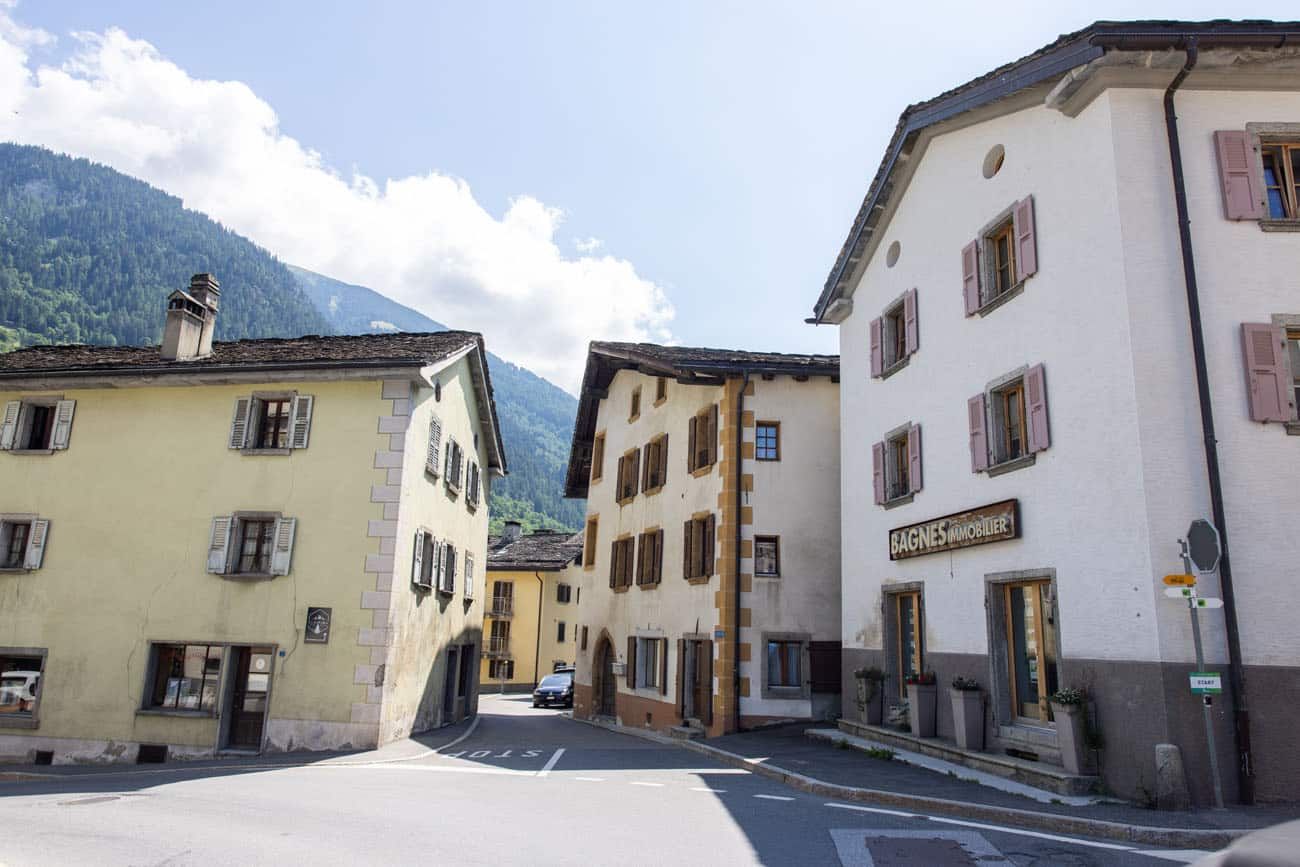
Sembrancher is a beautiful town positioned under the looming peak of La Crevasse. Take your time as you enjoy a closer look at Swiss architecture and the mountain peaks surrounding you.
Entering Sembrancher
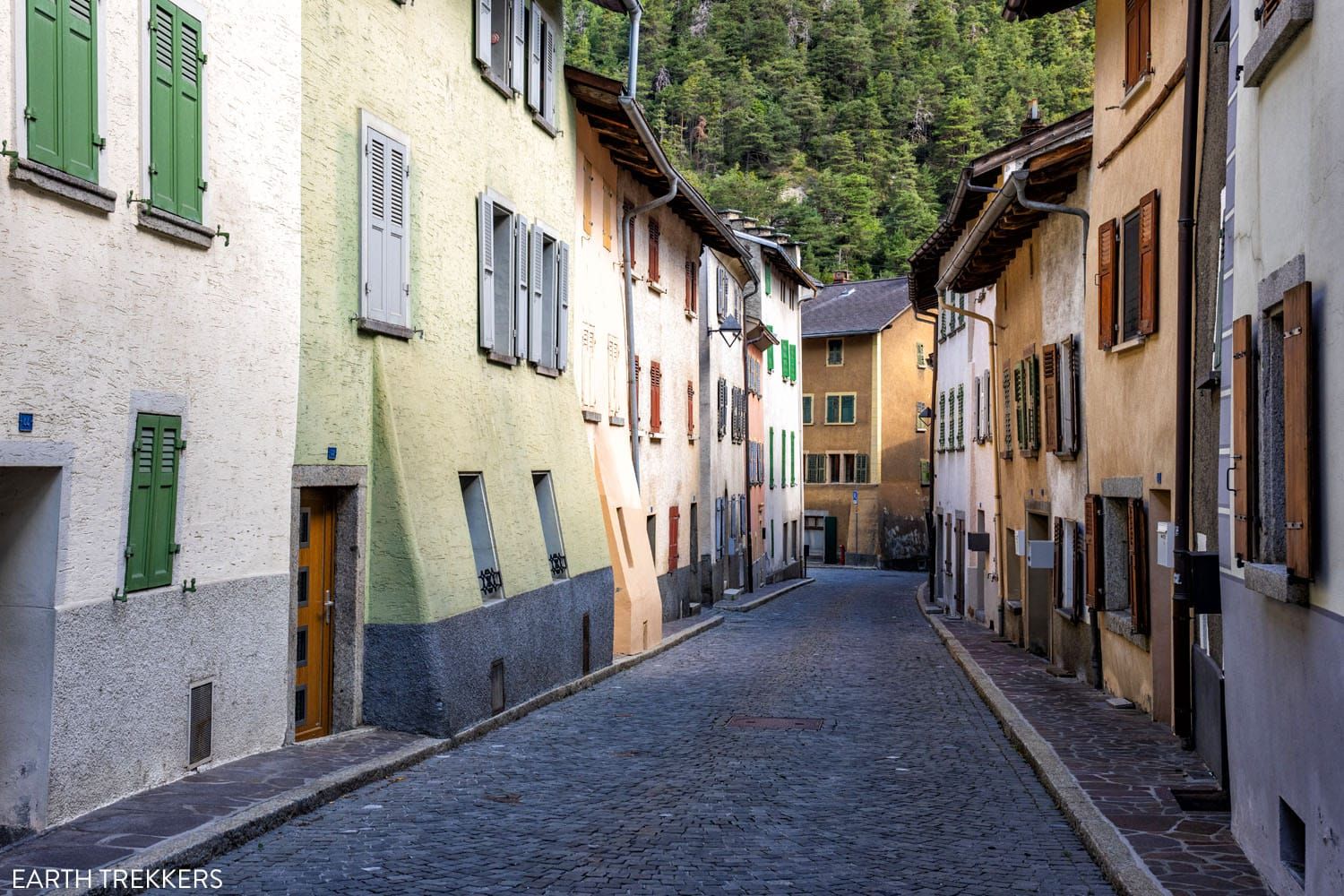
Sembrancher
The trail leads you directly through town, although there are very limited food & drink options, unless you leave the “hiking route” and venture farther into town. The next chance you’ll get to resupply will be Le Châble, roughly 6.5 km (4 miles) away.
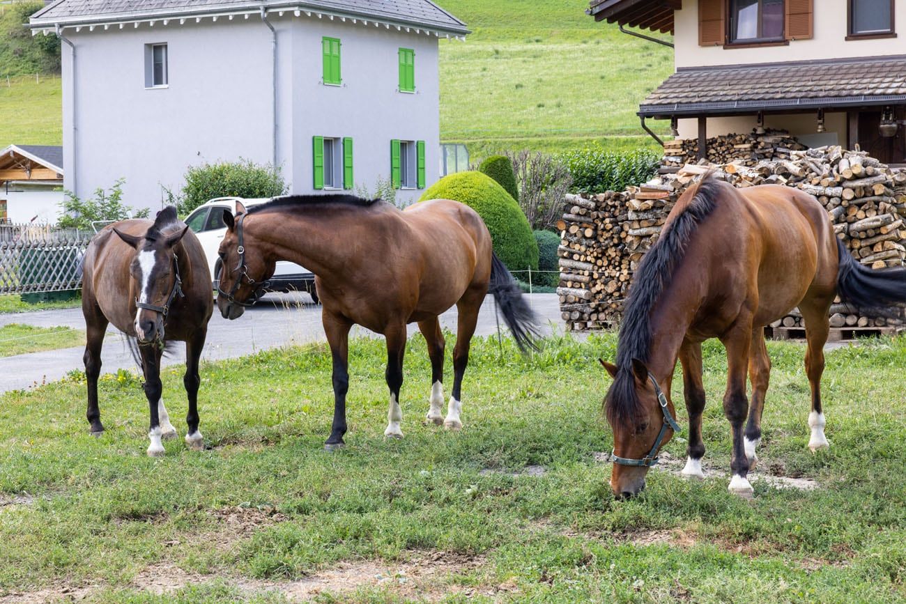
Once you leave Sembrancher, you will walk past several horse stables.
Sembrancher to Le Châble
As you leave town, you’ll continue walking along a paved road for a while until the trail leads you up through the woods. This is where you encounter your one and only large climb for today, and by “large” it is only 300ft.
You’ll continue to hike through the woods for a while, and the trail becomes quite monotonous. Continue to follow signs pointed towards Le Châble.
As the trail flattens out, you’ll leave the woods for the last time today, walking past several municipal buildings on Le Châble’s outskirts.
Le Châble
The trail leads you onto another paved road which will lead right into town, passing the Eglise St. Maurice de Bagnes.
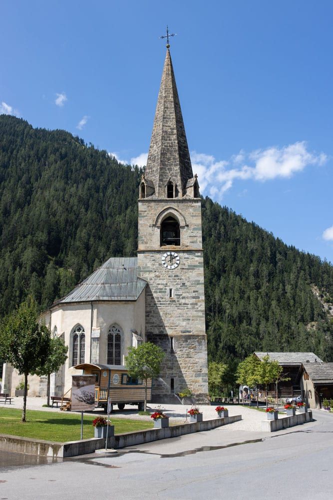
Eglise St. Maurice de Bagnes
We continued walking through town and crossed over a bridge to reach our ending point for today. We totaled 13.5 km (8.4 miles) in three and a half hours and were happy to keep a good pace for the entire stage. We still finished sore, but all felt so much better than we did at the end of the previous stage.
To celebrate our finish of Stage 4, we ate at Restaurant Pizzeria du Pont, located right next to today’s ending point. Kara enjoyed a plateful of penne arrabiata, while the rest of us scarfed down on pizza.
Le Chable
Where to Stay
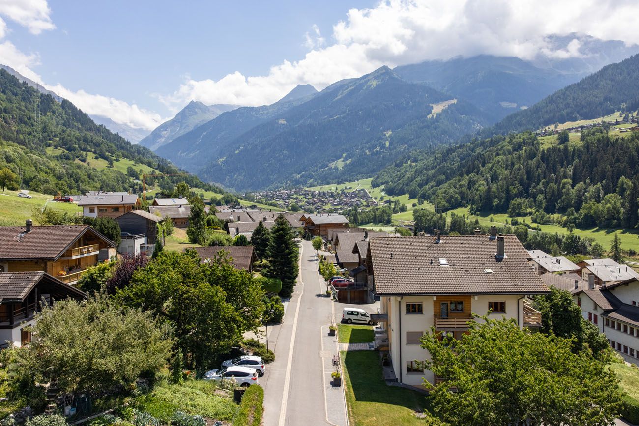
Traditionally Stage 4 ends in Le Châble, yet we decided to spend the night in the town of Verbier, which sits higher on the mountain above Le Châble. To get here, you can either hike up the road full of switchbacks, continue following the Haute Route up to Les Ruinettes and then take that gondola down to Verbier, or simply take the gondola in Le Châble up to Verbier, which is what we did.
The next morning, we then took the gondola back down to Le Châble and continued following the Haute Route from where we had left off the day before. That is, we hiked up to Les Ruinettes and onward to Cabane du Mont Fort and Cabane de Louvie. See our write up on Stage 5 for the details.
The view of Le Châble from gondola
We found that Verbier had a lot more lodging options to choose from. Verbier is a huge ski-town in the wintertime and in the summer is a popular destination for hikers. You won’t have any trouble finding a place to stay or eat if you decide to spend some time here.
Verbier, Switzerland
We stayed at Hotel de Verbier, a hotel located in the heart of town and only a 5-minute walk from the gondola station. The four of us stayed in two double rooms and we all greatly enjoyed our stay. This was our nicest accommodation on the Haute Route, since Hotel de Verbier is a 4-star hotel. The hotel also features a standout Italian restaurant where we ate for dinner.
In Verbier, there is a grocery store, ATM, and a long list of hotels and restaurants to choose from. If you choose to stay in Verbier, we recommend choosing a place near the gondola station, to limit how much walking you do. Tomorrow is one of the biggest day of the Haute Route and it really helps to save your steps today.
Here are more options for where to stay in Verbier, as well as options for where to stay in Le Châble.
For a detailed list of accommodations for each stage, along with information on making your reservations, see our guide on How To Book Your Haute Route Accommodations.
Clarifications for the Walkers Haute Route Book
We were able to follow the Walker’s Haute Book by Kev Reynolds (the sixth edition from 2019; there is now an updated version) without any issues, meaning we never had to backtrack. But there were a few times during this stage we felt a little more clarification would have helped so we are providing that clarification here.
Hotel Alpina: We took the right-hand option after Hotel Alpina as the book suggested. The book then states to go straight at all junctions on the way to Chez-les-Reuses. The first junction we saw split like a “Y” where a grassy path goes straight-left and a rocky dirt path goes straight-right. Take the straight-right path.
Before the small gorge: The book mentions the trail joins another track coming from the right. We noticed this happens twice before reaching the cleft above a small gorge. Ignore these tracks coming from the right and keep walking towards the cleft above the small gorge.
Before Sous La Le: The book mentions you come to a gravel farm road above Sous La Le. Turn left onto this gravel farm road to go downhill.
Before La Garde: The book mentions to keep to the main upper track when a choice is given, until a second track junction is reached after crossing a partially hidden stream. We didn’t see a partially hidden stream, but we did reach a split that was clearly sign posted with a hiker symbol directing you to the right. There was also a bench here with a way marker on it pointing you to the right (photo below). Follow these posted hiker signs to the right. Note that we thought this signpost and bench were located at the first track junction, not the second track junction as the book suggested.
The book mentions a junction of four tracks. It was really just crossing a gravel path.
The book mentions branching left at an intersection before La Garde. We never had to do that.
La Garde to Sembrancher: The sign by the chapel only points to Sembrancher, it doesn’t mention St-Jean. Still follow the sign towards Sembrancher.
The book mentions a hairpin bend in a road just after La Garde with signs pointing to Sembrancher and St-Jean. We didn’t see this sign but hiking signs at the bend in the road point you in the correct direction. As you approach this bend you will be on a paved path and at the bend it will transition to a dirt gravel path. Don’t follow the paved road that creates the bend.
As you continue you might not see signs pointing to Sembrancher and St-Jean, but rather hiker signs pointing you in the correct direction. These hiker signs no longer take you to the little chapel of St-Jean. They take you on a lower path around it, so just know you are still going the correct way.
Eventually the path will go downhill and join a wide gravel track where there is a sign to Sembrancher. Follow this a few steps and look for a narrower trail that leaves the wide gravel road on the left. This narrower trail backtracks a few steps before it switches back upon itself so you end up heading in the same direction as if you had stayed on the wide gravel road (you are just lower than the gravel road…see the photo below). When you come out to a paved road at a hairpin turn take the dirt path. Then when you come out to a gravel road turn left. This will dead end at a paved track where you turn right. Then turn left through the tunnel under the railroad tracks. When you emerge from the tunnel turn left following the hiker signs.
You will walk down the gravel road (from the top of the photo) and then take a hard left to take this lower trail. It may not look correct, but this is a nice little shortcut.
Sembrancher: The book mentions going straight across the main road. Since the crosswalk is a few steps from the intersection it can be tempting to keep going straight where the crosswalk is located. But you actually need to keep going straight where the intersection is located. Eventually you will come to a big turn in the road with a signpost. Follow that signpost towards La Chable. Then keep going straight until you reach the wooden cross mentioned in the book.
Promenade de la Dranse: Upon reaching the Promenade de la Dranse there will be a signpost. Do not follow the sign to Crie and Promenade de la Dranse, and do not cross the bridge. Instead follow the sign to La Châble. Eventually this track ends at a road. There will be a bridge to the left but you want to turn right following the hiker signs. You will be walking along this paved road until you turn left onto a paved track that takes you to the church (which you can see in the distance well before you make the left turn).
La Châble Church: Keep following the road beyond the church and you will come into town. The road will bend around to the left and down the hill to a bridge. From here Google Maps can be helpful to direct you to your accommodations. If you are staying in Verbier then turn right after crossing this bridge and the gondola station will be a short distance on the right.
More Information about the Haute Route
In our Walker’s Haute Route Planning Guide, we have links to all of our articles about the Walker’s Haute Route, including information about each stage, how to plan your trek, what to expect, and more.
For an overview of all 14 stages of the Walker’s Haute Route, with overall hiking stats, map, elevation profile, and lists of the most difficult stages, easiest stages, and our personal favorites, check out our Guide to the Walker’s Haute Route Stages.
Stages of the Haute Route: Below are our guides to each stage of the Haute Route.
- Haute Route Stage 1: Chamonix to Argentière
- Haute Route Stage 2: Argentière to Col de Balme to Trient
- Haute Route Stage 3: Trient to Fenetre d’Arpette to Champex-Lac
- Haute Route Stage 5: Le Châble to Cabane du Mont Fort
- Haute Route Stage 6: Cabane du Mont Fort to Cabane de Prafleuri
- Haute Route Stage 7: Cabane de Prafleuri to Arolla
- Haute Route Stage 8: Arolla to Les Haudères
- Haute Route Stage 9: Les Haudères to Lac de Moiry
- Haute Route Stage 10: Lac de Moiry to Zinal
- Haute Route Stage 11: Zinal to Gruben
- Haute Route Stage 12: Gruben to St. Niklaus
- Haute Route Stage 13: St. Niklaus to the Europahütte
- Haute Route Stage 14: Europahütte to Zermatt
If you have any questions about how to hike the Haute Route Stage 4, or if you want to share your experience, let us know in the comment section below.
You Might Also Like
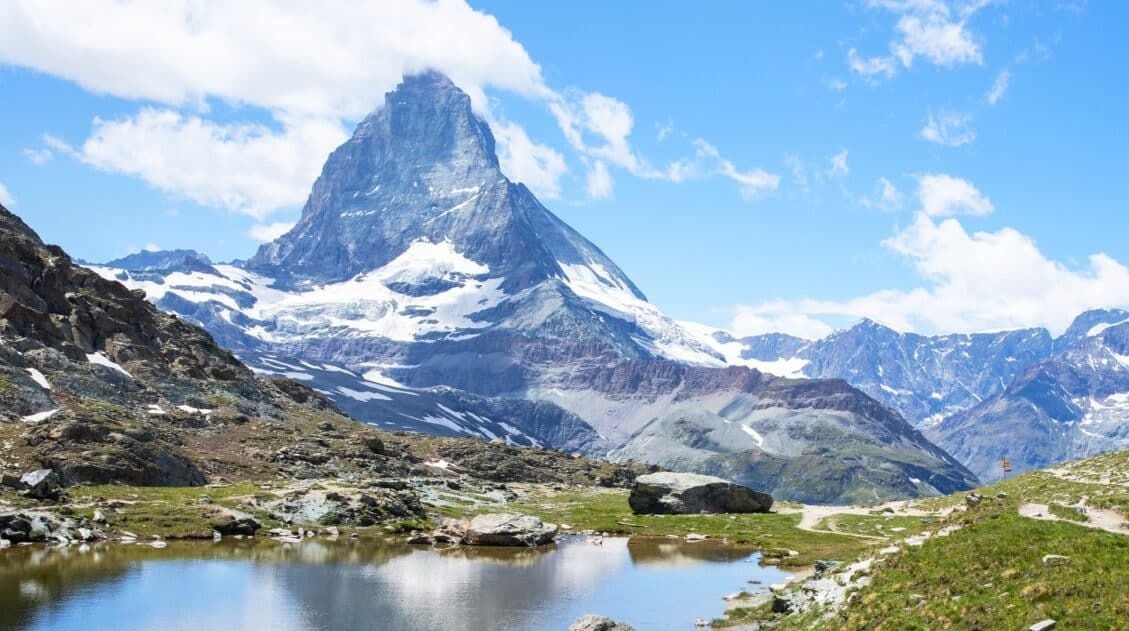
Ultimate Guide to the Walker’s Haute Route
Pinterest Facebook Flipboard Walker’s Haute Route The Walker’s Haute Route is one of the most rewarding and memorable multi-day walks in Europe. On this trek, hikers cross 10 of the highest mountain passes in the French and Swiss Alps, as they walk from Chamonix, France to Zermatt, Switzerland. Walking from Chamonix to Zermatt takes you to remote mountain […]
Walker’s Haute Route Stages: An Overview of All 14 Stages
The Walker’s Haute Route is a multi-day trek from Chamonix, France to Zermatt, Switzerland. On this walk, hikers will cross 10 mountain passes, walk through small towns and through rugged, remote landscapes, and get to experience a less touristy side of the Swiss Alps. There are several routes that take hikers from Chamonix to Zermatt. […]
Walker’s Haute Route: 21 Important Things to Know & FAQ
The Walker’s Haute Route is one of the most rewarding and memorable multi-day walks in Europe. On this journey, hikers will cross 10 of the highest mountain passes in the Alps, while walking from Chamonix, France to Zermatt, Switzerland. It’s an extraordinary journey but not without its challenges. With 14 stages, multiple variations to the […]
How To Book Your Walker’s Haute Route Accommodations
Along the Walker’s Haute Route, there are a variety of accommodation types, from mountain huts to 5-star hotels, from dormitories to apartments, and from shared bathrooms to private bathrooms. You will have the opportunity to experience a combination of all of these since you will be staying in a new place at the end of […]
How To Plan Your Walker’s Haute Route Experience
The Walker’s Haute Route is a 14-stage trek from Chamonix, France to Zermatt, Switzerland. It is a tough yet rewarding experience through the French and Swiss Alps that crosses 10 mountain passes and offers incredible scenery along the way. It is a beast of a trek! It took us 13 days, averaging 16 km (10 […]

Essential Hiking Gear: What Should You Bring on a Day Hike?
In this post, find out what we carry with us on day hikes. Whether you are a new hiker, shopping for a friend or family member, or just curious about what hiking gear you should bring on a day hike, we have a lot of great information to share with you. We have hiked thousands […]
12 Epic Day Hikes in Zermatt (+ Trail Stats, Photos & Map)
One of the best ways to explore Zermatt is on foot. Hiking trails climb high into the mountains above Zermatt, past Swiss hamlets, through scenic valleys and rocky gorges, and to some of the best viewpoints of the Matterhorn. The network of cable cars and trains takes you up into the mountains, so for the […]
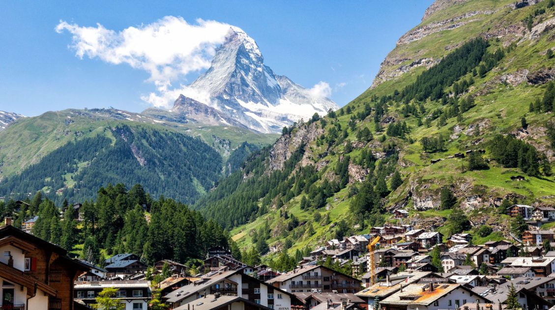
20 Amazing Things to Do in Zermatt, Switzerland
Zermatt is an idyllic mountain village tucked away in the Swiss Alps. The mighty Matterhorn dominates the skyline, creating one of the most unique alpine landscapes in Europe. Explore the hiking trails, journey up higher into the mountains by cable car and train, stroll the scenic streets of Zermatt, and go skiing all year long. […]
Best Hikes in Europe: 25 Incredible Hikes for Every Level
From the dramatic cliffs of Norway to the jagged peaks of the Dolomites and the volcanic landscapes of Iceland, Europe is packed with some of the most unforgettable hikes in the world. In this guide, we share our favorite hikes in Europe, trails that stand out for their scenery, uniqueness, and overall experience from start […]
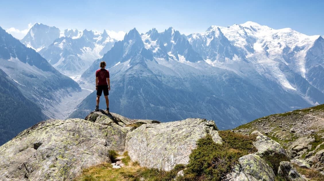
24 Best Things to Do in Chamonix, France in the Summer
Discover the best things to do in Chamonix, France in the summer. This guide covers the top cable cars, hiking trails, glaciers, and adventures in Chamonix, based on our firsthand experience hiking and exploring the area. Chamonix is one of the most spectacular mountain destinations in Europe, and in the summer, it’s an outdoor playground […]
Grand Balcon Nord Hike: Best Direction, Hiking Stats & Tips
The Grand Balcon Nord is one of the best hikes in Chamonix. This trail runs above the valley, offering sweeping views of Mont Blanc at one end and Mer de Glace, France’s largest glacier, at the other. Tim, Tyler, Kara, and I hiked it in July as part of a five-day visit to Chamonix before […]
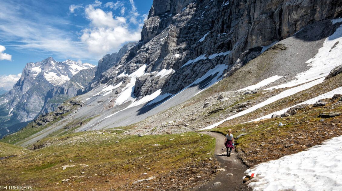
15 Great Hikes to Do in the Bernese Oberland, Switzerland
The Bernese Oberland is a hiker’s paradise. Alpine trails crisscross their way through the towns, valleys, and the mountain peaks of this gorgeous place. Take your pick from short, easy, family-friendly trails to cliff walks to thrilling trails. Here are 15 of the best hikes to do in the Bernese Oberland. All of the hikes […]

Leave a Comment