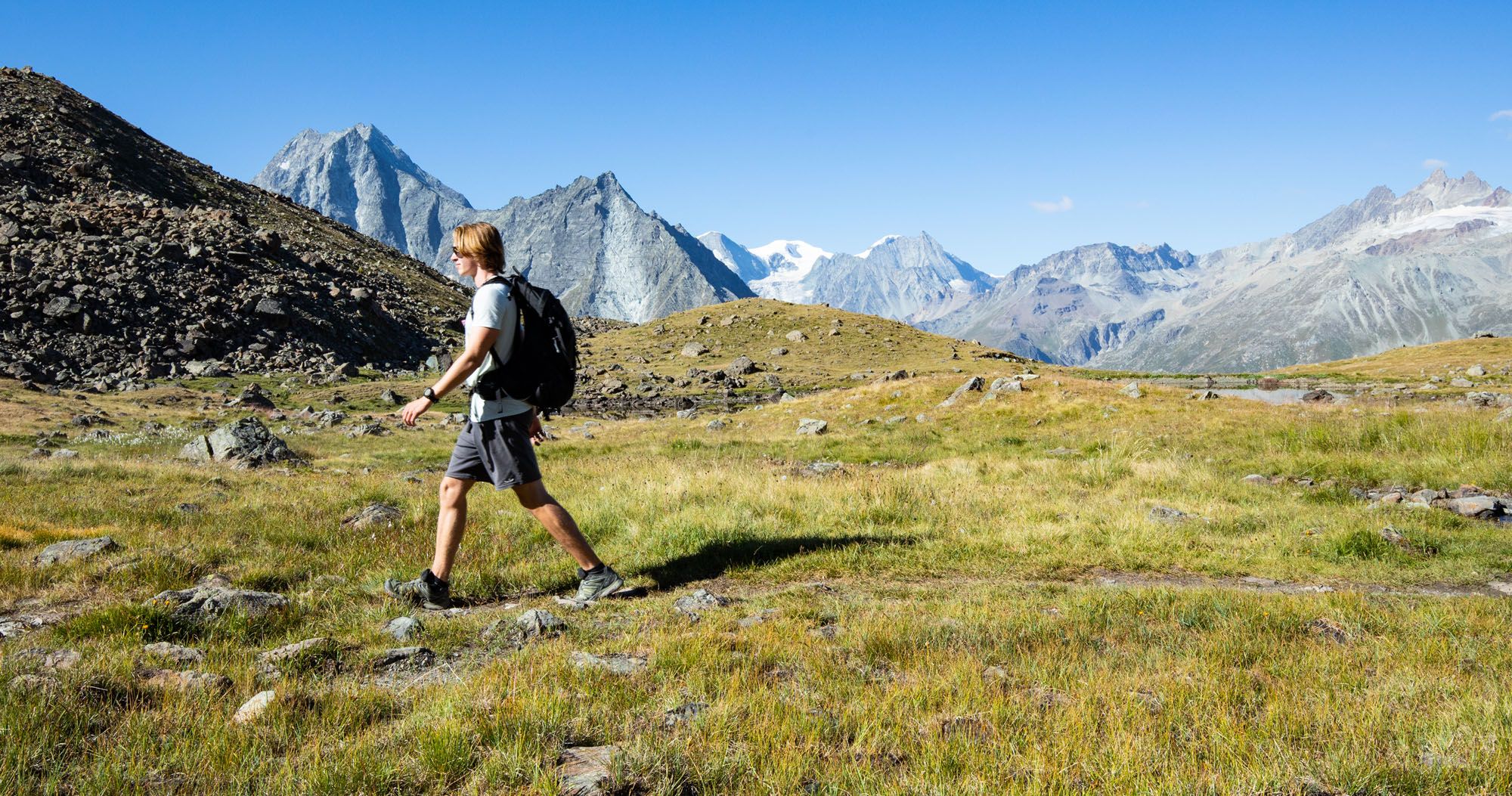
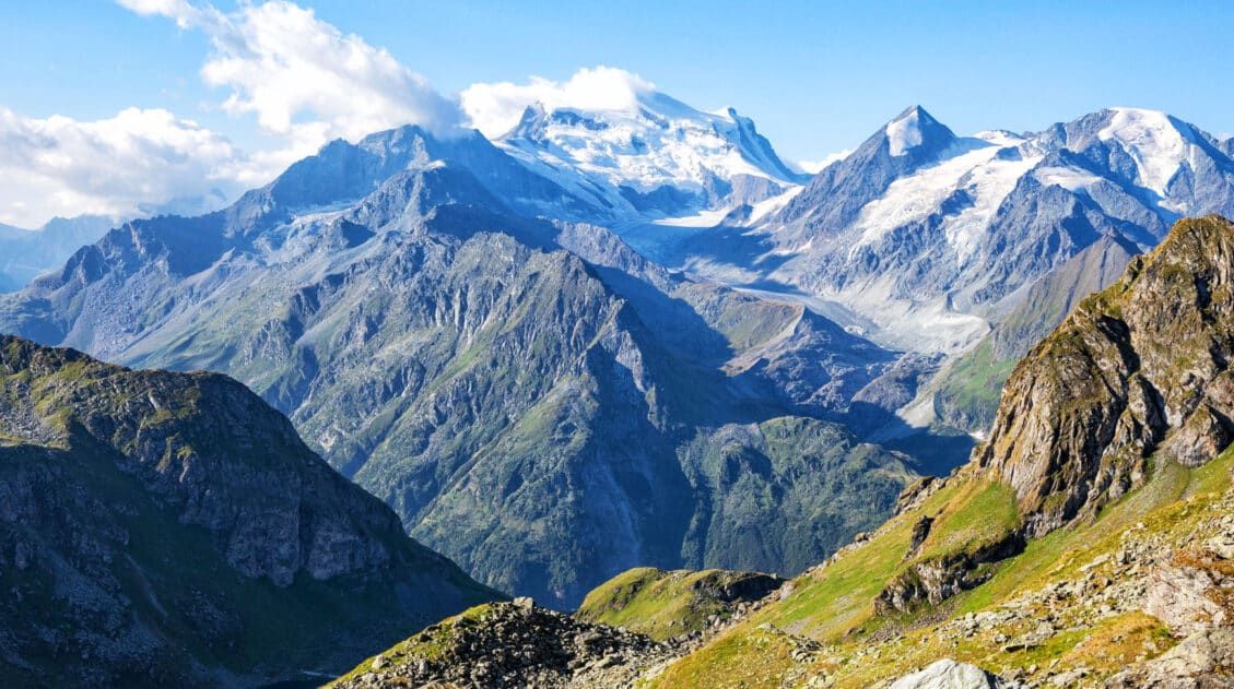
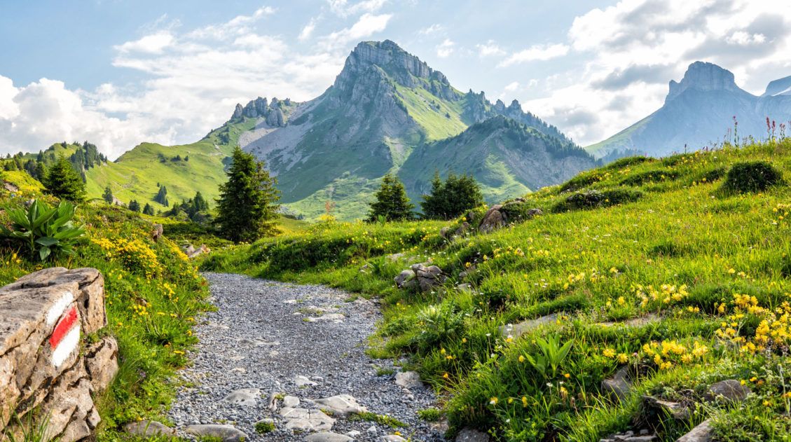
Stage 9 of the Walker’s Haute Route starts in Les Haudères or La Sage and from these two villages, it is a challenging hike up to Col du Tsaté. From Col du Tsaté, it is an easier and scenic downhill walk to Lac de Moiry. There are beautiful views as you look out over high snowy peaks and the valley that you last hiked through in Stage 8. But the highlight of this stage is seeing the massive Moiry Glacier.
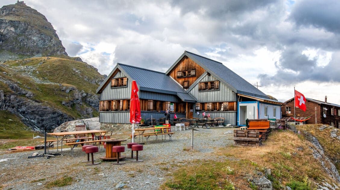
Tonight, you can stay in Cabane de Moiry, which is set on the edge of a mountain next to the Moiry Glacier. This refuge has epic close-up views of the glacier. Or, take a bus to the lovely town of Grimentz and stay in one of the hotels here. Grimentz is one of our favorite towns along the Haute Route.
Walker’s Haute Route Stage 9 Hiking Stats
This is another stage where there are multiple ways to do it. The starting point can be Les Haudères or La Sage.
The endpoint of Stage 9 can be Cabane de Moiry or a bus stop at Lac de Moiry. If you don’t have plans to stay in Cabane de Moiry, you can hike to either end of Lac de Moiry, ride the bus to Grimentz and spend the night, and the following morning, ride the bus back to Lac de Moiry.
Stage 9 typically ends at either Cabane de Moiry or the Moiry Glacier bus stop. But you can go farther, hiking part of Stage 10 to the Barrage de Moiry bus stop (the dam on the far end of the lake). From here, ride the bus to Grimentz, spend the night, and return the following morning to hike Stage 10.
We hiked from Les Haudères to Barrage de Moiry, which is an extremely long day (it includes a portion of Stage 10). However, it makes the next day much shorter.
With all that being said, below are the hiking stats for the different ways you can hike Stage 9.
From Les Haudères to the Moiry Glacier Bus Stop
Distance: 10.2 km (6.3 miles)
Difficulty: Strenuous
Total Ascent: 1,425 m (4,670 feet)
Total Descent: 565 m (1,855 feet)
Lowest Elevation: 1,470 m (4,825 feet)
Highest Elevation: 2,870 m (9,415 feet)
Elevation in Les Haudères: 1,470 m (4,825 feet)
Elevation at Moiry Glacier Bus Stop: 2,360 m (7,740 feet)
Our Time: 4 hours 30 minutes (including stops)
ADD-ON: From Moiry Glacier Bus Stop to Cabane de Moiry
If you plan to stay at or visit Cabane de Moiry, below are the one-way hiking stats from the Moiry Glacier bus stop.
Distance: 3.0 km (1.85 miles) one way
Total Ascent: 510 m (1,675 feet)
Total Descent: 45 m (150 feet)
Elevation at Cabane de Moiry: 2,820 m (9,250 feet)
Estimated Time: 1 hour
ADD-ON: From Moiry Glacier Bus Stop to Moiry Barrage Bus Stop
If you plan to hike part of Stage 10 to the far end of Lac de Moiry, here are the stats for this portion of the trail.
Distance: 5.6 km (3.5 miles)
Total Ascent: 300 m (990 feet)
Total Descent: 410 m (1,345 feet)
Our Time: 1 hour 45 minutes (including stops)
COMBINED: From Les Haudères to Moiry Barrage Bus Stop
This is what we did: Les Haudères to the Moiry Glacier bus stop to the Moiry Barrage bus stop.
Distance: 15.8 km (9.8 miles)
Difficulty: Very strenuous
Total Ascent: 1,725 m (5,660 feet)
Total Descent: 975 m (3,200 feet)
Lowest Elevation: 1,470 m (4,825 feet)
Highest Elevation: 2,870 m (9,415 feet)
Elevation in Les Haudères: 1,470 m (4,825 feet)
Elevation at Moiry Barrage Bus Stop: 2,265 m (7,430 feet)
Our Time: 6 hours 15 minutes (including stops)
Les Haudères to La Sage
Finally, if you stay in La Sage rather than Les Haudères, you can subtract the stats below from the stats above.
Distance: 2.1 km (1.3 miles)
Total Ascent: 212 m (700 feet)
Total Descent: 15 m (50 feet)
Our Time: 30 minutes (including stops)
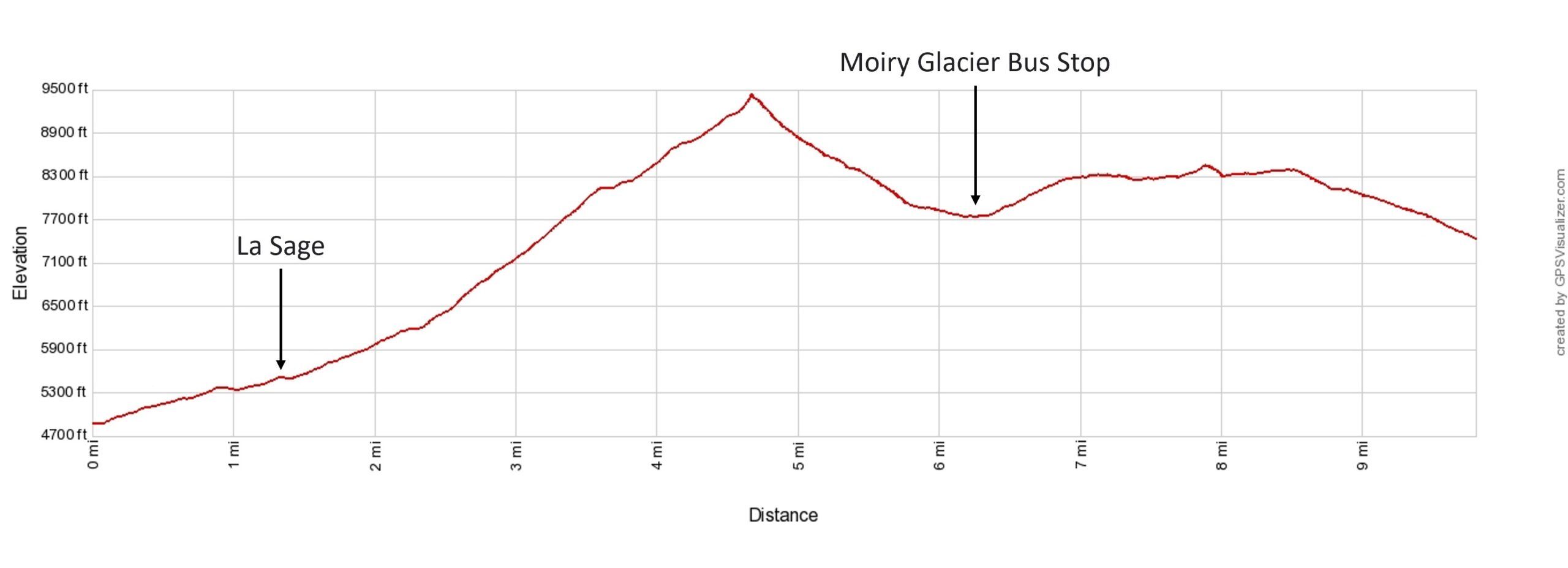
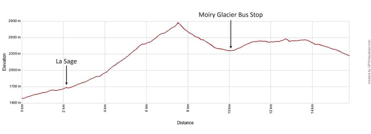
Walker’s Haute Route Stage 9 Elevation Profile: Les Haudères to Lac de Moiry bus stop to Barrage de Moiry.
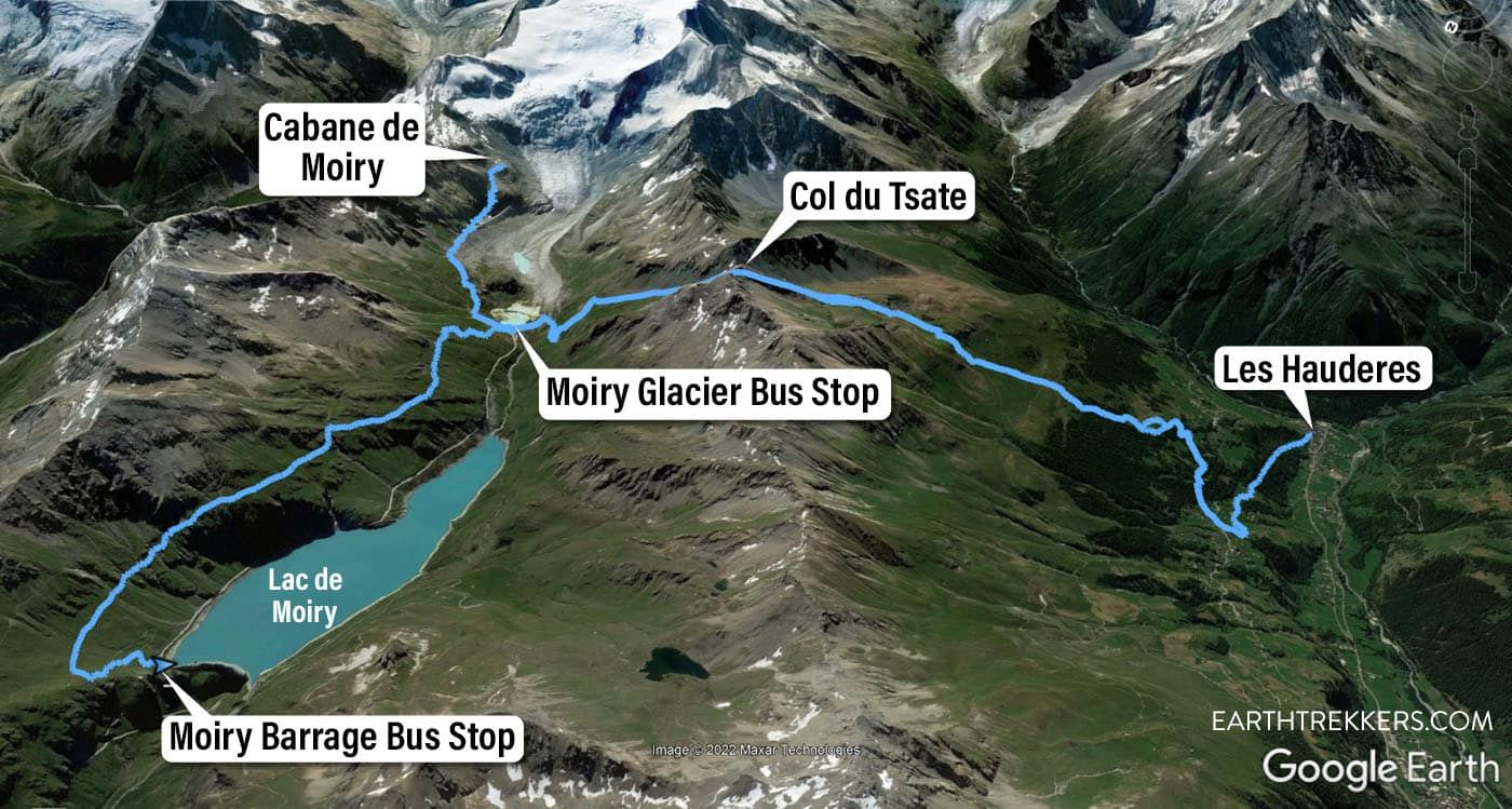
Stage 9 map
Please practice the seven principles of Leave No Trace: plan ahead, stay on the trail, pack out what you bring to the hiking trail, leave areas as you found them, minimize campfire impacts, be considerate of other hikers, and do not approach or feed wildlife.
Walker’s Haute Route Stage 9: Overview of the Trail
To hike the Haute Route, we highly recommend following the trail descriptions in the book Trekking Chamonix to Zermatt, The Classic Walker’s Haute Route by Kev Reynolds. Below we list an overview of the day, so you know what to expect along the way. We also provide advice on where to eat and where to stay. Later in this guide, we list a few tips and trail clarifications to be used with the Trekking Chamonix to Zermatt book.
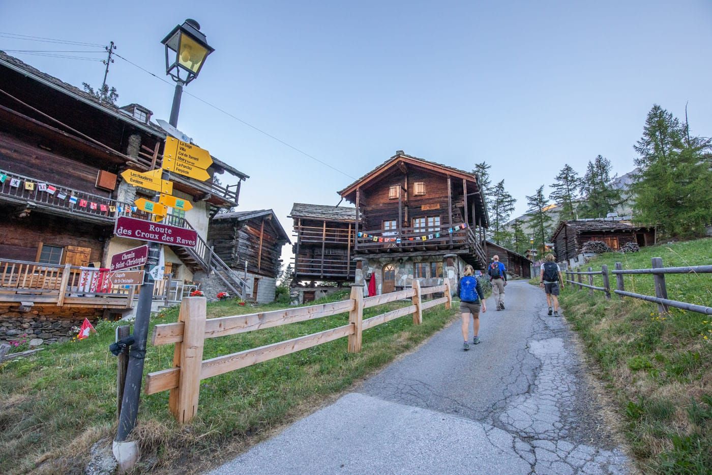
Les Haudères to La Sage
We began Stage 9 in Les Haudères instead of La Sage. If you do the same, do not worry. The hike up to La Sage is short and not very steep (2.1 km/1.3 miles with 212 meters/700 feet of total ascent). It took us about half an hour to reach Le Sage and it felt like a warm-up before the big climb of the day.
The trail from Les Haudères to La Sage takes you along a dirt road in the forest. This trail is easy to hike quickly.
La Sage
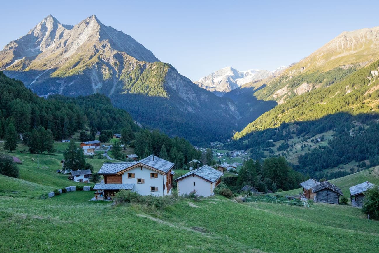
While hiking the Haute Route, the trail is usually shaded until 8 or 9 am. This helps keep you cool during the first part of the ascent but a lot of your views first thing of the day will look like this.
La Sage to Col du Tsaté
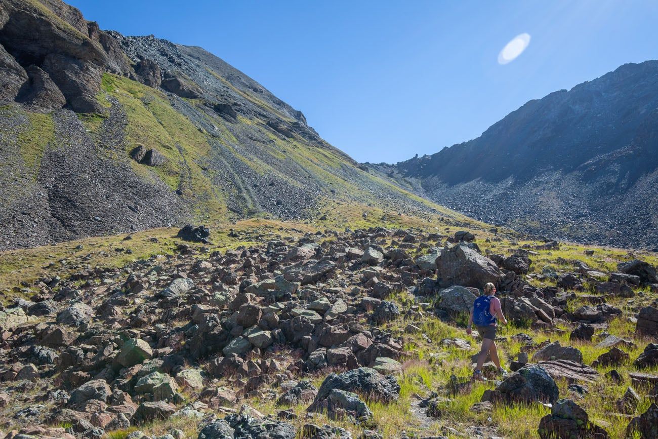
The hike to Col du Tsaté begins on a dirt road that steadily climbs up the mountain. As you hike along the road you will walk past quaint mountain homes. It is easy to quickly knock out the elevation gain on this section, as the dirt road is not very steep.
Eventually you will reach a small town and from here the dirt road becomes an actual hiking trail. The trail will become slightly steeper here, although it is still very manageable.
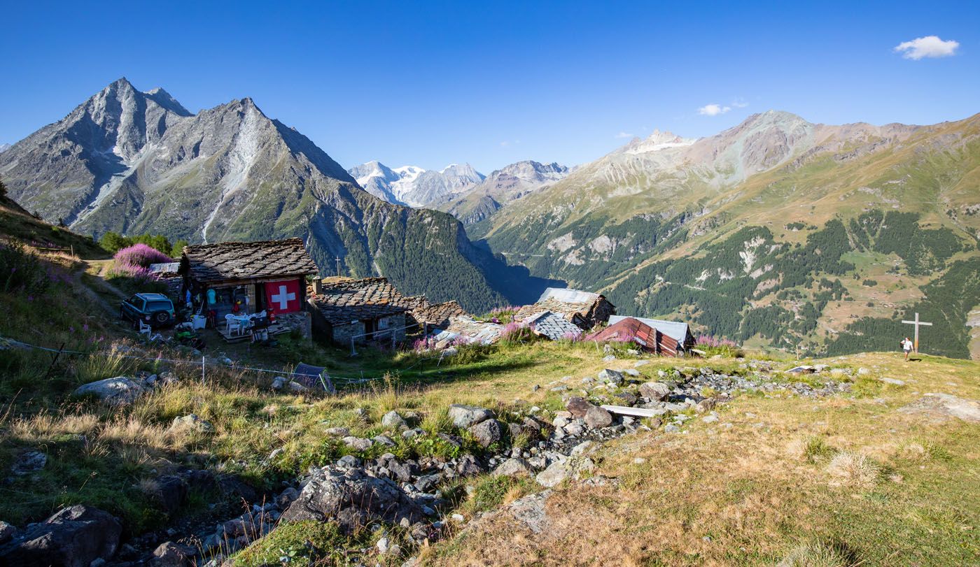
Once you exit the treeline, there will be a second small village of small wooden homes and stone roofs (Le Tsaté). All around are large mountains jutting into the sky and the far-away towns in the valley below.
Le Tsaté
Another view of Le Tsaté
The view from a little higher up the trail.
Continue your way up to Col du Tsaté.
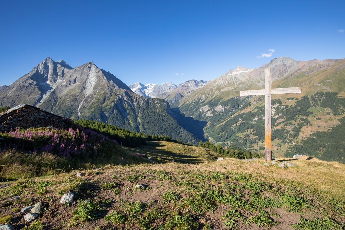
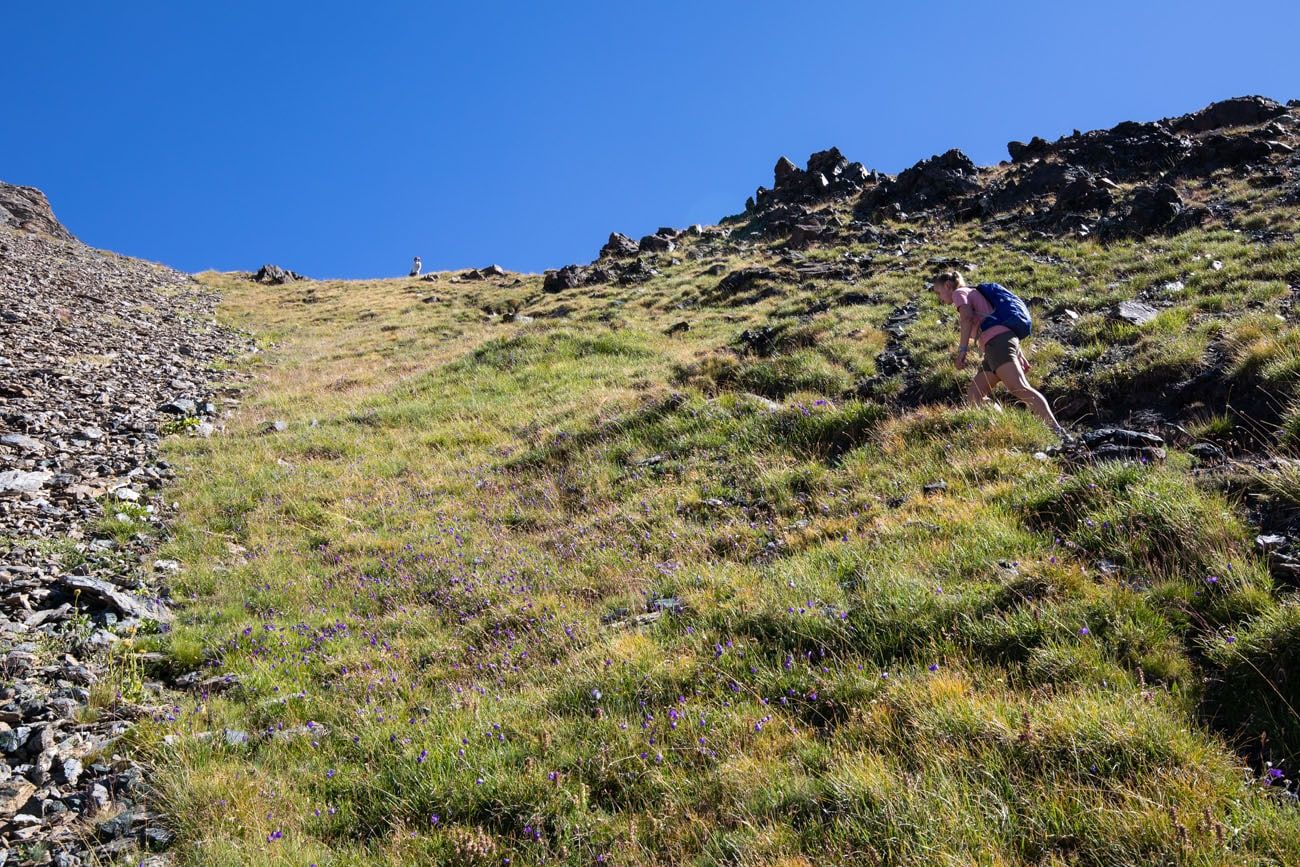
Beyond the village and a rather steep climb through a grassy field, you will reach an abandoned barn. Enjoy the spectacular views over the valley you hiked up from. But this is sadly not Col du Tsaté. There are two more short climbs in order to reach the highest point of Stage 9.

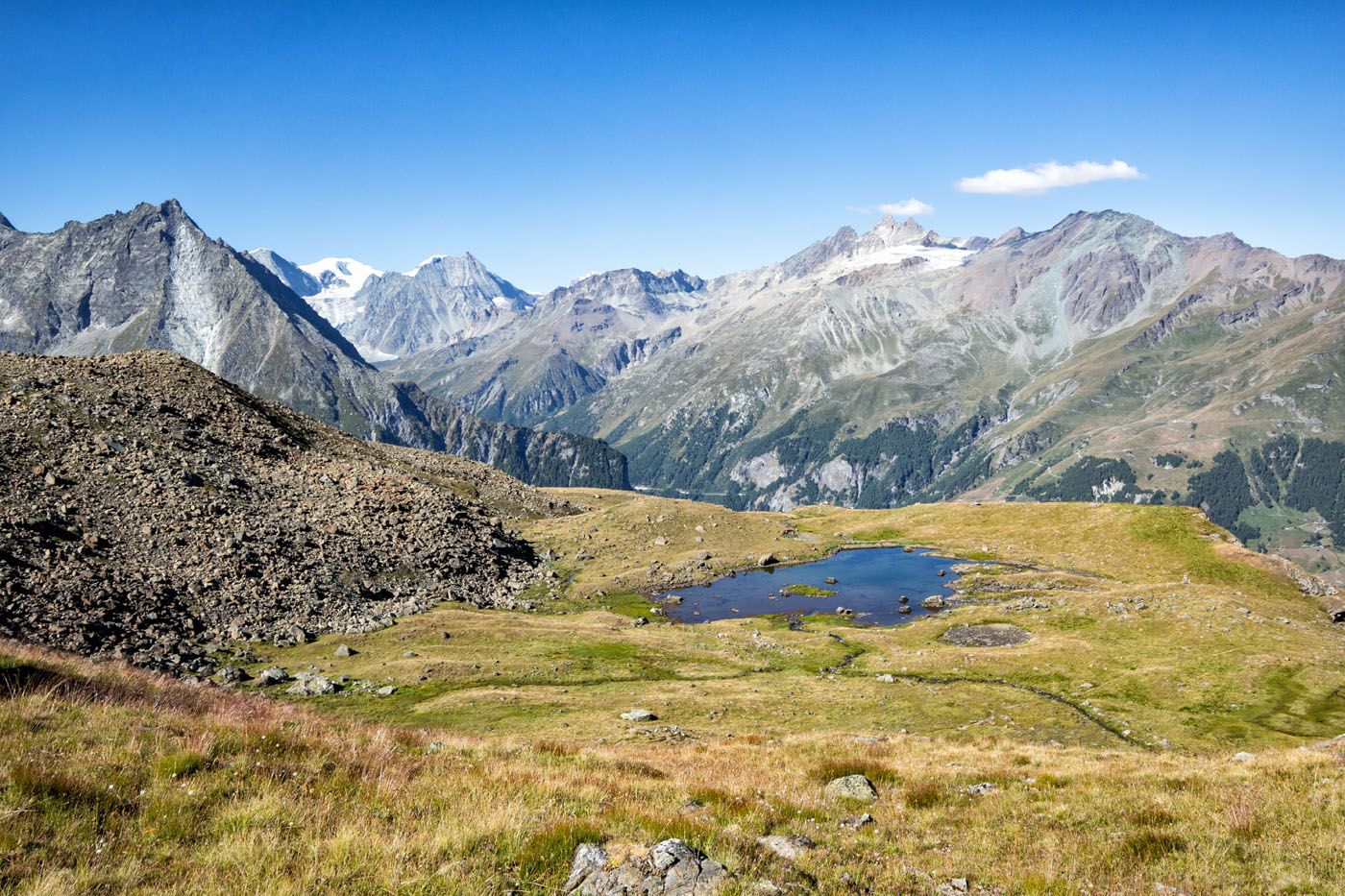
The next short climb brings you to a small but pretty lake. Just a short distance beyond this is a cross on top of a hill. From the cross, you can finally see Col du Tsaté, the high point of today’s hike. From here, you are very close, but the final climb is a challenge. You will hike over rocks and up a very steep slope. This climb is short but exhausting.
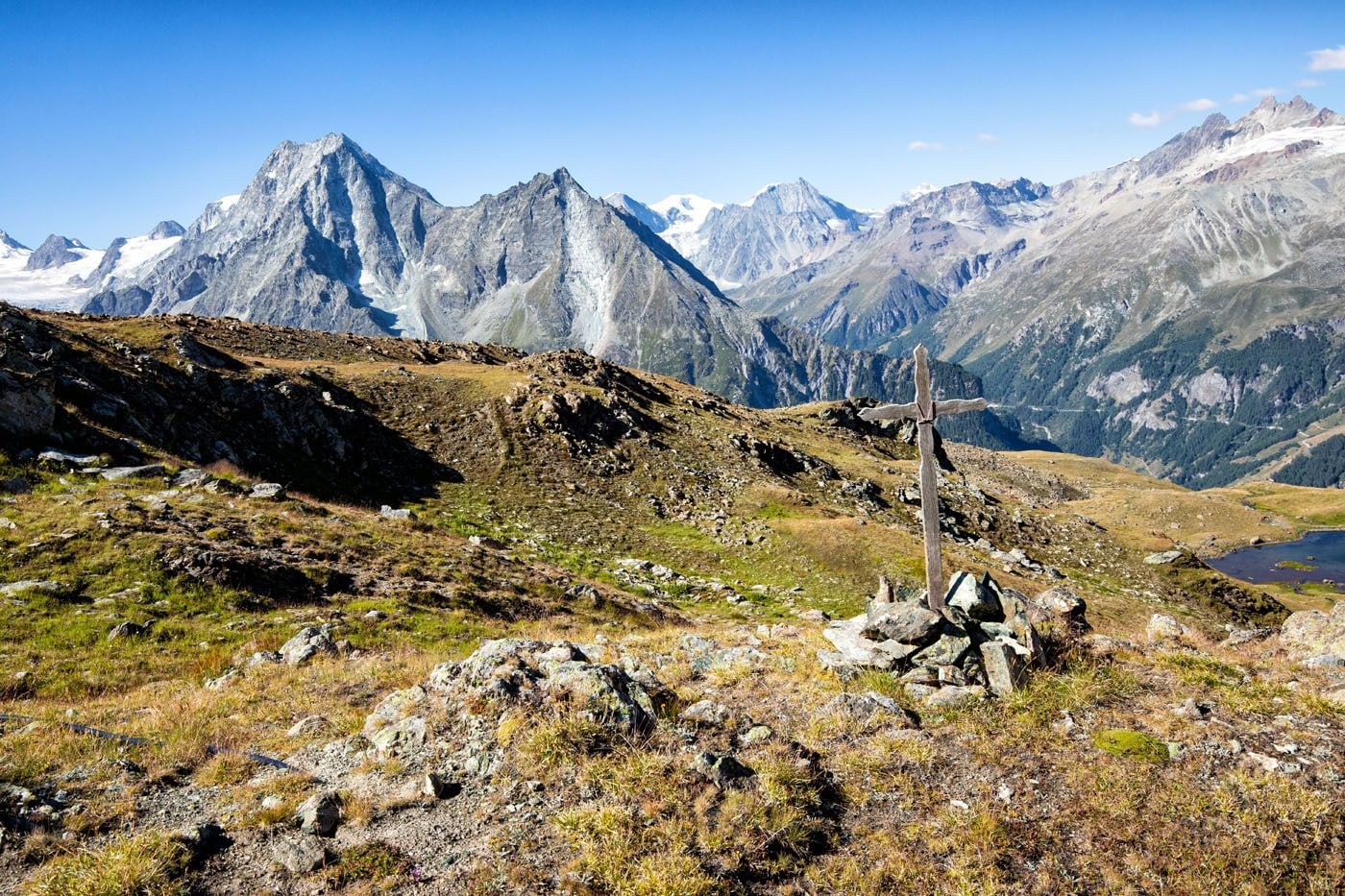
View of Col du Tsaté
Tyler is standing at Col du Tsaté. We are fast hikers but Tim and I struggled to keep up with Tyler. He cruised up these mountains like they were nothing and Kara wasn’t far behind him.
From Col du Tsaté, you are surrounded by large mountains.
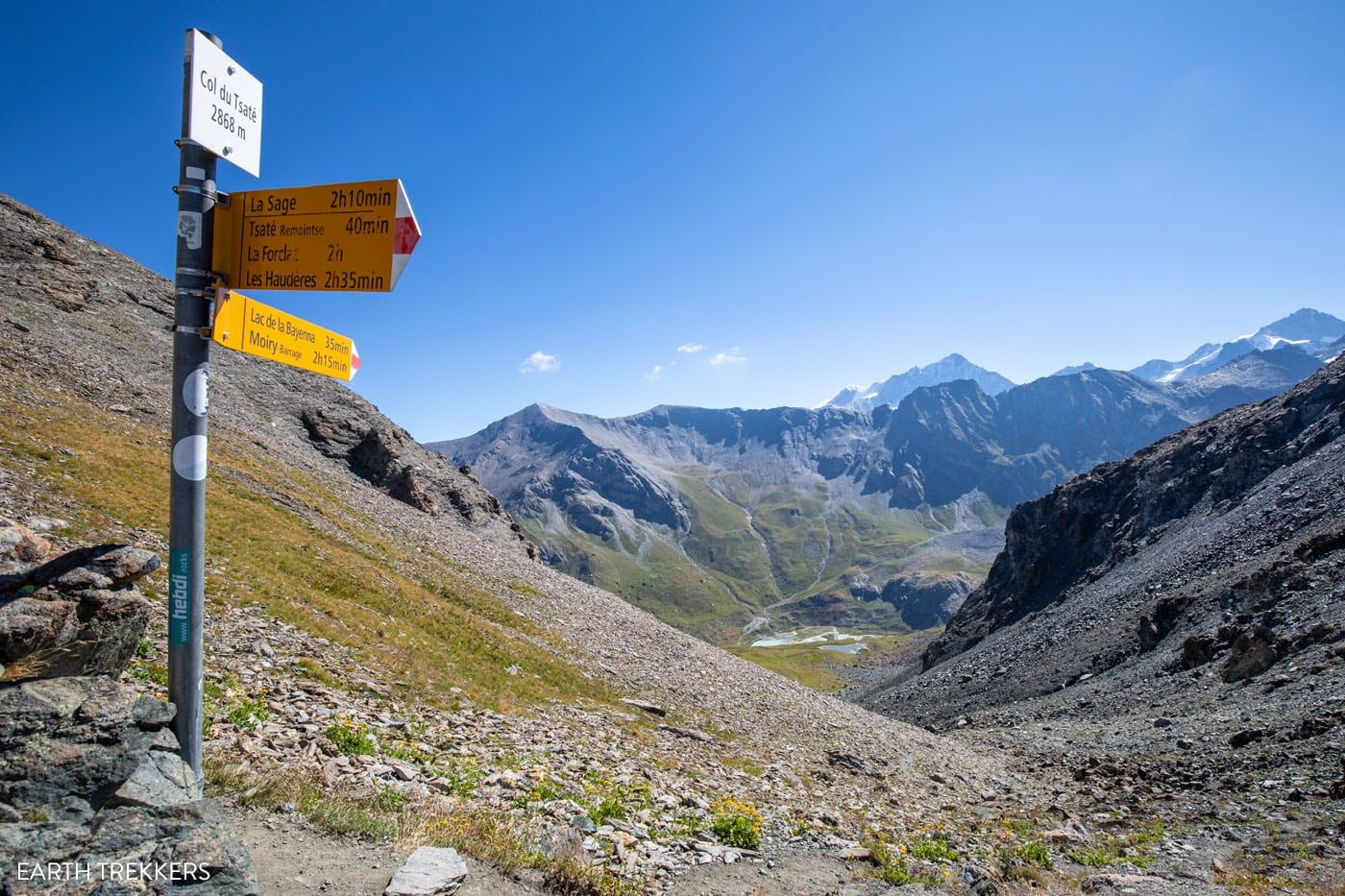
Col du Tsaté
Col du Tsaté to Lac de Moiry
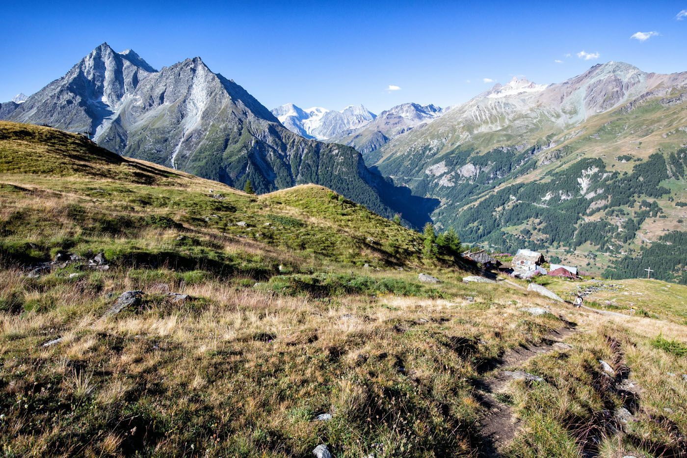
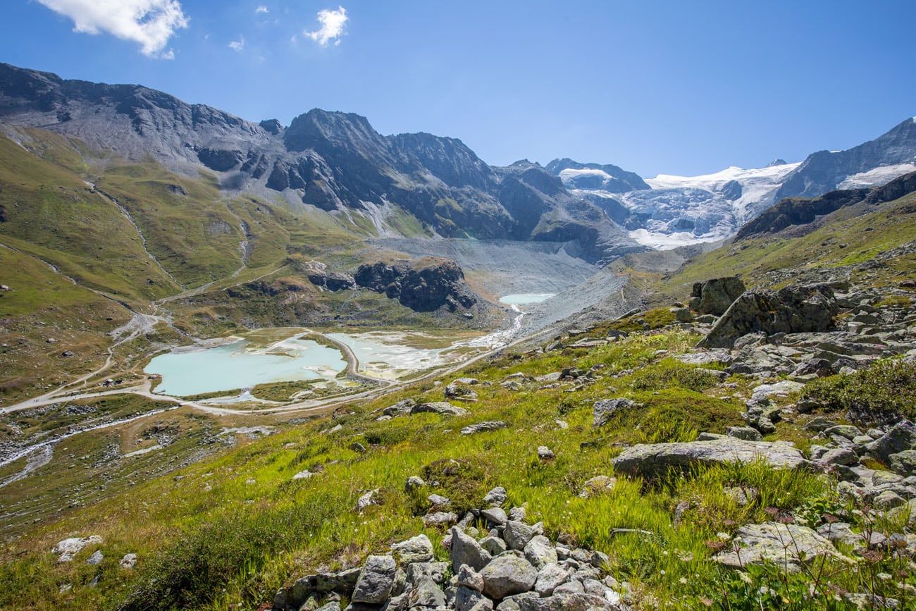
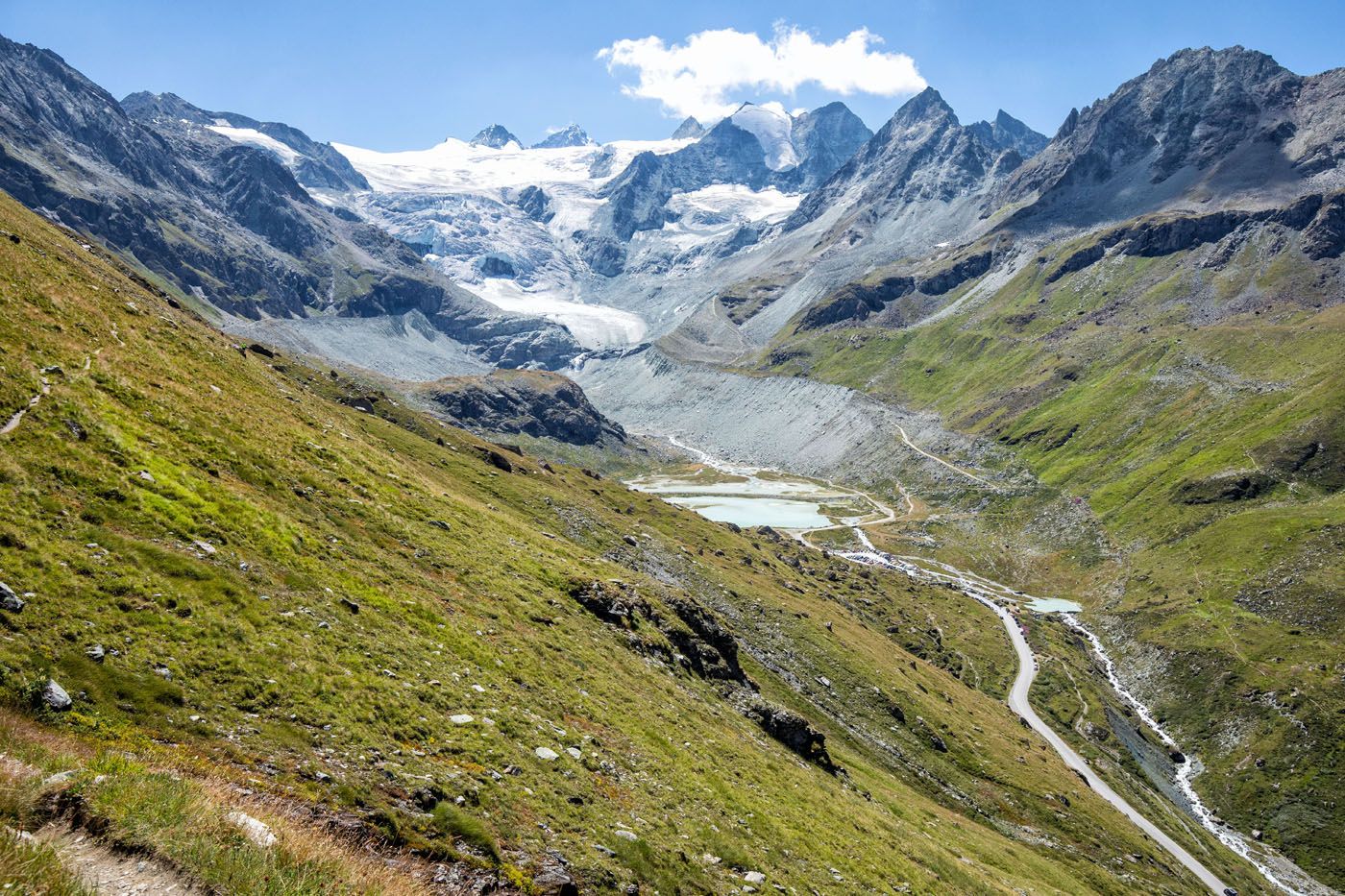
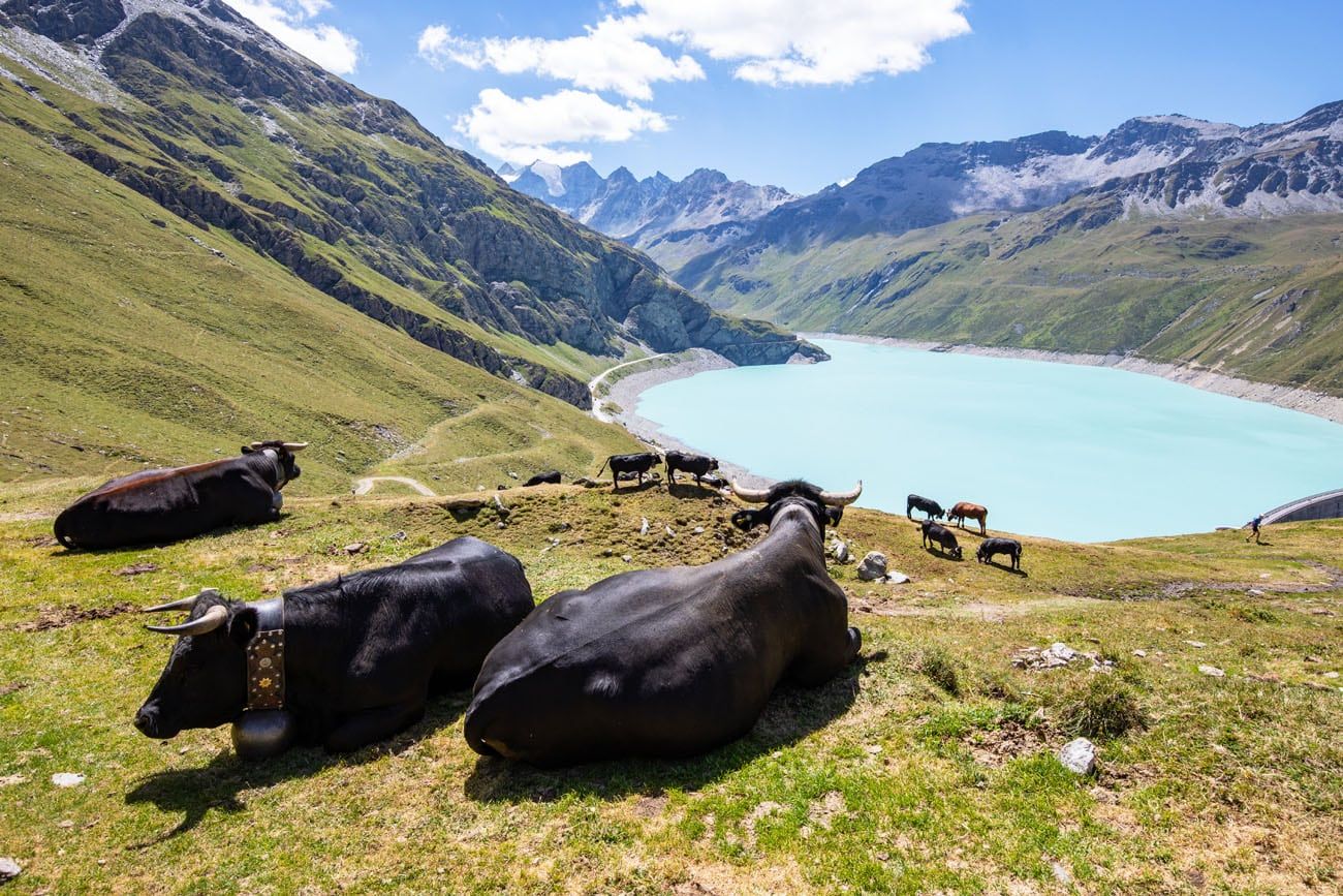
As you hike down from Col du Tsaté, the view only gets better. To the right, the beautiful Moiry Glacier will come into view.
The descent is steep and rocky, so it is slow-going. However, the descent is not very long.
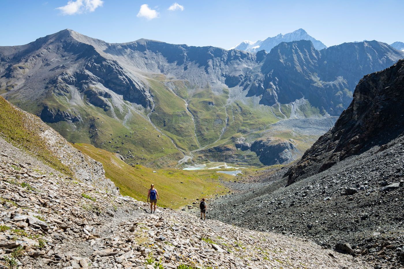
On the way down to Lac de Moiry, you will pass another lovely lake where the large glacier is reflected in its shimmering surface.
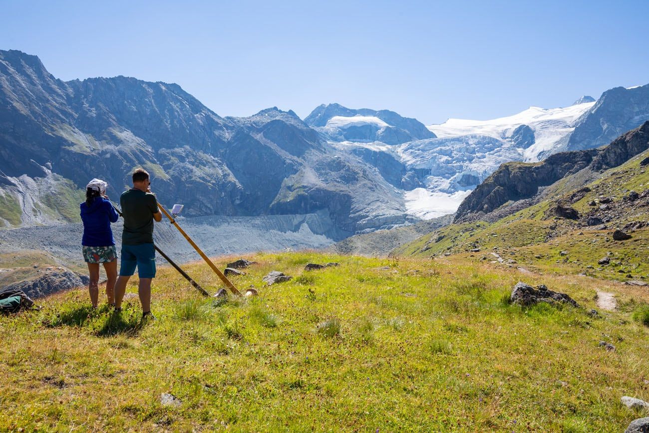
Alpine Horn Blowers
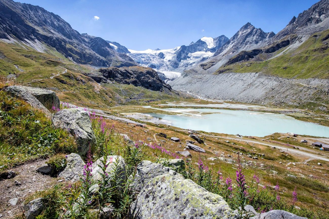
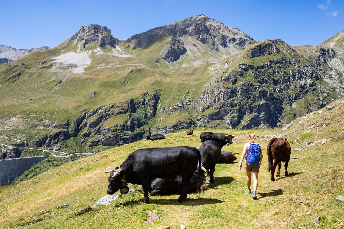
From the lake, you will start your descent into the valley. The large parking lot in the valley is where you are headed next.
It’s quite surprising, seeing this parking lot, because up until this point, it feels like you are in the middle of nowhere. And then boom, there is a busy parking area and lots of day hikers heading up to Cabane de Moiry. This area feels much different than the quieter trails on other parts of the Haute Route.
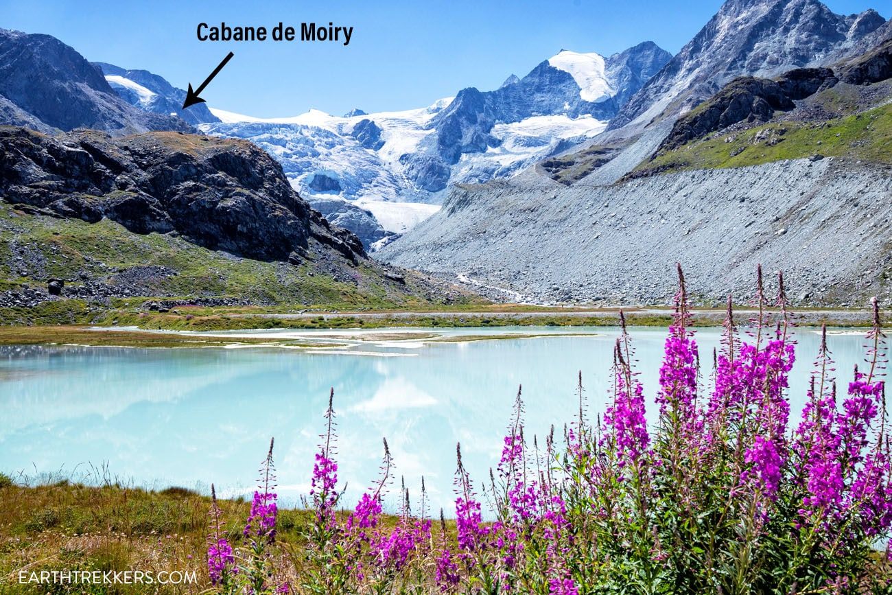
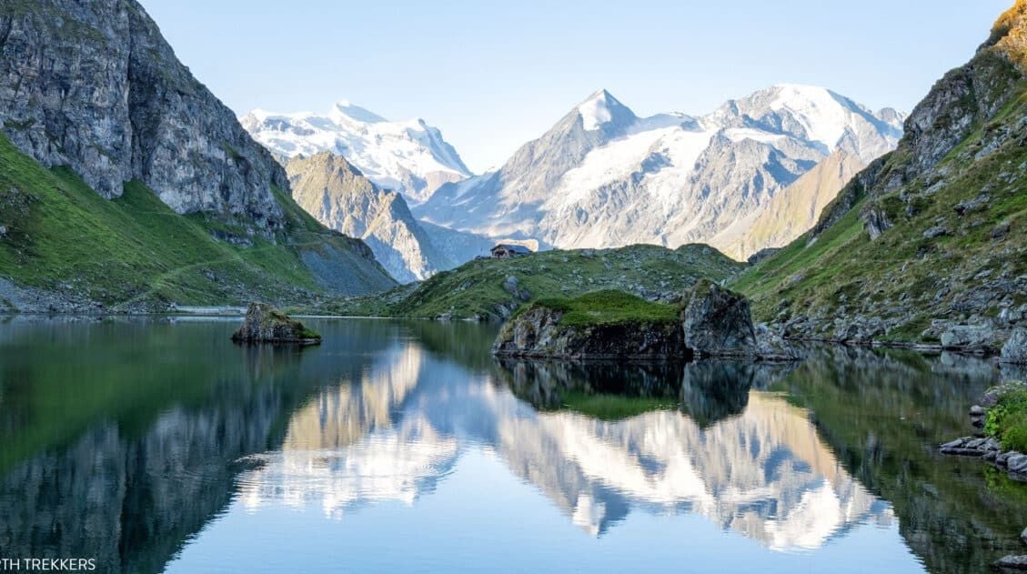
From the trail, if you look off to the right, sitting on a rocky mountain slope beside the Moiry Glacier is Cabane de Moiry. You have the option to hike here for a bite to eat or to spend the night.
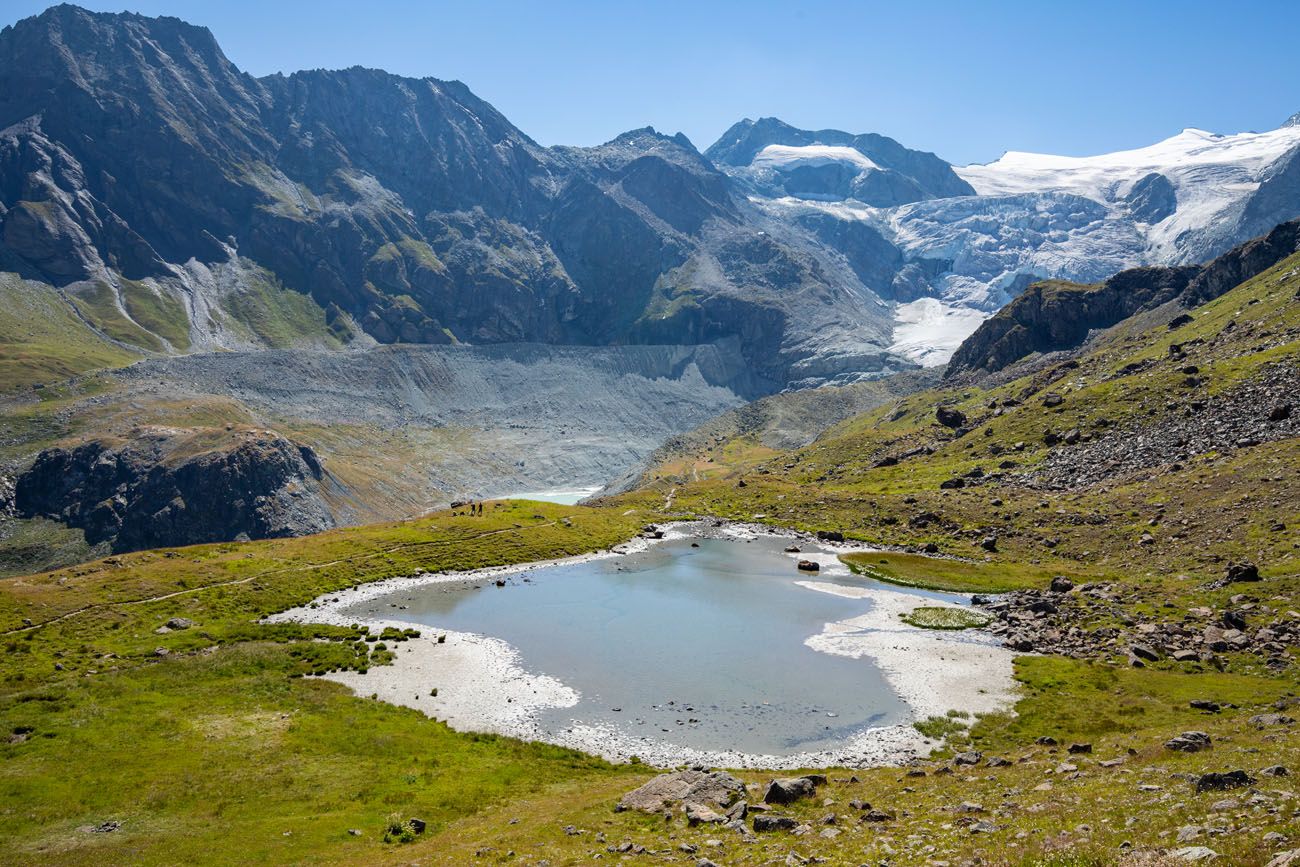
Glacier de Moiry comes into view.
So does Lac de Moiry.
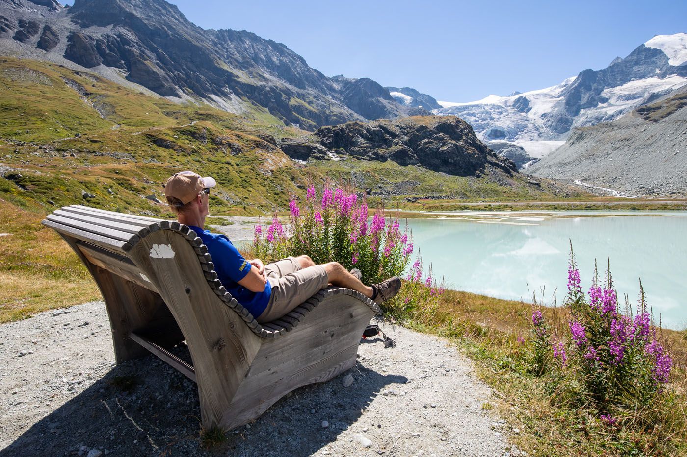
The trail makes several large switchbacks as you walk down to the parking lot. Once you reach the Moiry Glacier parking lot, enjoy the scenic view of the glacier, the bright blue lakes, and the surrounding mountains.
At the Moiry Glacier parking lot, there are toilettes and a small snack bar. There is also a bus station here with buses going to Grimentz.
Optional Endings to Stage 9
From the Moiry Glacier parking lot, you have several options. You can either continue up to Cabane de Moiry, where you can grab a bite to eat or spend the night, board the bus to Grimentz, or you can hike a portion of stage 10 to Barrage de Moiry (the dam on the far end of Lac de Moiry).
Cabane de Moiry
If you choose to hike to Cabane de Moiry, it is a 3 km/1.85 mile one-way hike that takes about an hour. It is uphill the entire way.
Cabane de Moiry is a popular place to end Stage 9. If you choose to stay here, stage 10 will start at Cabane de Moiry and from here you will walk along Lac de Moiry towards Barrage de Moiry, the dam on the far end of the lake.
When we were here, there were a lot of day hikers going to Cabane de Moiry. Many people park at the Moiry Glacier parking lot or take the bus here and hike up to Cabane de Moiry for a meal and a look at the glacier. This was one of the busiest spots we saw on the entire Haute Route.
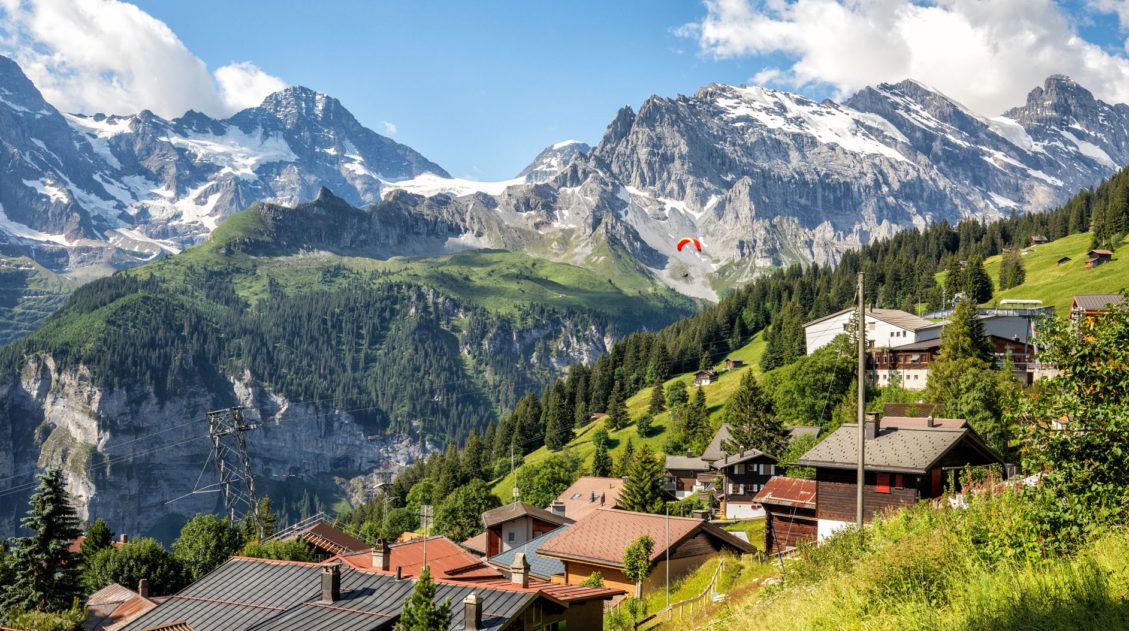
Bus to Grimentz
From the Moiry Glacier parking lot, you can take a bus to Grimentz, which is a small town that sits farther down in the valley. It is about a 20-minute bus ride into town. You can get the bus schedule here. It’s best to purchase your tickets online in advance because cellular service is limited in this area.
If you ride the bus to Grimentz today, tomorrow morning you will ride the bus back to this parking lot to start stage 10 of the Haute Route.
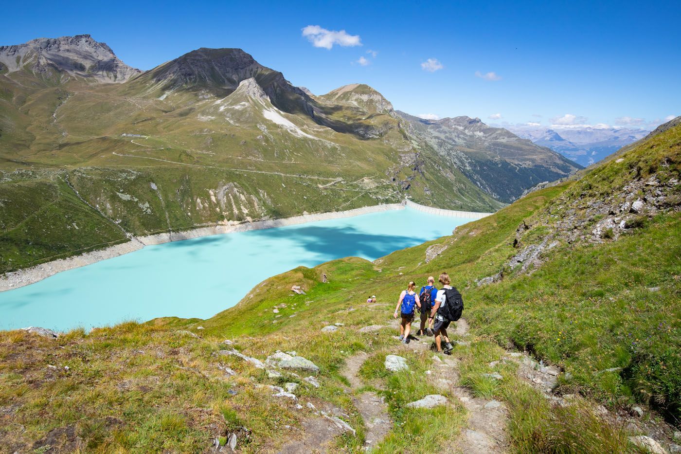
Hike a Portion of Stage 10
We arrived at the Moiry Glacier parking lot midday and weren’t quite ready to end our day yet. We had plans to stay in Grimentz so we chose not to walk up to Cabane de Moiry. So, to shorten tomorrow’s stage, we chose to walk the trail along Lac de Moiry.
From the Moiry Glacier parking lot, the hike to the dam is 5.6 km/3.5 miles with 300 meters/990 feet of total ascent. It took us just under 2 hours.
Before doing this, just be aware that it is a long hike (15.8km/10 miles) but more importantly, there is a lot of elevation gain (1,725 meters/5,660 feet…which is more than a mile of total ascent).
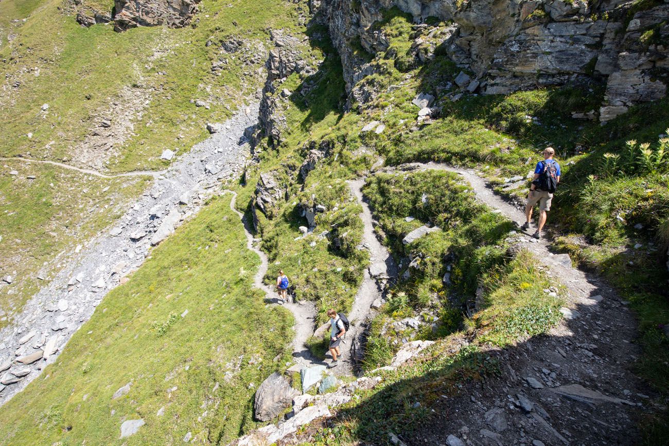
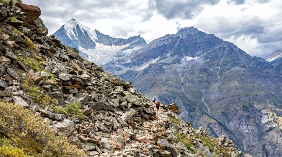
This section of the trail starts off with a short but steep uphill walk to get on a high route across the mountain. You will then hike a trail that follows along the side of the mountain to the dam.
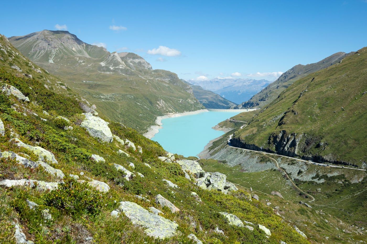
The scenery is beautiful up here, as you have the Moiry Glacier behind you, the startling blue Lac de Moiry ahead, and of course mountains all around you.
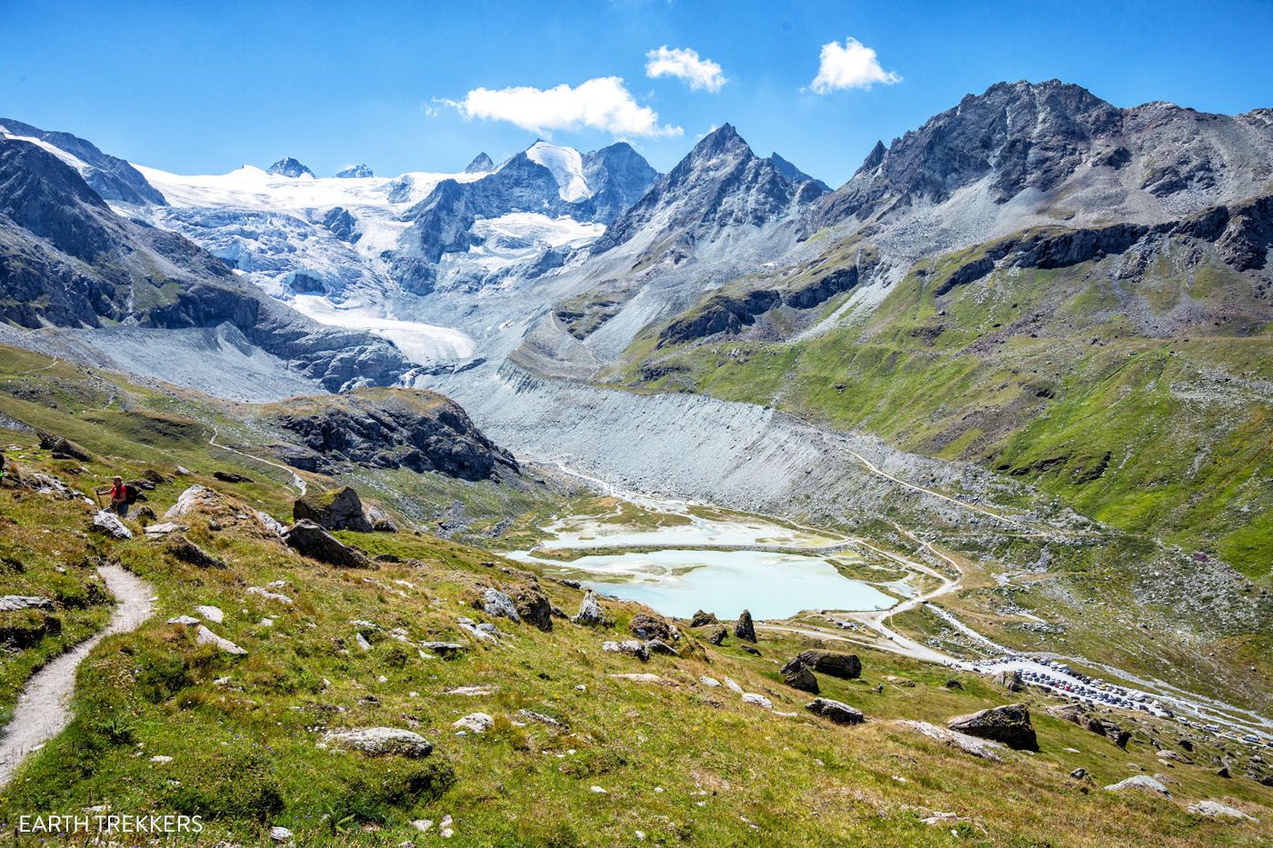
The higher up the trail you get, the better the view.

Lac de Moiry
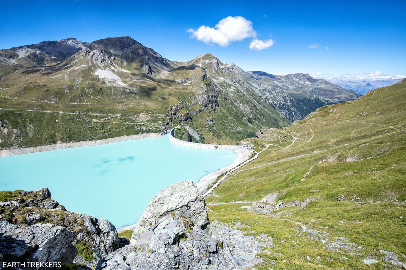
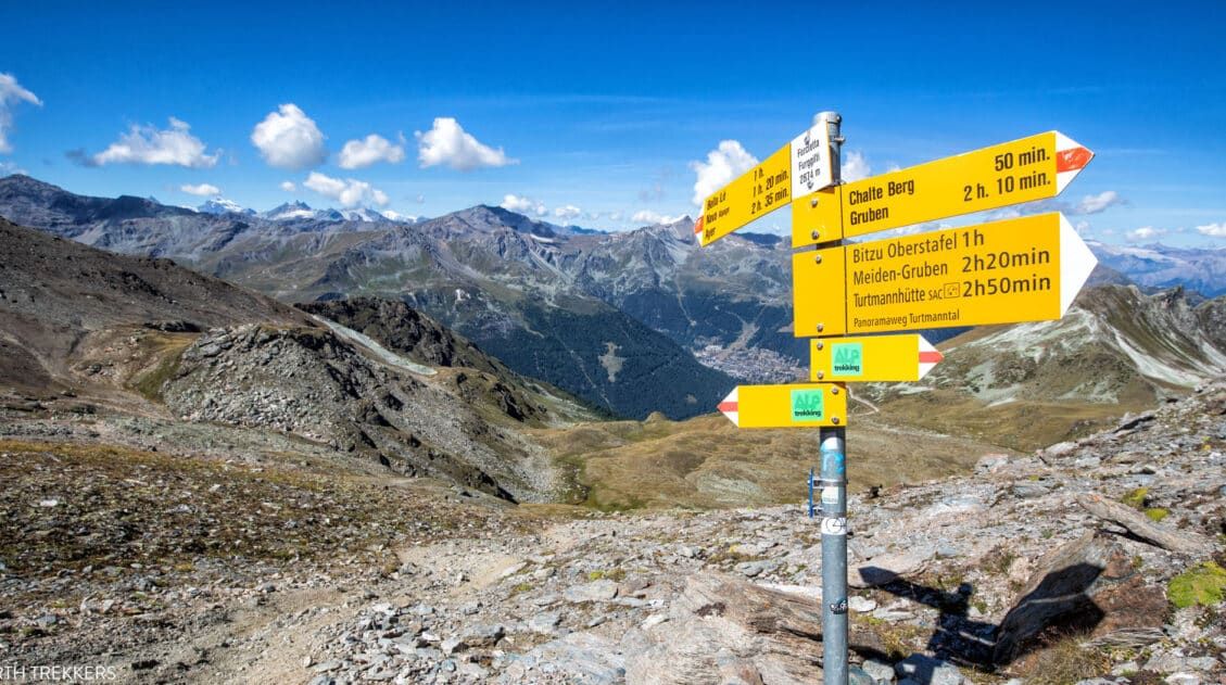
At the end of the hike to the dam, the trail will meet at a junction. One trail continues upwards (Stage 10’s mountain climb) and one trail heads down to the dam. Take the trail down to the parking lot next to the dam and then take the bus to Grimentz.
Tomorrow, you can begin Stage 10 from the Moiry Barrage instead of from the Moiry Glacier, which makes this stage shorter.
Is it worth adding on the first part of Stage 10 to Stage 9? Adding on the first 6 km of Stage 10 makes Stage 9 a very big day, so it’s not going to be worth it for everyone. We thought it was worth it, because it turned Stage 10 into a rest day, before heading into the final 4 days of the Haute Route, which are all difficult stages. Doing this only works if you have plans to stay in Grimentz. You can make the assessment for how you feel, once you reach the Moiry Glacier parking lot. If you still have gas in the tank, continue a little farther. If not, take the bus from here and hike the full Stage 10 tomorrow. Stage 10 is not too difficult so there is no pressure to lighten that day.
Where We Stayed
We stayed in Hotel Mélèze in Grimentz, which is a charming hotel with beautifully decorated rooms. We had two double rooms, with two twin beds, a private bathroom, desk, balcony, and TV. The rooms are small but clean and very comfortable. The bus stop is right outside of the hotel, which made it very convenient to get to and from the Moiry Glacier.
Hotel Mélèze has a highly rated restaurant and a sauna as well. Breakfast is delicious and we were able to purchase a packed lunch for the next day. The service here is very friendly as well, so much so that we were sad to have to leave in the morning!
This hotel was one of our favorite accommodations on the Haute Route and highly recommend it if you are considering a stay in Grimentz rather than Cabane de Moiry.
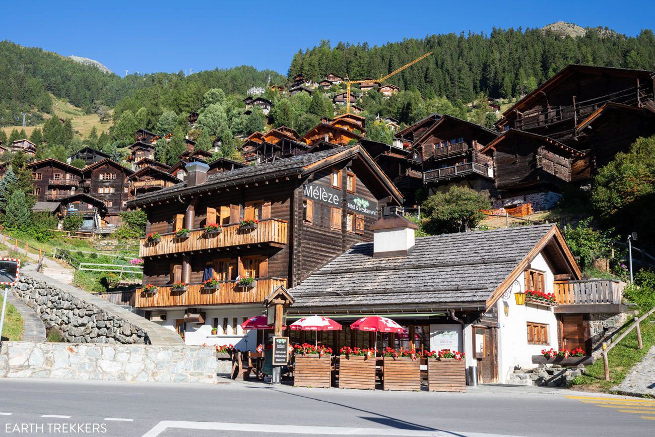
Hotel Mélèze
Grimentz has many restaurants to choose from, other hotel options, a large grocery store, and a sporting goods store. Other hotels we considered were Hotel Alpina – Grimentz, Hotel de Moiry, and Hotel Cristal.
For a detailed list of accommodations for each stage, along with information on making your reservations, see our guide on How To Book Your Haute Route Accommodations.
Clarifications for the Walkers Haute Route book
We were able to follow the Walker’s Haute Book by Kev Reynolds (the sixth edition from 2019; there is now an updated version) without ever needing to backtrack. But there were a few times during this stage we felt a little more clarification would have helped so we are providing that clarification here based on our experience. These notes were taken related to following the main route described under Stage 9.
Les Haudères: As we explored the old centre of Les Haudères we found a signpost pointing to La Sage at an intersection of old centre streets that connected Hôtel des Haudères and Restaurant Dents de Veisivi with Route du Vieux Village. After following this we immediately turned left at another sign pointing to La Sage. This began the climb to La Sage referenced in the book.
Before Mayens de Motau: The book mentions “in 25min go round a left-hand hairpin”. During that 25 minutes we came upon a hiking trail sign that rerouted us up a steep incline to the Mayens de Motau hamlet. The trail took us up alongside some timber houses where we saw a water trough on the left and a few steps later a signpost pointing to Col du Tsaté, which we followed. We were now ascending above the hamlet and able to follow the directions in the book again.
Between Col du Tsaté and Parking du Glacier: The book mentions turning right at a path junction at 2547m and then a minute later taking a left branch, signed to Lac du Glacier. The signpost pointing to Lac du Glacier is at the path junction. There is not a signpost a minute later at the left branch so keep your eyes open for this trail. It started as a faint path in the grass so it can easily be missed. But once you take a few steps along this faint path and look down the other side of the hill you will see Parking du Glacier down below and the trail will become more defined.
Parking du Glacier: If you plan to hike from Parking du Glacier to Barrage de Moiry then look for the signpost behind the buvette (refreshment hut) at Parking du Glacier. Follow it in the direction of Feta d’Aout de Chateaupre. This is the shortest path up the hillside where you will come to a trail junction. Turn left in order to go to Barrage de Moiry as indicated on the signpost at this junction. You will now be on the trail referred to under Stage 10 in the book that goes to Barrage de Moiry.
More Information about the Haute Route
In our Walker’s Haute Route Planning Guide, we have links to all of our articles about the Walker’s Haute Route, including information about each stage, how to plan your trek, what to expect, and more.
For an overview of all 14 stages of the Walker’s Haute Route, with overall hiking stats, map, elevation profile, and lists of the most difficult stages, easiest stages, and our personal favorites, check out our Guide to the Walker’s Haute Route Stages.
Stages of the Haute Route: Below are our guides to each stage of the Haute Route.
- Haute Route Stage 1: Chamonix to Argentière
- Haute Route Stage 2: Argentière to Col de Balme to Trient
- Haute Route Stage 3: Trient to Fenetre d’Arpette to Champex-Lac
- Haute Route Stage 4: Champex-Lac to Le Chable
- Haute Route Stage 5: Le Chable to Cabane du Mont Fort
- Haute Route Stage 6: Cabane du Mont Fort to Cabane de Prafleuri
- Haute Route Stage 7: Cabane de Prafleuri to Arolla
- Haute Route Stage 8: Arolla to Les Haudères
- Haute Route Stage 10: Lac de Moiry to Zinal
- Haute Route Stage 11: Zinal to Gruben
- Haute Route Stage 12: Gruben to St. Niklaus
- Haute Route Stage 13: St. Niklaus to the Europahütte
- Haute Route Stage 14: Europahütte to Zermatt
For strategies on how to shorten the Haute Route see our guide on How To Plan Your Haute Route Experience.
If you have any questions about how to hike the Haute Route Stage 9, or if you want to share your experience, let us know in the comment section below.
You Might Also Like
Ultimate Guide to the Walker’s Haute Route
Pinterest Facebook Flipboard Walker’s Haute Route The Walker’s Haute Route is one of the most rewarding and memorable multi-day walks in Europe. On this trek, hikers cross 10 of the highest mountain passes in the French and Swiss Alps, as they walk from Chamonix, France to Zermatt, Switzerland. Walking from Chamonix to Zermatt takes you to remote mountain […]
Walker’s Haute Route: 21 Important Things to Know & FAQ
The Walker’s Haute Route is one of the most rewarding and memorable multi-day walks in Europe. On this journey, hikers will cross 10 of the highest mountain passes in the Alps, while walking from Chamonix, France to Zermatt, Switzerland. It’s an extraordinary journey but not without its challenges. With 14 stages, multiple variations to the […]
Walker’s Haute Route Stages: An Overview of All 14 Stages
The Walker’s Haute Route is a multi-day trek from Chamonix, France to Zermatt, Switzerland. On this walk, hikers will cross 10 mountain passes, walk through small towns and through rugged, remote landscapes, and get to experience a less touristy side of the Swiss Alps. There are several routes that take hikers from Chamonix to Zermatt. […]
How To Book Your Walker’s Haute Route Accommodations
Along the Walker’s Haute Route, there are a variety of accommodation types, from mountain huts to 5-star hotels, from dormitories to apartments, and from shared bathrooms to private bathrooms. You will have the opportunity to experience a combination of all of these since you will be staying in a new place at the end of […]
How To Plan Your Walker’s Haute Route Experience
The Walker’s Haute Route is a 14-stage trek from Chamonix, France to Zermatt, Switzerland. It is a tough yet rewarding experience through the French and Swiss Alps that crosses 10 mountain passes and offers incredible scenery along the way. It is a beast of a trek! It took us 13 days, averaging 16 km (10 […]
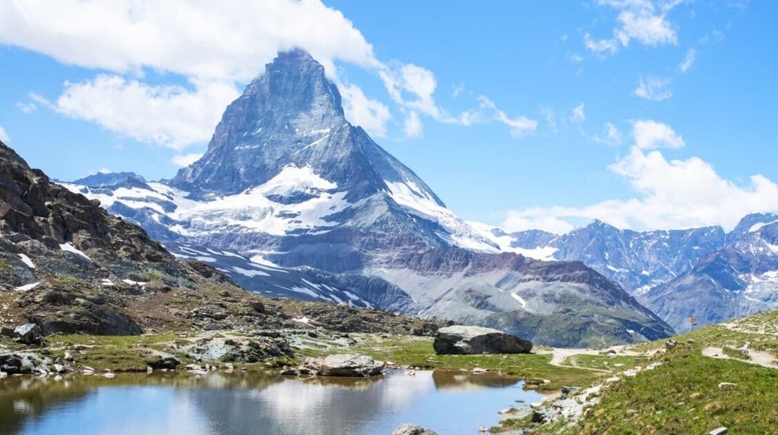
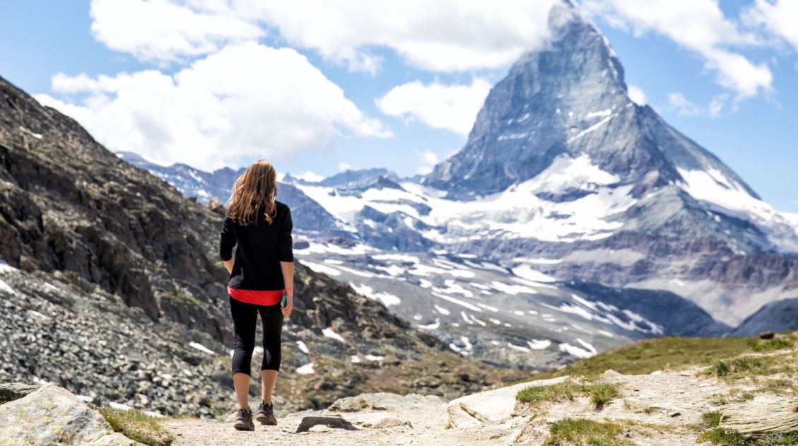
12 Epic Day Hikes in Zermatt (+ Trail Stats, Photos & Map)
One of the best ways to explore Zermatt is on foot. Hiking trails climb high into the mountains above Zermatt, past Swiss hamlets, through scenic valleys and rocky gorges, and to some of the best viewpoints of the Matterhorn. The network of cable cars and trains takes you up into the mountains, so for the […]
How to Visit Gornergrat and Hike to Riffelsee & Riffelberg
For one of the best views of Matterhorn, it’s hard to beat Gornergrat. A scenic, cogwheel train takes you from Zermatt to this alpine paradise. Once at the top station, you can simply enjoy the sweeping views of the Matterhorn and the Swiss Alps from the restaurant and terraces. Or, you can add on the […]
How to Visit Sunnegga, Blauherd, and Rothorn (Best One Day Itinerary)
Riding the series of lifts to Rothorn is one of the best things to do in Zermatt. Rothorn is one of the highest viewpoints in Zermatt, and from here you get a spectacular view of the Matterhorn and the surrounding mountains. On the journey to Rothorn, you will pass through two stations, Sunnegga and Blauherd, […]
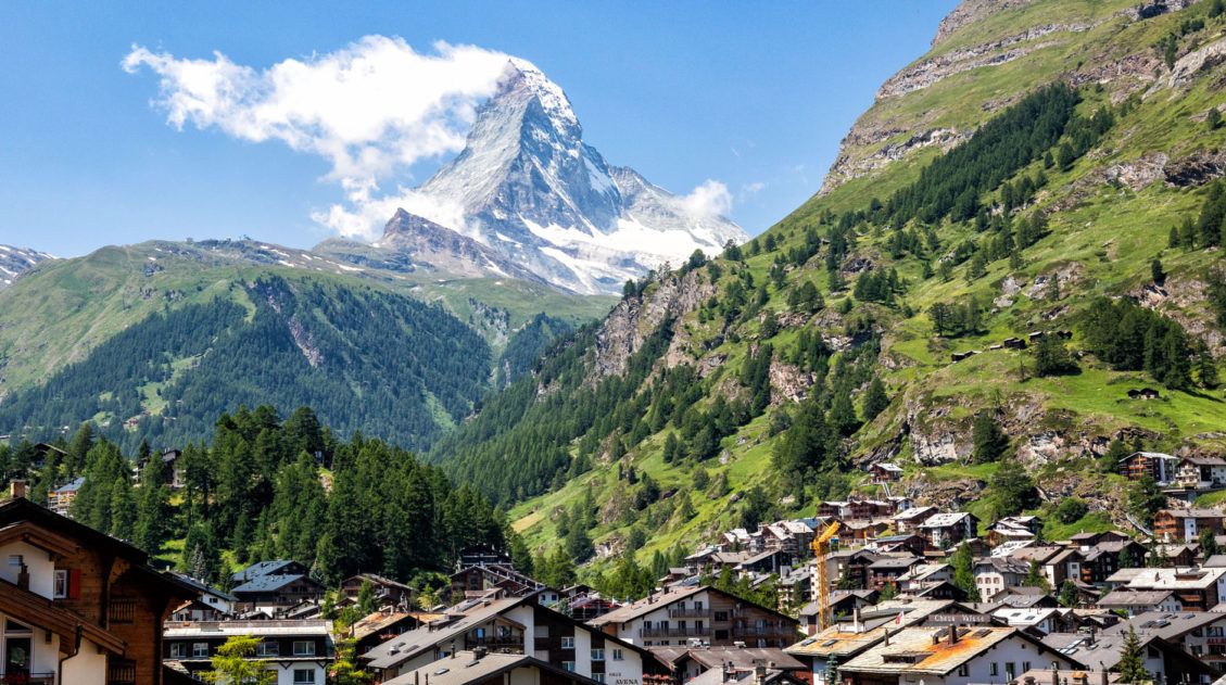
20 Amazing Things to Do in Zermatt, Switzerland
Zermatt is an idyllic mountain village tucked away in the Swiss Alps. The mighty Matterhorn dominates the skyline, creating one of the most unique alpine landscapes in Europe. Explore the hiking trails, journey up higher into the mountains by cable car and train, stroll the scenic streets of Zermatt, and go skiing all year long. […]
15 Great Hikes to Do in the Bernese Oberland, Switzerland
The Bernese Oberland is a hiker’s paradise. Alpine trails crisscross their way through the towns, valleys, and the mountain peaks of this gorgeous place. Take your pick from short, easy, family-friendly trails to cliff walks to thrilling trails. Here are 15 of the best hikes to do in the Bernese Oberland. All of the hikes […]
Switzerland Itinerary Ideas: 7 to 21 Days of Alpine Adventures
If you are planning a trip to Switzerland, this is a great place to start. There are many different ways to plan your “perfect Switzerland itinerary,” depending on your interests and how much time you have. In this article, we list five sample itineraries for Switzerland. These range from 7 to 21 days, with suggestions […]

Essential Hiking Gear: What Should You Bring on a Day Hike?
In this post, find out what we carry with us on day hikes. Whether you are a new hiker, shopping for a friend or family member, or just curious about what hiking gear you should bring on a day hike, we have a lot of great information to share with you. We have hiked thousands […]
Switzerland Travel Guide: How to Plan a Trip to Switzerland
Switzerland Travel Guide Looking to hike some of the world’s most beautiful mountain landscapes, stroll through colorful old towns, and dine on some fondue? Then Switzerland is the perfect place for you! Visit the Bernese Oberland, a hikers paradise filled with towering mountains, alpine meadows, historic cogwheel trains, and quaint villages. Or, relax at Switzerland’s […]

Comments 2