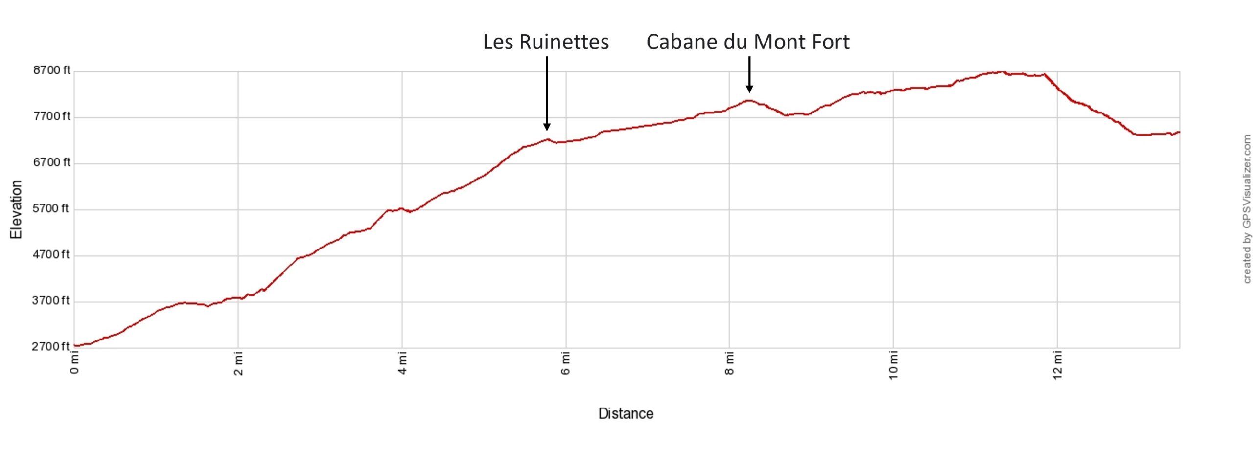
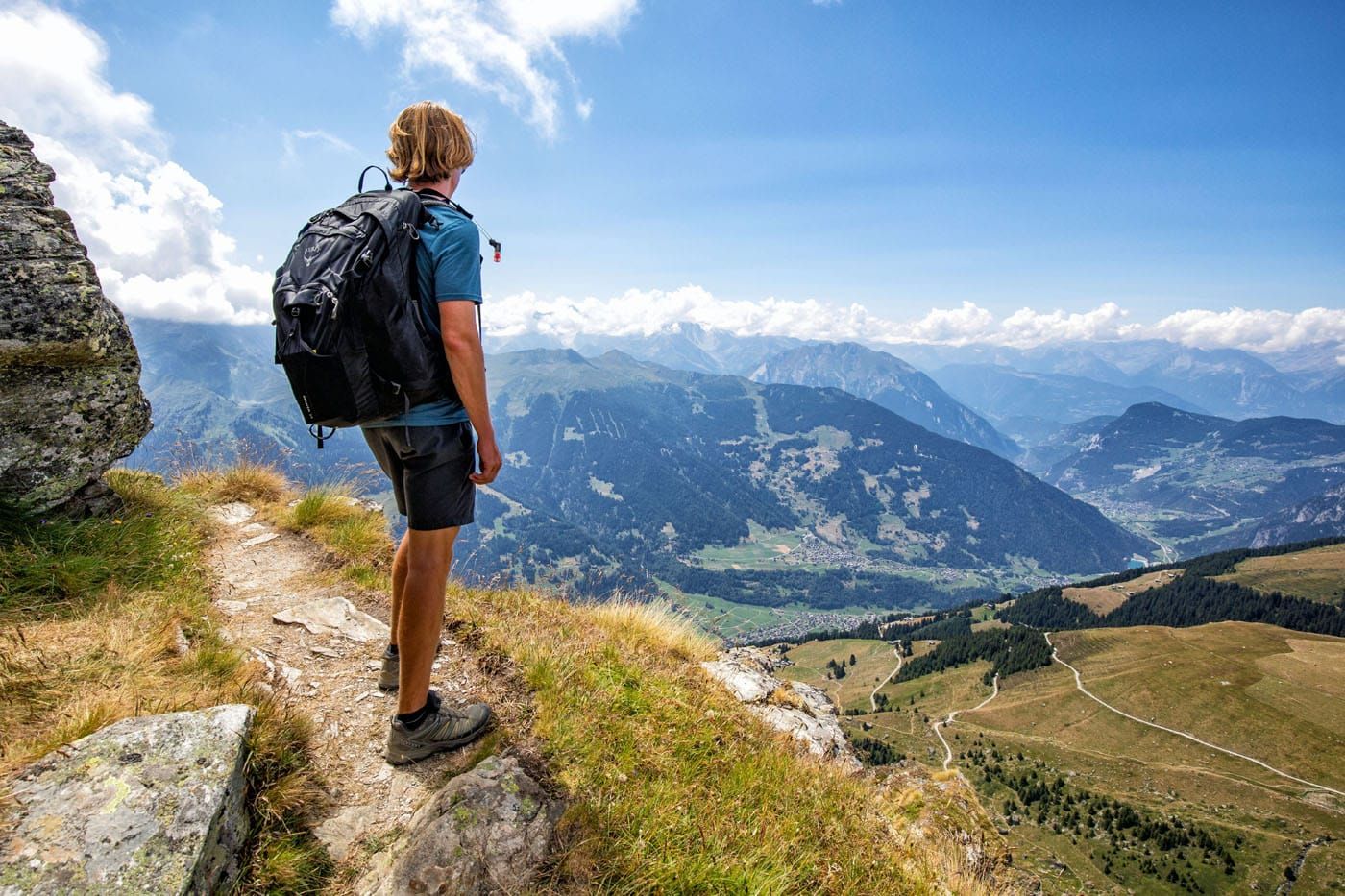
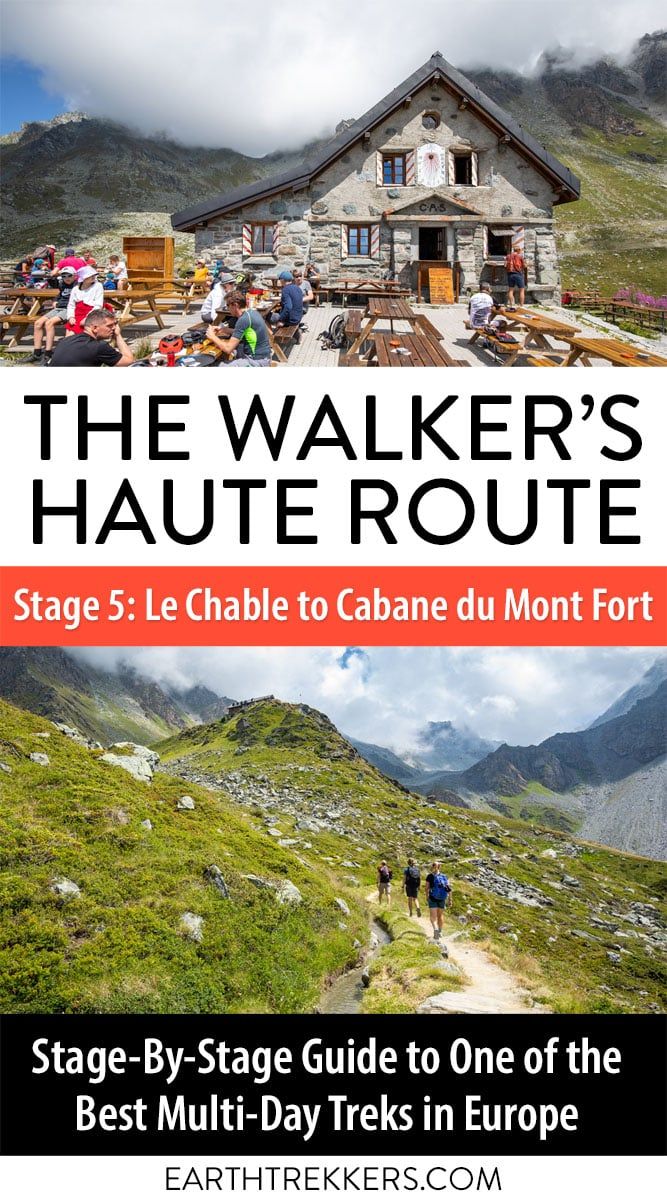
Hopefully you are feeling well rested, as Stage 5 of the Walker’s Haute Route includes one of the largest climbs of the entire route. Beginning in the valley in Le Châble, you will work your way up into the high alpine mountain ranges where you will spend the night. Be prepared for wild changes in scenery, as the views only get better as you continue your hike.
Stage 5 is arguably the most strenuous day of the entire Haute Route, especially if you continue past Cabane du Mont Fort to Cabane de Louvie, as we did. However, there are multiple ways you can bypass sections of the climb if you do not feel you can complete the entire thing. No shame in this, and it will be discussed further in detail along with how we completed the stage.
Since there are multiple ways to do Stage 5, we start with the typical way to do it, which is from Le Châble to Cabane du Mont Fort. Later in this guide, we provide information about how to continue to Cabane de Louvie (and this becomes by far the longest, most challenging stage of the Haute Route) and ways to shorten it.
Walker’s Haute Route Stage 5 Hiking Stats
Below are the hiking stats for the “typical Stage 5 route,” from Le Chable to Cabane du Mont Fort.
Distance: 13.3 km (8.2 miles)
Difficulty: Strenuous
Total Ascent: 1,700 m (5,570 feet)
Total Descent: 95 m (310 feet)
Lowest Elevation: 830 m (2,725 feet)
Highest Elevation: 2,455 m (8,055 feet)
Elevation in Le Châble: 830 m (2,725 feet)
Elevation at Cabane du Mont Fort: 2,455 m (8,055 feet)
Average Time: 5.5 hours; Our Time: 5.5 hours (including stops)
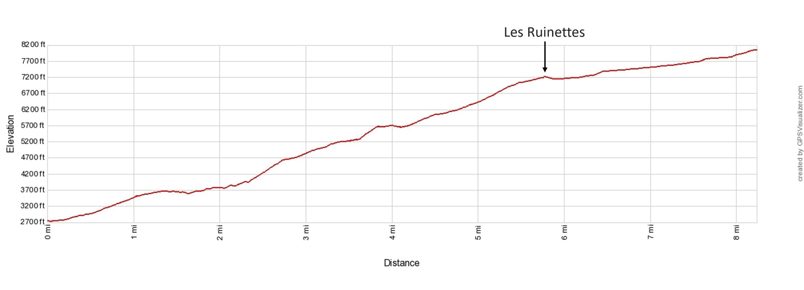
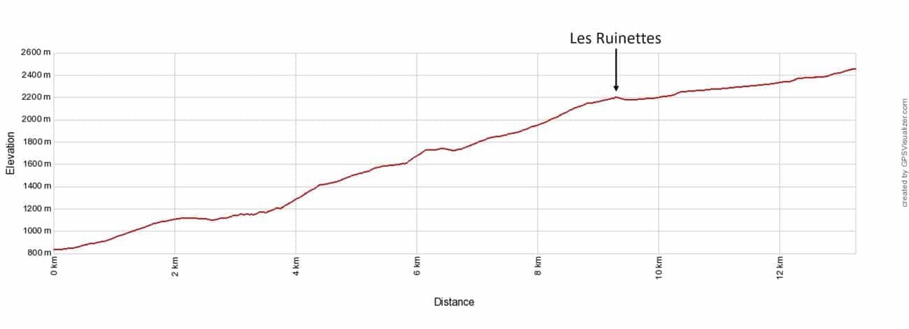
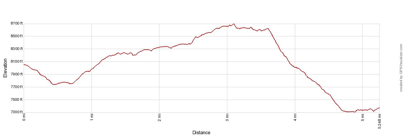
Walker’s Haute Route Stage 5 elevation profile: Le Châble to Cabane du Mont Fort
Please practice the seven principles of Leave No Trace: plan ahead, stay on the trail, pack out what you bring to the hiking trail, leave areas as you found them, minimize campfire impacts, be considerate of other hikers, and do not approach or feed wildlife.
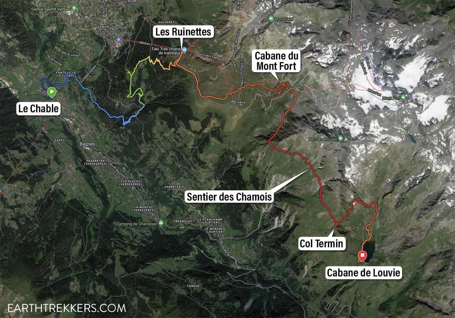
Walker’s Haute Route Stage 5 Map
The maps below are for the entire route from Le Châble to Cabane du Mont Fort to Cabane de Louvie since that is what we did.
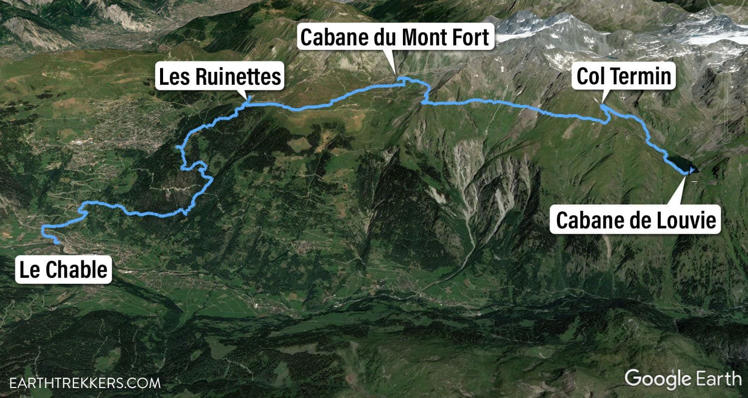
Google Earth image of Haute Route stage 5 plus the additional hike to Cabane de Louvie.
Another map of the trail from Le Chable to Cabane de Louvie (from Julie’s Garmin Fenix watch).
Walker’s Haute Route Stage 5: Trail Overview
To hike the Haute Route, we highly recommend following the trail descriptions in the book Trekking Chamonix to Zermatt, The Classic Walker’s Haute Route by Kev Reynolds. Below we list an overview of the day, so you know what to expect along the way. We also provide advice on where to eat and where to stay. Later in this guide, we list a few tips and trail clarifications to be used with the Trekking Chamonix to Zermatt book.
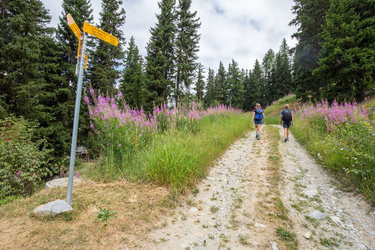
Le Châble to Les Ruinettes
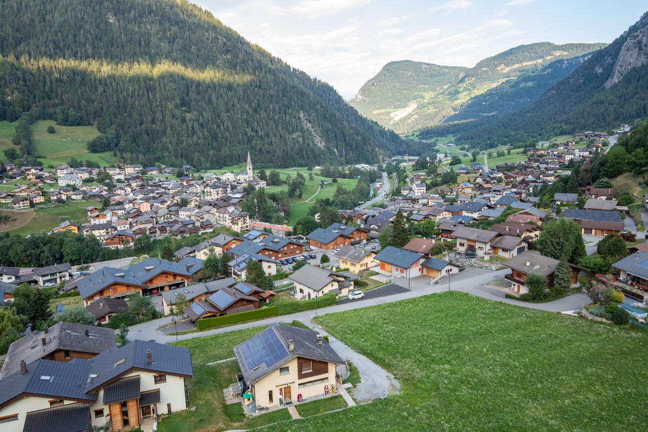
Stage 5 officially begins in the town of Le Châble.
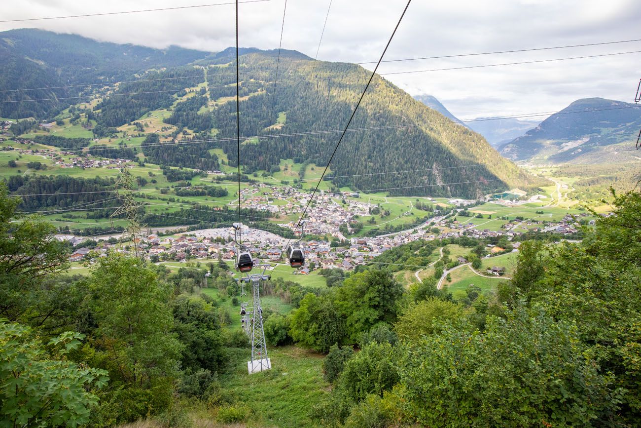
Since we spent the previous night in Verbier, the town located above Le Châble on the mountainside, we rode the gondola down in order to not cut corners. However, you have the option to start your day in Verbier, ride the gondola to Les Ruinettes, and hike to Cabane du Mont Fort from here, which is discussed in detail later in this guide.
The view of Le Châble on the gondola ride from Verbier.
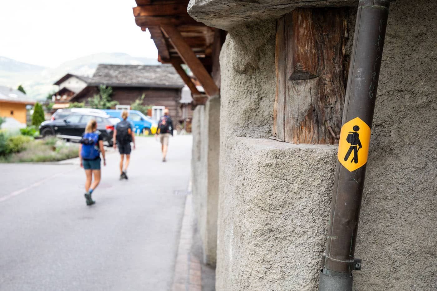
We began where we ended yesterday, at the end of the bridge next to Restaurant Pizzeria du Pont. The trail takes you up through the hilly roads of town, where golden walker signs indicate the trail’s direction. You’ll also find the same golden diamonds marking the trail as in other days.
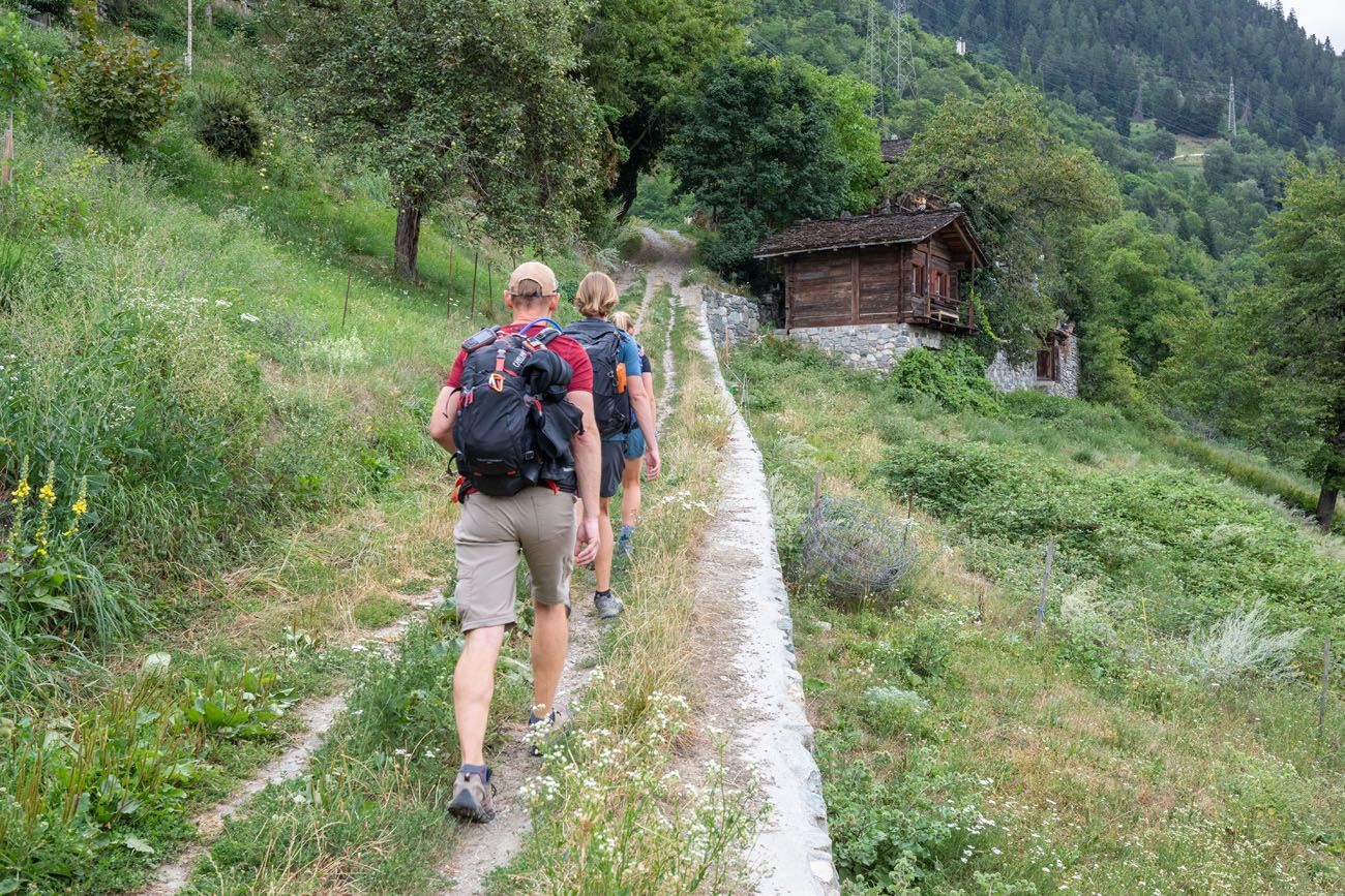
It’s a steady climb up and out of Le Châble as you pass through other smaller Swiss hamlets. As we walked through, we noticed locals leaning out of their windows to say “Bonjour”, where we replied the same.
Your climb will remain steady for a while, and we noticed it’s best to keep your pace slow here in order to conserve energy. You’re going to have a long day ahead of you.
Before you know it, you’ll be high above Le Châble. Enjoy the views of the valley and the surrounding mountains.
The gondola that connects Le Châble and Verbier. Not gonna lie…it feels kind of crazy hiking uphill under the gondola you just rode down earlier in the day.
The trail now enters the woods where it’ll wind up the mountainside for a long while. This is where you’ll knock out a large chunk of today’s climb. The trail here begins as a steady climb up until you transition into a more jungle-like setting. From here, the trail introduces steeper sections that are sure to leave you winded at the top.
As you climb, follow signs for Les Ruinettes.
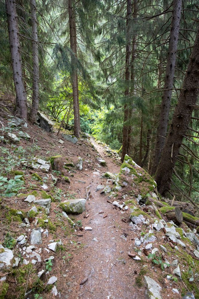
About a mile after entering the woods, you’ll be climbing up steep switchbacks through the trees. These continue on for a while, so once again, keep the pace slow.
After what seems to be an endless supply of switchbacks, you’ll reach a flat gravel road. The trail is a bit tricky to find here, but look for a tiny dirt path. This shortcuts the long winding switchbacks of the road, although both paths will take you to your destination. Soon after you’ll be back to climbing up steep switchbacks that are impossible to get used to.
At a little over four miles, you’ll reach an opening and have completed the hardest climb of the day. Starting from Le Chable, you’ll have climbed up over 3000ft (900m). Nearby is a restaurant (Chez Dany) that serves as a great place to sit and recover, grab a snack, and enjoy the views of the surrounding countryside.
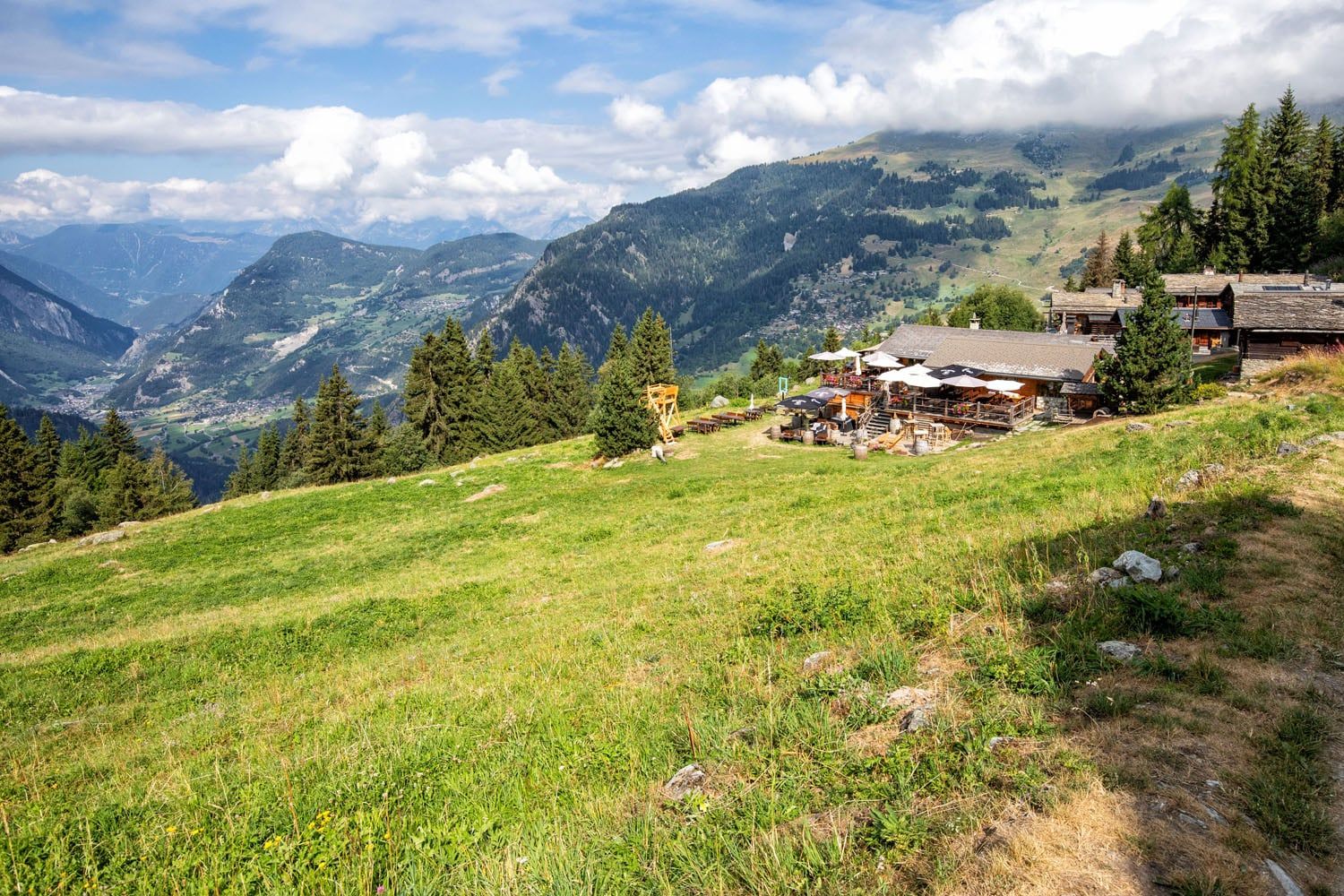
Chez Dany
Chez Dany
Beyond Chez Dany, the trail continues to climb steeply for a while, but will flatten out as you near Les Ruinettes. You’ll end up climbing another 1500ft (450m) to reach Les Ruinettes, but after what you just accomplished it’s not nearly as difficult. Soon before you reach Les Ruinettes, you’ll leave the treeline for good.
Trail between Chez Dany and Les Ruinettes.
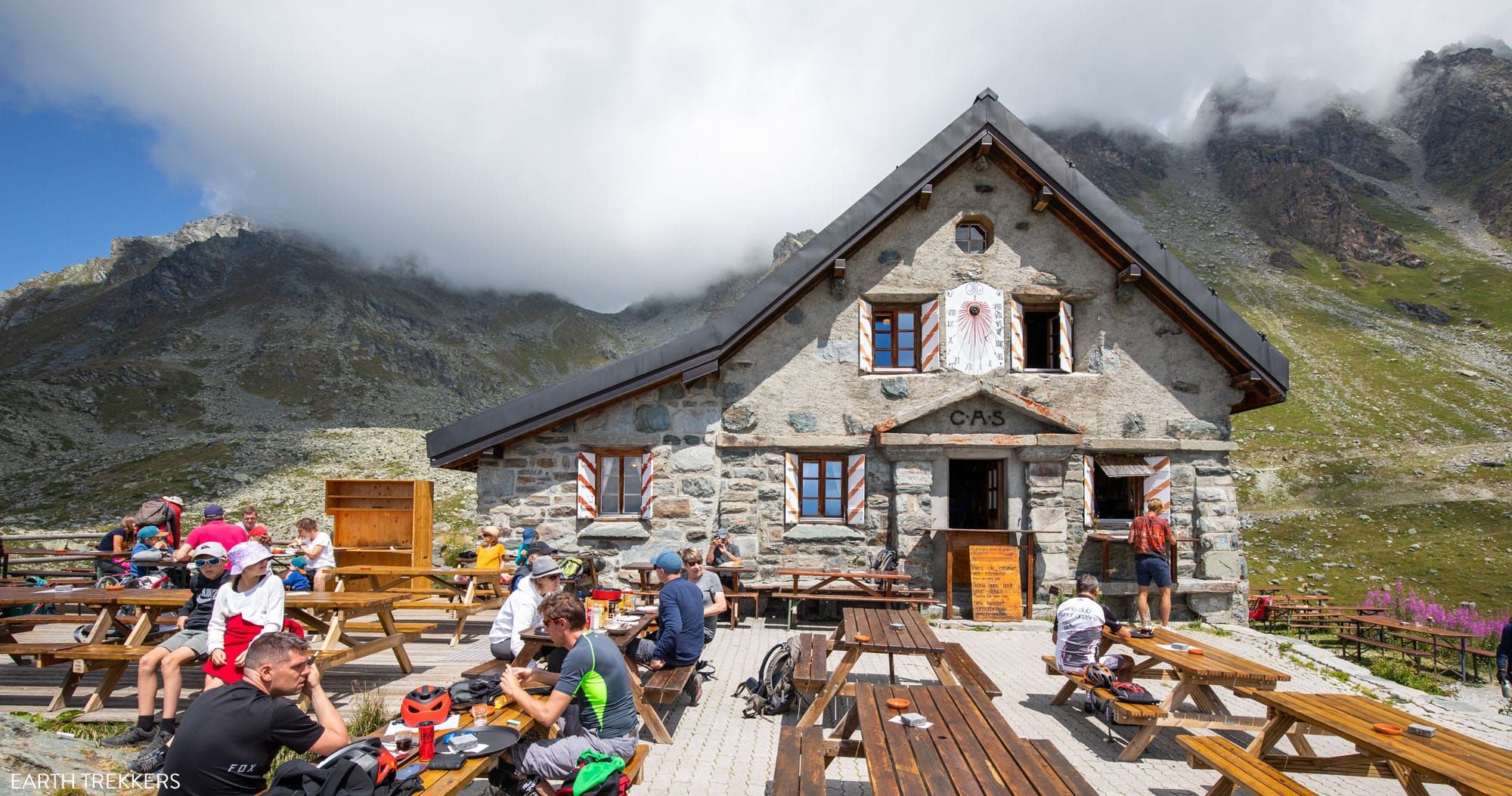
Les Ruinettes is where we ate lunch in order to fuel up for the second half of our day. The views were the best we had so far as you could look out at snow-capped mountains, which were breathtaking. Not to mention, the food served was delicious and cured our exhaustion from the gargantuan climb.
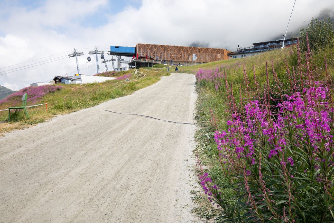
Les Ruinettes
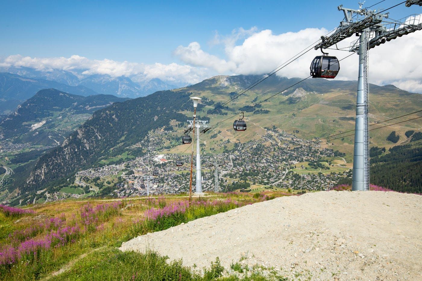
The view from Les Ruinettes: Verbier and the gondola that connects Verbier and Les Ruinettes.

Les Ruinettes to Cabane du Mont Fort
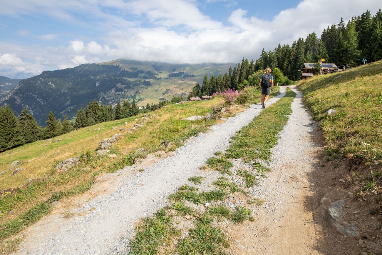
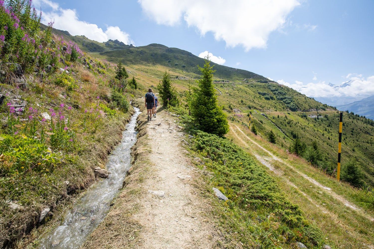
Continuing on, much to our enjoyment, the trail flattens out greatly as you walk alongside the mountain. As you walk, you’ll be treated to spectacular views of the Alps surrounding you.
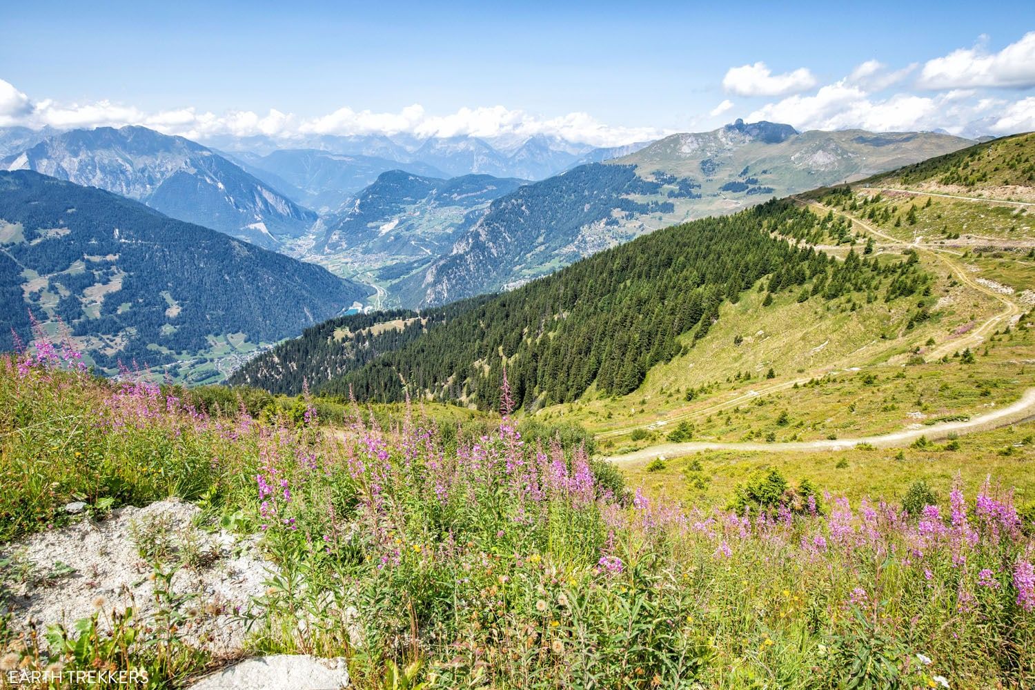
Cabane du Mont Fort comes into view.
The trail remains mostly flat until you reach Cabane Mont Fort, where you’ll find a short but steep climb up to the hut. Congrats, you finished Stage 5 of the Haute Route, having traveled 13.3 km (8.2 miles) and climbed 1,700 meters (5,570 feet). Enjoy the views from the cabin!
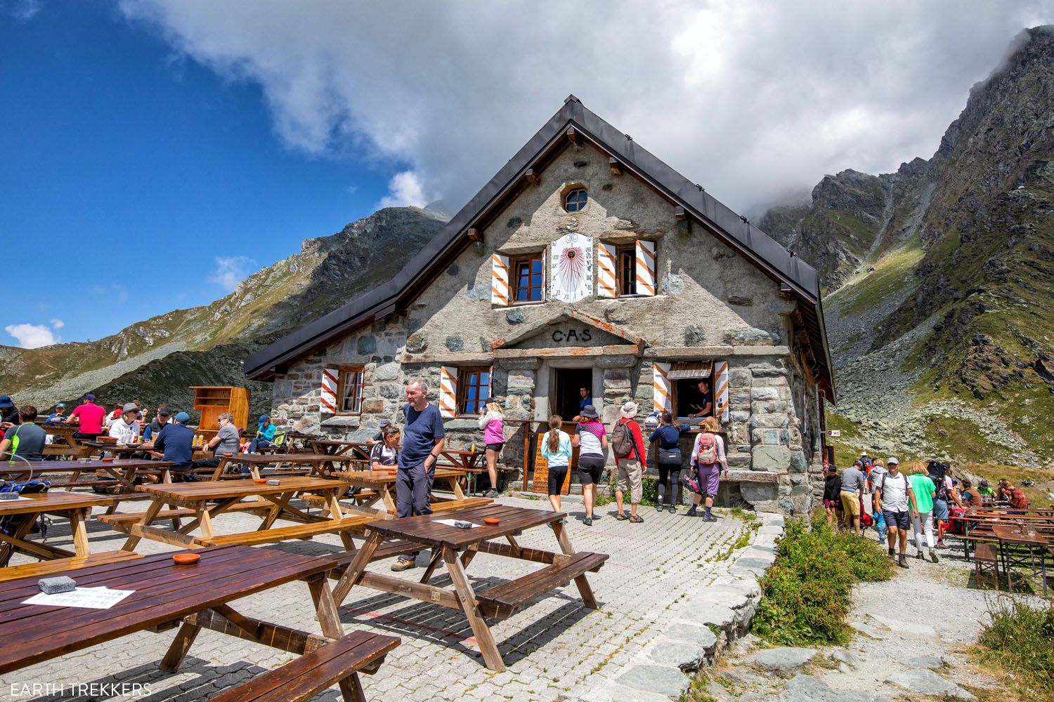
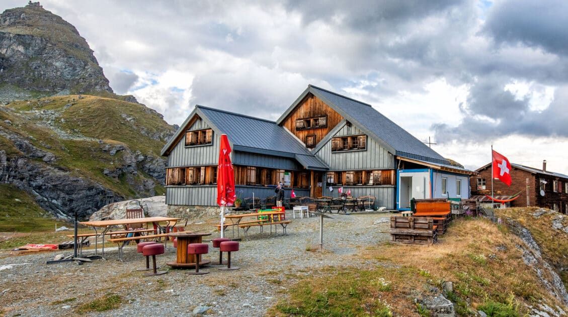
Cabane du Mont Fort
View from Cabane du Mont Fort
Optional: Continuing on to Cabane de Louvie
When Tim arranged our itinerary and accommodations, he heard from multiple sources that Cabane de Louvie is a much nicer place to spend the night than Cabane du Mont Fort. And now having seen both, we have to agree. However, adding on Cabane de Louvie turns this already strenuous day into one very long, tiring, challenging day. It’s not for everyone.
If you hike from Le Chable, you have already hiked 13.3 km/8.2 miles with a giant amount of ascent. This in itself is a very tiring day. Adding on another 8.4 km/5.3 miles should only be attempted by those who are fit and hike fast. We hike fast and got started around 8 am. It wasn’t until 4:45 pm that we arrived at Cabane de Louvie.
If you continue, you will be hiking part of Stage 6 as you walk towards Cabane de Louvie. Cabane de Louvie is not on the official Haute Route; it is a detour. A very worthwhile detour.
Hiking Stats: Cabane du Mont Fort to Cabane de Louvie
Below are the hiking stats for the additional hike from Cabane du Mont Fort to Cabane de Louvie.
Distance: 8.4 km (5.3 miles)
Difficulty: Easy to moderate
Total Ascent: 430 m (1,430 feet)
Total Descent: 605 m (1,990 feet)
Lowest Elevation: 2,225 m (7,300 feet)
Highest Elevation: 2,650 m (8,700 feet)
Elevation at Cabane du Mont Fort: 2,455 m (8,055 feet)
Elevation at Cabane de Louvie: 2,245 m (7,370 feet)
Our Time: 3 hours (including stops)
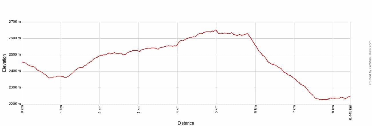
Cabane du Mont Fort to Cabane de Louvie Elevation Profile
Hiking Stats Le Châble to Cabane de Louvie
Here is the entire hike, from Le Chable to Cabane du Mont Fort to Cabane de Louvie.
In terms of distance, it’s really not that bad. But take a look at the total ascent. 2,100+ meters, or 7,000 feet, is HUGE. That’s a lot more than hiking from the Colorado River up the rim of the Grand Canyon…just to put it into perspective.
Distance: 21.7 km (13.5 miles)
Total Ascent: 2,130 m (7,000 feet)
Total Descent: 700 m (2,300 feet)
Lowest Elevation: 830 m (2,725 feet)
Highest Elevation: 2,650 m (8,700 feet)
Elevation in Le Châble: 830 m (2,725 feet)
Elevation at Cabane de Louvie: 2,245 m (7,370 feet)
Our Time: 8.5 hours (including stops)

Le Chable to Cabane de Louvie Elevation Profile
Worth it? Absolutely.
Staying at Cabane de Louvie was one of our favorite experiences on the Haute Route. If the hiking stats look insane, then break the day into two hikes (to Cabane du Mont Fort on one day followed by Cabane de Louvie on the following day).
Or short cut part of stage 5 in order to save the time and energy to hike to Cabane de Louvie.
Below, we list about the route from Cabane du Mont Fort to Cabane de Louvie. And later in this guide, we give suggestions on how to modify this day, because there are several different ways to shorten it.
Cabane du Mont Fort to Cabane de Louvie
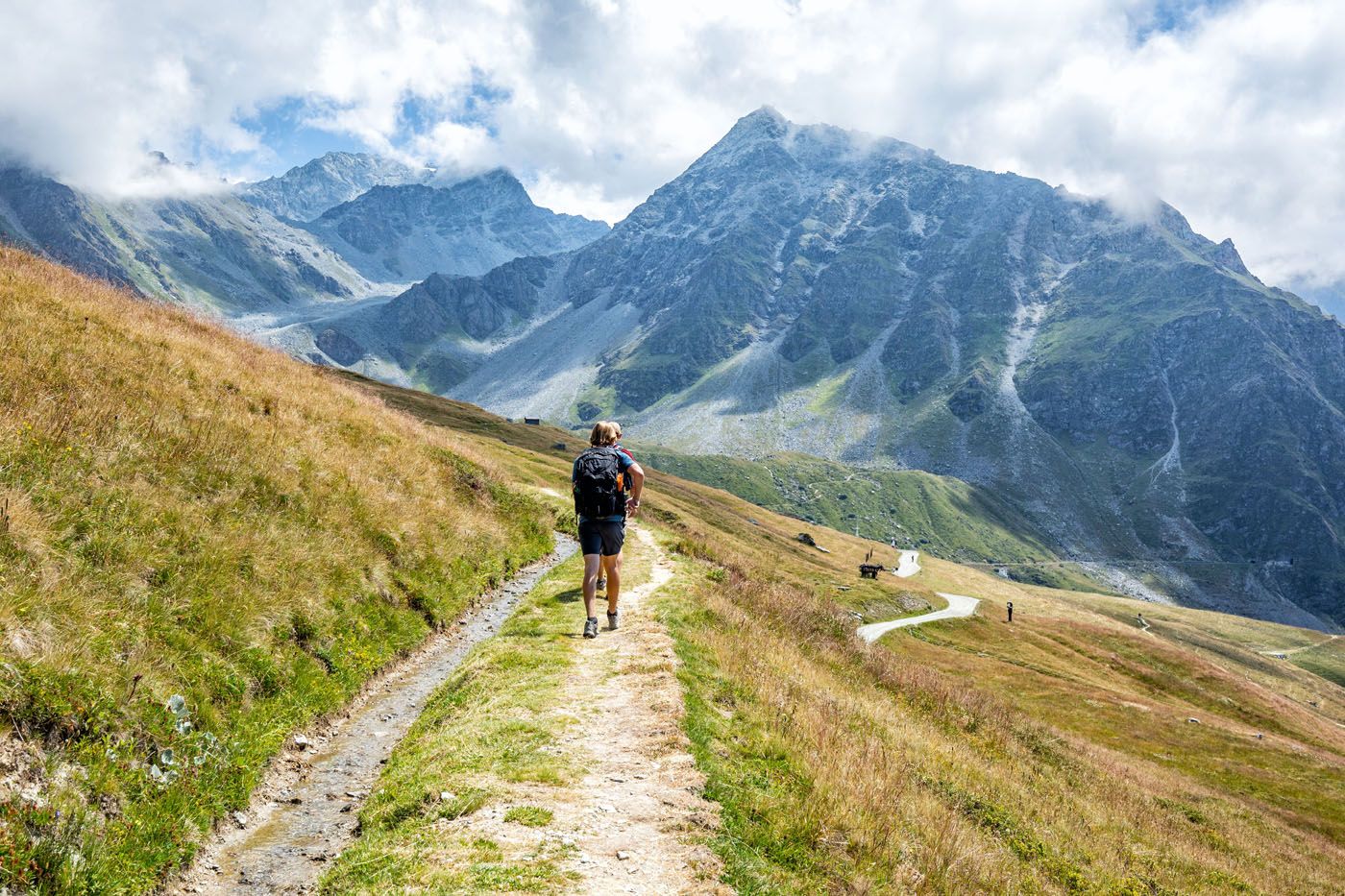
Stage 5 ends at Cabane du Mont Fort, where hikers spend the night. However, our plan was to continue onwards to Cabane de Louvie. To get here, we hiked the first part of stage 6 and then had an additional detour to Cabane de Louvie. However, the remainder of the hike pales in comparison to what you’ve already accomplished today.
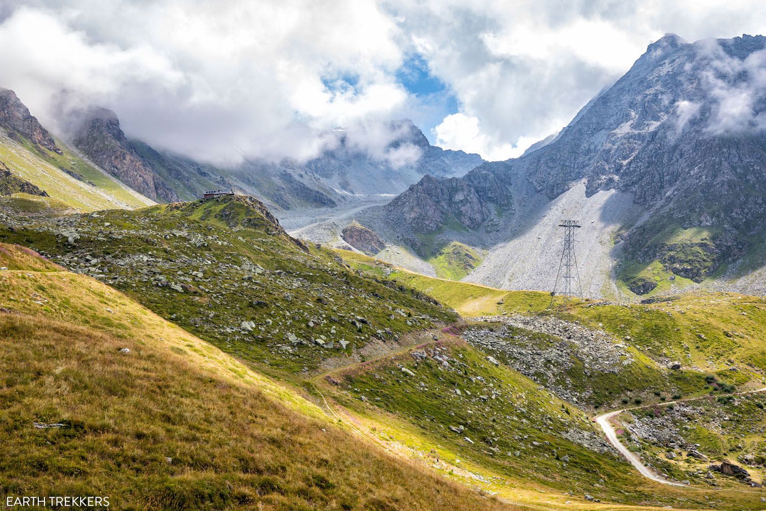
As you follow signs for Cabane de Louvie, you’ll come across a high alpine trail that crosses a boulder field. Be extra careful as you are now in a spot that has a risk of rockslides.
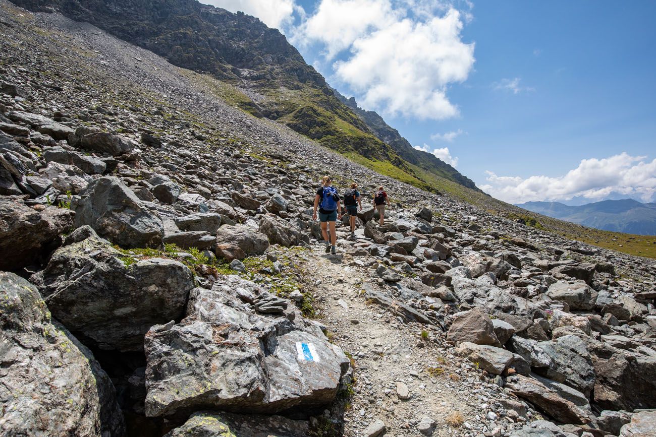
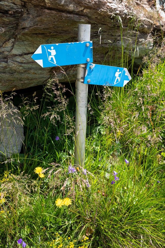
NOTE: In Switzerland, technical alpine routes are marked with blue signs and blue and white blazes. These are more challenging trails that sometimes require special equipment. For this trail, no special equipment is necessary. You will traverse a boulder field that was formed by a recent rockslide. And since the threat of another rockslide exists, it is designated as a blue trail. But many guides still list this as the best way to hike Stage 6. Hiking through the boulder field takes no special skills, just a bit of rock scrambling in a few spots.
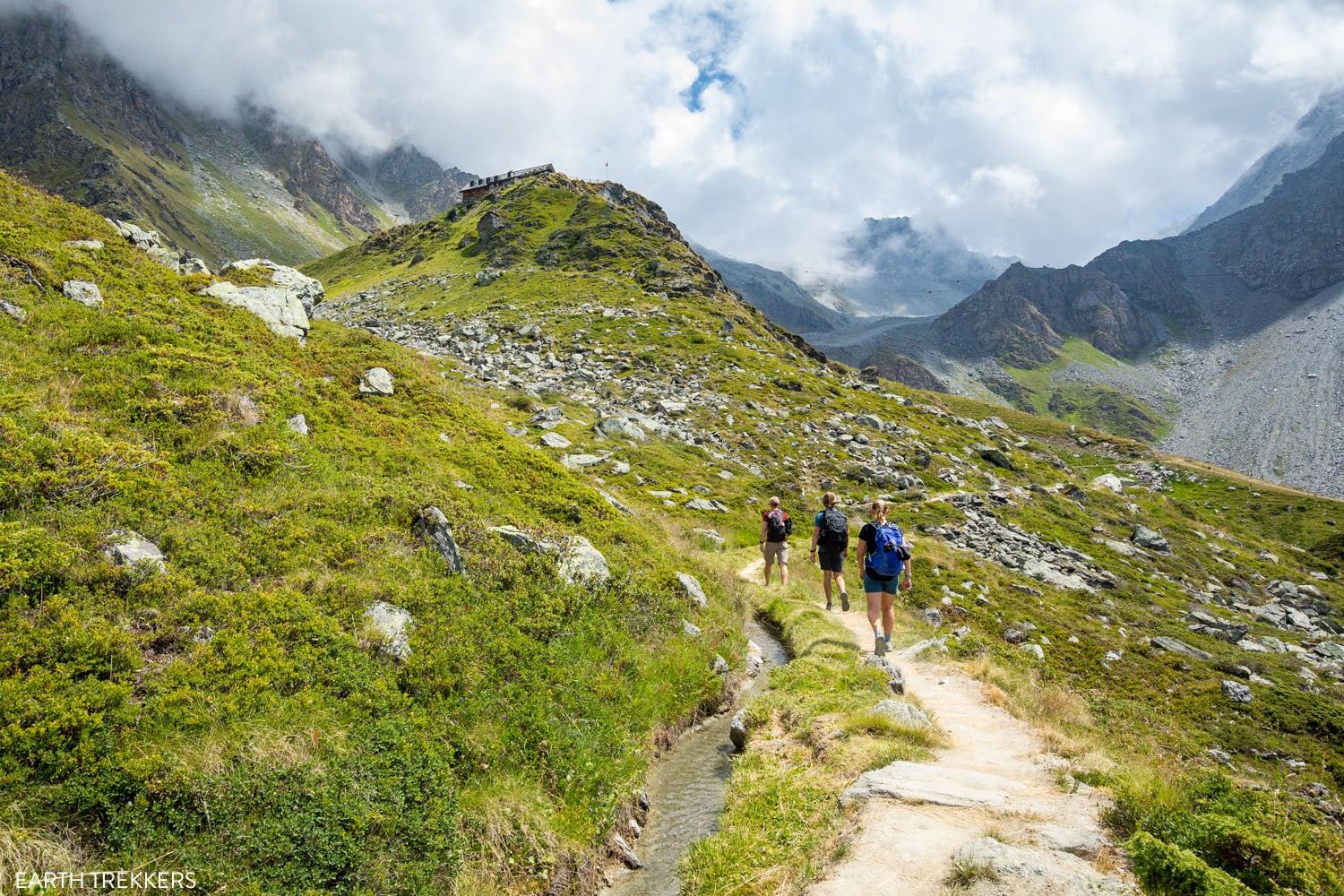
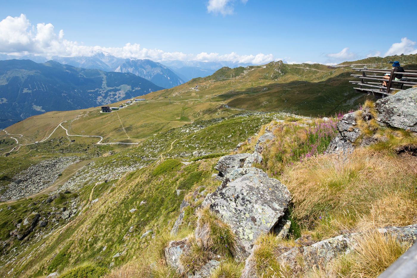
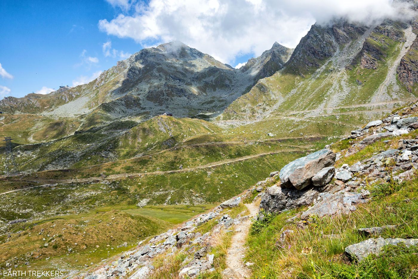
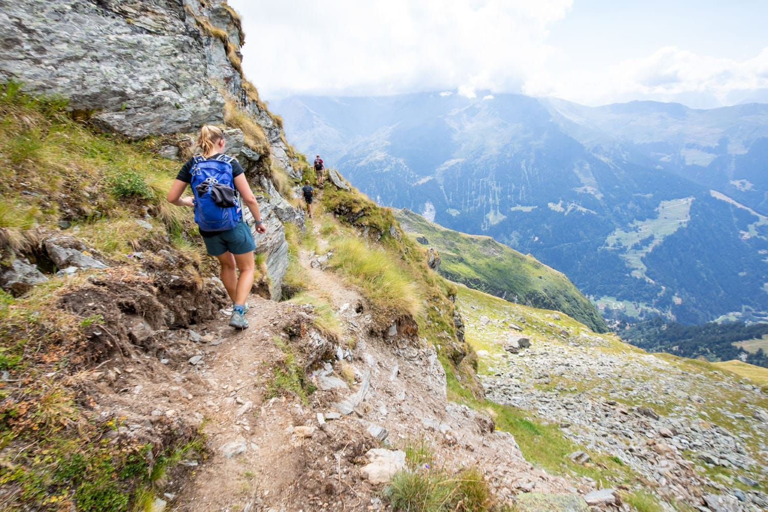
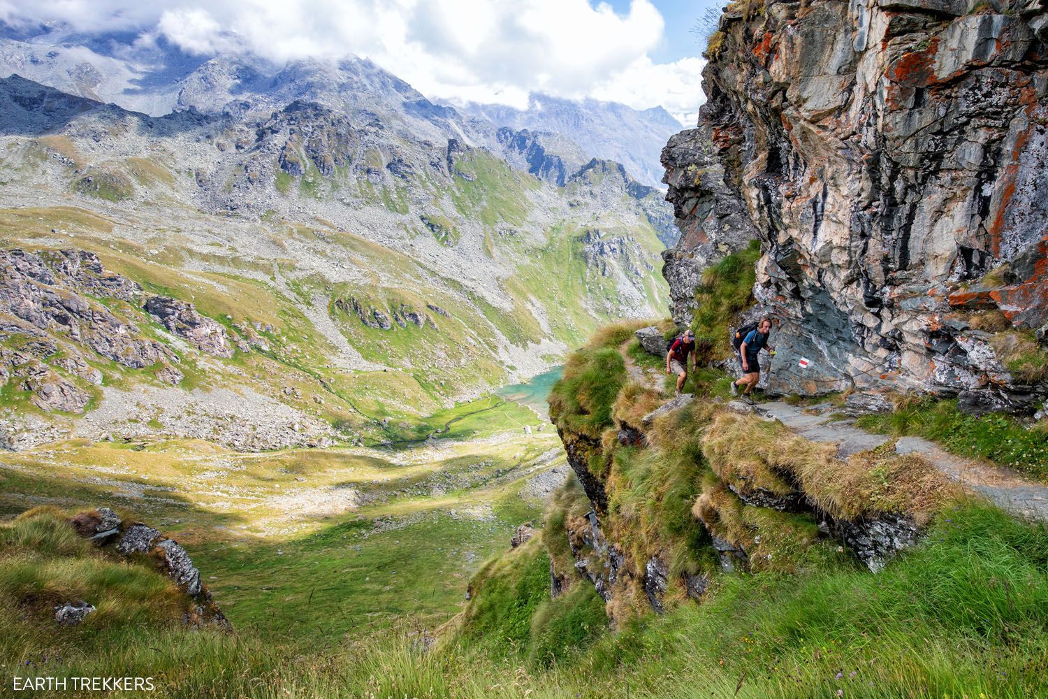
The trail will slowly climb out of the boulder field, where it becomes a dirt path that follows the side of a mountain. This is the Sentier des Chamois, a narrow trail that runs along the side of a mountain. At times there is a steep drop off from the trail, which can be narrow at times, so watch your step.
Looking back to Cabane du Mont Fort
Starting the Sentier de Chamois
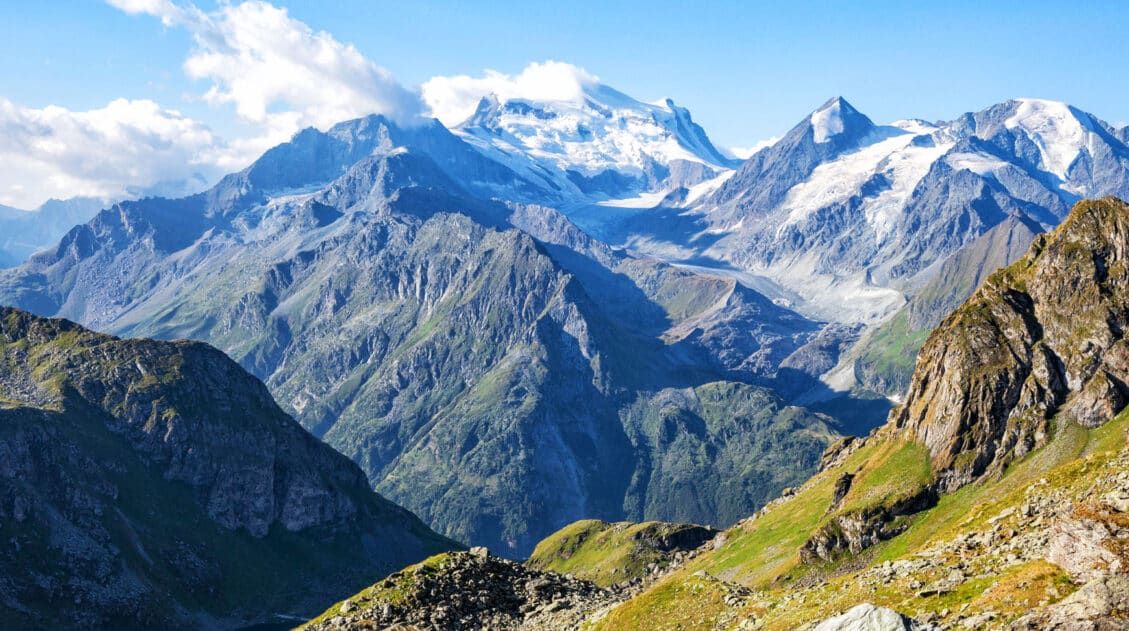
The views from this section are remarkable. The views continue to open up, revealing more of the valley and surrounding mountain peaks, which are even more amazing on a sunny day. These will be your views for the next few miles.
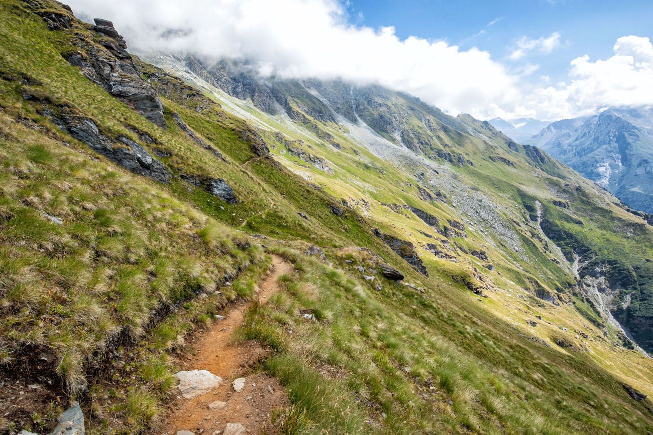
Sentier des Chamois
Sentier des Chamois
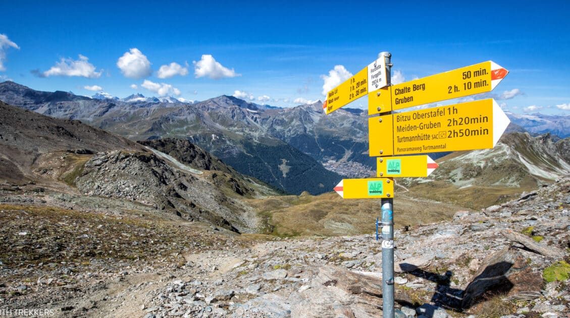
The Sentier des Chamois brings you to Col Termin. At this point, you are standing at 2,648 meters (8,700 feet). This is the first of three cols on stage 6 of the Haute Route.
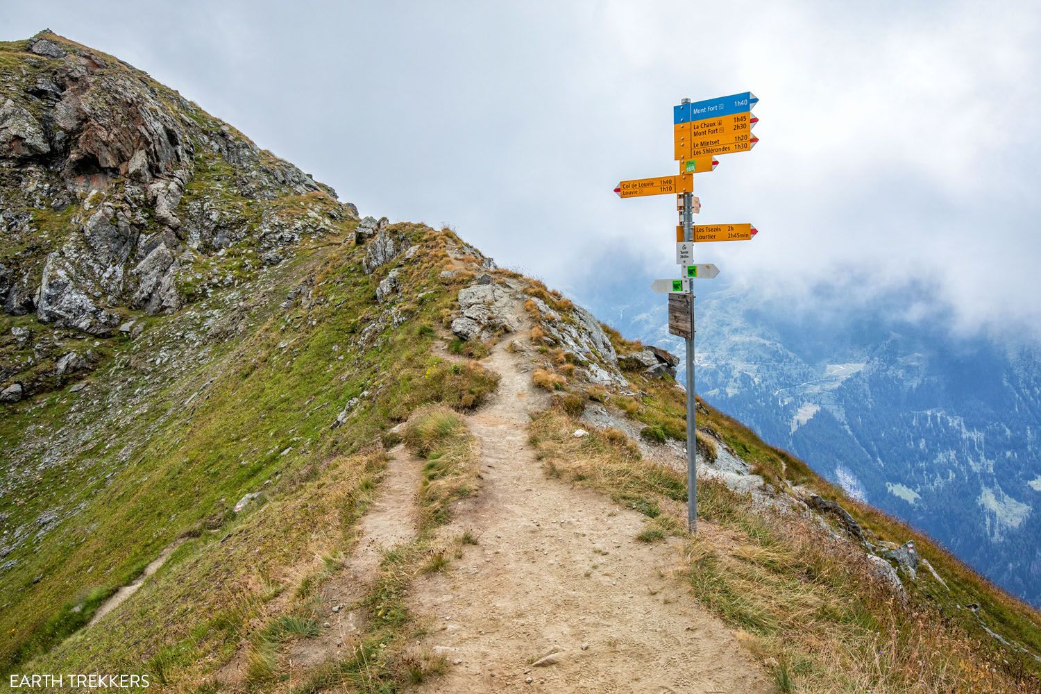
Col Termin
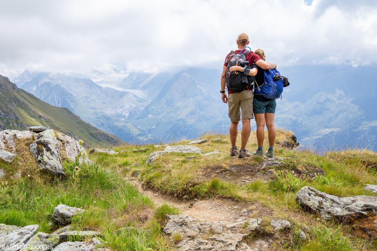
At this junction, follow the sign towards Louvie, which takes just over an hour from this point. Here are views from the trail.

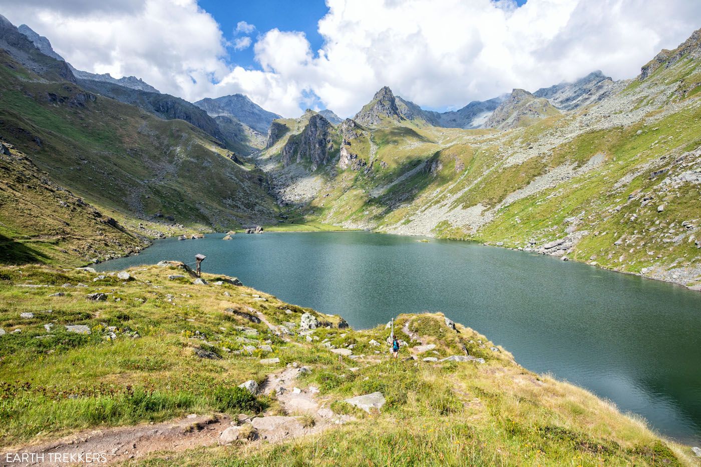
After a short walk along the main trail, the trail to Cabane de Louvie breaks off to the right. At the junction you are offered incredible views of the lake, such as this one.
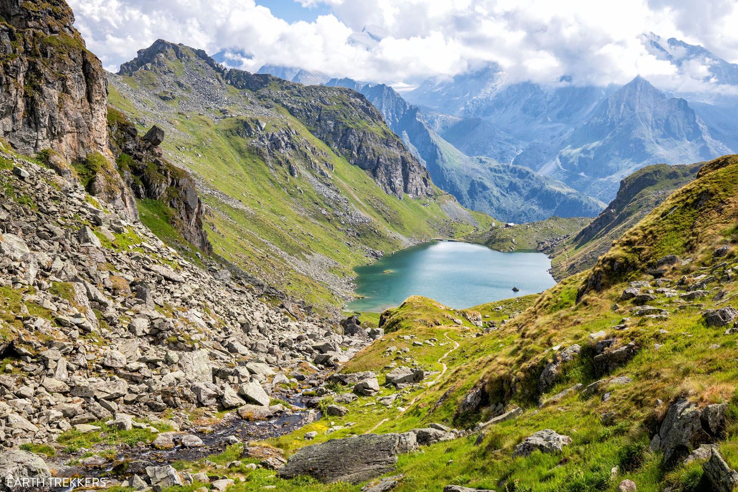
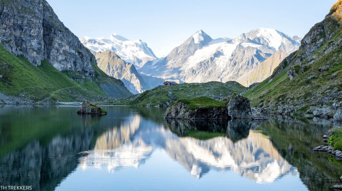
Lac de Louvie
From the junction, the trail takes you down a steep descent and then along the lake, where the cabin sits at the far end. This walk, from the junction to the cabin, is a detour off of the main Haute Route trail. Tomorrow morning you will do this walk in the opposite direction to return to the trail.
This detour from the Haute Route trail to Cabane de Louvie adds 2.6 km (1.6 miles) with 420 meters (1,375 feet) of elevation change, one-way. It will be a downhill walk to the cabin and an uphill walk the following day.
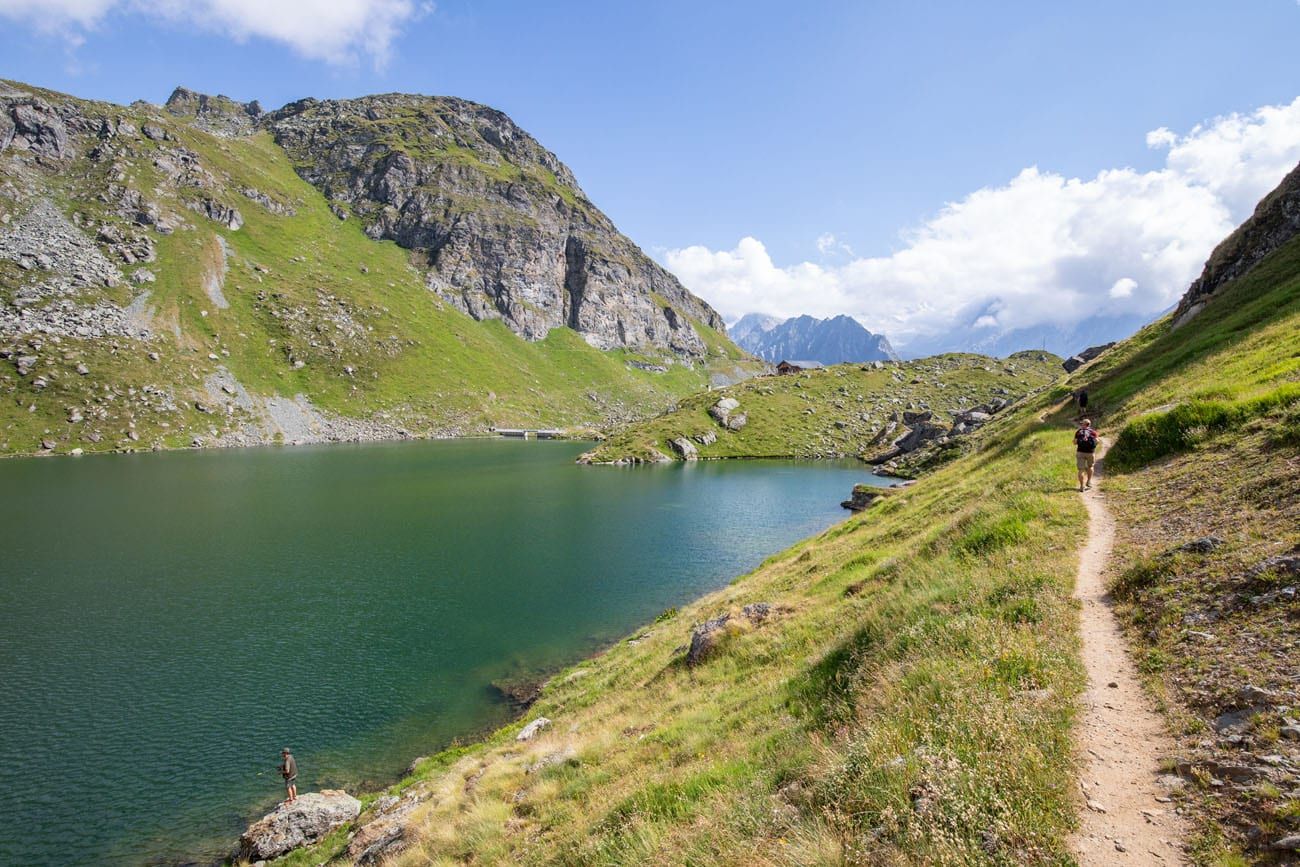
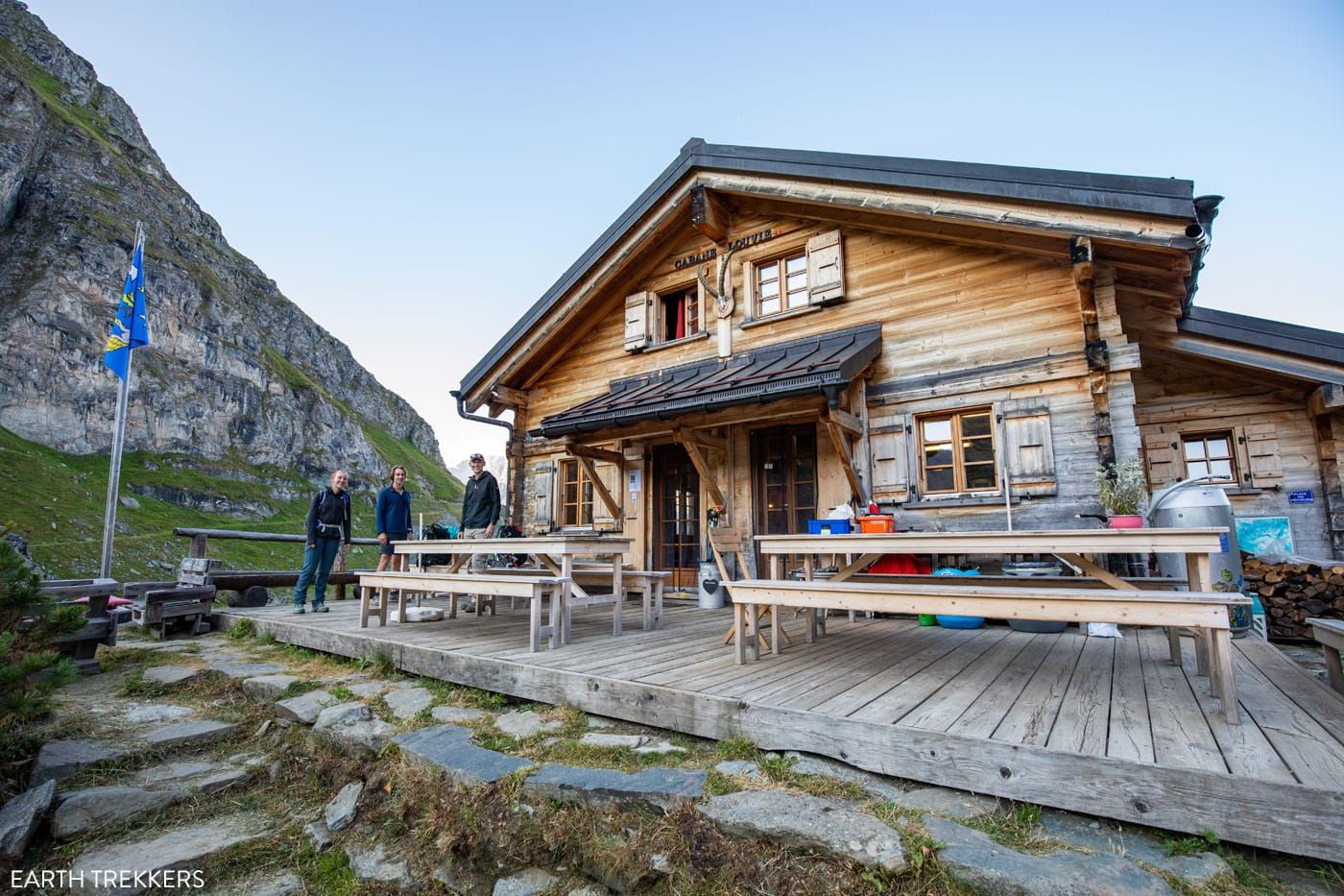
Cabane de Louvie
The view from Cabane de Louvie.
After our long day, we finished up at around 4:45, exhausted and anxiously awaiting dinner.
Shortcuts & Alternative Routes to Stage 5 of the Haute Route
Stage 5 is one of the longest, most challenging days of the Haute Route. Fortunately, there are a few different ways to shorten it.
Cable Car to Les Ruinettes
In the Walker’s Haute Route by Kev Reynolds, this is called Stage 5A.
Taking the cable car to Les Ruinettes lops off most of the first major climb. In terms of scenery, you aren’t missing much by taking the cable car, and in some ways, the views may actually be better from the cable car than the hiking trail.
We stayed in Verbier, so we rode the gondola from Le Châble to Verbier to get to and from our hotel. The view is very nice from the gondola and in just a matter of minutes, you are considerably higher on the mountain.
From Verbier, you will take a second gondola to Les Ruinettes. Once in Les Ruinettes, it takes about an hour and a half to walk to Cabane de Mont Fort and about 4.5 hours to walk to Cabane de Louvie.
This is a great option if you plan to stay at Cabane de Louvie rather than Cabane du Mont Fort. You eliminate the hefty climb of stage 5, still get the views from Les Ruinettes, and can hike to Louvie on relatively fresh legs.
Hiking Stats Les Ruinettes to Cabane du Mont Fort
Distance: 4.0 km (2.5 miles)
Difficulty: Easy to moderate
Total Ascent: 280 m (915 feet)
Total Descent: 37 m (120 feet)
Lowest Elevation: 2,175 m (7,135 feet)
Highest Elevation: 2,455 m (8,055 feet)
Elevation at Ruinettes: 2,190 m (7,185 feet)
Elevation at Cabane du Mont Fort: 2,455 m (8,055 feet)
Our Time: 1.5 hours (including stops)
Hiking Stats Les Ruinettes to Cabane de Louvie
Distance: 12.4 km (7.8 miles)
Difficulty: Moderate
Total Ascent: 710 m (2,345 feet)
Total Descent: 642 m (2,110 feet)
Lowest Elevation: 2,175 m (7,135 feet)
Highest Elevation: 2,650 m (8,700 feet)
Elevation at Ruinettes: 2,190 m (7,185 feet)
Elevation at Cabane de Louvie: 2,245 m (7,370 feet)
Our Time: 4.5 hours (including stops)
Split Stage 5 into Two Sections
If you don’t want to shortcut the Haute Route but a massive climb seems daunting, break it up into two days. On day 1, hike from Le Chable to Les Ruinettes. Ride the gondolas to Le Châble or Verbier (wherever you are staying). On day 2, ride the gondolas to Les Ruinettes and then hike to Cabane du Mont Fort or Cabane de Louvie.
Is Cabane de Louvie Worth It?
Cabane de Louvie was one of our favorite accommodations on the Haute Route. It’s remote setting keeps crowds low and this hut feels much less touristic than others on the Haute Route. The cabin is very clean, the food is great, and the staff is friendly.
Yes, you will do some extra walking to get here, but Lac de Louvie is one of the most beautiful places we saw on the Haute Route and to spend the night here is icing on the cake.
Summary of the Various Stage 5 Routes
1. Hike the official route: Le Châble to Cabane du Mont Fort
2. Add on Cabane de Louvie: Le Châble to Cabane du Mont Fort to Col Termin (part of stage 6) to Cabane de Louvie
3. Skip the first part of stage 5: Cable car to Les Ruinettes and hike to Cabane du Mont Fort or Cabane de Louvie
4. Split stage 5 into two days: Hike to Les Ruinettes on day 1 and ride the cable car back to Le Châble or Verbier; on day 2, cable car to Les Ruinettes and hike to Cabane du Mont Fort or Cabane de Louvie
For strategies on how to shorten the Haute Route see our guide on How To Plan Your Haute Route Experience.
Where We Stayed
We stayed at Cabane de Louvie. The isolation added to the charm of our experience, as we felt more immersed in the Alps. The cabin was clean and quaint, where we sat and played cards while enjoying the views.
The cabin has two rooms each with two beds, and several other rooms filled with closely-packed mattresses. Our family of four shared the two private bedrooms (Tim made our reservations in February), although I wondered what it would be like to sleep in one of the rooms that could hold ten hikers. When we stayed here however, rooms were not even half-capacity.
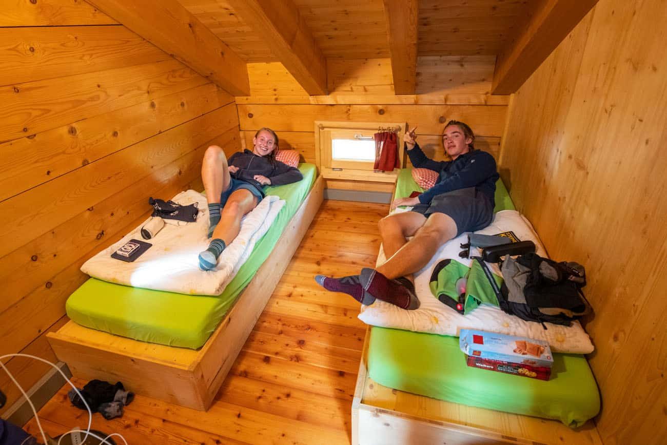
Kara and Tyler in one of the two double rooms. In the second room the two beds are pushed together.
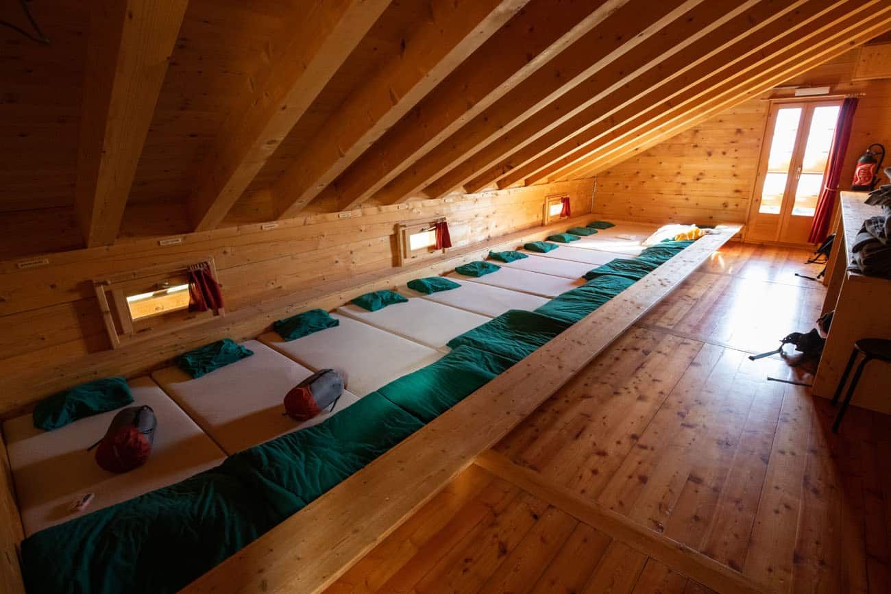
Cabane de Louvie dorm room (there are multiple rooms like this one).
When you make your reservation, you can book half-board, which includes dinner and breakfast. Snacks, drinks, and a picnic lunch are additional fees. We were able to pay with a credit card. Have some cash as backup.
There is no Wi-Fi or cellular service at Cabane de Louvie.
You can take a shower but this is limited to 2 minutes per person.
Pillows and bedding are provided. Bring a sleeping bag liner and a towel.
As mentioned, Cabane du Mont Fort is the traditional place to stay at the end of this stage. It has 15 rooms with a total of 58 beds.
Clarifications for the Walkers Haute Route Book
We were able to follow the Walker’s Haute Book by Kev Reynolds (the sixth edition from 2019; there is now an updated version) without any issues, meaning we never had to backtrack. But there were a few times during this stage we felt a little more clarification would have helped so we are providing that clarification here.
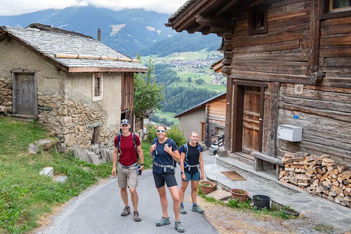
To Fontenelle: The book states “With waymarks and signposts as your guide, a series of tracks and footpaths lead to Fontenelle.” We were hiking to Fontenelle along a gravel road and a footpath that you need to follow breaks off on the left. The signpost at this junction doesn’t mention Fontenelle, rather it says the footpath you need to follow will take you to Verbier. This can be confusing because just before this you avoided a turn that would take you to Verbier.
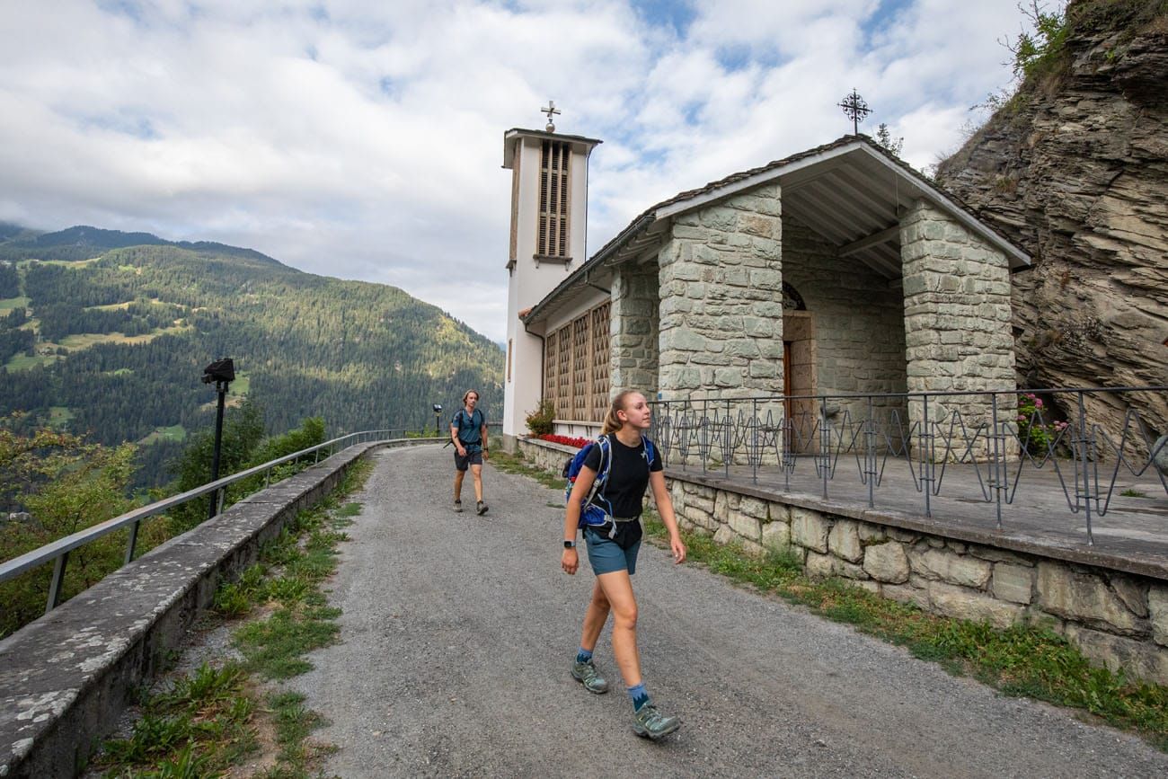
Fontenelle: There is a water trough here. We emerged from the old wooden houses of Fontenelle at a T intersection. Turn right following the sign to Chapelle des Verneys.
After Le Mayentset: The book states “This winds uphill in long loops with waymarked footpath shortcuts.” Take the shortcuts. We only saw one shortcut and it was signed with the words “Chemin pedestre”, which translates to pedestrian path.
Le Hatay: Know that a piste is a ski route. This particular piste looks like a rocky road in the summer.
After Le Hatay: This book states “Emerge at a junction 25m vertical and less than half a kilometre below the cable car station at Les Ruinettes.” We emerged from the forest onto a wide gravel dirt track with a signpost pointing right (uphill) to Mont Fort and left (downhill) to Les Ruinettes. We turned left in order to get food at Les Ruinettes. Along the way we saw another signpost next to a bisse (an irrigation canal) that also points uphill to Mont Fort along a narrow path. We took this path after getting food at Les Ruinettes, but I would suggest taking this path even if you don’t want to go to Les Ruinettes first. The path is well marked to Mont Fort.
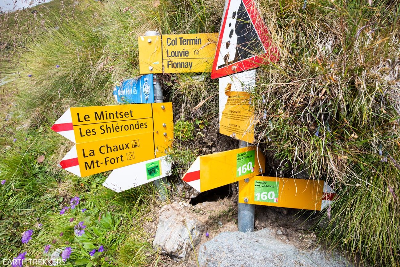
Cabane du Mont Fort: As you begin to round the hill that Cabane du Mont Fort sits on there is a yellow signpost pointing to Cabane de Louvie. This points you in the direction of the “Lower route from Cabane du Mont Fort” mentioned under Stage 6. If you ignore this and keep heading towards Cabane du Mont Fort you will eventually see blue alpine signs pointing towards Col Termin and Cabane de Louvie, this is the main path described under Stage 6.
For a detailed list of accommodations for each stage, along with information on making your reservations, see our guide on How To Book Your Haute Route Accommodations.
More Information about the Haute Route
In our Walker’s Haute Route Planning Guide, we have links to all of our articles about the Walker’s Haute Route, including information about each stage, how to plan your trek, what to expect, and more.
For an overview of all 14 stages of the Walker’s Haute Route, with overall hiking stats, map, elevation profile, and lists of the most difficult stages, easiest stages, and our personal favorites, check out our Guide to the Walker’s Haute Route Stages.
Stages of the Haute Route: Below are our guides to each stage of the Haute Route.
- Haute Route Stage 1: Chamonix to Argentière
- Haute Route Stage 2: Argentière to Col de Balme to Trient
- Haute Route Stage 3: Trient to Fenetre d’Arpette to Champex-Lac
- Haute Route Stage 4: Champex-Lac to Le Chable
- Haute Route Stage 6: Cabane du Mont Fort to Cabane de Prafleuri
- Haute Route Stage 7: Cabane de Prafleuri to Arolla
- Haute Route Stage 8: Arolla to Les Haudères
- Haute Route Stage 9: Les Haudères to Lac de Moiry
- Haute Route Stage 10: Lac de Moiry to Zinal
- Haute Route Stage 11: Zinal to Gruben
- Haute Route Stage 12: Gruben to St. Niklaus
- Haute Route Stage 13: St. Niklaus to the Europahütte
- Haute Route Stage 14: Europahütte to Zermatt
If you have any questions about how to hike the Haute Route Stage 5, or if you want to share your experience, let us know in the comment section below.
You Might Also Like
Ultimate Guide to the Walker’s Haute Route
Pinterest Facebook Flipboard Walker’s Haute Route The Walker’s Haute Route is one of the most rewarding and memorable multi-day walks in Europe. On this trek, hikers cross 10 of the highest mountain passes in the French and Swiss Alps, as they walk from Chamonix, France to Zermatt, Switzerland. Walking from Chamonix to Zermatt takes you to remote mountain […]
Walker’s Haute Route Stages: An Overview of All 14 Stages
The Walker’s Haute Route is a multi-day trek from Chamonix, France to Zermatt, Switzerland. On this walk, hikers will cross 10 mountain passes, walk through small towns and through rugged, remote landscapes, and get to experience a less touristy side of the Swiss Alps. There are several routes that take hikers from Chamonix to Zermatt. […]
Walker’s Haute Route: 21 Important Things to Know & FAQ
The Walker’s Haute Route is one of the most rewarding and memorable multi-day walks in Europe. On this journey, hikers will cross 10 of the highest mountain passes in the Alps, while walking from Chamonix, France to Zermatt, Switzerland. It’s an extraordinary journey but not without its challenges. With 14 stages, multiple variations to the […]
How To Book Your Walker’s Haute Route Accommodations
Along the Walker’s Haute Route, there are a variety of accommodation types, from mountain huts to 5-star hotels, from dormitories to apartments, and from shared bathrooms to private bathrooms. You will have the opportunity to experience a combination of all of these since you will be staying in a new place at the end of […]
Chamonix Itinerary: How to Spend 1 to 5 Days in Chamonix
Chamonix is one of the best places in the French Alps for a summer itinerary packed with cable car rides, glacier views, high alpine hikes, and jaw-dropping views of Mont Blanc. With 1 day, you can ride to Aiguille du Midi and see one of the most famous views in Europe; with 3 days, you […]
How to Hike to Lac Blanc, Chamonix (Photos, Stats & Map)
There are several reasons why the hike to Lac Blanc is one of the best in Chamonix. For one thing, this alpine lake is beautiful. A series of gondolas and chair lifts lop off the first big climb, making this hike doable for most ages and ability levels. But one of the best reasons to […]
24 Best Things to Do in Chamonix, France in the Summer
Discover the best things to do in Chamonix, France in the summer. This guide covers the top cable cars, hiking trails, glaciers, and adventures in Chamonix, based on our firsthand experience hiking and exploring the area. Chamonix is one of the most spectacular mountain destinations in Europe, and in the summer, it’s an outdoor playground […]
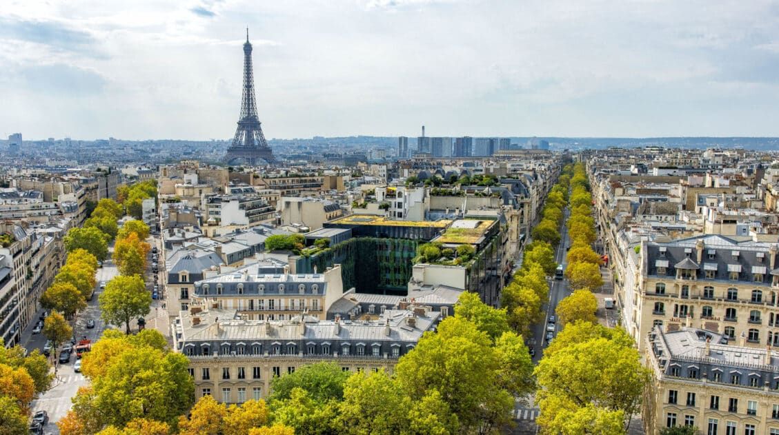
France Travel Guide: How to Plan a Trip to France
Travel information and advice for France. Best things to do in France with itineraries for Paris, the French Riviera, and the Alsace wine region.
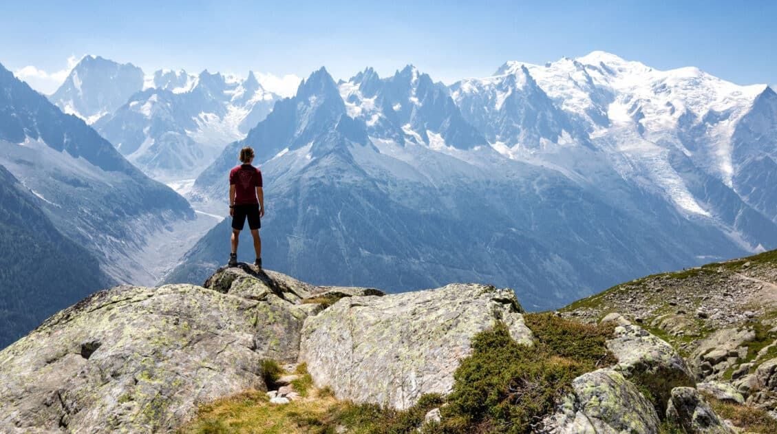
Best Hikes in Europe: 25 Incredible Hikes for Every Level
From the dramatic cliffs of Norway to the jagged peaks of the Dolomites and the volcanic landscapes of Iceland, Europe is packed with some of the most unforgettable hikes in the world. In this guide, we share our favorite hikes in Europe, trails that stand out for their scenery, uniqueness, and overall experience from start […]
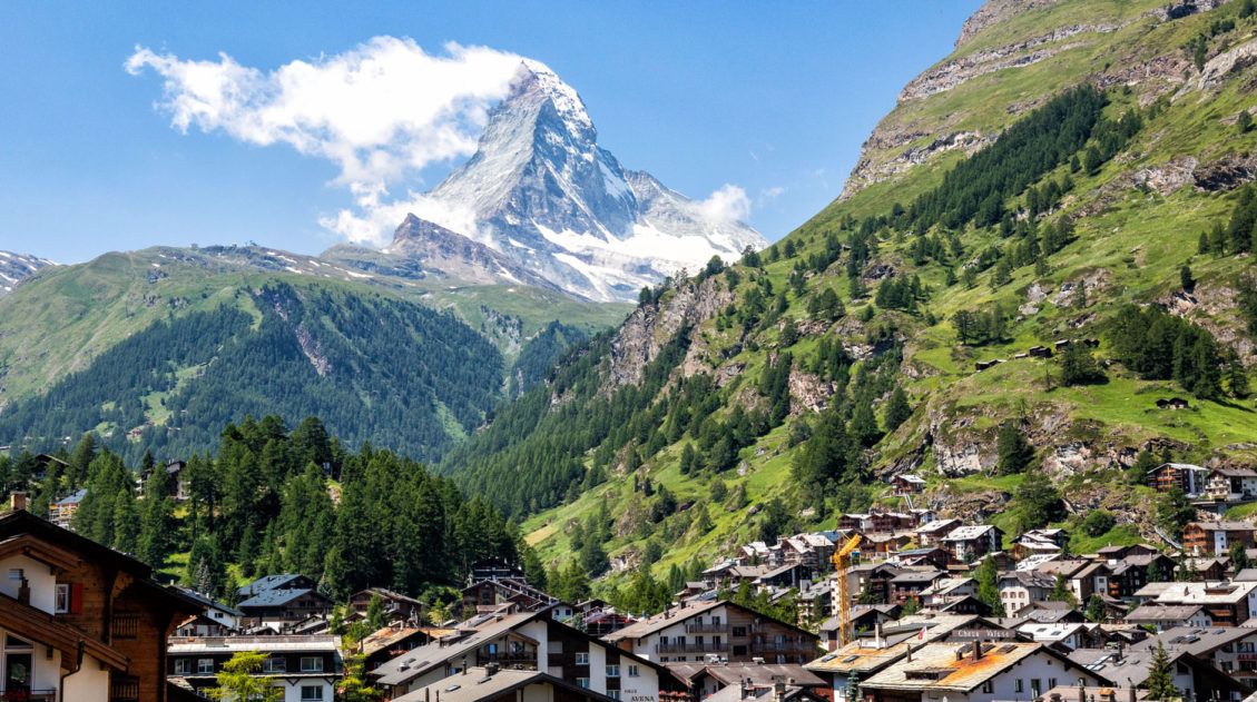
20 Amazing Things to Do in Zermatt, Switzerland
Zermatt is an idyllic mountain village tucked away in the Swiss Alps. The mighty Matterhorn dominates the skyline, creating one of the most unique alpine landscapes in Europe. Explore the hiking trails, journey up higher into the mountains by cable car and train, stroll the scenic streets of Zermatt, and go skiing all year long. […]
Complete Guide to the Hörnlihütte Hike (Map, Trail Stats & Photos)
The Hörnlihütte (Hörnli Hut) is a lodge built at the base of the Matterhorn. For thrill seeking rock-climbers, the Hörnlihütte marks the start of the ascent up to the peak of the Matterhorn. Even if you do not wish to stand on top of the Matterhorn, simply hiking to and from the Hörnlihütte makes for […]
12 Epic Day Hikes in Zermatt (+ Trail Stats, Photos & Map)
One of the best ways to explore Zermatt is on foot. Hiking trails climb high into the mountains above Zermatt, past Swiss hamlets, through scenic valleys and rocky gorges, and to some of the best viewpoints of the Matterhorn. The network of cable cars and trains takes you up into the mountains, so for the […]
Switzerland Travel Guide: How to Plan a Trip to Switzerland
Switzerland Travel Guide Looking to hike some of the world’s most beautiful mountain landscapes, stroll through colorful old towns, and dine on some fondue? Then Switzerland is the perfect place for you! Visit the Bernese Oberland, a hikers paradise filled with towering mountains, alpine meadows, historic cogwheel trains, and quaint villages. Or, relax at Switzerland’s […]

Comments 2