
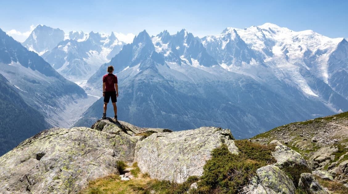
Stage 8 is both the easiest and shortest of the 14 stages that make up the Walker’s Haute Route and it is a great chance to catch your breath and rest your legs before heading into the final stretches of the Haute Route.
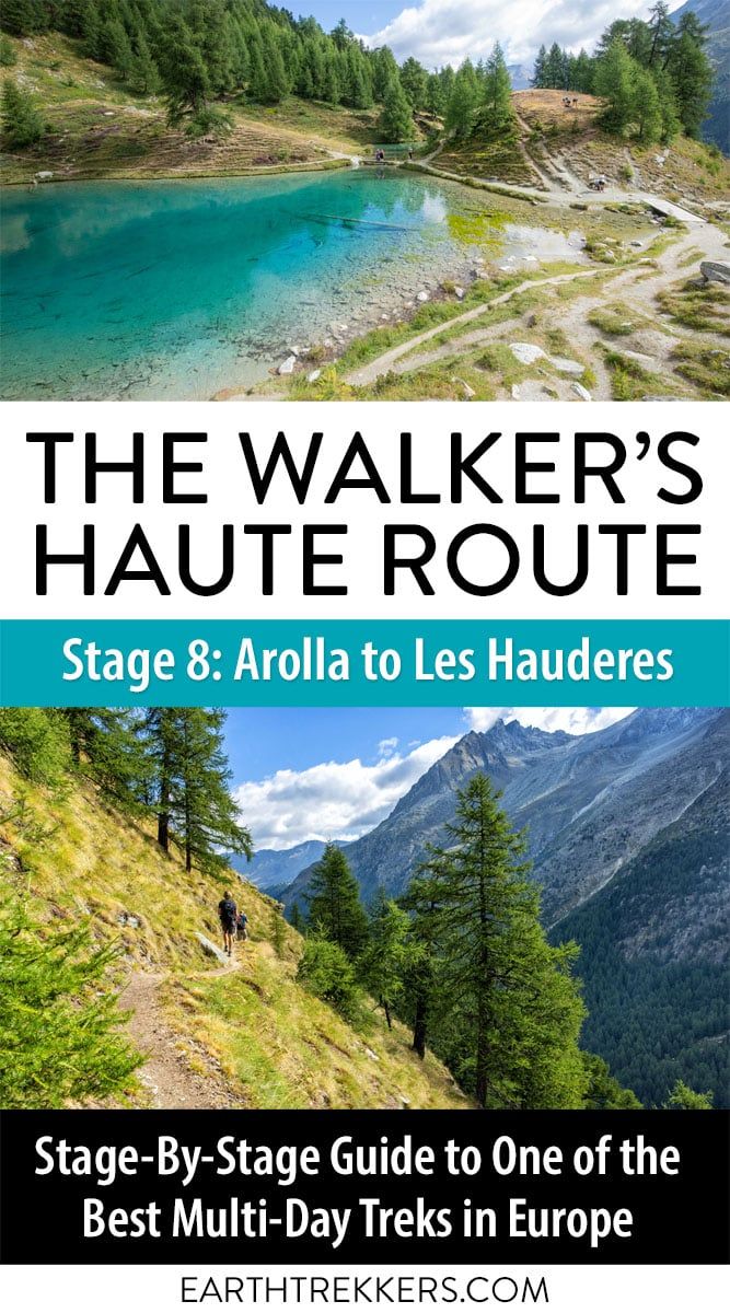
Beginning in Arolla, you will hike up and over hillsides, passing through several quaint hamlets and around a turquoise lake. Our day ended in Les Haudères, where we had booked our accommodations for the night. Les Haudères is a small town that sits in the valley below La Sage. Some sources list La Sage as the endpoint of stage 8 and it is just a short walk beyond Les Haudères to get here.
Walker’s Haute Route Stage 8 Hiking Stats
Distance: 8.9 km (5.5 miles)
Difficulty: Easy
Total Ascent: 350 m (1,150 feet)
Total Descent: 885 m (2,900 feet)
Lowest Elevation: 1,450 m (4,760 feet)
Highest Elevation: 2,145 m (7,035 feet)
Elevation in Arolla: 2,035 m (6,675 feet)
Elevation in Les Haudères: 1,470 m (4,825 feet)
Average Time: 3.5 hours; Our Time: 2 hours 45 minutes (including stops)
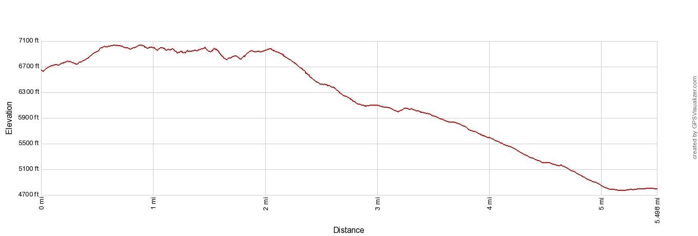
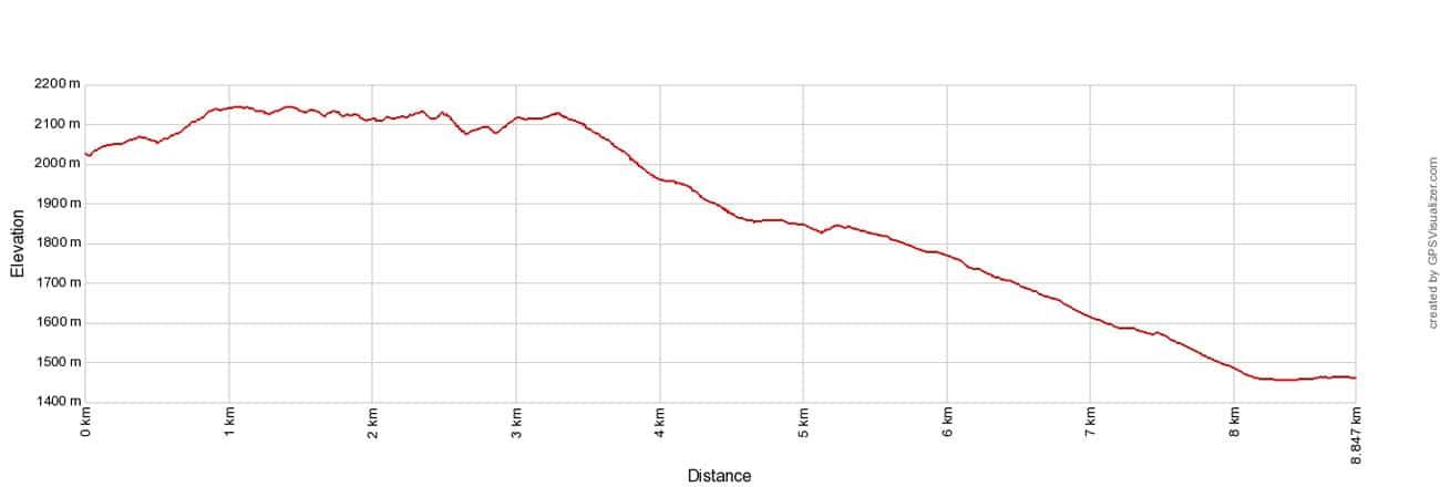
Walker’s Haute Route Stage 8 Elevation Profile
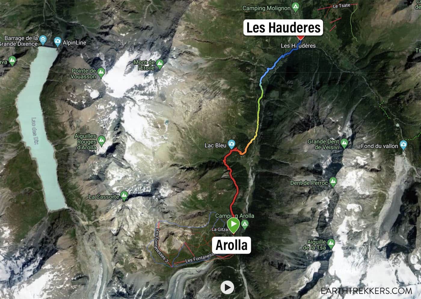
Haute Route Stage 8 Map (map generated from Julie’s Garmin Fenix watch). The red color indicates the highest elevation along the trail and the blue color is the lowest elevation along the trail.
Please practice the seven principles of Leave No Trace: plan ahead, stay on the trail, pack out what you bring to the hiking trail, leave areas as you found them, minimize campfire impacts, be considerate of other hikers, and do not approach or feed wildlife.
Walker’s Haute Route Stage 8: Overview of the Trail
To hike the Haute Route, we highly recommend following the trail descriptions in the book Trekking Chamonix to Zermatt, The Classic Walker’s Haute Route by Kev Reynolds. Below we list an overview of the day, so you know what to expect along the way. We also provide advice on where to eat and where to stay. Later in this guide, we list a few tips and trail clarifications to be used with the Trekking Chamonix to Zermatt book.
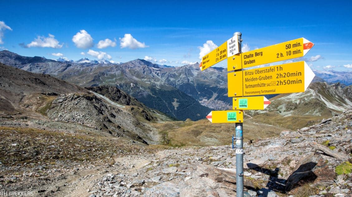
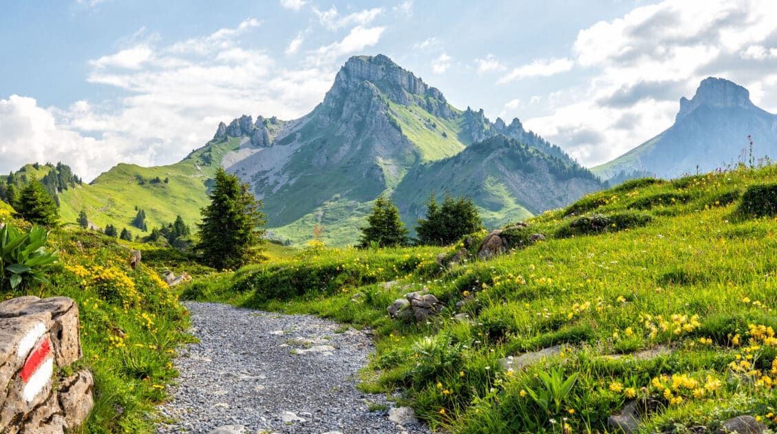
Arolla to Lac Bleu
Your day begins in the center of Arolla. A narrow, very easy to miss dirt path, which starts next to the Centre Alpin building, marks the start of Stage 8. Follow this trail as it wraps behind several buildings and instantly throws at you a short but steep climb.
Arolla
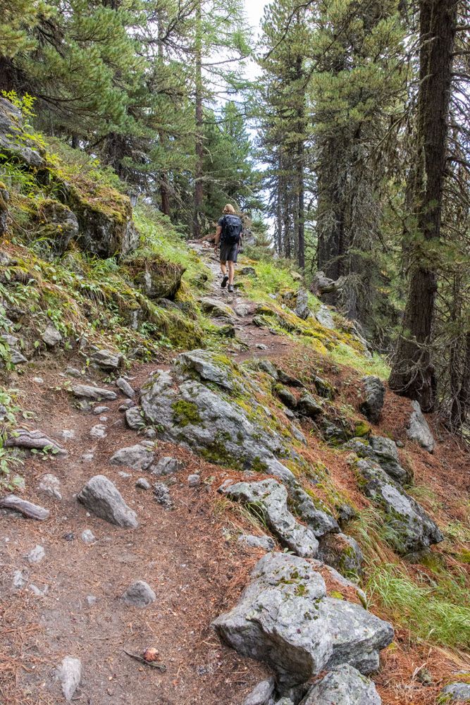
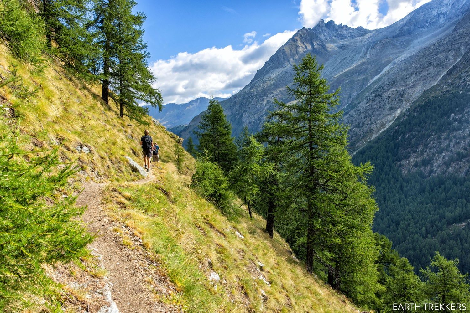
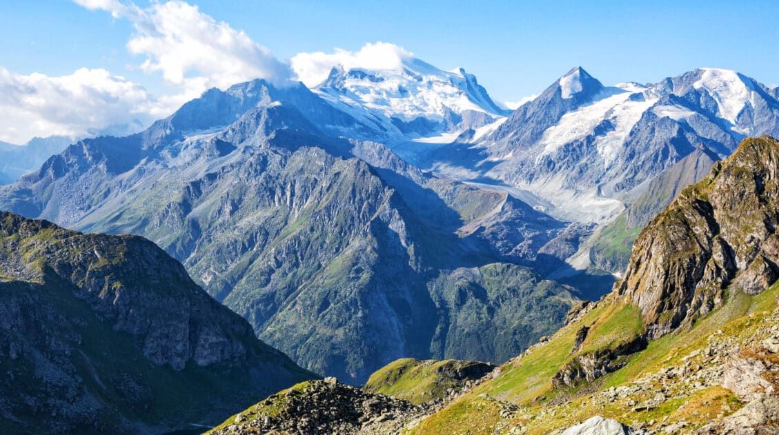
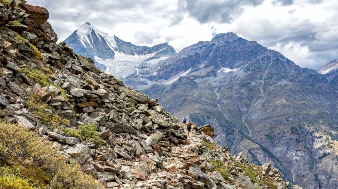
You’ll soon enter the treeline after departing Arolla. Once here, follow signs for Lac Bleu. The trail will climb up steeply through the woods for a bit, where the path can be cluttered with rocks and roots. On a wet day you’ll be very prone to slipping, so watch your step.
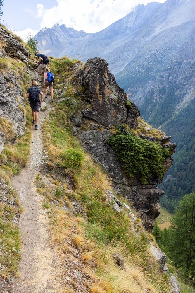
After a short but challenging climb, the trail will flatten out and continue on through the woods. There will be some sections where the trail opens up and then runs along the edge of a cliff.
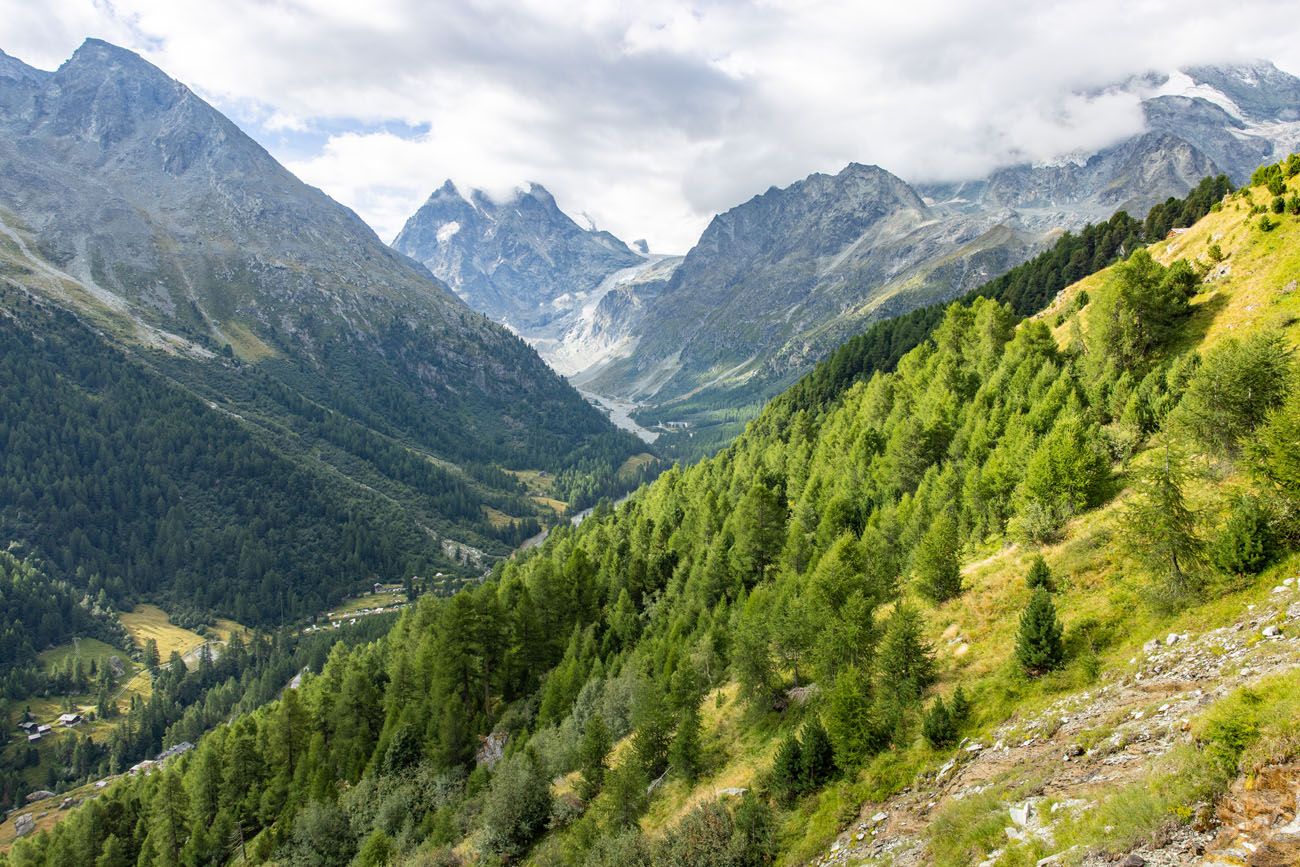
Looking back to Arolla
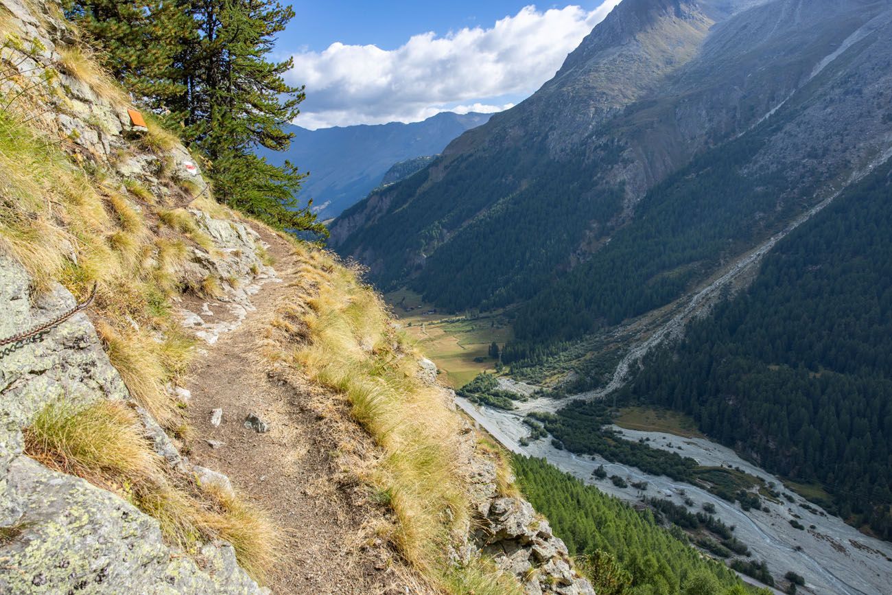
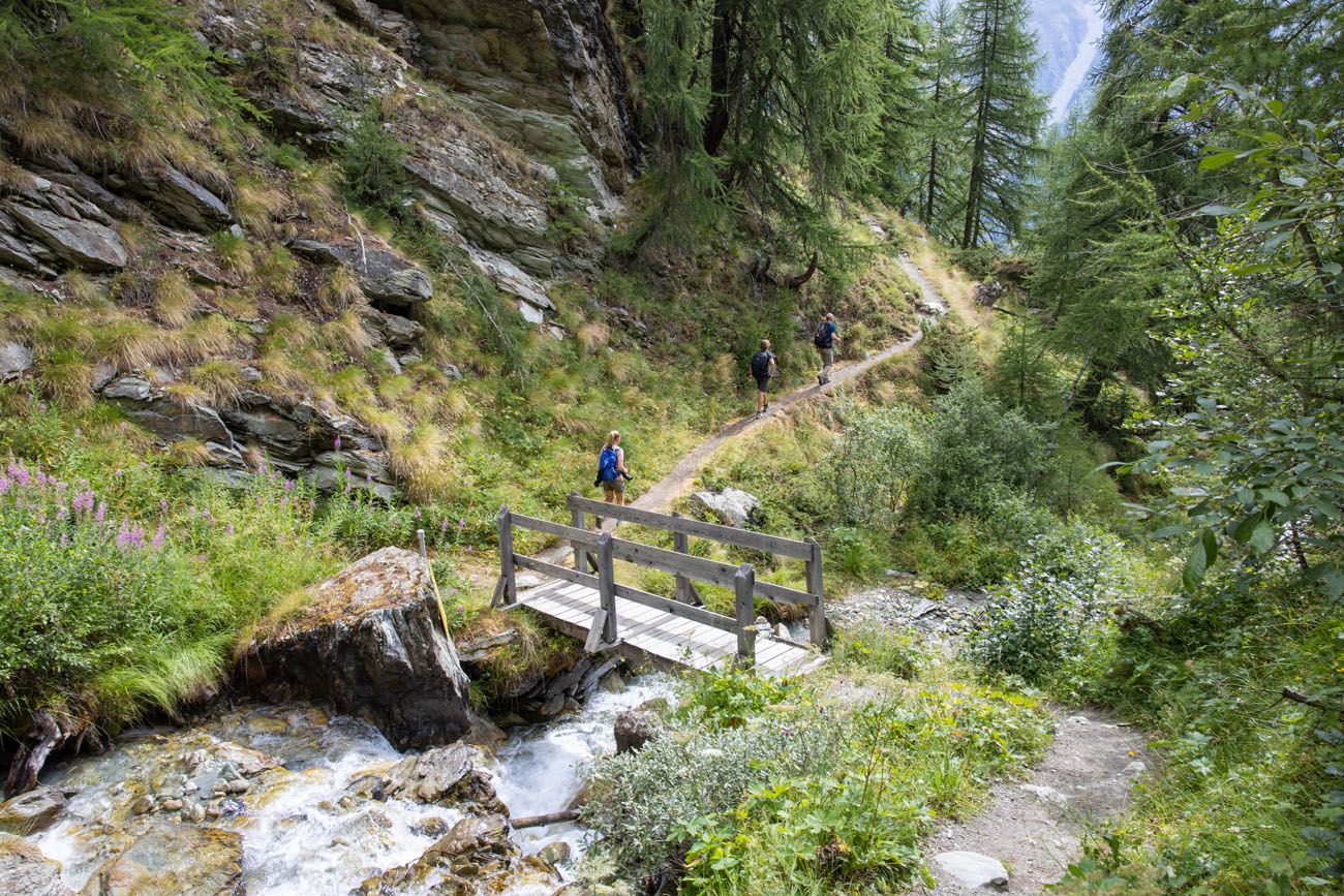
About 40 minutes into the hike, you’ll reach a few small wooden bridges that cross over tiny waterfalls. It’s here where the trail will bounce between steep, rocky descents and short climbs, which will persist until you leave the woods about 3 km (2 miles) into your hike.
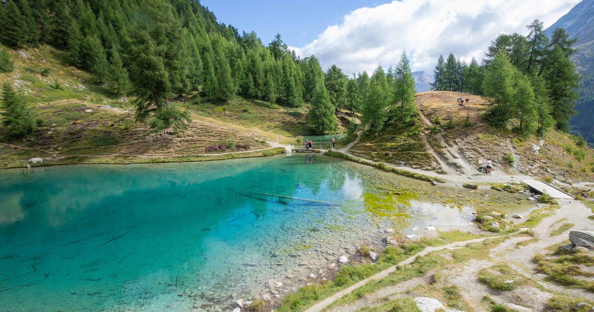
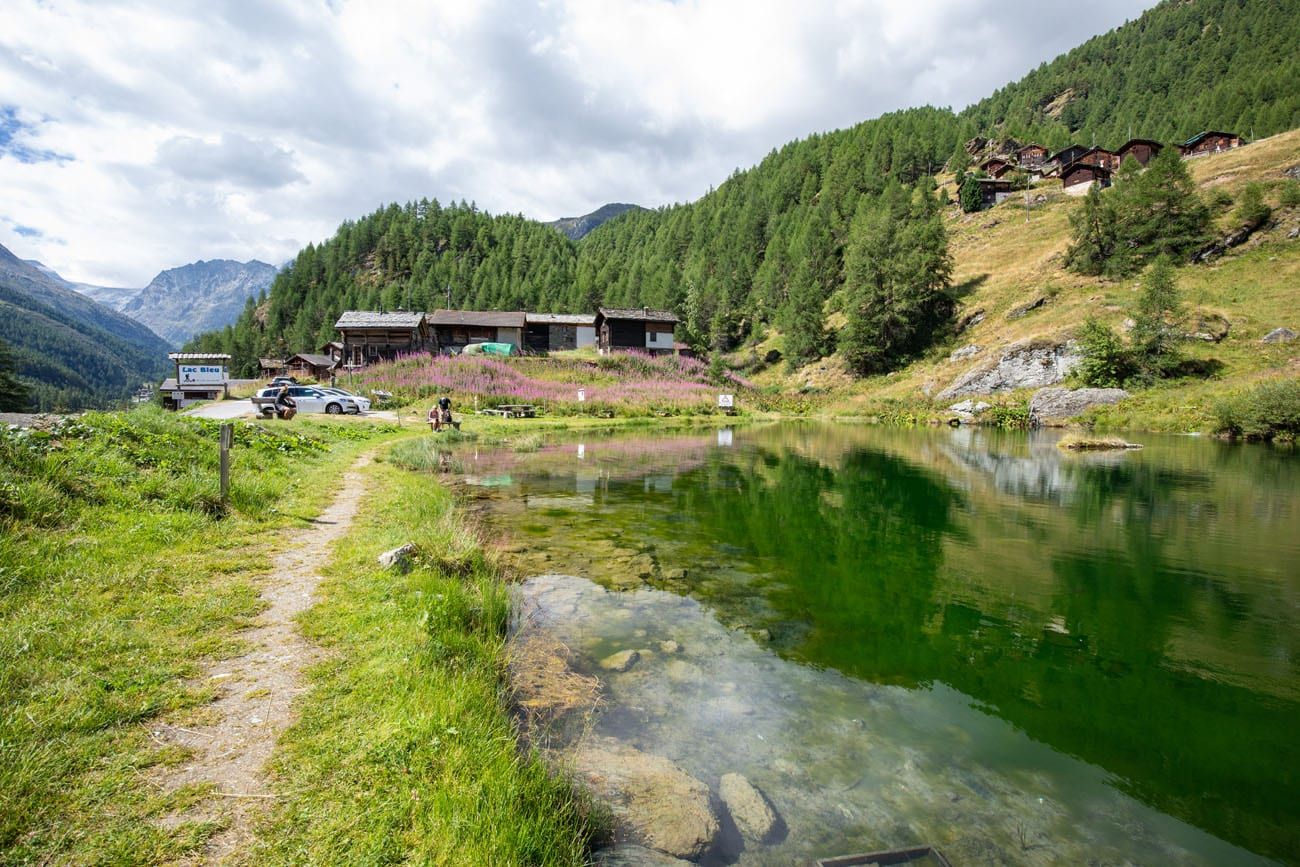
Soon after you will reach Lac Bleu, a tiny turquoise lake that honestly seems underwhelming compared to other lakes we’ve seen along the Haute Route. However, it’s a very calming spot to relax and take in the views. There is also a short path that circles the lake.
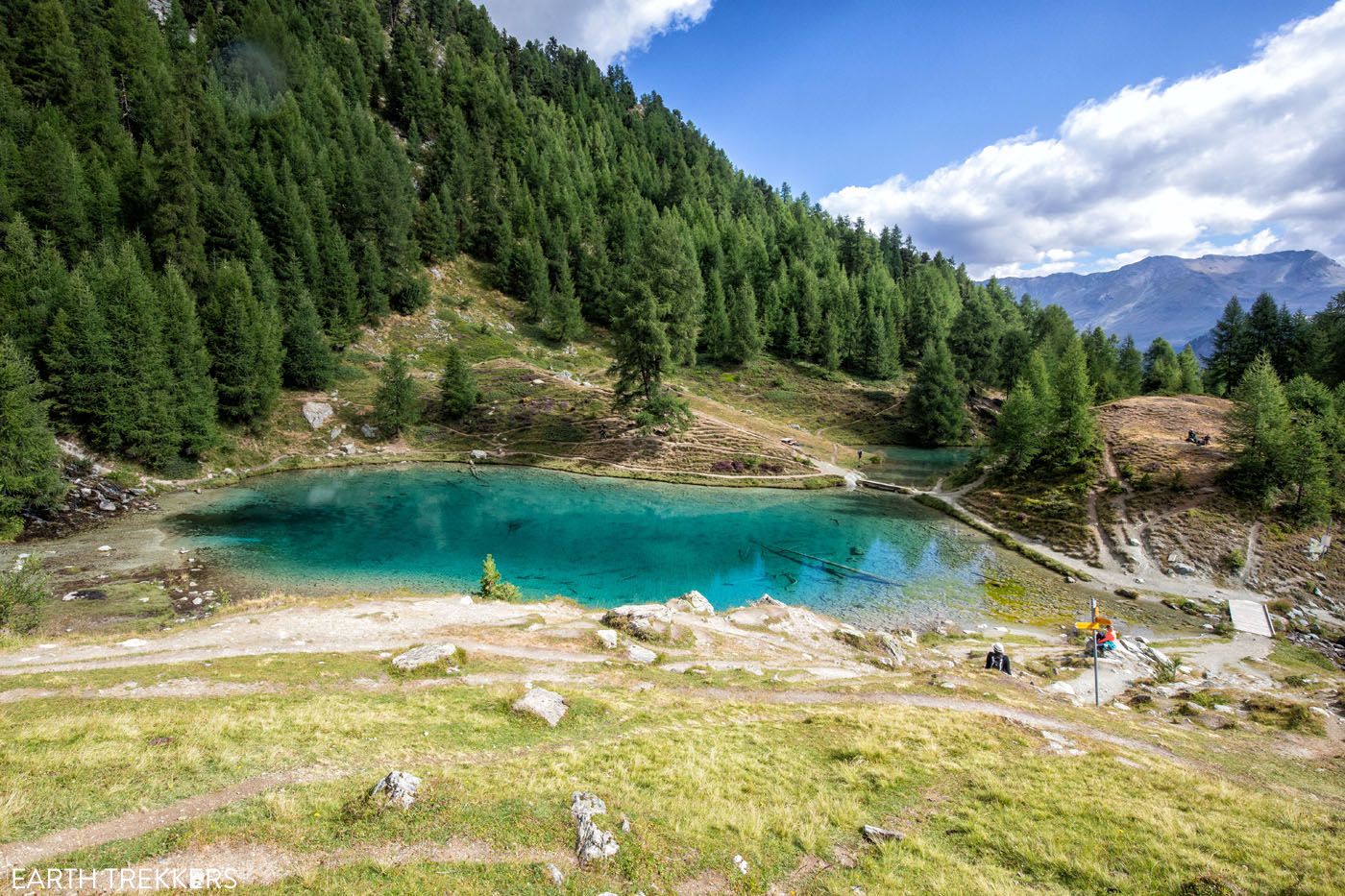
Lac Bleu
Lac Bleu to Les Haudères
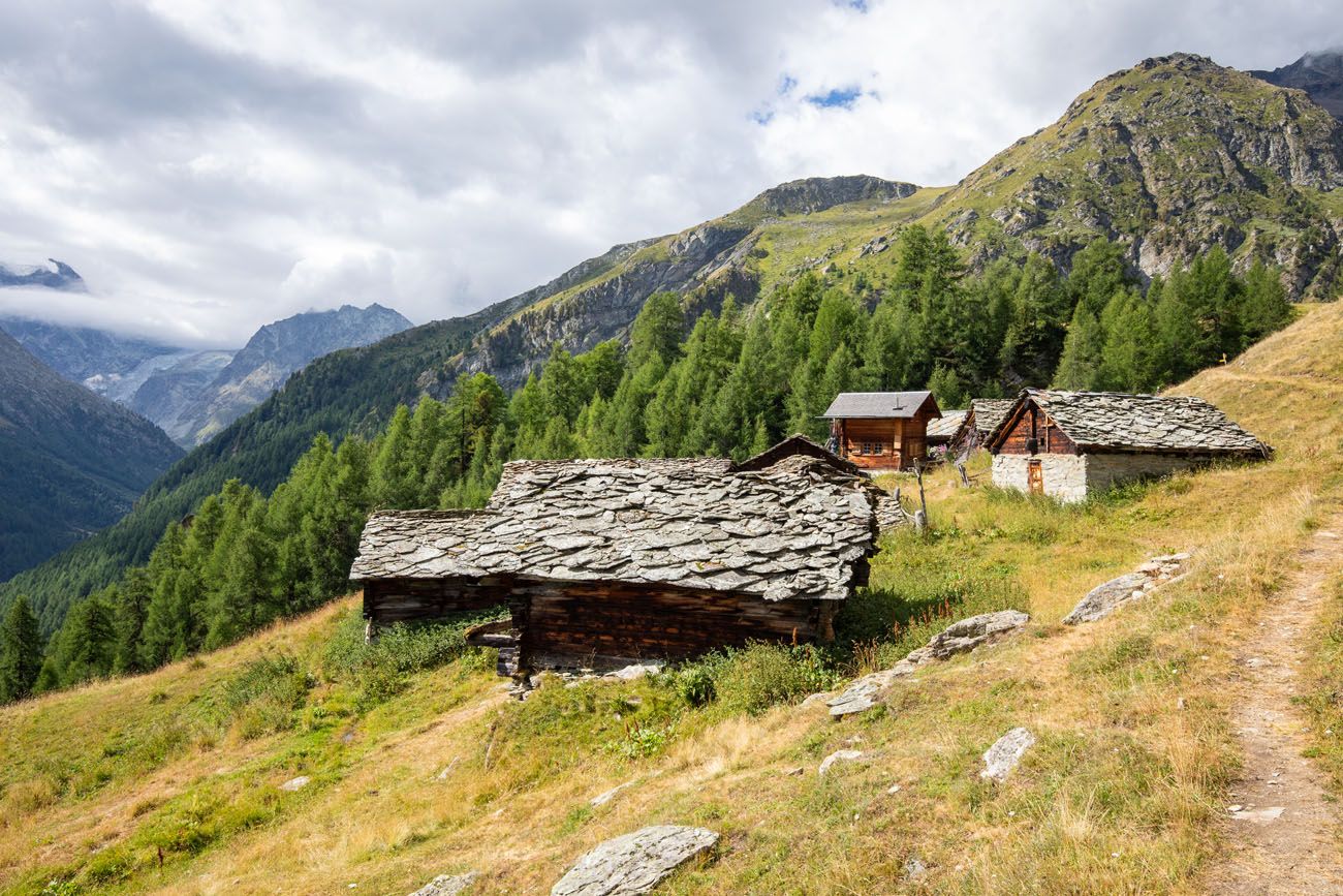
Continuing onwards, follow signs for La Gouille. Only a few minutes after leaving the lake you’ll come to Louché, a small Swiss hamlet. Check out this view.
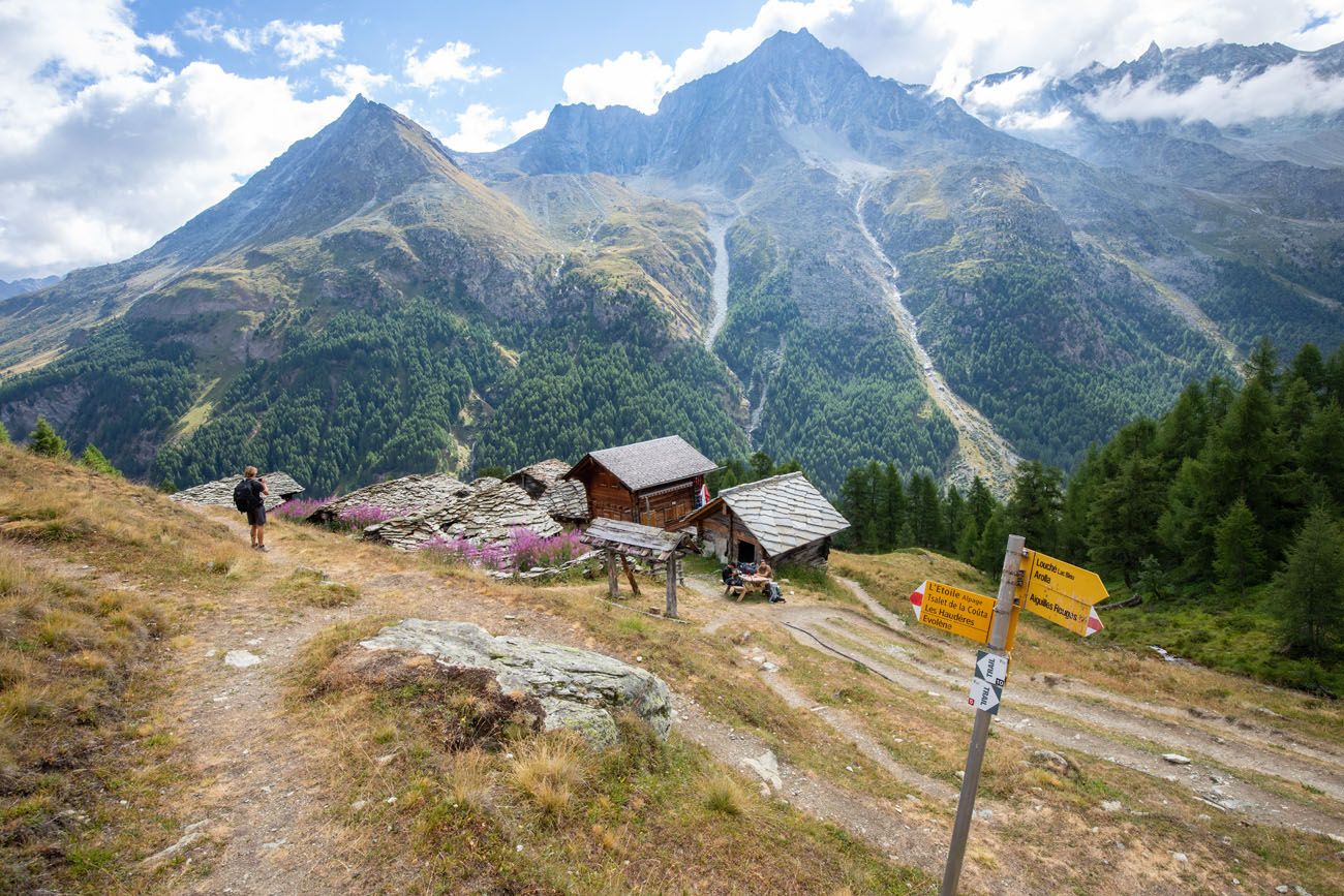
The trail leads below these cabins and will soon take you down a steady descent through the trees.
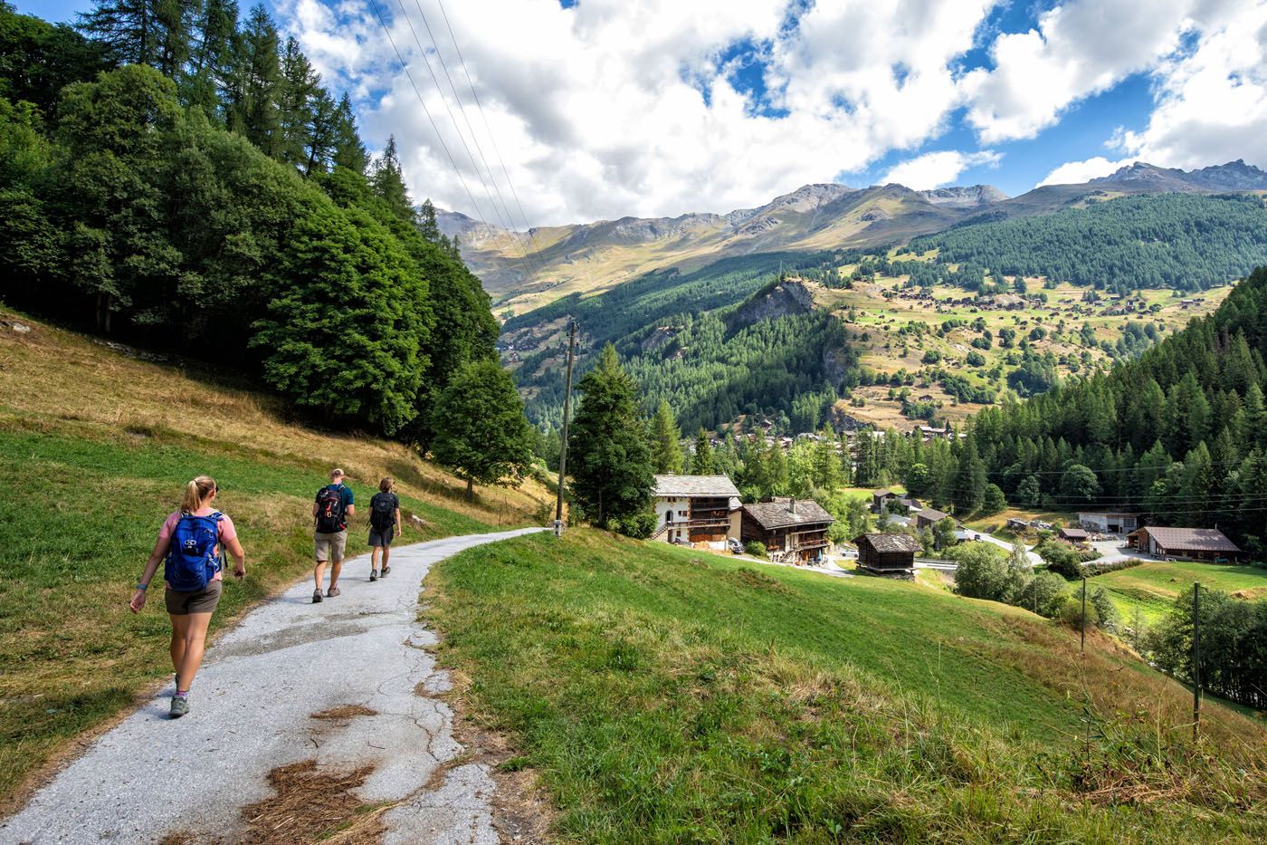
Once you emerge from the trees you will be in the small village of La Gouille. We noticed a lot of day hikers starting their hike to Lac Bleu from here.
La Gouille
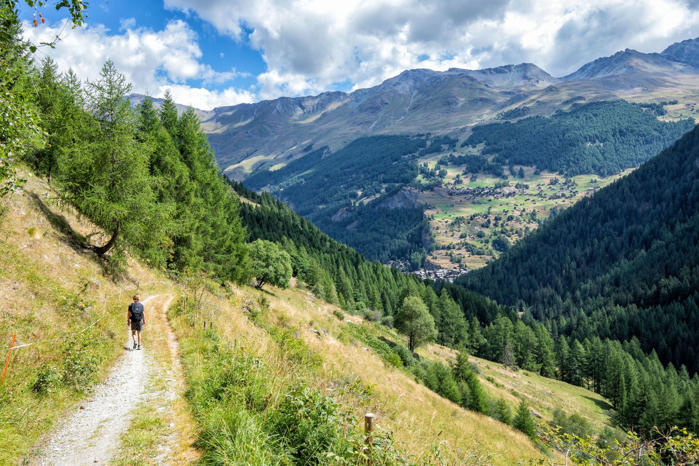
To continue on the trail, follow the road north for roughly 200 meters and then take a grass path downwards into the woods. From here you will gradually descend through the trees all the way down into Les Haudères. The grass path will turn into a gravel road early on.
Unfortunately, the path down to Les Haudères is very monotonous and you only get occasional views of the valley below, but the gradual descent lets you really pick up speed with ease.
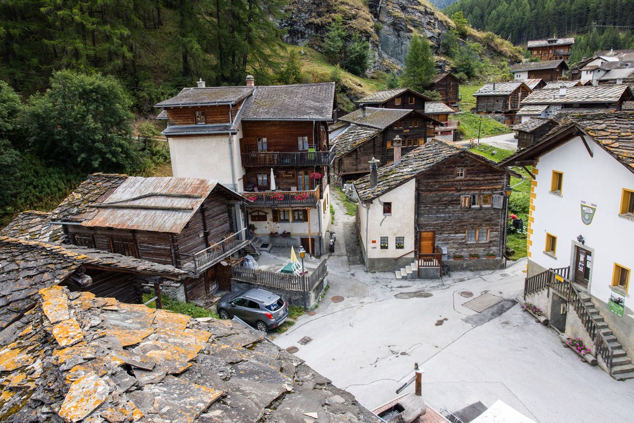
Before you know it, the gravel road will open up as it joins with a paved road at the outskirts of Les Haudères. Simply follow the road into town as you walk past old, wooden houses.
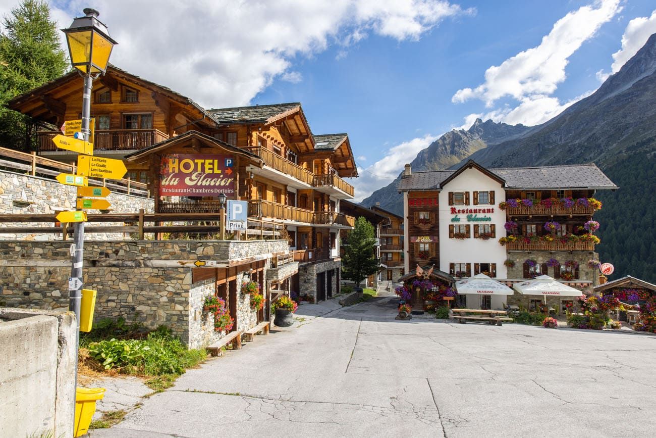
Entering Les Haudères
Officially Stage 8 ends in La Sage, a town above Les Haudères. However, in our case, we spent the night in Les Haudères since we found better accommodations here. All this means is we will have to tack on an extra few kilometers to tomorrow’s hike.
Les Haudères
The view of Les Haudères from our hotel room.
Les Haudères to La Sage
Distance: 2.1 km (1.3 miles)
Total Ascent: 212 m (700 feet)
Total Descent: 15 m (50 feet)
Our Time: 30 minutes (including stops)
Stage 9 is a big day that starts off with a very long climb. If you stay in La Sage, you will lessen the amount of uphill walking you will do on stage 9, so this is something to consider when you make your hotel reservations. We chose Les Haudères because Hotel Dents de Veisivi got great reviews (and we recommend it if you don’t mind a longer, more challenging stage 9).
Where We Stayed
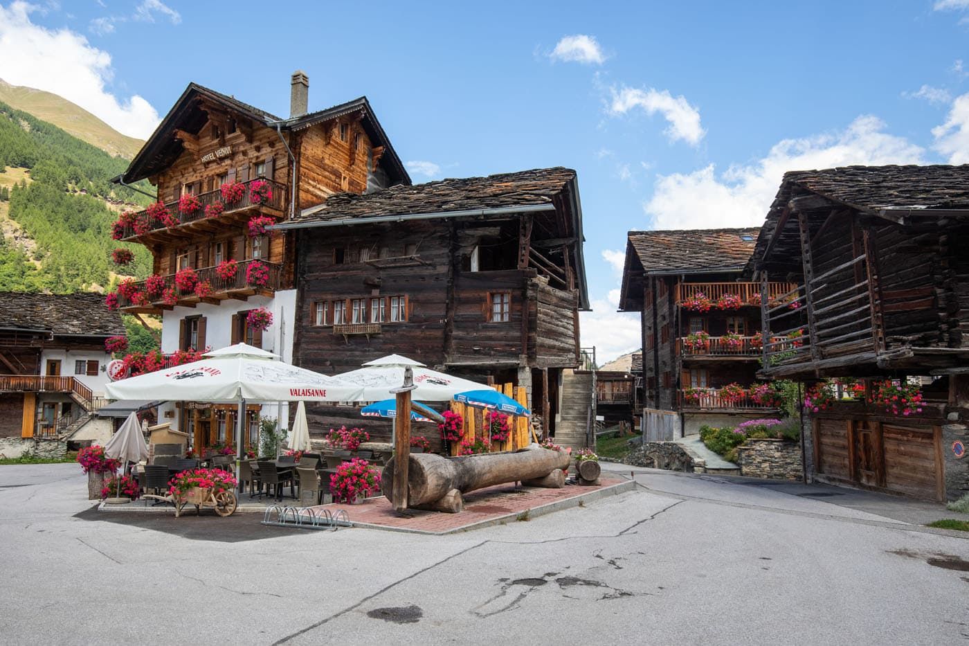
We stayed at Hotel Dents de Veisivi in Les Haudères. The town itself was unique compared to others we’ve stayed in on our trek, and Les Haudères definitely has a certain charm to it. Its bundles of old wooden buildings, outfitted with mossy stone roofs in a picturesque valley gave way to a very photogenic place to stay.
We grabbed both lunch and dinner at our hotel, and both meals were fantastic. The cozy atmosphere of the rooms fit well with the overall feel of Les Haudères, and we greatly enjoyed our time here as we rested up for the later stages of the Haute Route.
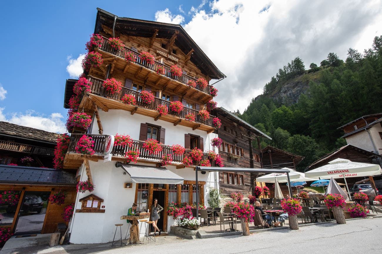
Hotel Dents de Veisivi
Alternative hotels are Hotel Les Mélèzes in Les Haudères and Hotel de la Sage in La Sage.
For a detailed list of accommodations for each stage, along with information on making your reservations, see our guide on How To Book Your Haute Route Accommodations.
Clarifications for the Walkers Haute Route Book
We were able to follow the Walker’s Haute Book by Kev Reynolds (the sixth edition from 2019; there is now an updated version) without ever needing to backtrack. But there were a few times during this stage we felt a little more clarification would have helped so we are providing that clarification here based on our experience. These notes were taken related to following the main route described under Stage 8.
Centre Alpin: The book mentions going between the buildings at Centre Alpin but the yellow & black waymarkers now direct you to stay in front of the buildings. A yellow & black waymarker is painted on the side of one of the buildings. After you go past that building the gravel track you are on will swing around to the left and then the trail you want to take (signed as Trail 10) will split off to the right. This takes you into the woods. Now that you are in the woods look for the signed junction mentioned in the book where you take the upper path (Chemin difficile – direction Louche, Lac Bleu and La Gouille).
Lac Bleu: When leaving Lac Bleu along the lake’s outflow, walk in front of the hamlet you see in front of you. This is Louche and you will see a buvette sign pointing to one of the houses. You will be at the hamlet level. If you are above the hamlet then you are following the wrong trail.
La Gouille: There is a water trough where the track through La Gouille meets the main road.
St Barthelemy: As you approach St Barthelemy the trail you are on will reach a gravel road at a hairpin bend. The white chapel with no steeple is visible in front of you. Follow the gravel road in front of the chapel and downhill. Beyond this is the fork mentioned in the book.
Les Haudères: Just before reaching Les Haudères, there is a water trough located between the “group of handsome old timber houses” and “main road” referenced in the book.
There is a water trough located by Hôtel des Haudères and another by Restaurant Dents de Veisivi. Google Maps can be helpful to find these.
As we explored the old centre of Les Haudères we found a signpost pointing to La Sage at an intersection of old centre streets that connected Hôtel des Haudères and Restaurant Dents de Veisivi with Route du Vieux Village. After following this we immediately turned left at another sign pointing to La Sage. This began the climb to La Sage referenced in the book.
More Information about the Haute Route
In our Walker’s Haute Route Planning Guide, we have links to all of our articles about the Walker’s Haute Route, including information about each stage, how to plan your trek, what to expect, and more.
For an overview of all 14 stages of the Walker’s Haute Route, with overall hiking stats, map, elevation profile, and lists of the most difficult stages, easiest stages, and our personal favorites, check out our Guide to the Walker’s Haute Route Stages.
Stages of the Haute Route: Below are our guides to each stage of the Haute Route.
- Haute Route Stage 1: Chamonix to Argentière
- Haute Route Stage 2: Argentière to Col de Balme to Trient
- Haute Route Stage 3: Trient to Fenetre d’Arpette to Champex-Lac
- Haute Route Stage 4: Champex-Lac to Le Chable
- Haute Route Stage 5: Le Chable to Cabane du Mont Fort
- Haute Route Stage 6: Cabane du Mont Fort to Cabane de Prafleuri
- Haute Route Stage 7: Cabane de Prafleuri to Arolla
- Haute Route Stage 9: Les Haudères to Lac de Moiry
- Haute Route Stage 10: Lac de Moiry to Zinal
- Haute Route Stage 11: Zinal to Gruben
- Haute Route Stage 12: Gruben to St. Niklaus
- Haute Route Stage 13: St. Niklaus to the Europahütte
- Haute Route Stage 14: Europahütte to Zermatt
If you have any questions about how to hike the Haute Route Stage 8, or if you want to share your experience, let us know in the comment section below.
You Might Also Like
Ultimate Guide to the Walker’s Haute Route
Pinterest Facebook Flipboard Walker’s Haute Route The Walker’s Haute Route is one of the most rewarding and memorable multi-day walks in Europe. On this trek, hikers cross 10 of the highest mountain passes in the French and Swiss Alps, as they walk from Chamonix, France to Zermatt, Switzerland. Walking from Chamonix to Zermatt takes you to remote mountain […]
Walker’s Haute Route Stages: An Overview of All 14 Stages
The Walker’s Haute Route is a multi-day trek from Chamonix, France to Zermatt, Switzerland. On this walk, hikers will cross 10 mountain passes, walk through small towns and through rugged, remote landscapes, and get to experience a less touristy side of the Swiss Alps. There are several routes that take hikers from Chamonix to Zermatt. […]
How To Book Your Walker’s Haute Route Accommodations
Along the Walker’s Haute Route, there are a variety of accommodation types, from mountain huts to 5-star hotels, from dormitories to apartments, and from shared bathrooms to private bathrooms. You will have the opportunity to experience a combination of all of these since you will be staying in a new place at the end of […]
How To Plan Your Walker’s Haute Route Experience
The Walker’s Haute Route is a 14-stage trek from Chamonix, France to Zermatt, Switzerland. It is a tough yet rewarding experience through the French and Swiss Alps that crosses 10 mountain passes and offers incredible scenery along the way. It is a beast of a trek! It took us 13 days, averaging 16 km (10 […]
Switzerland Travel Guide: How to Plan a Trip to Switzerland
Switzerland Travel Guide Looking to hike some of the world’s most beautiful mountain landscapes, stroll through colorful old towns, and dine on some fondue? Then Switzerland is the perfect place for you! Visit the Bernese Oberland, a hikers paradise filled with towering mountains, alpine meadows, historic cogwheel trains, and quaint villages. Or, relax at Switzerland’s […]
Best Hikes in Europe: 25 Incredible Hikes for Every Level
From the dramatic cliffs of Norway to the jagged peaks of the Dolomites and the volcanic landscapes of Iceland, Europe is packed with some of the most unforgettable hikes in the world. In this guide, we share our favorite hikes in Europe, trails that stand out for their scenery, uniqueness, and overall experience from start […]
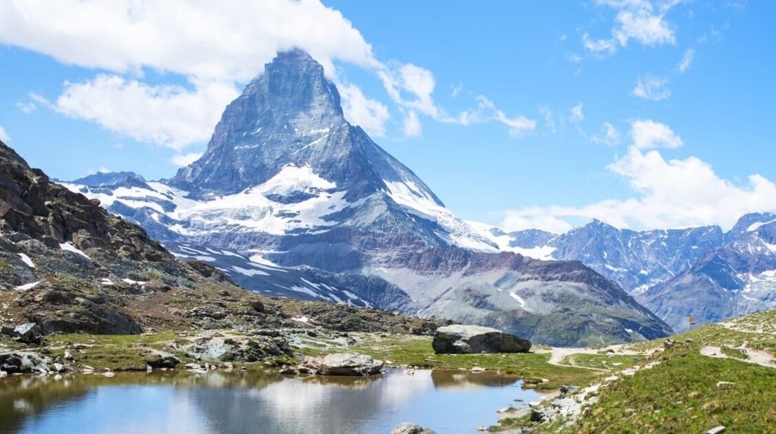
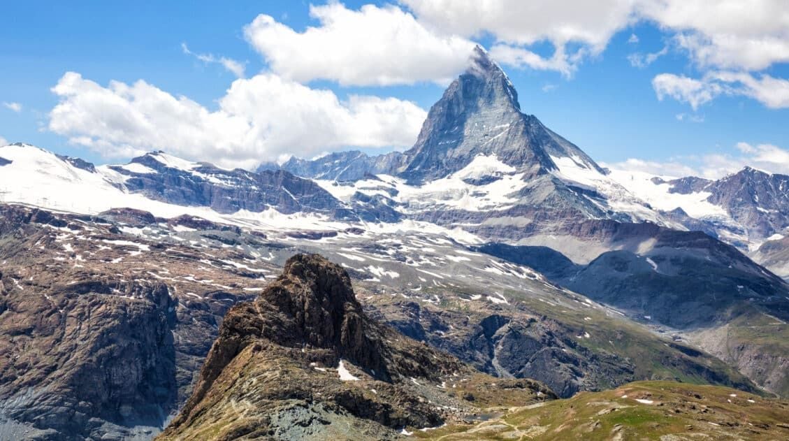
20 Amazing Things to Do in Zermatt, Switzerland
Zermatt is an idyllic mountain village tucked away in the Swiss Alps. The mighty Matterhorn dominates the skyline, creating one of the most unique alpine landscapes in Europe. Explore the hiking trails, journey up higher into the mountains by cable car and train, stroll the scenic streets of Zermatt, and go skiing all year long. […]
Complete Guide to the Hörnlihütte Hike (Map, Trail Stats & Photos)
The Hörnlihütte (Hörnli Hut) is a lodge built at the base of the Matterhorn. For thrill seeking rock-climbers, the Hörnlihütte marks the start of the ascent up to the peak of the Matterhorn. Even if you do not wish to stand on top of the Matterhorn, simply hiking to and from the Hörnlihütte makes for […]
12 Epic Day Hikes in Zermatt (+ Trail Stats, Photos & Map)
One of the best ways to explore Zermatt is on foot. Hiking trails climb high into the mountains above Zermatt, past Swiss hamlets, through scenic valleys and rocky gorges, and to some of the best viewpoints of the Matterhorn. The network of cable cars and trains takes you up into the mountains, so for the […]
The Ultimate Zermatt Itinerary for 1 to 4 Days
How many days do you need in Zermatt? How do you plan the perfect Zermatt itinerary? The answer to these questions depends on several factors. How much time do you have? Do you want to get out and hike the trails or simply ride the cable cars to viewpoints of the Matterhorn? What time of […]
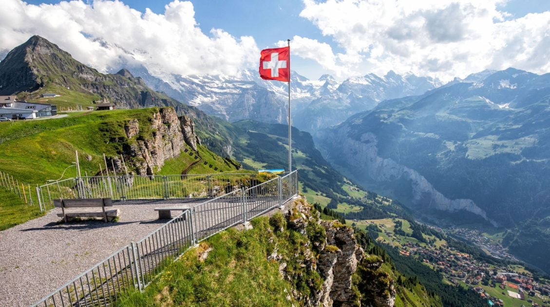
20 Amazing Things to Do in the Jungfrau Region of the Bernese Oberland
Towering mountains, alpine meadows, soaring cable cars, historic cogwheel trains, scenic walking trails, quaint villages and hamlets…this is the Jungfrau region of the Bernese Oberland. In this guide, we cover the very best things to do in the Jungfrau region, ranging from scenic cable car rides to hiking some of the most beautiful trails in […]
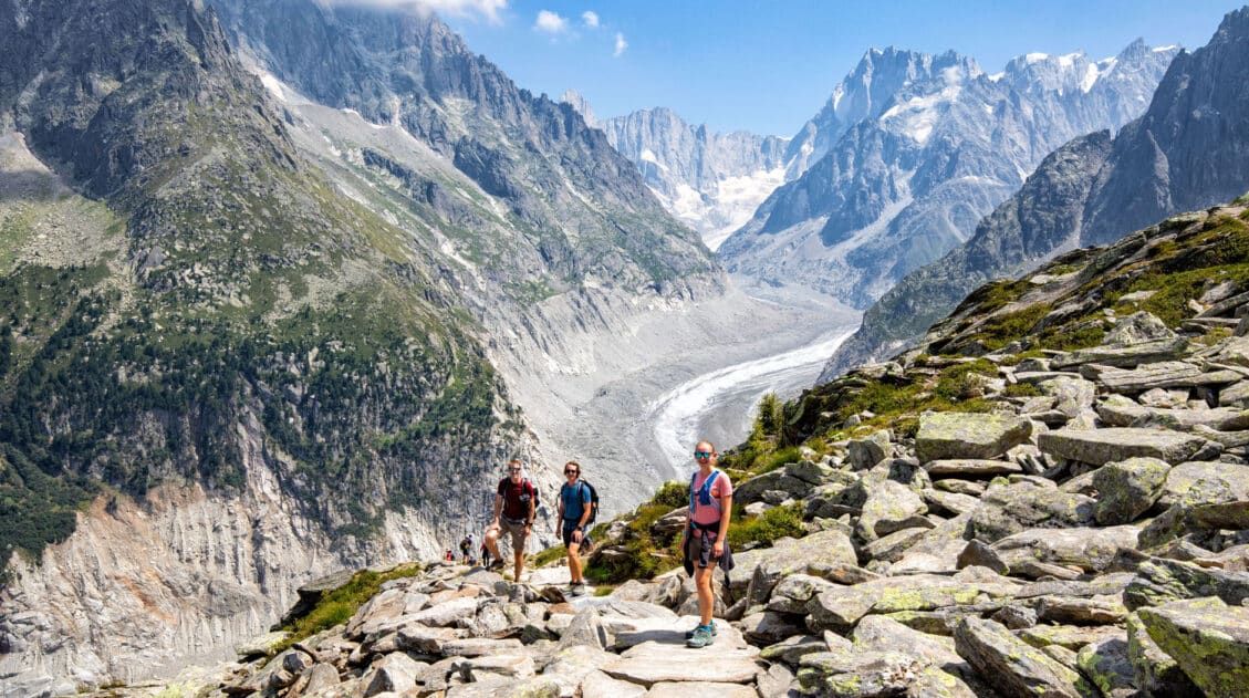
Grand Balcon Nord Hike: Best Direction, Hiking Stats & Tips
The Grand Balcon Nord is one of the best hikes in Chamonix. This trail runs above the valley, offering sweeping views of Mont Blanc at one end and Mer de Glace, France’s largest glacier, at the other. Tim, Tyler, Kara, and I hiked it in July as part of a five-day visit to Chamonix before […]
24 Best Things to Do in Chamonix, France in the Summer
Discover the best things to do in Chamonix, France in the summer. This guide covers the top cable cars, hiking trails, glaciers, and adventures in Chamonix, based on our firsthand experience hiking and exploring the area. Chamonix is one of the most spectacular mountain destinations in Europe, and in the summer, it’s an outdoor playground […]

Leave a Comment