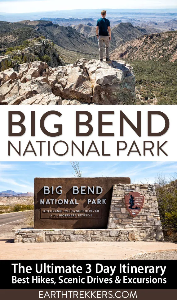
Three days in Big Bend National Park is the ideal amount of time to experience all three regions of the park: the Ross Maxwell Scenic Drive, the Chisos Basin, and Rio Grande Village.
We visited in early March and spent our days hiking slot canyons, crossing the border into Mexico, and standing at the edge of the Rio Grande, with one of the most unexpectedly beautiful hikes in the park tucked into day three. This itinerary covers exactly how to do it.
Note: The proposed construction project in Chisos Basin for 2026 has been canceled.
At a Glance: 3 Days in Big Bend
DON’T MISS | Santa Elena Canyon, Lost Mine Trail, Ernst Tinaja, Balanced Rock, stargazing
DAY 1 | Ross Maxwell Scenic Drive + Santa Elena Canyon
DAY 2 | Chisos Basin
DAY 3 | Rio Grande Village + Boquillas del Carmen
GETTING THERE | Fly into El Paso (5 hrs) or Midland-Odessa (3.5–4 hrs)
BEST TIME TO VISIT | October to April
ENTRANCE FEE | $35 per vehicle (valid 7 days)
PASSPORT REQUIRED? | Yes, to cross into Boquillas del Carmen
April 2026 Update: Updated Boquillas del Carmen Port of Entry hours (now open Friday–Monday year-round). Added camping options and FAQ.
Overview of Big Bend National Park
Big Bend National Park sits in the southwestern corner of Texas, where the Rio Grande curves sharply south, creating the “big bend” that gives the park its name. For 118 miles, the river forms the border between the park and Mexico. At 800,000 acres, it’s one of the largest and most remote national parks in the contiguous United States, and also one of the least crowded.
The park is built around three distinct landscapes and understanding them is the key to planning your time well.
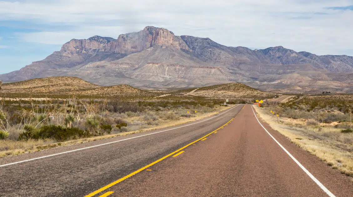
The Chisos Mountains run through the center of the park. It’s the only mountain range in the US located entirely within a national park and is home to the most popular hiking trails.
The Ross Maxwell Scenic Drive cuts through the western desert, past volcanic formations, canyon overlooks, and the iconic Santa Elena Canyon on the Rio Grande.
To the east, the Rio Grande Village region is where you’ll find the hot springs, the border crossing into Mexico, and access to some of the park’s most remote terrain, including Ernst Tinaja.
Each region looks and feels completely different. That’s exactly why spending one day in each is the best way to experience Big Bend in three days.
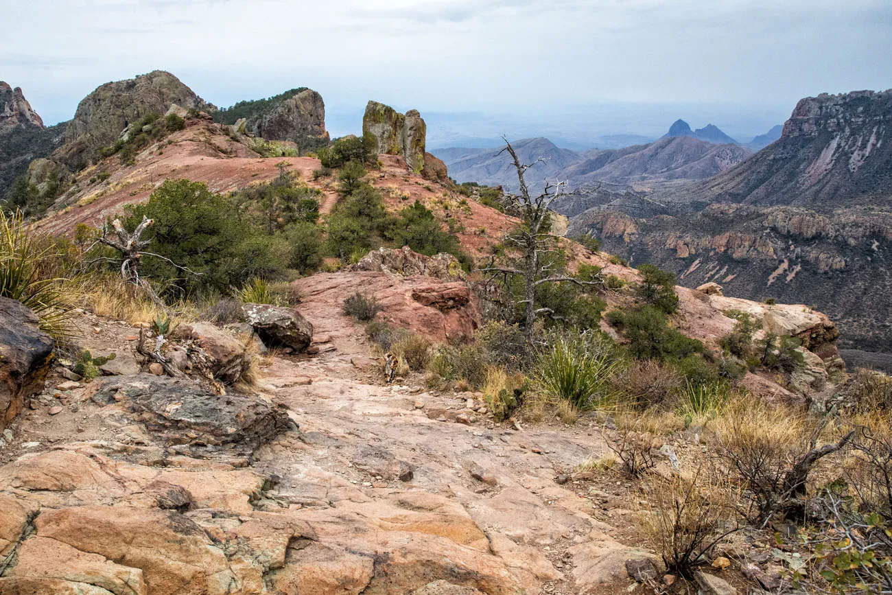
View from the trail to Emory Peak
How to Get to Big Bend National Park
The closest airport is Midland International Air and Space Port in Midland-Odessa, Texas. It takes between 3.5 and 4 hours to drive to Big Bend, with a distance of 220 miles.
El Paso is a farther away but might be a better option, since it is a larger airport with more flight options. It takes 5 hours to drive to Big Bend, with a distance of 315 miles.
We flew into El Paso and drove to Big Bend National Park. It is somewhat of a monotonous drive, on a mix of multi-lane highways and two-lane roads. The speed limit is high (usually around 70 mph) so you can cover a lot of distance quickly.
San Antonio is another option. From here, it takes just over 6 hours to drive to Big Bend National Park.
Regardless of which airport you choose, you’ll need a car. There is no public transportation to or within Big Bend National Park, and you’ll be driving between regions every day.
Best Time to Visit Big Bend National Park
We visited the first week of March, just ahead of Spring Break. Hotels were nearly fully booked and the park was noticeably busy, but if you’ve been to Yellowstone or the Grand Canyon at peak season, Big Bend will still feel quiet by comparison. The weather was ideal: warm and sunny during the day, cool enough at night to sleep comfortably. If I were planning the trip again, I’d go in February, when temperatures are a little cooler but crowd levels are half of those in March.
One thing worth knowing: autumn brings more rainfall than spring, so if clear skies are a priority, spring has a slight edge. Summer heat is no joke and temperatures regularly exceed 100°F in the desert, and the National Park Service issues heat warnings from May onward.
- Late winter to early spring (February – April): Best weather, most popular — book accommodation months in advance
- Late spring through summer (May – September): Very hot; possible if you hike early and stay hydrated
- Fall into early winter (October – December): Excellent conditions, fewer crowds, some chance of rain
Big Bend National Park appears in our Best US National Parks Month-By-Month series as a great park to visit in February, March, and November.
3 Days in Big Bend Itinerary
With 3 days in Big Bend, I recommend spending one day in each of these sections of the park: the Ross Maxwell Scenic Drive region, Chisos Basin, and the Rio Grande Village.
You can do these days in any order.
⚠️ Plan Your Days Around Boquillas The Port of Entry to Boquillas del Carmen is only open Friday through Monday. If crossing into Mexico is on your list, make sure your Rio Grande Village day falls on one of those days. The three days of this itinerary can be done in any order, so plan accordingly before you arrive. Get updates about when the Port of Entry is open (this tends to change frequently) on the National Park Service website.
Day 1: Ross Maxwell Scenic Drive
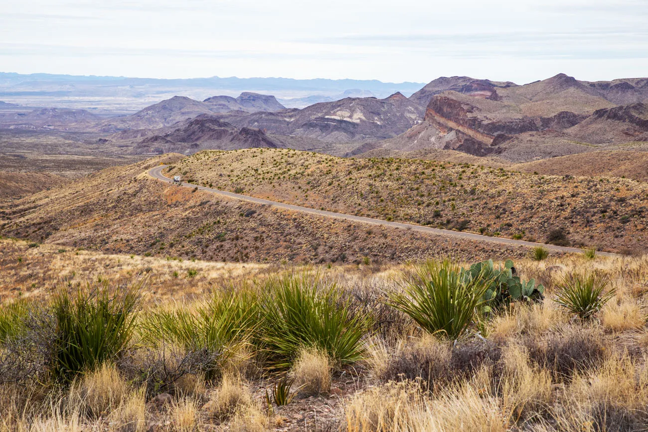
Ross Maxwell Scenic Drive is a 30-mile road through the western desert of Big Bend. The road starts near Panther Junction and ends at Santa Elena Canyon, so the whole day is essentially building toward a payoff. Even a straight drive with no stops takes about an hour, but with overlooks, short hikes, and the canyon trail at the end, plan on a full day.
Get out of the car as often as you can. The stops below range from five-minute overlooks to a 1.7-mile trail, and the cumulative effect is what makes this day memorable. We especially loved Tuff Canyon — it’s easy to breeze past but worth the short walk — and Santa Elena Canyon is not to be missed.
Note: All driving routes in this Big Bend itinerary start in Terlingua, since this town has several hotels and restaurants, making it one of the most popular places to stay on a visit to Big Bend National Park.
How to Use This Map: Click the tab in the top left corner of the map to see a list of the points of interest and to turn layers on/off. Click the icons on the map to get more information about each point of interest.
To take this map with you, click the star next to the title of the map which adds it to your Google account. Next, within your Google Maps app, select ‘Saved’ and then select ‘Maps’. This map title will now appear in your list.
Sotol Vista Overlook
This overlook is worth the quick stop. From here, you get almost panoramic views of the park and can see the Ross Maxwell Scenic Drive twisting and turning through the Chisos mountain range.
Sotol Vista Overlook
Lower Burro Mesa Pour-Off
Distance: 1 mile | Difficulty: Easy | Time: 45 minutes
This quick and easy hike takes you through a large canyon, ending at the base of a giant cliff. At the end of the trail, you are standing at the base of Burro Mesa and the spot where the water pours off of the cliff during rainstorms.
Lower Burro Mesa Pour-Off
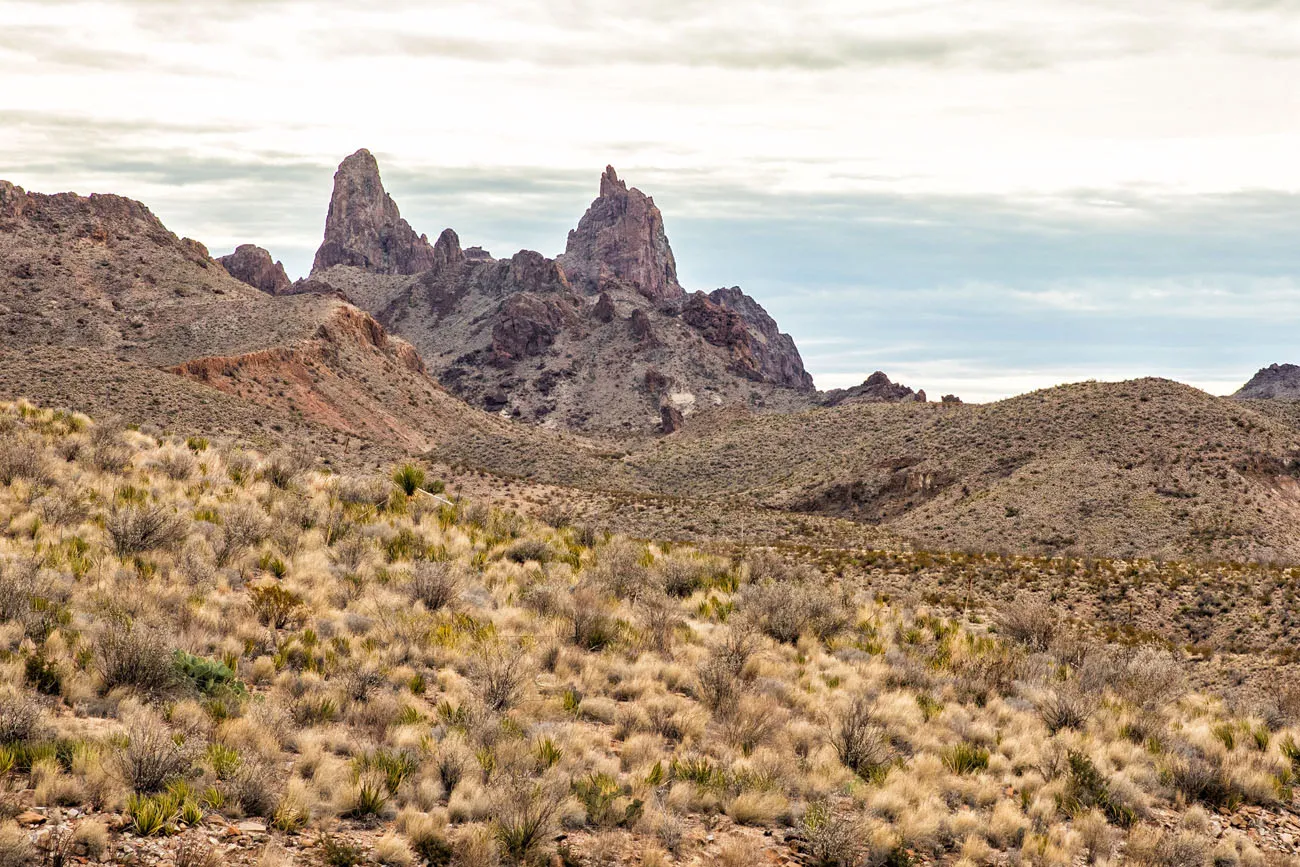
Mule Ears Viewpoint
The Mule Ears are a unique rock formation that looks like, you guessed it, mule ears. You can see the Mule Ears from an overlook along Ross Maxwell Scenic Drive but for a closer view, hike the Spring Trail (3.8 miles, moderate, 2 to 3 hours).
Mule Ears
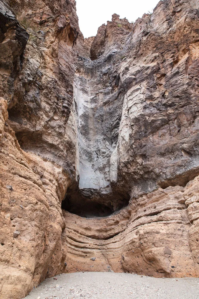
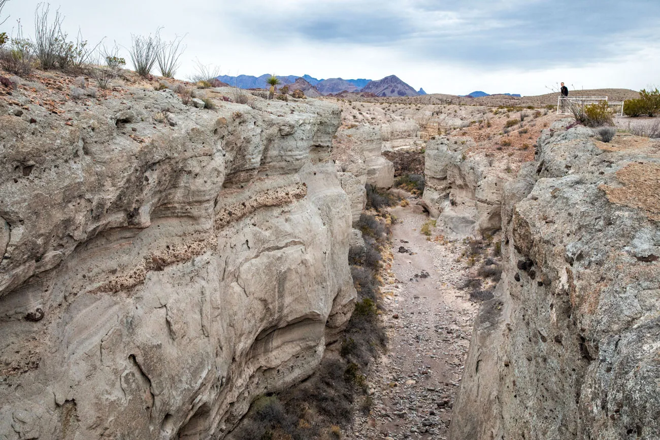
Tuff Canyon
Distance: 0.75 miles | Difficulty: Easy | Time: 30 minutes
We really liked this. It’s a short, easy stroll to a viewing platform where you can look into Tuff Canyon. The upper trail makes a loop to overlooks of the canyon. If you want to explore more, take the spur trail and walk through the canyon.
Tuff Canyon
Santa Elena Canyon Overlook
You will drive right by this viewpoint as you approach Santa Elena Canyon, so if you are curious, it only takes a few minutes to stop and take in the view.
In my opinion, it’s not all that impressive. What you are about to see next is much more thrilling. So, if you skipped anything on this drive, the Santa Elena Canyon Overlook would be the thing to skip.
Santa Elena overlook
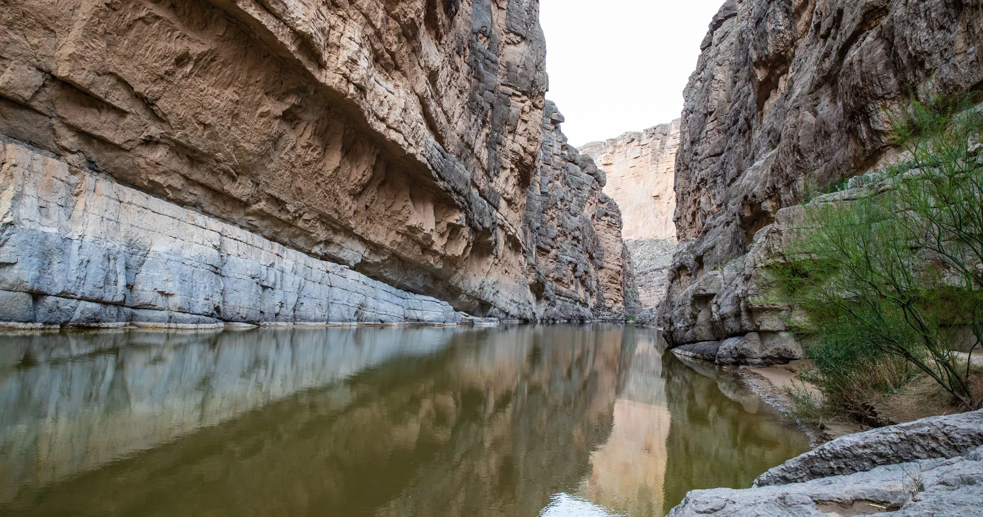
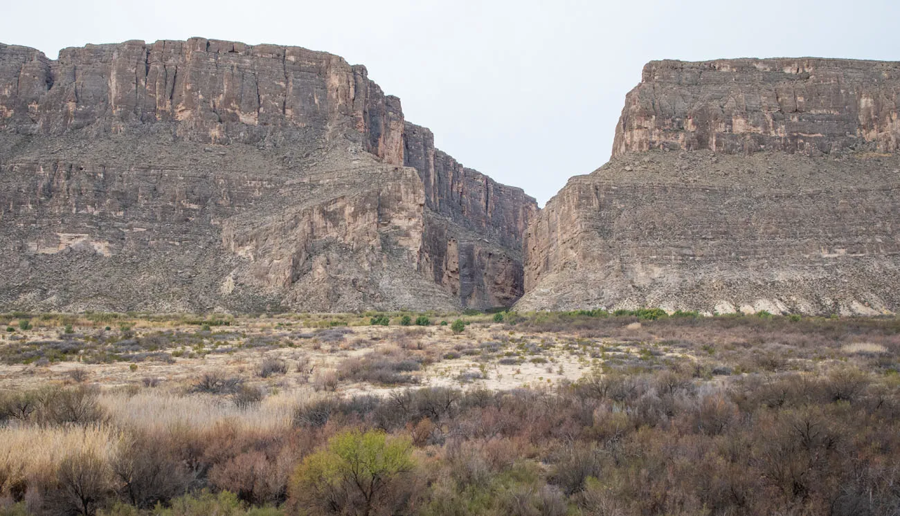
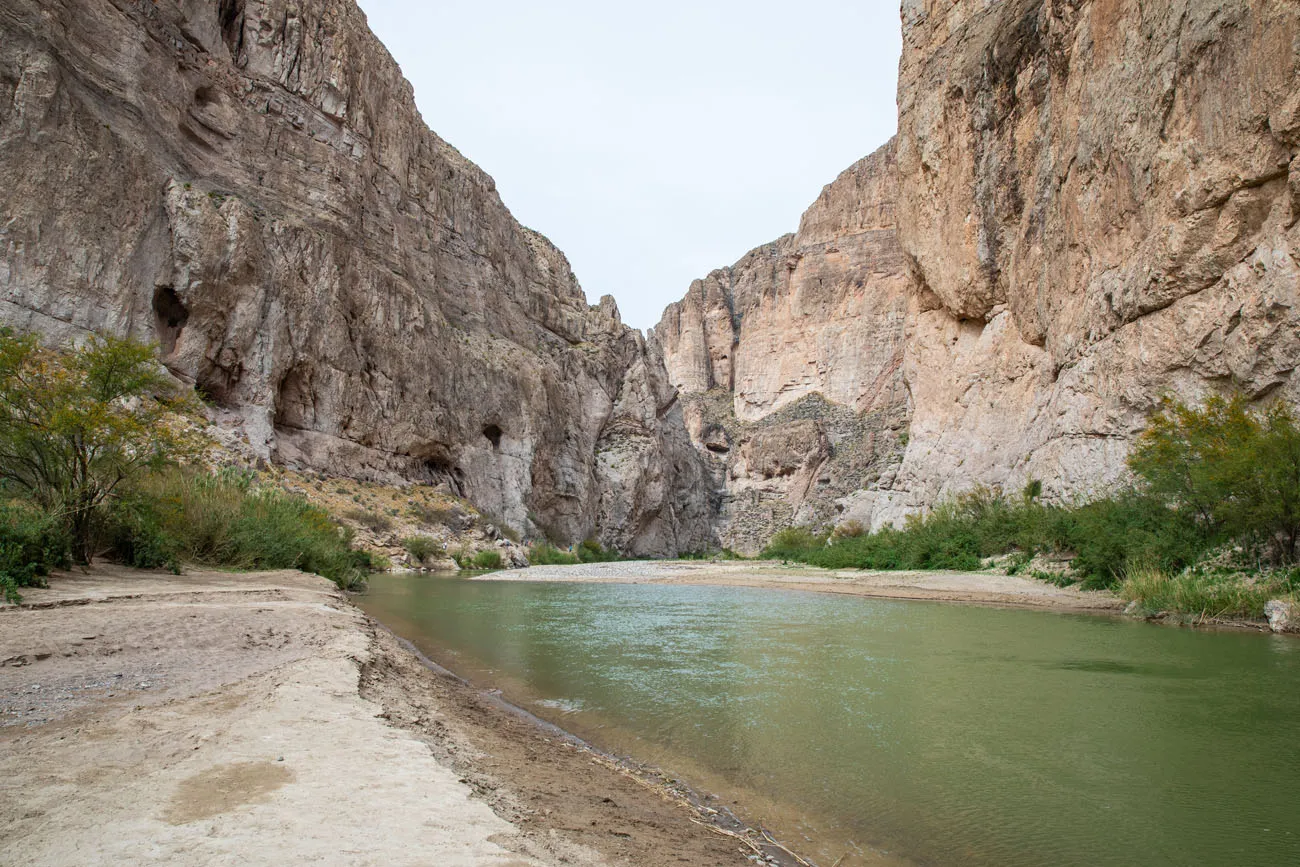
Santa Elena Canyon
Distance: 1.7 miles | Difficulty: Easy | Time: 1 to 2 hours
This is one of the big highlights of the day. When you see photos of Big Bend National Park, this is what you commonly see…the mighty Rio Grande River coursing through this canyon.
This short, easy hike takes you right alongside the Rio Grande River. There is one brief climb but it’s worth it…the views over the Rio Grande are breathtaking. The trail ends at a beautiful viewpoint of the Santa Elena Canyon.
The view from the top of the climb
Santa Elena Canyon
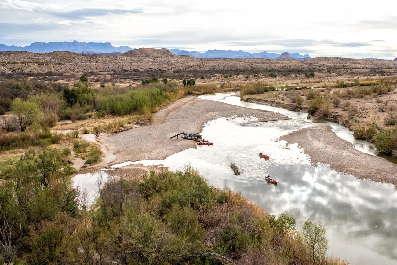
Optional: Canoeing on the Rio Grande
One of the best ways to experience the Santa Elena Canyon is to float through it on a canoeing trip. Big Bend River Tours offers a guided canoeing trip on the Rio Grande in Santa Elena Canyon. Learn more about this one day tour here.
Return to Terlingua
There are two ways to return to Terlingua. You can either retrace the driving route on Ross Maxwell Scenic Drive or you can drive Old Maverick Road.
Old Maverick Road is a 14-mile improved dirt road that is suitable for most vehicles. Depending on road conditions, the national park service warns that this can be rough and washboarded. Old Maverick Road starts near the Santa Elena Canyon Overlook and heads north towards Terlingua. It takes an hour to drive this road and goes past several historic sites.
By now it is around early to mid-afternoon, if you opted not to go canoeing on the Rio Grande. You can spend the remainder of the day exploring Terlingua or visiting Big Bend Ranch State Park. Or, add on the quick and easy hike to Balanced Rock.
Hiking the Closed Canyon Trail in Big Bend Ranch State Park
Day 2: Chisos Basin
If you are a hiker, this just might be your favorite day in Big Bend National Park. Rugged, jagged mountains rise up from the desert, creating a wonderland of hiking trails and beautiful landscapes. This is where you will find some of the most exciting and challenging hiking trails in Big Bend National Park ↓
15 Best Hikes in Big Bend National Park (By Area & Difficulty)
Here are 15 of the best hikes to do in Big Bend National Park.There are several great trails that start in Chisos Basin. Take your pick from the list below. I recommend getting an early start, as the parking lots fill up quickly during peak season.
Lost Mine Trail
Distance: 4.8 miles | Difficulty: Moderate | Time: 2.5 to 3.5 hours
The Lost Mine Trail is an extremely popular hike in Big Bend National Park. Most of the hike is an unexciting, steady uphill walk, with occasional views across the Chisos mountain range. However, once at the top, the views really open up. Your reward is a panoramic view over the mountains and valleys of Big Bend National Park.
Lost Mine Trail
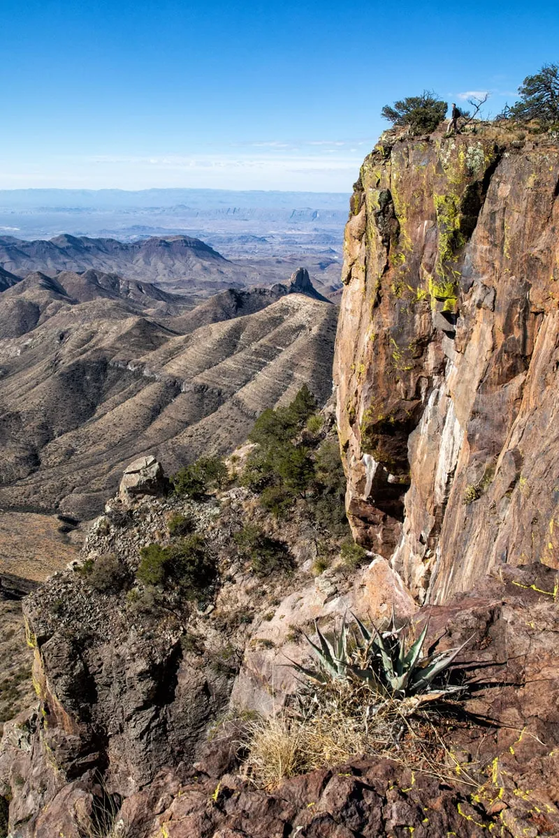
Emory Peak
Distance: 10.4 miles | Difficulty: Strenuous | Time: 5 to 7 hours
If you want to stand on the highest peak in the Chisos Mountains and Big Bend National Park, put Emory Peak on your list. This is a tough hike but the views over the park are awesome. Learn more in our guide to Hiking Emory Peak.
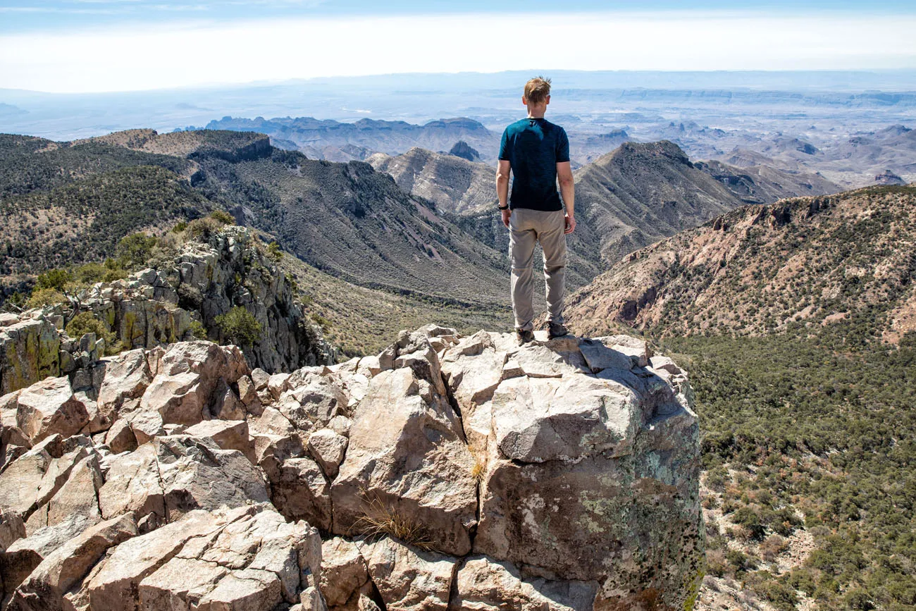
Emory Peak
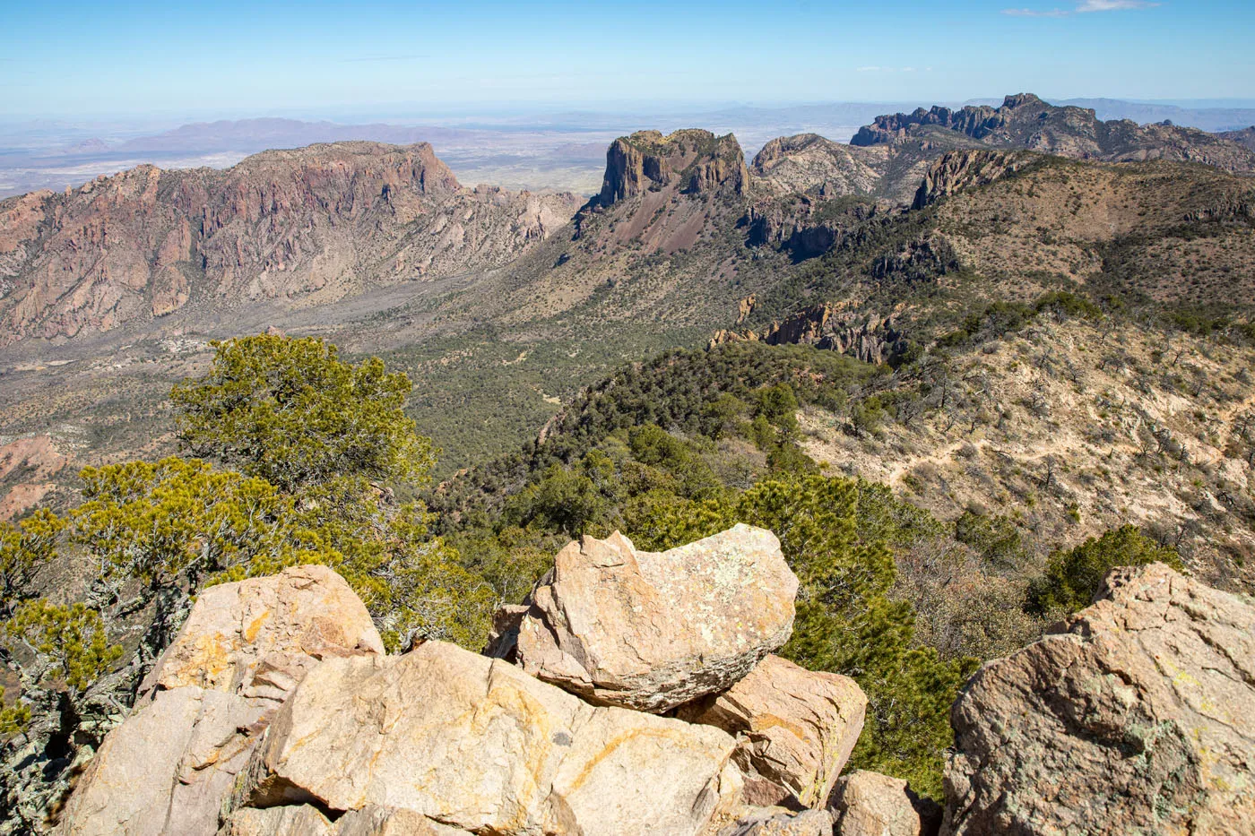
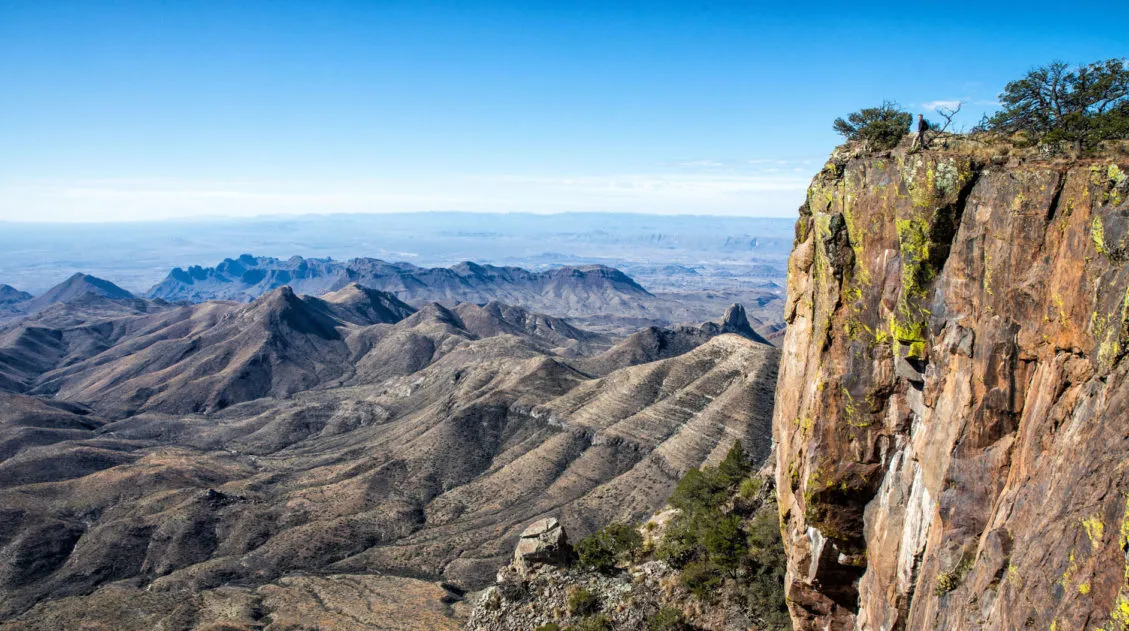
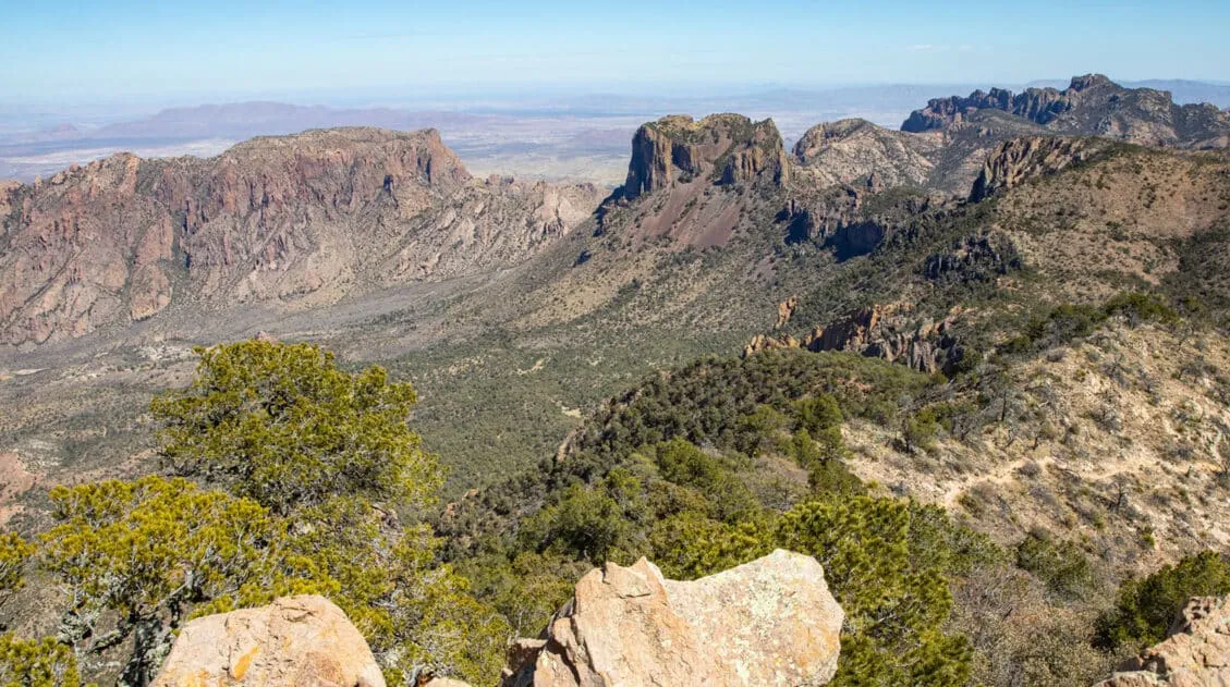
South Rim Trail
Distance: 12.6 miles | Difficulty: Strenuous | Time: 6 to 8 hours
Starting in the Chisos Basin, you will steadily climb up to the South Rim, where jaw-dropping views of the Chihuahuan Desert await. This hike is done as a loop and you have the option to add on Emory Peak. Learn more in our Guide to the South Rim Trail ↓
South Rim Trail Loop + Emory Peak | Complete Hiking Guide
How to hike the South Rim Trail and add on Emory Peak.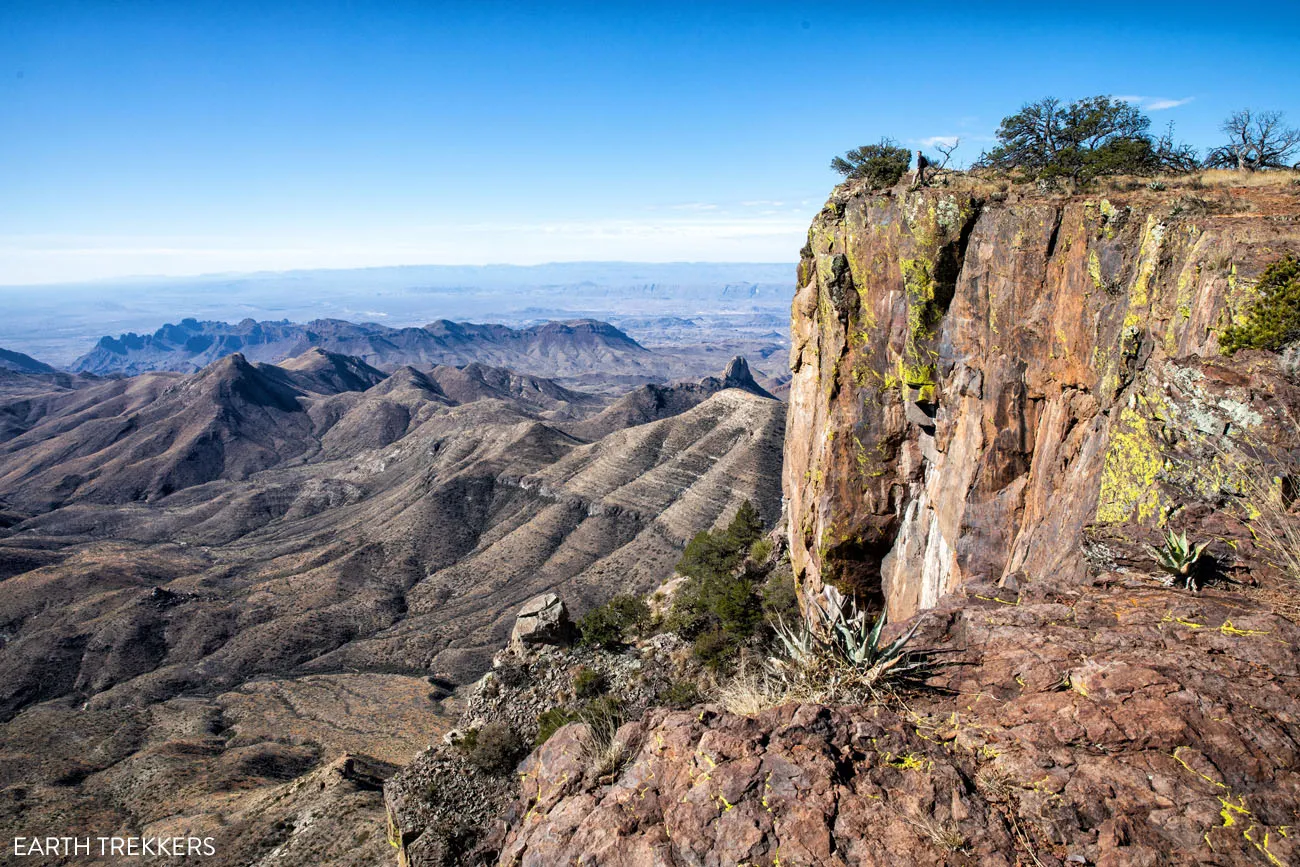
South Rim Trail
Emory Peak + South Rim Trail
Distance: 15.6 miles | Difficulty: Strenuous | Time: 7.5 to 9.5 hours
This is the ultimate hiking experience in Big Bend National Park. Hike the complete South Rim Trail and top it off with the climb up to Emory Peak for unbeatable views of the Chisos Mountain Range and Chihuahuan Desert. Learn more in our guide to the South Rim Trail.
Chisos Basin Loop
Distance: 1.8 miles | Difficulty: Easy to moderate | Time: 1 to 2 hours
This loop hike weaves its way through the Chisos Basin valley. You will hike in and out of a forest of oak, juniper, and Mexican pine with occasional views of the mountains that surround the basin.
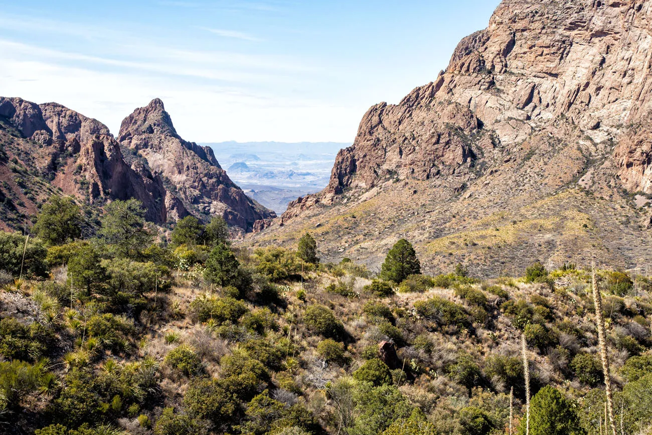
The Window Trail
Distance: 5.6 miles | Difficulty: Moderate | Time: 3 to 4 hours
The Window Trail is a moderately strenuous hike that ends at the Window. From here, you have stunning views of Big Bend National Park.
Window View Trail
Distance: 0.3 miles | Difficulty: Easy | Time: 20 minutes
Not to be confused with the Window Trail, the Window View Trail is a paved, flat trail leads to a viewpoint of the Window, a cut-out in the Chisos mountains. This is a popular sunset destination in Big Bend National Park.
View from the Window View Trail
Afternoon
Depending on which trail(s) you chose to hike, you could be finished anywhere from mid-morning to mid-afternoon. If you still have plenty of time left in the day, consider hiking the nearby trail to Balanced Rock, visiting the Fossil Discovery Exhibit (great if you are traveling with kids), soaking in the hot springs near Rio Grande Village (just note that it will be a very long drive to get back to Terlingua or Lajitas), or exploring Big Bend Ranch State Park.
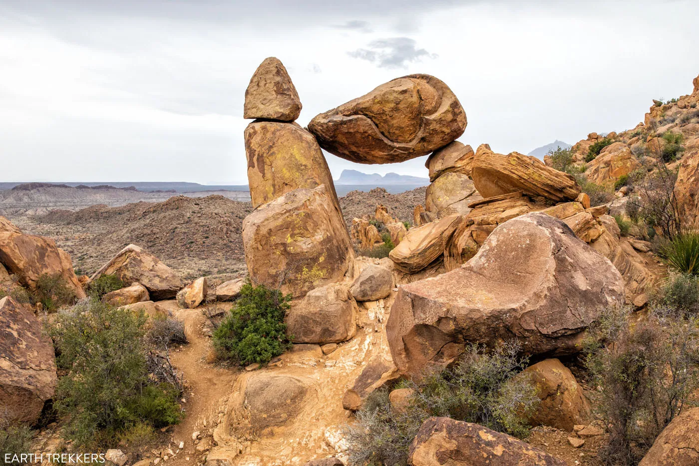
Balanced Rock
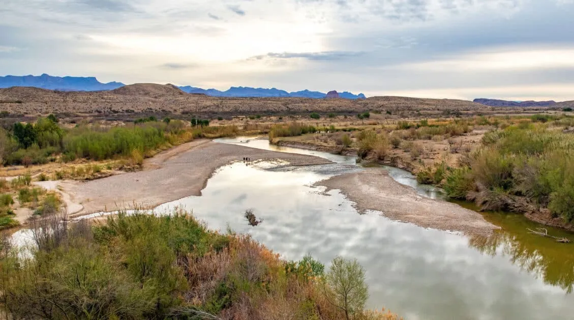
Day 3: Rio Grande Village
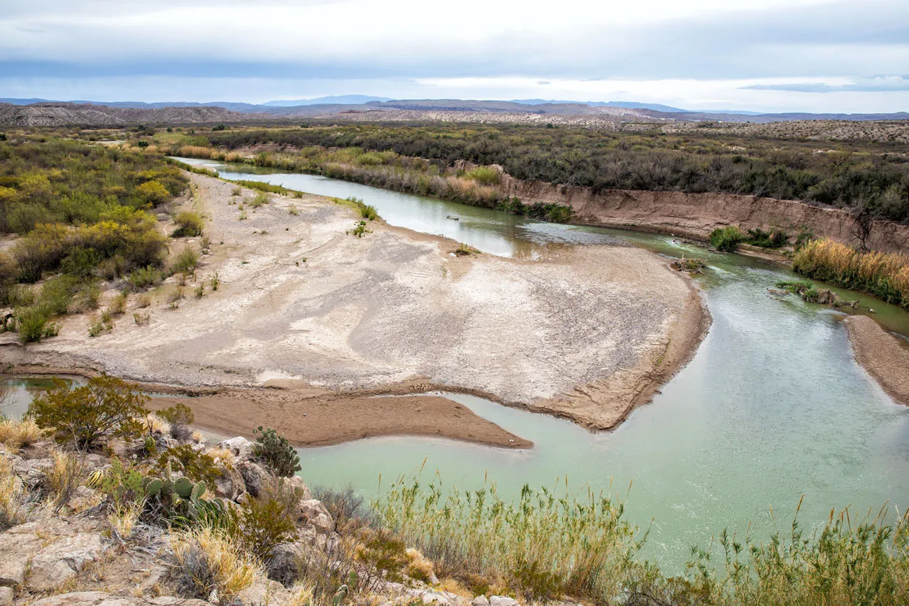
Day 3 takes you to the eastern section of the park, where the Rio Grande does most of the storytelling. This is the most varied day of the three. You’ll hike a remote slot canyon, cross the border into Mexico by rowboat, walk along the river’s edge inside a towering canyon, and (if you have energy left) soak in 105°F hot springs as the sun goes down.
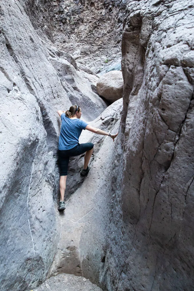
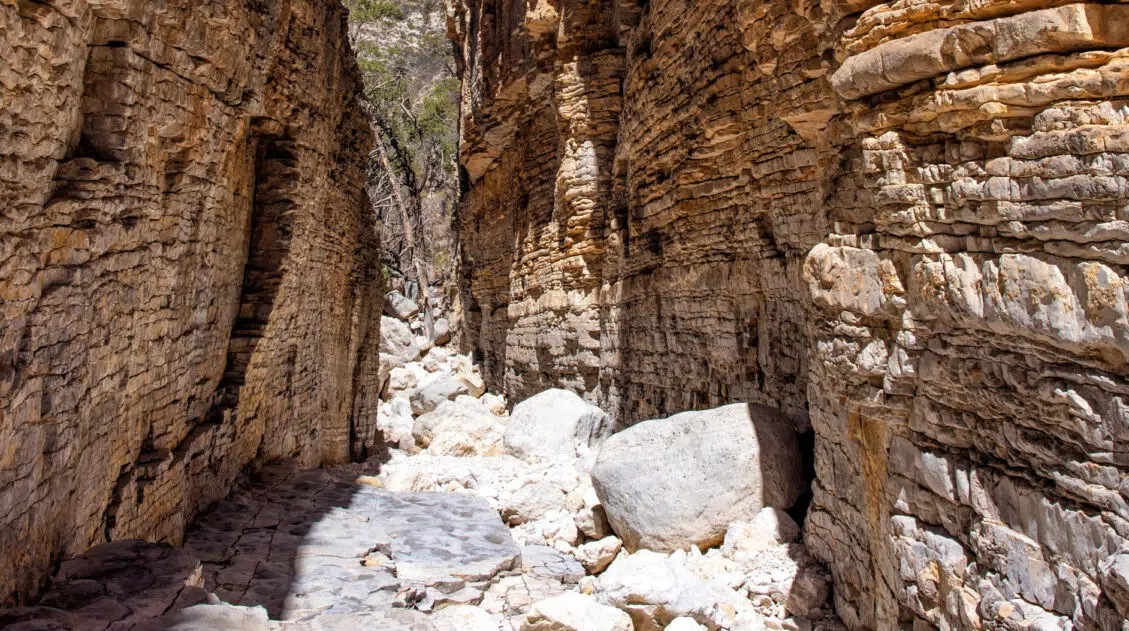
Before heading to Rio Grande Village, don’t skip Ernst Tinaja. We’d call it the most underrated experience in all of Big Bend — a hidden series of water-filled pools tucked inside a colorful limestone canyon that looks unlike anywhere else in the park. It requires a high-clearance 4WD vehicle to reach the trailhead, but if you have one, it’s worth every bit of the rough road to get there.
Optional: Ernst Tinaja
Distance: 1.6 miles | Difficulty: Easy | Time: 1 to 1.5 hours
Ernst Tinaja is a series of water holes that are tucked away in a remote canyon. With its colorful limestone rocks and canyons, this area looks much different from the rest of Big Bend National Park.
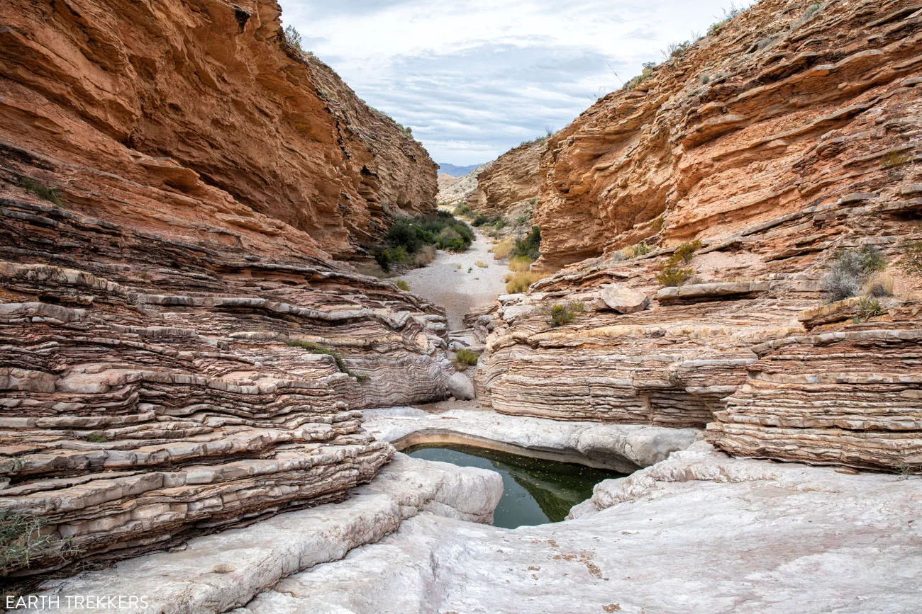
To get here, you will drive Old Ore Road, a rough, primitive dirt road. The national park service recommends having a high-clearance 4WD vehicle for this drive.
Once at the trailhead, it is a short, easy hike through a slot canyon to get to the water holes. Those looking for a little more adventure can continue the hike past the water-filled pools and rock scramble their way to the back of the canyon.
Ernst Tinaja Trail: Big Bend’s Most Underrated Adventure
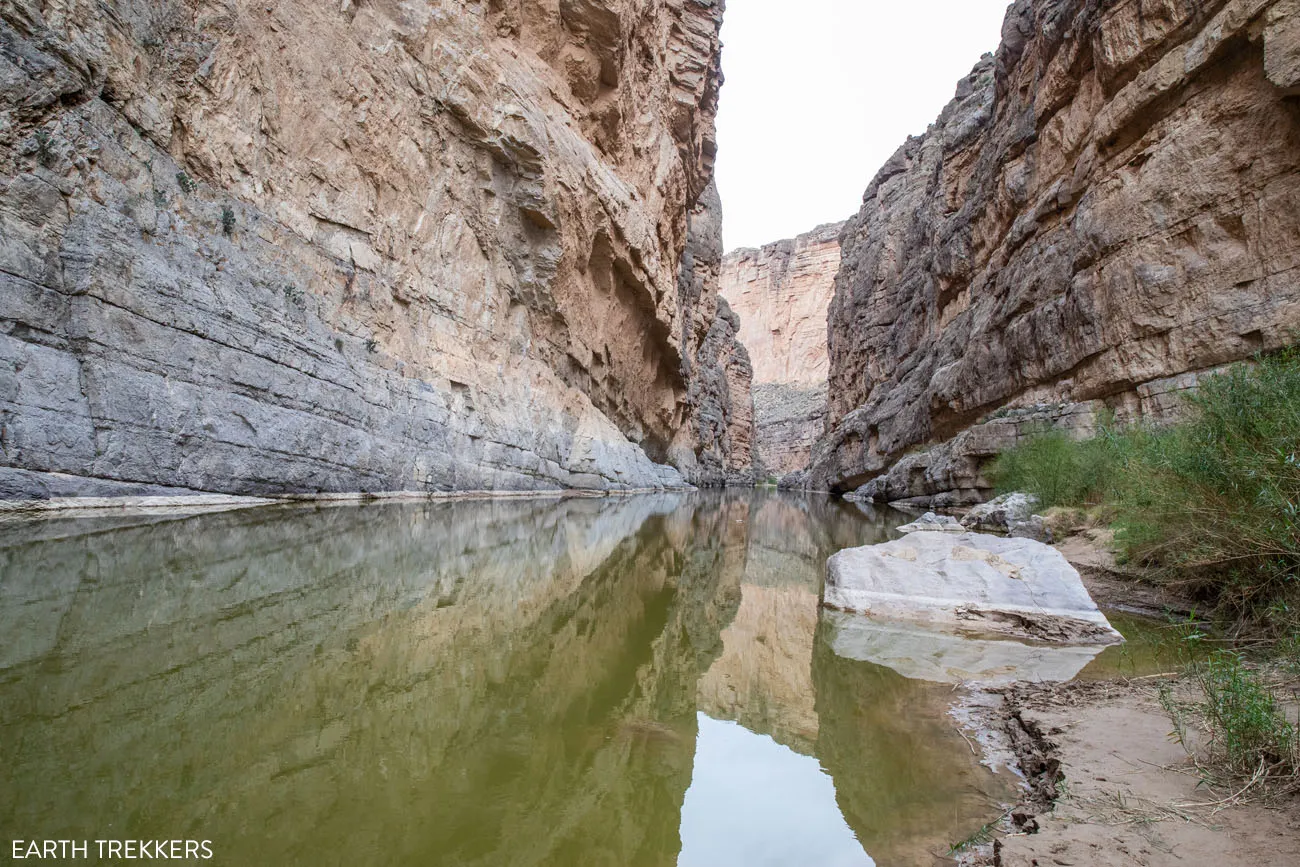
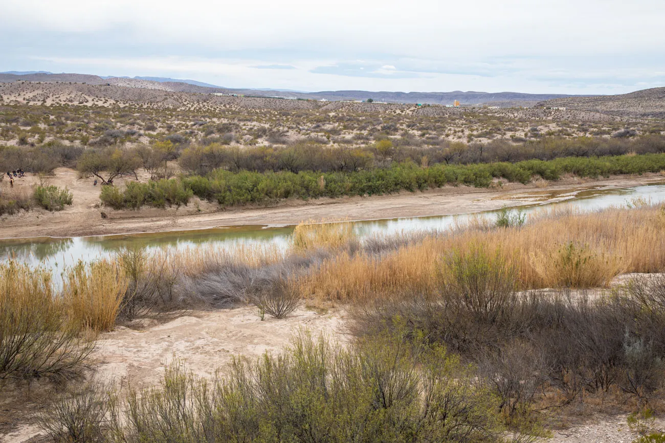
How to get to and then hike the Ernst Tinaja Trail.Boquillas Canyon Trail
Distance: 1.6 miles | Difficulty: Easy to moderate | Time: 1 to 1.5 hours
Drive to the end of Boquillas Canyon Road. This road dead-ends at a parking lot and the trailhead for Boquillas Canyon.
This hike is similar to Santa Elena Canyon in that it follows along the edge of the Rio Grande. The first part of the hike is the most challenging, a steep but brief climb up and over a good-sized hill. The view from here is very nice, as you look out over the Rio Grande River, and honestly, it’s better than the view you will have from the nearby Boquillas Canyon Overlook (next on this itinerary). Then, it is a mostly flat and scenic walk along the river.
View from the top of the first climb
Boquillas Canyon
Boquillas Canyon Overlook
Drive back down Boquillas Canyon Road just a short distance until you reach the Boquillas Canyon Overlook. This view isn’t quite as good as the view you just had from the Boquillas Canyon Trail, but it’s still worthwhile. From here, you look out over the Rio Grande and off in the distance you can see Boquillas del Carmen in Mexico.
Boquillas Canyon Overlook
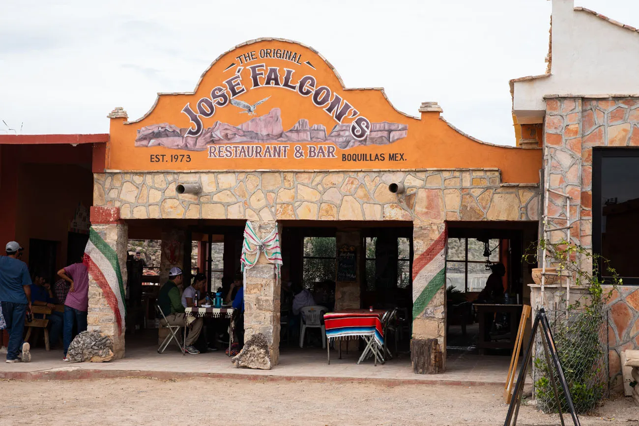
Visit Boquillas del Carmen
Boquillas del Carmen is a very small town in Mexico. To get here, you will cross the Rio Grande by row boat. Spend the afternoon drinking margaritas, eating Mexican food, and shopping.
In order to do this, you will go through Border Control, so you must have your passport.
Park at the Boquillas Crossing Port of Entry. You will pass through the Port of Entry building and then walk a short distance along the Rio Grande to the river crossing.
There are several men operating row boats to shuttle visitors back and forth across the river. Once on the Mexican side of the Rio Grande, you pay your fee ($5 per person, cash only, round trip), are given a ticket, and you will show this at the end of your visit, when you are ready to cross the Rio Grande again.
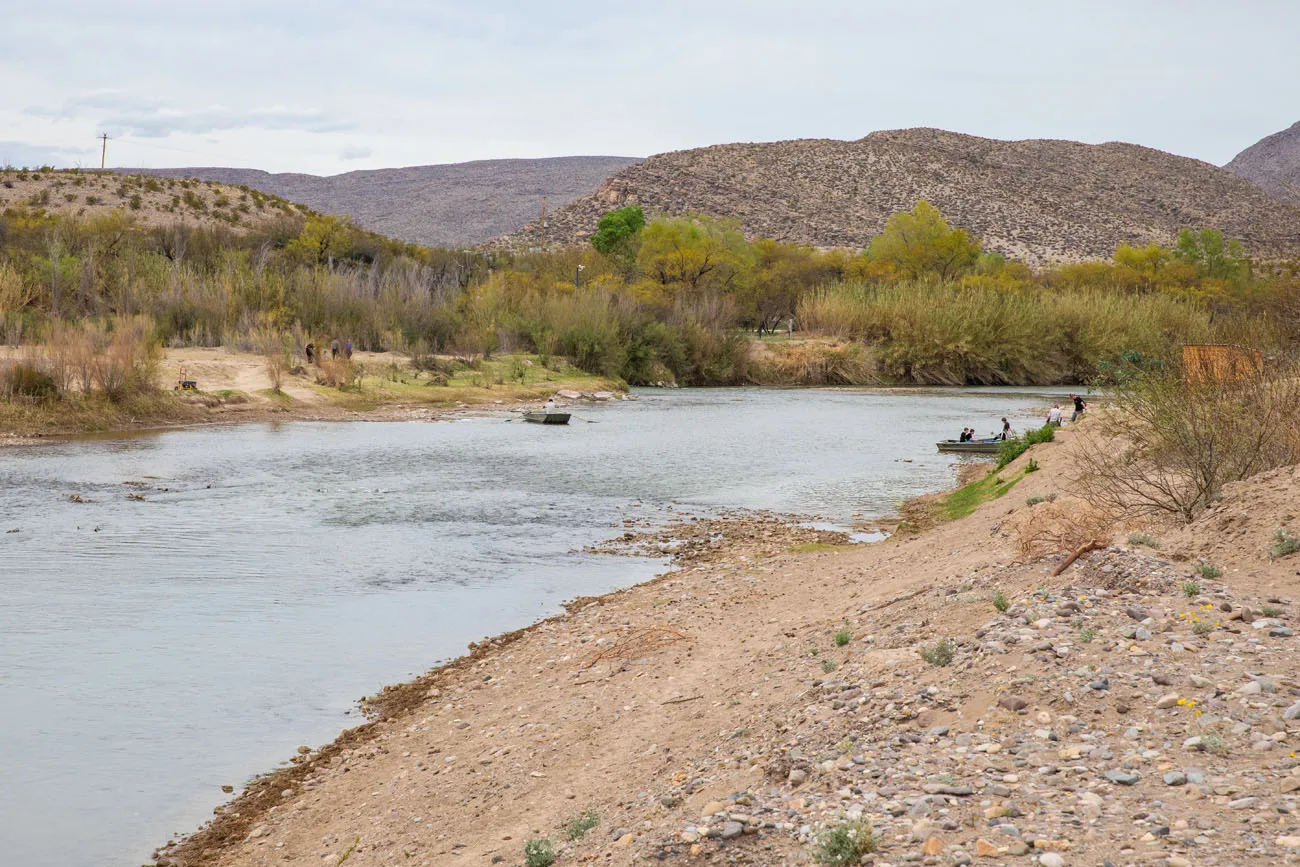
Rowboats crossing the Rio Grande
To get into town, you can walk or you can ride a donkey or a horse. We chose to walk, and from what we saw, it takes about the same amount of time, since the donkeys and horses do not move very fast.
It is a 0.6-mile walk (one-way) along a sandy road. The road is covered with donkey poop and the trucks that drive back and forth kick up dust into the air, making this very unpleasant, whether you are walking or riding a donkey.
Boquillas del Carmen has a few restaurants that have terraces with views of the Rio Grande. There are also several small souvenir shops. Many people who come here love hanging out at one of the restaurants, eating Mexican food, and having drinks.
To return to Big Bend National Park, cross the river by rowboat and go through the Port of Entry. Your passport will be scanned and then you will be on your way.
Important Note: The Port of Entry is open Friday through Monday from 9 am to 4 pm year-round, so you cannot come here for dinner. You need to make sure you are back at the Port of Entry no later than closing time or you will be spending the night in Mexico. If you plan to spend the night in Mexico, you will need a temporary visa. Get updated hours on the National Park Service website before you go.
Planning Your Visit: This will take about 4 hours of your time if you do a little shopping and have lunch in town. The shops and restaurants accept US dollars and it is helpful to have small bills. Note that the Port of Entry is only open Friday through Monday, so plan your Rio Grande Village day accordingly.
Rio Grande Hot Springs
If you still have time and energy after your visit to Boquillas del Carmen, visit the Rio Grande Hot Springs.
To get to the hot springs, it is a 1-mile easy walk (one-way) on the Hot Springs Historic Trail. This takes about 2 hours, including time for the hike and time in the hot springs.
Where to Stay
We spent 4 nights in Big Bend, splitting our time between two different properties, simply because there were two accommodations that looked great and we had a hard time deciding between the two.
Lajitas Golf Resort
Located just outside of Big Bend National Park, this 4-star hotel has a golf course, multiple onsite restaurants, and an equestrian center. Some rooms can accommodate up to four people.
We spent two nights here and really enjoyed our stay. The property offers free WiFi. It worked great around the main lobby and the Boardwalk area of the resort. However, farther out, near Calvary Post, we were not able to get a signal. If you think that you will need WiFi during your visit, request a room in the Lajitas Boardwalk area of the resort. By the way, there was very limited cellular service here so don’t depend on this as a back-up.
The Local Chapter
Three yurts, each one secluded from its neighbors, sit along a plateau and from here, you have outstanding views of Big Bend National Park. The owners went above and beyond, furnishing the room with plush towels, a very comfortable bed, and even a telescope to peer into the night sky. When you lay in bed, you can stare up at the stars through the skylight in the ceiling.
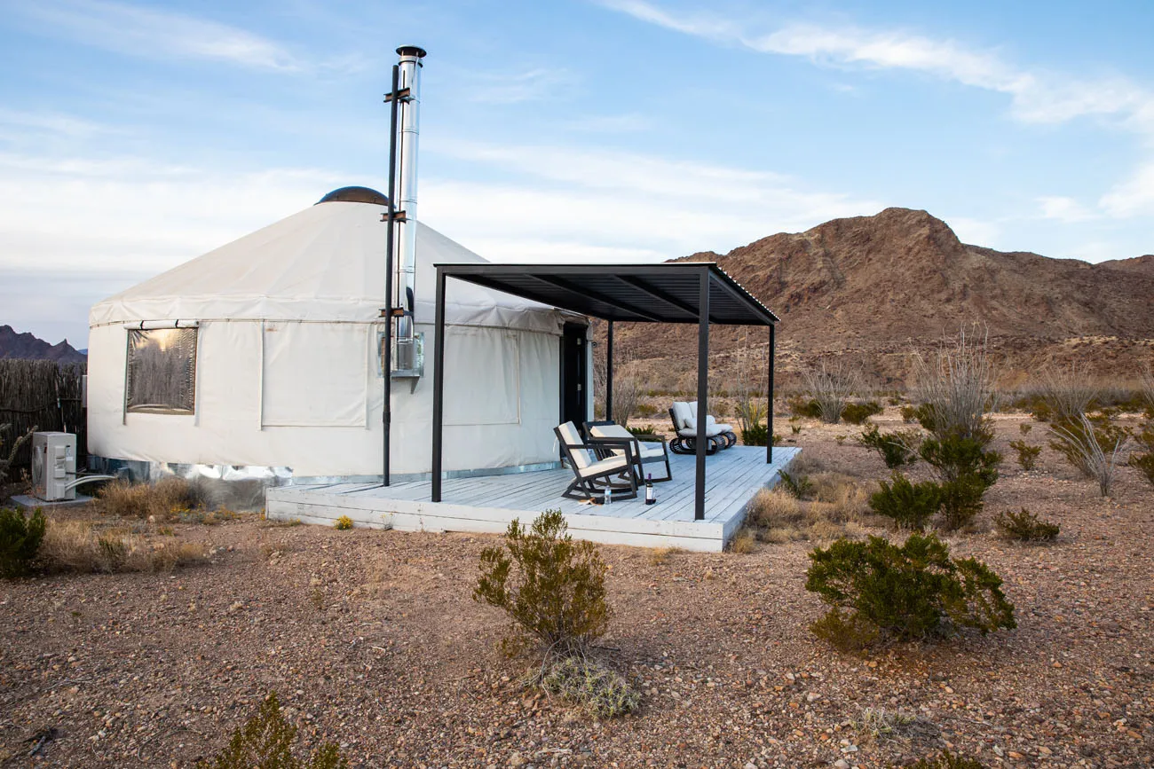
We loved staying in the yurt and we recommend it. However, our only complaint is that it can be noisy if it is a windy night. On our second night a storm rolled through the area and it sounded like the yurt would blow away. The noise of the wind rattling the yurt was so loud that we could not sleep until the storm passed. If you are a light sleeper, you might want to look elsewhere.
Learn more about the Local Chapter here.
Terlingua Ranch Lodge
If you are looking for a budget place, Terlingua Ranch Lodge gets decent reviews. It is a 45-minute drive (a portion of which is unpaved) to the center of Terlingua and the west entrance into Big Bend National Park. So, plan accordingly if you want to make use of the restaurants, grocery store, and gas station located in the heart of Terlingua.
Inside the Park
Staying inside Big Bend puts you closer to the trailheads and cuts down significantly on driving time each day. There are several options depending on how you like to travel.
Chisos Mountains Lodge is the only hotel inside the park, located in the Chisos Basin. Note that the basin area may be affected by a construction closure beginning May 2026 — check the National Park Service website for current status before booking.
For campers, there are three developed campgrounds inside the park. Rio Grande Village Campground is open year-round and is the most convenient base for Day 3 of this itinerary — hot springs, Boquillas, and Ernst Tinaja are all close by.
Cottonwood Campground is seasonally open (January–April and November–December) and sits in a remote corner of the park near Santa Elena Canyon, making it a great base for Day 1.
Chisos Basin Campground is the most scenic option, perched at 5,400 feet surrounded by the Chisos Mountains, but is subject to the same potential closure as the lodge.
All campgrounds require advance reservations through Recreation.gov.
If you’re traveling by RV, Rio Grande Village RV Park is the only full hookup option inside the park, with water, electrical, and sewer connections.
Book early. During peak season, campsite reservations fill up months in advance.
Marathon, Texas
Marathon, a small town that is about a 45-minute drive north of the north entrance of Big Bend National Park, also has several highly rated hotels to consider. The Gage Hotel is a historic and very highly rated hotel. It has received numerous accolades, such as the #1 Small Hotel in Texas, “Best Hotel Bar” in Texas, and it was voted the #1 hotel in Texas by the readers of Conde Nast Traveler.
Practical Information
Park Hours: Park entrances are open 24 hours a day, 365 days per year.
Park Fee: $30 per vehicle, valid for 7 days
Get updates on trail closures and park conditions on the National Park Service website as you plan your trip and just before your visit.
Please practice the seven principles of Leave No Trace: plan ahead, stay on the trail, pack out what you bring to the hiking trail, leave areas as you found them, minimize campfire impacts, be considerate of other hikers, and do not approach or feed wildlife.
Frequently Asked Questions
Is 3 days enough for Big Bend National Park?
Three days is the ideal minimum for Big Bend. With one day in each of the park’s three regions — Ross Maxwell Scenic Drive, Chisos Basin, and Rio Grande Village — you can cover the highlights without feeling rushed. That said, Big Bend rewards extra time. If you can stretch to 4 or 5 days, you’ll have room for longer hikes, a canoe trip on the Rio Grande, and a more leisurely visit to Boquillas del Carmen.
What is the best order to visit the three regions of Big Bend?
You can do the three days in any order, but we recommend starting with Ross Maxwell Scenic Drive, then Chisos Basin, then Rio Grande Village. This builds naturally toward the border crossing at Boquillas on your final day, a memorable way to end the trip. Just note that the Boquillas Port of Entry is only open Friday through Monday, so plan your Rio Grande Village day accordingly.
Do you need a passport to visit Big Bend National Park?
You don’t need a passport to enter Big Bend National Park itself. However, if you want to cross the Rio Grande into Boquillas del Carmen, Mexico, one of the highlights of any visit, a valid US passport is required. Don’t leave home without it.
What is the best hike in Big Bend National Park?
It depends on what you’re looking for. For stunning mountain views, the South Rim Trail and Lost Mine Trail are the top picks. For something shorter and off the beaten path, Ernst Tinaja is our personal favorite. For a full breakdown of the best trails in the park by difficulty and type, see our guide to the 15 Best Hikes in Big Bend National Park.
Can you drive to Big Bend National Park without a 4WD vehicle?
Yes, the main paved roads through all three regions of the park are suitable for any vehicle. However, some of the best experiences require a high-clearance 4WD vehicle. Old Ore Road, which leads to the Ernst Tinaja trailhead, is a rough primitive dirt road that the National Park Service recommends a high-clearance 4WD for. Old Maverick Road is an improved dirt road suitable for most vehicles in good conditions. If you don’t have a 4WD, you can still have an excellent three days, but you’ll miss Ernst Tinaja.
How far is Big Bend National Park from the nearest airport?
The closest airport is Midland International Air and Space Port in Midland-Odessa, about 220 miles away, roughly a 3.5 to 4 hour drive. El Paso is farther at 315 miles and 5 hours, but offers significantly more flight options and is often the better choice. We flew into El Paso and found it straightforward. San Antonio is also an option at just over 6 hours.
Plan Your Big Bend Trip
- Big Bend National Park Travel Guide — everything you need to know before you go
- 15 Best Hikes in Big Bend National Park — full trail breakdowns by difficulty and region
- Best Things to Do in Big Bend National Park — top experiences beyond the hiking trails
- Big Bend Ranch State Park — the overlooked gem next door worth at least a half day
- 10-Day Texas New Mexico Road Trip Itinerary — combine Big Bend with Guadalupe Mountains, Carlsbad Caverns, and White Sands
If you have any questions about this Big Bend itinerary or how to spend 3 days in Big Bend, let us know in the comment section below.
More Information about Big Bend & Texas
Ernst Tinaja Trail: Big Bend’s Most Underrated Adventure
Pinterest Facebook Flipboard The Ernst Tinaja Trail is one of the most unique hikes to do in Big Bend National Park. This is a short, easy trail through a slot canyon, featuring a series of waterholes located within colorful layers of limestone rock. Those looking for a little more adventure can continue the hike past the water-filled […]
15 Best Hikes in Big Bend National Park (By Area & Difficulty)
Big Bend National Park is one of the most underrated hiking destinations in the United States. Tucked into the southwestern corner of Texas along the Rio Grande, it packs an extraordinary range of terrain into one park — slot canyons, volcanic rock formations, a full mountain range, and miles of river canyon trails. We visited […]
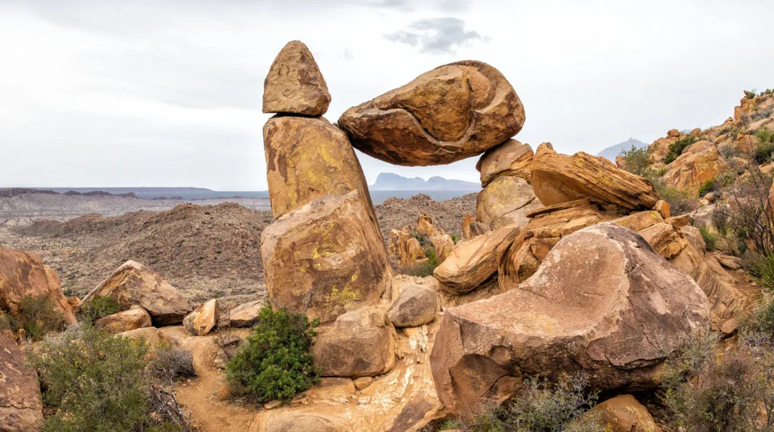
Balanced Rock Hike: A Short but Sweet Hike in Big Bend National Park
The Balanced Rock hike is one of our favorite short hikes in Big Bend National Park and one of the most rewarding for the effort required. The trail is only 2.2 miles round trip, with just a brief stretch of rock scrambling near the end, making it accessible for most hikers and genuinely fun for […]
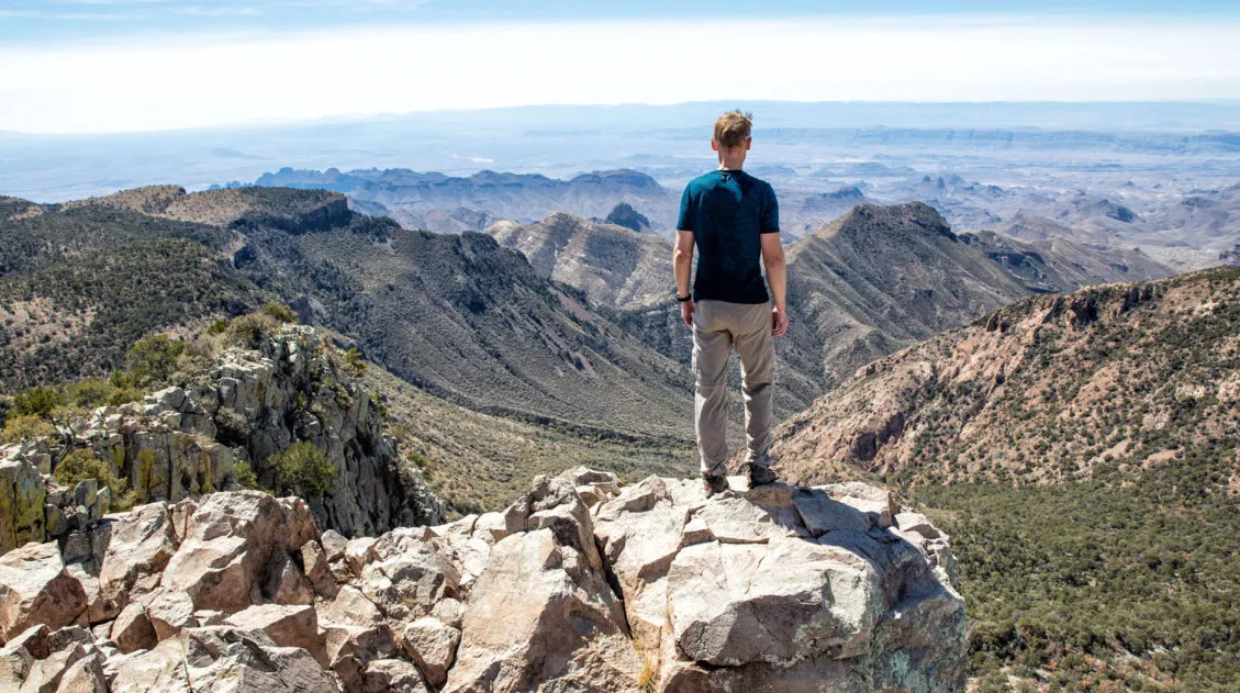
Emory Peak Trail, Big Bend: Everything You Need to Know
Emory Peak is the highest point in Big Bend National Park and the Chisos Mountains, and the hike to the summit is one of the best things you can do in the park. The 10.4-mile out-and-back gains nearly 2,500 feet of elevation and finishes with a short rock scramble to the top, where 360-degree views […]
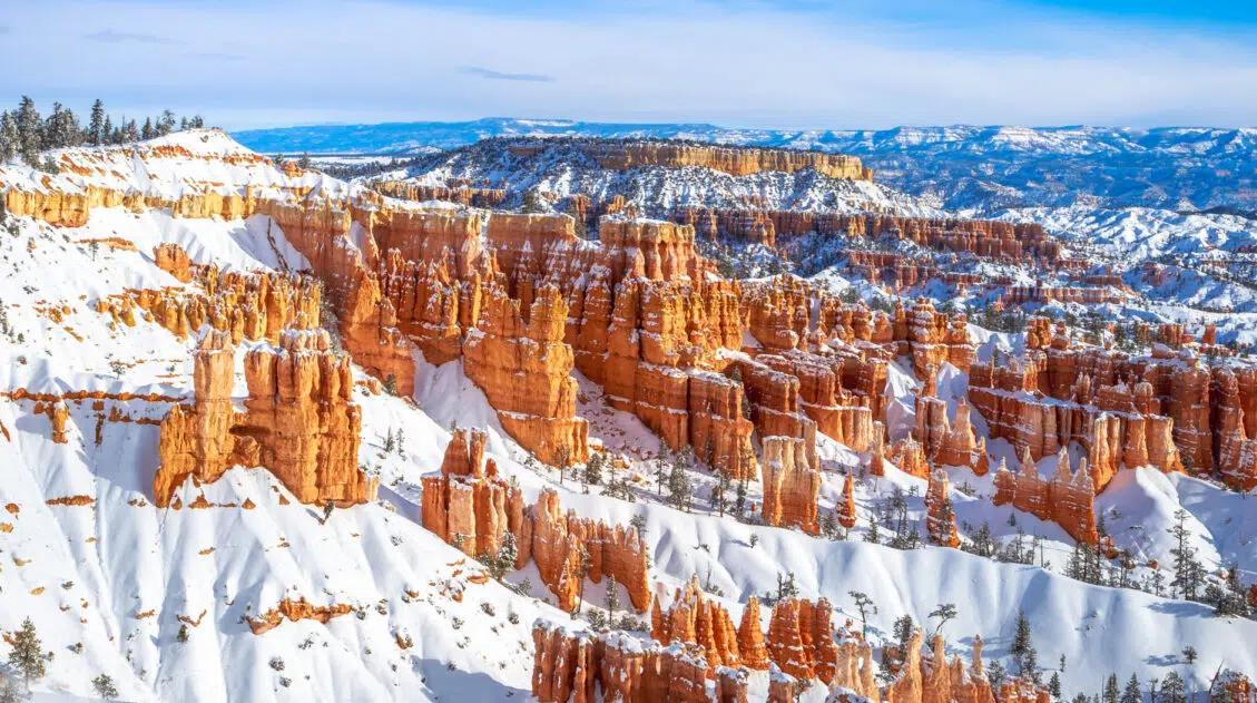
10 Day Texas New Mexico National Parks Road Trip Itinerary
On this 10-day Texas New Mexico road trip itinerary, you will visit four national parks plus make a quick detour to a gem of a state park that just might be one of the big highlights of the trip. Go hiking in Big Bend and Guadalupe Mountains, explore the underground wonderland of Carlsbad Caverns, and […]
25 Best Things to Do in Big Bend National Park
Discover the best things to do in Big Bend National Park, including the must-see highlights, unique experiences you won’t find anywhere else, and practical tips to help you plan your visit. Big Bend National Park is one of those places that genuinely surprises you. Tim and I had heard it described as remote and rugged, […]
15 Best Things to Do in Guadalupe Mountains National Park
Tim and I have hiked a lot of national parks, and Guadalupe Mountains is one that genuinely surprised us. We expected a remote desert park with a few good trails. What we found instead was a place with incredible variety — a slot canyon, a fossilized coral reef trail with almost no one on it, […]
Devil’s Hall Trail Guide: What to Expect | Guadalupe Mountains NP
The Devil’s Hall Trail is one of the most unique hikes in Guadalupe Mountains National Park. It’s a 4.2-mile round-trip route through Pine Springs Canyon that ends at a narrow limestone slot canyon with 50-foot walls and just 15 feet of width at its narrowest point. Along the way, you’ll scramble through a rocky wash, […]
Best Things to Do in Carlsbad Caverns National Park
In this guide, we cover the best things to do in Carlsbad Caverns, tour options (both ranger-guided and self-guided), timed entry reservations, plus lots of helpful information. Located in the Guadalupe Mountains of New Mexico sits an underground fantasy land of limestone chambers, stalactites and stalagmites, and long, twisting tunnels. Carlsbad Caverns is breathtaking in […]
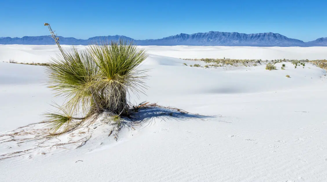
11 Amazing Things to Do in White Sands National Park
White Sands National Park is home to the largest gypsum dunefield in the world. These pure white dunes create a fun place to explore, for both kids and adults. Hike out into the dunes, learn about the wildlife that calls this park home, and go sledding on sand as white as the snow…these are just […]
12 Best US National Parks to Visit in November
Planning a trip to the US national parks in November and don’t know which ones to visit? The cooler weather in November makes this one of the best times of the year to visit the parks across the southern part of the USA. Road trip through Utah’s Mighty 5, go sledding on sand as white […]
United States Travel Guide: Places to Visit in the USA
Plan your visit to the United States. Learn about the best things to do, how to plan your time, road trip ideas, and sample itineraries.
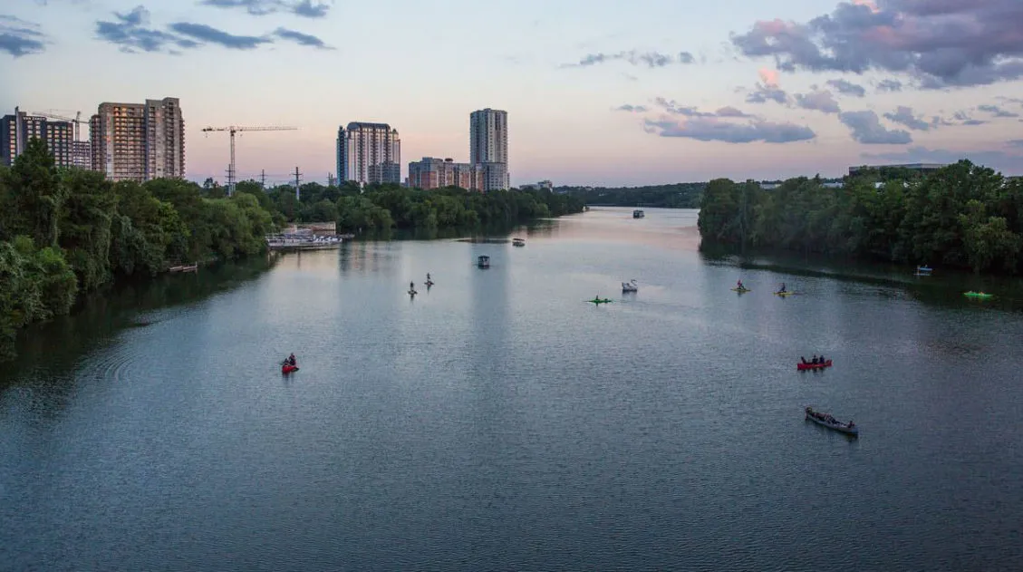
Best Things to Do in Austin, Texas (+ Where We Ate)
Austin surprised us. We went expecting live music and barbecue, and we got both, but what caught us off guard was how much fun the city itself is. There’s a loose, come-as-you-are energy here that makes it easy to just wander, eat, and stay out too late. Tim and I spent a long weekend here […]

Comments 32