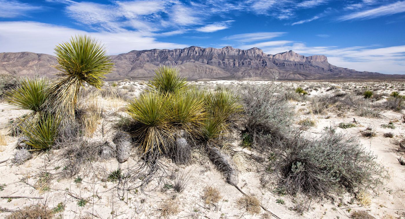
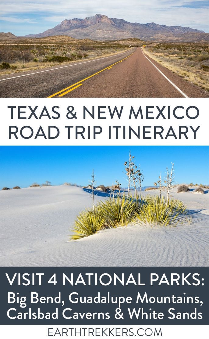
On this 10-day Texas New Mexico road trip itinerary, you will visit four national parks plus make a quick detour to a gem of a state park that just might be one of the big highlights of the trip. Go hiking in Big Bend and Guadalupe Mountains, explore the underground wonderland of Carlsbad Caverns, and sled on dunes as white as snow at White Sands National Park.
This road trip is done as a loop from El Paso, Texas. In general, the best times for this itinerary are late winter into spring and the fall months, when temperatures are mild. Since Big Bend is so remote, you will do a lot of driving and most of this will be getting to and from Big Bend.
When we did this, we had to split the itinerary into two different road trips. We started in Big Bend, touring the park the second week of March 2020. This was the week when COVID lockdowns began, forcing us to return home early. Tim and I returned a few years later (again in March), to visit the rest of the parks. I have taken our favorite experiences in each of the parks and included them in this road trip itinerary.
Overview of this Texas New Mexico Road Trip
10 Day Texas New Mexico Road Trip Itinerary
Day 1: El Paso and Big Bend National Park
Day 2: Big Bend National Park
Day 3: Big Bend National Park
Day 4: Big Bend National Park
Day 5: Big Bend Ranch State Park & drive to Carlsbad
Day 6: Guadalupe Mountains National Park
Day 7: Guadalupe Mountains National Park
Day 8: Carlsbad Caverns National Park & Drive to White Sands
Day 9: White Sands National Park
Day 10: Fly home
Below is a map of this Texas New Mexico road trip itinerary.
How to Use This Map: Click the icons on the map to get more information about each point of interest. To take this map with you, click the star next to the title of the map which adds it to your Google account. Next, within your Google Maps app, select ‘Saved’ and then select ‘Maps’. This map title will now appear in your list.
HIGHLIGHTS: This road trip includes four national parks (Big Bend, Guadalupe Mountains, Carlsbad Caverns and White Sands) as well as Big Bend Ranch State Park. You will drive through Marfa, Texas, and have the option to add on Roswell, New Mexico.
DIRECTION: The road makes a loop and a “lollipop,” the lollipop being the out-and-back drive to Big Bend National Park. This itinerary can be done in either direction. In this article, I lay out a detailed day-by-day itinerary for doing this road trip in a counter-clockwise direction. We liked the idea of getting the long drive to Big Bend over with early in the trip, so we chose to start with Big Bend. If you prefer to do it in the other direction, at the end of this article I list how to do this itinerary in the opposite direction.
RENTAL CAR: For this road trip, a standard vehicle is sufficient. There is just one place where a high clearance 4WD is necessary (Ernst Tinaja in Big Bend), but you can skip this if you don’t want the added expense of renting a 4WD vehicle.
Best Time for this Texas New Mexico Road Trip
The best time for this Texas New Mexico road trip is from late winter into spring (late February into early April) and the fall months (October and November). Temperatures are mild during this time and this is the best weather for hiking.
Mid-March is when many Texans go on spring break, making the second and third weeks of March the busiest time of year in these national parks. If you can, plan your visit for the first week of March or the last week of March for slightly lower crowds.
In Guadalupe Mountains National Park, fall colors appear in mid-October, peaking by the end of October and sometimes lasting into early November. During this time, the average high in Guadalupe Mountains is in the low 70’s, making this a gorgeous time of year to visit this national park. The temperature will be similar in Big Bend, Carlsbad Caverns, White Sands.
Winter is also a good time to do this itinerary, but you will have cold temperatures and maybe a dusting of snow. But crowds will be very low.
The worst time, at least in terms of weather, are the summer months. In Big Bend, it gets into the 90’s in the summer, with the high temperature getting well over 100°F on the hottest days. Mid-May through September are the hottest months in the parks.
10 Day Texas New Mexico Road Trip Itinerary
Day 1: El Paso & Big Bend National Park
On the Road: 300 miles, 4 hours 45 minutes
Arrive in El Paso, Texas
There are several airports that you can fly into for this itinerary. El Paso International Airport has the best location, since it is near White Sands and the drive to Big Bend is not too far (300 miles, just under 5 hours of driving). It’s also a large airport, so you should have lots of flight options to choose from.
The Midland International Air & Space Port is slightly closer to Big Bend National Park (240 miles with just under 4 hours of driving), so it is also an option to consider. But due to this airport’s location, you will have to reconfigure the order of this itinerary.
Ideally, book a flight that gets into El Paso, Texas no later than noon or 1 pm, so you have plenty of time to drive to Big Bend National Park. In the airport, pick up your rental car.
Drive to Big Bend National Park
From El Paso International Airport, it takes just under 5 hours to drive to Big Bend National Park. It is somewhat of a monotonous drive, on a mix of multi-lane highways and two-lane roads. The speed limit is high (usually around 70 mph) so you can cover a lot of distance quickly.
Where to Stay
Inside of Big Bend National Park, you can stay at the Chisos Mountains Lodge, which has a great central location in Chisos Basin. There are also campgrounds at Rio Grande Village, Chisos Basin, and on Ross Maxwell Scenic Drive (Cottonwood Campground).
Terlingua is a small town that sits just outside of Big Bend National Park. Near Terlingua, we stayed in two different places.
We spent two nights in a yurt at the Local Chapter. Three yurts, each one secluded from its neighbors, sit along a plateau and from here, you have outstanding views of Big Bend National Park. And we spent two nights at the Lajitas Golf Resort, a 4-star hotel with a golf course and multiple onsite restaurants.
Tim and I split our stay into two different properties because we had a hard time deciding between the two. Both had their advantages: the yurt was really cool, private, and had great views but Lajitas Golf Resort had onsite restaurants and internet.
You will spend 4 nights in Terlingua/Big Bend National Park.
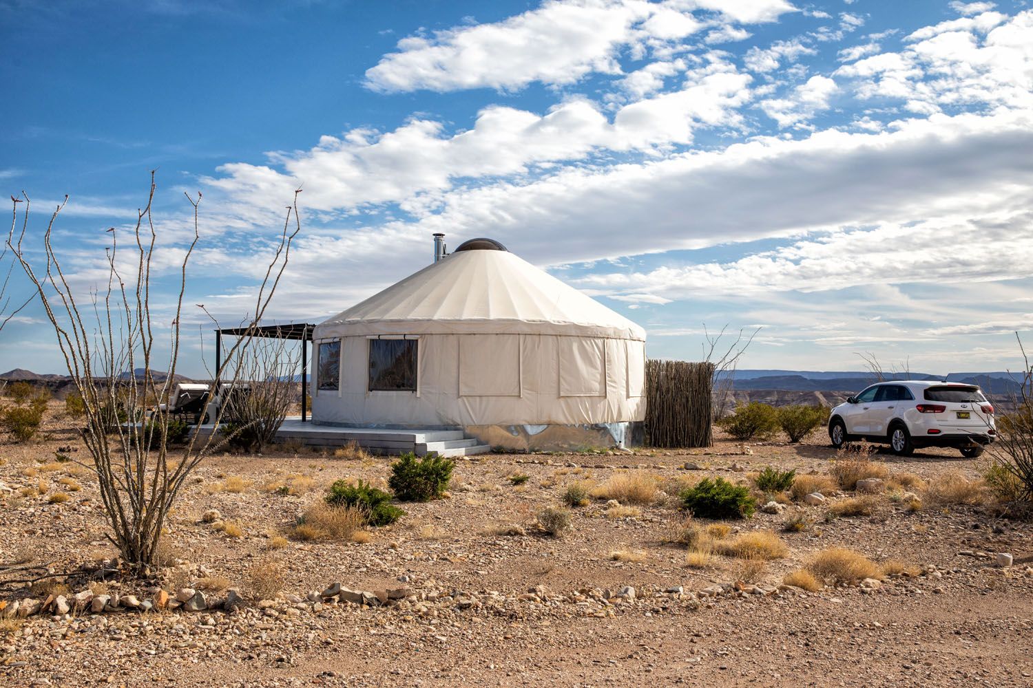
Local Chapter Yurt
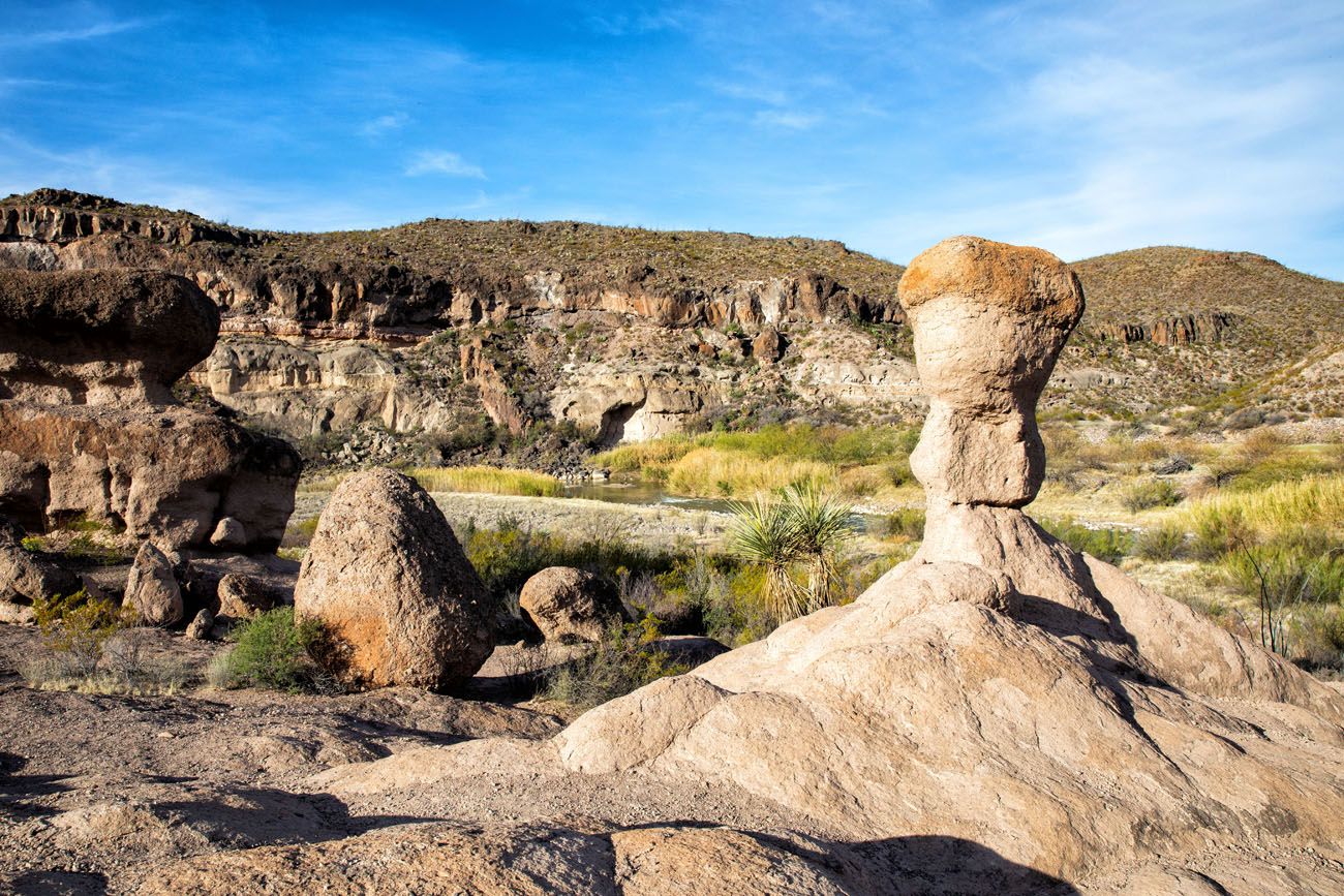
Day 2: Big Bend National Park: Ross Maxwell Scenic Drive
On the Road: 100 miles, 2.5 hours, out and back from Terlingua. Adding on Balanced Rock adds a total of 32 miles and 1.5 hours of driving.
On this road trip, you have 3 days in Big Bend, which gives you plenty of time to visit each area of the park and not feel like you are in a race. You can do day 2, 3, and 4 of this itinerary in any order.
Ross Maxwell Scenic Drive
Ross Maxwell Scenic Drive is a 30-mile road through some of the most beautiful landscapes in Big Bend National Park. This road starts at Panther Junction Road and ends 30 miles later at Santa Elena Canyon.
There are numerous viewpoints and hiking trails along this drive. Here are recommended viewpoints and hikes to do:
- Sotol Vista Overlook: panoramic views of the park
- Lower Burro Mesa Pour-Off: 1 mile easy hike through a canyon
- Mules Ears Viewpoint: for a view of a rock formation that look like Mules ears
- Tuff Canyon: 0.75 mile easy hike to a viewpoint of Tuff Canyon
- Santa Elena Canyon
Ross Maxwell Scenic Drive
Tuff Canyon
Santa Elena Canyon
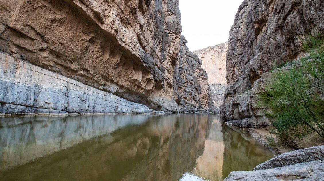
Visiting Santa Elena Canyon is one of the highlights of the day. When you see photos of Big Bend National Park, this is what you commonly see…the mighty Rio Grande coursing through this canyon.
The Santa Elena Canyon hike is 1.7 miles out-and-back and easy to do. The trail runs alongside the Rio Grande. There is one brief climb but it’s worth it…the views over the Rio Grande are breathtaking. The trail ends at a beautiful viewpoint of the Santa Elena Canyon.
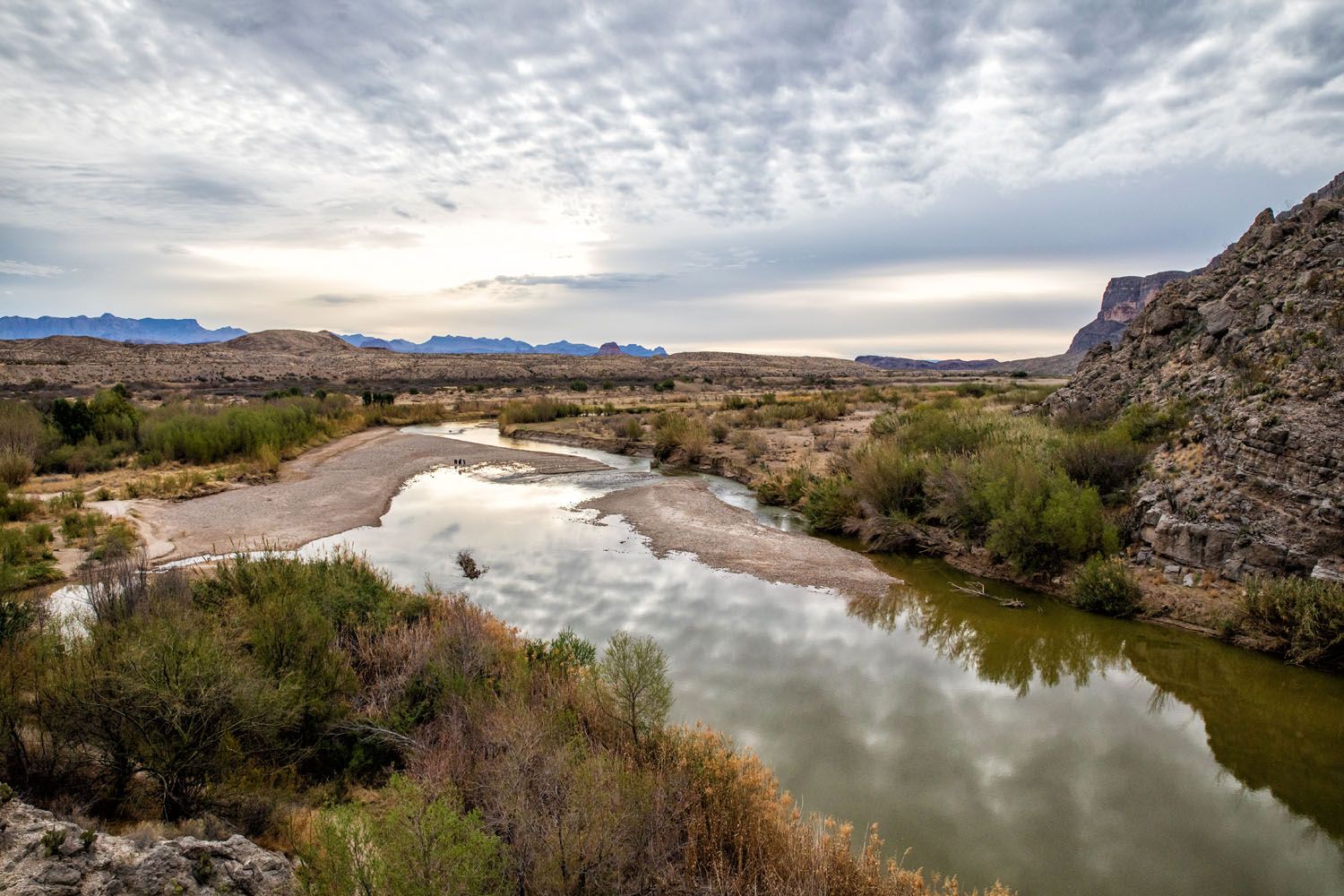
Rio Grande at Sunrise. Photo taken from the Santa Elena Trail.
Santa Elena Canyon
You have the option to go canoeing on the Rio Grande. Big Bend River Tours offers a guided canoeing trip on the Rio Grande in Santa Elena Canyon. Learn more about this one day tour here.
Afternoon: Return to Terlingua or Hike to Balanced Rock
By now, it is midday (unless you added on canoeing in Santa Elena Canyon, which typically lasts into the early afternoon). You have a choice to make: return to Terlingua or hike to Balanced Rock.
Return to Terlingua
There are two ways to return to Terlingua. You can either retrace the driving route on Ross Maxwell Scenic Drive or you can drive Old Maverick Road.
Old Maverick Road is a 14-mile improved dirt road that is suitable for most vehicles. Depending on road conditions, the national park service warns that this can be rough and washboarded. Old Maverick Road starts near the Santa Elena Canyon Overlook and heads north towards Terlingua. It takes an hour to drive this road and goes past several historic sites.
Once in Terlingua, you can explore the Terlingua Ghost Town (this only takes about a half an hour to see the cemetery and other sights) and have dinner at the Starlight Theater. The Starlight Theater opens at 5 pm and has live music every night. People line up before opening in order to get a seat.
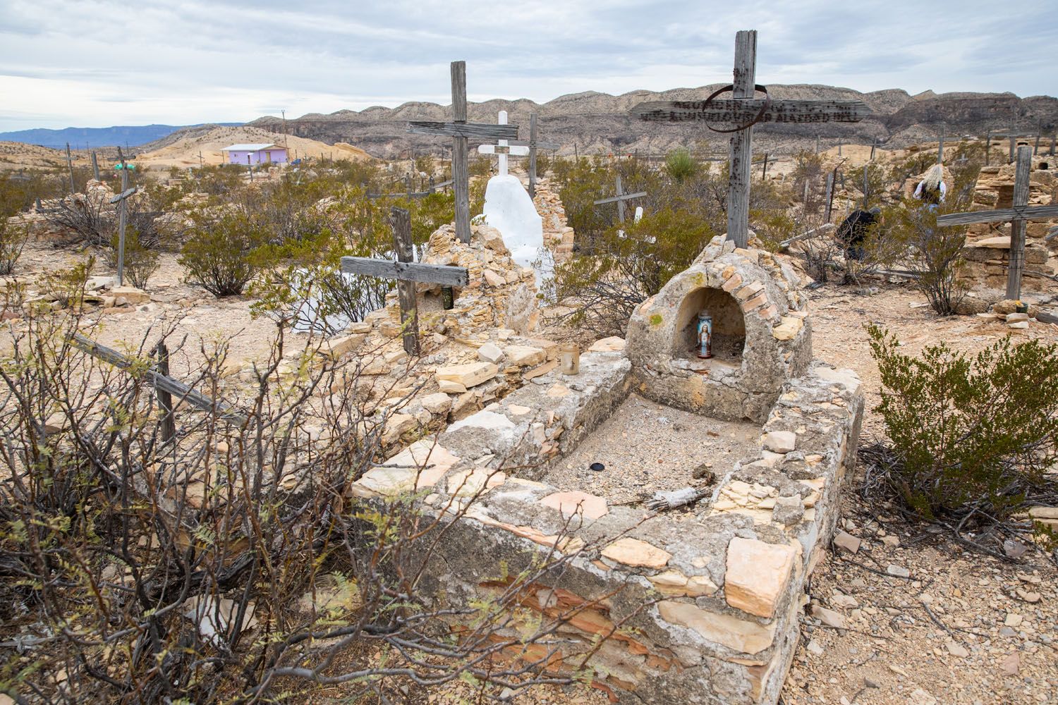
Terlingua Ghost Town
Hike to Balanced Rock
This is one of our favorite hikes in Big Bend National Park. It’s a bit out of the way but if you do it today, you have more free time later in Big Bend to add on other cool activities.
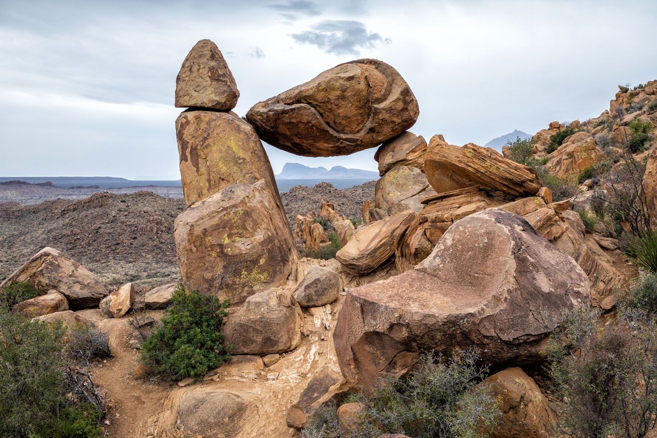
Balanced Rock
From Santa Elena Canyon, it takes about an hour and a half to drive to the Balanced Rock trailhead. Retrace the drive on Ross Maxwell Scenic Drive, turn right onto Gano Springs and then turn left onto Grapevine Spring. Grapevine Spring is a 6.3-mile gravel road that is suitable for standard vehicles, but an SUV or a vehicle with high ground clearance is ideal.
To hike to Balanced Rock, it is a 2.2 mile out-and-back hike on the Grapevine Hills Trail. This hike is rated as easy to moderate and takes 1 to 2 hours. Get the full details in our Balanced Rock Hiking Guide.
After the hike, return to your hotel/yurt/lodge/campsite and have dinner.
Day 3: Big Bend National Park: Chisos Basin
On the Road: 66 miles, 1.5 hours out and back from Terlingua. Minimal driving if you stay in Chisos Basin.
Chisos Basin is the prime spot to go hiking in Big Bend National Park. Rugged, jagged mountains rise up from the desert, creating a wonderland of hiking trails and beautiful landscapes. This is where you will find some of the most exciting and challenging hiking trails in Big Bend National Park.
There are several great trails that start in Chisos Basin. Take your pick from the list below. I recommend getting an early start because the parking lots do fill up fast during peak season.
Lost Mine Trail
Distance: 4.8 miles | Difficulty: Moderate | Time: 2.5 to 3.5 hours
The Lost Mine Trail is an extremely popular hike in Big Bend National Park. Most of the hike is an unexciting, steady uphill walk, with occasional views across the Chisos mountain range. However, once at the top, the views really open up. Your reward is a panoramic view over the mountains and valleys of Big Bend National Park.
Lost Mine Trail
The Window Trail
Distance: 5.6 miles | Difficulty: Moderate | Time: 3 to 4 hours
The Window Trail is a moderately strenuous hike that ends at the Window. From here, you have stunning views of Big Bend National Park.
The Window View Trail
Distance: 0.3 miles | Difficulty: Easy | Time: 2o minutes
Not to be confused with the Window Trail, the Window View Trail is a paved, flat trail leads to a viewpoint of the Window, a cut-out in the Chisos mountains. This is a popular sunset destination in Big Bend National Park.
The Window
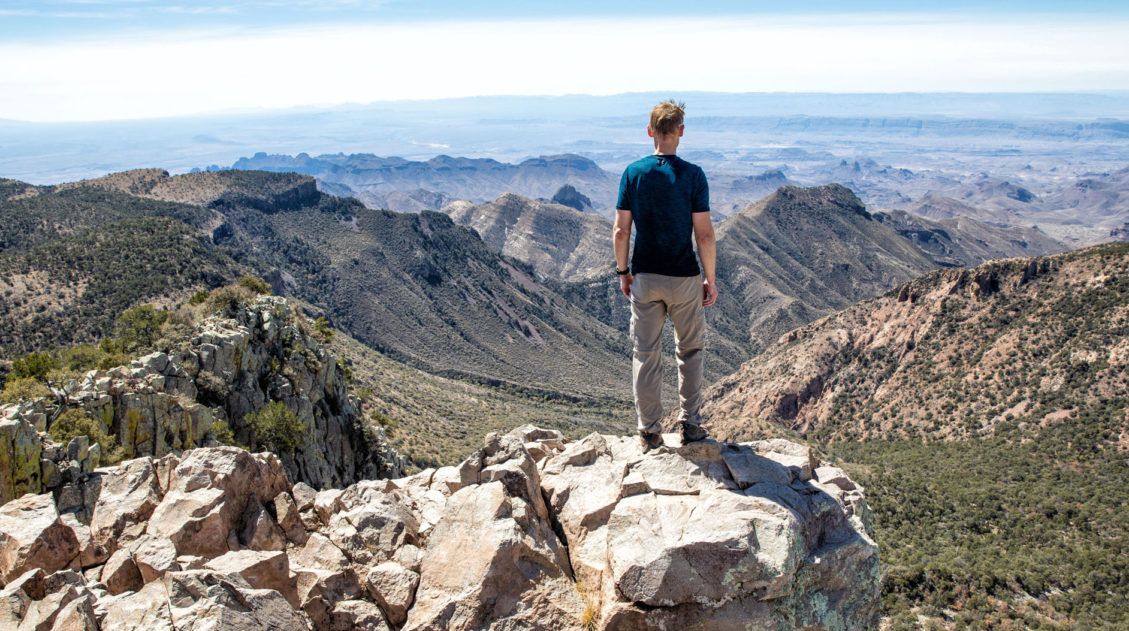
Emory Peak
Distance: 10.4 miles | Difficulty: Strenuous | Time: 5 to 7 hours
If you want to stand on the highest peak in the Chisos Mountains and Big Bend National Park, put Emory Peak on your list. This is a tough hike but the views over the park are awesome. Learn more in our guide to Hiking Emory Peak.
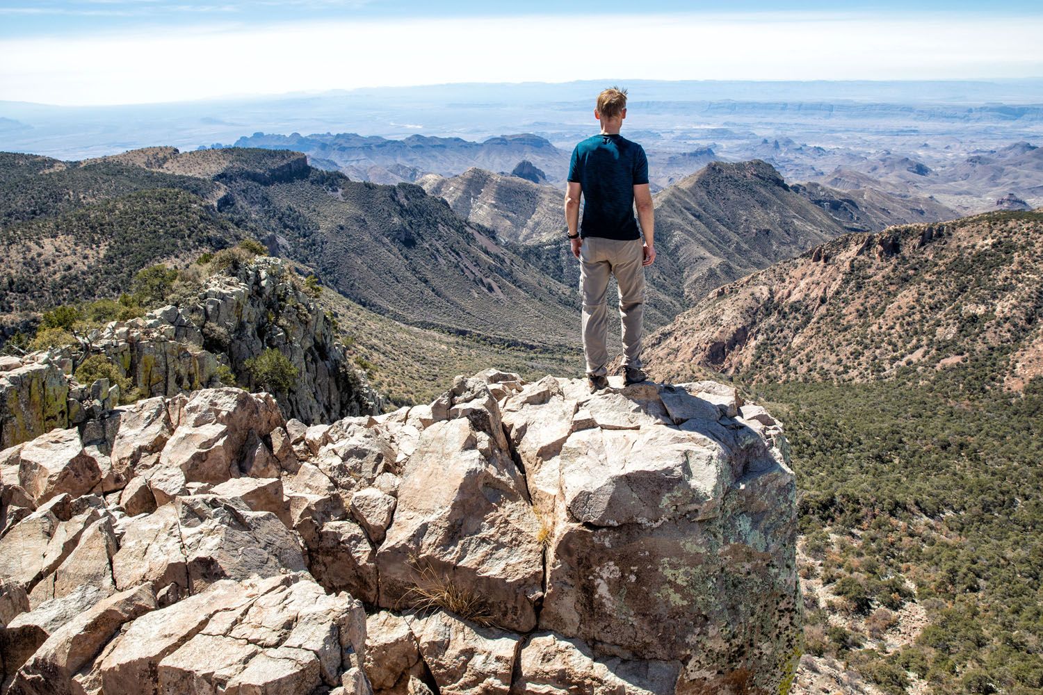
Emory Peak
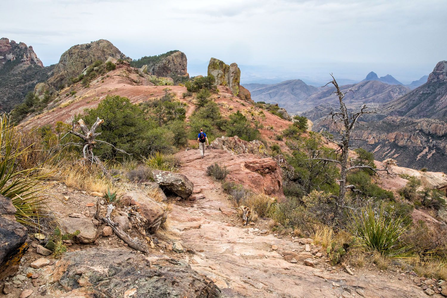
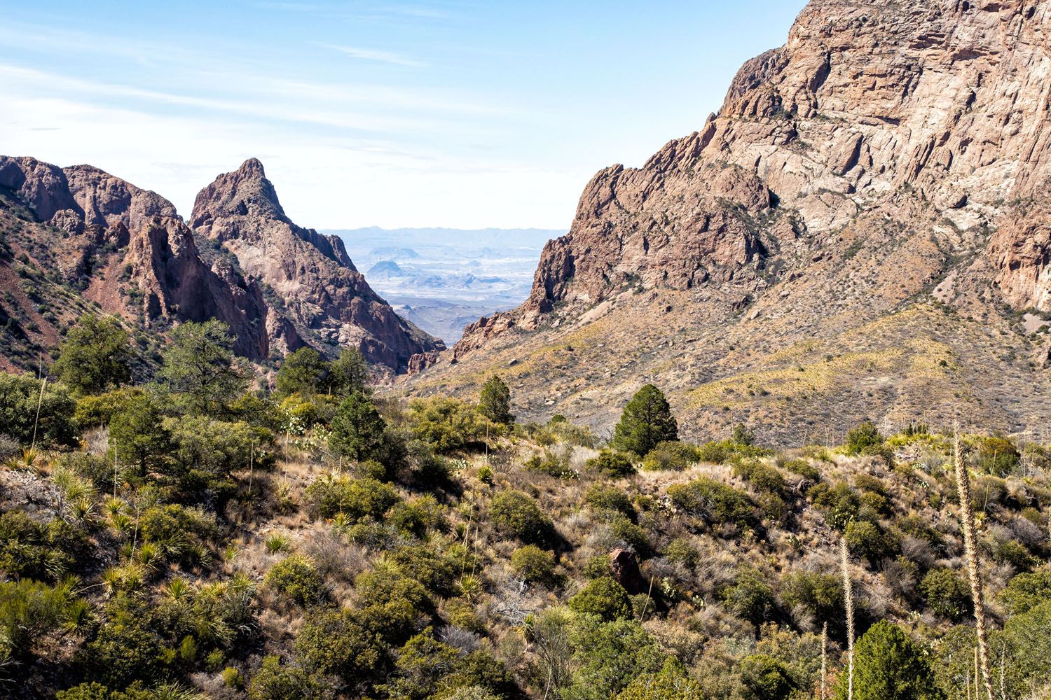
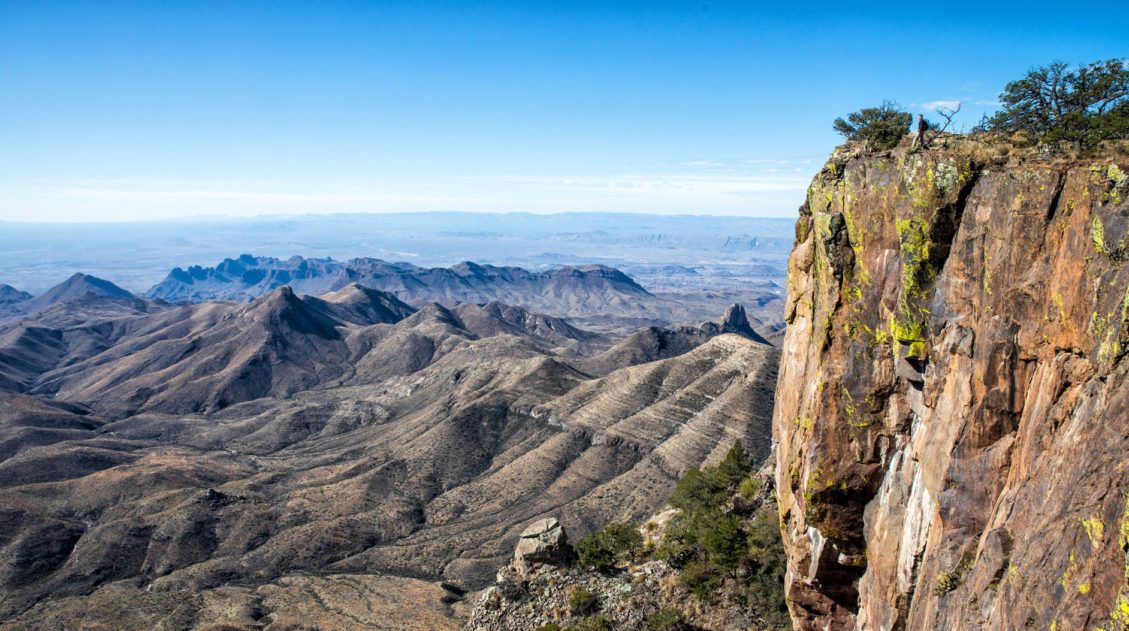
South Rim Trail
Distance: 12.6 miles | Difficulty: Strenuous | Time: 6 to 8 hours
Starting in the Chisos Basin, you will steadily climb up to the South Rim, where jaw-dropping views of the Chihuahuan Desert await. This hike is done as a loop and you have the option to add on Emory Peak. Learn more in our guide to the South Rim Trail.
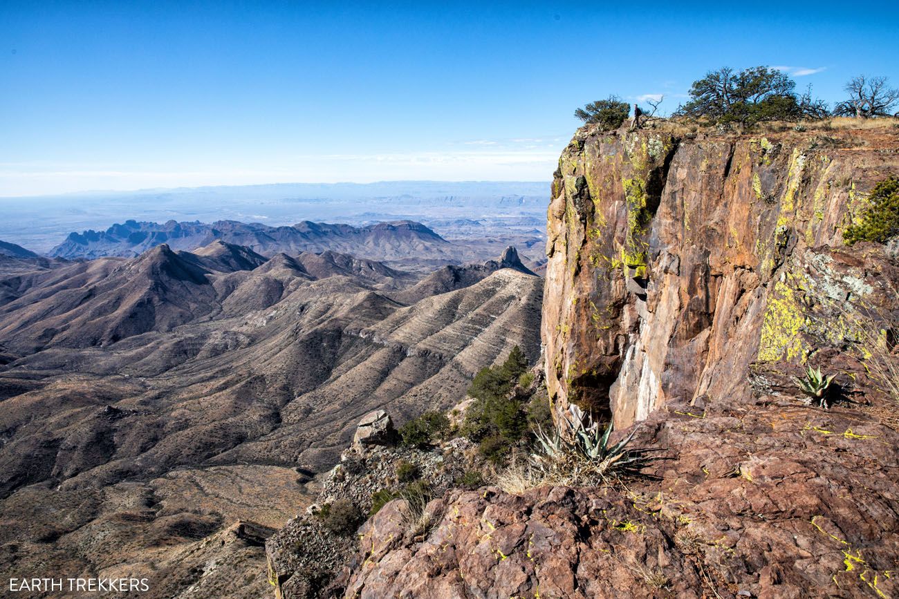
South Rim Trail
Emory Peak + South Rim Trail
Distance: 15.6 miles | Difficulty: Strenuous | Time: 7.5 to 9.5 hours
This is the ultimate hiking experience in Big Bend National Park. Hike the complete South Rim Trail and top it off with the climb up to Emory Peak for unbeatable views of the Chisos Mountain Range and Chihuahuan Desert. Learn more in our guide to the South Rim Trail.
Emory Peak Trail, Big Bend: Everything You Need to Know
Pinterest Facebook Flipboard Emory Peak is the highest point in Big Bend National Park and the Chisos Mountains, and the hike to the summit is one of the best things you can do in the park. The 10.4-mile out-and-back gains nearly 2,500 feet of elevation and finishes with a short rock scramble to the top, […]
South Rim Trail Loop + Emory Peak | Complete Hiking Guide
The South Rim Trail is the best full-day hike in Big Bend National Park. This 12.6-mile loop starts in the Chisos Basin and climbs steadily to the South Rim, where sweeping views over the Chihuahuan Desert make every switchback worth it. Add on the short but steep scramble up Emory Peak, the highest point in […]
Afternoon
Depending on which trail(s) you chose to hike, you could be finished anywhere from mid-morning to mid-afternoon. If you still have plenty of time left in the day, consider hiking the nearby trail to Balanced Rock, if you didn’t do it yesterday, visiting the Fossil Discovery Exhibit (great if you are traveling with kids), or soaking in the hot springs near Rio Grande Village (just note that it will be a very long drive to get back to Terlingua or Lajitas).
Day 4: Big Bend National Park: Rio Grande Village
On the Road: 105 miles, 2.5 hours out and back from Terlingua.
Rio Grande Village is located in the eastern section of Big Bend National Park. There are a few hiking trails and scenic overlooks, but the big draw are the hot springs and the chance to cross the border to visit the Mexican town Boquillas del Carmen.
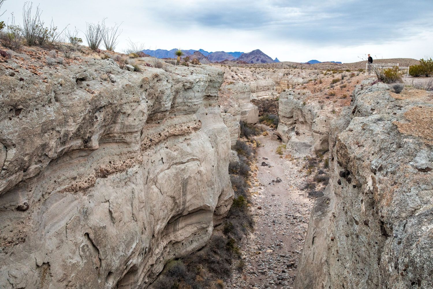
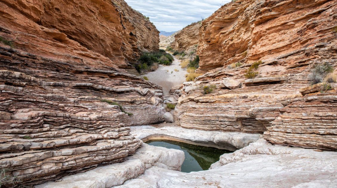
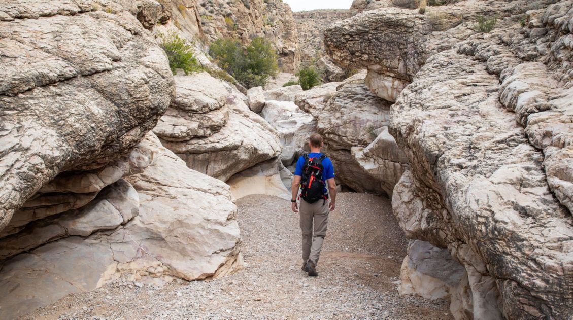
Before heading right to the Rio Grande Village, we have an optional side trip to recommend. Hiking to Ernst Tinaja was one of our favorite experiences in Big Bend National Park.
Optional: Ernst Tinaja
Distance: 1.6 miles | Difficulty: Easy | Time: 1 to 1.5 hours
Ernst Tinaja is a series of water holes that are tucked away in a remote canyon. With its colorful limestone rocks, this area looks much different from the rest of Big Bend National Park.
Ernst Tinaja
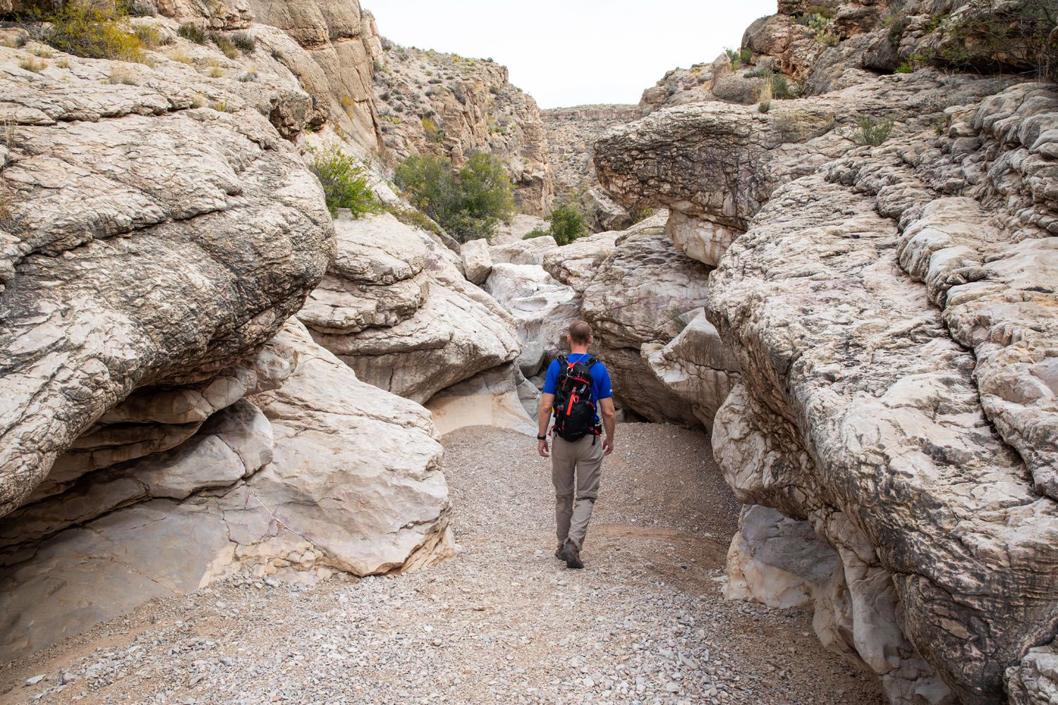
Ernst Tinaja Trail
It is a short, easy hike through a canyon to get to the water holes. Those looking for a little more adventure can continue the hike past the water-filled pools and rock scramble their way to the back of the canyon.
You will need a 4WD vehicle to get to the Ernst Tinaja trailhead. Old Ore Road, a rough, primitive dirt road, leads to the trailhead. The national park service recommends having a high-clearance 4WD vehicle for this drive.
For full details on the hike and the drive, read our guide to Ernst Tinaja↓
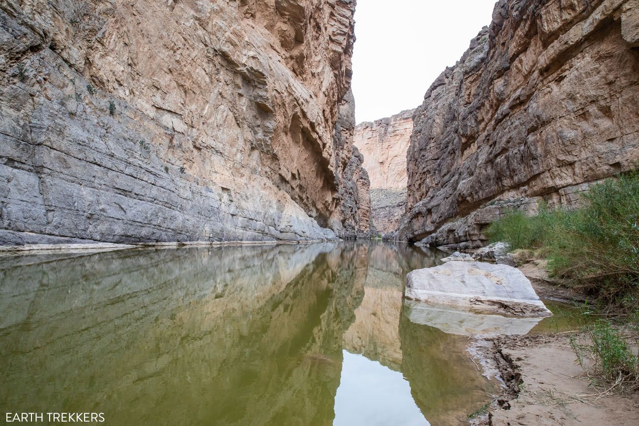
Boquillas Canyon Trail
Distance: 1.6 miles | Difficulty: Easy to moderate | Time: 1 to 1.5 hours
Drive to the end of Boquillas Canyon Road. This road dead-ends at a parking lot and the trailhead for Boquillas Canyon.
This hike is similar to Santa Elena Canyon in that it follows along the edge of the Rio Grande. The first part of the hike is the most challenging, a steep but brief climb up and over a good-sized hill. The view from here is very nice, as you look out over the Rio Grande, and honestly, it’s better than the view you will have from the nearby Boquillas Canyon Overlook (next on this itinerary). Then, it is a mostly flat and scenic walk along the river.
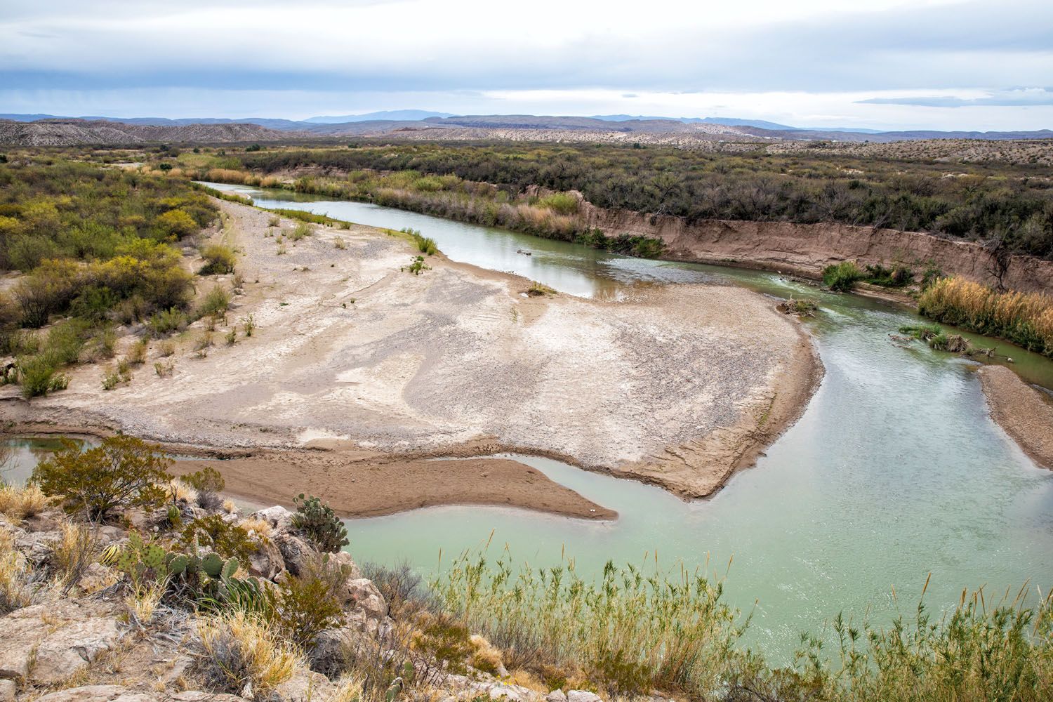
View from the Boquillas Canyon Trail
Boquillas Canyon Overlook
Drive back down Boquillas Canyon Road just a short distance until you reach the Boquillas Canyon Overlook. This view isn’t quite as good as the view you just had from the Boquillas Canyon Trail, but it’s still worthwhile. From here, you look out over the Rio Grande and off in the distance you can see Boquillas del Carmen in Mexico.
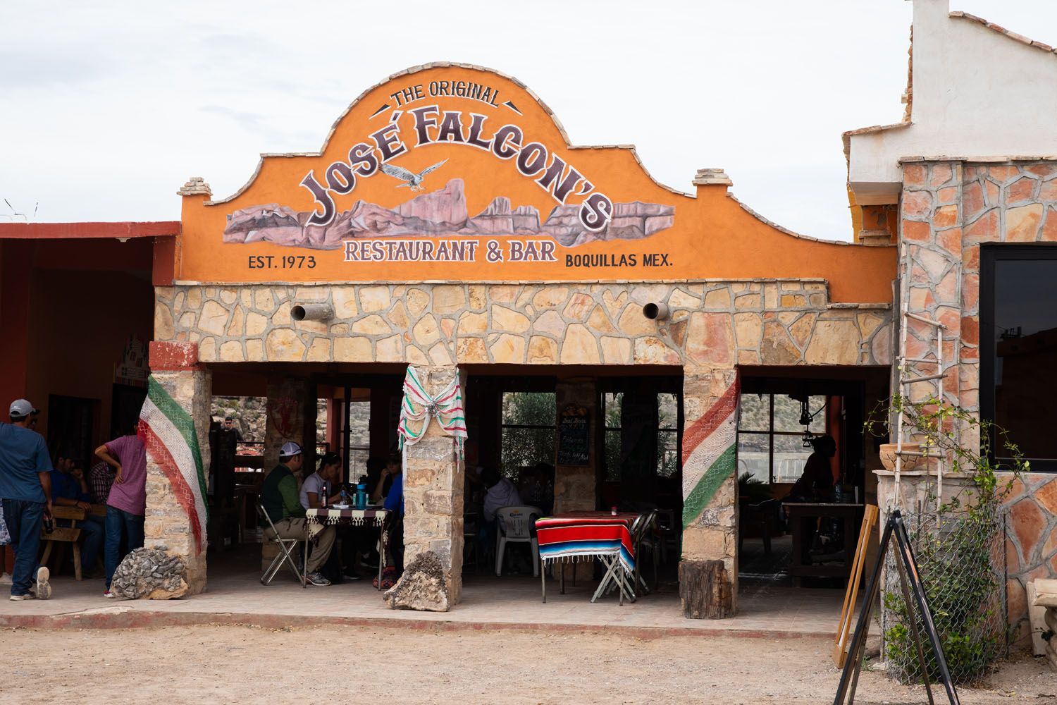
Visit Boquillas del Carmen
Boquillas del Carmen is a very small town in Mexico. To get here, you will cross the Rio Grande by row boat. Spend the afternoon drinking margaritas, eating Mexican food, and shopping.
In order to do this, you will go through Border Control, so you must have your passport.
Park at the Boquillas Crossing Port of Entry. You will pass through the Port of Entry building and then walk a short distance along the Rio Grande to the river crossing.
There are several men operating row boats to shuttle visitors back and forth across the river. Once on the Mexican side of the Rio Grande, you pay your fee ($5 per person, cash only, round trip), are given a ticket, and you will show this at the end of your visit, when you are ready to cross the Rio Grande again.
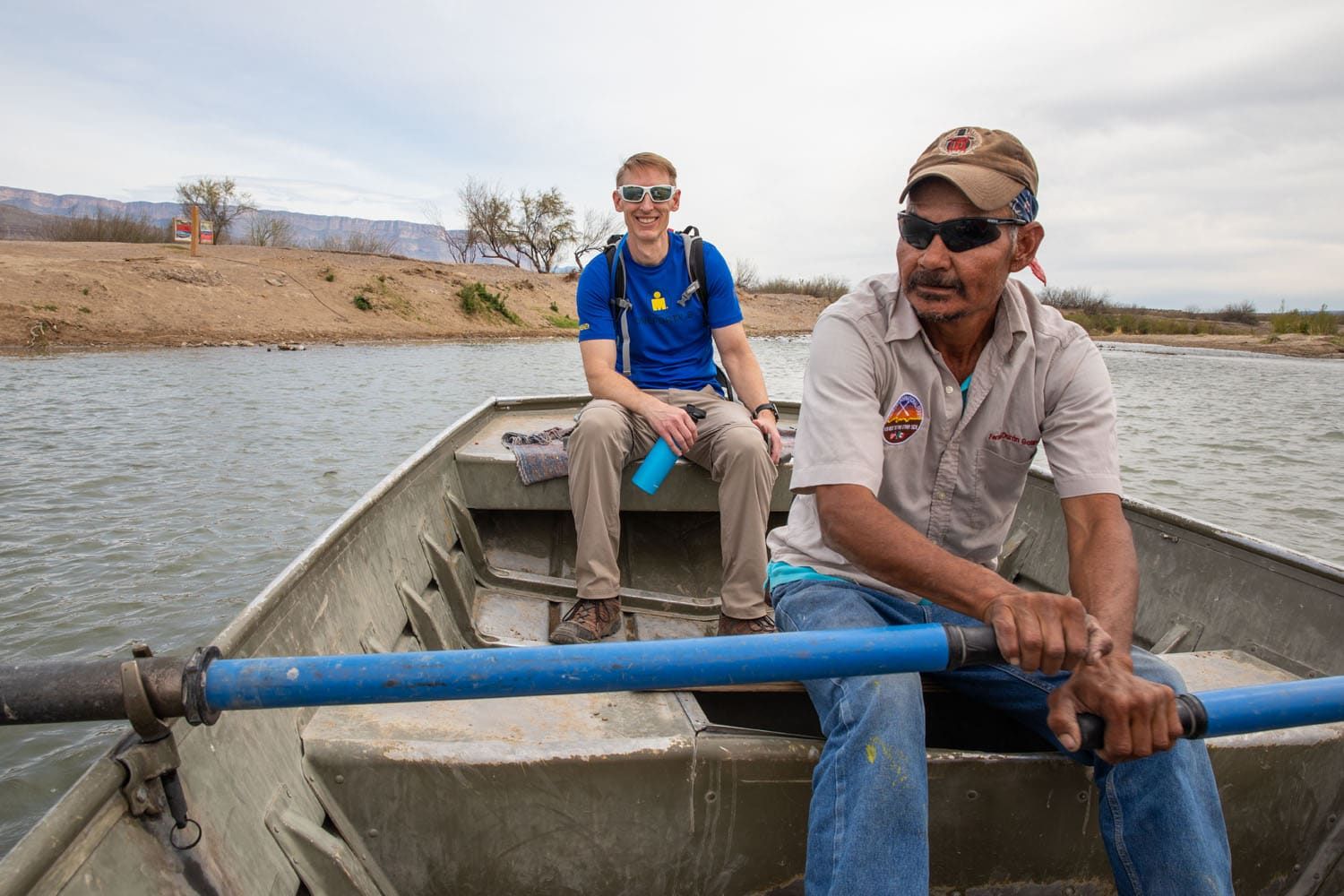
To get into town, you can walk or you can ride a donkey or a horse. We chose to walk, and from what we saw, it takes about the same amount of time, since the donkeys and horses do not move very fast.
It is a 0.6-mile walk (one-way) along a sandy road. The road is covered with donkey poop and the trucks that drive back and forth kick up dust into the air, making this very unpleasant, whether you are walking or riding a donkey.
Boquillas del Carmen has a few restaurants that have terraces with views of the Rio Grande. There are also several small souvenir shops. Many people who come here love hanging out at one of the restaurants, eating Mexican food, and having drinks.
To return to Big Bend National Park, cross the river by rowboat and go through the Port of Entry. Your passport will be scanned and then you will be on your way.
Important Note: The Port of Entry is open Friday through Monday from 9 am to 4 pm year-round, so you cannot come here for dinner. You need to make sure you are back at the Port of Entry no later than closing time or you will be spending the night in Mexico. If you plan to spend the night in Mexico, you will need a temporary visa. Get updated hours on the National Park Service website before you go.
Planning Your Visit: This will take about 4 hours of your time if you do a little shopping and have lunch in town. The shops and restaurants accept US dollars and it is helpful to have small bills. Note that the Port of Entry is only open Friday through Monday, so plan your Rio Grande Village day accordingly.
Day 5: Big Bend Ranch State Park & Drive to Carlsbad
On the Road: 315 miles, 5.5 hours
Morning: Big Bend Ranch State Park
Big Bend Ranch State Park is a wonderful state park that sits just outside of Big Bend National Park. There are fun, easy hiking trails to choose from and these tend to be less crowded than those in the national park. Even if you don’t plan to do any big hikes, it’s a very scenic drive through the state park and a great detour on the way to Carlsbad, New Mexico.
It is free to drive through Big Bend Ranch State Park but if you choose to stop and hike any of the trails, you will pay a $5 fee per person. At each trailhead, there is a box with envelopes. Fill in your vehicle and personal information. Place the appropriate amount of money into the envelope and deposit it into the box. You only have to do this one time per visit. Make sure you bring cash and a pen or pencil.
Big Bend Ranch State Park is open 24 hours a day, 7 days per week.
Here are things we recommend you do as you drive through the park.
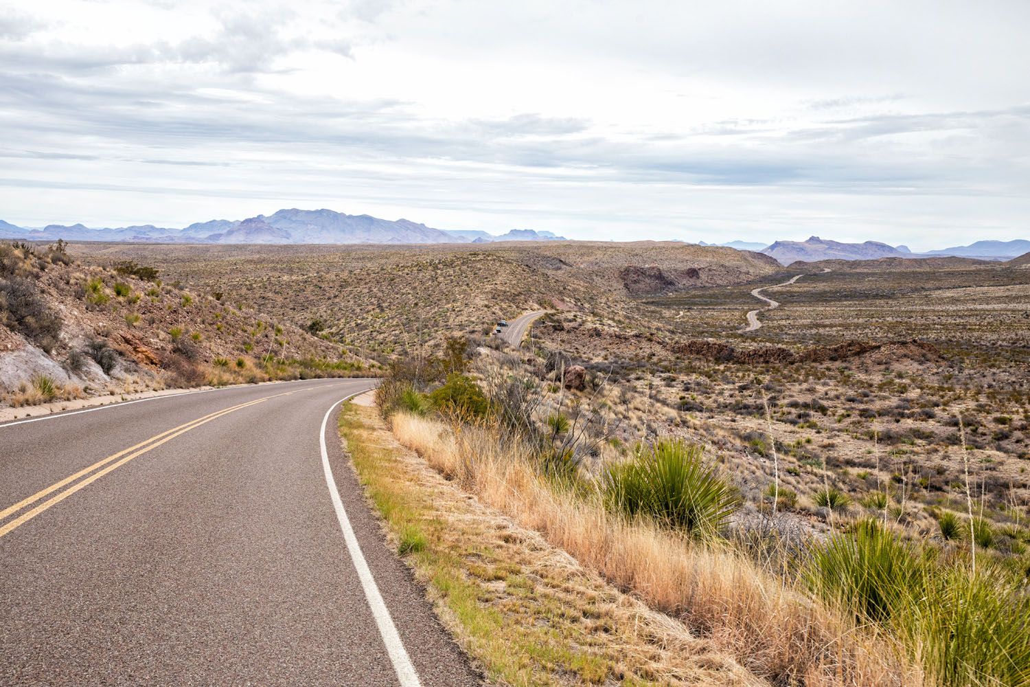
El Camino del Rio
El Camino del Rio, also called River Road, is the stretch of highway 170 that travels through Big Bend Ranch State Park. This road runs parallel along the Rio Grande, and National Geographic called this scenic drive one of the prettiest in America.
This road is 40 miles long and it takes about an hour to drive the full length of it, without stopping at the viewpoints or hiking trails. On this itinerary, you will exit the park in the north and continue the drive to Carlsbad.
See Dom Rock
Fandango is a 1985 comedy that stars Kevin Costner and Judd Nelson. Fandango Dom Rock, located in Big Bend Ranch State Park, was one of the filming sites for this movie.
It is located at the top of the first large hill you come to on Camino del Rio. Just past the crest in the hill is a turn-off where you can park your car. Walk to the top of the hill and look for the word “DOM” scratched on the rock.
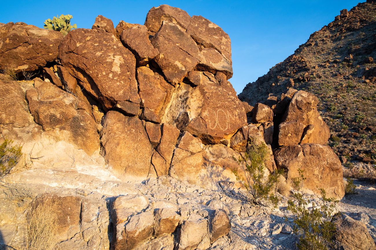
Fandango Dom Rock
Rio Grande Viewpoint
Located on the same hill as Dom Rock, next to the parking turn-out, is a wonderful view over the Rio Grande.
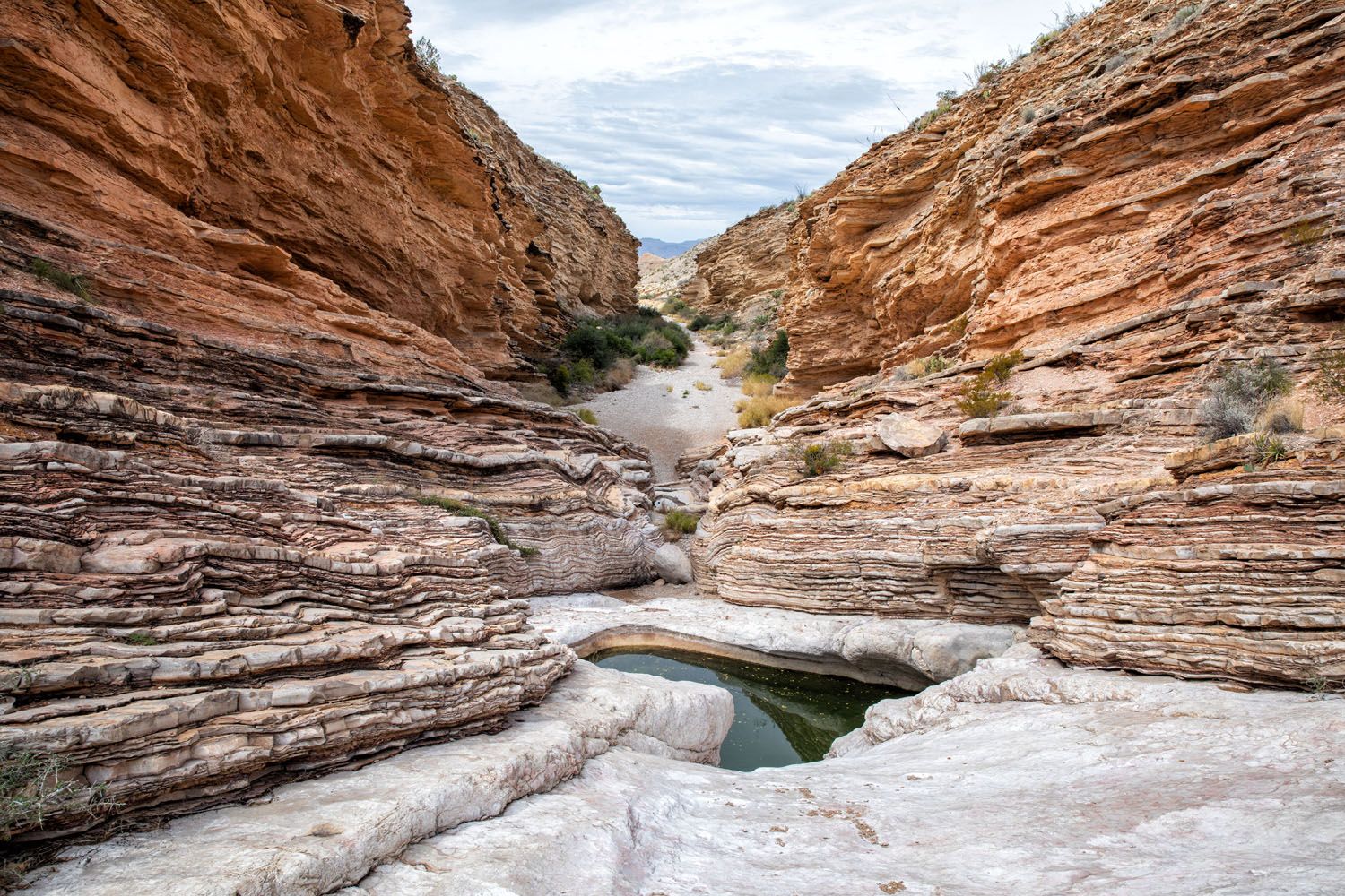
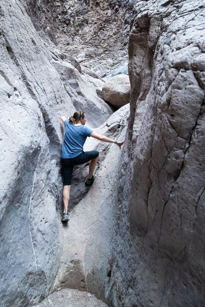
Hike Closed Canyon
This hike is 1.4 miles round trip. Most of it is through a slot canyon.
For the most part, it is a very easy hike, since it is mostly flat, but there are a few sections of rock scrambling that could be difficult for some people. You can simply hike through the slot canyon as far as you like. Once you get tired, or once you meet an obstacle that you can’t get past, turn around and walk back to your car.
The slot canyon ends at a pool of water. You can wade through this murky pool of water or turn around when you get to this point. We chose to turn around.
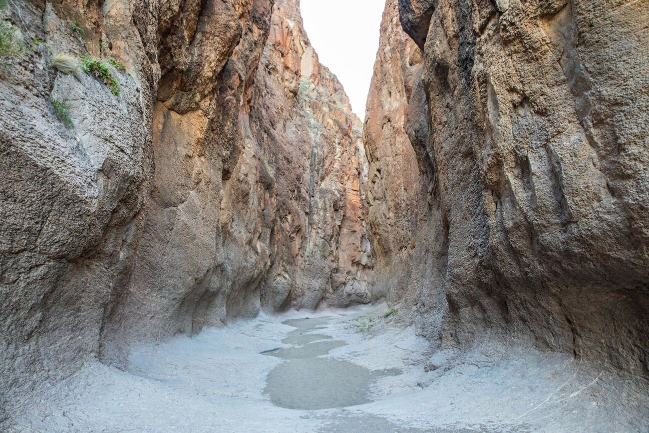
Closed Canyon
Closed Canyon
Hike the Hoodoos and Balanced Rocks Trail
This is another wonderful, short hike to do in Big Bend Ranch State Park. Hiking trails weave their way between hoodoos and rock formations. You can follow the trail out to the edge of the Rio Grande, for an up-close view of this river.
Expect to spend 30 to 60 minutes here, depending on how much exploring you would like to do.
Afternoon: Drive to Carlsbad, New Mexico
Continue on Highway 170 until you get to Presidio. Once in Presidio, take US-67N for 24 miles to Marfa. In Marfa, take US-90 W. Just past Valentine, keep a look out for the Prada art installation on the side of the road. This is a popular photo spot. There is a turn out where you can safely park and take a photo of the art installation.
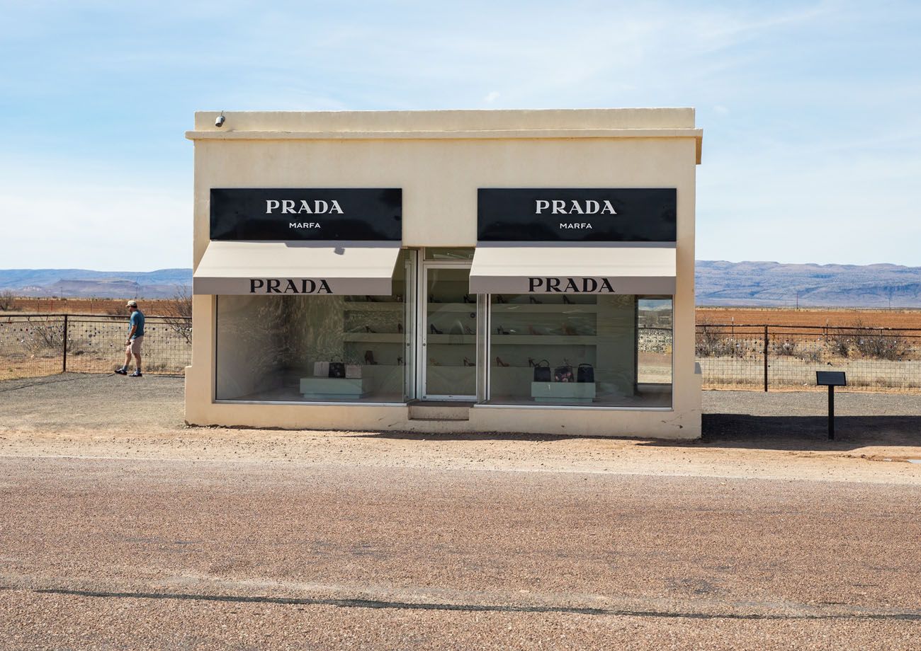
Prada
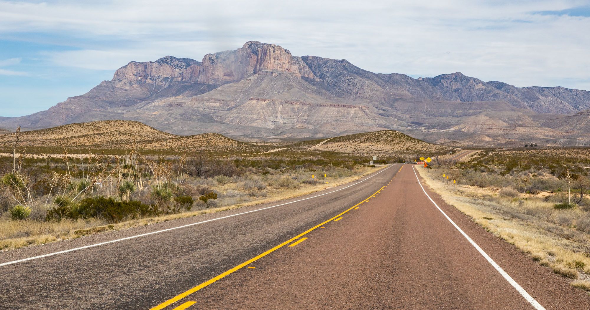
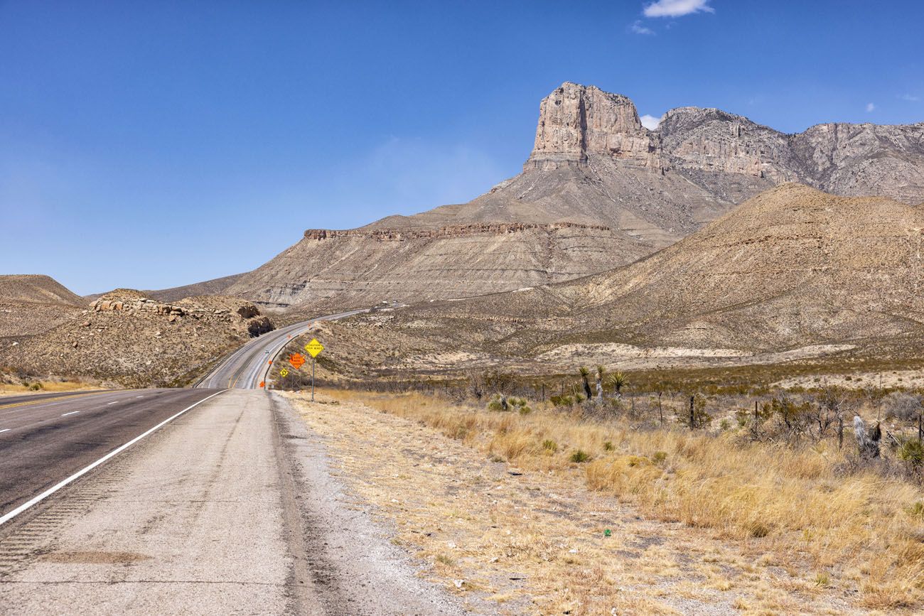
Continue the drive to Carlsbad. US-90 changes to TX-54 north of Van Horn. The Guadalupe Mountains come into view and then you will make a slight right onto US-180/US-62 and continue north to Carlsbad.
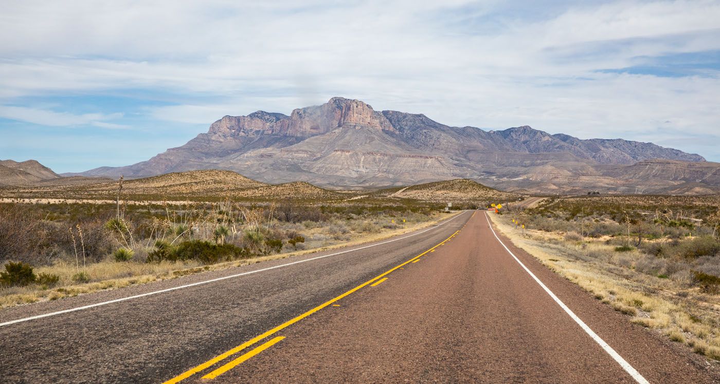
Guadalupe Mountains from Us-180/US-62
Get settled into your hotel and have dinner.
Where to Stay
There are campsites (for tent camping and RVs) at Pine Springs Campground and Dog Canyon Campground in Guadalupe Mountains National Park. Learn more here.
Carlsbad, New Mexico is the best town to stay to visit both Guadalupe Mountains and Carlsbad Caverns. There are many hotels to choose from them (some are brand new) as well as a handful of good restaurants.
Here are several hotels that get very good reviews.
TownePlace by Marriott Carlsbad. This is where we stayed on both of our visits to Carlsbad. It is centrally located in town, so it’s just a quick drive to get dinner or go to the grocery store. Breakfast is included and this is one of the highest rated hotels in Carlsbad.
Home2 Suites by Hilton Carlsbad. This new property is located on the southern end of Carlsbad, making it faster to drive to Guadalupe Mountains and Carlsbad Caverns National Park. It sits outside of Carlsbad, so if you have plans to go to dinner in town, you will have a 10 to 15 minute drive, but staying here shortens your drive to the parks. Plus, it gets awesome reviews.
Hyatt House Carlsbad. This hotel features larger suite-style rooms with living areas and kitchenettes, perfect for families and those who just want extra space or the ability to cook a few meals. It’s located on the southern end of Carlsbad, putting you just a little bit closer to the park.
You will stay in Carlsbad for 3 nights.
Where to Eat in Carlsbad
Here are two restaurant recommendations, great spots to get dinner at the end of the day. We have eaten at both of these on both of our visits to Carlsbad. The Trinity Restaurant is our favorite of the two.
The Trinity Hotel Restaurant. This hotel serves excellent pasta dishes. We were lucky enough to get a table on the second level where we could overlook the restaurant and bar.
Yellow Brix Restaurant. This restaurant offers indoor and outdoor seating. They serve salads, steak, burgers, sandwiches and pasta. I had the Green Chili Fettuccini and it was delicious.
PRO TRAVEL TIP: Call and make a reservation in advance, especially if you will be visiting the area during peak season. During our second visit, the restaurants were turning people away or offering wait times of an hour or more.
Days 6 & 7: Guadalupe Mountains National Park
On the Road: 110 miles, 2 hours each day (Carlsbad, NM to Pine Springs Visitor Center). Driving distances to Dog Canyon and Salt Basin Dunes are longer.
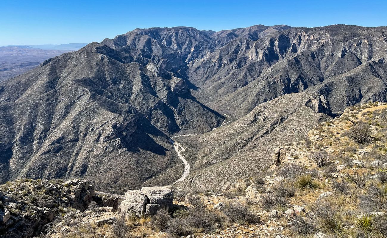
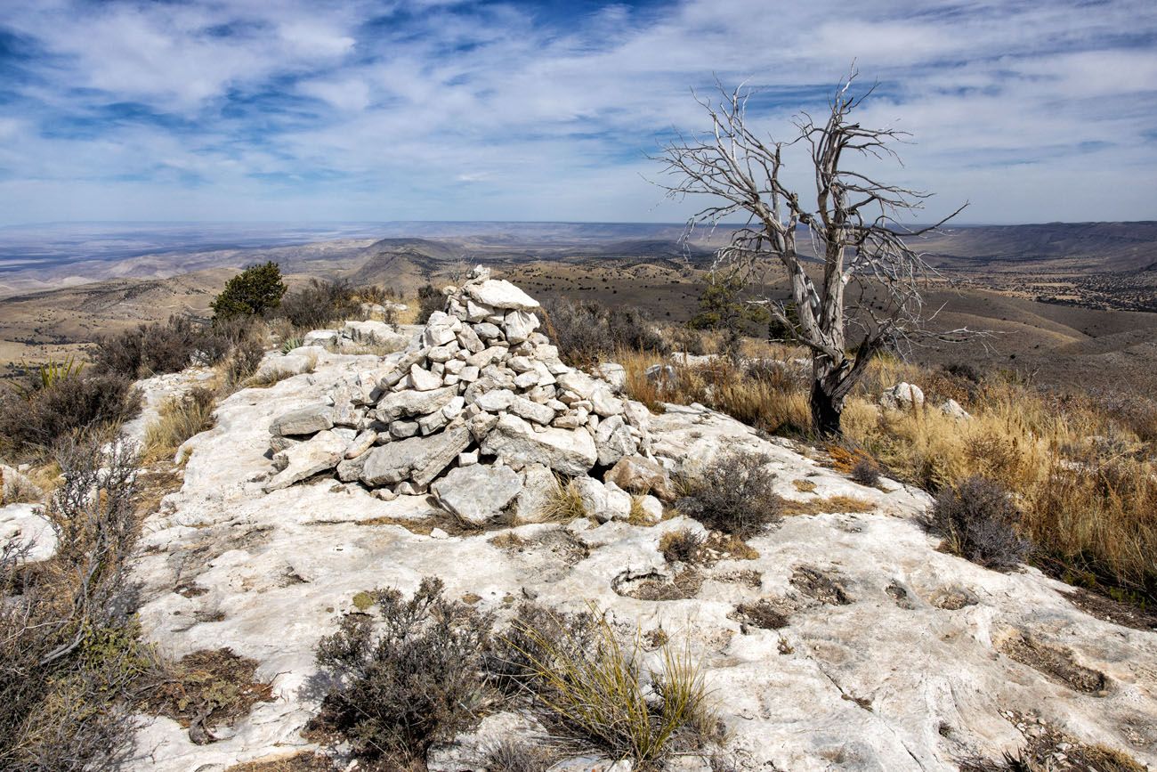
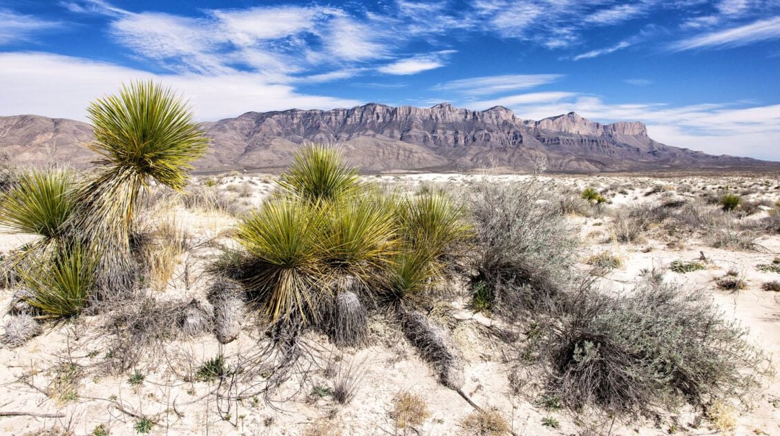
Guadalupe Mountains National Park preserves a portion of the Guadalupe Mountains. The highest peaks are in the southern part of the mountain range, within the boundaries of the national park. Guadalupe Peak, at 8,751 feet, is the highest peak in the Guadalupe Mountains and the highest peak in Texas, earning it the nickname “Top of Texas.”
Carlsbad Caverns National Park is also located within this mountain range. You will visit Carlsbad Caverns later in this itinerary.
There are many different ways to plan your time in Guadalupe Mountains. The main factor depends on how much hiking you want to do. This national park is really geared towards hikers and there is not much you can do without setting foot on a hiking trail. So, if you aren’t a big hiker, you can eliminate a day from Guadalupe Mountains, turning this road trip into a 9-day itinerary.
Here are several different ways to plan your days. With 2 full days in Guadalupe Mountains, you can pick two of these. For more information, check out our article Best Things to Do in Guadalupe Mountains National Park.
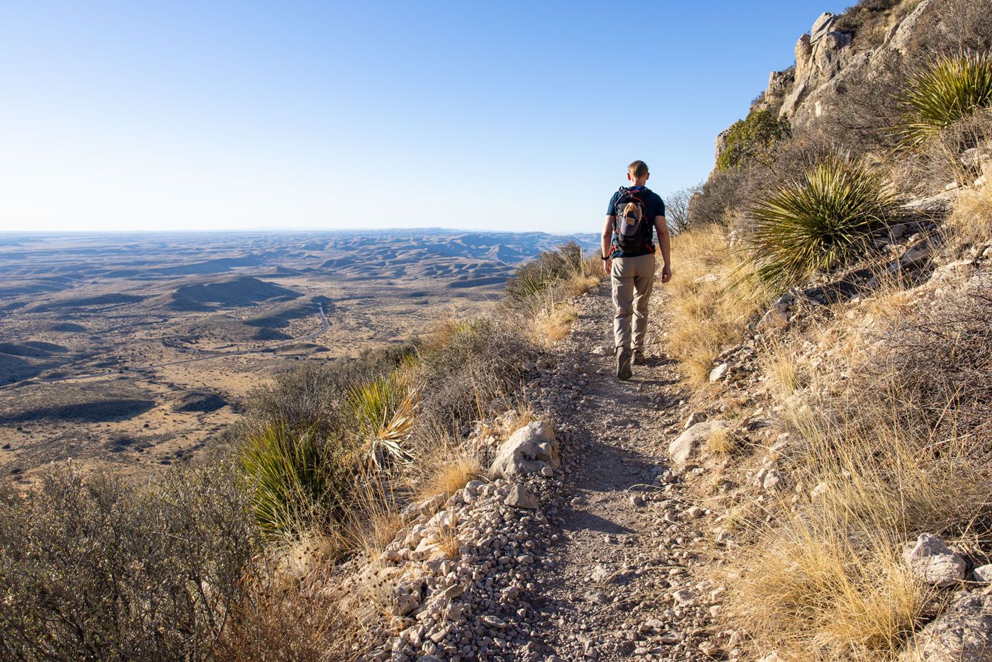
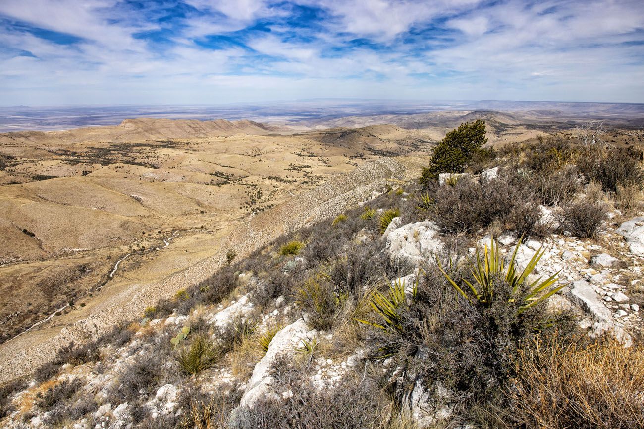
Option #1: Hike Guadalupe Peak
Distance: 8.4 miles out-and-back | Difficulty: Strenuous | Total Ascent: 3,000 feet | Time: 4 to 8 hours
This is one of the most popular hikes in the park, as many people want the bragging right that they stood on the highest peak in Texas.
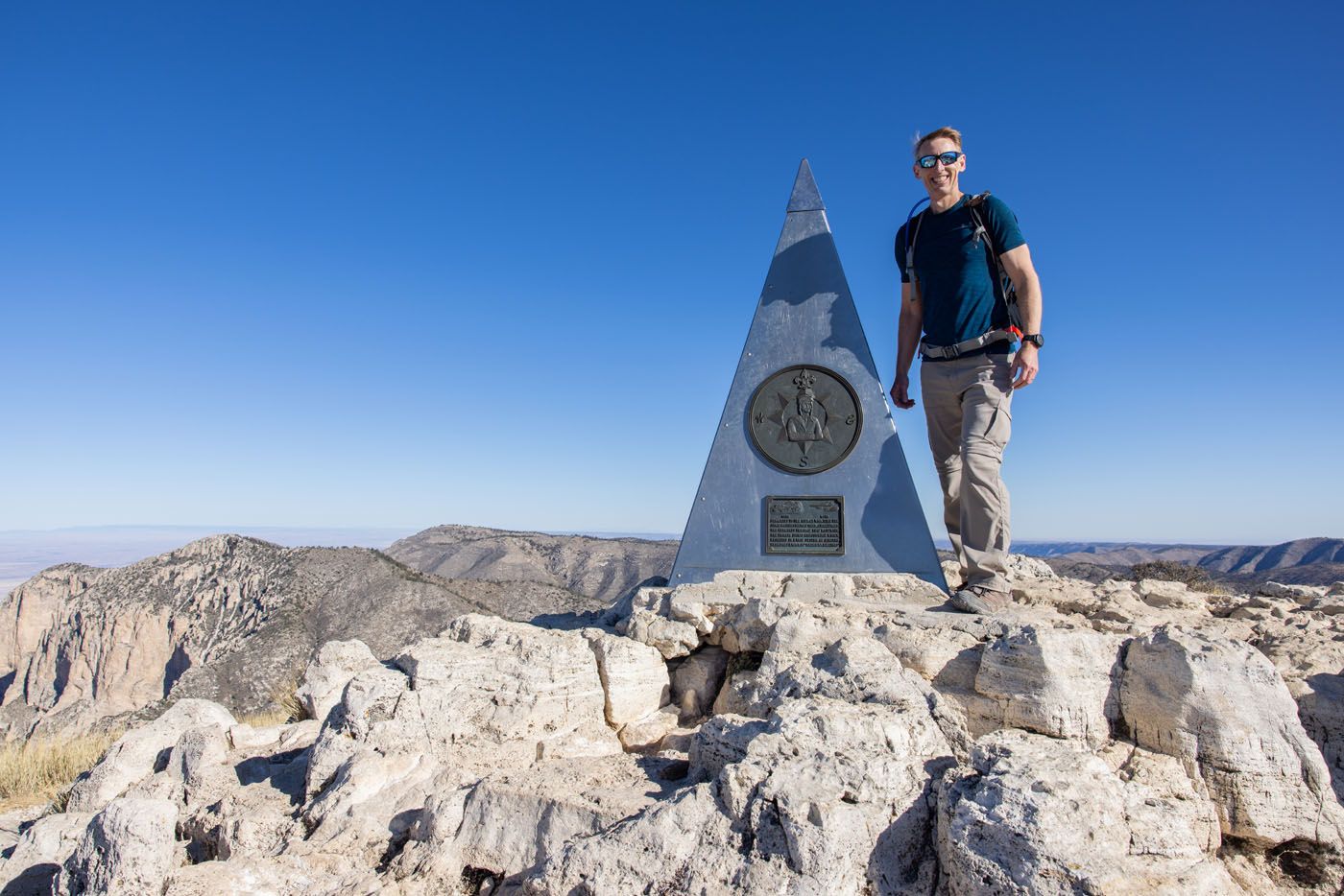
Tim on Guadalupe Peak
Trail to Guadalupe Peak
Getting here is not easy. It’s a tough, uphill hike to get to Guadalupe Peak, with rocky trails, long steep staircases, and some narrow sections of trail.
But once at the top, the views are unbeatable. From Guadalupe Peak, you have panoramic views over the national park as well as the Chihuahuan Desert.
For full details on how to do this, check out our guide on How to Hike to Guadalupe Peak.
Option #2: Hike McKittrick Canyon Trail or the Permian Reef Trail
The McKittrick Canyon Trail is 10 miles out-and-back. It’s one of the most popular hikes in the park and takes you to a historic cabin and the Notch (a nice viewpoint of the park).
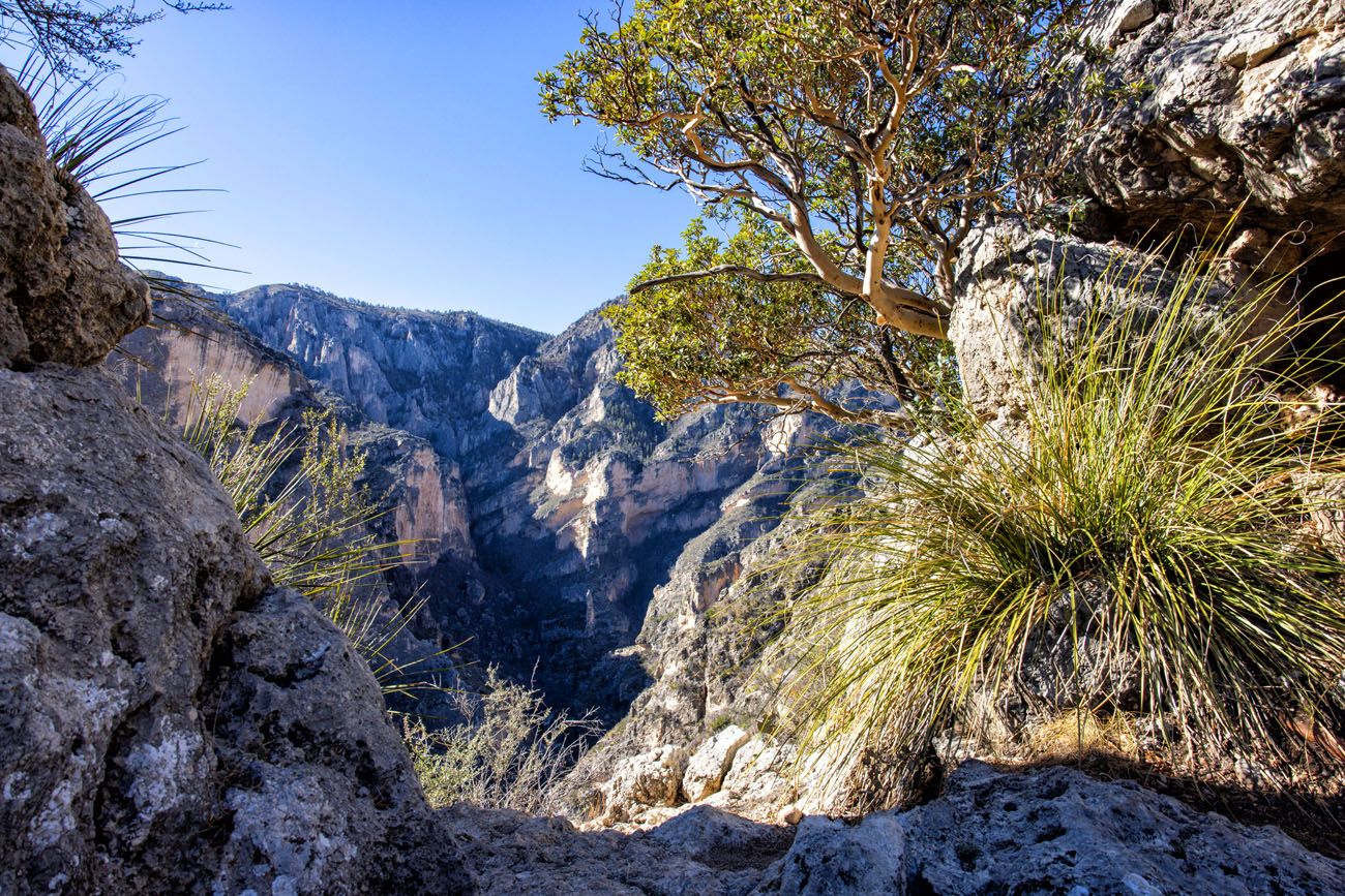
The Notch
The Permian Reef Trail starts at the same spot but is much more scenic and less crowded than McKittrick Canyon. It also has more elevation gain over its 9+ miles, which makes it more challenging. But we recommend the Permian Reef Trail over the McKittrick Canyon Trail.
View of McKittrick Canyon from the Permian Reef Trail.
Both of these hikes take 4 to 6 hours. In the afternoon, hike the McKittrick Canyon Nature Trail, visit the El Capitan Lookout and visit the Frijole Ranch Museum. You can also visit Carlsbad Caverns in the afternoon. If you are planning your itinerary between late May and October, you can watch the Bat Flight Program in Carlsbad Caverns.
Option #3: Visit Dog Canyon
Dog Canyon is a remote area on the northern end of the park. To get here from Carlsbad, it is an hour and a half drive through ranches and tiny towns. It is a beautiful drive to get here and the road is paved the entire distance.
If you like the idea of leaving the crowds behind and going off-the-beaten-path, put Dog Canyon on your to-do list.
Once here, hike the Tejas Trail to Lost Peak. This hike is 6 miles out-and-back, moderately difficult, and takes 3 to 5 hours. I also liked this hike more than the McKittrick Canyon Trail.
Lost Peak
View from Lost Peak
Option #4: Devil’s Hall Trail
Distance: 3.75 miles out-and-back | Difficulty: Moderate to Strenuous | Total Ascent: 800 feet | Time: 2 to 4 hours
Starting at the Pine Springs Trailhead, the first mile is an easy hike on a dirt trail that runs through the canyon. At about one mile into the hike, you reach the wash. For the next 0.75 miles, you hike/rock scramble up and over boulders of all sizes to get to Devil’s Hall, at the end of the canyon. Get the full details in our Devil’s Hall Trail Guide.
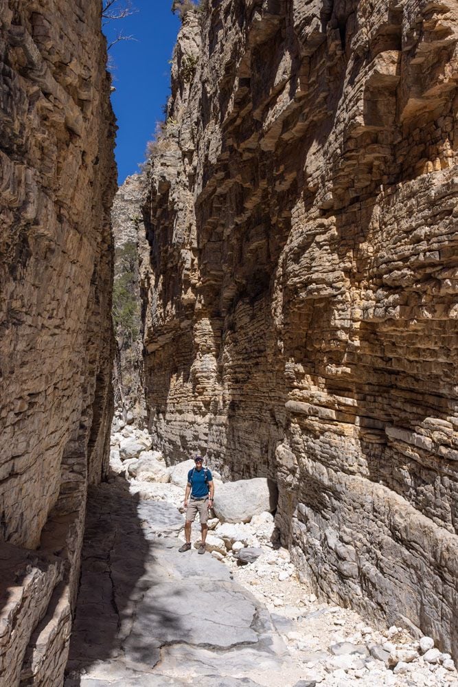
Devil’s Hall
Since this hike only takes half of a day, in the afternoon, visit the El Capitan Lookout and visit the Frijole Ranch Museum.
Option #5: Salt Basin Dunes
This is another remote region of Guadalupe Mountains National Park.
The Salt Basin Dunes are gypsum dunes, similar to those at White Sands National Park. However, the dunes in Guadalupe Mountains are smaller and covered with vegetation.
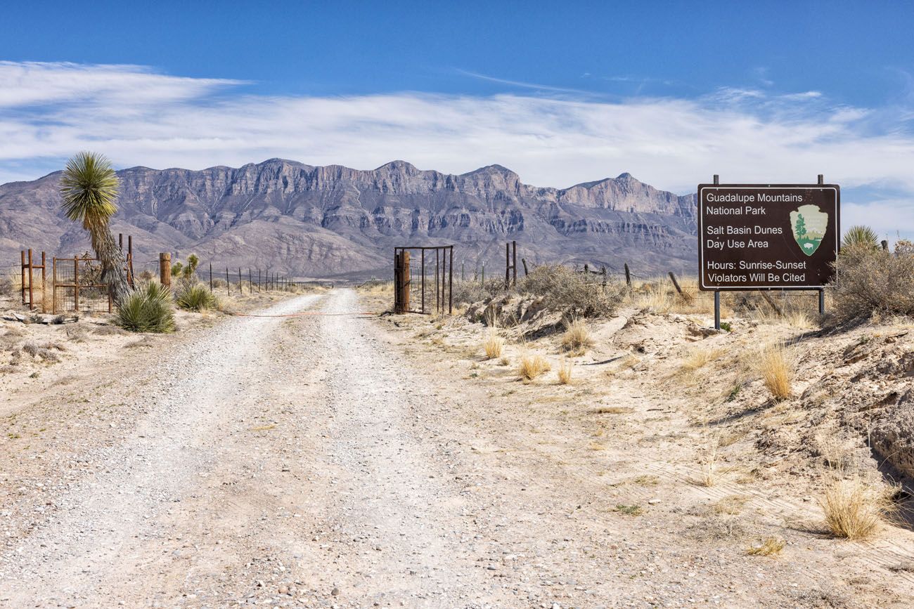
Entrance to Salt Basin Dunes
Salt Basin Dunes
From the Pine Springs Visitor Center, it takes an hour to drive here. Google Maps can route you to the dunes, just be aware that you will not have any cellular service once you leave the Pine Springs area. We did not have cellular service in and around the sand dunes. From Highway 62, turn right on FM road 1576 and take this for 17 miles. Turn right on Williams Road and take this for 7.5 miles. The road ends at the parking lot. Williams Road is a well-packed clay road but it can be impassable and slippery when wet.
From the parking area, it is just over a 1-mile walk one-way to get to the dunes. This trail is flat and sandy. Since the Salt Basin Dunes sit at a lower elevation than the rest of the park, it will most likely be warmer here than at Pine Springs or McKittrick Canyon. There is no shade on the trail so bring water, sunblock, and sunglasses.
We didn’t walk far into the dunes, just far enough to take a few photos. This is one of my favorite parts of Guadalupe Mountains National Park. The views of the Guadalupe Mountains, the beautiful snow-white dunes, and low crowds make this one of the best things to do in Guadalupe Mountains National Park.
DOG CANYON + SALT BASIN DUNES: It is possible to visit Dog Canyon in the morning and the Salt Basin Dunes in the afternoon. Just note that you will do a LOT of driving on remote roads and some of these are gravel roads. These roads are suitable for standard vehicles, as long as it is not wet or raining. For more information on how to do this, read about Dog Canyon in our article Best Things to Do in Guadalupe Mountains National Park.
Day 8: Carlsbad Caverns National Park & Drive to White Sands
On the Road: 200 miles, 4 hours on the “fastest route” to Alamogordo.
Morning: Carlsbad Caverns
A half of a day is all you need to hike the Natural Entrance Trail and explore the Big Room. With a little more time, add on a ranger-guided tour of Carlsbad Caverns National Park.
Unlike many national parks, which are open 24 hours a day, Carlsbad Caverns has set hours of operation. The visitor center is open daily from 9 am to 5 pm. You are permitted to hike into the cave starting at 9:30 am.
To make the most of your time today, I recommend getting here right at opening time. It’s also a very nice experience to be one of the first people on the Natural Entrance Trail.
PRO TRAVEL TIP: Timed-entry reservations are required to enter Carlsbad Caverns. Ticket go on sale 30 days in advance and sell out almost instantly, so mark your calendar so you can purchase these as soon as they become available. The Self-Guided Tour includes the Natural Entrance and Big Room Trails, which you can explore on your own without a park ranger. There are set times for these tickets and the first one is at 9:30 am. Learn more here.
Natural Entrance Trail
Start your morning with the Natural Entrance Trail.
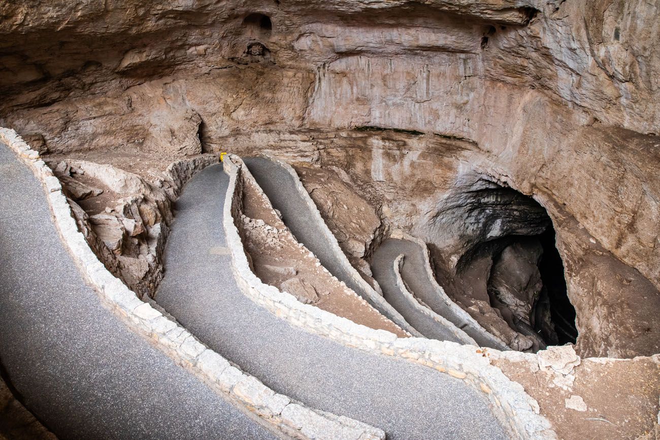
Natural Entrance Trail
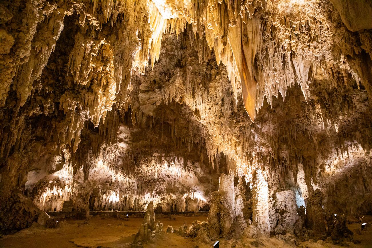
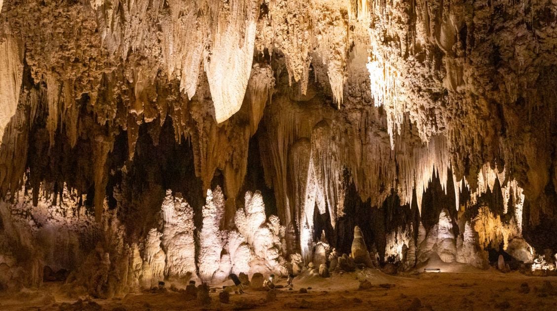
Entering Carlsbad Caverns through the Natural Entrance is one of the best experiences in the park. A well-maintained asphalt trail winds its way down into the mouth of Carlsbad Caverns. Gradually, your eyes will adjust to dim lighting, as you travel farther into the cavern. The cavern gradually reveals itself and its collection of unique rocky formations and dripstones. The trail ends in the Big Room.
This hike is 1.25 miles one-way and downhill for the entire distance. It takes 45 minutes to one hour.
Big Room Trail
The Big Room is the largest cave chamber in the United States by volume. This massive room is filled with stalactites and stalagmites, cave formations, and breathtaking views.
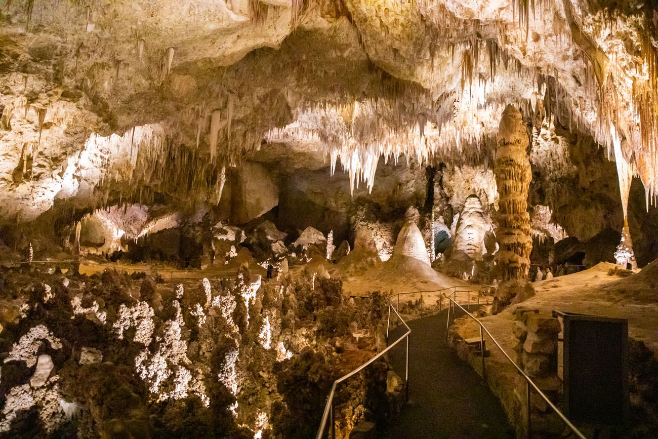
Big Room
The Big Room Trail makes a loop in the Big Room. This “hike” is 1.25 miles, wheelchair accessible, and takes 45 minutes to one hour.
If you choose not to take a Ranger Guided Tour, you will ride the elevator from the Big Room to the visitor center, rather than walking back up the Natural Entrance Trail.
PRO TRAVEL TIP: Both the Natural Entrance and Big Room Trails are self-guided, which means that you do not have to do these on a tour. However, you still need to make a timed-entry reservation. If you just walk these two trails, you get to see some of the best parts of Carlsbad Caverns. For many people, this is sufficient. But if you want to explore farther, consider adding on a ranger-guided tour.
Ranger Guided Tours
IMPORTANT: Ranger-guided tours are operating on a limited basis due to staffing cuts. The Lower Cave Tour runs every Saturday, and the King’s Palace Tour is offered Sunday through Friday when staffing allows (walk-up tickets only, day-of). Other tours (Slaughter Canyon, Spider Cave, etc.) remain suspended indefinitely. Check the National Park Service website for current availability before your visit.
Currently, there are five ranger guided tours that you can choose from. These range from short, easy walks to much longer “hikes” that have you crawling through narrow tunnels and doing a bit of rock scrambling. All of these tours have an additional fee.
For the full list, read our article Best Things to Do in Carlsbad Caverns National Park.
Tim and I took the King’s Palace Tour. This tour is 1.5 hours long, has 1 mile of walking, and you get to see a huge number of stalactites, stalagmites, and other cave formations. If you are looking for an easy but beautiful tour of Carlsbad Caverns, this is a great choice.
Afternoon: Drive to White Sands
There are several ways to drive between Carlsbad Caverns National Park and Alamogordo (the town that sits rights outside of White Sands).
FASTEST ROUTE: The most direct route goes through Carlsbad (so you can grab a bite to eat here) and Cloudcroft and takes just over 3 hours (175 miles).
ROSWELL DETOUR: You can add on a detour to Roswell. We drove through Roswell and weren’t impressed. But if you are curious about what it’s all about, this drive takes 4 hours (220 miles).
THROUGH EL PASO: Finally, you can also swing past Guadalupe Mountains again, take US-62 to El Paso, and then head north to White Sands. It is a boring drive almost the entire way (we have driven all of this multiple times).
Roswell, New Mexico
Where to Stay & Eat
Alamogordo is the best place to stay. From this town, it takes 20 minutes to drive to the park entrance of White Sands.
In Alamogordo, we stayed at the brand new Home2 Suites by Hilton and had a great experience. Other highly rated hotels include the Hampton Inn Alamogordo, the White Sands Motel, and the Fairfield Inn & Suites by Marriott.
Alamogordo has a bunch of chain restaurants like Chili’s, Buffalo Wild Wings, Applebee’s, IHOP, and Starbuck’s. We spent two nights in Alamogordo and both nights ate at D. H. Lescombe’s Winery and Bistro and highly recommend it (make a reservation in advance).
You will stay in Alamogordo for two nights.
Day 9: White Sands National Park
On the Road: 50 miles, 1.25 hours out and back from Alamogordo
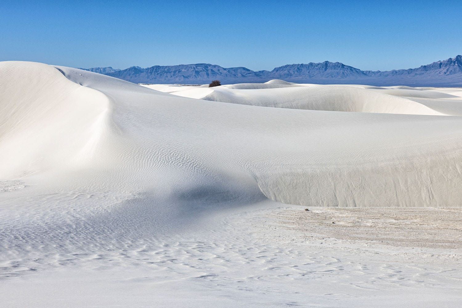
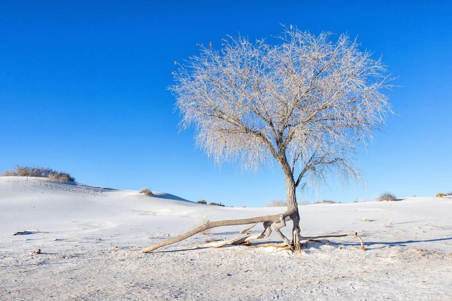
White Sands National Park is small and very easy to visit. With one full day, you have plenty of time to go hiking and sledding.
PRO TRAVEL TIP: Unlike many national parks, White Sands National Park has set hours of operation. This park is gated and once the gate is closed, you won’t be able to get in or out. The gate always opens at 7 am and closing time is 30 minutes after sunset. Before your visit, check the hours of operation and make sure you exit the park before closing time.
Road Closures due to Missile Testing: Dunes Drive can close for up to 3 hours during missile testing at White Sands Missile Range. Usually, park staff is notified within 2 weeks of a missile testing, but in some instances, they may only get 24 hours notice. You can get updates on missile testing and road closures on the National Park Service website.
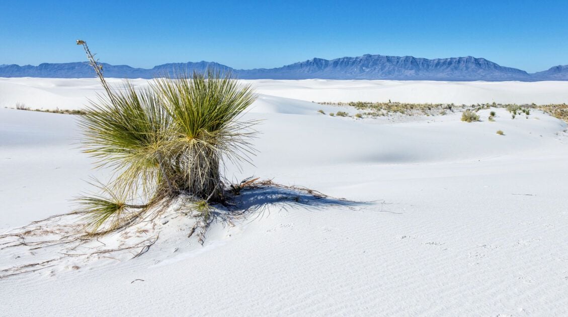
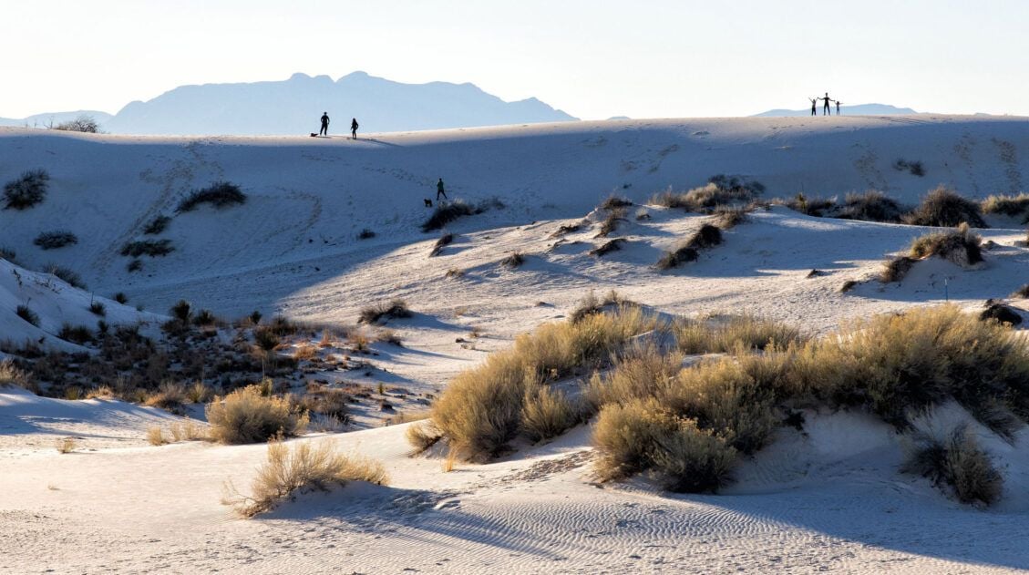
Hike the Alkali Flat Trail first thing in the morning, before the crowds arrive and the temperatures climb. This hike is a 4.5-mile loop through the largest dunes in White Sands. The Alkali Flat Trail is our favorite experience in the park.
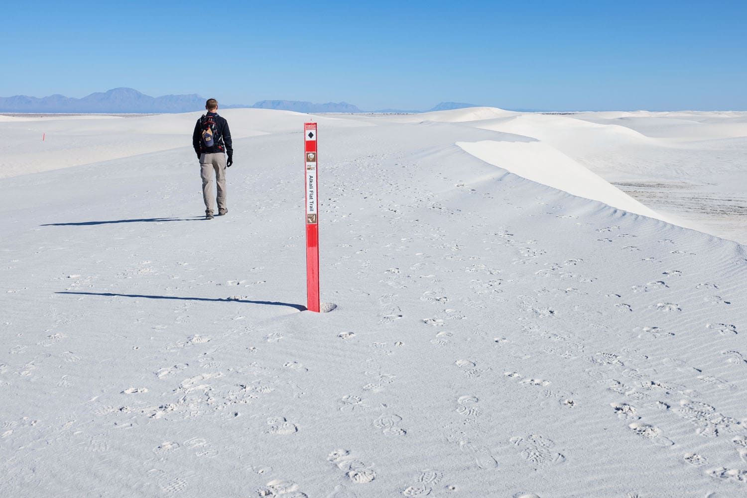
Alkali Flat Trail
View of the dunes from the Alkali Flat Trail
Midday, go sledding on the dunes and have a picnic lunch. You also have the option to hike one of the shorter trails in the park (we recommend the Backcountry Camping Trail and the Dune Life Nature Trail).
Dune Life Nature Trail
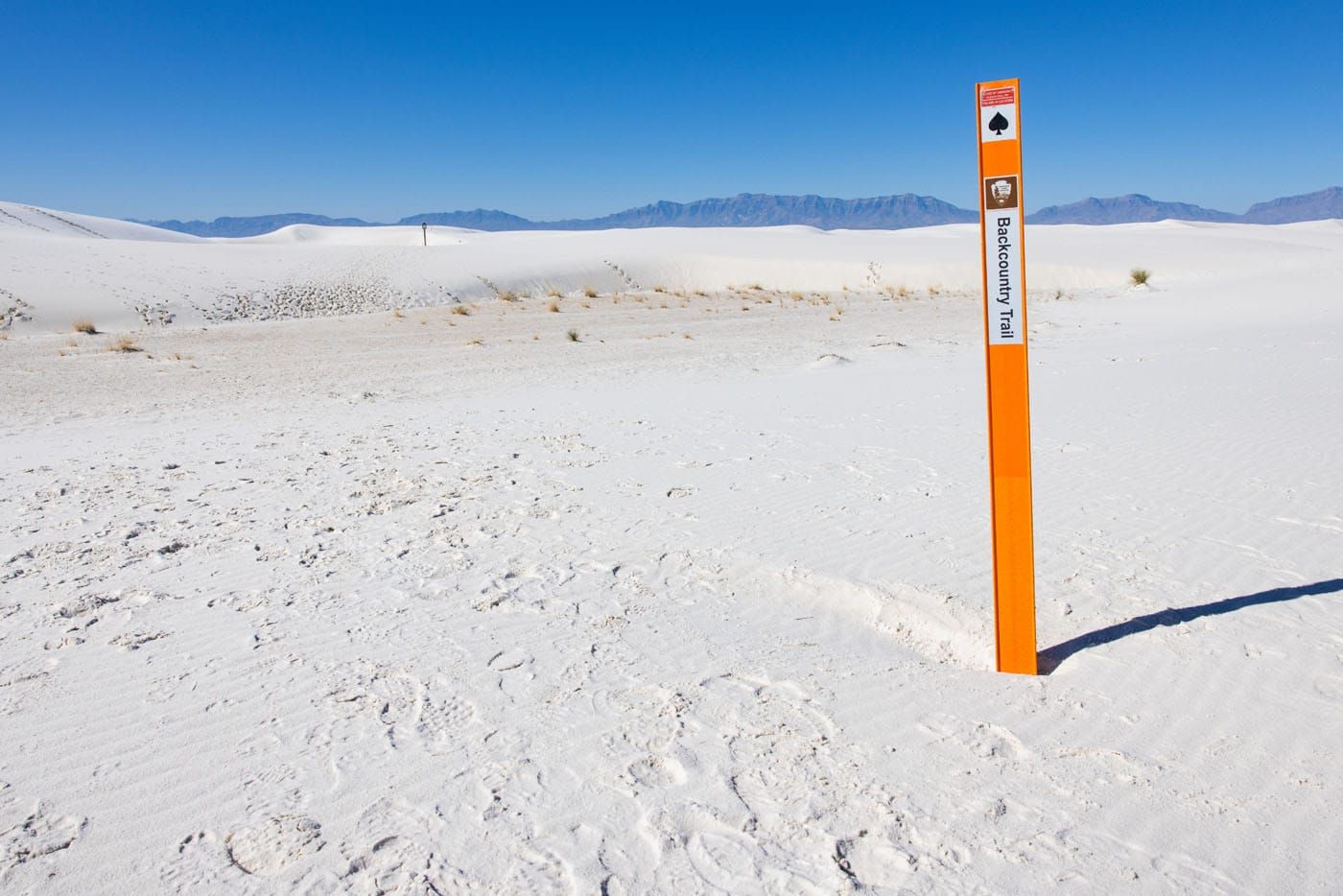
Backcountry Trail
End the day with the ranger-guided Sunset Stroll.
For more information about these activities, including many more photos, hiking stats, and additional things to do with your time, read our article Best Things to Do in White Sands National Park.
Day 10: Fly Home
On the Road: 90 miles, 1.5 hours
In the morning, drive to El Paso and in the afternoon, fly home.
How to Modify this Itinerary
If you plan to do this road trip in the opposite direction, here is the itinerary:
Day 1: Arrive in El Paso and drive to Alamogordo
Day 2: White Sands National Park, drive to Carlsbad
Day 3: Guadalupe Mountains National Park
Day 4: Guadalupe Mountains National Park
Day 5: Carlsbad Caverns National Park, drive to Big Bend
Day 6: Big Bend National Park
Day 7: Big Bend National Park
Day 8: Big Bend National Park
Day 9: Big Bend Ranch State Park, drive to El Paso
Day 10: Fly home
Planning Your Trip
National & State Park Fees
Here are the fees to enter each park.
- Big Bend: $30 per vehicle, valid for 7 days
- Carlsbad Caverns: $15 per person, valid for 3 days
- Guadalupe Mountains: $10 per person, valid for 7 days
- White Sands: $25 per vehicle, valid for 7 days
- Big Bend Ranch State Park: $5 per person from October through April
Timed Entry Reservations
A timed entry reservation is required to visit Carlsbad Caverns National Park.
America the Beautiful Pass
If you have plans to visit all four national parks on this itinerary, it is worth it to purchase the America the Beautiful Pass. This annual park pass costs $80 and is valid for one year. You just break even with this pass but you will also get free admission to any other national park or federal recreation sites that you visit within 365 days of purchasing this pass. Big Bend Ranch State Park is not included with this pass since it is a state park.
Purchase your pass at the first national park that you visit (in this case, at Big Bend) or you can get it online.
Click here to learn more.
Important Links
Here are the links to each national park website. Check park conditions and road closures as you are planning your trip and again just before you go.
Plan Your Texas New Mexico Road Trip
For deeper dives into the two biggest stops on this itinerary, check out our Big Bend National Park travel guide and our Guadalupe Mountains National Park travel guide. Both cover everything you need to know to make the most of your time in each park.
If this road trip is part of a bigger trip to the Lone Star State, our Texas travel guide has plenty of ideas for extending your adventure. And if this itinerary has you hungry for more, browse our favorite USA road trips for your next big adventure.
If you have any questions about how to plan a Texas New Mexico road trip itinerary, let us know in the comment section below.
Explore More of the USA
15 Best Hikes in Big Bend National Park (By Area & Difficulty)
Big Bend National Park is one of the most underrated hiking destinations in the United States. Tucked into the southwestern corner of Texas along the Rio Grande, it packs an extraordinary range of terrain into one park — slot canyons, volcanic rock formations, a full mountain range, and miles of river canyon trails. We visited […]
11 Amazing Things to Do in White Sands National Park
White Sands National Park is home to the largest gypsum dunefield in the world. These pure white dunes create a fun place to explore, for both kids and adults. Hike out into the dunes, learn about the wildlife that calls this park home, and go sledding on sand as white as the snow…these are just […]

The Ultimate Guide to the 63 US National Parks
Stretching from the South Pacific, across the United States to the Caribbean, are 63 national parks. These national treasures preserve iconic landscapes, majestic mountains, primordial forests, arid deserts, misty coastlines, immense canyons, wildlife, and historic landmarks. We have visited 56 of the 63 US national parks, from the towering granite walls of Yosemite and the […]
US National Park Itineraries & Road Trip Ideas
National Park Itineraries The national parks are best experienced as a road trip and with 56 parks visited between us, we’ve done a lot of them. Whether you’re dreaming of a two-week American Southwest loop, a classic Yellowstone and Grand Teton combo, or a deep dive into Utah’s Mighty 5, we’ve put together detailed itineraries […]
3 Days in Big Bend National Park: The Perfect Itinerary
Three days in Big Bend National Park is the ideal amount of time to experience all three regions of the park: the Ross Maxwell Scenic Drive, the Chisos Basin, and Rio Grande Village. We visited in early March and spent our days hiking slot canyons, crossing the border into Mexico, and standing at the edge […]
Best Things to Do in Carlsbad Caverns National Park
In this guide, we cover the best things to do in Carlsbad Caverns, tour options (both ranger-guided and self-guided), timed entry reservations, plus lots of helpful information. Located in the Guadalupe Mountains of New Mexico sits an underground fantasy land of limestone chambers, stalactites and stalagmites, and long, twisting tunnels. Carlsbad Caverns is breathtaking in […]
15 Best Things to Do in Guadalupe Mountains National Park
Tim and I have hiked a lot of national parks, and Guadalupe Mountains is one that genuinely surprised us. We expected a remote desert park with a few good trails. What we found instead was a place with incredible variety — a slot canyon, a fossilized coral reef trail with almost no one on it, […]
United States Travel Guide: Places to Visit in the USA
Plan your visit to the United States. Learn about the best things to do, how to plan your time, road trip ideas, and sample itineraries.
12 Amazing National Parks for Your Next Family Adventure
We’ve visited 56 of the 63 U.S. national parks and almost every single one would make a fantastic family destination. With 63 parks to choose from, the options can feel overwhelming. After years of exploring the national parks, we’ve narrowed it down to 12 that hit the sweet spot for families. These parks are easy […]
10 Days in the American Southwest: The Ultimate Road Trip
The American southwest is one of the USA’s best road trip destinations. It’s unbelievable how much there is to see and do here. There are the breathtaking vistas of the Grand Canyon, thrilling hiking trails in Zion National Park, and millions of hoodoos to photograph in Bryce Canyon. Are you getting excited yet? The list […]
The Ultimate Arizona Road Trip Itinerary
On this Arizona road trip itinerary, you will visit three national parks, drive past the buttes and mesas of Monument Valley, walk through magical Antelope Canyon, and hike the desert hills of Sedona. Arizona is home to some of the most iconic landscapes in the United States and this road trip is the perfect way […]
12 Best US National Parks to Visit in February
Which are the best US national parks to visit in February? The answer to that question depends on whether or not you prefer a warm destination or if you want to explore a winter wonderland. Most of the parks on this list have you escaping the cold, wintry weather, with the exception of one beautiful […]
10 Best US National Parks to Visit in March
Planning a trip to the US national parks in March but don’t know which ones to visit? March brings warmer temperatures to most of the United States. Travel begins to pick up during this month, both because of the warmer weather and because families are hitting the road for spring break. There are a lot […]

Comments 30