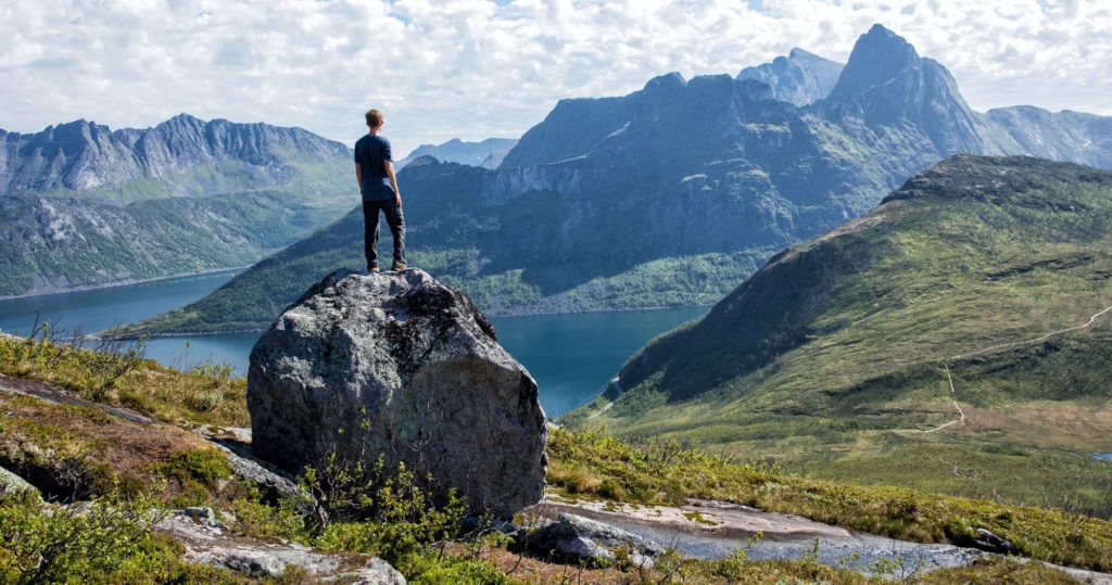
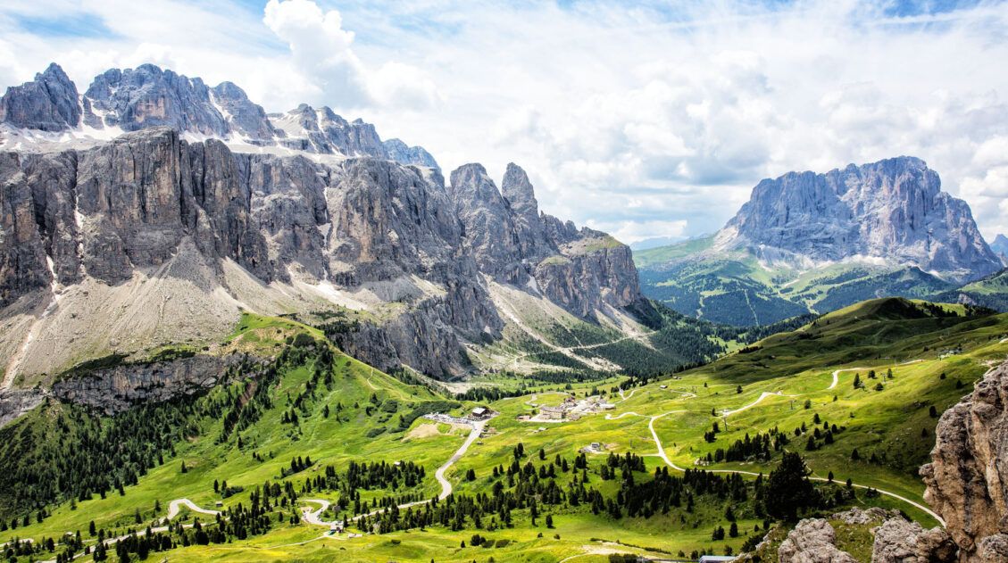
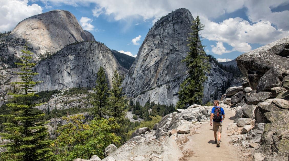
For hikers, few places in Europe can match Norway. The hikes in Norway are endlessly varied and genuinely world-class, from the fjords of southern Norway, the jagged peaks of the Lofoten Islands, and the remote coastline of Vesterålen and Senja. Alongside the Dolomites and the Swiss Alps, this is one of our absolute favorite places in the world to lace up our boots.
We’ve been coming back to Norway for years, and each trip has taken us somewhere new. We’ve hiked the iconic trails of the southern fjords, including Pulpit Rock, Kjeragbolten, and Trolltunga, explored the Lofoten Islands, Senja, and the Vesterålen Islands in northern Norway, and capped it all off with an unforgettable adventure in Svalbard. Every time we return, Norway delivers.
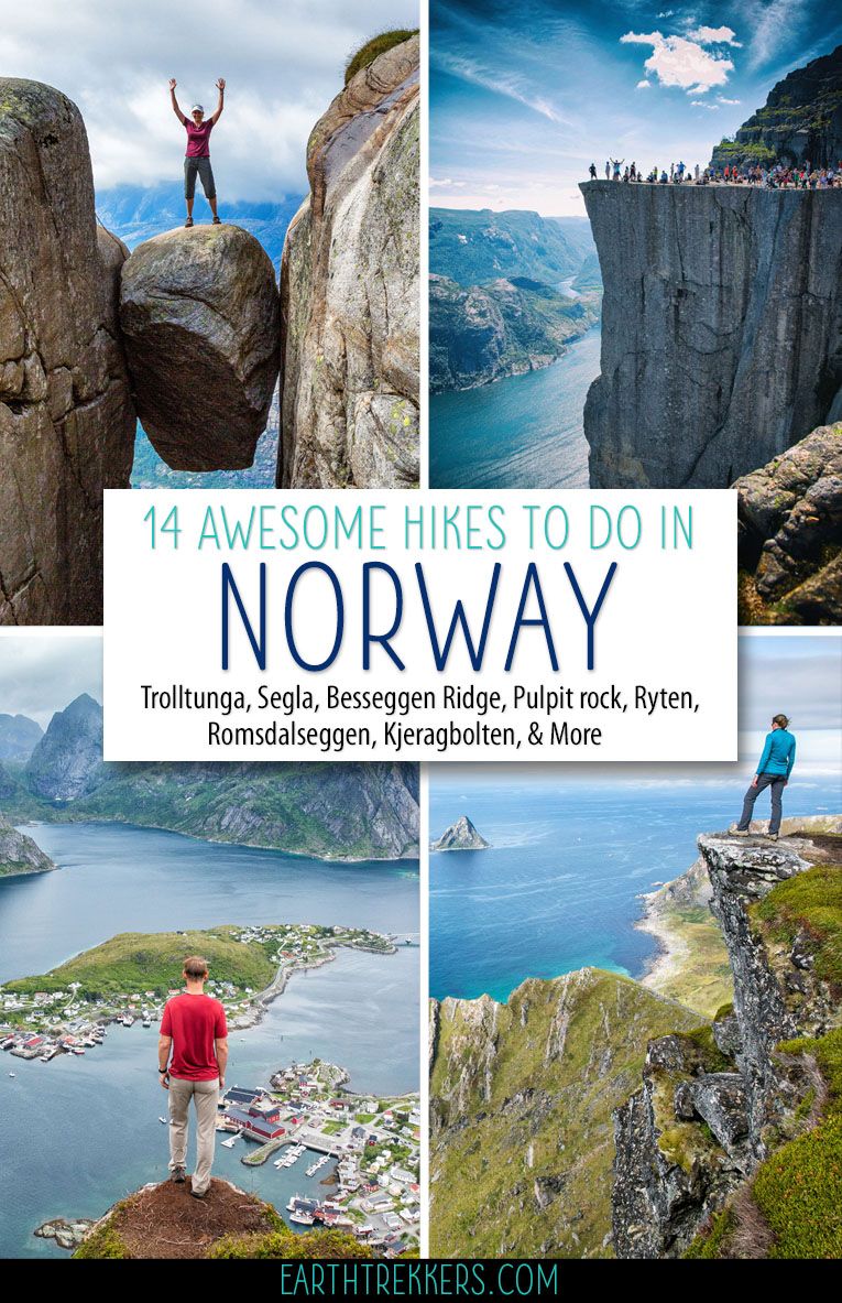
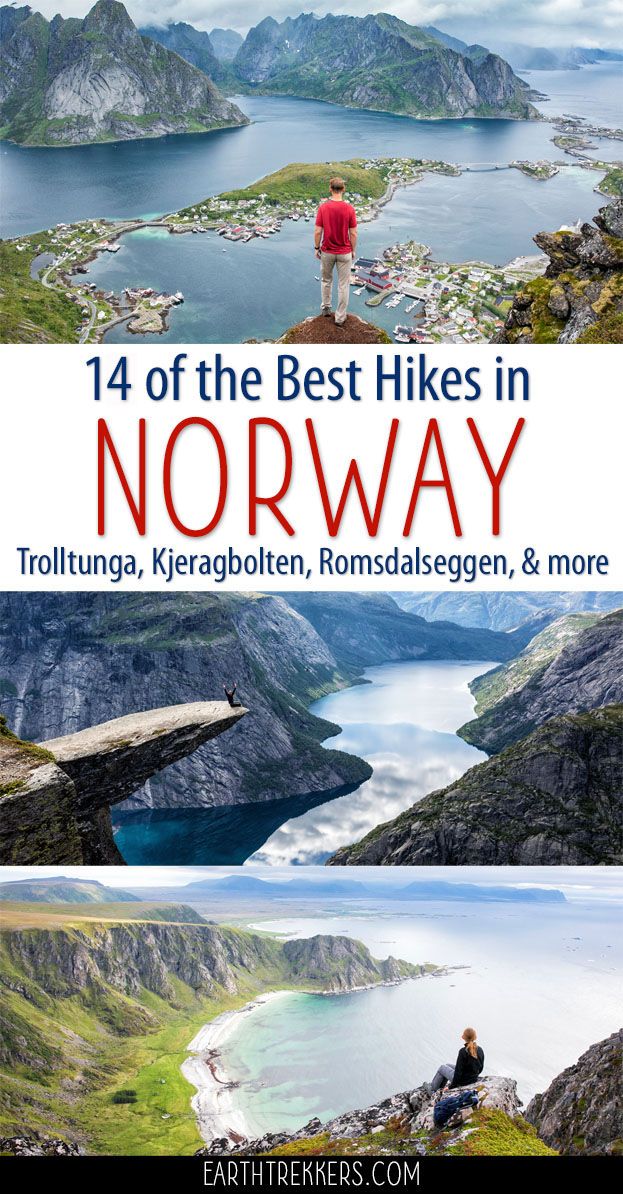
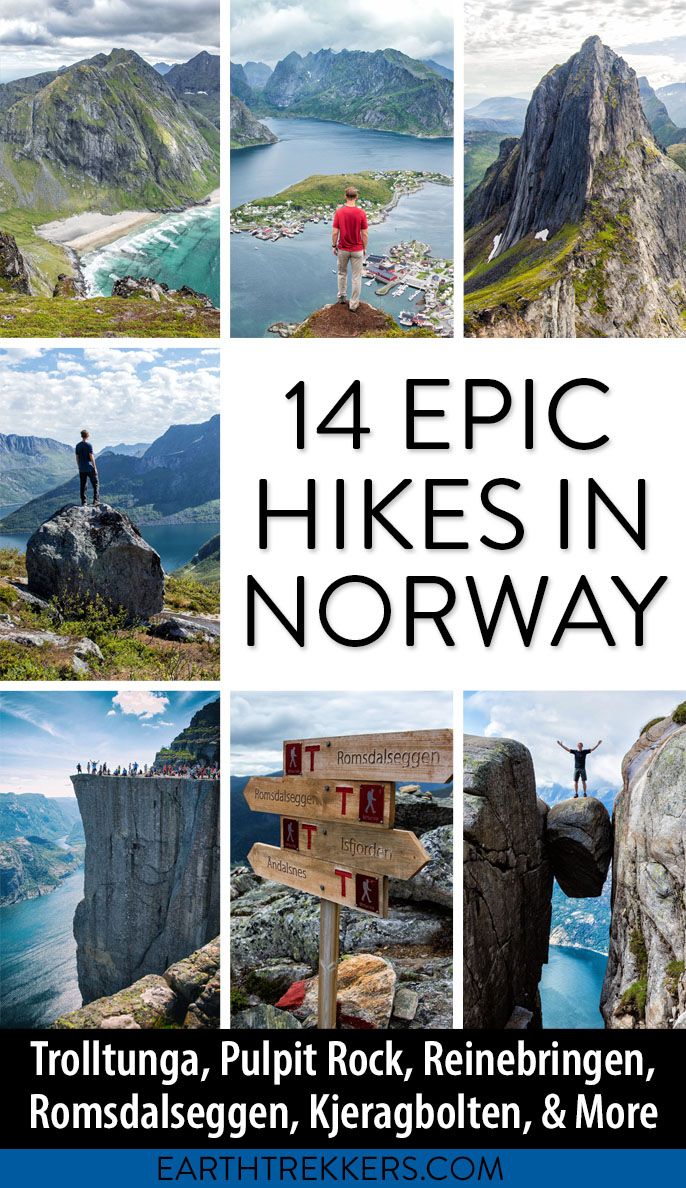
In this guide, we share our 14 favorite hikes in Norway, spanning everything from short, accessible trails with big payoffs to long, strenuous all-day adventures. Most of these hikes we’ve done ourselves. For the few still on our bucket list, we’ve noted that clearly.
Looking for even more inspiration? Don’t miss our guide to the best hikes in Europe, or browse all of our hiking guides in our Hiking Guide.
How to Choose the Right Hike in Norway
With 14 hikes spread across southern Norway, the Lofoten Islands, northern Norway, and Svalbard, the best trail for you really depends on where you’re headed and what kind of experience you’re looking for. Use the table below to find the hikes that best match your trip.
| If you want… | Consider these hikes |
| An iconic, bucket list experience | Trolltunga, Kjeragbolten, Pulpit Rock, Reinebringen |
| A big summit with panoramic views | Galdhøppigen, Romsdalseggen Ridge, Besseggen Ridge, Segla |
| A challenging all-day adventure | Trolltunga, Romsdalseggen Ridge, Stetind |
| Something shorter but still rewarding | Pulpit Rock, Segla, Reinebringen, Ryten and Kvalvika Beach |
| A hike in the Lofoten Islands | Reinebringen, Ryten and Kvalvika Beach, Svolvaer Fløya, Munken |
| A hidden gem with fewer crowds | Måtind and the Stave-Bleik Coastal Trail, Segla, Munken |
| A hiking and adventure combo | Svolvaer Fløya and Svolvaergeita, Hiorthfjellet (kayak + hike), Stetind |
| Something truly remote and Arctic | Hiorthfjellet (Svalbard) |
A Few Quick Tips
- Know the season. Most trails are accessible from late June through September. Trolltunga and some higher-elevation hikes may have snow into early summer.
- Check conditions before you go. Norwegian trails are not always well-marked, and weather can change fast, especially in the north.
- Start early. Popular trails like Trolltunga and Reinebringen get busy in peak season, and an early start makes a big difference.
- Plan your logistics. Several hikes require ferries, shuttles, or specific parking areas. We cover all of this in each individual trail guide.
Map of the Best Hikes in Norway
Here is a map of the best hikes in Norway featured in this guide, from the fjords of southern Norway to the remote peaks of the Lofoten Islands and the Arctic landscapes of Svalbard. Use this map to get a sense of where each hike is located and to help plan your trip.
How to Use This Map: Click the icons on the map to get more information about each point of interest. To take this map with you, click the star next to the title of the map which adds it to your Google account. Next, within your Google Maps app, select ‘Saved’ and then select ‘Maps’. This map title will now appear in your list.
Best Hikes in Norway
Hikes in Southern Norway & the Fjords
The southern fjord region is where most first-time visitors to Norway begin, and for good reason. This is the land of Pulpit Rock and Trolltunga, two of the most iconic viewpoints in Europe, plus Kjeragbolten, one of the most thrilling hikes we’ve ever done anywhere in the world. The trails here are well-established, logistics are relatively straightforward, and the scenery is unforgettable.
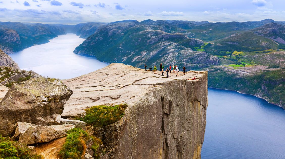
Pulpit Rock (Preikestolen)
Why it’s awesome: One of the most iconic viewpoints in Norway, Pulpit Rock is a flat-topped cliff rising 604 meters above Lysefjord, and the hike to get there is accessible enough for most fitness levels.
Best for: First-time hikers in Norway, families, and anyone looking for a big payoff without a full-day commitment.
Distance: 8 km (5 miles)
Difficulty: Easy to moderate
Length of Time: 5 hours
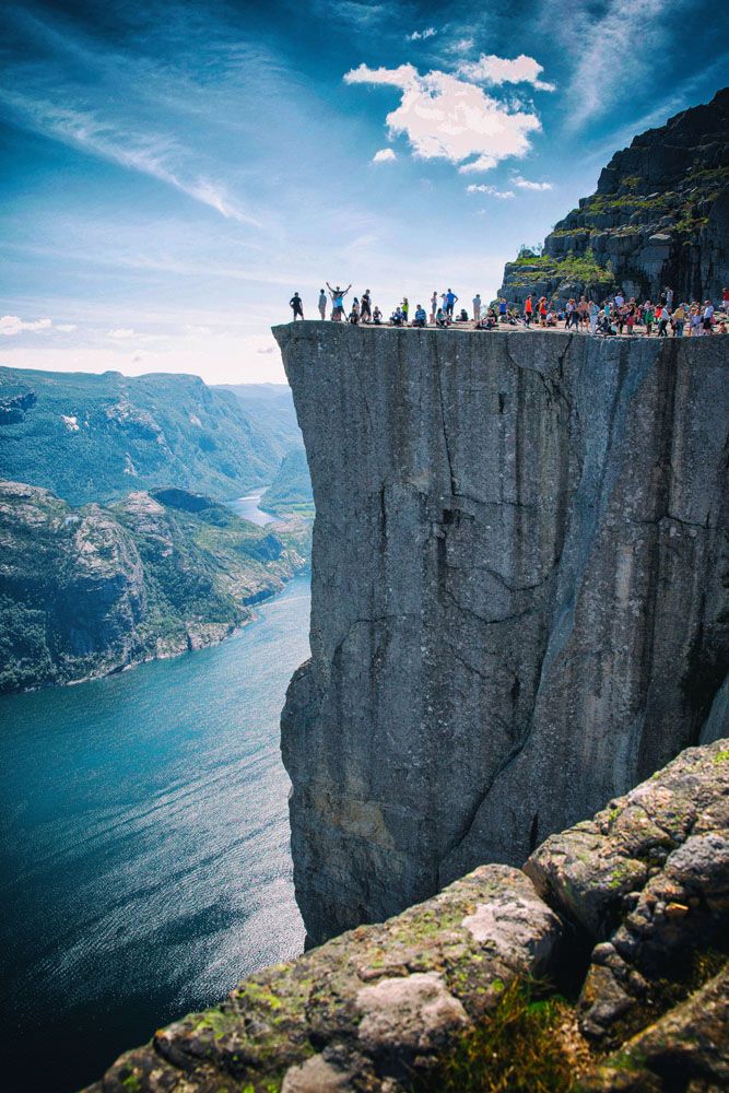
Pulpit Rock
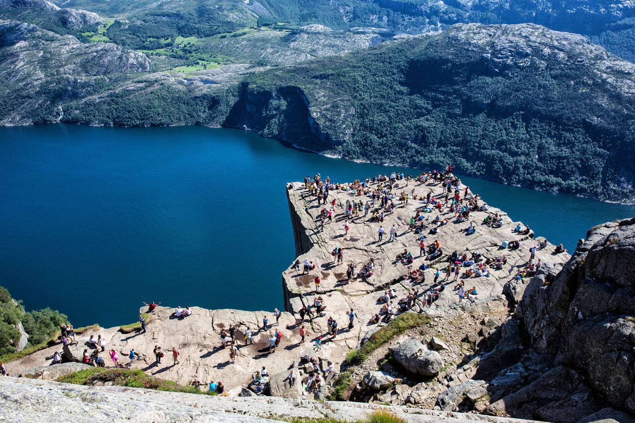
Pulpit Rock can be a very crowded place in the summer months.
What to expect: The trail climbs steadily through rocky terrain and past a small lake before opening up to the famous clifftop platform. It’s a well-marked, well-maintained trail, but the final approach can be slippery in wet weather. Crowds are significant in peak season, so an early start is strongly recommended. This was our first hike in Norway, and it set the tone for everything that followed.
👉 See our complete Pulpit Rock hiking guide for trail details, parking info, and tips for hiking with kids.
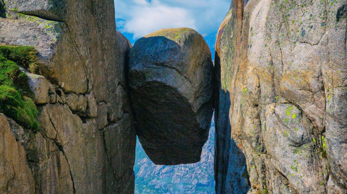
Kjeragbolten
Why it’s awesome: A giant boulder wedged between two cliff faces, suspended 1,000 meters above Lysefjord, and you can step out onto it. This is one of the most thrilling hikes we’ve ever done.
Best for: Adventurous hikers who want a physically demanding trail with an unforgettable, adrenaline-fueled finish.
Distance: 12 km (7.5 miles)
Difficulty: Strenuous
Length of Time: 6 to 8 hours
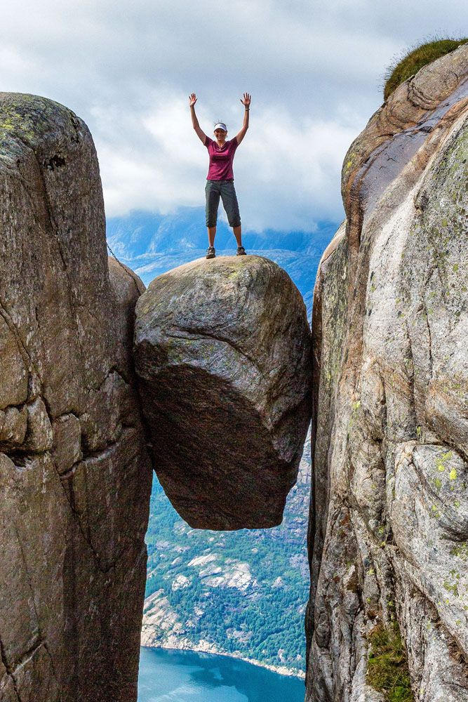
Kjeragbolten
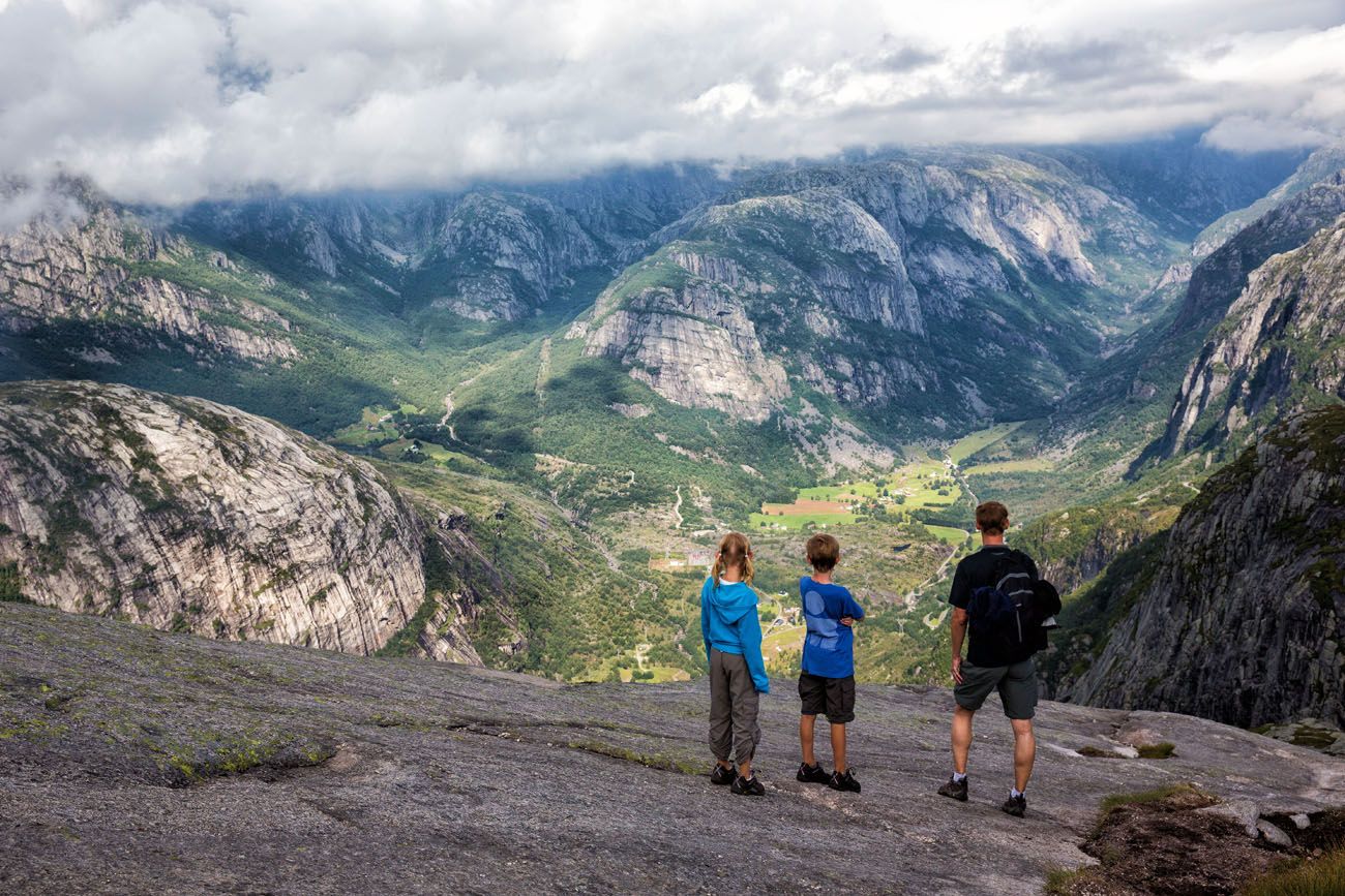
What to expect: The trail to Kjeragbolten is a roller coaster: three steep ascents and descents on granite rock faces, aided by chains in the steepest sections. Between the climbs, you’ll hike through valleys grazed by sheep, with sweeping views over some of the most dramatic scenery in Norway. The Kjeragbolten itself sits right at the end: a boulder wedged in a crevice with nothing but air beneath it. Stepping out onto it is a little unnerving, but the photos are worth it. This is one of our favorite hikes of all time.
👉 See our complete Kjeragbolten hiking guide for trail details, parking info, and tips for tackling the steep sections.
Hiking Kjeragbolten: Trail Guide & Photos
Step-by-step trail guide for hike to Kjeragbolten.Trolltunga
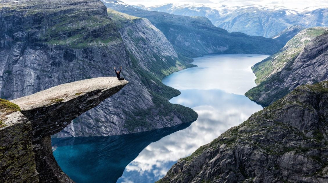
Why it’s awesome: One of Norway’s most iconic hikes, Trolltunga ends at a narrow tongue of rock suspended high above a fjord. It’s one of the most photographed viewpoints in the country.
Best for: Experienced hikers looking for a long, demanding day with spectacular scenery from start to finish and a true bucket list finish line.
Distance: 28 km (17.4 miles) round trip
Difficulty: Strenuous
Length of Time: 10 to 12 hours
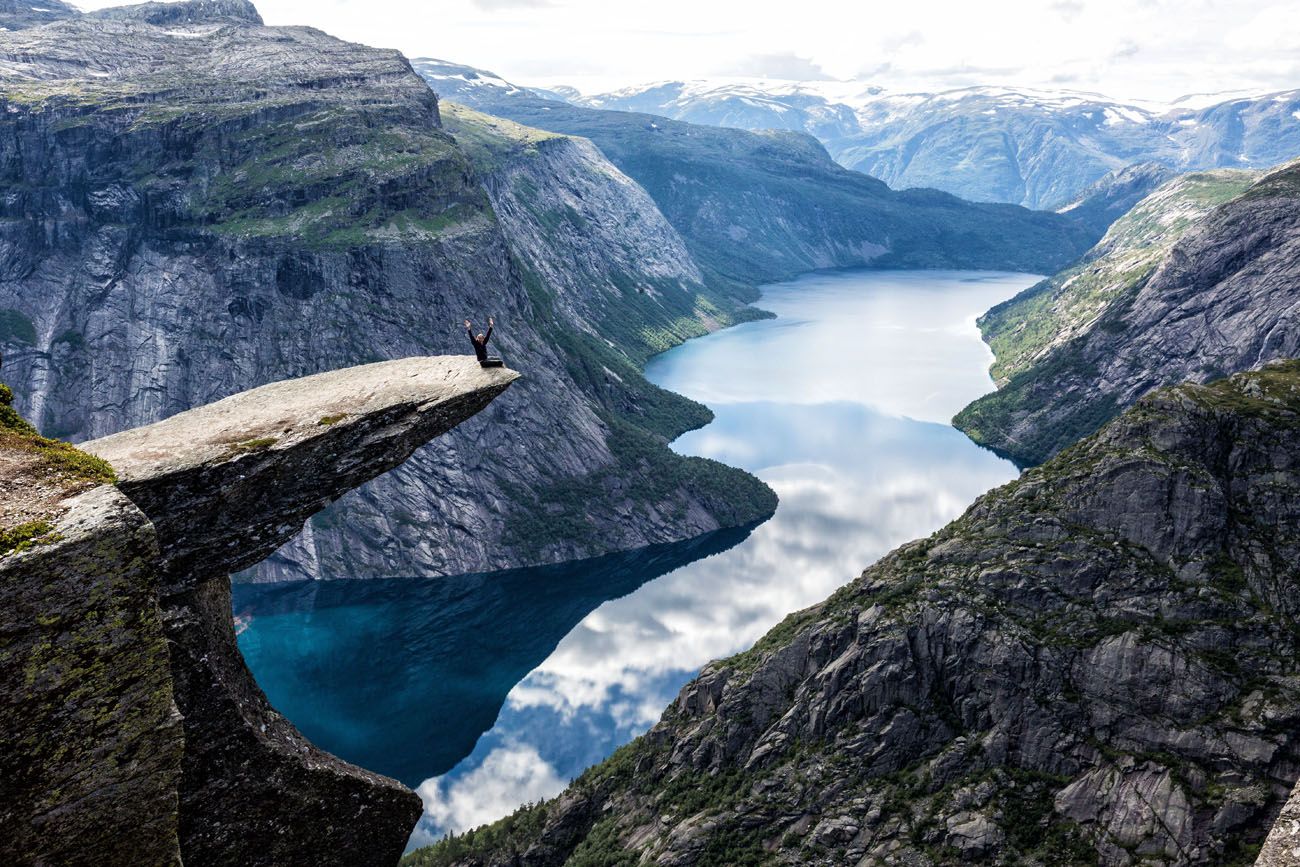
Trolltunga
What to expect: This is a big day. The trail climbs onto a high plateau with wide-open views before the final stretch to Trolltunga. Weather can change quickly, crowds are significant in peak season, and you’ll want to start early. There is a small upper car park that shortens the hike to around 20 km with significantly less elevation gain and it’s worth checking availability when you book. For us, this hike absolutely lived up to the hype.
👉 See our complete Trolltunga hiking guide for trail details, parking options, and tips for planning your day.
How to Hike Trolltunga: Parking, Stats & Trail Guide
How to hike Trolltunga: trail guide plus the logistics of how to get here and where to stay.Romsdalseggen Ridge
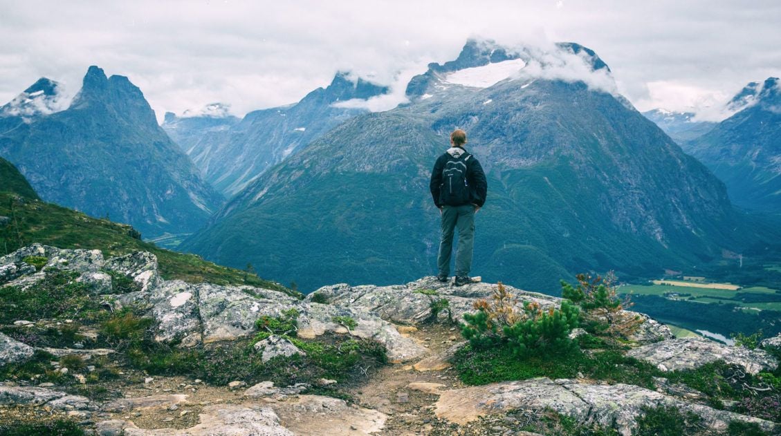
Why it’s awesome: A breathtaking point-to-point ridge hike high above the fjords and the town of Åndalsnes, with some of the most expansive views in Norway. On a clear day, you can see all the way out to the Atlantic Ocean.
Best for: Experienced hikers looking for a long, demanding day with nonstop scenery and a true sense of exposure along a narrow mountain ridge.
Distance: 11 km (7 miles) point-to-point hike
Difficulty: Strenuous
Length of Time: 8.5 hours
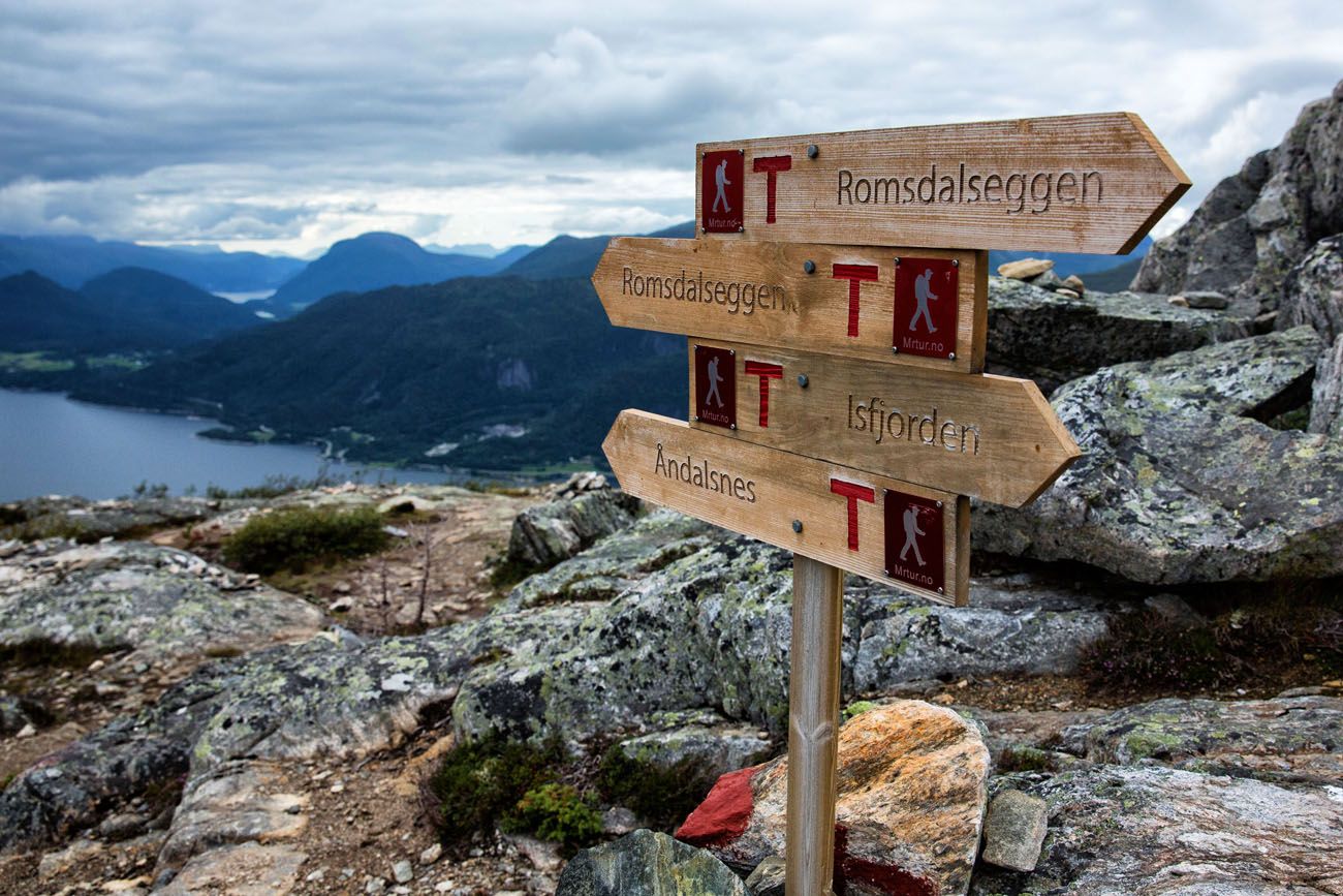
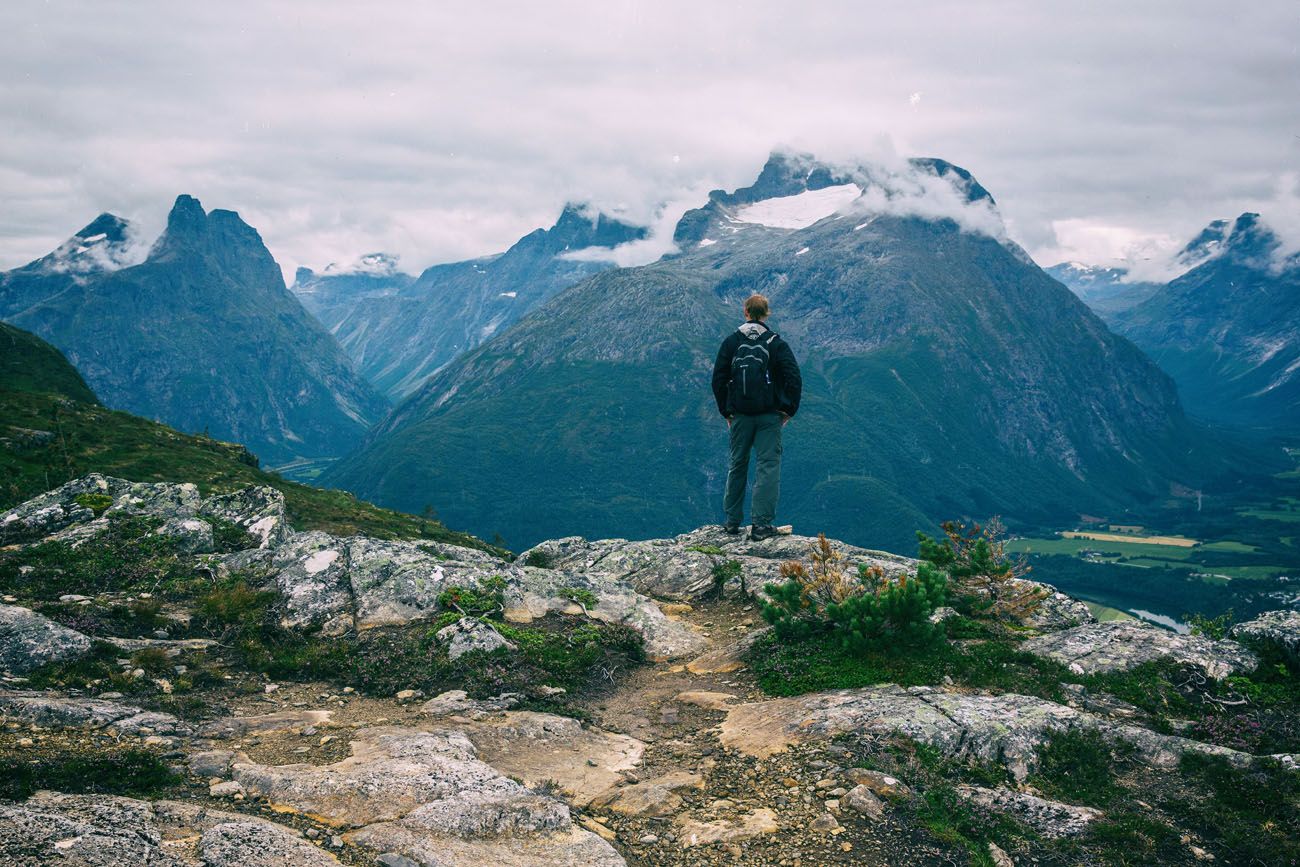
Hiking Romsdalseggen Ridge
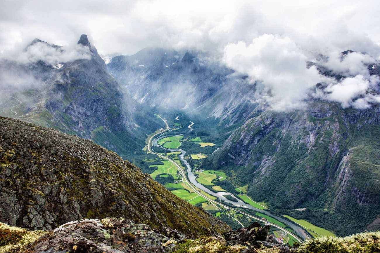
What to expect: This point-to-point hike follows a narrow ridge high above Romsdalen valley, with dramatic views in every direction. The trail is long and physically demanding, with some exposed sections that require care in wet or windy conditions. Some people consider this the most beautiful hike in Norway, and we won’t argue with that. Logistics require a bit of planning since it’s a one-way trail, so factor in transportation between the start and end points.
👉 See our complete Romsdalseggen Ridge hiking guide for trail details, transportation logistics, and tips for planning your hike.
Hiking Romsdalseggen Ridge in Norway (+ Photos & Helpful Tips)
Everything you need to know to hike Romsdalseggen Ridge.Hikes in the Lofoten Islands
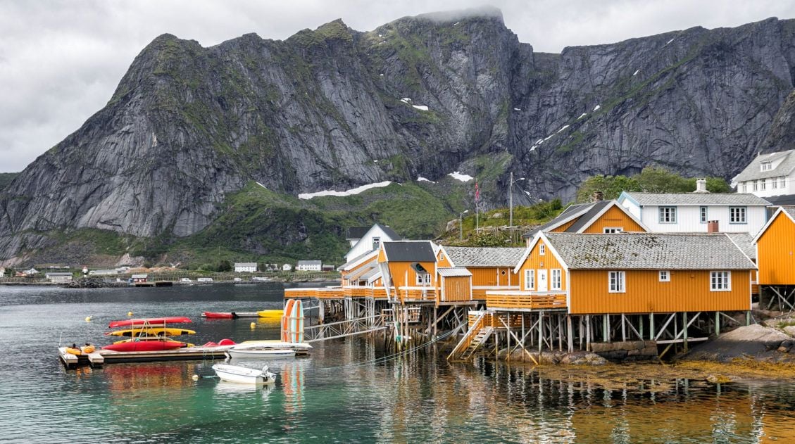
The Lofoten Islands are one of the most dramatic landscapes in Europe, with jagged mountain peaks rising straight out of the sea, white sandy beaches, and fishing villages perched along the coastline. We’ve spent a lot of time here, and the hiking is exceptional. Every trail seems to end with a view that makes you forget how hard the climb was.
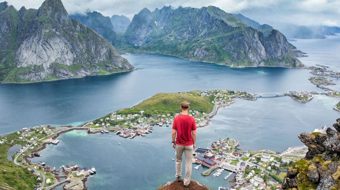
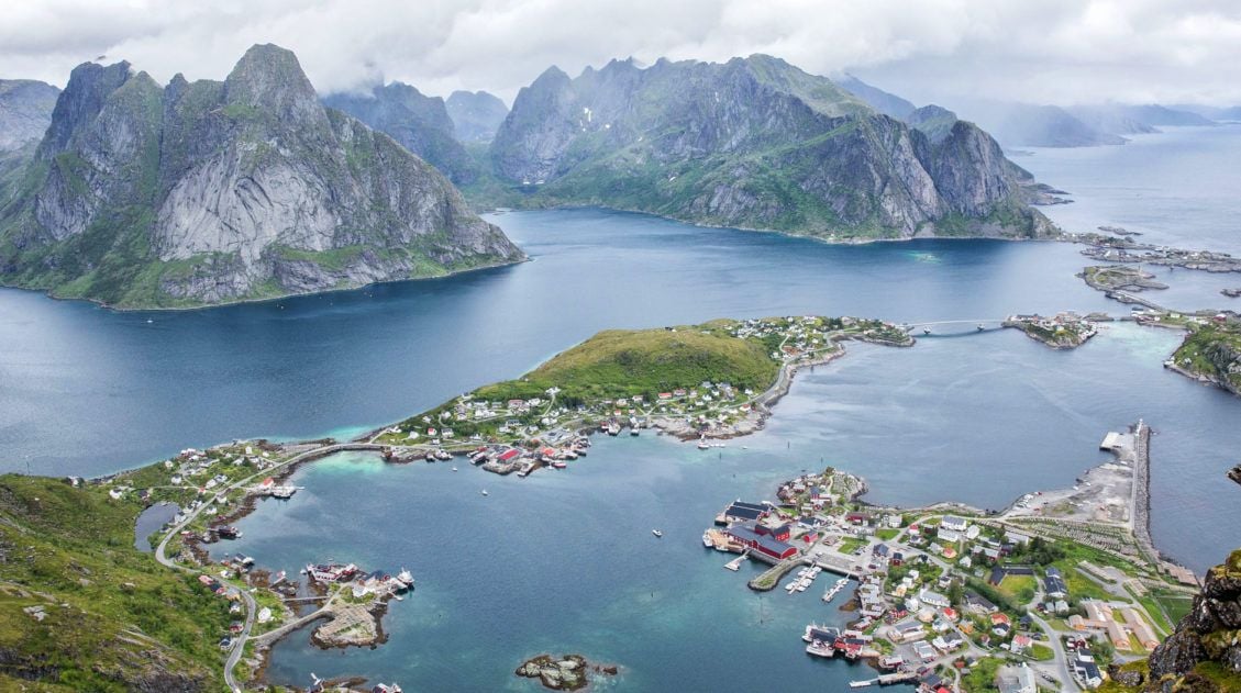
Reinebringen
Why it’s awesome: The most popular hike in the Lofoten Islands, Reinebringen delivers one of the most stunning panoramic views in all of Norway: a sweeping vista over the fishing villages of Reine, Sakrisøy, and Hamnøy.
Best for: Hikers who want the classic Lofoten Islands experience and are prepared for a steep, physically demanding climb.
Distance: 3 km (1.8 miles) round trip
Difficulty: Challenging
Length of Time: 3 hours
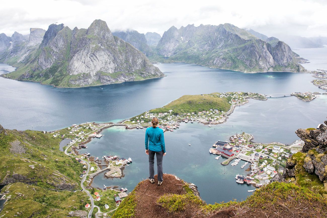
Reinebringen
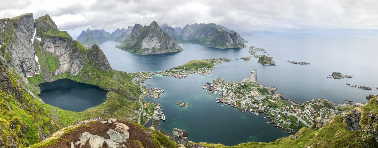
What to expect: Don’t let the short distance fool you. This is a tough hike. The trail climbs steeply on stone staircases and muddy, rocky terrain, and a good level of fitness is required. The reward at the top is worth every step: a panoramic view over one of the most photogenic corners of the Lofoten Islands. This is the hike everyone comes to Lofoten to do, and it earns its reputation.
👉 See our complete Reinebringen hiking guide for trail details and parking information.
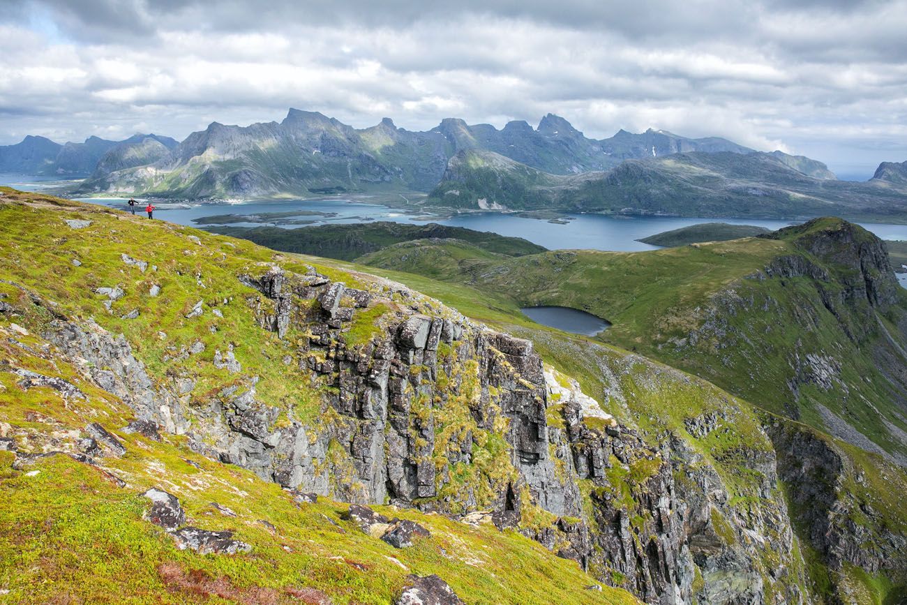
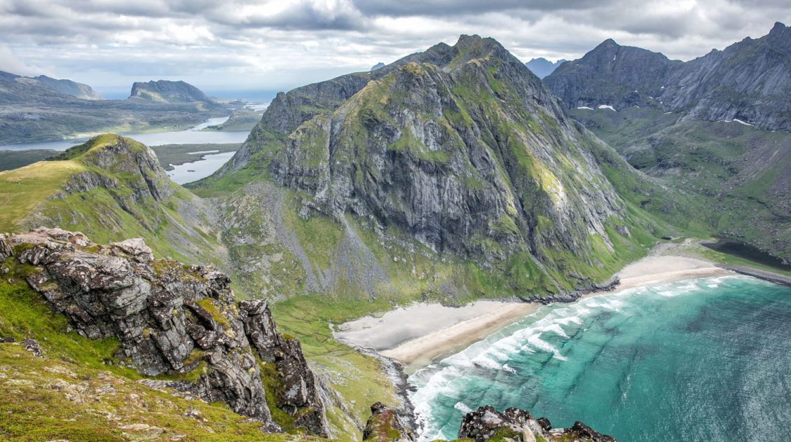
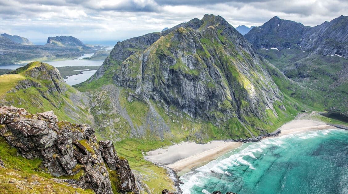
Ryten and Kvalvika Beach
Why it’s awesome: A perfect Lofoten hike in miniature, with a mountain peak, sweeping fjord views, a “mini Trolltunga” rock outcropping, and a stunning white sand beach, all in one trail.
Best for: Hikers looking for a well-rounded Lofoten Islands experience without a full-day, strenuous commitment.
Distance: 8.7 km (5.4 miles) round trip
Difficulty: Easy to moderate
Length of Time: 3 to 5 hours
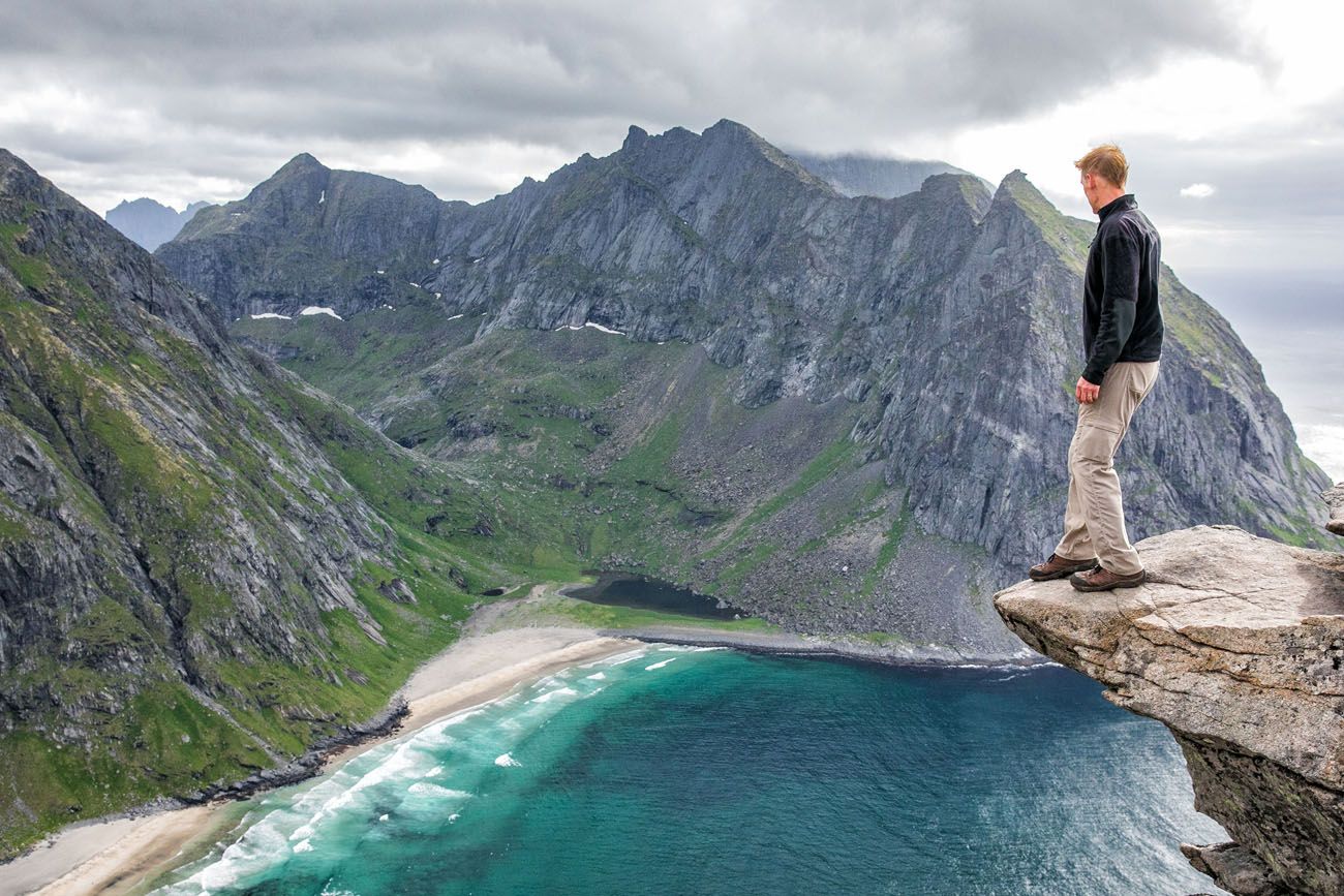
Ryten
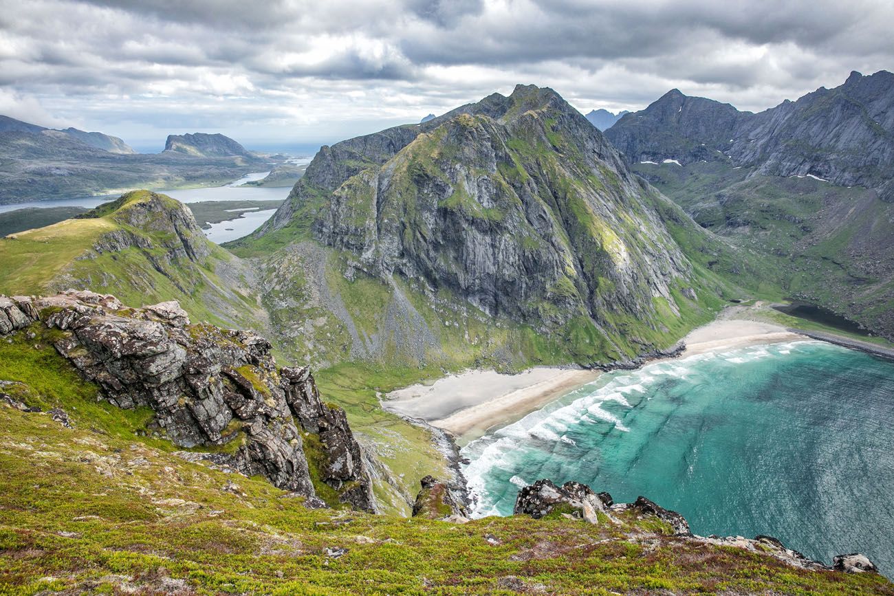
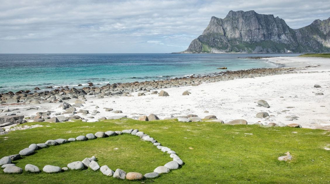
Kvalvika Beach
What to expect: The trail climbs steadily to the summit of Ryten, where you’ll find a rocky outcropping with views straight down to Kvalvika Beach, one of the most beautiful beaches in Norway. It’s a fun, varied hike with a big payoff, and the descent to the beach is an optional but worthwhile add-on. This is one of our favorite hikes in the Lofoten Islands.
👉 See our complete Ryten hiking guide for trail details and tips for planning your hike.
Hiking Ryten: Kvalvika Beach Views & Lofoten’s Mini-Trolltunga
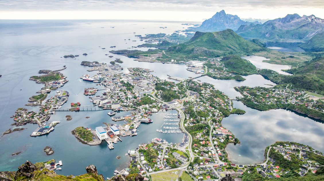
Everything you need to know to hike to Ryten.Svolvaer Fløya
Why it’s awesome: The best view over the town of Svolvaer and the surrounding Lofoten Islands, reached by a hike that’s challenging enough to feel earned without requiring a full day on the trail.
Best for: Hikers looking for a rewarding half-day hike with one of the best panoramas in the Lofoten Islands.
Distance: 5 km (3.1 miles)
Difficulty: Moderate
Length of Time: 3 to 4 hours for the hike, 2 hours for Svolvaergeita
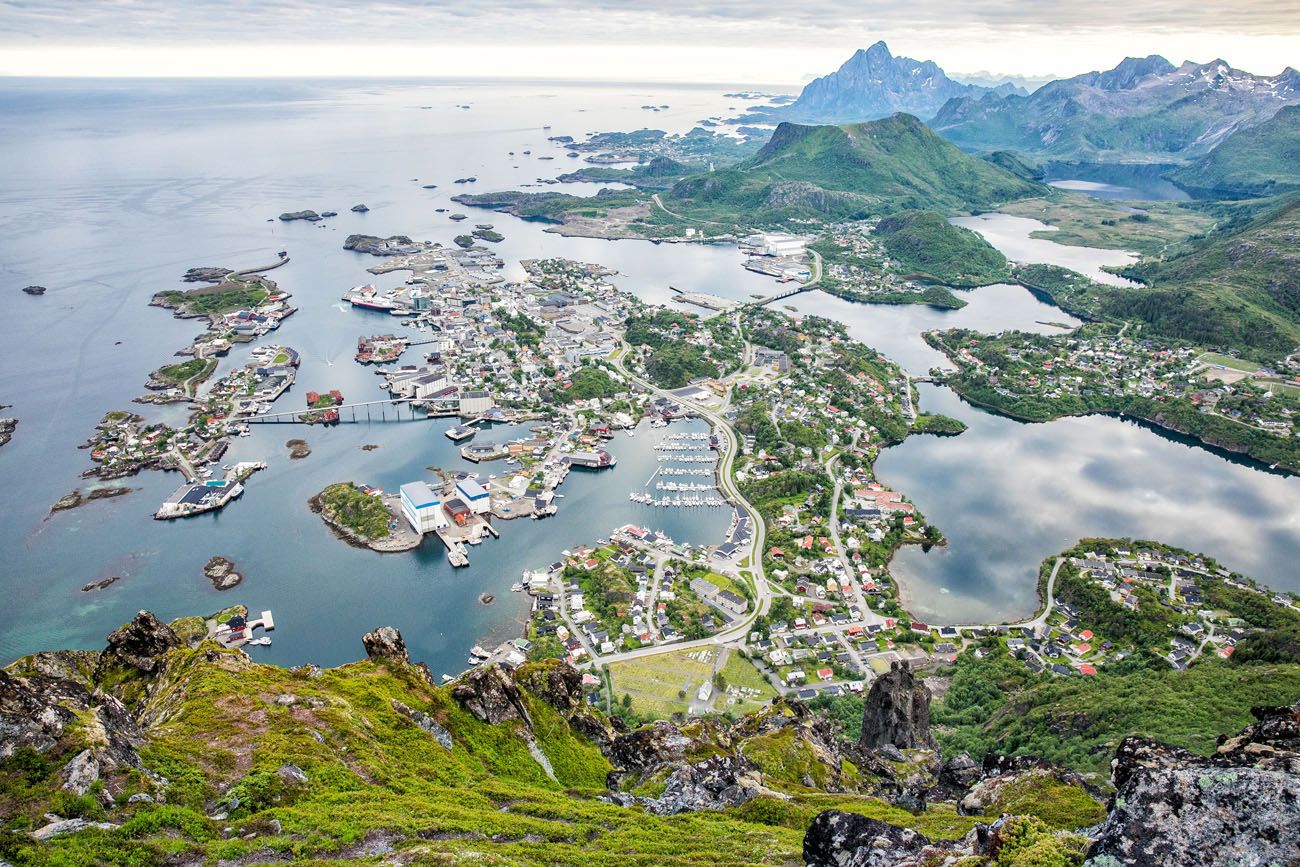
The view from Svolvaer Fløya
What to expect: The trail climbs steadily above Svolvaer, rewarding you with a sweeping panoramic view over the town, the harbor, and the islands beyond. It’s a satisfying hike on its own, and one of the best ways to experience Svolvaer beyond the waterfront.
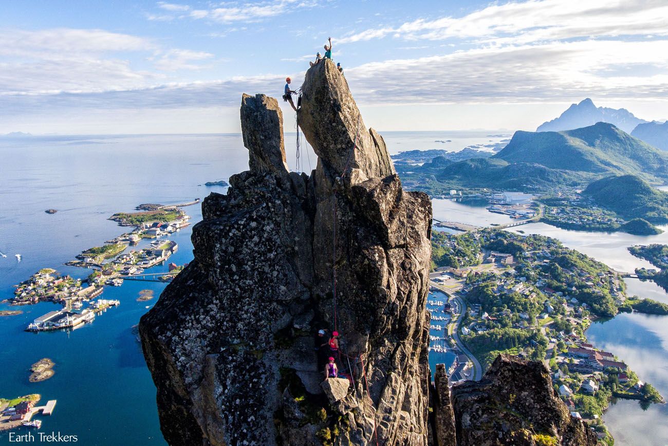
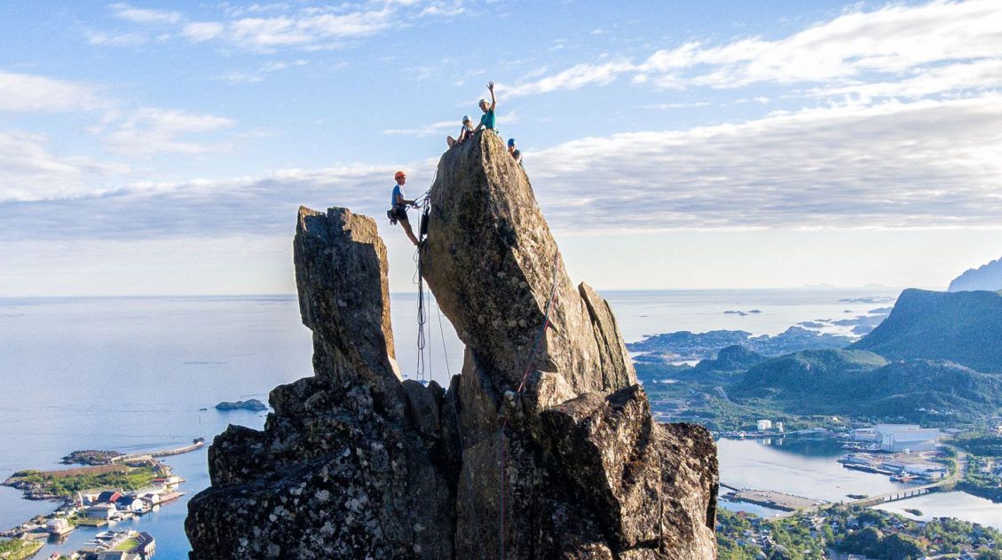
Svolvaergeita
If you’re looking to turn this into a bigger adventure, consider adding on a climb of Svolvaergeita (also called The Goat).
This dramatic pinnacle of rock is just below the summit of Fløya and is popular with climbers. It requires booking a guide in advance, but it’s doable for beginners and makes for an unforgettable afternoon. We did both on the same day and it’s one of our favorite memories from the Lofoten Islands.
Learn More
👉 See our guides to hiking Svolvaer Fløya and climbing Svolvaergeita for full details on both.
Complete Guide to Climbing Svolvaergeita in the Lofoten Islands
Pinterest Facebook Flipboard Svolvaergeita, also called “The Goat,” is a pinnacle of rock that is a popular rock climbing spot in the Lofoten Islands. It is named The Goat because of the two horns of rock that sit atop the rock. Those with a sense of adventure can climb to the top of Svolvaergeita and […]
How to Hike Svolvaer Fløya & Djevelporten in the Lofoten Islands
There are two ways to get a spectacular view over the town of Svolvaer…hike to the top of Svolvaer Fløya or climb Svolvaergeita. We did both on the same afternoon, making this one of our most memorable days in the Lofoten Islands. Svolvaer is one of the largest towns in the Lofoten Islands. Fløya is […]
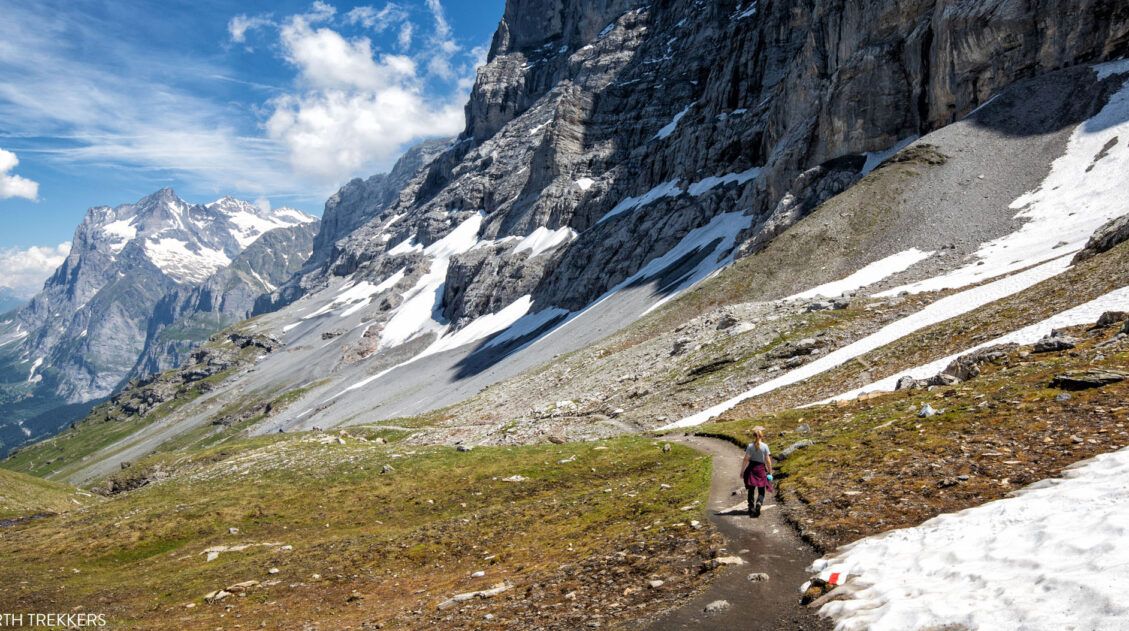
Hikes in Northern Norway & Vesterålen
Northern Norway feels like a different world from the fjord region in the south. It’s wilder, more remote, and in many ways even more spectacular. On our trip here, we traveled from Tromsø to Senja and the Vesterålen Islands before ending in the Lofoten Islands. The hiking in this part of Norway doesn’t get the same attention as Trolltunga or Lofoten hikes, but it absolutely should.
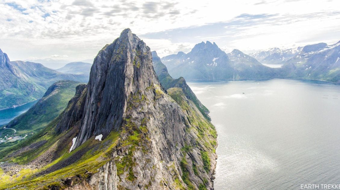
Segla
Why it’s awesome: A short but steep hike to one of the most dramatic summits in northern Norway, with panoramic views over Medfjord and the surrounding mountains of Senja.
Best for: Hikers who want a big reward without a big time commitment — and who don’t mind a strenuous climb to get there.
Distance: 5 km (3.1 miles)
Difficulty: Strenuous
Length of Time: 3 to 4 hours
Located in northern Norway on the island of Senja, this short hike is surprisingly tough. But, oh the view from the top! Your reward is breathtaking panoramic views of Mefjord and the nearby mountains. It is worth visiting Senja just to do this hike.
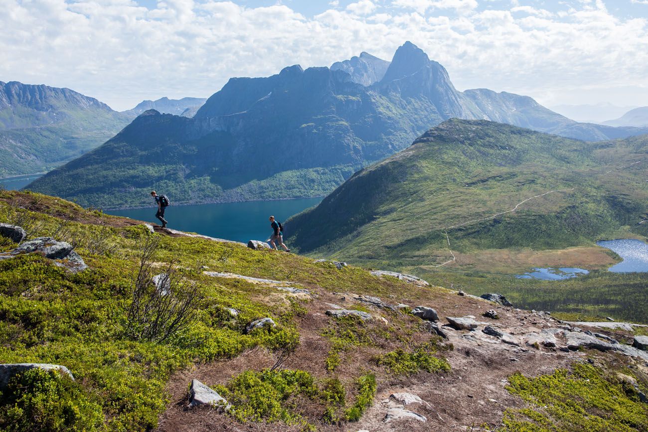
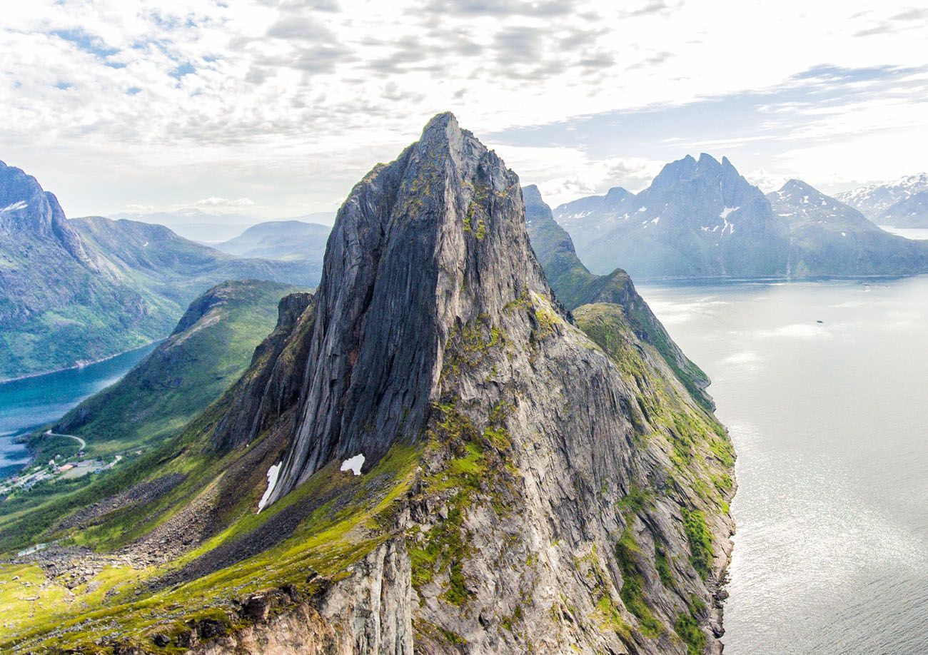
Segla
What to expect: Don’t let the short distance mislead you — Segla is a steep, demanding climb. But the view from the top is one of the best we’ve experienced in northern Norway, with Mefjord stretching out below and jagged peaks filling the horizon in every direction. Senja is worth visiting just to do this hike, but many travelers bypass it entirely on their way to the Lofoten Islands.
👉 See our complete Segla hiking guide for trail details and tips for planning your visit to Senja.
How to Hike Segla, An Iconic Peak in Senja, Norway
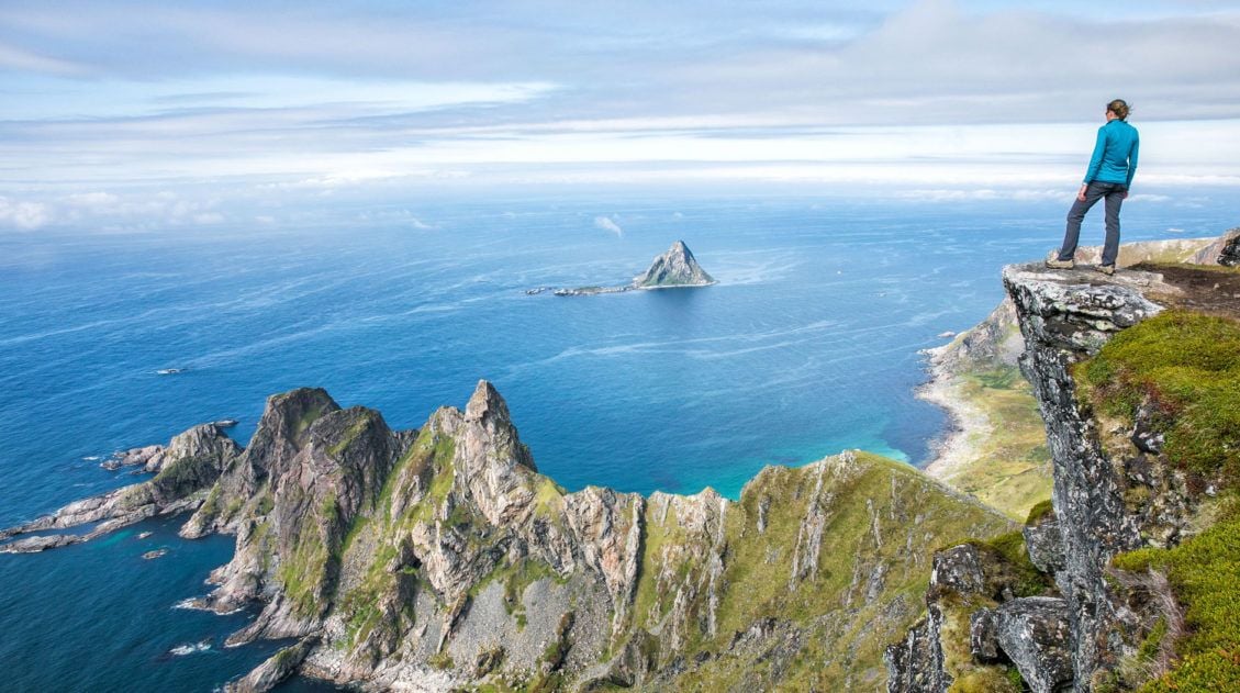
Everything you need to know to hike to the summit of Segla.Måtind and the Stave-Bleik Coastal Trail
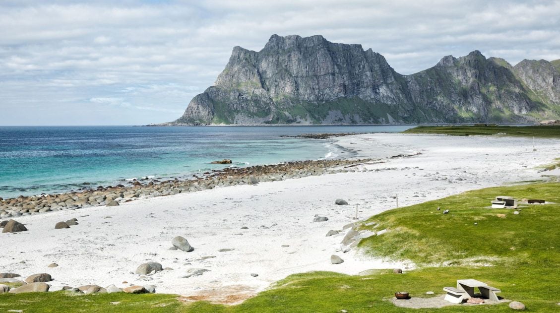
Why it’s awesome: A short, relatively easy hike to a stunning coastal summit on the Vesterålen Islands, with sweeping views over turquoise water, rugged coastline, and one of the most beautiful beaches in northern Norway.
Best for: Hikers looking for a shorter, accessible trail with a big payoff, and one of the best hidden gems in all of Norway.
Distance to Måtind: 7.6 km (4.7 miles) round trip to Måtind
Distance of the Coastal Trail: 9 km round trip
Difficulty: Easy to moderate
Length of Time: 3 to 4 hours
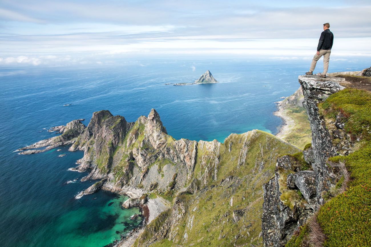
Måtind
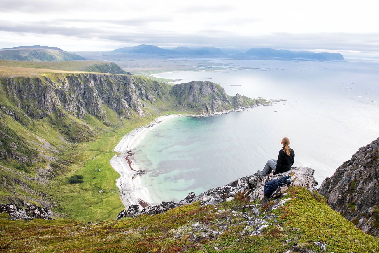
What to expect: The trail climbs steadily to the summit of Måtind, where the views over the Arctic coastline are genuinely breathtaking. Below you, Stave Beach curves along the water in shades of turquoise that feel more Caribbean than Norwegian. It’s one of those hikes where the scenery catches you completely off guard. This is one of our favorite hidden gems in Europe, and one of the highlights of our northern Norway trip.
👉 See our complete Måtind hiking guide for trail details and how to get here.
Hiking to Måtind on the Stave-Bleik Coastal Trail, Vesteralen, Norway
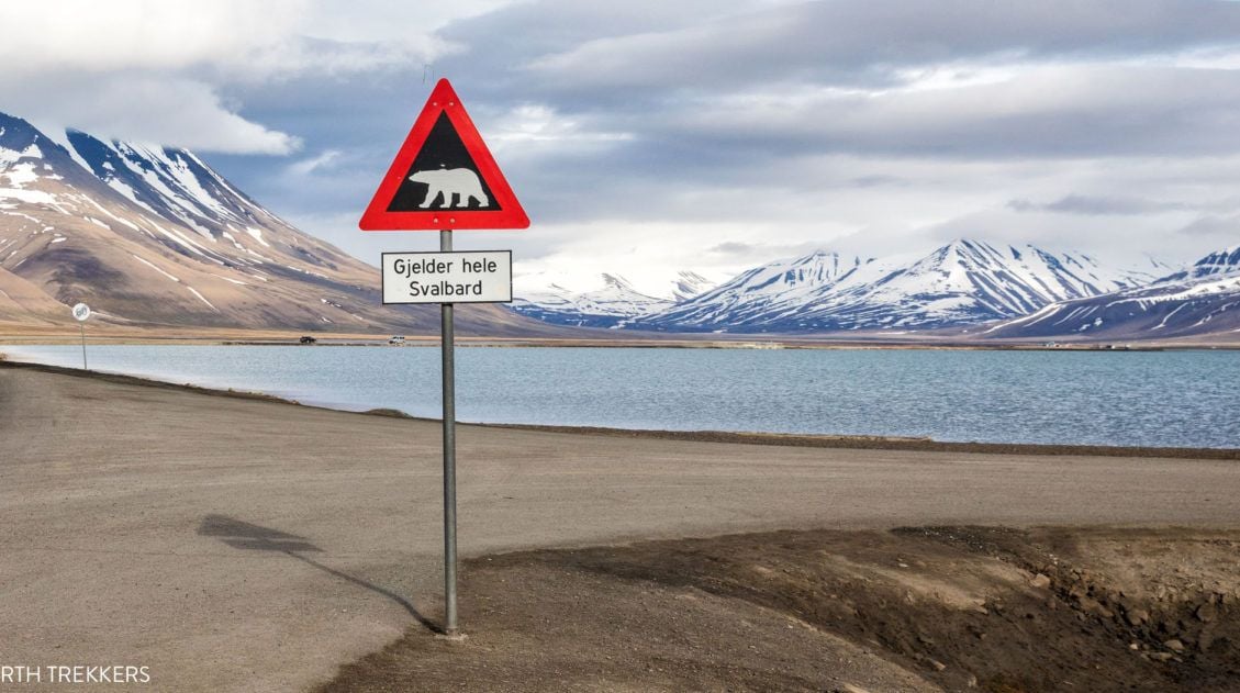
How to hike to Måtind on the Stave-Bleik Coastal Trail.Hiking in Svalbard
Svalbard is unlike anywhere else on this list, or anywhere else on earth. This Norwegian archipelago sits deep in the Arctic Ocean, closer to the North Pole than to Oslo, and visiting it feels like stepping into a completely different world. We came here immediately before our northern Norway trip, and the contrast between Svalbard’s raw, frozen wilderness and the rest of Norway is striking. If you have a sense of adventure, put this on your list.
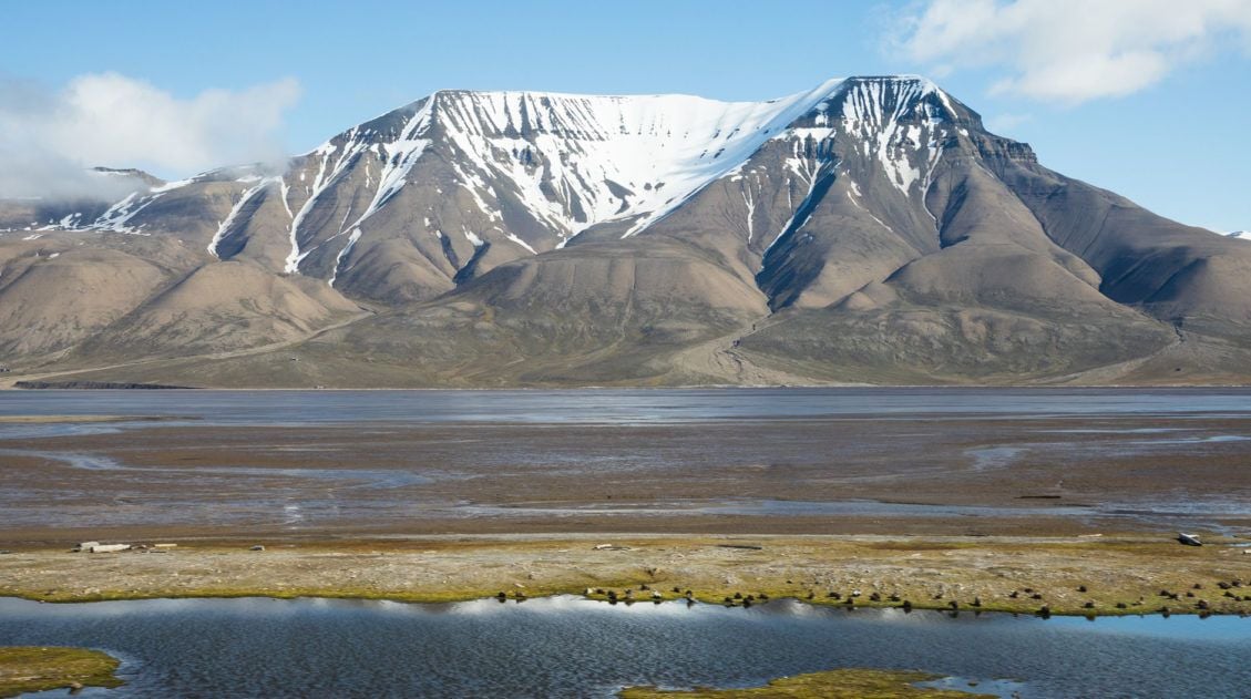
Hiorthfjellet
Why it’s awesome: A remote Arctic hike to one of the tallest mountains on Svalbard, with sweeping views over Longyearbyen and Adventfjord. The option to combine it with a kayak crossing makes for one of the most memorable days of adventure travel you’ll ever have.
Best for: Adventurous travelers looking for a truly unique, off-the-beaten-path experience far beyond the typical European hiking destination.
Hiking Distance: 8.7 km (5.4 miles) round trip
Kayaking Distance: 5.4 km (3.4 miles) round trip
Difficulty: Strenous
Length of Time: 11 hours
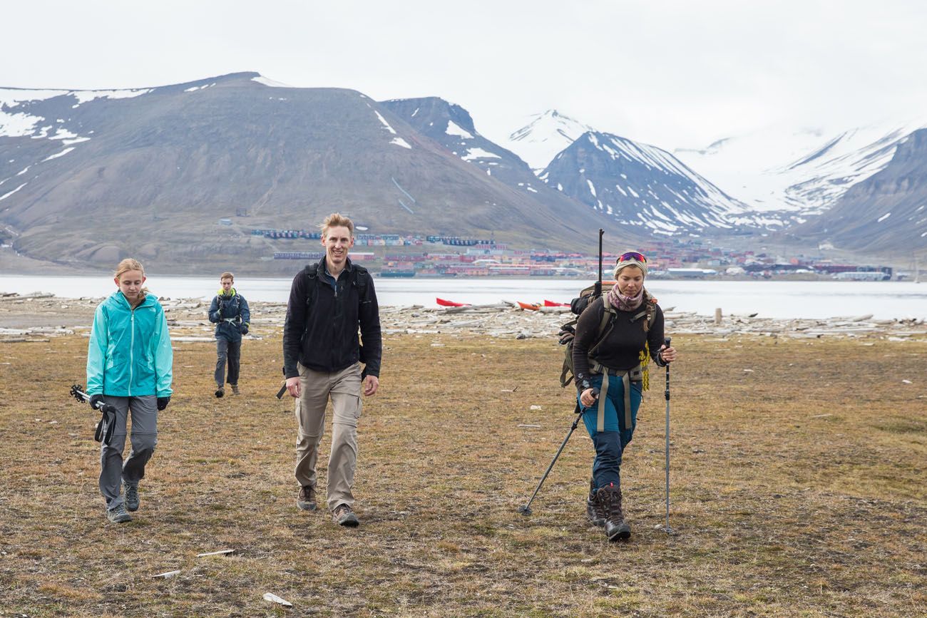
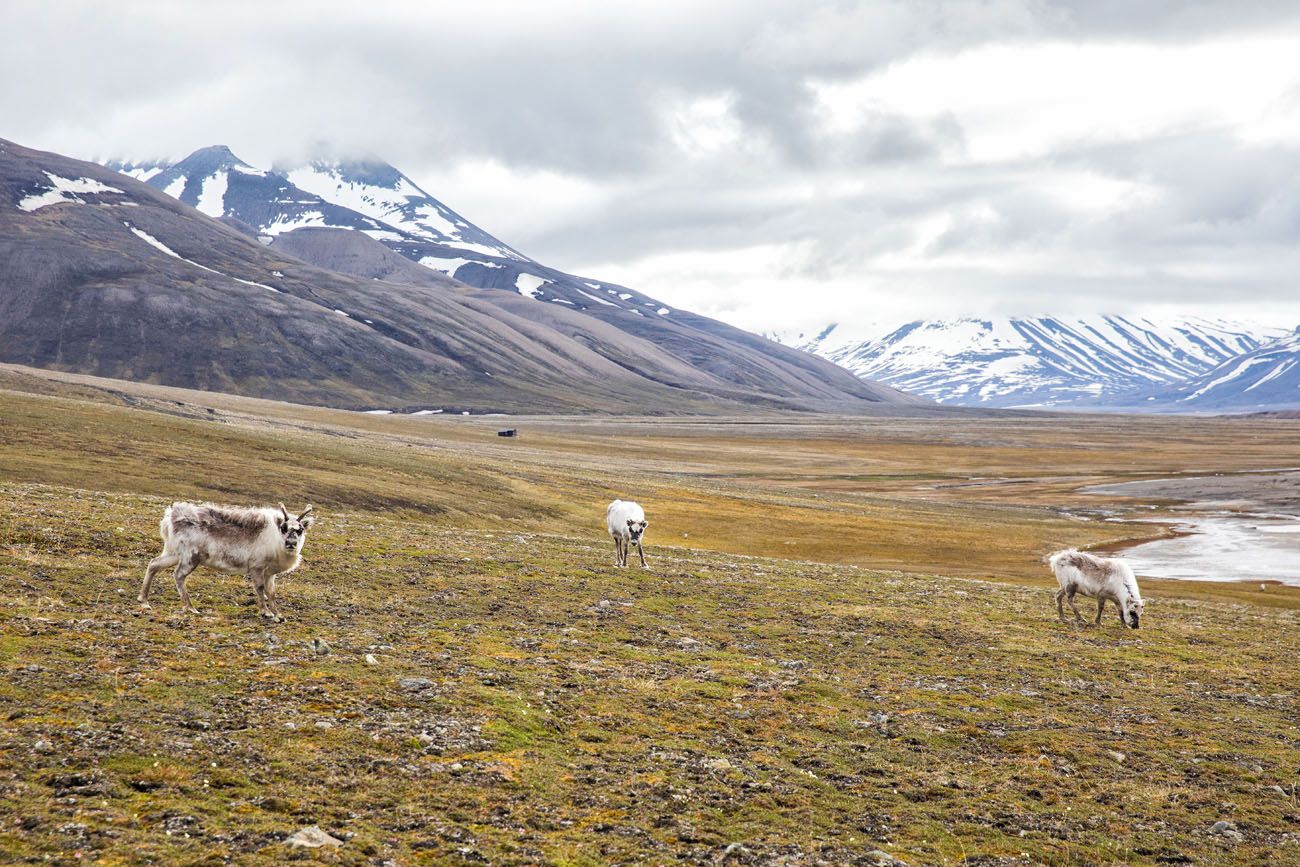
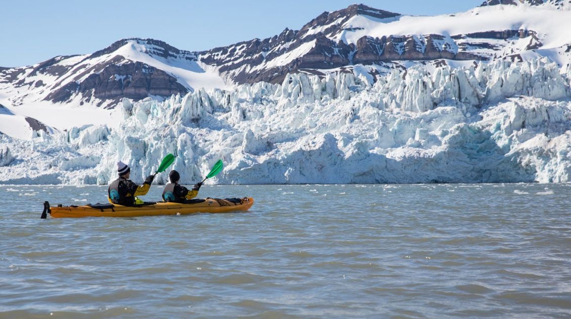
What to expect: The adventure starts in Longyearbyen, the world’s northernmost city, where reindeer wander the streets and there are more snowmobiles than cars. From here, you kayak across Adventfjord before setting off on foot to the summit of Hiorthfjellet. The hike itself is not technically difficult, but the distance and Arctic conditions make it a serious undertaking. Along the way, keep an eye out for Svalbard reindeer and arctic fox. When we did this in late June, it snowed during the final push to the summit, which made it even more memorable.
If you are feeling adventurous, you can combine this hike with a kayaking trip across Adventfjord for a full day adventure. It is an amazing day!
Famous Hikes That Didn’t Make Our List
The hikes below are among the most celebrated in Norway, and every one of them is on our bucket list. We haven’t done them yet, so rather than write about them from firsthand experience, we’re being upfront about that here. What we can tell you is that each one has a strong enough reputation to warrant a place on any serious Norway hiking list, and we fully intend to come back for them.
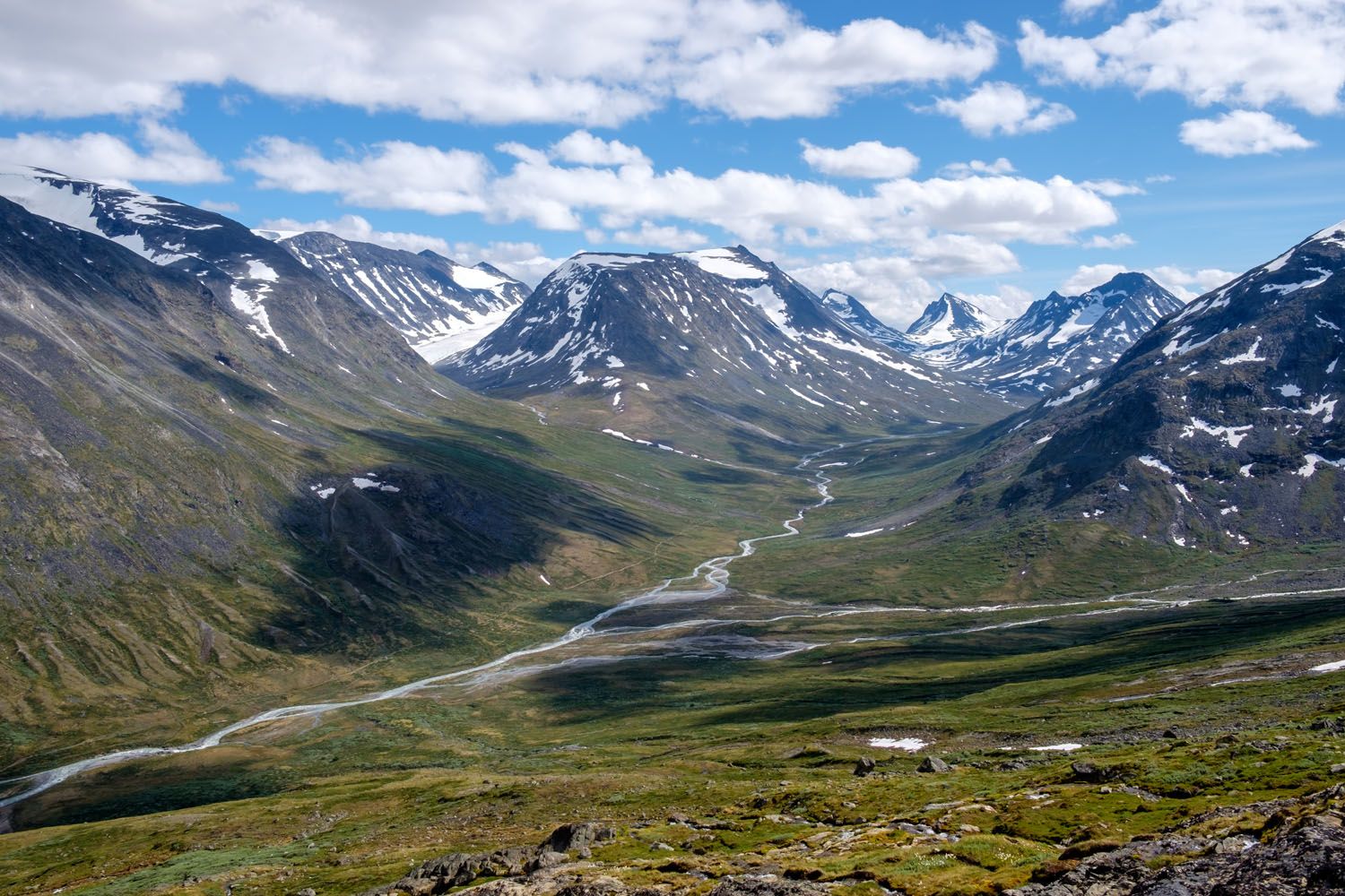
Galdhøppigen
Why it’s famous: The highest mountain in Norway and in all of northern Europe, Galdhøppigen draws hikers and mountaineers from around the world. Standing on the highest point in northern Europe is a bucket list experience in every sense.
Distance: Varies depending on the route
Difficulty: Easy to extreme
Length of Time: Varies
There are several routes to the summit, ranging from straightforward hiking trails to glacier crossings that require a guide. The glacier route is the most popular and arguably the most spectacular, but it should not be attempted without professional guidance. If standing on top of northern Europe sounds like your kind of day, this one belongs on your list.
shutterstock.com
Besseggen Ridge
Why it’s famous: One of the most walked routes in Norway, Besseggen Ridge offers stunning views of two dramatically different lakes: emerald green Gjende and deep blue Bessvatnet, separated by a narrow ridge high in Jotunheimen National Park.
Distance: 13.3 km (8.2 miles)
Difficulty: Strenuous
Length of Time: 6 to 8 hours
Most hikers do this as a point-to-point between Memurubu and Gjendesheim, taking a ferry to the start and hiking back. The combination of the ridge walk and the vivid contrast between the two lakes makes this one of the most visually distinctive hikes in Norway.

shutterstock.com
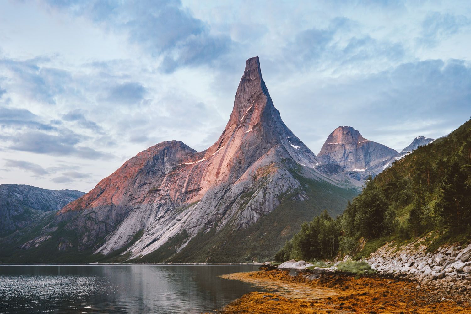
Stetind
Why it’s famous: Norway’s national mountain, Stetind is a towering granite obelisk in Nordland that is one of the most iconic peaks in the country. It’s a serious mountaineering objective that requires a guide, but the approach hike alone is spectacular.
Distance: 10 km round trip (6.2 miles)
Difficulty: Challenging
Length of Time: 10 to 12 hours
We passed through this area on our northern Norway trip and didn’t have enough time to fit Stetind in, which gives us a very good excuse to go back. If you’re comfortable with exposed terrain and want to hire a guide, this is one of the most rewarding summit experiences in Norway.
shutterstock.com
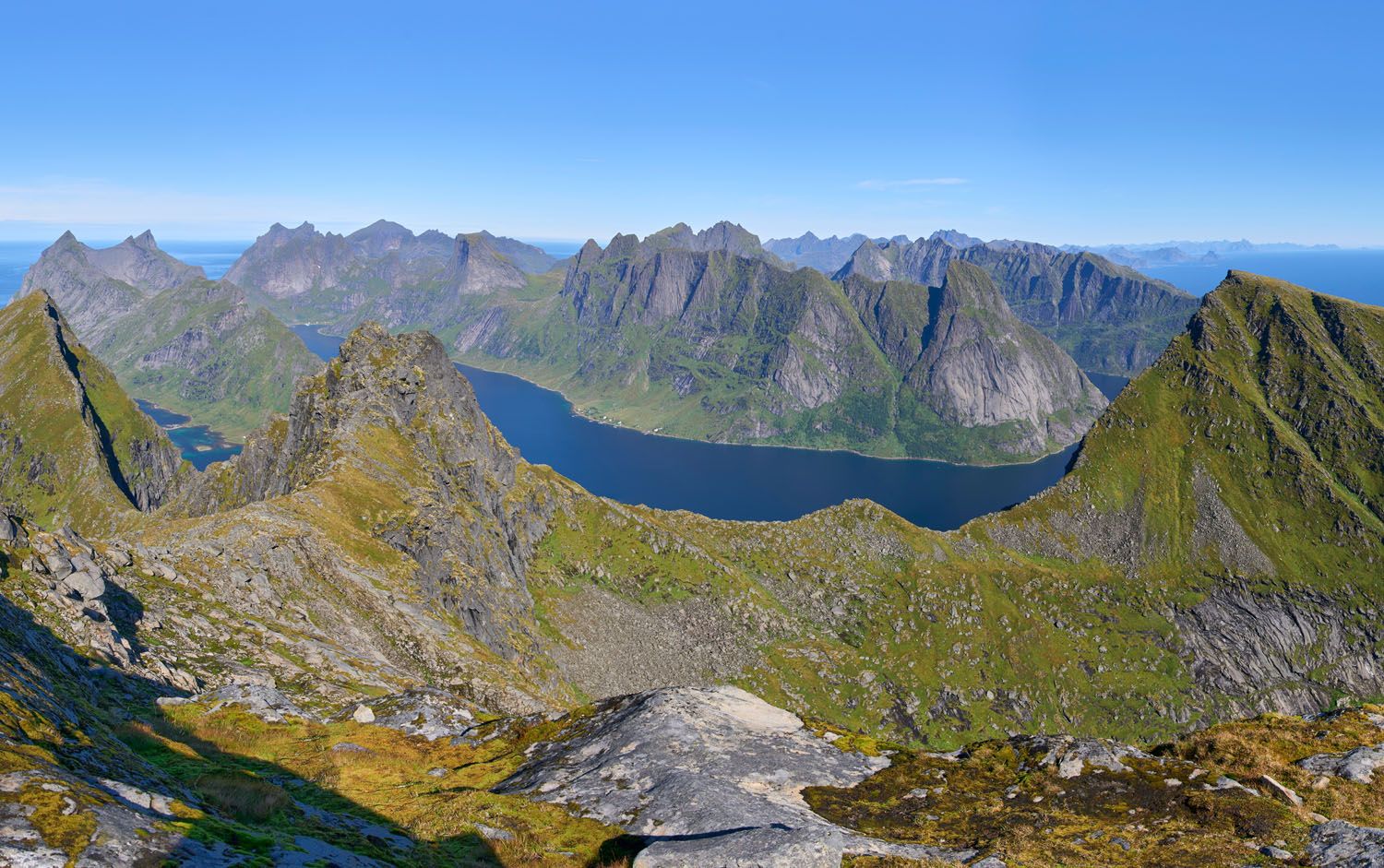
Munken
Why it’s famous: Located just around the bend from Reinebringen in the Lofoten Islands, Munken is a longer, more demanding alternative with equally spectacular mountain scenery. It can also be extended into a two-day backpacking adventure via Munkebu Hut to Hermannsdalstind.
Distance: 11 km
Difficulty: Strenuous
Length of Time: 6 to 8 hours
A solid day of rain kept us off this trail during our time in the Lofoten Islands, and it’s one of our biggest Norway regrets. If you have the stamina and the weather cooperates, this is one to prioritize.
shutterstock.com
Frequently Asked Questions about Hiking in Norway
When is the best time to hike in Norway?
Late June through September is the best time to hike in Norway. Snow clears from higher elevations by late June, daylight is abundant, and trail conditions are reliable. Trolltunga and some higher-elevation routes may still have snow in early June, so always check conditions before you go. For the Lofoten Islands and northern Norway, July and August are ideal. If crowds are a concern, late August and early September offer a good balance of solid conditions and thinner crowds on popular trails like Trolltunga and Reinebringen.
Are these hikes suitable for kids?
Some of them, yes. We hiked Pulpit Rock as a family when our kids were young, and Ryten and Kvalvika Beach is another great option for older kids and teenagers. Måtind on the Vesterålen Islands is shorter and more accessible for families with older children. The more strenuous hikes, such as Trolltunga, Kjeragbolten, Romsdalseggen Ridge, and Reinebringen, are best reserved for teenagers with solid hiking experience and good fitness.
What is the best hike in Norway?
Kjeragbolten is our personal favorite, with the combination of a demanding trail, dramatic scenery, and the thrill of stepping out onto a boulder suspended 1,000 meters above Lysefjord makes it unlike any other hike we’ve done. That said, it depends on what you’re looking for. For sheer iconic status, Trolltunga is hard to beat. For the best view in the Lofoten Islands, Reinebringen delivers every time. For hidden gems most visitors overlook, Segla on Senja and Måtind on the Vesterålen Islands are both exceptional.
Do you need permits to hike in Norway?
Most day hikes in Norway don’t require advance permits, though some popular trails have introduced fees or timed entry systems in recent years. Trolltunga now has a paid parking system and shuttle options that require advance booking during peak season. National parks are generally free to enter, but some trailheads charge for parking. We recommend checking the current requirements for any trail you’re planning well before your trip, as these systems can change.
What should I pack for a day hike in Norway?
The essentials are sturdy hiking boots, a daypack with water, snacks, a rain layer, sunscreen, and a downloaded offline GPS route or trail map. Norway’s weather, especially in the north and at higher elevations, can change quickly, so a warm mid-layer is worth carrying even on sunny summer days. For longer hikes like Trolltunga and Romsdalseggen Ridge, trekking poles are strongly recommended. See our complete hiking gear guide for a full breakdown of everything we carry on day hikes.
Is Norway good for hiking beginners?
Yes, but it depends on which trails you choose. Pulpit Rock is a great first Norway hike, with a well-marked trail and a manageable distance. Ryten and Kvalvika Beach in the Lofoten Islands and Måtind on the Vesterålen Islands are both rewarding without being overwhelming. The more famous trails like Trolltunga, Kjeragbolten, and Romsdalseggen Ridge require solid fitness and experience. Use the “How to Choose” table at the top of this guide to find trails that match your level.
Plan Your Trip to Norway
Planning a hiking trip to Norway? These guides cover everything you need to know, from building your itinerary to exploring individual destinations in depth.
If you’re visiting the fjord region, our 10 Days in Norway itinerary covers four of the best hikes in southern Norway: Pulpit Rock, Kjeragbolten, Trolltunga, and Romsdalseggen Ridge, along with all the logistics for road tripping through the fjords.
For the north, our 10 Day Northern Norway itinerary takes you from Tromsø through Senja and the Vesterålen Islands and into the Lofoten Islands, covering many of the hikes in this guide along the way.
If the Lofoten Islands are on your list, our Lofoten Islands itinerary will help you plan your time there, and our guide to the best things to do in the Lofoten Islands goes beyond hiking to cover everything the islands have to offer.
For Svalbard, our Svalbard Travel Guide covers how to plan your trip, what to do in Longyearbyen, and how to make the most of this extraordinary Arctic destination.
And for even more hiking inspiration across the continent, don’t miss our guide to the best hikes in Europe, where Norway features prominently alongside the Alps, Iceland, and beyond.
Which of these hikes in Norway do you want to do? Comment below!
Explore More of Norway
20 Best Things to Do in Norway: Fjords, Lofoten & Svalbard
Norway is one of our favorite countries in the world, and narrowing down the best things to do in Norway for this list was genuinely hard. There’s just so much worth doing. We’ve been twice so far, and we’re already dreaming about a third trip. Our first visit was a family trip with the kids […]
Norway Travel Guide: Fjords, Lofoten Islands & Svalbard
Norway Travel Guide There is nowhere quite like Norway. We’ve been to Norway twice, and both trips rank among the most spectacular we’ve ever taken. On our first visit, we road tripped through the fjord region in summer, hiking Trolltunga, Kjeragbolten, Pulpit Rock, and Romsdalseggen Ridge and cruising past some of the most dramatic scenery […]
10 Days in Norway: How to Combine the Fjords and the Lofoten Islands
After two trips to Norway, one through the fjord region, one through the far north, we started getting the same question over and over in our comments: Can we combine both into one trip? How do we do the fjords AND the Lofoten Islands in 10 days? That’s exactly what this post is for. We’ve […]
Best Hikes in Europe: 25 Incredible Hikes for Every Level
From the dramatic cliffs of Norway to the jagged peaks of the Dolomites and the volcanic landscapes of Iceland, Europe is packed with some of the most unforgettable hikes in the world. In this guide, we share our favorite hikes in Europe, trails that stand out for their scenery, uniqueness, and overall experience from start […]
Best Things to Do in the Lofoten Islands: 16 Epic Experiences
We arrived in the Lofoten Islands after driving down from the Vesterålen Islands, and on our very first day, we climbed Svolvaergeita and hiked Svolvaer Fløya. It was a long, exhausting, unforgettable day, and somehow, it set exactly the right tone for everything that followed. By the time we left four days later, we were […]
Svalbard Travel Guide & Itinerary for First Time Visitors
Svalbard. An arctic playground where there are more polar bears than people. This is a land of glaciers, the northern lights, the midnight sun, and frozen tundra. Svalbard may seem barren, but it is filled with arctic wildlife like reindeer, walrus, and polar bears. If you like the idea of exploring the great outdoors, your […]
20 Best Day Hikes in the World (+ Map & Photos)
Where can you go to find that perfect day hike? The hike that leaves you breathless as you climb the summit of the mountain. The hike with the awe-inspiring views. The hike that is so enjoyable because the terrain and its views are always changing. The hike that has you saying “Wow!” over and over […]
Glacier Kayaking in Svalbard, Norway
Does the idea of kayaking in icy waters to get up close to a glacier sound like fun to you? If so, put the Icebreaker excursion with Better Moments on your list of things to do in Svalbard. We had a lot of awesome experiences in Svalbard, and this just may be the best one. […]
Where to Stay in the Lofoten Islands: Rorbuer, Hotels & More
If you’re trying to figure out where to stay in the Lofoten Islands, the first thing you need to know is this: the islands have their own iconic accommodation type, and it’s unlike anything else in the world. Rorbuer, traditional Norwegian fishermen’s cabins, typically perched on stilts over the water, are the reason so many […]
Complete Guide to Climbing Svolvaergeita in the Lofoten Islands
Svolvaergeita, also called “The Goat,” is a pinnacle of rock that is a popular rock climbing spot in the Lofoten Islands. It is named The Goat because of the two horns of rock that sit atop the rock. Those with a sense of adventure can climb to the top of Svolvaergeita and those who are […]
Lofoten Islands Itinerary: 4 to 5 Days in Norway’s Most Spectacular Islands
There are places that stop you in your tracks the moment you arrive. The Lofoten Islands are one of them. We pulled over constantly, not because we planned to, but because we couldn’t drive past another mountain plunging straight into the fjord, another stretch of white sand beach backed by jagged cliffs, or another cluster […]
Ultimate Hiking Guide: Europe, Asia, Africa, Americas & Oceania
Are you looking for the perfect hike? With hikes on six continents ranging from a few miles to multi-day adventures, explore some of the best hikes from around the world.

Comments 18