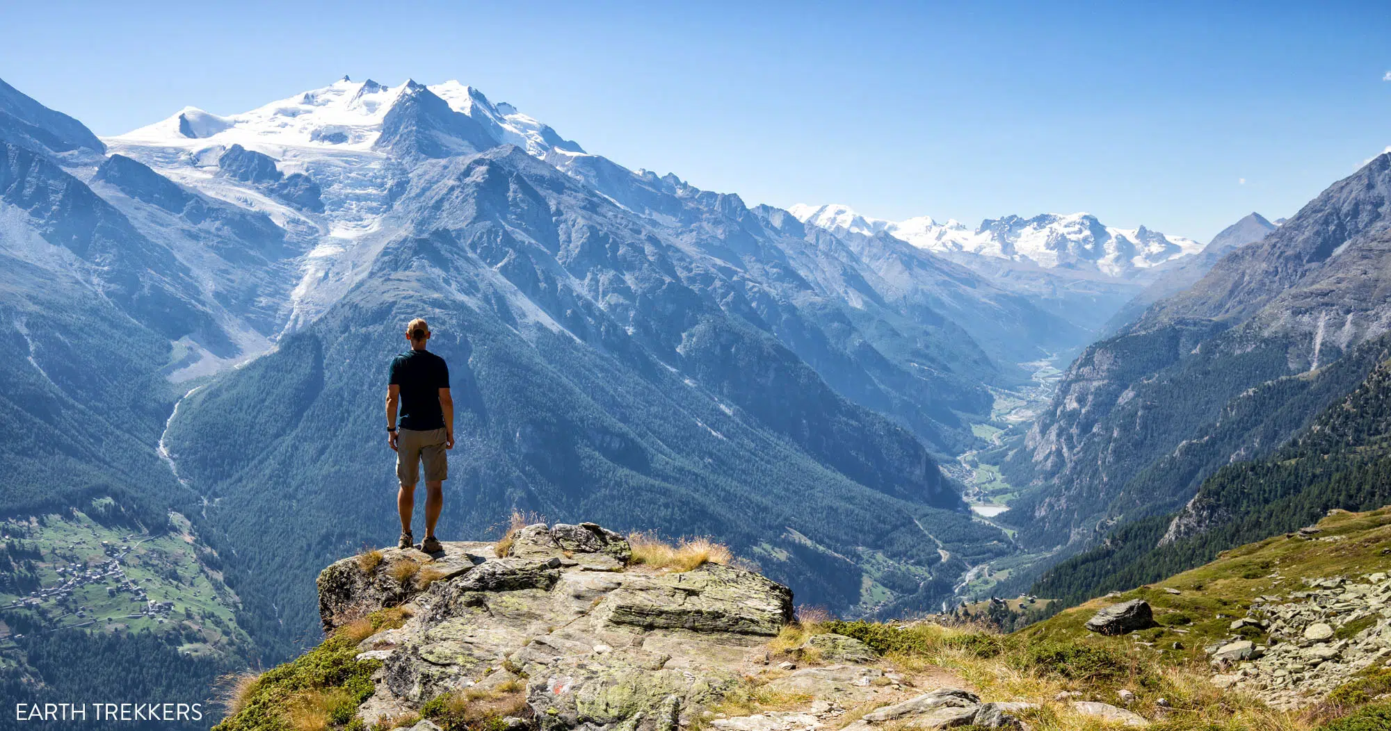
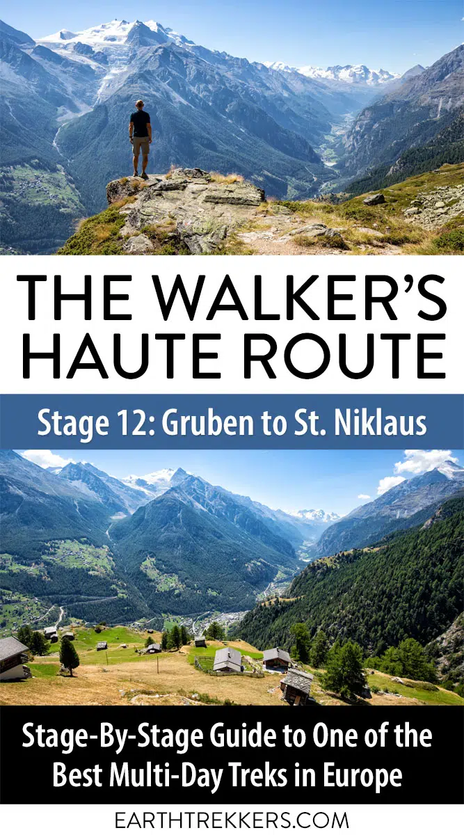
Today’s stage marks the beginning of the end of the Walker’s Haute Route. With only three stages to go, things once again ramp up in both alpine views and physical challenge in terms of the trail.
Opening up to Mattertal valley and passing through a large hamlet, Stage 12 has little shortage in excellent views. However, with its long ascent and a totally grueling descent, today is one of the hardest stages you’ll complete along the entire Haute Route.
Walker’s Haute Route Stage 12 Hiking Stats
Distance: 16.9 km (10.5 miles)
Difficulty: Moderate
Total Ascent: 1,135 m (3,725 feet)
Total Descent: 1,830 m (6,000 feet)
Lowest Elevation: 1,160 m (3,800 feet)
Highest Elevation: 2,900 m (9,500 feet)
Elevation in Gruben: 1,855 m (6,085 feet)
Elevation in St Niklaus: 1,160 m (3,800 feet)
Average Time: 7 hours; Our time 6 hours 15 minutes (including stops)
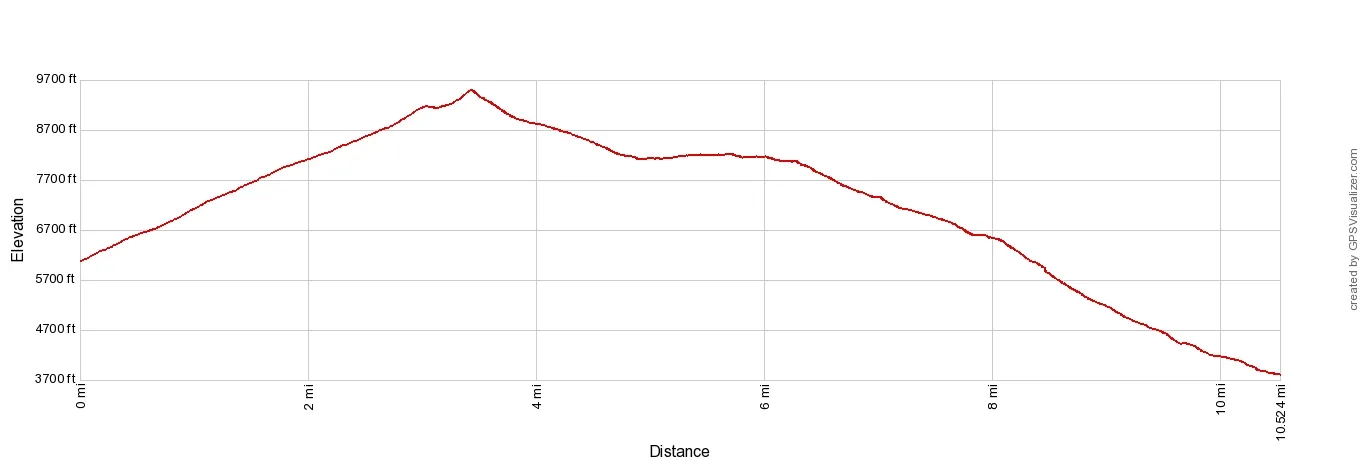
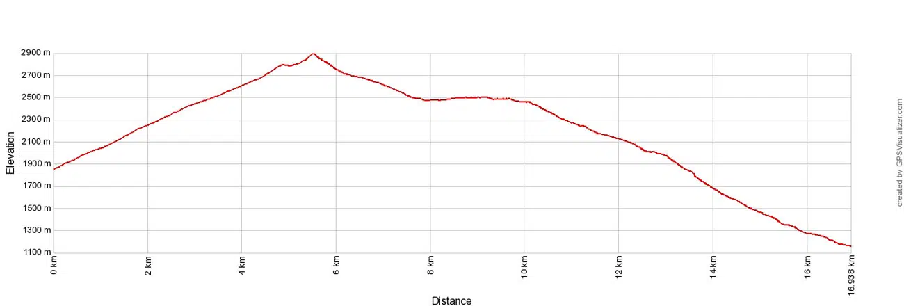
Walker’s Haute Route Stage 12 Elevation Profile
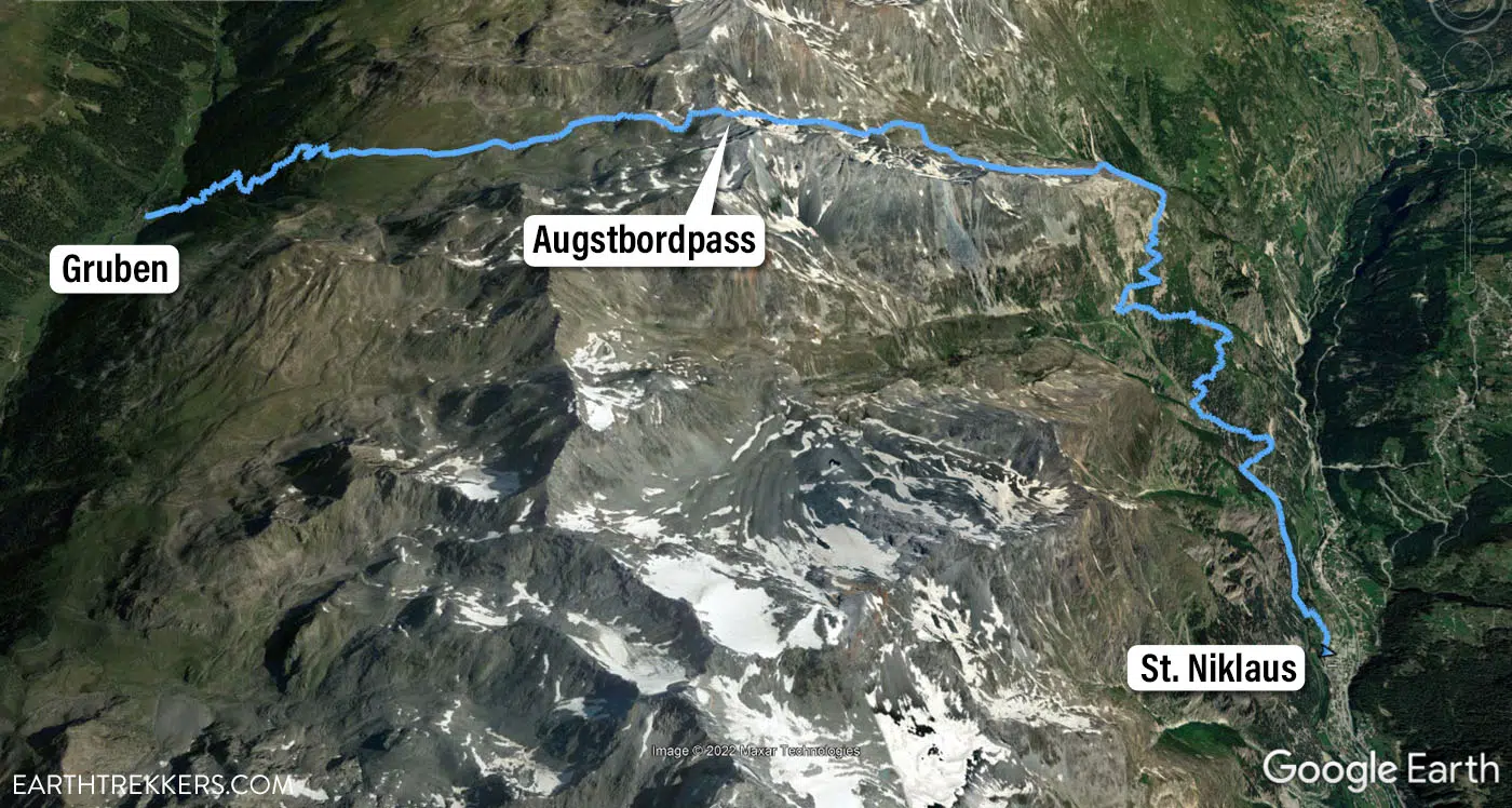
Haute Route Stage 12 map
Please practice the seven principles of Leave No Trace: plan ahead, stay on the trail, pack out what you bring to the hiking trail, leave areas as you found them, minimize campfire impacts, be considerate of other hikers, and do not approach or feed wildlife.
Walker’s Haute Route Stage 12 Trail Overview
To hike the Haute Route, we highly recommend following the trail descriptions in the book Trekking Chamonix to Zermatt, The Classic Walker’s Haute Route by Kev Reynolds. Below we list an overview of the day, so you know what to expect along the way. We also provide advice on where to eat and where to stay. Later in this guide, we list a few tips and trail clarifications to be used with the Trekking Chamonix to Zermatt book.
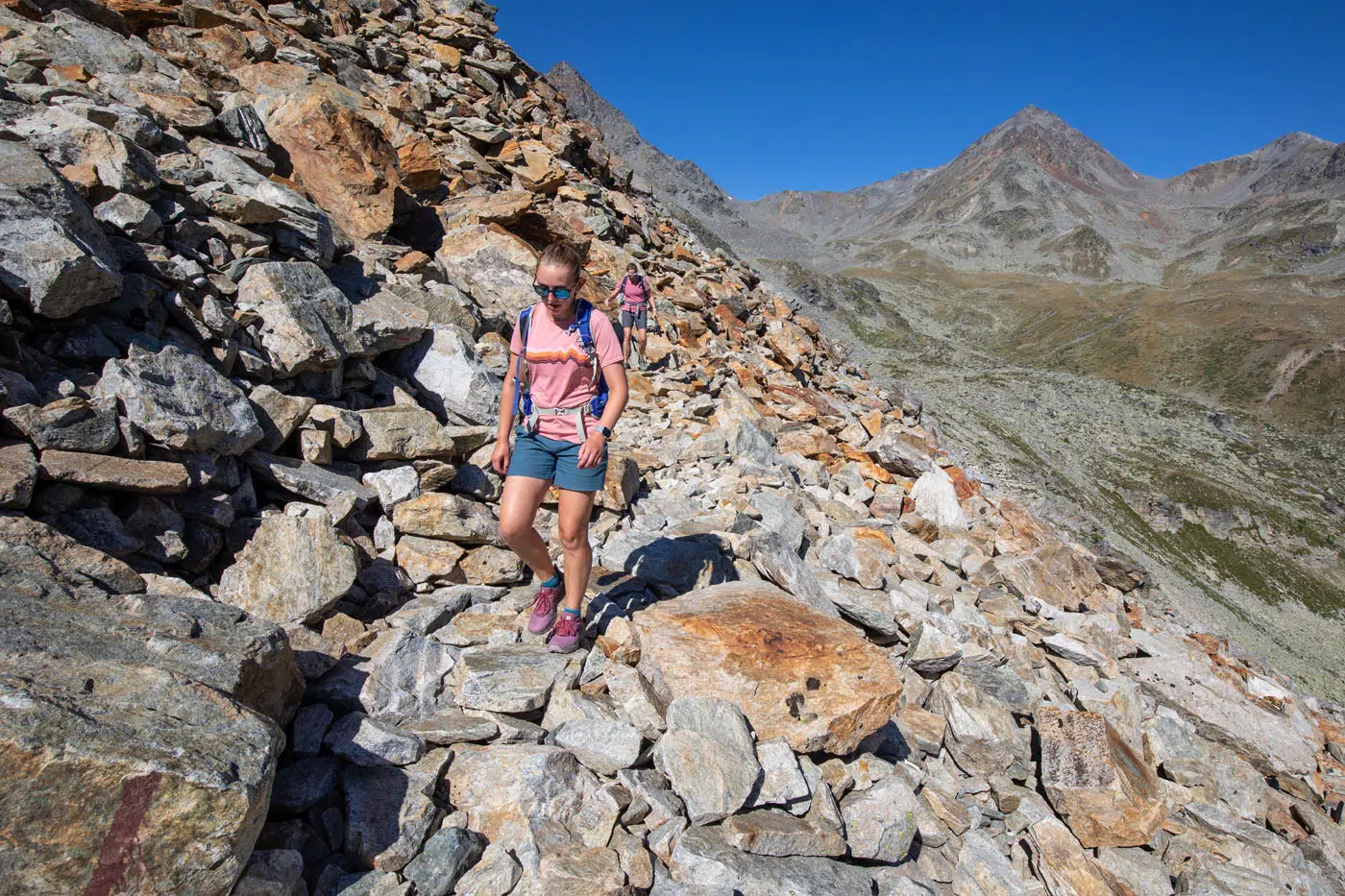
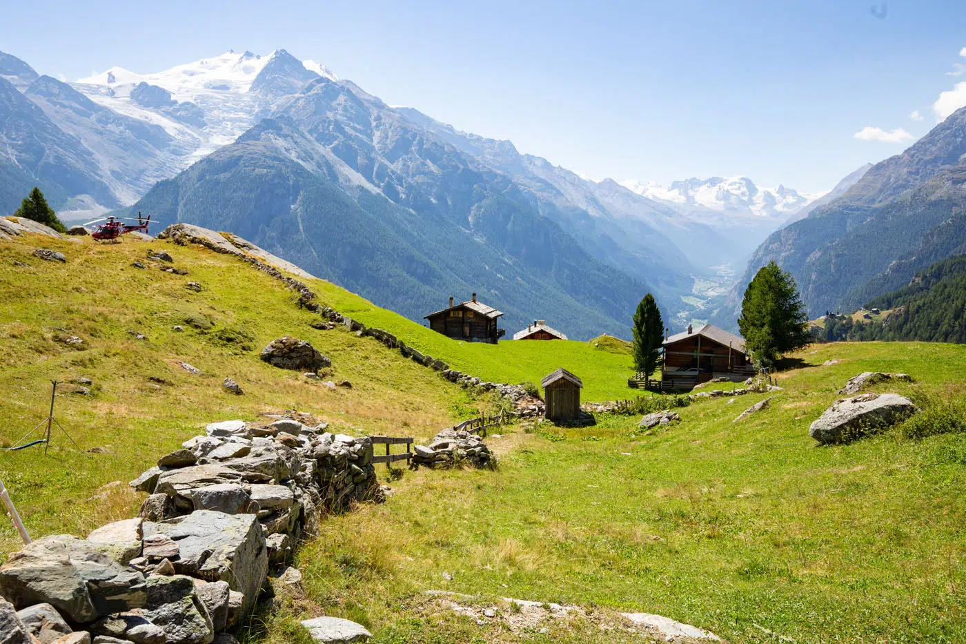
Gruben to the Augstbordpass
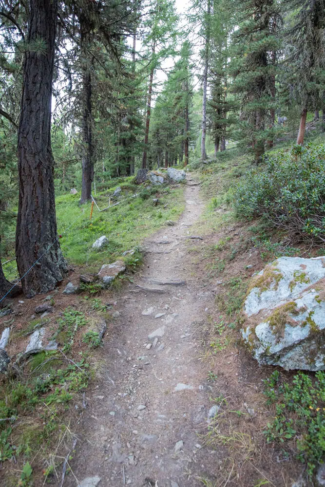
Today’s trail gets right down to business as it throws a steep climb at you as soon as you take your first few steps. You’ll hike on a dirt path that travels up through the woods in switchbacks that are guaranteed to leave you breathless. You won’t have any great views out during this section, but thankfully this is only a small portion of today’s stage. We climbed above the treeline about an hour into the stage. The hardest part of today’s climb is now finished.
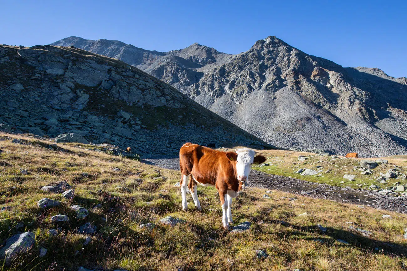
Once you leave the forest behind, the trail becomes a lot easier to manage. The climb is now pretty steady but not steep, and you’ll have great views of the valley in which you started today’s stage. You may even pass a few cows along the trail.
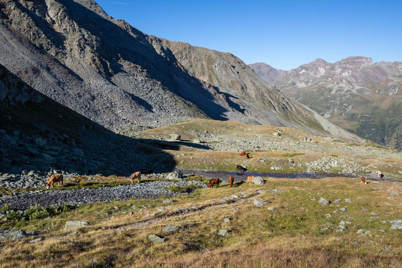
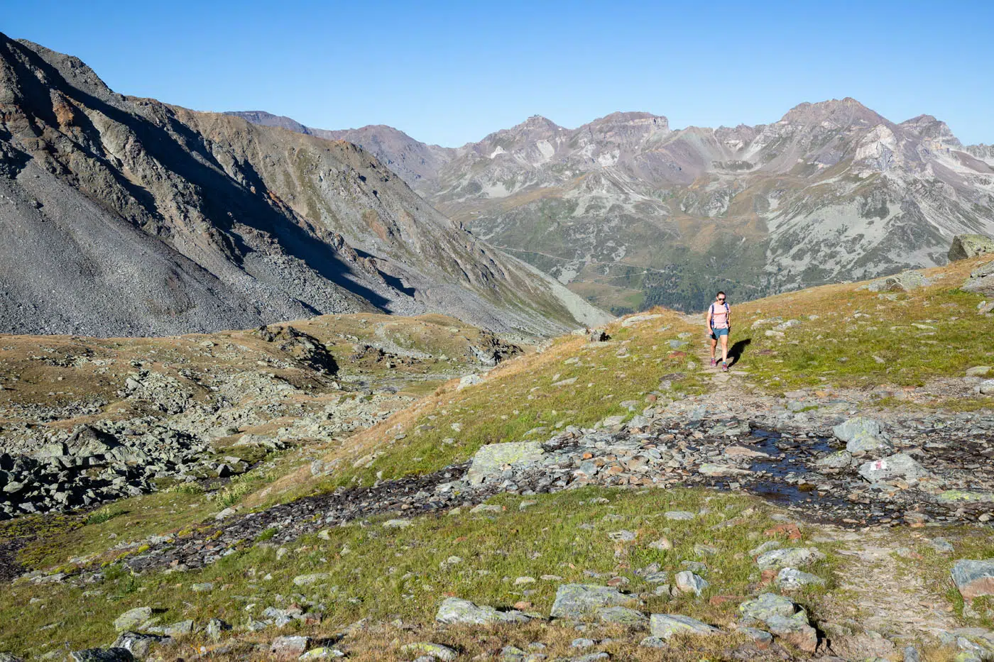
The trail continues on, and you’ll notice a few peaks in front of you. Between them lies a mountain pass, the Augstbordpass, which you’ll soon be standing on top of. Don’t fear if the climb up to the pass seems daunting, as the climb is easier than it looks. The trail will flatten out and be occasionally broken up by some short climbs over rocky hills. As you approach the base of the pass, the mountains above will loom higher and higher above you, yet the climb is shorter than it looks.
You’ll follow a rocky path that winds up the mountain. There are sections of the trail that are not well defined, so keep an eye out for the red and white trail markers placed on nearby rocks. The final climb takes roughly 30 minutes, beginning at the base of the mountain pass.
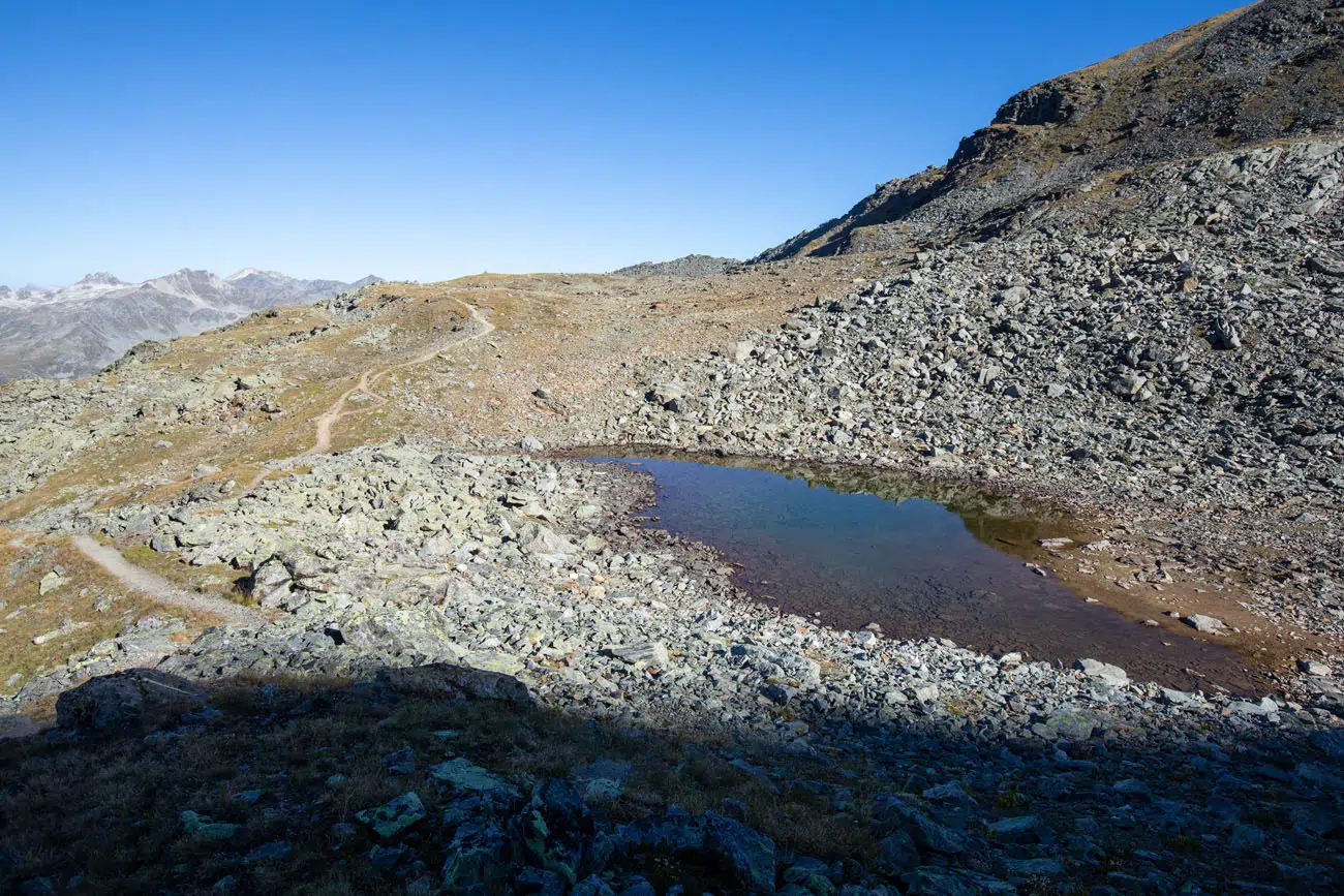
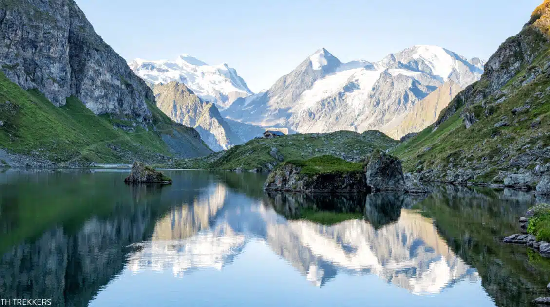
Small lake along the trail.
Once you’ve made it to the top, enjoy the spectacular views it has to offer! The Augstbordpass is located at 2,894 meters (9,500 feet). From here, it is roughly a 3 hour walk to St. Niklaus.
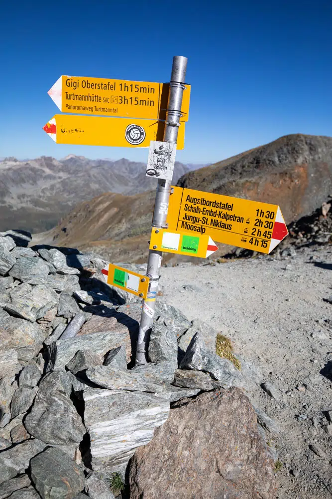
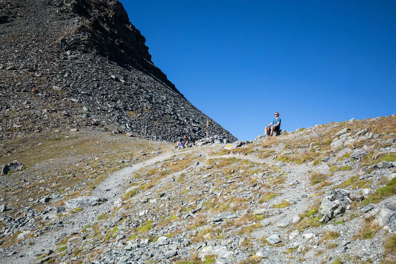
Augstbordpass
Augstbordpass to Jungen
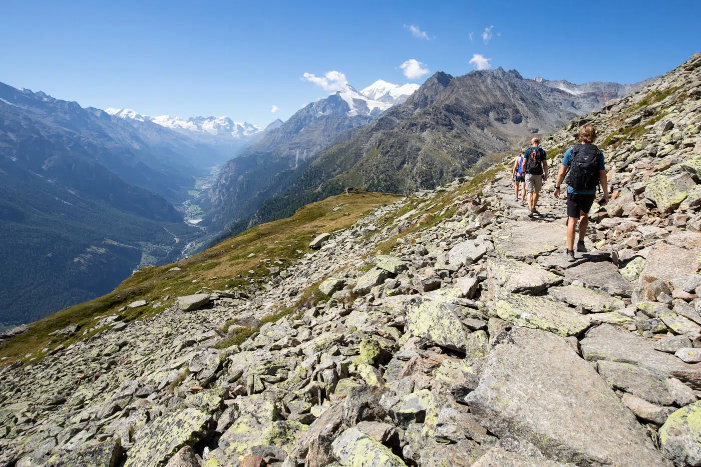
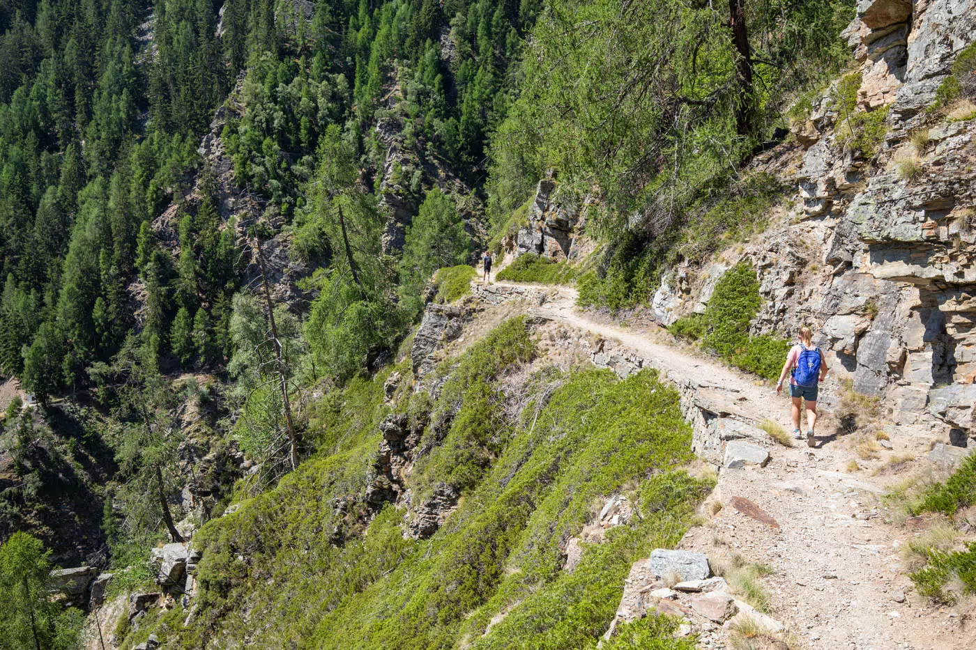
Your descent down to St. Niklaus will be broken up into different, diverse sections. From the Augstbordpass, you will walk along a high mountain plateau. Here the trail occasionally descends pretty steeply along a rocky path. About 2.5 kilometers from the pass, the trail will lead you through a long boulder field (it never seems to end). Watch your footing here as it’s difficult to tell if there are any loose rocks.
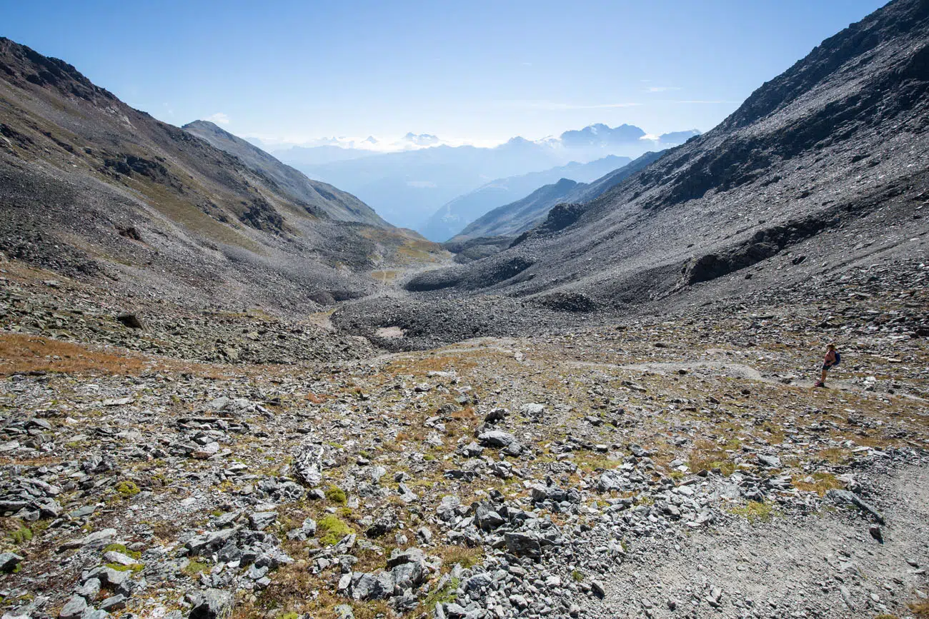
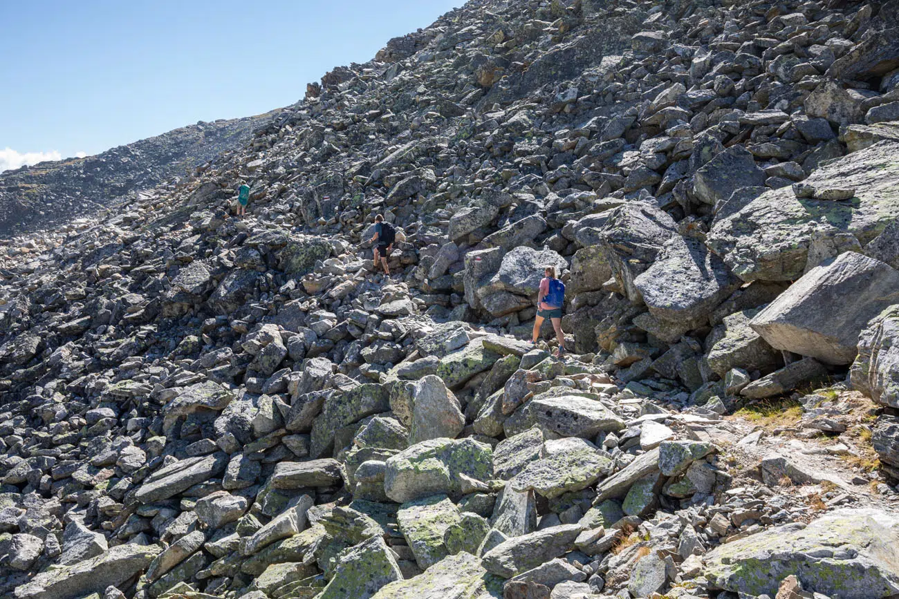
The boulder field
Another view of the boulder field and the Augstbordpass in the distance.
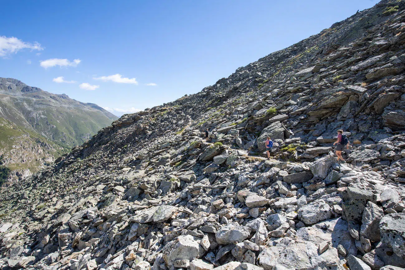
It just keeps going.
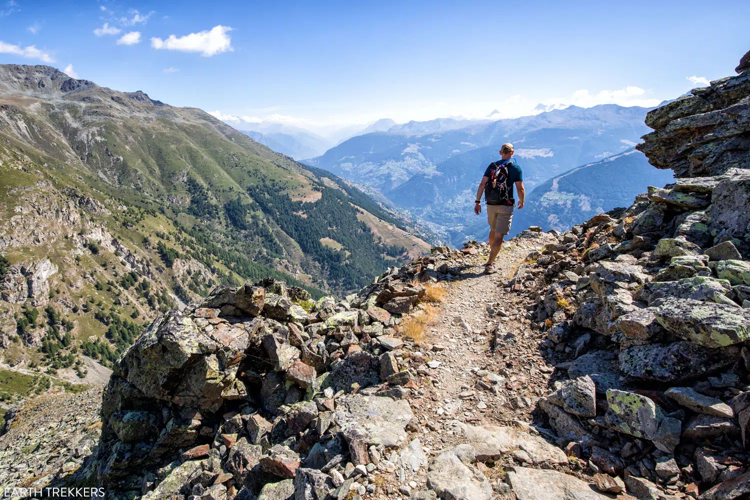
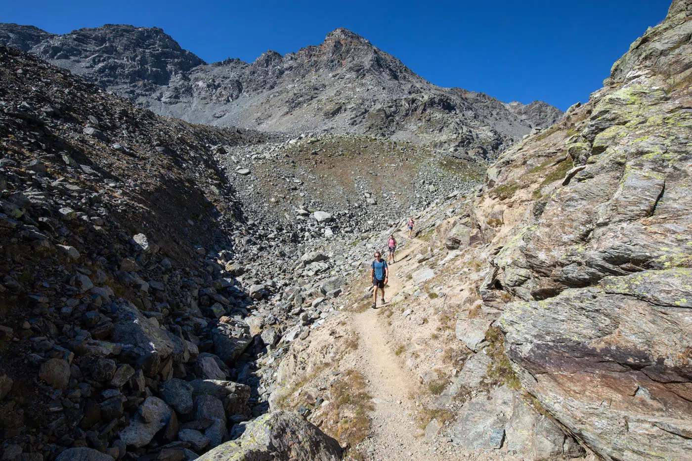
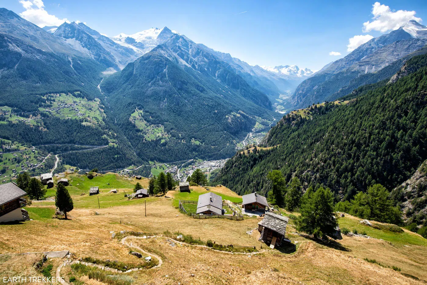
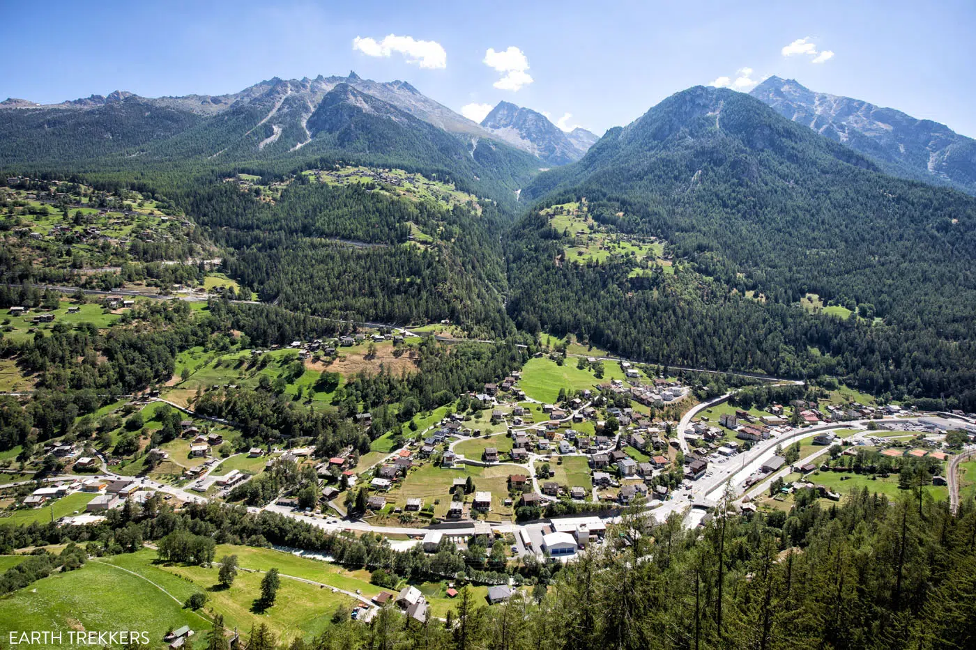
Roughly an hour and a half after departing the col, the trail will wind around the mountainside and open up to views of the Mattertal Valley and surrounding mountains.
We thought this was the best part of Stage 12. These were some of the most impressive views we had on the Haute Route. This is also the same valley where Zermatt is located, although you cannot see Zermatt just yet.
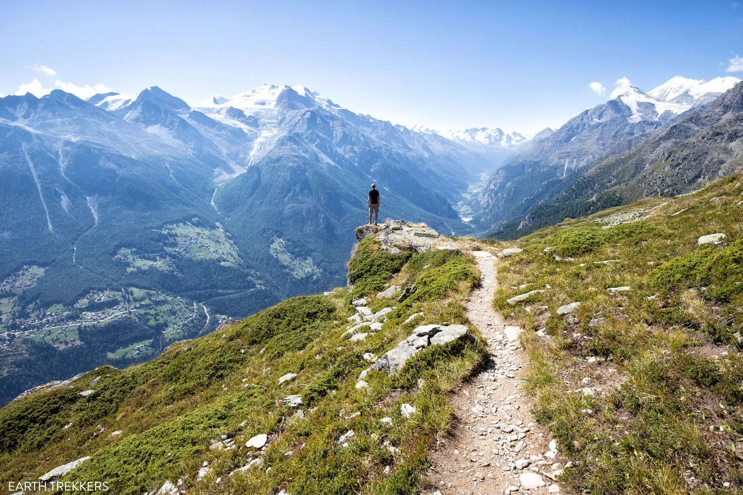
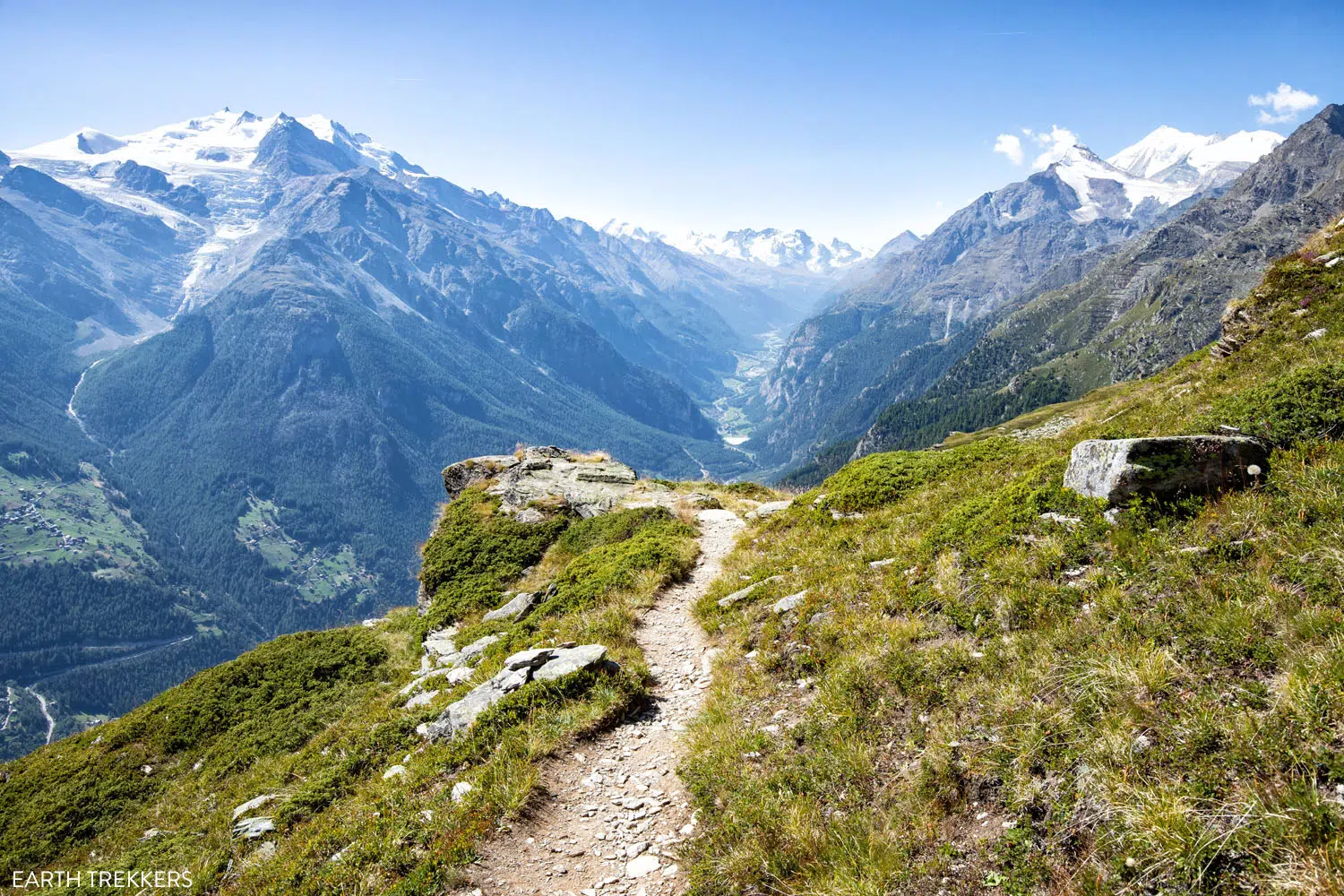
The viewpoint at Twära.
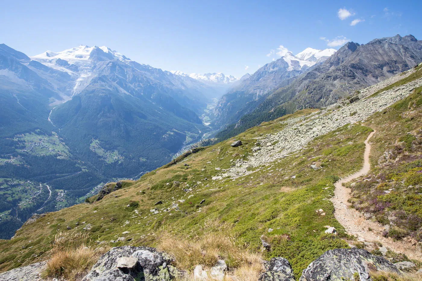
Once the trail turns, you start walking in the direction of the Mattertal Valley.
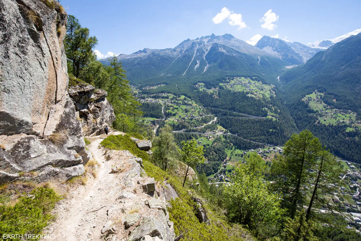
About five minutes after the awesome viewpoint at Twära, the trail will split. Follow signs for Jungen.
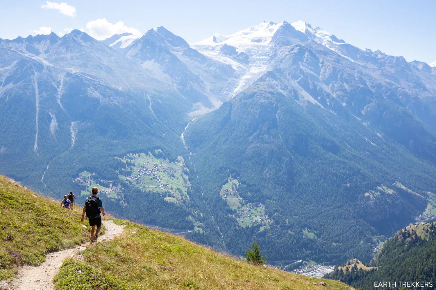
As you hike down to Jungen, the Dom looms over the opposite side of the valley.
Entering Jungen.
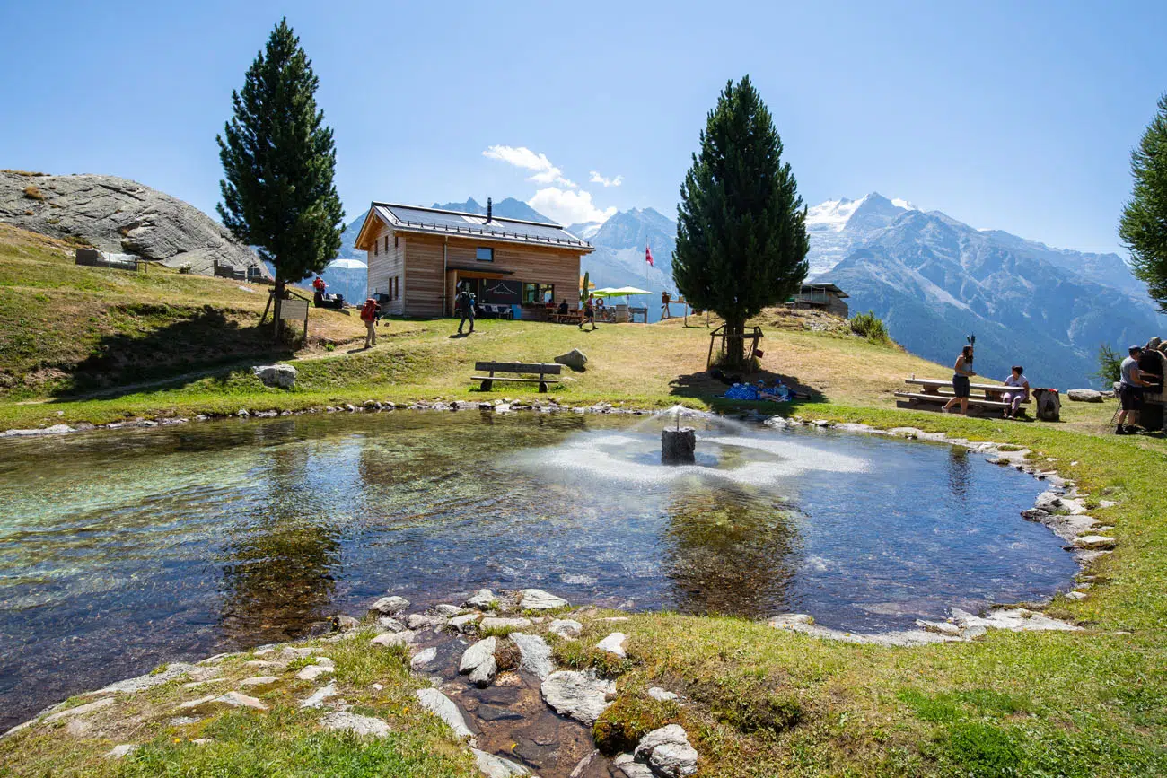
The trail will descend through the trees for about 2.5 kilometers before reaching the hamlet of Jungen. Here you can grab food and enjoy the views of the Mattertal Valley before starting the final section of Stage 12.
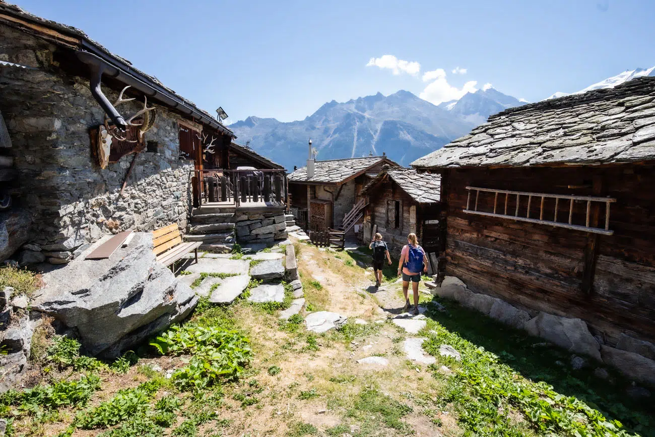
As you walk through the hamlet, you may get a good look at life up here. You’ll find locals going about their day, working, or maybe even enjoying the views like you.
Jungen
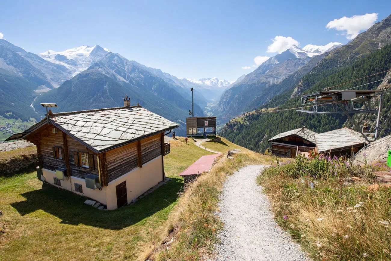
In Jungen there is a cable car that runs to St. Niklaus if you want to skip the massive descent.
Jungen to St. Niklaus
From the base of the hamlet, be prepared for a steep and seemingly never-ending descent down to St. Niklaus. Over the next 4 kilometers you’ll descend roughly 800 meters (2,600 feet) on a dirt trail that winds through the forest below. You won’t have any impressive views from here but you will come across many small white chapels.
PRO HIKING TIP: At this stage of the Haute Route, long descents like these were adding a lot of strain on our knees. We recommend getting a pair of hiking poles to help reduce the strain and knee pain on steep descents. You can skip this descent by riding the cable car from Jungen to St. Niklaus.
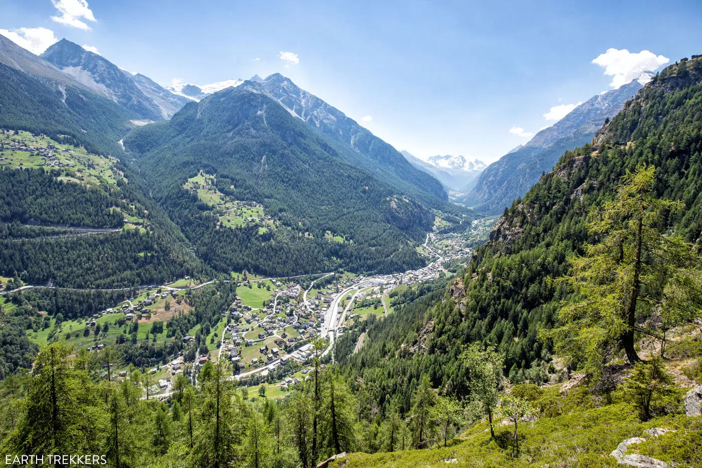
View of St. Niklaus and the valley.
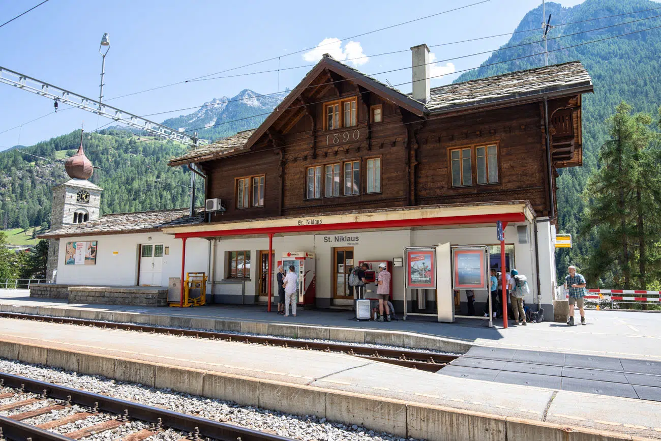
St. Niklaus Train Station
By the time we reached St. Niklaus, we were hot, exhausted, and very hungry. We trudged through town and then we scarfed down plates of rosti at Monte-Rosa.
Where We Stayed
We stayed in Hotel Heimatlodge for the night in St. Niklaus and absolutely loved it. We booked two double rooms and this ended up being one of our favorite stays along the Haute Route. Being both clean and comfortable, we were almost hesitant to leave the following morning.
We aren’t sure for what reason, but the town itself felt deserted the day we were there. Most restaurants were closed and hardly anyone was seen walking around town. We were in St. Niklaus on a Wednesday, so maybe there was a holiday or the town is usually like this?
For a detailed list of accommodations for each stage, along with information on making your reservations, see our guide on How To Book Your Haute Route Accommodations.
Clarifications for the Walkers Haute Route Book
We were able to follow the Walker’s Haute Book by Kev Reynolds (the sixth edition from 2019; there is now an updated version) without ever needing to backtrack. But there were a few times during this stage we felt a little more clarification would have helped so we are providing that clarification here based on our experience. These notes were taken related to following Stage 12: Gruben to Augstbordpass to St Niklaus.
Hotel Schwarzhorn to Ober Gruobu Stafel:
On the way to Gruobualp we passed a Wanderweg sign which we followed since it was pointing up the hill. We then passed a Neue Strasse sign which we ignored and kept going straight. We then passed a water trough. And we finally reached the four-way path junction of Gruobualp. The signpost didn’t state Gruobualp or have the elevation (2151m) on it, but it did point to St Niklaus which is the direction to follow.
The book mentions that at Gruobualp the Turtmann Hut is in a different direction than St Niklaus, but the signpost here indicates they are both in the same direction. There is another signpost about 15 minutes later (2270m) where the direction for Turtmann Hut and St Niklaus split. Follow this sign towards St Niklaus.
Gruobtalli: As you walk along the stream you will see a sign pointing to Turtmann Hut. Ignore this and keep going in the same direction you were going.
Huge flat slabs: The book mentions “Beyond the viewpoint the route follows a paved mule-path for a short distance on huge flat slabs, before you descend steeply on a footpath …”. After crossing the huge flat slabs, start looking for a signpost pointing to Jungen which you want to follow. This is the steeply descending footpath that the book mentions.
Jungen:
There is a restaurant above the gondola station.
There is a water trough on the path through Jungen between the gondola station and the chapel.
There are signposts throughout Jungen pointing in the direction of St Niklaus, which you want to follow.
More Information about the Haute Route
In our Walker’s Haute Route Planning Guide, we have links to all of our articles about the Walker’s Haute Route, including information about each stage, how to plan your trek, what to expect, and more.
For an overview of all 14 stages of the Walker’s Haute Route, with overall hiking stats, map, elevation profile, and lists of the most difficult stages, easiest stages, and our personal favorites, check out our Guide to the Walker’s Haute Route Stages.
Stages of the Haute Route: Below are our guides to each stage of the Haute Route.
- Haute Route Stage 1: Chamonix to Argentière
- Haute Route Stage 2: Argentière to Col de Balme to Trient
- Haute Route Stage 3: Trient to Fenetre d’Arpette to Champex-Lac
- Haute Route Stage 4: Champex-Lac to Le Chable
- Haute Route Stage 5: Le Chable to Cabane du Mont Fort
- Haute Route Stage 6: Cabane du Mont Fort to Cabane de Prafleuri
- Haute Route Stage 7: Cabane de Prafleuri to Arolla
- Haute Route Stage 8: Arolla to Les Haudères
- Haute Route Stage 9: Les Hauderes to Col du Tsate to Lac de Moiry
- Haute Route Stage 10: Lac de Moiry to Zinal
- Haute Route Stage 11: Zinal to Forcletta to Gruben
- Haute Route Stage 13: St. Niklaus to the Europahütte
- Haute Route Stage 14: Europahütte to Zermatt
If you have any questions about how to hike the Haute Route Stage 12, or if you want to share your experience, let us know in the comment section below.
You Might Also Like
Ultimate Guide to the Walker’s Haute Route
Pinterest Facebook Flipboard Walker’s Haute Route The Walker’s Haute Route is one of the most rewarding and memorable multi-day walks in Europe. On this trek, hikers cross 10 of the highest mountain passes in the French and Swiss Alps, as they walk from Chamonix, France to Zermatt, Switzerland. Walking from Chamonix to Zermatt takes you to remote mountain […]
Walker’s Haute Route Stages: An Overview of All 14 Stages
The Walker’s Haute Route is a multi-day trek from Chamonix, France to Zermatt, Switzerland. On this walk, hikers will cross 10 mountain passes, walk through small towns and through rugged, remote landscapes, and get to experience a less touristy side of the Swiss Alps. There are several routes that take hikers from Chamonix to Zermatt. […]
Walker’s Haute Route: 21 Important Things to Know & FAQ
The Walker’s Haute Route is one of the most rewarding and memorable multi-day walks in Europe. On this journey, hikers will cross 10 of the highest mountain passes in the Alps, while walking from Chamonix, France to Zermatt, Switzerland. It’s an extraordinary journey but not without its challenges. With 14 stages, multiple variations to the […]
How To Book Your Walker’s Haute Route Accommodations
Along the Walker’s Haute Route, there are a variety of accommodation types, from mountain huts to 5-star hotels, from dormitories to apartments, and from shared bathrooms to private bathrooms. You will have the opportunity to experience a combination of all of these since you will be staying in a new place at the end of […]
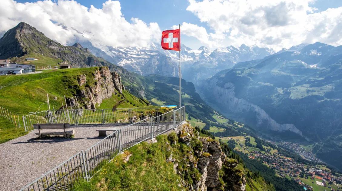
20 Best Day Hikes in the World (+ Map & Photos)
Where can you go to find that perfect day hike? The hike that leaves you breathless as you climb the summit of the mountain. The hike with the awe-inspiring views. The hike that is so enjoyable because the terrain and its views are always changing. The hike that has you saying “Wow!” over and over […]
How to Visit Gornergrat and Hike to Riffelsee & Riffelberg
For one of the best views of Matterhorn, it’s hard to beat Gornergrat. A scenic, cogwheel train takes you from Zermatt to this alpine paradise. Once at the top station, you can simply enjoy the sweeping views of the Matterhorn and the Swiss Alps from the restaurant and terraces. Or, you can add on the […]
The Ultimate Zermatt Itinerary for 1 to 4 Days
How many days do you need in Zermatt? How do you plan the perfect Zermatt itinerary? The answer to these questions depends on several factors. How much time do you have? Do you want to get out and hike the trails or simply ride the cable cars to viewpoints of the Matterhorn? What time of […]
12 Epic Day Hikes in Zermatt (+ Trail Stats, Photos & Map)
One of the best ways to explore Zermatt is on foot. Hiking trails climb high into the mountains above Zermatt, past Swiss hamlets, through scenic valleys and rocky gorges, and to some of the best viewpoints of the Matterhorn. The network of cable cars and trains takes you up into the mountains, so for the […]
How to Climb the Breithorn: Photos, Trail Stats & What to Expect
Climbing to the summit of Breithorn is one of Zermatt’s most adventurous experiences. Standing at a height of 4,164 meters (13,660 feet), Breithorn is one of the highest peaks in the area and it is one of the easiest 4,000+ meter peaks to summit in the Alps. Thousands of hikers come to Zermatt to summit […]
15 Great Hikes to Do in the Bernese Oberland, Switzerland
The Bernese Oberland is a hiker’s paradise. Alpine trails crisscross their way through the towns, valleys, and the mountain peaks of this gorgeous place. Take your pick from short, easy, family-friendly trails to cliff walks to thrilling trails. Here are 15 of the best hikes to do in the Bernese Oberland. All of the hikes […]
20 Amazing Things to Do in the Jungfrau Region of the Bernese Oberland
Towering mountains, alpine meadows, soaring cable cars, historic cogwheel trains, scenic walking trails, quaint villages and hamlets…this is the Jungfrau region of the Bernese Oberland. In this guide, we cover the very best things to do in the Jungfrau region, ranging from scenic cable car rides to hiking some of the most beautiful trails in […]
24 Best Things to Do in Chamonix, France in the Summer
Discover the best things to do in Chamonix, France in the summer. This guide covers the top cable cars, hiking trails, glaciers, and adventures in Chamonix, based on our firsthand experience hiking and exploring the area. Chamonix is one of the most spectacular mountain destinations in Europe, and in the summer, it’s an outdoor playground […]
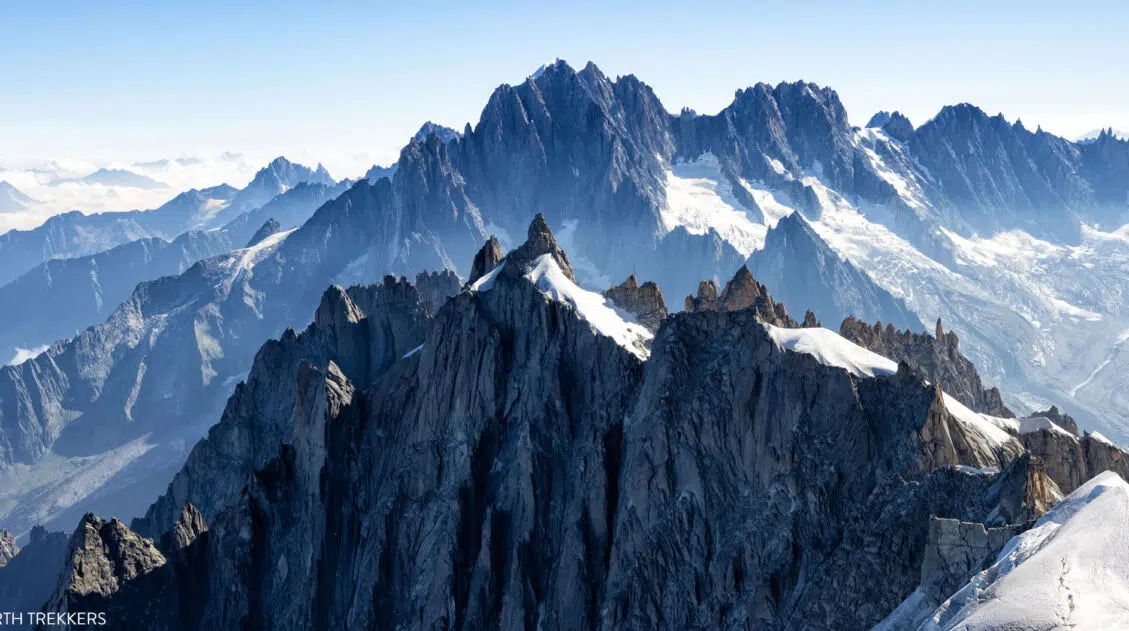
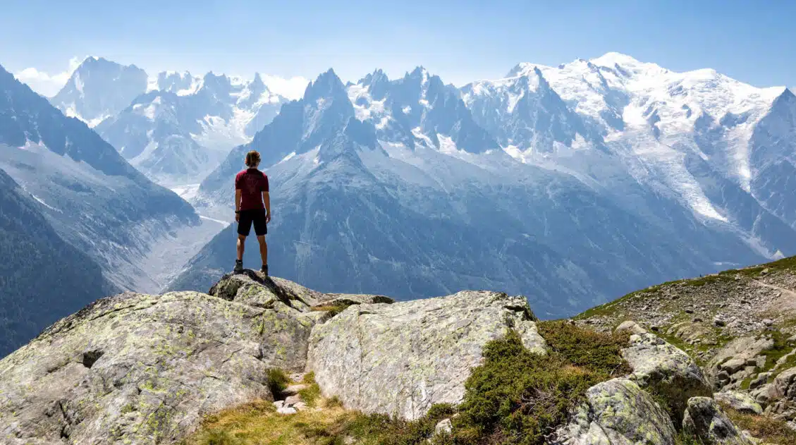
Aiguille du Midi + Panoramic Mont-Blanc: The Ultimate Guide
At 3,842 meters (12,605 feet), Aiguille du Midi is one of the highest places you can reach by cable car in the world and the closest most people will ever get to the summit of Mont Blanc without a rope and crampons. We’ve ridden cable cars across Europe from the Dolomites to Zermatt, and this […]
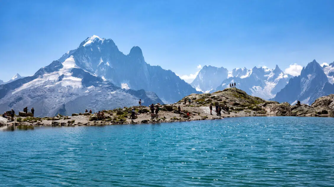
How to Hike to Lac Blanc, Chamonix (Photos, Stats & Map)
There are several reasons why the hike to Lac Blanc is one of the best in Chamonix. For one thing, this alpine lake is beautiful. A series of gondolas and chair lifts lop off the first big climb, making this hike doable for most ages and ability levels. But one of the best reasons to […]

Comments 2